
Destinations & Things To Do
Why Pakistan Should Be Your Next Adventure Travel Destination

I woke at 4:30 am and stumbled out of my tent into the chilly morning air. The pre-dawn sky was a soft dove grey, while frost-stiffened grass crunched satisfyingly underfoot. Snow-dusted mountains rose to either side, their sheer rock faces dwarfing our solitary camp. Watching for the first rays of sunlight on the distant peaks, I listened to the icy stream gushing and birds twittering. Cows grazed nearby while bulky yaks navigated the steeper slopes, the terrain of rarely spotted Himalayan ibexes and even lesser-seen snow leopards.
Not for the first time on this trip, I wondered how so many outdoor-loving travellers — myself included — have overlooked Pakistan.
What makes Pakistan the best travel destination for adventure lovers?
Five days prior, I’d touched down in Islamabad, where I met my trekking group. The city — a purpose-built capital established in 1967 — is strikingly green, receiving enough rain to keep it looking lush even during the intense heat of May and June when temperatures can hit 110 degrees F (43 degrees Celcius). It felt calmer than I’d expected and was easy to navigate alone.
Tourism being relatively uncommon, people were openly curious about our presence. One of my fellow travellers proved particularly popular regarding photo requests; it turned out he resembles various moustachioed Australian cricketers (Merv Hughes, Travis Head, a substantially taller David Boon).
Cricket is wildly popular in Pakistan and played everywhere, from the city streets to the mountain valleys. Imran Khan, the captain of the 1992 World Cup-winning team, became Prime Minister and maintained strong grassroots support after being imprisoned on questionable grounds. (“Talking about politics is a national pastime,” said Aneeqa Ali, founder of Pakistani travel company The Mad Hatters, who I met in Islamabad. But religion, she added, is more taboo.)
Islamabad lies at the foot of the Margalla Hills National Park, a refuge for city dwellers escaping the heat (and a population of leopards). One morning — painfully early — I joined a local trail running group, gasped, and wheezed my way up switchback paths carpeted in pine needles to a summit overlooking the city. I could hear the distant rush of traffic far below, layered under birdsong. We jogged along the ridge line and back down to the carpark — a warmup for the trip’s main event.
Pakistan has abundant hiking and mountaineering opportunities, especially in its Himalaya-adjacent Karakoram range, which includes some of the world’s highest peaks and valleys of staggering beauty. Yet, the tourism figures don’t reflect this.
In 2019, around 28,000 foreigners visited Pakistan on tourism visas, compared to 1.2 million tourist arrivals in Nepal and nearly 11 million in India. Safety perceptions that date back to the 9/11 aftermath, a lack of government interest in promoting tourism, relatively few tour operators offering trips, and a dearth of information for intrigued travellers are just a few contributing factors.
In 2020, while exploring the mountains of his home country, Pakistani entrepreneur Umer Latif realised how much the lesser-visited areas could benefit from a responsible tourism model. He founded trekking operator Beyond the Valley and, at an adventure travel summit last year, tracked down Erica Kritikides, the global product manager for tour company Intrepid Travel. Kritikides didn’t take much convincing to form a partnership, and in 2024, they launched Intrepid’s first Pakistan hiking tours.
While travelling with Intrepid on one of their initial departures, I found myself at the bottom of the Nangma Valley, looking up at the rocky trail snaking between two 3,300-foot rock faces.
From Islamabad, our group of 12 (including Kritikides and Latif and our ever-joyful tour leader, Muneer Alam, from Baltistan) had flown an hour northwards over a dramatic landscape of colossal peaks, landing in the gateway town of Skardu. This is Baltistan, part of the Gilgit-Baltistan territory and sometimes called Little Tibet. The high-altitude region is home to five of the world’s 14 eight-thousanders (mountains over 8,000 meters or 26,247 feet), including K2, the second-highest point on Earth and among the most serious mountaineering undertakings.
The area is popular with Pakistanis escaping the sweltering cities (even more so as heatwaves become more severe and more frequent with the climate crisis), and Islamabad-Skardu flights are booked months in advance, said Latif. The number of hotels in Skardu has increased more than fourfold over the past decade, which has put pressure on the infrastructure. Not everyone is here for hiking: “Pakistanis just like to relax,” Alam told me, laughing.
We made our way to the village of Kanday, at the base of the Nangma Valley, via winding, narrow roads cut into the cliffsides above jade-green rivers. There, we met the 26 porters and chefs who would be accompanying us on our trek, all of whom were from the immediate area. Burgeoning local tourism means they now have less need to travel far from home, hoping to pick up work on challenging, sometimes dangerous K2 expeditions — the trekking here is far easier and pays the same, said Latif. Intrepid also supplies tents, food allowances, and insurance for their porters (which isn’t always the case).
The Nangma Valley is at a sweet spot, experiencing the first flushes of tourism and associated economic opportunities. Visitors are as excited to be there as many residents (especially those employed in the trekking industry) are to see them. I think this is impossible to maintain, but sustainable tourism development — prioritising hyperlocal employment, respecting cultures, and giving back — can build a model that works for everyone.
Ibrahim Ali, one of our porter team, told us that before Latif’s first guests started arriving in 2022, less than five trekking groups would visit each May-September season. Previously, Ali said, operators claimed no one would want to come here. But this year, by mid-June, around 40 treks had already departed. (We saw another group, plus a solo hiker with a guide, during our trip.)
It’s hard to imagine how this place — full of fragrant, traditionally sacred juniper trees, a glacial stream tumbling down the valley, grand views in every direction — was ever disregarded. I thought our first campsite, a wooded flat between towering peaks, was something special. But the bar was swiftly raised the next day when I crested a hill near the valley’s top and looked down at our second camp. Our tents (already assembled by the team of porters who powered up the trail before us) were set on an open meadow by the stream at the foot of the imposing Green Tower rockface. Surrounding mountains included the intimidating-looking Shingu Charpa; Cho Nono, with its needle-like pinnacles, thought to resemble hunters who disappeared, according to porter Liaqat Ali; and Amanat Brakk, named after Ali’s son by Hungarian climbers who made the first summit in 2022. Many peaks in the area remain unclimbed. Aside from the cows, we had the place to ourselves.
The hiking wasn’t exactly easy, but it was manageable for most moderately fit people. Between 9,500 and 13,100 feet above sea level (plus an optional trek to Amin Brakk base camp at 14,750 feet), the trail was steep in parts and sometimes loose underfoot. We regularly stopped in the shade to catch our breath, hydrate, and snack on the trail mix that Alam had prepared for us.
Reaching camp, we were treated to tea and Chef Khadim Hussain’s chicken noodle soup. Latif said Hussain has been to K2 dozens of times, including on winter expeditions. “So he really knows what to feed people at altitude,” he explained. On our last night — in addition to staples such as daal and pilau rice — he produced a dinner of ‘mountain pizza’ and fried chicken (live birds were brought up with us), followed, remarkably, by a flan.
Afternoons were for cricket, naturally. I watched the porters politely soft-bowl their guests, saving the aggressive fastballs for each other. It started to snow, so we ended up nestled inside the mess tent, drinking tea and comparing altitude symptoms and celebrity encounters.
The scenery may be a major appeal of Pakistan, but repeat visits seem driven by deeper connections to the country. Aneeqa Ali, who also leads Intrepid’s culture-focused trips, said although tourists come to see the mountains, he “(thinks) it’s the hospitality of the people that brings people back.”
On one of our afternoons in camp, I stood on the grassy pasture before jagged peaks tickling the moody sky above. But what held my (amused) attention was the Pakistani-Canadian-Australian cricket team huddled, heads together, earnestly devising a game plan to demolish their opponents. Ali was right. I may have come to see the mountains — but the fun I had with folks along the way is the reason I’ll return.
Book your stay at Serena Khaplu Palace via Booking.com
Book your stay at Serena Khaplu Palace via Agoda.com
shop the best travel experiences here
(Feature Image Credit: Heather Richardson/Travel + Leisure)
This story first appeared on travelandleisure.com
Related: Journey Through Pakistan’s Beautiful Hill Stations And Mountain Retreats
Note:
The information in this article is accurate as of the date of publication.
We may earn an affiliate commission when you shop through links on our site.
Written By


19.8 miles
From Purple Lake mile 894.8, elev 9974
To Upper Soda Springs campground (mile 912.2, elev 7733)
Climb 1882
Descend 4128
Steps 38761
As I reached Duck Creek early in my hike there was a man sitting there on a downed tree enjoying a snack and a rest. He pointed out there was plenty of space on the tree for me if I wanted it. I declined as I wanted to get some miles in today, but we still talk for 5 minutes or so. He was doing the JMT. He started in Yosemite Valley, made it to Purple Lake, and decided that his body just didn’t have the strength that it used to. He opted to turn around and hike back to Red’s Meadow. I never would have guessed that he was 77 but he said that he has done things like climb Mt. Shasta with his son when he was 60. So he has certainly maintained a very active life. I relayed my story about coming off trail and thinking through everything as I did so. I relayed that I had to come to terms that I might not make my eventual goal of completing the whole PCT. But that even if I had to stop, then I completed 800 miles That was still an accomplishment to be proud of, and I felt the same about his hike. I hope he sees it that way. He certainly wasn’t distraught, but to have other people have a positive outlook on what you’ve accomplished makes it easier to have that outlook yourself.
He was actually one of the first JMT hikers I’ve come across who voluntarily seemed to look for a way to help a northbound PCT hiker. He volunteered trail conditionings up to Yosemite in particular. He commented on today’s trail to Red’s Meadow. He said that once I get past this next ridge it was downhill the whole way. For me, who is trying to make some ground so I can get my resupply in Tuolumne in a couple days, that was very comforting information.
When I arrived at red’s Meadow, I looked around and put my pack down quickly. I found a spot at a picnic table that was in the shade. I ordered a double cheeseburger and a soda. They tasted good like any real food does when you come off the trail.
Hearing the ongoing conversations among other hikers, I found that I was sitting at a table with Becs, a woman who was living in South Lake Tahoe and working remotely. That made me jealous because I used to have a cabin in Tahoe and would love to live and work remotely from there (I’ve actually updated this post while sitting at the Lake Tahoe Pizza Company – almost in her backyard).
We had done so many Tahoe trails in common, the conversation flowed easily. Hearing her talk about the trails brought back fond memories.
While there, the sun shifted. To stay comfortable in the shade, Hennje changed tables and joined me at my table. He is from near Hamburg, Germany and was a little jealous that I was able to take the time to hike the whole PCT. He has two little ones at home so he only has time to fly over here, hike the JMT, and return. He was very organized and had created his own overview map with his own points of interest.
He also had the JMT map booklet from National geographic. That is similar to the series of booklets they put out for the PCT. We both like paper maps and both had some of the same complaints about the National Geographic map books.
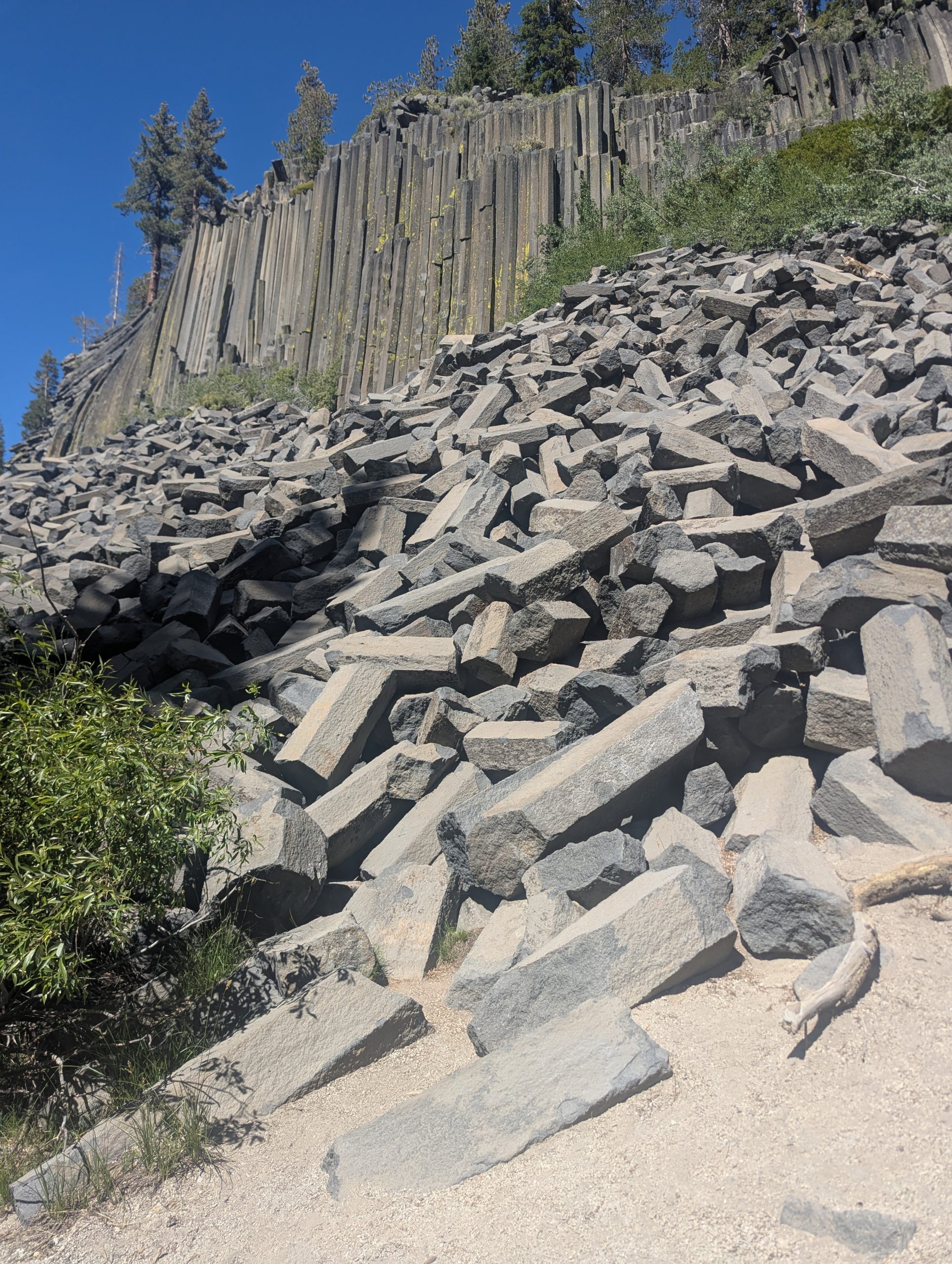
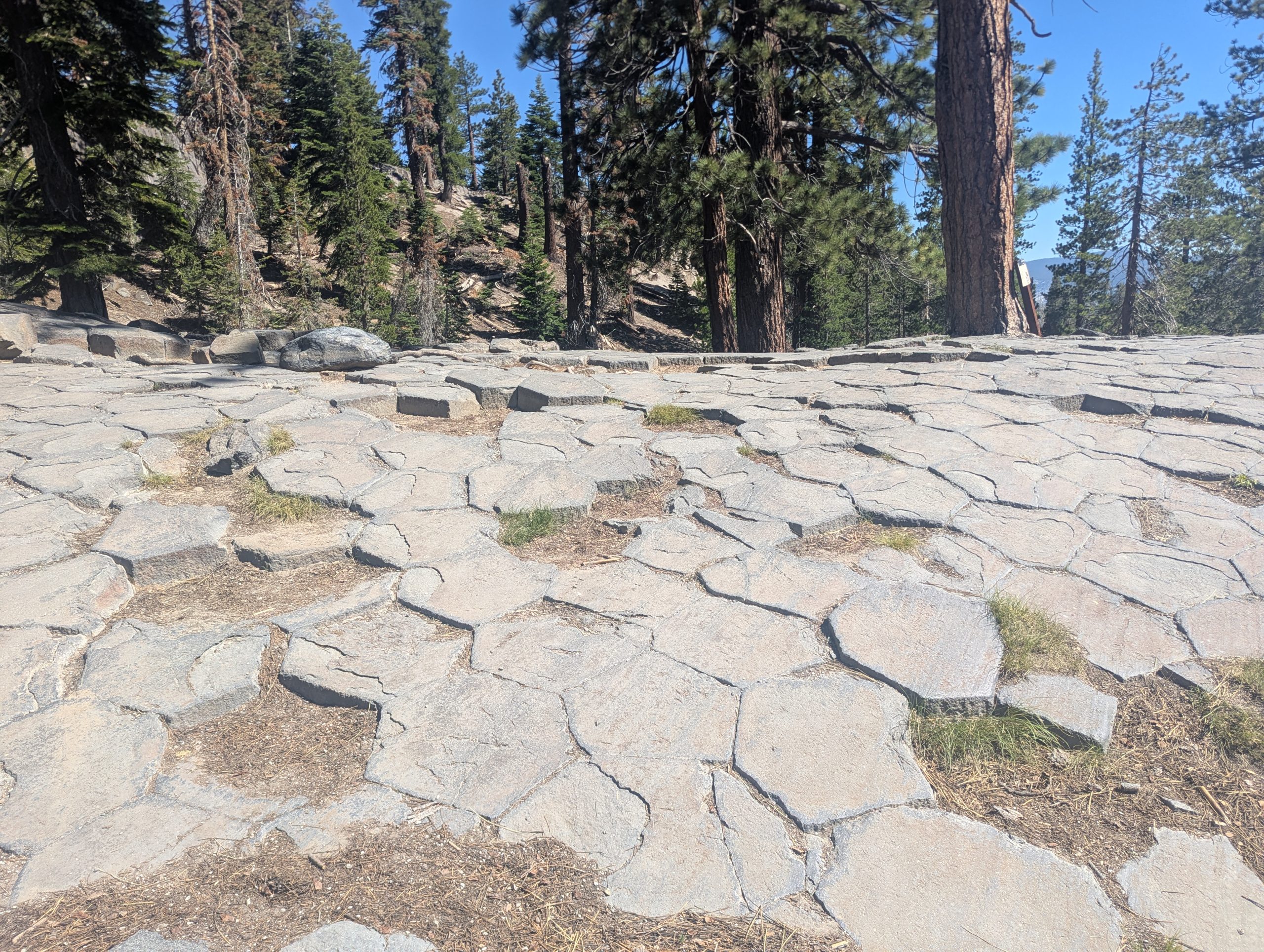
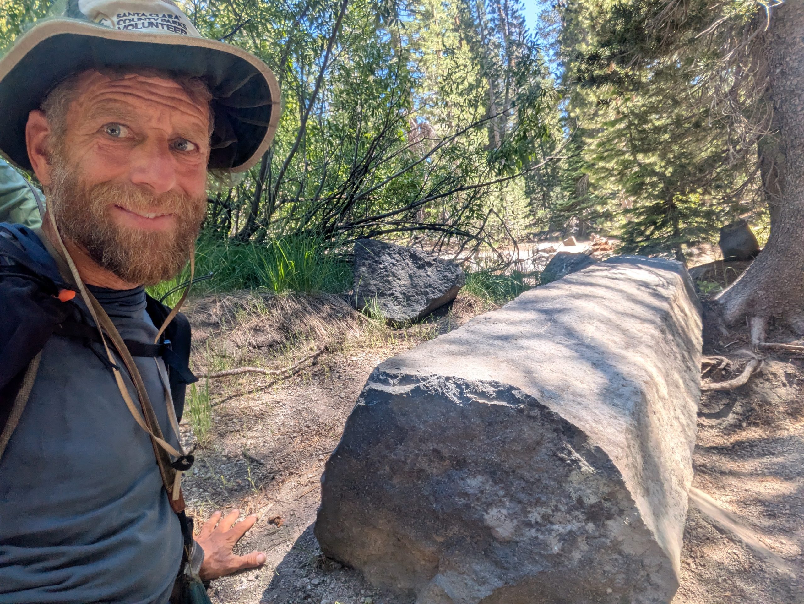
Because of a bridge that is out there is a detour on the PCT around Devil’s Postpile National Monument. But I have a little bit of history with Devil’s Postpile that made me really want to go in and see it.
When I first came to California for graduate school, my big brother and I drove cross country on a big road trip. Bob planned lots of things to see along the whole route. Having just passed through Death Valley and heading to Yosemite, her thought Devil’s Postpile seemed like an interesting side trip.
I remember being fascinated by the basalt columns in the postpile. Since it had been 41 years since Bob and I took that trip, and I was so close, I wanted to come back.
I ended up running into somebody working in the Ranger’s office. She was able to tell me current conditions and how best to hike out and back to the PCT.
It took me 41 years to return, but these photos are for you, Bob.
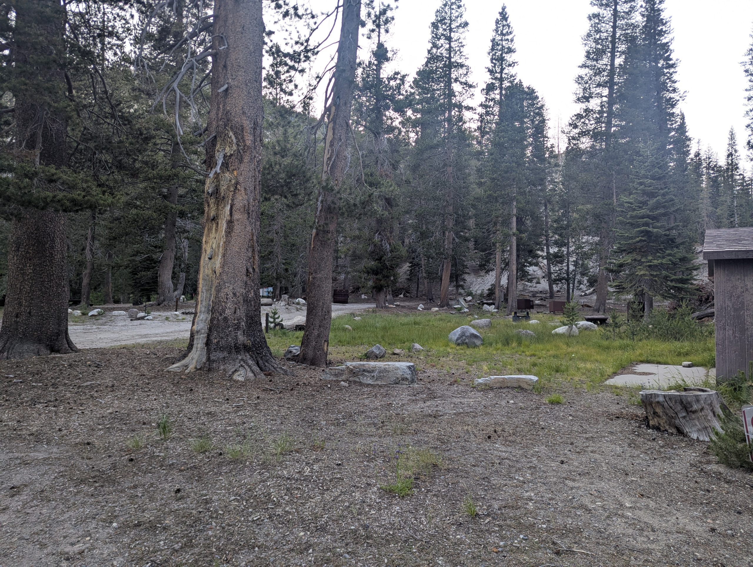
Because of the bridge being down and the PCT Detour, a ranger at Devils Postpile told me that even though a lot of the campgrounds along the river were closed, PCT hikers were still allowed to use them. So I had almost the whole campground to myself. If only the water was turned on and the latrines unlocked. But a flat tent site, bear box, and picnic table still felt nice to have.
This website contains affiliate links, which means The Trek may receive a percentage of any product or service you purchase using the links in the articles or advertisements. The buyer pays the same price as they would otherwise, and your purchase helps to support The Trek’s ongoing goal to serve you quality backpacking advice and information. Thanks for your support!
To learn more, please visit the About This Site page.

16.0 miles
From N. Fork Mono Creek 881.7, elev 8638
To Purple Lake mile 894.8, elev 9974
Climb 4304
descend 2962
Steps 19882 (I don’t think my watch counts steps correctly when I use trekking poles)
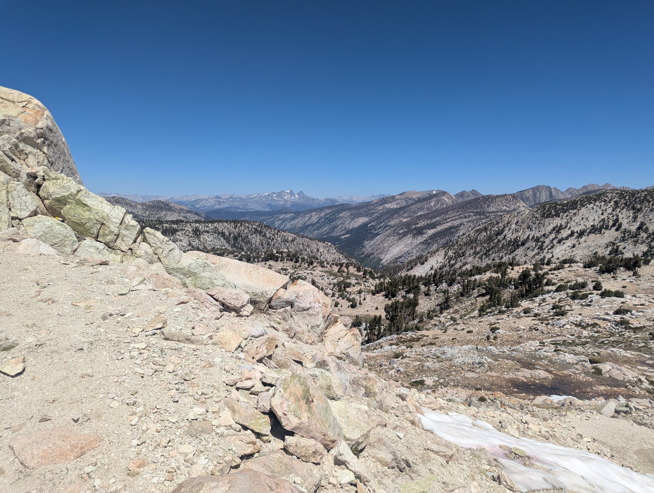
Today was a day where I felt I had to occasionally pirouette – turn around- to make sure I didn’t miss any spectacular scenery. So I spent a lot of time today just enjoying my surroundings.
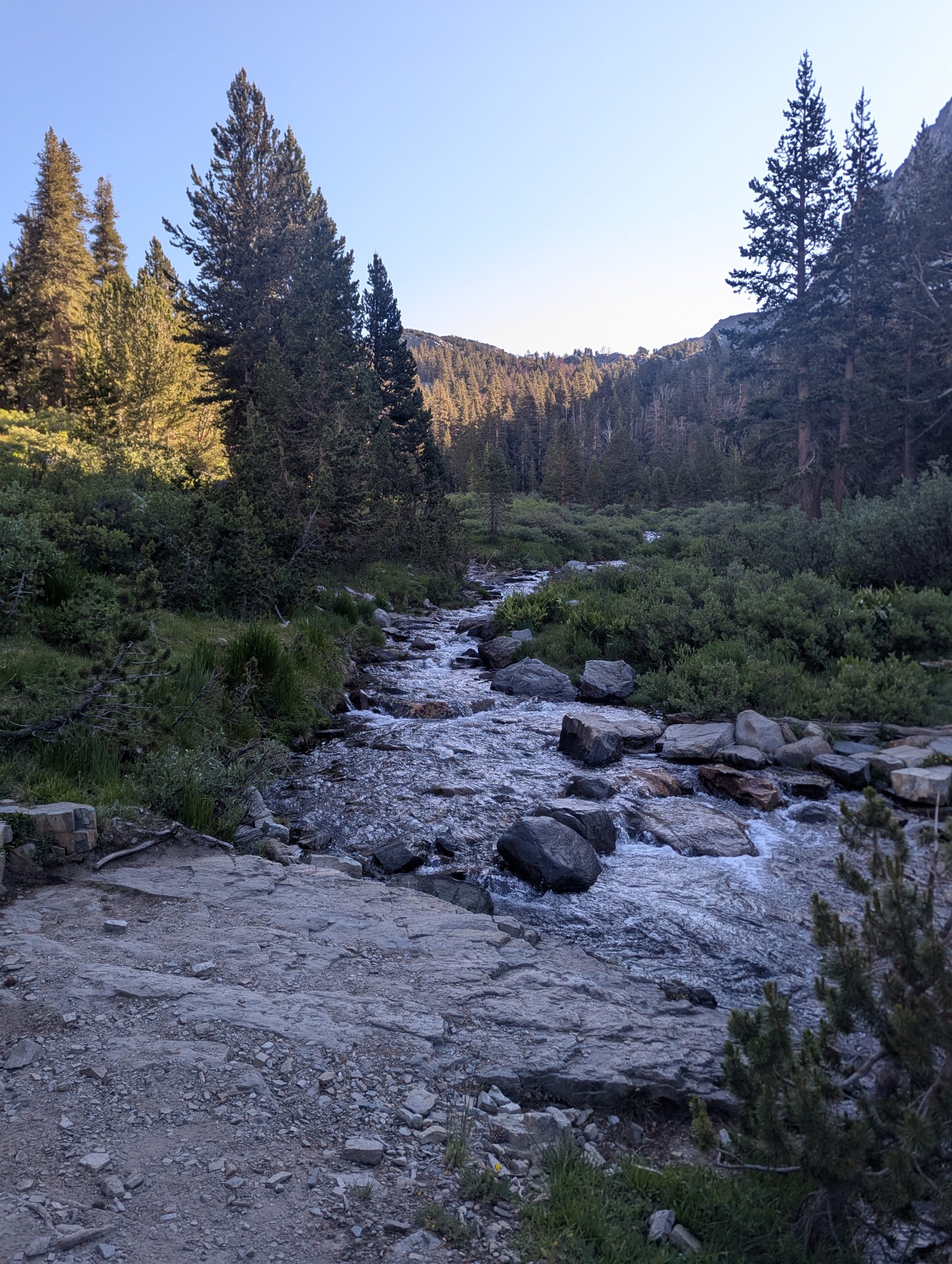
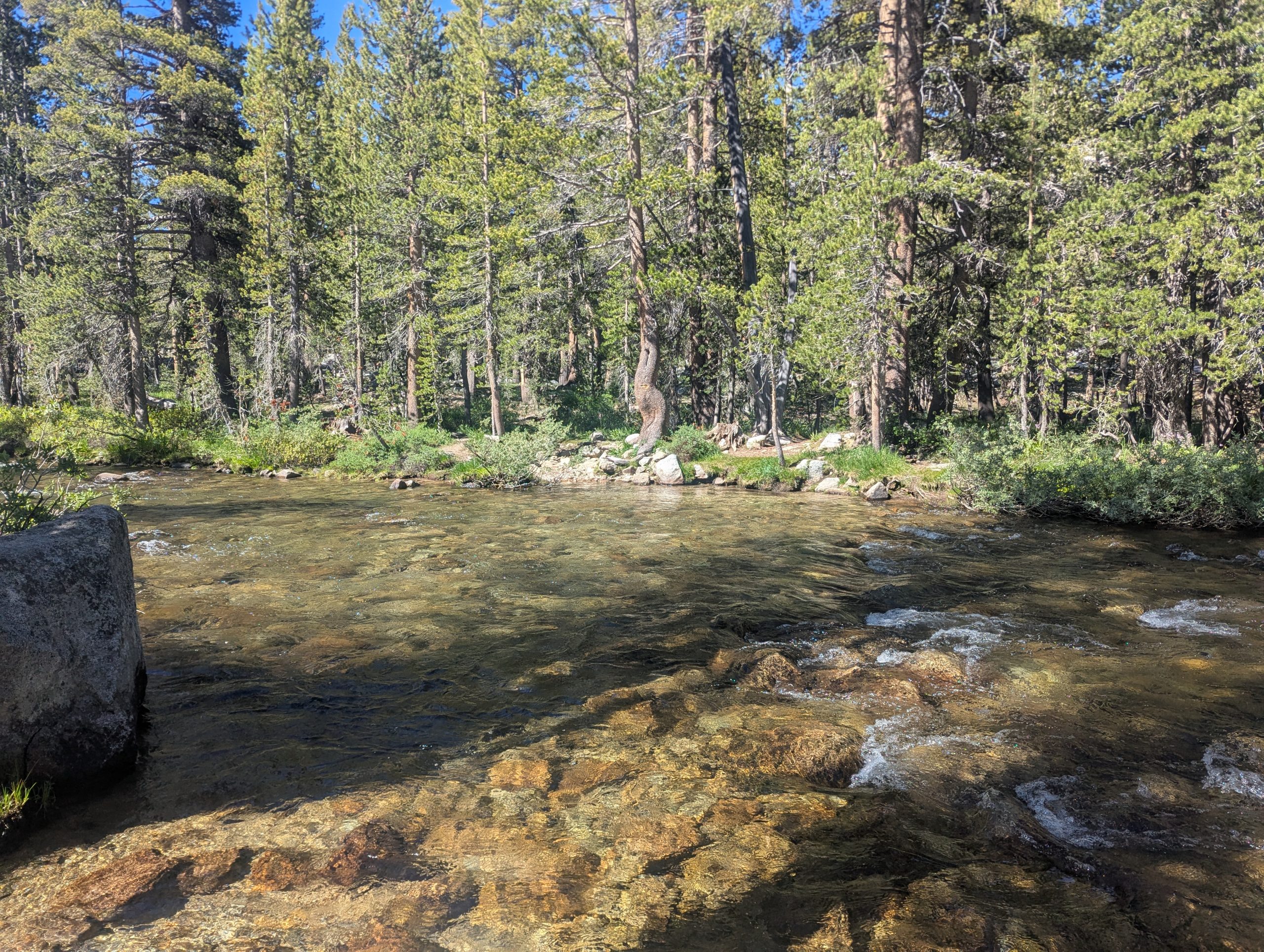
It started with the crossing of N. Fork Mono Creek. Initially, it looked like a wet foot crossing in the wild water. But I found some rocks that allowed me to keep my feet dry.
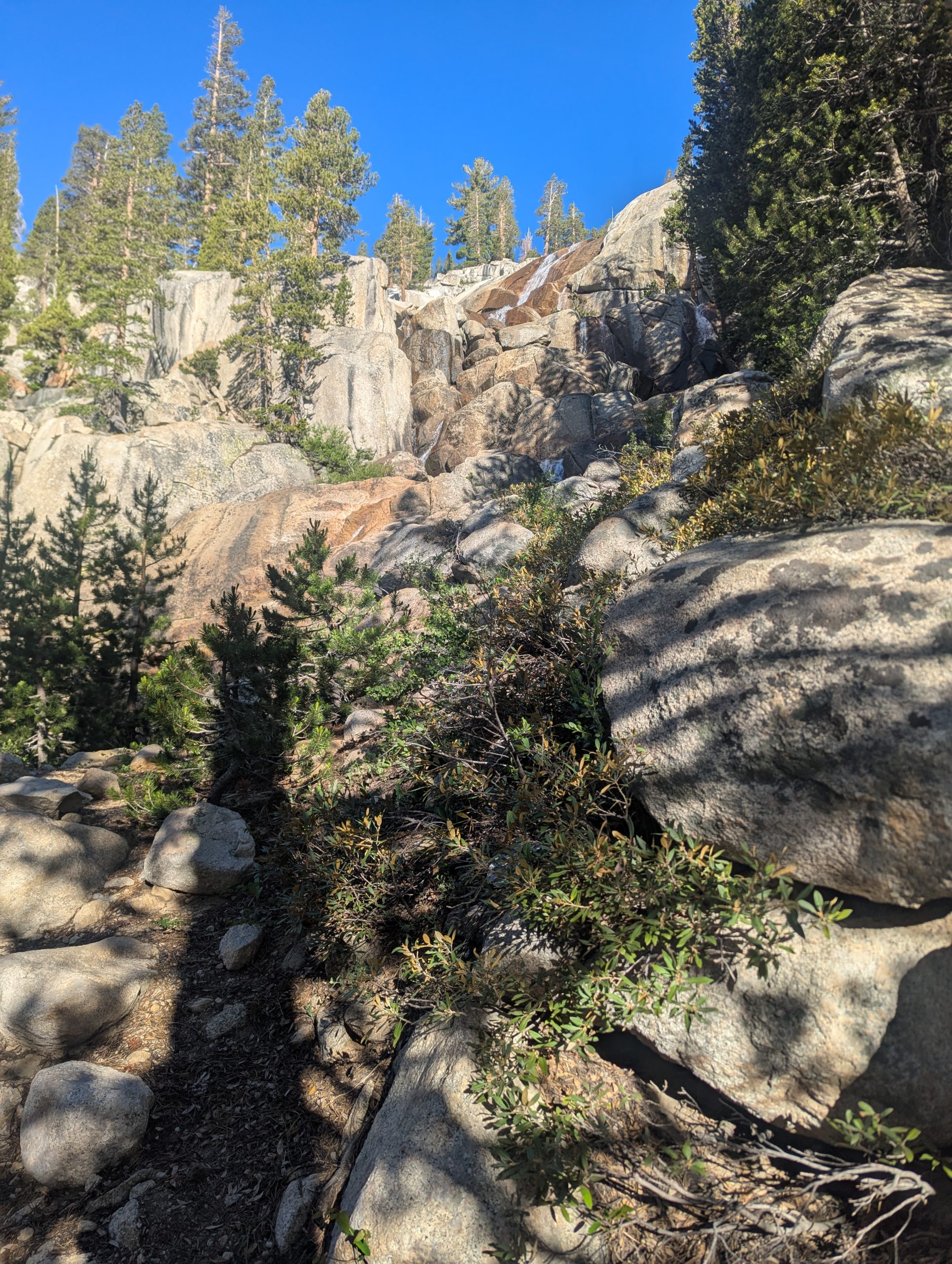
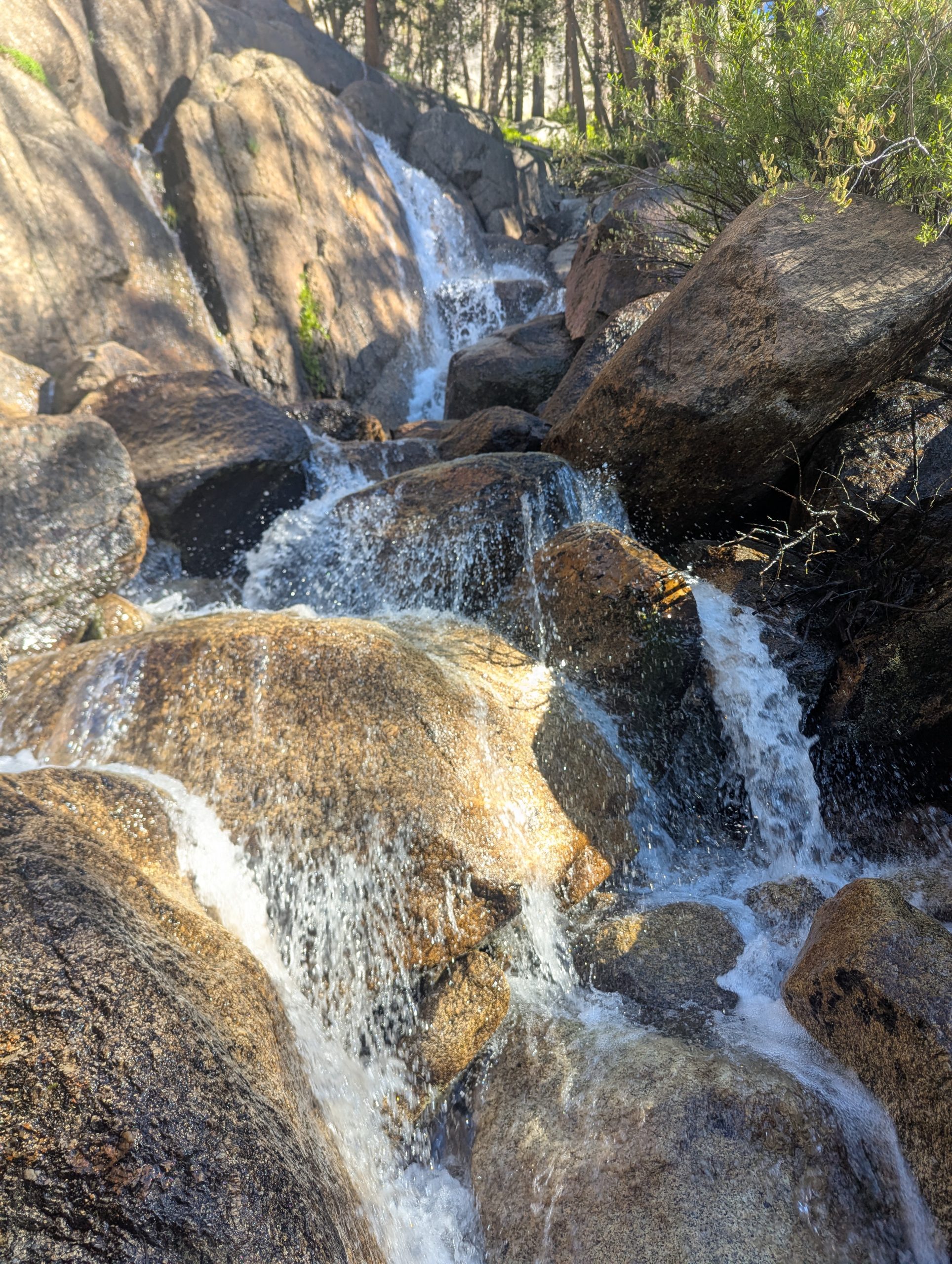
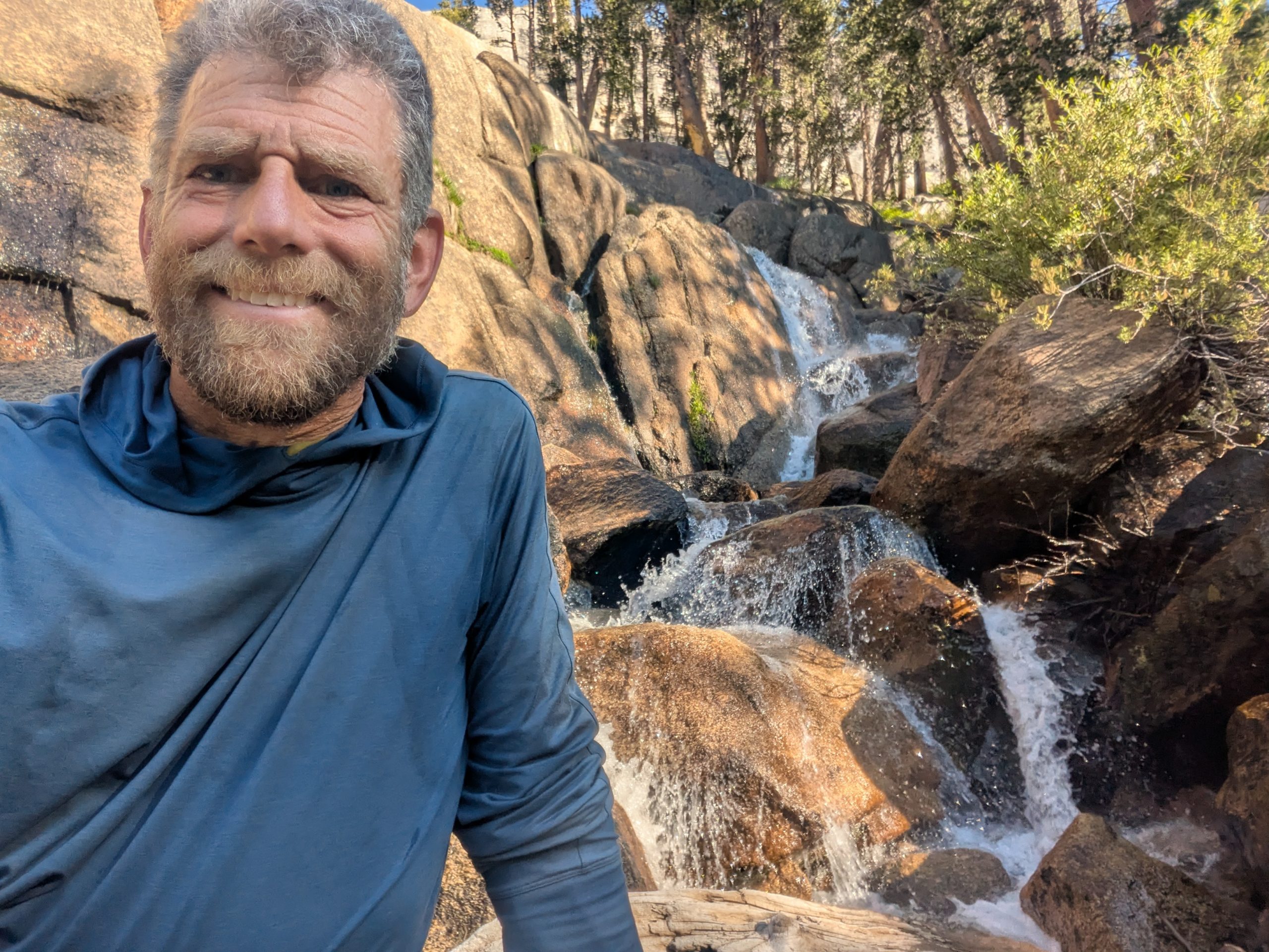
Not too long after that, Silver Pass Creek, Britt into lots of small waterfalls from way above the trail, only receiving at the trail. If it was warmer, I would have liked to check out different pools and letting the water fall over my head.
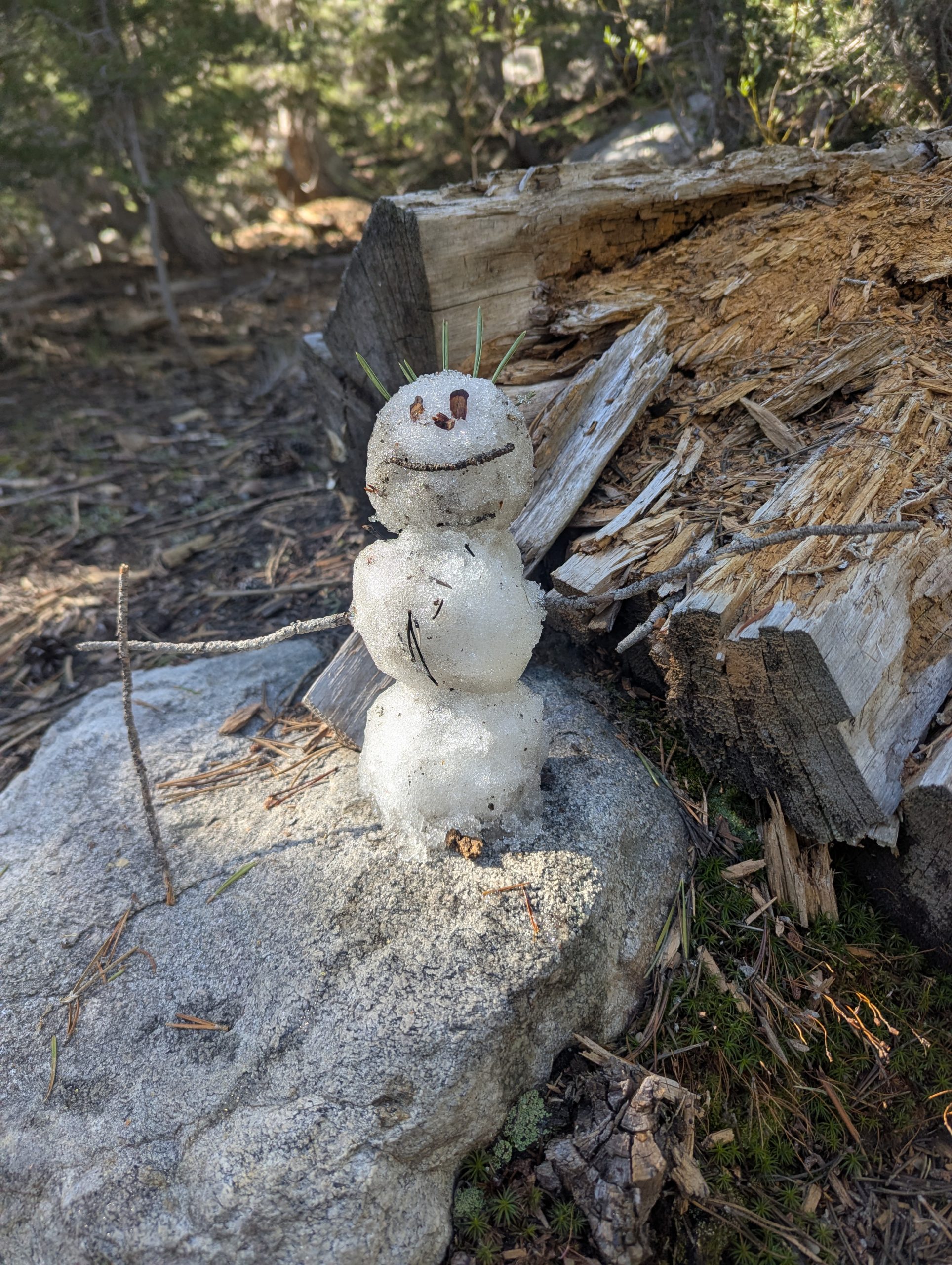
In the meadow above the falls, I found my first patch of snow. That resulted in snowman #3 of the trail: Silver – named after the creek.
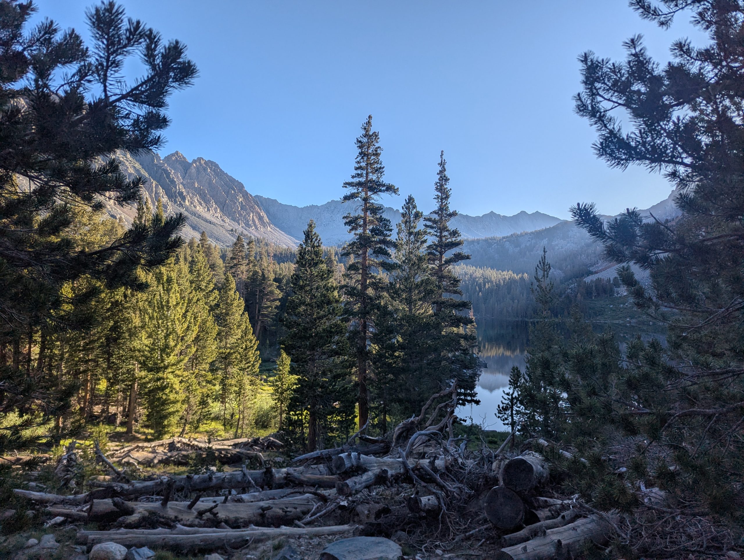
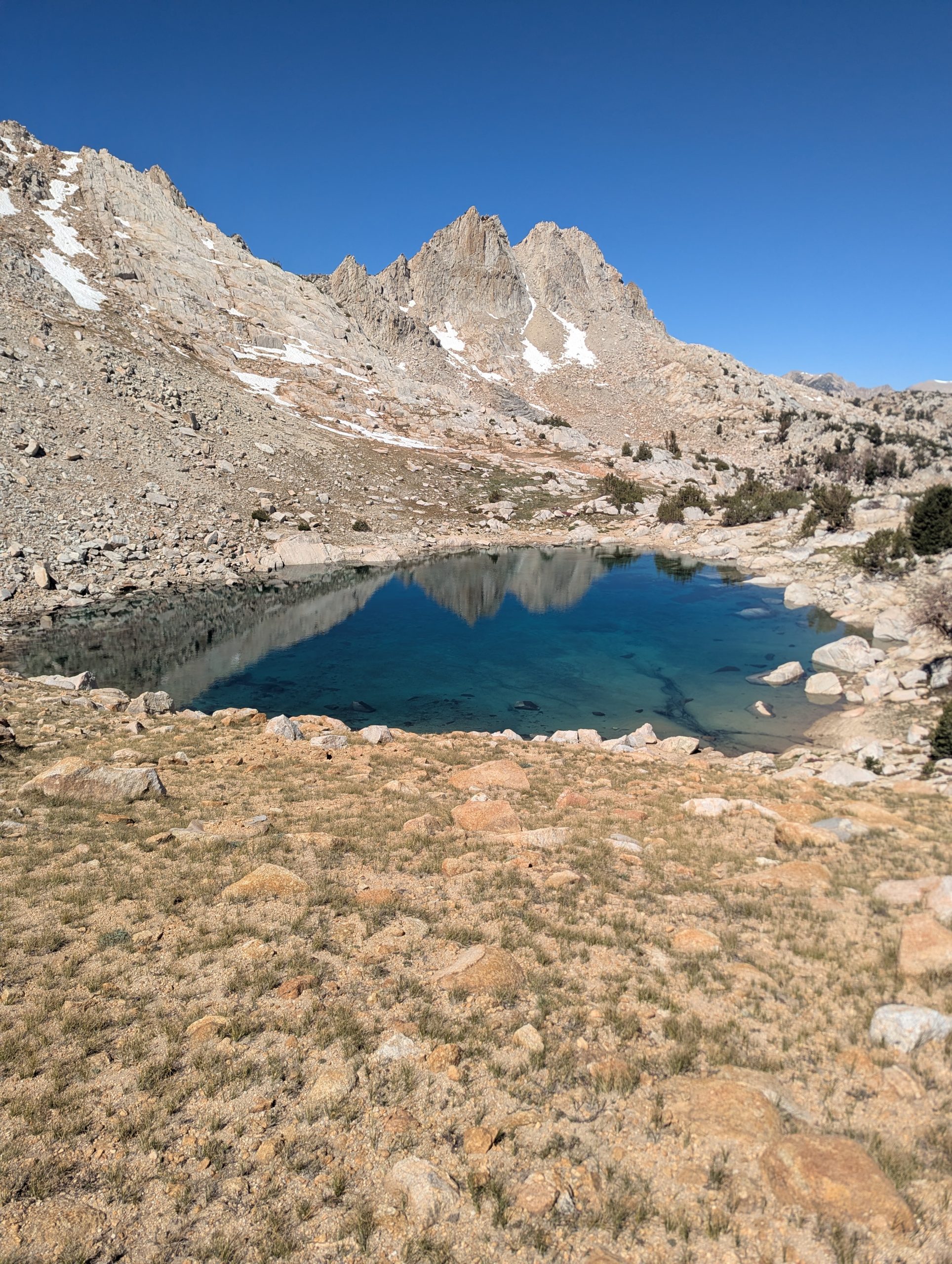
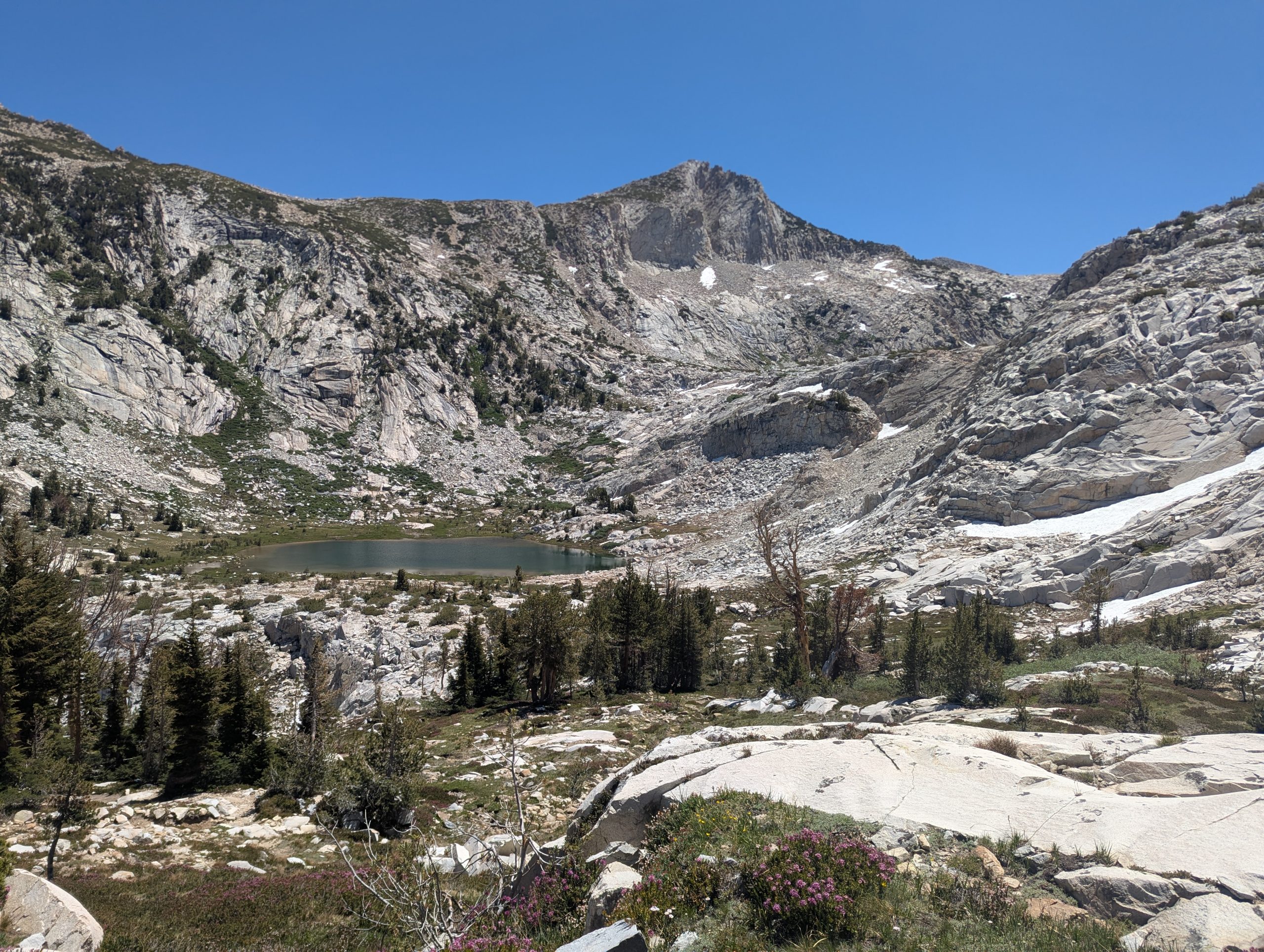
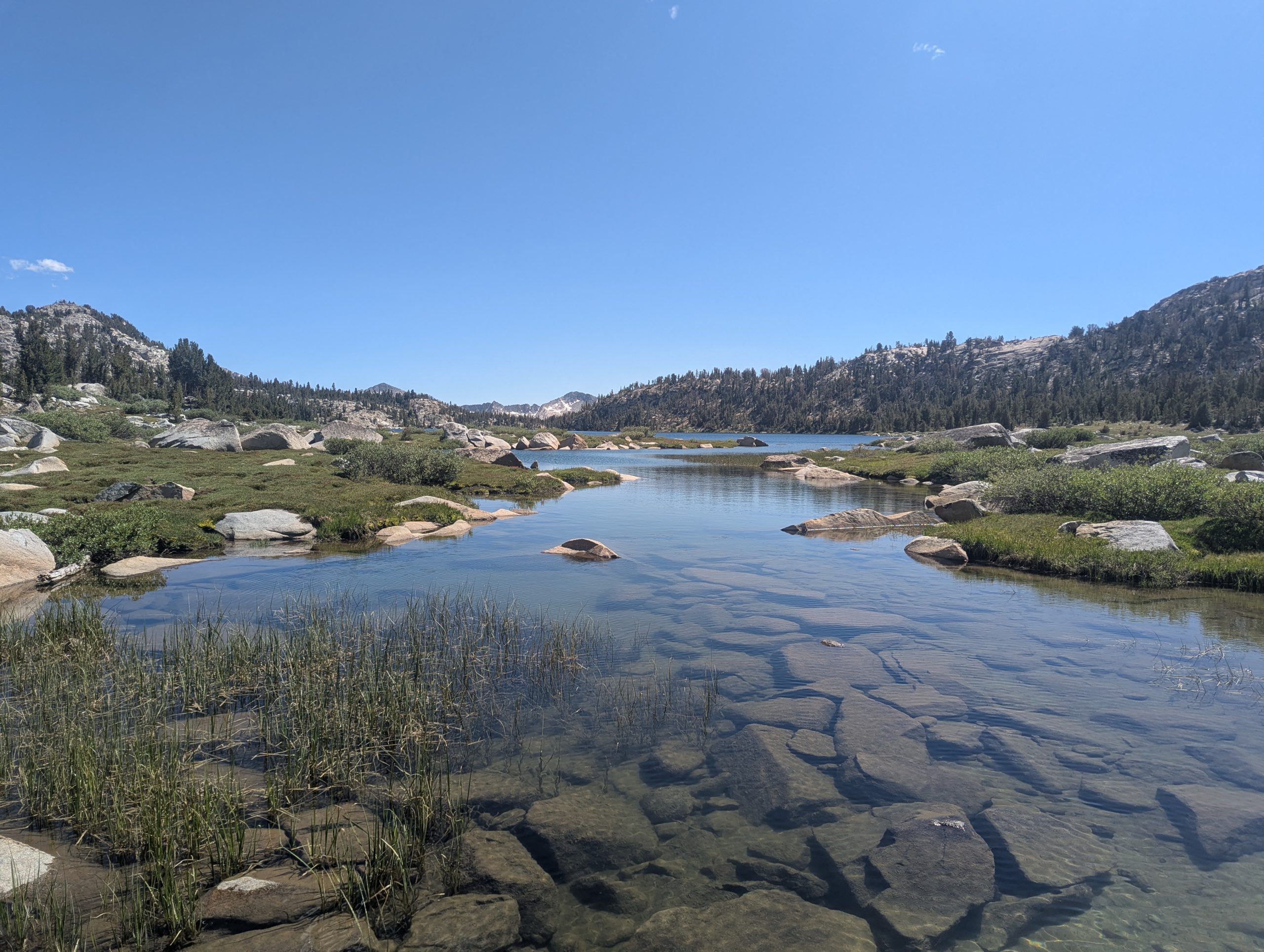
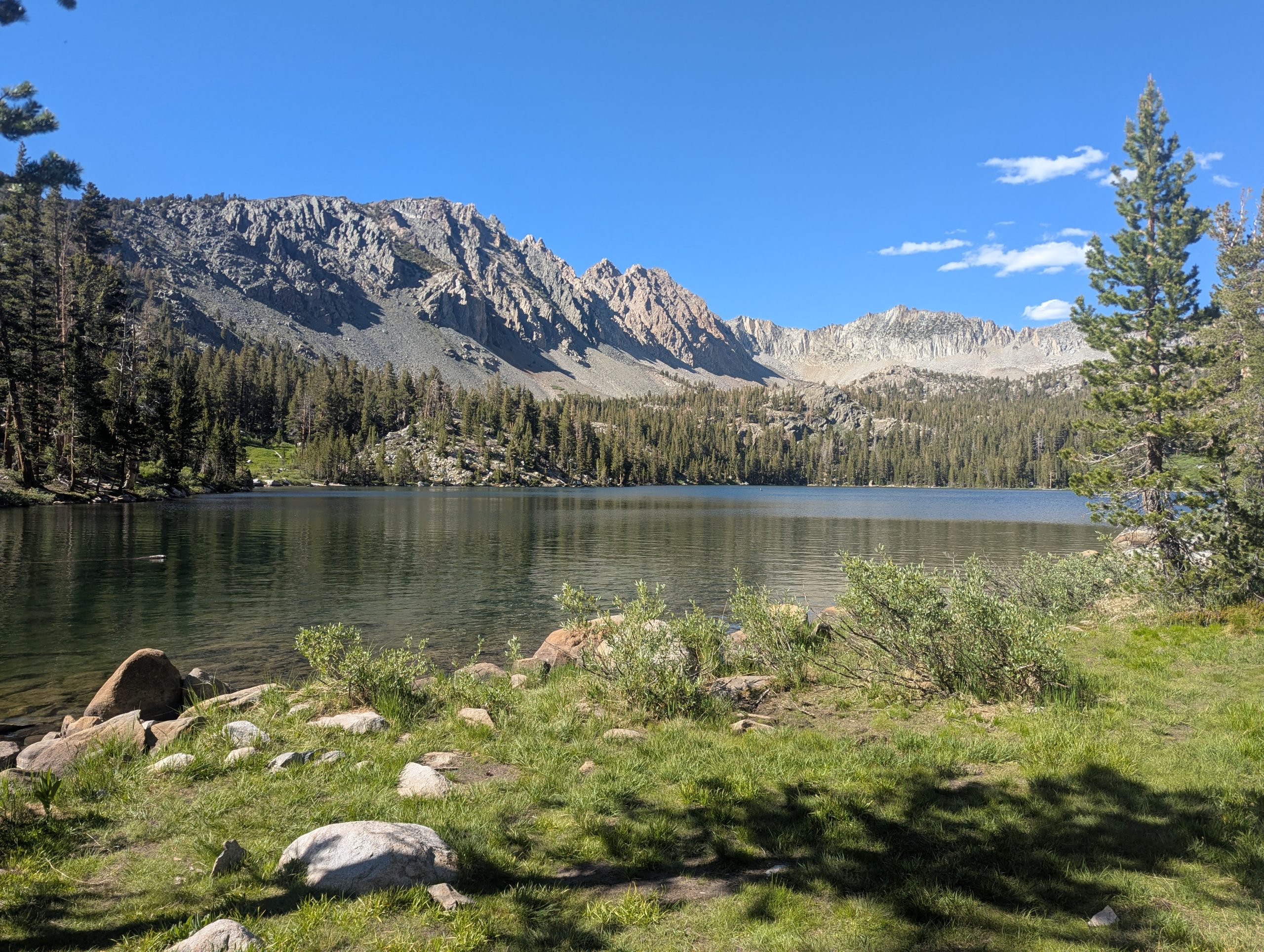
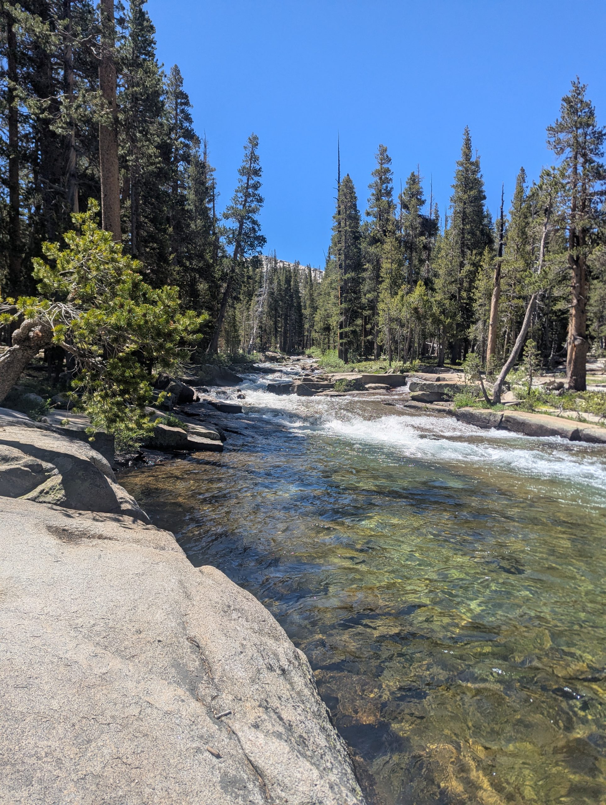
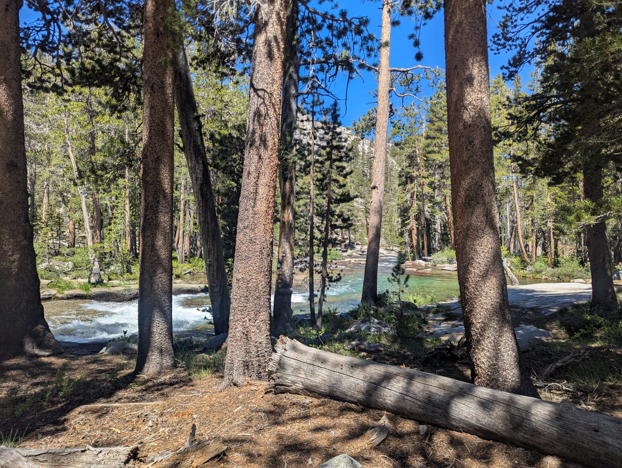
As I approached Silver Pass, there was was a little lake whose blue/green colors I found irresistable. I walked down to the lake and took a snack break.
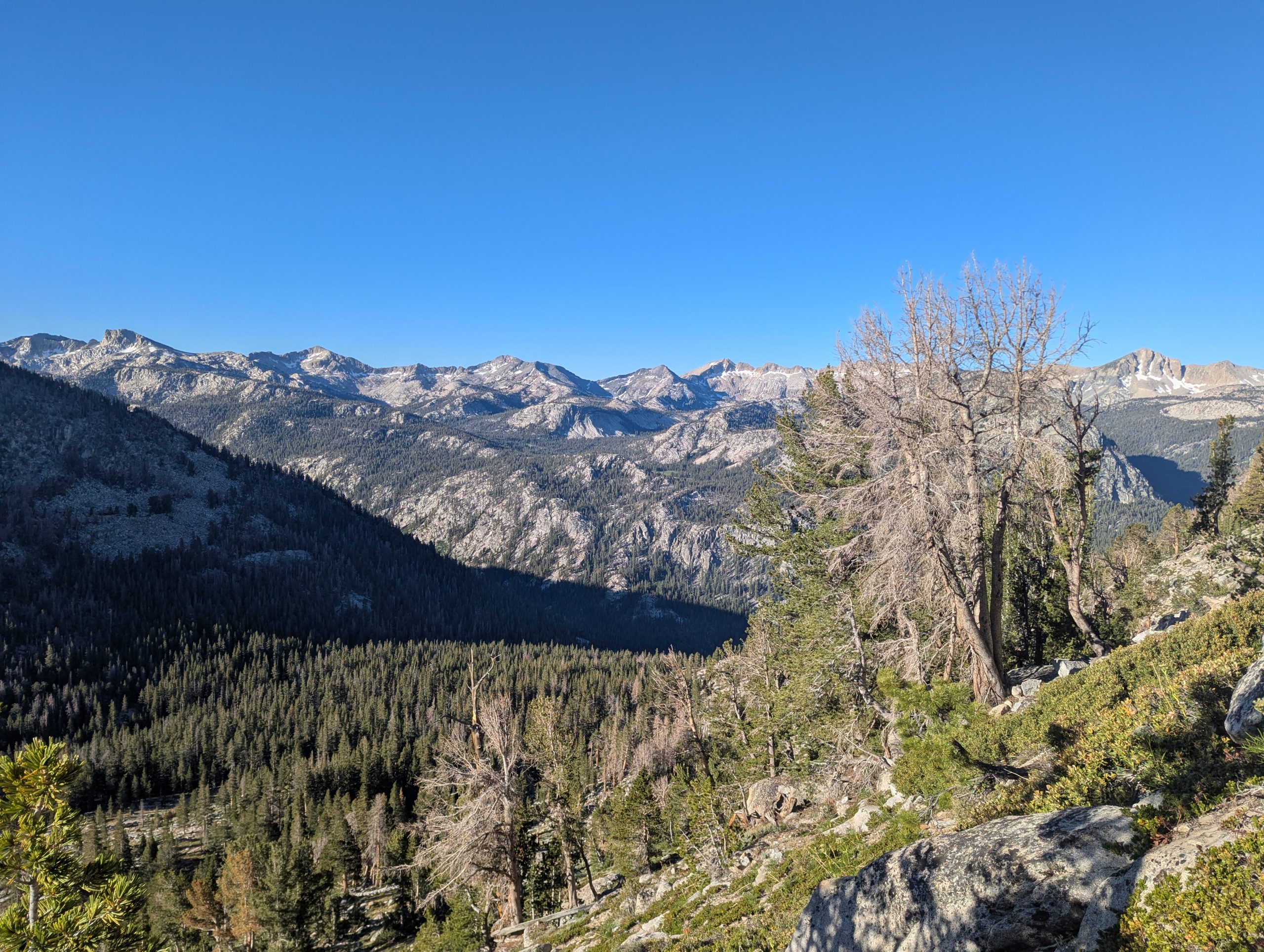
The descent from Silver Pass was just as remarkable as the climb up to it. There were lakes and creeks with step mountains as a backdrop.
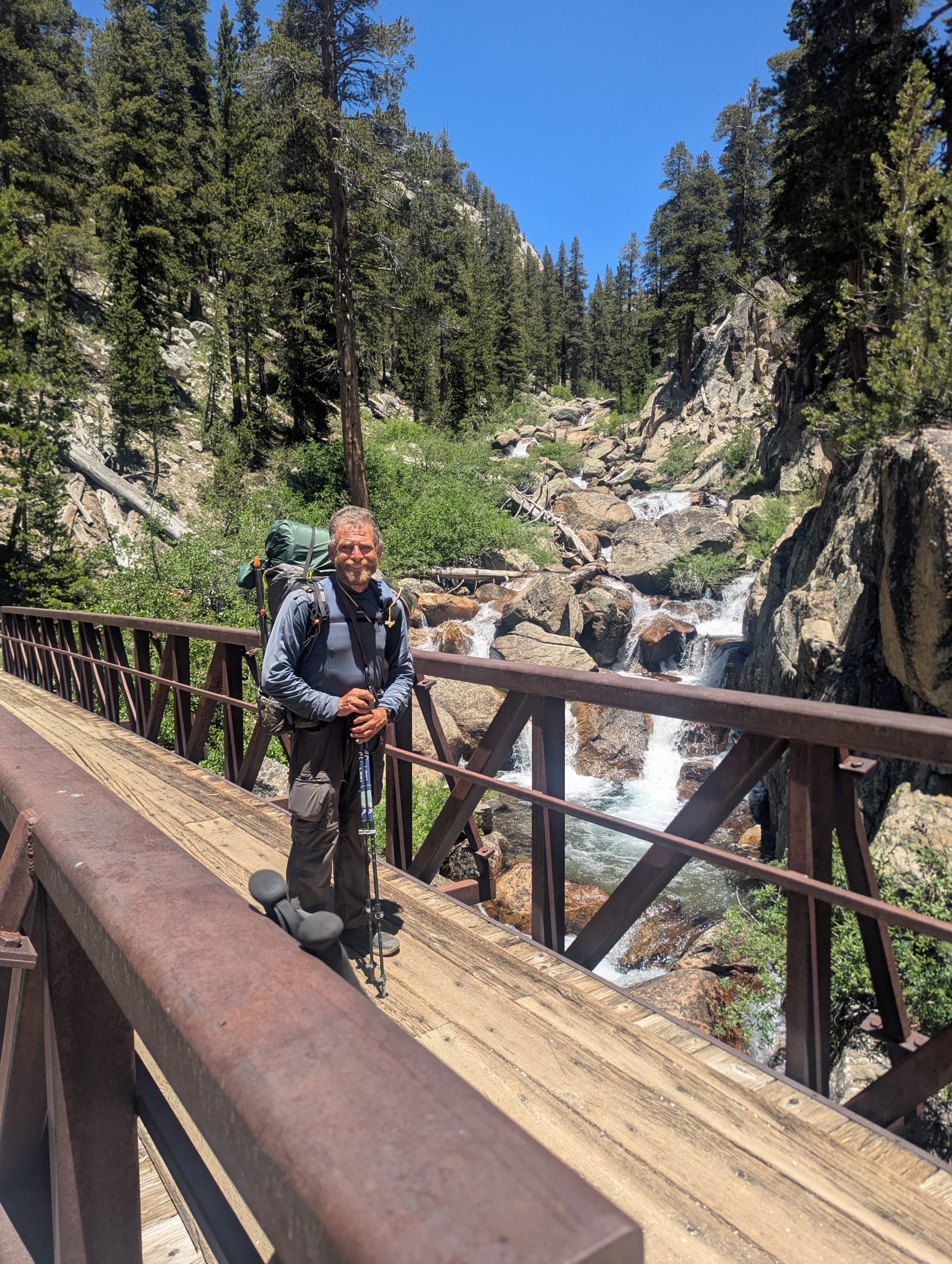
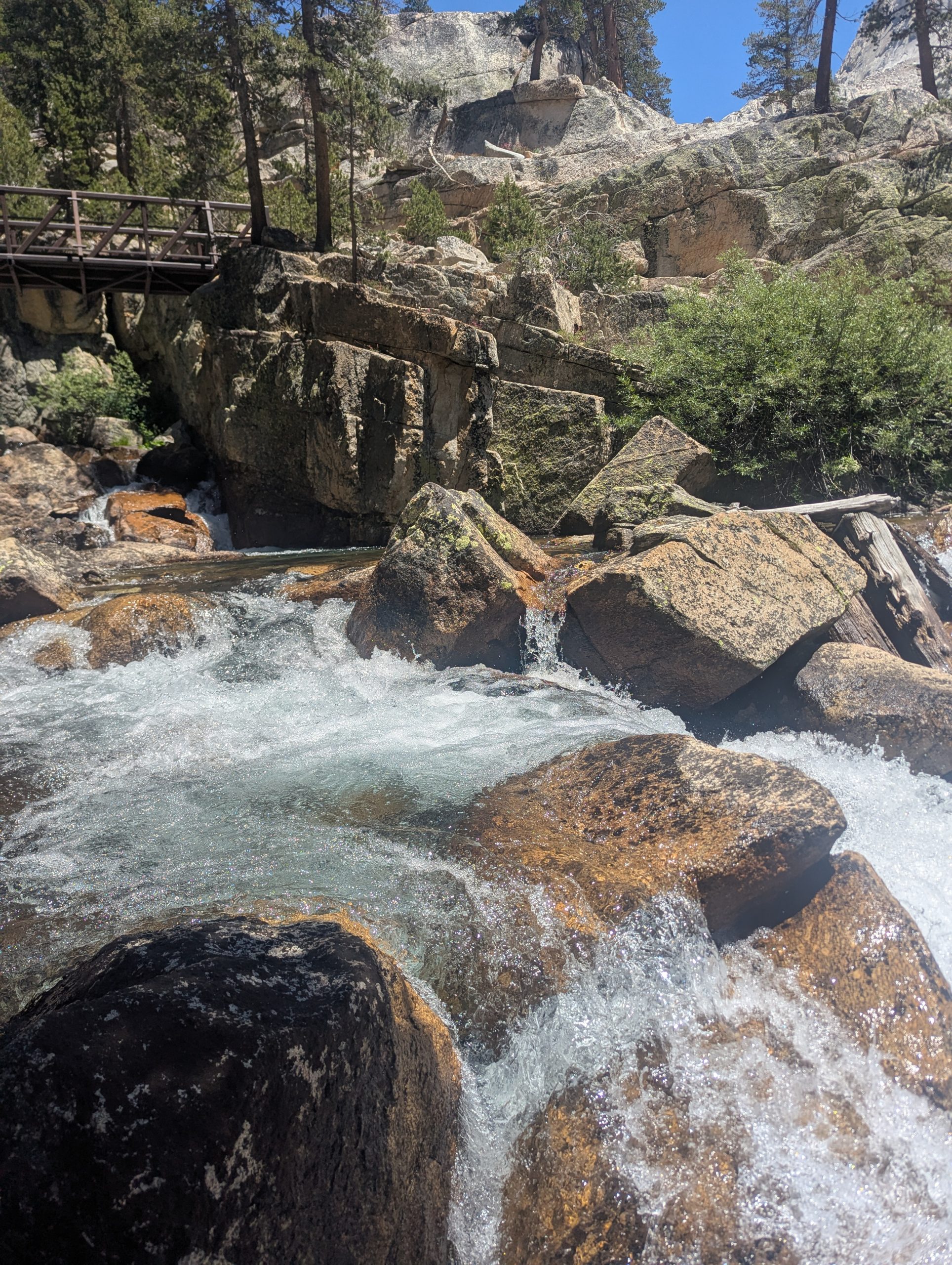
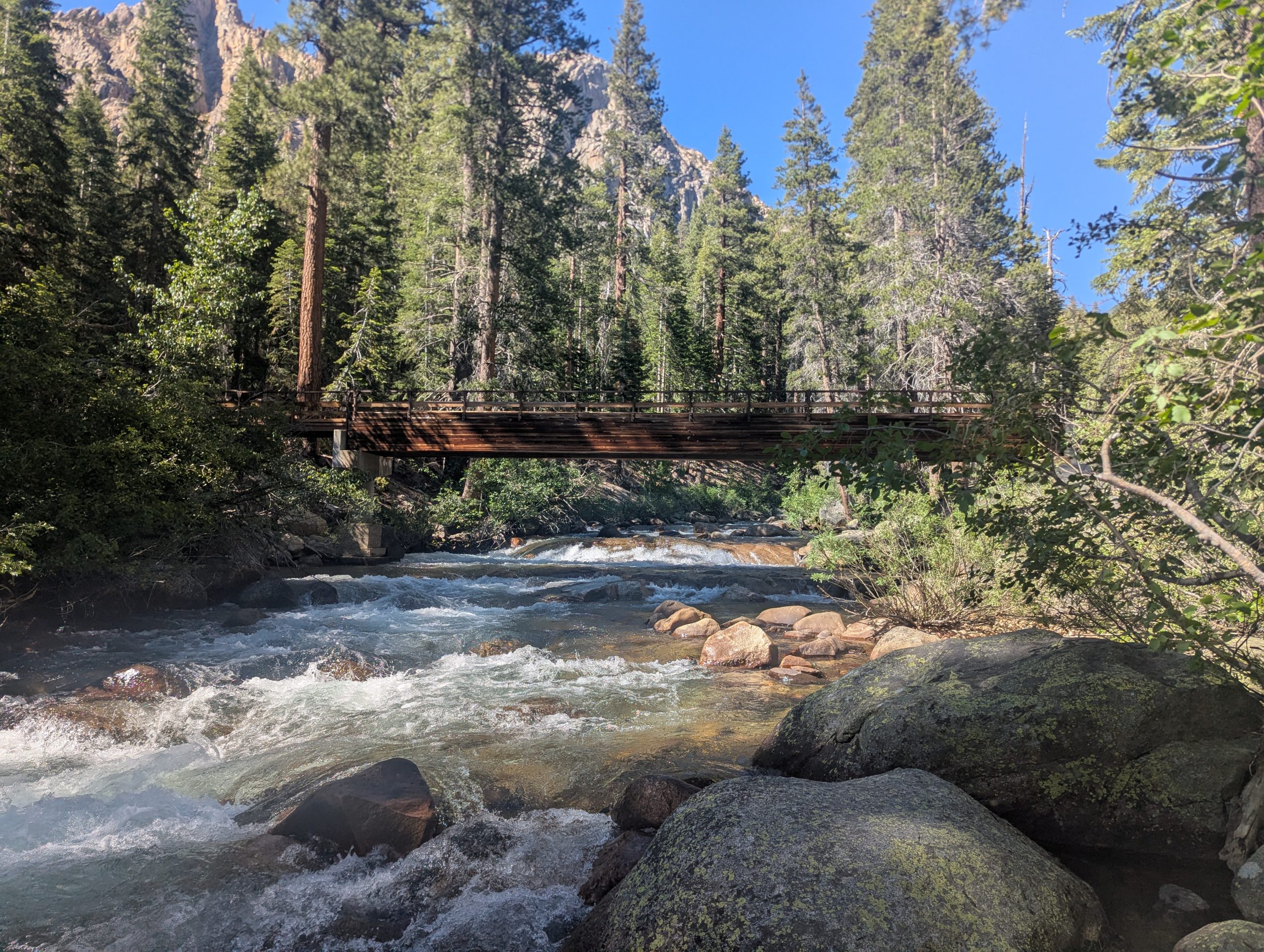
I finally made it to Fish Creek, which marked the end of the downhill. At the footbridge over the creek, Fish Creek was awesome, cascading over lots of rocks with a large flow of water.
As I followed Fish Creek upstream, it kept alternating between roaring and calm.
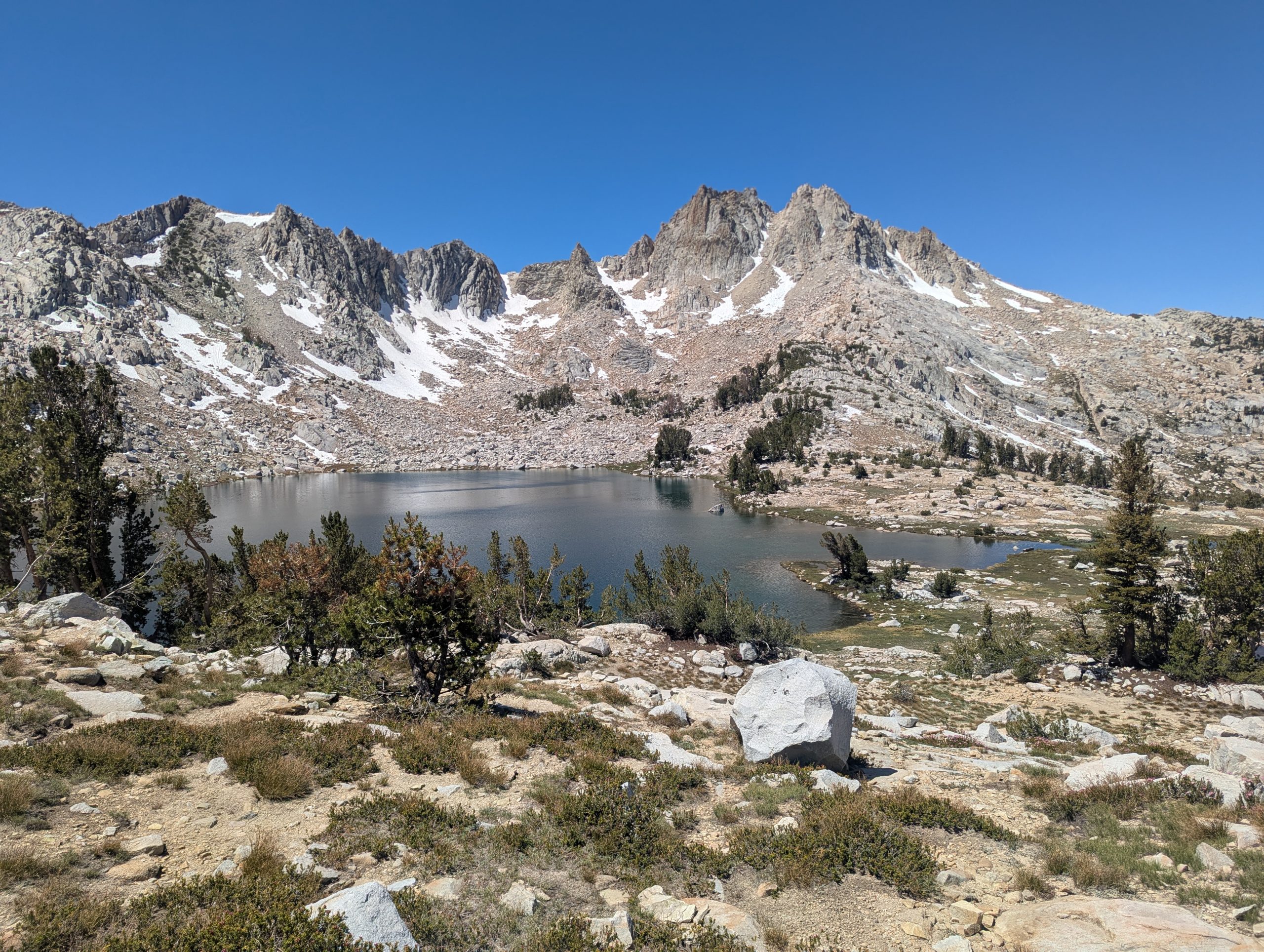
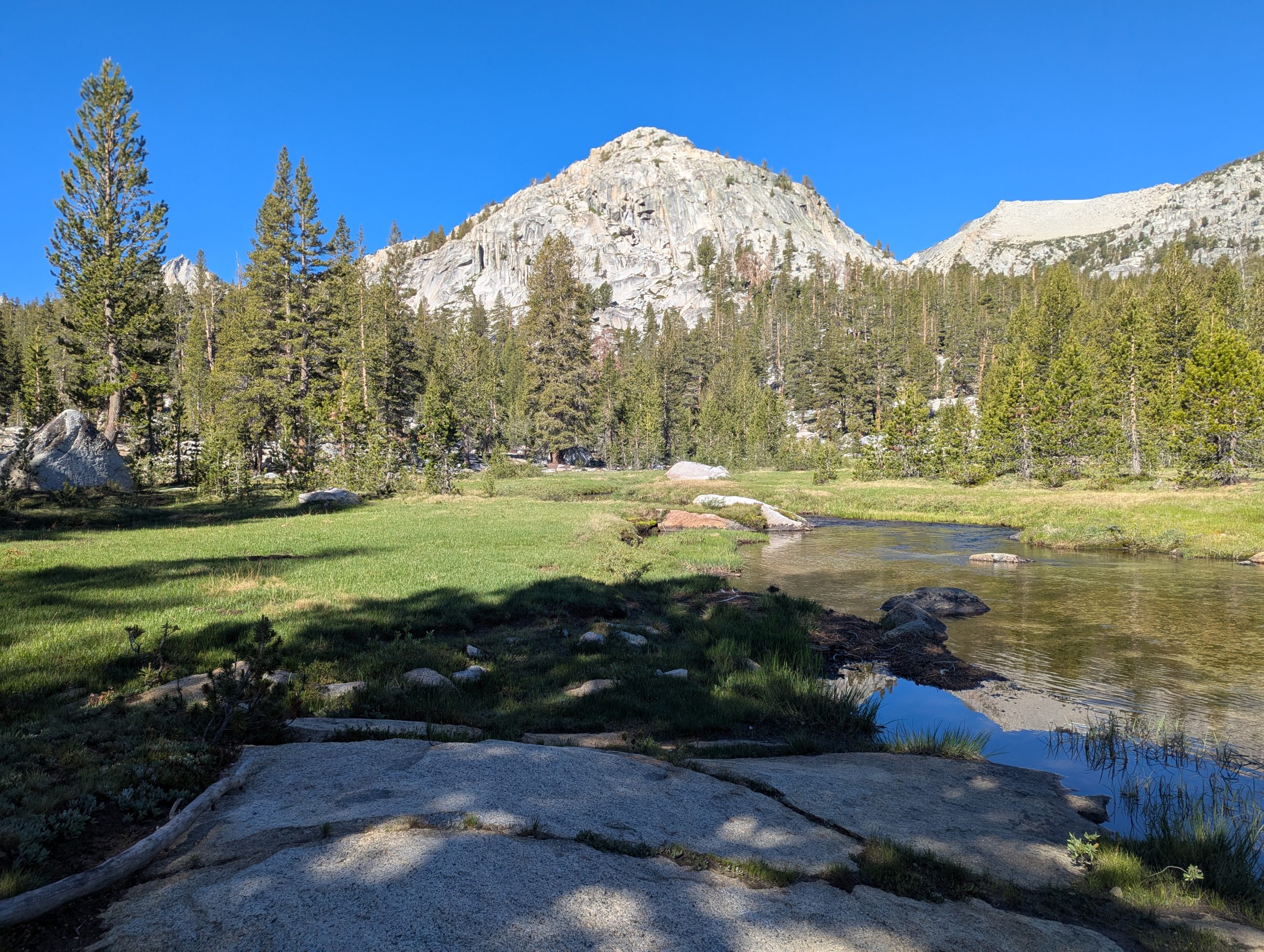
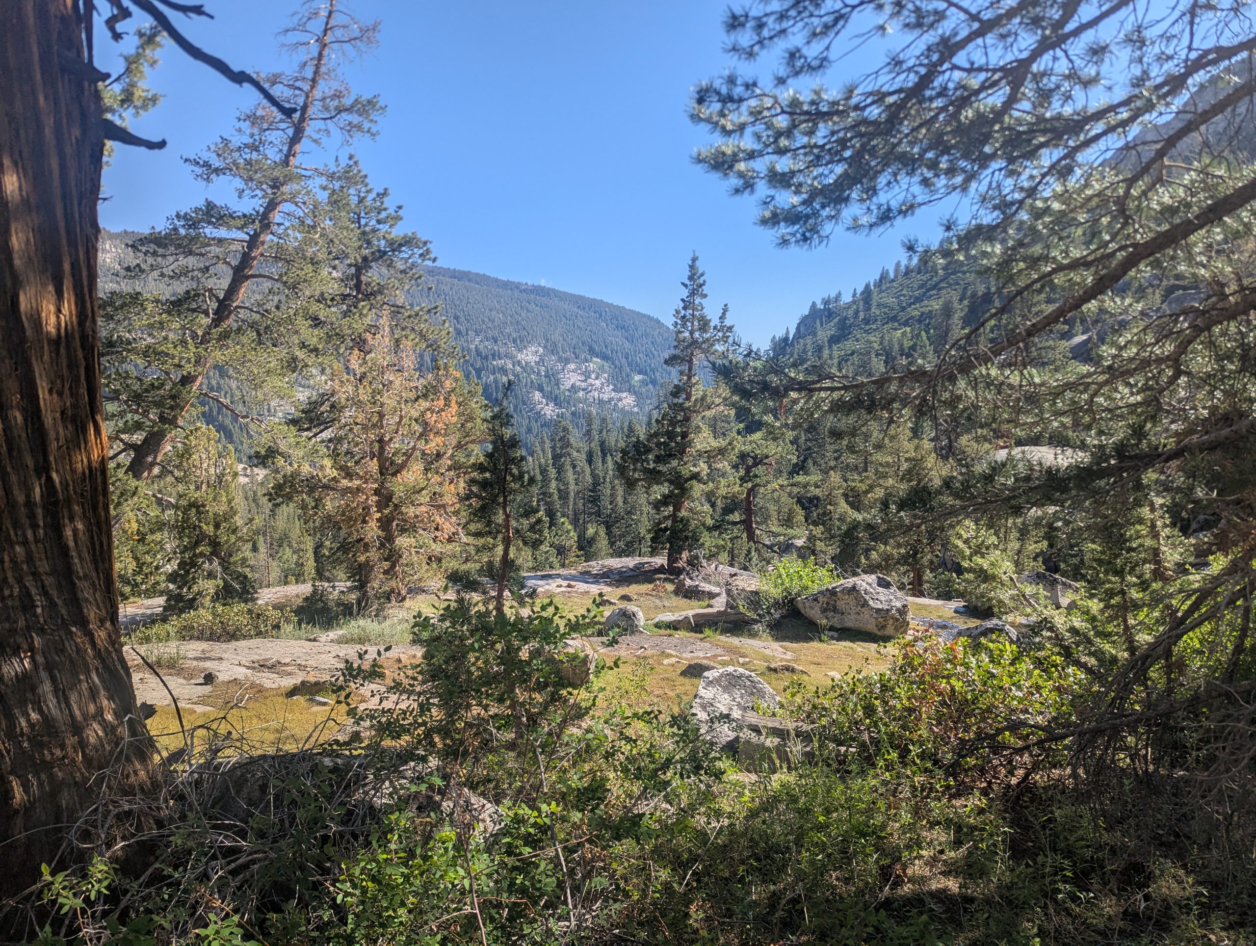
As the trail departed Fish Creek at Tully Hole, the view across Tully Hole was also amazing, circled by so many peaks.
Virginia Lake was a wet foot crossing. There were big stepping stones, but they were several inches underwater. After all the wild creeks, it seemed odd that Virginia Lake was the only wet foot crossing of the day.
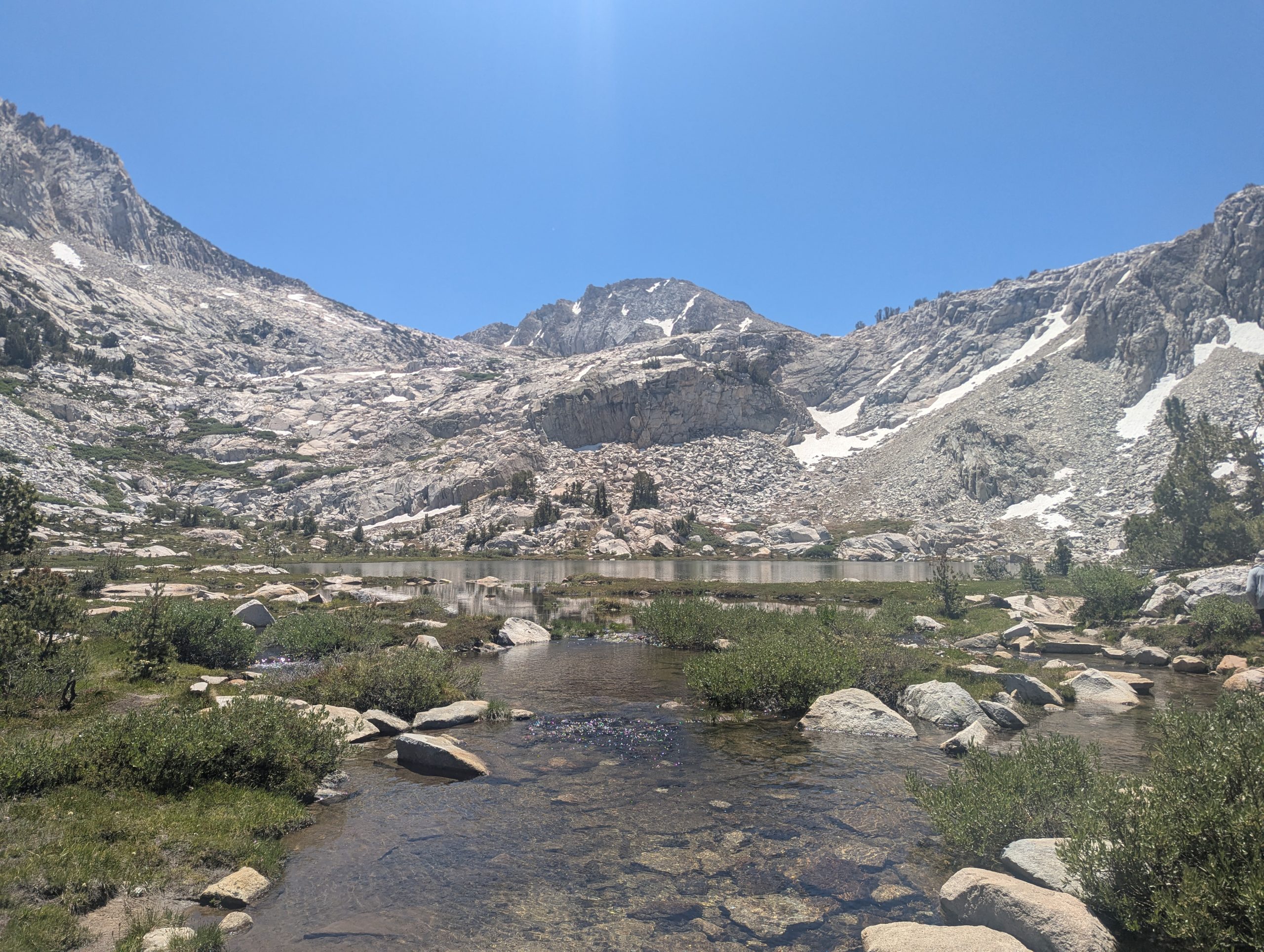
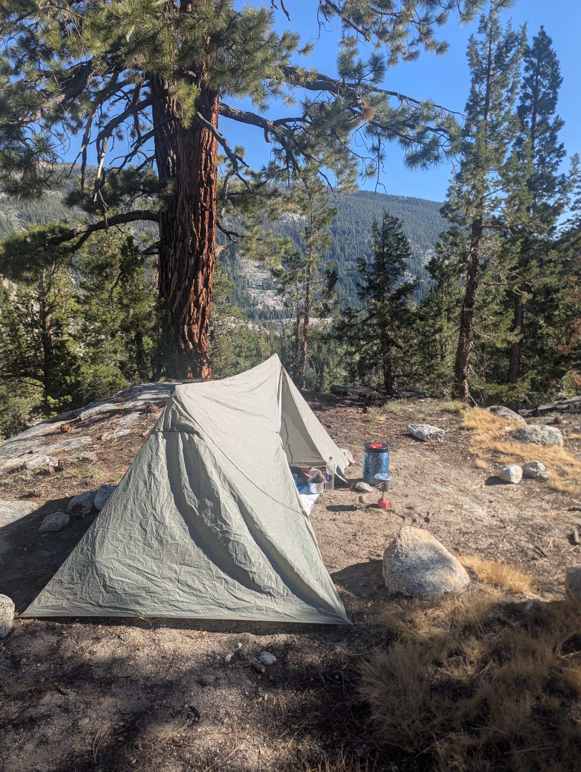
I stopped at Purple Lake for the evening. It is another lake surrounded by high, step, rugged peaks. There were lots of tent sites a little ways off trail.
I’ve been seeing lots of my southbound JMT hikers. I feel like that bunch keeps a bit more to themselves, without as much time in trail to really meet others. I’ve had conversations with a few, mostly those about my age.
This website contains affiliate links, which means The Trek may receive a percentage of any product or service you purchase using the links in the articles or advertisements. The buyer pays the same price as they would otherwise, and your purchase helps to support The Trek’s ongoing goal to serve you quality backpacking advice and information. Thanks for your support!
To learn more, please visit the About This Site page.

16 miles
From Marie Lake 867, elev 10574
To N. Fork Mono Creek 881.7, elev 8638
Climb 2149
descend 4078
Steps 28780
I still felt pretty exhausted when my alarm went off at 5:15 and then again at 5:30 this morning. I ended up going back to sleep until 6:45. I think my body needed it after a week at scout camp, where I was regularly getting to sleep around midnight and up around 5:30.
When I reached Bear Creek and forded it, the depth was 16-17″ (a little below my knee). I had no problems crossing it. But as the trail continued to follow the river, I saw numerous spots that were really pretty. I made mental notes to return and possibly camp here in the future.
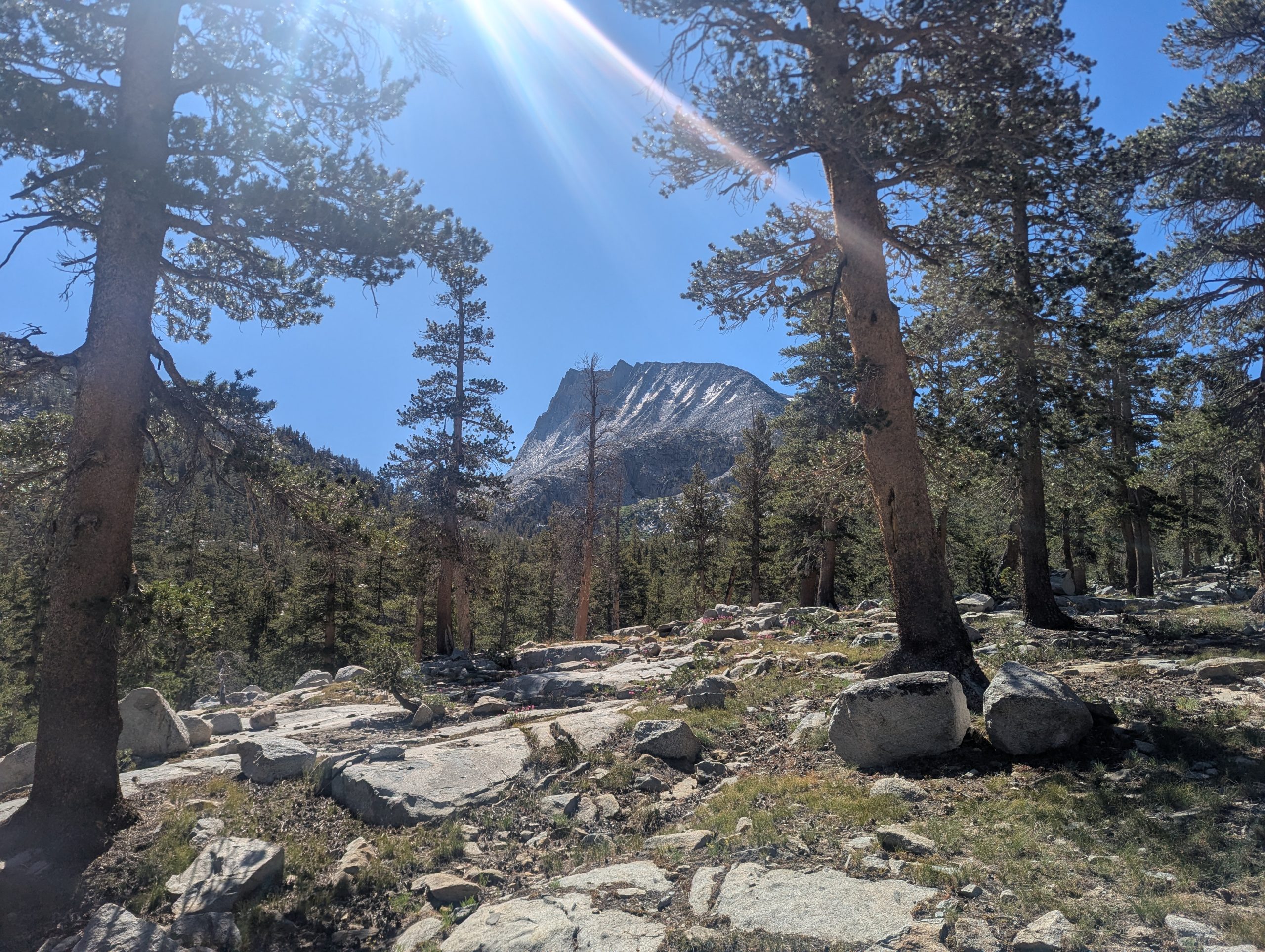
There was a 1000 ft climb in the middle of the day that was steep and had lots of Roman steps on it. Taking it at a measured pace, my legs got a bit tired, but nowhere close to feeling exhausted. I feel like my hiker legs didn’t completely abandon me during my layoff.
Speaking of my layoff, my foot has been doing very well. No signs of infection, and no pain while hiking. It is still a little sensitive if I push directly on the spot where my ice ax punctured my foot.
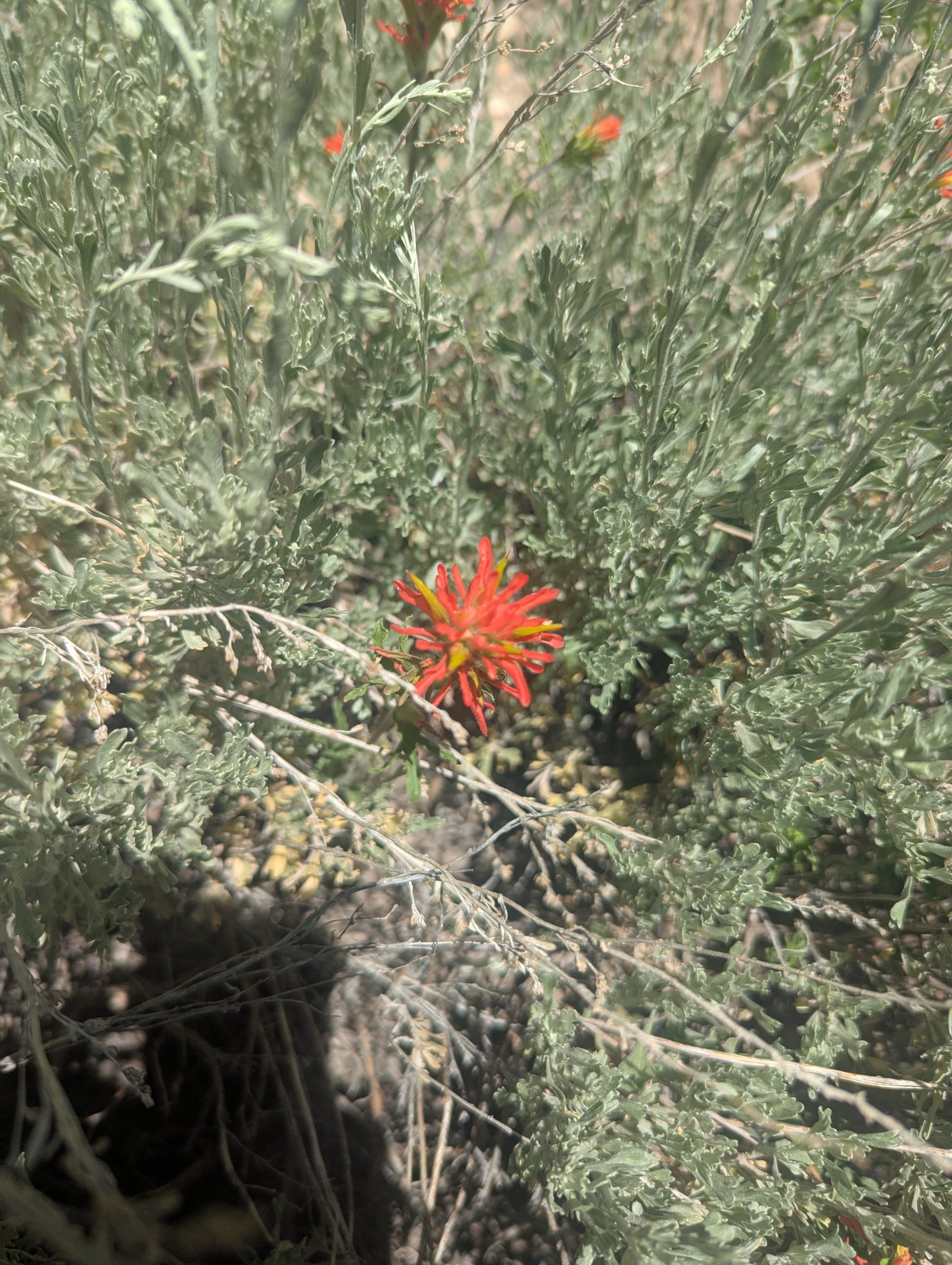
One thing I have really appreciated with all the water is the prevalence of wildflowers. I’m seeing such quantities and variety. Usually, I feel lucky if I see a couple Columbine or Larkspur. I’m seeing lots of them all over the place, and each one puts a smile on my face.
At my last stop, I gathered some water. As I tied my gravity filter system to a fir tree, a took a whiff of the air and thought, “I don’t think I even need to look to identify that big tree 20 ft to my side. I smelled that distinctive vanilla/butterscotch smell of Jeffrey Pines. When I walked over and stuck my nose up to the tree, it was one of the more fragrant Jeffreys I’ve smelled. Yum!
When I finally reached Mono Creek shortly before it ran into Lake Edison, it was roaring. I was glad it had a bridge.
I am crossing paths with quite a few southbound John Muir Trail hikers. Talking to them about their trip so far, I find myself thinking, “It’s only 100 miles to Yosemite.” The PCT has changed my mentality about hiking distances. Previously, a 60 mile trip seemed long, as did 14-16 mile days. Today, I did 16 miles in the Sierras and never felt stressed about it. And 100 miles is just “How far I’ll go to my next resupply.” Even trying to communicate with people at home. It didn’t seem scary or even strange to say, “I probably won’t have cell coverage for a week.”
I think this showed up when hiking from Florence Lake to MTR with JoJo yesterday. Despite doing a fair bit of backpacking, he was just setting out on his first longer trip, first trip in California, and was meeting friends (who started JMT in Yosemite) at MTR. He felt the think air a bit. I was calm and able to confidently lead us without referring to any map. I had done this hike last year and just felt very comfortable on trail.
Today, I found a really nice tent site near the trail. It had no water, but that is because the creek is a bit below me here in a valley. The trail was next to it back as little ways. And the trail will rejoin it again in 1/4-1/2 mile. I may not have lots of water here, but I can easily get it in the morning.
I took advantage of my early stop to get out my sewing supplies and fix a hole in the pocket of my pants. I really don’t want to lose my pocket knife.
This website contains affiliate links, which means The Trek may receive a percentage of any product or service you purchase using the links in the articles or advertisements. The buyer pays the same price as they would otherwise, and your purchase helps to support The Trek’s ongoing goal to serve you quality backpacking advice and information. Thanks for your support!
To learn more, please visit the About This Site page.
-

 The Travel Revolution of Our Era3 weeks ago
‘AI is undeniably reshaping the core structure of the hospitality ecosystem’: Venu G Somineni
-
Brand Stories7 days ago
The Smart Way to Stay: How CheQin.AI Is Flipping Hotel Booking in Your Favor
-
Brand Stories2 weeks ago
Voice AI Startup ElevenLabs Plans to Add Hubs Around the World
-
Mergers & Acquisitions1 week ago
Amazon weighs further investment in Anthropic to deepen AI alliance
-
Mergers & Acquisitions6 days ago
How Elon Musk’s rogue Grok chatbot became a cautionary AI tale
-
Asia Travel Pulse2 weeks ago
Looking For Adventure In Asia? Here Are 7 Epic Destinations You Need To Experience At Least Once – Zee News
-
Mergers & Acquisitions1 week ago
UK crime agency arrests 4 people over cyber attacks on retailers
-
AI in Travel2 weeks ago
‘Will AI take my job?’ A trip to a Beijing fortune-telling bar to see what lies ahead | China
-
Mergers & Acquisitions2 weeks ago
ChatGPT — the last of the great romantics
-
Mergers & Acquisitions1 week ago
EU pushes ahead with AI code of practice


