
Destinations & Things To Do
Watch it! Here are the 24 most overcrowded Texas tourist destinations

Here’s how to find the cheapest airline flights every time you travel
Is there a strategy for finding cheap airfare every time you travel?
As overall travel increases throughout the country, Governor Greg Abbott has described the Texas travel and tourism industry as “a critical economic driver and job creator across every region of the state.”
“Texas is a top travel destination for visitors from across the United States and around the world, attracting a record 62 million travelers and $97.5 billion in visitor spending to our great state last year,” Abbott said in his May announcement of Travel and Tourism Week. “The travel industry drives almost $200 billion in economic opportunity for Texas businesses and supports 1.3 million jobs for hardworking Texans across our state.”
The figures Abbott referenced came from a Travel Texas study, which also showed travel in the state generated an additional $9.2 billion in tax revenue alone. But exactly which Texas destinations are attracting the most travelers?
A recent analysis by Canada Sports Betting gathered data from TripAdvisor reviews, flagging terms like “busy” and “overcrowded” to find the destinations that are most often packed to capacity (and beyond). Unsurprisingly, the 24 most overcrowded spots clustered around Texas’ five largest cities. And one suburb in particular claimed the top two busiest destinations.
Can you guess which Texas spots will draw the most tourists in 2025? Here are the 24 most overcrowded tourist destinations, according to Canada Sports Betting.
LIST: Most overcrowded tourist destinations in Texas
| Rank | Destination | City | Percentage |
| 1 | Schlitterbahn Waterpark | New Braunfels | 17.14% |
| 2 | Comal River | New Braunfels | 15.12% |
| 3 | Port Aransas Beach | Port Aransas | 14.65% |
| 4 | Perot Museum of Nature and Science | Dallas | 13.43% |
| 5 | Barton Springs Pool | Austin | 13.07% |
| 6 | The Sixth Floor Museum at Dealey Plaza | Dallas | 11.65% |
| 7 | Cadillac Ranch | Amarillo | 9.95% |
| 8 | Enchanted Rock | Fredericksburg | 7.87% |
| 9 | Lost Maples Trail | Vanderpool | 7.67% |
| 10 | San Antonio River Walk | San Antonio | 7.43% |
| 11 | Houston Zoo | Houston | 6.59% |
| 12 | Moody Gardens | Galveston | 6.47% |
| 13 | The Alamo | San Antonio | 6.26% |
| 14 | Space Center Houston | Houston | 5.64% |
| 15 | Japanese Tea Gardens | San Antonio | 5.62% |
| 16 | Dallas Arboretum and Botanical Garden | Dallas | 5.16% |
| 17 | The Strand | Galveston | 4.08% |
| 18 | Kimbell Art Museum | Fort Worth | 3.89% |
| 19 | Fort Worth Stockyards | Fort Worth | 3.47% |
| 20 | Palo Duro Canyon | Amarillo | 3.36% |
| 21 | Grape Creek Vineyards | Fredericksburg | 3.34% |
| 22 | Museum of Fine Arts, Houston | Houston | 2.88% |
| 23 | Texas State Capitol | Austin | 2.56% |
| 24 | Reunion Tower | Dallas | 2.42% |


- Blackrock Hut (885.3) to Pinefield Hut (898)
- 2549 feet ascent, 2757 feet descent
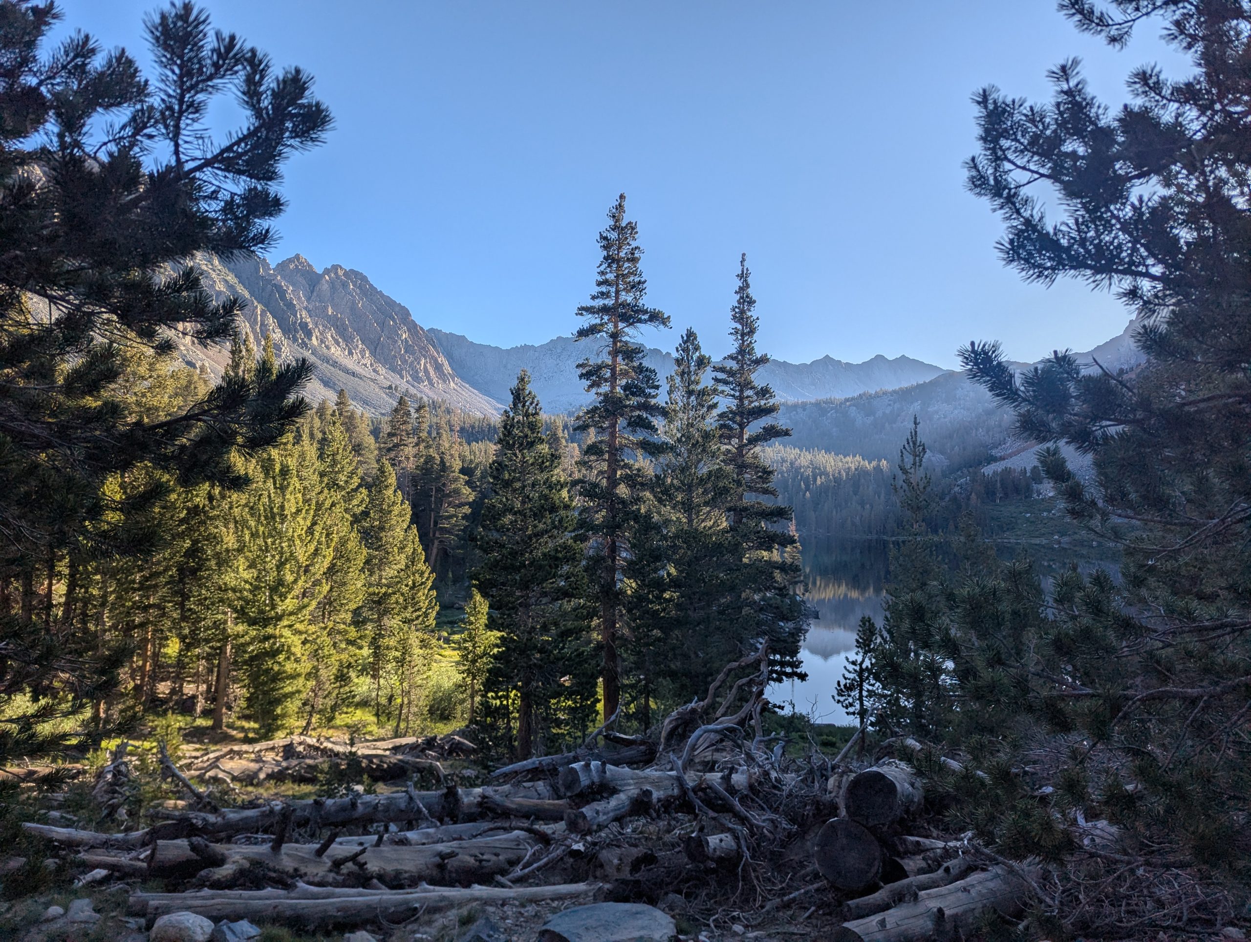
Today was hot. Really hot. Like 100 degree hot. We started early, took an afternoon wayside vortex break, and hiked into the early evening. By doing this, we packed in a 14 mile day.
Most of the hikers at last night’s shelter planned to go to the same hut. We were not confident we could make the 14 mile hike so had told folks not to worry if we didn’t make it.
Early Morning Climb
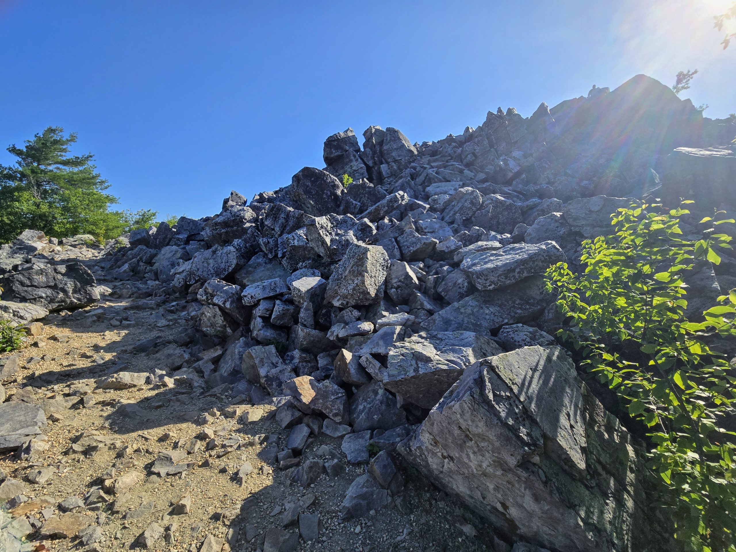
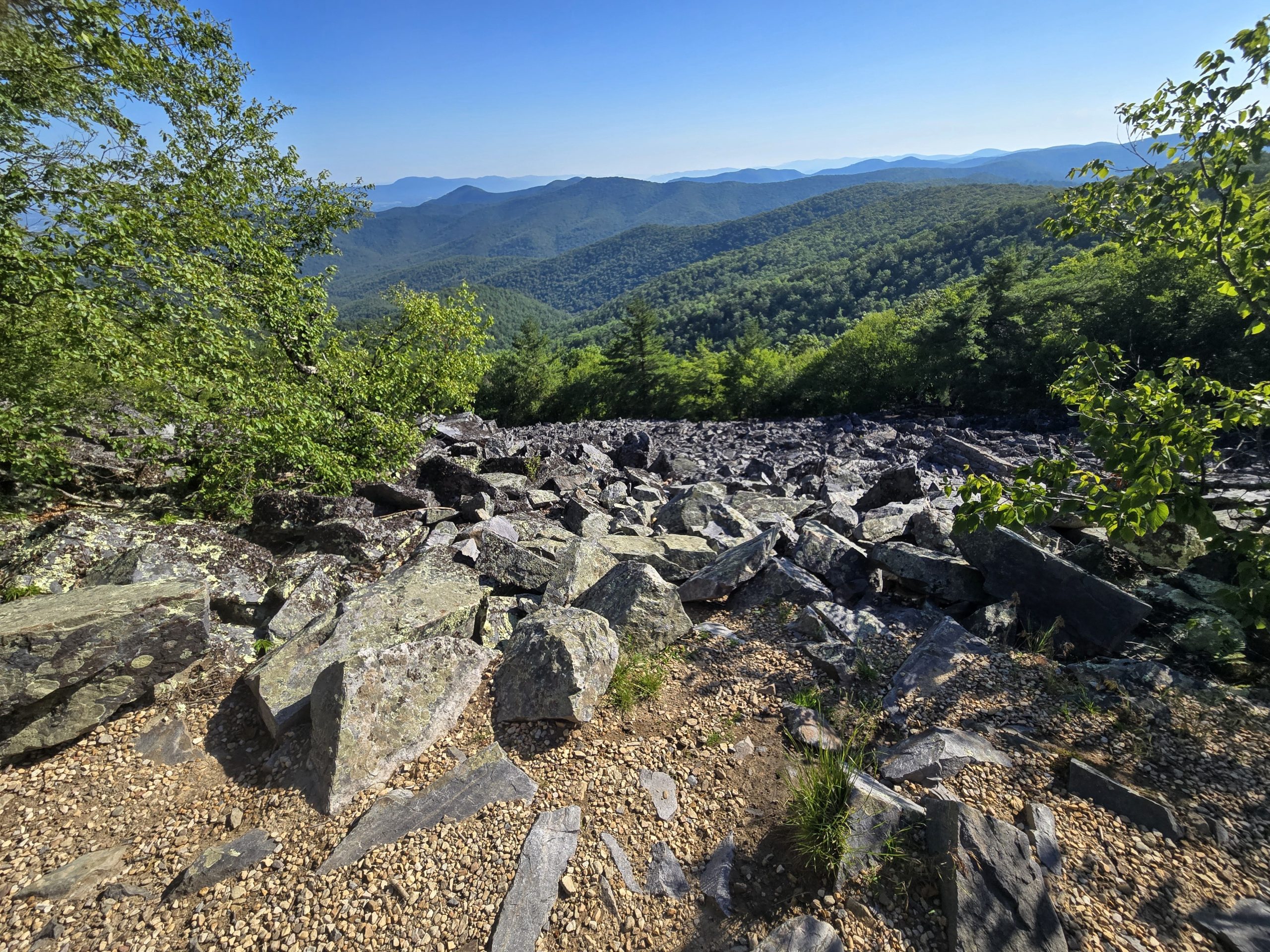
The day started with a climb up Blackrock Summit. The trail was easy enough, skirting the side of the summit rather than going over the top. I was relieved not to have to climb the rocks in the heat as I had no desire to disturb any of the snakes I assumed must be resident there.
It was warm, but due to being 8:30 am, it wasn’t too hot yet. In the glare of the summer sun, we still squinted to make our way up and around the summit.
After winding our way around the peak, we wove back and crossed the rockfall on the back side of the summit. Some hikers came up behind us and I offered to let them go ahead, assuming we would be slower given our 30 year age advantage. In fact, we had to slow down for them. We didn’t mind taking our time, especially after we moved into the shadow of the peak.
Forest Friends Along the Way
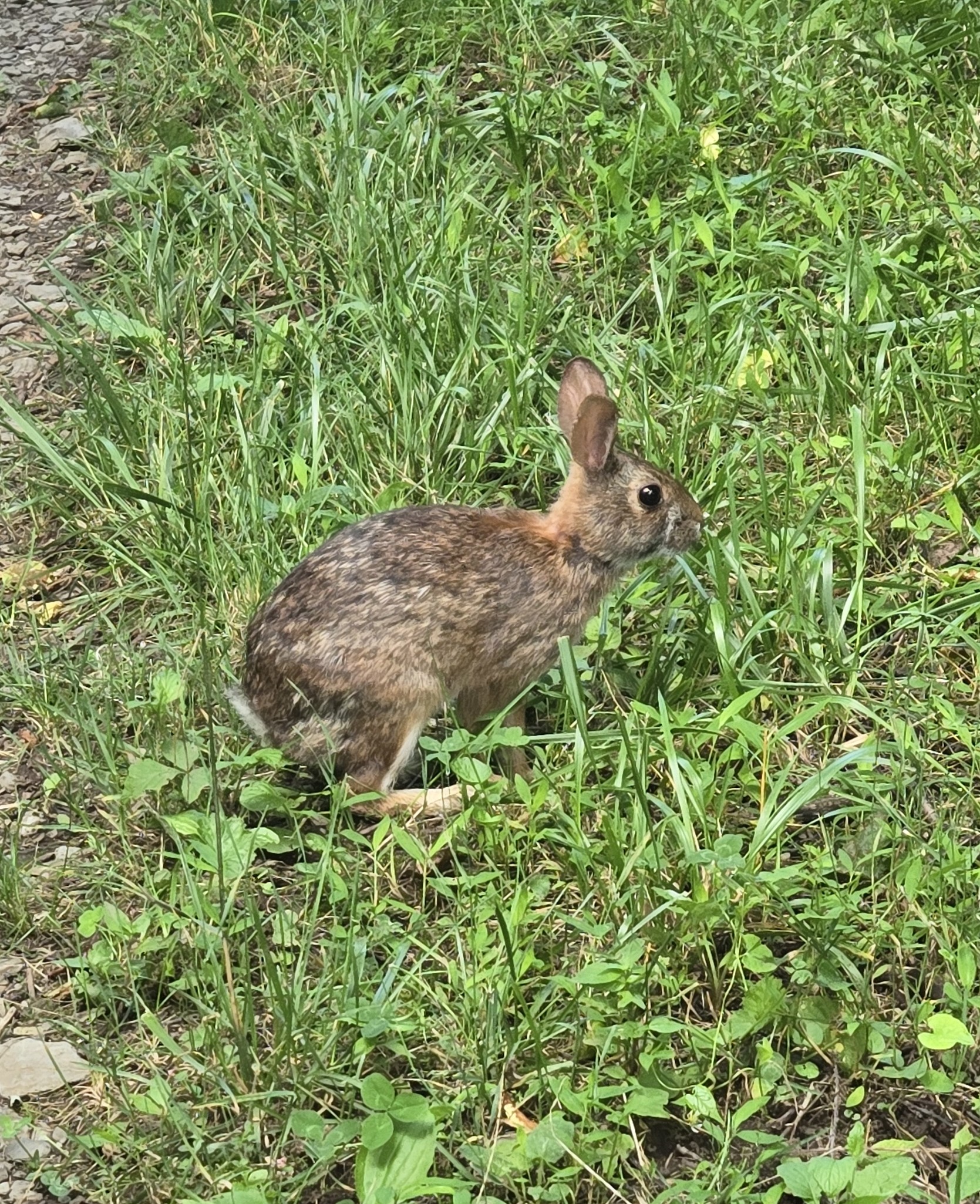
One of our forest companions today was an Appalachian Cottontail (Sylvilagus obscurus). This sweet bunny sat still in the middle of the trail, preventing our advance. I gently eased forward and the bunny went left a couple of feet. I paused. The bunny went right. It was a standoff. No one was going anywhere. After a photo shoot, the bunny finally hopped off into the woods and we hiked on.
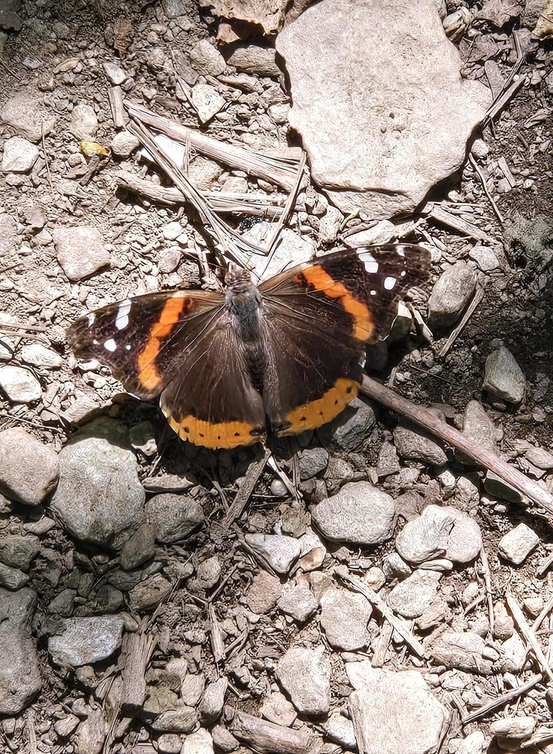
We were also graced by a posing Red Admiral Vanessa atalanta. Like the bunny, the butterfly sat in the middle of the trail opening and closing its wings for a minute or two. Finally, it too went off into the woods.
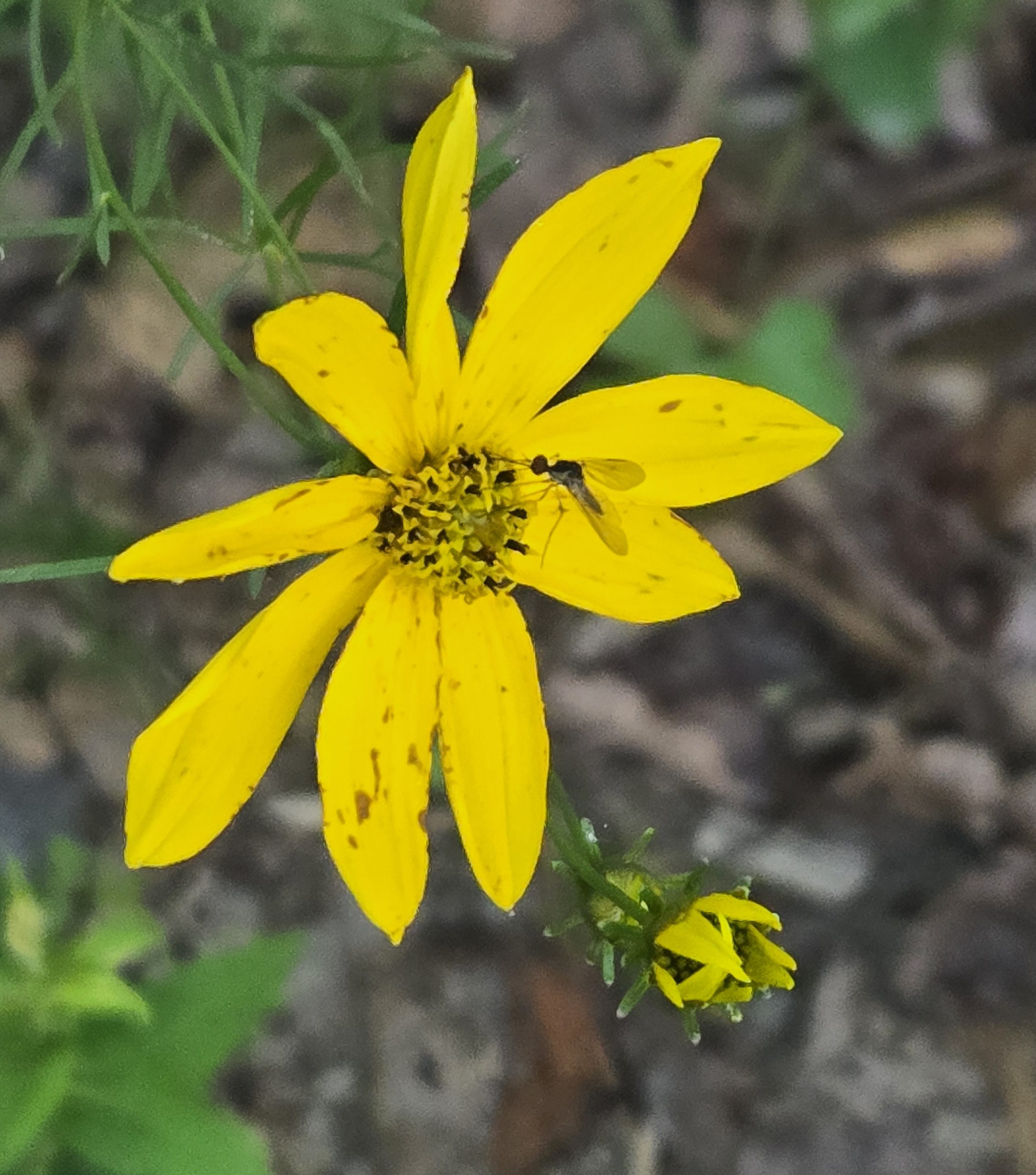
We also saw a mosquito on a Coreopsis verticillata L., Threadleaf Coreopsis, Whorled Tickseed, Whorled Coreopsis. The flower is somewhat mundane, aside from its bright yellow color. However, the mosquito posing on it was remarkable.
Heading for Our First Wayside
We decided definitely to go for the camp store. It was so hot we were dreaming of dunking our heads into a cooler of cold drinks.
The noon hour passed and we carried on. The promise of ice sailed us full steam to the Loft Mountain camp store.
Once inside, we were overcome with options. On top of that, we were so hot eating didn’t seem like a favorable option. We wandered around the store for 30 minutes not sure what we wanted to buy.
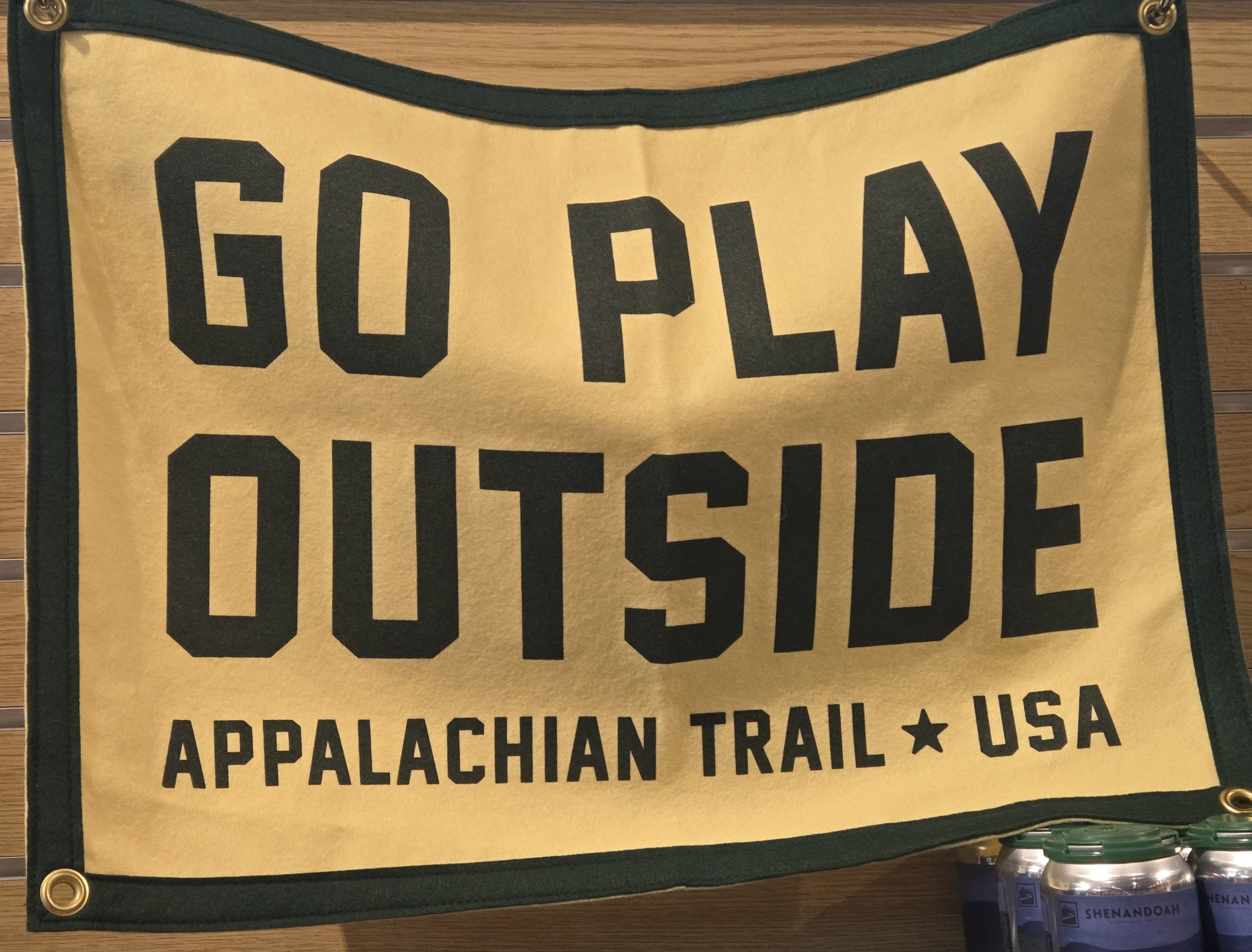
We saw a cute banner on the wall. It wasn’t for sale.
Digging In
Adter wandering around the air conditioned store, we cooled off enough to think. We finally got a load of food over two different visits into the store. The breezeway between the store and the bathrooms had long benches with plugs for recharging. Soon after we arrived, other hikers came in, filling the benches as we all guzzeled drinks, chomped food, and charged phones.
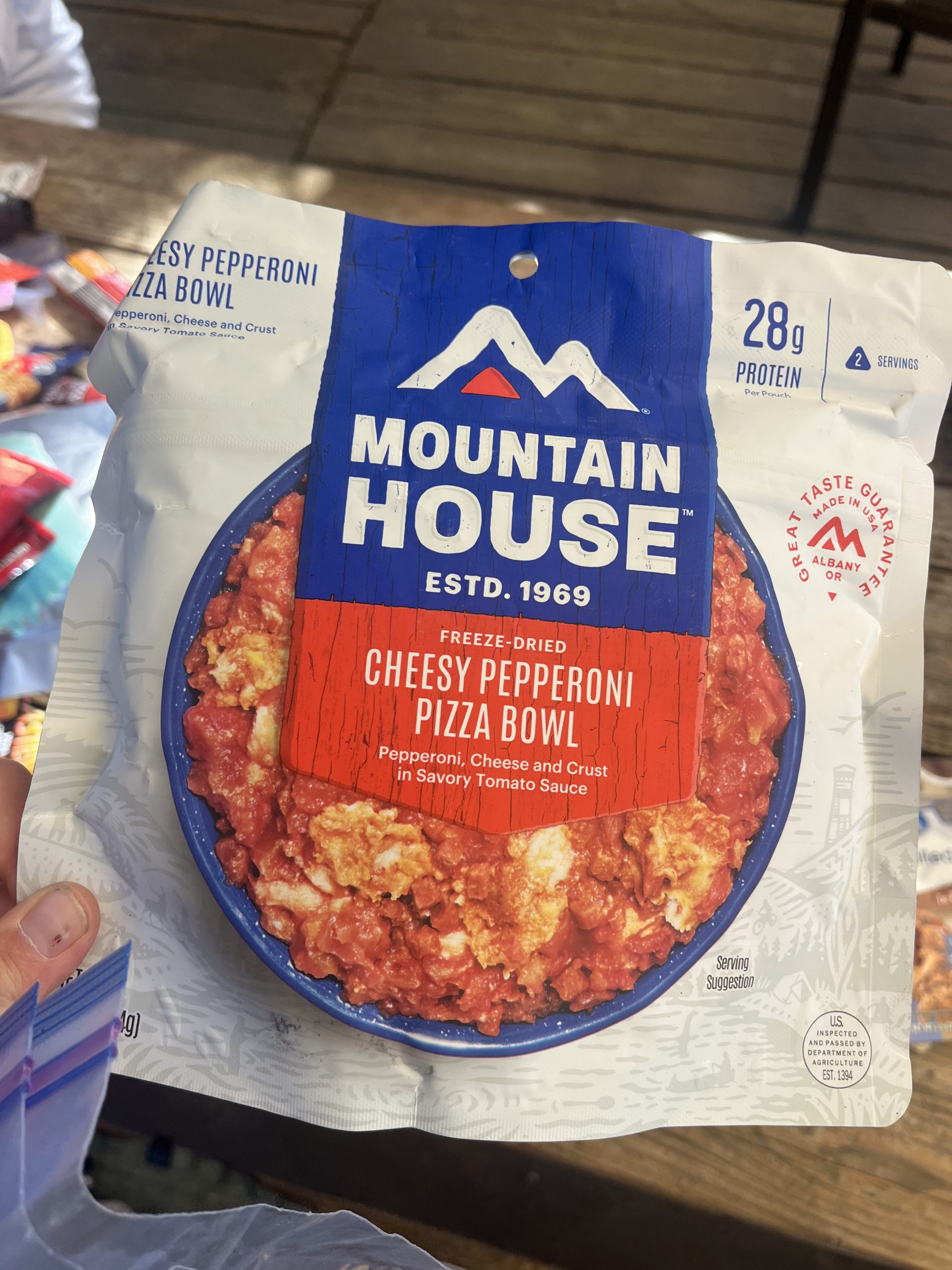
The Historian packed in two sandwiches, three drinks, some potato chips, and half a sleeve of oreos. I started off more sedately with one sandwich, some chips and unsweetened iced tea. I love iced tea but gave it up a few years ago because tea doesn’t suit my body well. I watered it down and chugged on. I regretted it later in the day but it sure was good.
Vortexing
After an hour, our tummies were as full as oir chargers. The heat was awful and the company great. No one moved. The clock ticked on. The Hiatorian ate more. I drank more tea. No one moved.
At 3:30, with 6 miles to go, we staggered out into the heat. We busily discussed whether or not we could make the 6 miles left. I commented on how steep the trail was. We walked on. We stopped and looked at each other. It should not be so steep. We took the wrong side trail to return to the Appalachian Trail. Bonus miles at the end of the day in the heat.
Ugh. After studying the maps, we decided to retrace our steps.
We Made It
After correcting our error, we hiked on at a steady pace and finally arrived at Pinefield Shelter. When we got there, our shelter mates cheered and shifted things around to make space for us.
For some unknown reason neither of us were very interested in dinner. Of course not after eating so much for 2nd lunch.
Someone was giving away a foil package of chicken they had been given by someone else who didn’t want it. Hmmm. Chicken salad sounded good.
I mixed the chicken packet with home dehydrated onions and marinara sauce. It was just right. A cool salad supper of protein and vegetables. Eaten in the company of friends, it was a perfect summer supper to end a hot day of hiking.
This website contains affiliate links, which means The Trek may receive a percentage of any product or service you purchase using the links in the articles or advertisements. The buyer pays the same price as they would otherwise, and your purchase helps to support The Trek’s ongoing goal to serve you quality backpacking advice and information. Thanks for your support!
To learn more, please visit the About This Site page.

It was so funny laying in the back of the truck bed as Jay drove us all the way from Reno to Kennedy Meadow South. We stopped off once so that I could pee. But for the most part, I slept continuously and felt wonderful. Then as we were getting closer, Jay pulled over so that we could wait for the sun to come up. The final stretch of road to KMS was a winding mountain road. And he thought the views would be better for sunrise.
I continued sleeping in the truck bed as he was parked there. Then slowly woke up as the car began to move again an hour or so later. And boy, was Jay right. The window to the covered truck bed was open as we drove up the mountain roads. I was able to lay there and dozed in and out while simultaneously watching the most incredible sunrise. It was a really unique experience.
Then I woke up again to the feeling of the truck pulling over. And lo and behold, we are pulling into the parking area for the general store at Kennedy Meadows south. I can’t believe that I’m back out on the PCT again.
I rolled back over and slept for another couple of hours. At this point in time, I was feeling a lot better and more rested, but was still leaning toward taking the day off. I still have to figure out my resupply strategy for the next couple hundred miles. I don’t know how much food I want to carry, where I want to re-up on food, and everything like that.
In the past, I’ve done the side trail down Kearsarge pass to go into Bishop. But that adde substantial mileage and elevation gain and loss. This time around, I’m trying to avoid any side trails. Even if that means carrying substantially more food and being a bit uncomfortable. At the same time, my backpack is 35 L. The biggest bear canister I can fit in my pack is a 450, which only fits about three or so days food. And my pack itself in the past typically can only hold about 5 to 6 days of food. So I’ll be curious to see what I’m actually capable of taking.
I slept well for another couple of hours before getting up to go pee. Then back at the truck I packed my quilt away and headed over to the store at Kennedy Meadows. I could smell breakfast cooking and was eager to be up and moving a bit. Otherwise, I felt like I would probably sleep in that truck bed for the entire day. But if I’m taking the day off today, then I’ll probably set up my tent and wind up taking a nap at some point. I haven’t taken a single nap for the entire year. Typically every single time I’m in town and have the opportunity to nap, I have hours of video editing and writing to get done. But I’m basically all caught up at this point. So today can actually just be a rest day for once.
I was surprised that there were only a couple hikers up by the general store. When I was here a few weeks ago, there were tons of people. And at that point in time, the conditions in Sierra were actually not ideal for hiking. Especially at the limited skill level that a lot of hikers have when they start Pacific Crest Trail. Now, a few weeks later, the conditions in the Sierra are finally suitable for most people to pass through. But there’s only a handful of hikers to be seen.
Jay and I sat with two hikers, Hillbilly and Flower and had breakfast. I had a giant pancake loaded with M&Ms, along with hashbrowns, sausage, and eggs. This cute deaf cat named Ranger came and tried to beg for food while we ate. It was nice to just hang out with hikers and have absolutely no plans for the day.
At this point, Jay checked in and was curious what I was planning on doing. I told him I really wanted to work on sorting out my resupply and take the day off. Southern Maine and New Hampshire exhausted me more than I ever could have imagined. So after breakfast, I got my pack and all of the food that I bought at the store yesterday. Then went through everything and sorted out my resupply. Jay made some suggestions about the fastest the easiest places for me to pick up food as well.
Jay suggested that I just carry a day and a half of food out of KMS. Then I can do a short side trail down to Cottonwood trailhead, which will only add about a mile and a half. There I can get my bear canister and about five or six days of food. So at least I could be light and comfortable for the first day or so as I acclimate a bit to the altitude. Fortunately in the past, my body adjusts very well and quickly at high elevation.
That sounded like a good plan and helped me to avoid any of these side trails which add time, elevation, and mileage. All things that I really don’t need to be adding to my already big year. That means I don’t have to go down Kearsarge pass this time around, which I’m super excited about. I’ll probably just carry food to VVR. That would be about 180 miles from Kennedy Meadows. And there I’ll be able to get hot food, resupply, and likely to shower and laundry. It would be another four or so days past there to get to Sonora pass and be completely done with the Sierra.
I like that plan and it seemed to be the easiest option. But I’m not looking forward to how incredibly heavy my pack is going to be. After we figured that out I packed away a day and a half of food to take tomorrow. Then got my bear canister packed, and all of the other food I would be needing. I wasn’t remotely surprised to find the canister couldn’t fit six days of food. Even the BV500 are typically too small to fit six days of food. So I will just have to keep my other food bag and try to hang it where I can, or camp at locations with bear boxes for the first couple days.
The rest of the day after that was super relaxing, and I did basically nothing. I hung out with Jay and some of the other hikers who were at KMS. As the day went on, some more people emerged from their tents. Apparently there are also a handful of hikers down the road at grumpy‘s. Grumpy’s is a bar and restaurant which also has yurts and allows hikers to pitch tents. In 2022 when I was going southbound with PCT, I was at grumpy’s for their Halloween potluck, which wound up being an absolute blast.
Sometime in the afternoon, Jay wanted to drive down there so I headed over with him. It was nice to be inside of grumpys again and it felt nostalgic. I ordered a patty melt and a root beer float and we sat outside with a handful of hikers. A few of them recognized me off of YouTube or something like that. I chatted with one man who is out supporting his son on his first thru hike at the age of 18. He was so incredibly excited for him and was also super stoked to run into me. Apparently he’s been watching my videos for most of the year.
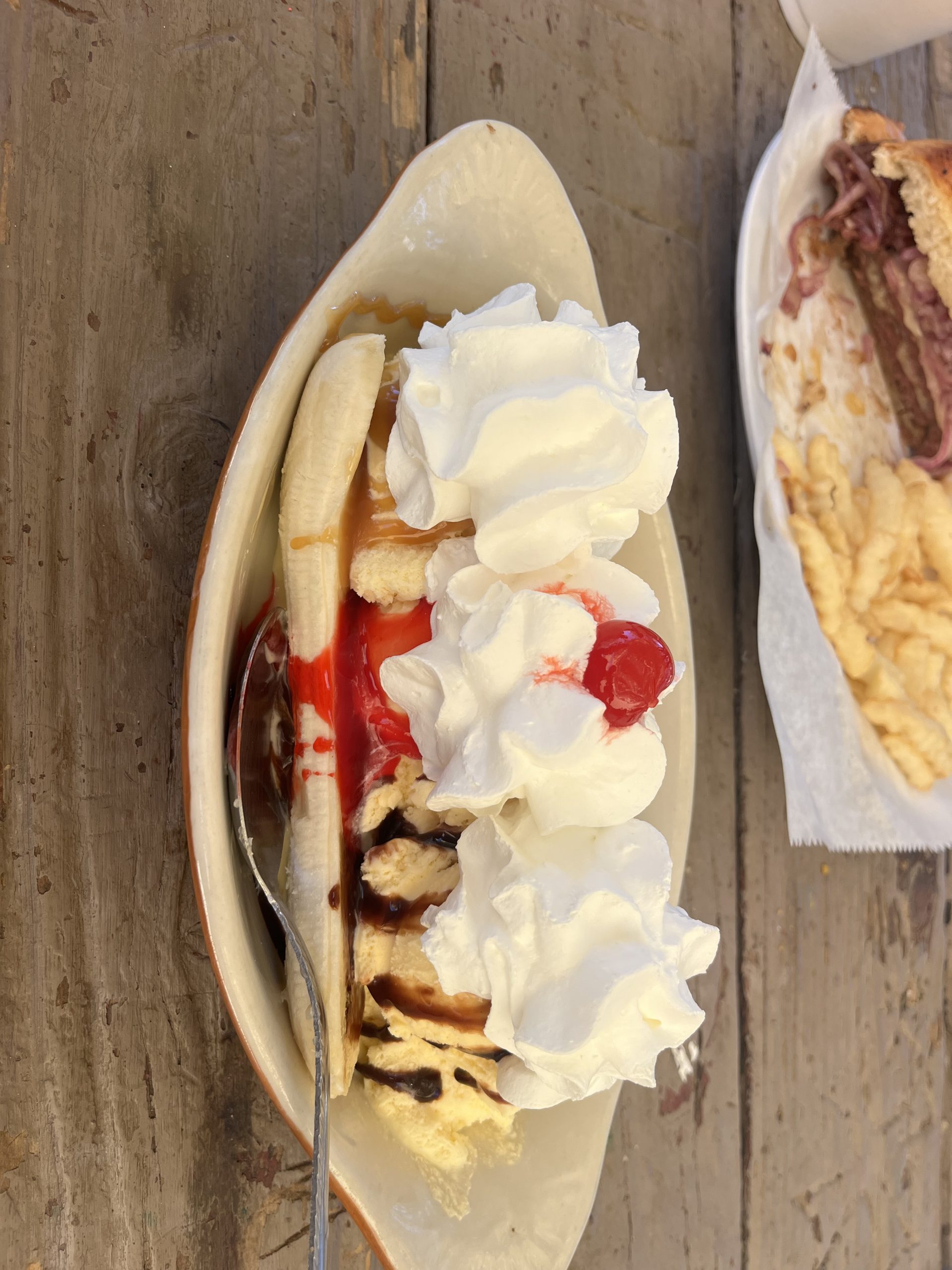
When I was barely done eating my huge patty melt, the guy who worked inside came out and brought me a banana split! Jay said that he had insisted after Jay mentioned that I was doing the calendar year triple crown. And even though I was already so full I absolutely devoured it. I can’t remember the last time that I had a banana split. There are three scoops of ice cream, one covered in caramel, one covered in hot fudge, and one covered in strawberry syrup. It was delicious.
We sat around for a while after that chatting with the other hikers. It’s so nice to see more people after it had been such a quiet morning. But a lot of the hikers are either leaving late tomorrow or taking the day off tomorrow. They’re eager to fall into bigger groups and embark on the Sierra together. Which I completely understand. If weather conditions were different, I would likely want to do the same. Though it’s almost impossible to find other hikers doing 35 miles a day.
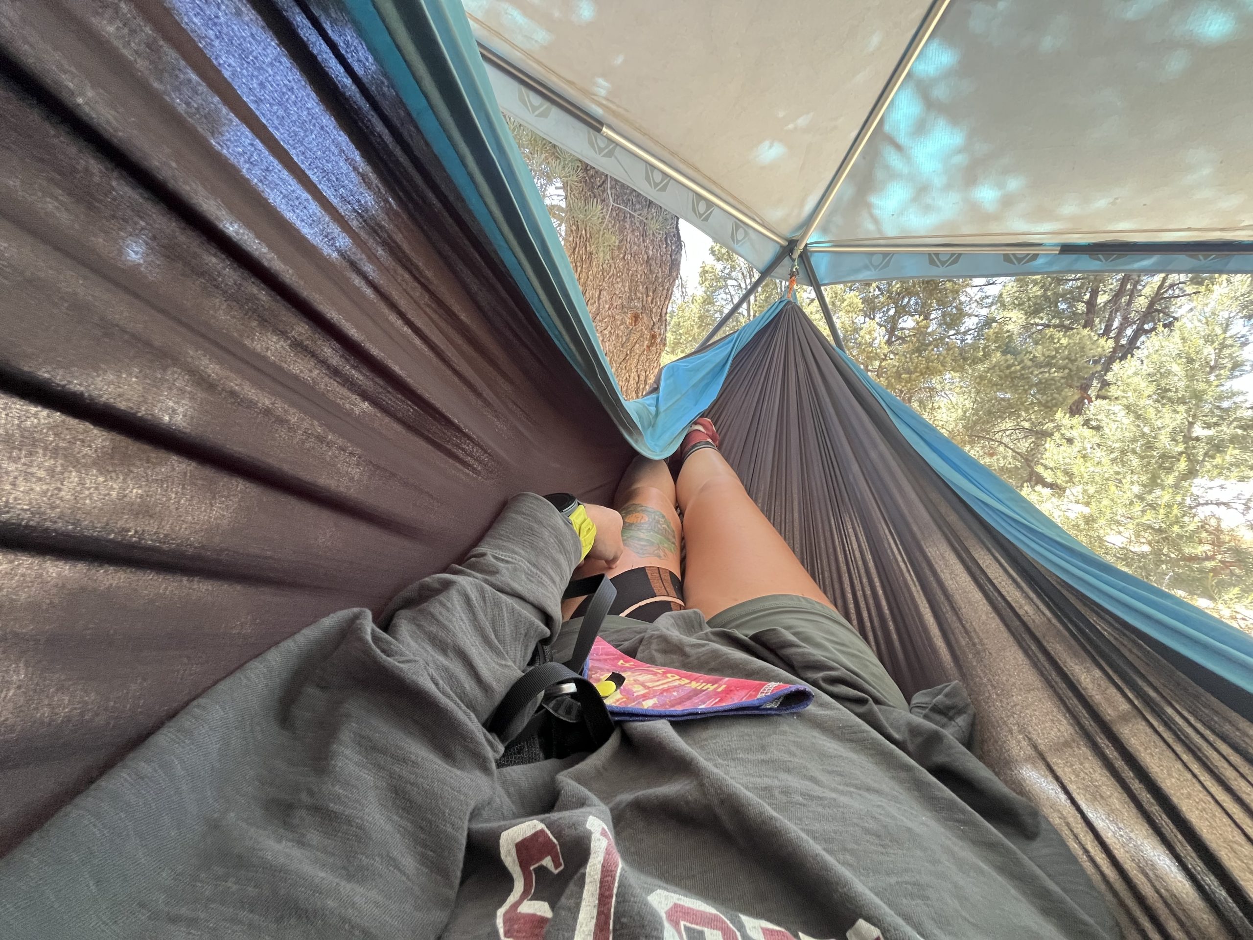
Eventually, Jay and I headed back to KMS and I planned to finally take that nap. When we got back, I found a hammock and wound up laying down for a few hours. It’s crazy to think that in the last 5 1/2 months and 4300 miles I haven’t napped once. It felt so good to have no place to be and to just be able to relax. And I didn’t have any work to get done.
Eventually, I emerged from the hammock later on in the day. I headed back out toward the general store to grab a couple last items. I wanted to superglue the Velcro onto my new shoes for my gaiters. I also needed to buy fuel and a couple last-minute things. I grabbed a few drinks and sat at the tables with a bunch of hikers and Jay. I tried to use Wi-Fi to get some YouTube videos uploaded, but it was a lost cause. Because of lack of service recently and how challenging the terrain was at the end of the Appalachian Trail, I’m ridiculously behind on everything. But there’s nothing I can do about it.
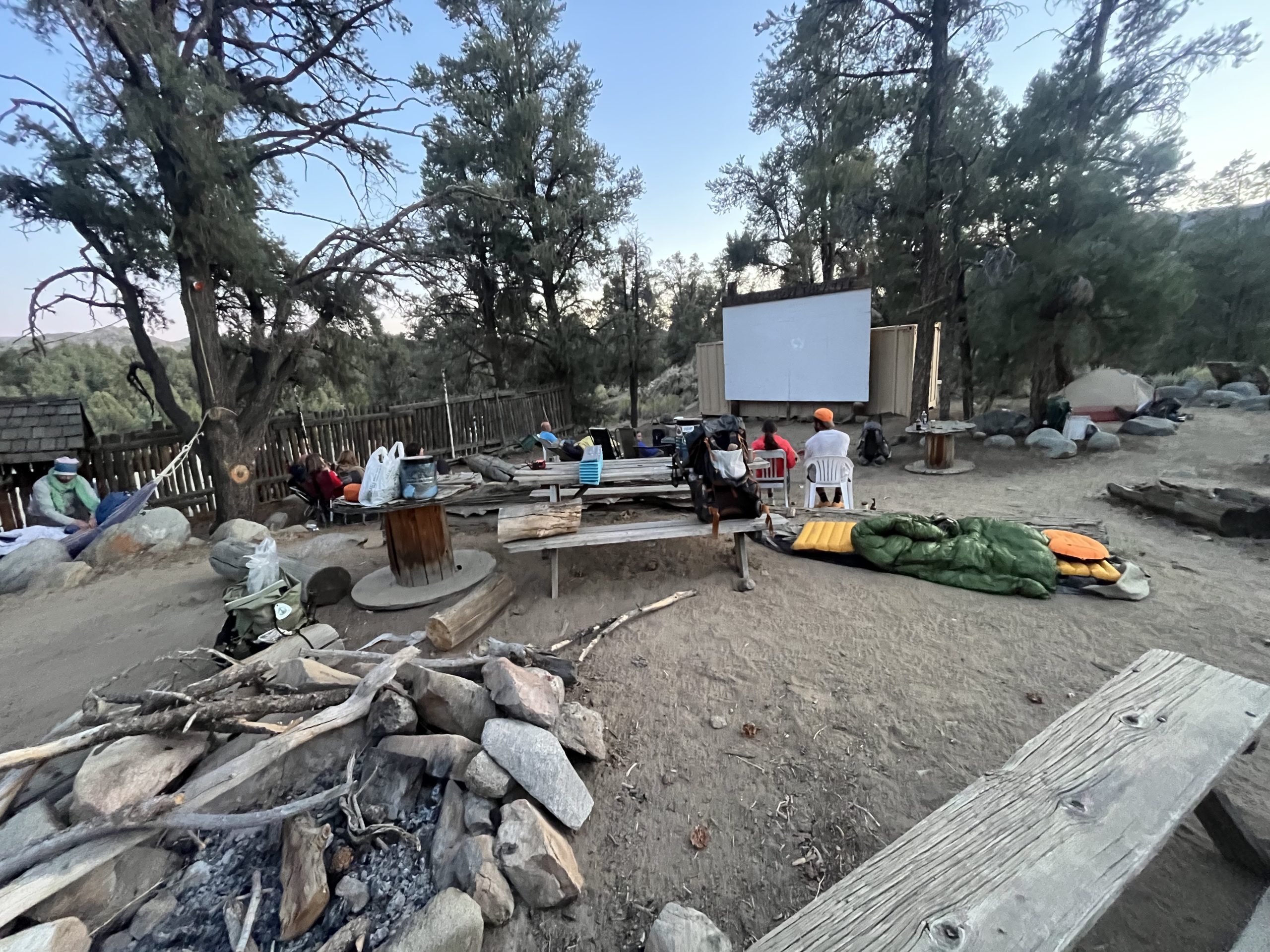
All of the other hikers wound up coming back from grumpys later on in the night. I got my tent set up near everybody and eventually the whole group sat around to watch a movie on the big projector screen. I was close enough to hear so I just laid inside to do my stretches. Then wound up having a really early night. It looks like Jay is going to drop me back off the trail sometime around 5:30-6AM tomorrow. And I very likely won’t be back in Wi-Fi or service for about six days. But I’m glad to be going through the Sierra as quickly as possible. It’ll be easier to judge my pace once I see how much snow remains on the highest mountain passes.
If you enjoyed this blog and would like to support my hike by buying me a soda or a snack along the way, there is a “Tip the Author” button below! It links directly to my Venmo. Any and all support is incredibly appreciated!
This website contains affiliate links, which means The Trek may receive a percentage of any product or service you purchase using the links in the articles or advertisements. The buyer pays the same price as they would otherwise, and your purchase helps to support The Trek’s ongoing goal to serve you quality backpacking advice and information. Thanks for your support!
To learn more, please visit the About This Site page.

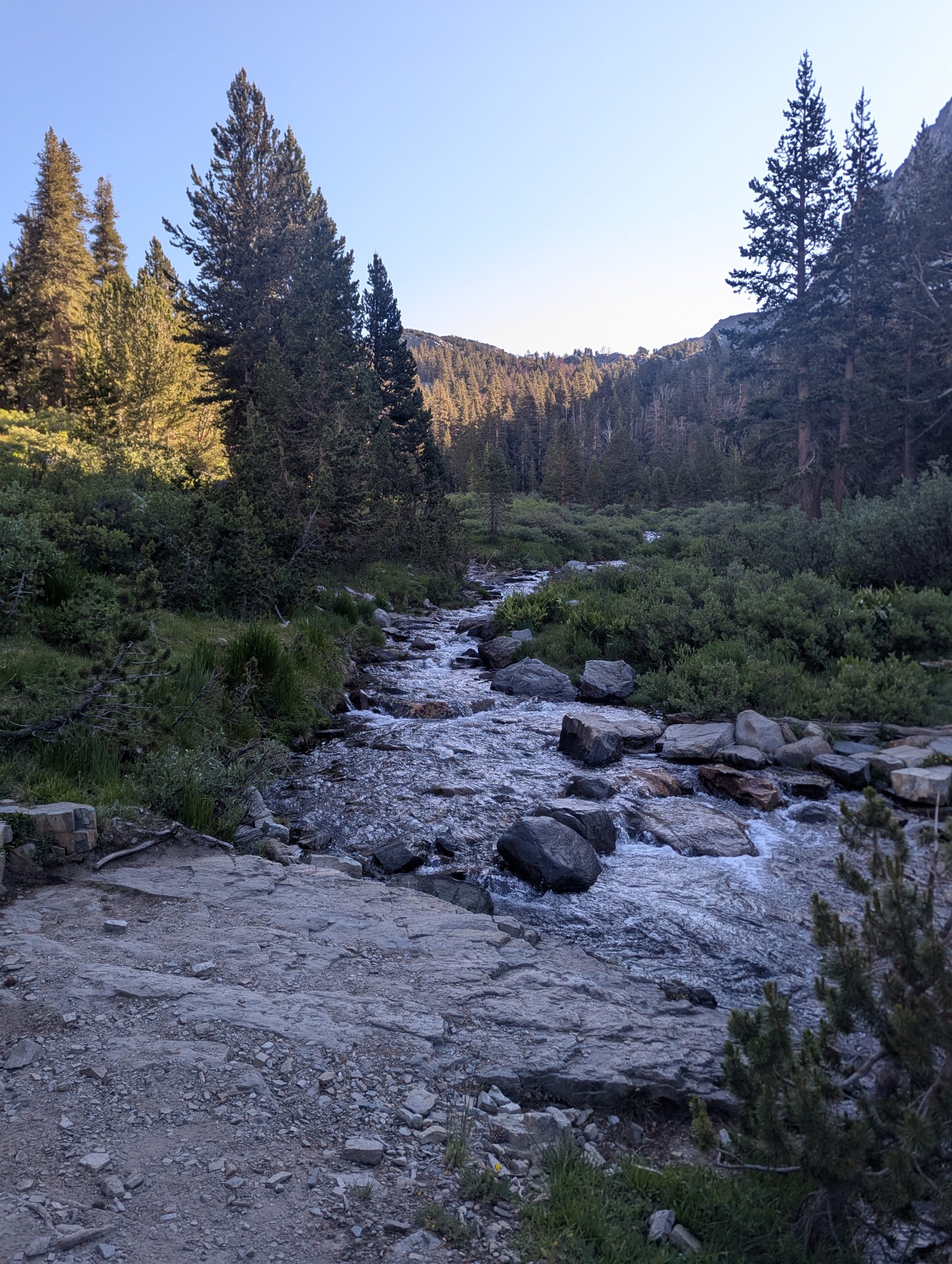
19.8 miles
From Purple Lake mile 894.8, elev 9974
To Upper Soda Springs campground (mile 912.2, elev 7733)
Climb 1882
Descend 4128
Steps 38761
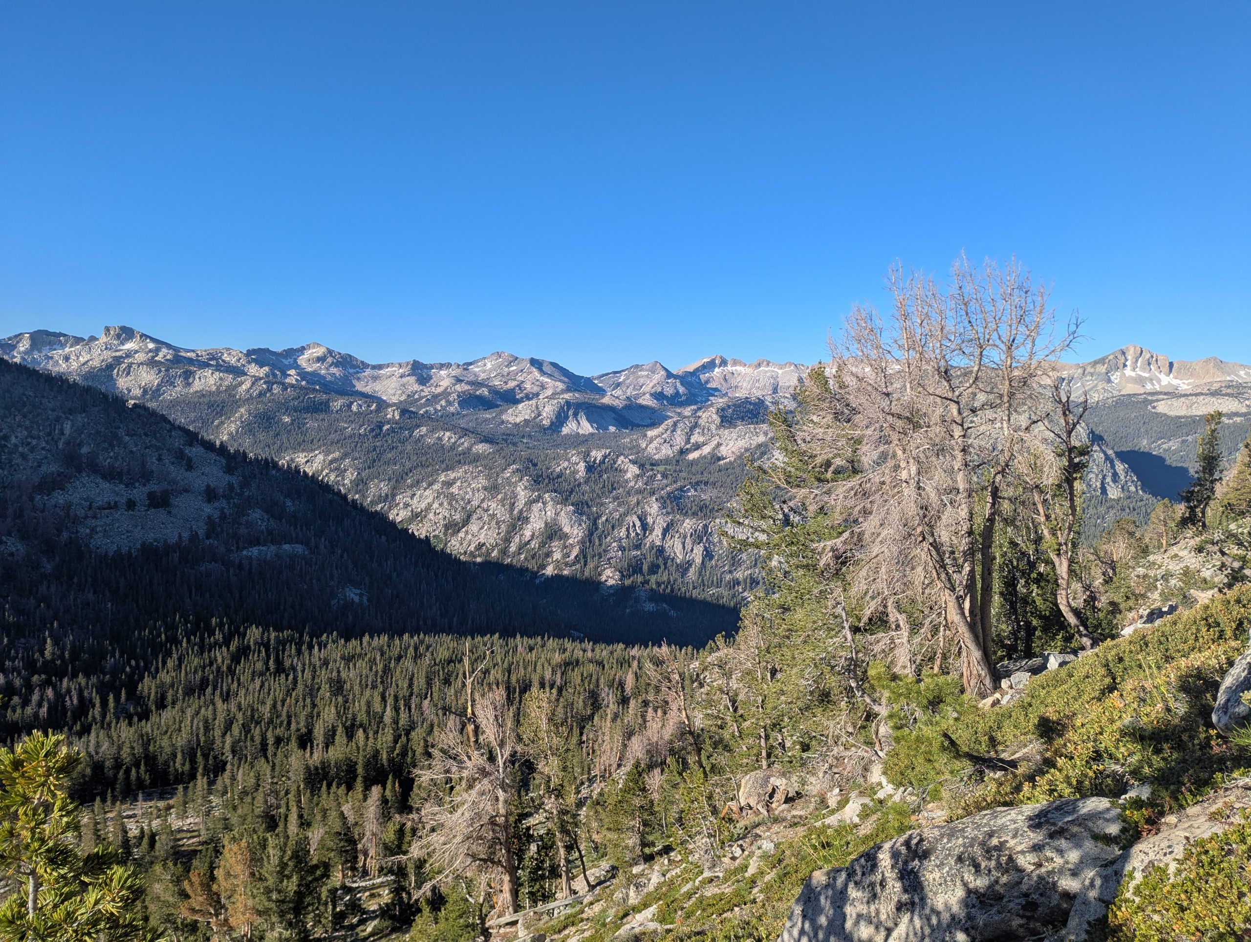
As I reached Duck Creek early in my hike there was a man sitting there on a downed tree enjoying a snack and a rest. He pointed out there was plenty of space on the tree for me if I wanted it. I declined as I wanted to get some miles in today, but we still talk for 5 minutes or so. He was doing the JMT. He started in Yosemite Valley, made it to Purple Lake, and decided that his body just didn’t have the strength that it used to. He opted to turn around and hike back to Red’s Meadow. I never would have guessed that he was 77 but he said that he has done things like climb Mt. Shasta with his son when he was 60. So he has certainly maintained a very active life. I relayed my story about coming off trail and thinking through everything as I did so. I relayed that I had to come to terms that I might not make my eventual goal of completing the whole PCT. But that even if I had to stop, then I completed 800 miles That was still an accomplishment to be proud of, and I felt the same about his hike. I hope he sees it that way. He certainly wasn’t distraught, but to have other people have a positive outlook on what you’ve accomplished makes it easier to have that outlook yourself.
He was actually one of the first JMT hikers I’ve come across who voluntarily seemed to look for a way to help a northbound PCT hiker. He volunteered trail conditionings up to Yosemite in particular. He commented on today’s trail to Red’s Meadow. He said that once I get past this next ridge it was downhill the whole way. For me, who is trying to make some ground so I can get my resupply in Tuolumne in a couple days, that was very comforting information.
When I arrived at red’s Meadow, I looked around and put my pack down quickly. I found a spot at a picnic table that was in the shade. I ordered a double cheeseburger and a soda. They tasted good like any real food does when you come off the trail.
Hearing the ongoing conversations among other hikers, I found that I was sitting at a table with Becs, a woman who was living in South Lake Tahoe and working remotely. That made me jealous because I used to have a cabin in Tahoe and would love to live and work remotely from there (I’ve actually updated this post while sitting at the Lake Tahoe Pizza Company – almost in her backyard).
We had done so many Tahoe trails in common, the conversation flowed easily. Hearing her talk about the trails brought back fond memories.
While there, the sun shifted. To stay comfortable in the shade, Hennje changed tables and joined me at my table. He is from near Hamburg, Germany and was a little jealous that I was able to take the time to hike the whole PCT. He has two little ones at home so he only has time to fly over here, hike the JMT, and return. He was very organized and had created his own overview map with his own points of interest.
He also had the JMT map booklet from National geographic. That is similar to the series of booklets they put out for the PCT. We both like paper maps and both had some of the same complaints about the National Geographic map books.
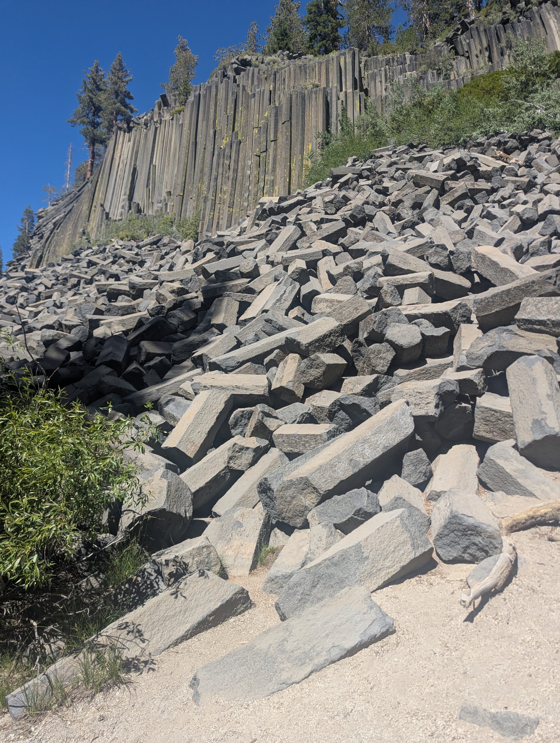
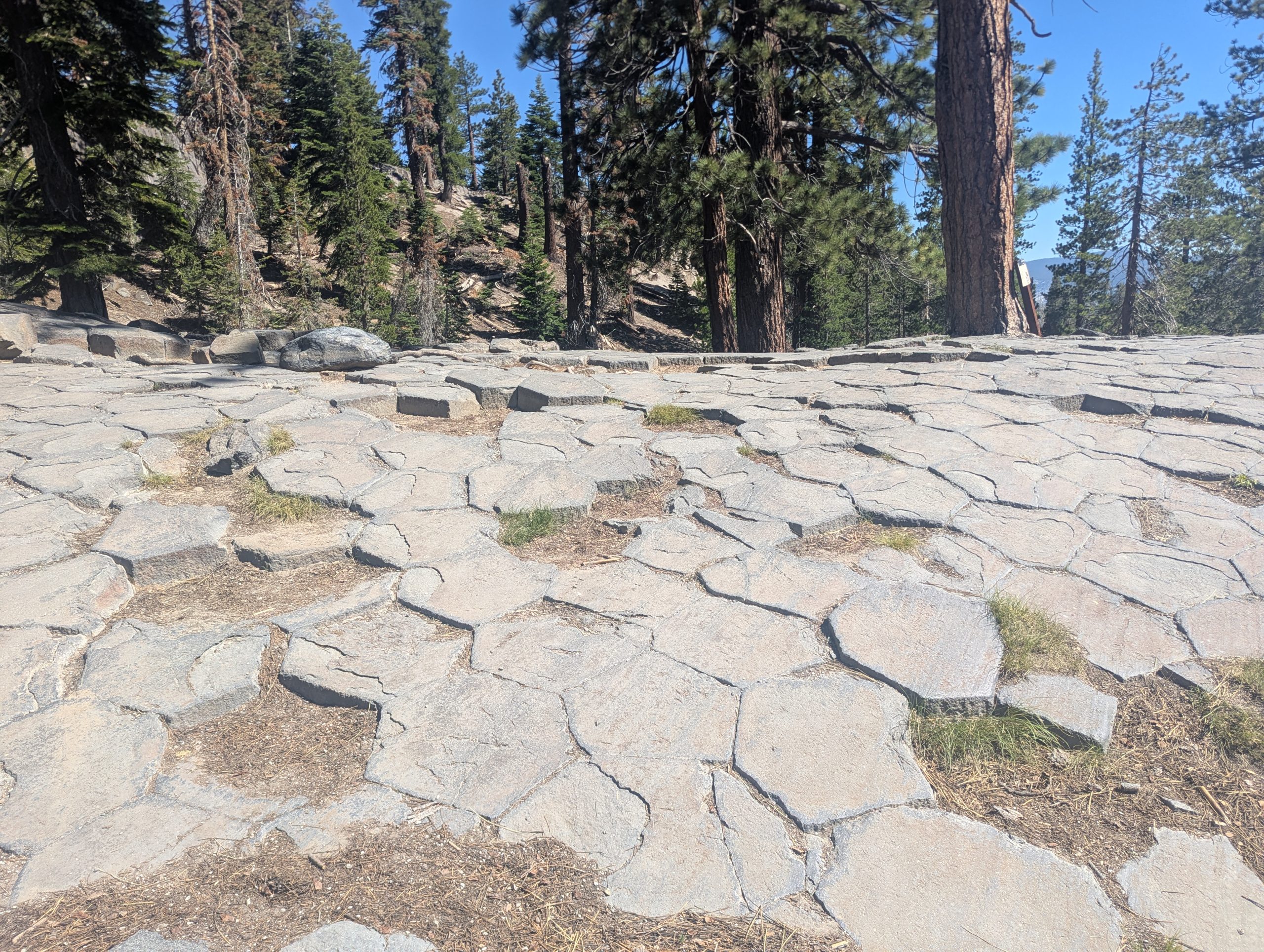
Because of a bridge that is out there is a detour on the PCT around Devil’s Postpile National Monument. But I have a little bit of history with Devil’s Postpile that made me really want to go in and see it.
When I first came to California for graduate school, my big brother and I drove cross country on a big road trip. Bob planned lots of things to see along the whole route. Having just passed through Death Valley and heading to Yosemite, her thought Devil’s Postpile seemed like an interesting side trip.
I remember being fascinated by the basalt columns in the postpile. Since it had been 41 years since Bob and I took that trip, and I was so close, I wanted to come back.
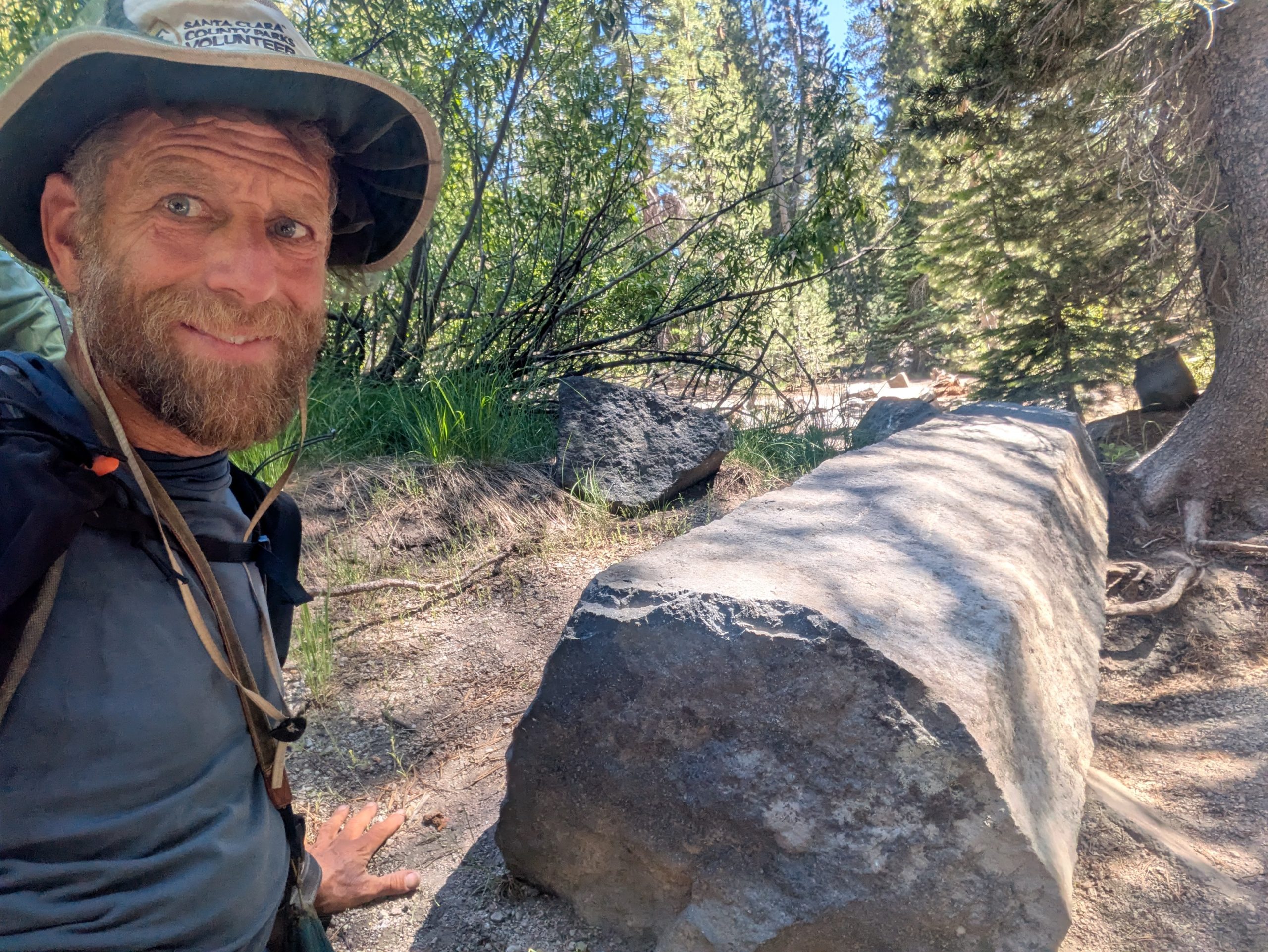
I ended up running into somebody working in the Ranger’s office. She was able to tell me current conditions and how best to hike out and back to the PCT.
It took me 41 years to return, but these photos are for you, Bob.
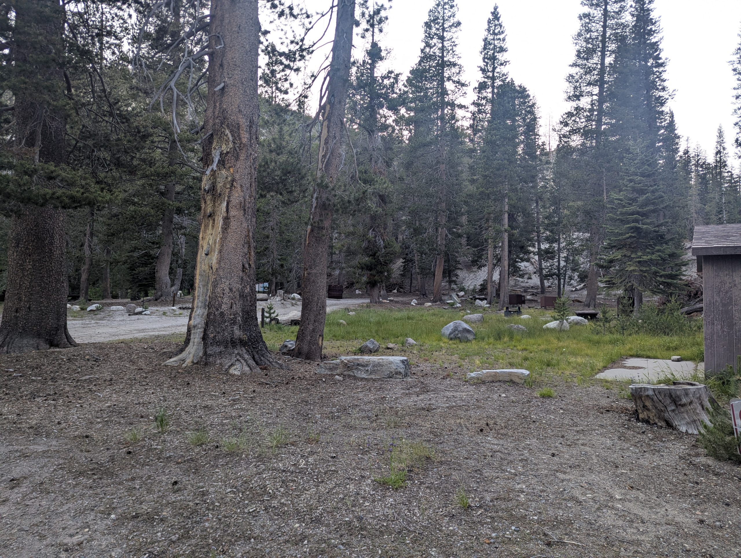
Because of the bridge being down and the PCT Detour, a ranger at Devils Postpile told me that even though a lot of the campgrounds along the river were closed, PCT hikers were still allowed to use them. So I had almost the whole campground to myself. If only the water was turned on and the latrines unlocked. But a flat tent site, bear box, and picnic table still felt nice to have.
This website contains affiliate links, which means The Trek may receive a percentage of any product or service you purchase using the links in the articles or advertisements. The buyer pays the same price as they would otherwise, and your purchase helps to support The Trek’s ongoing goal to serve you quality backpacking advice and information. Thanks for your support!
To learn more, please visit the About This Site page.
-

 The Travel Revolution of Our Era3 weeks ago
‘AI is undeniably reshaping the core structure of the hospitality ecosystem’: Venu G Somineni
-
Brand Stories7 days ago
The Smart Way to Stay: How CheQin.AI Is Flipping Hotel Booking in Your Favor
-
Mergers & Acquisitions7 days ago
How Elon Musk’s rogue Grok chatbot became a cautionary AI tale
-
Brand Stories2 weeks ago
Voice AI Startup ElevenLabs Plans to Add Hubs Around the World
-
Mergers & Acquisitions1 week ago
Amazon weighs further investment in Anthropic to deepen AI alliance
-
Asia Travel Pulse2 weeks ago
Looking For Adventure In Asia? Here Are 7 Epic Destinations You Need To Experience At Least Once – Zee News
-
Mergers & Acquisitions1 week ago
UK crime agency arrests 4 people over cyber attacks on retailers
-
AI in Travel2 weeks ago
‘Will AI take my job?’ A trip to a Beijing fortune-telling bar to see what lies ahead | China
-
Mergers & Acquisitions2 weeks ago
ChatGPT — the last of the great romantics
-
Mergers & Acquisitions1 week ago
EU pushes ahead with AI code of practice


You must be logged in to post a comment Login