
Destinations & Things To Do
Up the Kinsmans, Down to Snow Catcher (ECT Day 188)
“‘Cause it seems I get so hung up on the history of what’s gone wrong
And the hope of a new day is sometimes hard to see
But I’m finally catching on to it, yeah, the past is just a conduit
And the light, there at the end is where I’ll be
‘Cause I’m on the up and up, I’m on the up and up
And I haven’t given up, given up on what I know I’m capable of
Yeah, I’m on the up and up and yeah, there’s nothing left to prove”
– “Up and Up” (2007) – Relient K
- Hiked Today: 17.9 miles
- Appalachian Trail (1,807.4 – 1,825.3)
- Total Hiked: 3,758.1 miles
- Total Paddled: 99.5 miles
Weather: 55 – 78 °F, sunny, mostly clear, and wonderful!
Elevation: 1,409 – 4,358 feet
Beaver Brook Shelter to Snow Catcher Lodge
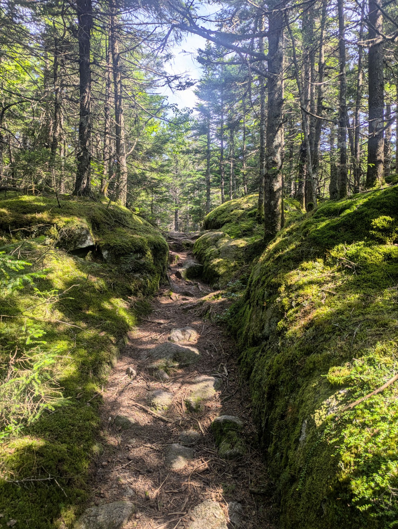
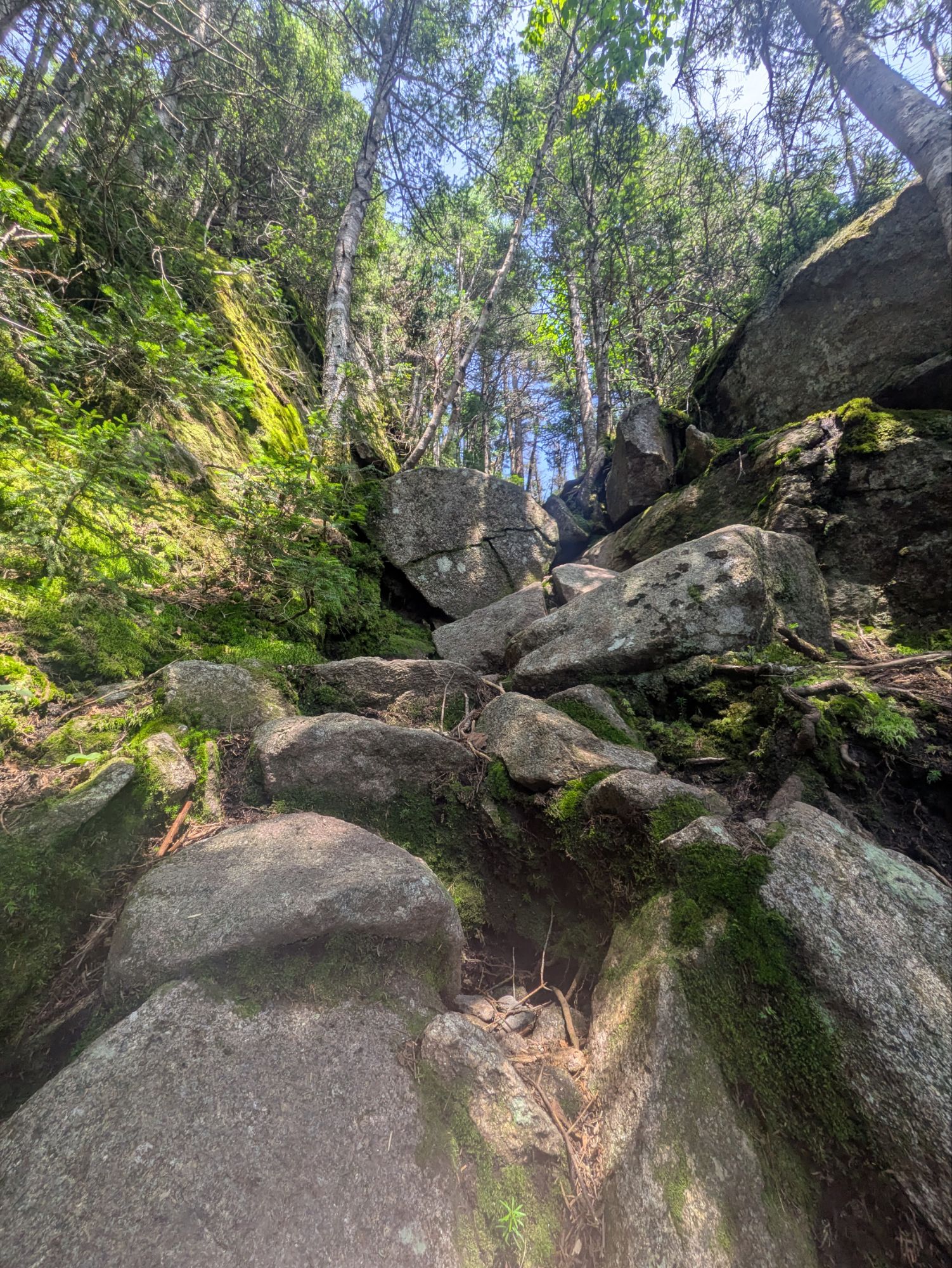
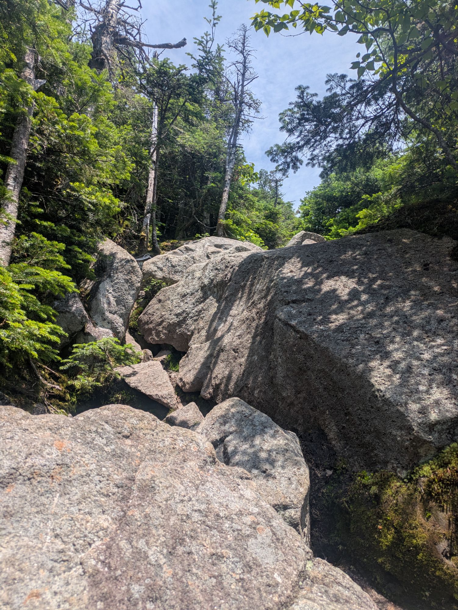
Gnarly. Absurd. Diabolical.
I’m not even sure I know what that last one means, but these were the descriptive words that came to mind as I struggled up South Kinsman Mountain. It was not easy pulling myself up using roots as hand holds, stepping in the tiniest crack or divot to climb up 3-5 feet tall rock cliffs, and scrambling up boulder after boulder going up and up and up. On top of that, it was overgrown in places. The positive of this was that as I brushed the pine needles, it smelled like Christmas. Maybe that’s what caused my mind’s eye to picture Jim Carrey’s portrayal of The Grinch, when he says, “This is Nuts!”
Lots happened even before this “wonderful” experience though, so let’s start back at the beginning…
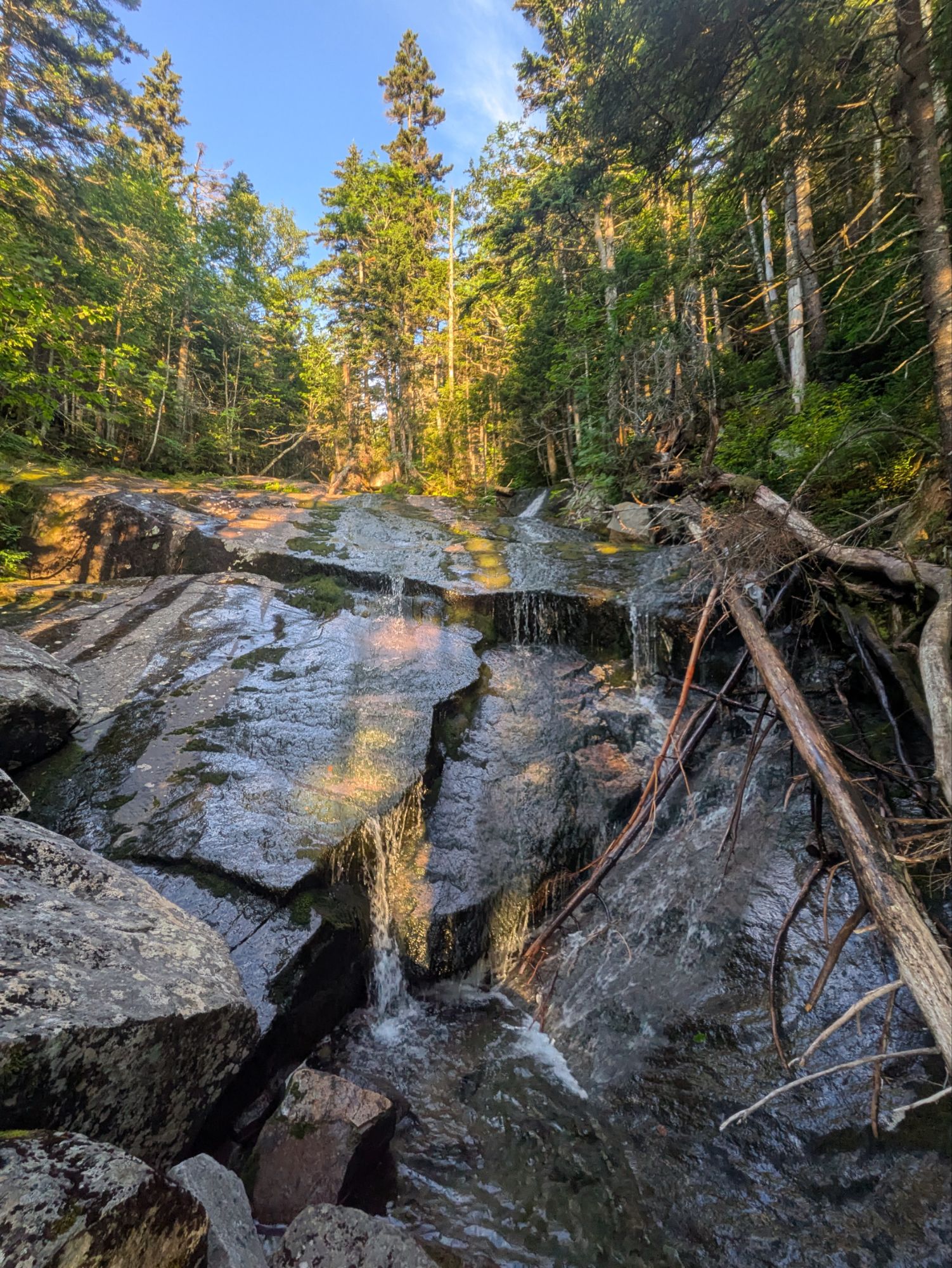
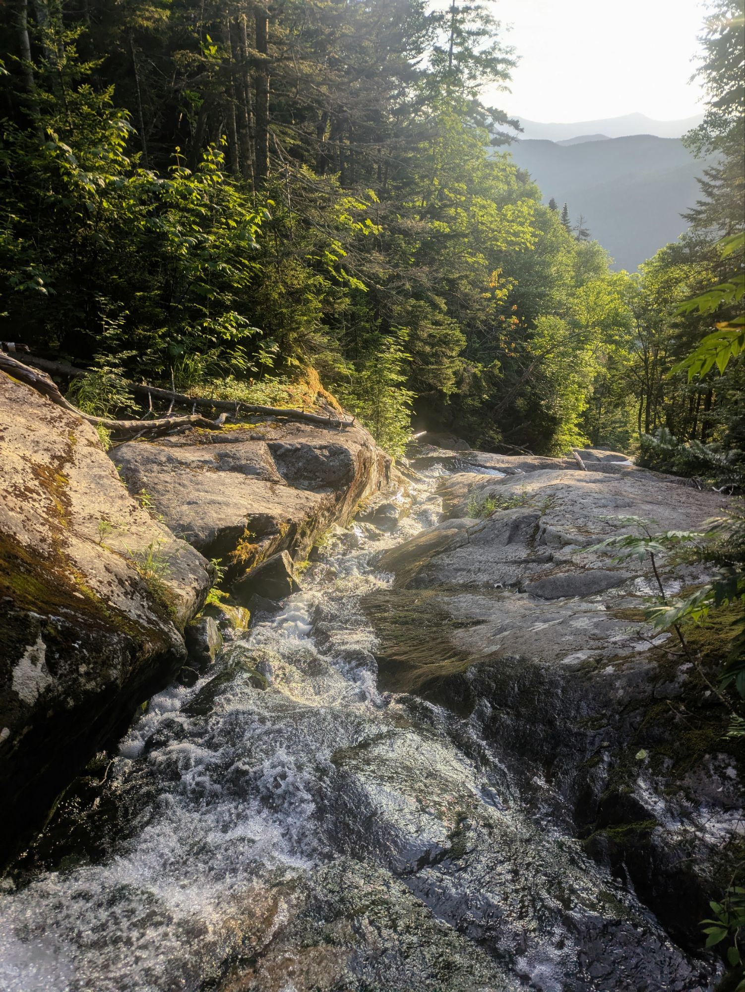
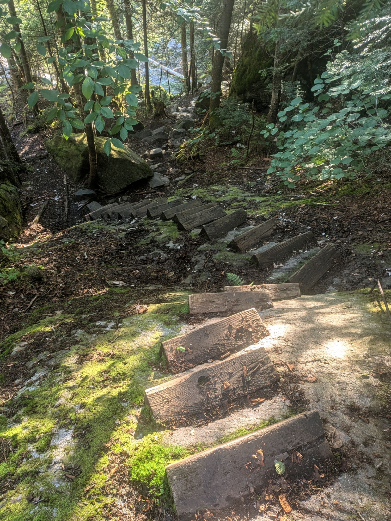
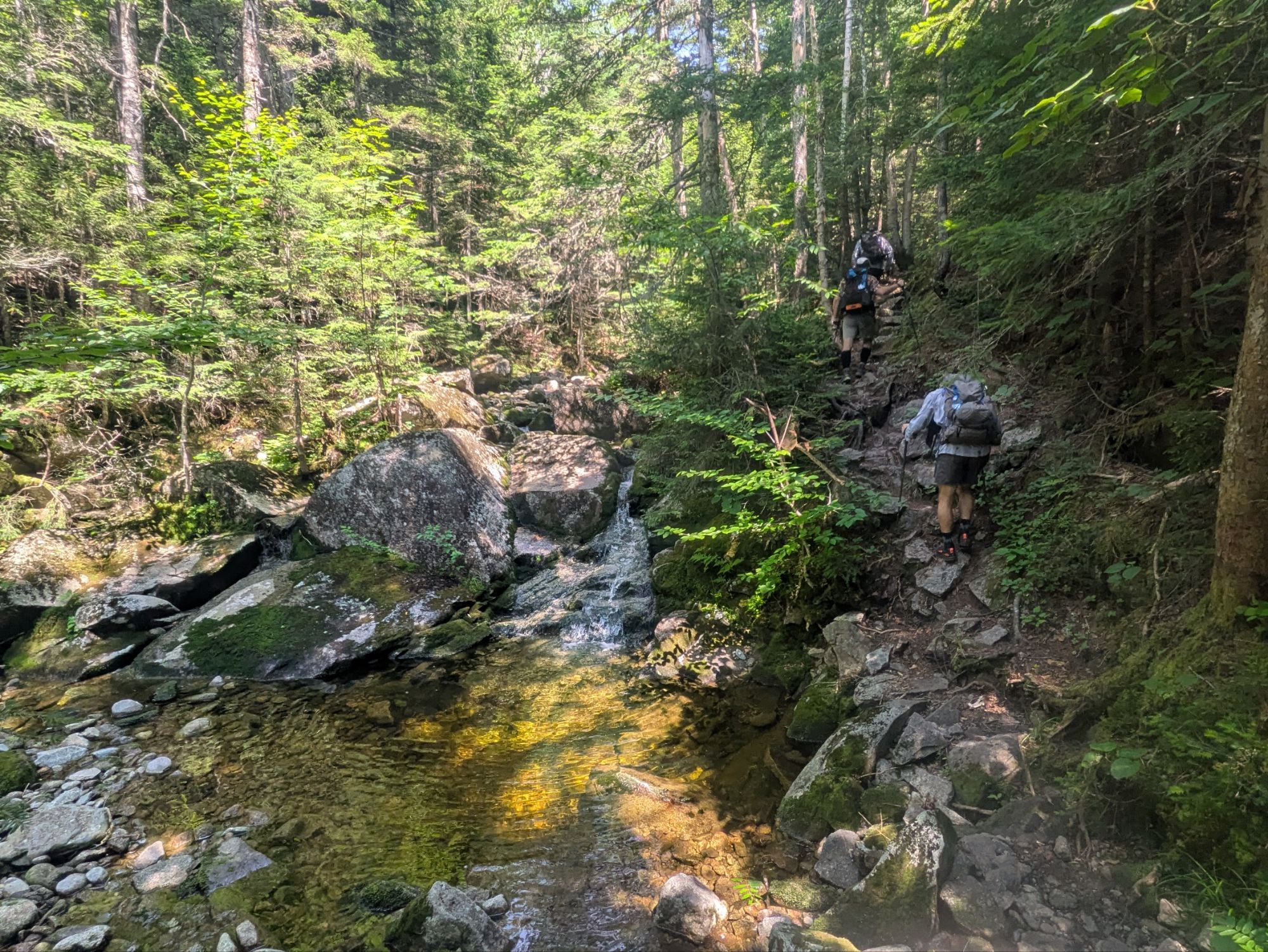
I was hiking before 6:00 am knowing today would be another big day. I’d stopped last night on the way down from Moosilauke, but the steepest part was ahead and below me. This was the part folks had warned me about. I was super happy everything was dry because if not yeesh, I would not have liked to try getting down on some such steep slanty boulder slopes.
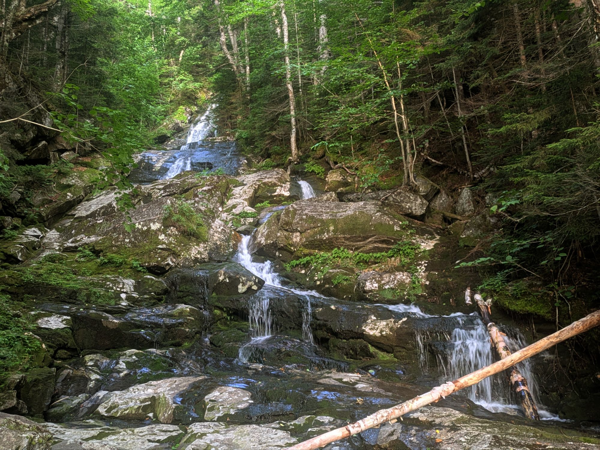
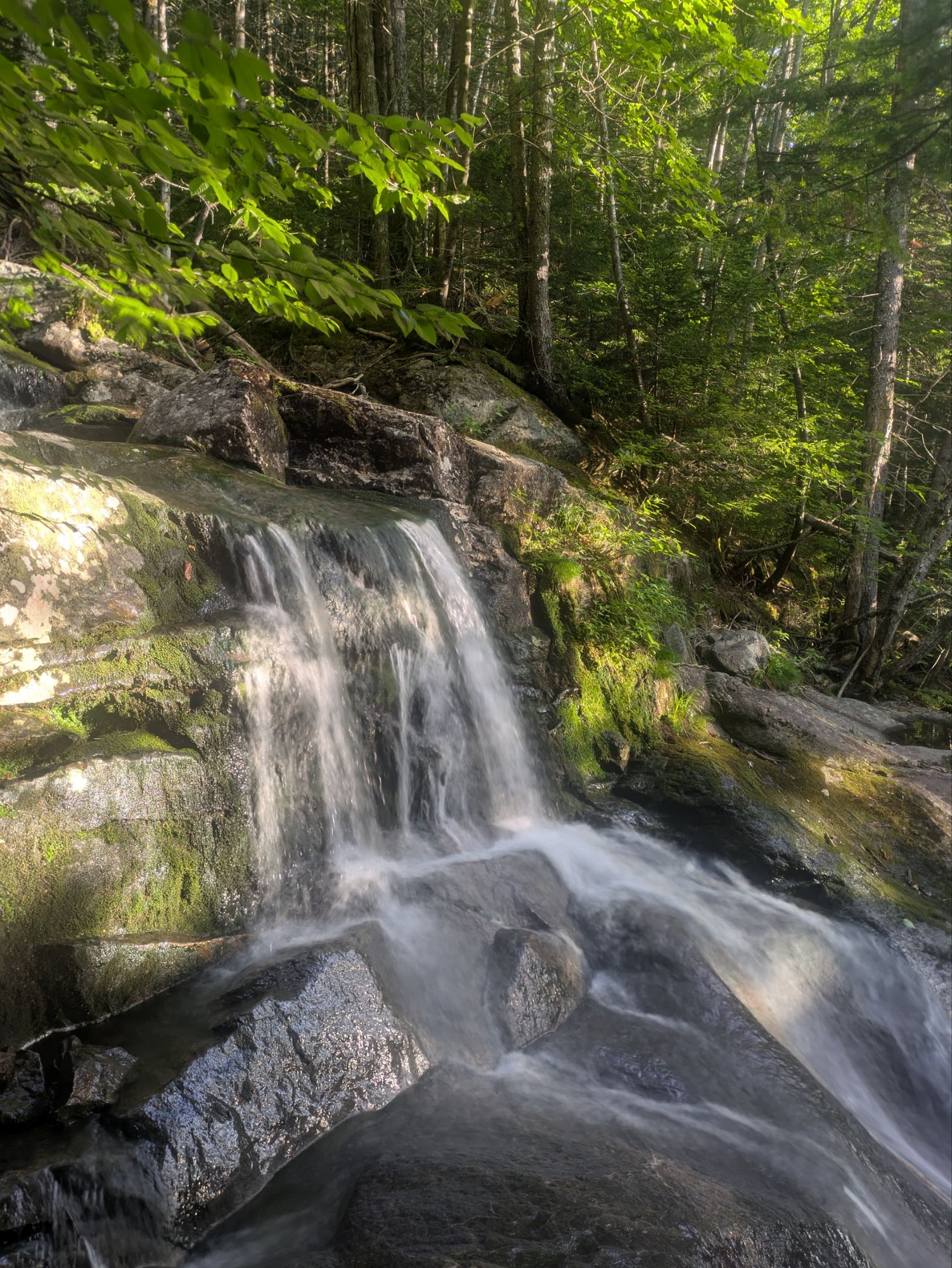
Soon, the trail started to parallel a stream cascading down with waterfall after waterfall. It was a very pleasant scene and I took lots of pictures…
Amazing, right? Well, just remember it wasn’t a walk in the park (I mean, I suppose technically it was if you consider White Mountain National Forest a park). Once down, I found a lovely and well timed parking lot with privy and trash bin. It’s always nice when that works out.
Crossing NH Route 112 and Kinsman Notch, the trail went up steeply. It would be the start of some up and down rollercoaster stuff culminating in a rugged climb up to Mt. Wolf. This was tougher than anticipated. I think after Moosilauke, I had the impression it might be somewhat gentle before starting up Kinsman. Bahaha, never underestimate the AT!
This is the top of Mt. Wolf. After the tough path to get there, it was a bit of a let down, if honest.
As shown above, I had second breaky at the top “lookout” point. While hanging there, some guys came up the short side trail too. After chit chatting, someone from the back out of sight says, “Is that Stevie Wonder?” It was Ghost Dog and he recognized my voice haha. We’d met, hiked a little together, and hung out in town back near Shenandoah National Park and the town of Front Royal, VA.
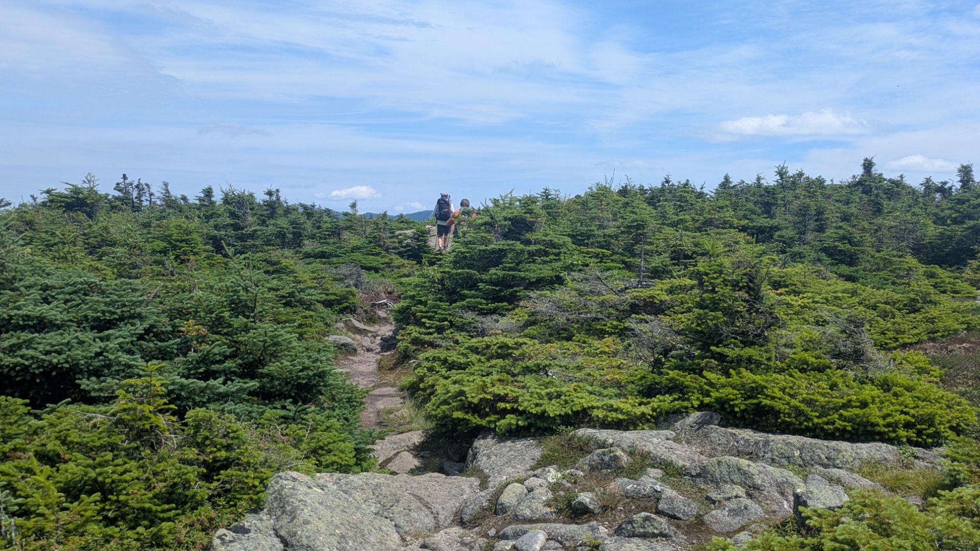
The group of hikers he was with had recently grouped up for the Whites, a smart idea. They moved on north, but eventually I caught up and hiked with/sort of followed behind them for most of the day. Some of the others were Water Slide, Obi-Wan, and Freebird. It was nice to be around others and these guys set quite the pace.
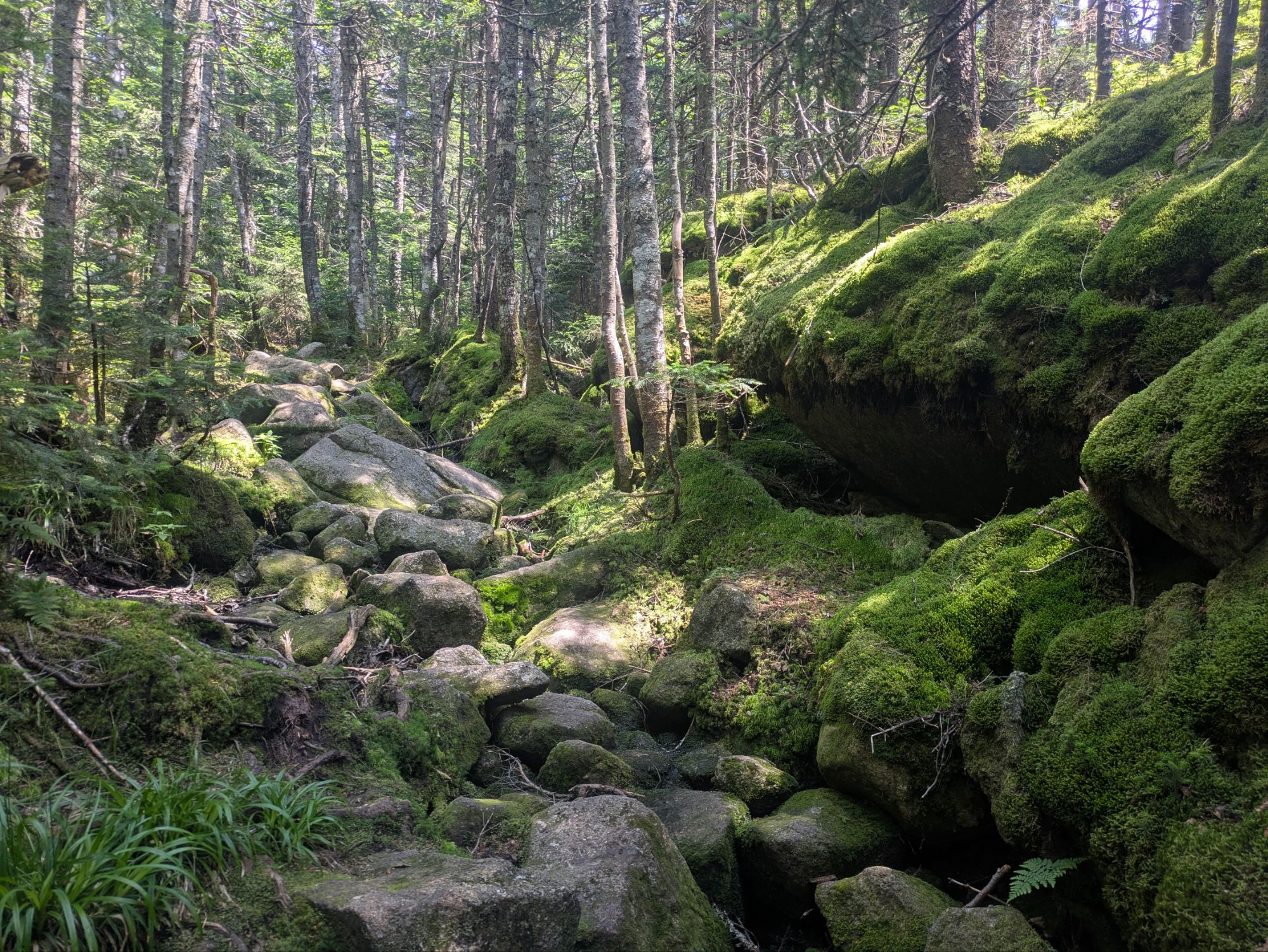
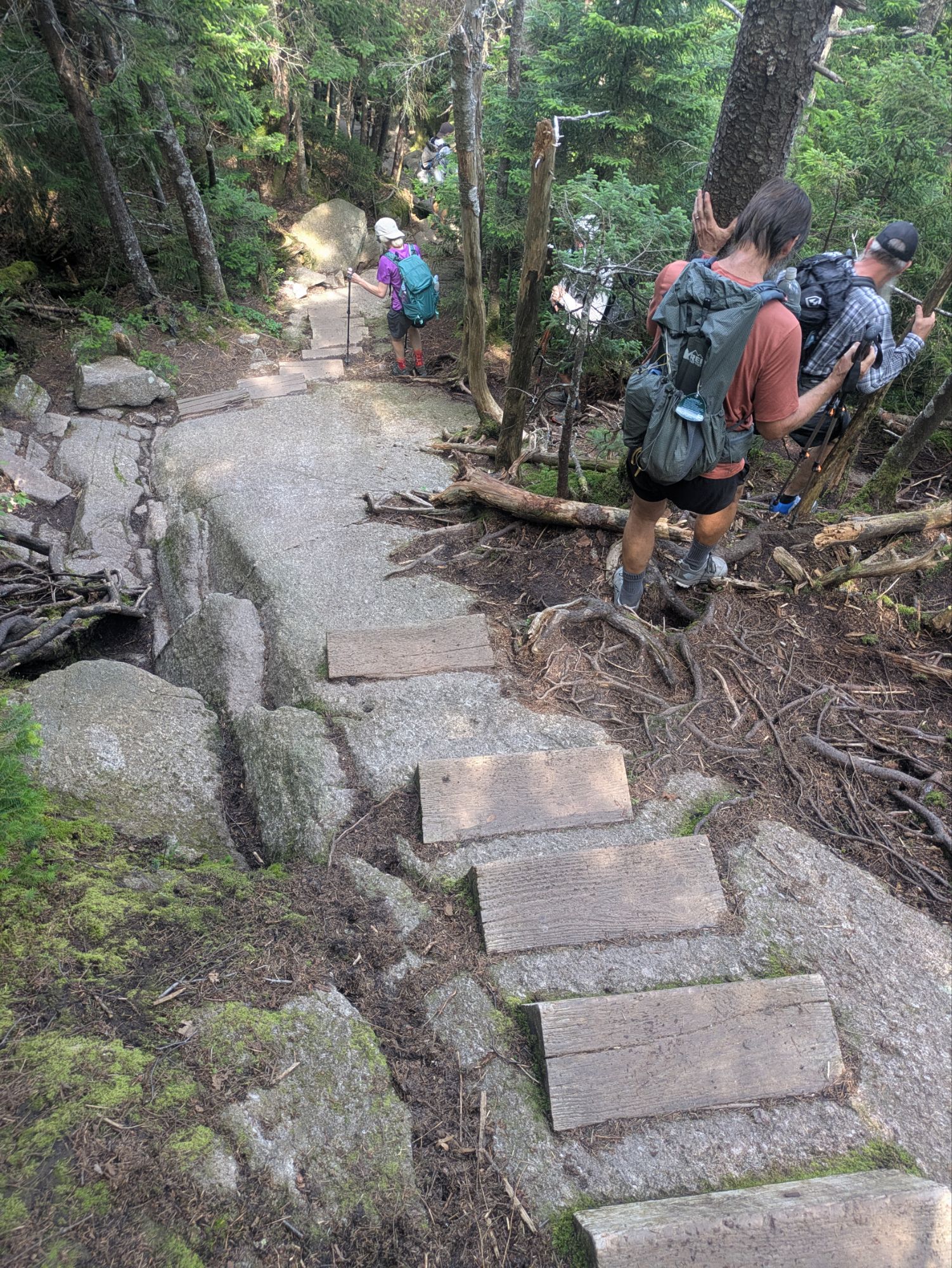
Starting up South Kinsman, things started out alright. But eventually, it turned into the wild adventure I described up above.
Not until we were very near the top did views out start to show up. I had fallen behind the others at this point, but could hear them every now and then and it was as if they were straight up above me on a cliff haha.
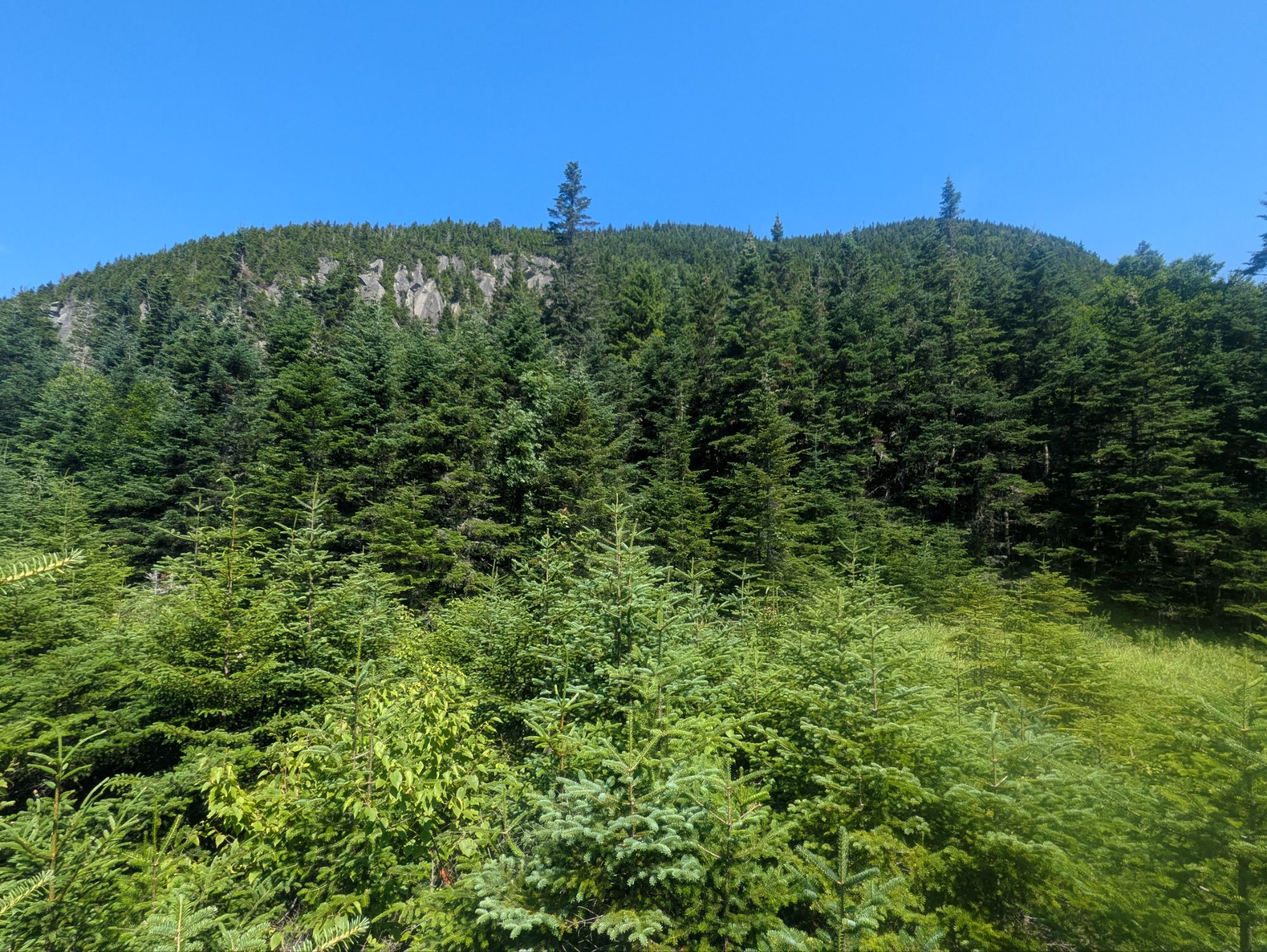
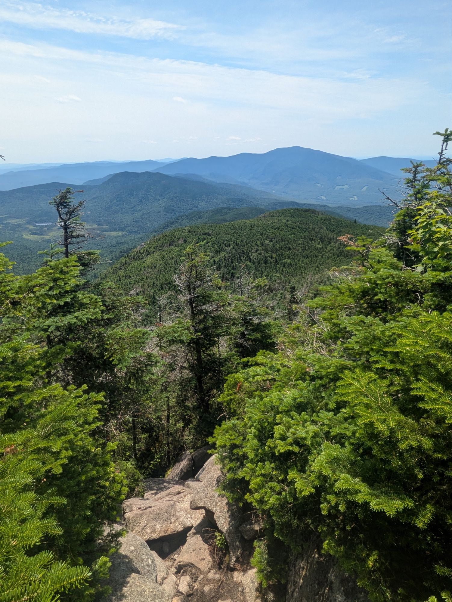
There was a last burst of steepness after this, but finally we reached a bare rock opening with stellar views. Getting a chance to catch our breath, Ghost Dogs said something like, “Well, that was fun.” One of the others expressed agreement. And they were serious. I couldn’t help myself and laughing, said, “You guys are crazy… I’m having a great time, but that was straight gnarly.” That sort of sums it up. The way I see it, the route up here could barely be called a trail. Someone at some point said, I’m going to the top of this sucker. They picked a line and now we all follow it haha. Anyways, we did it and I felt a huge sense of accomplishment.
The summit was still ahead and so after catching our breath, we continued onward.
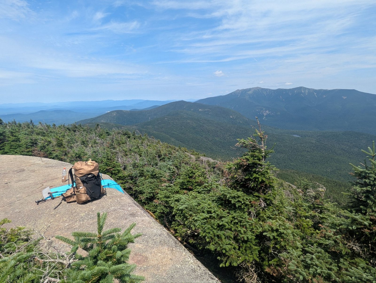
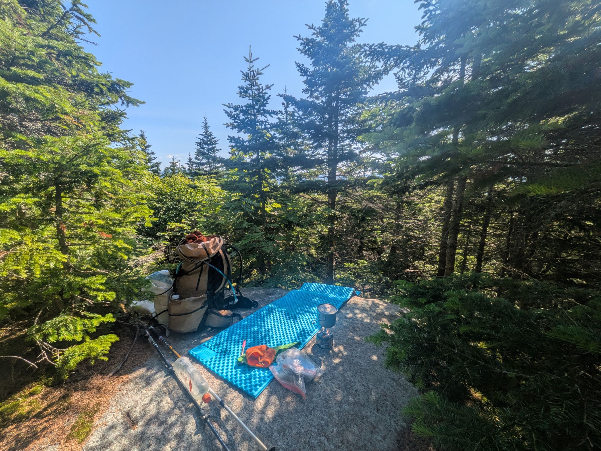
I hoped for a spot to sit for lunch there, but it turned out that the actual top was more tree covered. The group stayed nearby and had their break in the shade of the trees, but I kept going to North Kinsman to have my lunch out on a ledge there…
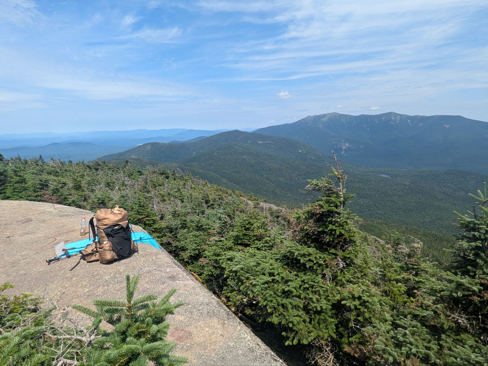
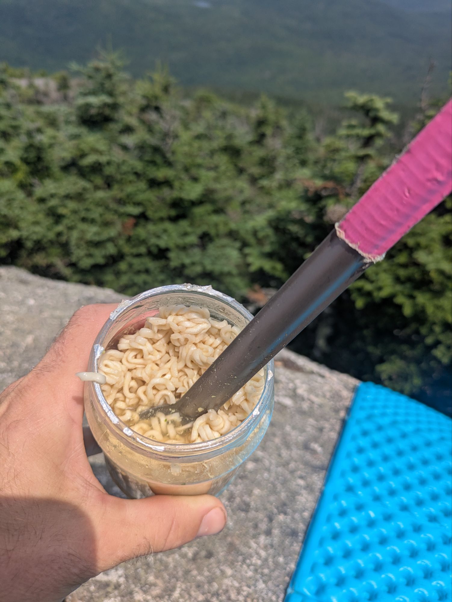
I’m reintroducing cold-soaked ramen noodles into my diet. It’s a pretty light weight lunch option and I’m intentionally trying to lighten the load with all these steep climbs.
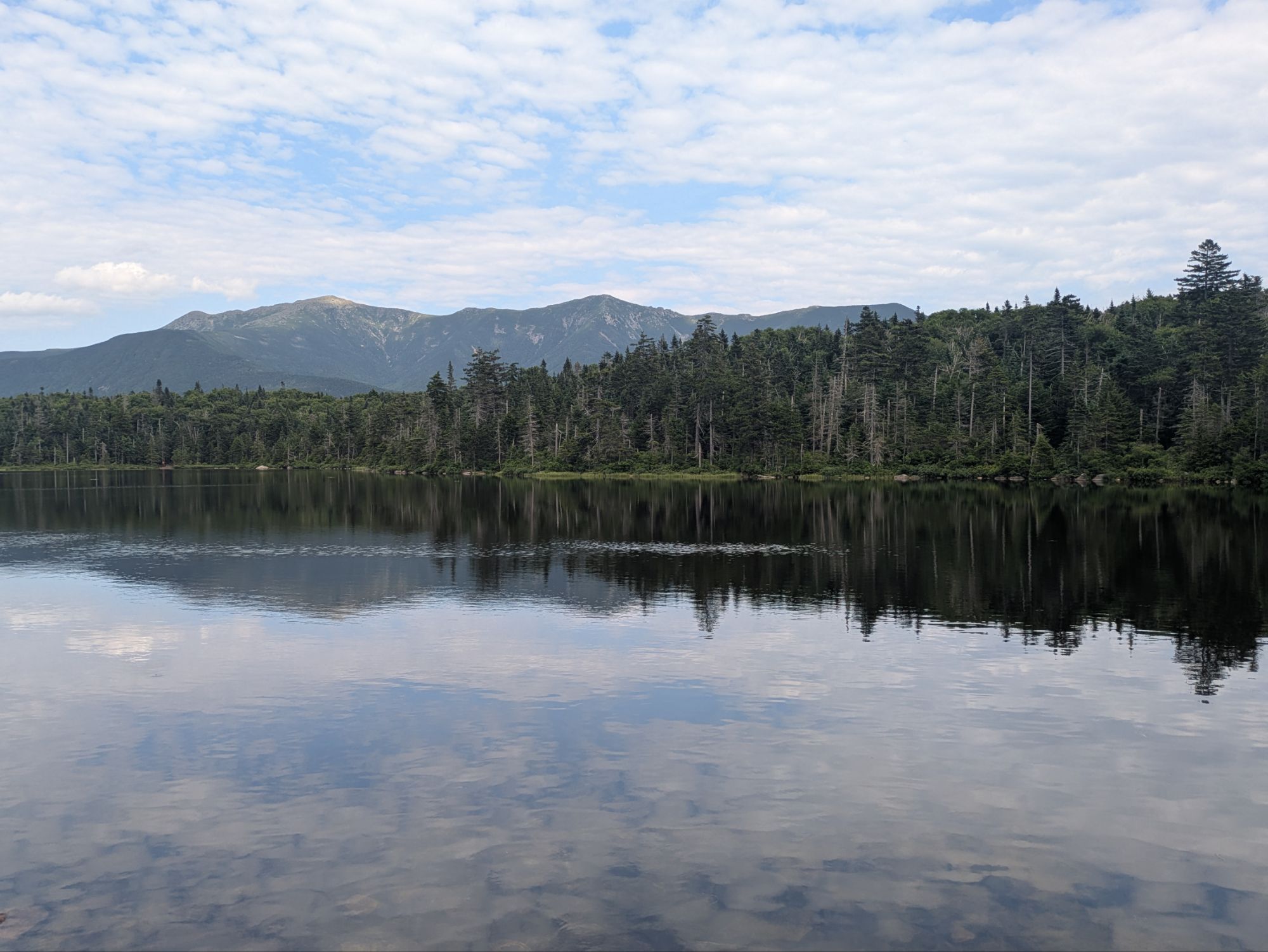
Another outstanding summit with weather that couldn’t have been better. I have felt very honored or privileged or lucky or something of that sort to have gotten these experiences atop Kinsman and Moosilauke the past two days. It really is an incredible setting for a human to be when the weather is agreeable.
The way down felt long and slow going. I think it was something like 5 miles from the top to where the trail crosses Interstate 93.
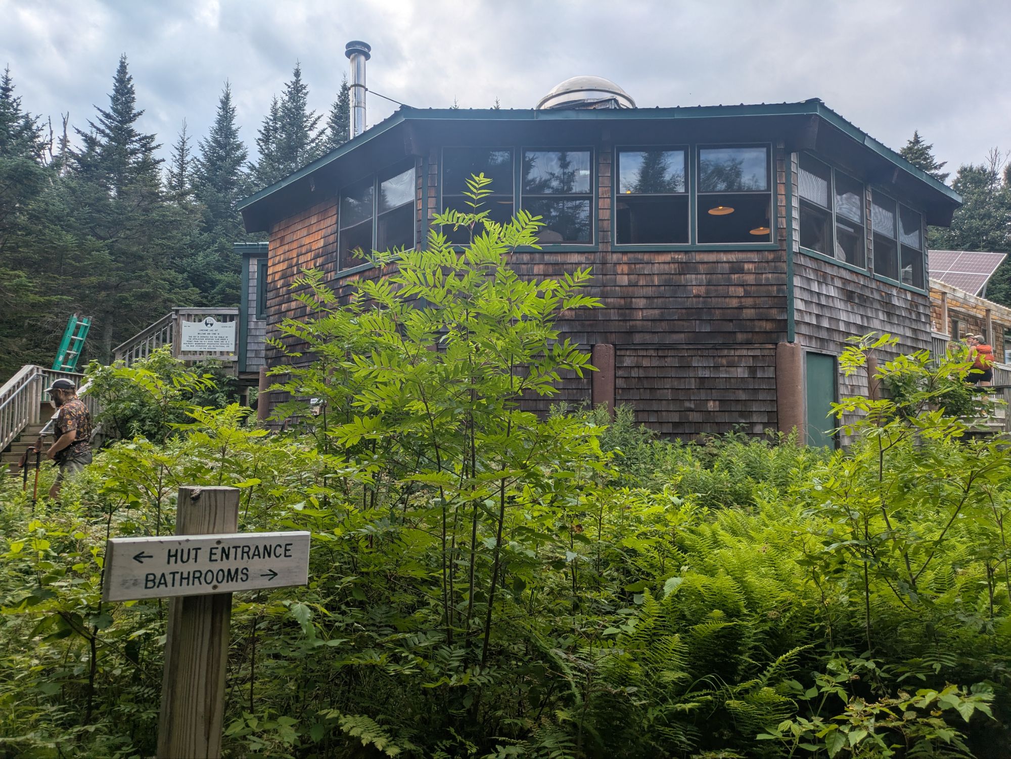
This is the first of the Appalachian Mountain Club huts, the Lonesome Lake Hut. I wanted to check it out but wanted to get into town at a decent time more. The group of 5 I was hiking around went to see if they might score some lemonade though.
I was quite unsure how things would go this evening. I planned to go into town to resupply and hoped for a nero or zero tomorrow. Where I would stay and how I’d get there was a bit of a mystery for most of the day though. Eventually, I nailed it down to stay at Snow Chasers Lodge, which appeared to be a ski club headquarters/bunkhouse/I wasn’t sure. And to get there, I hoped to hitchhike from the Flume Gorge Visitor Center, but wasn’t sure how that’d go.
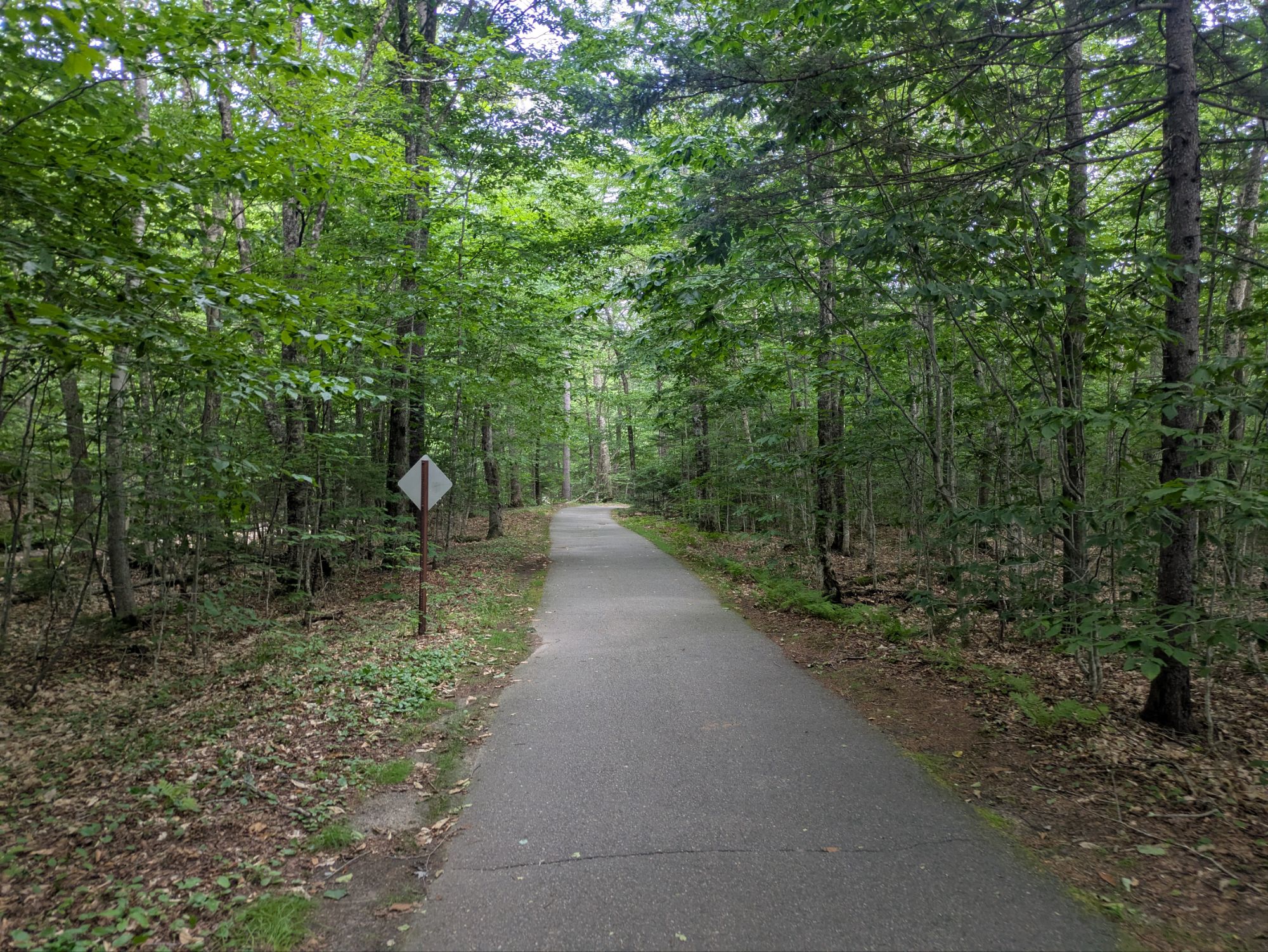
After crossing underneath the interstate, a side trail led to the visitor center. I was stoked to find it paved after all the treacherous rocky terrain over the last few days.
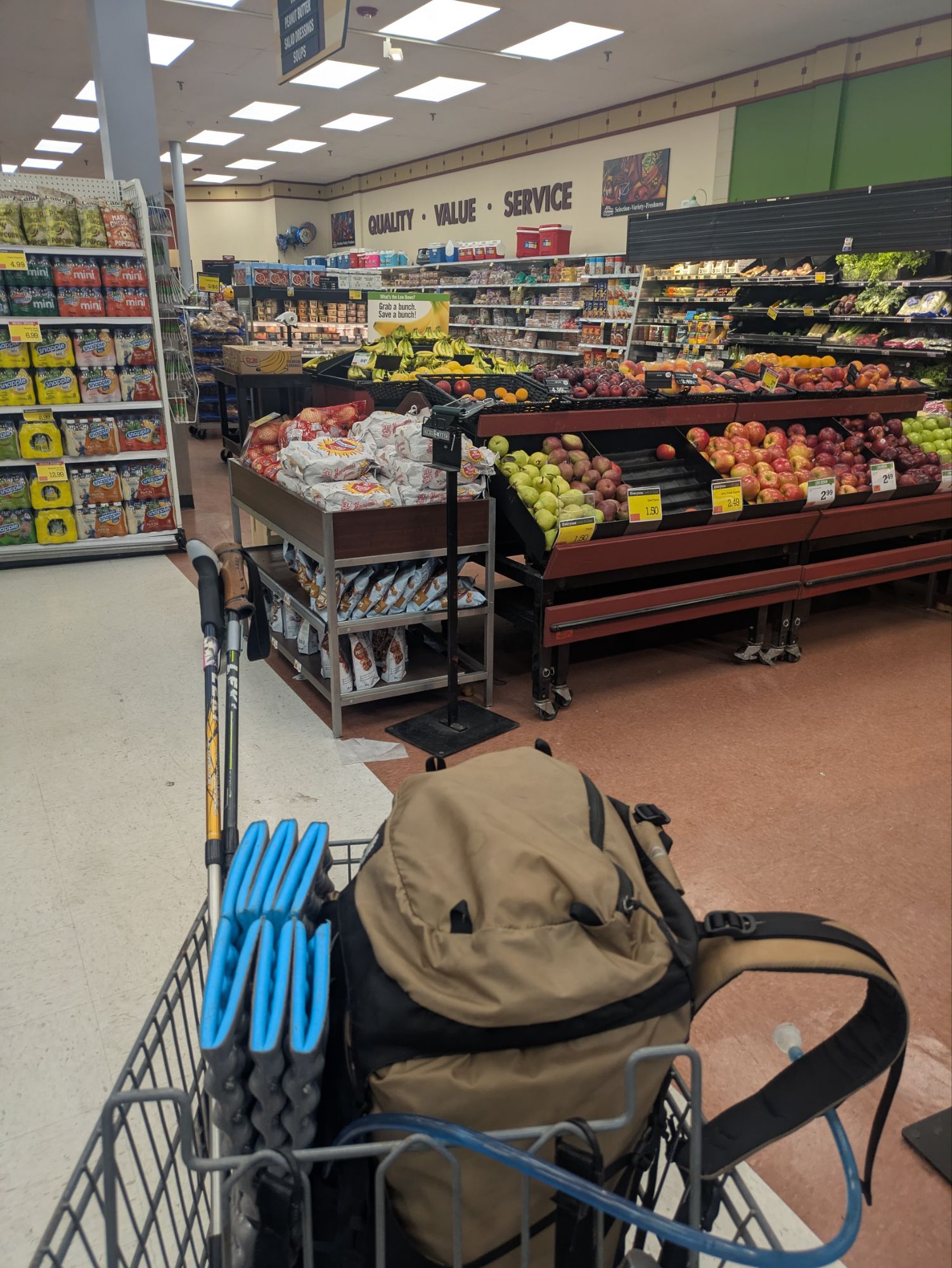
After a mile, I was there and bopped out to the road. I wasn’t super hopeful, if honest, but in less than 15 minutes I was in a car heading down the mountain! My savior today was Gary and he dropped me off right at the front curb to Price Chopper grocery store in Lincoln, New Hampshire! Thanks good sir!
Wow, I could hardly believe my schemes all came together. Kind of bonkers, this thru-hiking world. I jumped right into resupplying and the store was wildly busy with tourists. This town seems to be a destination for vacationers.
Afterwards, I walked about a half mile and found Snow Chasers Lodge. Collin, the manager of the place, showed me around and right away I was in town mode. It was such an inviting and comfortable place. I got my little pizzas in the toaster oven, then started up the washing machine with all my dirty belongings, and eventually got showered up. Boom. So refreshing. While going about my tasks, I spotted another hiker being shown around. It was Late Start!
Late Start and I met back at Woods Hole Hostel. He also has a blog on The Trek and in recent days we’ve been checking in with each other since we knew we were close. That being said, I was pleasantly surprised to see him thinking he was about a day back. After a quick reunion, he actually headed out to dinner with a friend. I was so freaking tired that I crashed early. I have loved my introduction to the Whites, but as expected, they’ve been kicking my behind too!
Thanks for joining on the journey! It means a lot that you took the time to read up on these adventures. If you want to help kids get access to the outdoors, a cause that means a lot to me, please help me in supporting Outdoors Empowerment Network! The “Tip Author” button is a direct link to my fundraising page. Y’all are truly amazing. Thank you!

After two grueling but beautiful days, I had walked 360 degrees around Loowit (Mt St Helens) and bagged the summit. Now I rejoined the Truman Trail and headed north to continue my journey.
Engineering efforts to address the impacts of the 1980 eruption still dominate this landscape. My Truman Trail connection is only open on weekends until 2028 – it’s a construction site during the rest of the week. The Spirit Lake intake gate, which the Army Corps of Engineers raced to build to stabilize the lake’s post-eruption level, …
The post ORV = Off-grid Relaxing Vibes appeared first on The Trek.
Destinations & Things To Do
Why Arizona Is Becoming the Top Honeymoon Destinations in America as Scottsdale Combines Desert Charm, Lavish Resorts, Couples Spa Experiences, and Romantic Sunset Adventures

Thursday, July 24, 2025
As global honeymoon trends shift away from far-flung Caribbean islands and European escapes, couples in the United States are choosing something closer to home—and no less extraordinary. Scottsdale, Arizona, has emerged as a standout destination, captivating newlyweds with its breathtaking desert beauty, lavish accommodations, and enchanting experiences designed to celebrate love.
This romantic renaissance is part of a growing domestic travel movement, and Scottsdale now sits at the heart of it—offering couples the perfect blend of indulgence, relaxation, and adventure in a single unforgettable setting.
Why Scottsdale is the New Star of Honeymoon Travel
Set against the striking backdrop of the Sonoran Desert, Scottsdale is where golden sunsets, rugged mountain peaks, and vibrant city life intersect. It’s a place where couples can hike red rock trails in the morning, indulge in spa treatments by afternoon, and enjoy gourmet dining under a canopy of stars by night.
The city’s year-round sunshine and rich cultural offerings provide endless opportunities for connection, while its variety of upscale resorts and activities create tailor-made experiences for all honeymoon styles—from quiet, nature-focused retreats to chic, urban indulgences.
Where to Stay: Romantic Resorts in Scottsdale
Mountain View Hideaway
A luxury property nestled near one of Arizona’s most iconic peaks, this resort features secluded desert casitas designed with romance in mind. Each suite offers private terraces, sunset vistas, oversized soaking tubs, and cozy fireplaces. Guests can enjoy artisan cuisine, scenic poolside lounging, and uninterrupted tranquility.
Mediterranean-Inspired Desert Escape
Bringing old-world charm to the Southwest, this romantic retreat offers dreamy Spanish architecture, lush courtyards, and views of desert mountains. Its serene pools and a renowned wellness center—complete with steam rituals and hammam experiences—make it an idyllic setting for couples looking to slow down and reconnect.
Modern Bungalow Oasis
Located minutes from Scottsdale’s most dynamic neighborhoods, this resort offers private bungalows surrounded by native flora and modern art. Guests can unwind at the luxury spa, enjoy cocktails at a poolside cabana, or explore local galleries and boutiques just a short walk away. The blend of intimacy and convenience makes it ideal for honeymooners who want it all.
What to Experience: Romantic Activities for Two
Float Over the Desert in a Hot Air Balloon
Couples can take to the skies for a sunrise or sunset hot air balloon ride above the vast Sonoran landscape. With panoramic views, gentle breezes, and a champagne toast at the end, it’s a once-in-a-lifetime romantic memory that captures the beauty of the region from above.
Spa Bliss for Two
Scottsdale is home to more than 50 wellness centers and resorts, many of which offer tailored couples’ experiences. From private in-room massages to full spa packages featuring facials, body treatments, and indulgent extras like sparkling wine and sweet treats, relaxation comes easy. Some luxury resorts also offer exclusive spa suites designed specifically for couples.
Discover the Scottsdale Wine Trail
In the heart of Old Town, honeymooners can follow a curated wine trail that connects several intimate tasting rooms—all within walking distance. The trail offers a mix of locally produced and internationally sourced wines, allowing couples to sip, savor, and explore at their own pace.
Savor Romance Through Fine Dining
Scottsdale’s culinary scene is rich in both flavor and intimacy. Summer dining experiences feature special tasting menus and seasonal wine pairings from regional vineyards. Local favorites include gourmet kitchens offering private dining nooks, handcrafted courses, and immersive wine-paired dinners that are perfect for celebrating love.
Why Scottsdale is the Perfect Post-Wedding Paradise
Scottsdale offers more than just a destination—it delivers a feeling. Whether couples are sharing their first sunrise as newlyweds from a mountaintop trail, unwinding in a candlelit spa suite, or dining beneath glowing string lights in the desert breeze, every moment feels carefully crafted and deeply personal.
The city’s ease of access, warm hospitality, and diverse experiences make it one of the most appealing honeymoon spots in the country today. It’s a place where romance thrives not because of fantasy—but because of authenticity.

In my previous post, I covered the journey of “Undecided” and I from Truckee to Chester, following this section’s closure in 2024 due to the Park Fire. Below is a reminder of our Fire Closure Areas to cover this season. This post covers the second part of the first closure.
Fire Closure One – Truckee to Mt. Shasta, CA – 340 miles
Fire Closure Two – The Three Sisters, OR – 118 miles
And finally:
Fire Closure Three – Glacier Peak Wilderness, WA – 108 miles
Follow The Blazes
Fire Closure One – Part Two
Start Point: Highway 36, Chester, CA
End Point: I5, and Soda Creek Road, CA
Start Date: Saturday June 28th
End Date: Monday July 7th
Chester to Mt. Shasta, 165 miles
Mileage Breakdown on trail (including side trails):
14.8 – 23.5 – 22.9 – 19.0 – 0.0 – 17.6 – 22.5 – 21.8 – 23.3 – 4.8
Highlights of Fire Closure One – Part Two:
Getting Back Onto Trail After Time Off
On the morning we left Chester, we had potatoes and toast at the local diner – a common staple for hiking vegans in smaller town restaurants. We grabbed coffee and ice tea from a local shop as I worked on a previous blog post. We rode the bus back to trail, grateful that we didn’t need to try and hitch again. That first day we walked only as far as the boundary of the National Park, to ensure we followed the rule that campers in the park need a Bear Cannister (of which ours are in Maine).
Don’t Tell Me To Enjoy My Hike
Sean was struggling with his appetite, and I continued to try and walk on a broken shoe, using a rolled up sock as a wedge. Most of this day was more burn zone, but we did get to see some new fauna. This came in the form of the Western Giant Ichneumon Wasp, with an extremely long ovipositor to help lay eggs in beetle grubs under tree bark (horror movie stuff).
Western Giant Ichneumon Wasp aka nightmare fuel
We made it to the end of the day, found a spot with less chance of widow makers ending our journey prematurely and went about cleaning up the sweat and dirt of the day. We didn’t know what to expect from Lassen, but knew there were several volcanic features in the upcoming area to enjoy.
Creek Water CNOC shower
Lassen Volcanic National Park
We entered the National Park, by which you could only know this from a small sign on the trail, and immediately hiked along a short side trail to see ‘Terminal Geyser’. Although not an erupting body of water, the cool stream which we stood by drains down to a geothermally active spot that heats the water. Large quantities of steam bubbled from the water and rocks nearby.
A Squinting Undecided with the Thermal Venting of Terminal Geyser
We then got to enjoy the sites of Boiling Springs Lake, before heading to a camping area. Any excuse to not dig a cathole is greatly welcomed, and we took advantage of the campground restrooms, as well as receiving trail magic in the form of some snacks and a yellow pepper from vacationers headed home.
Boiling Springs Lake – No Swimming
Though we couldn’t swim in the waters of Boiling Spring Lake, we did take a dip to cool down in the waters of Lower Twin Lake. This was my first full body swim since the Hot Springs in Southern California, and it felt great. Finally we worked through the heat of the remaining burn area in the park. Though it was hot, the trail was flat and easy to hike on. The views of Mt Lassen were also incredible!
Undecided in the Burn Area, Mt Lassen Looming in the Distance
Old Station and the Lava Tube
Some parts of trail are remote, whilst others just feel that way. After leaving Lassen, our next day took us through Old Station for breakfast. Of course we also hung out with hikers, and upped our snack levels. We then got to hit the third volcanic feature, a lava tube, north of Old Station. The Farout App describes this place as maintaining a 46F or 8C temperature year round. All I can say to that is that it was tough to leave here and continue on to one of the more challenging parts of this section: Hat Creek Rim (check the challenges section).
Showstopperi Squaterus in the Lava Tube
Burney Falls
The end of our resupply took us first to the Burney Mountain Guest Ranch where Sean treated us to a night in luxury. We then spent the next day in the town of Burney, eating our veggies, resupply shopping, and picking up a pair of replacement shoes I ordered a few days prior.
Packing the Beans and Veggies into Town Time
The next day we got a quick hitch from town to the trail, and made our way to Burney Falls. As we walked, I realised we had the chance to take a side trail to a viewpoint. I ran with a full pack, falling flat on my face, but managed to keep going before Sean missed the turnoff. We got to see the bridge from ‘Stand By Me’.
The Bridge from “Stand By Me”
As has become the pattern, we made it to Burnley Falls State Park, and went straight to the snack area for cold drinks, and to use the bathrooms. Hiker friends watched our packs so we could pop over to the falls. We were not disappointed with the beauty, though the day visitors did make for slow walking back up the pathway. The coolness of the air, sprinkled with waterfall mist was truly delightful and should be mandatory for all sections of trail on hot days!
Burney Falls and Me
The Falls are fed by Lake Britton, which also has an operating dam that we crossed on trail. There’s something about the sound of flowing water that brings me such peace and admiration.
Appreciation to the Dam Crossing at Lake Britton
Making it to Mt. Shasta
As we left the Dam area we took another three and a half days to reach Interstate 5, and this in itself was eventful. The trail wound along Hawkins Creek and then the McCloud River. As such, our days were filled with climbing up several thousand feet, then going right back down. Every time a creek or stream fed these larger bodies of water we had to hike along these areas to be able to cross the water at appropriate spots.
Taking a Break at a Small Water Source along a ridge
The elevation kept dropping us into sticky, warm areas, and then took us up to slightly cooler spots. The gradient of the trail was easy enough that we didn’t have to work too hard, but Deer definitely have the advantage.
A Deer before it climbed straight up the mountain when between Undecided and I
On the last full day of hiking, Sean was elated that we could finally take part in shenanigans that he had been planning since last year. At the final descent from the ridge towards the highway, you can follow the trail OR you can bushwhack a short distance to an old forest service road. This road rejoins the PCT, but cuts off three whole miles of trail. We didn’t even need to discuss if we were doing it. Our final night of this section was spent with the view of Mt Shasta looming over us.
The View of Mt Shasta from Inside our Tent
Challenges of Fire Closure One – Part Two:
Beating the Heat
With Summer in full swing, and the copious burn zones of NorCal, we were feeling the heat. It saps the energy from you; everything is damp with perspiration, and you have to pay attention to your hydration much more. Electrolyte packets like Liquid IV and Gatorade were essential to keep our salt levels up.
The Flowers Seem to Fair Better in the Heat
We planned to take as many breaks by bodies of water as we could, grateful that there weren’t too many mosquitoes (usually).
Undecided Cooling Off in a Large Creek, too Silty to Get Water From
We like to Dry Camp if there can be a stunning view, but sometimes we chose to stay by water just to keep hydrated, and with the chance to wash the salt from our bodies.
Camping at Low Elevation to Have Access to Water
My technique involves wetting my hair and hat whenever possible to cool me down. Sometimes I even dipped my sleeves in streams too! Of course my favourite way to keep cool was a dip in a pool.
Keeping Cool in Mt Shasta KOA Campground with a Dip in the Pool
Hat Creek Rim
Old Station was great. What isn’t so great is that the next on trail water was about 18 miles ahead. It’s a relatively gradual climb up to the ridgeline, and then you’re just walking under the heat of the sun.
The Lizards Seem to Enjoy The Heat (Mt Lassen in the background)
We packed out 4.5 liters (150oz) of water each ready to camel our way to the water cache provided by a trail angel named Jim. I also brought a Gatorade for bonus electrolytes. We received trail magic in the form of a hot, expired Diet Coke (I don’t recommend drinking these), and a small cache as we left a scenic viewpoint. Taking in the views kept our mind off water, but we did camp by a Communications Tower with dwindling water for the night. We were joined by our friends, and a pushy deer who was clearly after our salty deposits in our clothes, and on our packs.
Cowboy Camping at the Communications Tower
The next morning it was cool enough that our thirst didn’t challenge our last few miles to the water cache. However, the nearby cows did have Sean ready to hike on without water. We took a break, chatting with many hikers also filling up after a dry spell. The logistics surrounding the PCT continue to be one of the harder aspects of this hike, but we’re grateful to those who provide a helping hand.
The Kindness of Trail Angels and the Thirst for Water
Fire Closure One – Part Two Reflection
On our second to last night of the section, ‘Coin Flip’, ‘Rainbow’, ‘Ferdinand’, Undecided and I were warned by a hiker that there may be a fire ahead of us on trail by Cabin Creek. With no phone service we had no choice but to hike on and play it by ear, ready to turn around. We were fortunate that it wasn’t smoky and wasn’t affecting the trail. We did however head up the creek for water, a bathroom, and lunch, which resulted in a great discovery.
Trail Angel Mark Coming Through with the Pineapple Rings
We spent our last night on the edge of the trail, looking at the views of Shasta, grateful that we could finally check off this large section of trail. The next morning we hiked the last four and a half miles to the interstate. We knew the next days would be full of travel and logistics as we prepared to travel to central Oregon for our second fire closure section.
The Sleep Before Finishing our 340 Mile Section in Northern California
Sean found his trail legs and appetite, whilst I practiced resilience in dealing with gear failure. I even picked up a second pair of shoes in Mt Shasta that Topo Athletic sent out as part of the warranty claim for my damaged pair. We hung out in Mt Shasta and Dunsmuir and set our sights towards the Three Sisters, OR.
For now, goodbye California, it’s been real.
Catch Ya Later, California
-

 Brand Stories3 days ago
Bloom Hotels: A Modern Vision of Hospitality Redefining Travel
-

 Brand Stories2 days ago
Olive Living: India’s Intelligent, Community-Centric Hospitality Powerhouse
-

 Destinations & Things To Do3 days ago
Untouched Destinations: Stunning Hidden Gems You Must Visit
-

 AI in Travel3 days ago
AI Travel Revolution: Must-Have Guide to the Best Experience
-

 Brand Stories3 weeks ago
Voice AI Startup ElevenLabs Plans to Add Hubs Around the World
-

 Brand Stories2 weeks ago
How Elon Musk’s rogue Grok chatbot became a cautionary AI tale
-

 Asia Travel Pulse3 weeks ago
Looking For Adventure In Asia? Here Are 7 Epic Destinations You Need To Experience At Least Once – Zee News
-

 AI in Travel3 weeks ago
‘Will AI take my job?’ A trip to a Beijing fortune-telling bar to see what lies ahead | China
-

 Brand Stories3 weeks ago
ChatGPT — the last of the great romantics
-

 The Travel Revolution of Our Era1 month ago
CheQin.ai Redefines Hotel Booking with Zero-Commission Model
You must be logged in to post a comment Login