
Updated July 31, 2025 08:23AM
Destinations & Things To Do
This State Is Your Unexpected Caribbean Dupe, No Passport Required
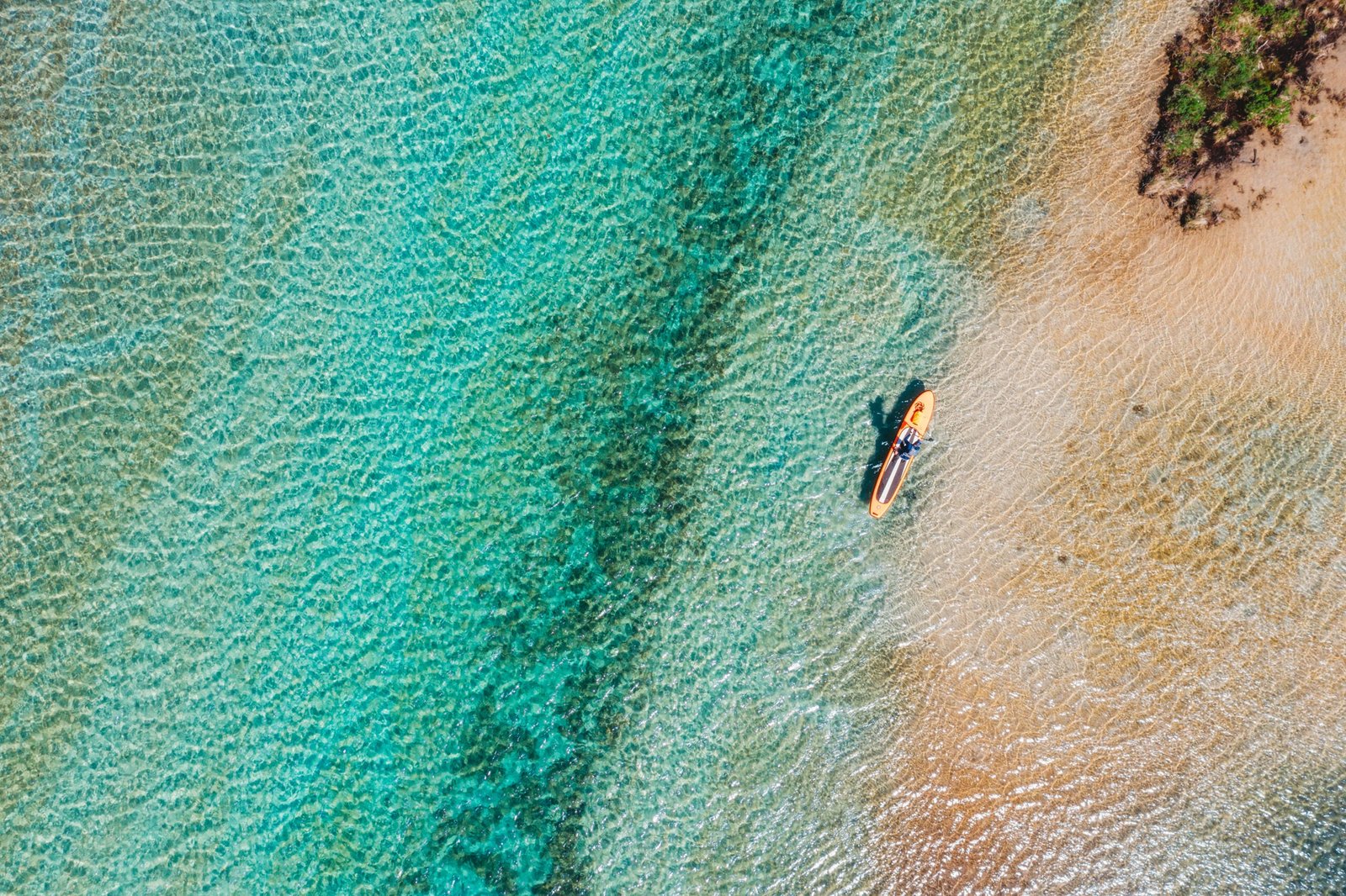
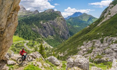
Hike dune ridgelines that feel like island peaks, paddle through teal coves that rival the tropics, and end your nights with sunset bonfires or schooner sails.
Michigan’s Torch Lake, and its outflow in the Torch River, are exceptionally clear and exhibit a bright turquoise hue, often recalling Caribbean waters.
You don’t need a passport for a beach escape that feels downright tropical. And with 71 percent of Americans opting for stateside stays this summer, more people are looking to access paradise without currency exchanges.
Enter: Michigan.
I get it. You’re skeptical. But that just means you’ve never stood on the blinding-white sands of Northern Michigan’s west coast, staring out at topaz waves. As a scuba diving travel writer who’s logged plenty of time in tropical locales and spent 26 of my 30 years in the Great Lakes State—I’m here to tell you: Michigan can absolutely hold its own.
We’ve got sugar-soft beaches, teal bays you can sail, and freshwater so clear it hurts to look at. No sharks, no salt, no passport. Just miles of dune hikes with island-caliber views, paddleboarding in turquoise bays, and the kind of geology that turns Midwestern lakes into Caribbean lookalikes.
This is your no-passport tropical dupe that’s hiding in plain sight.
Sleeping Bear Dunes
Sleeping Bear Dunes National Lakeshore stretches 35 miles along Lake Michigan in Northern Michigan, with over 71,000 acres of dunes, forests, inland lakes, and historic sites—including the Manitou Islands, old farmsteads, lifesaving stations, and an 1871 lighthouse. At its heart: some of the tallest freshwater dunes on Earth, earning it the title of the “Most Beautiful Place in America” from Good Morning America in 2011.
Fortunately for me, my parents own a vacation condo in this overlooked part of the National Parks system. The Homestead, a resort with over a mile of Lake Michigan shoreline, is known as America’s Freshwater Resort. Amenities include shoreline tennis courts and Spa Amira, which has panoramic lake views. No surprise, you’ll find me at the Homestead multiple times a year.
You have no shortage of options for incredible sugar-sand beaches in Sleeping Bear. For swimming, sunbathing, or tubing into Lake Michigan, Platte River Point Beach is a local favorite with calm river shallows on one side and dramatic surf on the other. Good Harbor Bay offers soft sands and Caribbean-clear water—ideal for sunset bonfires. North Bar Lake near Empire is shallow, warm, and perfect for kids, with a quick hop over the dune to the big lake. D.H. Day Campground Beach delivers wide views of the Manitou Islands, while Glen Haven Beach is a peaceful spot with historic charm. For a quieter afternoon, Esch Road Beach has soft sand, easy parking, and a creek that’s fun to wade.
Sleeping Bear Dunes National Lakeshore is also a hiker’s paradise with about 100 miles of trails weaving through dunes, forests, and coastline. No visit is complete without attempting the Dune Climb itself, a rite of passage for Michigan visitors and children alike. This is the steep wall of sand near Glen Arbor that kids (and fit adults) love to charge up. It’s roughly 110 feet tall to the first ridge, but feels higher because every step up slides you half a step back. Many families make a morning of it—racing up before rolling or running back down.
You can also keep walking from the top on the Dunes Trail, a 3.5-mile roundtrip from the Dune Climb, down to Lake Michigan’s shore best done barefoot or in flip-flops. It’s strenuous – you’re hiking up and down steep sand hills with zero shade. (Bring more water than you think you’ll need.) But the payoff is worth it when you reach the 473-foot Mother Bear Dune at the end towering over the endless expanse of Lake Michigan. It’s the same view that inspired the Ojibwe legend of the Sleeping Bear that gave the park its name: A mother bear and her cubs jumped into the water to escape a forest fire, but the cubs tragically slipped beneath the waves when nearing shore. The two cubs became the Manitou Islands, and the protective mother became the solitary dune overlooking them in the lake.
Sprinting down the Mother Bear dune into the crisp waters of Lake Michigan at her feet after the long hike is one of the most refreshing experiences of all. But be sure you can make it back up if you sprint down. Rescue fees for stranded climbers who can’t make it back up themselves can run $3,000. And pro tip if you plan on hanging out at the beach: Be careful as you keep an eye on the time. At the shore, your phone might start picking up Chicago cell towers and fall back an hour from Eastern to Central.
Hiking the Mother Bear Dune is a favorite childhood memory of mine. My younger brother and I tackled it when I was about 10 years old. After sprinting down at a breakneck pace, it took 45 minutes to climb back up—the sand sends you back three steps for every two you take, I swear. But that night, after our victorious crest, my parents let me order from the adult menu for the first time ever. (I got the chicken nachos.)
For an easy hike with stunning views, hit up Empire Bluff Trail, a simple out-and-back that leads to a high bluff overlooking Lake Michigan and the expansive Sleeping Bear Bay. This spot is particularly special to me: it’s where my husband proposed, dropping to one knee with endless blue water and the Manitou Islands on the horizon. Other great paths in the area include Pyramid Point (2.6 miles), Alligator Hill (9 looping miles in total), and Sleeping Bear Point (2.8 miles). Sleeping Bear Heritage Trail (4.25 miles) is the park’s only paved biking trail. It connects the Dune Climb with several campgrounds, as well as the town of Glen Haven and Glen Arbor, making it a great thoroughfare.
Torch Lake
Legitimately nicknamed the “Caribbean of the North,” 19-mile-long Torch Lake stuns visitors with unreal clarity and color. Michigan’s longest inland lake reaches 310 feet deep, and owes its tropical hues to glacial history: minimal organic runoff and calcium-rich marl on the lakebed make the water incredibly transparent blue-green. In other words, Torch’s geology filters the water to an almost unnatural clarity.
I spent many childhood summers boating on Torch since my grandparents lived just a few miles from shore. In the lake’s southern shallows, a wide sand shelf forms a sandbar that hosts a natural pool-party scene each summer, boaters knee-deep to socialize. By midday on a summer weekend, it’s a flotilla of pontoon boats and inflatable tubes, music echoing over the turquoise expanse. (Three event promoters were put on a court-ordered hiatus from 2016 to 2020 after a 10,000-person 4th of July party got out of hand.) My family likes to joke that Craig Morgan’s song “Redneck Yacht Club” was inspired by a day at the Torch sandbar. The man selling hamburgers every day off the back of his pontoon from a portable grill is one of my core childhood memories.
If you want to toss anchor and the sandbar (or spend the day zooming around) Dockside Water Sports rents tritoons ($520+) and jet skis ($199+) while Torch Lake Pontoon Rentals offers—you guessed it—pontoons, with kneeboards and tubes available for add-on. Kayaking fans can contact Clear Bottom Kayak Rentals for single and tandem rentals ($35+). Anglers can book full and half day trips with Charters North to fish for salmon, trout, walleye, porch, and more ($495+). Scuba divers can work with Scuba North for gear rentals and site selection, with plenty of shipwrecks to choose from. When hunger strikes, boat to Dockside near Torch River, where slips await and pints are poured. There’s nothing like tying your boat to the restaurant’s dock for lunch—a classic Up North experience.
Grand Traverse Bay
Grand Traverse Bay is a 32-mile Lake Michigan inlet that cuts in to the east of the Leelanau Peninsula. Ranging between seven to 10 miles wide, it bottoms out at 620 feet. Traverse City, the region’s largest city, sits along the southern shores.
Every Fourth of July, I find myself on Old Mission Peninsula, which bifurcates Grand Traverse Bay, watching the sunset from the deck of my husband’s grandparents’ waterfront home. The distant hills—striped in the vineyards of world-class wine country—glow in the late sun. By day, the bay transforms into an adventure playground for paddling, boating, hiking, and lazy beachgoing, all within view of those spectacular vistas.
For a paddling adventure, you can take a day trip to Power Island, a 200-acre uninhabited island park once owned by Henry Ford. It’s a 15-mile kayak journey from Traverse City or 3 miles from Bowers Harbor. Paddle TC rents single and double kayaks ($30+) and paddleboards ($30+) from Clinch Park on West Bay (they also deliver within a 30-minute radius). If you prefer horsepower, rental companies like TC Watersports make it easy to gear up, offering everything from jet skis ($75/hour) to speedboats ($140/hour).
In Traverse City, Clinch Park Beach and the adjacent West End Beach offer soft sand and remarkably clear water for swimming. The bay’s gentle, sand-bottomed shallows are kid-friendly and sparkle a Caribbean hue under the midday sun.
Three-masted schooners are a distinct way to experience Grand Traverse Bay. Traverse Tall Ship Company operates the Schooner Manitou—Michigan’s 114-ft largest schooner. Public 2‑hour sails include options like the Evening Sail (~$73), Brunch Cruise (~$88), Ice‑Cream Sail (~$61), and Wine‑Tasting Sail (~$70–85) per person. The Inland Seas Education Association operates two schooners: the 77-ft Inland Seas and the 105-ft, three‑masted Alliance, both home-ported in Suttons Bay (a bay within Grand Traverse Bay). Public sails range from $45–$75 per person, with options like the Great Lakes Discovery Sail (3 hours of hands-on science and sailing), Fishes of Lake Michigan, and Steady the Ship! (2-hour eco-sails featuring net pulls, fish handling, and sail-raising). Specialty trips include stargazing sails and fall color cruises, all departing from Suttons Bay.
For lodging, Sutton’s Bay has a charming choice is the Vineyard Inn, a 12-room boutique hotel on a sandy stretch just north of downtown that has a complimentary dock for those who boat in.
Big & Little Glen Lakes
Tucked beside Sleeping Bear Dunes, Big Glen Lake and Little Glen Lake are a startlingly blue pair. Stop #2 on the Pierce Stocking Scenic Drive—a 7.4 mile loop with 12 recommended vistas of Lake Michigan, the Glen Lakes, and the dunes—presents a postcard view of these interconnected twins framed by verdant hills, their bright blue waters stealing the show.
Little Glen (the smaller western part) is especially shallow and warm. On summer afternoons, it feels like a giant natural swimming pool. Big Glen, meanwhile, reaches about 130 feet deep and stays a bit cooler, but its drop-offs create gorgeous color gradients from aqua to deep blue. There’s nothing like floating in Big Glen’s clear, teal water with the massive Sleeping Bear dunes looming just beyond.
These lakes are perfect for paddling and boating. You can rent a boat or jetskis from the Glen Craft Marina or On the Narrows Marina. Crystal River Outfitters, in Glen Arbor, will deliver SUPs and kayaks to local lakes ($68+), including the Glens. Anchor off the sandy shore of Glen Lake’s tiny islands for a swim, or paddle a kayak along the forested shoreline. The water is usually bathtub-calm, ideal for stand-up paddleboarding even if you’re a beginner. For boat or beach snacks, swing by Anderson’s Glen Arbor Market a few minutes away.
So this summer, skip the customs line. Michigan’s freshwater paradise is ready when you are.
Sure, it’s not palm trees and coconuts—but it is sugar sand, Caribbean hues, and adventure-packed days on the water. You’ll hike dune ridgelines that feel like island peaks, paddle through teal coves that rival the tropics, and end your nights with sunset bonfires or schooner sails. It’s wild, it’s beautiful, and it’s a hell of a lot cheaper than flying south.
________________________________________
Growing up in the Great Lakes state gave Alexandra Gillespie a lifelong love of being in, on, or anywhere near the water. After cementing her adoration with a scuba certification, she worked as digital editor of Scuba Diving magazine, where travel assignments took her all around the world. Now a freelancer for Outside, she continues to cover water and travel. Her work has also appeared in National Geographic, Afar, NPR, and other national outlets.
Alexandra Gillespie is a freelance journalist who covers scuba diving, underwater wildlife, and travel. Her work has appeared in media outlets including Outside, National Geographic, Scuba Diving, and NPR. She previously worked with the research team at “Last Week Tonight with John Oliver,” as well as on the production of “Full Frontal with Samantha Bee” and “The Opposition with Jordan Klepper.”


If you buy through our links, we may earn an affiliate commission. This supports our mission to get more people active and outside.Learn about Outside Online’s affiliate link policy
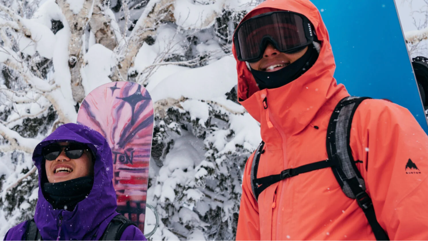
(Photo: Courtesy of Burton)
Published August 1, 2025 01:04PM
Snowboard season may still be a few months away, but if you’re anything like us, you’re already counting down the days until that first chairlift ride up the mountain. Since we can’t hit the slopes just yet, we’re spending these warmer months organizing the gear closet, reminiscing on our most epic days out last year, and reading all of the snow-related inspo we can find.
As we take inventory of our gear, we’re simultaneously building a wish list of all the new apparel and equipment to buy for the upcoming season. And for all the wish-list-makers out there, we have good news: the Burton Summer Sale is has just started and there are markdowns across all of the brand’s categories, including jackets and bibs, bindings, boards, boots, and more. This means you can knock a few things off your list right now — no need to wait until October to start shopping for new snowboarding gear. Keep reading to find our favorites from the sale, or head straight to Burton and see for yourself.
Burton Family Tree 3D Deep Daze Flat Top Snowboard
One of our favorite snowboards for 2025, this is an ideal choice for powderhounds that are always the first ones down the mountain after a big storm. The board provides constant energy and float, and was much more versatile on the mountain than we expected it to be. But the real reason it stands out is its innovative channel technology. The unique 3D base wowed our testers, with one of them claiming that the 3D Deep Daze “pumped, bounced, and buttered through powder like a peyote-popping porpoise on a vision quest.”
Burton [ak] Hover GORE‑TEX 3L Stretch Jacket
GORE-TEX isn’t the only waterproof tech on the mountain, but it has certainly become the go-to for boarders who are keen on staying dry all day long. The Hover jacket is a light, packable, waterproof shell made for conquering the backcountry. It stows small when you’re following the skin track up the hill and keeps the conditions at bay on the way back down.
Anon M4S Goggles (Toric) + Bonus Lens + MFI® Face Mask
This bundle has everything you need to protect your eyes and face on the mountain. The M4S goggles use cylindrical lenses for a wide field of view and come with a bonus lens you can swap out on the go thanks to Anon’s Magna-Tech magnetic lens interface. The bundle also includes a magnetic face mask to keep you warm on the coldest days. The M4S frames are designed for folks with medium-sized faces and come with a microfiber goggle bag to keep them protected when you’re not wearing them.
Burton [ak] Kalausi GORE-TEX C-KNIT 3L Bib Pants
If you’re a splitboarder that needs their pants to be equal parts stormproof and breathable, the Kalausi bib pants are a treat. The three-layer GORE-TEX material is fully waterproof while still allowing for hot air to move away from your skin on tough climbs. Once you reach the summit and prepare to turn back down the hill, the impenetrable outer membrane will keep you completely dry and comfortable.
Burton Futuretrust Insulator Vest
When the cold really starts to hit, your mid-layers make all the difference. The Futuretrust Insulator Vest, one of Burton’s many gender-neutral offerings, is a low-bulk option that packs a huge punch warmth-wise. A lightweight Pertex shell is paired with 200g ThermacoreEco fill to keep you warm without making you feel like a marshmallow. Bonus points for the zippered side vents that let your torso breathe when you work up a sweat.
Destinations & Things To Do
7 travel destinations where Australia dollar will stretch further: ‘Smarter’
Keen for an international escape but don’t want to break the bank? The Australian dollar no longer goes as far as it once did for popular destinations like the United States and Europe, but there are some travel destinations where you can get a better bang for your buck.
Wendy Wu Tours managing director Simon Bell told Yahoo Finance travellers were getting “smarter” about where and how they spent their money, with more Aussies seeking value-packed holidays and turning to destinations where the Aussie dollar stretches further.
“We’re seeing strong interest in destinations where the cost of living is lower, but the experiences are just as rich, like India, Sri Lanka, and parts of Southeast Asia,” he said.
RELATED
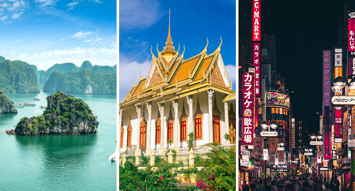
Southeast Asia continues to deliver good value for Aussie travellers, the tour company found, with countries like Vietnam and Cambodia remaining firm favourites.
Japan could be a cost-effective destination for off-peak travellers, along with those who head to lesser-known regions like Kyushu and Kagoshima.
China now also offers visa-free travel for up to 30 days, a favourable exchange rate and relatively low local costs.
Looking beyond Asia, other areas like Turkey, Morocco and Egypt offer more affordable transport, food and shopping, with the Aussie dollar generally going further compared to the Euro or US dollar zones.
Here’s a closer look at the top seven travel destinations, according to Wedny Wu Tours.
We’ve also included current exchange rates via Wise as of July 31 and a general idea of costs based on Numbeo data.
With $1 buying about 16,918 Vietnamese dong, Vietnam is among the most affordable travel destinations for Aussies.
A meal at an inexpensive restaurant will set you back around 50,000 dong, or just $3, while half a litre of domestic beer would cost about 25,000 dong, or $1.50.
Cambodia is another popular option for value-conscious travellers, with $1 equalling 2,587 Cambodian riel. US dollars are also accepted, with $1 getting you about 65 cents at the moment.
A meal at an inexpensive restaurant costs about $USD3, or $4.65, while a local beer is about $USD1, or $1.55.
Japan is another popular destination with $1 getting you about 96 Japanese yen.
A meal at an inexpensive restaurant would set you back about 1,000 yen, or $10, while a local beer would be about 500 yen, or roughly $5.

*these posts are coming straight from trail, I apologize in advance for typos!*
Location: High Sierra
Start: Red’s Meadow Junction – 907.9
End: Rush Creek – 928.1
Miles: 20.2
Ascent: 4408 | Descent: 2003
Sleep: Tent
Today felt like a big day! We both slept good and woke up around 5am. The wind had continued through the night and it was chilly when we were packing up. Getting moving helped to warm us up, and we were on trail around 6:30am. We had a short and easy hike to Red’s Meadow Resort which was closed. I’m learning that “resorts” around here are basically just shacks with a small store. Truffles and I talked about how crazy it is that people would pay to stay in places like that when they could just camp for basically nothing.
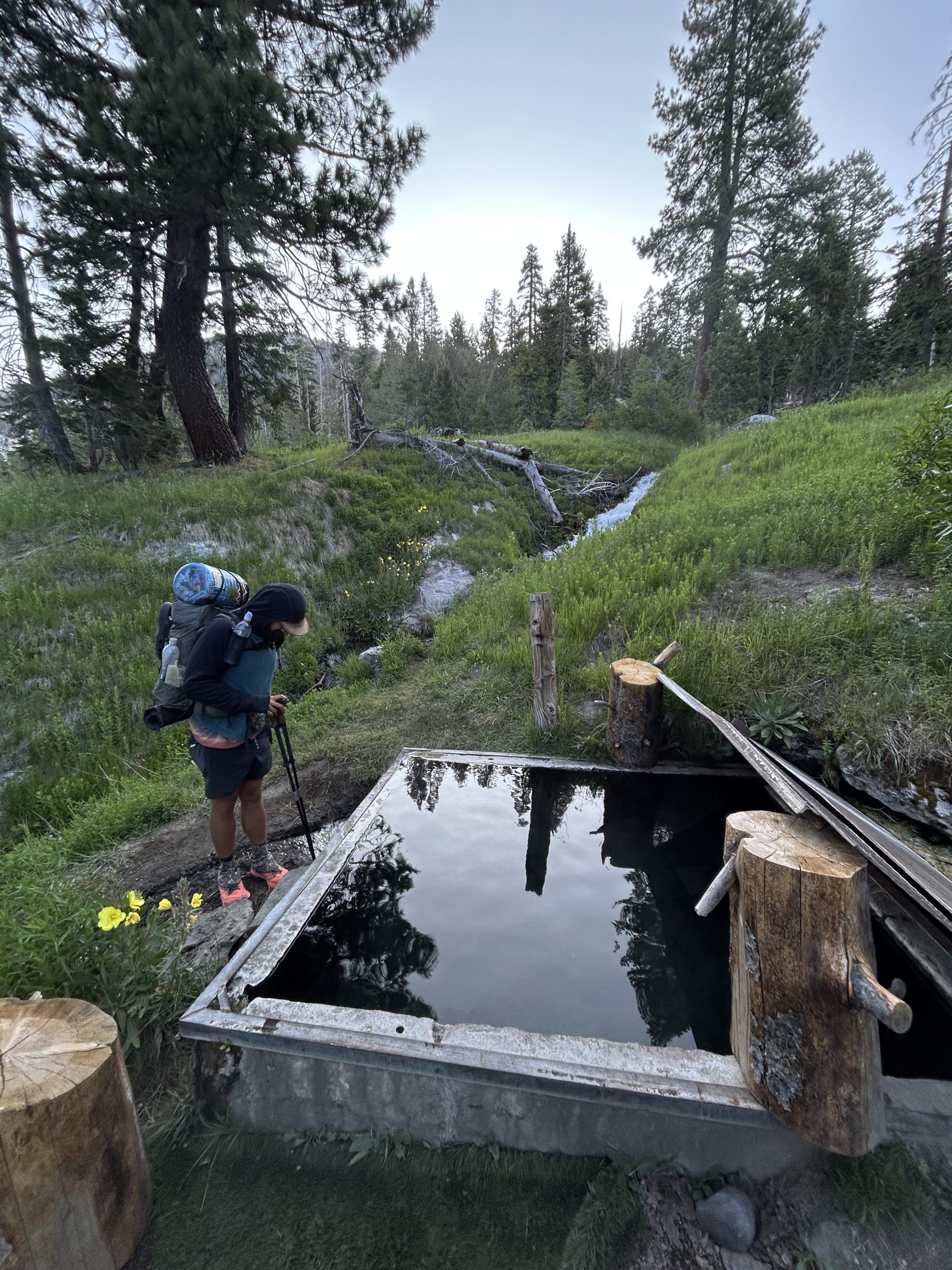
We saw lots of other hikers at the campground for the resort. We hadn’t stayed there last night because we weren’t sure if we’d have to pay or not. We did pass the hot spring just beside the campground and debated getting in, but ultimately decided to keep moving because we didn’t want to have to take our clothes off in the cold.
We had camped near the junction and this morning hiked along the alternate route. The actual PCT is technically closed in this stretch because of a bridge being out over the Middle Fork San Joaquin River. The alternate route was lovely and took us past multiple closed backcountry campgrounds, including Red’s Meadow.
We walked past numerous pit toilets in the morning, but I didn’t feel the need to go. Once we got further up the trail away from the campground, I suddenly desperately needed to go. I decided to run back towards the pit toilets, only to discover the 2 that I tired were locked. I didn’t have much time until the inevitable and scurried off into the woods to dig a cat hole. It felt like a dramatic and awful way to start the morning. Truffles had said he didn’t want to wait for me to run back to the campground, so he kept hiking. After I finished my business I wasn’t sure when I would catch up to him.
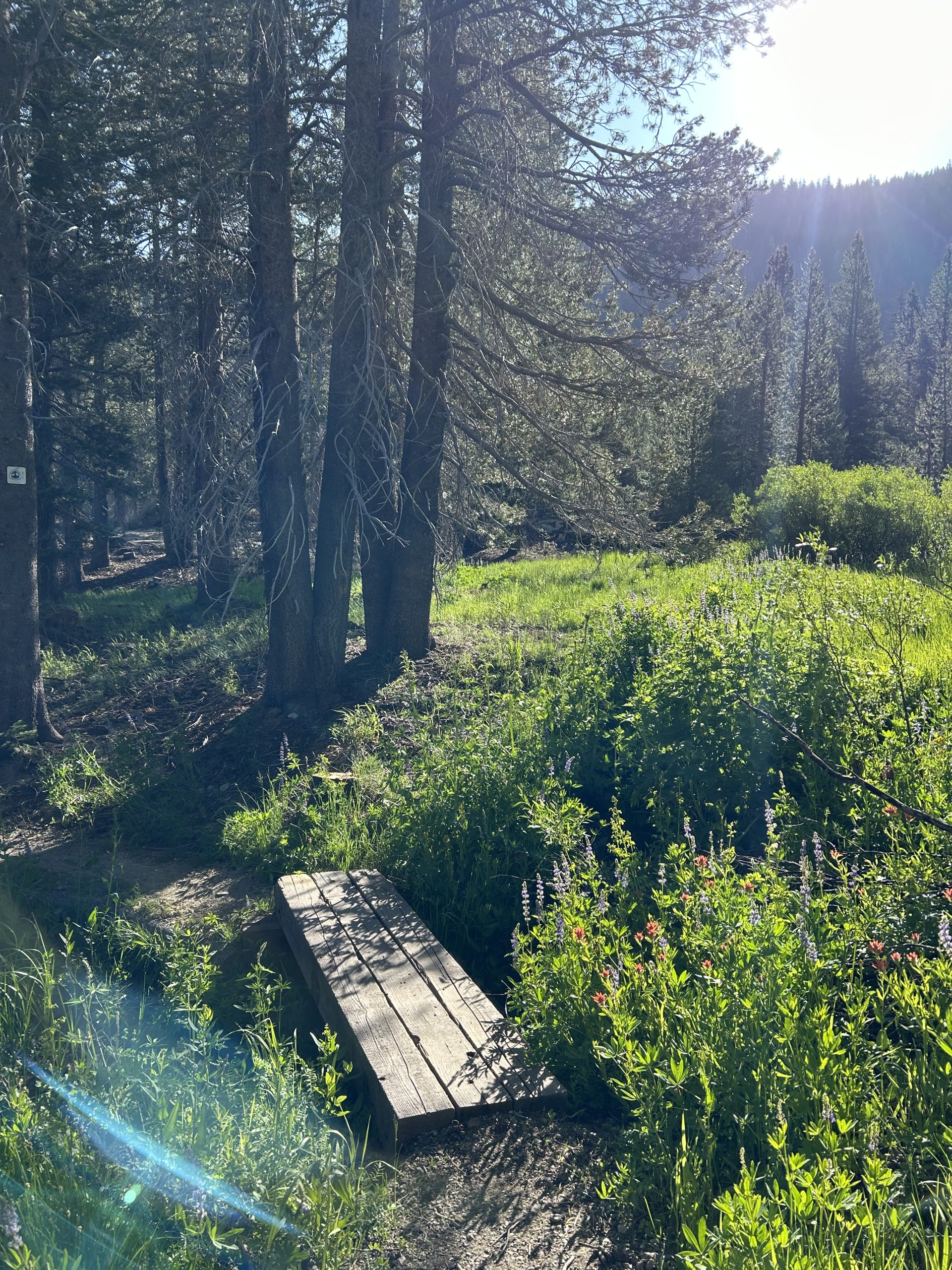
The trail at least was pretty and I enjoyed the green ferns and grasses around Sotcher Lake. It was still cold and windy and I could hear the wind whistling through the pine trees overhead and I hiked. The alternate was mostly flat and made for easy hiking, especially in the morning.
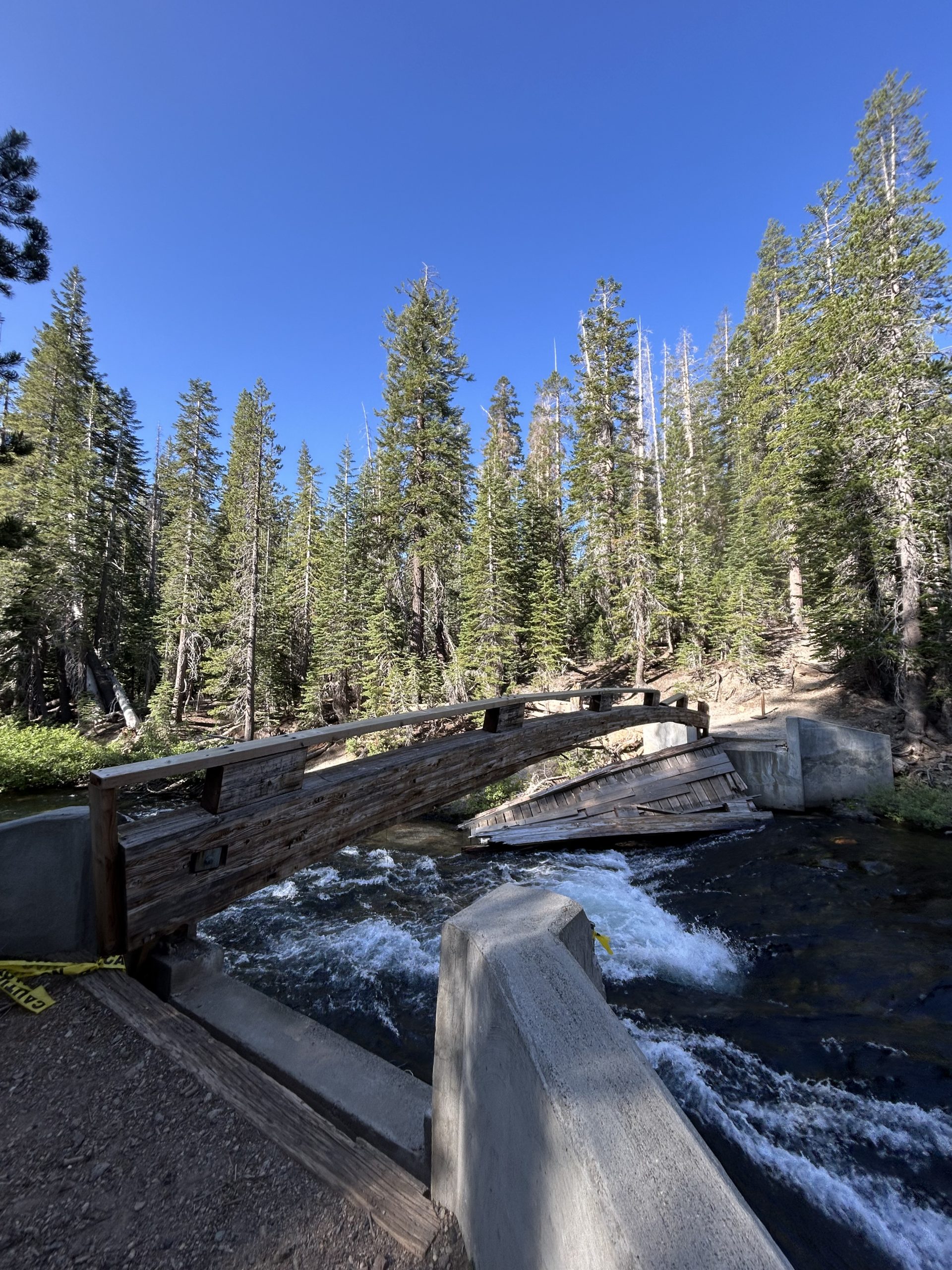
I caught up to Truffles where he was waiting for me at one of the campground we hiked through. We both said we were feeling tired and slow and neither of us hiked that fast today. We eventually connected back into the PCT and got to see the damaged bridge. The river looked so low, it was hard to imagine it rising enough to wash away part of the bridge. From there the trail began to climb and we slowly put one foot in front of the other.
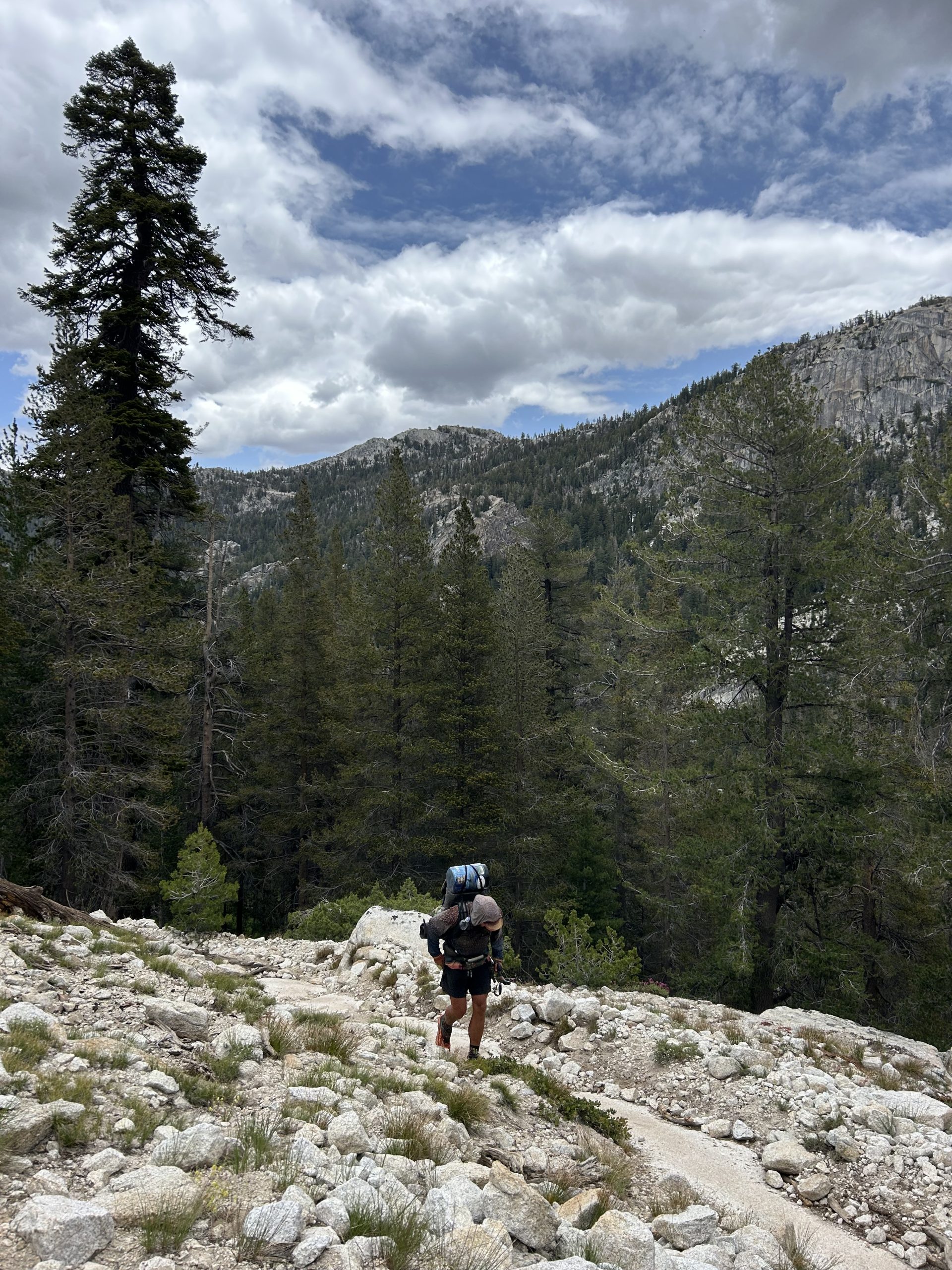
We hiked along the river for a while before climbing up towards Agnew Meadows. We meandered along the switchbacks, both still moving slow. We’ve carried more food out from town before, but my pack felt very heavy and I couldn’t get it to sit comfortably. My hip belt was digging into my hip bones and my shoulder straps were making my shoulders ache. I found myself looking for rocks to lean up again just so I could get a break from the full weight of my pack. Maybe it was having so many days off and my body is rebelling. Whatever the reason, I felt like I was struggling all day.
A highlight of the day came around Agnew meadow just before the campground junction. I saw 2 coyotes out in the field! They appeared to be eating something, and one head my approach and darted closer to the trail. It go within 20 feet of me and sat down to watch me. Truffles came up behind me and got to see it too, it seemed completely unbothered by us and was content to just watch us walk by.
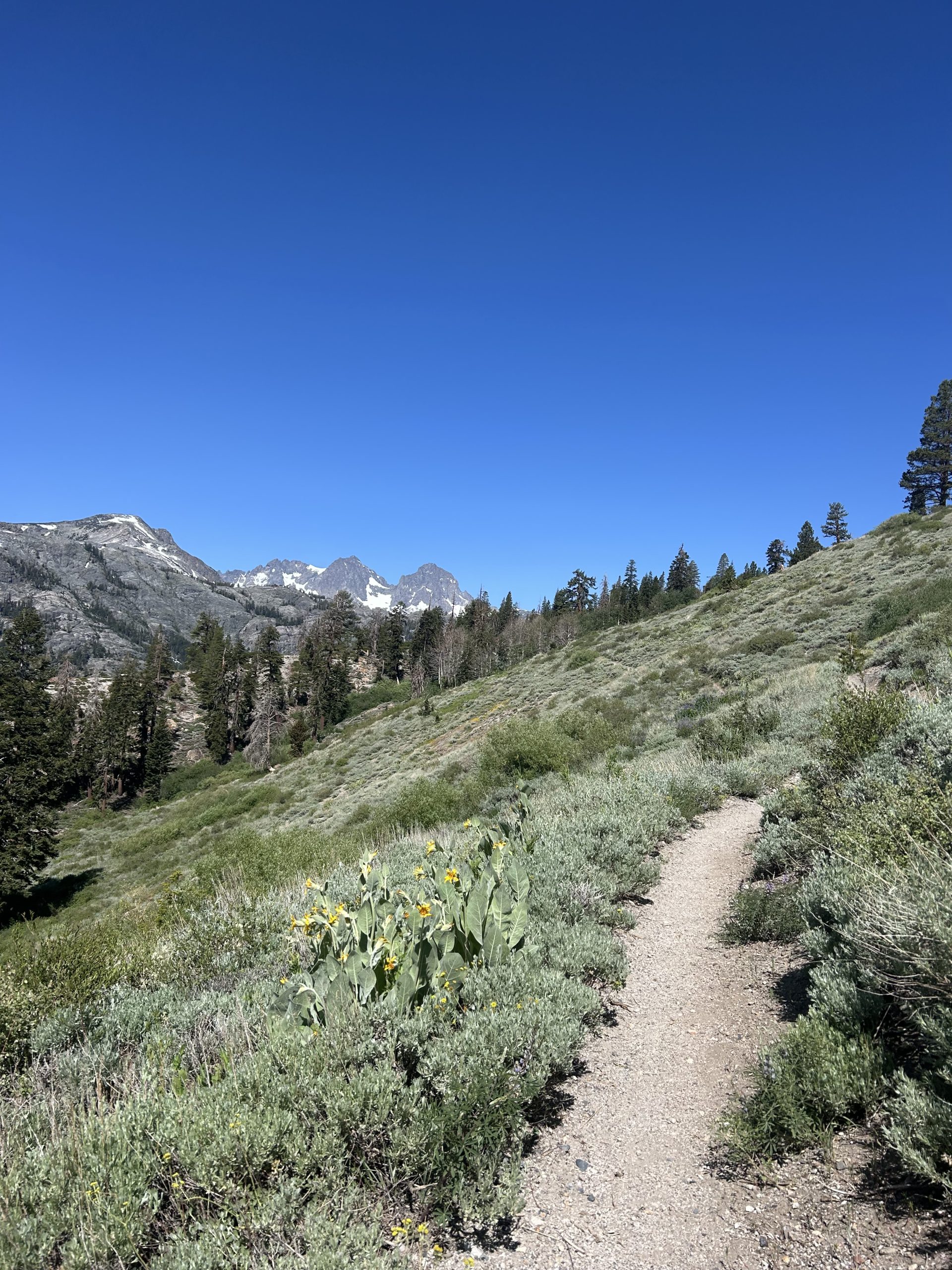
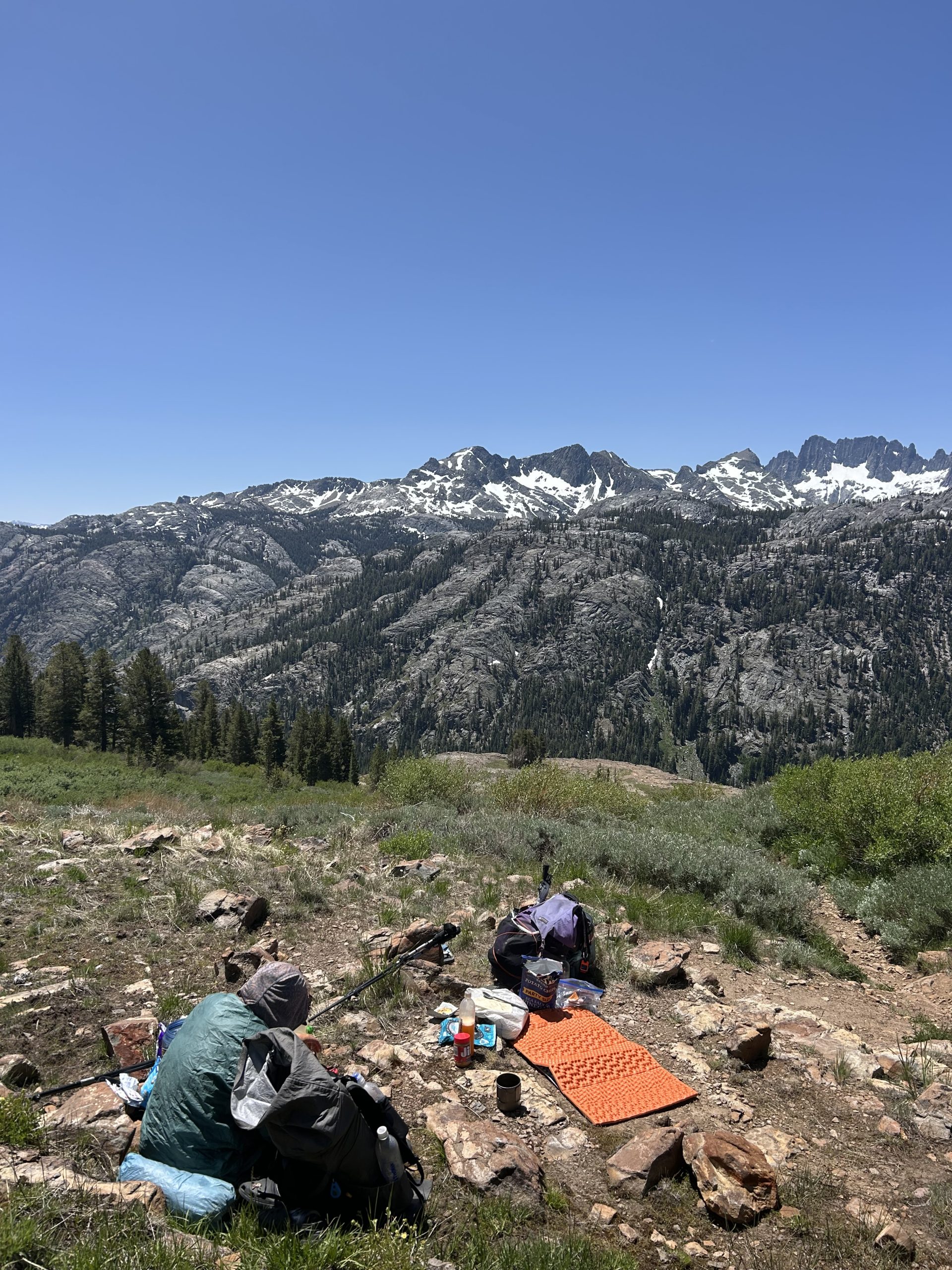
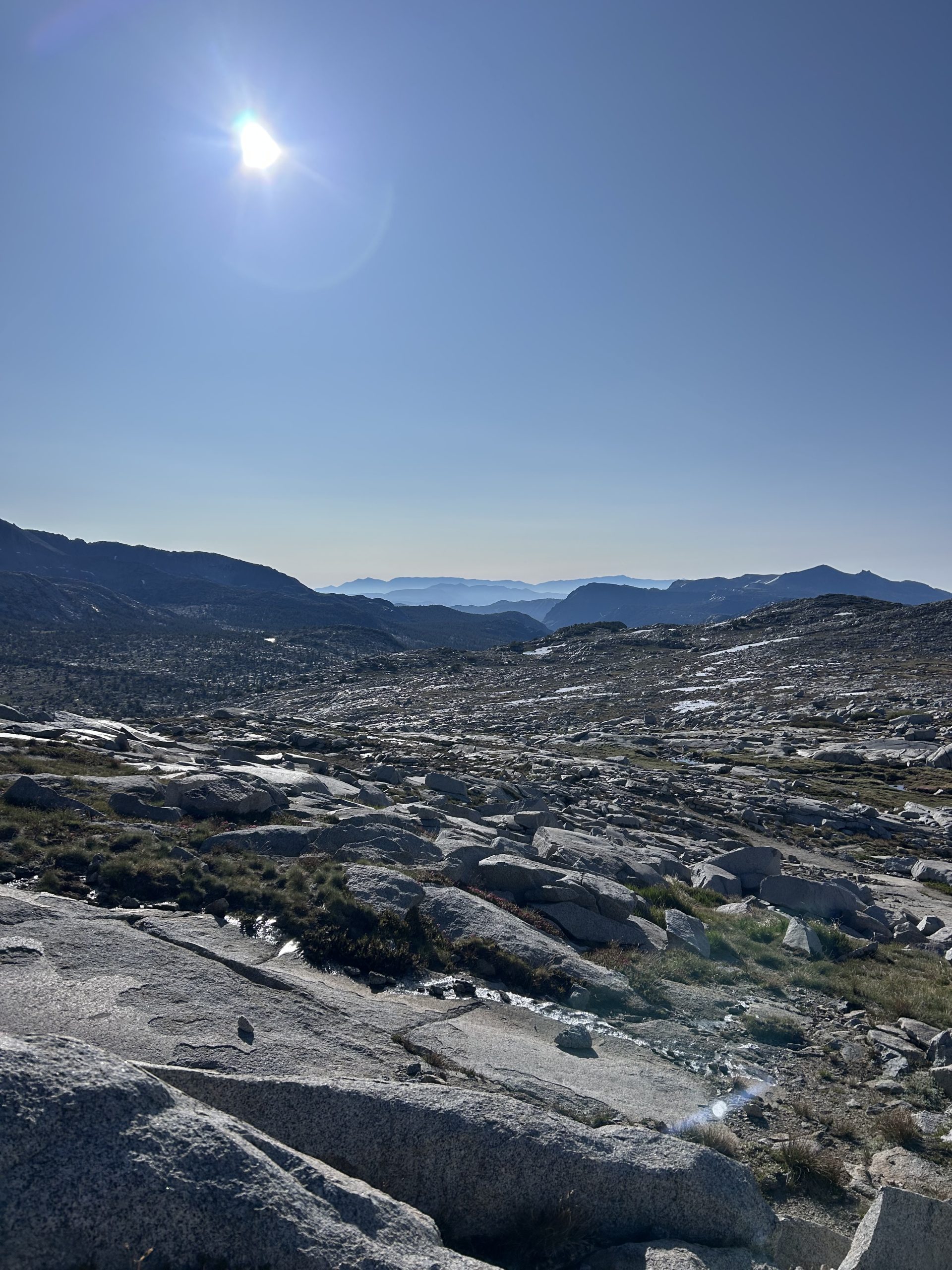
The rest of the day was all uphill. We passed a couple more pit tokens before starting more long switch backs. These got us up to elevation quickly and we walked for several miles along a flatish open meadow with dramatic views of snow covered peaks all around us. We stopped for lunch during this stretch around noon and it was easily one of the prettiest lunch spots so far on trail. The only downside was the wind which continued blowing and made for a chilly lunch stop.
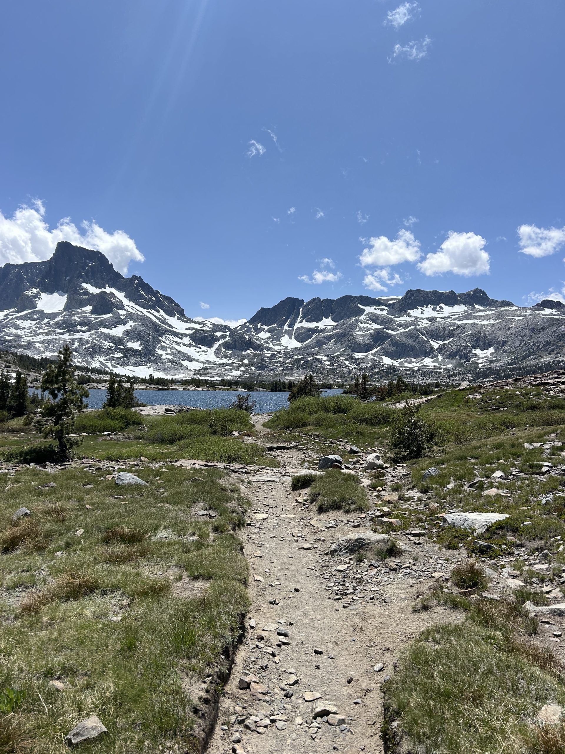
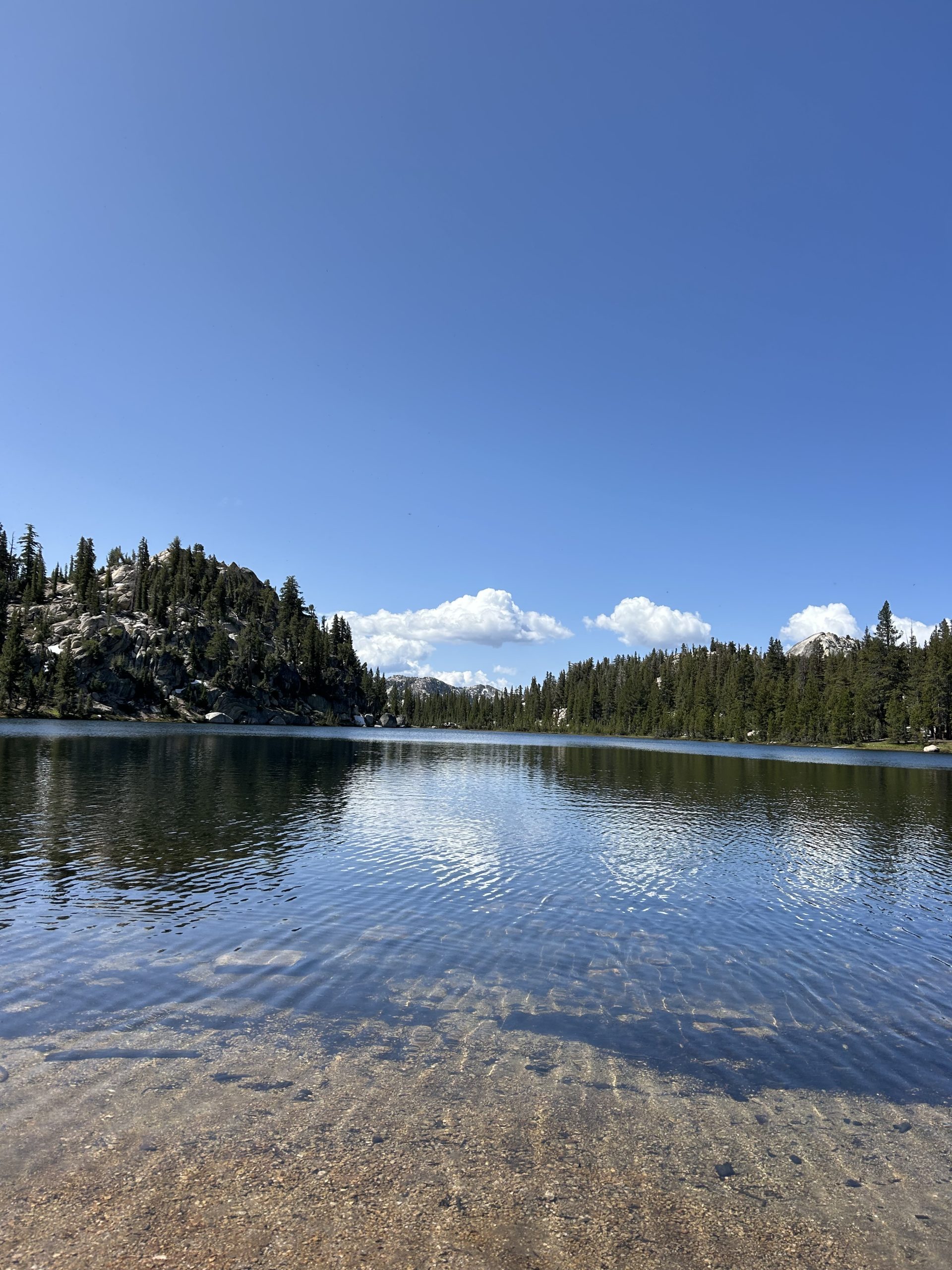
We started hiking again around 1pm with only 8 miles left in the day. The open meadow gave way to more pine trees before those too fell away and we were hiking over exposed rock. We kept climbing and were rewarded with views of Thousand Island Lake. The trail took us closer to the lake where we got even better views before continuing uphill.
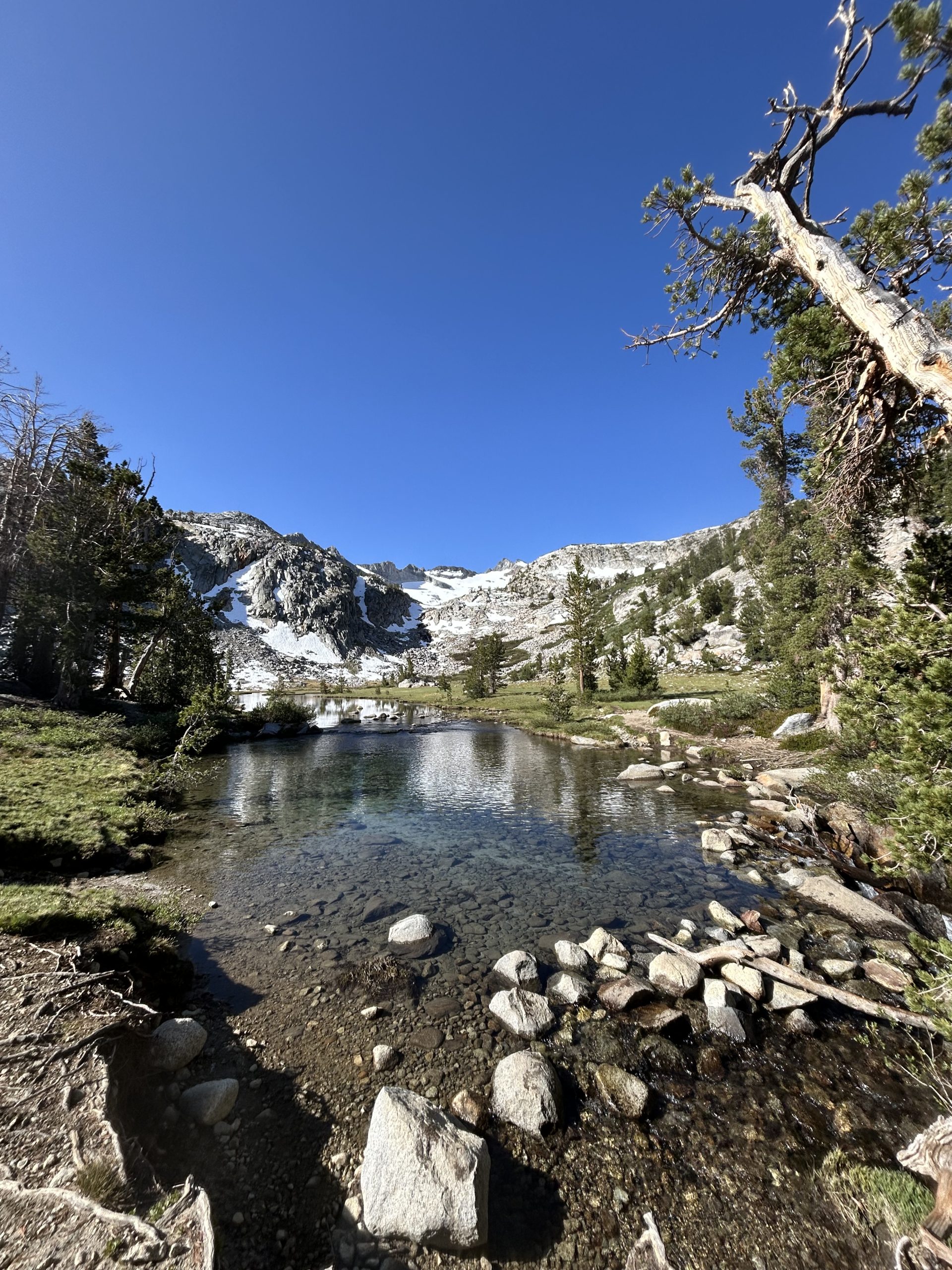
At the top of Island Pass we got to go downhill for a bit before starting to climb up towards Donohue Pass. We weren’t planning on going all the way to the pass, but wanted to camp just a couple of miles before it. We passed so many day hikers and backpackers in the later half of the day, we were worried our desired campsite would already be full. We crossed Rush Creek and saw a beautiful campsite and decided to call it early. We stopped just a mile shy of where we had planned to go, but I was exhausted and happy to be done.
While we were setting up several other hikers arrived at the campsite. I’m glad we got here when we did because we got a sweet spot! We set up the tent and made dinner. It was 50 degrees when we arrived and the wind just made it feel extra cold while we were eating. We got into the tent around 6:30pm just because it was so chilly and we wanted to get warm in our bags. We’re planning to do 24 miles tomorrow to get out of the “no camping zone” in a section of Yosemite. When we cross Donohue Pass tomorrow morning we’ll officially be in Yosemite!
Location: High Sierra
Start: Rush Creek – 928.1
End: Tentsite – 952.2
Miles: 24.1
Ascent: 2480 | Descent: 3768
Sleep: Tent
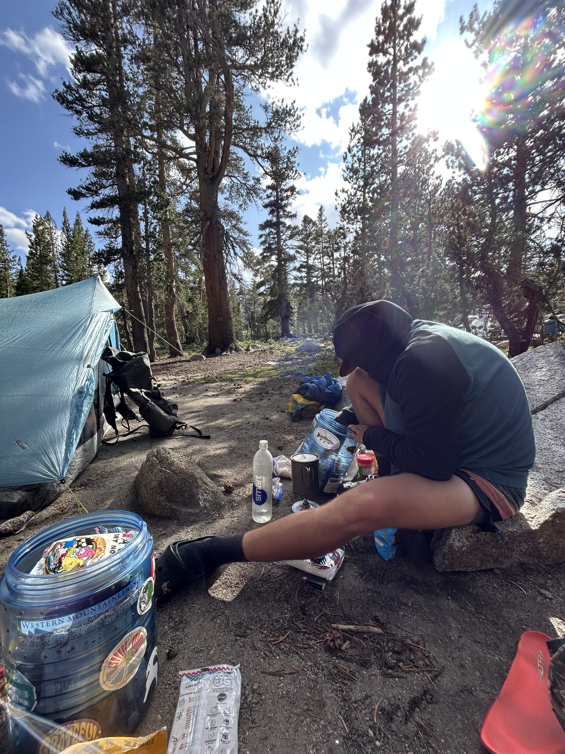
Today was a big day and I’m super proud of us for pushing through! We did just over 24 miles to get through the “no camping zone” in Yosemite. This morning I was worried we wouldn’t make it since we were planning to stop at Toulumne Meadows store, but we stayed there 2 hours and still managed to make it to our desired campsite for the night!
The day started off frigid, Truffles’ thermometer said it was 30 degrees in the tent when we woke up. It was hard to get going in the cold, and we both left camp on our mid layers and rain pants. I thought the climb right off the bat would warm us up, but the cold wind kept me chilled to the bone. The scenery was so pretty this morning with minimal snow and lots of flowing water. There was a decent amount of ice on the trail wherever there was water. It really was cold!
We climbed up Donohue pass without any issues. There was maybe a tenth of a mile section of trail that had snow on it, but otherwise it was smooth sailing and easy trail. We got up and over the pass and were only a little disappointed there wasn’t a big sign to announce our entry into Yosemite. We passed a handful of other hikers on the descent, one of whom was Jenni, my friend from high school.
The descent was several miles long but thankfully went by quickly. It was steep in sections, especially along the areas with the narrow stone stairs. The views were pretty looking down towards the river and into the meadow far below. It didn’t take long for us to reach that meadow, though, and from there it was easy cruising.
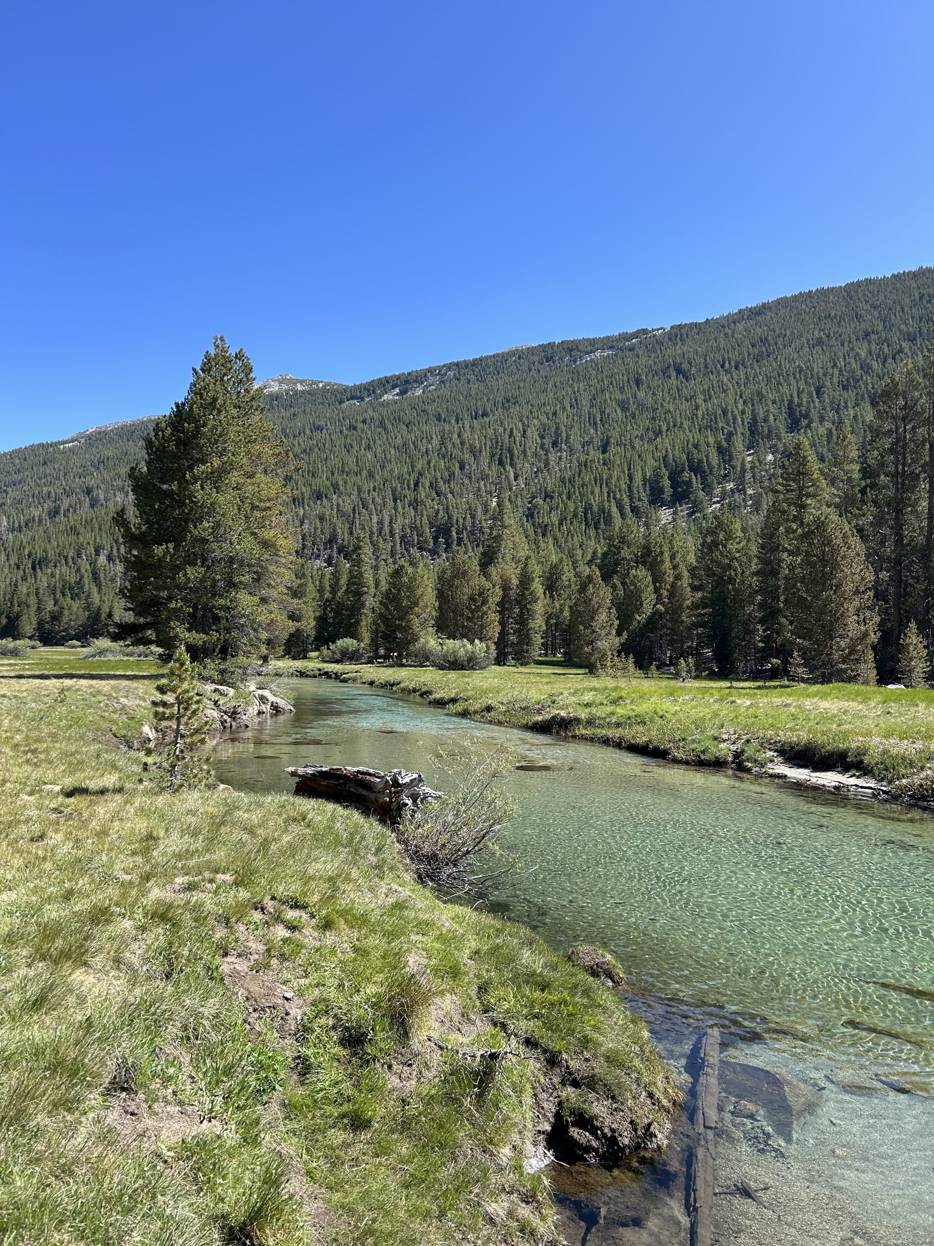
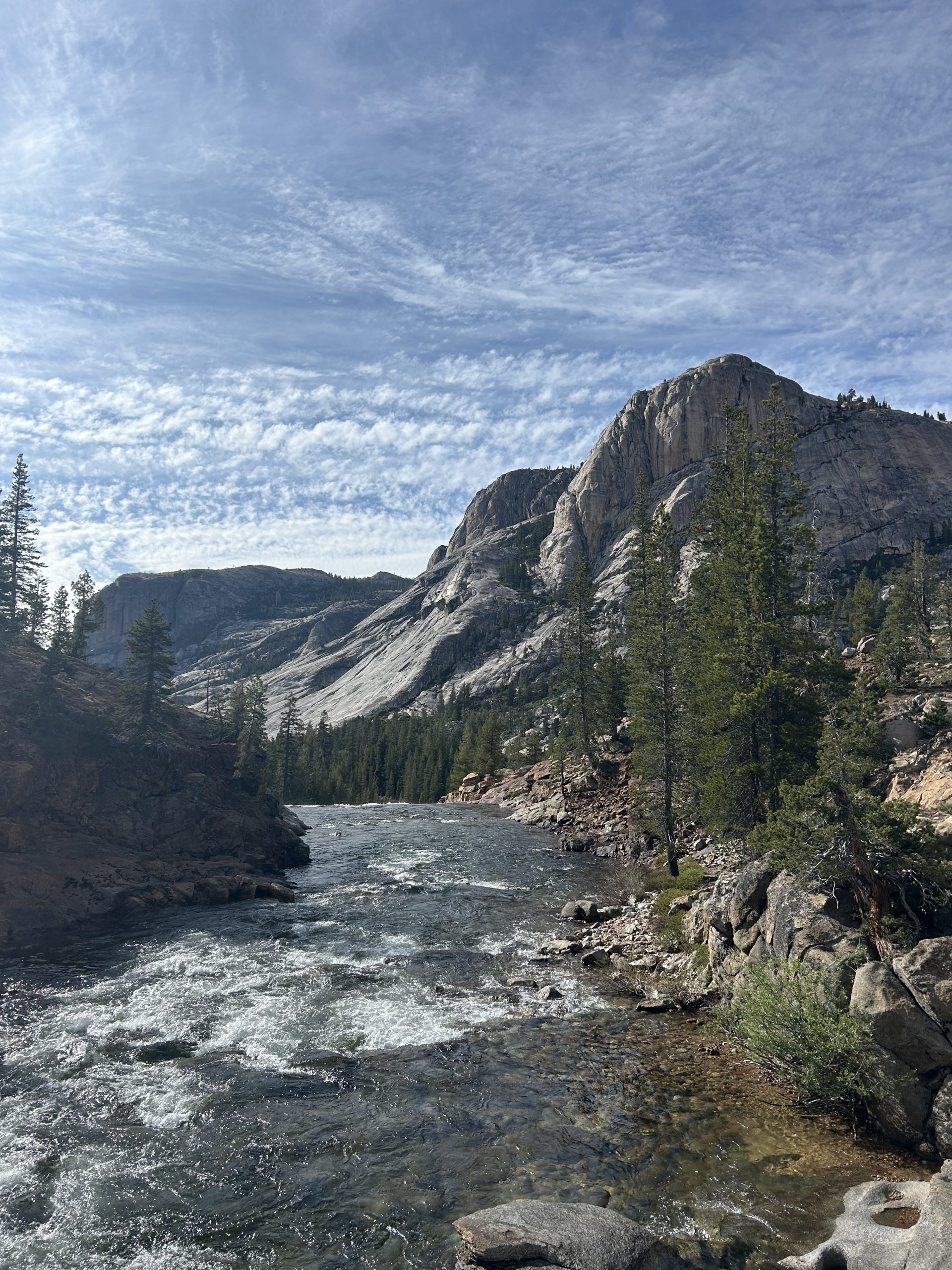
We were very motivated to get to the grill, so we tried to fly along the flat land. We followed the river the majority of the time and it was beautiful! It was super clear and blue in places and we could see fish swimming around. We started passing day hikers and other folks out for backpacking trips. It’s weird seeing other people since we’ve only been seeing a handful of other hikers each day.
We tried to minimize our breaks in order to get to the store. I could feel my energy starting to wane but kept pressing forward with images of Dr. Pepper and hamburgers dancing in my head. Finally we made it to the road where it was a short walk down to the store. Thank goodness the grill was open today despite it being Sunday!
We each ordered two double cheeseburgers a piece and went to charge our battery banks and look through the store. We figured out that we have enough food to get us to Kennedy Meadows North, so all we bought were drinks to go with our lunch and post cards to mail home. We picked up our food and went to eat on the picnic tables outside along with Scout Master.
We hadn’t seen Scout Master since around Forester, so it was nice to catch up with him. He got wilderness permits to go off trail in the park for the next few days, so hopefully we’ll run into him again once he’s done gallivanting around. Since we took so many days off in Tahoe we haven’t recognized many of the people we’ve been hiking around so it was nice to have lunch with a familiar face.
Scout Master went on his way after finishing his meal, but as he left Jenni walked up. She came to sit with us and we spent more time catching up and leaning about what the other has been doing since high school. Another familiar face staggered up, Mock! We hadn’t seen him since Mike’s Place early on in the desert, so we were shocked to run into him. It was so good to chat with him about his hike so far and hear about his recent mini backpacking trip he went on with his brother in Yosemite.
Around 3pm Truffles and I decided we needed to pack up and get on the trail. We bid farewell to our friends and set off. The trial followed the road for a little bit and then turned into a wide open gravel trail on the way to Soda Springs. It made for easy walking and it was beautiful to walk through the famous Toulumne Meadows. We saw deer in the meadow and enjoyed reading the informational signs scattered about.
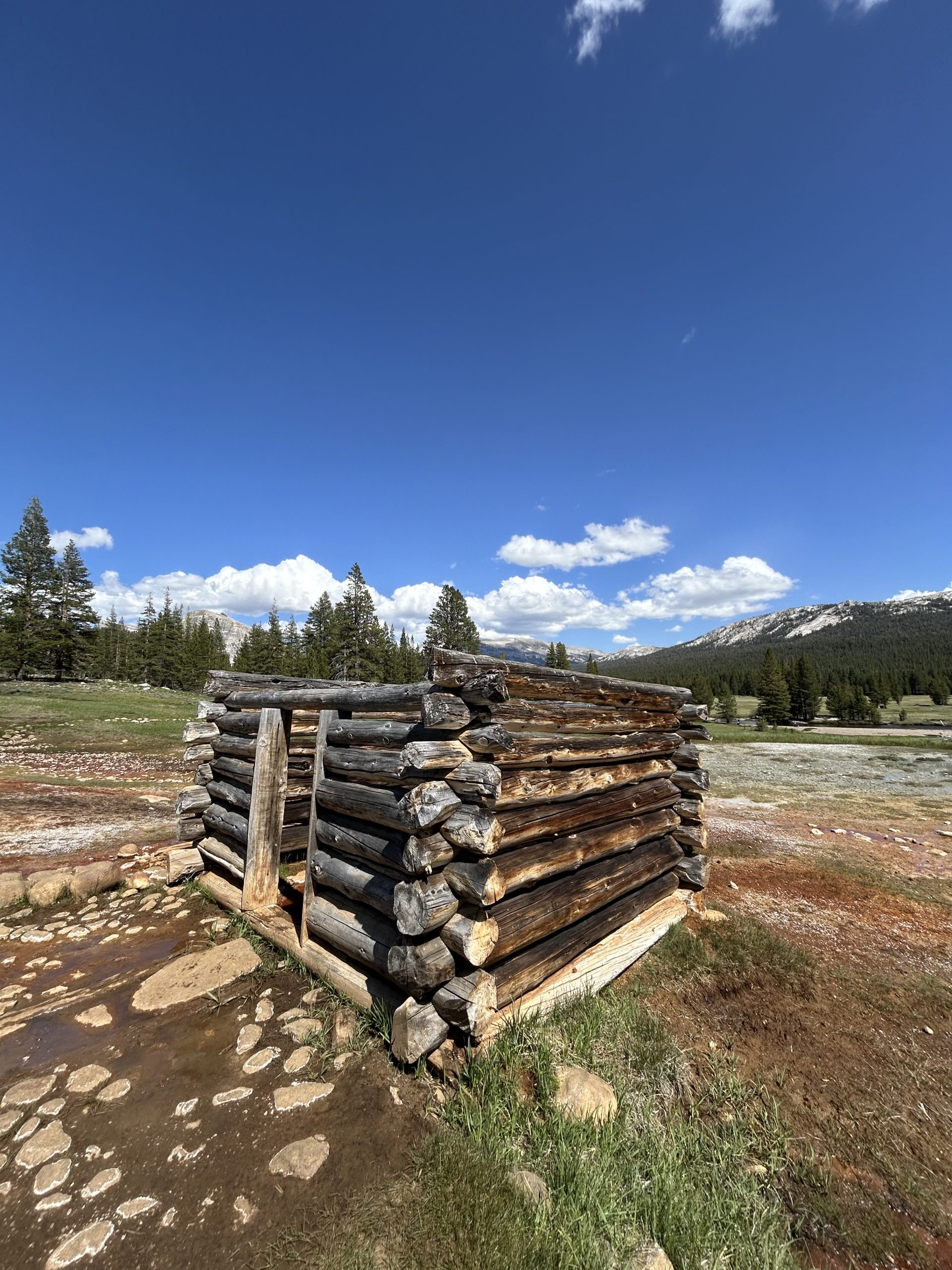
We made it to Soda Springs where I was delighted to find little spring house. The water was bubbling up out of the earth and we filtered a little to give it a try. It was very metallic tasting and carbonated which made for a strange mix. Neither of us were crazy about the taste so we dumped the bag and kept hiking. The trail was again super flat, gentle, and smooth and we were able to boogie on down the trail. We continued seeing other people, but the further away we got from the road the less and less we saw.
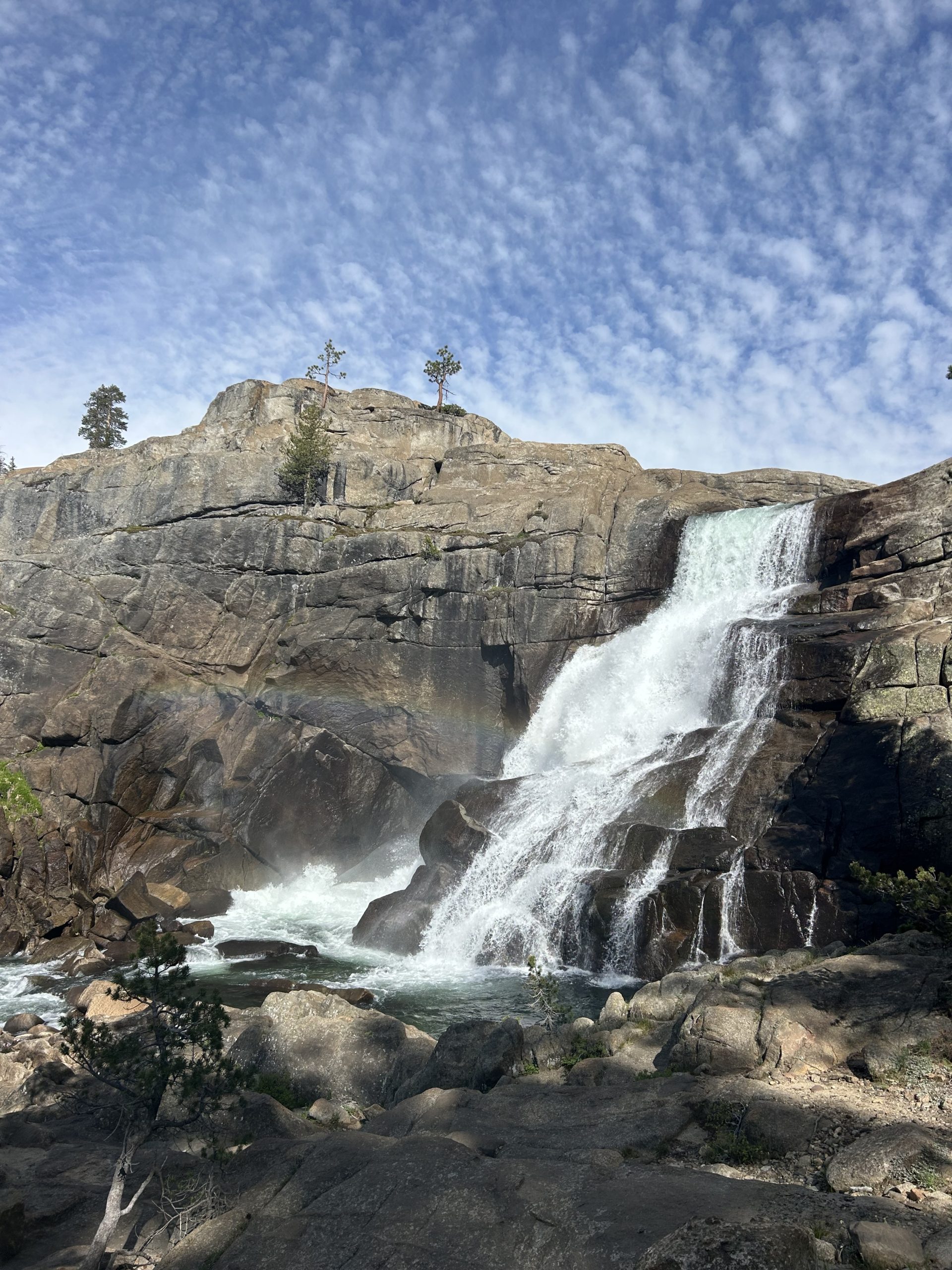
We hiked over multiple bridges and alongside the river and over rocks in the afternoon. It was flat and easy until we had a sharp downhill towards Tuolumne Falls. There were lots of stairs that took us down closer to the falls and we had plenty of opportunities to pause and admire the mighty falls and the rainbows shimmering in the afternoon light.
Once we were at the base of the falls the trail began to climb again. We only had a few more miles to the campsite but we were tired and didn’t want to go uphill. Our water was also dwindling so I tried to sip sparingly. About 2 miles from the campsite we passed a creek and decided to go ahead and filter water for the night. FarOut made it seem like the campsite was dry, but there were conflicting comments. We didn’t want to risk it so we filled up what we’d need for the night and morning and then set off.
The last few miles felt hard because they were uphill and I was tired. There were also insufferable mosquitoes that made it impossible to stop, otherwise we’d be swarmed. We kept moving (very slowly) and finally got to the campsite. The mosquitos were so bad while we were setting up the tent that we chose to eat inside the safety of the tent. We had packed out a burger from the store and split it for dinner. I also made Ramen and and ate it as it started to sprinkle.
The rain was short lived and we were able to set up our sleeping stuff once we were finished eating. It sleeted for a bit but thankfully it’s not nearly as cold as last night since it’s not windy. We are both beat so I know we’ll rest well!
Location: High Sierra
Start: Tentsite – 952.2
End: Tentsite – 974.0
Miles: 21.8
Ascent: 4209 | Descent: 5337
Sleep: Tent
I feel like I’ve been starting every journal recently with “what a big day” and today is no different. Truffles and I are constantly cranking out over 20 mile days and it feels good to be exhausted when we get to camp. I spent a lot of time today contemplating if I could do more miles, but I feel pretty spent when we get to camp. I wonder if that’s partially mental, though, because I know where we’re going to camp at each night and can say “I have to do X amount of miles today”. If we were going further, would I feel better throughout the day knowing “we’re doing 30 miles today” because I’d be mentally prepared? I’m not sure but when the terrain flattens out more I think we’re start pulling even bigger days.
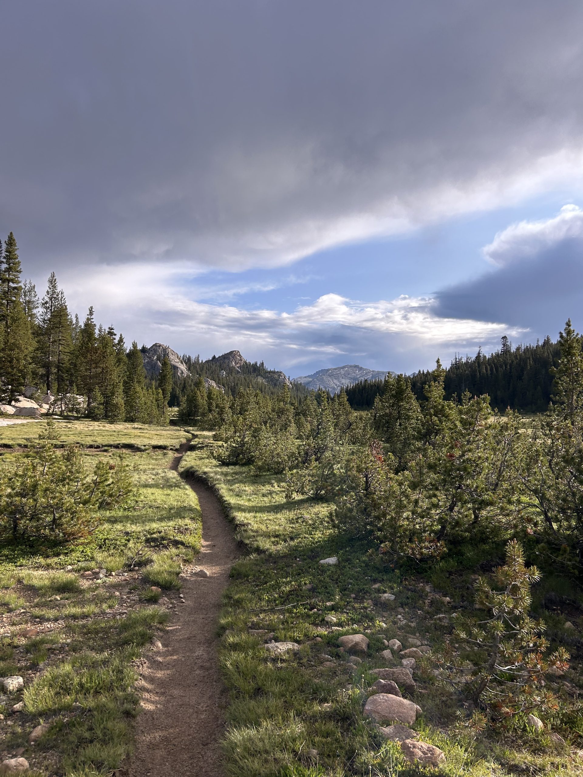
Today was a big day, though, just looking at the elevation! Lots of up and lots of down. The day started off with a gentle climb and descent into a large meadow. We walked through several meadows throughout the day. It was overcast and cloudy when we got up, and the meadow breeze and lack of sunshine made for a chilly start.
The meadow turned into pine forest and we kept cruising right along. There were several stream crossings this morning but we were able to rock hop across them without getting our feet wet. We went down a steep descent before crossing a creek and beginning the climb up towards Miller Lake.
On the elevation profile it looked short and steep, but it felt very long and drawn out while in the midst of it! There were countless switchbacks that kept us climbing up and up. We were hiking through pine trees and I could see pockets of blue sky peaking through the needles as we got closer to the top.
As we neared the top we ran into Turkey and Poppins who we hadn’t seen since leaving KMS. They are a middle ages German couple and are so friendly, we stopped to talk with them for a while and told them all about our tramily’s disbanding due to injuries. We wished them well and continued on our way to the lake.
Reaching Miller Lake was great because it meant that the first climb of the day was done. We stopped to filter water and take in the view. When the wind wasn’t blowing, the water was glassy calm. I watched water bugs dance across the placid surface as I filtered water. When the wind picked up, small choppy waves appeared on the lake’s surface. I could have sat in the sun by the water for hours were it not for the mosquitoes attacking us. We tried to get moving again quickly just to escape the onslaught.
After the lake we had another steep descent. I like the cardio break in a descent but these steep downhill grinds have me moving slow for my knee’s sake. Eventually we made it down to the bottom and shin got to walk through a meadow along a river. We decided to take lunch before the big climb and stopped by Wilson Creek. The mosquitoes were again out in full force and we were constantly swatting them away. Thankfully the bug spray helped keep them off my exposed skin, but their swarms were still annoying flying around my head while trying to eat.
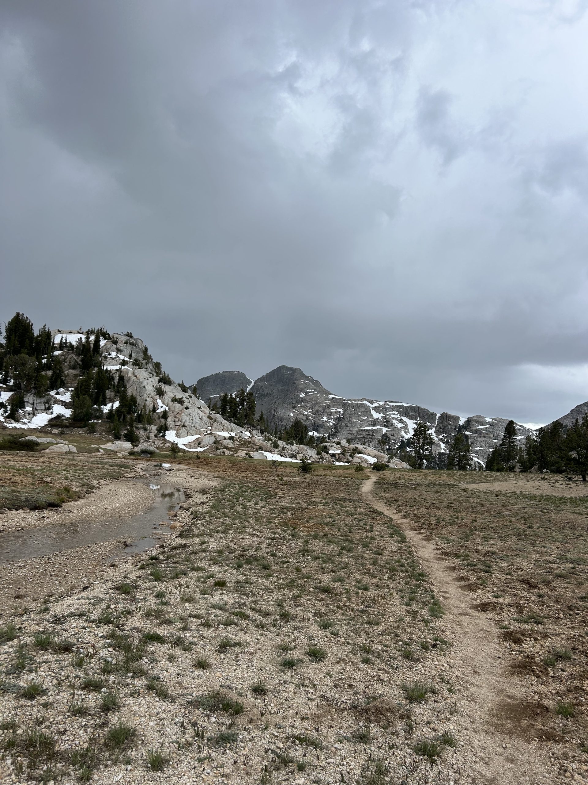
After lunch we had to climb Benson Pass. It was only 3 miles to the top, but there were steep sections and more stream crossings. Some areas had even been flooded so it was challenging to find the trail since it appeared to have washed away. Despite all this, the first 2 miles went by rather quickly and painlessly. The last mile, though, was tough.
All day the weather had been cool and cloudy, but after lunch the skies turned dark. We could embrace thunder rumbling in the distance and had to decided if we thought we could get up and over before the storm broke. We decided to hustle the last mile and the clouds continued to darken. We huffed and puffed the whole way up but kept moving and finally crested the pass. We could see down to the meadow below us and knew we needed to keep moving.
We never saw any lightning, but there was plenty of thunder as we hurried through the meadow at 10,000 feet. Once across we began to descend, we were thankful to be going lower in elevation should the storm hit. It started to sleet on us as we hiked down, but thankfully it didn’t hinder our progress.
We hiked down as quickly as we could in case the weather got worse. All it did was sleet on us a little on and off for a couple of hours, but the temperature did drop significantly. It had been in the low 60s all day, but as we were coming down from elevation it dropped to 44 according to Truffles’ thermometer. We passed Smedberg Lake and had one final short uphill before the junction to take us down towards Benson Lake. The final uphill was steep and had my legs aching, but once we got to the top we put our rain jackets on to avoid the increasing sleet/rain mixture and began heading downhill.
We had about 3 miles left in the day but I felt pretty gassed at this point. The downhill was steep and rocky on top of being slick, so I was moving slowly. It felt like it took forever to cover the last few miles. Finally we made it down to the bottom, only to have to cross multiple creeks and streams. Of course the final crossing couldn’t be managed by rock hoping it a log walk, so we had to wade through. Thankfully the water was only about calf high, but I hated to get my shoes went right before camp especially since they likely won’t dry out in the damp weather overnight.
We filled up our dirty water bags at the creek and began walking towards what we thought would be a dry campsite. The first campsites we came to were very swampy, so we continued on and found a wonderful spot tucked away near some trees. The only downside was the swarms of mosquitoes buzzing about. We put the tent up and quickly and we could and dove into safety. This has become the new norm at camp unfortunately since the bugs have been so bad. We tried to minimize the need to leave the tent or even open the big net doors. We ate dinner in the tent and then set up to get ready for bed. We’ve earned a good night’s rest, hopefully I won’t dream of mosquitoes!
-

 Brand Stories2 weeks ago
Bloom Hotels: A Modern Vision of Hospitality Redefining Travel
-

 Brand Stories7 days ago
CheQin.ai sets a new standard for hotel booking with its AI capabilities: empowering travellers to bargain, choose the best, and book with clarity.
-

 Destinations & Things To Do2 weeks ago
Untouched Destinations: Stunning Hidden Gems You Must Visit
-

 Destinations & Things To Do6 days ago
This Hidden Beach in India Glows at Night-But Only in One Secret Season
-

 AI in Travel2 weeks ago
AI Travel Revolution: Must-Have Guide to the Best Experience
-

 Brand Stories4 weeks ago
Voice AI Startup ElevenLabs Plans to Add Hubs Around the World
-

 Brand Stories3 weeks ago
How Elon Musk’s rogue Grok chatbot became a cautionary AI tale
-

 Asia Travel Pulse4 weeks ago
Looking For Adventure In Asia? Here Are 7 Epic Destinations You Need To Experience At Least Once – Zee News
-

 AI in Travel4 weeks ago
‘Will AI take my job?’ A trip to a Beijing fortune-telling bar to see what lies ahead | China
-

 Brand Stories4 weeks ago
ChatGPT — the last of the great romantics
You must be logged in to post a comment Login