
Destinations & Things To Do
The Laugavegur Trail | Day 1 | It’s Go Time!
I woke up at 8:00 a.m. to a world wrapped in fog—52 degrees, low clouds, and rain expected by late afternoon. Seven miles stood between me and the next hut, and I had one goal: move with purpose and hope to beat the weather.
That’s the mindset you slip into when you’re hiking solo in a foreign landscape—accountable to nothing but your body, your instincts, and the ever-shifting sky.
I packed my tent with intention, separating the rain fly from the inner. If your setup allows it, do it. There’s nothing better than being able to pitch a dry space in the middle of a downpour.
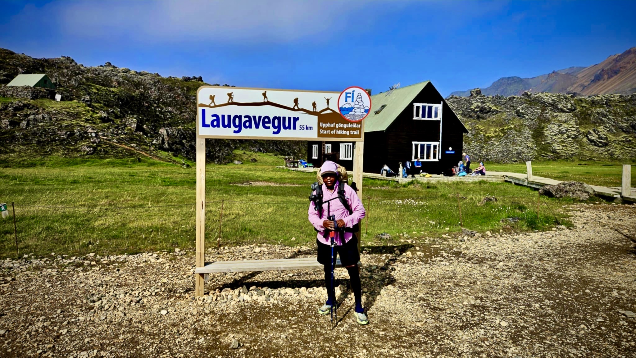
I took some Vitamin I (ibuprofen) for my hips and lower back—unusual for me, but I’ve come too far to let an ache distract me from my commitment. After a quick breakfast, I hit the trail around 10:20 a.m.—and just as I did, the sun broke through the clouds. My thru-hike of the Laugavegur Trail had officially begun.
Keep Going!
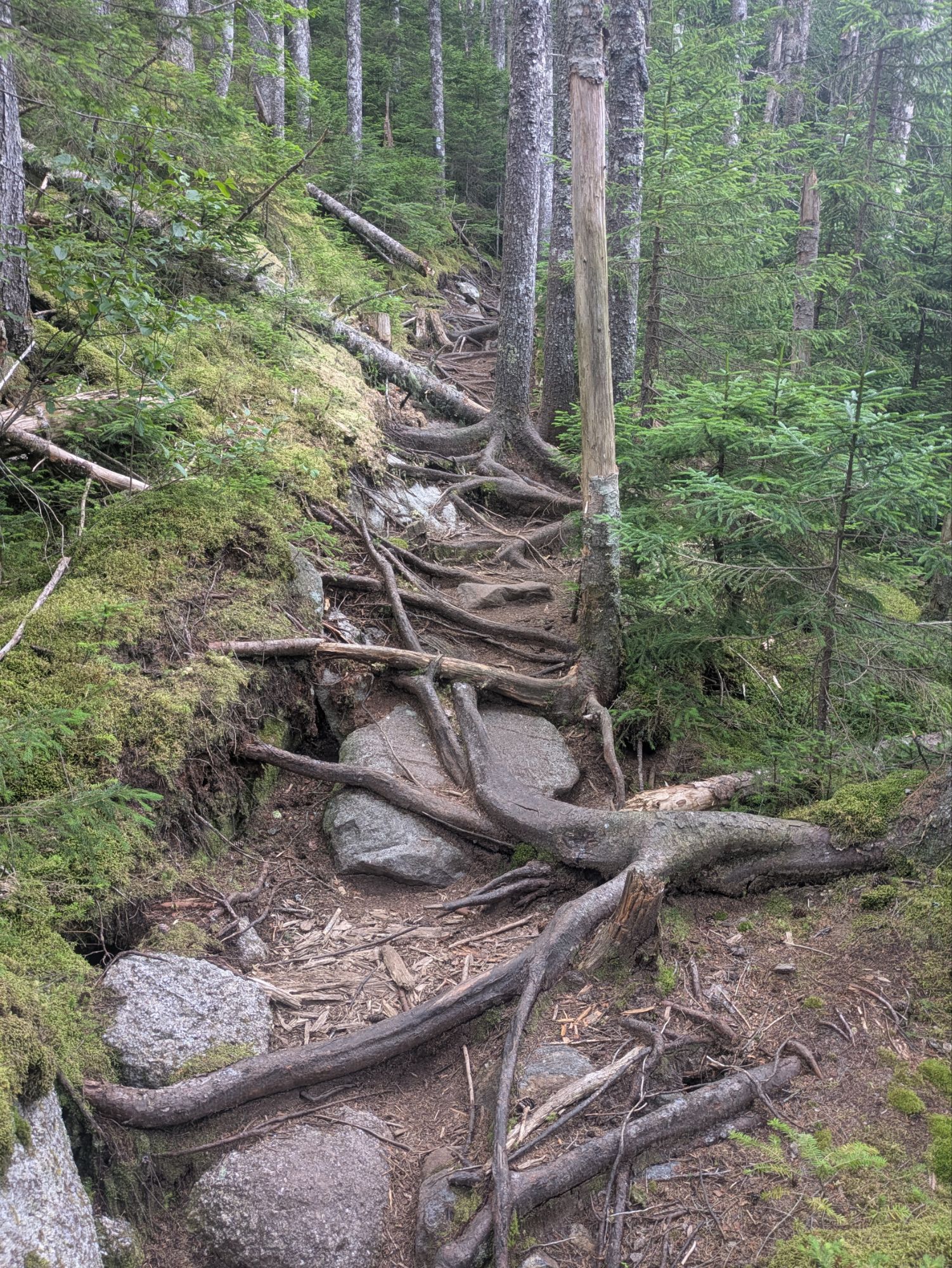
The hike kicks off with a climb—steep and steady—then teases you with a brief flat section before throwing you right back into the uphill grind. And then more climbing after that. I felt it immediately. Between yesterday’s warm-up hike and exploring every corner of Reykjavík the day before, I already had 24 miles on my legs. They were tired. My body was talking.
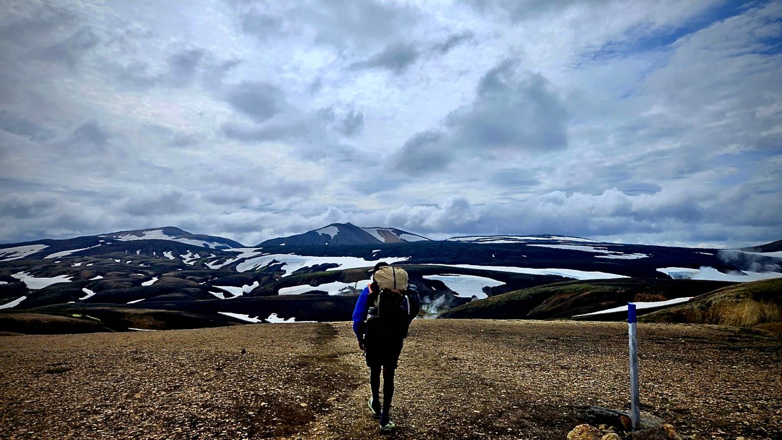
But the trail was louder. And what it said was: Look at this.
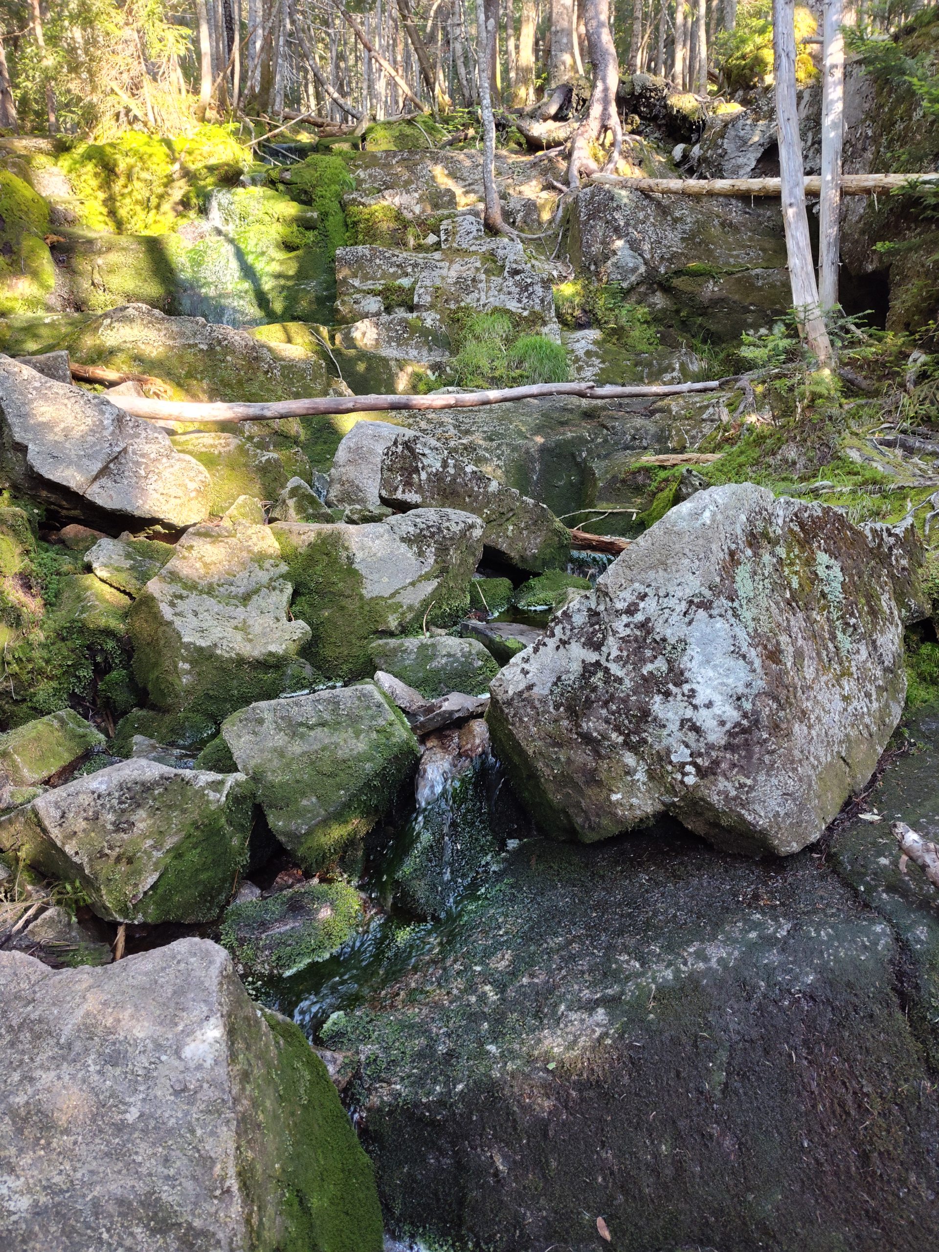
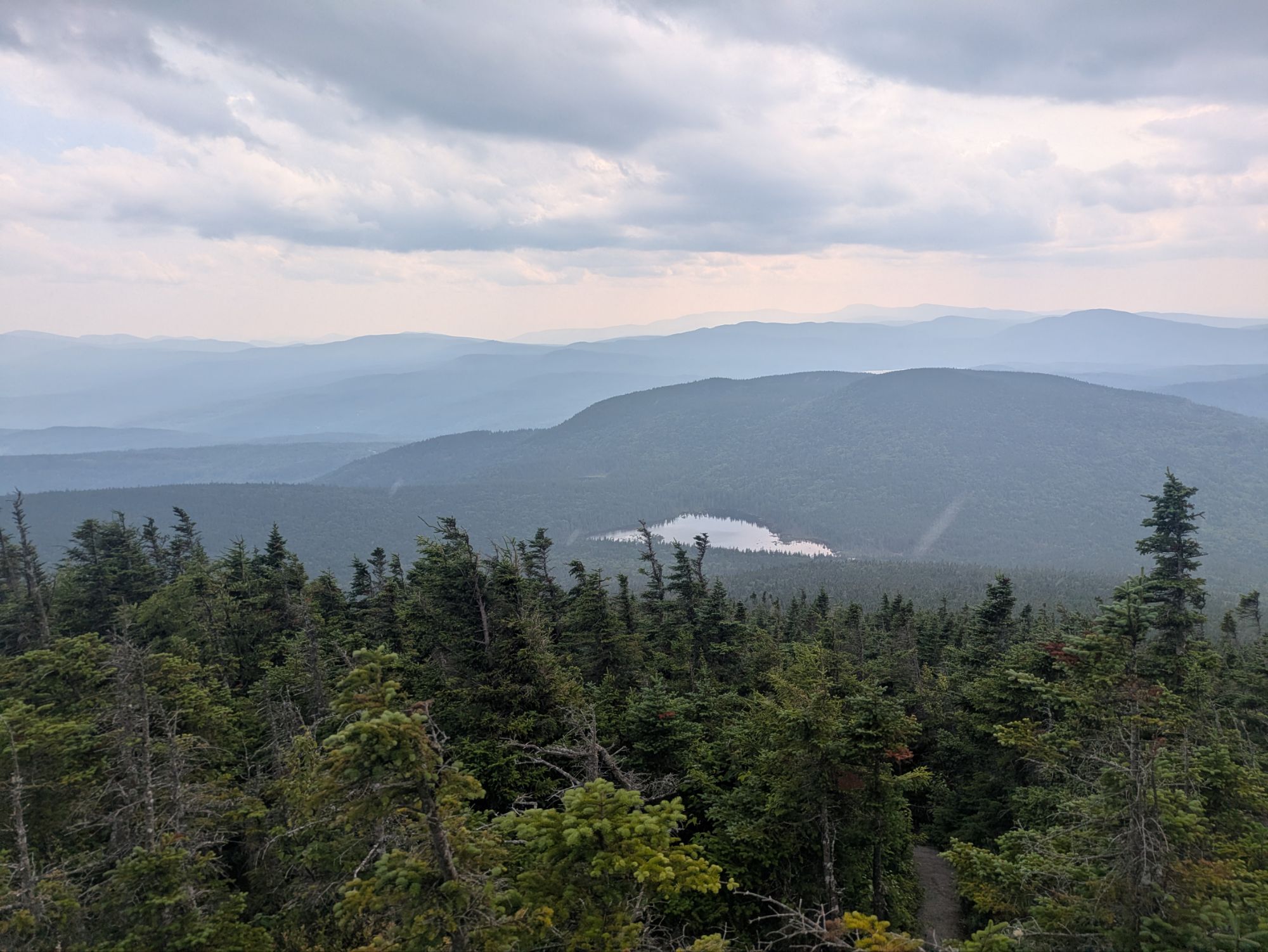
I was walking through a landscape sculpted by fire and ice—ancient lava fields hardened into black rock, ridges carved by glaciers long gone. The ground beneath me shifted between loose volcanic soil and solidified flows of obsidian and basalt. In the distance, multicolored rhyolite mountains glowed in muted pinks, oranges, and greens—minerals reacting to centuries of geothermal heat. Patches of snow still clung stubbornly to the hillsides, defying summer.
So I kept walking.
People and Lemon Drops
One of the best parts of hiking isn’t just the scenery—it’s the people you meet while chasing it.
First, there was Kiel, a 22-year-old from the Netherlands on his third Laugavegur trek. He had just wrapped up a multi-month hike in New Zealand and came straight to Iceland to hike this trail with his family. Next up? Moving to Banff to work at a resort. He’s got the kind of fearless spirit I admire—and, okay, envy just a little.
Then there was a man originally from Ohio who’s lived in Germany for over two decades. We touched on politics—just briefly—but isn’t it wild how even in the middle of Iceland, “Do you like Trump?” still becomes the universal conversation filter?
By that point, between the steep climbs and all the small talk, I was feeling a little socially overloaded.
Later, I crossed paths with Caitlin and Brad. She grew up in Rochester—where most of my family lives now—and when I mentioned Route 104, she knew exactly what I meant. Small world, big trail.
She offered me chocolate-covered Kix, and I traded her some lemon drops. Bartering candy on a glacier—just another day in the Icelandic Highlands.
One Goal. Nothing Else.
Somewhere in the middle of the trail, something unexpected happened—my brain shut up.
No spinning thoughts. No mental to-do lists. No wondering if I remembered to Venmo my ex-wife for the kids’ something-or-other. No checking in.
Just one clear mission: Get to the hut and set up camp.
That was it. No multitasking, no second screens, no tabs open in my mind. This was rare. It was kind of magical.
For once, I wasn’t everywhere—I was right here.
A Little Rain, A Lot of Gratitude
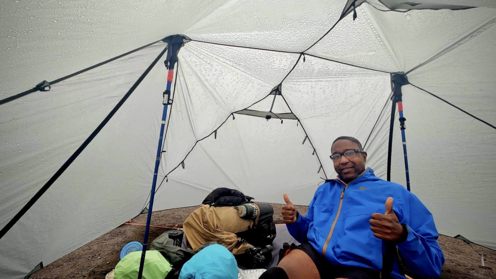
The last mile, the sky finally gave in. I felt the first drops, looked up, and saw the clouds stacking into rain formation. So I pushed hard.
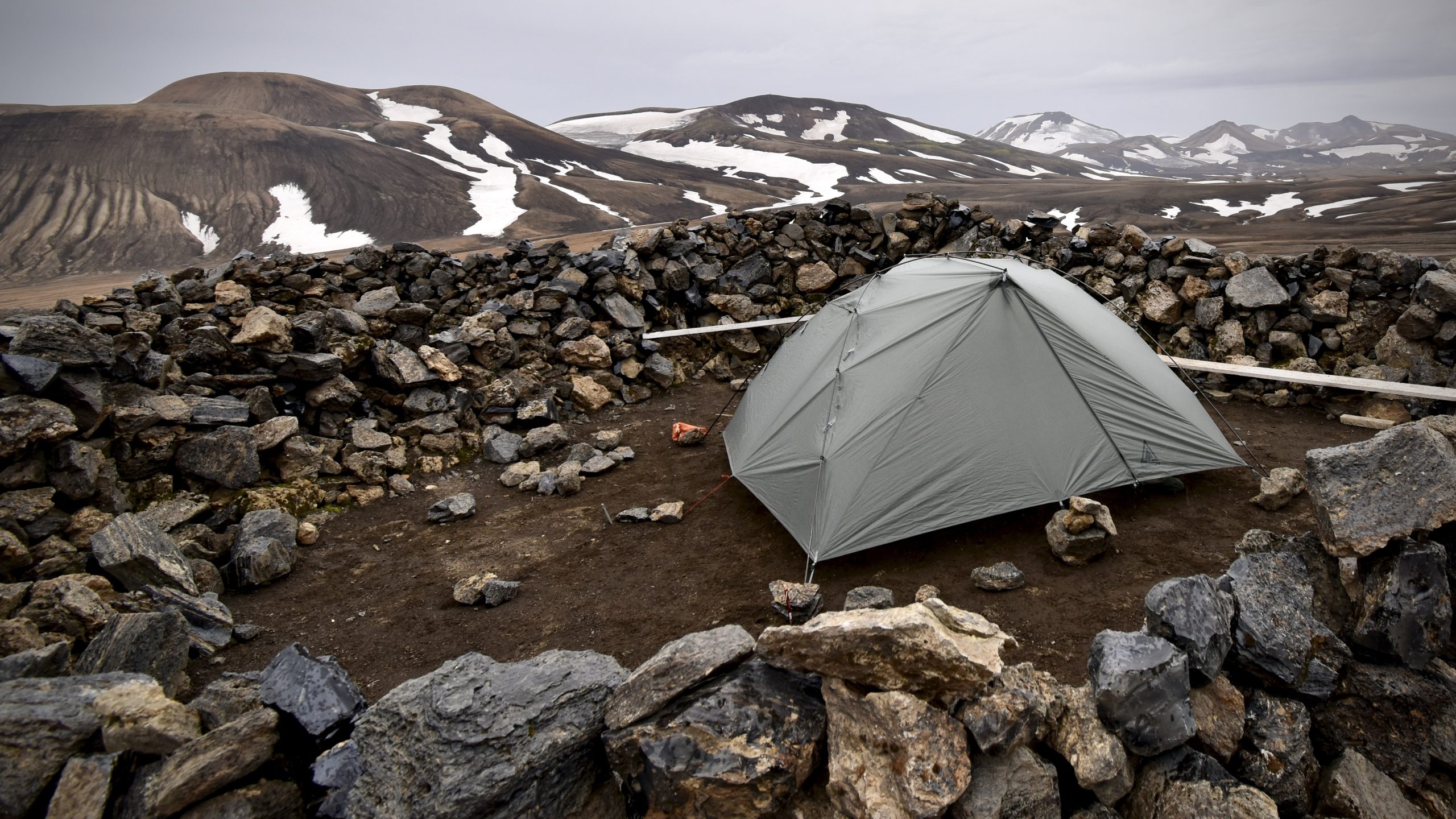
When I got to the hut, I set up fast—rain fly first, then the rest. Just in time. The rain came in full.
But I was dry. I was safe. I was exactly where I needed to be.
Inside my tent, I brewed tea, made pasta, and broke out some Icelandic chocolate I’d bought back in town. My camp chair was set, my groundsheet dry. I felt like a king in a nylon castle.
The Lesson in the Miles
Today reminded me of something I already knew, but had forgotten to trust: You only have to do one thing at a time.
I didn’t need to plan my whole life. I didn’t need to carry every worry I’ve ever known. I didn’t even need to hike all seven miles at once.
Just one step. Then another.
And when it got hard—and it did get hard—I kept moving anyway.
Even when I got stuck in the bathroom because the lock jammed (yep, that happened), I figured it out. Because what else can you do but solve the thing in front of you?
Rain Tomorrow? So Be It.
The forecast says tomorrow’s a wash. That’s okay. I’ll wake up when I wake up. Walk when I’m ready. Eat when I’m hungry. Hike seven more miles.
One thing at a time.
Maybe I’ll see Caitlin and Brad again. Maybe I’ll run into the Canadian couple I met earlier. Maybe I’ll hike in silence all day and love it.
For now, I’m lying in my tent, full and warm, listening to the sound of Iceland’s sky letting go.
And I am so proud of what I did today.
Not because it was easy.
But because it wasn’t.
Day 1 is done. My legs are sore. My heart is full. My brain is quiet. I’m not thinking about the end of the trail—just the next bend. And that is more than enough
This website contains affiliate links, which means The Trek may receive a percentage of any product or service you purchase using the links in the articles or advertisements. The buyer pays the same price as they would otherwise, and your purchase helps to support The Trek’s ongoing goal to serve you quality backpacking advice and information. Thanks for your support!
To learn more, please visit the About This Site page.
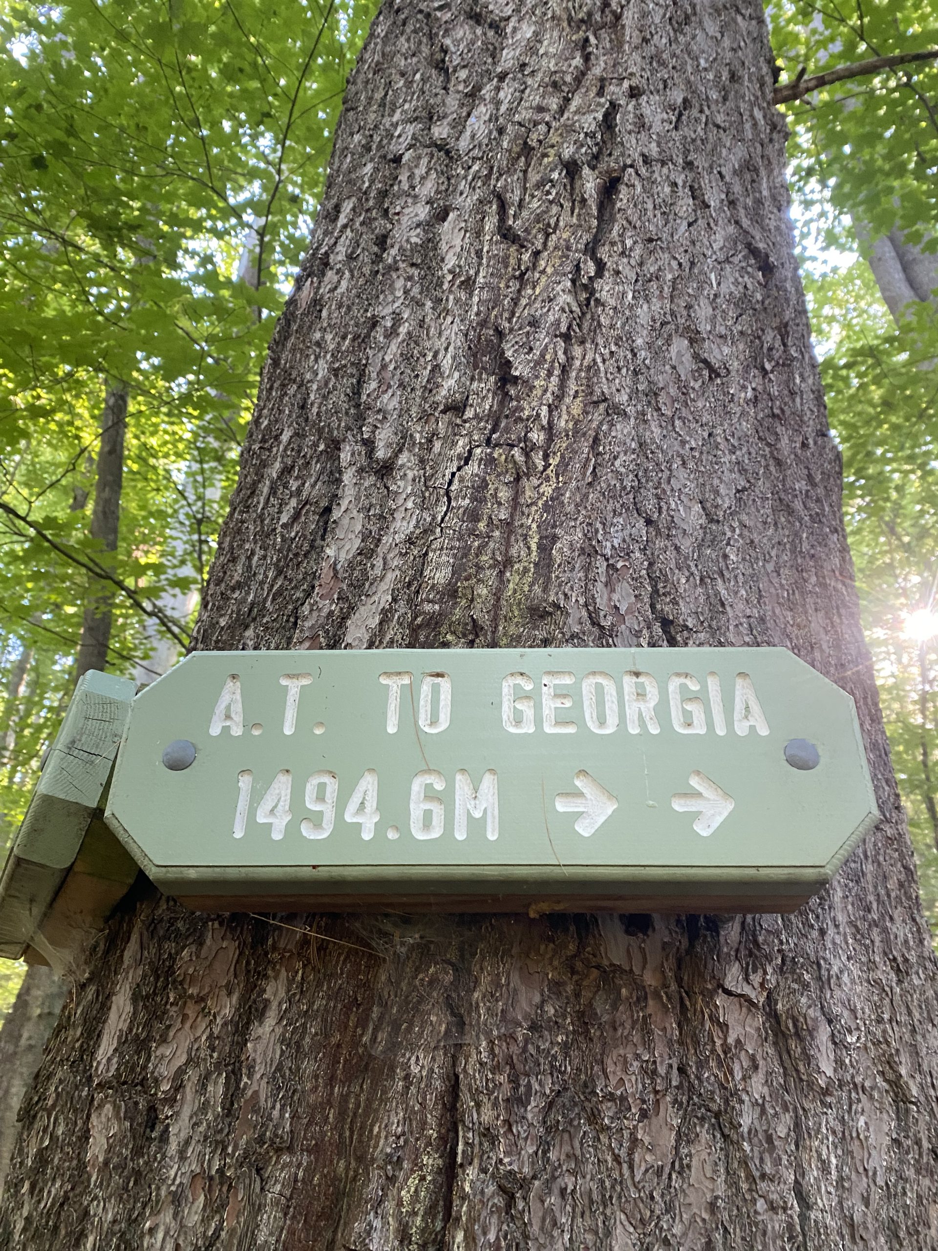
Day 101- 7 Miles today from Kinsman Pond shelter to Liberty Springs campsite, 2600Feet Up, 2400 Feet down, AT Mile Marker 1828
The Whites So Far
So far in the Whites the climb up Moosilaki mountain from Kinsman Notch to the Alpine zone maybe two three miles was a tough climb going south. Then after leaving the Alpine zone a couple of miles climbing down southbound off of the Mountain was tough. Coming up from Kinsman Notch was really tough after leaving Eliza Brook. There was some very difficult rock climbing for a a mile or so before reaching South Kinsman Mountain. That was very slow and I was very happy to see the shelter yesterday evening.
Zero?
I felt bad about taking a zero tomorrow especially since it’s only 5 miles down to a pickup point today. But there is rain in the forecast for tomorrow and I definitely don’t want to be climbing around on some of these rock faces like we were climbing on yesterday evening if it’s wet and raining and storming plus I don’t want to be up on Franconia Ridge during a storm.
So I’ll have the rest of the day and all of tomorrow to rest up. It’s probably a good thing because I have been pushing hard since Great Barrington especially since I left Knockerz at the Cookie Lady house. I pushed hard through Vermont.
My Food Bag
Got an early start this morning at 6:15. There was no need to rush today so I will just take it easy.
My pack is really light. It’s totally due to the food.
I purposely packed light with my food. Most of the Sobos I talked to carried anywhere from two to four days worth of food through the Whites. They all said you could get some food at the huts which really made it easier on the food carry.
I am really glad that I had a light pack because I needed the extra energy to get through some of those difficult climbs yesterday. However I really don’t want to eat the food that’s in my pack.
I was so hungry last night I ate two wraps that had cheese and meat sticks in them. And then I was still hungry I ate another wrap with peanut butter and honey. I also sprinkled in chilicheese Fritos in all my wraps. I didn’t eat much on the hike yesterday other than the snacks that I had put in my belt pockets to carry me through the hike. Last night with all that food I put in my belly, stomach acids were coming up in my throat.
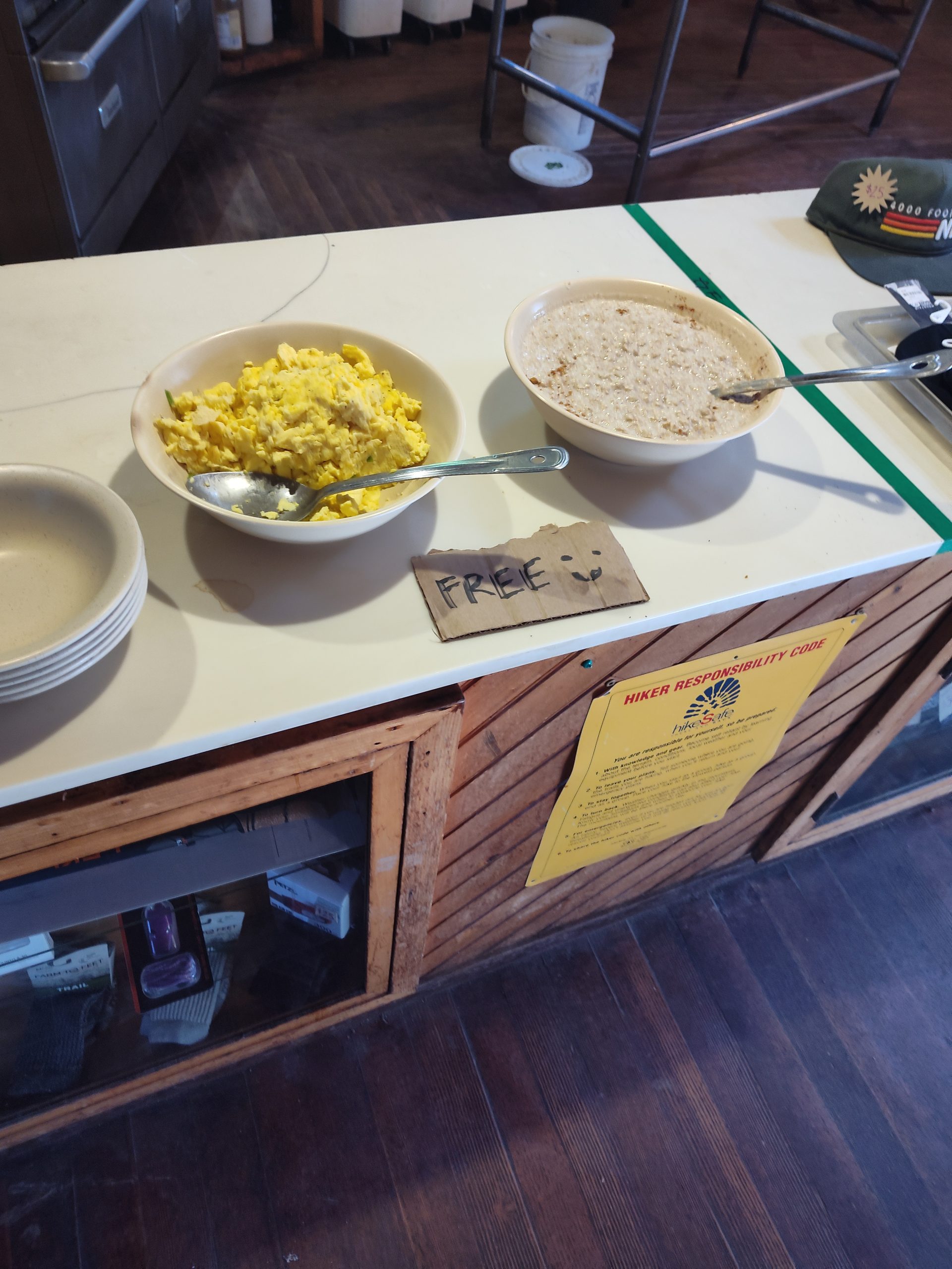
Free Breakfast
This morning there wasn’t anything in my pack I felt like eating so I made a Carnation instant breakfast and coffee shake and downed it real quick. I’m hoping I can grab something at the hut in just a little while.
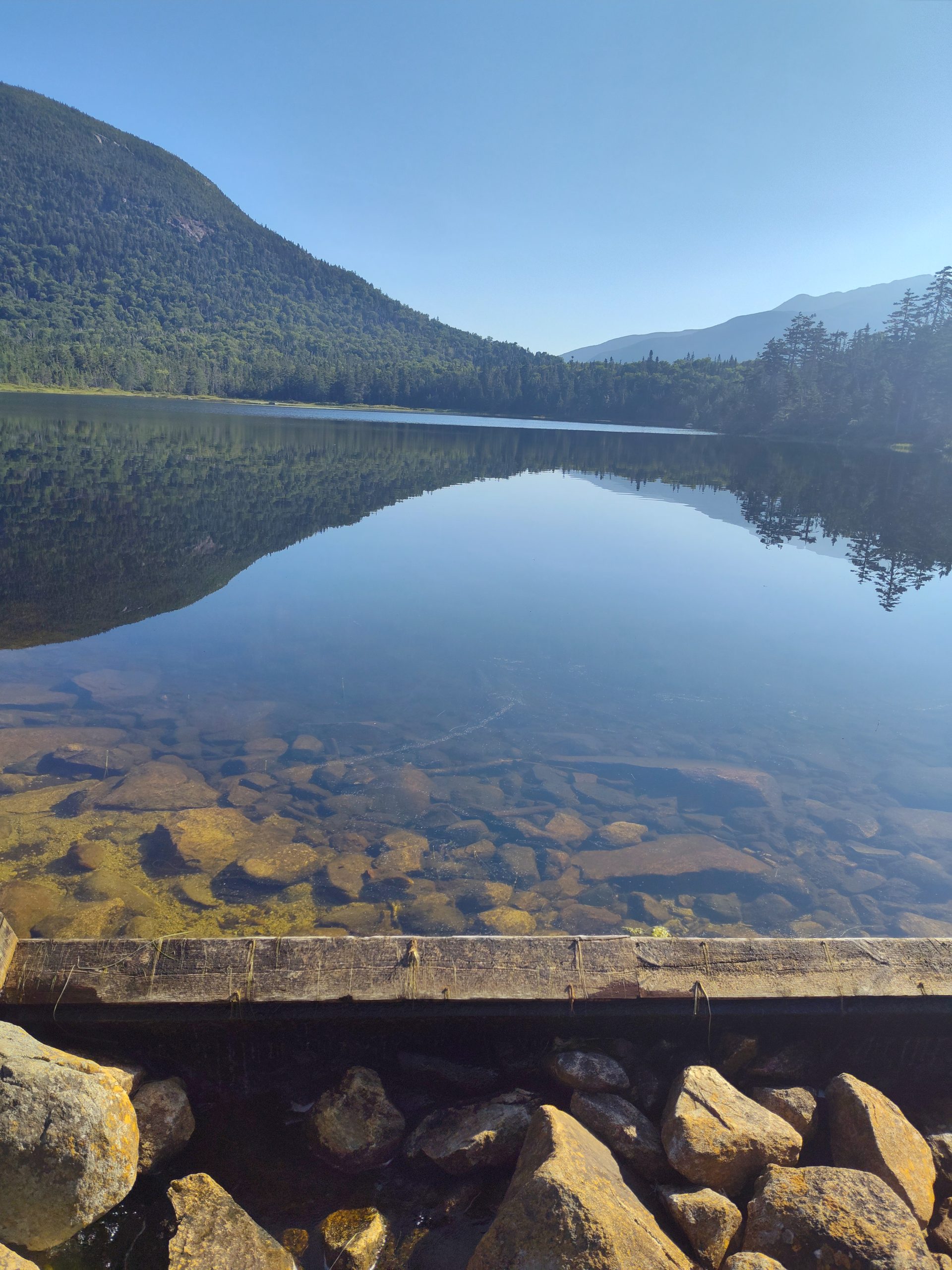
The hike down to the Lonesome Lake hut was a little technical at first but not too bad. I stopped and at the hut a little after 8:00 which is the ideal time to grab leftover breakfast. I got some free eggs, oatmeal, and some coffee.
The trail then meandered around and crossed several creeks. The trail continued a nice easy descent down to the Interstate where my shuttle would have picked me up.
Nero, Zero or Hike On
It was only 10:30. I looked at what would be coming up next if I took a nero the rest of today and then a zero tomorrow. I would have to do 5,400 ft of climbing to get to the Garfields Ridge shelter.
I looked at the weather and it looked like there is still a chance of rain tomorrow.
I knew I would be stir crazy sitting around on this beautiful day today. And then sitting around tomorrow when I should be hiking. So I decided to move on to the Liberty Springs campsite only 3 more miles but 2400 feet of climbing. And that will knock off a lot of the climbing I’ll have to do to get to the Garfield shelter. That’ll set me up nicely for the following day to be able to have a nice day up on Franconia Ridge.
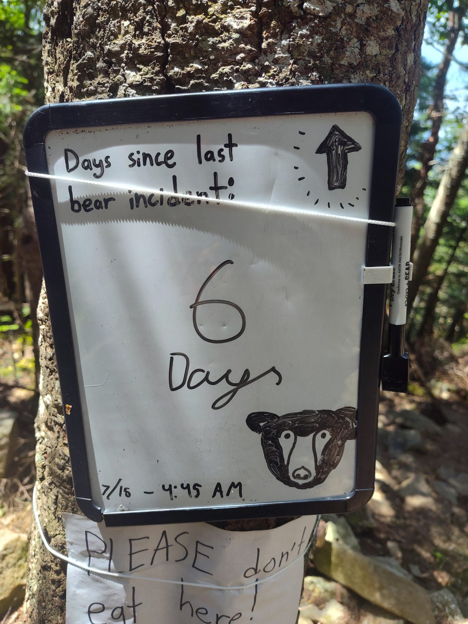
Storm Chasing?
The climb up to the campsite was a continuous grade but nothing technical. The campsite has gotten infamous for a bear that wrecked somebody’s tent apart a few days ago. So we had to be careful about where we eat and store food. Tomorrow we need to get up early so hopefully we can avoid being on the ridge when the storm hits.
This website contains affiliate links, which means The Trek may receive a percentage of any product or service you purchase using the links in the articles or advertisements. The buyer pays the same price as they would otherwise, and your purchase helps to support The Trek’s ongoing goal to serve you quality backpacking advice and information. Thanks for your support!
To learn more, please visit the About This Site page.

I’ve been slacking on my evening writings, and I feel like it’s related to my enthusiasm for this stretch of trail. They say that NOBO hikers get the Virginia blues, and I feel like that has been building in me since we crossed into Connecticut.
We made it about 1/3 of the way on day 49. We got coffee at an overpriced and underwhelming coffee shop, but it was better than cold coffee and oats. We met another hiker named Frickles (short for fried pickles) and chatted with her over our sandwiches.
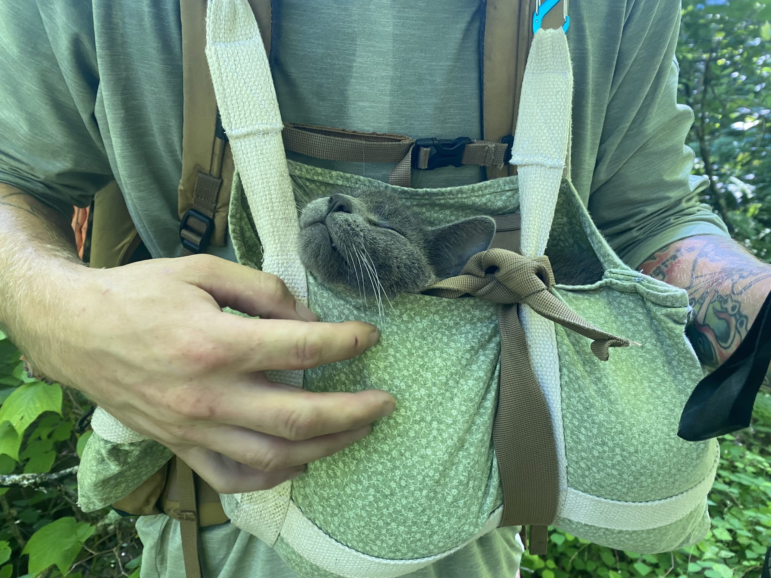
We have officially hit the bubble and crossed paths with so many hikers all day. The most notable being IKEA and his companion Smokie. Smokie is a cat that Ikea found in Tennessee that’s been bonded to him ever since.
The following day, we made it to Pawling, NY. We officially crossed out of Connecticut. There were too many puds to count, and in all honesty, we took a river road walk to avoid some of the worst of them. Hike your own hike, as they say. It made our time in this state all the more enjoyable, and we stayed cool on such a hot and humid day. I’d say that’s a win!
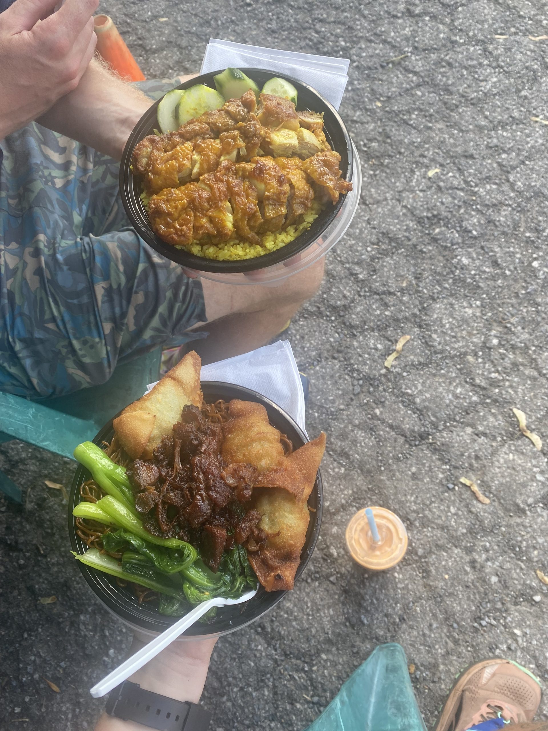
We had the absolute best trail meal yet. DC Malaysian Food was incredible. Nick got a crispy curry chicken, and I got Char Sui. It was a deliciously sweet honey pork over egg noodles, bok choy, and crispy filled wontons. It was another scorcher, so we started with Gatorade and had a Thai bubble tea for dessert.
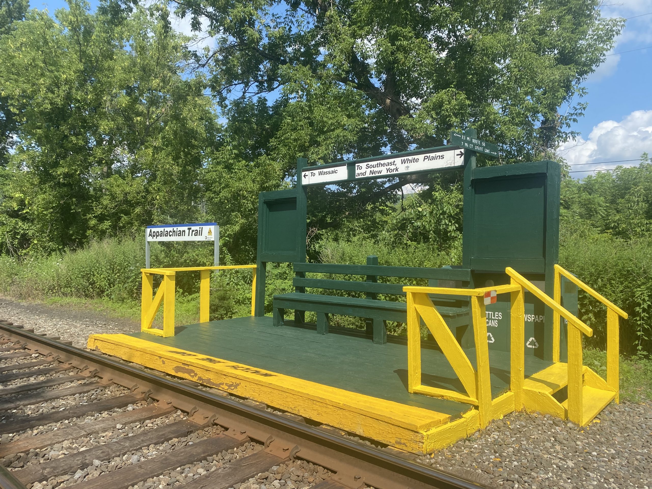
We passed over the train station on the trail. You can catch a commuter train to the city twice a day here!
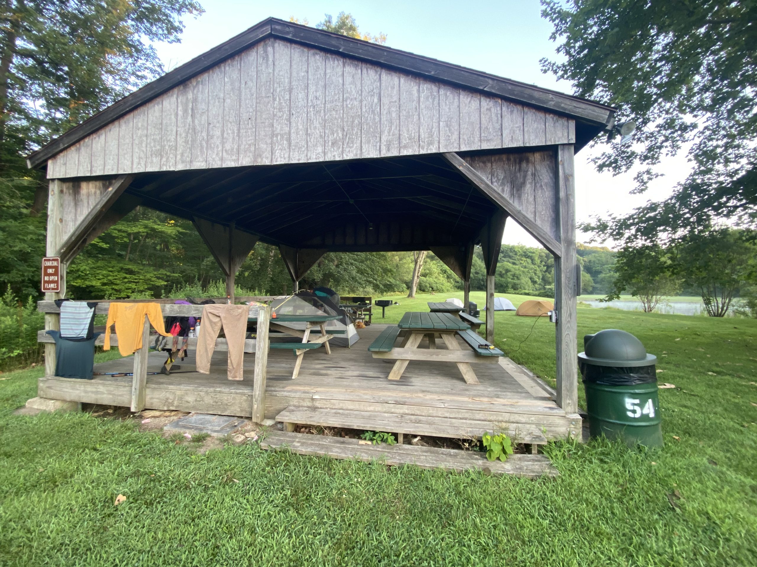
We hitched into the town of Pawling to stay at a Lion’s Club Park. There was a cold outdoor shower and a pavilion that we slept under. In keeping with the overpriced north section, we spent way too much at a CVS resupply. But we need the food, so it is what it is. We aren’t planning to stay in any other hotels or hostels until southern PA or further south, so we will eat the cost.
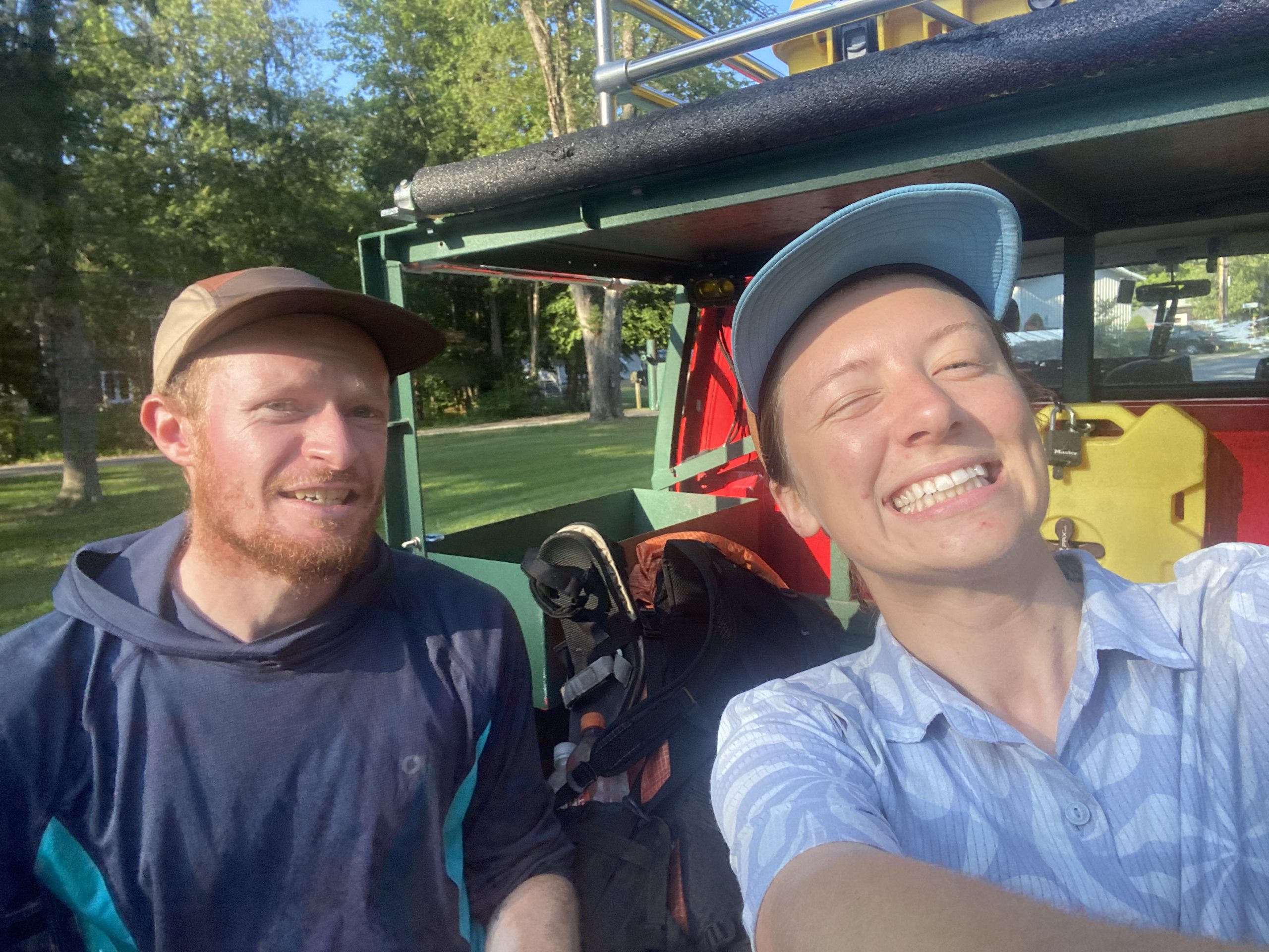
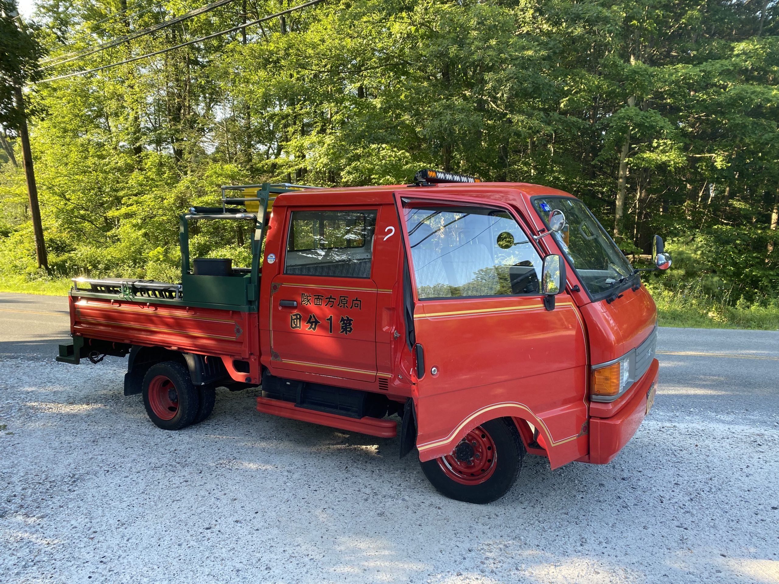
The next morning, we were picked up by the coolest little truck. We weren’t even hitching at this point; he just stopped and asked if we wanted to hop in the back. Duh!!
We had some lofty mileage goals to meet up with some of Nick’s friends before Bear Mountain. I was still feeling the residual Connecticut funk, so we scaled the miles back and pushed out our meetup a day.
We summited Shenandoah Mountain. There were power lines and cell towers everywhere. I was sitting facing away from the view, feeling a little sad, when a couple of folks walked up to us and asked if we were thru-hiking. This mom and daughter duo pulled ice pops out of their bag for us as mobile trail magic! Absolutely incredible, and this generosity picked me up in a moment of feeling pretty low.
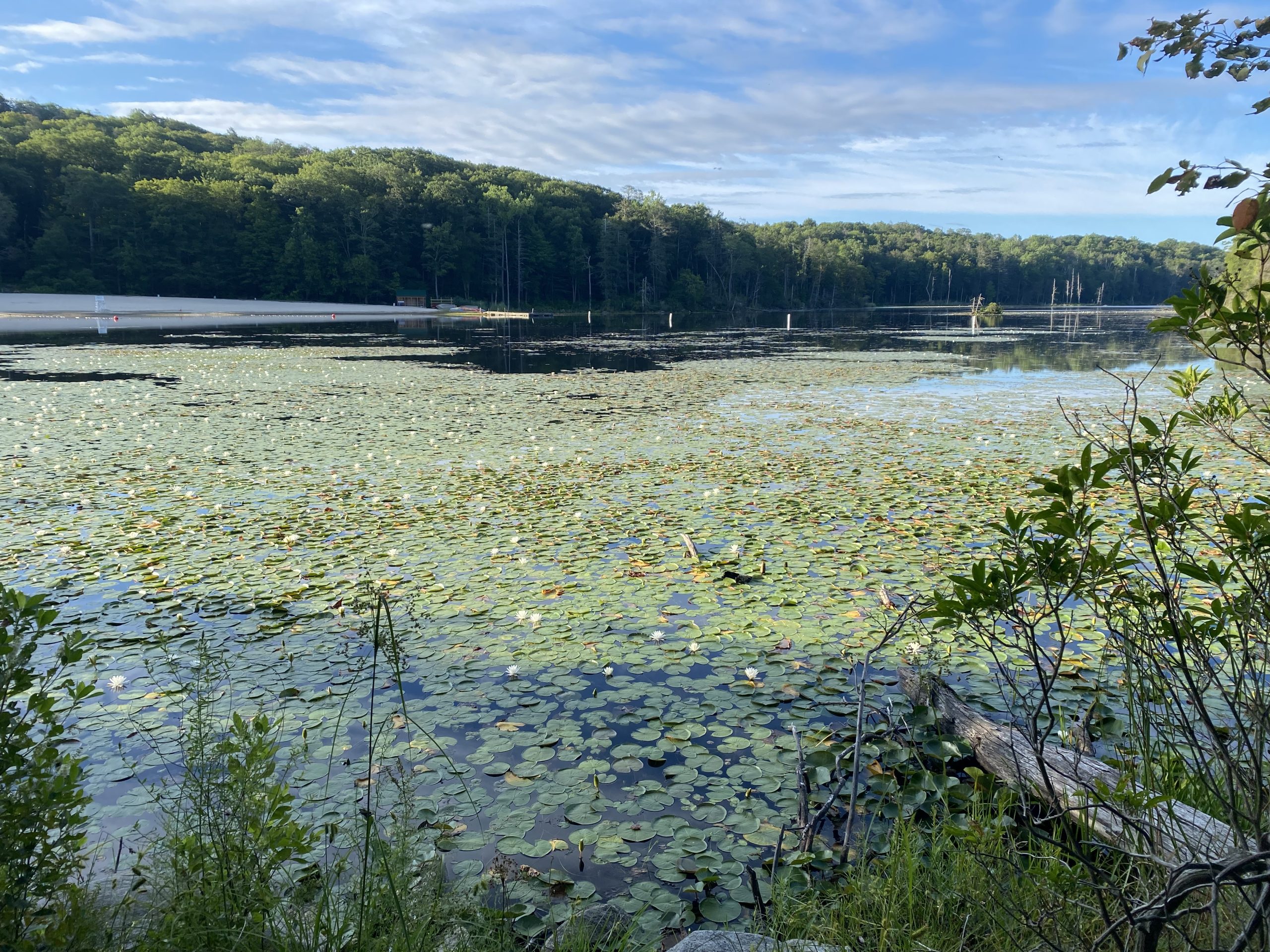
Our camp spot for the night was at Canopus Lake next to a state park. We got ice cream and warm showers and met some other awesome NOBOs.
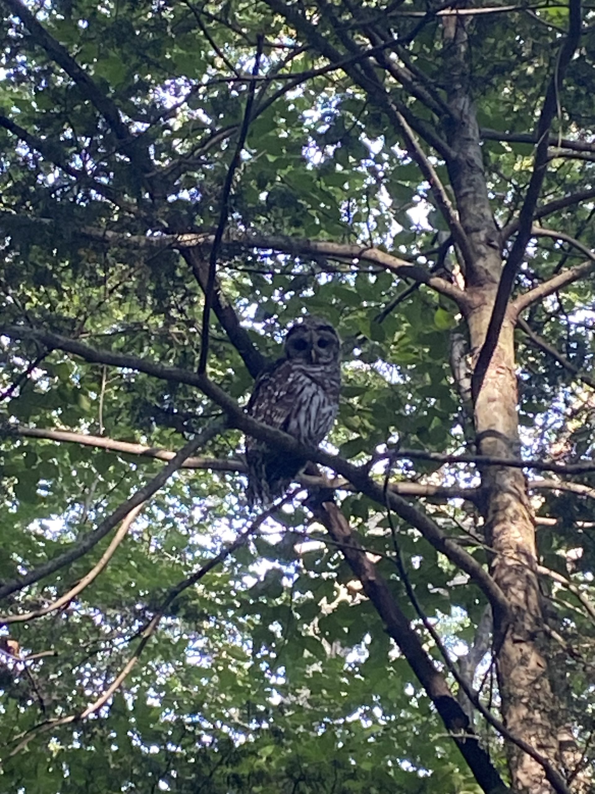
Our walk to meet up with Nick’s friends was all of 3 miles. We got very close to a barred owl, and he didn’t seem to care.
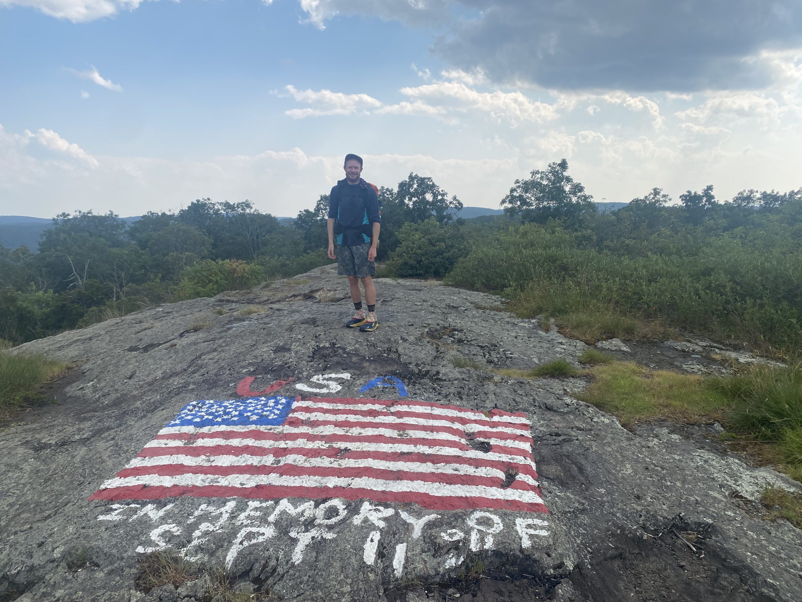
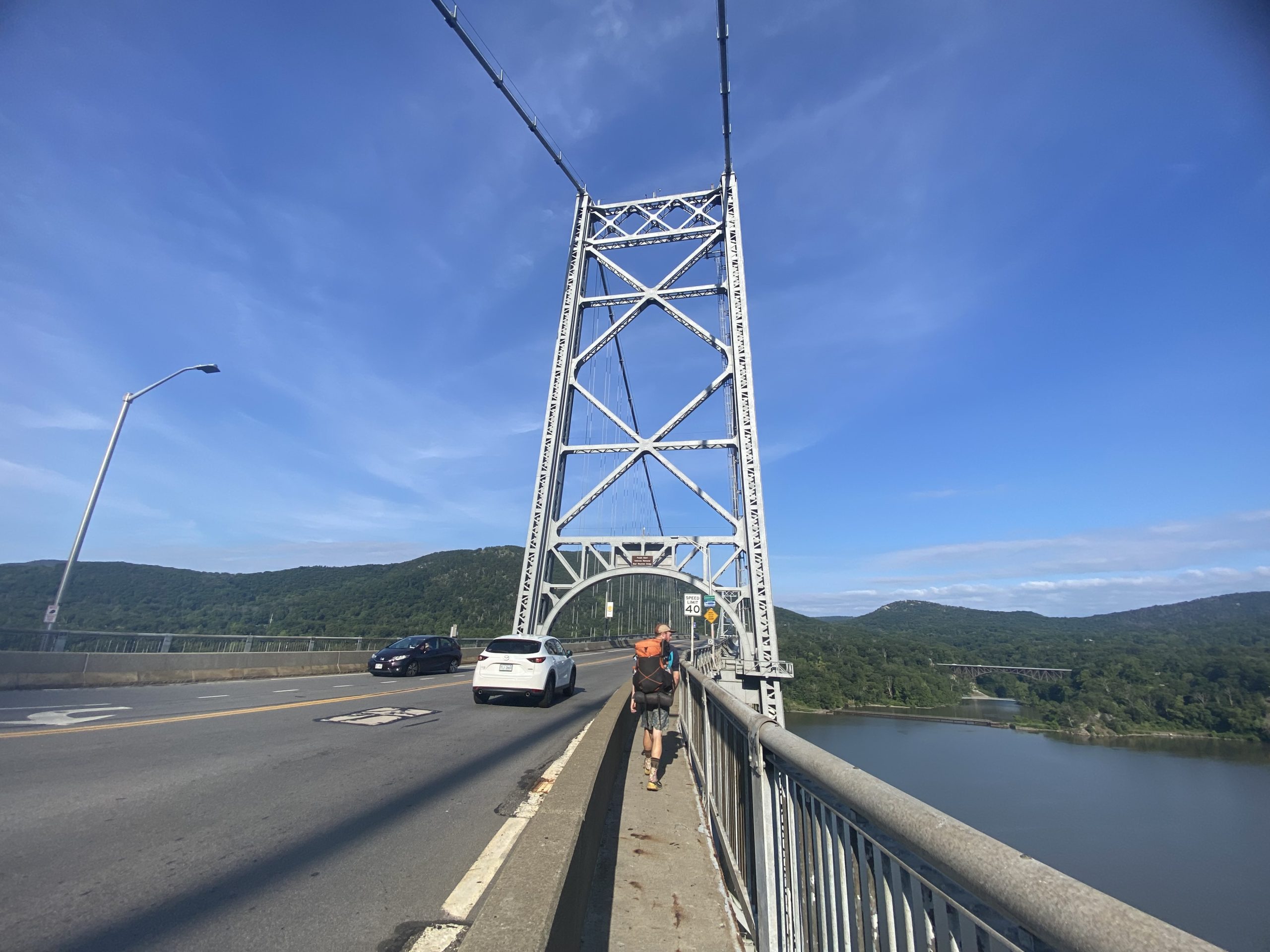
We crossed over Bear Mt Bridge and the Hudson River. Arguably the coolest part of New York yet. Unfortunately, the zoo that the trail goes right through wasn’t open yet, so we missed it. But we had showers and friends waiting for us very soon.
Our day proceeded with catching up with friends, resupplying at Walmart, and finally sending home some gear! I sent my puffy, a foam mat, my bowl and coffee cup, and some clothes. Nick did the same but also threw in the stove. We are officially entering our cold soaking era.
We enjoyed the company of Kayleigh, Dave, and their really sweet 1-year-old daughter, Juniper, for the first half of the day. Then we headed over to Sam, Matt, and their super cute 9-month-old daughter Juliana’s house for burgers, corn, and zucchini. We slept in a king-sized bed and hopefully got enough rest to keep it up!
I’ll try and get back on the wagon with daily postings. I just needed a little mental health break. It’s hot and I’ve been struggling with morale if I’m all the way honest. I know I’ll bounce back, I just need to rediscover my purpose out here. We are next to highways all the time. The scrubby vegetation is not the most beautiful and immersive woods I’ve ever been in. Thru-hiking just to be in nature all the time when “this” kind of nature isn’t what I want isn’t enough of a reason to keep me enthusiastic about the trail. I’ll get back to you when I bring myself back down to earth 😛
This website contains affiliate links, which means The Trek may receive a percentage of any product or service you purchase using the links in the articles or advertisements. The buyer pays the same price as they would otherwise, and your purchase helps to support The Trek’s ongoing goal to serve you quality backpacking advice and information. Thanks for your support!
To learn more, please visit the About This Site page.
- Hiked Today: 11.5 miles
- Appalachian Trail (1,977.2 – 1,988.7)
- Total Hiked: 3,921.9 miles
- Total Paddled: 99.5 miles
Weather: 60-80°F, sunny with clouds, rain and thunder late afternoon, then clear
Elevation: 1,577 – 4,120 feet
South Hwy 4 Dispersed Site to Poplar Ridge Shelter Sites
I felt quite accomplished to have gotten these 11.5 miles today. Going into today, it was particularly unknown how it would turn out. I schemed for a combined town resupply visit and return to trail to cover a challenging section. And, the forecast was iffy. So many different things could go awry. But here’s how it went down…
I had just a short hike down to Maine Route 4. There, I was surprised to find it didn’t look great for hitching. Based on comments, it seemed like folks had no problem getting rides, but I was seeing a winding and very fast road with little area for cars to pull off.
Welp, it didn’t matter what I thought, one of the first vehicles stopped for me, pretty much still in the road. Today it was Jackie, a 2020 (I think) AT hiker, who saved me. She was planning to do a trail run at the trailhead I popped out on, but went out of her way to bring me to the grocery store! So very kind. I offer cash for gas money and just to say thanks to every driver that stops for me, but so far on the AT nobody has accepted.
I was charging my power bank outside the building super early, which was what I was hoping for. I needed to get a full charge on it again before heading back to trail. The store opened at 7:00 am and I was lined up waiting like folks used to (still do?) for Black Friday deals.
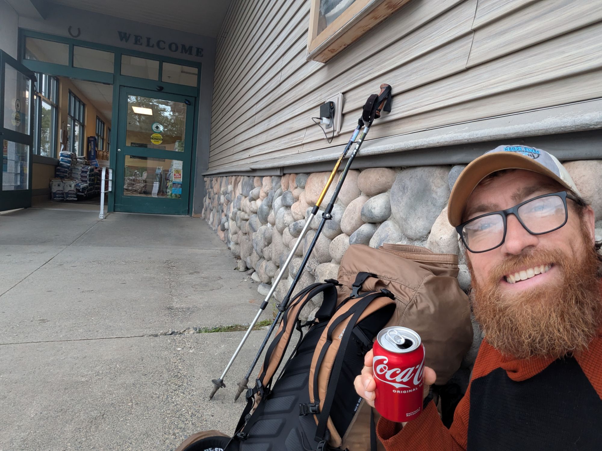
There was a cooler of sodas at the trailhead and even though it was morning, I couldn’t pass up such generous trail magic. A little pre-7:00 am Coca-Cola classic never hurt anyone. Probably.
I hung out at the Rangeley IGA until 12:30 pm ish. Leaving, my pack had truly transformed into The Hulk again. To understand why, I think we need to take a look at this quote from the movie The Perfect Storm. I promise, it explains everything…
“Look, look at this. We got Hurricane Grace moving north off the Atlantic seaboard. Huge… getting massive. Two, this low south of Sable Island, ready to explode. Look at this. Three, a fresh cold front swooping down from Canada. But it’s caught a ride on the jet stream… and is motoring hell-bent towards the Atlantic. What if Hurricane Grace runs smack into it? Add to the scenario this baby off Sable Island, scrounging for energy. She’ll start feeding off both the Canadian cold front… and Hurricane Grace. You could be a meteorologist all your life… and never see something like this. It would be a disaster of epic proportions. It would be… the perfect storm.”
– Todd Gross (the TV meteorologist in the movie The Perfect Storm)
You could be a thru-hiker all your life and never see something like this. It would be a disaster of epic proportions! Dun, dun dun.
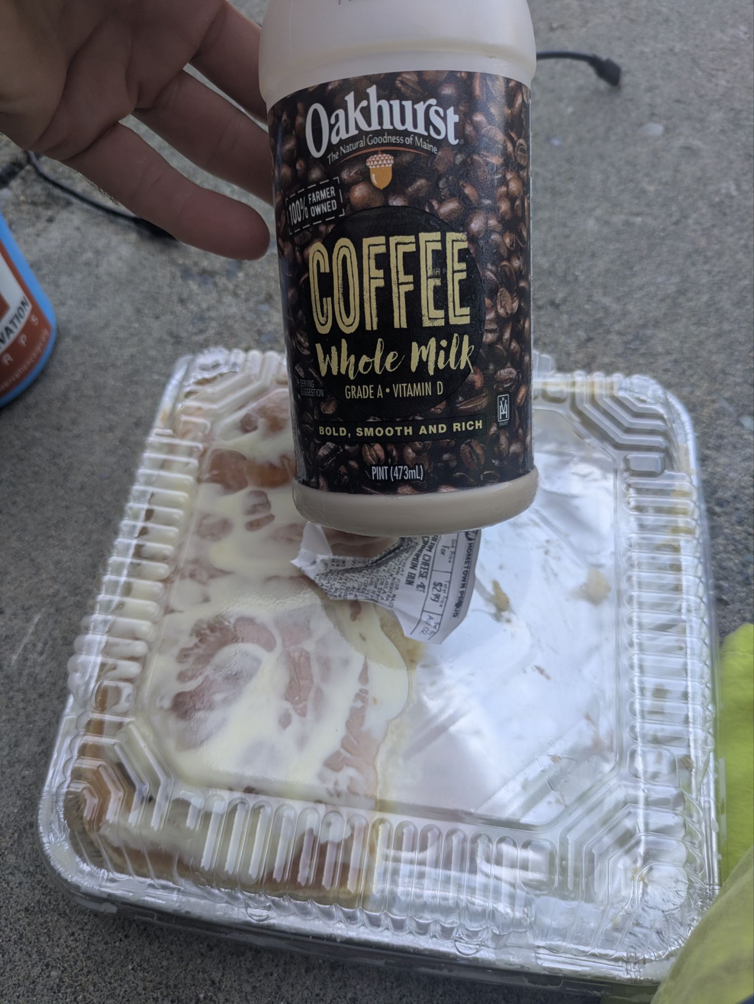
Ok, so for me… 1) the last stretch I felt I didn’t have enough and was doing some super rationing (didn’t want that to happen again), 2) I came into the store ravenously hungry (never a good idea), and 3) the store was a bit on the pricey side so I went for deals not thinking of weight (amateur mistake). There you go, the perfect storm. Maybe a stretch, but that’s where my brain went 🤦😅. As evidence, I submit that the bag of animal crackers I purchased was 1 lb in and of itself!
I also ate a massive amount of food at the store including this coffee flavored milk, which was very scrumptious (basically one of those Starbucks cold drinks), and nearly all of these four cinnamon rolls.
I got a ride back with a guy named Peter. He spotted me sitting next to the power outlet and was already bringing two other hikers back to trail, Pancakes and E.T. The timing was perfect, so I took him up on his kind offer.
Back up at the trailhead, those two guys started trekking, but I sat down to have lunch. Soon, a camper van pulled up. I had talked to the owner when down at the store. This was Angelica and her husband John is thru-hiking too and she’s scooting along in the van for support. Quite the demanding job, lots of logistics and then finding things to do in the meantime as well. She generously offered me some cherries and I ate my messy sub sandwich too. We had a nice chat.
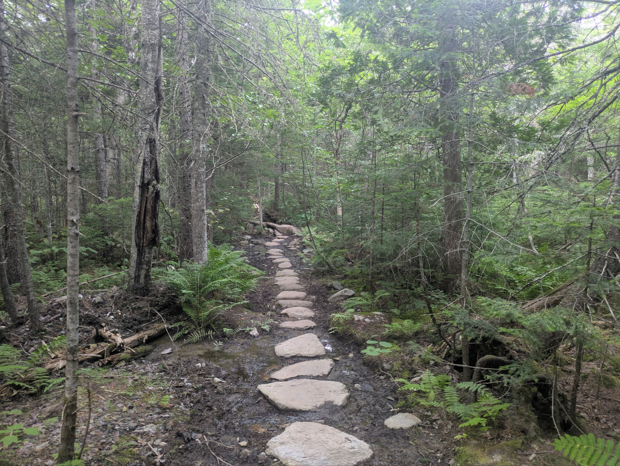
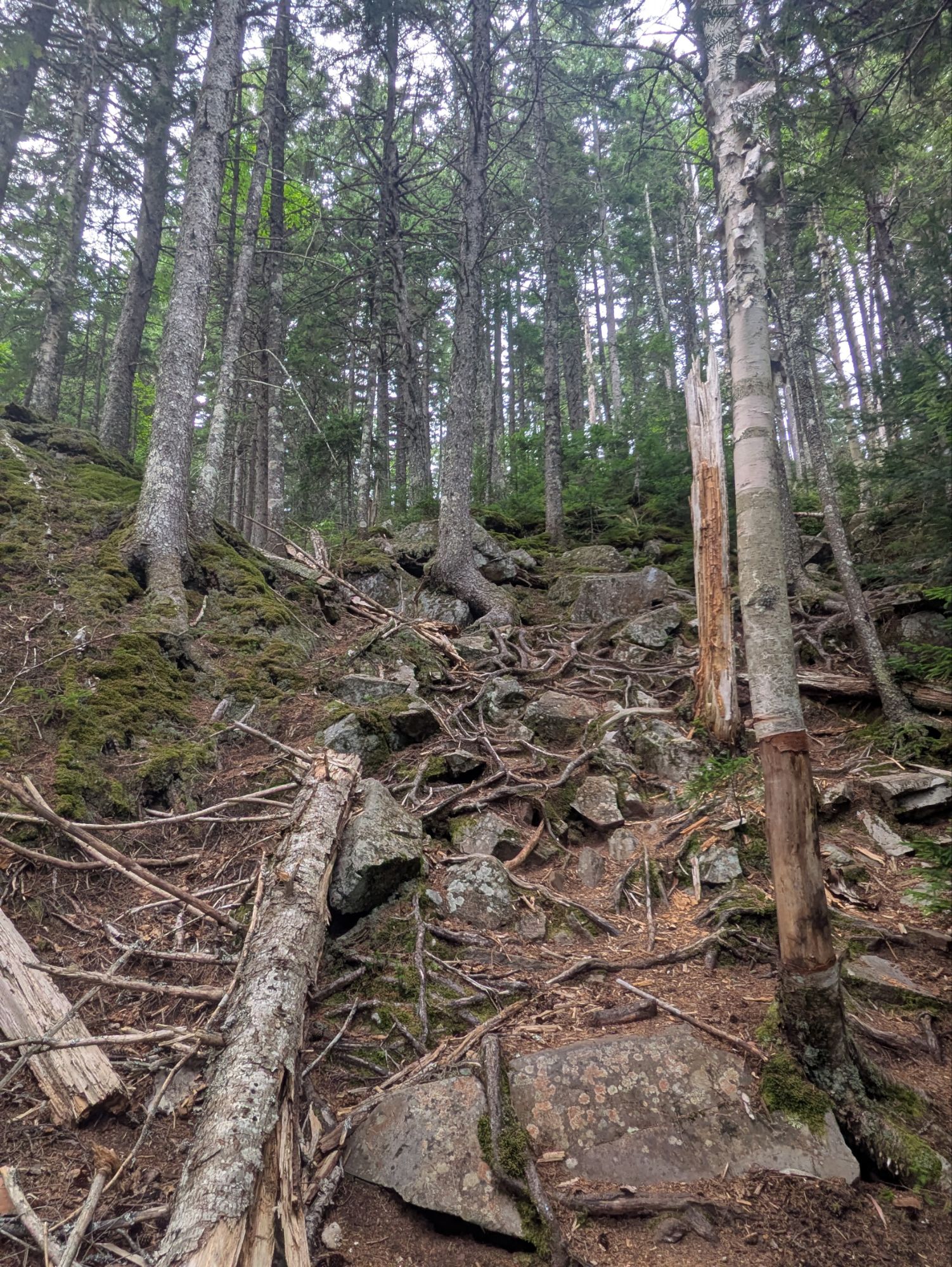
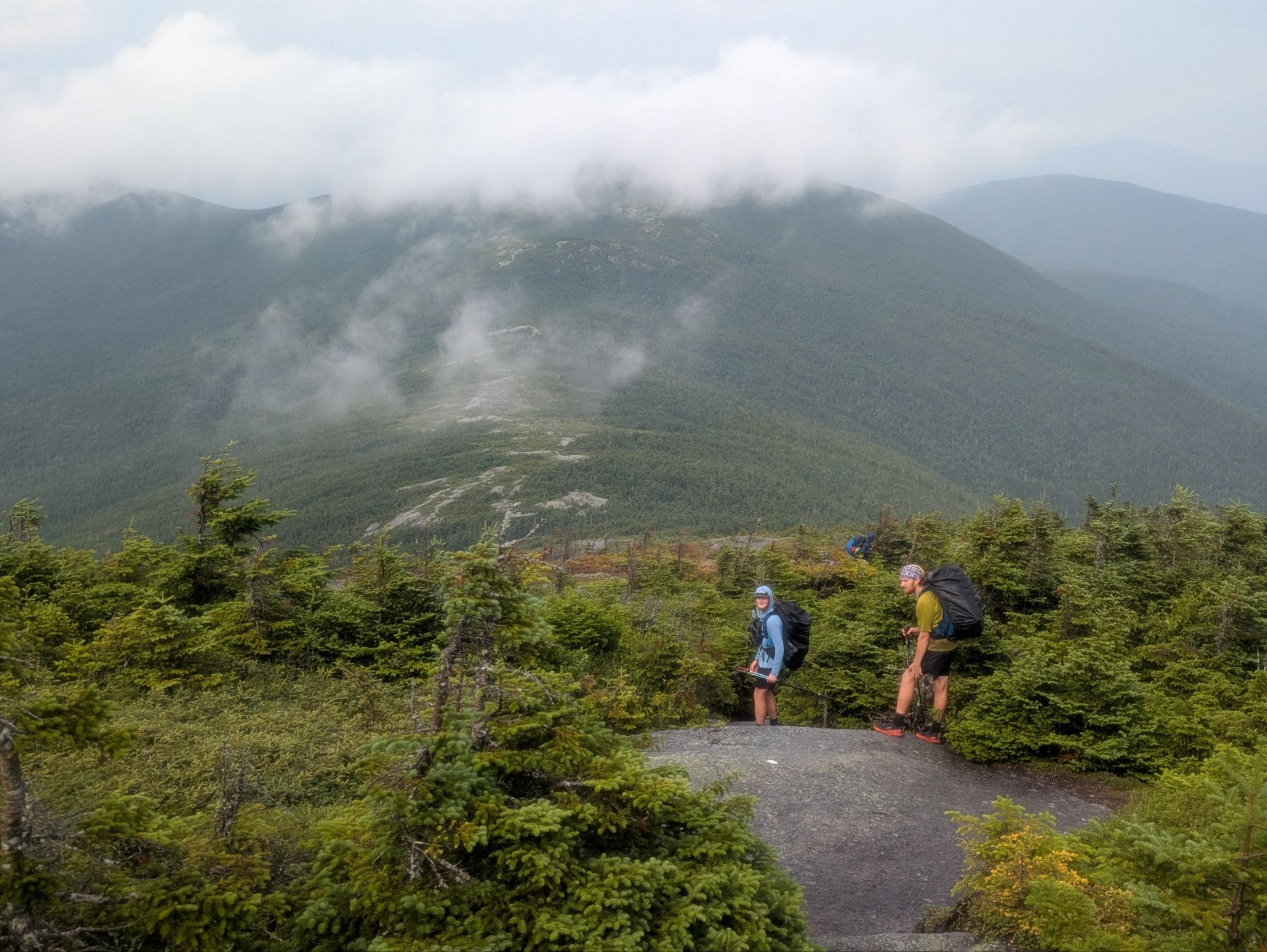
I got hiking at 1:30 pm. After crossing the road, I started down the wrong path, but thankfully figured it out quickly. Then, it was up and I certainly felt the return of the Hulk. The first 3 miles weren’t so bad, but after Eddy Pond, things went up to 4,120 feet Saddleback Mountain. I had been dreading the climb, but it wasn’t as gnarly as expected. Swampfoot and Pony Boy passed me by. They can really fly, particularly my on the uphill I’ve noticed. They just go!
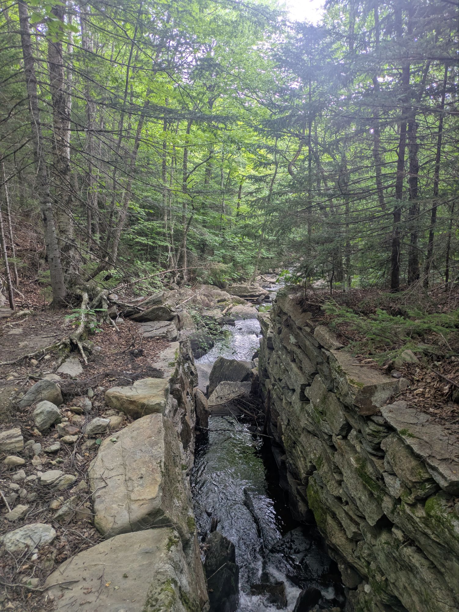
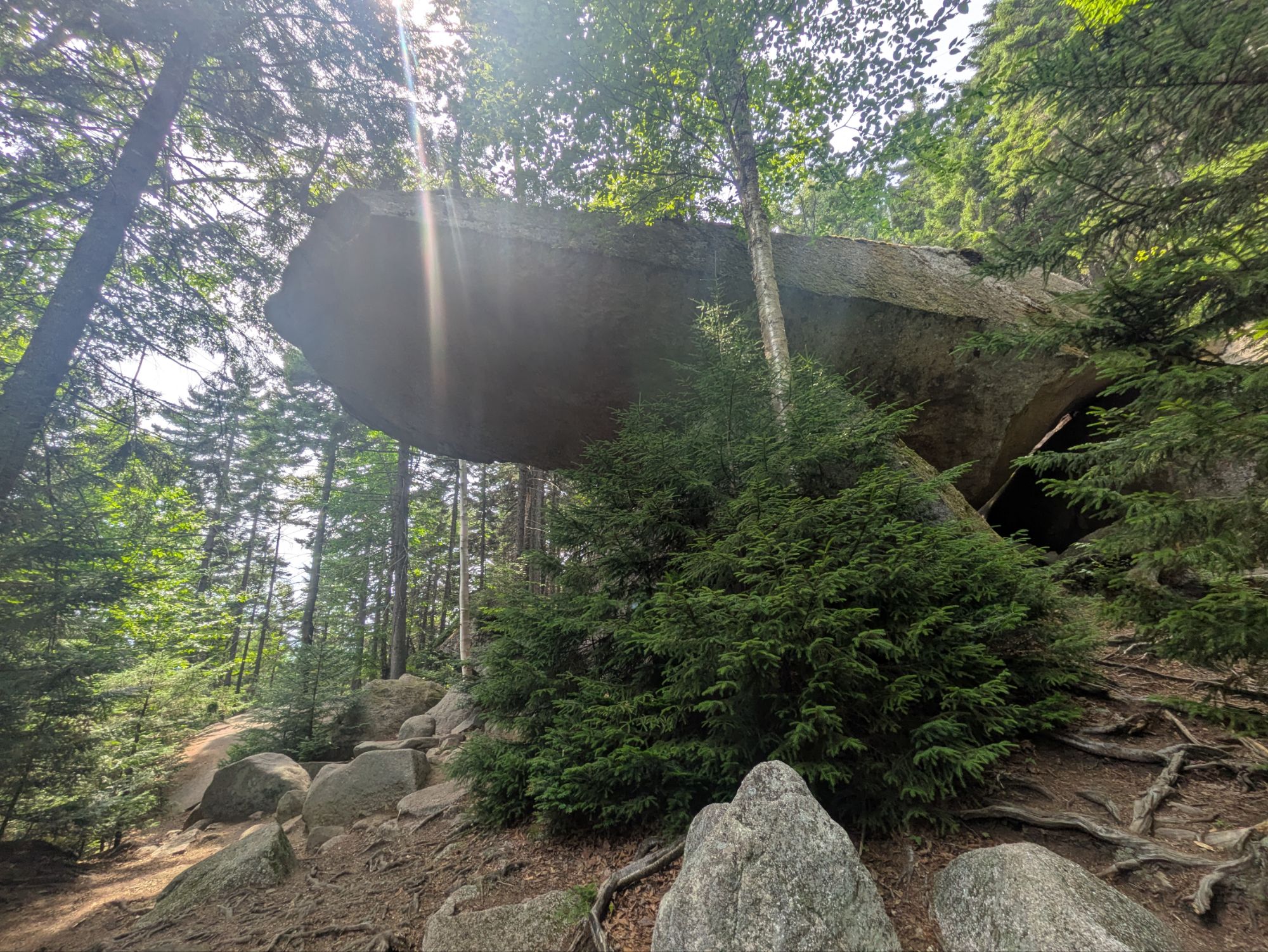
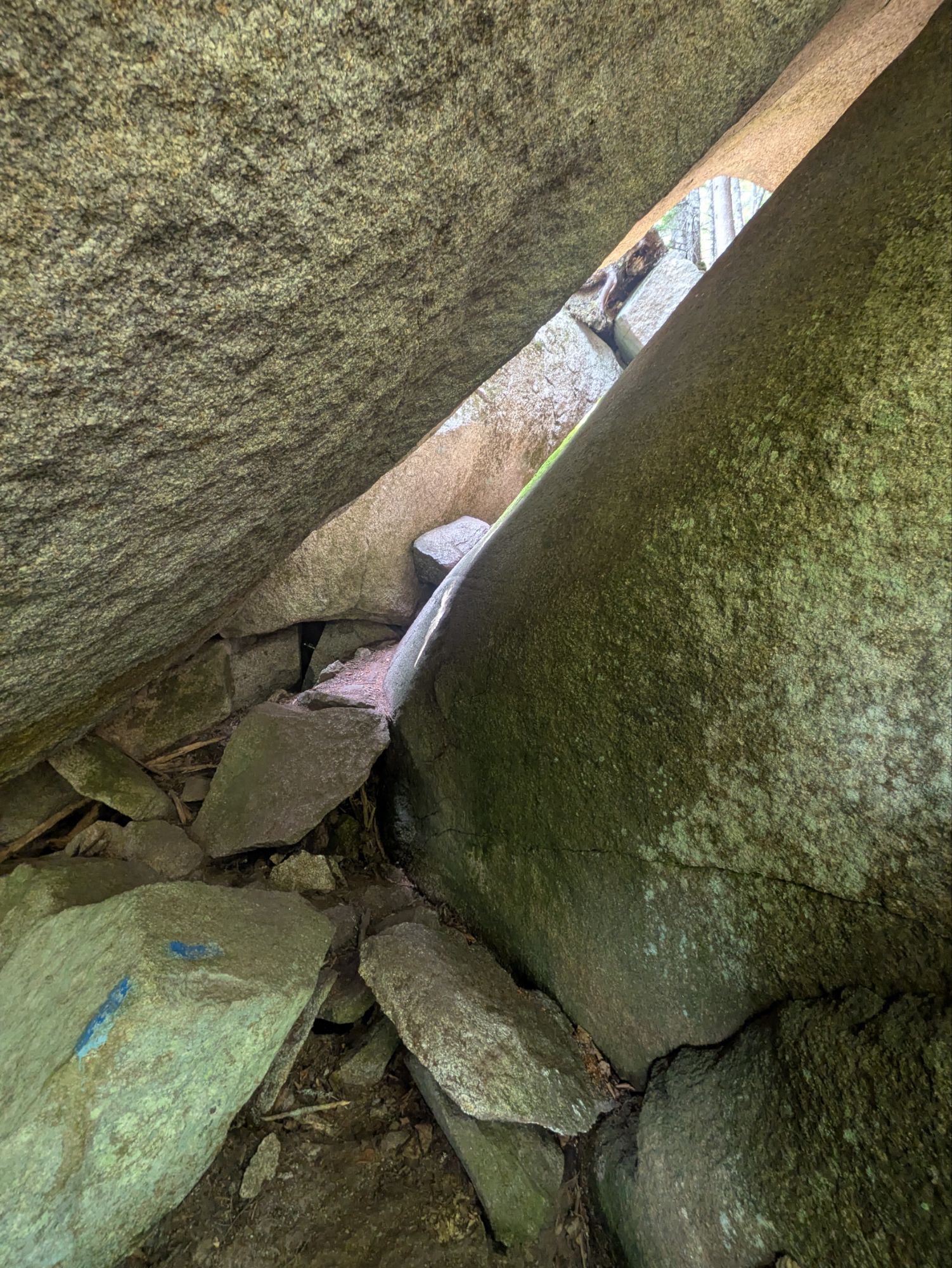
There was a short side trail that was supposed to lead through a series of boulders and tunnels, similar to Mahoosuc Notch the other day. I wanted to check it out, but ended up taking the wrong side trail. It was short but very steep up and I got myself peeved a bit. I never did find the “caves” as they were called, but afterwards reflected that my little side trip was neat nonetheless. See, I found Mufasa’s Pride Rock and a little tunnel…
After Swampfoot and Pony Boy passed, I spotted some sunglasses in the middle of the trail. Usually with this kind of stuff I leave it or hang it up to be more visible. You never know if someone might return for it or which direction the owner had been going, north or south. I had a hunch these were one of those guys’ though, so carried them for when I’d see them next.
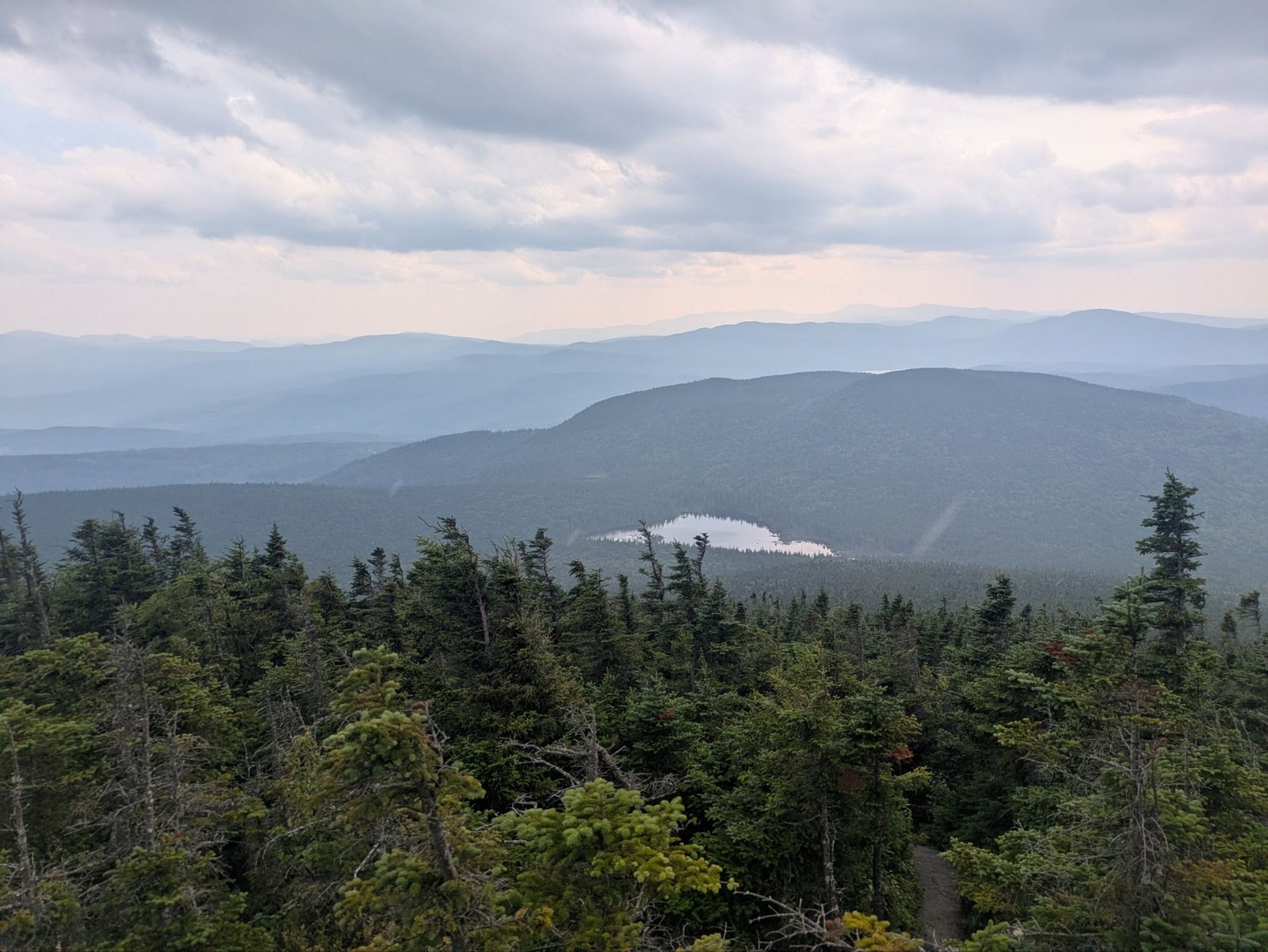
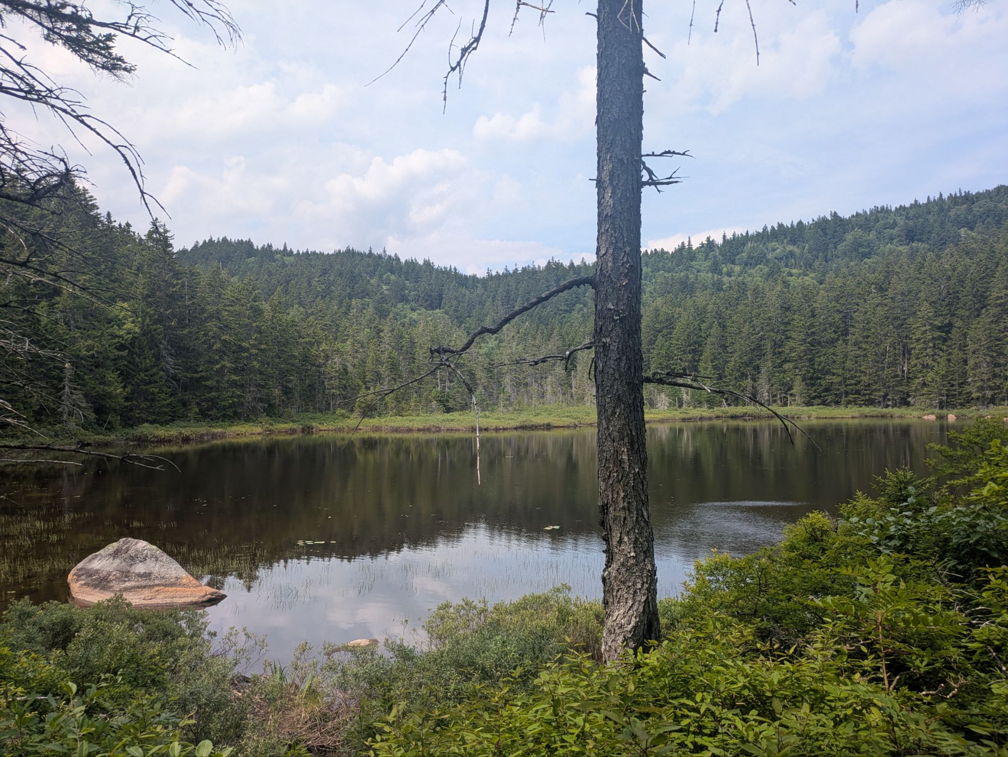
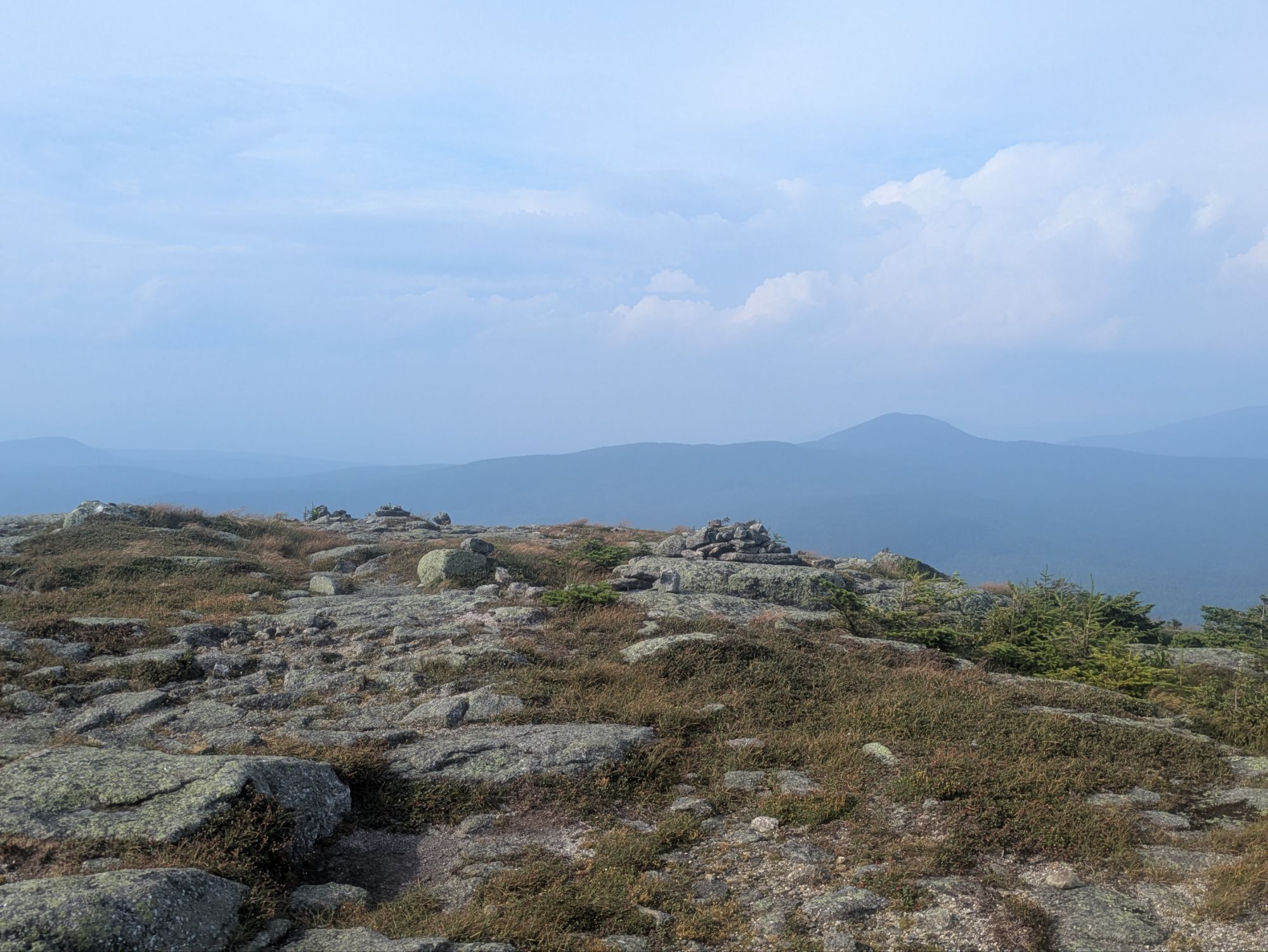
Going up, I started to get views looking back away from the mountain…
Off to what I thought of as southeast there were some particularly dark clouds coming closer to. They didn’t seem like they were going to hit; I thought I might miss the storm. Well, I’ve never been good at predicting things like this and when I was fully up in the alpine zone, I heard the the first round of thunder. Not great!
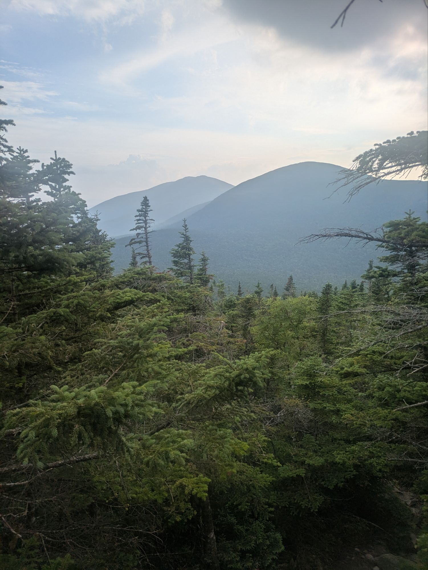
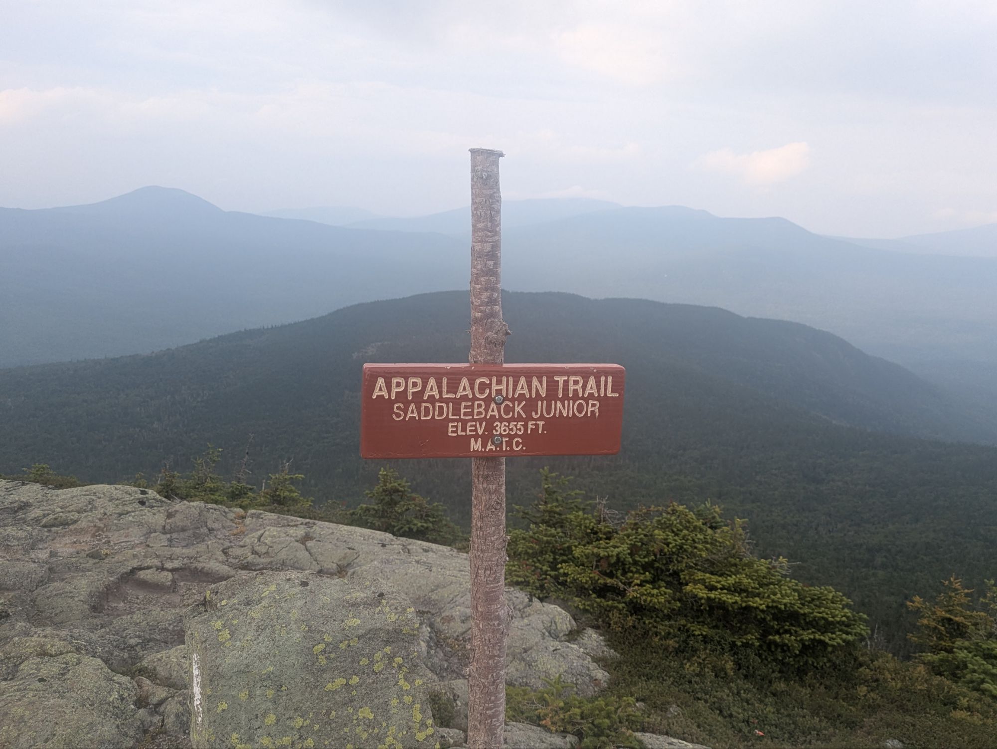
Although I still felt the main body of the storm was going to skim by, I got nervous and started speed hiking in hopes of getting up and over the top, down to the lower elevation saddle. The trail dips between Saddleback Mountain and the next mountain called, The Horn. There, I hoped there might be some tree cover. The peak just kept growing though. As the rain started spattering me sideways, my anxiousness grew with it, but I kept trudging in fast-walking mode.
The thing is, this mountain has a pretty lengthy exposed area. It reminded me of Moosilauke actually. And in better weather I would’ve taken my time and marveled at is magnificence. Today though, several more rounds of thunder sounded distantly as I continued overtop. Thankfully, after twenty minutes or so (?), it seemed like it was lessening and the rain too was becoming lighter.
I found Swampfoot and Pony Boy in the saddle, but by the time I reached them the sun was beginning to break back through again and we all felt safe to keep hiking. We walked some together, but I just couldn’t keep up with the youngins. It does seem like our bigger scale planned pace for the last chunk of the AT might be similar though, so might be seeing more of them.
I was pretty spent from trying to outrun the storm. I debated setting up early at a different camp than my goal, but ultimately kept going. At 7:15 pm, I arrived, once again being welcomed by Swampfoot and Pony Boy who were already set up haha. That’s when I remembered the glasses and found out they were indeed Pony Boys Oakley’s.
Rather than sleep in the shelter, I moved on up the hill to some sites and made camp. It was a bit lumpy and I’m beginning to think there isn’t a place in Maine to tent without tree roots sticking up! Still, happy for any place to rest after another big day on trail
Thanks for joining on the journey! It means a lot that you took the time to read up on these adventures. If you want to help kids get access to the outdoors, a cause that means a lot to me, please help me in supporting Outdoors Empowerment Network! The “Tip Author” button is a direct link to my fundraising page. Y’all are truly amazing. Thank you!
-

 Brand Stories2 weeks ago
Bloom Hotels: A Modern Vision of Hospitality Redefining Travel
-

 Brand Stories1 week ago
CheQin.ai sets a new standard for hotel booking with its AI capabilities: empowering travellers to bargain, choose the best, and book with clarity.
-

 Destinations & Things To Do2 weeks ago
Untouched Destinations: Stunning Hidden Gems You Must Visit
-

 Destinations & Things To Do1 week ago
This Hidden Beach in India Glows at Night-But Only in One Secret Season
-

 AI in Travel2 weeks ago
AI Travel Revolution: Must-Have Guide to the Best Experience
-

 Brand Stories4 weeks ago
Voice AI Startup ElevenLabs Plans to Add Hubs Around the World
-

 Brand Stories3 weeks ago
How Elon Musk’s rogue Grok chatbot became a cautionary AI tale
-

 Asia Travel Pulse4 weeks ago
Looking For Adventure In Asia? Here Are 7 Epic Destinations You Need To Experience At Least Once – Zee News
-

 AI in Travel4 weeks ago
‘Will AI take my job?’ A trip to a Beijing fortune-telling bar to see what lies ahead | China
-

 Brand Stories4 weeks ago
ChatGPT — the last of the great romantics
You must be logged in to post a comment Login