
Destinations & Things To Do
The 12 Best Weekend Section Hikes on the Pacific Crest Trail
While thousands of people attempt a thru-hike of the Pacific Crest Trail each hiking season, even more step foot on the trail for shorter hikes throughout the year. This post is dedicated to the weekend warriors out there—to the past and future thru-hikers among us who, right now, can only manage weekends in between what we sometimes call “real life.”
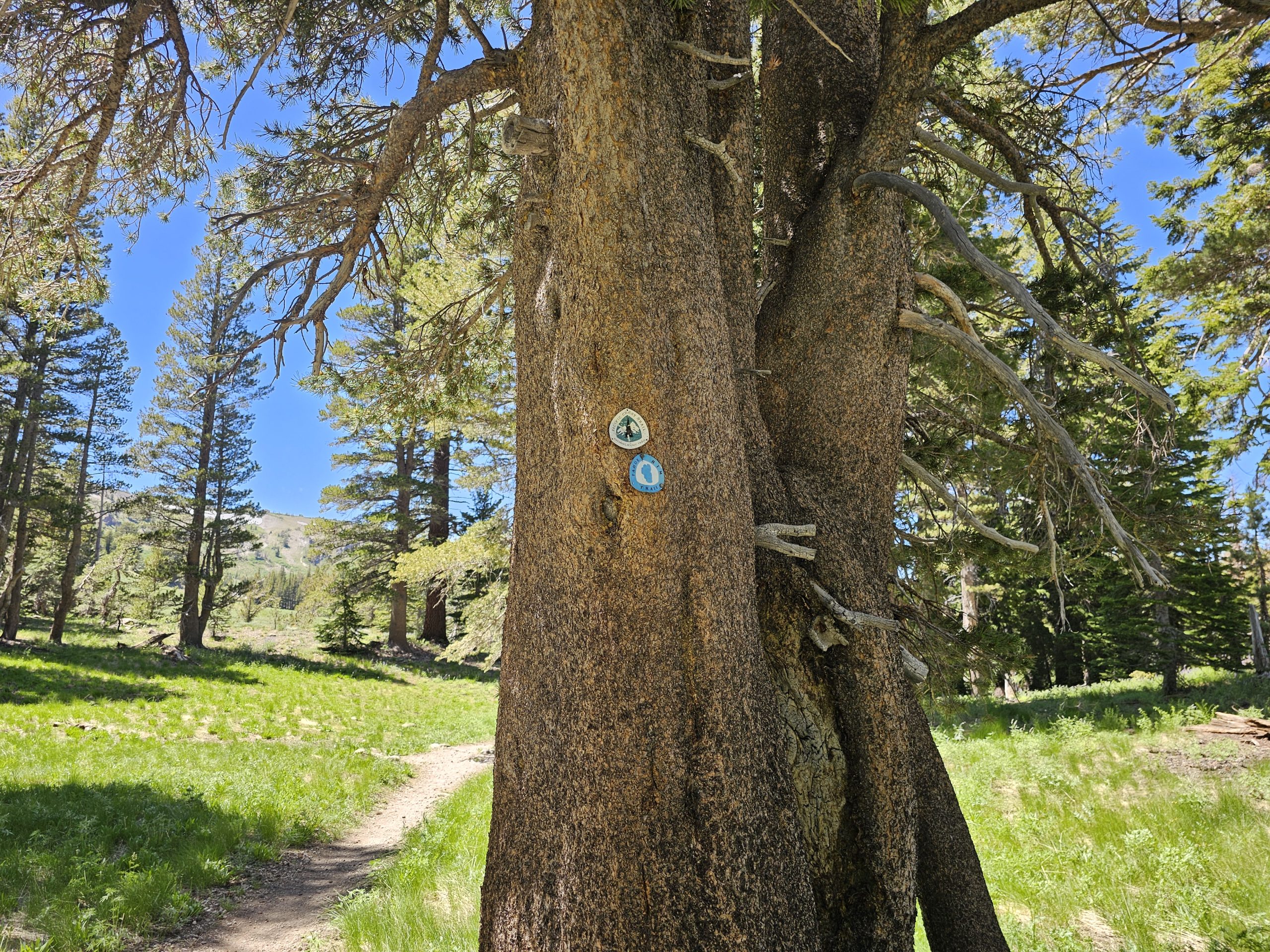
It’s worth mentioning that all of the sections below have varying degrees of elevation gain and loss, so doing your own research before heading out is recommended. Some of the resources I like to use when planning my weekend trips include the Forest Service webpage for the area I’m hiking, FarOut, AllTrails, Google Maps satellite view, and of course, checking the weather forecast. Be sure to also double-check the PCTA website for updated permit requirements for the section you’re hiking.
The following sections were chosen not only for their natural beauty and interesting highlights but also for their logistical ease—all start and end where the trail crosses a highway, road, or trailhead parking lot, making weekend vehicle drop-off or shuttle logistics more manageable. Planning logistics for a section hike that isn’t an out-and-back is probably one of the biggest hurdles of the trip. The best way to tackle this is to first figure out if you’ll need a car at both ends, plan to hitch a ride back to your car, have someone drop you off and pick you up, or work out something else entirely.
These sections were also selected with distance and time in mind, with hikes ranging from 22.1 to 42 miles. The goal is to pick a section that’s doable for your fitness level in the time you have. Here, I’ve aimed for routes that work well for a typical two- or three-day weekend. Feel free to adjust the mileage or pacing to fit your schedule!
Once the logistics are planned, all that’s left to do is walk and enjoy.
Sections Perfect for a Weekend Trip on the Pacific Crest Trail
Starting in the Desert
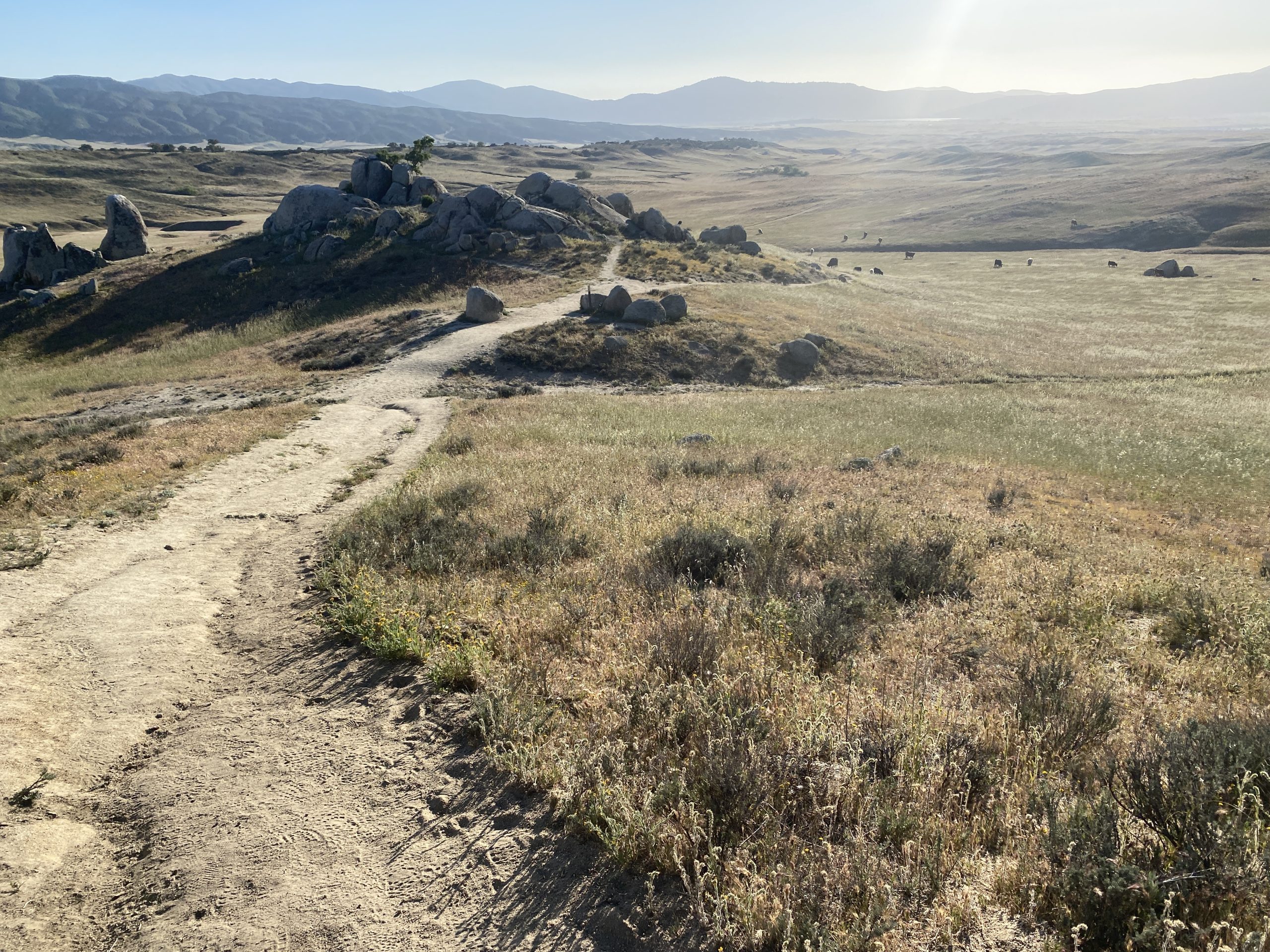
Scissors Crossing to Warner Springs (PCT mi 77.3 to mi 109.5)
Mileage: 32.2 miles
Permit required? No
This Southern California stretch is ideal for a weekend adventure and offers a surprising variety of landscapes over its 33 miles. You’ll start with panoramic views of the Anza-Borrego Desert, gradually climbing into rolling grasslands and shaded oak-studded chaparral, making it feel like you’ve hiked through three different ecosystems in just a couple of days.
As you near Warner Springs you’ll pass by Eagle Rock, one of the most recognizable and beloved landmarks of the PCT’s desert section. With its striking resemblance to a perched eagle, it’s a photo-worthy landmark, a natural gathering point for hikers and, if you camp nearby, you might end up sharing camp with some cows, too.
While there’s a small parking pullout at Scissors Crossing, Warner Springs is generally the better spot to leave a car due to its quieter surroundings and distance from Highway 78. If you’ve got time to spare, make a detour to Julian, a nearby mountain town famous for its homemade apple pie, hiker-friendly vibe, and welcoming local shops—perfect for carb-loading before you hit the trail, if time allows.
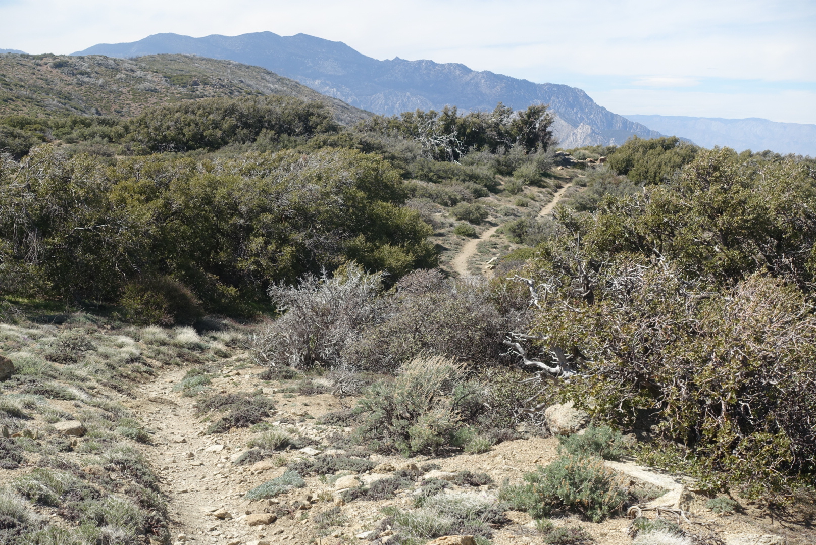
Paradise Valley Cafe to Idyllwild (PCT mi 151.8 to mi 179.4)
Mileage: 27.6
Permit required? Yes, $5 per person for permit covering San Jacinto Wilderness and San Jacinto State Park. More permit details here.
This is a beautiful and accessible section to tackle for a weekend backpacking trip in Southern California, offering alpine views, steady elevation gain, and a perfectly rewarding finish in Idyllwild, one of the cutest mountain towns in all of Southern California. With parking available at both ends, it’s a great option for hikers using the two-car shuttle method or anyone looking to experience a memorable stretch of the Pacific Crest Trail over a few days.
The hike begins near Paradise Valley Cafe, just off Highway 74, about a mile from the PCT. This rugged and beloved biker bar and cafe is a popular stop for thru-hikers and offers a decent sized parking lot. If you plan to leave a vehicle there, it’s important to contact the cafe in advance and ask for permission, since the lot is privately owned. This same rule applies to any privately owned lots—always check before leaving a car.
From the trailhead, the route climbs into the San Jacinto Wilderness, offering a mix of mountain views, shaded forest sections, and dramatic glimpses of the desert far below. The hike ends in the town of Idyllwild, where you can enjoy good food (Idyllwild Pizza Co.), a walkable downtown, and a great mountain-town atmosphere to end your weekend on trail.
The Sierra
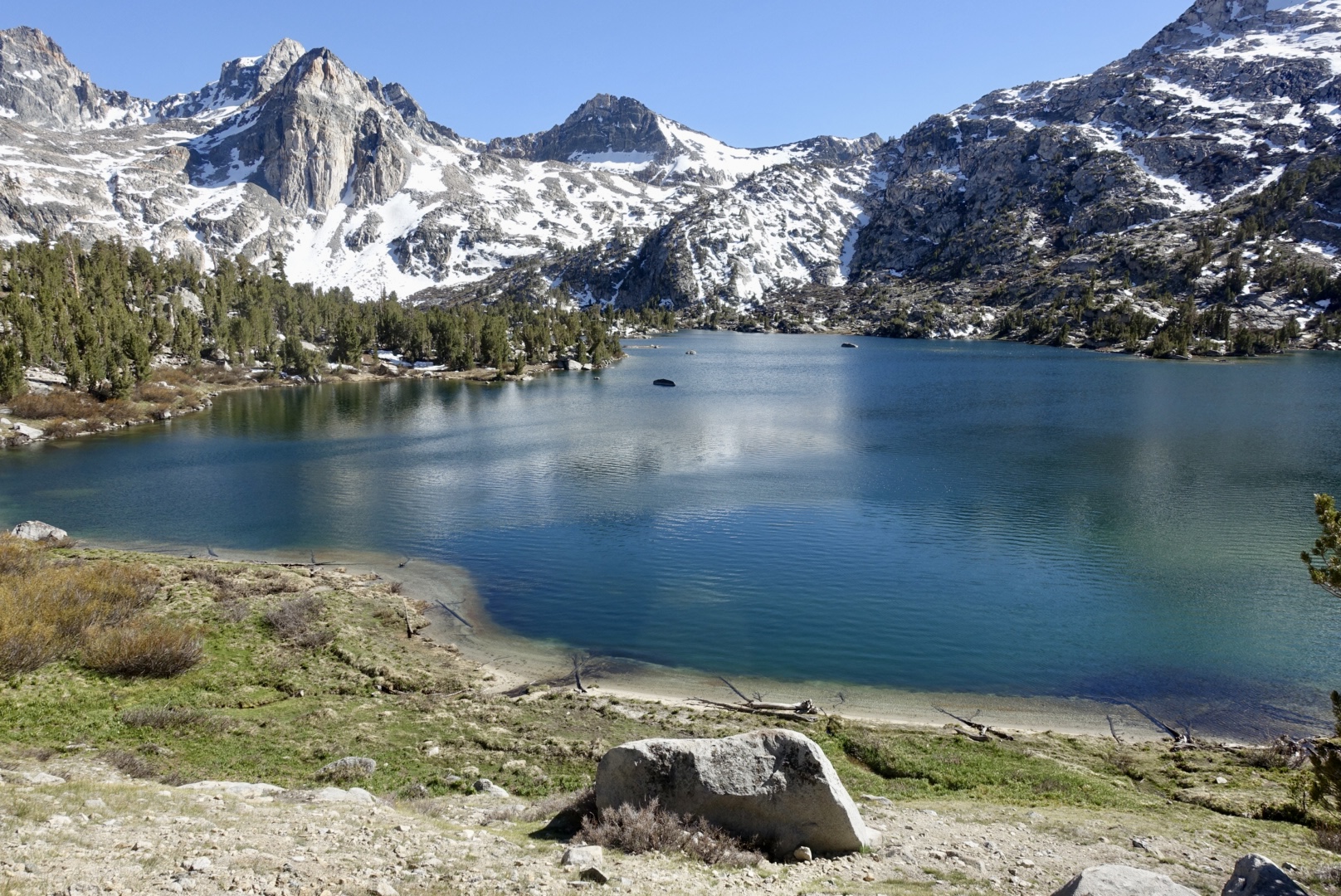
Kearsarge Pass to Rae Lakes out and back (PCT mi 790.3 to 794.7)
Mileage: ~24.5 miles
Permit required? Yes, permits for Inyo National Forest are required. 60% of permits released six months in advance and 40% released two weeks in advance, both at 7 am PST on Recreation.gov.
Starting at Kearsarge Pass, you’ll head 7.5 miles up the Kearsarge Pass Trail until you hit the PCT at mile 790.3. From there, you’ll head North on the PCT for 4.4 miles, hiking up and over Glen Pass, before you reach camping options around Rae Lakes. This is an out-and-back route—about 12 miles each way—crossing two high alpine passes (Kearsarge and Glen Pass) to reach the remote and beautiful Rae Lakes and then retracing your steps back to the trailhead.
The scenery in this stretch of the high Sierra is almost unbelievable. Towering granite crags, deep alpine lakes, and potential Sierra wildlife encounters make the challenging miles worth it. If tackling this section, be prepared to be above 10,000 feet for most of the hike. It’s definitely one of the harder areas to secure a permit for in the Sierra but if you can manage it and are flexible on your hiking dates, it’s an extremely rewarding weekend trip in the Sierra.
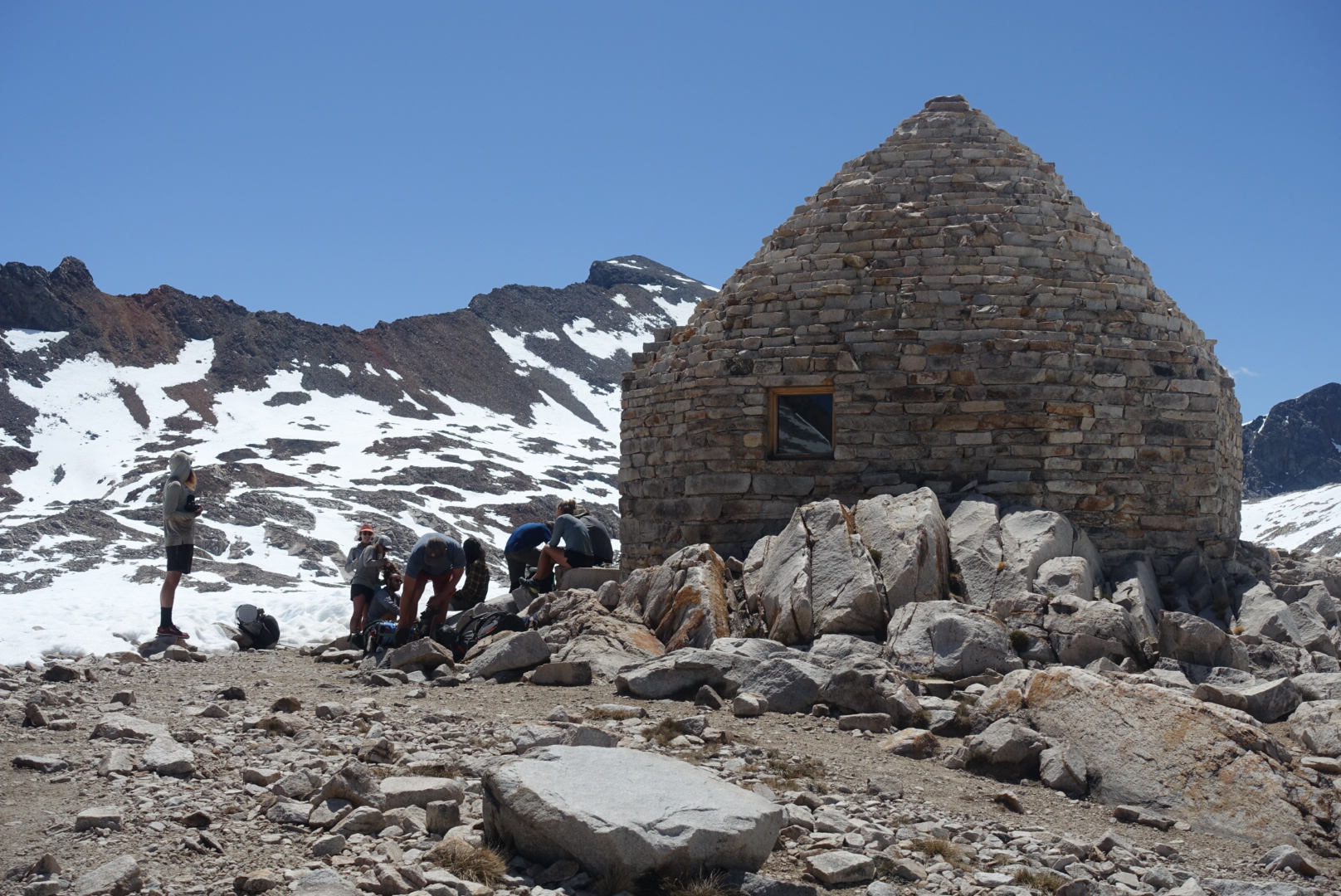
Bishop Pass to Muir Hut out and back (PCT mi 832.2 to mi 839.7)
Mileage: 38.4
Permit required: Yes, permits for Inyo National Forest are required. 60% of permits released six months in advance and 40% released two weeks in advance, both at 7 am PST on Recreation.gov.
Starting from the Bishop Pass Trailhead, you’ll hike 11.7 miles up and over Bishop Pass until you reach the PCT at mile 832.2. From there, head North on the PCT for another 7.5 miles until you reach Muir Pass and the iconic stone Muir Shelter perched at the top. Campsites can be found both a few miles before and after the pass, giving you some flexibility depending on your pace and direction.
This stretch is dramatic and rugged, with big climbs, sweeping alpine views, and that classic high Sierra feeling of being way out there. One important note: Muir Pass is notorious for holding snow well into the summer, with long snowfields on either side. Be sure to check current conditions and plan accordingly—sometimes snow gaiters and long pants can help when you posthole, even late in the season. If you’re up for the challenge, though, it’s an unforgettable section of trail.
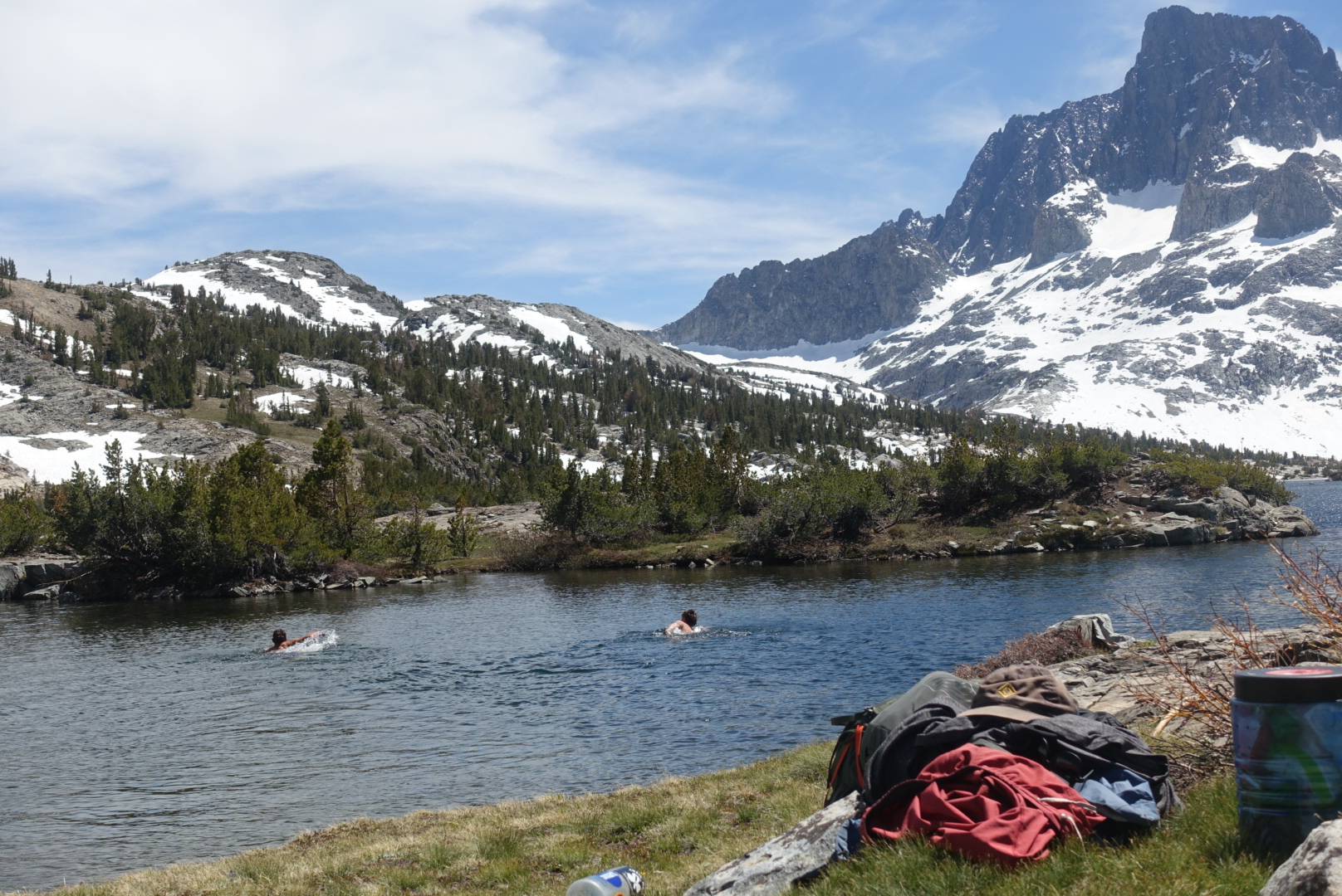
Reds Meadow to Tuolumne Meadows (PCT mi 907.8 to mi 943.7)
Mileage: 35.9
Permit required: Yes, permits for Yosemite Wilderness are required. 60% of permits released six months in advance and 40% released two weeks in advance, both at 7 am PST on Recreation.gov.
This section is your classic, jaw-dropping, Sierra scenery. Red’s Meadow makes for a convenient jumping-off point, with a small general store and summer shuttle service into Mammoth Lakes. It’s only about a half-mile off the PCT, making it an easy spot to begin hiking north (or end if you decide to hike south).
Important note: as of current, Red’s Meadow Road is closed for construction and is expected to remain closed through 2026. During this time, consider starting your hike from the Horseshoe Lake Trailhead near Mammoth Lakes instead. There’s a large parking lot and established trail access there, but it will add about 4.4 miles to your trip.
Along this stretch, you’ll pass iconic High Sierra landmarks like Devil’s Postpile, Thousand Island Lake and Donohue Pass before descending into the outskirts of Yosemite National Park. The Tuolumne Meadows Store, located just 0.3 miles off trail on Tioga Road, can be a great end location for this section. If you’re looking to extend your trip, you can catch a shuttle or drive from Tuolumne into Yosemite Valley—but keep in mind that campsites in the Valley book up well in advance so plan accordingly.
Northern California
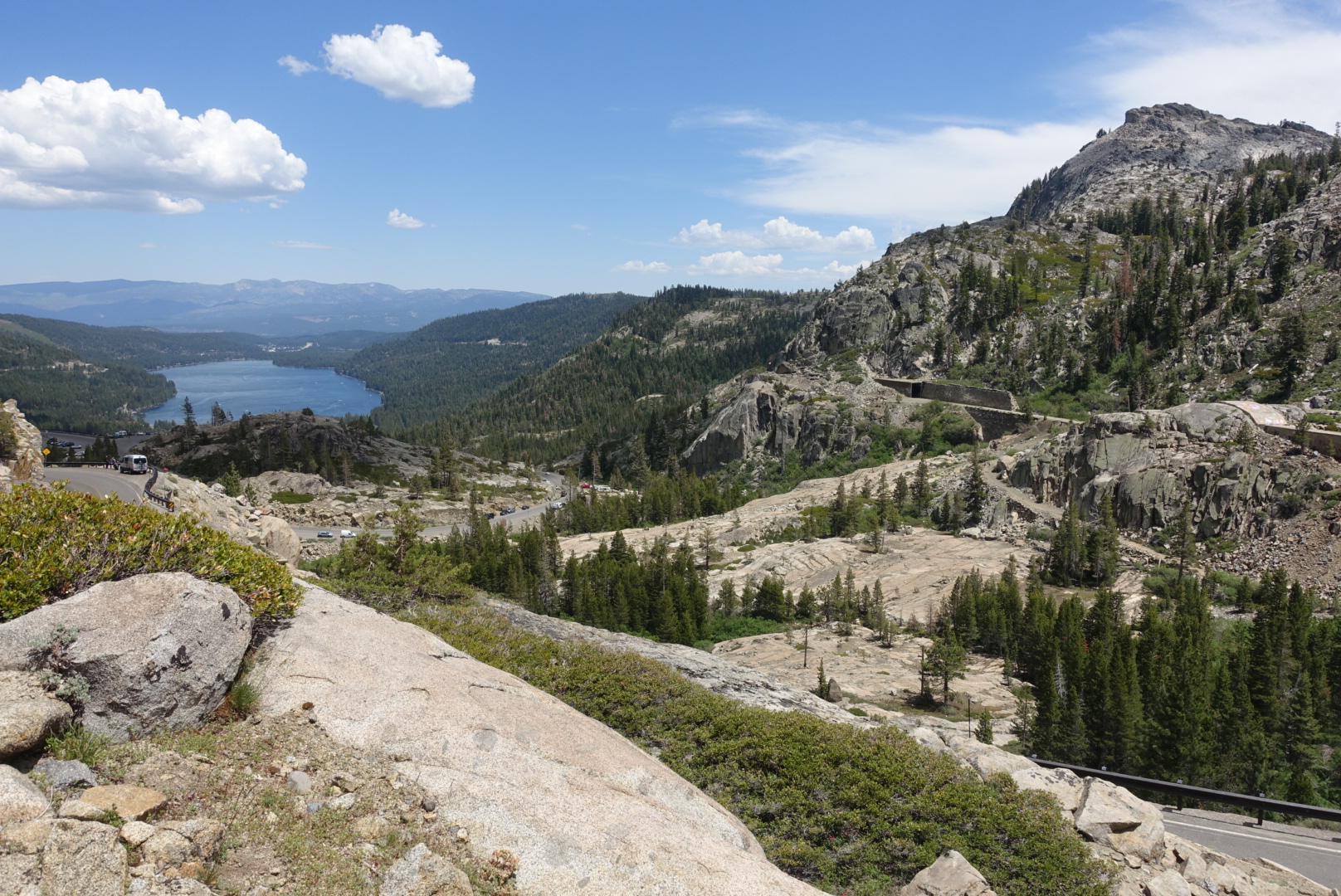
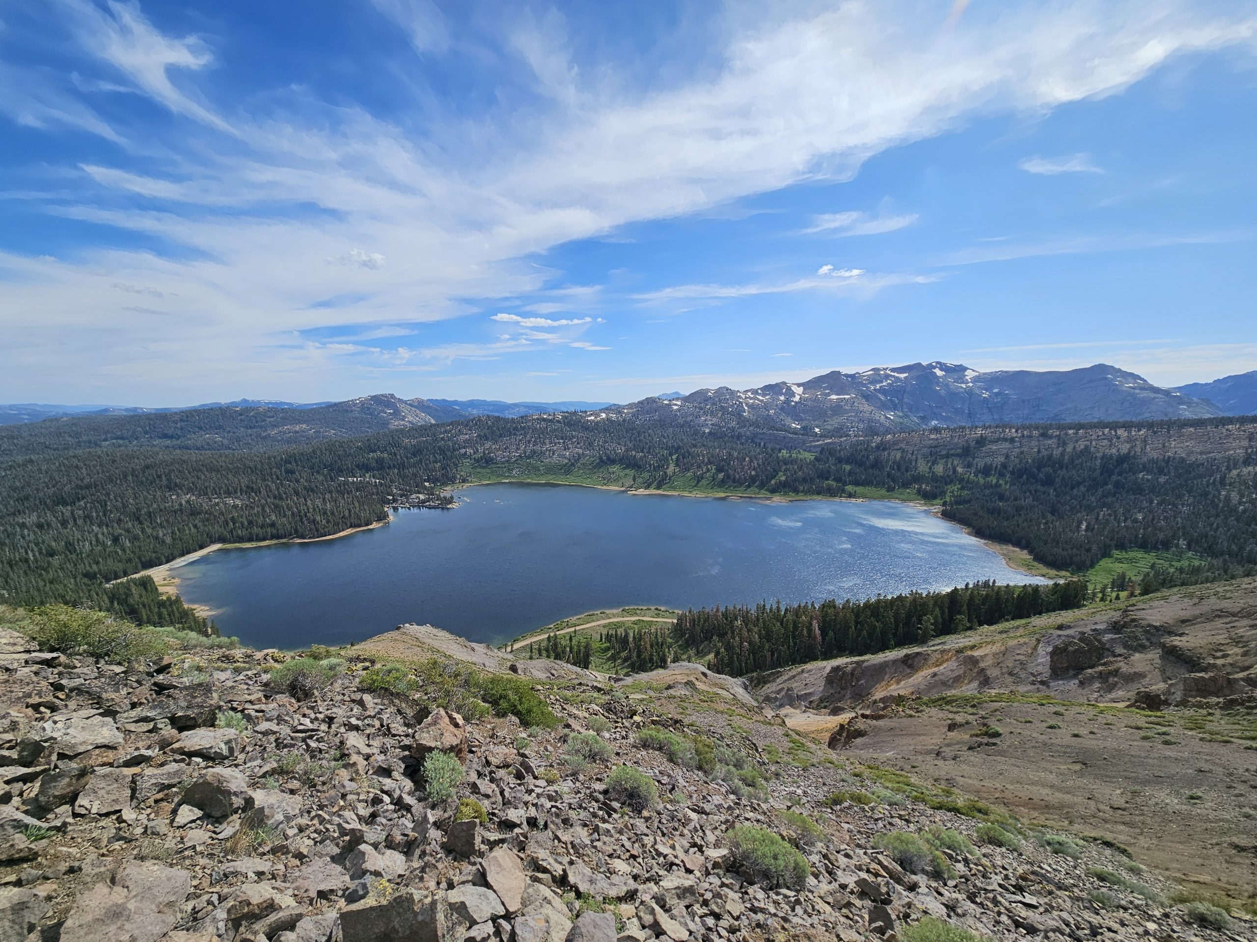
Donner Summit to Sierra City (PCT mi 1154.5 to mi 1196.5)
Mileage: 37.5 (if starting at Highway 80)
Permit required? No
Otherwise known as California Section L of the PCT (Highway 80 to Highway 49), this stretch covers about 37.5 miles—starting officially at Highway 80, a few miles north of Donner Ski Ranch. Donner Ski Ranch is just 0.3 miles off trail across Highway 40 and makes for a great spot to grab a meal before you start your trip; they are very used to hikers coming by and are super hiker friendly.
This section features some beautiful Tahoe National Forest scenery, a pass by the Peter Grubb Hut managed by the Sierra Club, and a visit to the small mountain town of Sierra City where there are a handful of restaurants and a general store built alongside the Yuba River. The town of Sierra City is accessed by walking about 1.5 miles down Highway 49 from the PCT and is filled with local charm- a great place to end your section, especially since the climb out of Sierra City heading north on the PCT is notoriously steep.
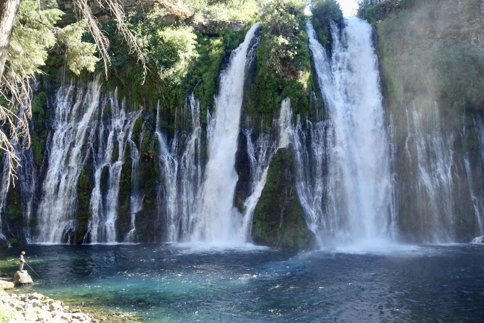
Hat Creek Overlook to Burney Falls State Park (PCT mi 1381.5 to mi 1420.5)
Mileage: 39
Permit required? No
Highlights of this section include the welcoming Hat Creek Resort campground—a great spot to make camp if you have a night to spare before your hike. Just a short detour from the trail heading north, Subway Cave offers a fascinating glimpse into the area’s volcanic history with its walk-through lava tube formation, making it super fun side trip- just remember your headlamp or flashlight. Throughout this section, you’ll enjoy stunning distant views of Mount Shasta rising up over the valley, a constant reminder of the volcanic past (and future?) of Northern California.
The section ends at the breathtaking Burney Falls, one of the most spectacular waterfalls in the state and a must-see for any hiker passing through. The falls cascade into a crystal-clear pool, surrounded by lush greenery—a perfect place to relax and soak it all in after your trek. And if you’re lucky, the soft serve machine at the Burney Falls State Park general store will be up and running when you arrive and you can enjoy a well-earned treat to cap off your adventure!
Oregon
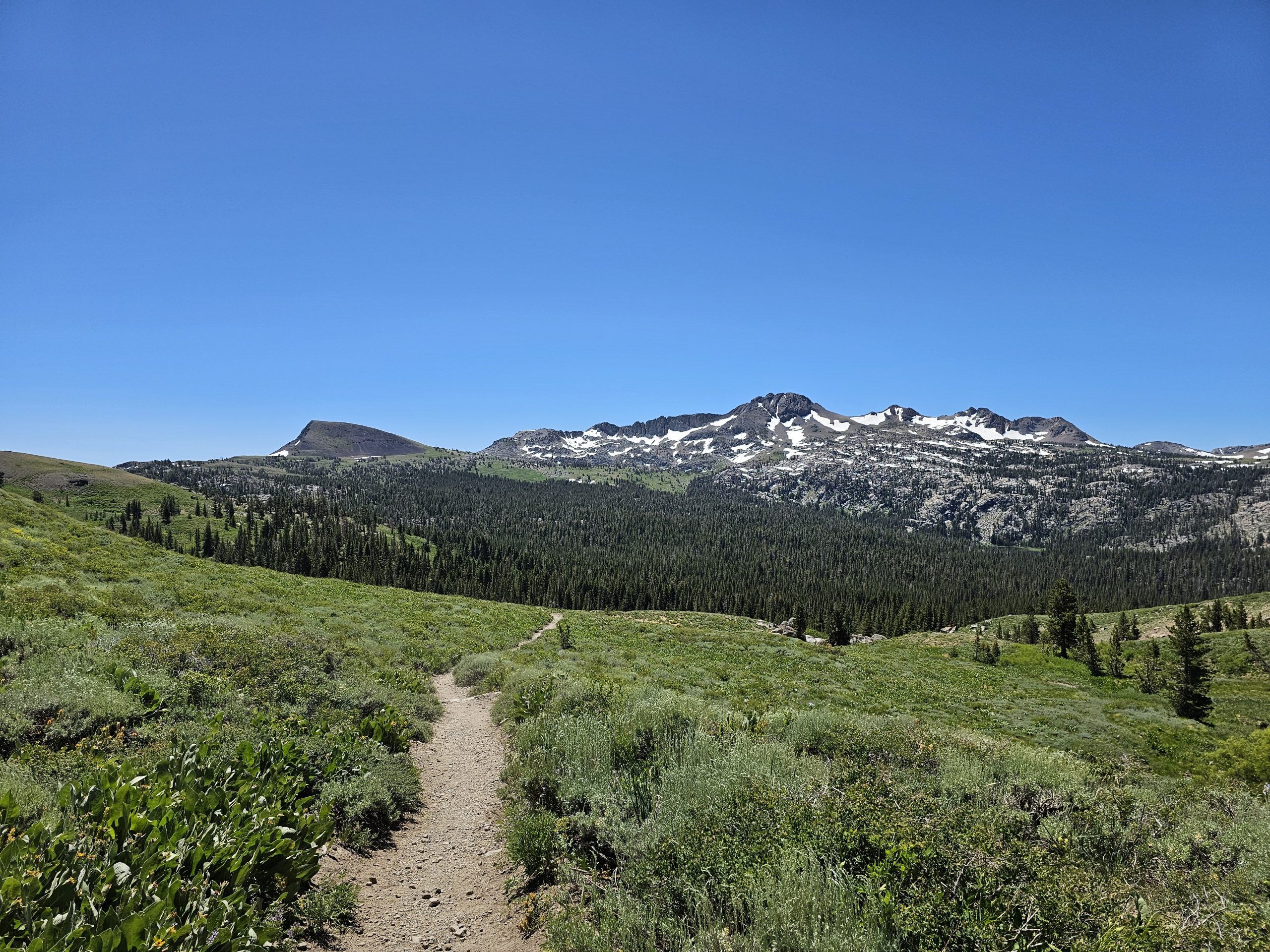
Mirror Lakes Trailhead to Mckenzie Pass (PCT mi 1960.6 to mi 1985.3)
Mileage: 28.2 (24.7 PCT miles + 3.5 side trail miles)
Permit required? Yes, if visiting between June 15th and October 15th a Central Cascades Wilderness permit is required. 40% of permits are available the first Tuesday in April, then 60% of permits available 7 days prior to start of trip. Check availability at Recreation.gov.
Start by heading about 3.5 miles northwest on the Mirror Lakes Trail to reach the Pacific Crest Trail at mile 1960.6. From there, follow the PCT north through the stunning Three Sisters Wilderness, passing by the South, Middle, and North Sister peaks as you make your way toward Mackenzie Pass on Highway 242.
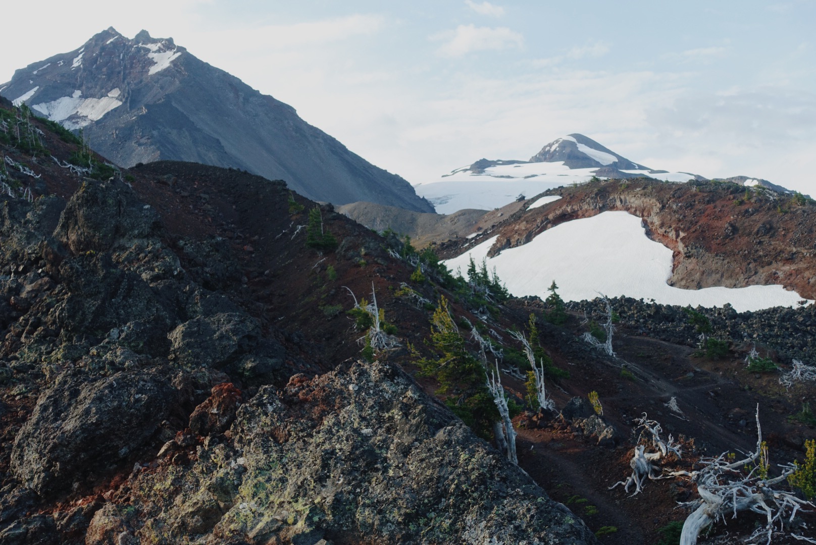
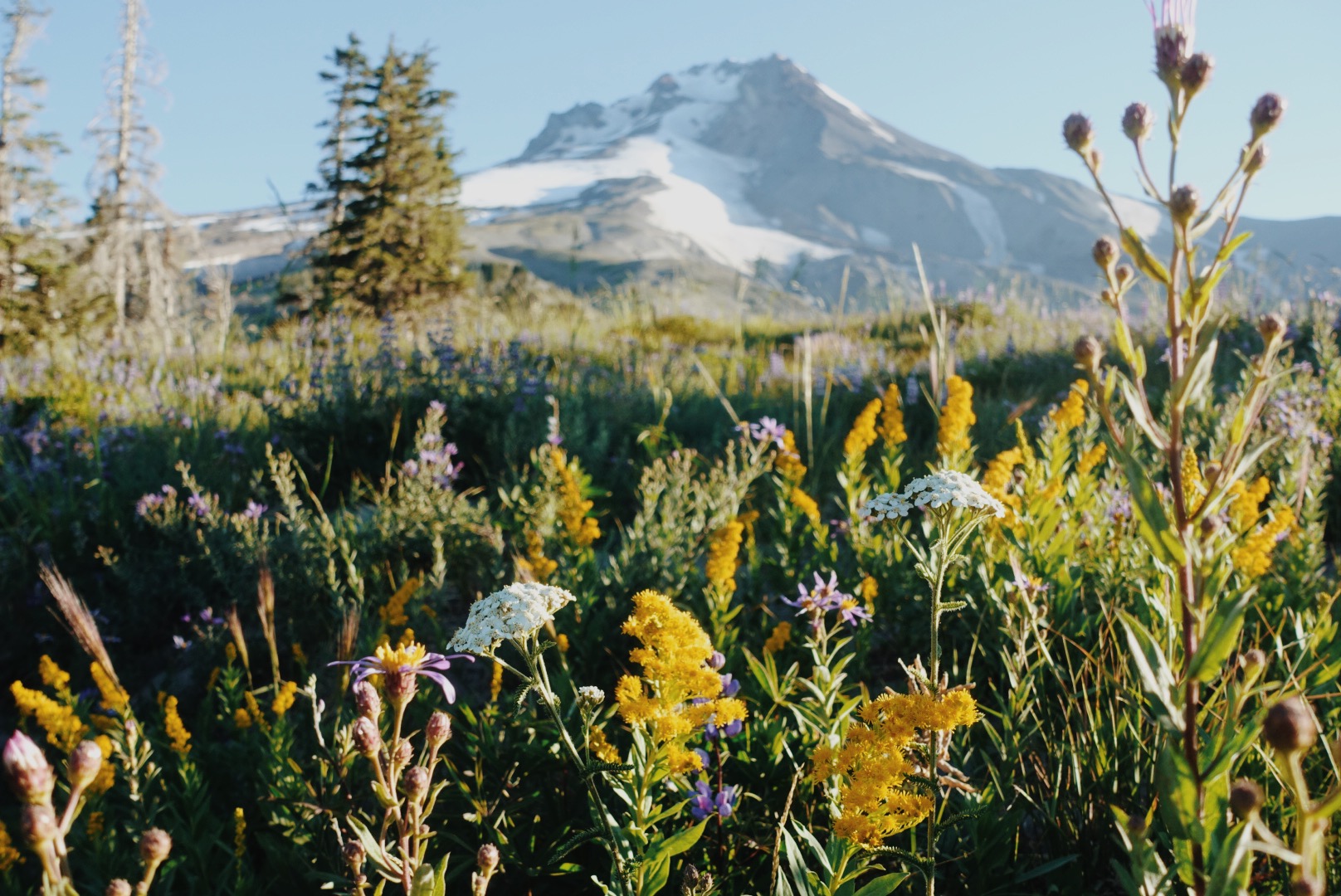
This section offers one of the biggest bangs for your buck as a section hike on the PCT, packing incredible scenery into a manageable couple day distance. Along the way, you’ll hike past several 10,000+ foot volcanic peaks that are part of the Cascade Volcanic Arc. You’ll also come across an obsidian area, where volcanic glass sits in piles along the trail, adding a unique geological aspect to your adventure. Wildflower fields bloom vibrantly in the spring and summer seasons, and on clear days, you can enjoy views of Mount Jefferson to the north. This stretch perfectly combines dramatic landscapes and diverse ecosystems, making it an unforgettable weekend backpacking trip.
Timothy Lake to Timberline Lodge (PCT mi 2077.9 to mi 2100.0)
Mileage: 22.1
Permit required? No
Timothy Lake is a popular spot in Oregon with several campgrounds right around its shores—the closest just about half a mile from the PCT. Starting your hike here makes a lot of sense since it’s easy to get to from well-traveled roads and offers direct access to the trail.
This section has plenty of highlights, including the beautiful Timothy Lake itself and the quirky Little Crater Lake (not to be confused with the much bigger Crater Lake National Park). Along the way, you’ll come across a YETI Danger meter—a popular photo stop—which adds a fun element to the section. Plus, you’ll get spectacular views of Mt. Hood as you move through the landscape. When you wrap up this stretch, you can wander through the famous Timberline Lodge and maybe even grab a bite (or two) at the famous Timberline Lodge Buffet.
Washington
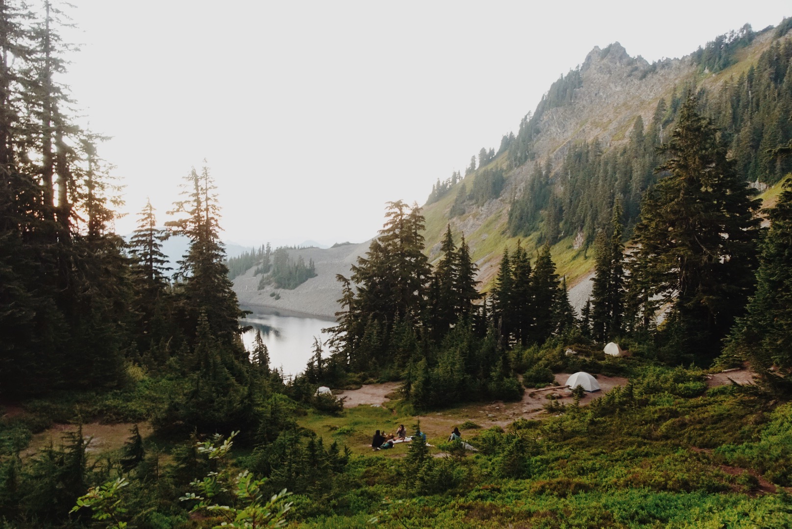
Snoqualmie Pass to Spectacle Lake and back (PCT mi 2396.3 to mi 2413.5)
Mileage: 34.4 (17.2 PCT miles out and back)
Permit required? Yes, free self-issue at most Ranger Stations in the area.
This section gives you a real taste of the rugged Washington mountains as you hike through the Alpine Lakes Wilderness. You’ll be rewarded for the effort with stunning views of alpine lakes and jagged peaks all around. Snoqualmie Pass is a small ski resort area that offers a few good food options during the summer months (don’t miss the gas station pizza place).
If you want to get a little closer to the water, the Spectacle Lake Trail drops about half a mile down to the lake— worth the side trip before you head back the way you came if you don’t mind adding a bit more elevation to the day.
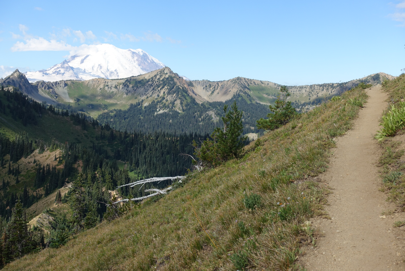
White Pass to Chinook Pass (PCT mi 2298.1 to mi 2327.0)
Mileage: 28.9
Permit required? Yes, since you pass through Mount Rainier National Park you will need a wilderness permit that can be obtained online in advance at Recreation.gov or on site first-come first-serve.
About 0.6 miles west along Highway 12 from the White Pass trailhead, you’ll find the Kracker Barrel—a small store with a limited but handy selection of food and supplies. It’s a convenient spot to grab snacks or top off your water before you hit the trail. There’s also a parking lot right where the PCT crosses the highway, making access easy for a car drop-off.
This section takes you through some stunning terrain within Mount Rainier National Park, where dense old-growth forests, wildflower-filled meadows, and of course, Mount Rainier, dominate the landscape. You’ll experience classic Pacific Northwest mountain scenery as you make your way toward Chinook Pass, climbing and enjoying breathtaking views at nearly every turn. This stretch is ideal for weekend backpackers wanting to soak in the beauty of the Cascades without the crowds (or the distance) of the Wonderland Trail.
Rainy Pass to Stehekin and back (PCT mi 2575.1 to mi 2594.6)
Mileage: 39 (19.5 PCT miles out and back)
Permit required? Yes, North Cascades National Park requires a permit. 60% will be reservable in advance on Recreation.gov and 40% will be available walk-up on a first come, first serve basis.
This section is out there—and that’s what makes it so special. It’s remote, rugged, absolutely gorgeous, and the only southbound hike on this list (but many of these sections you can decide to hike northbound or southbound). You’ll get big North Cascades views right away, with steep ridge lines and glimpses of massive peaks like Mount Rainier in the distance. The terrain feels wild and exposed in all the best ways.
You’ll eventually make your way down toward Stehekin, a tiny, off-grid community that’s only accessible by foot, boat, or float plane. From where the PCT hits High Bridge, you’ll want to catch the shuttle bus in the summertime, or else it’s an extra 10.8 miles round trip on Stehekin Valley Road. The shuttle is great- it stops at the Stehekin Pastry Company on the way into town, and trust me, that cinnamon roll might be the best thing I’ve ever eaten.
Stehekin itself has a post office, small general store, a few lodging options, and ferry access to the town of Chelan if you want to get a boat ride back to “civilization” instead of hiking back toward Rainy Pass. It’s one of the more remote and rewarding sections of the Washington PCT, and totally worth the extra logistics.
What sections do you love to hike over a weekend?
Comment below and let’s make an even bigger list of great section hike options!

PPPPPP. Military people will immediately recognise this most fun of all the acronyms. For those unfamiliar, prior planning prevents piss poor performance.
Last night we had an updated weather forecast suggesting thunderstorms may roll through camp in the morning. With this knowledge, I packed everything in my pack before falling asleep, safe in the knowledge that I could break camp quickly and head over to the hut to avoid a soaking wet tent.
Sure enough, at 415am the thunder and lightning arrived. Fortunately Chestnut heard it as I was dead to the world, and I heard him start to pack in his tent that was next to mine on the platform. Because of PPPPPP, I was able to instantly stuff my quilt into my pack, then stuff my air mattress, put on my shoes and get out of the tent, break down the tent and stuff the tent at the top of the pack. Time taken: five minutes and thirty seconds from waking to walking toward the hut. I even impressed myself a little.
Safely ensconced inside, the storm rolled through and poured down. The next section of trail is above tree line, so we now had a nervous wait to hear the updated forecasts from Mt Washington that is delivered to all huts and campsites in the Whites at 7am. The first of two free nights gifted by a hiker that left the trail a few days ago depends on being able to not get zapped by a huge clap of electricity while heading for Lake of the Clouds.
Weather
At 7am the storm had passed so we wandered back over to the campsite to hear the forecast. Fortunately it was great news, with the front passing through in the morning, and a pleasant afternoon incoming. With this good news, we decided to celebrate by making Sofia surprise pancakes. We snuck up to the caretaker cooking area and prepared the food. Sofia was suitably surprised by our efforts and we spent the morning hanging about the hut after the pancakes waiting for the weather to clear.
The hut croo then fed us some leftover cake. As keen readers will note, I now have about six days of food in my pack and I continue to consume almost none of it. This is not a problem I have ever run into hiking anywhere else in the world. It is causing me equal parts concern and hilarity.
Hiking
After almost 48 hours of excellent rest at the hut and campsite, it was time to get hiking once more. The climb out of the camp was a reasonably easy affair, and the views slowly opened up once we gained the ridgeline.
Reasonably clear weather was the order of the day post lunch, and after a few short hours the Lake of the Clouds came into view. I headed into the hut and claimed the first of two free nights of hut accommodation that had been gifted to me by a kind hiker that left the trail a few days earlier.
Lake of the Clouds
This hut is by far the most utilised and popular in the Whites. It was like entering a madhouse. The noise of the people was overwhelming, a full house of humanity after spending a month not seeing more than a handful of people in one place.
I chilled out in my bunk through the remainder of the afternoon, writing some blogs and reading a book. At 6pm the croo announced dinner and they definitely did not need to call me twice.
The four course dinner was extraordinary. I chatted with my table mates, and was the only thru hiker among a number of overnight hikers. This led to many questions about my level of insanity and why I would want to spend months at a time in the wilderness.
The great part of being the only thru at my table was the desire of everyone to see that I was well fed. Huge advantage of looking like a zombie. I ate so much food I thought I would explode.
Chestnut had managed to get WFS at the hut. Lake of the Clouds is the one hut to take four people for WFS each night and tonight there were only two. I am genuinely curious as to why more thru hikers are not taking advantage of the free dinner and sleeping quarters, especially at this location three quarters of the way up Mt Washington. I can only assume it’s a combination of lack of knowledge of the program and the (general) desire of most thrus that I’ve met to hike all day and not looking to time a hut stay.
All too soon the meal was over. I toddled off to bed with a very satisfied tummy. I wonder if I’ll eat any of the food in my pack tomorrow.
This website contains affiliate links, which means The Trek may receive a percentage of any product or service you purchase using the links in the articles or advertisements. The buyer pays the same price as they would otherwise, and your purchase helps to support The Trek’s ongoing goal to serve you quality backpacking advice and information. Thanks for your support!
To learn more, please visit the About This Site page.
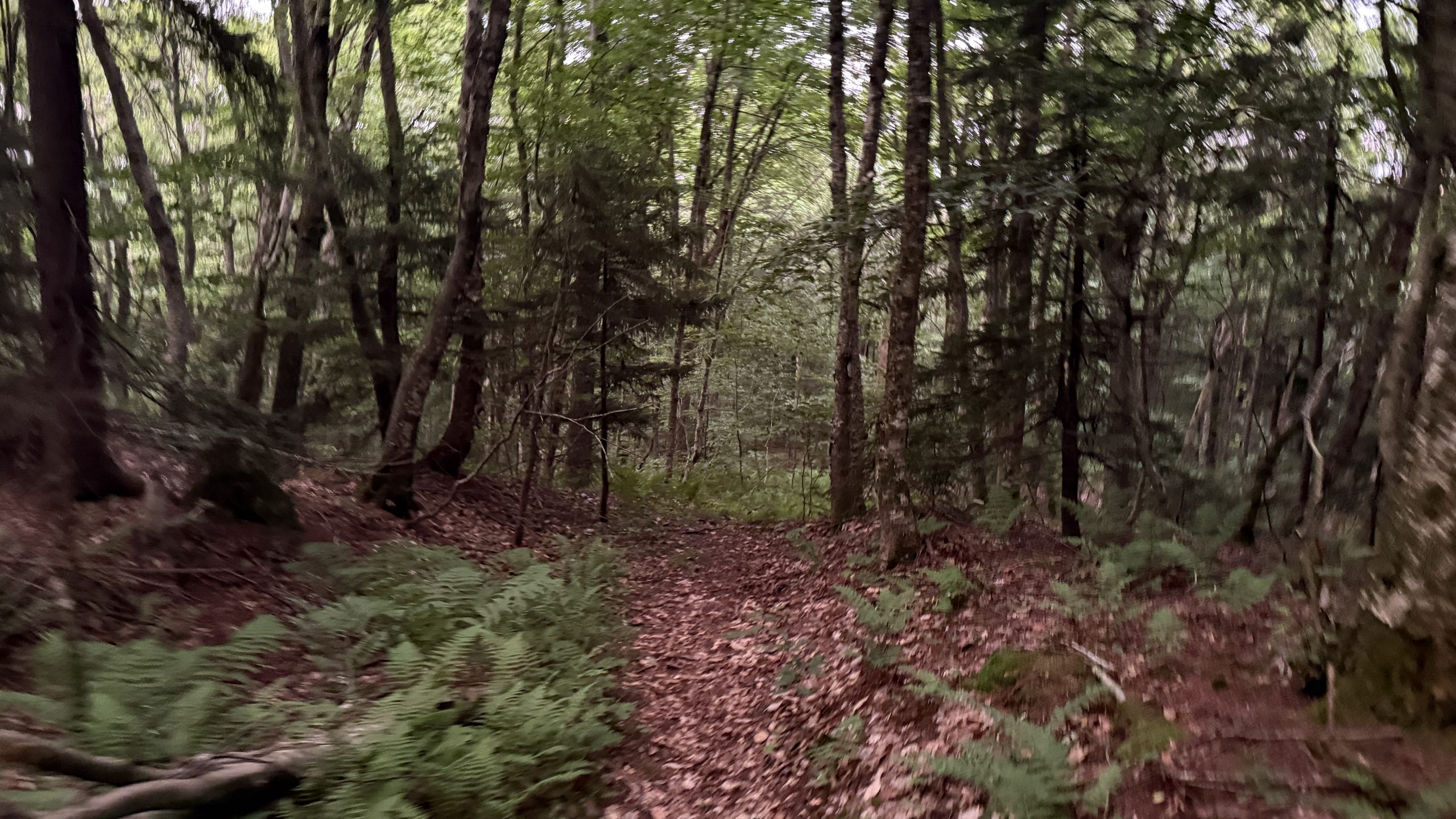
The morning’s hiking was fairly unremarkable. I got started a bit late, traversed the minor ups and downs, and met a hiker called Big Rig at a water source. I like easy days like this, it means I can turn off my mind and just walk.
The afternoon was more interesting however. Immediately after lunch I began a fairly long climb up the side of a mountain called The Nipple.
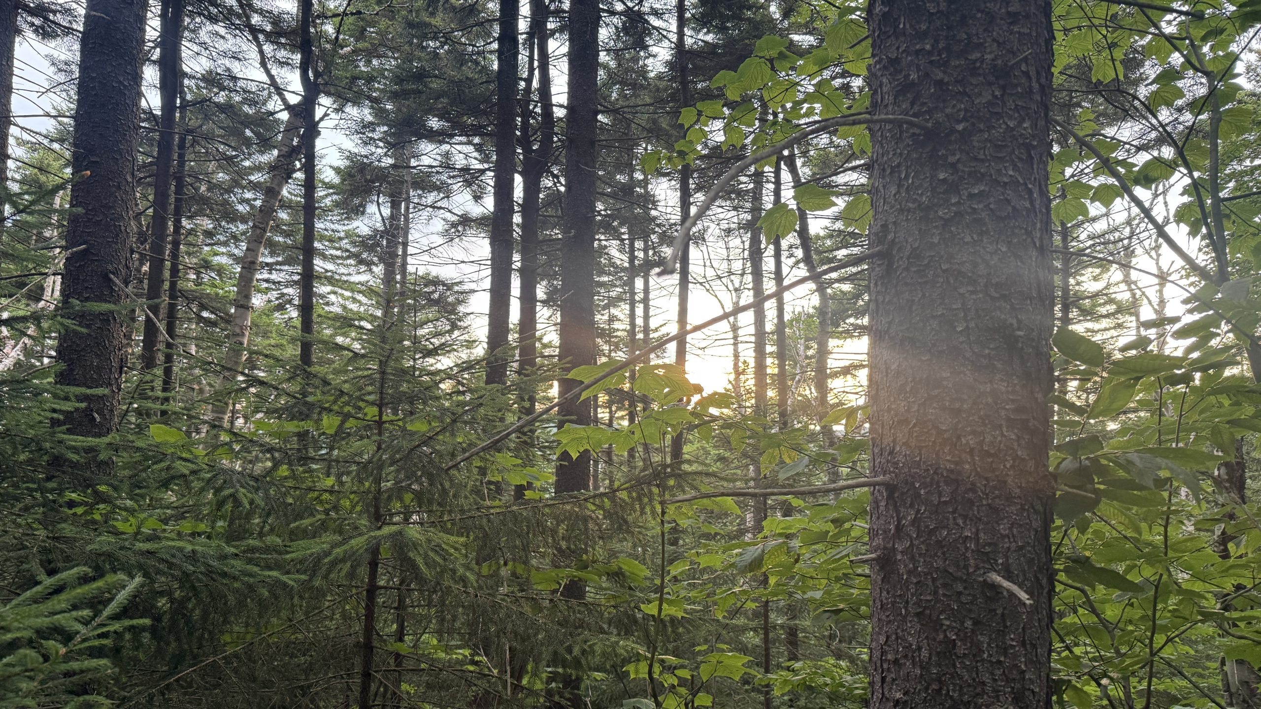
Most of the trail up here was above the treeline and the wind was crazy strong. It was rocky and open and the path was a little rough but the views were very good. I didn’t take the side trail up to the peak as it looked straight up and my ankle was feeling pretty tired. Walking this area meant I was constantly bracing myself against the wind but it also meant that, when I passed behind a rock outcropping on the descent, the sudden absence of that wind caused me to stagger to the side.
I got below the trees, out of the gale, and found a small campground to crash in. There was another hiker already here and to my surprise, they were a SOBO (southbound) PCT section hiker! I’d not met any SOBOs before and we chatted a bit over dinner, giving each other details of the upcoming terrain.
Day 95: Look at the Fireworks
Like the previous day, the morning was uneventful. I went over Carson pass easily and reached the trailhead shortly after, passing many day hikers on the way in. The information station there had a trail magic setup with snacks and sodas and I was all to happy to take advantage of it. I saw Presto again here and met a hiker called Celery.
The way onward was easy mountain hiking. It reminded me a little of the Tuolumne area of the Sierra as there were very many day hikers and weekend backpackers hiking around me. I’ve been a little careful up until now not to align my blog posts with any specific dates but it’s important to share here that today was the 4th of July so people were out and I knew there would be fireworks tonight. I could’ve made South Lake Tahoe today but I wanted to avoid the madhouse of a tourist town on a holiday so I’d planned to find a campsite with a view of the lake and watch the spectacle from a distance.
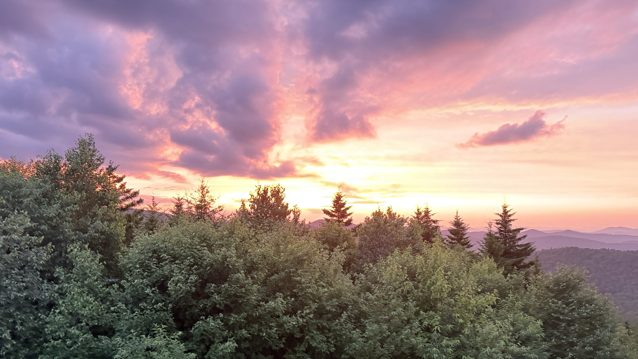
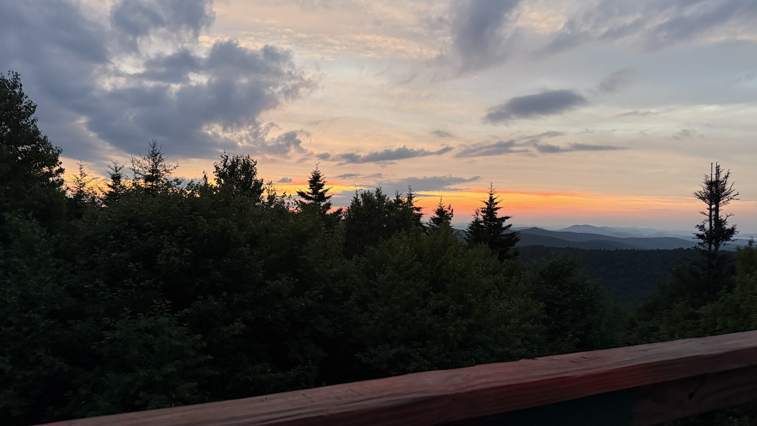
I found the perfect site, about 4 miles from the road, and found Presto and a hiker called Sketchy were already there. The show started at 9:30, past when I’m usually fully asleep, so I ate an early dinner and dozed for a few hours to try to keep myself well-rested for tomorrow. Come 9:15 I climbed a very large boulder set into the hill side next to my tent and enjoyed the show from there. The explosions were visible but far enough away to almost completely inaudible.
Day 96: The Bliss of New Shoes
Only being a few miles from town meant I was under no pressure to get up early and I made sure I slept in. The few miles into town were all downhill too. The last mile or so was through a section of burned forest, the first I’d seen on trail. The trees were grey and still and it was just a little eerie. Thankfully the mile went fast and I soon found myself with thumb out at the road. A cop pulled someone over right in the pullout section I was hitching from so I put my thumb down, thinking nobody was going to stop while that was going on. Entirely unprompted however a car pulled over and asked if I needed a ride into town! The driver named Tom and his wife Claudia were here for the holiday and were very excited to meet a PCT hiker. They dropped me off just across the street from the hostel where I would be staying. I dropped my pack off and picked up the new shoes I’d shipped here. I don’t think I can properly communicate the bliss of walking in new, supportive, grippy shoes after going miles in worn out footwear.
The rest of the day was town chores and relaxing. I purchased a new CNOC dirty bag to repace my broken one, wandered around town a little (chock full of tourists), and picked up some cheap backpacker meals from Sierra Trading Post. When I got back to the hostel I showered and did laundry then took advantage of their computer lab to write up a few blog posts. I headed to a well-rated burger place for dinner and discovered that just by walking down the street I had crossed into Nevada. I’d been paying relatively little attention to the map beyond the trail so it was a surprise when I crossed at an intersection and suddenly went from clothing stores to casinos. The burger was good though.
Day 97: Into Desolation Wilderness
Town meals are particularly exciting after long stretches on trail and the mountain of pork, eggs, and salsa over tortilla chips I ate at a local diner was divine. I packed up, showered, then kept blogging for the last hour before I had to check out. South Lake Tahoe has a Grocery Outlet thankfully so I headed there first for my resupply, then stopped by a more conventional (but more expensive) grocery store for the few items I couldn’t find. I ended up staying at this store, a Raley’s, for a little longer, using their Wi-Fi to get a few more posts finished and scheduled to go public. For anyone curious, I do most of my writing on the notes app on my phone and that can be done anywhere, but images and various configuration chores need to be done with an internet connection.
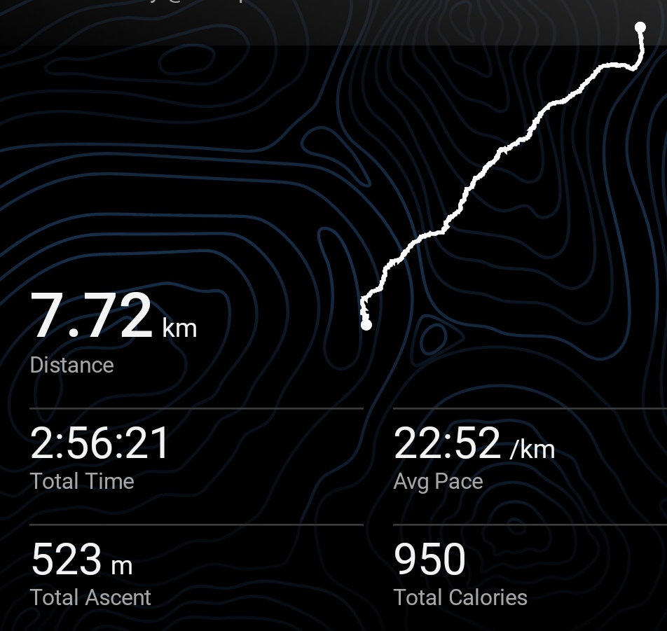
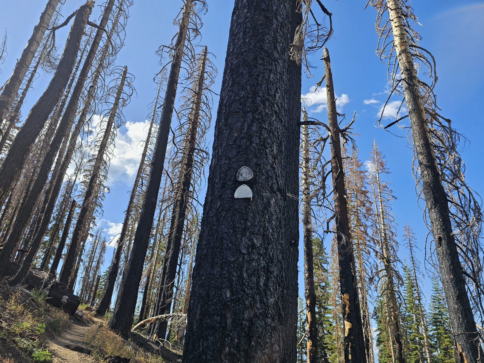
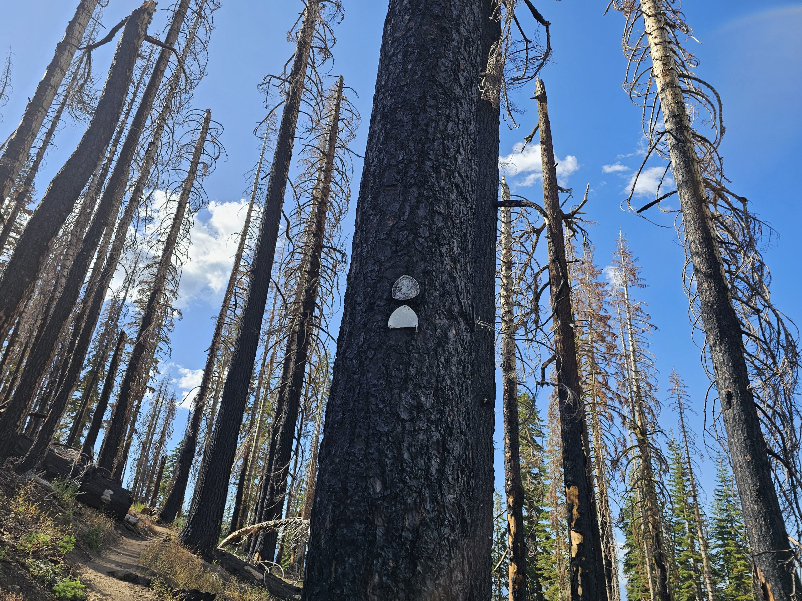
A local named Sydney gave me a hitch back to the trail and I was back among the trees. The burned trees unfortunately, large stretches of trail were blackened and dead.
I walked past Berkeley Echo Lake Camp, a summer camp I once CITed at in my teens, then past Echo Lake itself. A lot of people were here as well but as I hiked further they thinned out. I’d spent too much time in town though and it was getting dark as I climbed up from the lakes into Desolation Wilderness where I would be able to camp.
Day 98: Lakes I Want To Revisit
The late night meant I was up later than I’d liked and I think I need to start being more conscious of how I hike out of town. If I get back to trail too late, I don’t get to my campsite until too late as well and that throws off my hiking and sleeping schedule until I get to the next town.
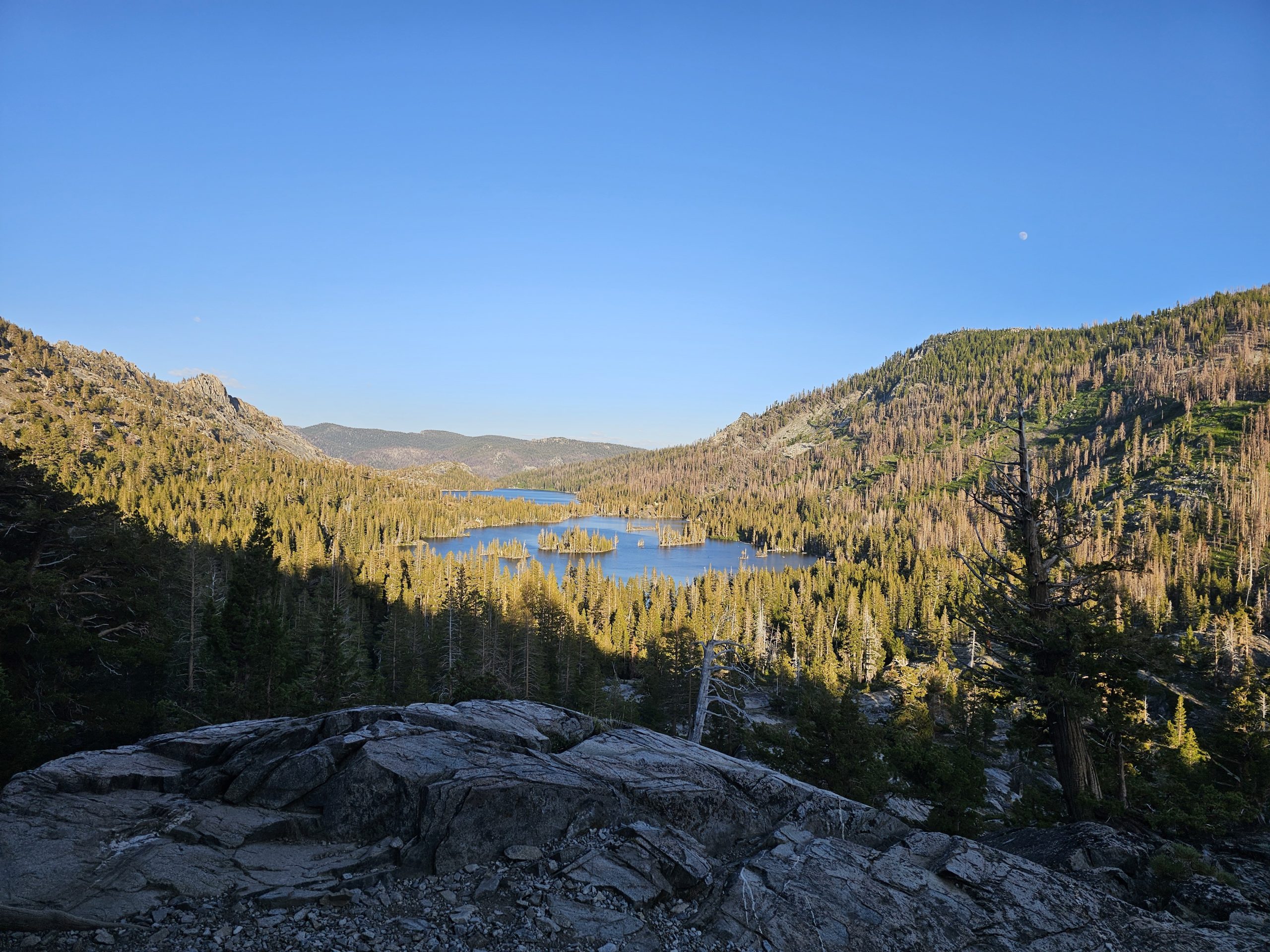
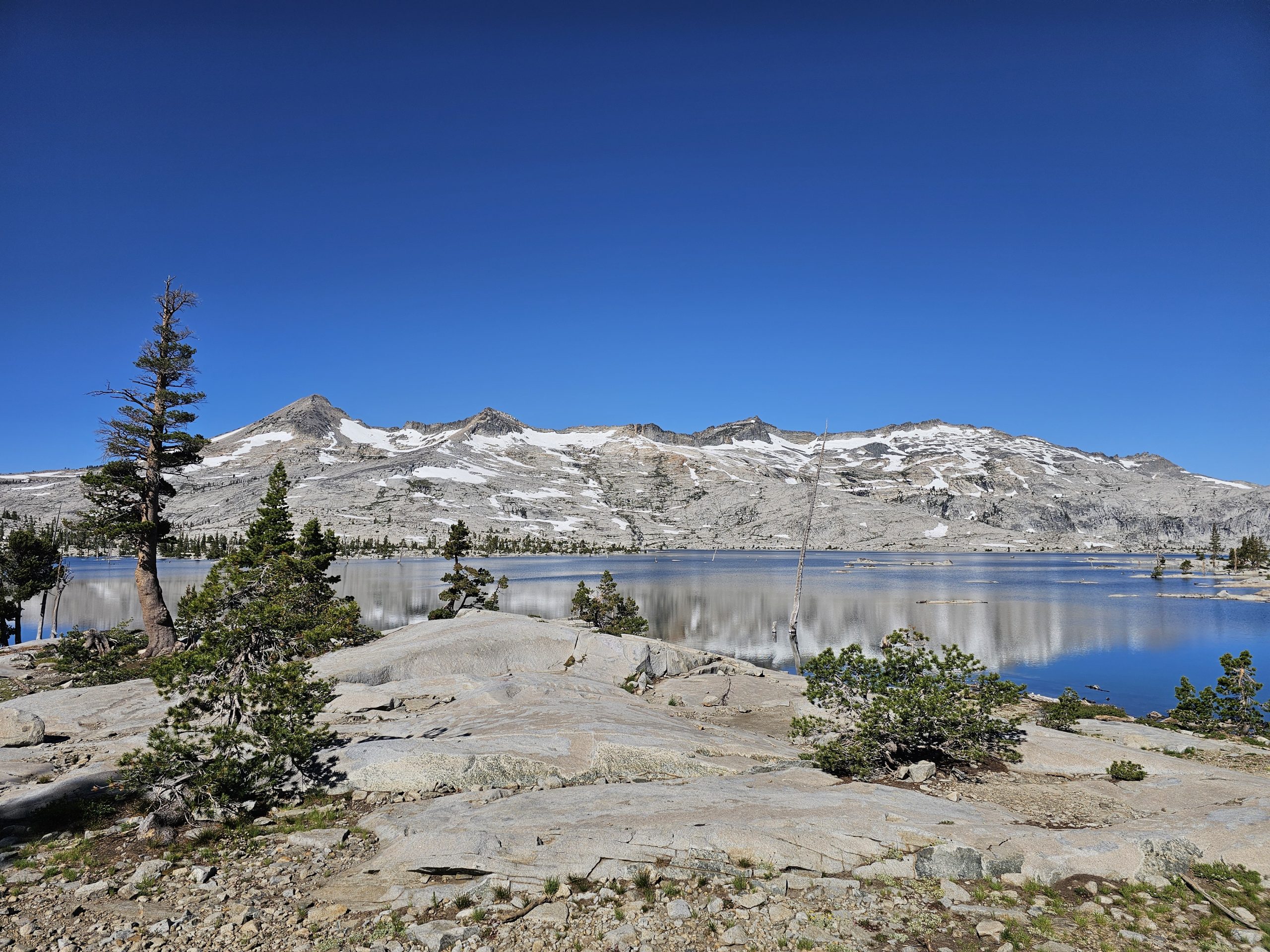
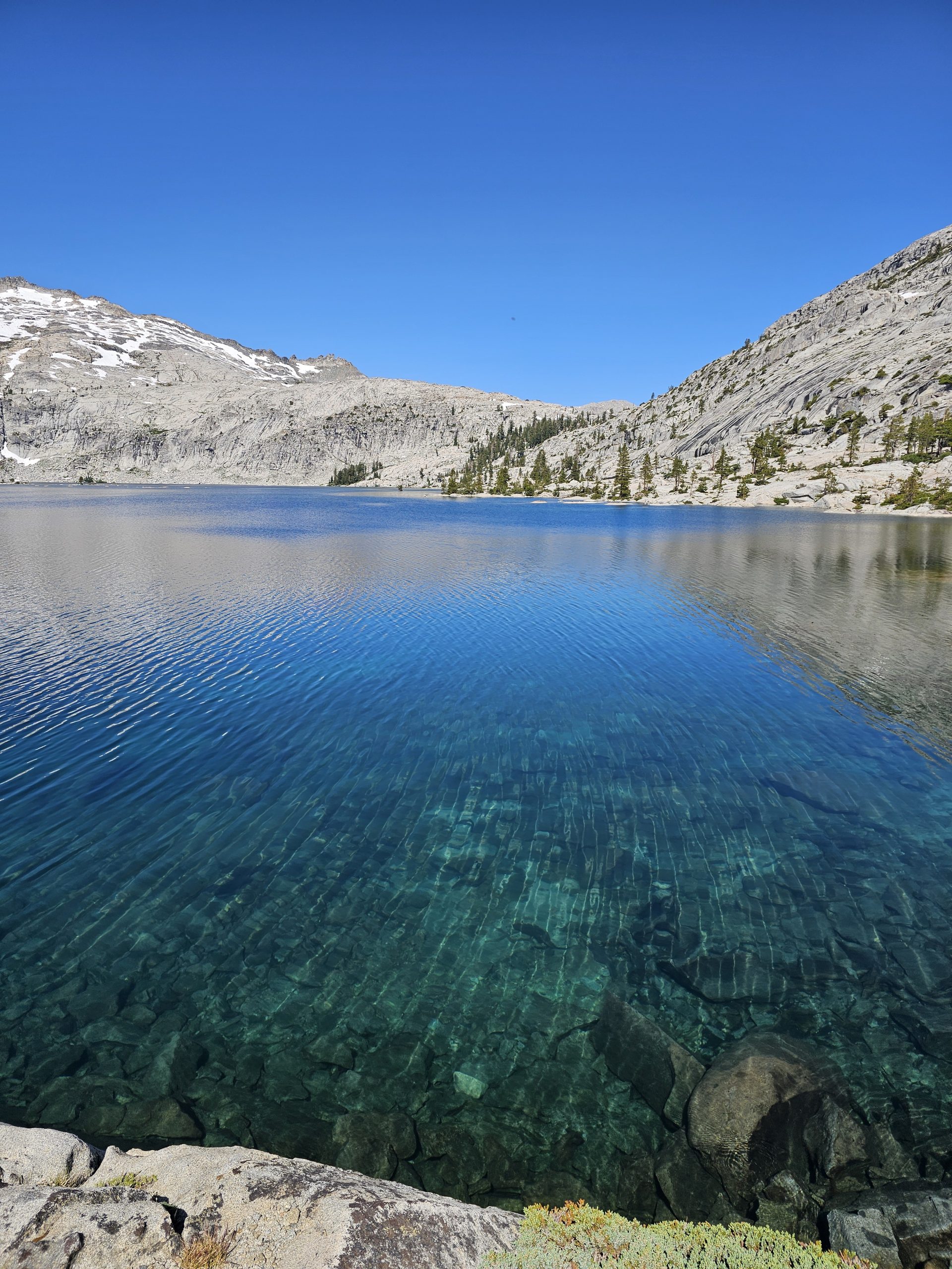
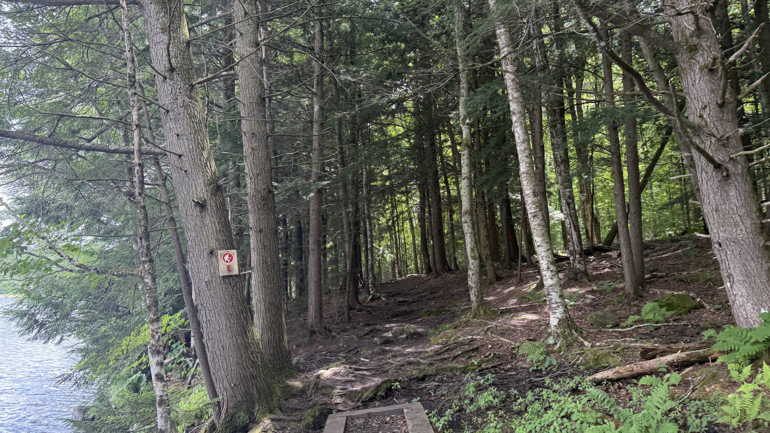
The morning walk was past an absolutely gorgeous lake, Lake Aloha. The water was the blue I’ve only previously seen in tropical ocean and all the islands looked to inviting. I wish I’d known how great this lake was, I would have packed additional food and maybe spent a day here. Ah well, it’s just somewhere I’ll have to come back to I suppose.
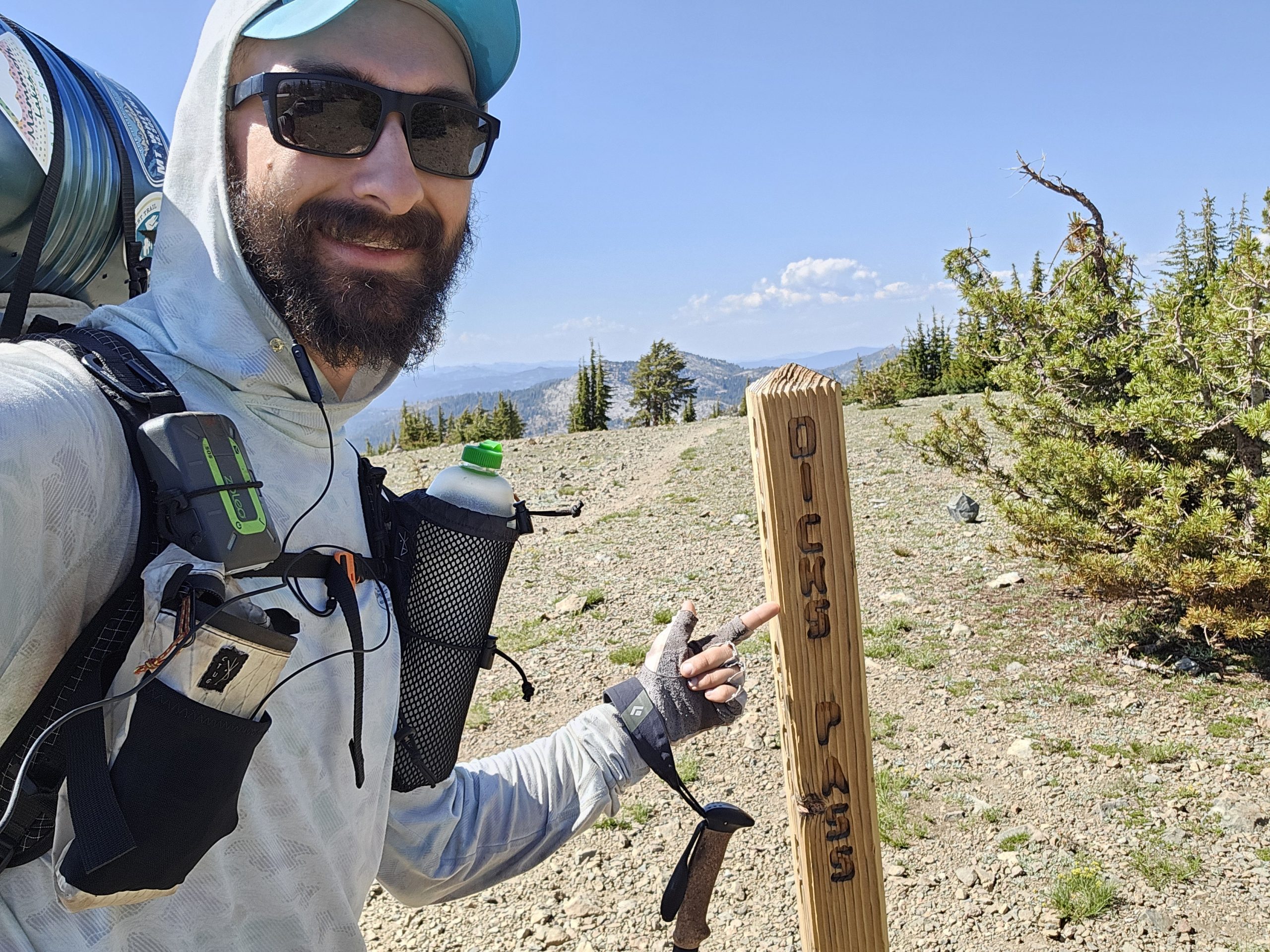
The rest of the day was more lakes, though none quite as stunning as the first. I crossed over Dicks Pass in the afternoon without too much trouble. There was only a little snow at the top, a far cry from the snow fields of the high Sierra. There were more lakes on the other side of course.
I reached the tent site I’d planned for around 6:30 but it was quite full so I had to hike another hour to find an open spot. The mosquito swarm descended as the shadows grew long and I walked fast, slapping at my arms constantly to dislodge the bloodsuckers continually landing there. I love most insects but mosquitos are the true exception and I loathe them so.
Trail Stats:
Catholes: 33
Stops to filter water: 152
Resupplies: 16
Hitches: 19
Zeros: 15
Crys on trail: 13
Blisters: 12
Gear repairs: 19
Miles Skipped: 212.3
Significant Water Crossings: 100
Falls: 3
This website contains affiliate links, which means The Trek may receive a percentage of any product or service you purchase using the links in the articles or advertisements. The buyer pays the same price as they would otherwise, and your purchase helps to support The Trek’s ongoing goal to serve you quality backpacking advice and information. Thanks for your support!
To learn more, please visit the About This Site page.
Honestly, for a donation-based hostel where the hostel owners don’t have any other significant/obvious forms of income, the beds at the Yellow Deli Hiker Hostel were fantastic. It’s clearly a labour of love. But yes, there are many things I don’t agree with everything they believe in. I do still highly recommend people to stay though, since it’s kind of an “iconic” ish experience.
I somehow was the first to wake up in our bunkroom, which was wild. But, I still feel drained, even after yesterday’s Zero. In fact, I just feel drained in general. After getting past Killington, and seeing the “500 miles to Katahdin” sign… that was the first time I’ve really wanted this to be over. I’m sure the constant malnourishment and low energy doesn’t help. It’s sad that my body’s failing me. It’s funny how there’s a parabola between “got my trail legs,” and “my legs are strong but my body is dying.”
All that to say that leaving the hostel this morning was a difficult ask. I went down for their breakfast — cottage cheese, eggs, and cheese on rice. I don’t like cottage cheese, so I gave it away, but downed the rest. They also made some great coffee. At the table, I re-met Bridget, who was an LT thru-hiker I met on her first night on trail, and just sat around and listened to what others were planning to do today. Peanut and Tode were taking a zero at the deli, and Plinko/Woodworm were going to start going up the Long Trail instead of along the AT. I didn’t really want to Zero in Rutland, so I decided to get a move on.
But, one order of business. For the trail, I’ve been using the Shokz OpenFit 2 headphones, which have been great. I used them constantly for running, and I love how I can hear my surroundings while they’re still on. Just one problem… they use a proprietary charging case. And one of the pins in the case is recessed permanently, which means that it’s been harder and harder to get my headphones to charge. Finally, though, it seems like the case has finally breathed its last breath. So I went to Walmart in hopes of finding a new pair. Unfortunately they were out of the model I had, but they had the old OpenFit Air, so I just went with those. I can already foresee issues with the touch controls being hit accidentally by the bug net, but what’re you to do when your technology fails you?
Submitted a warranty claim, and got a sandwich from the PriceChopper nearby, before heading back to the hostel. I missed the 9:15 bus out… so I took my time talking to Plinko and Wormwood a bit more, picking their minds about things. Mostly Plinko. He was such a help at Trail Days that I couldn’t help but almost feel as if he’s partially a mentor. Asked him about his food strategies, his hiking strategies, mentalities, all that good stuff.
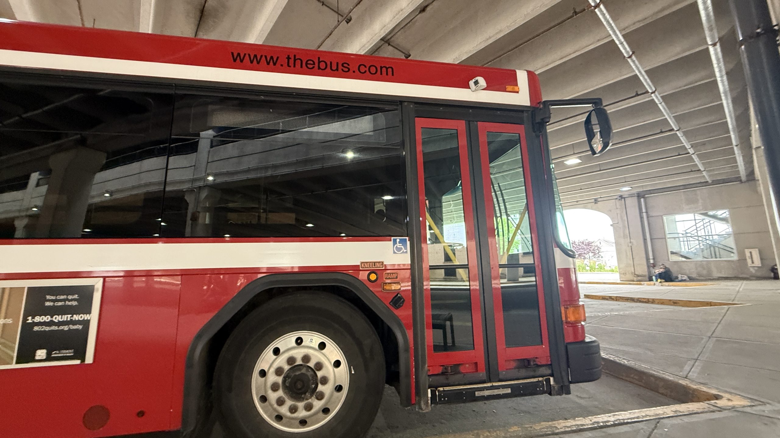
All this thinking aside, I then went off to catch… The Bus! The Yellow Deli Hiker Hostel doesn’t bother providing shuttles, since Vermont provides a very cheap bus that goes from the Inn At Long Trail (where I got off with my friends two days ago) straight to a bus stop just a block over from the hostel. I got on, and the driver and I struck up a conversation about how my hike is going. And, this dear reader, is where I have to admit something.
I’m pretty burnt out with the trail. Maybe extremely burnt out of the trail. I didn’t expect the trail to “change me” or anything, but I did at least hope that I’d be having a grand old time all the way through. And I really was!… until the Mid-Atlantic. And while New England’s provided a small boost, there’s still the really hot conditions and the bugs to deal with. And then there’s the deal with the end date. I’m actually ahead of schedule now, even with the Whites standing scarily in the distance. So, I know that I can just take it easy, right? The problem is… I can’t even muster the energy to sleep outdoors anymore. The great outdoors sometimes feels like a coffin of bugs, rain, and heat, and something in me wants nothing more than a month where I can just sit inside and watch a movie, or something. But that’s me just wanting another extreme.
I think the best thing I can do is to try to take some good nearos or zeroes and then hike on in better conditions. I know my thoughts on this change constantly. There are days where I’m zooming along (usually when there’s good coffee on trail…), and there’re days when I can’t even get myself to walk another step (like today). I should throw this end date out the window… and just let the trail end when it ends. Trying to force something isn’t helping. If I get to Shaw’s, and I’m one day off my goal, sure, I’ll take an extra Zero or something. But there’s no use thinking about all of this when I still have the hardest 450 miles left to go. (by the way, since this was written about three weeks ago… I might have different opinions by now and better strategies to manage the burnout 😉 )
I got dropped off at the Inn At Long Trail, taking a look around and remembering how it felt when my friends were around. Then, I got going. Up, and up, and up… and then down and down. I ran back into Morgan, a MA/VT section hiker who’s hiking with her dog! I’m unsure if I wrote about the first encounter with her, but it was at the Rock Pond Shelter on the night before Killington. She’d gotten a bit turned around with some blowdowns and inconsistent blazing, so I helped her find her way, and we hiked together for about an hour. It was nice to converse… and this is where I realized something else. Partially why I’m so out of it is probably because I haven’t found my “tribe” yet. Of all the long trails, the AT is the one of tramilies, but I haven’t been able to find one that matches both my pace, and are also good matches for me as people. There’ve been brief moments, but then either I burn out and they want to get ahead, or I have a spurt of energy and want to hike, and they fall behind. For a social trail… it’s been a lonely walk.
I know the real bubble’s about three weeks behind me, and there’s a very small mini-bubble about a week behind me. And given how far my end date is, I could wait a week. But sitting around for a week now will probably bring that other feeling back. The feeling that I’m not going to make it “on time,” whatever on time really means. This is all so funny. I shouldn’t be worried about any of this stuff. The trail’s so simple. Just walk forward. But I’m me. This was something I was supposed to work on. *sigh*.
Morgan and I parted at Gifford Woods State Park, where she was going to triple Zero. She’d actually made it further than her planned hike, and needed to kill some time before her ride got her at Norwich, so she was going to spend some R&R here, watch some movies, go into town on the bus. That sounds so nice…
I’m speeding ahead a bit though, because I want to get to the Whites by the weekend. While I don’t think anyone necessarily is waiting on me there for anything important, it’s still a close enough destination to Boston that there’s a chance something could magically happen this weekend if the time comes. Plus, being ahead of the mini-bubble, or other hikers, makes it more likely that I get a Work For Stay. Yes, even with all this complaining about it being a lonely trail… there are still some highlights to it. Campsite selection being one of them. So many marbles to roll in the head… (if you can’t tell, this has been on my mind for a long time).
Whew, we’re already at 1300 words for this blog post… what a sufferfest! Sorry about that, but I figured it’s better to let people in to my true state of mind rather than pretend everything on trail is hunky dory.
Afterwards, I started struggling with hiking through the day. The humidity was through the ROOF it felt like I was hiking through soup! Skirted by the lovely Kent Pond, and then back up, up, and up. This is where I ran into some more issues… I ran out of water. I thought there’d be a source due to some FarOut comments and recent rains… but it was bone dry. So my normal caffeine shot that I have around 2 PM wasn’t there. That probably also contributed to the sadder feelings that I normally can dodge.
Alas… onwards! I took frequent breaks to not let my heart rate get too high in the heat, but by the time I reached Stony Brook Shelter, I was beat. Drank as much water as could fit in my belly, and then grabbed more for the road. I probably overloaded on water given that there are reliable sources on the road, but today it didn’t matter. I just wanted to get any of it I could into my system.
The rest of the day kind of became a monotonous slog/blur. I was getting attacked by bugs at every angle. I was going through some rough terrain, just wondering when it was all going to end. Grabbed some water for the rest of my day, but what should’ve been a 10 minute stop turned into 30 as I just couldn’t will myself to move anymore. Turns out, even though I did a measly 15 miles today, I still almost did 5k in vert. I didn’t even plan for this in advance… so it kind of kicked me in the butt. That, and I’ve been struggling to eat.
I know I’ve been going through ketosis recently. My clothes all smell sour. But no matter what, I just can’t get enough calories in. Loads of chips, freeze dried meals, ramen, tuna packets, nuts and nuts and nuts. None of it feels good going down. And yet I can still feel myself getting weaker every day. I know there’s no real way to “lose” in a thru-hike, and yet it feels like I’m losing.
So, I ended the day at the unofficial Lookout “Shelter,” which is a privately owned cabin set aside for hikers. Inside, I ran back into Marky-Mark, who was camping at Greenwall the day I was there. Huh, looks like everyone’s surpassed me from before. I guess that means I’m going average pace now. I climbed to the top to get some spectacular views while eating dinner, but I wasn’t able to enjoy it for long… even about 30 feet up, the bugs were still vicious! So I did my best and went to bed.
I just… wasn’t feeling it today. It’s hot again. Maybe I should wait it out. I think I’ll throw this birthday plan in the drain, and figure out some other way to spend it. Who even knows anymore?
(title lyrics from: Time to Say Goodbye, Jeff Williams and Casey Lee Williams)
-

 Brand Stories2 weeks ago
Bloom Hotels: A Modern Vision of Hospitality Redefining Travel
-

 Brand Stories2 weeks ago
CheQin.ai sets a new standard for hotel booking with its AI capabilities: empowering travellers to bargain, choose the best, and book with clarity.
-

 Destinations & Things To Do2 weeks ago
Untouched Destinations: Stunning Hidden Gems You Must Visit
-

 Destinations & Things To Do2 weeks ago
This Hidden Beach in India Glows at Night-But Only in One Secret Season
-

 AI in Travel2 weeks ago
AI Travel Revolution: Must-Have Guide to the Best Experience
-

 Brand Stories1 month ago
Voice AI Startup ElevenLabs Plans to Add Hubs Around the World
-

 Brand Stories4 weeks ago
How Elon Musk’s rogue Grok chatbot became a cautionary AI tale
-

 Brand Stories2 weeks ago
Contactless Hospitality: Why Remote Management Technology Is Key to Seamless Guest Experiences
-

 Asia Travel Pulse1 month ago
Looking For Adventure In Asia? Here Are 7 Epic Destinations You Need To Experience At Least Once – Zee News
-

 AI in Travel1 month ago
‘Will AI take my job?’ A trip to a Beijing fortune-telling bar to see what lies ahead | China
You must be logged in to post a comment Login