
Destinations & Things To Do
Superior Hiking Trail Days 5-7: Silver Bay Special and Finland (The One In Minnesota)

An alternative title to this section could be “SHT 5-7: I Go Into Civilization, Skip a Bunch Of Miles, and Stop Sleeping on the Trail”
Maybe that’s a bit dramatic. However, the previous parts of the hike up until this point have been nothing but true, good ol’ hiking. These past three have been town/restock days, which is a whole different vibe.
For those slightly confused (“why’s is he in town? Shouldn’t he be walking?”) let me explain. It’s a little bit of a misconception that that a thru hiker is supposed to spend all their time on trail. When I was starting out, I was surprised to learn that it’s fairly common for thru hikers to walk or hitchhike into town and spend a day restocking and enjoying the comforts of society. This could include eating at a restaurant, sleeping in an actual hotel bed, or even going out to the bar for a drink. I haven’t done the last one yet, but I guess there’s still time in Grand Marais…
These stops can be really common on trails with lots of towns (like the Appalachian Trail). Sometimes, people will even stop for weeks at a time to let minor injuries heal up.
Since the SHT is a lot shorter than those kinds of trails, my goal is to keep my town days short while still enjoying the food and restocking my kit. I won’t be doing any zero days, but I decided ahead of time that “nearos” would be ok when coming and going from town.
Essentially, the goal for towns is to get everything ready to go back out on trail. This means buying more food, but also doing the small things to keep morale up. It’s not good being resupplied if I quit the next day.
With that said, though, I still had to make it to Silver Bay…
Day 5: The Silver Bay Sprint
I woke up late in Blueberry Hills after sleeping. like an absolute rock. This already cost me like an hour of hiking, as I didn’t get out of my tent until 9:30. I don’t know what it was, The ground at that camp was so soft, so maybe that played a role? Maybe it was the gentle buzzing of the bees at their flowers.
Whatever the reason, I knew that today was going to be the day that I pushed through to Silver Bay. I’d packed in way too much food (enough for ~9 days, if I had to guess) so that wasn’t a problem. Still, there were a few things I was lacking, mostly medical kit for blisters. I didn’t have any yet, but I also wasn’t thrilled about possibly getting some and not being able to treat them.
I also wanted to dry out my gear, which was STILL WET from the rain during the first two days. My boots were especially bad, but we’ll get to that.
With all that in mind I booked myself a campsite in Silver Bay, figuring I could hitch in, sleep there, then restock in the morning. It was around 20 miles away, which was completely doable. I’d hit 19 walking into Blueberry Hills the night before. Honestly, the idea of not being in the woods sounded pretty good at this point as well. I was going to get to Silver Bay, no matter what.
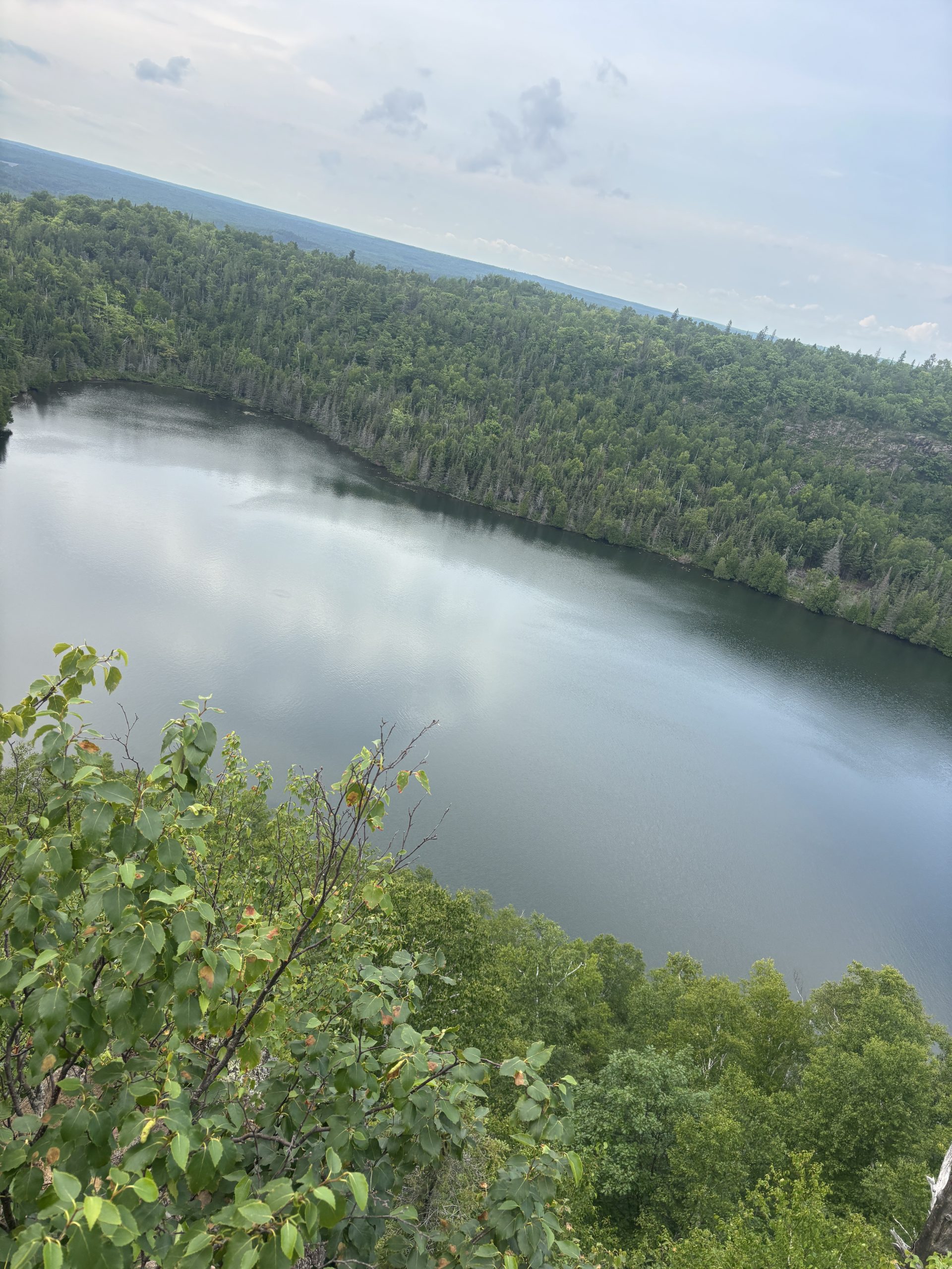
I started walking. Almost immediately I came across a really cool waterfall. It was the lower part of the Split Rock River, one of the first capital R rivers I’d encountered on the walk. I was cool. I took some good photos.
Normally, the trail would then cross the river, head inland, and cross back over at a higher point in the river. Unfortunately, the upstream bridge was out, so I had to detour down into Split Rock River State Park and cross the river there.
This wasn’t altogether too bad, as I think it was actually shorter than if i’d had to go inland. Also, it was on state park trails which are practically paved roads compared to the wetter sections of the SHT.
I think the best part, though, was bumping into some SHT volunteers raising awareness at the trailhead during the detour. They were incredibly friendly and had had fruit snacks and cold water. They’d been section hiking further north, and were able to give some tips about the infamous “Tetegouche State Park Reroute”. Overall it was super fun to meet folks so excited about the trail, and I put my email down on the volunteer newsletter.
As a side note about the cold water they gave me: this trail has made me crave refrigerated beverages like nothing else. Food is fine, I only want it when I’m hungry and it’s mostly been cravings for things I have in my pack, like cheese or jerky. A movie theater icee though? Or a cold glass of lemonade? You have to remember, I’ve had nothing but lukewarm filtered water for the past 4 days. I literally had to avoid thinking about cold, sugary drinks while walking or it would dominate my thoughts for the next hour.
I promise you this isn’t a symptom of dehydration; I’m drinking at least six liters of water a day.
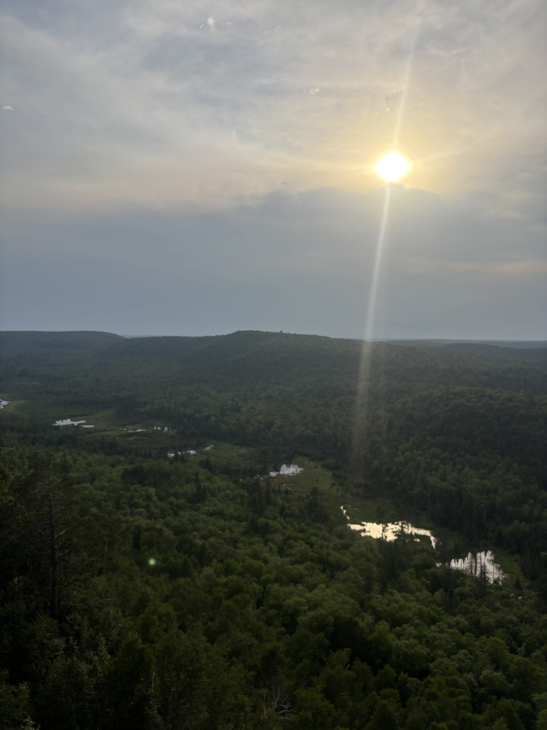
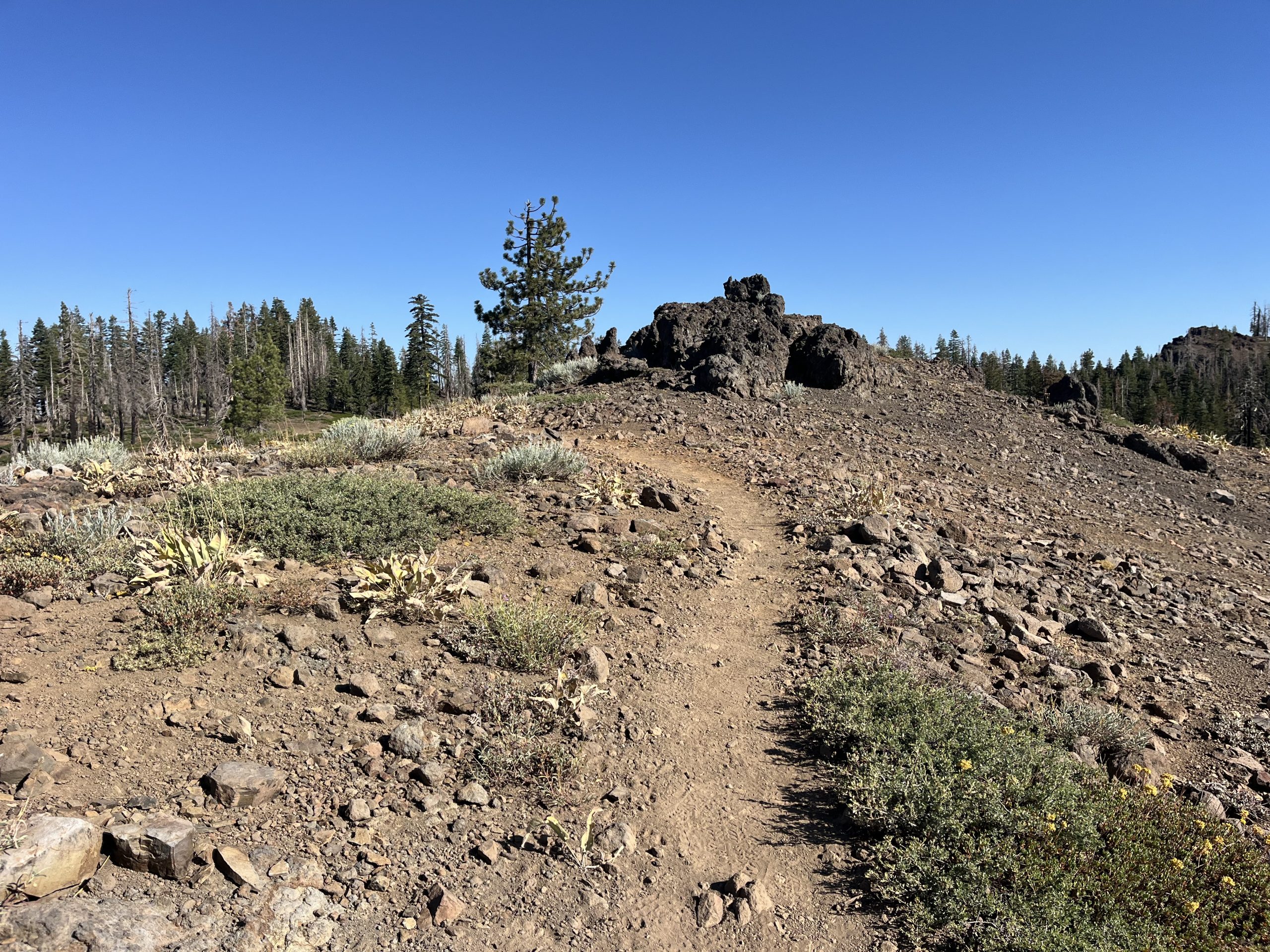
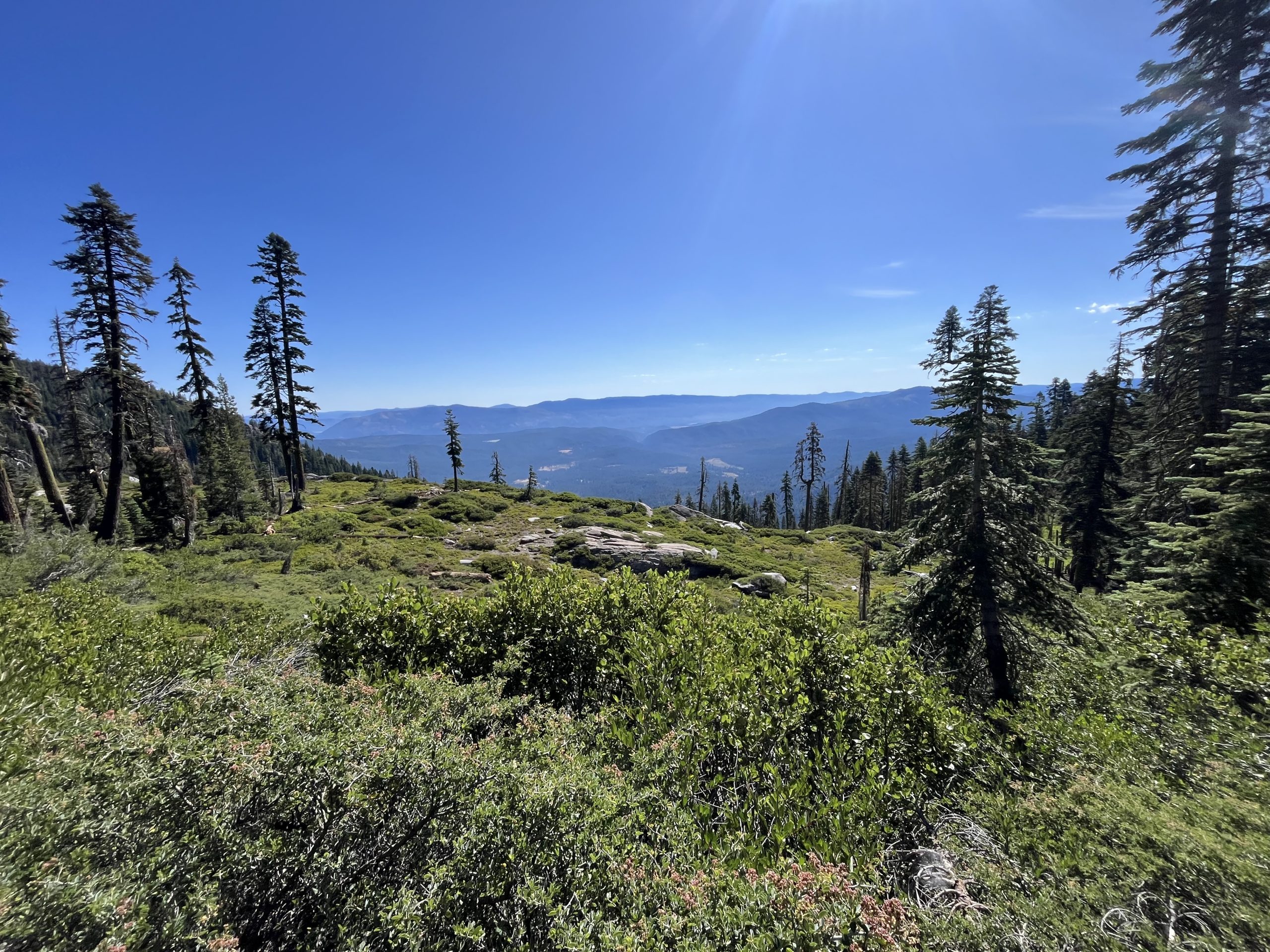
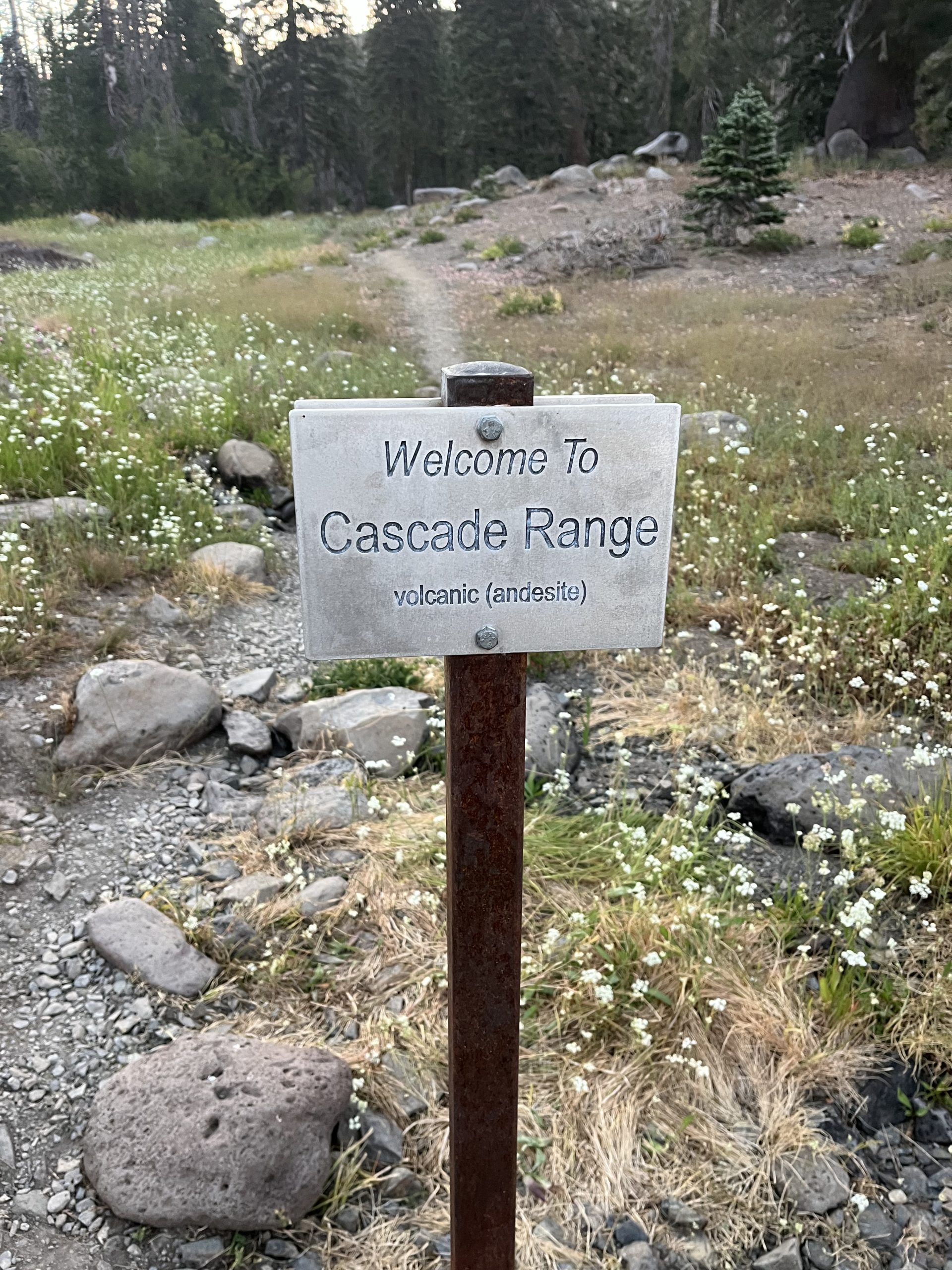
Then the trail started to CLIMB. Like I said in the last post, section C was a night and day difference from section B. Instead of winding through bogs and lakes, section C climbed up into the vast hills of volcanic rock that had been a backdrop of the hike up until now. This made for some incredibly pretty views, but also caused a pretty big problem.
You see, I was basing my opinion 20 a day distance estimate on what I had been doing during section B. Definitely solid efforts, but I’d forgot to consider that section B was as flat as a pancake. Section C was not.
It took approximately two leg burning, ling destroying climbs before I realized that I would be hard pressed to go even fifteen today. 20 to Silver Bay would be a do or die effort. However, the campsite had already been booked. Do or die it was.
It was also at this point that my feet started to hurt BAD. A little bit of foot pain is to be expected when you’re putting that many miles on them, buy the soles of my feet were starting to become overly tender to the point where it was affecting my ability to pick my way up trail.
I found a nice scenic overlook, unpacked my things for lunch, and took my feet out of my boots. They were wrinkly messes, like when you soak in the bathtub for too long. I kicked them out in the sun, but despite drying off pretty quick they didn’t seem to be un-wrinkling at all.
This kind of had me panicking. I had a a bar of service, so I was googling “consequences of wet feet” which quickly lead me to trench foot and all the horrible google images that come with that.
Fortunately, trench foot requires colder temperatures (below 60 degrees) and it had been pretty warm, so I don’t have trench foot. I had, at worst, a super early stage of its cousin, warm weather immersion syndrome. Even then, since none of my skin was peeling (yet) it seemed like all I needed to do was keep my feet as dry as possible for the next few days.
Crisis averted, but also easier said than done. My boots would not dry out, and my socks were damp at best. I used the sun on the open rock surface to get one pair almost dry, then hung the other on the back of my pack to get them more dry. I planned to rotate my socks every few hours, keeping my feet as dry as possible even if my boots were still damp.
For the most part this plan worked, and I was able to keep chugging out the miles. Still, the rocky, technical downhills and crushing uphills meant that I was making slow pace. The views were nice, at the very least, but I felt like I couldn’t enjoy them because I was so busy pushing up and down this mountain to get off trail faster.
By the time I got down off the mountains, I was exhausted and still had at least four miles to go. I was sitting in the parking lot contemplating what to do when I noticed a car was running. A man rolled down his window and asked if I needed a ride. Iforgot to ask if I could write about him, so his name won’t be featured, but he was incredibly kind.
He’d been helping with a trail race that was apparently going on near by, and was just now driving back into town. He had a cooler full of ice cold coke, which was possibly the best thing I’d ever tasted. He dropped me off at the Black Beach campground and bid me farewell.
So yes, technically I skipped four miles of trail here. Sue me. I was exhausted and I would not have made it into town until after dark if i’d chosen to do it. I atone for it later in mileage, trust me.
After setting up my tent, I walked up the road into Silver Bay and grabbed dinner at Zoe’s Pizza Kitcehen. I ordered pulled pork with jalapeños and pineapple. It was one of the best things i’ve ever eaten. Also, I had a blast drinking literally every option from their soda fountain. I think Mug tasted the best after being on trail.
Full of at least 2000 calories, I hiked back down to my campsite and settled in for a good night of rest.
Day 6: Silver Bay Stroll
Ok, day six was a pretty chill day. It didn’t start out that way, though.
You know how I said that the Durston tents were great, but if you pitch them badly they can fall over?
Yeah, it happened.
At 1am one of the stakes for my tent slips out of the ground, causing the whole thing to collapse on me. Luckily I was already half awake, so this was annoying rather than terrifying. I then had to spend the next half hour frantically trying to re-pitch my tent as a pretty strong wind blew in from the north. It was cold, I was tired. Not fun.
I don’t think it was fully my fault. The Black River campsite was pretty exposed. I didn’t have tree or rock cover, so when the wind blew in it hit my tent directly. The ground was also loose gravel, meaning I didn’t really get to sink my stakes in deep. I admittedly half-assed my pitch because I was excited to go eat dinner, so that contributed too, but the environmental factors were the main cause (that’s what I’ll tell myself, anyways).
Fortunately, things were calmer in the morning. we got some real sun at the campsite, which allowed me to finally dry out my gear for good. Except my boots, but I managed to get them to just damp, which was a win in my book. Plus, I realized I could take put the insoles and dry those specifically, so at least. a third of my boot would be dry every time I put them on.
After packing my stuff back up I headed in to town to make some purchases. I didn’t really need food, so all I bought in that department was pop tarts and MnMs to boost morale until Finland. I did pick up more plastic bags (all of my old ones were getting holes in them) and some medical supplies I needed.
The best purchase wasn’t even a purchase: I just asked the woman running the store if she could give me one of her 40 gallon garbage bags to use as a pack liner, and she said “sure why not”. Now, hopefully, my sleeping set up and spare clothes will stay dry inside the bag while I get rained on.
I started out again. The road walk back to the trailhead was brutal; almost two miles of a steep uphill. Being blasted between the sun and asphalt makes you appreciate how much cooler the forest keeps you.
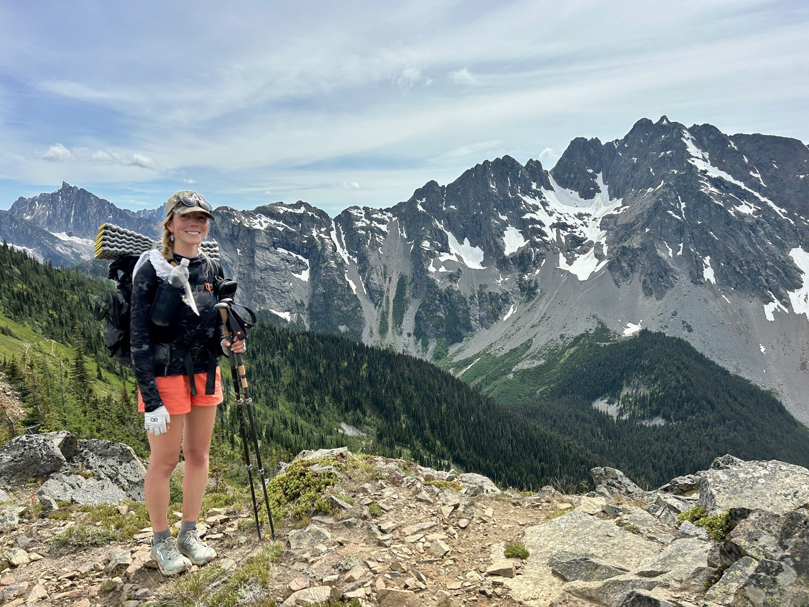
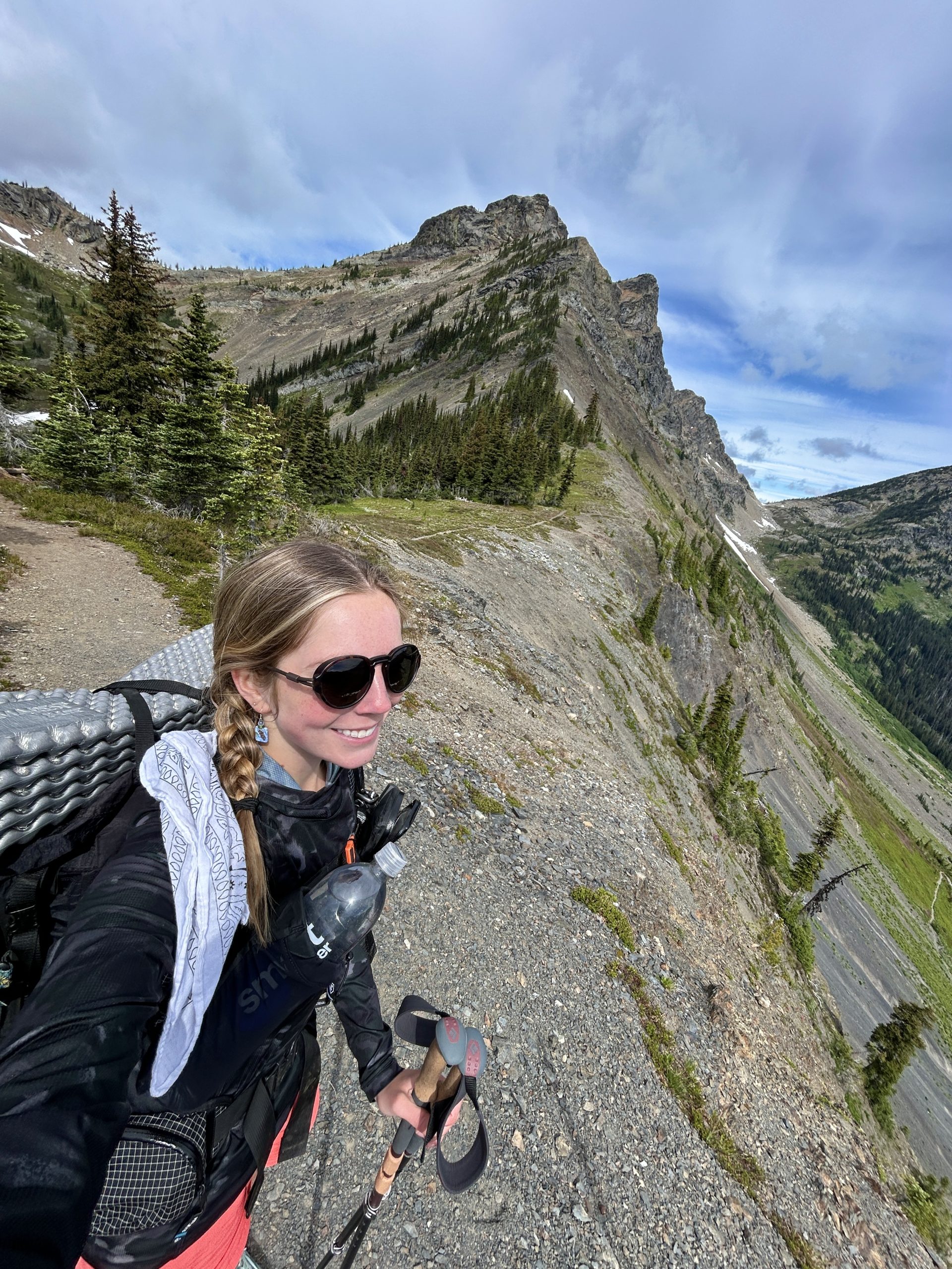
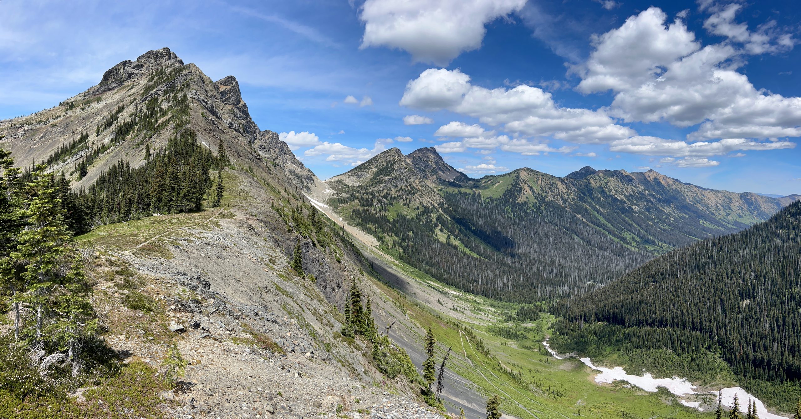
The trail, once I got there, was super cool. This was the section that overlooked Bear lake and Bean lake, which is one of the super scenic areas they slap on all the promotional material. Still, it lived up to its name. I got some absolutely killer views. More importantly, because I wasn’t in a rush, I actually got to enjoy them this time around.
Being on a more scenic section of trail meant way more day hikers. Seeing more day hikers lead to ten realization that, holy cow, I look rough. I probably smell rough too at this point. I’d be friendly to people and they’d be friendly back, but it was clear they were giving me my space. It was. almost a badge of honor to finally be evolving into scary hiker trash.
I also was really starting to hit my rhythm on this section. My stops were down to a science: big breakfast in the morning, three hours of hiking, lunch, three hours of hiking, dinner, three hours of hiking and then sometimes a second dinner if I was hungry.
Water became pretty exact too: I’d stop and chug water (and gasp for air) at the top of every climb, and refill whenever the trail would go back into the valley to cross a stream. It would do that pretty often, climbing up to a scenic view and then going back down to cross water, so I was drinking over a liter and a half per hour. I needed it: 85 and sunny on the exposed ridge lines was frying me like an egg.
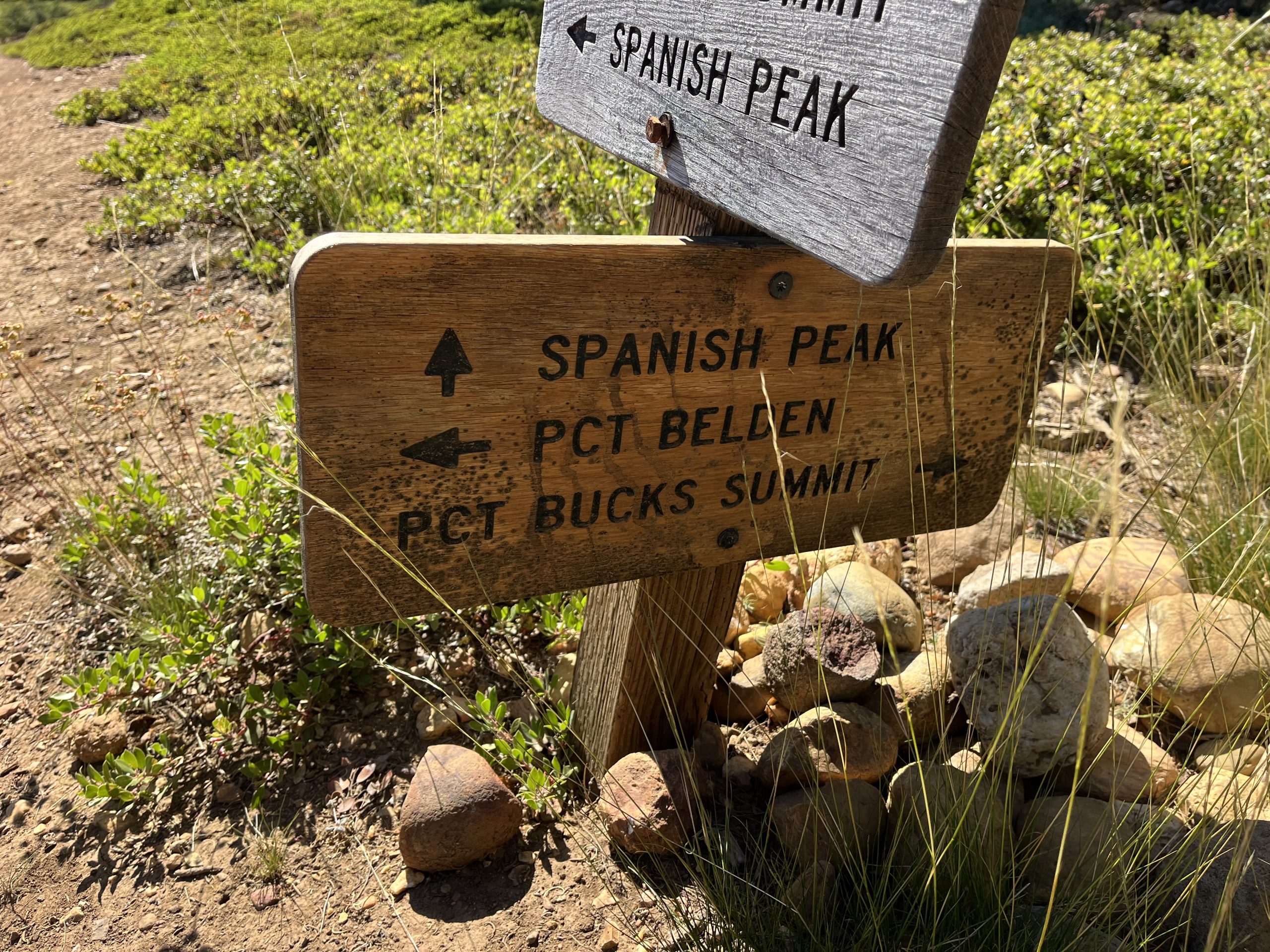
The day ended fairly dramatically in Tetagouche state park, home of the dreaded “Tetagouche reroute” that Id been hearing about. As a side note, the park is pronounced Tet-ah-goosh. I’d been saying Tat-a-gooch-ee like the southerner I am.
Anywho, the problem with TG state park is that the trail normally runs way up into the park to cross the Baptism River at the high falls, which is another one of the promotional material caliber scenic vistas. However, the high falls bridge has been out for years. The reroute isn’t that bad, you just follow the river down to tbe shore where M 61 crosses, and then follow it back up to where the trail starts again.
Unfortunately, at least as far as I could tell, the trail to do that was ALSO closed for maintenance. This meant that the only way to get down to the highway (the only working bridge across the Baptism River, apparently)was a second trail that went 5 miles southward, adding a total of 8ish to my walk.
Mind you, I got into TG at around 6:30. I was ready to be done, not to walk an extra eight miles to make what should have been two miles of progress. A part of me considered camping up on the mountains, but I had just enough service to see that there might be storms later that night and I didn’t want to risk it.
Fortunately, the other thru hikers and the SHT volunteers told me the best way to get down. I hiked off trail through the park and hitched my way up to the state park, where I ended up crashing for the night. And, to my credit, it did end up being windy, so I made the right call skipping a hit of trail to get off the mountain.
Day 7: Finland
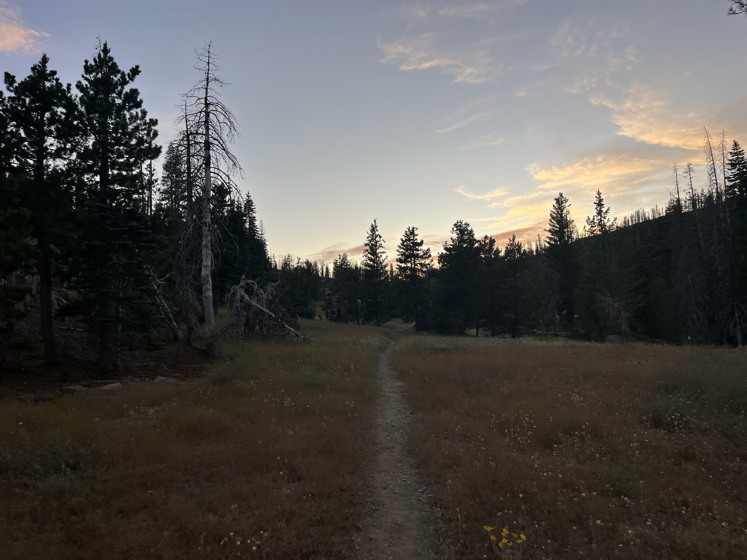
The walk to Finland was probably the least eventful out of the three days.
I got up fairly early and hiked out of the state park campgrounds. I found the reroute, and hiked about 3 miles of it to get back to the trail. Not amazing, but could be way worse.
From there, the trail wound up and down through the remainder of the mountains I was in. I met a few hikers, but not nearly as many as I had in previous days. Still, I was in weirdly high spirits. Compared to the earlier bits of this hike, I really felt like I was starting to figure things out. I was in a rhythm. I was putting down some miles.
At some point I passed the Minnesota highway 1 trailhead, which meant I’d officially entered section D. I knew C and E were hilly and scenic, but less had been said about D. It seemed relatively the same to section C, but maybe a bit flatter.
Another nice thing about this day is that it was probably the clearest one so far. I’ve been dealing with wildfire smoke from Canada blowing in and lowering the value of the views I got, which hasn’t been great. Today was really, really clear so I was able to get some good scenic photos.
Eventually the trail wound down out of the mountains into a stretch called “Section 13”. I don’t actually know what section 13 is, or why every trailhead for the miles leading up to it had a sign saying how far I was from it. It wasn’t particularly scenic or anything. It was just a stretch of trail. My best guess is that it used to be the 13th section of the original SHT before they added the Duluth bits, and that made it important because… who knows.
The good thing though was that the mysterious Section 13 was the flattest part I’d had since entering section C of the trail, so I was able to really push the pace. I made it all the way to Finland before it even hit 6:30, and tried to get a hitch into town so I could resupply at their co-op.
I managed to grab a ride with someone(s) who, once again, I forgot to ask permission to write about. The bad news, they told me, was that the grocery store had closed at 6 (small town things, made sense). The good, even great news, was that they were willing to let me stay on their property for the night, and would drive me into town in the morning so I could resupply.
This was the first bit of really propped trail magic I experienced. I got a shower, a warm meal of mushroom pasta (with foraged mushrooms, it was SO GOOD) and I got to hear all about the local area and its flora and fauna. It was one of the best nights I’ve had on trail so far. I’m so grateful for the experience, and will be sending them a postcard when I get off trail.
In Conclusion…
So yeah. I skipped around 8 miles of trail and didn’t sleep in SHT campsites on any of the nights. I don’t feel too bad about any of it; I think the circumstances made sense. Plus, I already skipped 40 miles at the start. This isn’t a true thru hike anyways. I’ll cut myself some slack.
I have been feeling a lot better about being on trail. Things haven’t necessarily gotten easier, but I feel like I’m just getting more acclimated to the challenges I’m facing. I really have been in a good mood since I got into silver bay, with a few minor exceptions like when my tent blew down. At some point during these few days I think I quietly passed the hundred mile mark on this hike. Soon, I’ll be in the home stretch.
I can’t wait for Grand Marais and getting a giant burger with an XL Coke. That’s the biggest motivator rn. Still, that’s around 80 miles away at this point. I’ll update when I get there.
Happy Trails!
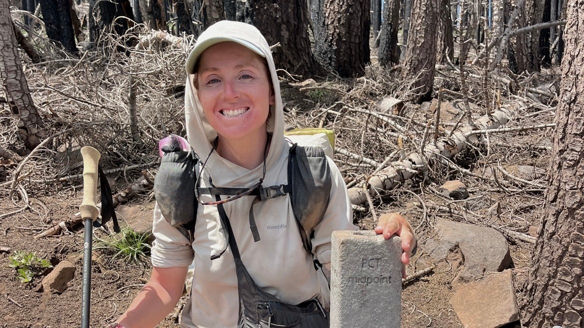
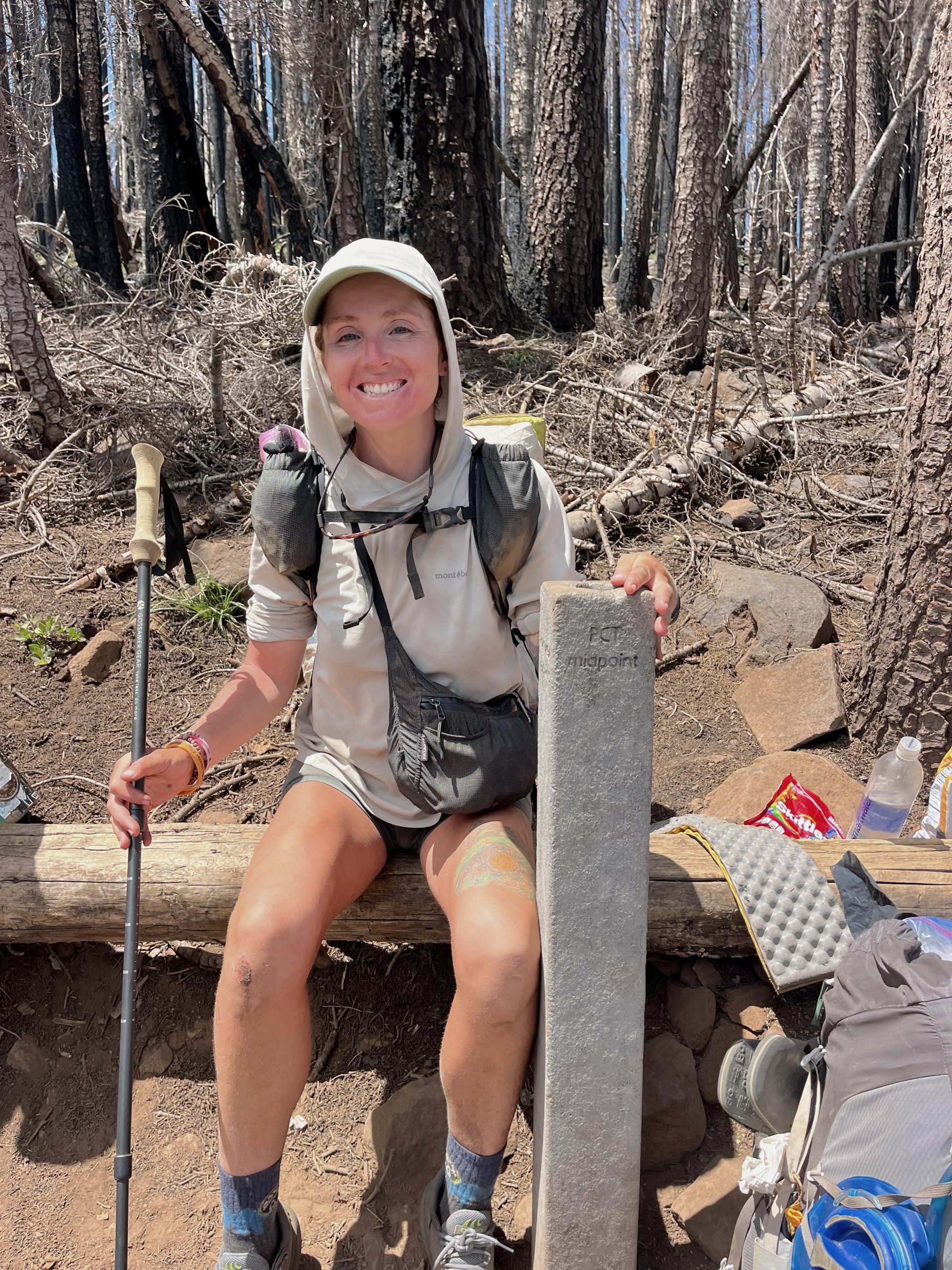
This morning I was up bright and early and was feeling energized by the prospect of heading into town. I only had 31 miles to go to get to the road where I can hitch into Chester. And only had 23 miles to go to reach the PCT halfway point! Today is only day 41 of my hike along the PCT. Which means I walked from Mexico to the halfway point in 41 days. That is around 1330 miles. Which means I’ve averaged about 32 miles a day on the PCT. I’m very happy with that.
The sun had barely come up by the time I was packed up and leaving camp. Data was having breakfast so I said goodbye to him. He’s also planning on going into Chester today so maybe I will see him later on today. It felt nice to hike out on my own this morning though. It’s super fun hiking with other people, but I think I’m just way too used to my own routine. At this point, I’m spending all of my time hiking alone for the most part. That’s just something I’ve gotten really good at. And I’m especially really good at zoning out and letting time slip away when I’m going solo. So this morning I was looking forward to just putting my head down and crushing some miles.
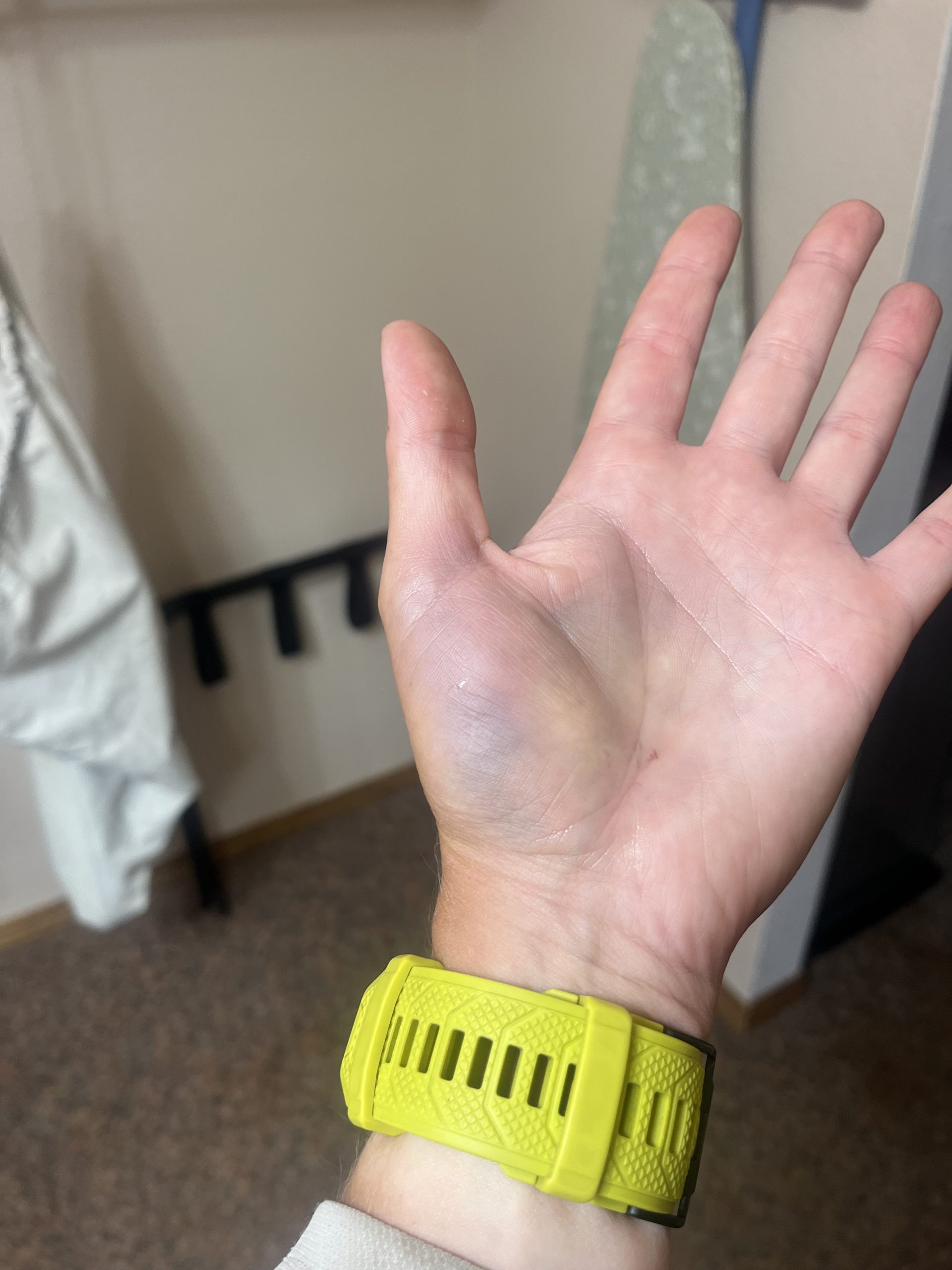
I was pleasantly surprised to wake up this morning feeling at least a little bit better after all my falling yesterday. My left hand is still incredibly sore but a little bit more usable than last night. I still definitely can’t get water bottles out of my pockets or even unscrew a water bottle with my left hand. But it doesn’t hurt nearly as much when it’s at my side as it did last night. Last night it was throbbing with every single step that I took. Today it was just pretty sore and off limits for use. My right hand was also pretty sore, and two of my knuckles were super bruised. At least you don’t really use your hands very much while hiking on the Pacific Crest trail. Because now I have two bum hands.
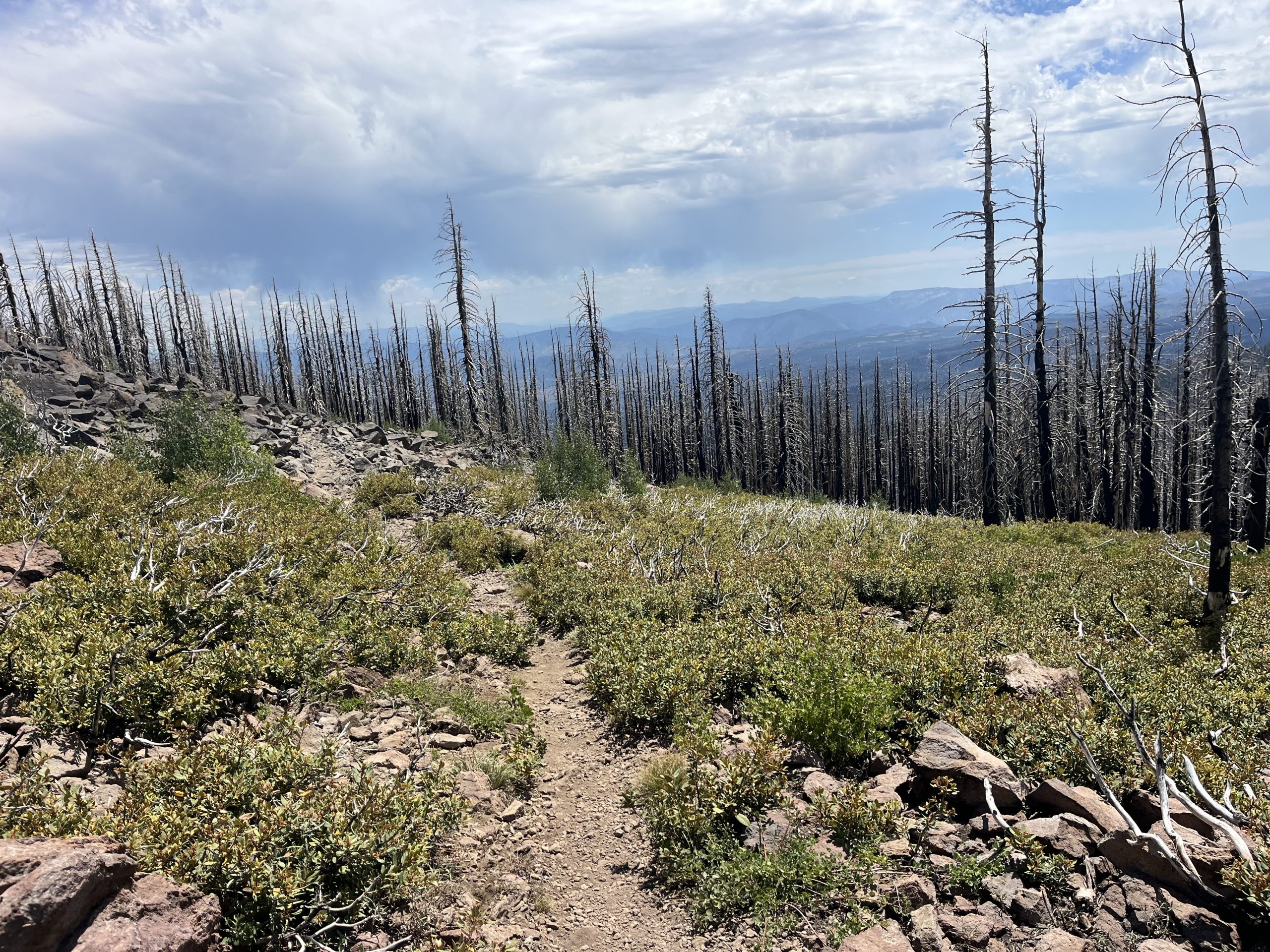
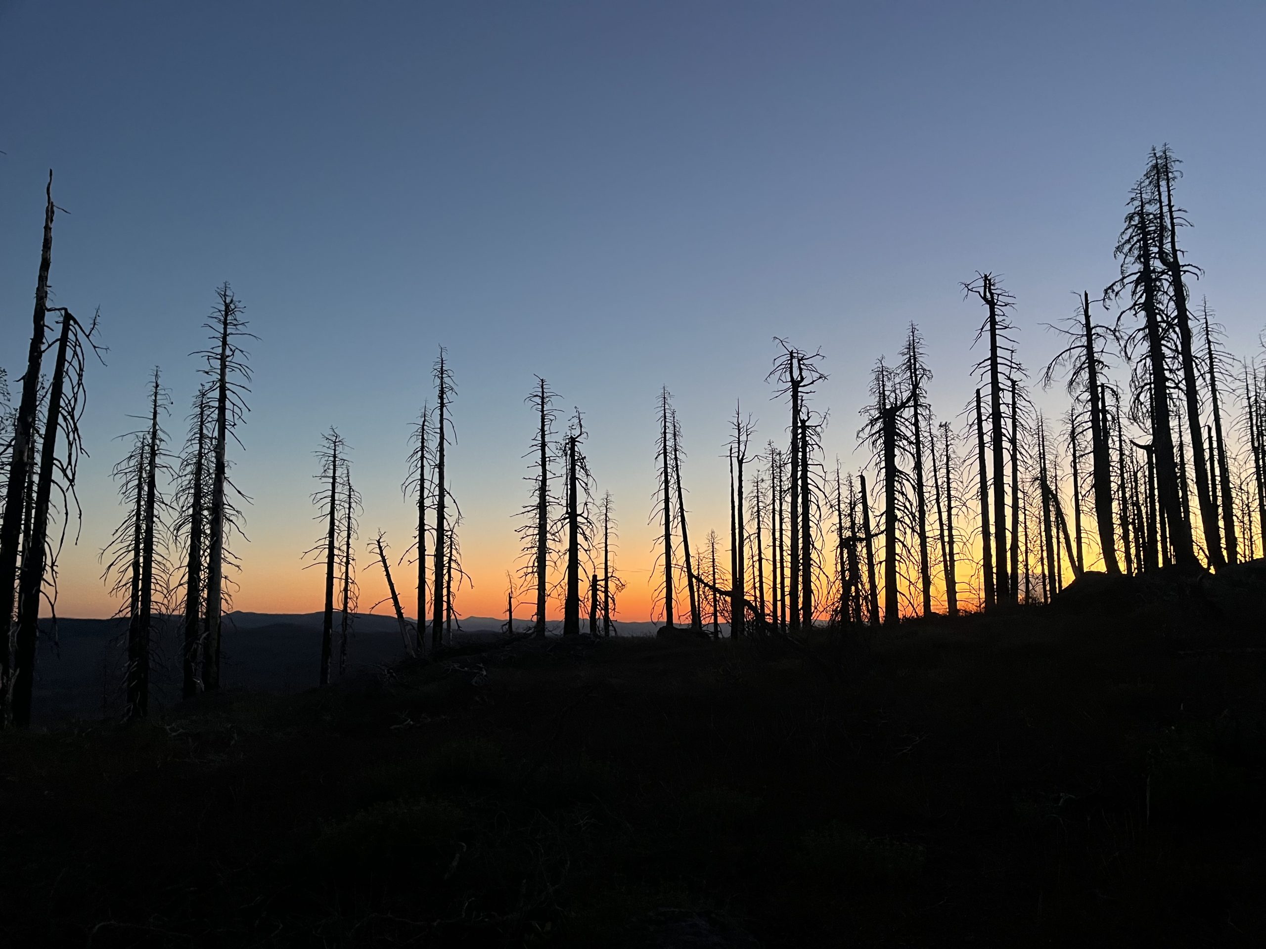
The train this morning was really nice and easy. I really didn’t have too much elevation gain to do at all. But I did wind up getting some really nice and exposed views as the day went on. Today was another day of walking continuously through the damage of the Dixie burn. The PCT in this area is just completely decimated. All that remains are the black remnants of trees. And the small amount of fresh growth that has come into the forest over the last few years. I guess the monotony of the views in a way did help the day to go by quickly. Because time just seemed to fly. I was also quite motivated by getting into town to relax.
Over the course of the morning and early afternoon, I went past a bunch of hikers. I actually wound up running into Happy Meal, a hiker who I met back at a water cache after leaving Julian. He was hanging out and sitting with another hiker named Jay, who I had messaged back-and-forth with on Instagram prior to meeting. It was so cool to see Happy Meal again and we actually wound up walking together for at least maybe a mile or so.
Then we went past another hiker who Happy Meal knew, and he veered off to go talk with him. After that, I just continued along solo as always. I would go past a ton more hikers over the course of the day. Lately, it seems like I’ve been playing one of my least favorite hiking games a little bit too much. With all of the hikers that I’m seeing on trail, I often come across people who want to race. Today I had two hikers come up super fast behind me and passed me going at least 4 mph, which is totally fine!
I was actually doing something on my phone at the time so I was going even slower. But I certainly don’t go 4 mph. So they got by super quick and then got up ahead pretty fast as well. My thing is I either want someone to pass me or fall behind. I really don’t like walking in a train with a bunch of people. Especially when you’re not hiking together or talking to each other. I really don’t want to be able to see or hear anyone unless we’re hiking together. Maybe that’s entitled of me? But it’s at least my preference.
The thing that’s been happening a lot lately though is that a hiker will blow past me going 4 mph, and then almost immediately slow down. It’s totally fine if someone wants to pass me. But I don’t understand the logic of speeding up to pass someone just to slow down again. It’s like cars! That is just as annoying on the road as it is on the trail. If everyone just hiked at the pace they are comfortable with then this wouldn’t be a problem. So a couple people over took me and then not long after that I wound up passing by them. I asked them if they wanted to get up ahead again because their pace was fast. And they seemed confused and just wound up going behind me. And I never saw them again.
That’s just happened a few different times now and isn’t my favorite thing. I don’t mind passing people along the trail and I don’t mind them passing me. But I really don’t wanna be bouncing back-and-forth repeatedly. It just takes away time and honestly feels exhausting for some reason.
The rest of the day absolutely flew by. I wound up getting to the PCT halfway point just after 1 PM. Which meant I was already 23 miles into the day and was making great time. There were actually like seven or eight hikers sitting by the halfway monument. I asked one of them to take my picture and then just continued along. I was super excited to bang out the next 7 miles and get into town for the night.
From there on out, it was basically all downhill to the road into town. Other than a small hundred foot climb here there. I was feeling fantastic and just kept my head down and kept it moving. I stopped off one more time to grab a little bit of water, but other than that, I just kept on hiking. As I got closer and closer to town, I could feel a shift in the wind and the temperature dropped. It seemed like some bad weather was rolling in.
The closer and closer that I got to the road the worse the weather turned. It seemed like any second now is going to start raining. I actually wound up getting some service when I was a few miles out from town so I checked the weather. And sure enough, it was supposed to rain right around 4:30 PM. I was on track to get to the road right at 4 PM. Now my mission was to be sure that I got a hitch and into Chester before the rain started. It is pretty difficult to hitchhike in the rain, as you might imagine.
By about 28 miles into the day I was just feeling pretty tired mentally. My body felt really sore from falling yesterday. As more time has gone by I think that it just set in a little bit more. My right arm and shoulder are quite sore. My right knee is sore and very scraped up. My left hand is incredibly bruised and swollen and I really can’t use it at all. And a couple fingers on my right hand are super swollen and I can’t close those fingers into a fest. In the grand scheme of things these are all very minor injuries. But compiling with all of the mileage that I’m doing every single day it’s just an added factor.
Now today, I was just feeling a little bit worn out and ready for some rest. I’m so glad that Jay is connecting me with trail angels in Chester because I could really use a zero day tomorrow! Honestly, the timing couldn’t be better considering my fall yesterday. Then today, of course I’m running as quickly as I can to get to town so I’m feeling pretty fried. But since I got service toward the end of the day, I was able to put a couple videos on to distract myself. And that made a huge difference and really helped to pass the last 30 minutes to an hour before I got into town.
When I did finally get out to the road, the weather was looking worse and worse. I was starting to hear thunder crack off in the distance, and the clouds were so dark. But I had made it before the rain started!
And I shit you not, as soon as my feet hit the pavement, a man parked at the trailhead came out of his car. He asked if I was a PCT hiker and said he had driven by and decided to sit and wait for a few minutes to see if any of us would arrive. Then he asked me if I wanted a ride into Chester. I wanted nothing more in the world than a ride that easy into town.
His name was Steely Dan and he’s done a lot of sections of the trail. When he went by the trailhead today, he figured he would just hang out for a little bit and try to give some hikers a ride into town. His timing could not have been better. None of the hikers I’ve passed along the trail were super close by so it didn’t really make a lot of sense to wait for them. It had been a few miles since I’d seen anybody on trail. Steely Dan drove me into town and brought me over to the Best where I would be spending the night. Then he dropped me off and headed on his way. It could not have worked out any better.
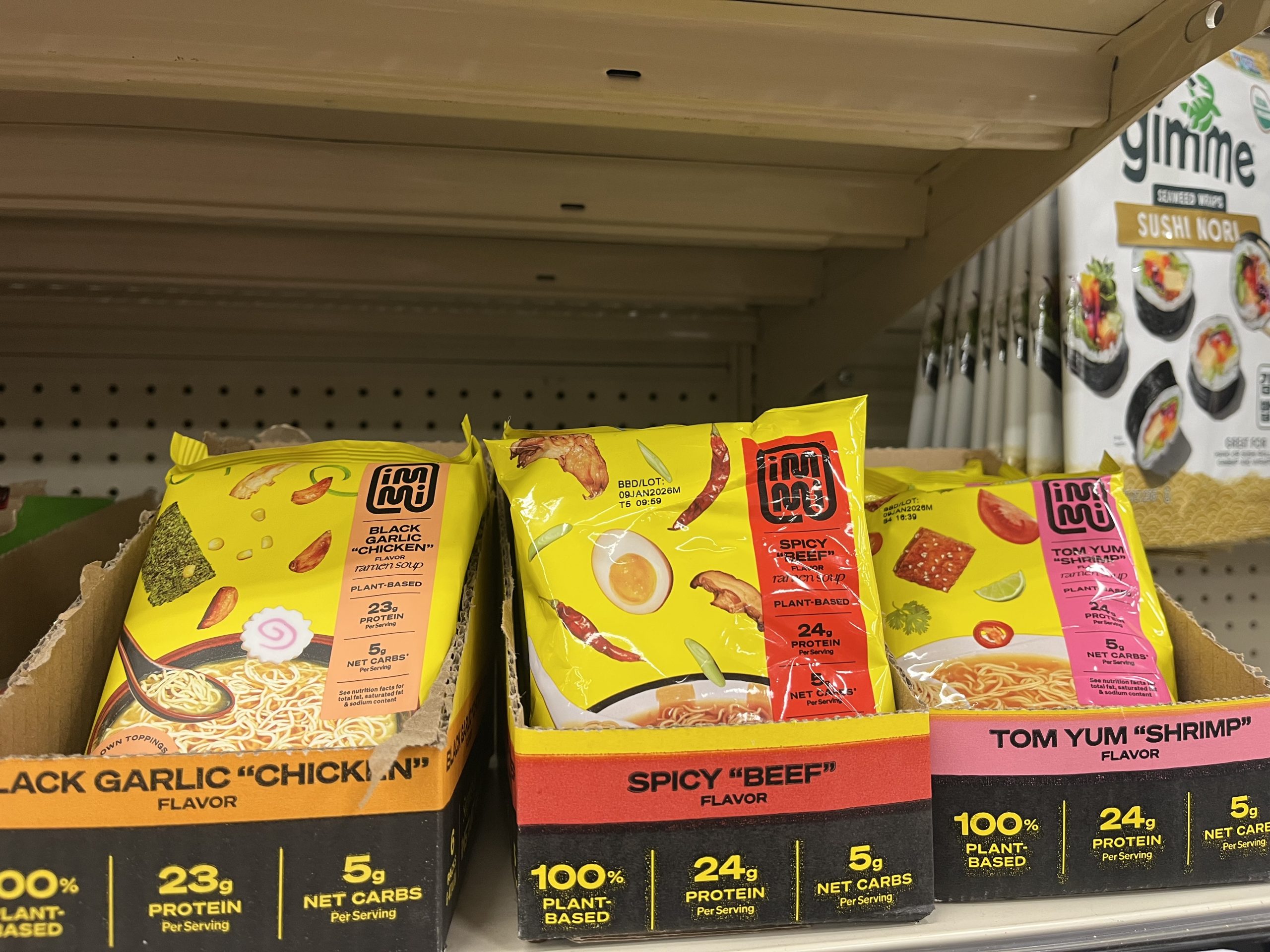
This company actually reached out and sent me some of their Ramen earlier this year. They have tons of protein and actually tasted really good. This is the first time I’ve seen them in the grocery store. For Ramen, they are expensive. But considering how much protein they have, I think it’s pretty worth it.
I checked in to my room super quick and threw my bag down. Then walked across the street to the pine frosty, a classic burger and milkshake joint in town. They have a 32 ounce jumbo milkshake which I was in desperate need of. I got a giant coffee milkshake, a chili burger, and cheese curds. Then walked across the street to the gas station next door to grab some drinks for tonight. And after that, it was back to the room to devour my feast and start doing my chores.
I wound up taking a shower and pre-washing my socks. I’ll probably just do laundry tomorrow at the home of the Trail Angel that I’ll be staying with. Which saves me from having to go down the street to the laundromat tonight. After I showered, got things charged, and got everything situated, I just decided to walk down the street to the grocery store. I wanted to get even more drinks and some random goodies for tonight. And on my way back, I picked up steak hibachi from a restaurant right next to the hotel.
I spent the entire rest of the night in the hotel room as god intended. I watched TV, but mostly just got a ton of video editing done and writing. I’m not sure what the circumstances will be like tomorrow at the trail angel house, so I got all of the voice to text and video stuff done first. That way if I don’t have a private space to do voice overs and other editing then it won’t be a big deal.
It felt so nice to be relaxing in bed for the night. My body really needed this after yesterday. And I ate so much delicious food, drank a ridiculous amount of soda, and of course, some chocolate milk.
Now, tomorrow morning, my plan is just to sleep in at the room and check out at 11 AM. Then I’ll get in touch with the Trail Angel in Chester and head on over to their place for the day and night. Life is good!
If you enjoyed this blog and would like to support my hike by buying me a soda or a snack along the way, there is a “Tip the Author” button below! It links directly to my Venmo. Any and all support is incredibly appreciated!

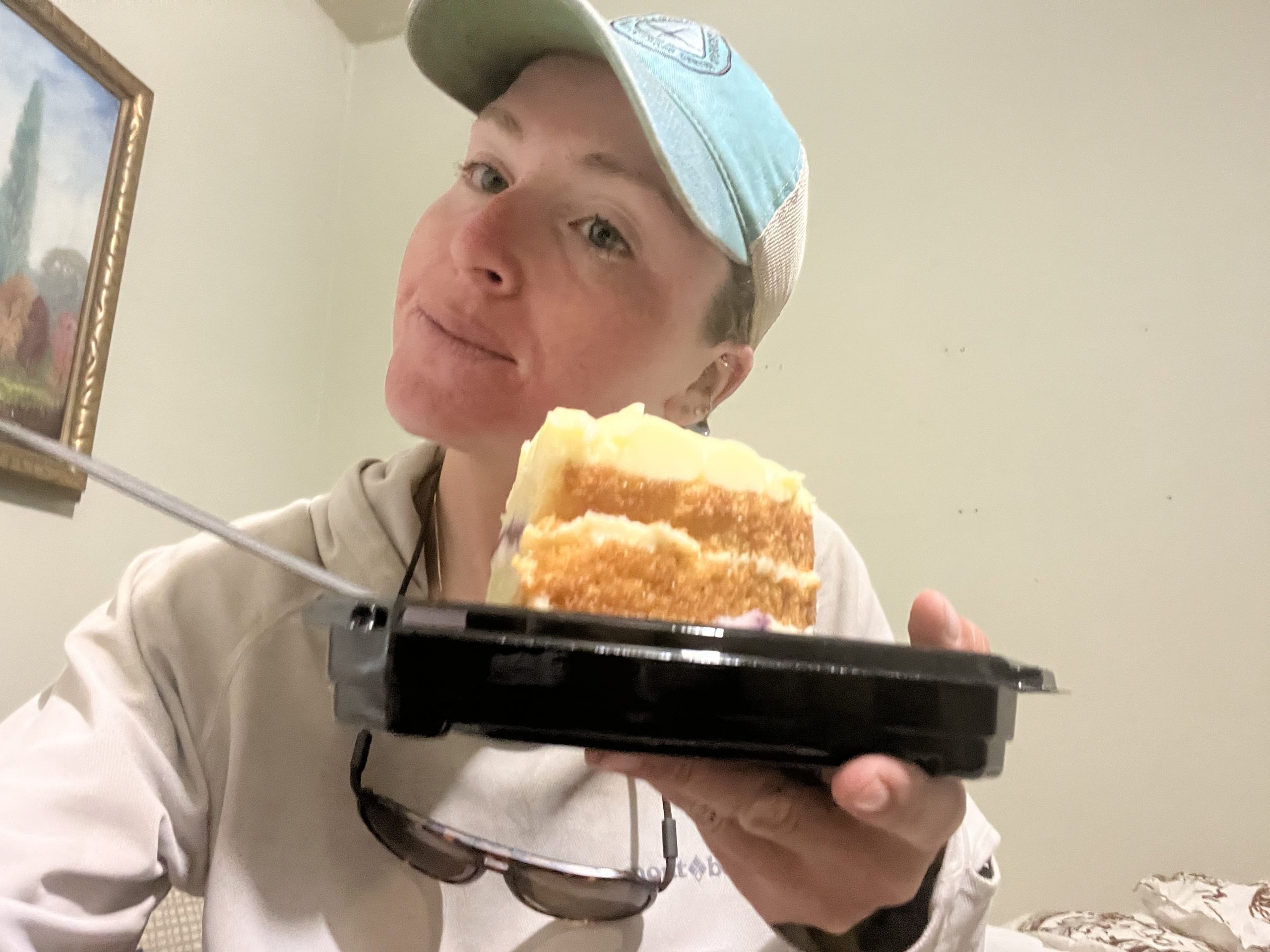
Last night I had made plans with Taylor to get a ride back to trail this morning around 6:30 AM. My hope is to be hiking north once again right around 7 AM. Which considering I stayed in town last night, is about as good as it’s going to get. It was hard waking up this morning because I stayed up super late last night. But I had bought myself a giant piece of raspberry cake which I ate for breakfast. That sure helped. Then Taylor drove me back to trail.
Even though I didn’t spend a ton of time in Quincy last night, that was absolutely amazing. It’s crazy how just sleeping in a bed and taking a shower can be such a major reset. Even after doing a big day and not getting much rest. It definitely feels like more of a reset than just ending the day in my tent for the night. Plus, I got to get in tons of calories last night.
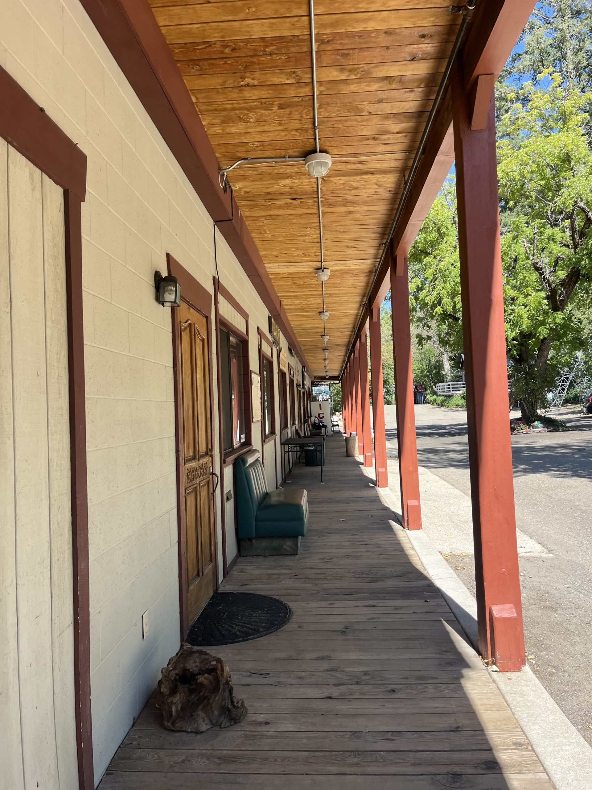
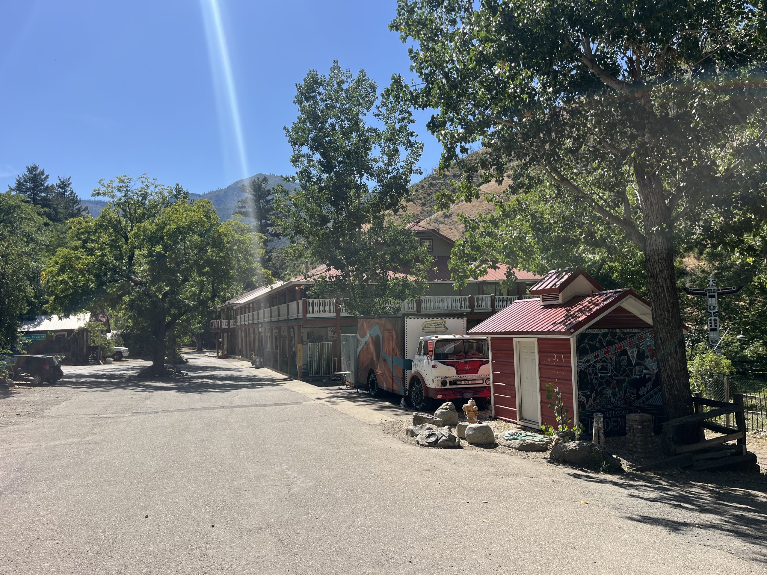
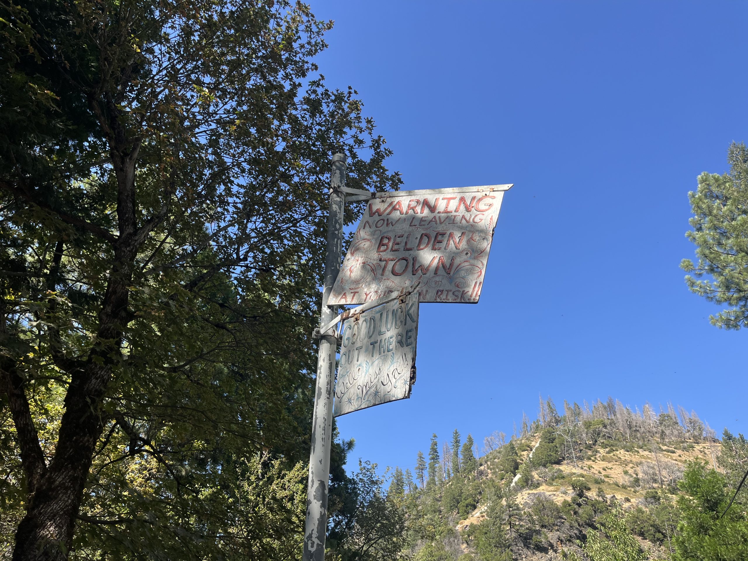
Now today, I am only about 23 miles from the town of Belden. A tiny town with a general store, motel, and RV park, which the trail passes right through. And the overall structure of the day today is actually very similar to yesterday. The first 23 miles of the day there isn’t a ton of elevation gain. I think I’ll have one or two small climbs. Then I drop down 4000 feet to get into Belden. And leaving Belden I have to climb back up 4000 feet again.
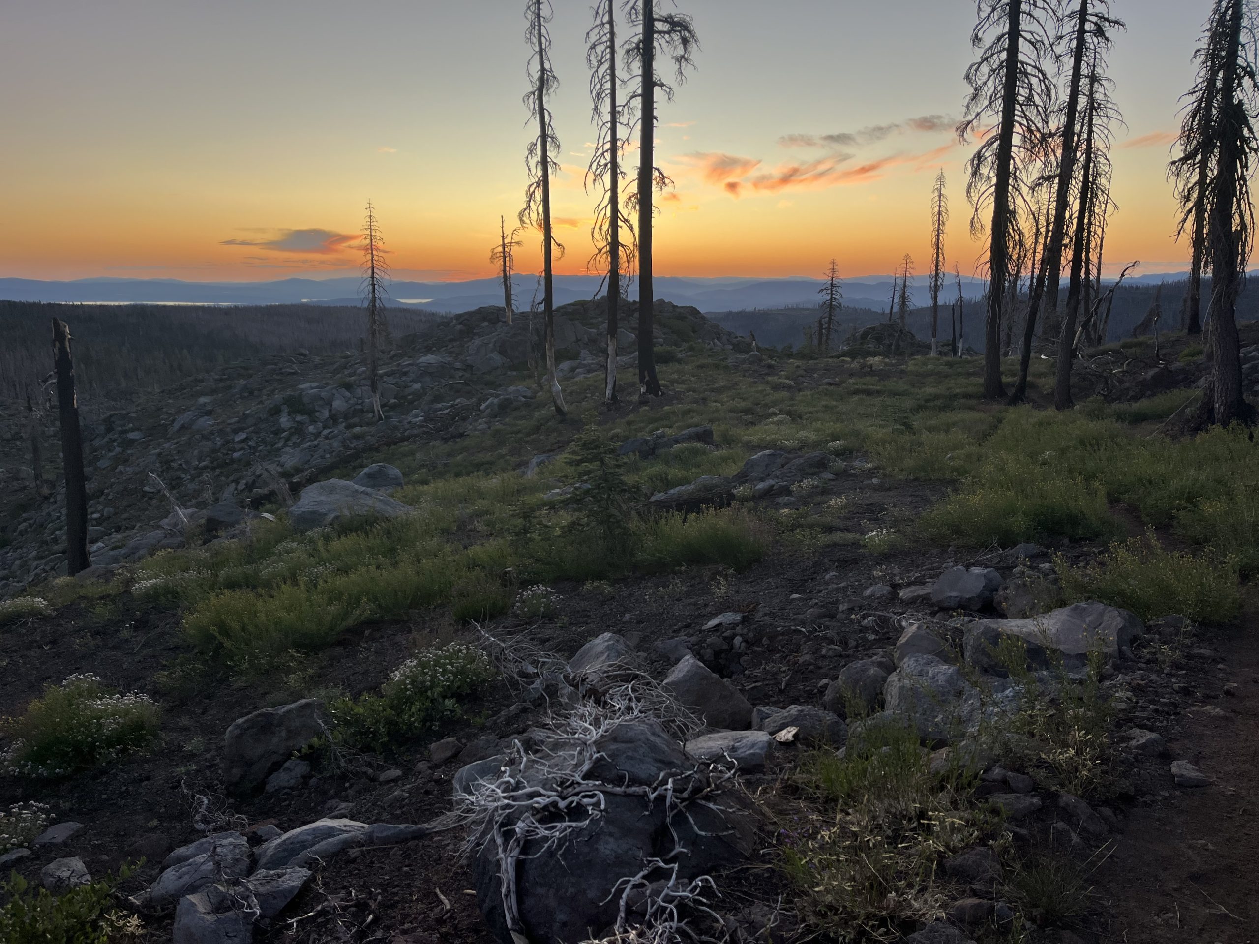
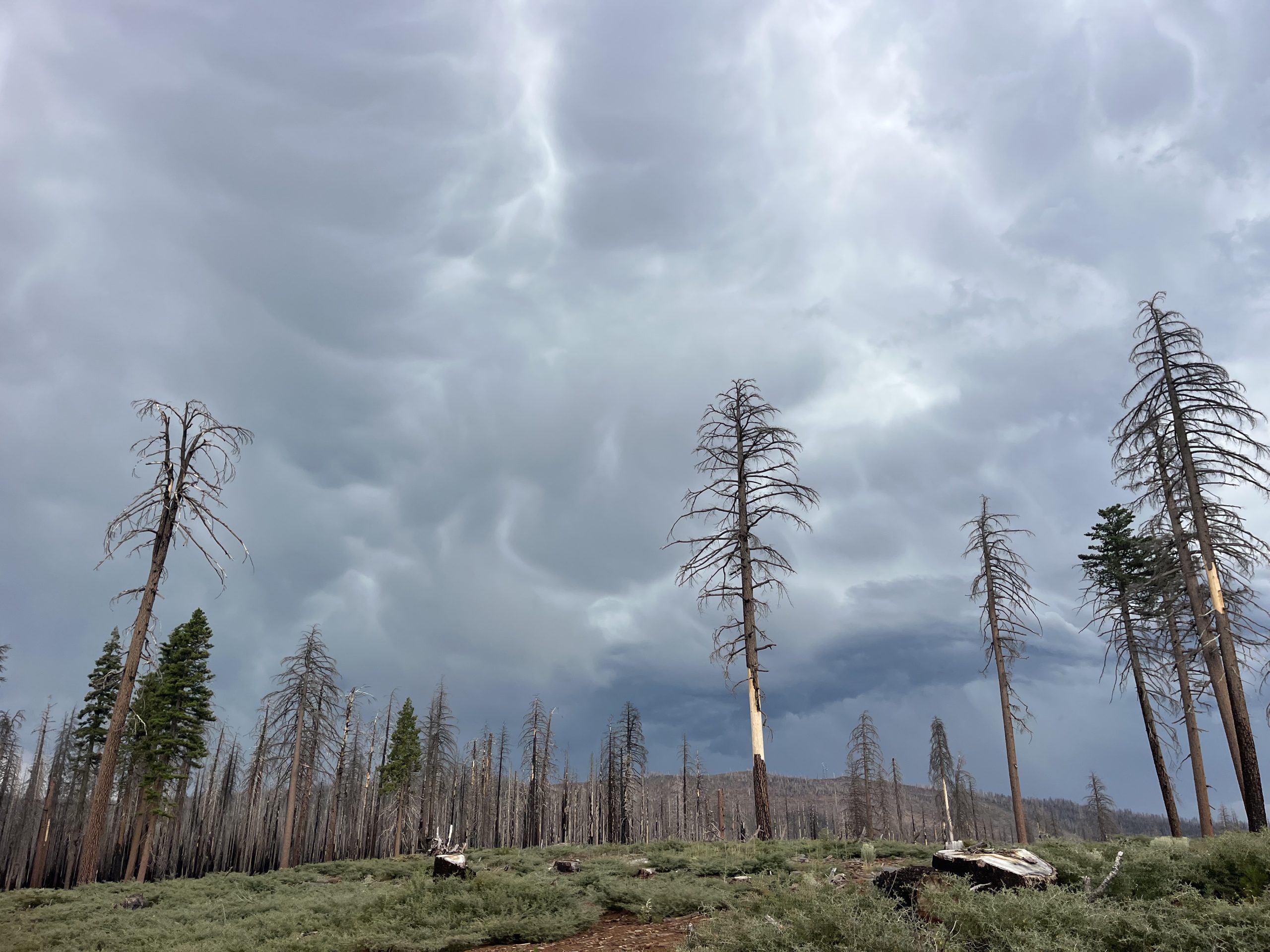
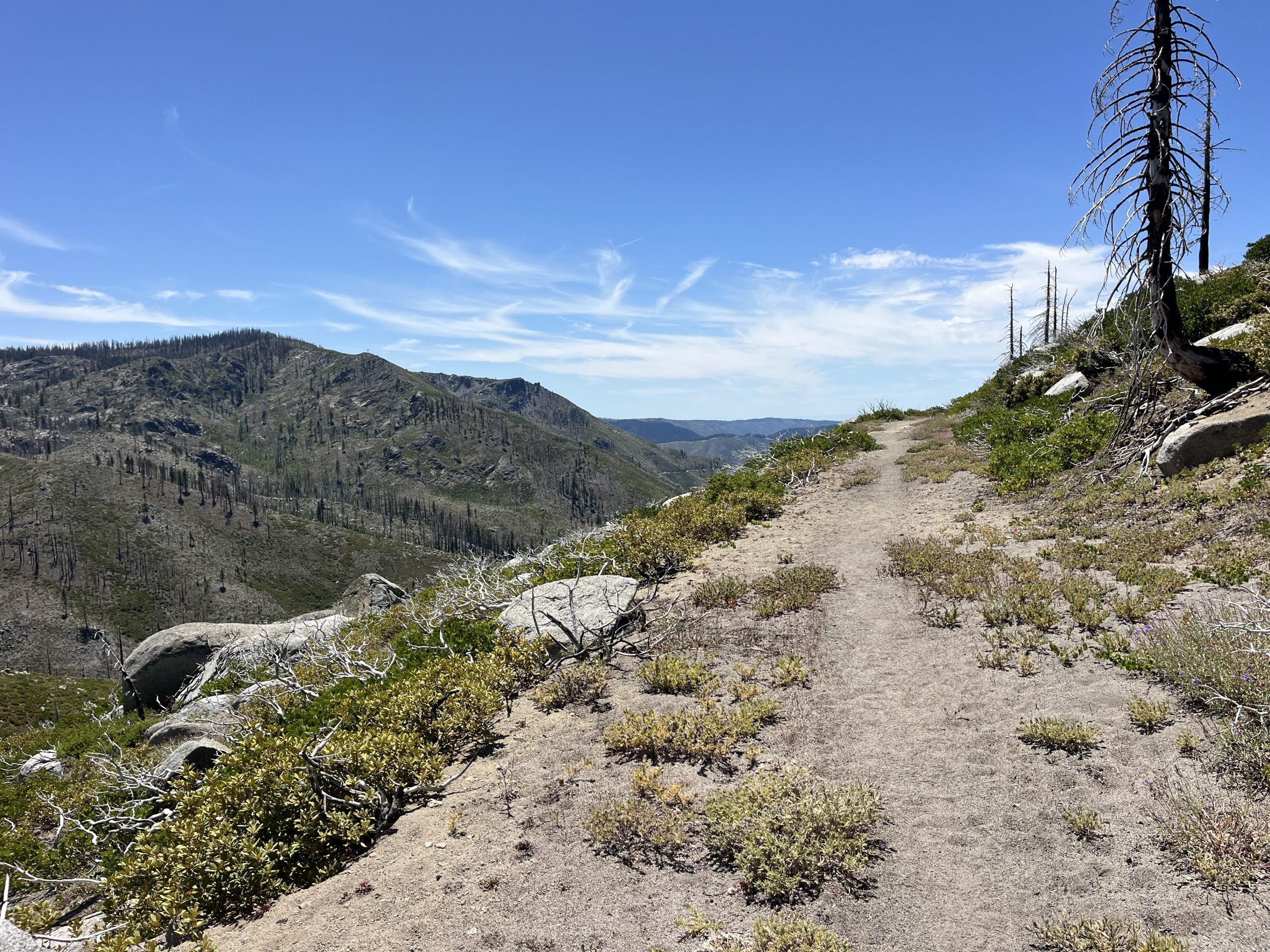
The views through the Dixie burn are beautiful in their own way. You just need to change your perspective a little bit.
The morning wound up being really nice and easy. Plus the temperature was super cool. When I was in this part of Northern California in 2022 it was during a heat wave. And this area is just absolutely brutal when it’s over 100°. Because of all the damage from the Dixie burn there really isn’t a lot of coverage. So I’m incredibly grateful that this time around my experience has been the polar opposite. The temperature has been really moderate most days and even cool at times.
Yesterday it felt like there were a ton of blowdown along the trail, and I went through a good bit of fire damage. But today it was basically all fire damage all day. The entire trail is just completely burnt, and the trees are left behind like a little black toothpicks. Some sections of trail do have a good bit of new growth. But shocking other sections of the trail really don’t.
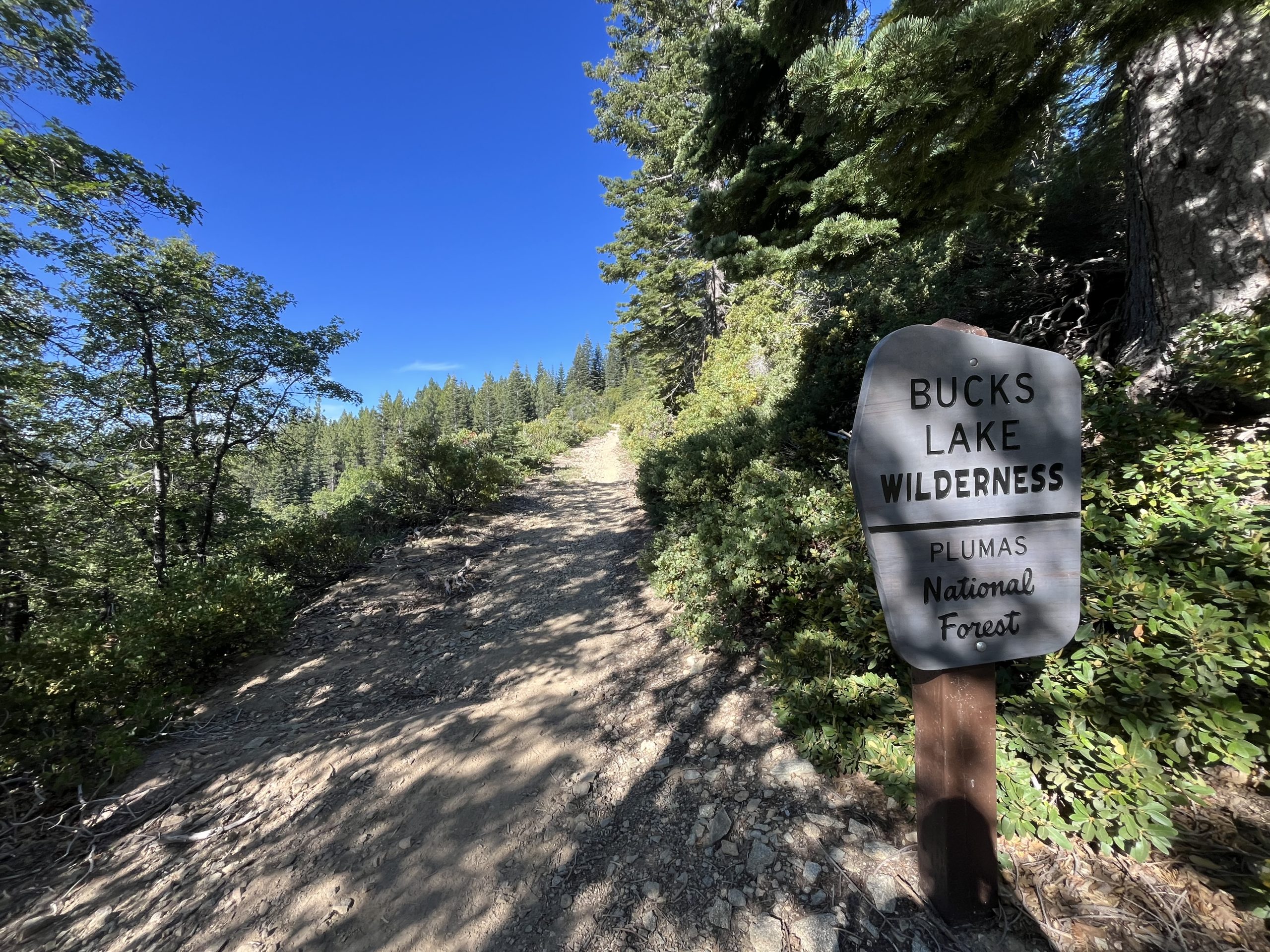
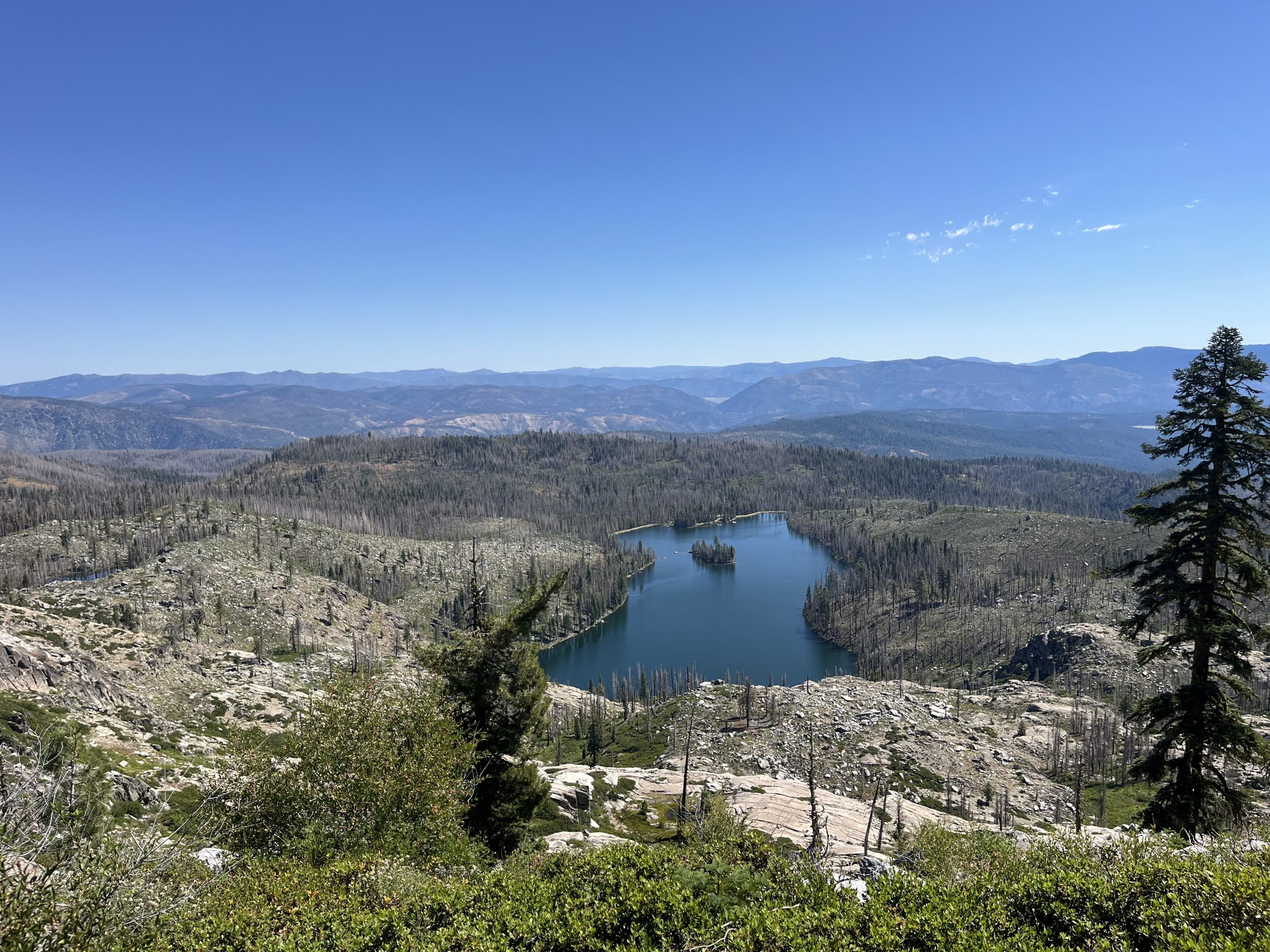
About 4 miles into the day I crossed over another major road. This is the second road where you can hitch into Quincy. And it’s the recommended road for hitching into Quincy because it’s a lot more populated than the road that I got picked up that last night. After crossing over the road, I began a very gradual climb for the next few miles. Then I was basically just up for a while riding along the ridge. Even though I was mostly just looking at burn, I did get some really beautiful views of Bucks Lake in the distance. I can only imagine what the Bucks Lake wilderness looked like prior to this fire. It must have been really beautiful.
The walking today felt a little monotonous at times. But on a bright side, it also felt like the time went by really quickly. It looked like I would be getting into Belden before 4 PM. Which was amazing because I was planning on going in and out quickly and then hopefully doing another 10–12 miles. I was also really dreading the descent into Belden. In 2022 this is where Peg Leg came to be. I was having really mild IT band problems prior to this decent. Then the trail dropped 4000 feet over 5 miles into Belden. And I think on that downhill I was going about a mile an hour.
I wound up spending a couple days at the RV park in Belden. Then somehow continued along and made it to the town of Chester. In Chester, I took another few days off for injury and eventually got everything sorted and started my road to recovery. It’s just so funny being back here where the name was born. This time around though I was pleasantly surprised by the downhill. It was graded really well and wasn’t nearly as bad as I remembered. I actually wound up enjoying it honestly.
I got down into Belden just before 4 PM and headed into the store. OutsideJay had left me a box with some resupply goodies. I also bought some cold drinks and soda. I knew it was going to be a very hot and exposed climb coming out of town. So I wanted to hydrate a bunch and also take a lot of goodies with me.
In my memory, I picture this porch covered in hikers hiding from the heat of the day. But today when I arrived, there wasn’t a soul in sight.
At this point, I was planning on potentially doing this entire upcoming climb this evening. It was about 13 miles of uphill. So I chugged a Red Bull, ate an ice cream, and got rolling. I had seen one other backpack outside of the store while I was there, but the hiker never came by. Not long after I got moving again, though, they came running up behind me. They must’ve asked the clerk about me or something like that. Because the clerk told them my name and I think they came to catch up to me.
This hikers name was Data, and our paths actually crossed earlier in the year. There was one late night where I set up my tent by a water source with one other tent nearby. Apparently next to him and his wife’s tent. The next morning when they got up, I was super apologetic about whether I might have woken them up the night before. But they said they hadn’t even heard me. Since then, his wife has gotten off trail because of a combination of things. But he’s planning on continuing to finish.
We got to talking and then fell in line together and making our way up the climb. I think sometimes it’s hard for me to hike with other people. I simultaneously crave the connection while also craving the routine that I’ve created for myself. I find it really easy to hike by myself, make big miles, and allow time to slip away. I think sometimes when I hike with other people that time also flies by quickly. And sometimes when I hike with other people, it makes it more difficult for time to go by quickly. That might not make a lot of sense, but it’s just something that I’ve thought about recently. Every instance is different.
It was nice having someone to talk to and we walked and talked for the next few hours. The climb was graded pretty well, which allowed us to keep chatting. We were basically just continuously going uphill for the entire rest of the day. Thought it was the perfect time a day and was starting to get a little cooler. We also started getting brief segments of shaded trail. As the day went on the trail would get more and more shaded as well.
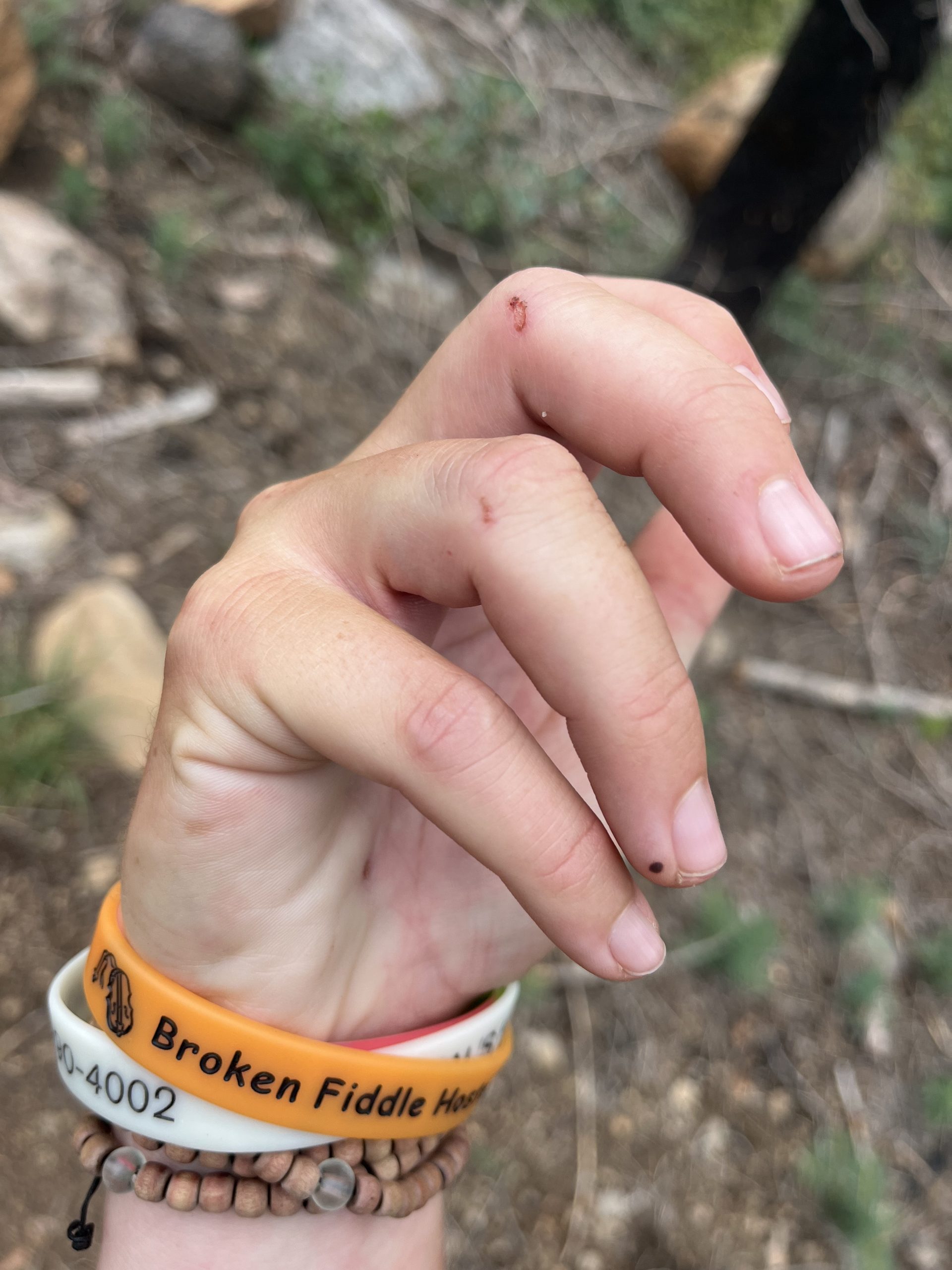
An hour or two after leaving Beldon though I took a really bad fall. It was just one of those perfect falls where your foot get stuck on some thing and you’re not able to free it. But my backpack is super light right now so I’m hiking without my hip belt attached. Which means when I fell forward, my backpack basically tried to jump up and over me. Which just made for a much harder hit onto the dirt and rock covered trail.
I knew almost immediately that I was completely fine. I could tell I had definitely roughed myself up a bit, but hadn’t done any major damage. Data seemed super concerned as I sat there on the ground. But I just always need to take a minute and slowly get up on my own.
A couple days ago I took a soft fall and scraped my knee a little bit. Now this time I re-scraped the knee and had ripped all of the skin off. So that was bleeding a little bit. But it definitely didn’t hurt as bad as the time earlier this year when I fell and smashed my knee on a rock. The only other damage done was that I smashed my left hand into a rock or onto the hard ground. It was super sore pretty much right away. But considering how hard I hit the ground, that actually didn’t seem to be too much damage.
We kept moving after that and the climb just went on and on. As time went on, though, I could definitely tell that my left hand was more hurt than I’d realize. It was very clear that it wasn’t broken. I took a similar fall on the Appalachian Trail in 2023 and my right hand hit a rock so hard that it turned purple almost immediately. This was clearly not as bad as that. And that also wasn’t broken. But over the next hour or two my hand started to throb and was incredibly uncomfortable. I also basically couldn’t use my left hand at all for anything. Which meant I couldn’t take my water bottle out of my pockets or do just about anything with my hand.
As we continued up the climb, the trail crossed over a lot of water crossings. A couple of them were a little bit tricky to get across with dry feet. I had actually read someone’s comment that they wished they had just gotten their feet wet because they hurt themselves doing one of the crossings. And at one point when I was crossing one particularly easy river I made a grave error.
I stepped out onto a rock that seemed super sturdy. But it was slick like oil and I just couldn’t tell. When I actually put weight onto it, my foot immediately slipped off of it, and I fell sideways partially into the river and partially onto some rocks. Once again, it was the type of fall that I knew immediately that I was ok. Honestly, the worst part was now half of my body was wet at 7 PM.
Data was behind me and saw this happen and ran over so quick. I thought it was hilarious that this man was here to witness two of the only falls I’ve taken in the last thousand miles. He seemed so incredibly concerned when he ran up to me. But I said that I was definitely fine, just soaking wet. The only thing that I did notice right away is that I had hit my right hand on a rock when I went down. I had a couple cuts on two of my fingers from smashing into a rock. So now both of my hands were sore.
On the bright side, it was only 7 PM and we were planning on hiking until just around dark. Which meant I had plenty of time to dry out before camp. I figured I’d still be a little damp later, but definitely not as wet as I was after falling in the river. It seemed like Data was originally planning on doing a slightly shorter day. But I said I was going to go up to the top of the climb and he wanted to tag along. Sometimes it’s easier to hike later into the evening or go further when you’re hiking with somebody else.
The last couple hours of the day the trail was basically the same as it had been. The elevation gain wasn’t too bad and was just very continuous. Honestly, though, I was feeling super sore after the two falls. Both my hands were throbbing and my right knee really hurt. It was scraped open and bleeding. Neither fall was that particularly bad. But it’s always jarring and bruises you up a little bit to say the least. I was definitely excited to get to camp for the night.
We wound up grabbing water a couple miles before the end of the day. Then had the freedom to continue up to the top of the climb and camp wherever we wanted to. As we continued along, the sun began to set, and it was absolutely beautiful. Then just before it got dark, we got up to the top of the climb. The views of the sunset from up there or even better. Unfortunately, there weren’t a ton of flat spots anywhere anywhere nearby. We just kept walking and walking and hoping we would find something. But eventually we went past some mediocre spots and decided to make the most of them. It just didn’t seem like we were going to be getting a significantly better option anytime soon.
It felt really good to be done for the day to finally be able to lay down. But setting up camp was already ridiculously annoying with my bad hand. You don’t really realize how much you use both of your hands until you can’t use one of them. This is exactly what happened on the AT in 2023 when I bruised my other hand. I’m just hoping that it feels significantly better tomorrow.
Of course, though, after everything that transpired today, the possibility of taking a zero on Friday was sounding a whole lot better. And there was a slight change of plans today that made that dream seemed like a possibility. OutsideJay texted me today and asked if I wanted him to put me in touch with any Trail Angel’s from Chester. I told him that I was contemplating taking a zero on Friday but that there were no rooms available in town. He said he was on it and he would find a person to host me for the night on Friday. So it looks like I might get that zero day after all!
Inside my tent, I didn’t have the energy to do hot dinner. I just decided to eat a bunch of snacks instead. I also didn’t have service so I wasn’t able to do too much on my phone. But I got a little bit of writing and video work done before calling it a night. Thanks to doing a big mile day today, now tomorrow I’m only 31 miles out from Chester.
My plan for tomorrow is to start early and get into town as quickly as possible. I’m going to stay in a room tomorrow night, which will be nice. I’ll be able to get a bunch of writing and video work done and enjoy some privacy. Then the following day, I will hopefully be staying with someone in Chester for the night. Jay makes magic happen so I know that I don’t have to have all of the details to have faith that it will work out.
If you enjoyed this blog and would like to support my hike by buying me a soda or a snack along the way, there is a “Tip the Author” button below! It links directly to my Venmo. Any and all support is incredibly appreciated!
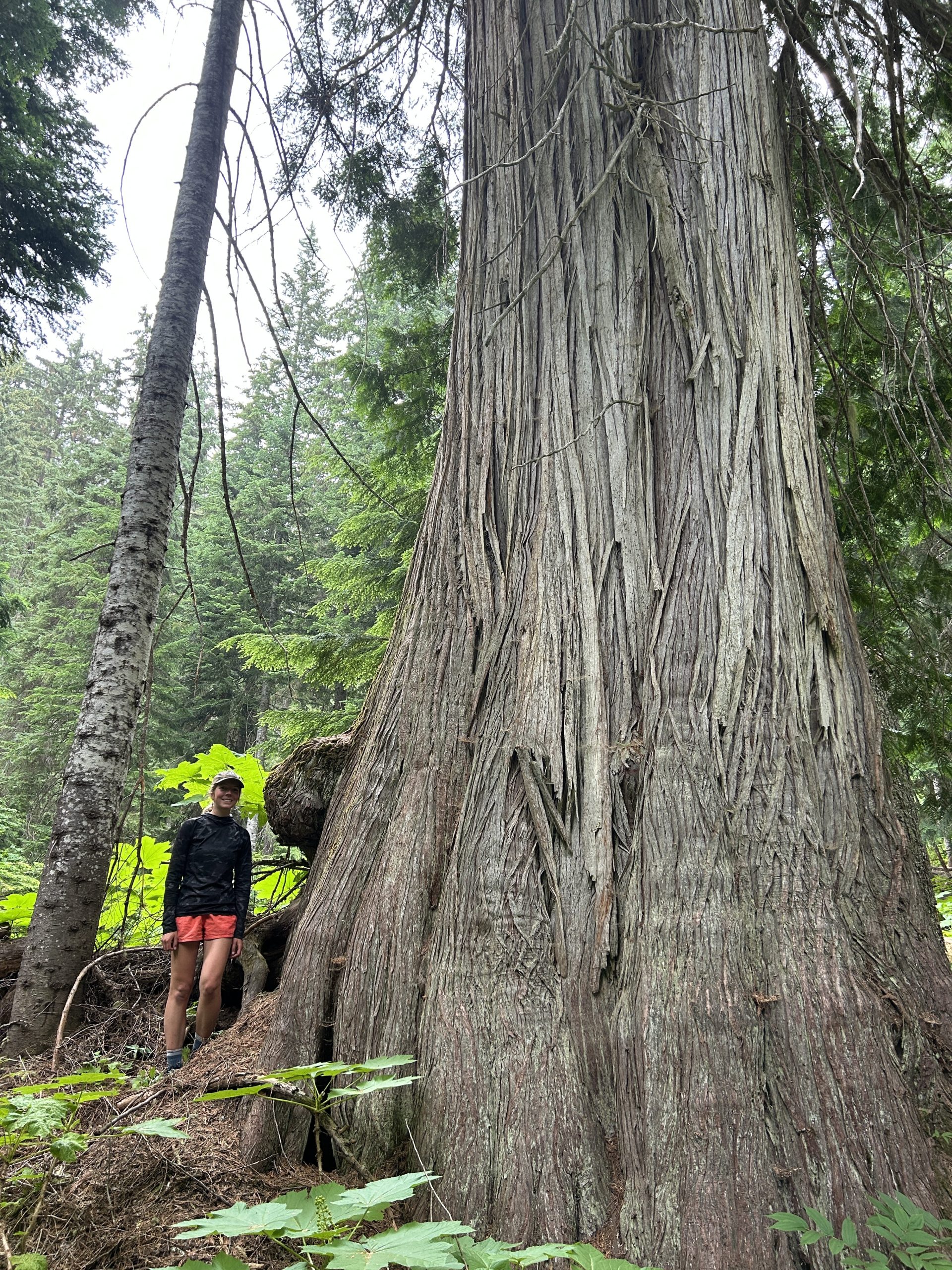
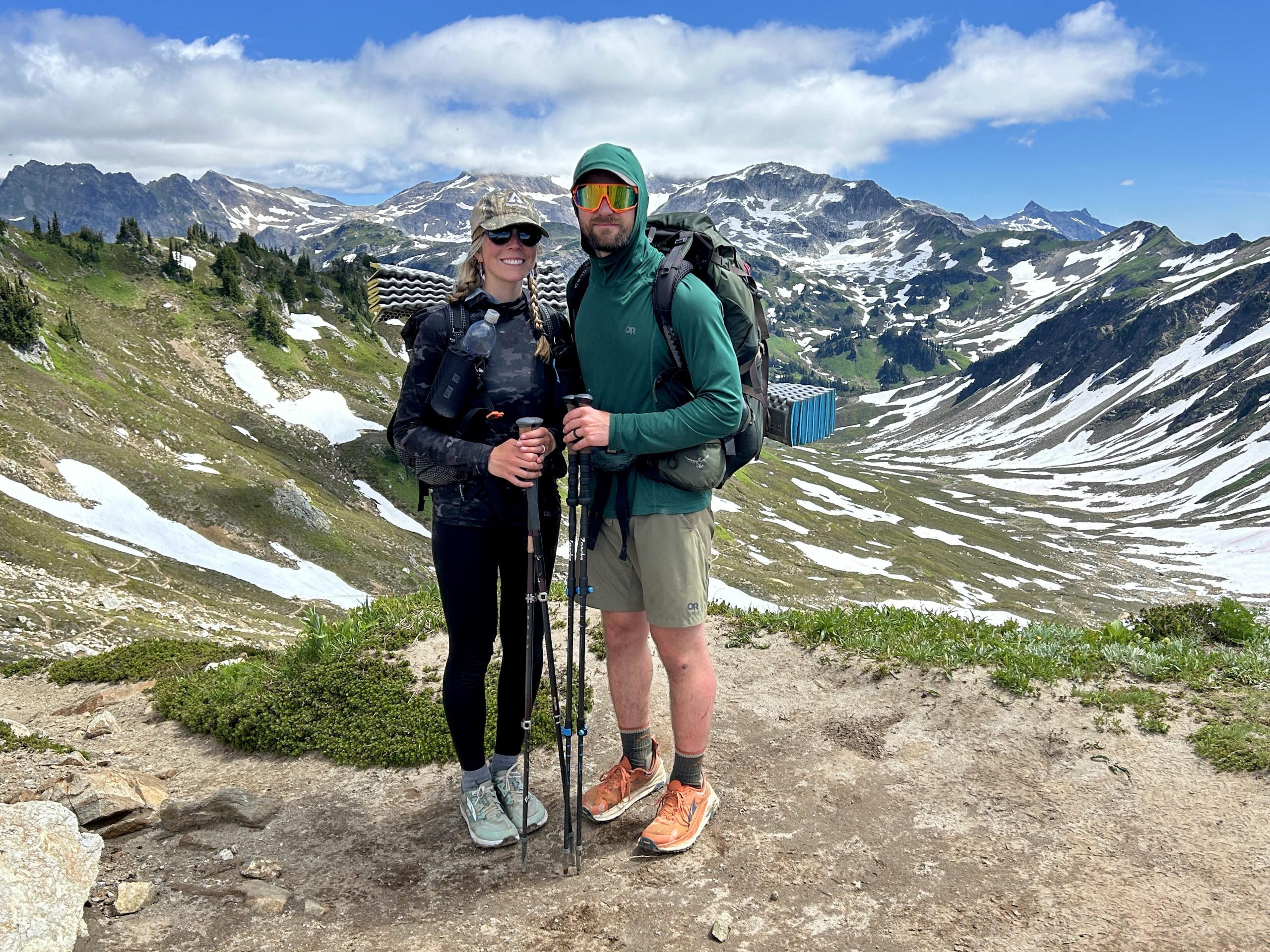
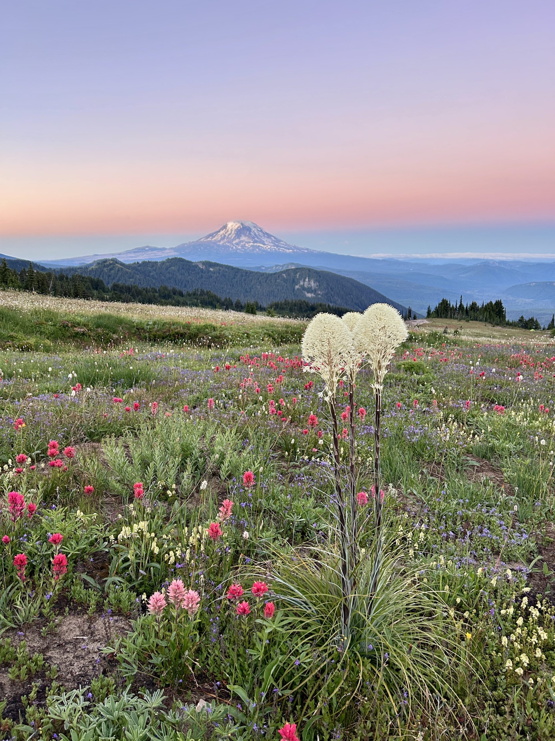
Our journey began on July 2nd as we made our way up to Harts Pass – thank you to trail angels Ani & Tigger for the local tour and ride up from Bellevue, WA!
We checked in with Ranger Terry at the Harts Pass Ranger Station and then began the 30 mile walk to the US/Canadian border. The trail was stunning from Harts Pass -> Canadian Border – as lifelong east coasters this is our first time on the west coast and we are thrilled to be here.
On July 3rd we arrived to the northern terminus monument at 6:00 pm and hiked 3.7 miles (officially heading south now) – if we hiked this mileage every day we wouldn’t arrive to the US/Mexico border until next June!
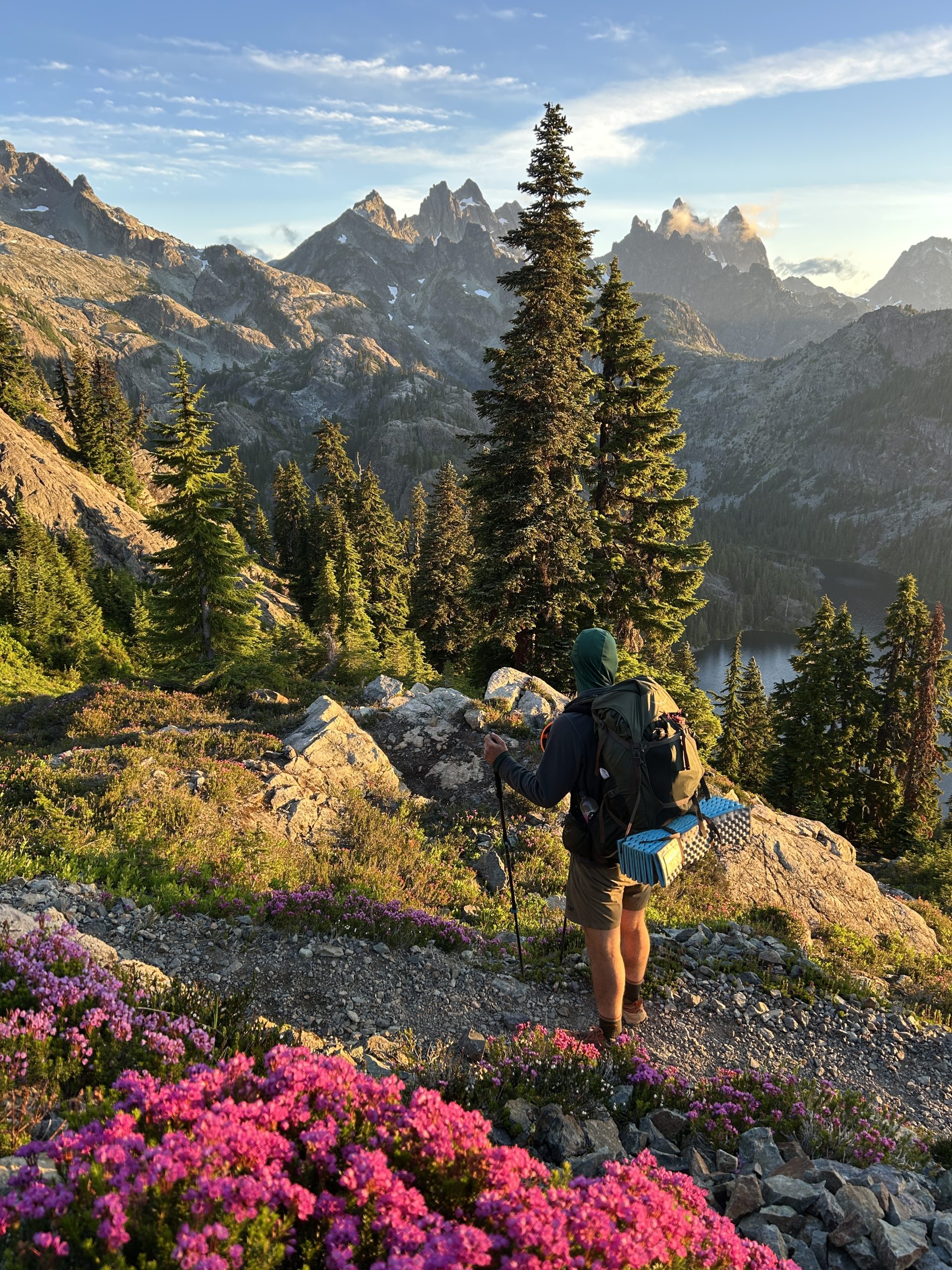
The section from the border to Stehikin was one of our favorite parts of Washington and we are already making plans to return. Rocky and Woody Pass were one of my favorite areas. We saw lots of hummingbirds, marmots, wildflowers, and hung out with lots and lots of mosquitoes.
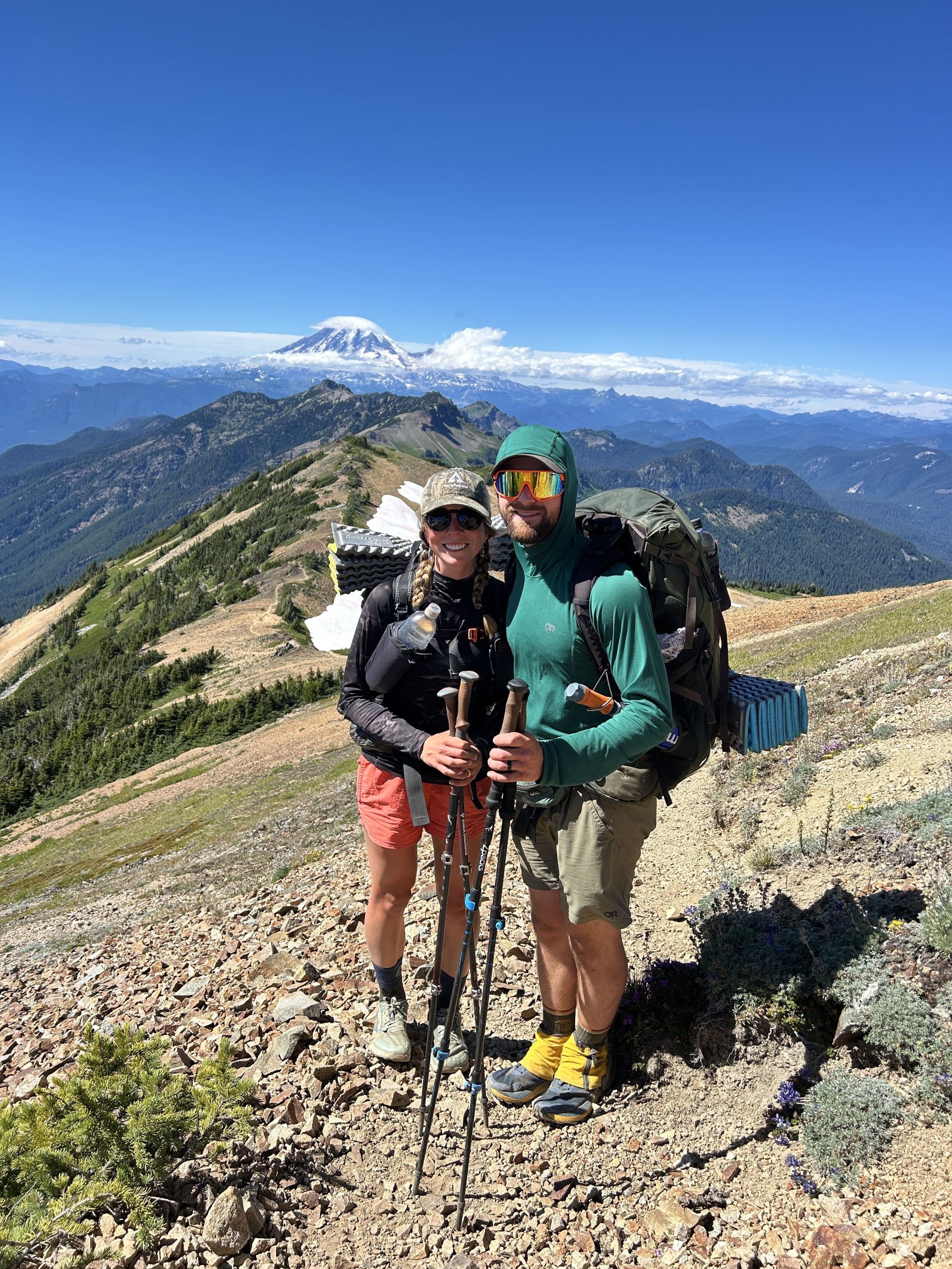
After the first 100 miles, our time in Washington seemed to go by quicker and quicker. We swam in endless pristine back country lakes, hiked over pass after pass, walked through old growth forests, and hiked around volcano after volcano. We stopped in the towns of Stehikin, Leavenworth, Snoqualmie Pass, White Pass, and Trout Lake and were so appreciative to those who helped us out (Right Time, WAC volunteer – helped Matt get new trail runners, Jo Ellen, and so forth).
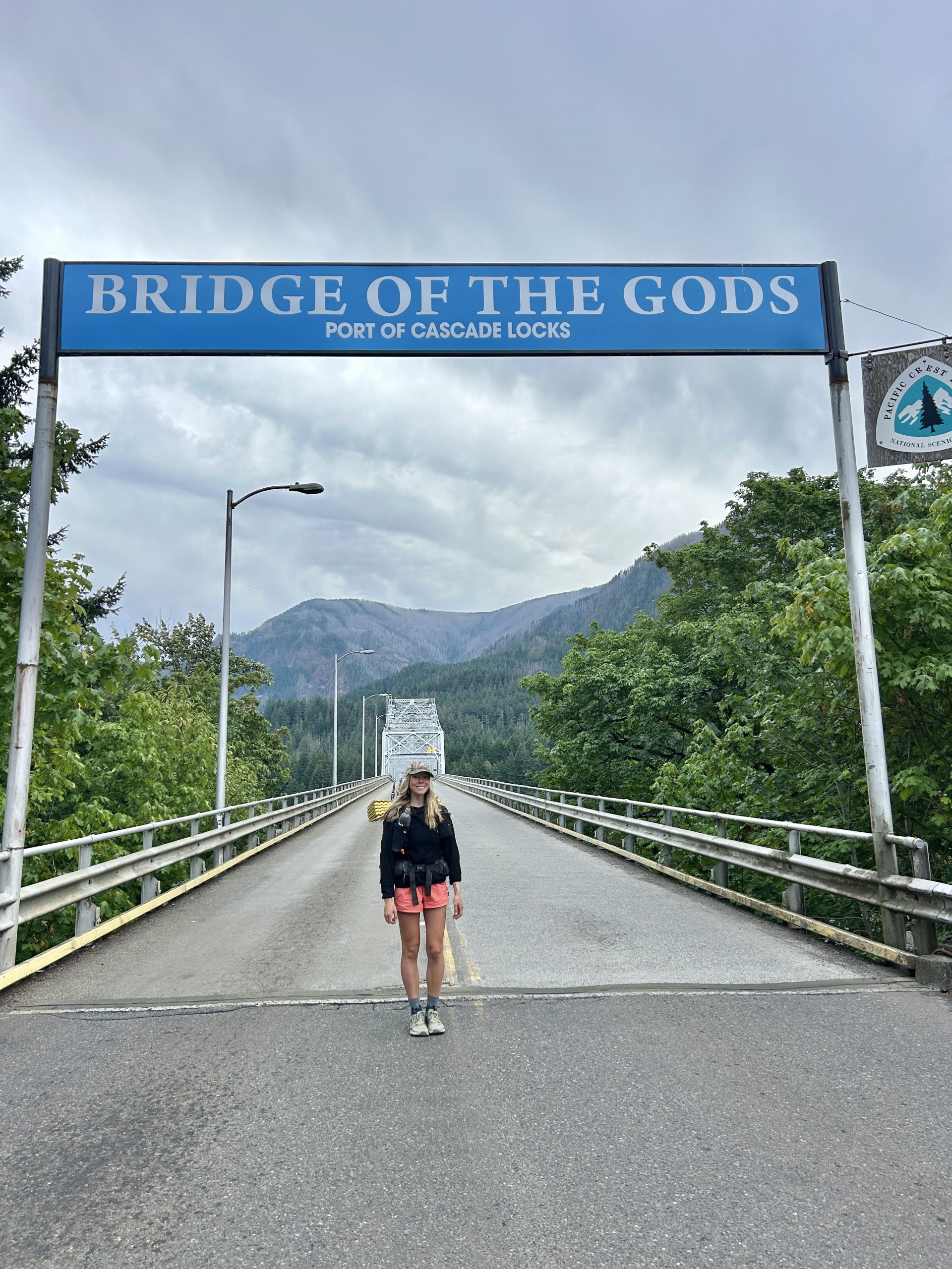
We are taking a couple of days in Cascade Locks to rest up before heading through Oregon! We have been loving the trail and are so grateful to share this experience with one another. We are realizing just how fast this journey will go so are taking everything in as much as possible. We are thankful for all of the love and support from family, friends, and folks we’ve meet along the trail! Looking forward to Oregon and hopefully meeting up with some friends.
For more updates follow along on IG or Facebook @ashleydefayette
Happy Trails
~Matt & Ashley
This website contains affiliate links, which means The Trek may receive a percentage of any product or service you purchase using the links in the articles or advertisements. The buyer pays the same price as they would otherwise, and your purchase helps to support The Trek’s ongoing goal to serve you quality backpacking advice and information. Thanks for your support!
To learn more, please visit the About This Site page.
-

 Brand Stories2 weeks ago
Bloom Hotels: A Modern Vision of Hospitality Redefining Travel
-

 Brand Stories1 week ago
CheQin.ai sets a new standard for hotel booking with its AI capabilities: empowering travellers to bargain, choose the best, and book with clarity.
-

 Destinations & Things To Do2 weeks ago
Untouched Destinations: Stunning Hidden Gems You Must Visit
-

 Destinations & Things To Do1 week ago
This Hidden Beach in India Glows at Night-But Only in One Secret Season
-

 AI in Travel2 weeks ago
AI Travel Revolution: Must-Have Guide to the Best Experience
-

 Brand Stories4 weeks ago
Voice AI Startup ElevenLabs Plans to Add Hubs Around the World
-

 Brand Stories3 weeks ago
How Elon Musk’s rogue Grok chatbot became a cautionary AI tale
-

 Asia Travel Pulse4 weeks ago
Looking For Adventure In Asia? Here Are 7 Epic Destinations You Need To Experience At Least Once – Zee News
-

 AI in Travel4 weeks ago
‘Will AI take my job?’ A trip to a Beijing fortune-telling bar to see what lies ahead | China
-

 Brand Stories4 weeks ago
ChatGPT — the last of the great romantics
You must be logged in to post a comment Login