
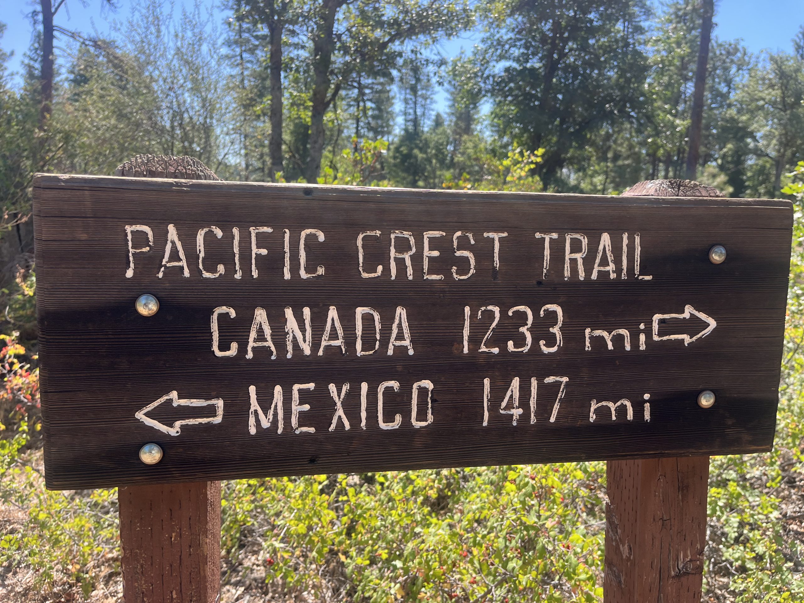
Destinations & Things To Do
Pit Stops for Sundae’s on a 35 Mile Day
This morning I woke up around 6 AM to the sound of my roommate getting packed up. I was surprised to hear anyone stirring so early. Usually in hostels, hikers have a tendency to sleep in. I always feel like I’m the only sicko getting up and out of the bed, bright and early in the morning.
They headed out and then I got up as well and packed my things. I figured I would have my bag ready to go before heading off to breakfast. I got over to the main building a little bit before breakfast started. Then grabbed some coffee and sat with another hiker. For the life of me, I cannot remember his name! I know for a fact, it starts with a T. But we ended up talking about my friend Sunshine, who trail magic’d l me somewhere in Virginia with her boyfriend and her baby. We stayed in an Airbnb with them for two nights back then. Apparently the hiker who I had breakfast with today had ran into Sunshine on the PCT in 2022 up in Washington. It turned out all of us were there right around the same time.
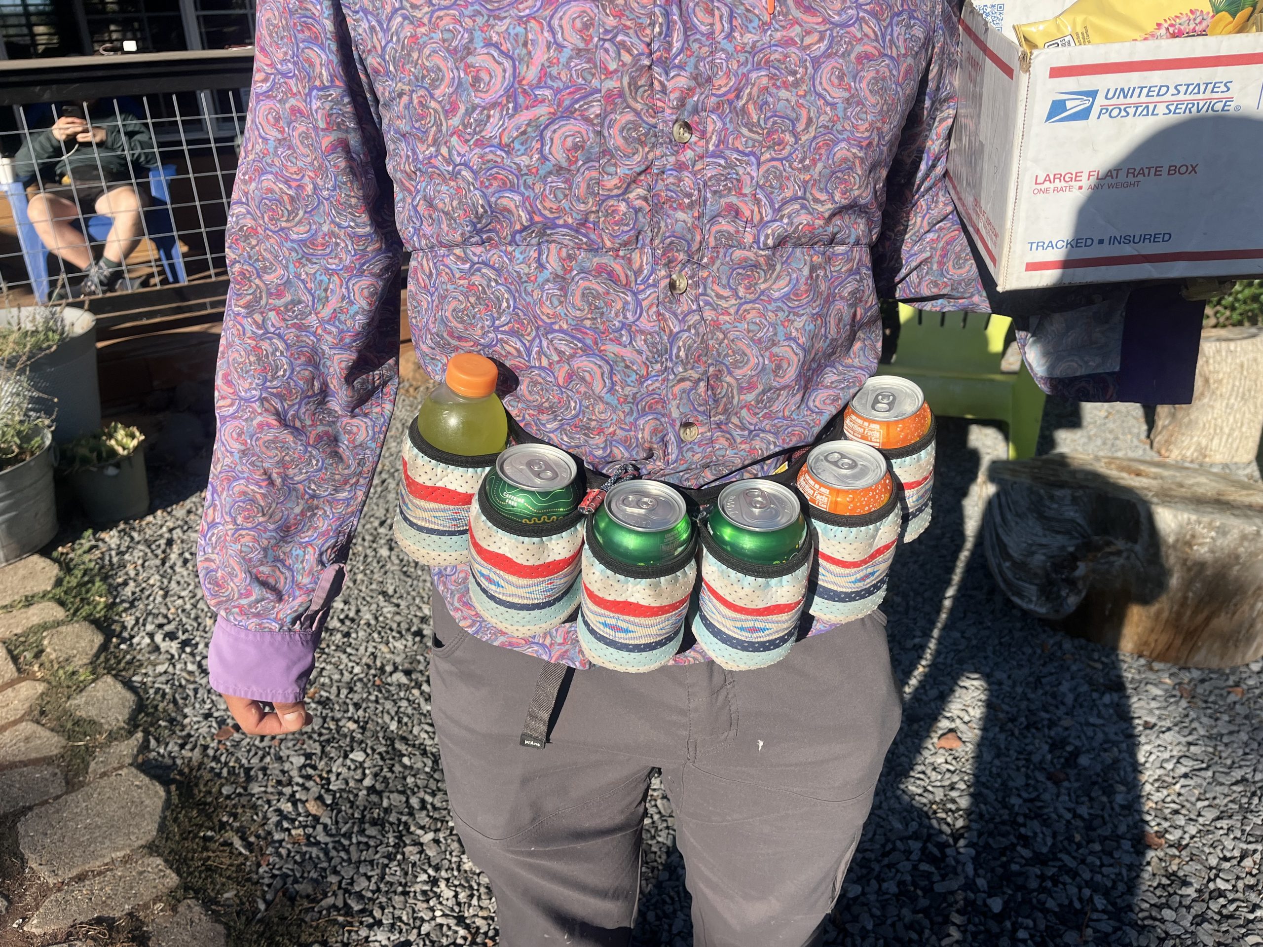
Met basically the coolest hiker on the PCT today. He’s wearing this belt that allows him to carry multiple beverages at the same time. I was so jealous. I think I might need to get one of these.
I sat and had breakfast with him and a few of his friends. It was really nice talking with people and having a slow start to the day. Breakfast was a huge spread of eggs, bacon, sausage, potatoes, pancakes, and fruit. I ate a bunch of food and was feeling really good. A ton of hikers wound up coming in for breakfast so I got to talk with some more of them.
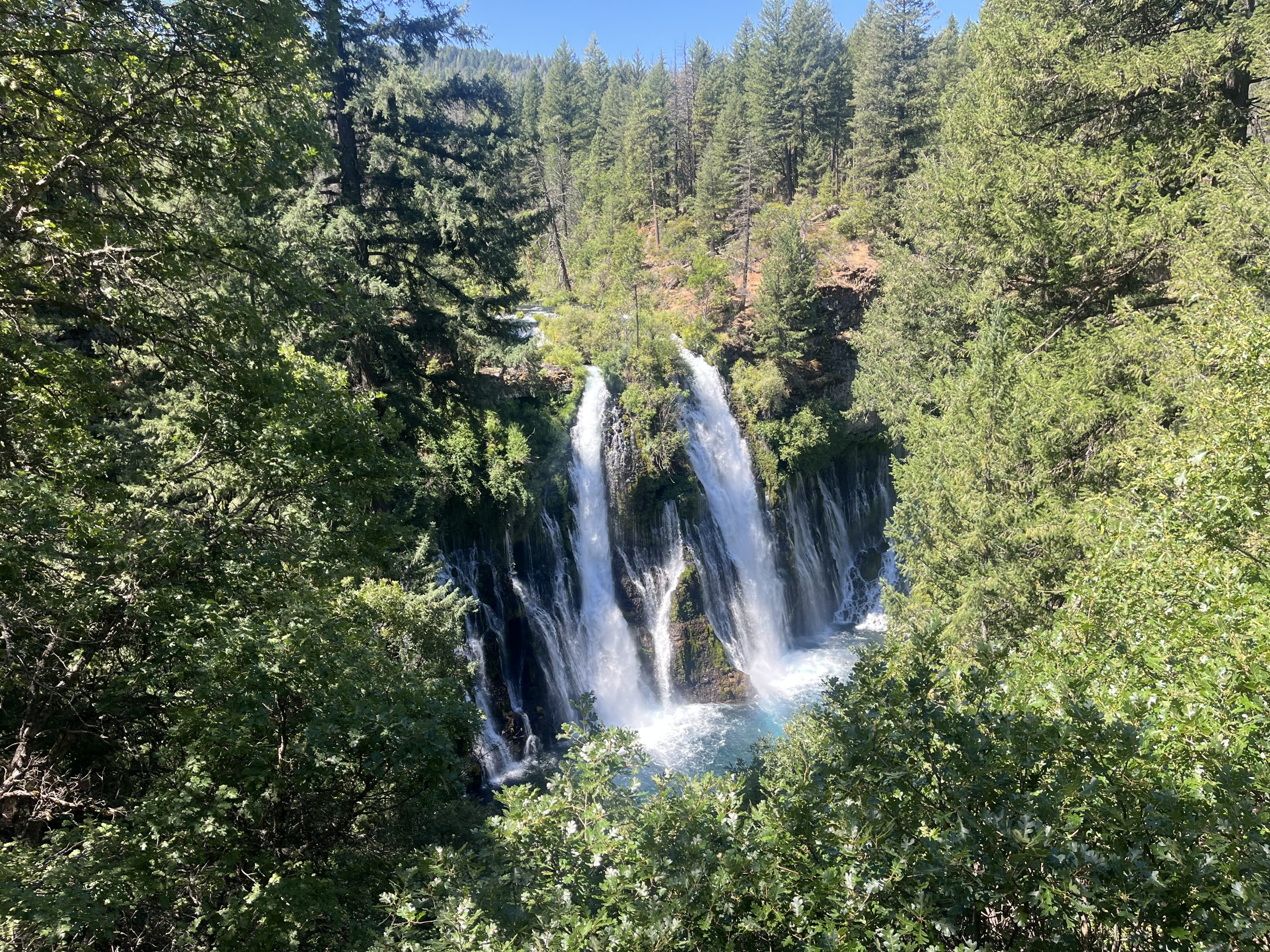
After I ate, I headed over to the small store on the property to get some food for today and tomorrow. I don’t need a ton of stuff but definitely don’t have enough to get to Dunsmuir. The nice thing is though, I am going to go past Burney Falls today. In about 10 miles I’ll pass the junction for the waterfall. And there’s also a general store right by the waterfall as well. Just as one might imagines in nature. But that means that I’ll be able to get some kind of a treat or snack while I’m there.
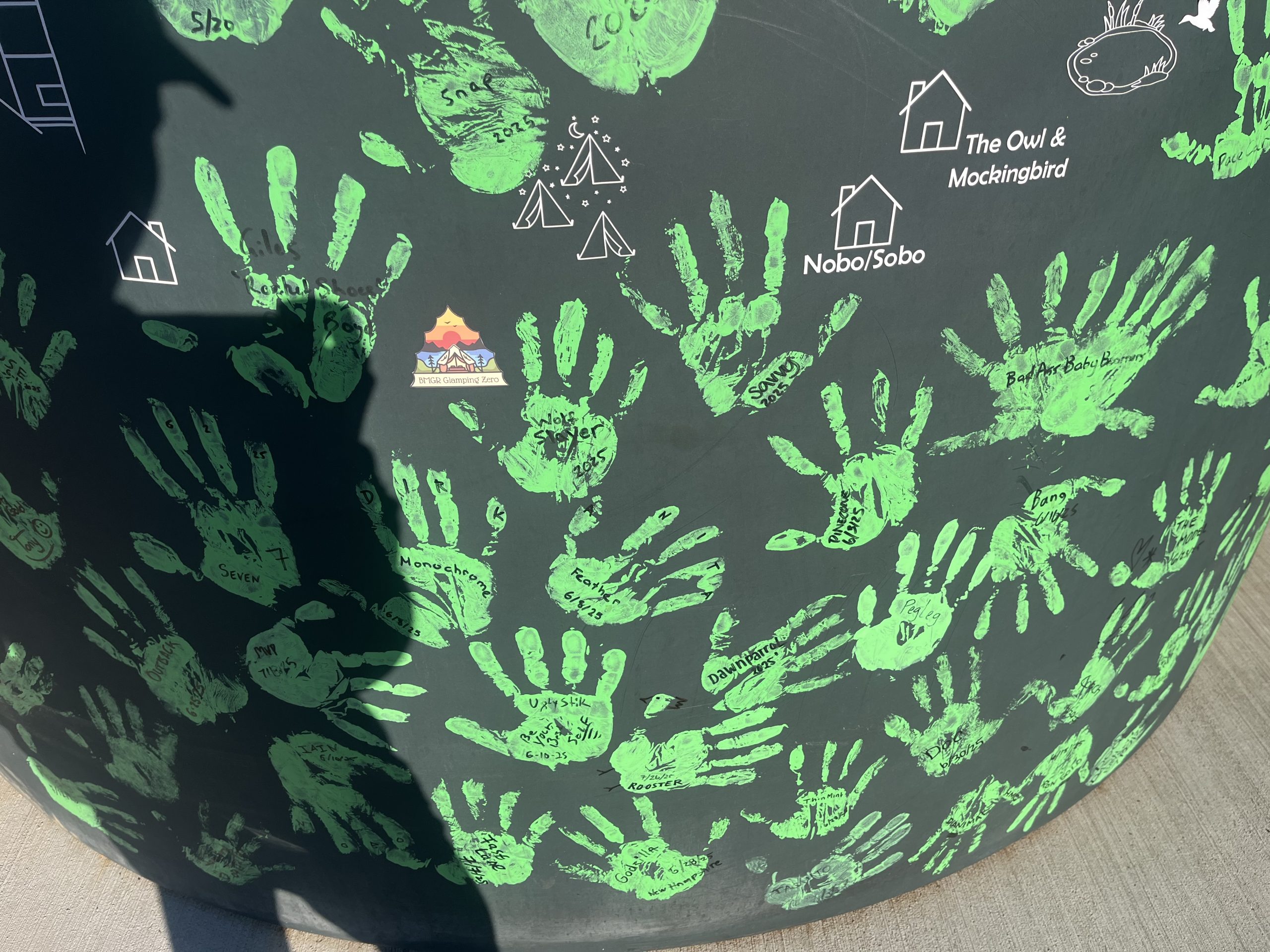
One of my favorite things about Burney Mountain guest ranch is that they have a large water tank on the property that you can “sign”. Hikers are painting their hands and stamping the tamp. Then you sign your name next to your hand. So I did that and then got ready to head out for the day. As I walked off the property there were almost 10 other hikers walking at the same time. I don’t think I’ve experienced that yet on the PCT. Sometimes I’ll see a lot of people in town, but I never really see that many people on the trail. Maybe over the course of an entire day or at a big tent site.
I knew that the first 10 or so miles to Burney Falls was going to be super nice and gradual. It was basically all flat or gradual downhill. Plus I even had some service. So I ended up giving my mom a call and we caught up. I feel like I’ve talked to both my parents a lot recently, which has been a really nice change of pace. Previously, I never had service and felt like I hadn’t talked to them in weeks. So now every chance that I get, I decide just to give them a ring and talk for a little while in between things. Then I was also able to do a little bit of uploading and watch some YouTube. One of my favorite things to do while I’m hiking.
The time flew by as I made my way toward Burney Falls. And I must’ve been literally flying because I think I did the 10 or so miles there in just about three hours. Which is great and meant that I actually would have already made up for the fact that Burney Falls is a side trail. So the time that I saved this morning was basically the same as the time I would be spending over by the general store and waterfall.
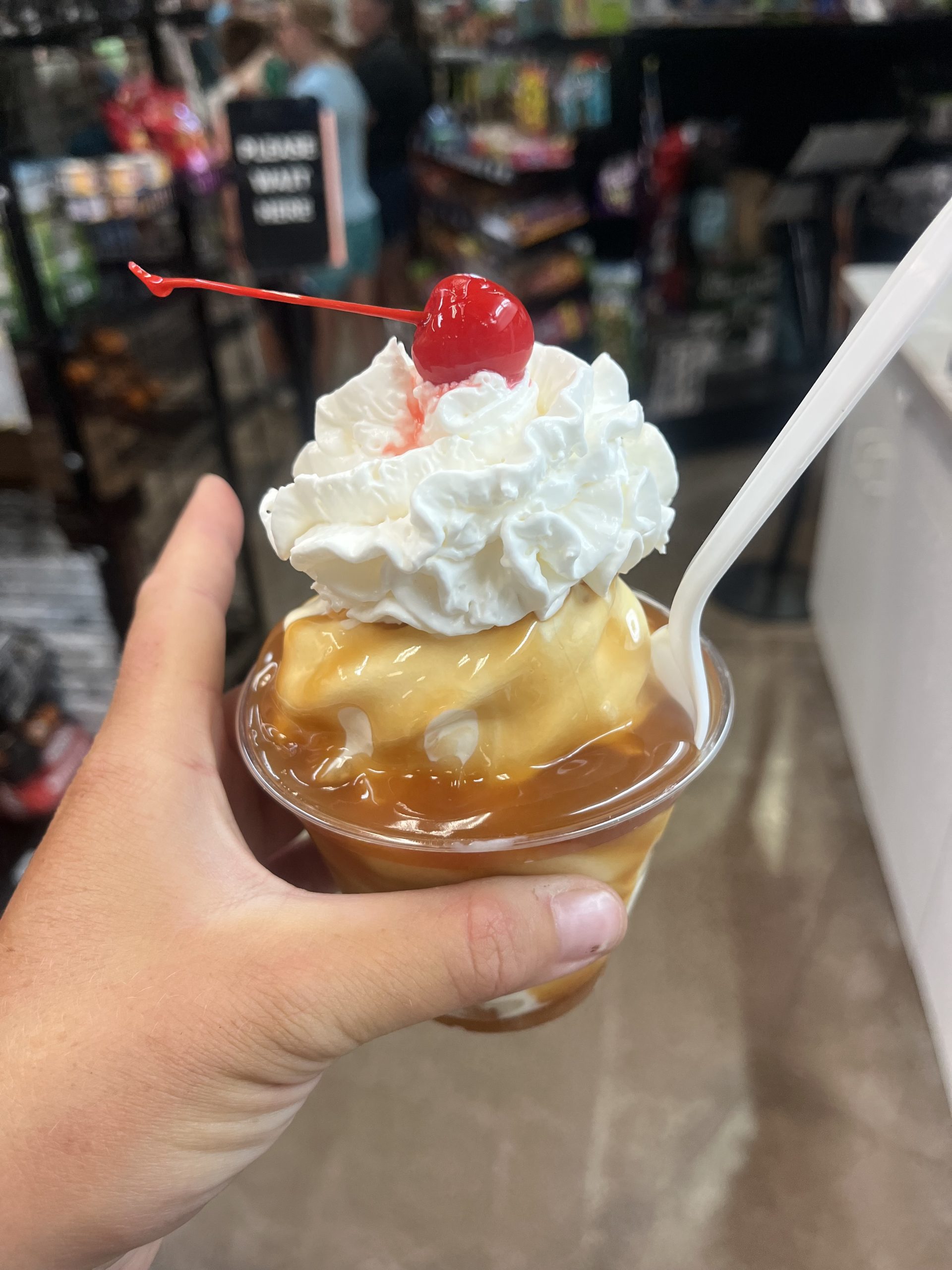
The first thing I did when I got to Burney Falls was grab some drinks and an ice cream sundae. Then I walked with a sundae down to check out the waterfall. Multitasking at its finest. When I came back, I sat down and finished eating. Then poured some Gatorade into my water bottles and chugged a Red Bull. It was going to be a long day still. The next few miles would be fairly easy. Then I would be starting a long climb for most of the rest of the day.
After I finished eating and left the store, the trail was chill for the next hour or so. Then I began the long and gradual time for the next couple of hours. It really wasn’t that bad at all. I did wind up encountering two rattlesnakes today though. One was only about a foot or two off the trail. And the other one must’ve been nearly as close, but I could never see it. The trail was very overgrown at times today. So I must’ve stepped right by it and alerted it. But I couldn’t physically see it.
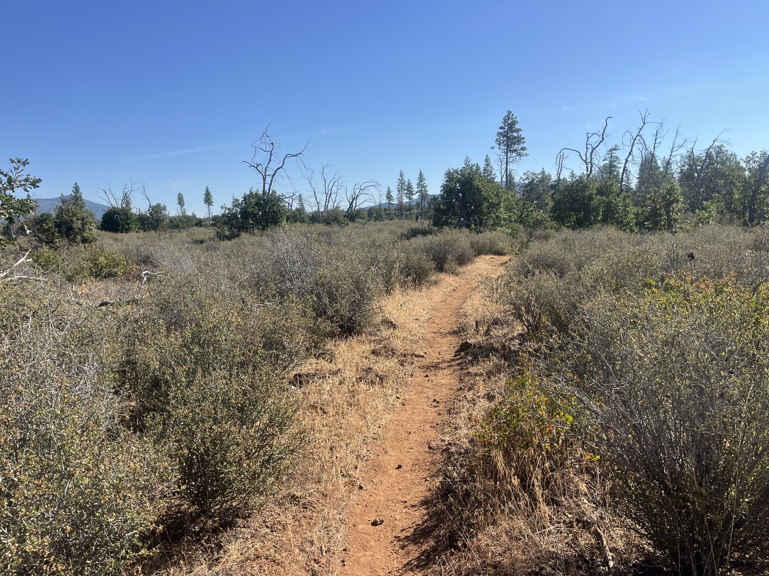
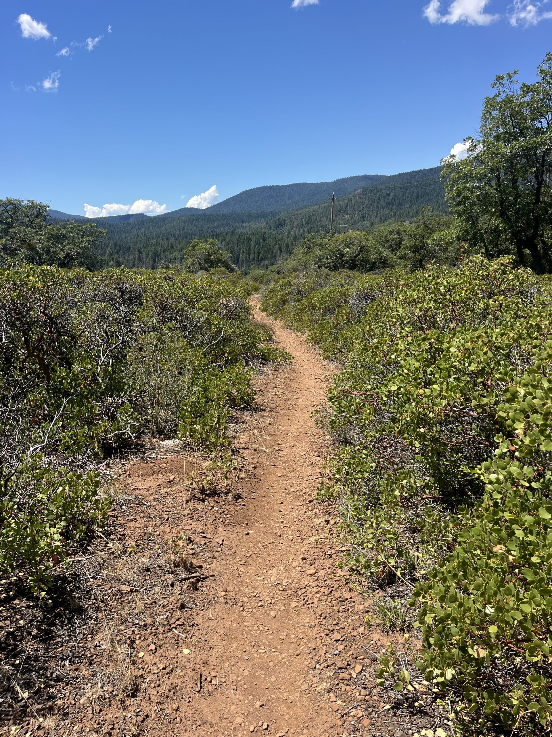
That was probably the only downside to the entire day. The trail wasn’t that bad, but was pretty overgrown here and there. Some sections just scraped up against your legs. Others were really tall and almost hung right over her head. Making it so that you had to duck down a little bit as you walked. The funny thing though was that someone commented on far out saying that you should road walk around this section because “it’s a jungle”. But it wasn’t really notably more overgrown than the trail has been every now and then. People can be so dramatic, especially on far out.
I really enjoyed the parts of the day when the trail was open like this. Other times it was incredibly overgrown.
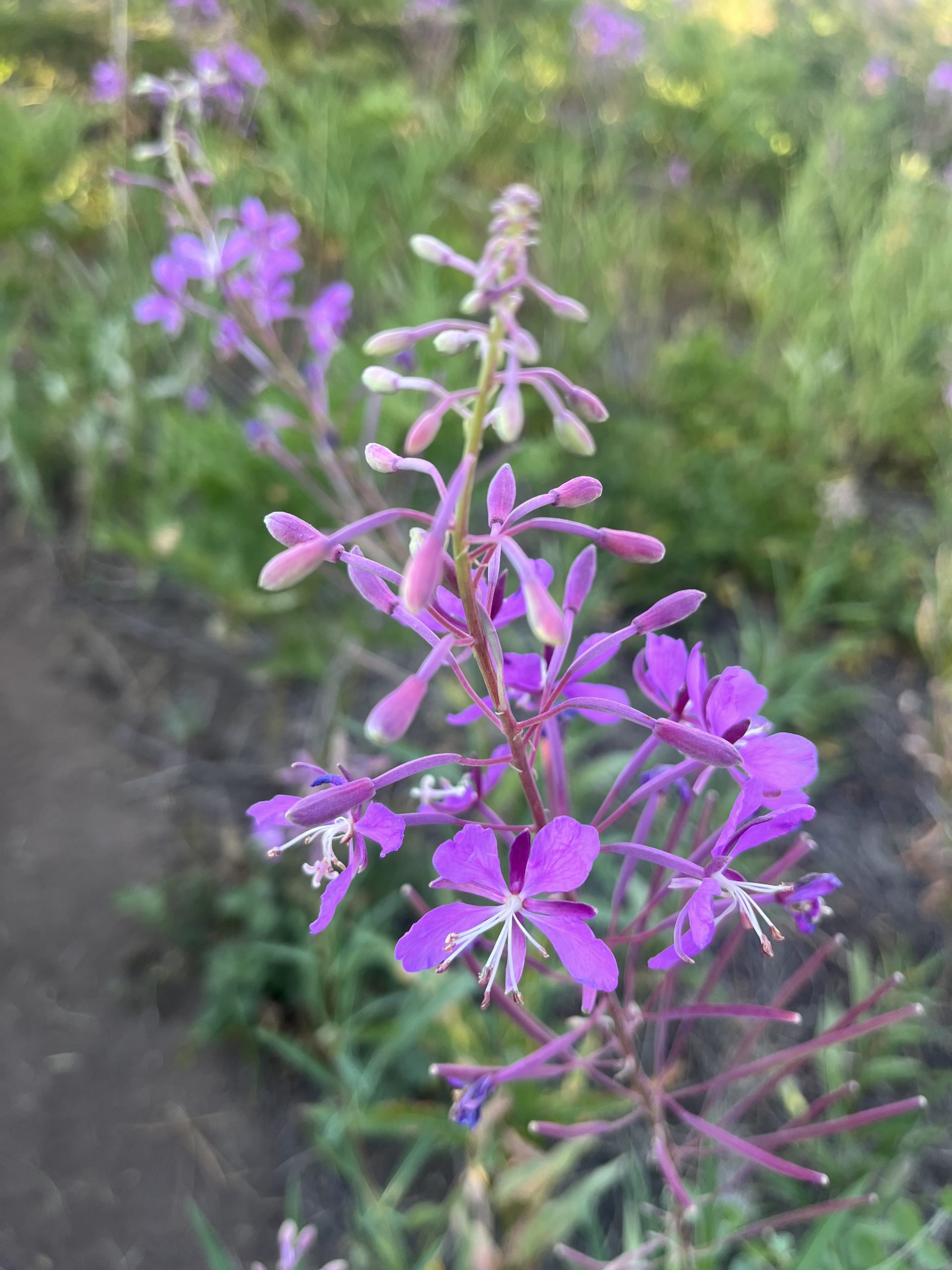
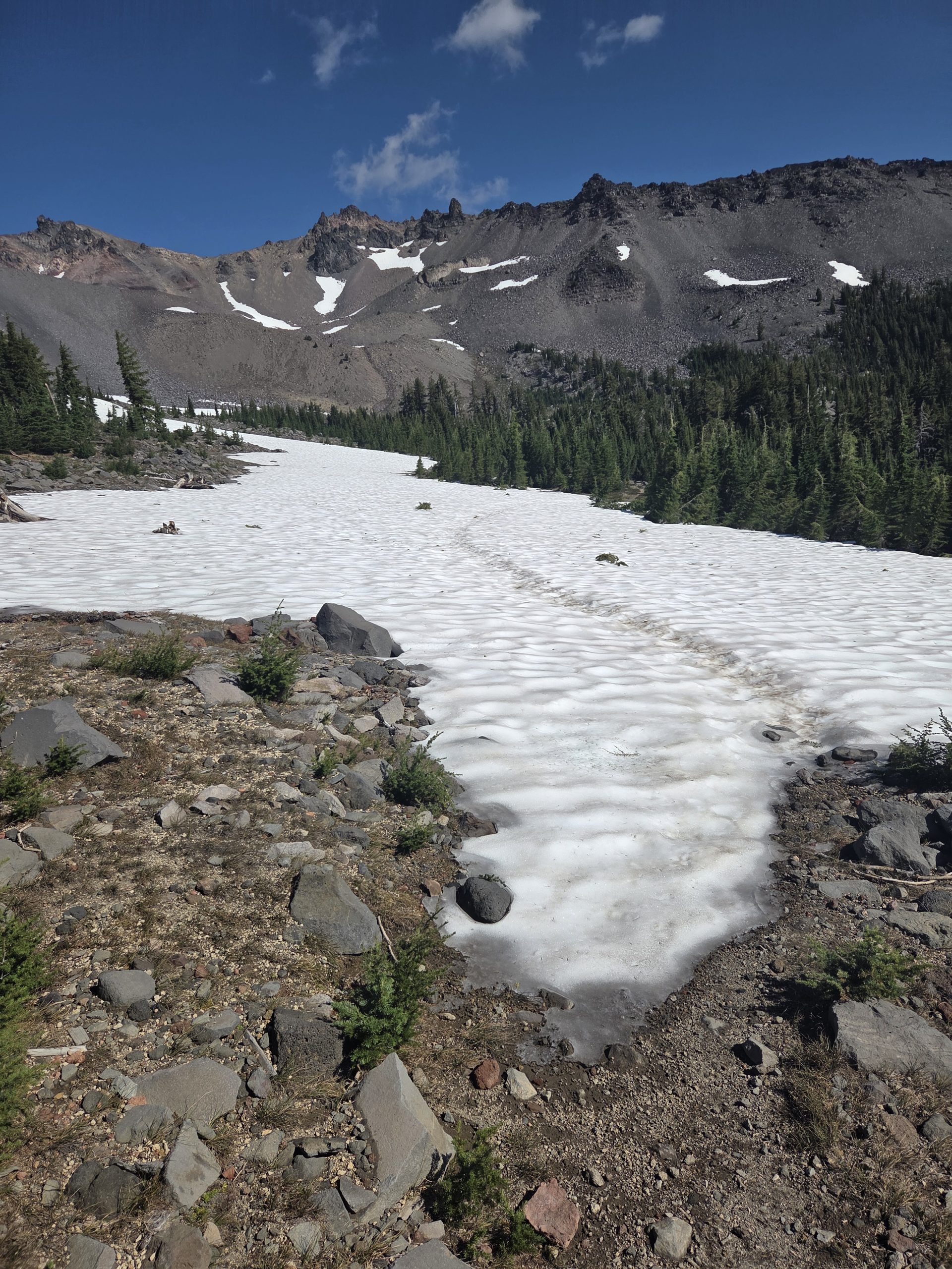
There were lots of beautiful wildflowers alongside the trail today which was great. Especially lots of fireweed through this section. For most of the day today there weren’t many on trail water sources. I loaded up when I left the ranch this morning. Then I got more drinks at Burney Falls. But eventually, as the day went on, I needed water badly and there were no sources on trail. I usually try to avoid going off trail for water if it’s the last thing I do. But sadly, the moment finally arose where it was unavoidable.
When I got out to the next road, I immediately recognized it from 2022. I had actually tented just off the road. Then we walked down to grab our water for the night. It really wasn’t that steep or far off trail. It just certainly wasn’t right on trail. I think the spur trail was probably about .2 miles. I went down quickly and grabbed a liter or two of water. Then I continued along, hoping to go another handful of miles for the day.
When I got up toward the way top of this next climb there were apparently some really nice tent spots. I guess we’re going to be getting some amazing views of Shasta up here. So I was excited at the prospect of actually having a lovely tent site for the night. And even though I was at Burney Mountain guest ranch this morning; it was still going to be about a 35 mile day. I’m very proud of my ability recently to both stay and enjoy town, and achieve big miles. And doing so isn’t destroying my sleep schedule or resulting in me doing a lot of night hiking. I just feel like I found a really great balance on this trail. Especially considering the more tame conditions recently.
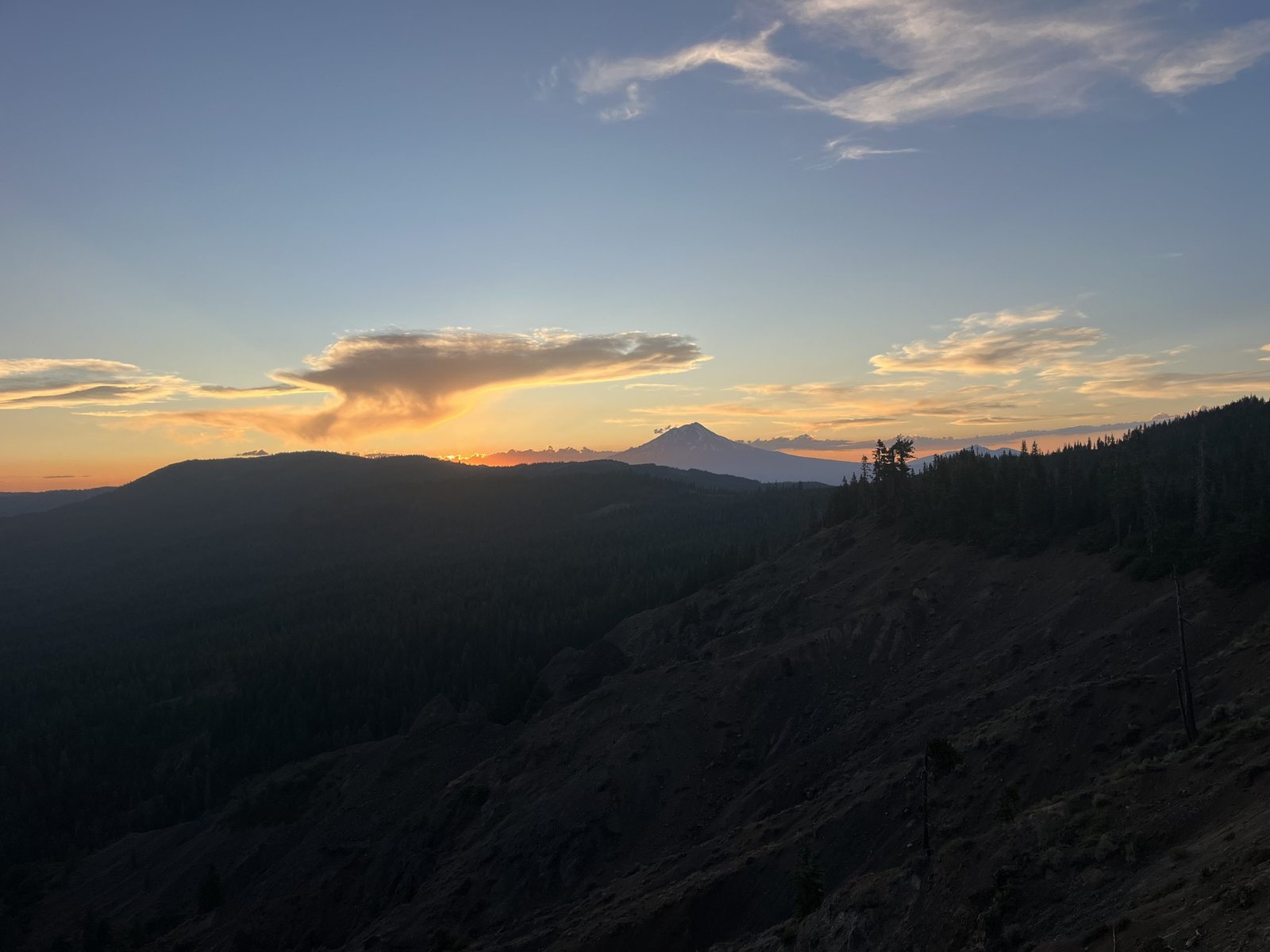
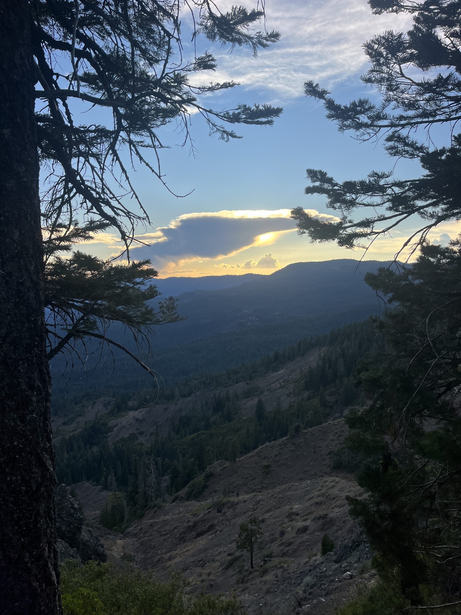
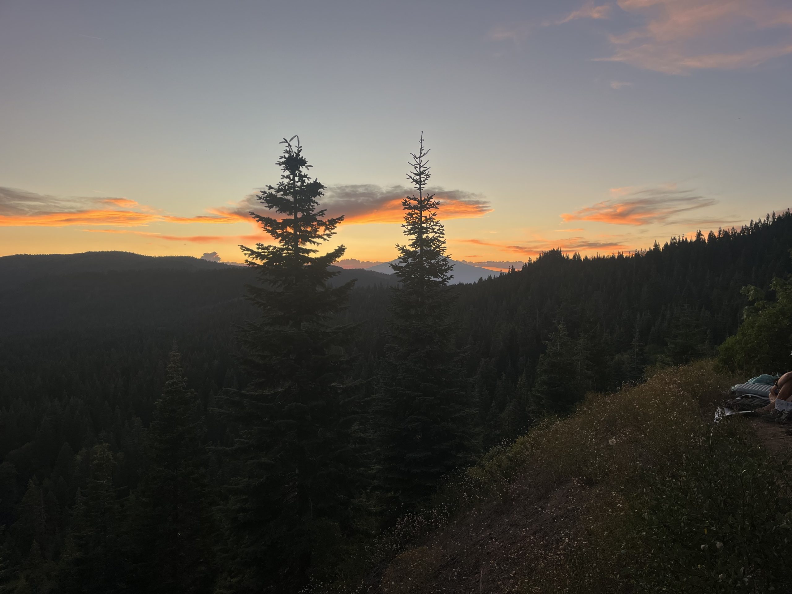
As I got higher and higher, I could tell that the views were about to get incredible. Then slowly but surely the sun began to set, and I started getting glimpses of Shasta out in the distance. The snow covered mountain, surrounded by the bright pink and oranges in the sky, was incredible. I saw a few comments about tent sites up top and was hopeful that I’d be able to find a nice one. But as I got closer I could hear people talking. I came across a few girls who were sitting at a sight that had zero views.
I exclaimed that I thought the views were going to be better up here. They explained that there was actually a really nice tent site just up ahead. But one guy had taken up space for about two or three tents for his one tent. And the other space had three people cowboy camping on it. That was definitely disappointing, but there was nothing I could do. I wound up tenting just up ahead on the trail and did have some decent views. But just behind me through the bushes, the trail opened up with perfect views of Shasta. I went to take some photos and got to see the guy who had clearly purposely camped right in the center of a big spot. Probably because he didn’t want anyone to join him. And the other hikers had just squeezed into a small spot and set up without their tents.
These were the views of Mount Shasta from that tent site. I still had some views from where I stayed for the night, but nothing like these.
The views were unreal and that probably would’ve been one of the best tent sites I’d ever stayed at. But I got my tent situated about 15 feet away and then started making dinner and everything for the night. It was nice getting in just before dark, even after just shy of 35 miles for the day. And I’m hoping to have a nice early start tomorrow so I can go even further. It’s crazy that I can do 35 miles in a day when I don’t start early. It really makes me realize just how much mileage I can get done if I do start early.
If you enjoyed this blog and would like to support my hike by buying me a soda or a snack along the way, there is a “Tip the Author” button below! It links directly to my Venmo. Any and all support is incredibly appreciated!
This website contains affiliate links, which means The Trek may receive a percentage of any product or service you purchase using the links in the articles or advertisements. The buyer pays the same price as they would otherwise, and your purchase helps to support The Trek’s ongoing goal to serve you quality backpacking advice and information. Thanks for your support!
To learn more, please visit the About This Site page.
The Oregon Trail
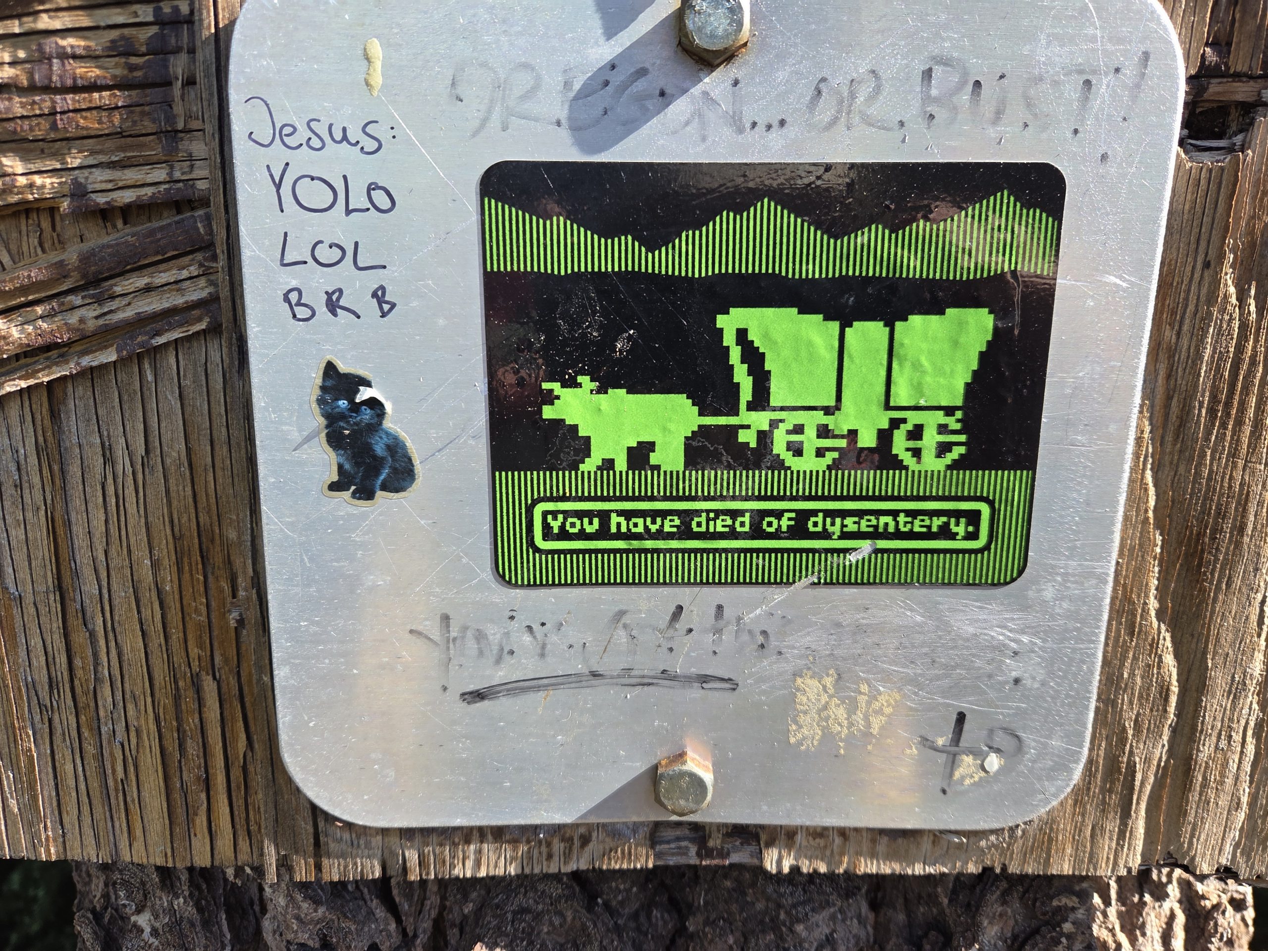
No I have not died due to Dysentery like in the video game….. But there was a dysentery sign just before leaving CA from that game messaging …pretty funny! I just got done eating a Maple Long John and drinking a chocolate milk from the bakery in Sisters OR. That puts me at 1985 miles on the trail. As soon as I get done with this Blog I will hitch the 12 miles back to the trail head. Then it is only about 165 miles left before I hit Cascade Locks and the Bridge of the Gods and step onto WA soil. The trail in Oregon has been fabulous. Well maintained and pine needle soft for a lot of it. There are still climbs up and decents down but they are graded pretty well for the most part. Some places with water sources that are spread out making you carry 2 liters of water but the streams have been ice cold and clear to replenish our water. Each liter is 2.2 lbs so we try to minimize the amout of water we have to carry. We have run across some awesome people doing trail maintenance in Oregon and their hard work really shows up on our hiking. I am most of the way through a 14 mile stretch of walking through a lava flow which is very different and more difficult to walk through. Gotta keep your eyes on the trail and watch where you plant your feet. We just hiked through the Sisters Wilderness and there were thousands and thousands of butterflies flittering all around us as we hiked through the meadows and up the trails. It was amazing to have all these butterflies coming right at you and then somehow flittering around you. The weather has also cooled off which makes hiking very enjoyable. The peaks still have some snow on them and we even have to cross a few snow fields every now and again. Nothing sketchy but still amazing considering it is August.
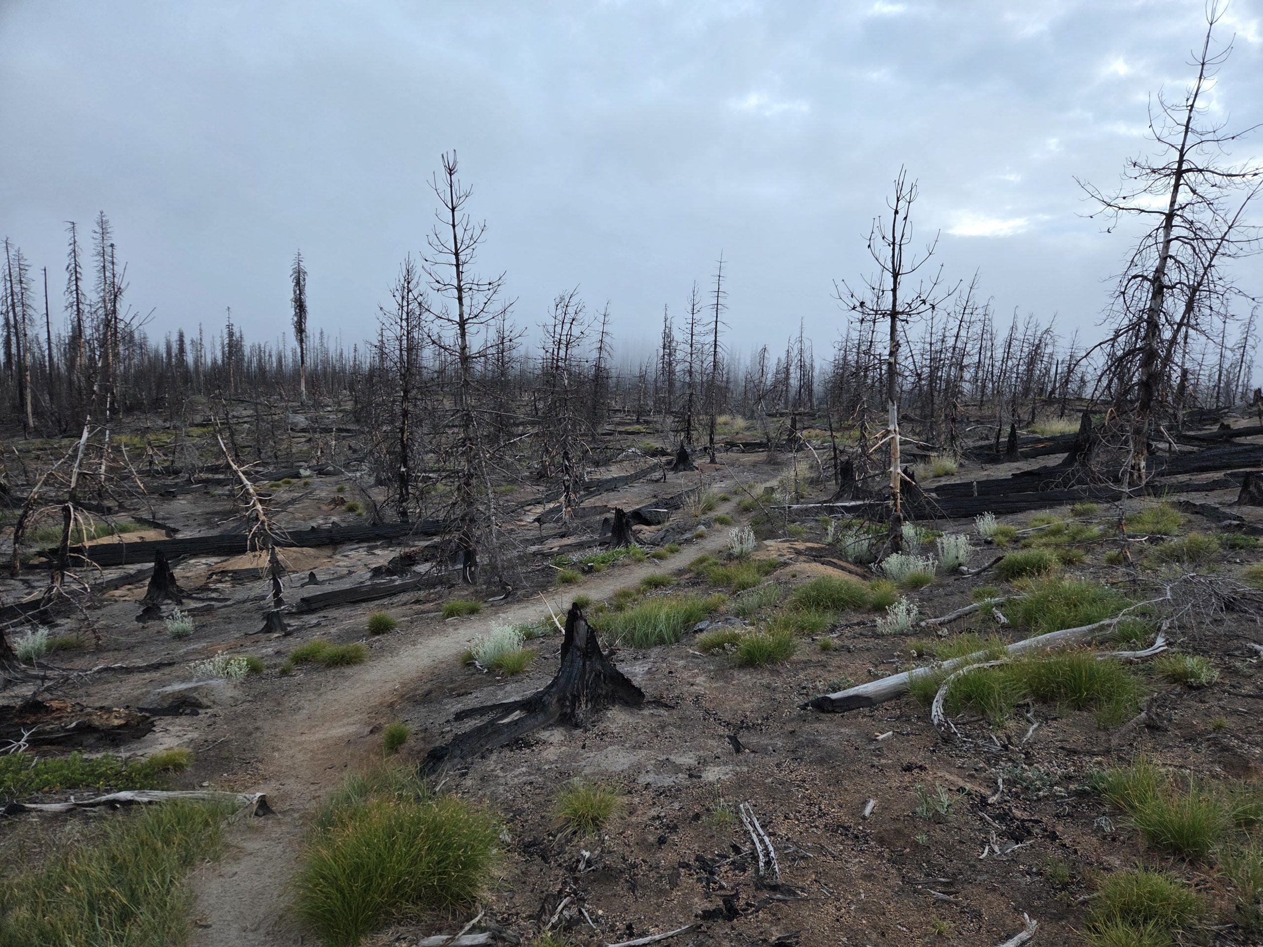
We have a couple of iconic mountains coming up. Mout Washington, Mount Jefferson, and Mount Hood. We can see them in the distance and they look amazing. We do have had to walk though some burn areas from previous years fires and it is jarring to see what looks like the zombie apocalypse landscape.
How Are the Knee and Feet
My knee is still doing great! No problems and I am now about 835 miles up the trail so I am very pleased with it. The new shoes are great. All 4 concerns I had with my feet have been addressed and the blisters are turning ito calluses. There is still dirt on my feet at night but not nearly as bad as it was. I think a combination of the shoe design and also the change in the trail environment have helped. My new logistical challenge is the weight loss and muscle mass loss from hiking 24-26 miles a day. I adjusted my food supply options so I can eat snacks ever couple of hours while hiking. There are a lot of Resorts on the backwoods lakes that the trail goes by as well as towns like Sisters. I am making sure I am chowing down on milk shakes, pizza, and burgers/fries as these locations to supplement the food I am carrying. It is helping with my energy levels and also the ability to hike more miles each day.
Tidbits from the Trail:
Burney Mountain Guest Ranch is an oasis in the middle of No. Cal. wilderness. It was previously a Horse Rance that has been turned into a hiker haven. There are bunk houses and private guest houses and laundry and showers besides tent camping area. The main dinning room has big wooden tables and the breakfast and dinners are buffet style with lots and lots of comfort food, salads, fruit, and desert. The ladies that are cooking are super nice and it is like going to Grandma’s house to eat. Off the dinning room is a salt water pool for swimming or just soaking your tired feet. Christine and Kyran are really making the place something special.
The worst trails conditions so far was just before and after the Middle Fork of the Feather River Gorge in No. Cal. 30 miles of the trail were burned in a 2020 fire and the burned trees are falling across the trail in large numbers and brushy plants have had the time to grow big enough to choke the trail. The effects of fires can cause years of maintenance issues and are of concern with climate change. Climbing over, under and around blow downs can be quite challenging and tiring. It was during this section that a woman injured herself and had to be air evacuated from the mountain. Her husband’s pack as well as her pack were left behind and SAR (Search and Rescue) arranged to have two hikers each carry out one of their packs latched onto their own packs. Bombadil and Appleseed carried 2 packs through this incredibly tough section for 2 days before they could get to a dirt forest road at the top of the Feather River Canyon and give them to SAR.
We had an interesting 3 days right out of Ashland OR. Day one Big Mac and I were walking up the trail then the earth started shaking…….. All of a sudden around the bend about 45-60 feet in front of us a riderless horse was galloping down the path right at us….. Being the City Slickers we are, we froze! Fortunetly the horse changed direction and bolted through a thicket of brush to our left and kept on running… A few minutes later 2 girls, one on foot, and one on a horse came looking for the horse. All we could do is point down the mountain. We heard a few days later that they were still looking for the horse…
The next day Big Mac left camp earlier than me and came upon a skunk on the trail…. The skunk turned and lifted his tail but fortunately Big Mac backed up before he could be sprayed… However on the third day, Mr. Skunk’s friend, Mr. Wasp, stung him righ on the upper lip area. The rest of the day Big Mac looked like Homer Simpson…
Another great place to stay is the Columbia Hotel in Ashlund OR. The have refurbished the old hotel and is very hiker friendly and is in the middle of town. Ashland puts on the Oregon Shakespearean Festival every year and there are free concerts in the plaza between shows. Lots of people travel to see these shows thorughout the summer. Makes the town very festive.
Sisters is a great little town in central Oregon with lots of Shops and Restaurants and Bars. The City Part has a very clean and accessable campgrounds that has a biker/hiker section to stay at for just $10.
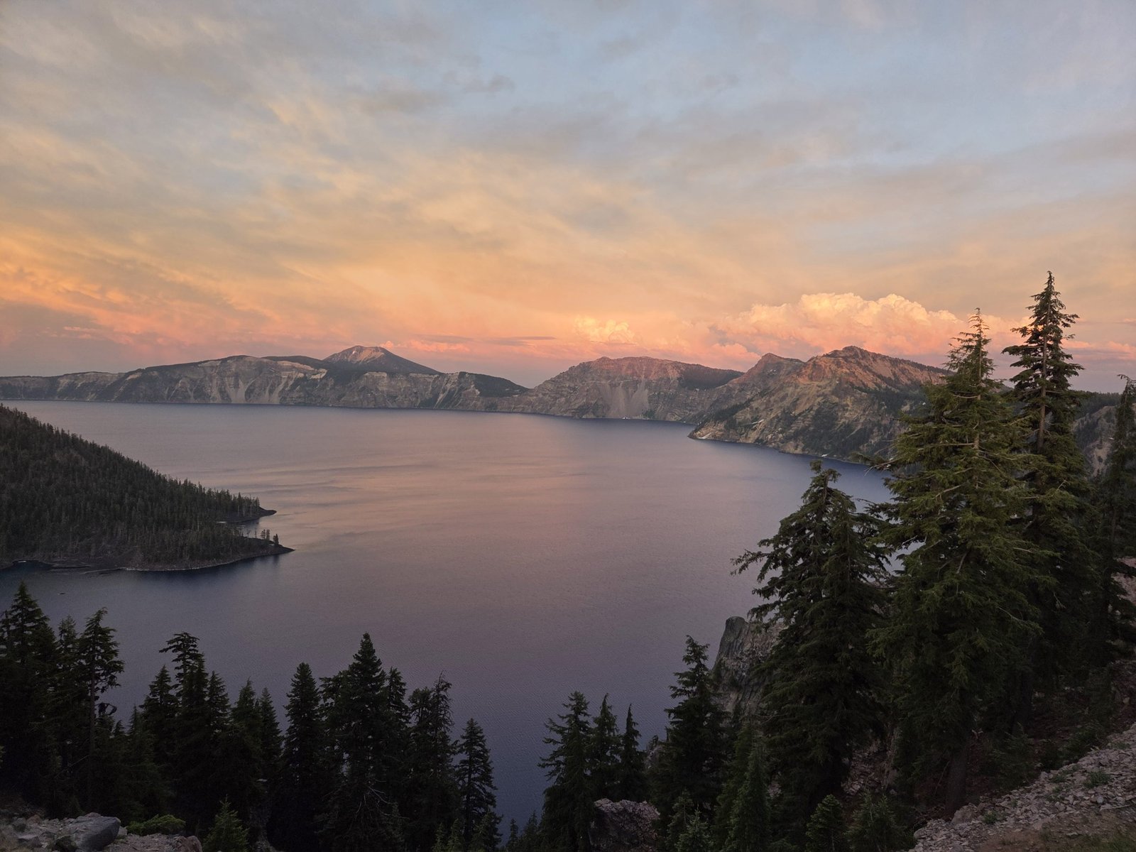
Crater Lake is pretty amazing and I met a guy from Texas that was shooting photos at sunset. He was waiting for the light to be just right and when he started taking pictures, I started taking pictures…..figured he knew what he was looking for.
Well onto Cascade Locks. Gonna grab a milkshake on the way through town and start hitching. Remeber to consider volunteering on a trail near you as the work is very rewarding and many hands are needed to keep the wilderness accessable to us all.
Peace and Happy Trails!
CrampPa
This website contains affiliate links, which means The Trek may receive a percentage of any product or service you purchase using the links in the articles or advertisements. The buyer pays the same price as they would otherwise, and your purchase helps to support The Trek’s ongoing goal to serve you quality backpacking advice and information. Thanks for your support!
To learn more, please visit the About This Site page.
For the first time in recent memory, Nova Scotia hiking trails are closed due to extreme wildfire risk and drought. The Canadian province has issued a full ban on hiking, backcountry travel, and forest access across both national and provincial lands.
The closure took effect on Tuesday, August 5 at 4 p.m. AST and will remain in place until at least October 15, or until conditions improve.
“Stay Out of the Woods” – Nova Scotia government signage reminds residents and visitors of the province-wide closure due to extreme wildfire risk. Photo: Premier’s Office of Nova Scotia
Nova Scotia, located on the Atlantic coast of Canada just east of Maine, is known for its forested landscapes, rugged shorelines, and many hiking trails. With a growing reputation among backpackers, the province is home to Kejimkujik National Park, the Cape Chignecto Coastal Trail, and part of the International Appalachian Trail in Cape Breton Highlands National Park.
Why Are Nova Scotia Hiking Trails Closed?
The province is currently experiencing severe drought conditions, with weeks of hot, dry weather leaving forests highly flammable. According to the Canadian Drought Monitor, much of Nova Scotia is facing moderate to severe drought, and officials say the risk of wildfire is elevated and widespread.
“Conditions continue to be extremely dry. Until we get a significant amount of rain, we’re at an elevated risk of wildfires,” said Premier Tim Houston. “Most wildfires are caused by human activity, so to reduce the risk, we’re keeping people out of the woods until conditions improve.”
Over 100 wildfires have already occurred this season. While all have been small and quickly extinguished, officials say that could change “in a heartbeat” under the current conditions.
In addition to hiking and camping restrictions, the ban also applies to forestry, mining, and other commercial activity on publicly owned wilderness areas managed by the province. Businesses and individuals conducting this kind of work must apply for permits through the Department of Natural Resources.
Anyone caught violating the restrictions faces a fine of $25,000 CAD.
What’s Affected by the Hiking Ban in Nova Scotia?
The ban includes all hiking on public lands, all backcountry camping, any vehicle use on forest roads, and commercial and recreational activity in wooded areas managed by the province. Private landowners may use their own property, but cannot host guests or allow others to access their wooded land.
While beaches, day-use areas, and some parks remain open, trail systems and backcountry areas—even within those parks—are off-limits. A total fire ban is also in place, prohibiting campfires, solid-fuel stoves, and open flames across the province.
Cape Breton Highlands’ most iconic hike, the Skyline Trail, is now off-limits under the province-wide fire risk ban, as it travels through vulnerable forested areas. Photo: Wikipedia Commons
Impact on Hikers, Tourism & Local Culture
The closure comes at the height of Nova Scotia’s travel season. Outdoor businesses, guides, and accommodations are already reporting cancellations. Some travelers have had to scrap multi-day hiking trips or modify backcountry itineraries into less immersive beach vacations.
Though not as well-known internationally as British Columbia or Alberta, Nova Scotia has become an increasingly popular destination for hikers seeking a quieter, coastal wilderness experience – with a mix of cliffs, old-growth forests, and ocean views. The closures are a reminder that wildfire risk is no longer limited to the western U.S. or Canada, and that climate change is reshaping outdoor recreation even in traditionally wetter, forested regions like Atlantic Canada.
Widespread Drought – Much of Nova Scotia is facing moderate to severe drought. Dry conditions have pushed the province to ban forest access and backcountry travel. Photo: Canadian Drought Monitor
Stay Updated
The situation is being monitored closely, and updates will be posted by local and federal agencies. Before making travel plans, check Nova Scotia BurnSafe map and restrictions and Parks Canada trail and park alerts.
“We ask everyone to cooperate, stay out of the woods, and be sensible,” said Tory Rushton, Nova Scotia’s Minister of Natural Resources. “We all have a role to play in keeping our communities safe.”
This website contains affiliate links, which means The Trek may receive a percentage of any product or service you purchase using the links in the articles or advertisements. The buyer pays the same price as they would otherwise, and your purchase helps to support The Trek’s ongoing goal to serve you quality backpacking advice and information. Thanks for your support!
To learn more, please visit the About This Site page.
Destinations & Things To Do
Tornos News | Russian Tourism: +12.5% Increase in Travel to the Top 30 Foreign Destinations in H1 2025

An increase in international travel activity by Russian citizens was recorded in the first half of 2025, according to the latest data from the Border Service of the FSB. From January to June, Russians made a total of 13.66 million trips abroad, marking a 7.8% increase compared to the same period in 2024.
However, the most notable finding is the impressive 12.5% rise in travel to the top 30 most popular tourist countries, compared to a modest 4.3% increase to “near abroad” countries — mostly former Soviet republics with limited tourist appeal.
Turkey Leads, But with Losses
Turkey remains the top destination for Russian tourists, with 2.57 million trips in the first half of the year (18.8% of the total). Despite holding the top spot, Turkish statistics show a 2.9% decline in arrivals, attributed to a drop in Russian arrivals from third countries. Analysts suggest some of these trips were transit-related.
UAE and China on the Rise – But Many Are Transit Trips
The UAE ranks second with 1.14 million trips, up 16%, although up to 200,000 of these were transit stops en route to other Asian destinations.
Similarly, China saw a 31.2% increase with 1.04 million visits, though a significant portion involved border shopping or transit travel. Purely tourist visits are estimated at 600,000 to 700,000.
Strong Genuine Growth in Thailand and Egypt
Thailand posted a healthy 12.4% increase, reaching 1.03 million Russian tourists, supported by regular flight connections and its reputation as a vacation hotspot.
Even more striking was Egypt, with a 40.4% rise and nearly 940,000 arrivals, confirming renewed interest in the destination.
New Players at the Top: Vietnam, Maldives, Indonesia
Vietnam recorded a 139.3% surge to 260,000 visitors, climbing from 9th to 7th place, thanks to new flight routes to Nha Trang.
Maldives saw a 20.7% increase with 126,780 Russian tourists.
Indonesia jumped 35.4%, with 117,000 visitors, mostly due to direct flights to Bali.
Sri Lanka and South Korea – Same Rank, Different Trends
Both countries share 10th place but with different dynamics:
Sri Lanka experienced a small drop of 1.6% (112,000 visits), attributed to rising costs.
South Korea increased 20.8% (110,000 visitors), supported by connecting flights via China.
Returns and Declines
Cuba, previously in the top 10, saw a 43.4% decline, largely due to fewer direct flights.
Venezuela showed a similar trend.
In contrast, some less traditional destinations posted explosive growth:
Tunisia +364% (though in small absolute numbers)
Japan +103%
Morocco +65.8%
North Korea +279% — reaching 1,937 tourists, which still doesn’t indicate a true tourism boom.
The Bigger Picture
In total, 8.74 million trips were made to the 30 most popular destinations, accounting for 64% of all international travel. The top 10 (or 11) destinations absorb 93.3% of outbound Russian tourism, a nearly unchanged share from last year.
Interestingly, two-thirds of the TOP-30 countries showed positive momentum. Among the major mass-market destinations, Egypt stood out for absolute growth, while Turkey slightly declined.
Abkhazia attracted an estimated 665,000 visitors (+6.5%), though data is less reliable due to cross-border day trips and irregular reporting.
Key Takeaways
2025 started positively for outbound Russian tourism, especially to long-haul and traditional vacation destinations. This trend is supported by tour operator flights and restructured air routes via third countries.
However, despite the growth, the outlook remains fragile. In many cases, numbers are affected by flight logistics and hub transfers (e.g., UAE, China). Experts expect greater stability or even further growth over the summer, especially in countries that strengthen direct flights and offer competitive travel packages.
-

 Brand Stories2 weeks ago
Bloom Hotels: A Modern Vision of Hospitality Redefining Travel
-

 Brand Stories2 weeks ago
CheQin.ai sets a new standard for hotel booking with its AI capabilities: empowering travellers to bargain, choose the best, and book with clarity.
-

 Destinations & Things To Do3 weeks ago
Untouched Destinations: Stunning Hidden Gems You Must Visit
-

 Destinations & Things To Do2 weeks ago
This Hidden Beach in India Glows at Night-But Only in One Secret Season
-

 AI in Travel3 weeks ago
AI Travel Revolution: Must-Have Guide to the Best Experience
-

 Brand Stories1 month ago
Voice AI Startup ElevenLabs Plans to Add Hubs Around the World
-

 Brand Stories4 weeks ago
How Elon Musk’s rogue Grok chatbot became a cautionary AI tale
-

 Brand Stories2 weeks ago
Contactless Hospitality: Why Remote Management Technology Is Key to Seamless Guest Experiences
-

 Asia Travel Pulse1 month ago
Looking For Adventure In Asia? Here Are 7 Epic Destinations You Need To Experience At Least Once – Zee News
-

 AI in Travel1 month ago
‘Will AI take my job?’ A trip to a Beijing fortune-telling bar to see what lies ahead | China
You must be logged in to post a comment Login