
Destinations & Things To Do
PCT Day 57-64 — High Sierra Solitaire
The Elixir of Life
27-28/6 — Day 57 & 58 — 3mi / 5km
Still feverish, fatigued, and congested to a degree that invited comparisons with LA traffic, Flies and I walked the streets of Mammoth. In our desperation for vitamins, micronutrients and food that didn’t require rehydration prior to consumption, we stumbled into an establishment called Elixir Superfoods. The sage coloured decor was tasteful—healthful even. The women portioning bowls from tubs arrayed with colourful vegetables were preternaturally thin and had flawless skin. There was a bookshelf by our table with various titles promoting long life and vitality, radiant men and women on their covers laughing or smiling naturally. “Aging and sickness may seem like an inevitable part of life,” one of them said, “but they aren’t inevitable.” Sick almost to the point of immobility, we were a receptive audience for this inspiring message. If we ate a bowlful of brightly coloured vegetables on quinoa served by these otherworldly women, perhaps we too could enter that softly lit, sage coloured realm of ceaseless health. And so it proved: the following day—despite the wads of used tissues in our pockets, and our squinting against the bright California light—we walked the streets of Mammoth conscious of the faint stirrings of wellbeing in our previously wracked bodies.
We bustled around and did our chores. Flies got a new sleeping pad and had her pack repaired: the good folks at Mammoth Mountaineering replaced the straps for free and talked through my plans for the North Loop of the Yosemite High Route. I would be parting ways with Flies halfway through the next section for a solo, off-trail trip that would take several days. We would meet again at the end of the High Sierra, in Kennedy Meadows North. I also replaced my lost glasses with a pair from the pharmacy that made me look less like an outdoorsman than a seedy shut-in who spent his life commenting on obscure internet forums. Thus equipped, I went to the library and found my fellows, the assorted members of the mildly mentally ill who spend their days sitting at the computers of American libraries. During the four or five hours I was there, several men in their fifties to seventies watched Youtube and TikTok videos without interruption. “Jesus Christ,” my neighbour exclaimed at his computer, “just fucking shoot him already!”
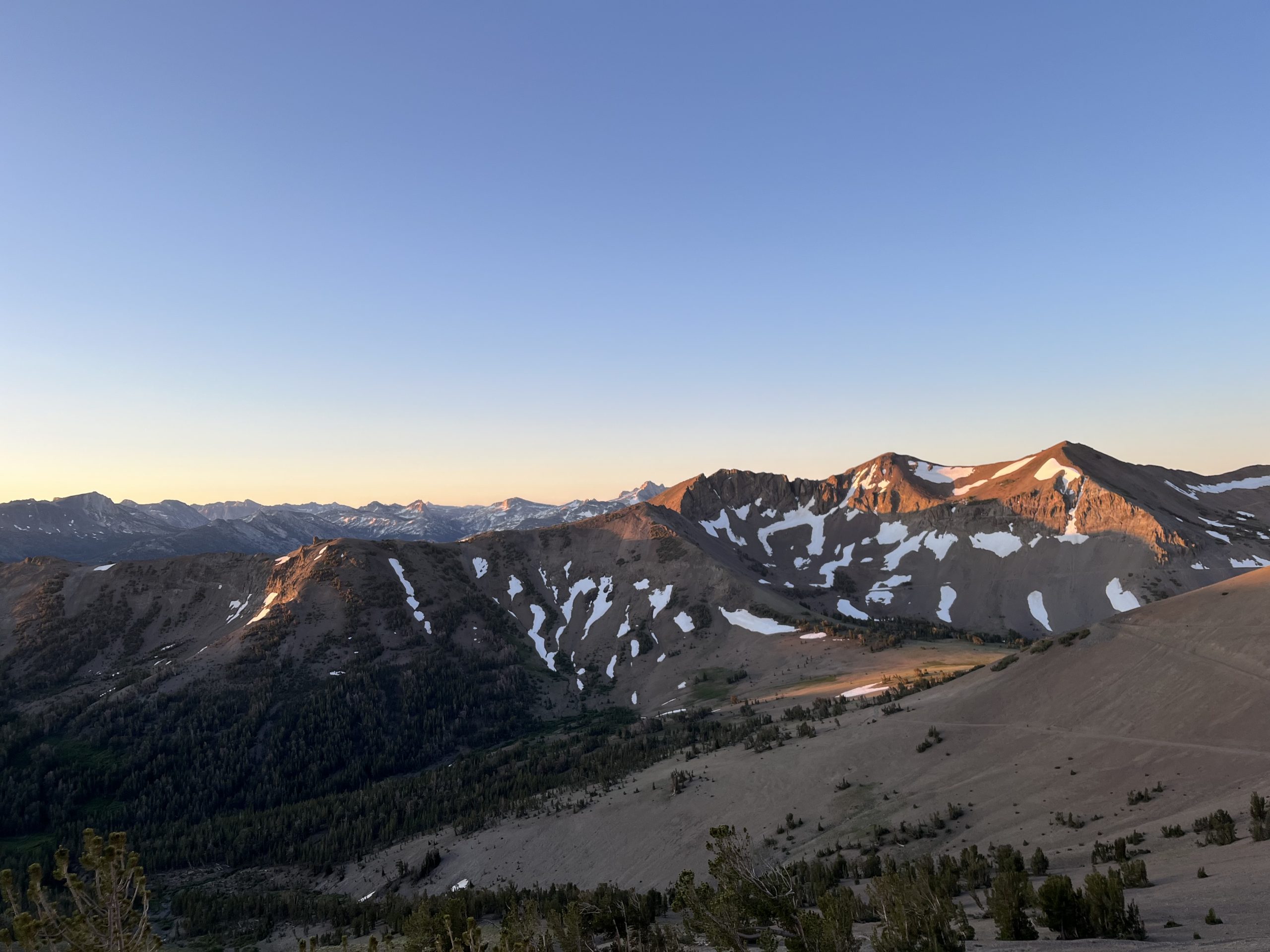
We hit the trail again the evening thereafter, putting in a short stint back over Mammoth Pass to Red’s Meadow Ranch. Atop the pass, we could see the famous Minarets, jagged remnants of the layer of metamorphic rock that had once sat atop the Sierra batholith, most of which had been scraped away by glaciers and erosion.
We’d seen in the Mammoth paper that Red’s Meadow was included among several million acres of public lands that the Trump Administration was proposing to sell. Before developers got their hands on it, we made use of the thermal hot pool behind the campground. It was tiny—about 2×2 metres, and scalding. The air smelled of farts, but for once it wasn’t our fault. Several more people arrived, and then several more, and before we knew it we had a large vat of hiker soup on the broil. An older local guy, who worked on the ranch, joined us, undisturbed by the high instance of nudity and progressive drunkenness of some of the pool’s inhabitants. We got talking about the sale. “If they sell all this land they’re just gonna spend the money on some more fucking missiles,” he said.
29/6 — Day 59 — 22mi / 35km
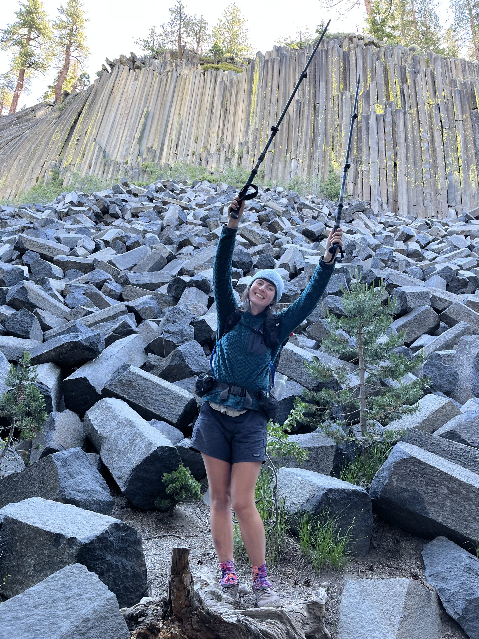
A short walk from Red’s Meadow we found another geological curiosity, a series of tightly packed and perfectly hexagonal basalt columns, that had been extruded, variously broken and heaped up. “What’s it called again?” Grace asked as we admired the implausibly geometrical forms. “The Devil’s Postpile,” I said. “Go the devil,” she said.
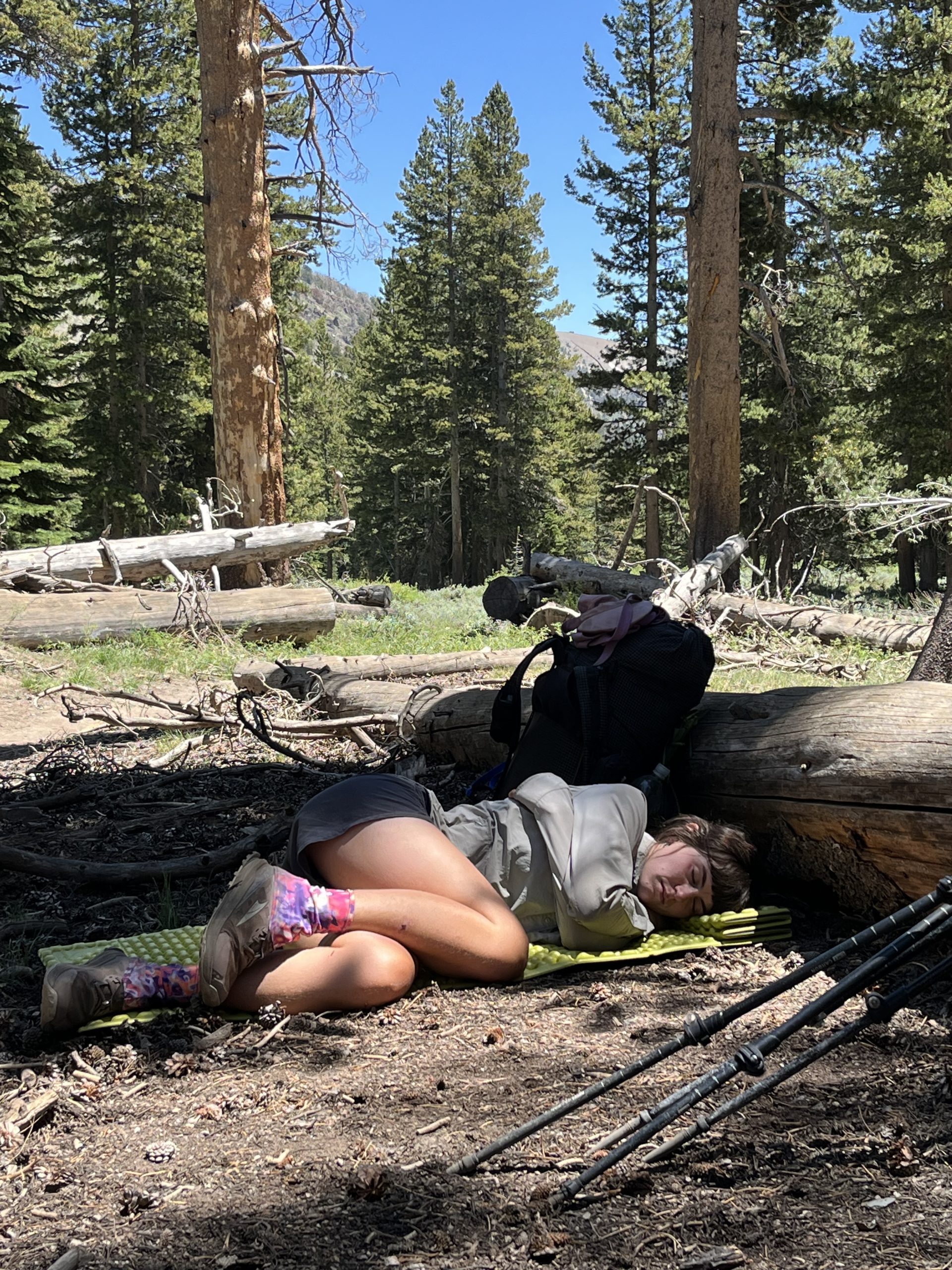
During the middle portion of the day we made a long, slow ascent up the valley. Grace had to lie down for a while after she threw up discreetly in the knee high grass beside the trail. Both of us had been a little off in the stomach department. I’d almost thrown up after the hot tub. Casting our minds back over the last week we found there were so many lapses in hygienic discretion that we gave up assigning probable cause to any of them. It was a consequence of sustained and general grottiness, that was all.
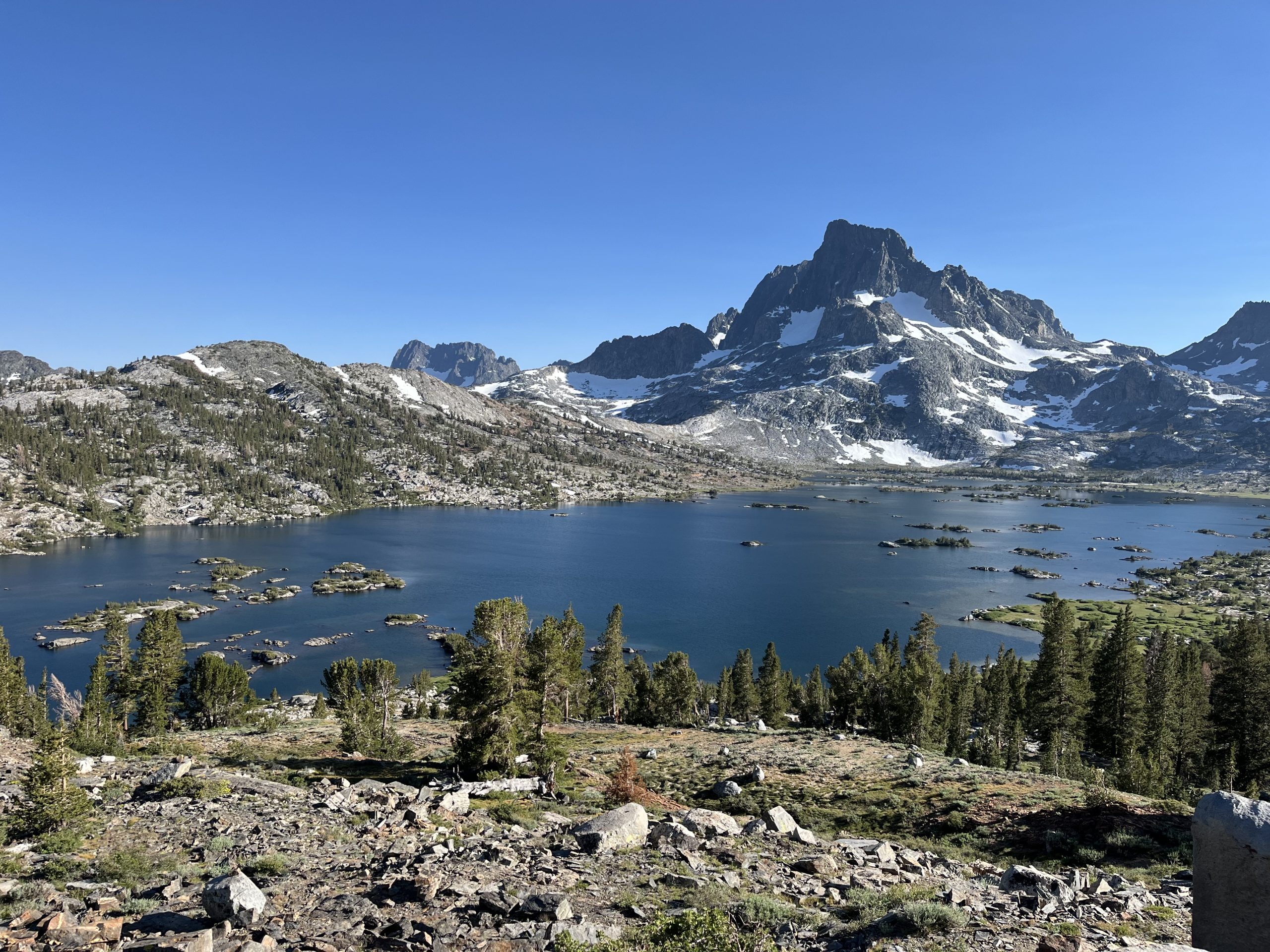
Having made our way up toward the most prominent peaks in the area: Ritter, Banner and Lyell, we were treated to the replenishing waters of the famed Thousand Island Lake. The islands probably only numbered 5 or 6 dozen, but it was preposterously picturesque, and enticed us in for a nude swim even with a couple of fishermen watching from a peninsula not so far off. Afterwards, Flies and I lay on the smooth, warm granite, which imparted to our bodies the heat it held from the day while the breeze ran its cool hands over our backs.
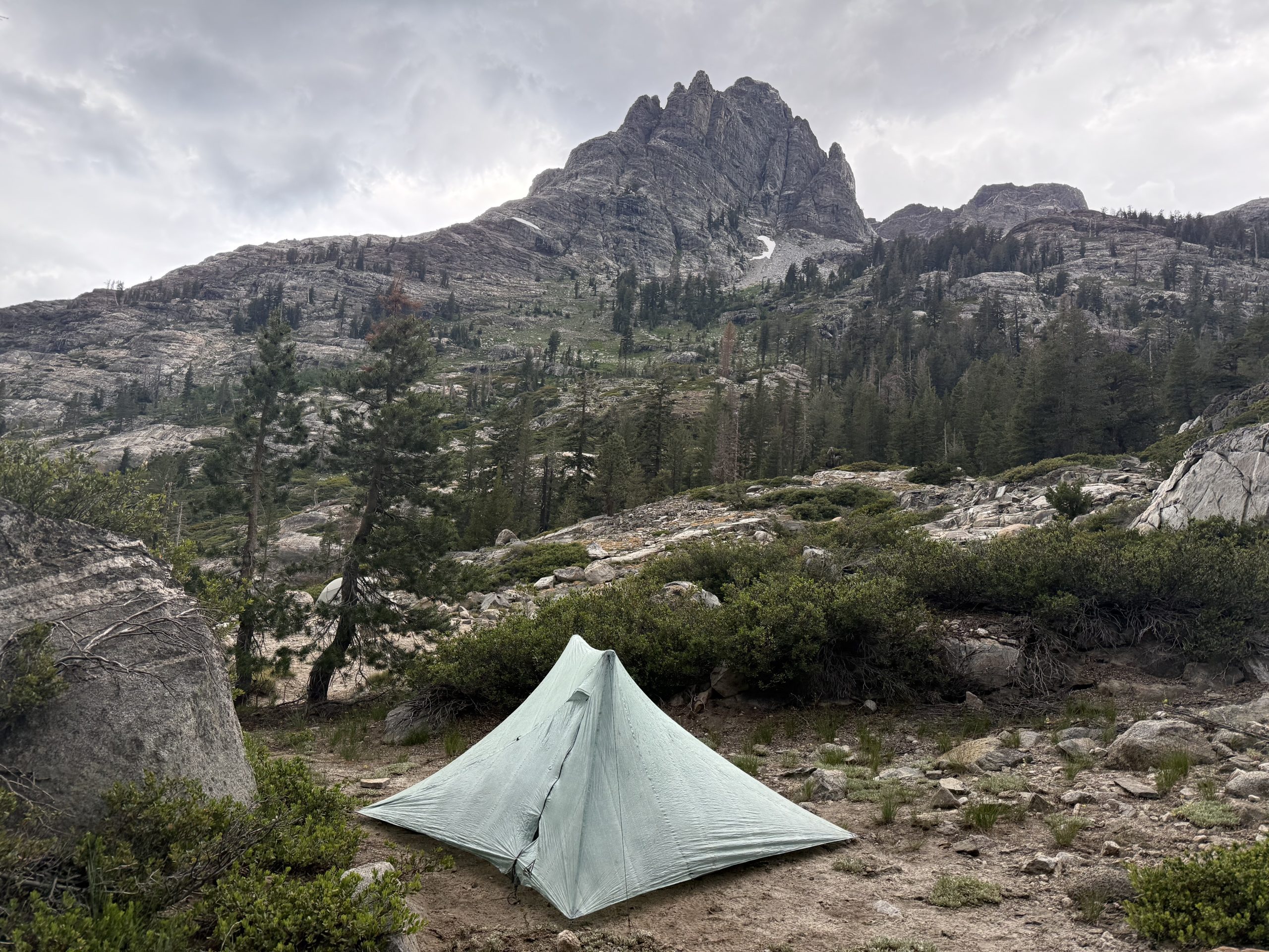
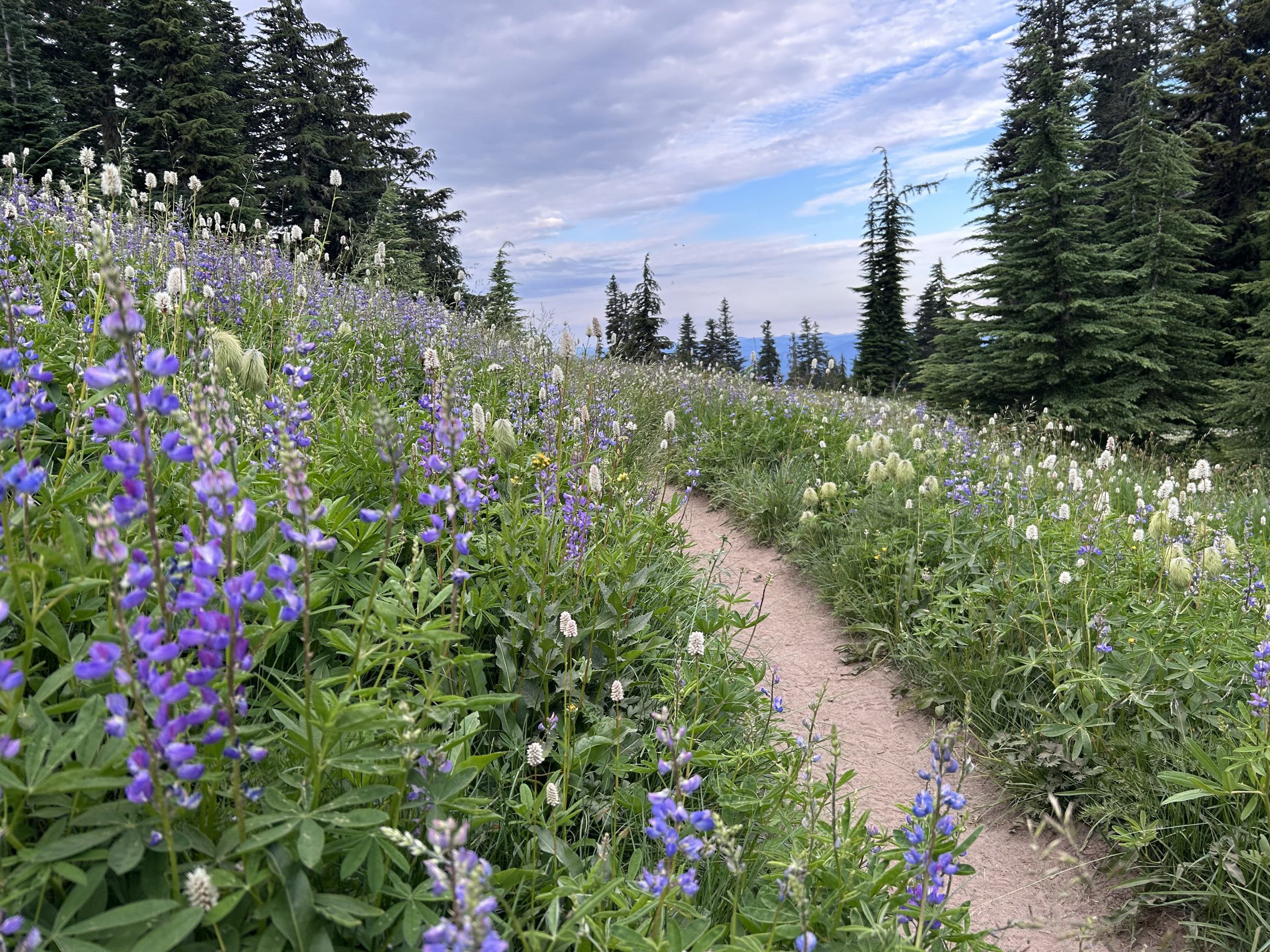
We still had 7 miles to Donahue Pass, where we were hoping to camp. These were gorgeous miles, packed with little tarns and strewn with wildflowers, but we were hounded mercilessly by mosquitoes until we climbed, a little light headed from loss of blood, out of the canyon onto the pass. We set up a cowboy camp among the last vestiges of snow. It was the last night Flies and I would spend together for a few days, and so we watched the satellites beetling about and the occasional shooting star, which streaked across and disappeared into the wide dark.
Parting is Sweet Sorrow
30/6 — Day 60 — 22mi / 35km
Morning shaped the range out of darkness, returning it to colour and form. Through speckled granite and sprinkled purple heather we picked our way down the other side of Donahue and into Lyell Canyon. A pika stood up and whistled in the grass. The Lyell River wended lazily through the wide, lush valley and we would have liked to do likewise, if Flies didn’t have a bus to catch into Yosemite at 2:30pm. So we set a brisk pace, arrested only by an invigorating dip and a cordial encounter with a baby marmot and her Mama.
“Wow, they let you get nice and close there,” a ranger said as she rounded a corner. There were two of them. The male ranger looked familiar. “Are you, by any chance, Colton Marshall?” I asked. He said yes, a little surprised. “This is a bit crazy of me to remember,” I said, “but you issued me a permit for the South loop of the Yosemite High Route three years ago, and I thought you had the perfect name for an American Park Ranger,” I said. Colton Marshall: it just sounded right. Like his smart khaki uniform, the name evoked the qualities of integrity and steadfastness, of gentle but firm authority. “You actually feature in the blog I was writing at the time,” I continued, “and–-with your permission—it’d be great to put you in the one I’m doing for the PCT.” “Wow, yeah, ok,” Colton said. He wrote down the internet addresses for the blogs in his notebook. It was like meeting a celebrity and then having them promise to read your fan mail.
So I arrived at Tuolumne Meadows with a bounce in my step. I was excited to get underway on the North loop of the YHR that evening. The ranger who issued me the permit went through the various conditions. He crossed out the part pertaining to fires. “No fires above 9600 feet,” he said. “You’re going to be up that high the whole time, so just don’t bother.”
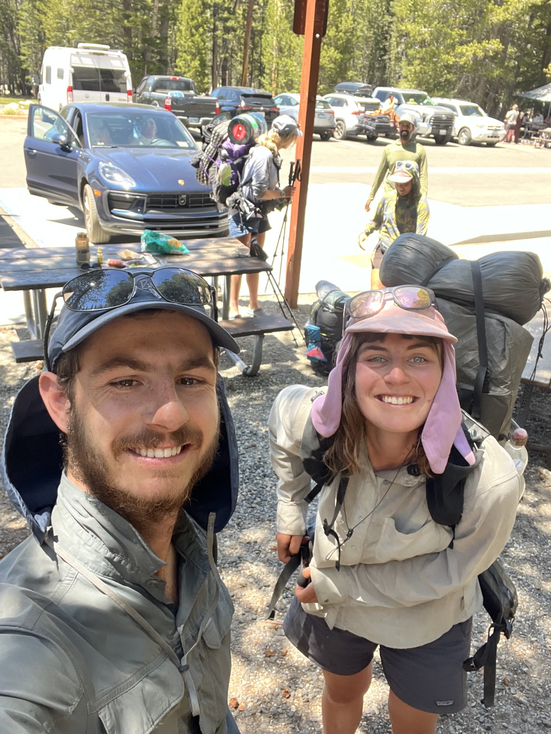
Flies and I hustled down to the general store and amidst the milling, sweet smelling tourists and sour smelling hikers in various degrees of post-lunch catatonia, we hastily swapped over all the things in our packs. It’s tricky to split up on trail when you’re sharing a tent and cooking equipment and electronics—a little like dividing your house and contents in a divorce, except that both parties need everything in the immediate term. Flies, ruthless negotiator that she is, took everything: tent, pot, stove, powerbank, bug spray. To carry it all, she was going to need more room, so she even got my beloved pack. This was the price I had to pay for cheating on the PCT with a high route alternate.
The upshot of being dispossessed of all my treasured belongings, however, was that I was left with very little to carry. That would help during the strenuous days of off-trail rambling and scrambling to come. I was a little nervous in particular, to be heading out without a proper shelter and without a powerbank—if my phone died, I’d be relying on the paper map I had, sans compass. If, despite the clear forecast, it stormed—well, there are rocks and trees to hide under. Muir, on his excursions in the Sierra, used to wrap himself up in his overcoat, tuck himself under a tree or dense shrub, and tend a small fire all night. I wouldn’t be allowed the fire, but I did have the Walmart equivalent of an overcoat. I figured Flies would have the worst of the mosquitoes in the valleys traversed by the PCT. “You’ll need it more than me,” I said, unwittingly committing one of the most self-abnegating acts of generosity of my life.
The bus pulled up. Flies and I said goodbye. “If I fall off a cliff and die,” I said, “you have to finish the blog. Colton is depending on it.” We hugged again. I felt like I was putting a child on the bus for their first day of school. “Have fun!” I said, “see you soon!” Then the bus pulled away and, for the first time in some two months, Flies and I were properly apart. It was a strange feeling, a kind of dilation into the mental space otherwise reserved for your companion, their mood, their needs. The classic adage on the trail is “Hike your own hike” rather than let others preferences, habits, opinions and mileages influence you too much. It’s a good maxim, but it’s irrelevant when you’re hiking as a couple. You exchange freedom for companionship, substitute self-attunement for the negotiation and compromise that relationships entail.
Flies: And just like that, I was all alone and acutely aware of the foreignness and vastness of the country I was in. In Hot Hands’ stead, his backpack teetered on the seat next to me stuffed with all the “comfort” items he’d foisted on me: tent, stove, trowel, insect repellant. On this bus, PCT hikers were outnumbered by muggles, but I was sitting among a group of guys I hadn’t seen since the desert named “The French Bubble”. One of them asked where I’d booked to stay in Yosemite. I said I hoped stay at the backpackers camp—the bus driver had seemed to think this might even be free. Apparently, however, I needed a wilderness permit, and the centre might be closing by the time we got there. Phillipe looked concerned. A flurry of fast French with his comrades ensued. “No space at our campsite, sorry” he said afterwards, “But good luck…”
Trying to ignore the surge of nerves this provoked, I sat back to enjoy the novelty of covering so much distance without moving a muscle. The pines streamed past, opening to occasional glimpses of granite peaks, but more enjoyable even than the scenery was the bus driver’s running commentary, which she delivered in a languid monotone that swerved from the relevant to the personal. “You know I was the first female truck driver in the Yosemite National Park… These are all ponderosa pines… There’s the spot I would pull over to hide and take a nap… Lake Tenaya over there is cursed; an Indian boy drowned in it way back… I got my kids jobs at the park and now they both earn more than me, the little bastards.” At one point, she called up a passenger to the front of the bus to show them where the hidden air brake was in case she had a heart attack.
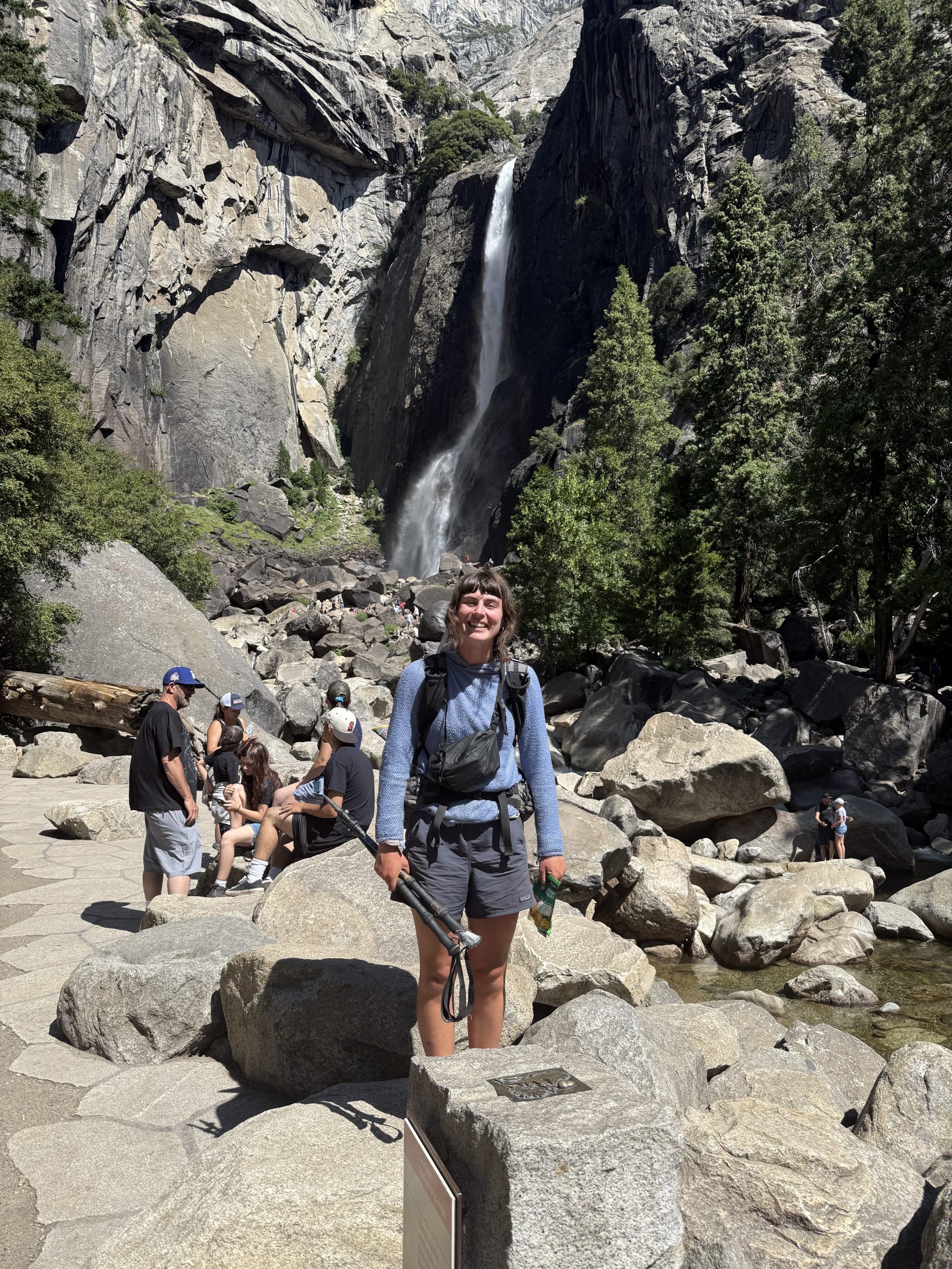
As we descended into the valley, the granite rose up around us like the walls of a gleaming fortress, the stern face of El Capitan guarding the entrance. On the other side of the valley, Bridal Veil Falls fanned out her delicate lace in sheets that briefly hung suspended before being shorn away in the wind.
Hot Hands: The trail that led to the start of the high route climbed steeply from Tuolumne up to the Young Lakes. I veered off after an hour, impatient to get into cross country travel, and clambered over an unnamed saddle beside Ragged Peak. To the north, framed by the steep cliffs either side of the saddle, the imposing massif of Conness Peak reared steeply over the the Young Lakes, flaring to vertical for a thousand feet up to the summit. I dropped off the pass down through talus and snow, sidled around Young Lake, and joined the High Route proper, clambering up through a forest of lodgepole pines to the long, skinny Roosevelt Lake in the basin below Conness. For the next 40 miles or so, I’d barely use formed trail at all. It felt delicious after nearly 1000 miles on the PCT, mildly anarchic, like setting fire to a school textbook or driving a golf cart through a city park.
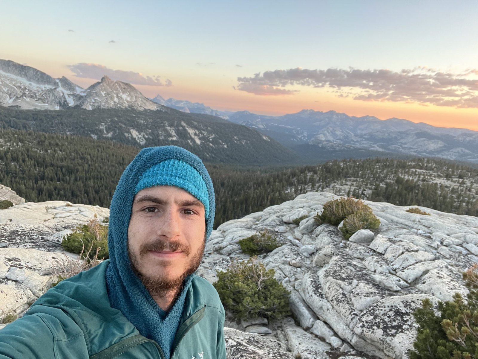
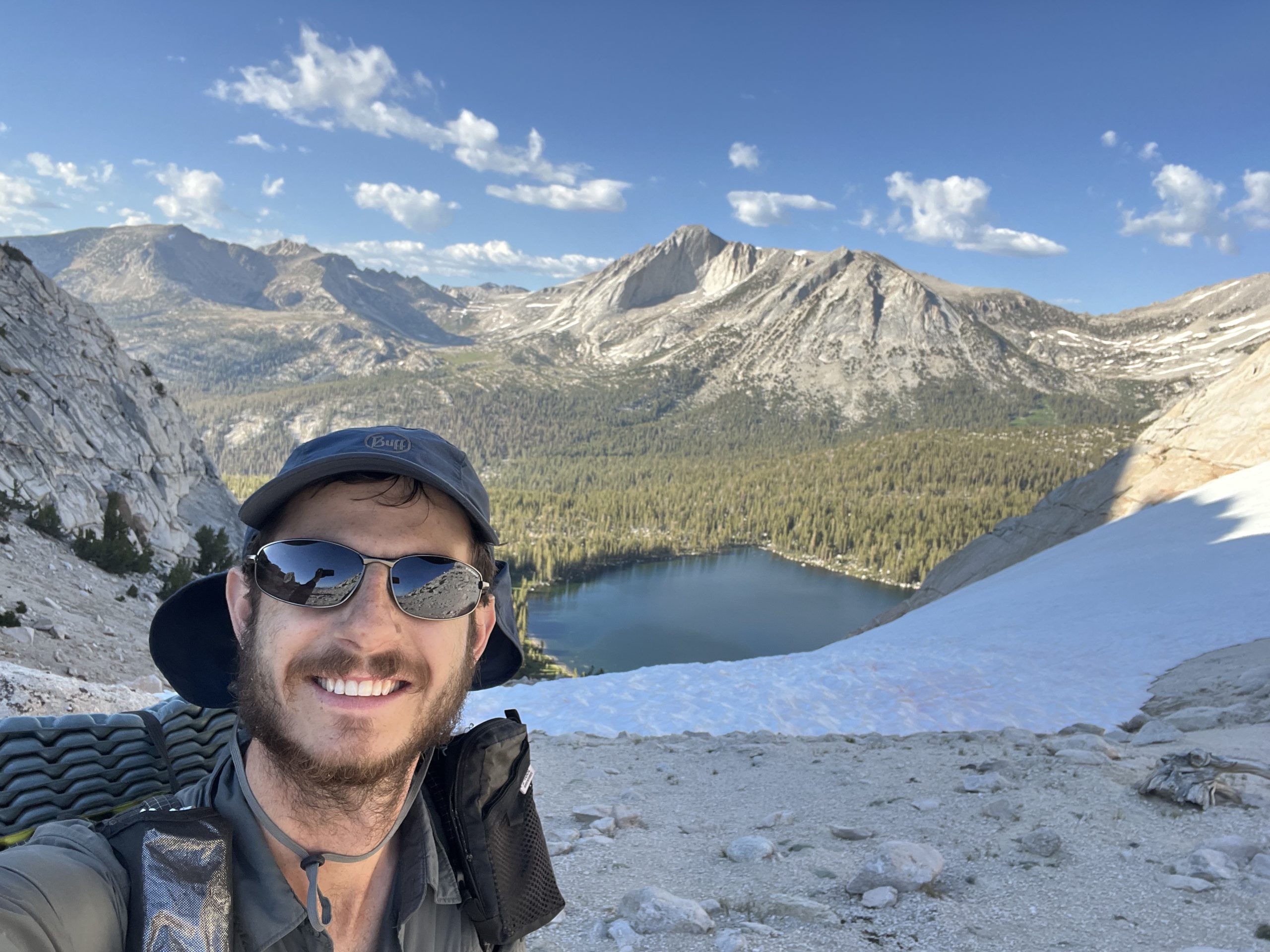
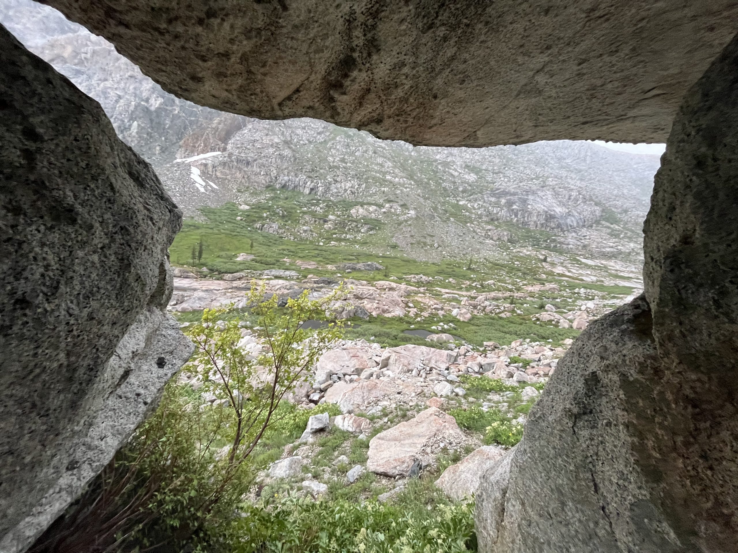
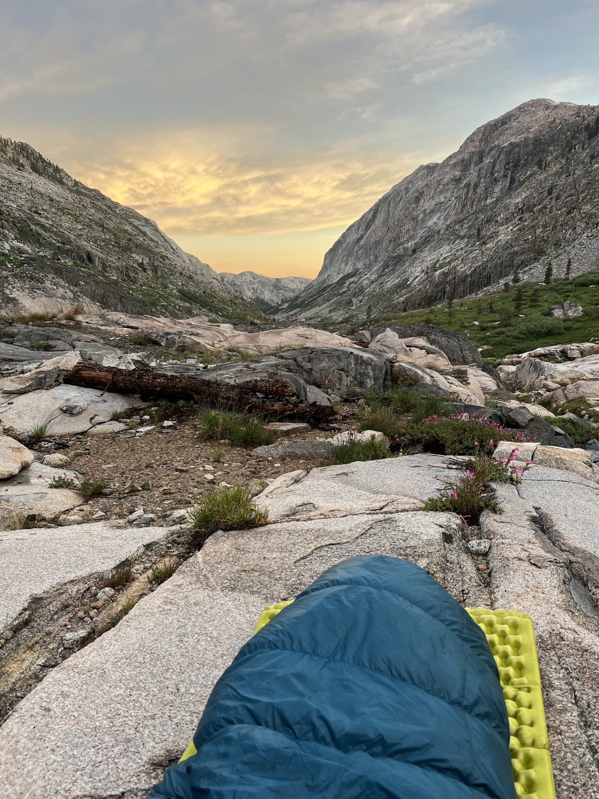
It was getting dark, so I scrambled up to a knoll above the lake, displacing a Peregrine falcon from its perch. It wheeled into the luminous evening light. A locals’ haunt, then. There was a little niche full of decomposed granite sand that perfectly fit my sleeping pad. The view displayed the Cathedral Range in the deepening gold of dusk and in full array of its sculptured splendour, the elegant curves of its polished, granite buttresses putting human architecture to shame. Muir always spoke of this place as a place of worship and reverence, as one of the great cathedrals of creation, and that evening I too felt the influence of the grand stone sermon of the Sierra. The sun lay the last of its gold upon the face of Half Dome. Light lay against rock, consciousness lay against matter, and the splendid, myriad world laid itself against the senses. Flies was down there somewhere in Yosemite, hopefully marvelling at the uplifted splendour of half dome herself.
Flies: By the time we arrived at the final stop—the Yosemite Visitors Centre—only myself and a similarly disorganised PCT hiker called Campo remained on the bus. We were ejected into the bustling crowd and spent the next several hours stressedly trying to conform with the baffling requirements of the park system. The visitors centre gave us conflicting information. Free? Not free? No—not free. We could pay cash, but we didn’t have the right denominations and there were no ATMs nearby. We were invited to book using an app but it turned out that it didn’t work on international phones. Finally, we were told to run to an office three blocks away as it was about to shut. I arrived sweaty and a little strung out and to find two young rangers lounging on the porch. “JMT hiker?” the guy smirked. I said I was doing the PCT. “That’s slightly better,” conceded the girl. It was ten minutes till closing but they were manifestly done for the day. I went to the campground, and, after another hour on patchy reception unsuccessfully trying to pay online, decided I was done for the day too.
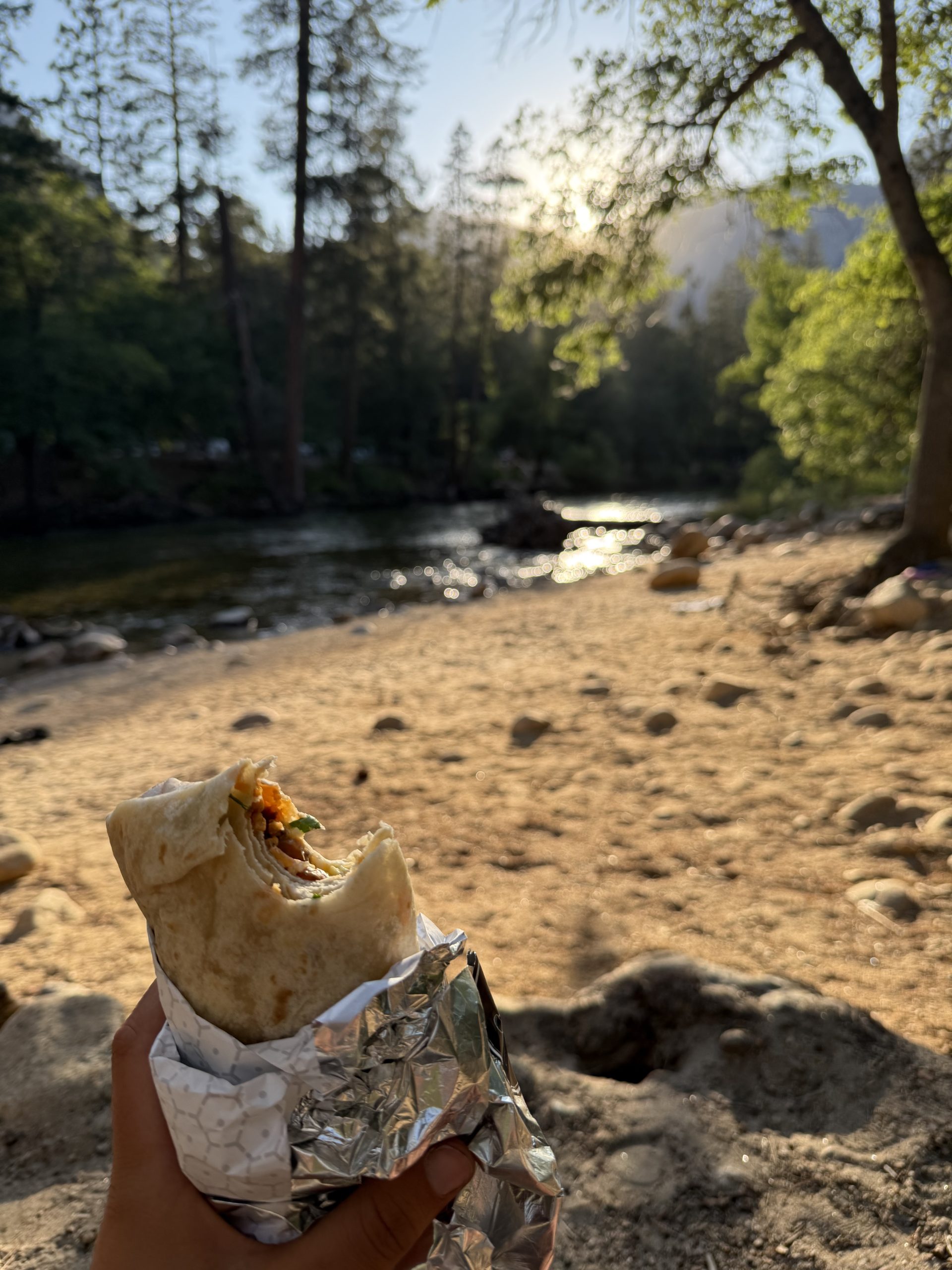
The day in question was almost over. I was starving. I braved the preposterous queues in Curry Village to buy a cold, hand-sized burrito for $15 USD then tried and failed to find a quiet spot to eat it by the river before taking what I hoped in vain would be a peaceful stroll out to admire Half Dome in the sunset. About two minutes into the walk, a young Indian man who was camping for the first time in his life struck up a conversation and decided we were undertaking the walk as companions. “I’m glad you brought a headtorch,” he said, “I don’t have one.” We arrived at the muddy puddles advertised somewhat audaciously as The Mirror Lakes, where I conducted a photoshoot for my new friend, and looked up at the small portion of sunlit dome just visible through the pines. Hot Hands was out there somewhere, still bathed in the wild sunset light. I’d chosen my fate, down here in the darkening valley.
The Crux
1/7 — Day 61 — 18mi / 30km
Hot Hands: All night long I was subjected to an onslaught of voracious vermin. They chewed on my sleeping pad mere inches from my head, scampered shamelessly across my quilt, and attacked Flies’ pack with tooth and claw. They were a legion, uncowed, unrelenting. I cursed and swatted and jealously guarded my possessions, swinging the beam of my headlight through the dark at their disappearing tails. Nothing I did discouraged them. Eventually, I put the pack some ten feet away, figuring they’d realise that it wouldn’t yield any calories, and finally caught a few hours sleep.
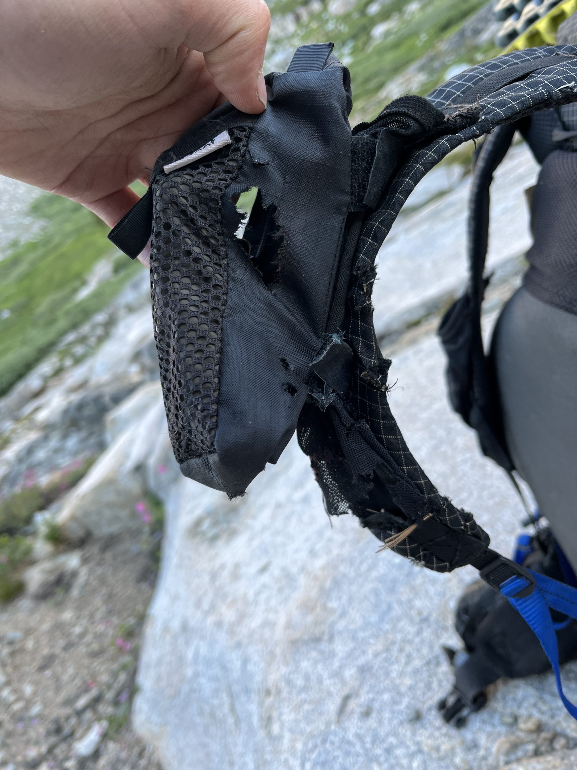
When I arose, I found the pack and my hiking poles vandalised beyond belief. With a total and utter lack of compunction, the furry little terrorists had chewed a dozen holes in the pack. They’d gnawed halfway through the shoulder straps and the straps of my hiking poles. They’d bitten through the pack’s mesh pocket and into the chest pocket accessory Flies had attached. What was the objective of this seemingly wanton act of destruction? All my food had been safely secured in the bear can. Were they after the salt from my sweat? Then why attack the mesh and the chest pocket? Maliciousness, plain, pure, mammalian maliciousness—that’s all that can account for it. The world is a nasty, brutish place. Its denizens are scoundrels.
My mood improved as I walked the length of Roosevelt Lake and climbed up to a pass called, bizarrely, “Don’t Be a Smart Pass.” I felt, despite the desultory sleep, full of energy. “Morning brings back the heroic ages,” according to our friend, Thoreau. The lake was absolutely still, the overleaning peaks duplicated as if in glass. The ranger who’d issued my permit had said that this pass was steep and still full of snow on the northern side—“You’ll need crampons and an ice ax for that one.” I’d said, “of course.” I didn’t actually have an ice ax or crampons, but, ever the optimist, I was hoping microspikes and hiking poles would suffice. It was as steep as promised but my worries vanished when I saw how deeply suncupped the snow was, cratered all over with little depressions from the melt that were perfect for placing feet securely and also functioned as a speed retardant in the event of a slip. Once my confidence grew I even tried to slide to my death, experimentally, and found that I couldn’t even if I’d wanted to.
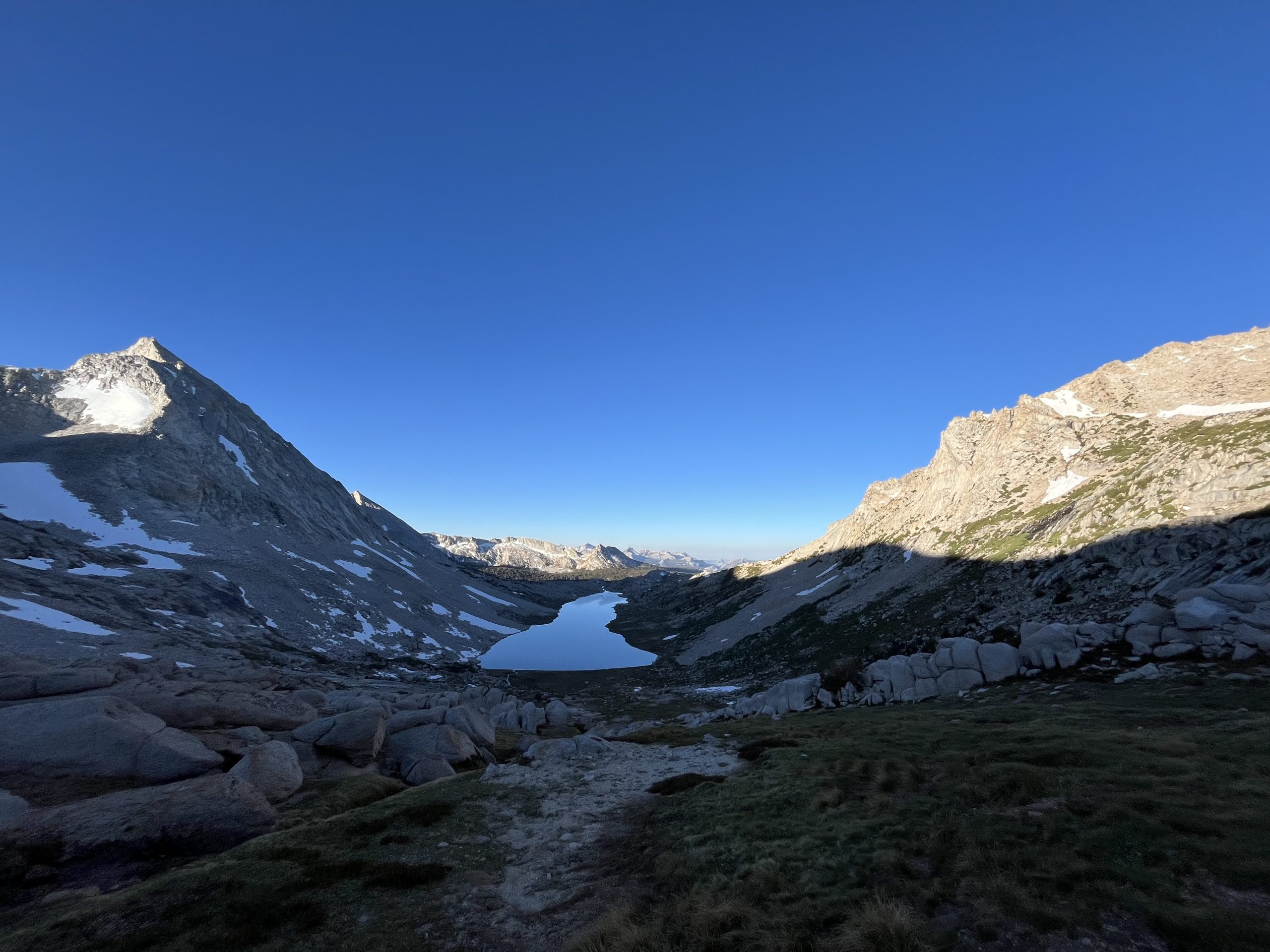
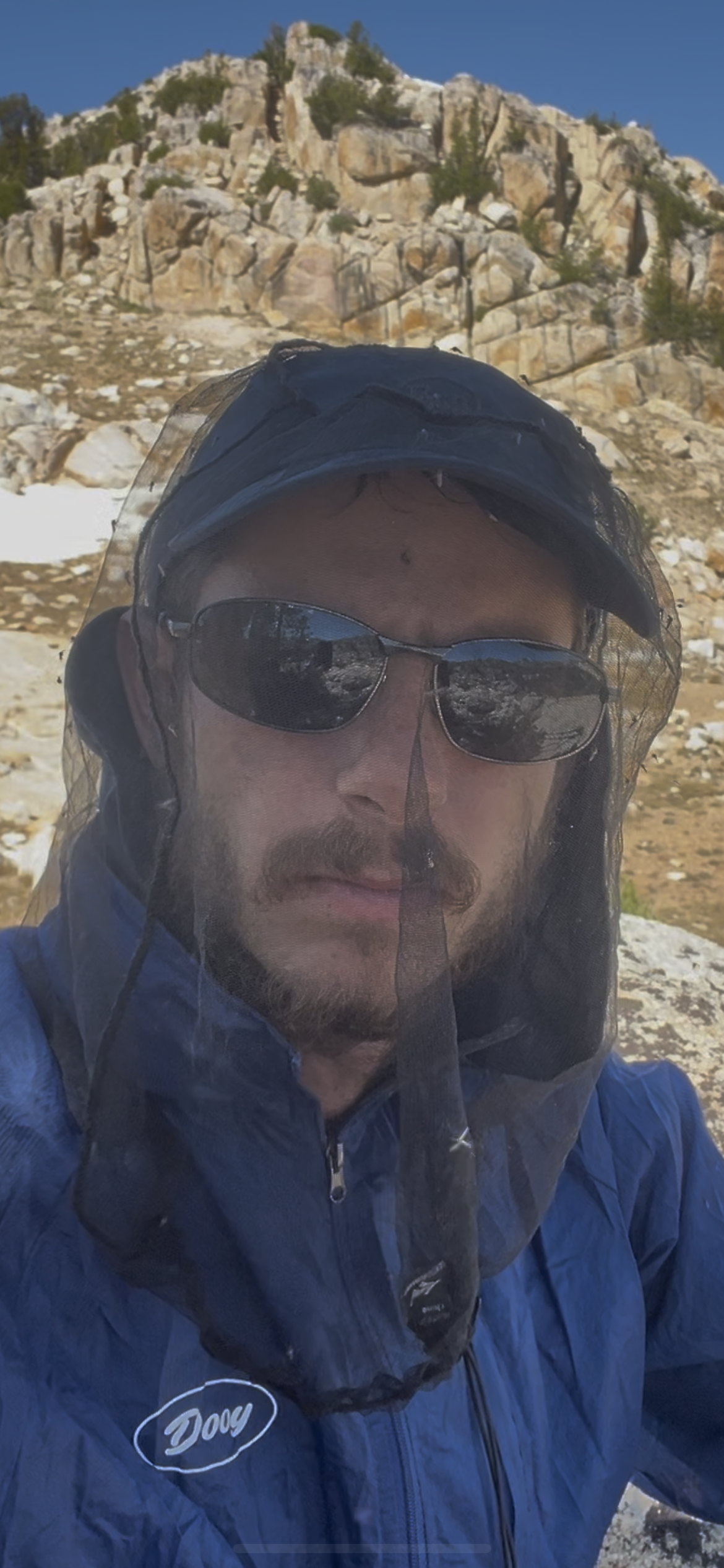
At the foot of the pass, I met with Upper McCabe Lake. It looked inviting even in the cool of the morning—a perfect spot for a bath and breakfast. As I neared the shore, however, I saw tall columns of mosquitoes bobbing about in the slanting light, hundreds or even thousands to a column, and many dozens of columns floating above and around the lake. I realised with some horror that the surface of the lake was also spotted with thousands—tens of thousands—of floating mosquitoes. Holy shit, I thought, they’ve got a navy. It was the mosquito capital of the world, and I got out of there as fast as I could, while its inhabitants were still dull from the early cold. Once I felt like I’d gotten far enough away, I parked myself up on a rock exposed to a light breeze and started on breakfast.
There were still a few mosquitoes around, though. Actually, there were a lot. If I stayed here I was going to be breakfast myself. I took off at a brisk pace that accelerated in proportion to the number of my followers, stumbling down a steep bank to the McCabe Creek and crashing clumsily through the forest, sending a couple of deer springing away. I was getting quite hungry but my pursuers kept up the chase for another hour before they finally relented after I’d puffed up to a saddle on a spur that divided the McCabe from the Virginia Canyon.
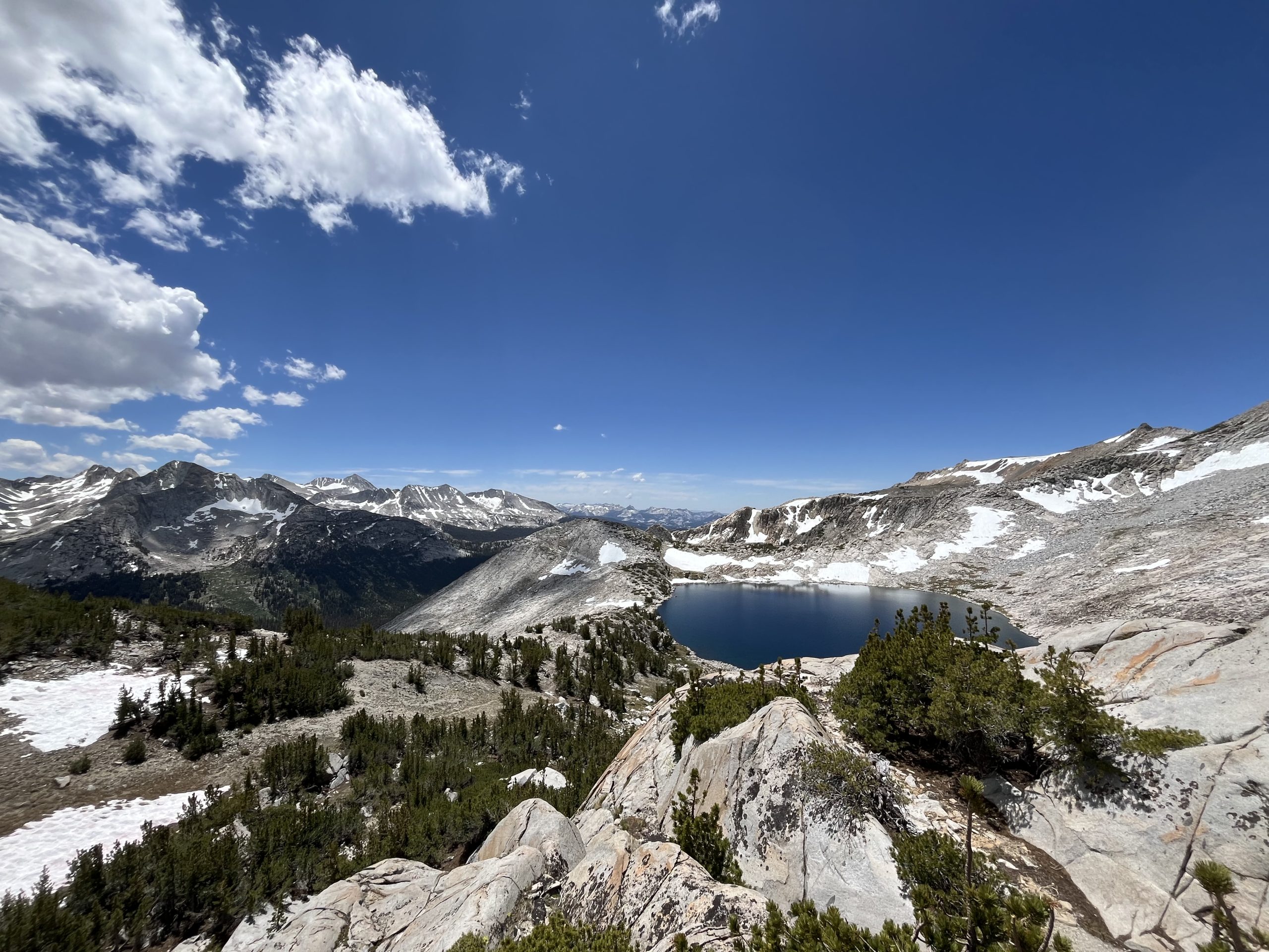
After ingesting the long awaited oats, I clambered down and made my way up a mile or two of actual trail before tackling a tough, tangled climb out of the canyon to a high basin full to the brim with a lake that was blue and cold and had the great merit of not harbouring a flotilla of blood-sucking insects. I washed off the sweat and muck and took a moment there before undertaking what would be the crux of the High Route: Stanton Pass.
Stanton Pass involved the only class 3 scramble on the route. I’m perfectly comfortable with class 2 scrambling—doesn’t even get the heart going. Class 3, however, usually equals trauma—ideally, of the mild, psychological variety rather than physical. Class 3 is easy climbing, requiring care and both hands but no real technical skill or stamina—its just that mistakes have dire consequences, i.e. grievous injury or death.
Some people, even people without any climbing experience, are fine with this kind of thing. Others, with sensitive and active imaginations such as my own, perceive, in an almost bodily way, the plausibility and consequence of a bone fracturing fall. This is unpleasant, unhelpful, and probably increases the likelihood of the feared outcome. I’ve done a fair amount of class 3 scrambling—and worse, class 4 and 5, once or twice—and I know from experience that it provokes consternation in advance, fear and regret during, and enormous relief afterward. I’ve vowed a half dozen times never to do any more exposed scrambling, but here, yet again, I was contemplating it. Fortunately, I’d talked Stanton through with Forest from Mammoth Mountaineering, who’d climbed some of the surrounding peaks and we’d found a couple of circuitous class 2 alternatives over adjacent passes if Stanton proved too unnerving.
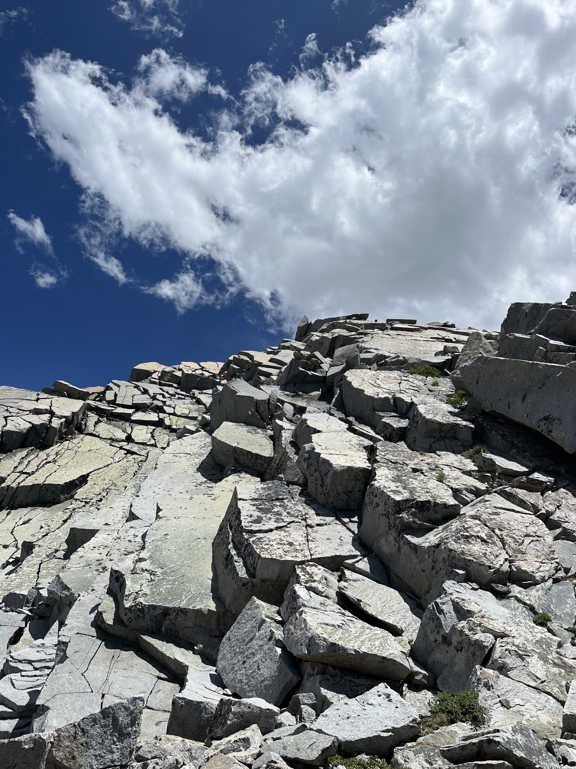
I climbed across a high basin, followed some coyote prints through a snow field, and scrambled up some blocky ledges to the pass, which sat under the intimidating mass of Virginia Peak, dyed red like congealed blood by ferrous compounds in the rock. The descent off Stanton was where things were supposed to get tricky, and it didn’t look great. The descent was a mess of big blocks of fractured rock for some sixty feet, before piled up talus relieved the angle. I clambered down just a little to get a better view and saw I could sidle across a steep slab using a horizontal, toe sized crack. On the other side I’d be able to survey another area that might prove more feasible. It was a simple series of manoeuvres, but if anything went wrong—a loose handhold or a misplaced foot—I would be rewarded with a sharp 30 foot slide onto a jumble of TV sized talus. Just a quick look, I figured, and I could always retreat back to the aptly named Return Lake in the previous basin if needed, and find my way from there.
Halfway across the sidle, I was flooded with the familiar sickening feeling that accompanies the vision of a soft body slamming into unyielding rock. What the heck was I doing here? Walking is so nice. Why risk mangling myself for a quick shimmy down a cliff? I’m better suited to horizontal adventure, I was thinking, before I checked the spin and steadied myself again on the rock. Simple, I said to myself. Casual. I stepped tidily and decisively across. That was a little more committing than expected—hopefully the new prospect proved less daunting. I poked my head around the corner to see. Damn. More of the same. Now that I’d come this far, however, I didn’t much want to retreat back across the exposed sidle. So I tried to downclimb using a vertical crack and some smeary footholds, but the crack petered out and my position became tenuous. I clambered nervously back up. I wished I didn’t have to downclimb this section—going up is always much less stressful. You don’t have to have the possible fall constantly in view while you poke around for footholds.
I tried another approach, climbing up and across a shoulder of rock to a steep chute full of decomposed granite sand. If I could avoid slipping on that, I could use the right angles of the chute to edge myself down. My poles would be in the way, though, so I threw them down. Now I’d have to do it. Slowly, tentatively, I smeared my way down, the only thing ensuring my feet and the granite were acquainted was the friction of rubber on rock.
I washed up on the talus below like a sailor on land after a storm, and vowed once again never to set foot on class 3 again.
Flies: After a morning cloistered in the dining hall charging my electronics, I decided on a final outing before catching the bus back to trail, a visit to one of Yosemite’s many wonders that I could point to and know my side trip had been worthwhile. Yosemite Falls was to be my Mecca. I boarded the free shuttle and stood awkwardly beside a couple having an acrimonious debate about when to take their several small children swimming. A woman in a pink cap videoed the unremarkable buildings we were passing, then turned the camera around to take a selfie with her daughter, who was wearing a matching hat. “We’re on the shuttle!!” she squealed.
The path to the falls was large enough to accommodate a truck, and hundreds of tourists streamed along it. I trotted along feeling a little barbarous in my despoiled grey hiking shirt and was almost run over by a fleet of gum-chewing cyclists apparently sponsored by Gucci. The runway show ended with the obligatory photoshoot. People up and down the river posed with the gushing torrent above. Water fell. They smiled and pouted. I awkwardly obtained the requisite photo, then turned on heel to leg it back to the bus stop. There, Yosemite. Mission accomplished.
En route, I passed a lavish wooden hotel. People unloaded their suitcases from cars in front. Two girls of about 14 stood watching their parents do so with undisguised disgust; one of them had freckles painted on her cheeks and the other was sporting a G string worn several inches above the waistband of her jeans. It seemed they were being punished with a trip to a five star hotel in one of the most beautiful places in the world.
I boarded the bus back to Tuolumne with mixed emotions: relieved to be getting back to the comparatively peaceful PCT and regretful that I didn’t have more time to spend exploring Yosemite’s bustling but remarkable wonders. My afternoon of hiking solidified the former sentiment, however. I followed the wending Tuolumne river, swam in several of its waterfalls, and climbed up into the sweeping granite mountaintops, and all without the hordes of tourists and pouting teens to blot the view. The ballooning cumulus that so mirrored the mountains below glowed in the setting sun and the few folks at my administratively undemanding campsite hushed as we watched the spectacle. It was good to be back on the trail.
Hot Hands: Having taken a moment to let my breathing relax, I collected my poles and made the knee-jarring descent to the canyon. Once I got to the open, grassy valley floor, the going was fabulously easy after the rigours of the day, and I felt buoyant with relief. The worst of the exposure was behind me. Now I could enjoy the rest of the trip without fear of maiming or killing myself. Huzzah!
After I’d made my way up Spiller Creek towards the top of the canyon, Matterhorn Pass came into view. It looked a little more severe than its class 2 status warranted, I thought, so I reviewed the notes for the pass in the route description. Shit. I’d somehow overlooked this section while researching the route. Matterhorn Pass involved properly exposed scrambling, maybe worse than Stanton: “The moves are feasible for a non-climber with a pack,” the guide said, “but a fall would have serious consequences, making it class 4.” I was already wired from the airy exposure on the last scramble, and the unforecasted risk tightened the strings of my nervous system yet further. I explored alternatives on the map, but, unless I went all the way down Spiller Creek to the PCT and then peeled off up Matterhorn Creek, there was nothing going. That option would add another 15 miles, more than half a day’s walking, and I was cutting it fine with food as it was. I stood regarding the pass. The upper Matterhorn Canyon lay on the other side, about a mile away as the crow flies. It was 5pm. A few stray mosquitoes whined in my ears. I’d have to break my vow once again.
Once I’d climbed up to the crux, which began ar the sheer, blocky uppermost section of the pass, the best option looked to be a smooth ramp of granite butted up against a vertical wall. It dropped off sickeningly. Could have done with a handrail. But it looked reasonably wide, and not so steep as to require much in the way of handholds, which its polished surface seemed unlikely to yield. I scampered up, palms to the rock, keeping right by the wall with my centre of gravity low. This time, I was able to remain calm and methodical, and topped out without afflicting myself with unnecessary visions of my body imploding on the speckled granite boulders below. Ascending was so much easier than descending.
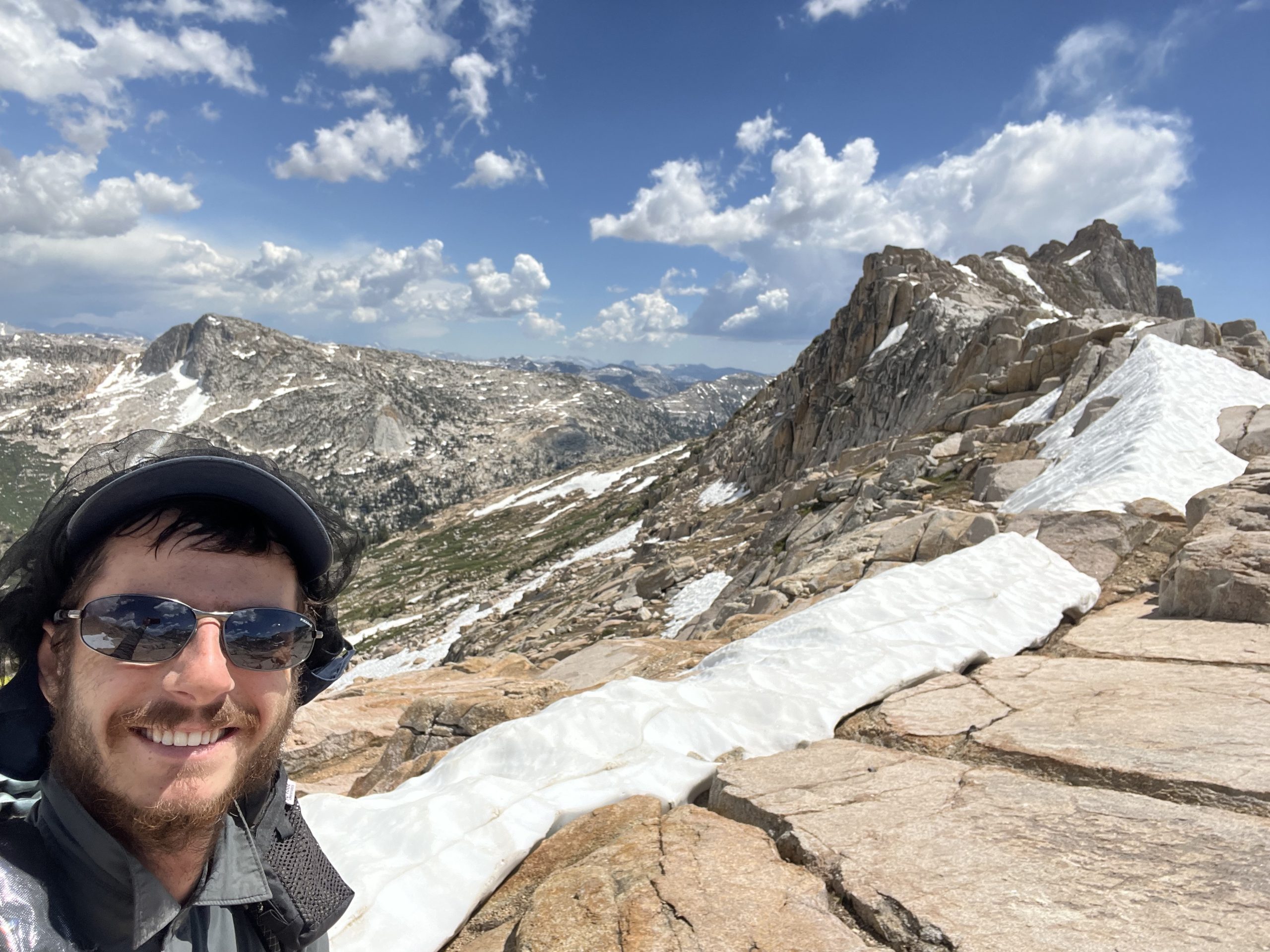
I’d reached the high point of the YHR, 11,320 feet, and the views were superlative. Just to the east of the pass was Matterhorn Peak, which Kerouac and Snyder scrambled up in The Dharma Bums. Or, Snyder did—I think Kerouac had even less stomach for exposure than I do. It was tempting to give the peak a go myself—it was only another thousand feet climb. But I had no idea what it would entail in the way of risk, and it was getting late, and my knees were about to form a union and go on strike. So I made the slow descent down a steep grassy canyon wall through a dazzle of wildflowers into the upper reaches of the canyon.
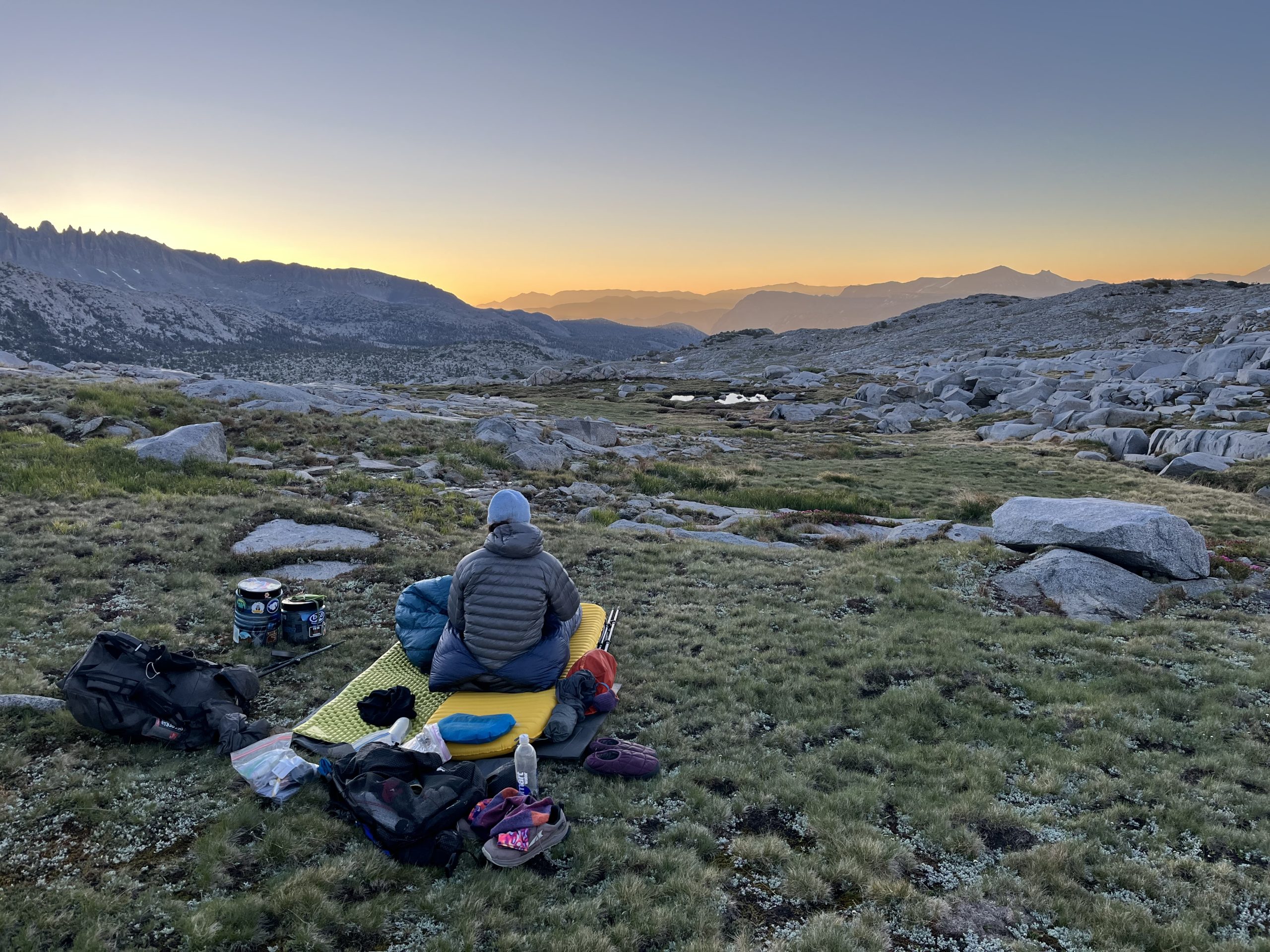
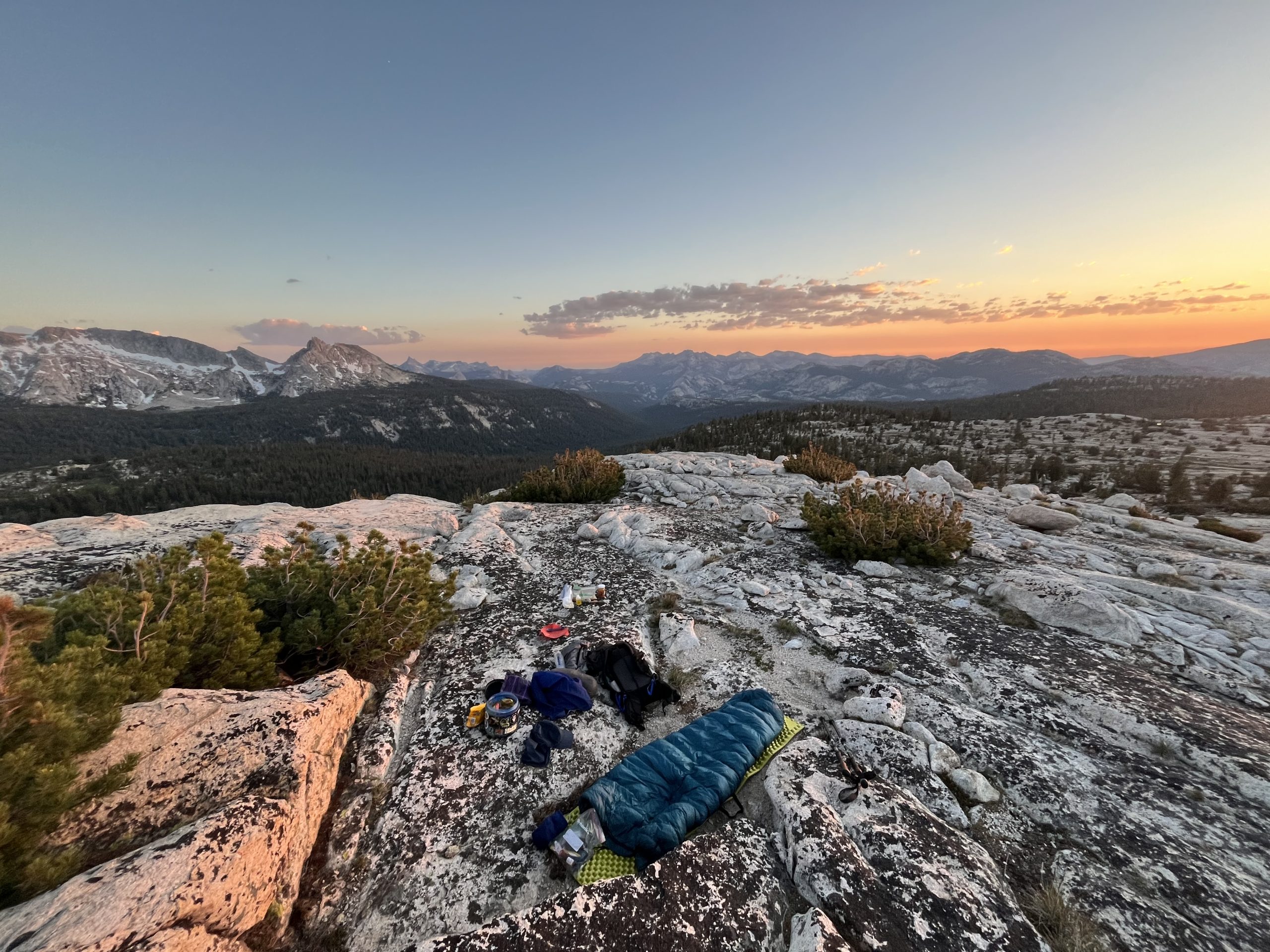
Once the adrenaline had subsided, it became apparent I was exhausted. I’d done some 12,000 feet of vertical gain and loss over 15 burly cross country miles on about three hours of sleep. I picked up a trail that led over Burro Pass and followed it to the top, where I hoped to camp. The mosquitoes were unexpectedly numerous there, and happy to see me. Normally passes are a moment of pause: you say goodbye to one world and hello to another, a link in the great daisy chain of memory and anticipation that after some four and a half months walking will stretch from Mexico to Canada. But the mosquitoes would tolerate that kind of sentimentality: I pushed wearily on. There were still some large snowfields blocking the path off the pass. They were fairly steep and a little slushy, but fatigue and achy knees compelled me to hazard sliding down on my butt, using my poles as a makeshift handbrake. I descended some 400feet in less than a minute. From the base of the pass, I left the trail and made my way cross country to an exposed knoll that I hoped would catch the breeze and undermine the dubious hospitality of the local bug population. It did. The wind brushed away the mosquitoes and I lay myself down. The day waned and the high, abstract clouds flared red and pink before finally subsiding into gloom. I felt a little lonely, lying there as the firmament unscrolled under stars that were remote and impersonal. Something made a furtive dash into the rocks a few feet away. “Don’t you fucking dare,” I said.
Blood Tax
2/7 — Day 62 — 18mi / 30km
Hot Hands: I woke with the dawn to find that my equipment had been left alone—that was a relief. Recalling yesterday’s breakfast fiasco, I ate my oats before setting off. An hour’s walking down Piute Canyon got me to The Slide: a huge deposit of rockfall that had blocked the canyon wall to wall, the force of the fall having tossed some boulders several hundred feet up the far side. It had also blocked the creek, turning the area upstream of into a marshy meadow, the favoured hunting grounds of everybody’s favourite flying insect. I was a sitting duck: the boulders were fridge to vehicle sized and made for slow and effortful clambering. Falling into any of the gaps between them would be awkward and painful, so, as the mosquitoes settled on my legs and neck, I had to balance the mounting urgency I felt with the imperative of maneuvering in a considered manner. It took me a ponderous 45 minutes to go a quarter mile, by which time I was itchy and flustered.
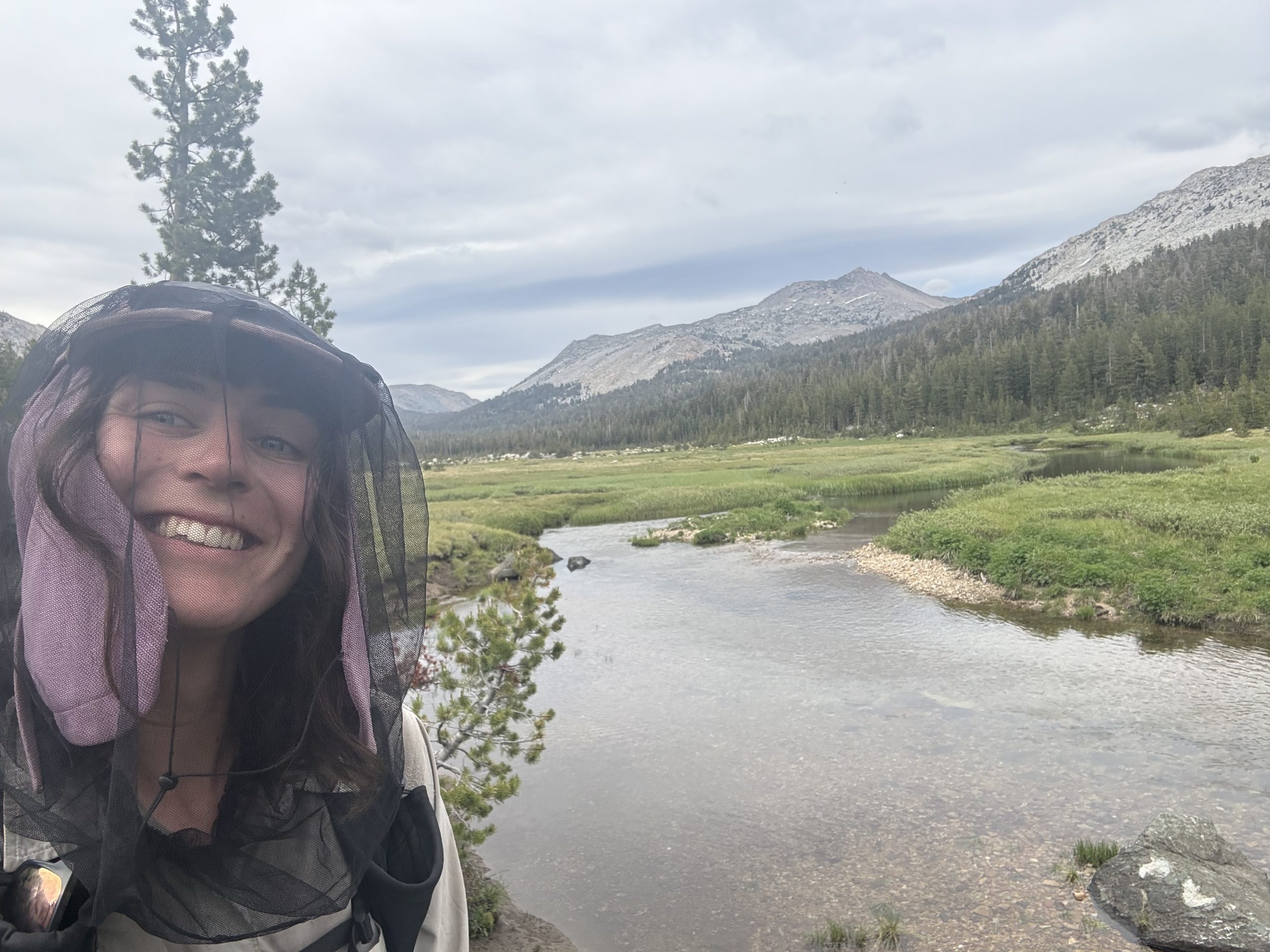
I pulled on my headnet and took off down Piute Canyon as fast as the boggy terrain would allow, but I couldn’t get up enough speed to leave the bugs behind. I didn’t time it, but I’m fairly confident that I set an FKT for the next 5 mile section of the high route. I bashed through the undergrowth to the general vicinity of the gully I was supposed to climb, unable to stop and read the route description, put on sunblock or my sunglasses, or catch a breather. I tried to do these things again once I’d climbed up out of the valley somewhat but had to abandon the attempts almost immediately, as dozens of animate syringes settled on the exposed skin of my legs and hands. I had pants in my bag, but it was already hot and the climbs were very strenuous. The pants would slow me down. I was increasingly frenzied. Did I regret surrendering the DEET to Flies? It would be fair to say that I did. Nothing for it now but to get the hell out of here, here being a territory of large but ultimately unknown extent controlled by the flying blood mafia.
Flies: Walking alone the day prior I had idly wondered what depths I would have to plumb to find the motivation to keep up a strict walking pace now that I didn’t have Hot Hands countering my inclination for sleeping in and taking breaks both many and long. It was soon clear, however, that I would need no recourse to inner strength: the mosquitos were out in force and would urge me on with their unquenchable proboscises. The first lake I arrived at was covered with a dense black blanket of bugs, which cloaked me as soon as I paused for breath. I applied my 100% DEET repellant in a desperate frenzy. DEET of this potency is strong enough to melt plastic, so I leaned over the water to wash my hands and naturally my phone and headphones dropped into the lake. A strong start to the day.
But it improved thereafter – I ascended Benson Pass at a tortoise-like pace and found, to my surprise, our old pal Oreo, who we’d last seen a couple of weeks ago. She was fast. So fast we’d said goodbye expecting never to see her again. So fast that she’d attempted to do the last 125 section in five days. So fast that she’d done back to back 30 mile Sierra days from Muir Pass to Mammoth on half rations and developed tendinitis in her tibialis anterior. One might consider her a hare. Now that she was hobbled, we walked at the same pace, an unfortunate but somewhat gratifying and otherwise improbable experience for me.
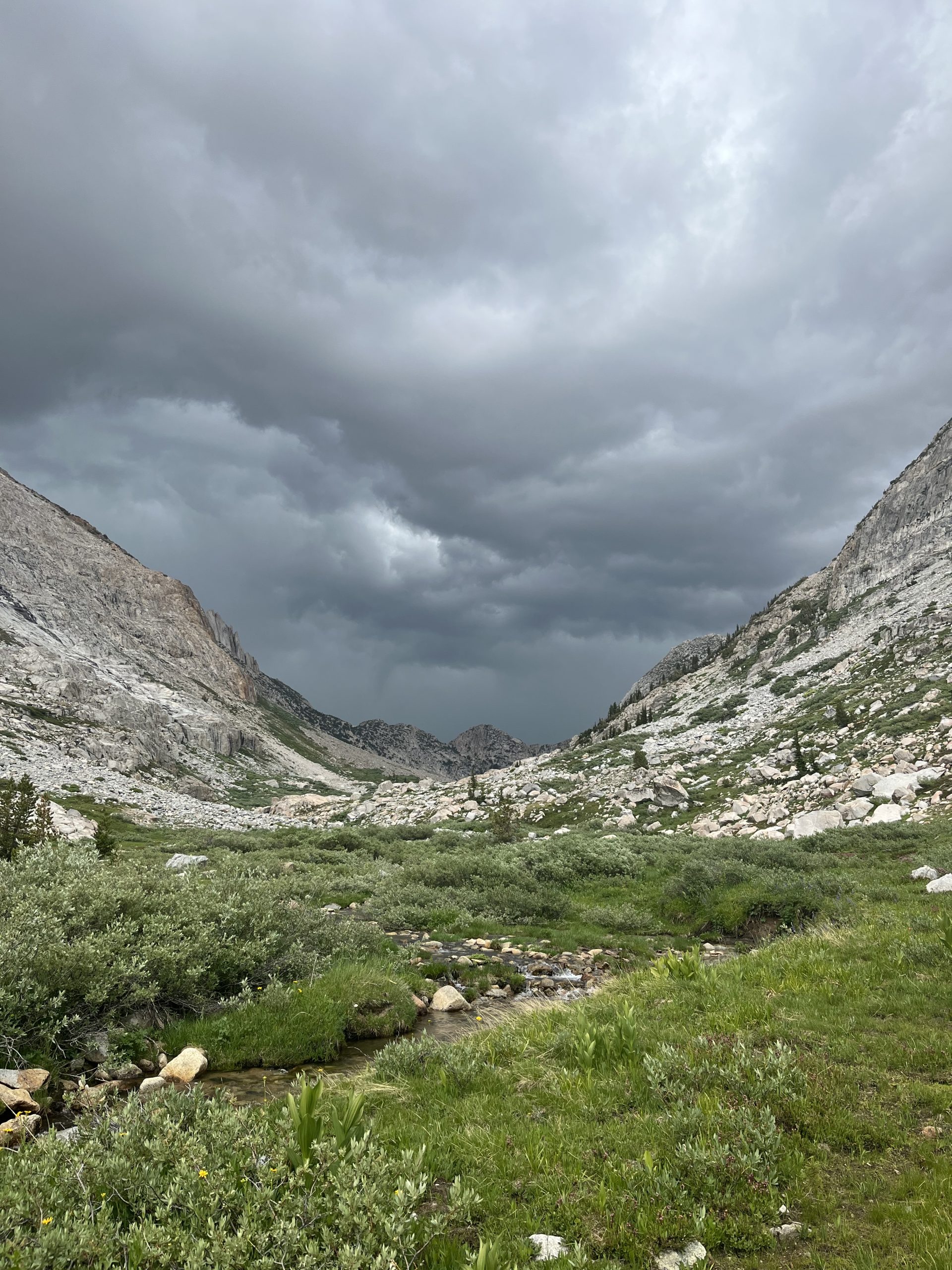
Trotting along and chatting happily, we did not notice the clouds gathering at our backs until we had reached the valley floor. They were dark, bruised almost purple, and grumbling with discontent: there was a serious storm on its way.
I had been planning on camping a few miles up at Small Lake, but a vaguely recalled injunction to avoid open water in thunderstorms bounced around in the back of my mind. I dithered, unused to being the sole decision maker: should I make the mileage or minimise my chances of being electrocuted to death? A difficult choice. It was only 5pm, but I decided to park up for a day. I ate dinner while pacing back and forth in a vain attempt to evade my bloodthirsty camp mates, and the first heavy rain drops started to fall just as I twisted the lid onto my bear can. They quickly developed into a deluge, and, like rocks tumbling over rocks, thunder cracked and boomed around the valley. was very gratefully ensconced in tent, snuggled into my quilt, warm, dry and sleepy now. I hoped Hot Hands was okay. It would be a shame if he were struck by lightning.
Hot Hands: My assailants were unrelenting. Breathing hard after having rushed up the steep, overgrown gully, I broke out into a wide meadow and hastily collected some water from a stream. The route dropped down to the top of Crazy Mule Gulch. I sympathised with this mule and had no doubts as to the cause of its insanity. I couldn’t really remember the precise route from here and stopping to consult the guide and the map was out of the question, so I set off in the general direction at a reasonably forgiving looking niche on Suicide Ridge—a very encouraging name. My improvised route worked out, and I dropped down through class 2 to Rock Island Lake, which I recalled the guide had said was one of the highlights of the YHR. I’d not thought it was ecologically or morally possible for the quantity of mosquitoes to increase in number, but, at this point, they did. The air by the shallow, boulder-fringed lake was so thick with them that, were it not for my head net, I was sure I’d be inhaling bugs with every breath. I’d been hiking at top speed for several hours without pause I was feeling knackered, so I tossed down my pack, stripped, and waded out info the mercifully mild water far enough that I could submerge myself up to my nose and regain some composure. The navy was out in full force, one mosquito per square inch of lake and I eyed them coolly. Buddhism enjoins its adherents to cultivate goodwill towards all living beings, and to refrain from deliberate killing. Christianity requires that you ask the lord for forgiveness for your sins. I could convert, kill all these fuckers, be absolved in the next town with a church and thereafter ascend to a bright and bugled paradise. It was tempting.
After five minutes of respite, I started to shiver and returned reluctantly to shore. I dressed with hasty efficiency and took off again with an entourage that now numbered in the hundreds. They harried me all the way up the valley. I was hungry again. I wanted a proper break, on terra firma. My shoulders got itchy. I turned and realised there were a half dozen mosquitoes on each shoulder, biting through my shirt. I rolled my shoulders in the fabric and they alighted a moment, then settled again with terrible patience. It seemed id deviated from the Yosemite High Route and ended up in the 10th circle of hell. Finally, like the harried souls of the netherworld, I accepted my fate, plonked myself down on Rock Island Lake Pass, wrapped every inch of my skin in clothing, and ate a snickers bar. The high, insistent whine rang loud in my ears. I felt like Vercingetorix at Alesia surrounded by Ceasar’s bristling legions: thoroughly besieged.
Replenished, I dropped off the pass and the mosquitoes suddenly and miraculously abated. I stopped to see if they’d catch up. Nope—gone. I’d crossed an invisible border to a place beyond their jurisdiction. I picked up some trail and followed it to the base of Willow pass, bashed my way through thick stands of the eponymous tree over and down the other side, and started up yet another pass. This high route business was gruelling. On the PCT we did a pass a day, not four. Under and up I went, my body a needle stitching memory’s thread to the horizon. A fighter jet boomed overhead, describing an arc that recapitulated my progress over the last two days in approximately 7 seconds.
Shelf Pass was so named because it had a series of shelf like ledges, which I skirted around. Snow still corniced the top, and would have made it impassable a couple of weeks ago, but I was able to edge around that too. On the pass in the wind I ate some of my last remaining M&Ms and surveyed the vast panoply of peaks that reared obstreperously into the sky. I caught a view of Tower Peak Pass, the next on the agenda. That was full of snow too—not good. I had no way of knowing whether it would be passable.
Steep chutes led down into a long sandy basin. I was going to need knee replacements within the decade. The basin drew water in capillaries from the surrounding peaks down to lake large and glorious and densely banked with wildflowers purple and yellow and white. I crossed bear prints in the sand en route, felt the warmth of their faint company, swam, and basked on a rock that still retained the suns heat. There didn’t seem to be much of a middle ground up here, just heaven and hell with nothing in between. I was experiencing a kind of metaphysical whiplash.
After a lovely rest I opened my eyes to meet the peaceful gaze of the wide blue iris above, sat, stretched, and—holy heck that was one mother of a dark cloud. A storm front had swallowed up the south eastern portion of the sky. Moments later, stern as a war drum, thunder pealed across the range. I suddenly felt very exposed. There wasn’t anything in the way of cover in the basin. The lakeside idyll was abruptly abandoned and one hurriedly clothed and shod mammal vould be seen hightailing it toward the lake outlet, which fell down a sheer wall into Stubblefield Canyon. The rapidly advancing black swallowed up Tower Peak. A sudden wind rushed through the trees and set them to tossing and bucking. The sky flashed erratically, as if there were an epileptic at the light switch, and thunder rolled deafeningly down the grooves of the canyon.
Stubblefield was so named for all the boulders that studded the valley floor. I took up residence out of the wind against a large one of these, hunkering down just before the deluge began. Within a few minutes, however, the wind did a 180 and drove the rain directly into my hiding place. Folks, it’s a good idea to carry a shelter into the high alpine zone. Don’t let Muir’s example persuade you otherwise. I quickly gathered up my things as the rain turned to a stinging hail that welted my legs. I panted up through a jumble of boulders to a hollow niche I could see at the bottom of a cliff. There I found accommodations that were cramped and steeply sloped but fairly sheltered. I could survey the storm lashing the valley from the narrow domain of my cliff-side eyrie. A couple hours passed, the ferocity of the storm steadily abating, until the late evening when the fresh-washed sky took on an innocent pale blue once again. Across the valley, I could see an alternate route that would negate the need to risk the snowy Tower Peak Pass and I determined to take that route tomorrow.
Satisfied I’d seen the last of the weather, I climbed back down to the canyon floor. After making a little rock bivvy for insurance, I set out my bedding on a flat patch of wet granite bedrock and had my dinner. Tomorrow, by midday, if my knees didn’t desert on me, I’d be back, bright-eyed and bedraggled, on the PCT.
Home again
3/7 — Day 63 — 24mi / 38km
Flies: Everything was fresh and clear and dazzling in the wake of the storm. At breakfast, I watched a show over Small Lake: insects skated over the glassy surface, dragonflies cruised above and cast shadows beneath them like little airplanes, and golden clouds of small flies gathered at pine trees around the perimeter.
The walking for the morning was gratuitously steep ascent and descent on repeat, with not a single named pass to show for it. I stopped to eat the first of my Snickers between two gnarled, shaggy junipers, tufted with bright lime green lichen and overlooking a small stream. A chipmunk raced around one of the trunks—“Hello!” I exclaimed. “Hi there!” two hikers replied from the path behind me.
In the evening, clouds gathered and the path descended through a series of hellish dark red ponds coated with swirls of thick pollen that sat on the surface like a layer of fat. I forwent a swim Wilmer Lake when I saw a hiker who had just made that mistake, panicked and swatting desperately and she tried to put her clothes back on. I held out hopes, however, for Grace Meadows. A river ran through it, and it was where Hot Hands would be rejoining the PCT. With such a name, surely I would pass an idyllic hour or two bathing and appreciating wildflowers while I awaited the possible appearance of my beloved.
Instead, Grace Meadows turned out to be a bug infested swamp. Stopping was not a possibility. Except… my bowels urged that my mark be made on the meadow bearing my name. It would have to be quick. I grabbed my toiletry bag, hastily dug a cat hole in the least swampy patch of dirt I could find, and did the deed. But when I reached for my toilet paper, I found to my horror that I had grabbed the rubbish bag in my haste. For toilet paper I had the option of defiling the cheerful colonial grin of the Quaker Oats man or the kindly, spectacled Abuelita that smiled on the packaging of our Mexican hot chocolate. I chose Abuelita and asked her and Madre Maria for forgiveness.
The day finished at Dorothy Lake, with dramatic snowy peaks rising in a final flamboyant celebration of the Sierra Nevada. I was camping entirely alone for the first time, but wondered about Hot Hands’ whereabouts. Maybe he had finished his High Route faster than expected and was already far ahead. Perhaps I’d pulled ahead in the imaginary race I was running to beat him to Kennedy Meadows North. Or he’d perished in the storm.
Hot Hands: After the storm, the world looked fresh as the first day of creation. My pack was wet, my clothes damp, but I walked my wet feet through dewy grass gloried with flowers. The air was full with smell of verbena. I laboured up the far wall of the canyon to the opening I’d seen the evening before and took the meadow at the top at a lope. Along the boggy, convoluted shore of high-set Tilden Lake, I even managed to outpace most of the mosquitoes, and marched up to the final pass under Keyes Peak for a leisurely repast in the warm lap of the sun. By noon, I’d completed the 8 miles to Grace Meadow, where the high route reconnected with the PCT. I splashed across a river and there it was, that familiar ribbon of dirt and rock, one foot wide and 2600 miles long: the Pacific Crest Trail. Home.
The miles fell away almost without resistance, three and a half for every hour. I passed a PCT hiker. “Hey” I said. “How’s it going?” “Good,” they said. “How about you?” “Good, thanks,” I said. He was the first human I’d seen in several days.
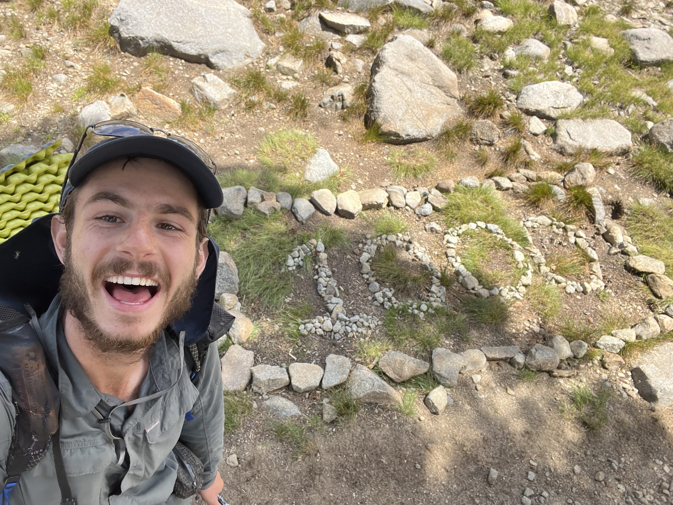
In the early afternoon, Yosemite National Park yielded to the Hoover Wilderness. I celebrated / mourned the end of the High Sierra with a dip in the cool slate grey water of Harriet Lake and a morsel of food. Soon after, I came upon some stones arranged on the side of the trail. 1000 miles, they said. A flush of pride, and a pang. I wished Flies and I could be here together. But it would be nice for her to take this win on her own, too. She’d been full of doubts before we began this journey—and during. This achievement was hers as much as it was ours, and standing here with this stony acknowledgement would impress her with her own independence and capacity. As I approached the climb to the long, exposed ridge that would deposit me there, the wind rose and dense, dark cumuli massed above once again. I pulled up in a stand of wind-thrashed white-bark pines with several other hikers and huddled there through the night as the wind tore through the trees.
4/7 — Day 64 — 11mi / 17km
Hot Hands: Dawn rose in a golden tide and flooded the Sierra. I climbed up to the ridge that led to the Sonora Pass, battling the wind that whistled through the teeth of the mountains all morning. In places where the rock funnelled the wind, it was almost strong enough to lean on. The few tents I passed whipsnapped in the gusts. The rock was so different from anything we’d seen, a kind of primordial ochre that fell away in clean lines into lake bejeweled valleys. I farewelled the white-grey sweep of Sierra granite whenever I thought I was going to dip below the horizon for the last time, but the trail kept returning the beloved range to sight. It was like saying goodbye to someone at the supermarket and seeing them in every aisle thereafter. Then the trail dropped to the road and the Range of Light blinked into memory.
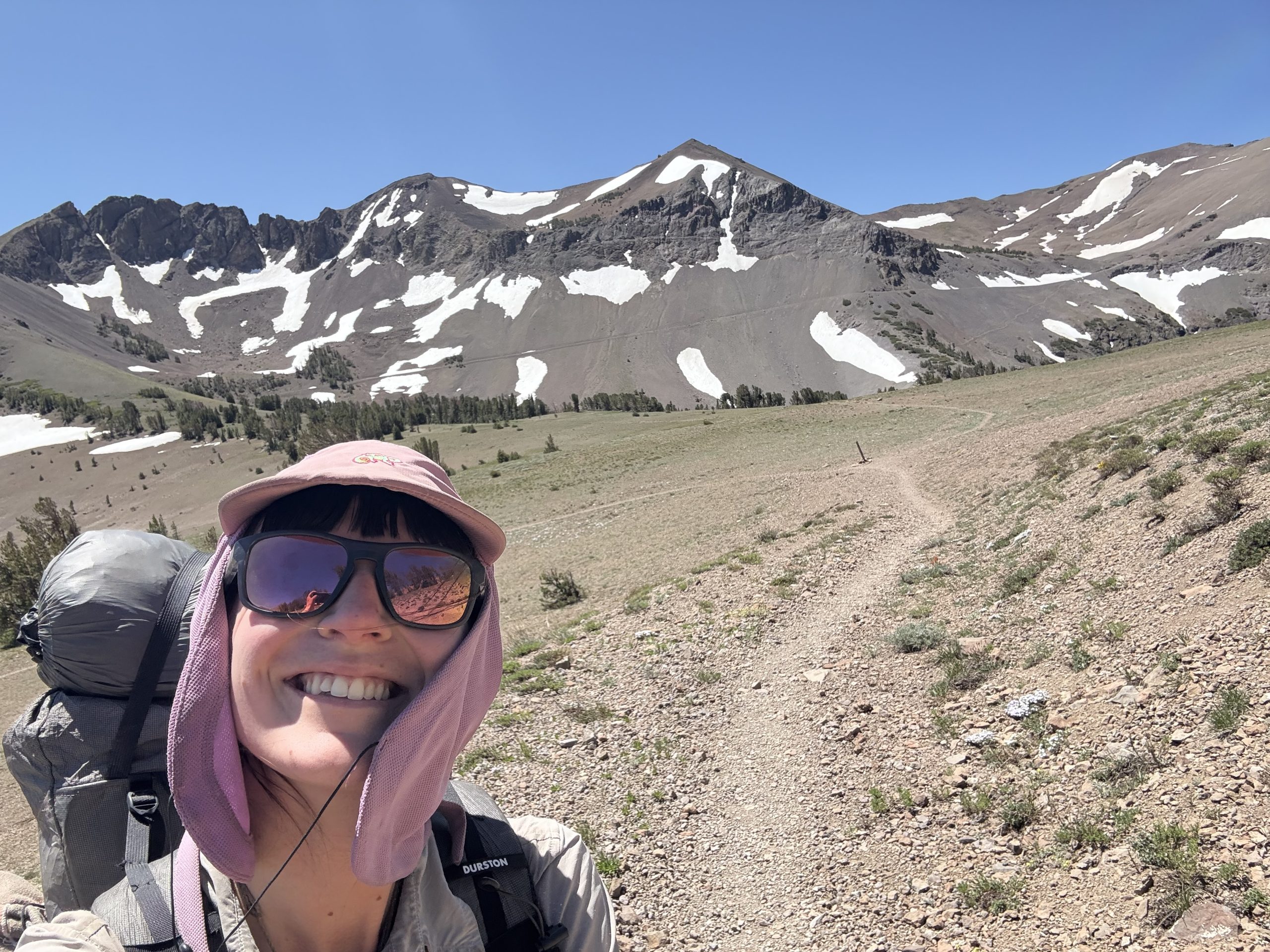
Flies: As soon as I crossed Dorothy Pass in the morning and left behind Yosemite National Park, the mountains changed. Our beloved granite ceded to orange ochre mud spires—still palatial, but such palaces as would be inhabited by squat and knobbly beings like gnomes or goblins. I made it to 1000 miles and took an ecstatic selfie. Later that morning, I climbed up to and strode along the ridge line, unbothered by the unexpected snow traverses, and the endless switchbacks down to Sonora Pass. 1000 miles! I’d made it through the hardest section of the trail. I’d see Hothands soon, provided he was still among the living. He’d left no sign on the trail and I had a feeling I was ahead. I imagined lounging about at the campground and rising to graciously greet him when he finally staggered in. I was not often the one with the luxury of waiting around.
I practically pranced across the highway to the trail register. Victory, I had a feeling, was mine! July 4th. I ran my gaze through the names: Viewpoint, Armstrong, Oreo, Kitchensink and… Hot Hands. I cursed the fleet-footed bastard and hopped on the shuttle to Kennedy Meadows North.
For hundreds of miles behind us, rocks preached mute gospel. The High Sierra. I hope we can return someday, who knows. Up on Matterhorn Peak, in the summit register there, is a short poem Gary Snyder wrote, several decades after that jaunt with Kerouac, called ‘On Climbing the Sierra Mountains Again.’ It reads: Range after range of mountains. / Year after year after year. / I am still in love.
I woke up a bit grumpy. Not necessarily because it was that bad a night of sleep, though it wasn’t great. No, it’s because I keep rolling the marbles in my head on how to approach the beginning of the Whites. Ya see, my plan was to saunter up to Hikers Welcome with a short day, cruise over Moosilauke on a short day, and take a nice rest in North Woodstock/Lincoln, some of my favourite towns. …
The post Who Has Lost All Powers… appeared first on The Trek.
Day 33
Start: Paradise Park Loop Alternate, mile ~550
End: Timothy Lake, mile 575.2
Miles hiked: ~25.2 miles
Last night was a little windy, which kept me from slipping into a deep sleep for a while. So, this morning, I slept in a bit later than usual, but eventually packed up and left my nearly perfect campsite.
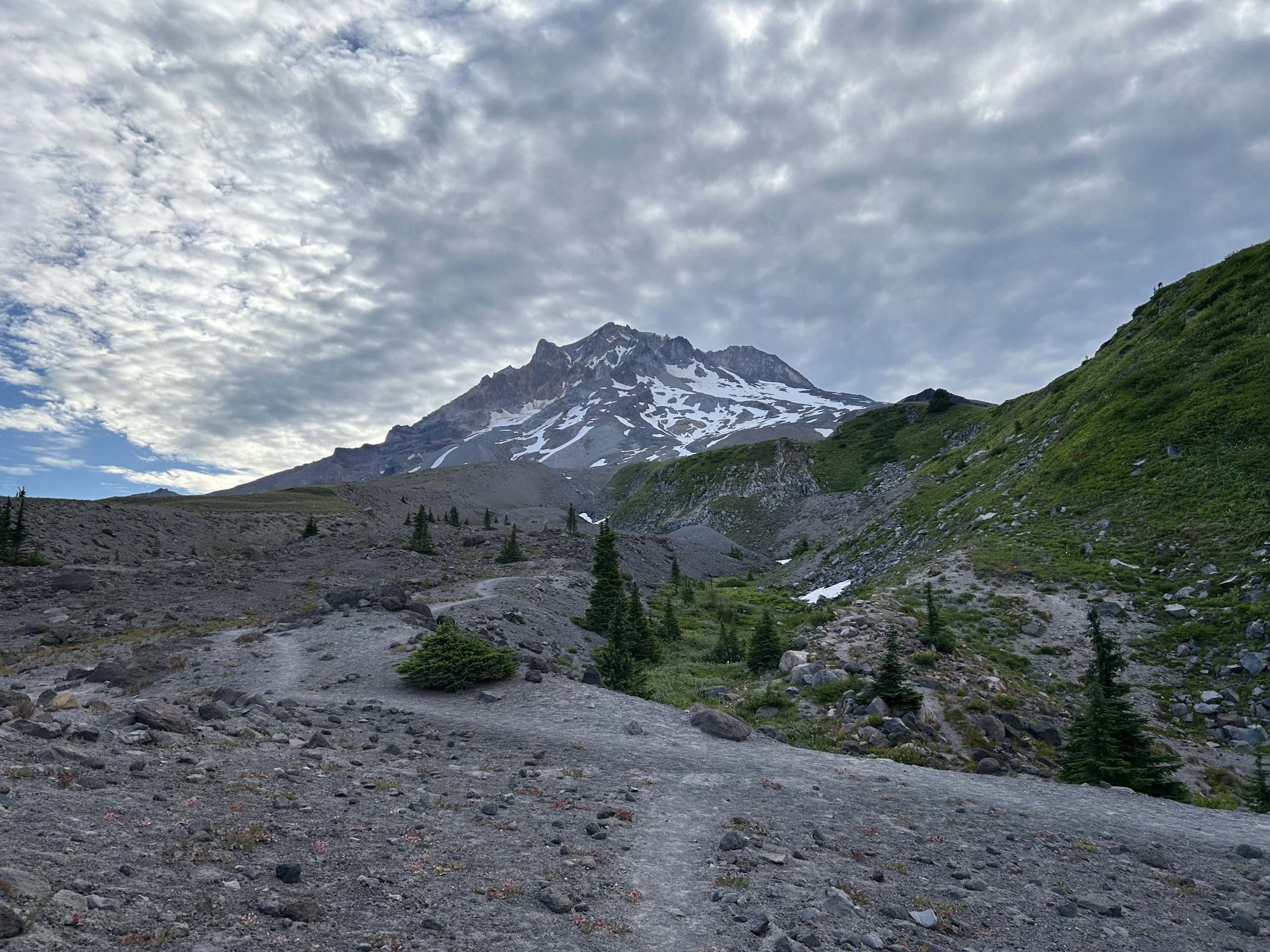
The goal for this morning was to reach Timberline Lodge to check it out. I didn’t have a box there nor did I plan on eating the breakfast buffet, but it still seemed like a cool stop. I had about 5 miles to hike to get there, but as I hiked, my legs felt heavy and sluggish.
A light layer of clouds covered part of the sky. As the morning wore on, the clouds expanded and got darker. It looked like rain was in the forecast for today! That didn’t stop the stream of day hikers that came from the direction of the Timberline Lodge. They were everywhere! I could tell I was getting close to the lodge when the day hikers were energetic and excited about their hike.
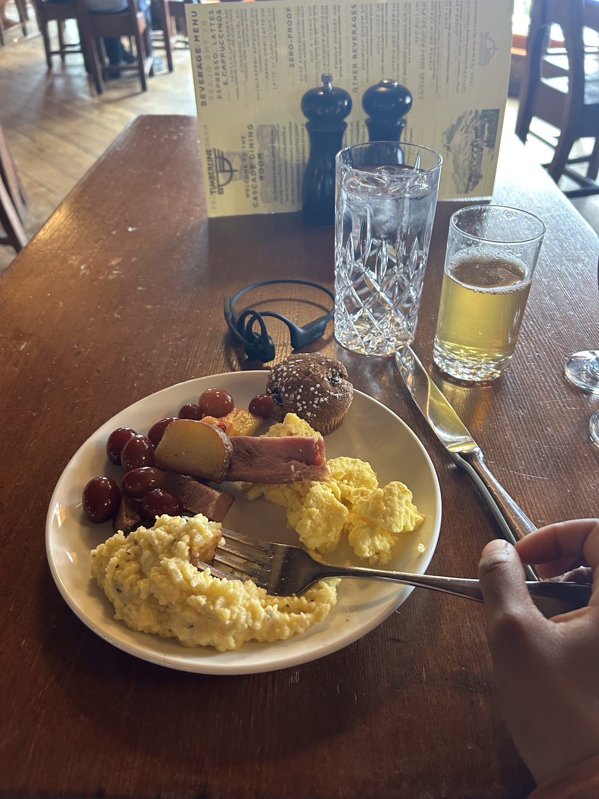
Soon, I passed a set of ski lifts and then I saw the famous grey building. I made it! And despite not planning on eating the breakfast buffet, my grumbling stomach steered me straight to the dining room. I saw a few other SOBO hikers in the small, dark room and said my greetings. To my surprise, I demolished two plates of food and felt like I could’ve stuffed another one down. I still think the buffet was overpriced, but it was worth it for the novelty of an on-trail buffet.
While having breakfast, I spotted a gentleman with a PCT shirt on and asked if he was a hiker. Turns out it was Papa Joe from Casa de Luna! If you don’t know, he and his wife were Trail Angels for 20 years, hosting hikers in Southern California before closing their doors a few years ago. Throughout my PCT research, Casa de Luna always showed up as a must-stop. To meet such a legend on trail really made my day!
After saying goodbye and paying my bill, I took a few minutes to explore the lodge. There was so much history contained here! From the little museum on the ground floor to the intricate carvings and symbols on the woodwork, there was a lot to see. I was surprised to find out that the lodge was constructed as part of FDR’s New Deal. I had no idea! I definitely want to come back and visit again.
Back on trail, it was time to descend. The trail was beach-like; fine rock pulverized into sand got into my shoes as I made my way down. Once I got to the forested area, I had to dump my shoes and watch the sand fly out.
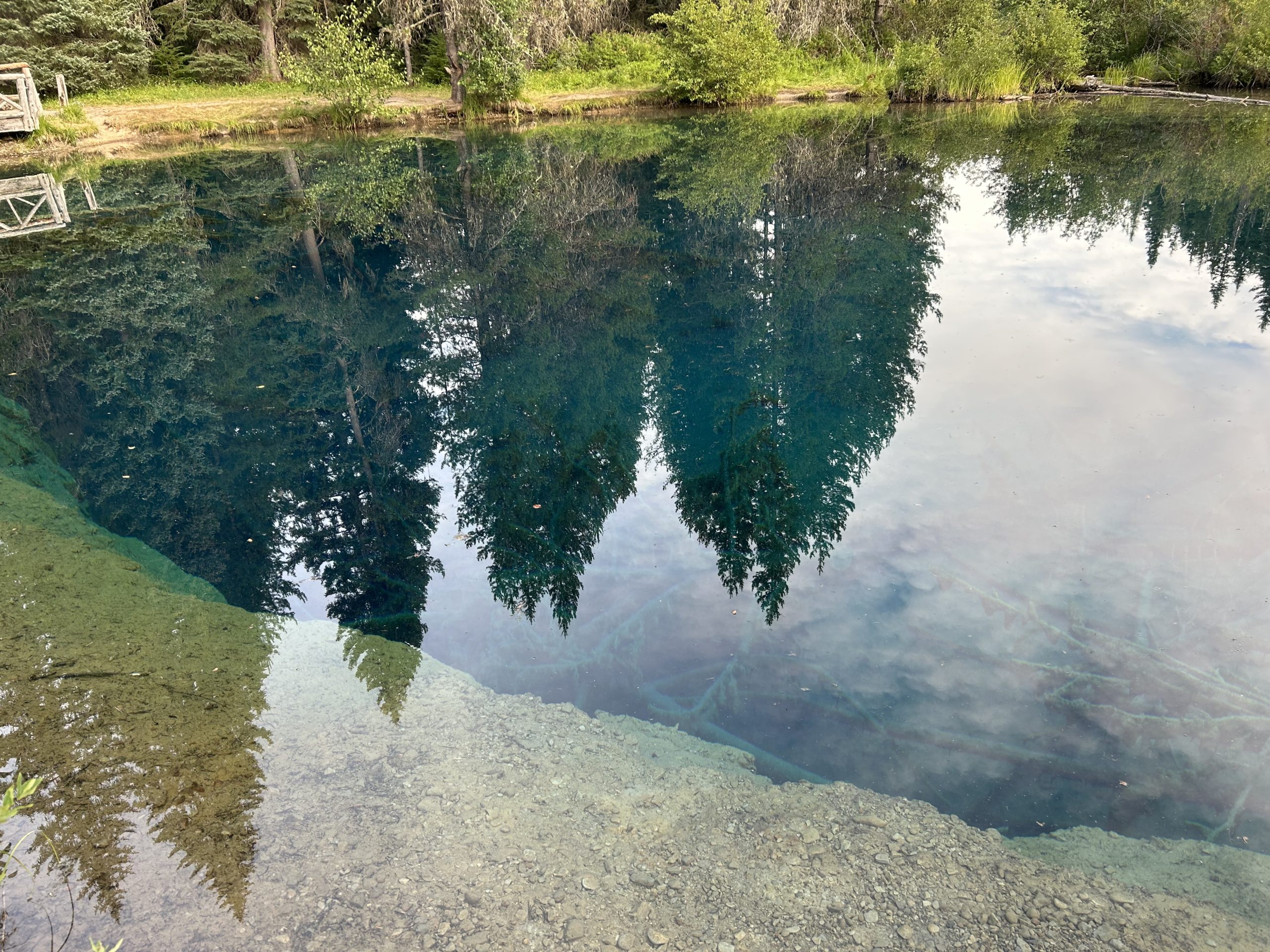
The rest of the day was easy walking through the forest along a relatively flat path. I ran into a couple of people who read my blogs (thanks for the support!) and took a short blue blaze to see Little Crater Lake, a magnificently blue pool of water.
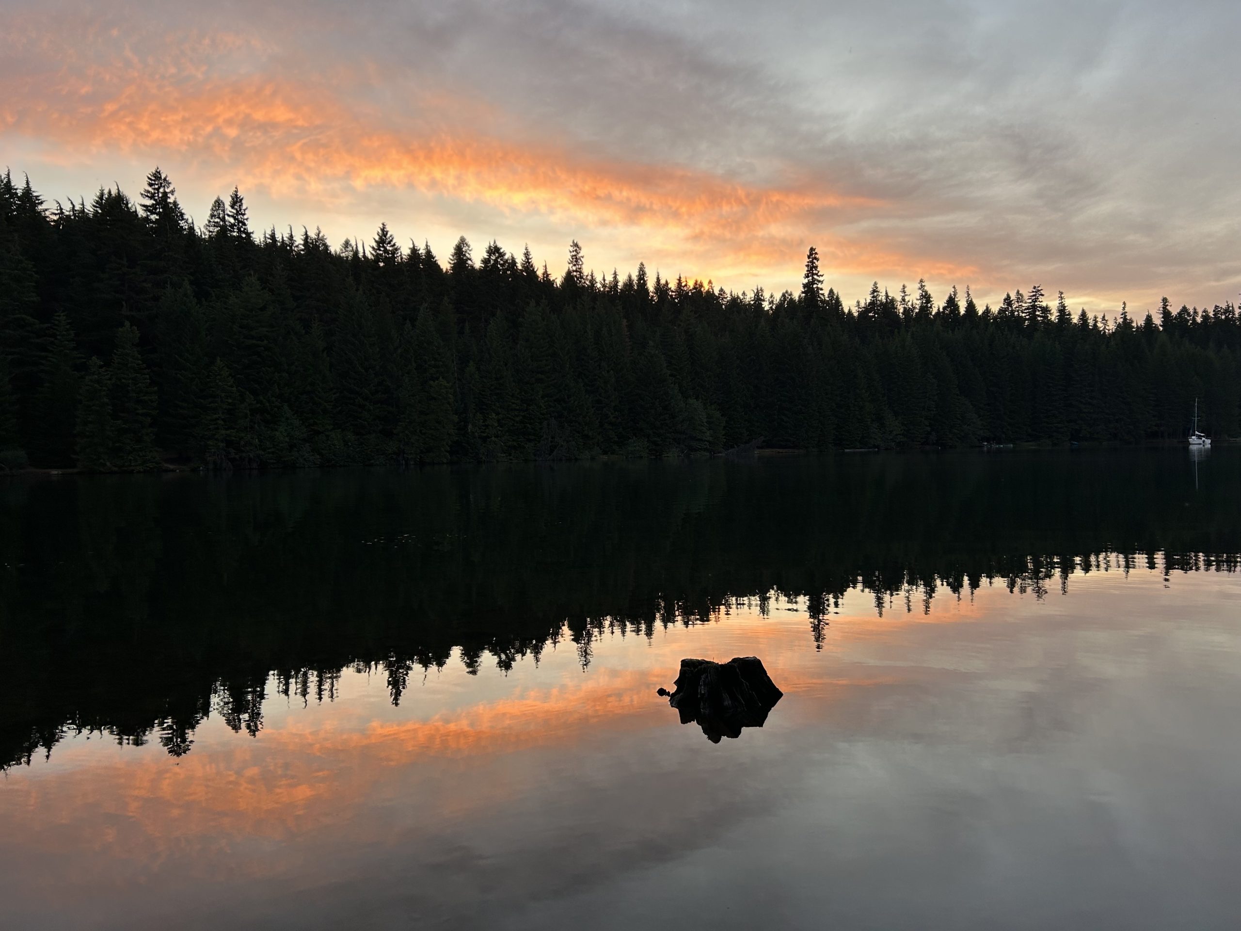
With sore feet and ready to be still for the evening, I walked the last 1.5 miles to my campsite on Timothy Lake. Another SOBO I had been leapfrogging was there as well as a section hiker. On the lake, baby ducks played and boaters floated on the water. I loved hearing the sounds of the family across the lake enjoying their summer outdoors. It was a peaceful evening.
And that’s a day in the life of a PCT SOBO hiker!
This website contains affiliate links, which means The Trek may receive a percentage of any product or service you purchase using the links in the articles or advertisements. The buyer pays the same price as they would otherwise, and your purchase helps to support The Trek’s ongoing goal to serve you quality backpacking advice and information. Thanks for your support!
To learn more, please visit the About This Site page.
Destinations & Things To Do
Muscat, Petra, Doha, Sharm El Sheikh, Riyadh, Byblos, and Wadi Rum: Here Are Seven Must-Visit Underrated Summer Travel Destinations in the Middle East
Published on
August 10, 2025 |
The Middle East is home to iconic cities and famous landmarks, but there are several underrated destinations that offer a unique and enriching experience for travelers this summer. From the stunning beaches and cultural heritage of Muscat in Oman to the ancient historical wonders of Petra in Jordan, the region is full of hidden gems waiting to be explored. Doha, the modern capital of Qatar, offers a blend of cutting-edge architecture and cultural experiences, while Sharm El Sheikh in Egypt promises beautiful beaches and thrilling underwater adventures. Riyadh, Saudi Arabia’s vibrant capital, showcases a fascinating mix of tradition and modernity, while Byblos in Lebanon offers a blend of ancient ruins and Mediterranean charm. Finally, Wadi Rum in Jordan, with its vast desert landscapes and adventure-filled activities, completes the list of must-visit Middle Eastern destinations. These 7 must-visit underrated summer travel destinations in the Middle East provide the perfect combination of culture, history, nature, and adventure, making them ideal spots for a memorable summer getaway.
Muscat, Oman
Muscat, the capital city of Oman, is a hidden gem that blends modernity with traditional Arabian culture. Located about 30 minutes from Muscat International Airport, it attracts around 2 million visitors annually, making it a great alternative to more crowded destinations in the Middle East. The city is known for its Sultan Qaboos Grand Mosque, one of the largest and most beautiful mosques in the region, showcasing stunning Islamic architecture. Mutrah Souq, a traditional market, offers a delightful mix of spices, textiles, and handicrafts, allowing visitors to experience the local culture. For adventure lovers, Muscat offers dune bashing in the surrounding desert and incredible snorkeling and diving opportunities in the crystal-clear waters of the Arabian Sea. During the summer, the city hosts the Muscat Festival, a cultural event that celebrates Omani heritage with music, dance, and food, providing a fantastic experience for visitors.
Petra, Jordan
Petra, one of the world’s most famous archaeological sites, is a must-visit destination for anyone interested in ancient history and breathtaking landscapes. Located in southern Jordan, Petra is easily accessible via a 2.5-hour drive from Queen Alia International Airport. Around 1 million people visit Petra annually, drawn by its iconic The Treasury (Al-Khazneh), a stunning rock-cut facade that remains one of the most recognizable landmarks in the world. The Siq, a narrow canyon that leads into Petra, offers a dramatic entrance to this ancient city, making it a favorite for photographers. Adventure enthusiasts can enjoy hiking through the vast site, which includes climbing to higher points for panoramic views of the desert and ruins. Visitors can also experience a traditional camel ride through the site’s surroundings, making the experience even more immersive. Don’t miss Petra Night, held each evening, when the site is illuminated by thousands of candles, creating a magical atmosphere that showcases the beauty of the ancient city in a new light.
Doha, Qatar
Doha, the capital of Qatar, is a bustling city known for its modern architecture, cultural landmarks, and thriving arts scene. Just a 20-minute drive from Hamad International Airport, the city attracts around 2.5 million visitors each year. Doha’s main attractions include the Museum of Islamic Art, home to a vast collection of Islamic art and a stunning architectural design, and the Pearl-Qatar, a luxurious man-made island offering high-end shopping and dining. Adventure seekers can explore the desert landscape surrounding the city with exciting dune safari tours, or enjoy a dhow cruise on the Arabian Gulf, offering stunning views of the skyline. During the summer, Doha hosts the Qatar International Food Festival, bringing together global chefs and food lovers to explore diverse cuisines and enjoy the city’s vibrant culinary scene.
Sharm El Sheikh, Egypt
Sharm El Sheikh, located on the Red Sea in Egypt, is a popular but often underrated summer destination that offers a mix of relaxation, adventure, and history. The city is easily accessible via Sharm El Sheikh International Airport, just 10 minutes away from the city center, and attracts around 5 million visitors annually, with most coming for its beaches and world-class diving spots. One of Sharm El Sheikh’s main attractions is Ras Mohammed National Park, a protected marine park known for its colorful coral reefs and diverse marine life. Naama Bay is a bustling area filled with restaurants, shops, and nightlife, while the surrounding desert offers opportunities for camel rides and off-road excursions. For those who enjoy diving or snorkeling, the waters of the Red Sea are among the best in the world, offering clear visibility and vibrant underwater ecosystems. If you’re visiting in the summer, the Sharm El Sheikh International Jazz Festival in August is an excellent opportunity to enjoy live music in a stunning coastal setting.
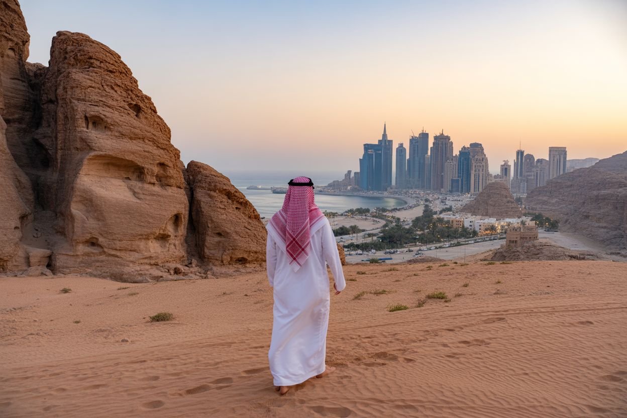
Riyadh, Saudi Arabia
Riyadh, the capital of Saudi Arabia, is a city that blends modernity with deep cultural heritage, offering travelers a unique look at the country’s rich history and development. Located 45 minutes from King Khalid International Airport, Riyadh attracts around 1 million visitors annually. Key attractions include the Al Masmak Fortress, a historic site that provides insight into Saudi Arabia’s past, and the National Museum of Saudi Arabia, where visitors can learn about the country’s cultural and historical evolution. For adventure enthusiasts, Riyadh offers camel rides through the desert, and skydiving over the vast landscape for those seeking a thrill. The city also boasts numerous high-end shopping malls, modern skyscrapers, and traditional souks. The Saudi National Day Celebrations, held annually in September, feature fireworks, parades, and a variety of cultural performances across Riyadh, providing an exciting and festive atmosphere.
Byblos, Lebanon
Byblos, located on the Mediterranean coast of Lebanon, is one of the oldest cities in the world and offers a blend of ancient history, stunning scenery, and cultural charm. Easily accessible via Beirut Rafic Hariri International Airport, about an hour’s drive from Byblos, the city attracts around 250,000-300,000 visitors each year. Key attractions in Byblos include the Byblos Castle, a Crusader fort that overlooks the Mediterranean Sea, and the Byblos Old Souk, a lively market that offers local handicrafts, textiles, and delicious food. For adventure lovers, diving along Lebanon’s coastline is a must-do, with the waters home to abundant marine life. Visitors can also enjoy hiking through Lebanon’s mountains and exploring the ancient ruins scattered throughout the region. The Byblos International Festival, held every summer, brings together musicians, artists, and performers for a vibrant celebration of music, theater, and culture, making it the perfect time to experience the city’s magic.
Wadi Rum, Jordan
Wadi Rum, also known as the “Valley of the Moon,” is a stunning desert landscape in southern Jordan, offering visitors an opportunity to experience the vast beauty of the desert in a peaceful and tranquil setting. King Hussein International Airport is just an hour’s drive from the desert, and the area attracts around 100,000-150,000 visitors annually. The desert’s main attraction is its dramatic rock formations, vast sand dunes, and ancient petroglyphs, which make for a surreal and unforgettable experience. Jeep tours are popular here, as they allow visitors to explore the desert and experience its beauty up close. Rock climbing enthusiasts can also tackle the towering cliffs that rise dramatically from the desert floor. During the summer months, the Wadi Rum Cultural Festival celebrates Bedouin culture with traditional music, dance, and food, giving visitors a deeper understanding of the local heritage.
Why These Destinations Are Perfect for Your Summer Getaway
These seven underrated Middle Eastern destinations offer a perfect mix of adventure, culture, and natural beauty. Whether you’re exploring the ancient ruins of Petra, relaxing on the beaches of Muscat, or experiencing the vast deserts of Wadi Rum, each destination provides a unique and unforgettable experience. With exciting cultural events and festivals to look forward to, now is the ideal time to visit these hidden gems in the Middle East.
-

 Brand Stories3 weeks ago
Bloom Hotels: A Modern Vision of Hospitality Redefining Travel
-

 Brand Stories2 weeks ago
CheQin.ai sets a new standard for hotel booking with its AI capabilities: empowering travellers to bargain, choose the best, and book with clarity.
-

 Destinations & Things To Do3 weeks ago
Untouched Destinations: Stunning Hidden Gems You Must Visit
-

 Destinations & Things To Do2 weeks ago
This Hidden Beach in India Glows at Night-But Only in One Secret Season
-

 AI in Travel3 weeks ago
AI Travel Revolution: Must-Have Guide to the Best Experience
-

 Brand Stories1 month ago
Voice AI Startup ElevenLabs Plans to Add Hubs Around the World
-

 Brand Stories1 month ago
How Elon Musk’s rogue Grok chatbot became a cautionary AI tale
-

 Brand Stories3 weeks ago
Contactless Hospitality: Why Remote Management Technology Is Key to Seamless Guest Experiences
-

 Asia Travel Pulse1 month ago
Looking For Adventure In Asia? Here Are 7 Epic Destinations You Need To Experience At Least Once – Zee News
-

 AI in Travel1 month ago
‘Will AI take my job?’ A trip to a Beijing fortune-telling bar to see what lies ahead | China
You must be logged in to post a comment Login