
Destinations & Things To Do
No Time for Trail Magic on the CYTC

This morning I was up nice and early. My plan is to go as far as I can today, making tomorrow a nice short day into South lake Tahoe. The average for the last few days will work out to be the same. So I figure I might as well get into Tahoe as early as possible so I can really enjoy myself and take advantage of town.
I got moving right around 5:30 AM and spent the morning walking past a good number of tents. I put my audiobook on right away because it was just so dang good. I wound up listening to it over the course of the whole morning until eventually finishing it. The story was really interesting and I think Bikepacking has a lot of parallels with thru hiking. One of the more interesting components of the story is the fact that the author Jedidiah had actually absolutely no experience bike packing or outdoors really. He just heard someone else’s story about their adventure and thought it would be really cool.
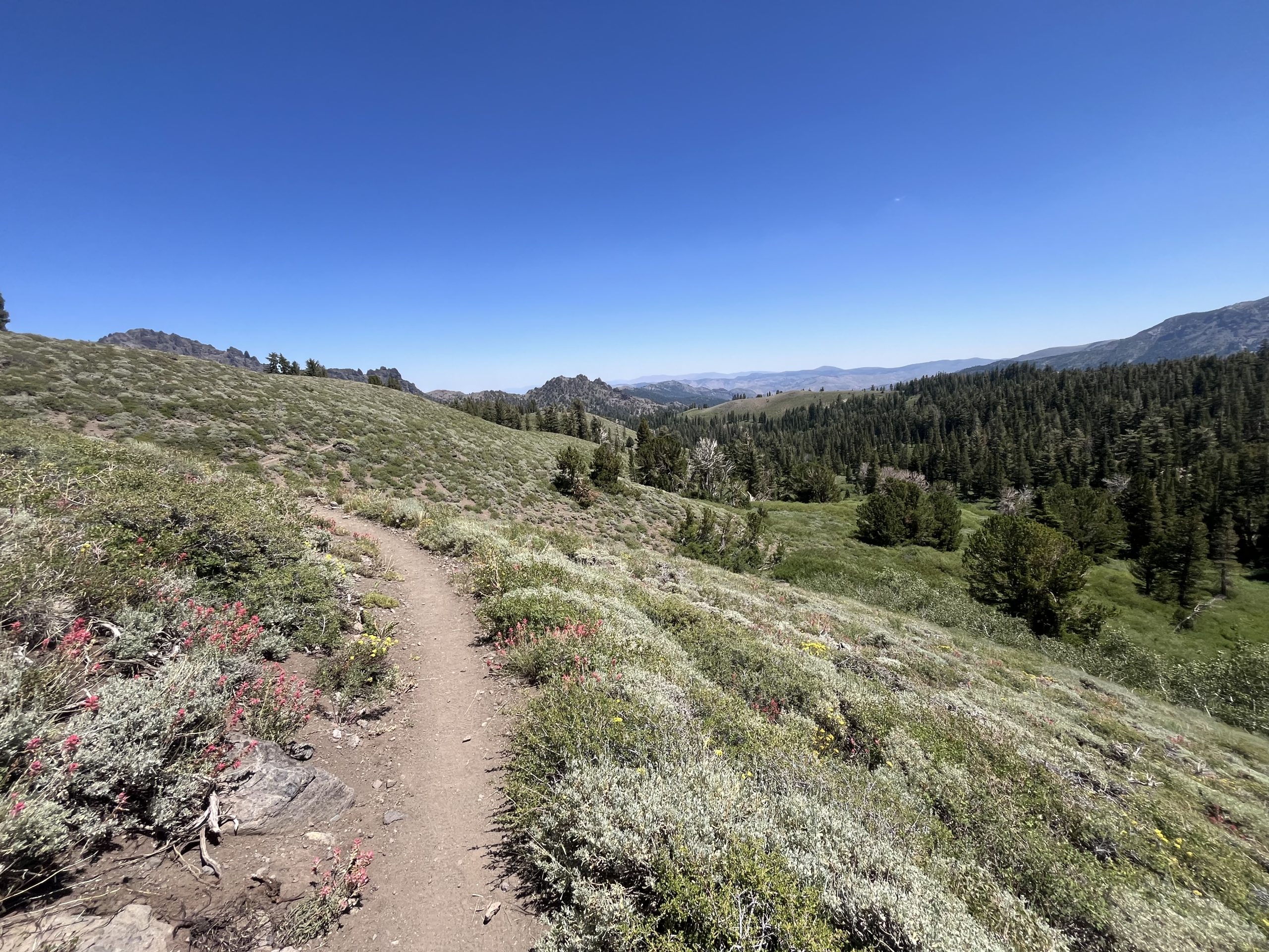
The trail this morning was nice and easy with only some shorter climbs to do. Within the first few hours of the day I ran into a hiker who I had met back in the desert section. He recognized me right away and was sitting down for a break. But he popped up pretty quick so that he could walk with me and talk with me for a while. We wound up making our way up the entire next climb together. Which was maybe 1000 feet or so. But it felt like it went by ridiculously fast.
Then when we got up top and he got some service. And shockingly I did not. I have a carrier which utilizes T-Mobile, which apparently is the least effective cell service plan in the sierra. So I just continued along and put my audiobook back on. And for a while after that, the trail just curved down and around switchback and was nice and easy.
Within the next hour or so I heard a loud noise off in the woods. And turned my head just in time to see a huge bear running off into the forest. Clearly it saw me well before I saw it. This is a perfect example as to why I’m not scared of bears in the wilderness. They are much more scared of you than you are of them. The rare exceptions to this rule typically revolves around getting too close to their cubs.
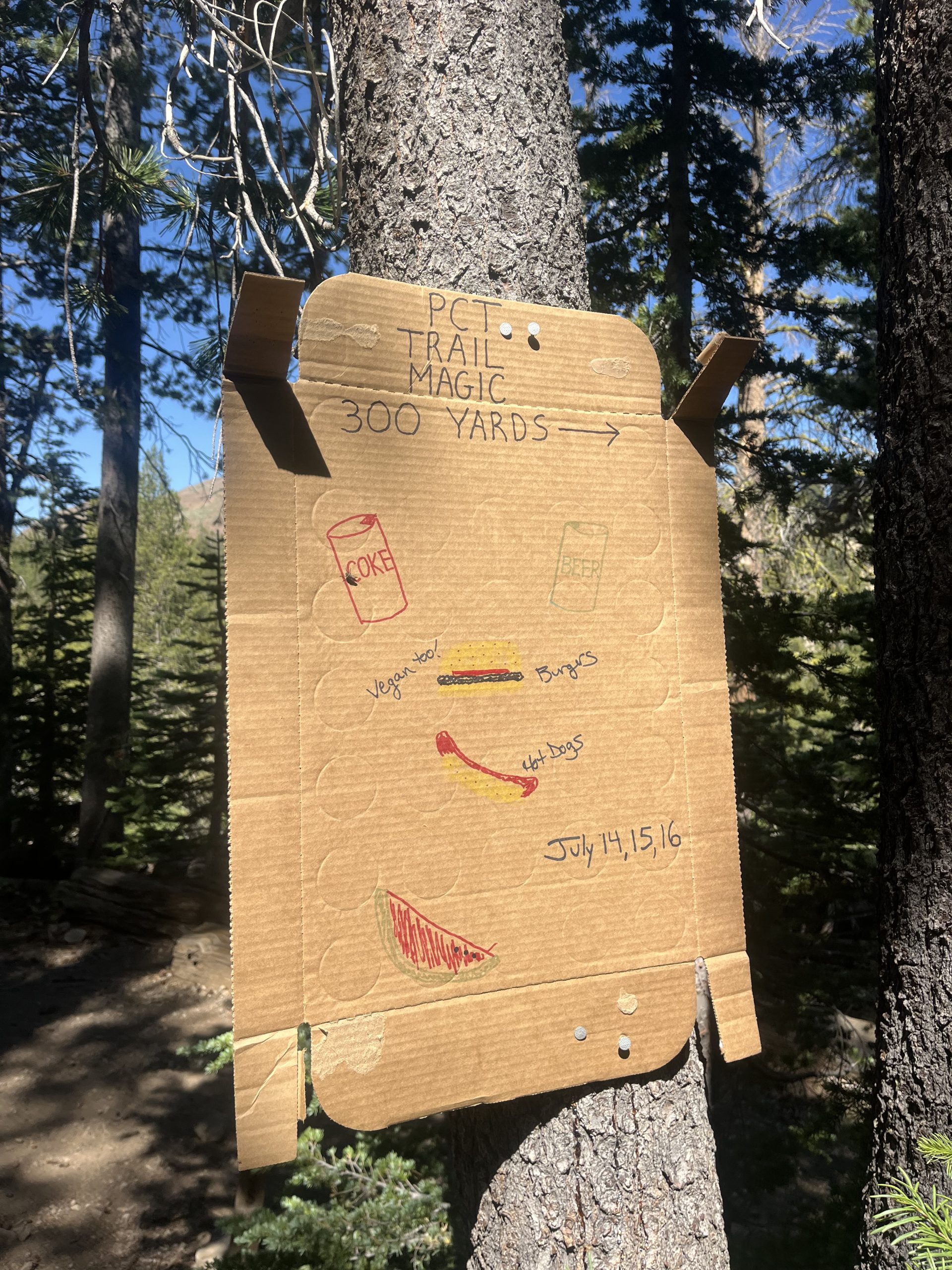
Around 11 AM I went past a trail junction right before a road. I noticed a sign hung up on a tree indicating there was a big trail magic set up about a quarter mile off the trail. At first I started walking down the side trail. There must’ve not been a big parking lot up at the road so the people had to set up down a spur trail. But as I started walking down the trail, it just kept going down and down. After a very short distance, I turned around and went back to the PCT. I just knew this was going to eat into the day and I really couldn’t afford it.
Even though I had been fantasizing about trail magic and the idea was everything I wanted and more, I had to keep my priorities straight. It would add a half mile at least just to go there and back to the trail. And I knew I would probably wind up sitting there for a while eating. And often times it can be a little hard to slip in and out of trail magic quickly. Just because there’s always so many nice people there and you wind up chatting with people. And in this moment, I truly felt the weight of the calendar year triple crown for the first time.
I don’t think there’s a more hardo move than turning down trail magic because it was going to take time away from your day. It’s certainly something I never would do on an ordinary thru hike. But today it felt like the responsible decision. I have so many more miles to go for the day. And I really want to get into South lake Tahoe as early as I can tomorrow. Those slightly shorter days are really one of the big things keeping me going. They help to keep me motivated to do big miles, and also provide me a little bit of mental rest and relaxation intermittently.
As I walked away from the trail magic, I was hoping that maybe they would be set up at the road up ahead. But of course they weren’t, as the sign had indicated. And over the next mile, I felt pretty dang sad. I had purposely turned my back to something that I wanted more than anything. And it almost felt like I had to do it because of my greater goal. Which is all very reasonable and in line with my mission. But it didn’t make it sting any less.
Not long after that, I did stop off briefly to pull some snacks out to satiate myself. And while I was stopped just off the trail a couple hikers walked by me and didn’t even see me. I thought that that was pretty funny. Then I wound up catching up to them soon after and passing by them. After going by those guys, I wound up catching up to a few other hikers as well. There’s a trend that’s been happening a lot recently when I start catching up to people. Which is only something I’ve noticed going through the bubble on the PCT. Sometimes another hiker will see or feel you approaching and will suddenly pick up their pace. I like to walk in about 3–3.5 mph and that’s the type of consistent pace that I could do nonstop all day long. Some days I quite literally will walk for 30 miles or more and I will never sit down once. I’ll only stop to pee or grab some water.
At times hikers will see me coming up behind them and they’ll speed their natural pace up so that I don’t pass them. They’ll wind up flying ahead going 4 miles an hour at a pace they can’t maintain. I always play a little game in my head wondering how long will it take for me to catch them? Sometimes it only takes 5 or 10 minutes. Other times it might take an hour or so, depending on their endurance. But today I ended up catching up to the people in front of me pretty quickly. And I never saw them again.
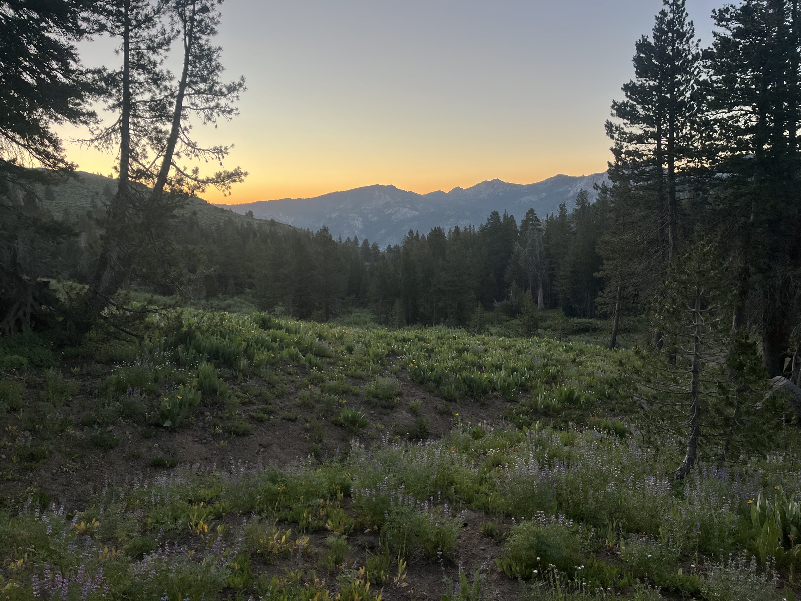
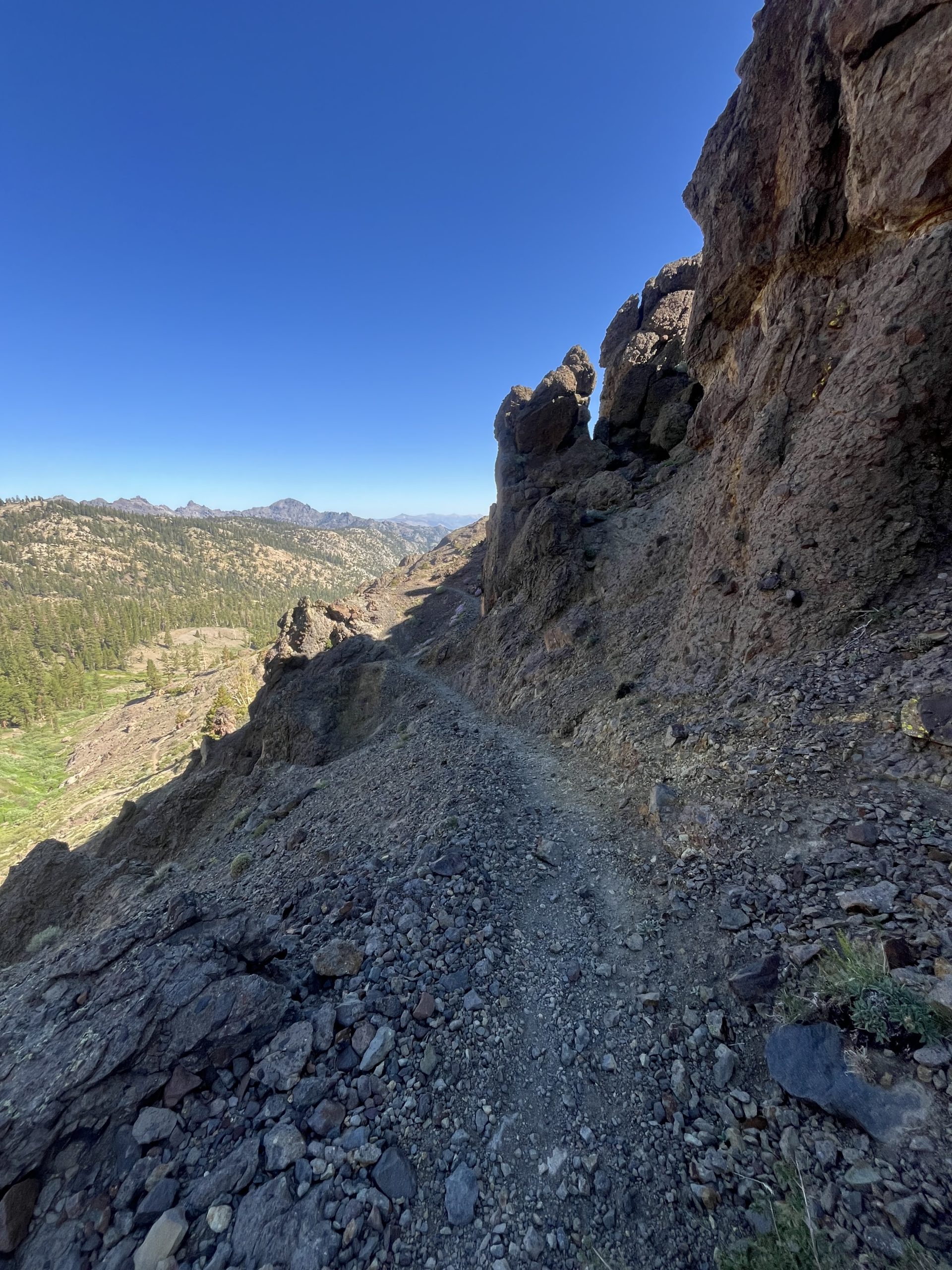
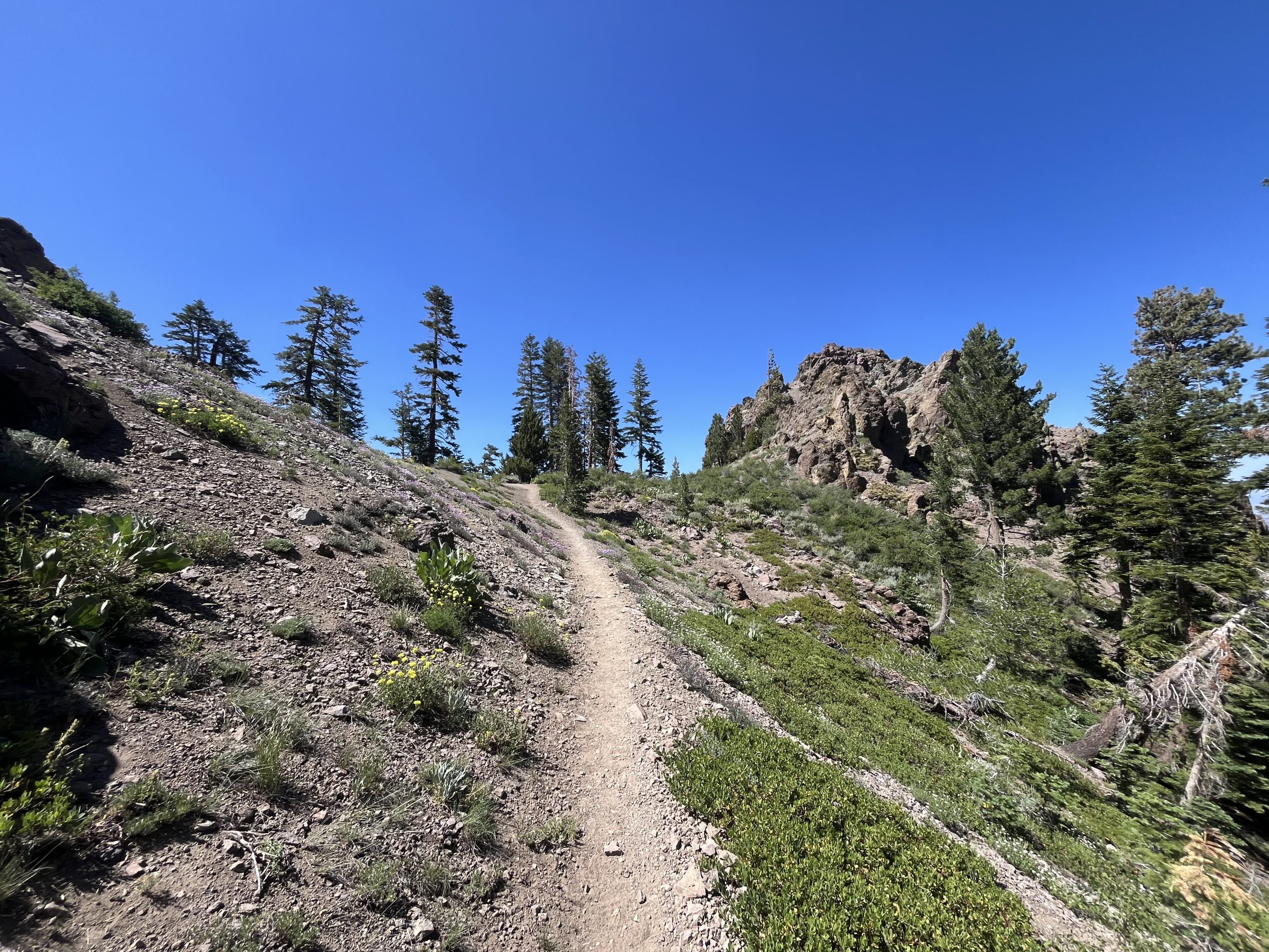
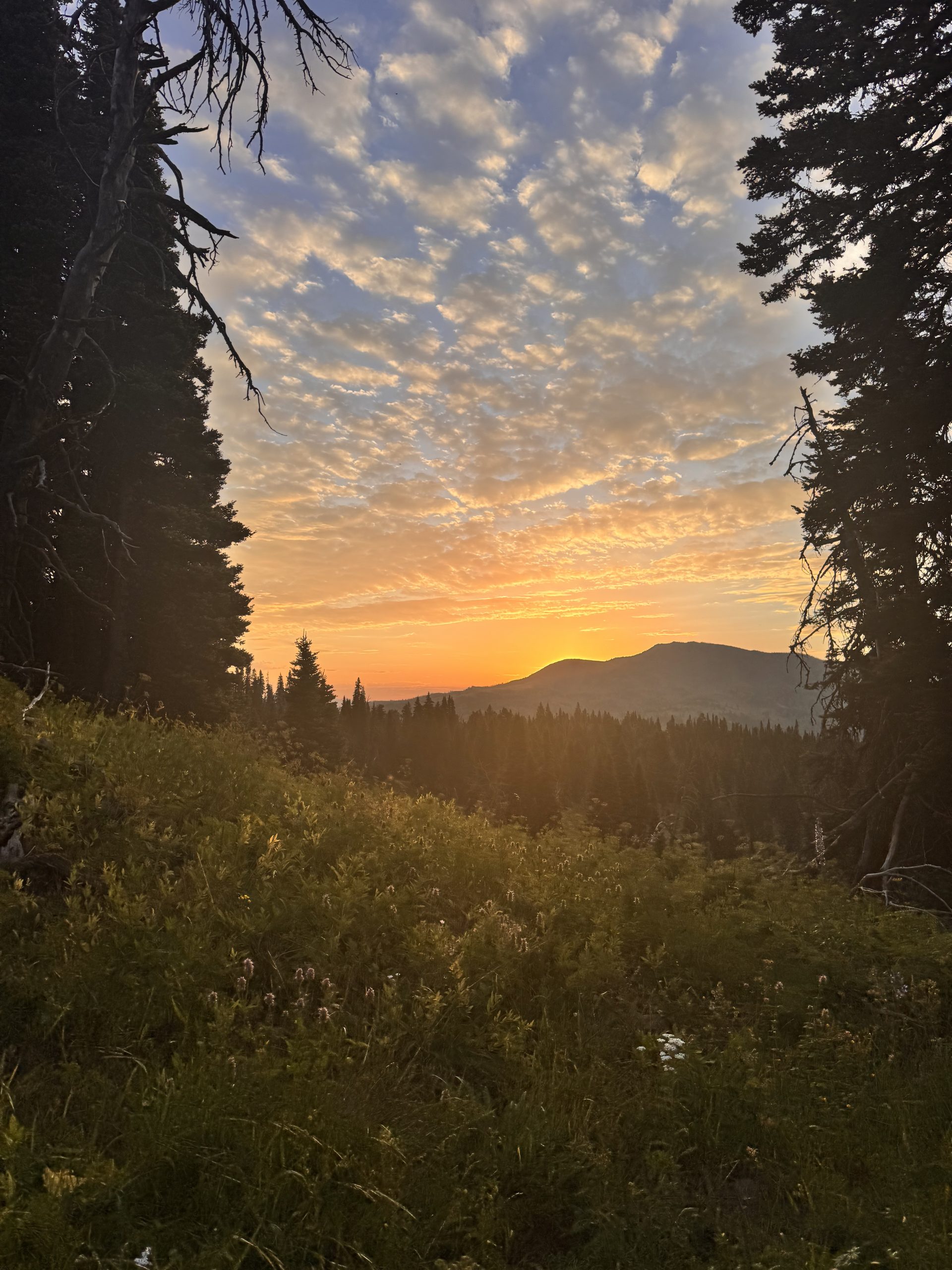
The day went by pretty fast and the views were beautiful. I had a couple rolling hills to go up and over. Up top the views were wide open and exposed. Then toward the end of the day, I had to go up one fairly long climb. I remembered this one from 2022 and knew it would be pretty rocky up toward the top.
Time had gone by so quickly that it was looking like I’d be able to go at least 36 miles for the day. And would probably be getting to my campsite actually quite early. That should be nice! Then I would get a great night sleep and be up bright and early tomorrow to make my way towards South Lake Tahoe.
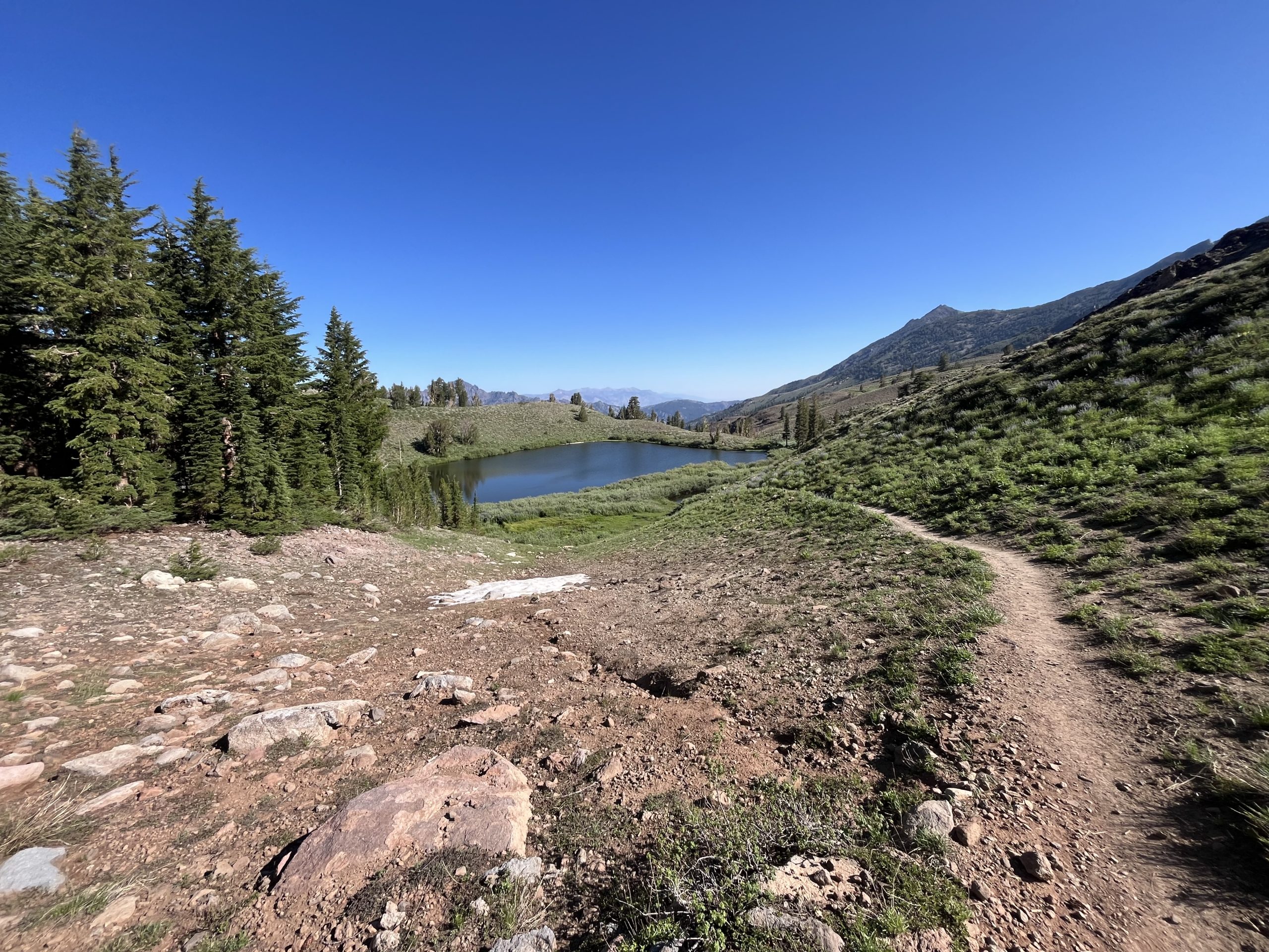
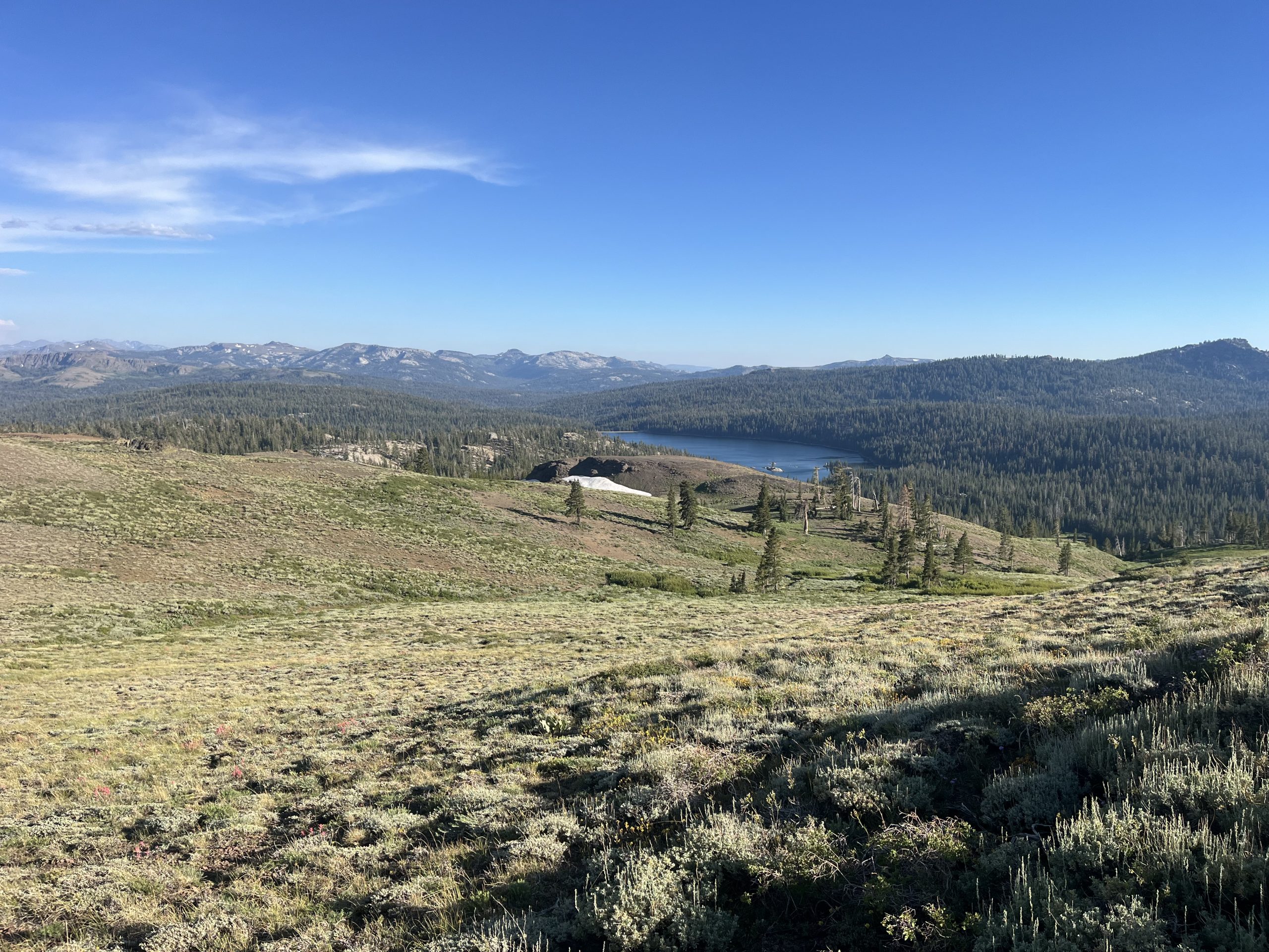
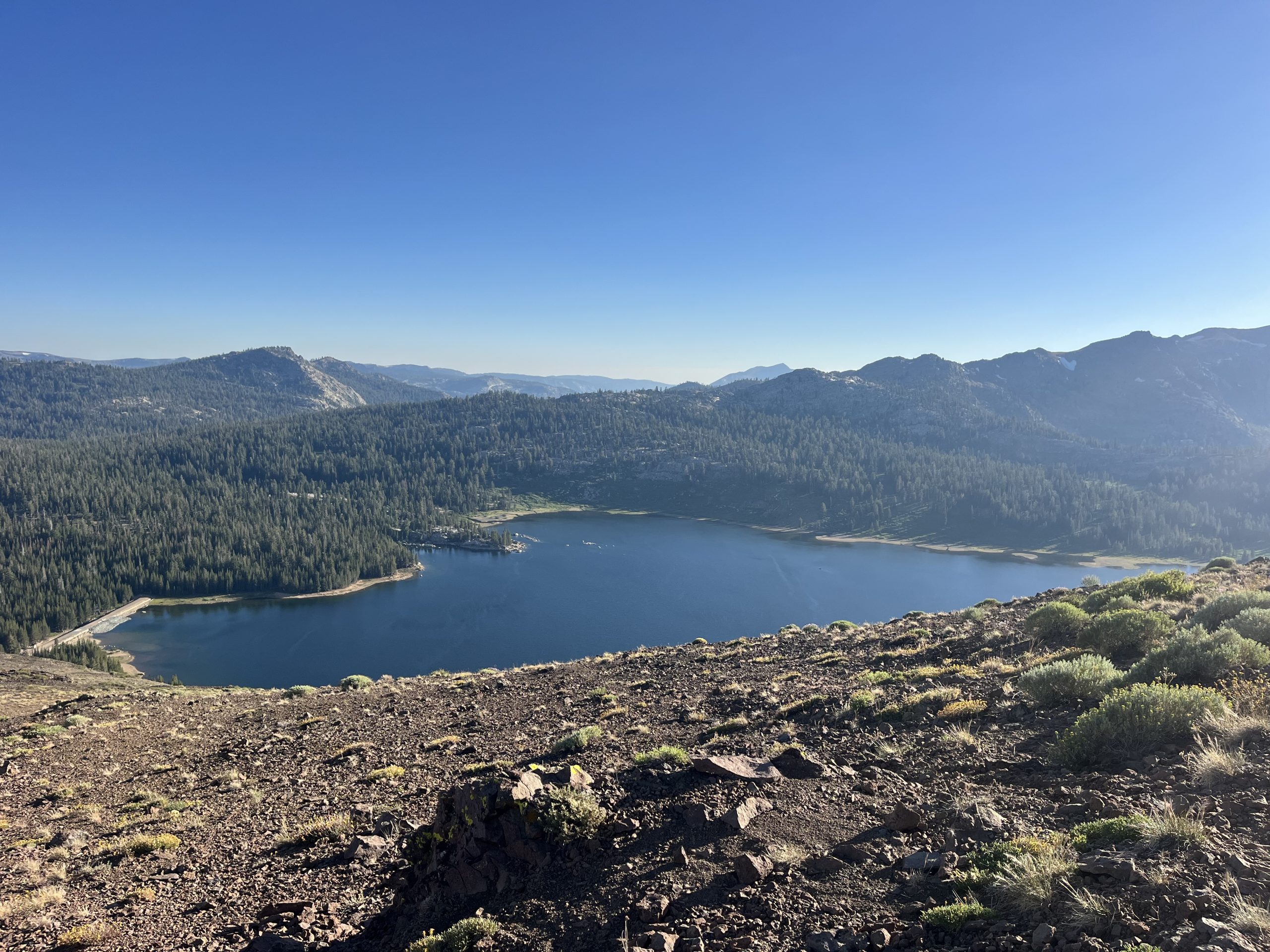
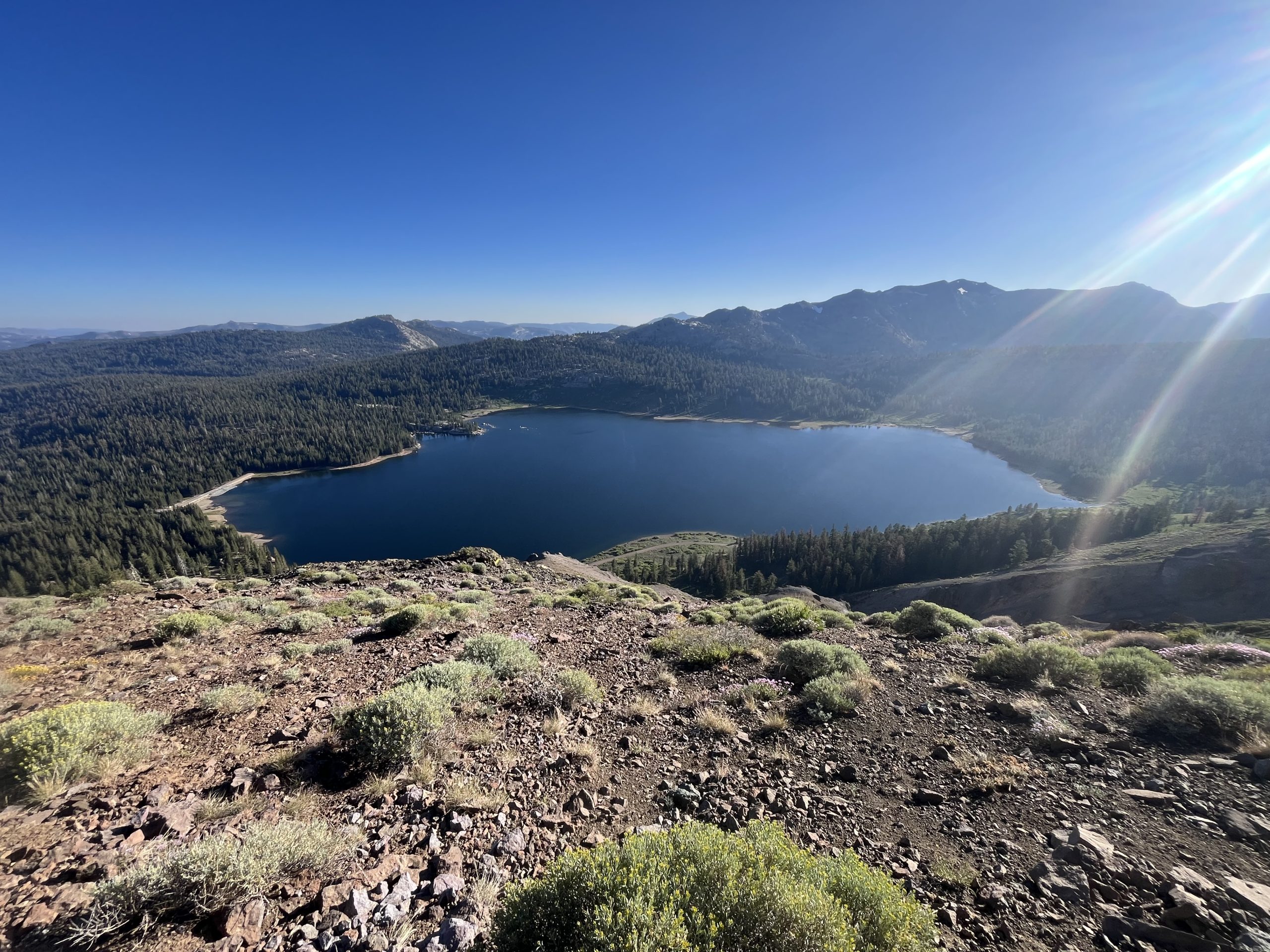
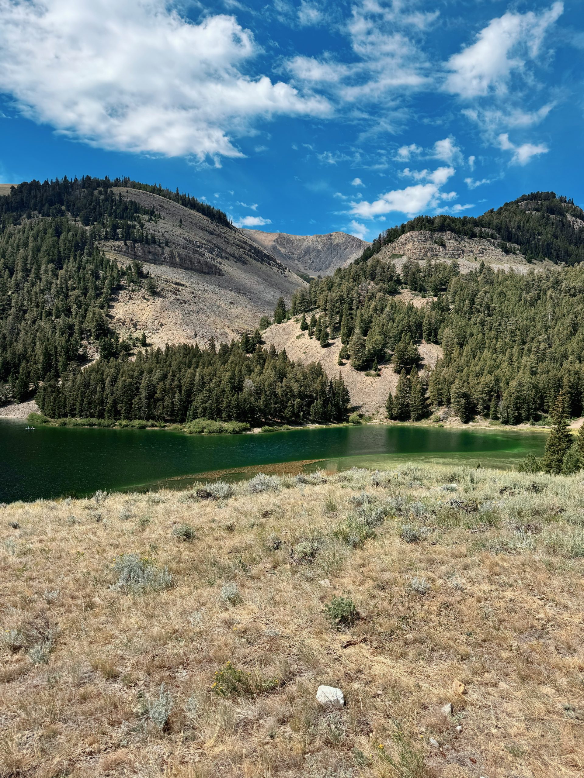
This last climb of the day was definitely a bit more tiring than I thought it was going to be. It just kept going and going well past what I had expected. But I got gorgeous views of a lake down in the distance. And I knew I would eventually be dropping down to that lake to set up camp for the night. The funny thing is, I actually camped at this exact same spot in 2022. Except I didn’t walk all the way down to the lake and instead just camped closer to the trail. This time around though I actually need water so I’ll be going down to the tent site by the lake.
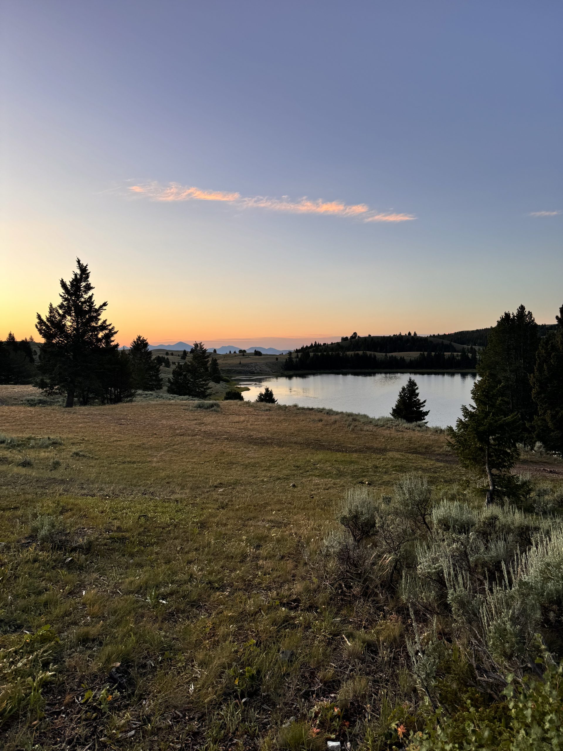
Eventually, I got up to the top of the climb and then it was only a half mile or so down toward the tenting area. There are some dirt roads at the trail intersection and a bit of a parking area. Though it doesn’t seem like the type of place that would get a ton of traffic. When I arrived at the camp spot, there were a few tents set up which put my mind at ease. I don’t love camping near roads by myself. Especially after my experience on the Appalachian Trail as I was making my way to the Canadian border. If you don’t recall, or didn’t read that story, I tented in a day used area just off the road. And in the middle of the night, a vehicle drove up and people approached my tent. They didn’t do anything though and I decided to stay quiet and just shine my light back at them. I didn’t want to give away the fact that I was a woman in the woods by myself.
But now I wouldn’t have to be alone at this parking lot for the night. I got my tent set up and got everything situated. Then grabbed some water from the beautiful lake and was able to rinse off my hands a bit. The other few hikers who I joined for the night were sitting off to the side by a campfire. There’s just something about that that always makes me a little envious. To think that they arrived a few hours earlier and had so much time in the day that they were able to make a fire, sit out, and eat dinner together. Whereas I arrived late, got straight into my tent, ate dinner, and went to bed.
Tomorrow morning I’ll have about 6 miles to get to Carson pass. Which actually has an information center that opens at 8 AM, right around the time I will arrive. And apparently the people who work at the information center do trail magic for hikers every single day. So I should be able to get a snack or a soda. Then past there I’ll have about 14 miles to get to the highway and hitch a ride into South lake Tahoe. So it should only be a 21 mile day and I will hopefully be in town ridiculously early. I’m excited for a nice little half-day and a bit of rest.
If you enjoyed this blog and would like to support my hike by buying me a soda or a snack along the way, there is a “Tip the Author” button below! It links directly to my Venmo. Any and all support is incredibly appreciated!
This website contains affiliate links, which means The Trek may receive a percentage of any product or service you purchase using the links in the articles or advertisements. The buyer pays the same price as they would otherwise, and your purchase helps to support The Trek’s ongoing goal to serve you quality backpacking advice and information. Thanks for your support!
To learn more, please visit the About This Site page.

Hi, Montanaho! Crossing into another state—or two—felt like a milestone worth celebrating. This stretch of trail straddles Idaho and Montana, following the jagged spine of the Continental Divide. Panoramic views stretched endlessly, accompanied by terrain that dished out both literal and emotional highs and lows. The past few days have tested me in new ways, leaving me to question what I’m doing out here. To adjust, we eased up our pace and hiked shorter miles, which made a noticeable difference.
Yellowstone Boundary to Lima
Day 82: 20 miles/ 400 ft gain
After a night of rain and thunder, we woke to a soaked tent and damp gear—bags, pads, and backpacks included. Warm morning air at 6:30am made fetching the bear bags slightly more tolerable. We skipped cooking breakfast since we didn’t have enough water to spare and instead hiked the 12 miles to the next source. By 7:00am, we were cruising.
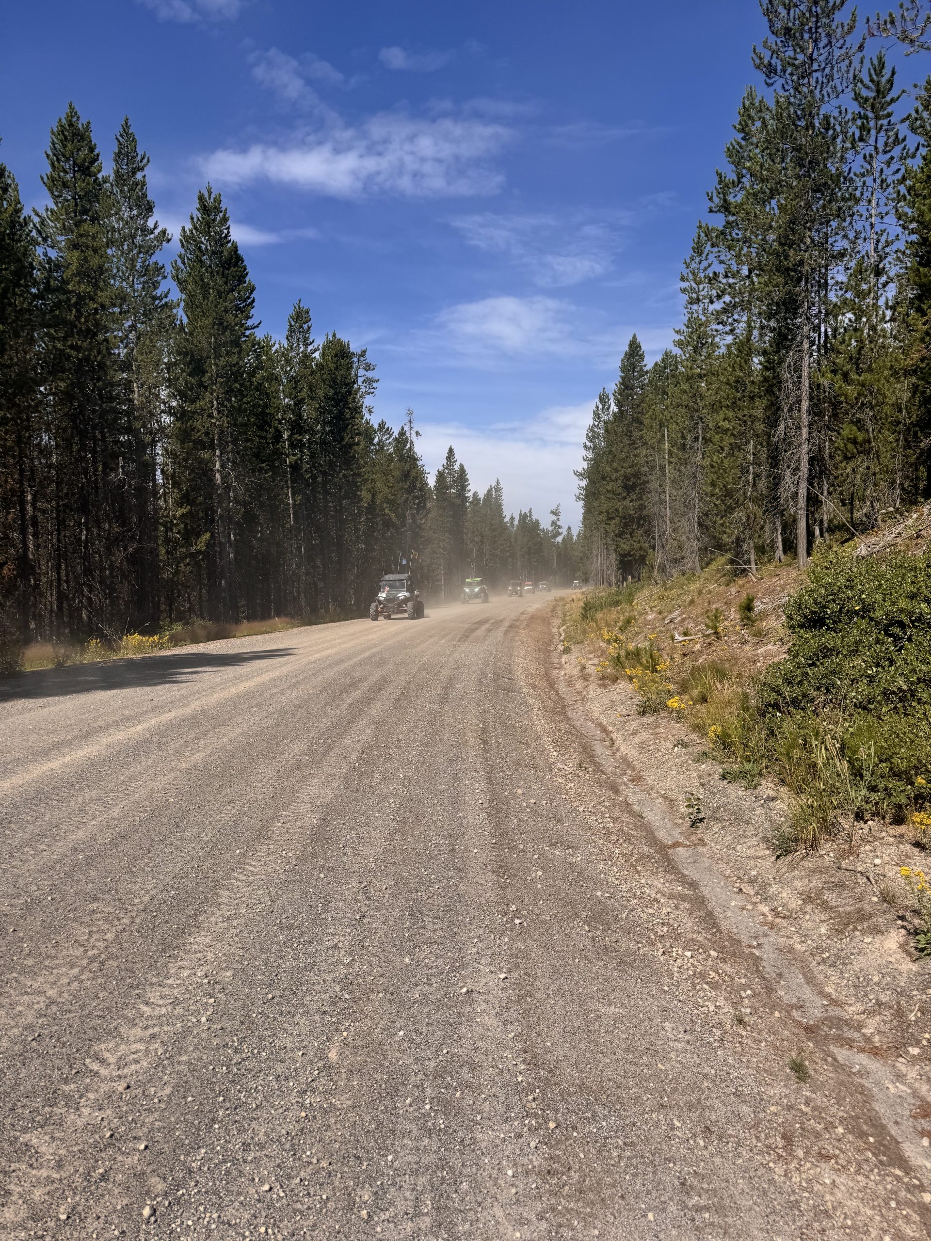
The 17-mile stretch into Island Park, ID followed mostly flat or downhill Forest Service roads, interrupted only by deep dips meant to deter vehicles. These dusty gravel routes were a favorite among 4×4 enthusiasts—at one point we counted 45 trucks in a row! Clouds of dust kept blowing into our faces, making the hike feel relentless. Seven miles in, we rested in the shade for a Poptart, and at mile 12, we filtered water at Moose Creek and had our early “dinner.”
At mile 14, the road turned to pavement, and after just a few steps on the blazing blacktop, we stuck our thumbs out. The first driver stopped and kindly gave us a lift the 2.5 miles to the highway—huge thanks! We then walked along Highway 20 for another mile and a half until we hit the grocery store. After grabbing snacks and a single beer, we headed across the highway to Subway.
We posted up there for two hours—recharging devices, sipping sodas, and devouring a footlong. Abbey sent us a Venmo for beer (you rock, Abbey!), so Devin ran back to the store and snagged the last can on the shelf. We sipped it at the park before beginning the final leg up Sawtell Road.
With more pavement ahead, we stuck out our thumbs again, and just like earlier, the first car stopped. A mother-daughter duo welcomed us into their truck, offering cherries and swapping stories as we wound up the road. They dropped us right where the trail met the road—saving us a dusty, noisy walk among ATVs.
From the ridge, we had an expansive view of the valley below and a tucked-away, flat camp spot. We pitched the tent right then and there. By 5:00pm, we were cozy in bed—full bellies, full hearts, and overflowing with gratitude.
Day 83: 20 miles/ 3,400 ft gain
Sunlight woke us, but we lingered in our sleeping bags. A rock poked through the tent floor under my side, but my thicker pad made it manageable. Devin, with the working door zipper, got stuck with breakfast duty while I dodged that chore. We slowly enjoyed oatmeal and coffee before hitting the trail right at 7:00am.
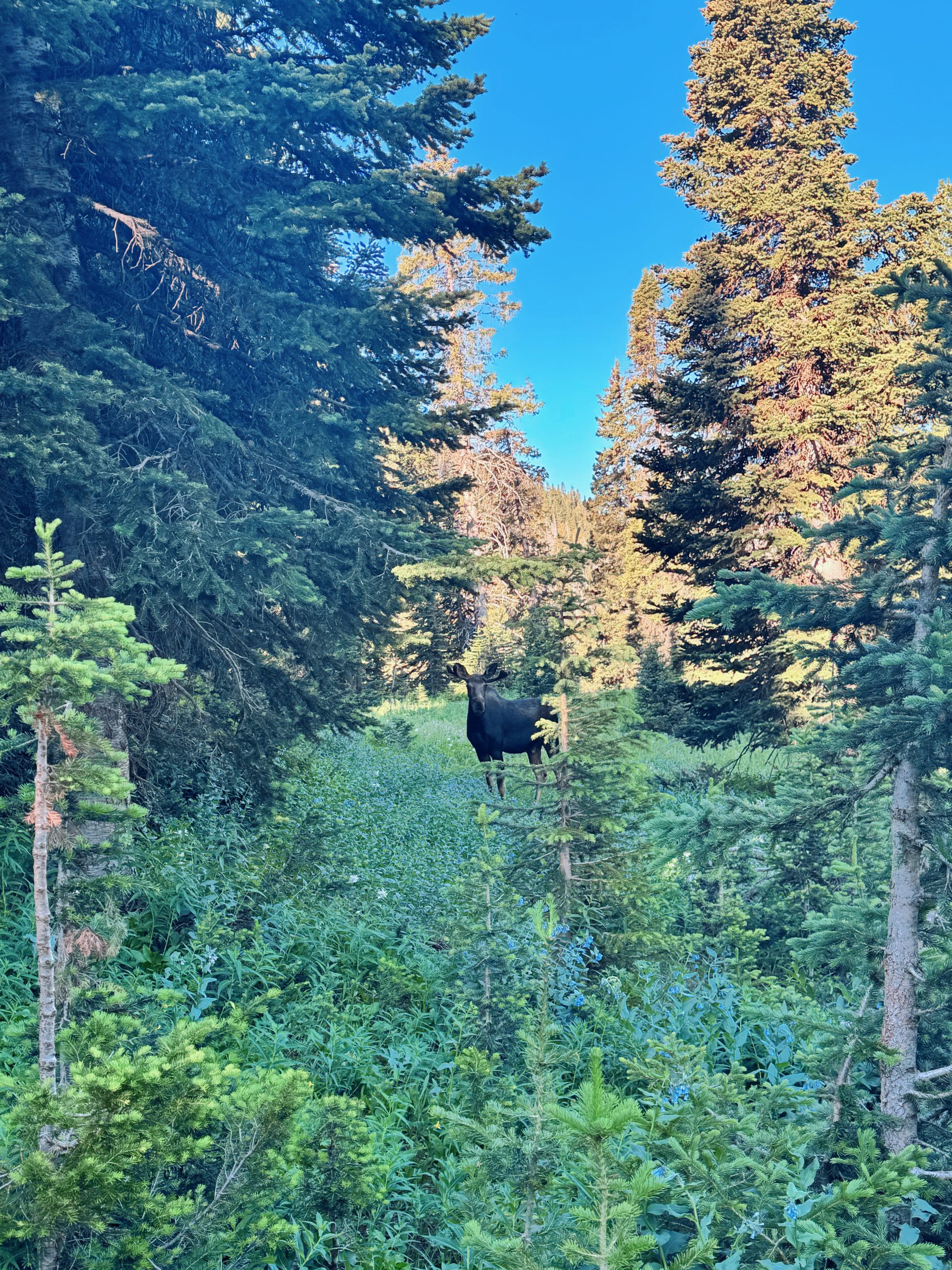
For the first 5.5 miles, wildflowers and thick sagebrush lined an overgrown trail—beautiful, but slow-going. Two moose appeared—one around a blind bend. We gave it space, and it didn’t seem to mind our presence. When we reconnected with better-maintained trail, we found a shady spot to plan our next water stop.
A few miles later, we found a tiny creek and scraped enough water together to fill our bottles. Shade came half a mile further, so we stopped again to hydrate and snack before beginning our 6-mile ascent toward Taylor Mountain. Switchbacks stretched far across the slope, making the climb feel never-ending despite their gentleness.
At the summit, we reached our final water source of the day—a murky puddle masquerading as a “pond.” We carefully placed rocks to stand on and slowly filled our bladders with brownish water. It worked, but barely. With heavy packs and questionable hydration, we made the final 4-mile descent to camp. Options were slim, so we grabbed the only flat ground next to the trail. Not ideal, but it did the job.
Day 84: 19.9 miles/ 3,600 ft gain
Mosquitoes buzzed in our ears as we woke—apparently the tent door had popped open during the night. By 7:00am, we were back on trail, trudging through warm, smoky morning air that painted the sky in blues and pinks. The trail undulated gently through grassy meadows, sometimes overgrown but mostly navigable.
About 6 miles in, we paused at a stream to grab water and refuel. With our biggest elevation gain ahead, we kept the break short. The climb began in thick thistles, which whipped our legs as hawks screeched overhead. Around mile 8, we entered the forest and heard the distant wails of a massive herd of sheep echoing up the valley.
Trail quality improved dramatically near Aldous Lake Trailhead. Just past the lake, we filtered water at Ching Creek before starting a brutal climb. Slippery molehills, steep grades, and overgrown brush made every step feel like a fight.
Three miles in, we paused to call and arrange a shuttle into Lima—hitching on the interstate wasn’t an option. Once that was secured, we continued past a small lake, collecting water for the night. Deadfall slowed us down, but we’d settled into the rhythm.
The final 3.5 miles followed a wind-blasted ridge. Hot sun and whipping gusts made the going tough, but we finally dropped into a sheltered grove and set up camp. Dinner was mac and cheese cooked 200 feet downwind. By 4:15pm, we were tucked into our tent, resting for town.
Day 85: 20.2 miles/ 3,000 ft gain
A speedy morning routine and we were out the door. It was town day and we scheduled a shuttle to town at 1:00pm so we had to hustle! The first 3 miles held our steepest climb of the day. The sun was still holding behind the tabs to the east, so at least the air was cool as we ascended. Once we crested the ridge, we ran into a heard of sheep with some sheep dogs guarding them. Luckily, they weren’t too aggressive and we were able to walk by without much issue.
We refilled at Rock Spring, about 3.5 miles in, but didn’t take breakfast until mile 6.5. It was mostly flat walking through the rolling sagebrush meadow until we stopped at the edge of the forested slope. We were making great time so we took a longer break before a steep descent and our second climb. The trail was littered with deadfall on the way down and up over the next 4.5 miles. It made for slightly less efficient hiking, but we were still moving fast!
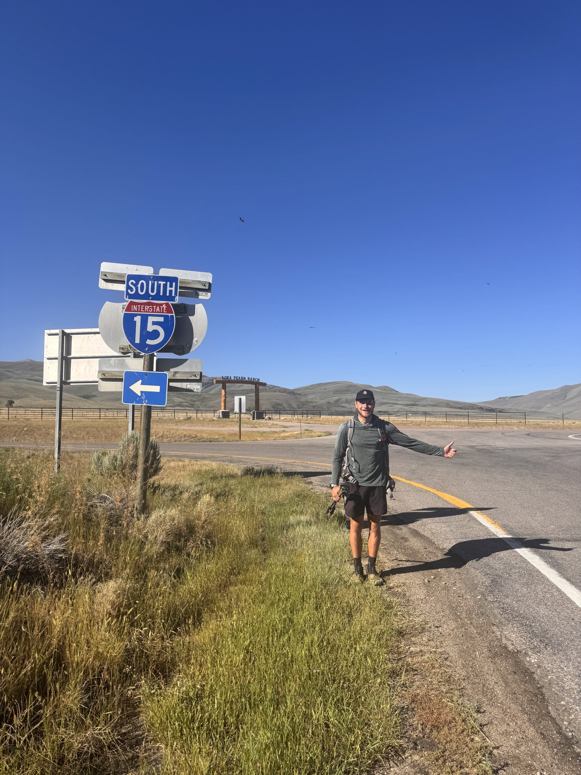
We crested the second ridge and rentered the expansive sage brush-covered hills. Without many trees, we could see for miles ahead of us. I am always shocked at the vat emptiness of some of the land we walk through. It makes me feel small! We spotted I-15, our stopping point, 7 miles west in the valley. After a quick snack break, we got back to walking through the meadow. The trail then joined a road that we absolutely cruised down!
We made it to the interstate around 12:45pm, and even got some trail magic in the hiker box: a beer and a sparkling water! Our shuttle arrived just before 1:00pm and pulled over on the side of I-15 for us to hop in. He stopped at the Lima Post Office so we could grab our package before it closed (it was a new tent)! Then, we got dropped off at the Beaverhead Motel. We scored an early check-in, got our laundry serviced (fancy!) and grabbed a resupply and a ton of snacks from the convenience/grocery store.
Lima to Bannock Pass
Day 86: 5ish miles/ 1,000ish ft gain
We didn’t expect this day to be so short! Sleeping in an actual bed felt luxurious, and we rolled out around 7:30am. After polishing off some Donettes for breakfast, we packed up and left the motel by 9:00am.
Originally, we planned to hike 13 miles, but hitching south on I-15 proved tricky. For an hour, no one stopped. While scanning maps, Devin suggested an alternate: follow back roads west of town to reach a trailhead near the CDT. Although it meant skipping a few miles, it lined up better with our timing to meet my mom in five days.
We started walking under a blazing sun—easy miles but no shade. After 3 miles, a kind man picked us up on his way to a worksite at the exact trailhead we were targeting. We swapped stories and learned a ton about the local area. Thank you, Aaron!
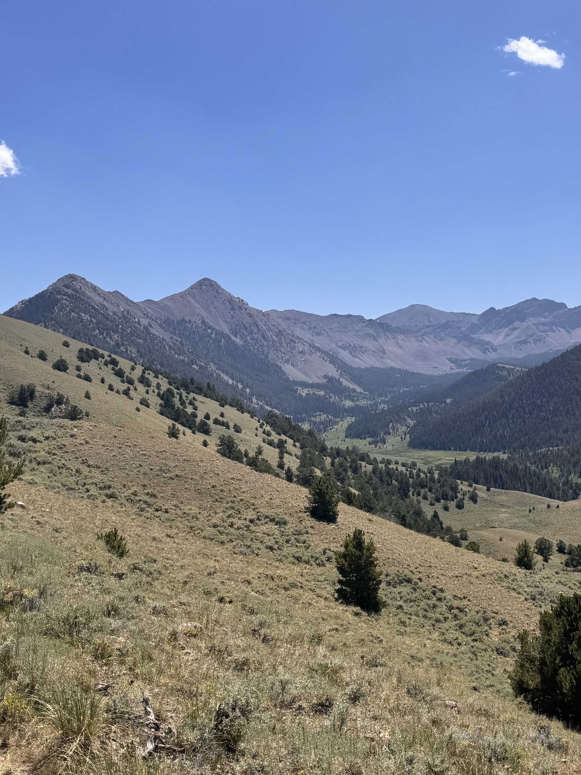
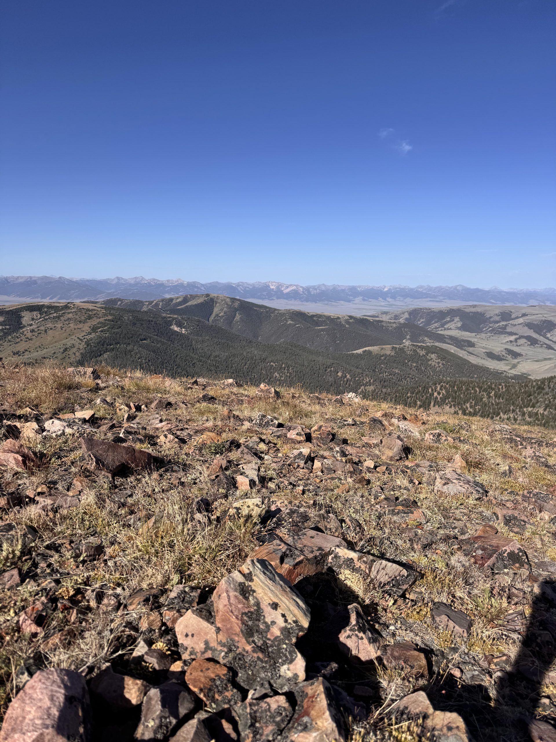
Once dropped off, we followed a nearly invisible road out of the valley. Though we only had 2 miles to the CDT, steep, brushy terrain made progress slow. But at the top, we were greeted by sweeping views of Lima Peaks and Garfield Mountain.
Since we were farther along than expected, we decided to stop early. With Buffalo Spring nearby—a clean, cold water source—we set up camp and relaxed in the tent by 1:30pm. Movies, reading, and rest filled the rest of the day.
Day 87: 19.5 miles/ 3,500 ft gain
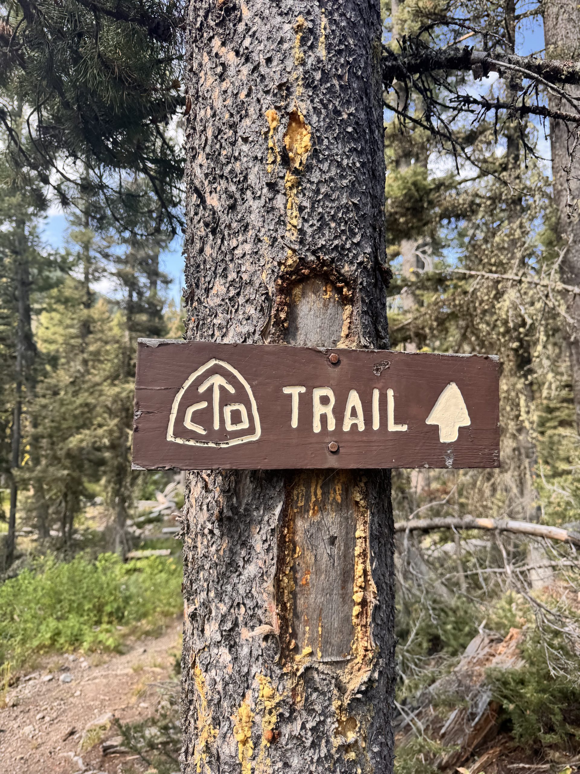
Warm air clung to the morning as I slid out of my sleeping bag. With our longest day of the section ahead, we packed up quickly and hit the trail at 7:00am. For the first 2 miles, we followed a line of CDT posts over gently rolling hills, then joined a road that carried us another 5.
Under a big Montana sky, we moved steadily as a herd of pronghorn trotted alongside us. They’d sprint ahead, pause, then watch us catch up—this repeated until a fence line finally separated us. We took our breakfast break after 7 fast miles, resting briefly before the day’s first major climb.
Rather than skirting the ridgelines, the trail charged straight over them. Our knees and feet ached from the effort. After cresting the ridge, we descended sharply to Deadman Lake, our lunch stop. Calm, teal water and a light breeze made for a perfect break spot, and we sprawled out on the groundsheet to rest.
Then came another stiff climb—1,000 feet straight up the opposite ridge. A cloudless sky beat down on us, but the ascent went by faster than expected. From the narrow pass, the view west opened wide.
The final miles flowed downhill through meadows and occasional forest cover. We found a dream campsite: shaded, next to a cold creek, complete with a bench and a bear hang. Days like this make it all feel worth it.
Day 88: 9.9 miles/ 2,200 ft gain
My watch buzzed me awake, and I pried open tired eyes. No matter how long I rest, mornings are always hard. I lowered the bear bags and whipped up a bare-bones oatmeal breakfast with one shared coffee. By 7:40am, we were on the move.
The trail followed the river downstream for 2.5 chilly miles. Cold wind whipped through the valley as the sun began to rise. Smoke in the air gave everything a hazy, yellow cast. We transitioned from flat trail to a gentle climb up a gravel road.
After 4 miles, we reached Harkness Lakes and stopped for snacks. Studying the map and reading water comments, we realized our planned destination involved a long dry stretch. Since the next day would only be 10 miles, we decided to camp earlier beside a reliable source 3.4 miles ahead.
The trail left the open sage and entered thick forest as we climbed again, eventually cresting a ridge near Cottonwood Peak. It felt alpine—our favorite. A final descent dropped us into a cool, shaded site by the creek. Bugs were minimal, and we were set up by noon. The rest of the day passed in a haze of books, movies, and naps.
Day 89: 13.3 miles/ 2,500 ft gain
Yesterday’s afternoon thunderstorm left the ground wet and soft as we retrieved our bear bags. For once, both of us woke up feeling rested and ready to go—maybe a trail first. We cooked breakfast and packed in under 40 minutes.
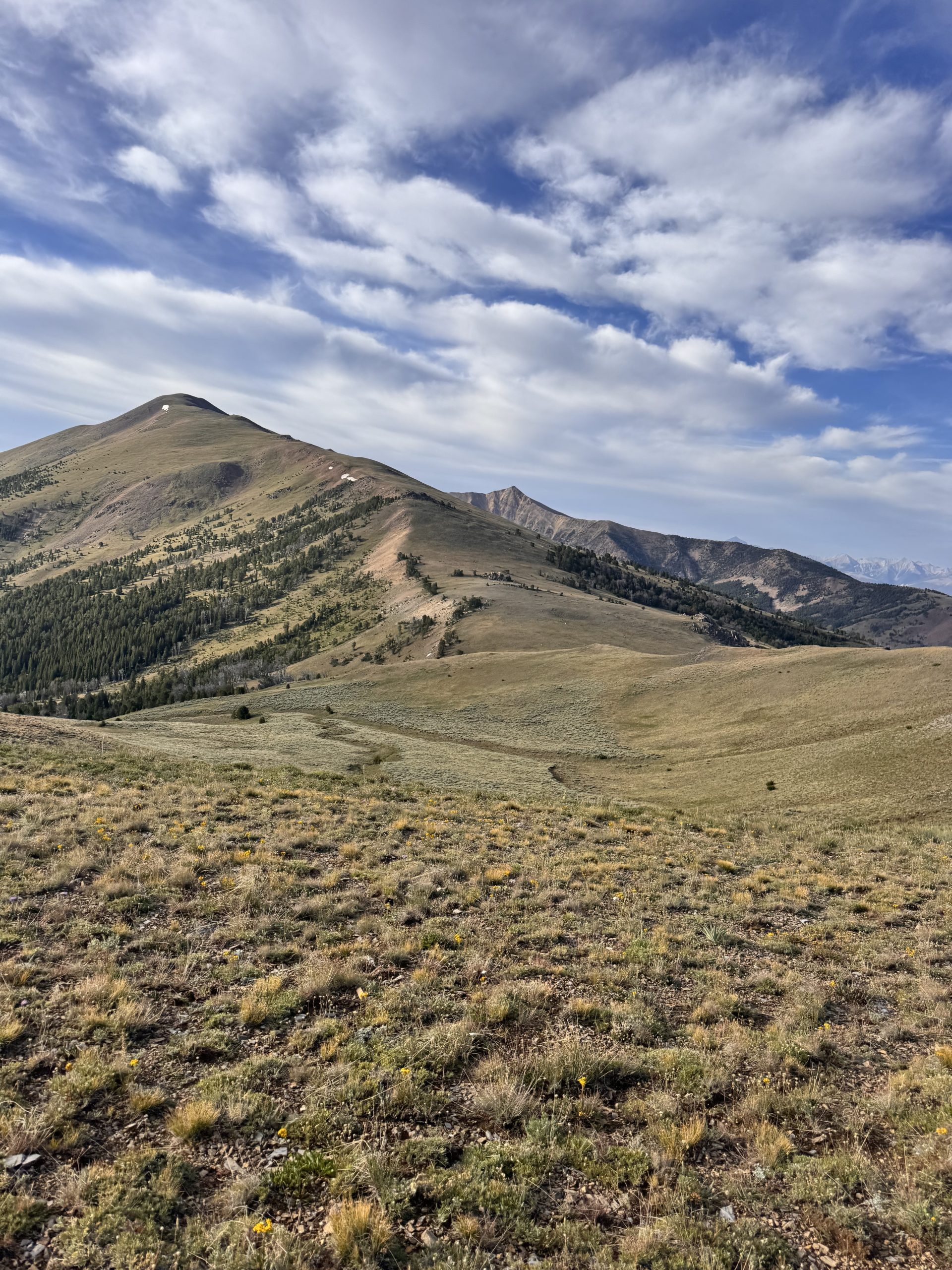
Most of the day’s gain hit early. We knocked out a 1,000-foot climb in 2 miles, rising through forested hills and along a breezy ridgeline. At the top, jaw-dropping views surrounded us—peaks in every direction. After a short descent, another 600-foot climb brought us to a cliff-lined canyon.
The trail traced the canyon edge before descending slowly into a lush valley where we crossed several creeks. With music in my ears, I hiked faster than usual—rhythm keeps me moving.
One final 700-foot climb led us onto a grassy slope, where an ATV road joined the trail. I startled some cows in the meadow and felt bad for making them run—seemed like a lot of work for them!
We passed two SOBO hikers and traded trail notes before parting ways. At Morrison Lake, we pitched camp on the north shore to catch a good sunrise.
Day 90: 13.1 miles/ 3,800 ft gain
The sun rose slowly over a mirror-still lake as I opened the tent door. Chill air and singing birds greeted us, but I wasn’t thrilled about the brutal elevation ahead. Despite sweating within minutes, my feet and fingers stayed numb the first couple of miles.
The trail felt like a roller coaster—endless ups and downs over steep, rolling hills. Every crest revealed a wider view of the northbound trail and the distant ranges.
Devin and I separated to hike our own pace, though we stayed within sight. I didn’t eat until 11 miles in, stopping just before the final big climb for a rushed breakfast. I know I should’ve fueled earlier, but I was deep in the hiking flow, moving to the beat of my music.
The last couple of miles wrapped gradually around Elk Mountain’s south ridge. At a spring near the top, I heard a cheerful “Cloud!” called out. Six SOBO hikers sat in a circle and somehow all knew my name—Devin had introduced me ahead of time. We swapped stories and shared excitement about what was still to come.
After goodbyes, I continued up the trail to where Devin had already picked out a great site under stubby pines. It positioned us perfectly to reach Bannock Pass the following afternoon. Another peaceful evening in the tent capped off a challenging but rewarding section.
Day 91: 11.5 miles/ 1,300 ft gain
Devin and I intended to sleep in, but by 6:30am we were both wide awake. We stayed cozy in our bags for a while, savoring the slower morning, before finally packing up and hitting the trail by 8:00am. Though the day looked easy on paper, the first mile packed a punch—it included the summit of Elk Mountain and half of our elevation gain.
We reached the top quickly and lingered for a while, enjoying the views and the rare treat of cell service. Devin headed out a bit earlier while I called my mom to confirm plans. She’d be meeting us at Bannock Pass, 10.5 miles down trail, and I wanted to make sure everything was good to go.
I flew down the descent, energized by the smooth, well-maintained trail. Around mile 6.5, Devin waited under a shady tree and we took a break together—snacking, chatting, and soaking in the peacefulness. From there, we cruised the remaining miles along a gentle ATV road that rolled up and over low hills. Elk Mountain and the pass stayed in view the entire time, landmarks keeping us company.
By 12:30pm, we dropped down into the pass and found a picnic table tucked near the road. With an hour to spare, we sprawled out, pulled out our phones, and watched an episode of Ted Lasso—trail luxury at its finest.
At 1:30pm, my mom rolled up with my dog riding proudly in the backseat. That reunion? Pure joy. A moment that made every mile worth it.

With beautiful mountain ranges, coastal escapes and vibrant cities, many people choose to vacation in Canada.
The number of tourists and where they are coming from vary from year to year.
But a new survey finds Canada is near the top of the bucket list for U.K. travellers, according to a survey from British trip booking company Travelbag.
“From long-haul escapes to dream destinations, Brits have big travel plans for the year ahead,” Travelbag said in a press release.
Nearly half (46 per cent) of U.K. residents are planning bucket list holidays, the company said.
At the top of the bucket list is Japan, with 32 per cent of those surveyed choosing the popular Asian destination.
“Its appeal lies in its rich history, cultural experiences, and its striking contrast to Western cultures,” Travelbag said in its report. “From ancient tea ceremonies to samurai history, there is much to explore.”
Canada comes in a close second at 31 per cent, with its breathtaking landscapes and outdoor adventures.
“Its vast, unspoiled wilderness, from the peaks of the Rockies to the emerald lakes of Banff, and the showstopping Niagara Falls, makes it an ideal location for nature lovers and adventurers,” Travelbag said.
In third place is Australia (30 per cent), offering once-in-a-lifetime experiences like the Great Barrier Reef and the Gold Coast.
Visitors from the U.K. topped the Statistics Canada May 2025 list of the highest number of overseas visitors. Over 78,000 British residents travelled to Canada in May. Indian residents were second, followed by France and Australia.
A Statistics Canada graph shows the number of overseas visitors by country in May 2025.
See the full report from Travelbag here.
Lead photo of Field, Alberta: James Wheeler
Last 30 Days: 96,569 Votes
All Time: 764,429 Votes
INsauga’s Editorial Standards and Policies
WIN A $100 SHOPPING SPREE!
Subscribe to INsauga – Ontario Headline News’ daily email newsletter for a chance to win a $100 gift card to Toronto Eaton Centre OR Sherway Gardens. Get news delivered straight to your inbox.

It’s early on a Tuesday morning in mid-March, and Isabella Calidonna is ready to run. She’s got a hydration pack wrapped around her back and a smile on her face while standing next to the Baroque Four Rivers Fountain in the heart of Rome, Italy. This centerpiece of the famed Navona Piazza, she tells me, is among more than 2,000 fountains in the city designed by the masterful Italian sculptor and architect Gian Lorenzo Bernini more than 400 years ago.
Calidonna is the founder of ArcheoRunning, a Rome-based running tour company, and she’s leading me on an easy 5-kilometer run that will zigzag through the city’s maze-like alleys. They’re paved with black basalt, referred to as sampietrini in Italian.
The iconic cobblestones date back to the 16th century, when they were first used to cover Saint Peter’s Square in front of Saint Peter’s Basilica, the iconic Italian High Renaissance church in Vatican City. These are the kind of details that Calidonna, who has a Ph.D. in art history and also studied archeology, easily shares mid-stride.
“I work in great beauty,” she says, chuckling. “Rome is very special—full of beauty that has been layered over centuries, from the medieval period to the Renaissance. You can see all that history here.”
Save for local shop owners preparing to open, at 7 A.M. Rome is unusually hushed and absent of tourists, an ideal moment to run through Italy’s most populous city of nearly three million.
“It’s a very particular experience,” Calidonna says of Rome’s pre-breakfast hour ambiance.
From the honeyed rays of sunlight that drench the city’s historic facades, to the quiet and crowdless streets, Calidonna describes this interval of the day as sacred and magical, insisting that it’s worth a wake-up call to encounter this tamer face of the city.
A Run-Tour of the Best of Rome
Calidonna, a six-time marathon finisher, no longer trains to race long distances. But she remains an avid runner. She started coaching in 2016 and logs roughly 20 miles per week as the owner of ArcheoRunning, which she founded in 2019. After constantly encountering tourists studying maps mid-run, Calidonna thought it was a prime opportunity to offer a guided running experience while also bridging her love for art, history, and archeology in her beloved adopted home.
“My running tours are for everyone,” Calidonna says. She adds that she accommodates all paces for the 13 running tours she offers. The company also features seven walking tours.
“I don’t use maps. I am the map!” -Isabella Calidonna, founder of ArcheoRunning
“The Best of Rome” tour is among her most popular. As part of the experience, she brings runners to iconic public squares and famed spots, like the Spanish Steps—the longest and widest staircase in Europe built in the 1720s. The tour also traverses architectural masterpieces, like the Pantheon. The ancient temple, dedicated to the 12 gods of the Roman religion, is one of the best-preserved Roman monuments in the world. A visit to the renowned Baroque Trevi Fountain—dubbed the world’s wishing well, attracting between 10,000 and 12,000 tourists daily—is another highlight of the rendezvous.
One of ArcheoRunning’s more atypical experiences includes taking runners southeast to the city’s “green lungs” to log miles on one of the oldest Roman consular roads. Calidonna describes the area as an open-air museum, where six of the ancient Roman aqueducts—used to transport fresh water for baths, fountains, and drinking to highly populated areas—are preserved. Dating back to 312 B.C.E. and built over a period of roughly 500 years, the Roman aqueduct systems are widely considered to be a masterful and advanced display of engineering.
Beat the Crowds Off the Beaten Path
On this Tuesday morning, I joined Calidonna for ArcheoRunning’s “Hidden Rome” running tour to visit a few of the lesser-known spots in the city. Our first stopping point is the ruins of the Stadium of Domitian, which is located beneath Piazza Navona. A rendered image of the stadium illustrates a horseshoe-shaped arena, which was formerly used for wrestling, foot races, and pentathlons. The space could accommodate 30,000 spectators (still significantly smaller than the better-known Colosseum, which could hold up to 80,000 people, while the Circus Maximus, the largest chariot stadium in ancient Rome, could fill more than 150,000).
I follow Calidonna to Via Coronari, an ancient Roman road in the heart of the city. Formerly referred to as Via Recta, the street was used by pilgrims on the journey to Saint Peter’s Basilica, she explains. These days, it’s full of renovated apartments sandwiched between art galleries and is also a place to hunt for antiques.
As we head to the Ponte district, Calidonna pauses and points at an inconspicuous arcaded lane, Vicolo San Trifone. This, she says, is one of the most distinct streets in the city—the narrowest in Rome, a fact that is often lost on tourists and locals alike. We move on to one of Rome’s oldest markets, Campo de’ Fiori, careful to steer clear of vendors meticulously arranging baskets of fruits and vegetables and buckets of fresh flowers. After we quickly pass by, we continue to a medieval courtyard of Ivy-wrapped ochre houses located through Arco degli Acetari. In the past, the area was used by vinegar makers before it was transformed into accommodations.
As we continue still off the beaten tourist track, Calidonna shepherds me to Passetto del Biscione, a tunnel with a stunning blue frescoed ceiling of cherubs and festoons. In 1796, the passage was reportedly the site of a miracle: an image of the Virgin Mary was allegedly seen moving her eyes, attracting pious Christians from around the city. The passage also served as a corridor to the Theater of Pompey, Rome’s first theater that was dedicated to Pompey the Great, Julius Caesar’s rival.
By the time we reach our second-to-last stop, I can’t help but gaze in awe inside the courtyard of the Palazzo della Sapienza. Here, Calidonna shows me the oldest university in Rome, and the largest in Europe, founded in the 13th century by Pope Boniface VIII. The building, designed by 17th-century architectural genius Francesco Borromini, is a Baroque masterpiece.
As we wrap up the run, Calidonna leads me to the back of the Pantheon. It’s certainly not a hidden gem. Rather, it’s one of the most popular architecture sites in the center of Rome—and the world. This, however, leads to our final stop, the ruins of the Baths of Agrippa. It’s the formerly private bath complex of Agrippa, the Roman general and son-in-law of Augustus, the first emperor of ancient Rome.
I’m still absorbing Calidonna’s granular details as we finish running and arrive at Caffè Sant Eustachio, the oldest coffee roasting company in Rome. The cafe uses water from an ancient aqueduct to make its coffee, like the Americano I sip as I gaze outside, noticing how much Rome has come to life, and it’s only 8 A.M.
A morning with ArcheoRunning feels like stepping into another world, one that serves as an amuse-bouche of the city’s culture, history, and traditions. I’m already ruminating on my return to the Eternal City.
___________________________________________________________
This article was first published by RUN.
-

 Brand Stories1 week ago
Bloom Hotels: A Modern Vision of Hospitality Redefining Travel
-

 Brand Stories3 days ago
CheQin.ai sets a new standard for hotel booking with its AI capabilities: empowering travellers to bargain, choose the best, and book with clarity.
-

 Destinations & Things To Do1 week ago
Untouched Destinations: Stunning Hidden Gems You Must Visit
-

 AI in Travel1 week ago
AI Travel Revolution: Must-Have Guide to the Best Experience
-

 Brand Stories3 weeks ago
Voice AI Startup ElevenLabs Plans to Add Hubs Around the World
-

 Brand Stories2 weeks ago
How Elon Musk’s rogue Grok chatbot became a cautionary AI tale
-

 Destinations & Things To Do2 days ago
This Hidden Beach in India Glows at Night-But Only in One Secret Season
-

 Asia Travel Pulse3 weeks ago
Looking For Adventure In Asia? Here Are 7 Epic Destinations You Need To Experience At Least Once – Zee News
-

 AI in Travel3 weeks ago
‘Will AI take my job?’ A trip to a Beijing fortune-telling bar to see what lies ahead | China
-

 Brand Stories3 weeks ago
ChatGPT — the last of the great romantics
You must be logged in to post a comment Login