
Destinations & Things To Do
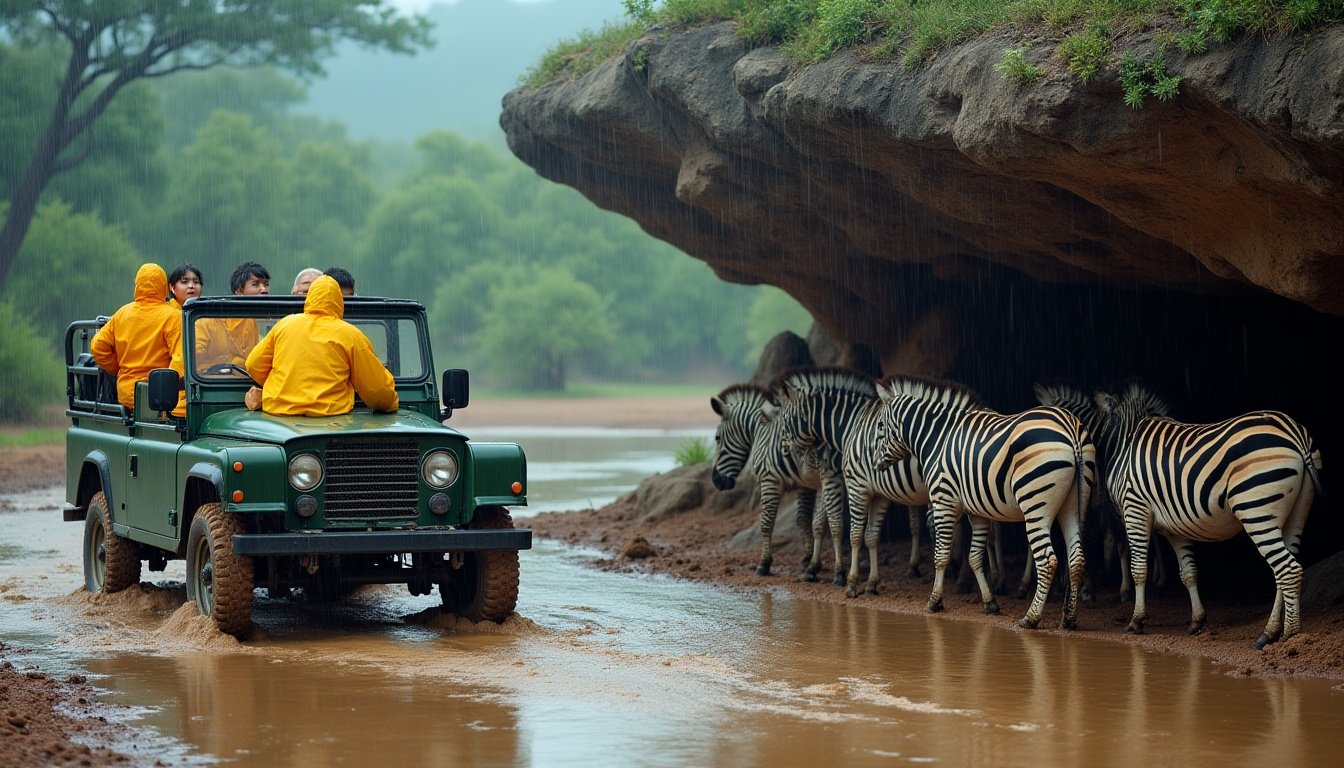
Looking for a Unique African Adventure? How About Trekking Across Zimbabwe and Mozambique on Intrepid Travel’s New Mystery Expedition?
Thursday, June 26, 2025
Intrepid Travel has once again embraced the spirit of adventure with its newly unveiled Mystery Expedition, an exclusive 14-day journey that promises to take guests on a once-in-a-lifetime experience across Southern Africa. Spanning over 1,500 miles (2,400 kilometers), the Mystery Expedition will take guests from Harare, Zimbabwe to the beautiful Ile de Mozambique, while ensuring that the itinerary remains a mystery until the journey begins. This immersive adventure is designed to give travelers a blend of thrilling activities, guided tours, adventure experiences, and a deeper connection to the local communities along the way.
The Mystery Expedition stands apart by its mystery element—participants will not know the exact itinerary before the trip. All that is known is that they will be venturing through Southern Africa, experiencing waterfalls, mountain hikes, and other local adventures, with expert guidance at each stop. The tour offers guests a moderate physical challenge due to trekking and the rugged terrain, but promises to push even the most seasoned adventurers out of their comfort zones.
This unique 14-day journey is set to depart in two different waves: the first departure on July 29, 2026, will be exclusively for past Intrepid travelers who enjoy early booking access, while the second departure on August 12, 2026, will be available to the general public. The Mystery Expedition will be limited to a small group of 21 travelers, ensuring an intimate and personalized experience. The cost for this exceptional journey will be $4,640 (or $6,410 CAD) per person.
“We run trips in over 120 countries and know our travelers always look to us to uncover new and exciting places to explore,” said Erica Kritikides, General Manager of Experiences at Intrepid Travel. “This itinerary is intrepid in every sense of the word, and I’m confident that this will be our best mystery trip yet.”
A Journey into the Unknown: What’s in Store for Adventurers?
The Mystery Expedition offers much more than a traditional tour—this adventure is a deep dive into the unknown. The participants will start their journey in Harare, Zimbabwe, and travel through an undisclosed route that will unveil hidden gems of Southern Africa, ending at the exotic Ile de Mozambique.
Throughout this exciting adventure, travelers will engage in several guided tours with local experts, allowing them to gain a deeper understanding of the region’s culture, history, and natural beauty. Some of the highlights of the journey are expected to include:
- Waterfall Adventures: A chance to swim beneath some of Africa’s most stunning waterfalls, offering guests an unforgettable natural experience.
- Mountain Hikes: Exploring the rugged terrain of Southern Africa on guided mountain hikes, taking in awe-inspiring views.
- Community-Based Experiences: Engaging with local communities through immersive experiences that connect travelers to the heart of the region’s culture.
- Adventure Activities: Additional activities that might include safaris, cultural tours, and time spent exploring various villages and towns that have shaped the region’s history.
This mystery journey promises an experience that is both active and educational, with opportunities for physical challenge, adventure, and personal growth. The best part is that every day will hold a new surprise for travelers, making it a truly once-in-a-lifetime opportunity.
Exclusive Departures and Limited Group Sizes
To maintain a personalized experience, Intrepid Travel is limiting the number of participants to just 21 travelers per departure. This ensures that each traveler has the opportunity to truly connect with their surroundings, their fellow adventurers, and the local communities they will visit along the way.
The Mystery Expedition will have two departures:
- July 29, 2026 – Exclusively for past Intrepid travelers, offering early booking access.
- August 12, 2026 – Available for the general public, allowing new adventurers to join the journey.
This departure limitation means that guests can enjoy a small group experience, ensuring that each moment is special, and travelers can enjoy greater access to the best that Southern Africa has to offer. With limited availability, interested parties are encouraged to sign up before June 29, 2025 to secure a spot. Following the application period, names will be selected via a random draw.
Intrepid’s Bold Approach: Inspired by Nostalgia
This new Mystery Expedition is part of Intrepid Travel’s Uncharted Series, which is designed for those who thrive on the unknown. Intrepid’s Uncharted Series brings the spirit of exploration and adventure into each trip, inspired by some of the first journeys the company organized for intrepid travelers years ago.
The previous edition of the Uncharted Series, which took 34 travelers through the Altai Mountains in Russia in 2018, proved to be an incredible success. The demand was so high that the first departure sold out within just 16 hours, with over 1,000 applications. This history speaks volumes about the appeal of mystery travel, where the thrill of the unknown is as important as the destination itself.
“This mystery trip taps into the nostalgia of our earliest Intrepid trips, where every journey held an element of surprise and the unknown,” said Kritikides. “It appeals to the most intrepid travelers—those with a sense of adventure who are prepared to take a leap of faith and go well beyond the beaten path.”
Who Should Join the Mystery Expedition?
The Mystery Expedition is perfect for those who enjoy a sense of adventure and have a passion for experiencing new cultures and environments. While the trip will involve trekking, it is rated as moderate, which means it is suitable for those in good physical condition, especially those who are comfortable with rugged terrain and a bit of physical exertion.
This trip will appeal to:
- Adventure seekers who thrive on the thrill of the unknown.
- Experienced travelers eager to step off the beaten path and visit places rarely seen by outsiders.
- Those who enjoy community-based travel and connecting with locals in an authentic, meaningful way.
- Intrepid Travel fans looking for a unique and challenging experience to add to their bucket list.
If you’re someone who loves the thrill of discovery and the excitement of living in the moment, then this Mystery Expedition is designed for you.
Booking Information and Application Process
Those eager to take part in this adventure are encouraged to submit their applications via the Uncharted registration form. The booking period closes on June 29, 2025, with names selected at random. As this journey is expected to generate a high volume of interest, early registration is recommended for those who want to be part of this exclusive adventure.
For more details and to apply, interested parties can visit the official Intrepid Travel website.
Conclusion: Embrace the Unknown
The Mystery Expedition is a bold step for Intrepid Travel, inviting adventurous travelers to embark on an epic journey that promises not only thrills but also a deeper understanding of the diverse cultures and landscapes of Southern Africa. It is the perfect opportunity for those who crave adventure, a challenge, and the excitement of not knowing what comes next. With limited availability, this once-in-a-lifetime trip is one that should not be missed by those who want to push their boundaries and embrace the unknown.


See what I did there?
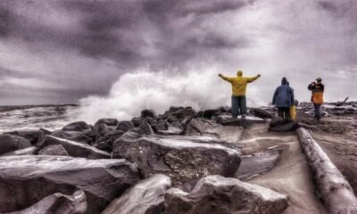
Things have certainly been… going. The first day was a whirlwind of events. Constant trail changes, meeting new people, the bear. The next three days have been less of that, and much more mud and rain.
I’m starting to find my rhythm, for sure. I wake up when the sun comes up, then ignore it and roll back over for another hour. Get up around 8. Put ramen on the stove to boil for hot breakfast. The ramen doesn’t take long to cook, but it takes surprisingly long to cool off so I get it going while I do my other camp chores.
While my breakfast cools, I refill my water and take down my tent. I cover myself in bug lotion, to mixed results.
Once the camp is all put together, I shove it into my bag and then walk until I can’t feel my legs. Then, I pitch the tent, eat cold dinner (I’m usually too tired to mess with the burner by this point), and go to sleep. Repeat.
I’ve come to the realization that I will be able to physically complete this trail, barring any freak accidents. The mental battle will be the real deciding factor.
Day 2: The Downpour
Everything can essentially be boiled down to morale, like an old timey army. Any event can be sorted into one of two camps: an event that makes me happy to keep hiking, or an event that makes me want to quit.
Cool waterfall? Good for morale, I hike faster. Clothing still wet from the previous day? Bad for morale, I hike slower. Giant open sore on my leg from chafing? Bad for morale, but it does actually make me hike faster because I don’t have any bandages on me and I need to make it to Silver Bay to buy some. You get the point.
Day 2 was really pushing that limit of quitting, which is not a good spot to be in on the second day of the hike. It rained for the first half of day, from 10:30 in the morning to around 3 in the afternoon. As a reminder, I have no waterproofing in my kitchen at all. The only thing that saved me last time was that the rain eventually let up before it could soak everything in my backpack. This time, it did not. Bad for morale.
That’s not even the worst part. When it rains, my glasses fog up. This isn’t terrible on its own; my vision is okish so I just take them off and clip them to my jacket.
In the middle of a thunderstorm, getting pelted with rain, I realize they’ve fallen off their clip. At this point I’ve been hiking for two hours with them off, so they could be anywhere along trail. Terrible for morale. Horrendous, even.
As I walked back along the trail, thunder booming, rain pouring, I was already brainstorming how I would tell my parents. I think I prayed the Hail Mary fifteen times.
What’s more, the thought crossed my mind that I might not be cut out for this. I mean, losing literally the second most expensive item I own (after the phone, I guess) on the second day? That definitely raises some doubts about my ability.
Luckily, I found them not even twenty minutes later. They had bounced off some of the ferns lining the path and were sitting dead center of the trail.
I cannot stress enough how much of a miracle this is. The trail was overgrown and flooded. Had they bounced anywhere else they would be buried under feet of foliage or submerged. I think the exact quote I said when I found them was “Holy sh*t no way.”
Overall good for morale, but it was still raining and I had just wasted almost half an hour backtracking. I was pretty sick and a little rattled at this point, so I decided I’d pitch my tent at the next camp and wait out the storm.
I did just that, but like my other gear my tent was soaked through. The bottom liner is waterproof, which is great for keeping water out but unfortunately also works to keep it in. I tried to get as dry as possible, putting down my sleeping pad (also pretty wet) and stripping off all my damp clothing.
The end result was me eating tortillas and cheese sticks (my new favorite food combo) in. my underwear as the rain kept going. Everything was damp at the minimum, and most of my gear was outright wet. Sitting in my tiny tent in the rain, my morale was broken.
I got homesick like I never have before in my life, looking at old photos of me and my family, missing the good times with them. They’re all fine present tense btw, that sentence sounded really morbid like something happened, but they’re dry and I miss them so I wanted nothing more than to be with them.
I seriously considered if I’d be able to make it to the northern terminus, or if I should just call quits at Twin Harbor (the nearest town). Morale at an all time low.
Luckily, the rain broke around mid afternoon. That left me with enough time to saddle back up and keep moving.
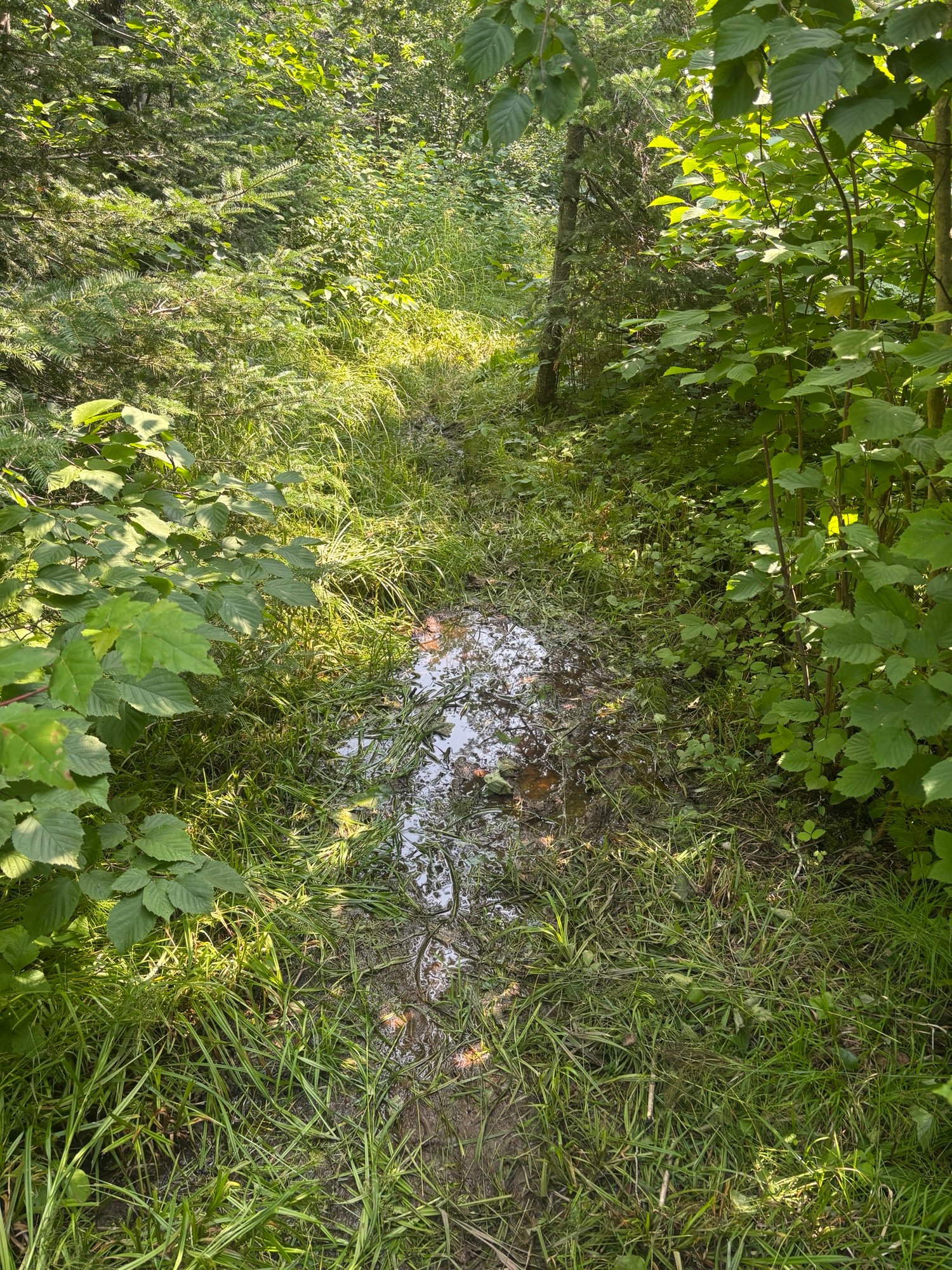
This is where things start to tie back to the title. Trail conditions were TERRIBLE. Even when I wasn’t getting wet from above, the flooded trail meant I was getting wet from below. There were numerous sections where I had to walk through shin deep water. Calling it the Superior “Hiking Trail” is generous, I’d say it was closer to the Superior “Military Amphibious Assault Training Course”. Lots of mud.
Let’s do a speed run of all my terrible trail condition photos:
At a certain point, though, you can only get so wet. I knew my sleeping bag would be soaked when I slept, and had made peace with that (admittedly miserable) fact. Literally nothing on my was dry, so I figured I was at rock bottom and nothing could get worse.
Wrong. Section B, as previously mentioned, is all snowmobile trails through bogs. It is INCREDIBLY lowland, which means you get a lot of bugs. Rain makes the bugs 10 times worse.
In the hour it took me to set up camp that night, I got bit at least times by mosquitos. They harassed me all day, never letting me slow down. The only time I wasn’t getting bit or downpours on was when I was in my tent, at which point I immediately passed out from exhaustion.
So yeah, not a great day to be a hiker or even a human being in the woods in general. I’m starting to understand why American colonists cut down so many old growth forests. If I had to live outside all the time before the invention of bug spray or mosquito nets, I’d be inclined to slash and burn everything too.
It’s also worth noting that, by the point I went to sleep, I hand not interacted with another human since the previous afternoon. Not enough to make me go crazy (yet) but I was getting bored.
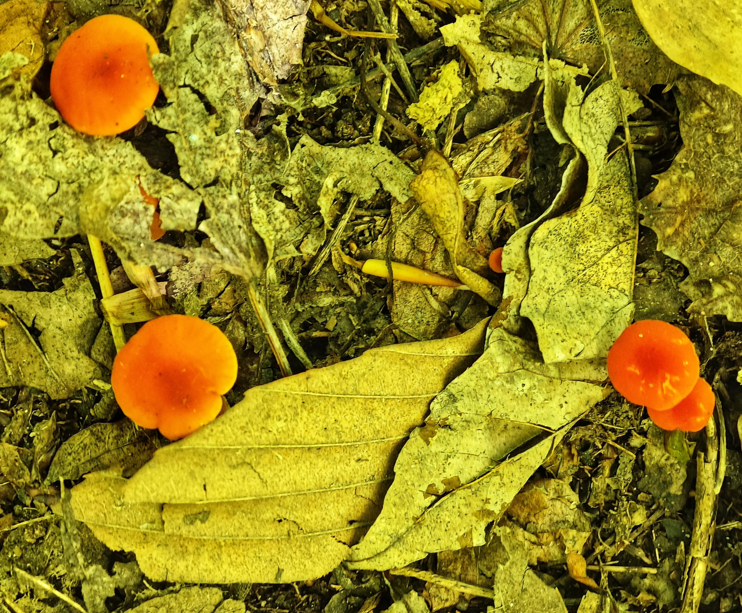
At least I found mushrooms.
Day 3: Walking WAY Too Far
Day 3 was a lot more of the same. I woke up, boiled myself some ramen, did a shot of my electrolyte caffeine mix, and packed up my tent.
On a side note, the electrolyte caffeine mix (Meijer branded, ofc) has become one of my favorite parts of the day. It’s a concentrate that your supposed to add into water, but since I have no bottles of clean water (I fill my bottles dirty and filter as I drink) I have nothing to mix it with. I’ve started just doing it like a shot every morning. It is INCREDIBLY sour (bc it’s concentrate) and makes my tongue tingle whenever I drink it. It’s a 10/10 experience and I’m half considering adding it to my non hike daily routine.
The trails were, for the most part, the same as before. There was a lot of standing water and mud, which slowed my progress. Fortunately there did seem to be at least a couple bits of really nice, well groomed dirt trail. Not enough to satisfy me really, but enough to give me hope that things would get better later.
My first stop was at McCarthy creek, where I got accused of being a communist and was able to take my boots off and soak my feet in the water. For whatever reason there were no mosquitos there, so I spent a LONG time just enjoying that. My feet didn’t need this, as my boots were still wet from the day before and so they’d kind of been soaking all day, but the cold water felt nice. I signed the SHT logbook there, ate lunch, and then pushed on.
I met a guy and didn’t catch his name, but he looked like a Bob, so we’ll call him Bob. He was the first person I’d seen in around 36 hours, but talking to him didn’t make me feel much better about the hike. He said that the trail was muddy and overgrown basically all the way to the northern terminus, which is where he’d started. He blamed it on all the rain, saying Minnesota had apparently been having a more rainy than average summer. From what I’d seen, I certainly believed him.
The trail eventually flattened out into a long gravel road walk section, which was cool because flatter, more consistent trail surface allowed me to really get my miles in. Also, three miles per hour seems to be the magic limit where most of the mosquitos can’t keep up. They’re motivating me to get my miles in more than I could ever motivate myself.
The road walk got further extended by a trail closure, causing me to push even further at this fast pace. I passed a camp site, but I figured I could get to the next one by the end of the day. By this point it was already 6, and the nearest camp site (big bend) was 6 miles away. The sun has been setting at 8:30, so it meant 6 miles in two and a bit hours. Doable.
The problem was, I hadn’t stopped to eat since McCarthy creek. I kind of forgot about this when I decided to push for big bend, but I sure felt it about two miles later. Also, the trail returned to its regular old self: mud and overgrown grass patches. This slowed my progress significantly.
I kept pushing. My legs started to tingle. The trail started following a river, and the river kept bending, but none of them were the big bend. The sun was starting to dip, and I still want at camp.
Part of the problem is that when I really hungry I get really dumb. This means worse decision making, but also just that I trip and stumble more. This slows me down, adding to the problems of pushing to camp while I’m on the clock. Should I have just stopped and eaten a cliff bar or something? Totally. That would have solved everything. But did I? No.
By the time I got into camp at 9 the light was already fading into dusk. I literally couldn’t feel my legs, and had to sit on the bench for a minute before I was ready to pitch camp. I I definitely, definitely overdid it, but oh well. My shoulder also felt like I’d pulled something, which was probably from catching myself with my poles while stumbling (literally stumbling) into camp.
I ended the day by eating 1000 calories of ramen and jerky and then crashed HARD.
Day 4: Oh Wait Hiking is Actually Fun
Luckily, this saga has a happy ending.
I woke up early like usual, then went back to sleep. I don’t think I got out of bed until 9, and slowly rolled into gear. I knew I’d pushed too hard the previous day, and was completely fine with chilling out a bit.
The good news was that my shoulder, which i’d been really worried about before going to bed, had turned out ok. Apparently 10 hours of sleeping on the ground is the best cure for aches and pains.
The bad news was my boots were still wet, and so my feet were starting to hurt a little bit. Not debilitatingly, but they were definitely tender. Also, the days of walking in the rain had made the chafing so bad on my legs that I made the executive decision to hike in my thermal layer instead. They’re tights, and although they’re a little hot for my liking they don’t rub nearly as badly as my actual hiking pants.
I braced for another day of mud and flooded our trails, but fortunately it only took around four miles before I passed the end of section B and into section C.
All of the other hikers I’d met weren’t lying. Within 300 meters of passing the section C trailhead I had to climb up almost 500 feet of switchbacks. It was like someone had heard me complaining about lowland mud hiking and curled the monkeys paw. It was tough trekking.
The top made it all worth it, though. I got my first of the promised “stunning views of Lake Superior and inland Minnesota” that I was beginning to think were a myth. The trail also cleaned up a lot, becoming much more of a mountaintop dirt path. This made it a lot easier to keep moving fast, which almost made up for the time I’d lost lugging my pack up the face of a cliff.
Almost immediately I bumped into another southbound thru hiker, a woman named Maddie. She was drying her gear in the sun while eating lunch. She supported the “trail gets better up north” narrative by saying that basically all the way to Grand Marais is similarly cool mountain trails, which was good to hear. She also told me that it flattened out for a bit after Crow Creek, which was nice because my legs were burning.
The trail quickly dipped back down, heading into one of the coolest rocky gorges I’ve ever hiked through. It reminded me a lot of out west. I ended up stopping there to eat take a breather before pushing on once more.
Maddie wasn’t lying, and the trail really did get flatter after that. I was able to go fast, as it was still relatively good quality with mud in a few spots. The weather was sunny and hot, but I didn’t mind it when the alternative seemed to be pouring rain.
As I neared my campsite, I kept seeing bear tracks in the mud. It was a good reminder that, even though I wasn’t seeing them like I did on day one, there were still bears in the area.
The best part of the day had to be the views, but the next best was the lack of bugs. I don’t know if it was the heat, the higher elevation, the dryer ground or some kind of divine intervention. There just weren’t as many bugs as there were one previous days.
I camped at a place called blueberry hills. It had no blueberries and only a passable amount of hill, but the ground was soft and I slept well.
Tomorrow I’ll be in stringing distance of Silver Bay for my first restock. I don’t technically need it; I’ve been hiking faster than I expected and started out carrying WAY too much food. Still, town will be good for drying out gear and buying some medical supplies to handle my blisters before they get too bad. Hopefully my chafing gets better too. It’s currently too graphic to even describe in a PG way, so the only way to go is up hopefully.
Also, I’ve decided that I’m going skinny dipping before the end of the trail. That’s always been a dream of mine, and I want to achieve it. It’ll have to be in an alpine lake to avoid leeches, on a weekday to avoid other hikers. In hoping for it to be cold and refreshing and life changing. And to not get a bacterial infection, I guess.
Stick around to see if I get there!
Happy hiking, y’all.

Budget Update
Whilst I want to rush headlong into telling you all about the views from the tower this morning, I previously promised to continue to update my budget every two weeks so that other frugal people like myself can see how realistic it is to tackle the trail on meager funds.
I’ve had a blowout. $147 spent in the last two weeks. An almost 50% increase on my first two weeks. And I know exactly what happened to cause this damage. Rotisserie chicken at Price Chopper.
Basically all that has happened is I’ve got much more hungry in the second half of my first month on trail. My caloric deficit has become too great as it does for all long distance hikers at some point, and when you walk into the grocery store your eyes become as big as saucers and you cannot imagine leaving the store without buying two of everything for instant consumption.
I’ve also had more opportunity by passing more towns in the last two weeks, and I’ve been very happy about that. The extra protein has been welcomed as my body slowly adjusts to the rigours of hiking every day. My spend on accommodation and transport collectively remains at a steady $0.00.
Total spend after four weeks on trail is $247.
Views
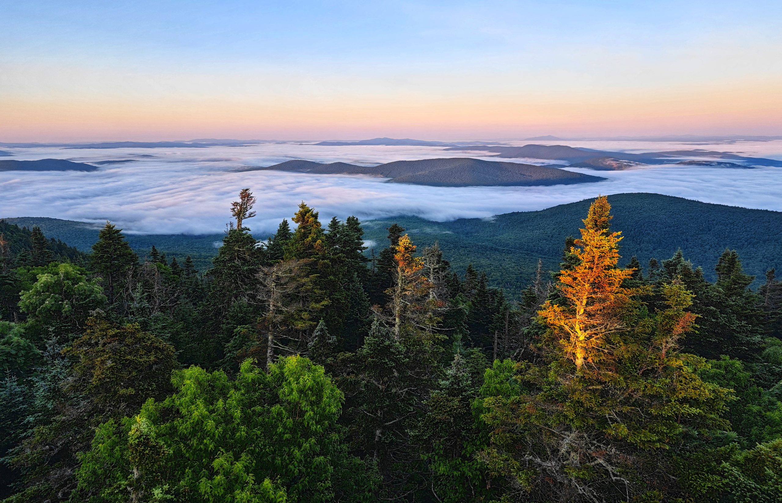
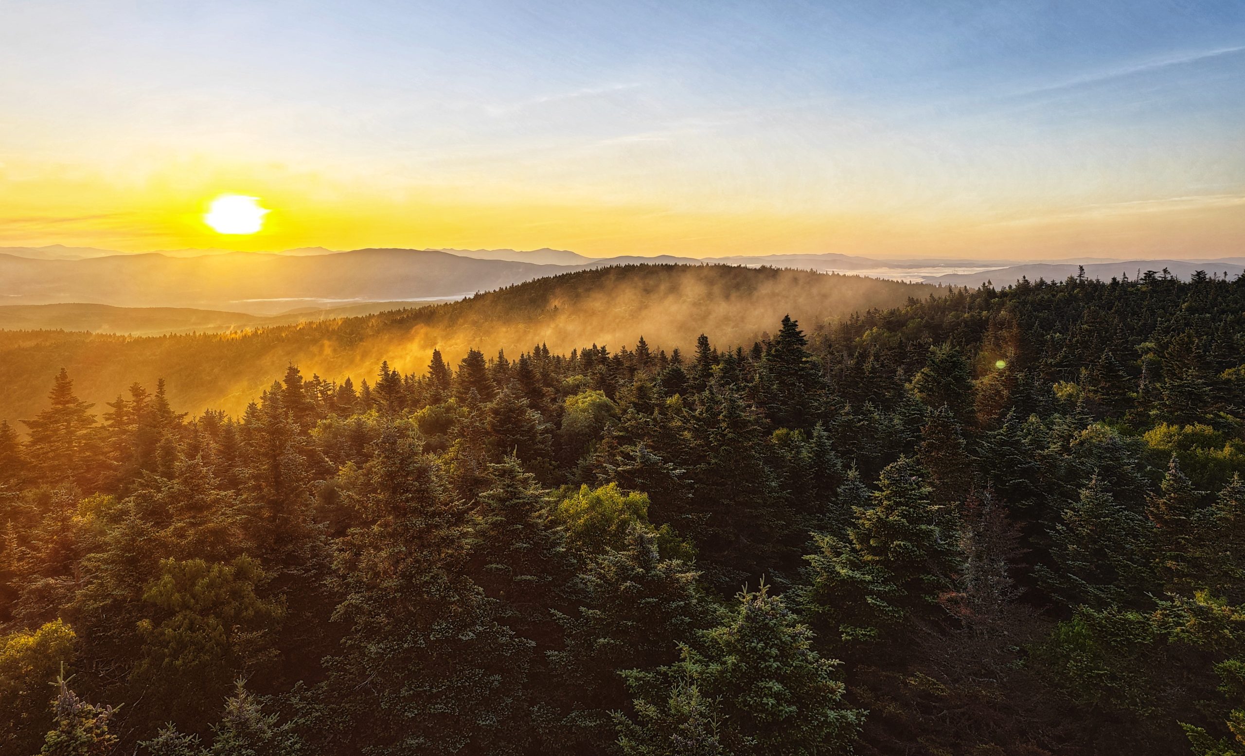
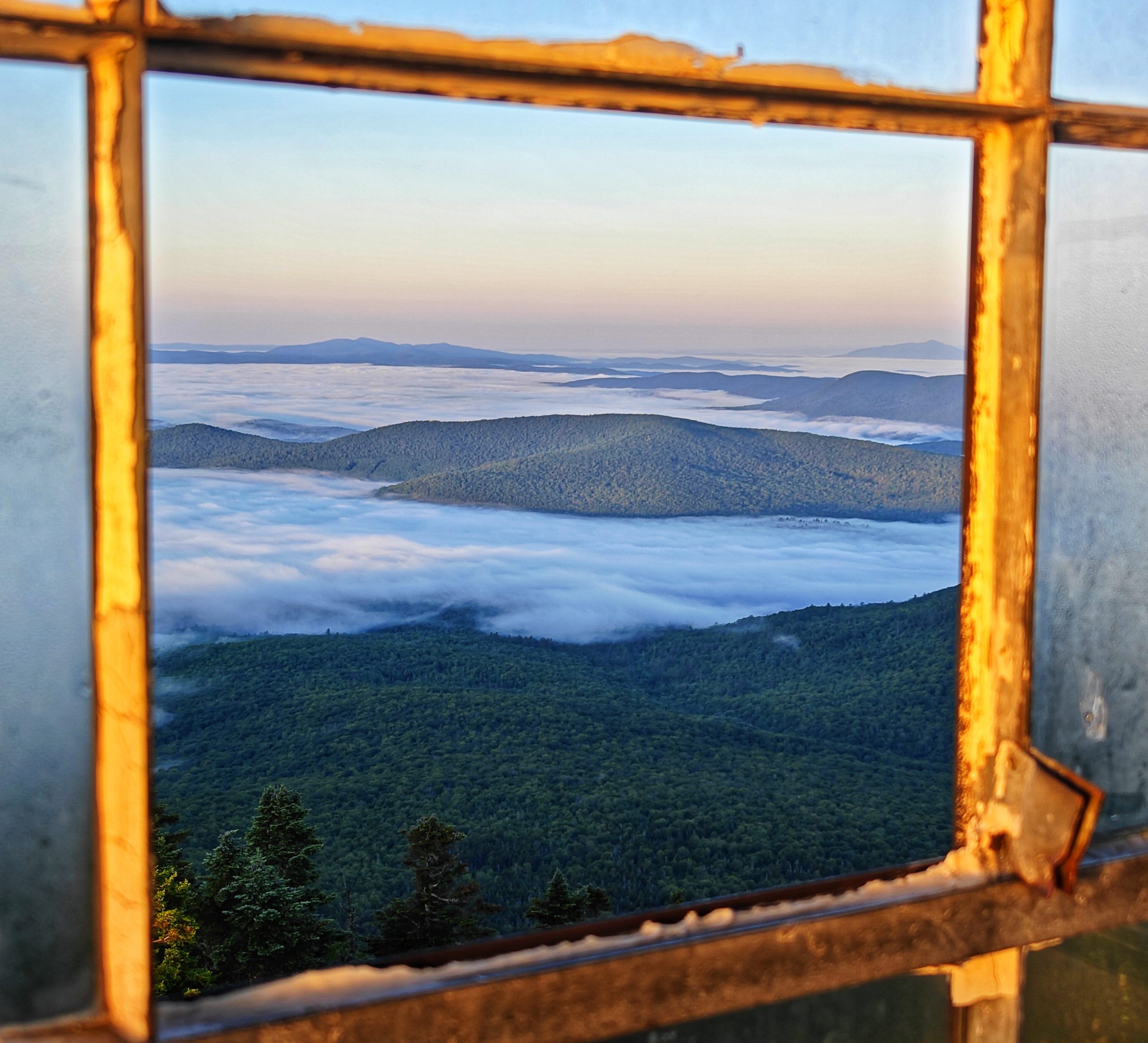
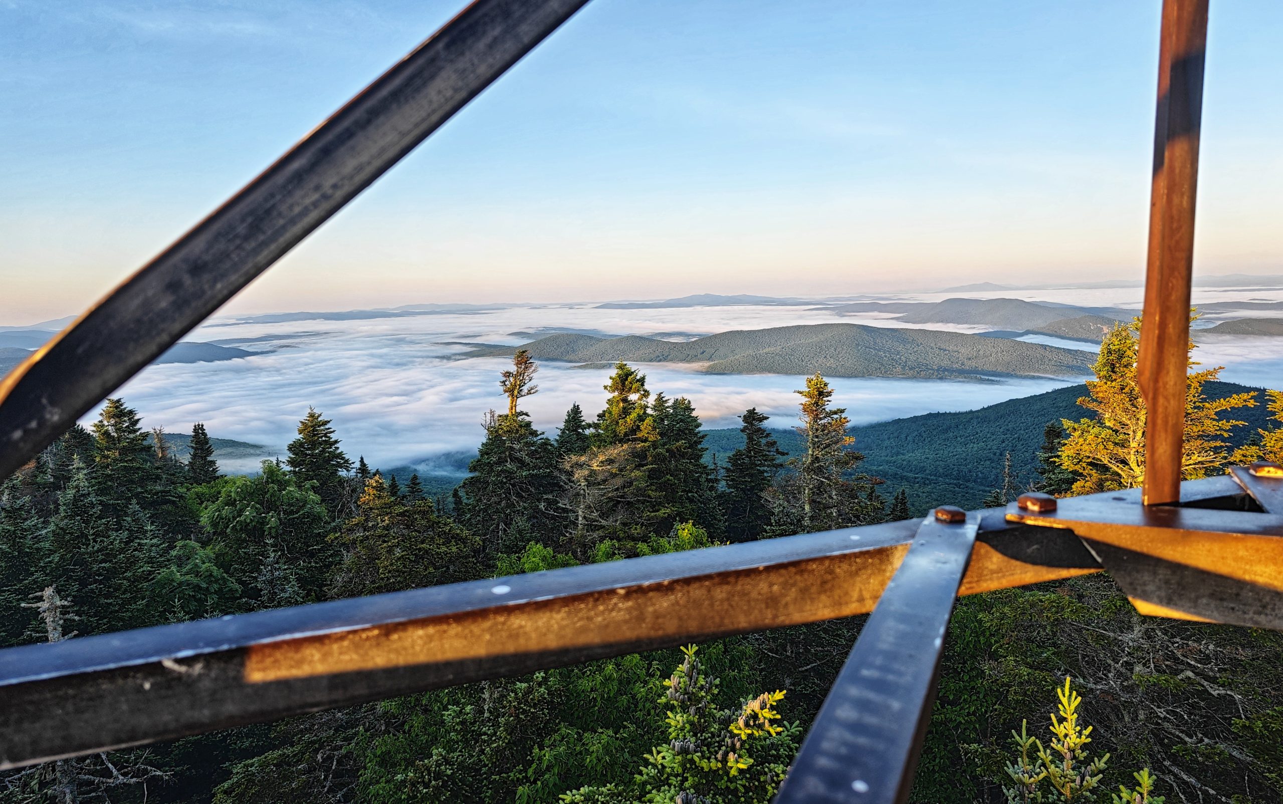
The day dawned clear and I scurried to get ready so I could head up to the fire tower and soak up the views. There were a few other hikers staying on the mountain last night so I expected we’d all be hanging from the tower trying to get the best angles for our pictures.
To my surprise I climbed the tower alone just after sunrise, and there was nobody above me.
Mother nature came to play this morning! The most perfect 360 degree view of cloud inversion and mountain peaks emerging from the mist. Days like these do not come along often on the trail, and I sent the next 30 minutes taking way too many photos of the glorious views.
It’s worth mentioning that it was absolutely freezing on top of the tower. The early hour combined with a healthy wind made for very cold hands that were unwilling to do simple things like press the shutter button on the phone and hang on to the tower so I didn’t fall.
I climbed off the tower to warm up, certain that I had taken enough shots. I ate a breakfast bar, drank some water, and then felt the inexorable pull to climb the tower just once more in case I’d missed an angle (I really hadn’t).
Eventually I managed to convince myself that no photo was going to do any justice to the spectacle I was enjoying, and after a quick selfie I headed back to terra firma to start my hike.
Hiking
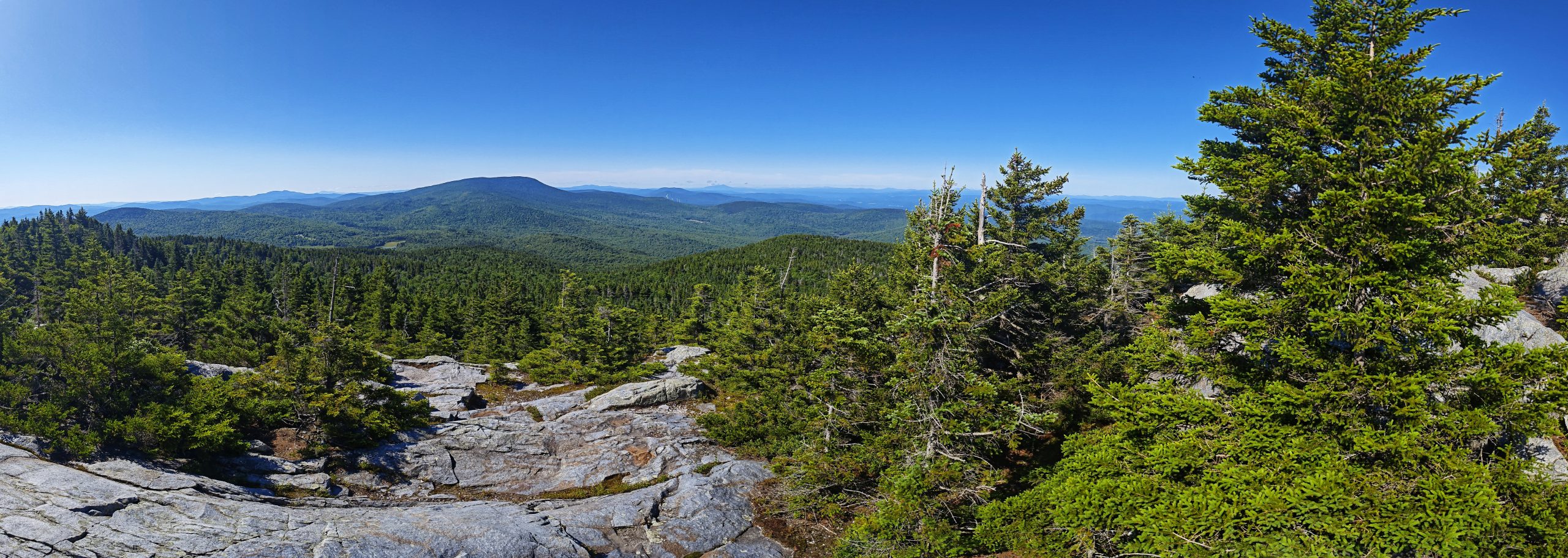
A long descent started the day as I wended my way off of Smarts. Fortunately it was not as steep a descent as the climb the day before. It was then time to climb Mt Cube, so named for its shape. A far more honest naming convention than bear or moose which of course only leads to despair and disappointment.
It was a decent climb up to the interestingly shaped peak, where more great views awaited.
Another descent followed (it’s almost like this trail follows along the spine of a mountain range) and then another climb toward a lunch time camp.
The comments on FarOut for Ore camp were less than glowing. Upon arriving I could see how one could come away with a less than stellar view of the campsite. The tent sites were sparse and uneven, and the water supply was…not good. Essentially the source of the water was some small stagnant pools located down a steep hill from the camp. Hikers are never delighted to have to do extra work to get to water at a camp, we are a fussy lot.
The good news about the stagnant pools is that they were a haven to mosquito larvae. Thousands of beautiful breeding insects hung around the pools, happy to relieve you of some of your weight in the form of blood donations while you scooped through the larvae to get to the drinkable water.
Task completed I hauled myself back up the hill and made the wise decision to put up the hammock for the afternoon as it had got very hot. The remaining kilometres to the final camp of the night would be completed after 4pm once the heat had leaked out of the day.
I made myself some tortillas for lunch and then rolled out the hammock and made myself cozy. The afternoon drifted by, it’s entirely possible I even napped for a while. All too soon it was nearing 4pm and time to get back on the trail.
Avoiding the heat had proved to be a great plan, and Chestnut and I were soon in stride heading toward camp.
Around 5.30pm we crossed a road and found some more trail magic. Some kind soul had left a carton of zero calorie seltzer water cans by the roadside. Certainly an unusual choice for thru hikers, I was not complaining as the bubbles hit just right at the end of a hot day.
We decided to cook dinner by a brook near the road, and after a hearty mac n cheese meal got back on the trail for the final push to camp.
And what a camp it proved to be.
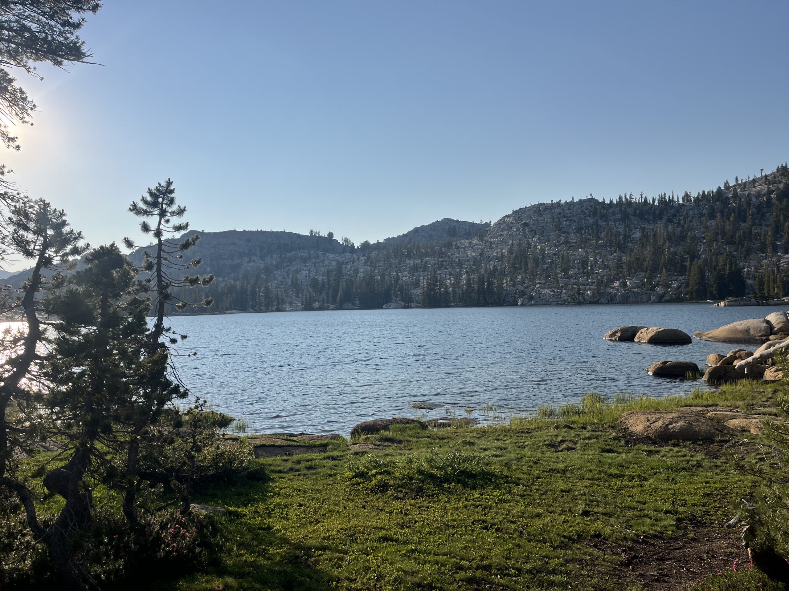
On the shores of a pond, a few perfectly placed campsites were strewn about, allowing you to gaze at the water from your tent. I scoured the water for beavers and moose, and was rewarded with ducks and a turtle. I’m not duck or turtle averse so was very happy with my findings.
As sunset closed in it was time to turn in for the day, with a final spectacular light show playing out in the clouds.
Hiker midnight had arrived and it was time to hit the hay.
This website contains affiliate links, which means The Trek may receive a percentage of any product or service you purchase using the links in the articles or advertisements. The buyer pays the same price as they would otherwise, and your purchase helps to support The Trek’s ongoing goal to serve you quality backpacking advice and information. Thanks for your support!
To learn more, please visit the About This Site page.

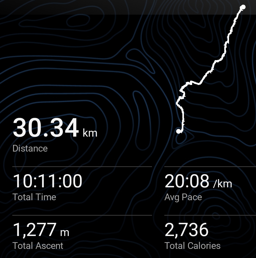
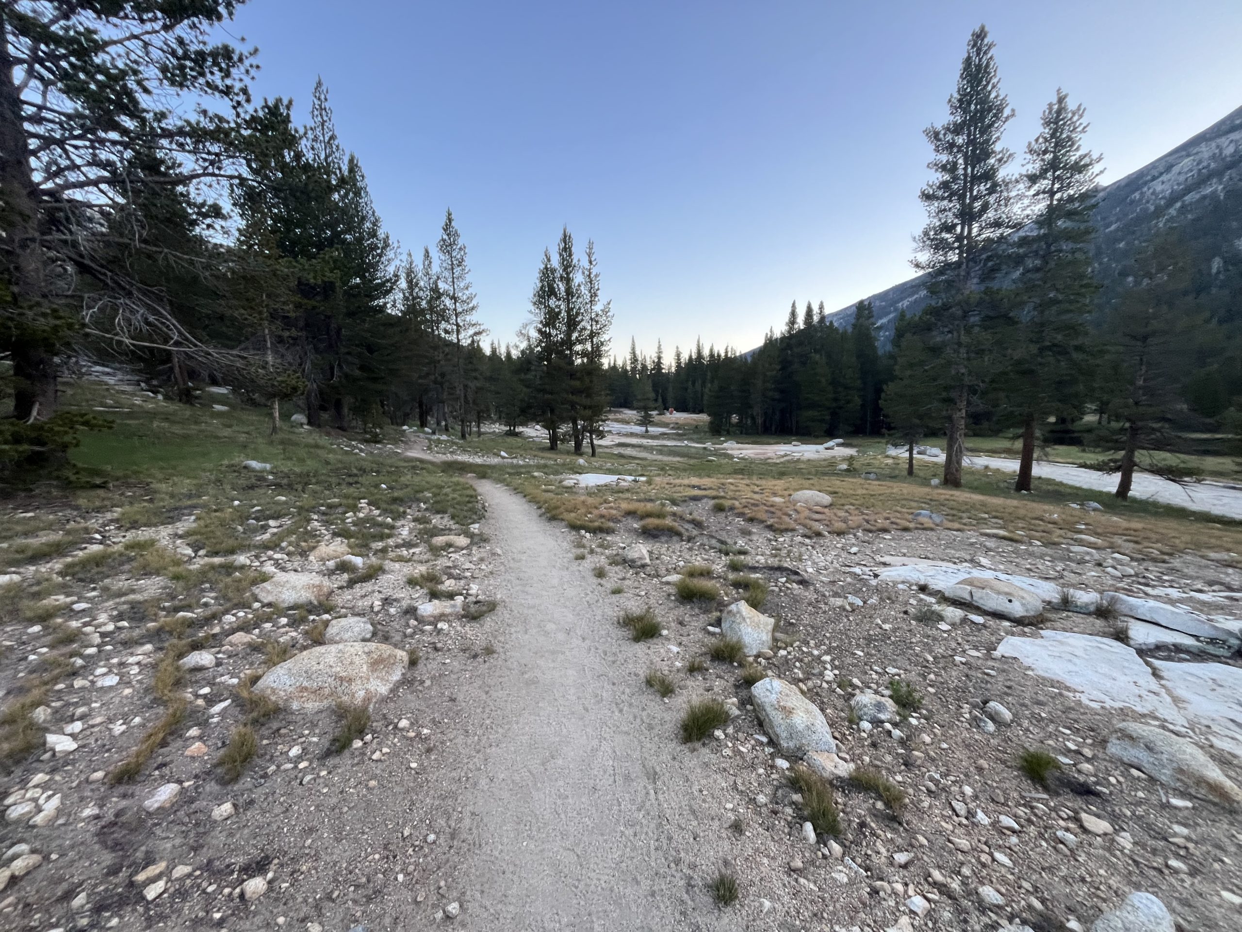
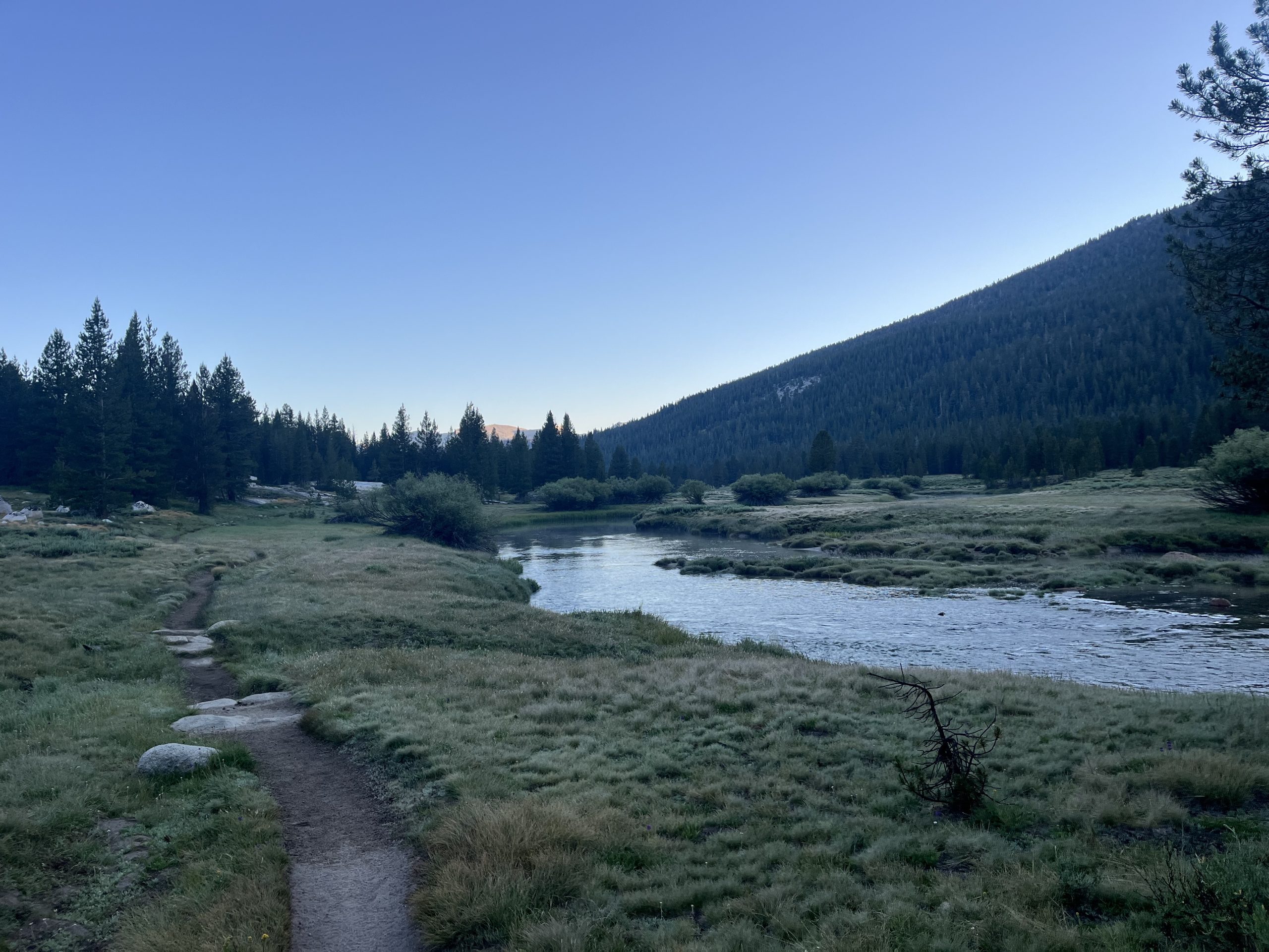
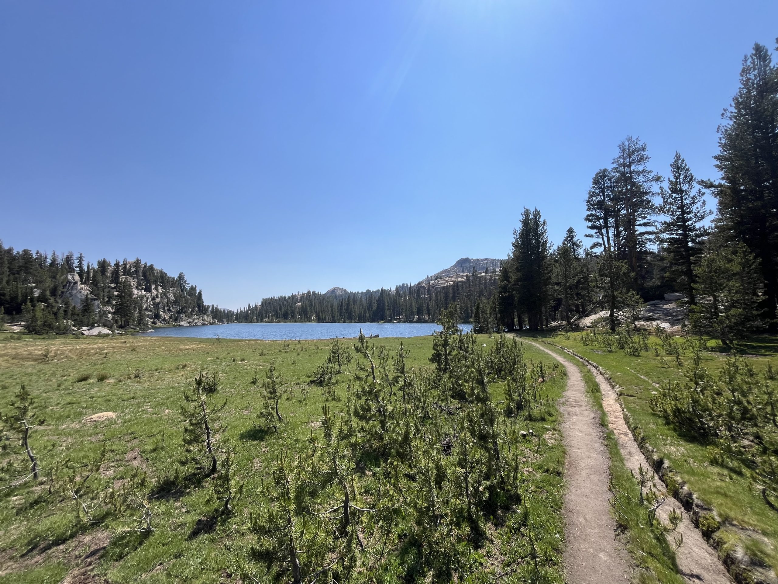
This morning I got up and made coffee. Then I was packed up and walking right around 5:45 AM. I said goodbye to Cara who I won’t be seeing again. The JMT and PCT split off very soon. She’ll be heading into Yosemite Valley to finish her hike. And I’ll be heading into Tuolumne Meadows and continuing on the PCT past there.
I only had a handful of miles to do this morning before I would get to Tuolomne Meadows. There is a small camp store there and a restaurant. I’m pretty excited to be able to grab a drink and something to eat. Especially considering it’s right off the trail. Plus the entire first 12 or so miles up today are completely flat. So the hiking from my camp spot to the store is about as easy as it gets.
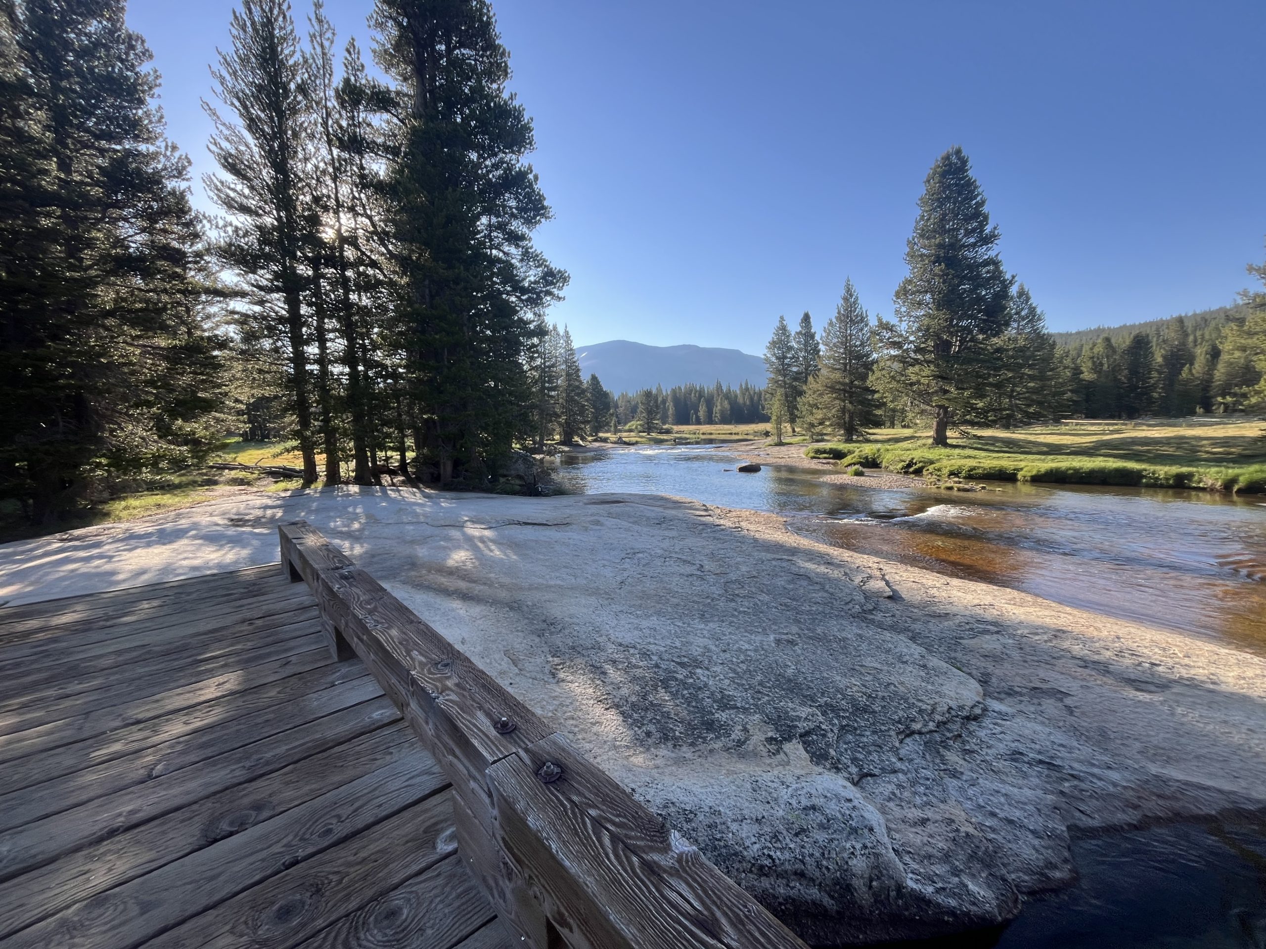
As I got closer to Tuolumne I started passing a bunch of hikers. Some were out doing section hikes and others were doing day hikes from the parking area. I wound up getting into Tuolumne Meadows and down the road to the store right as it opened. I was standing outside by 8:02 AM. But unfortunately for me, so were about 10 other people who had driven there in their vehicles.
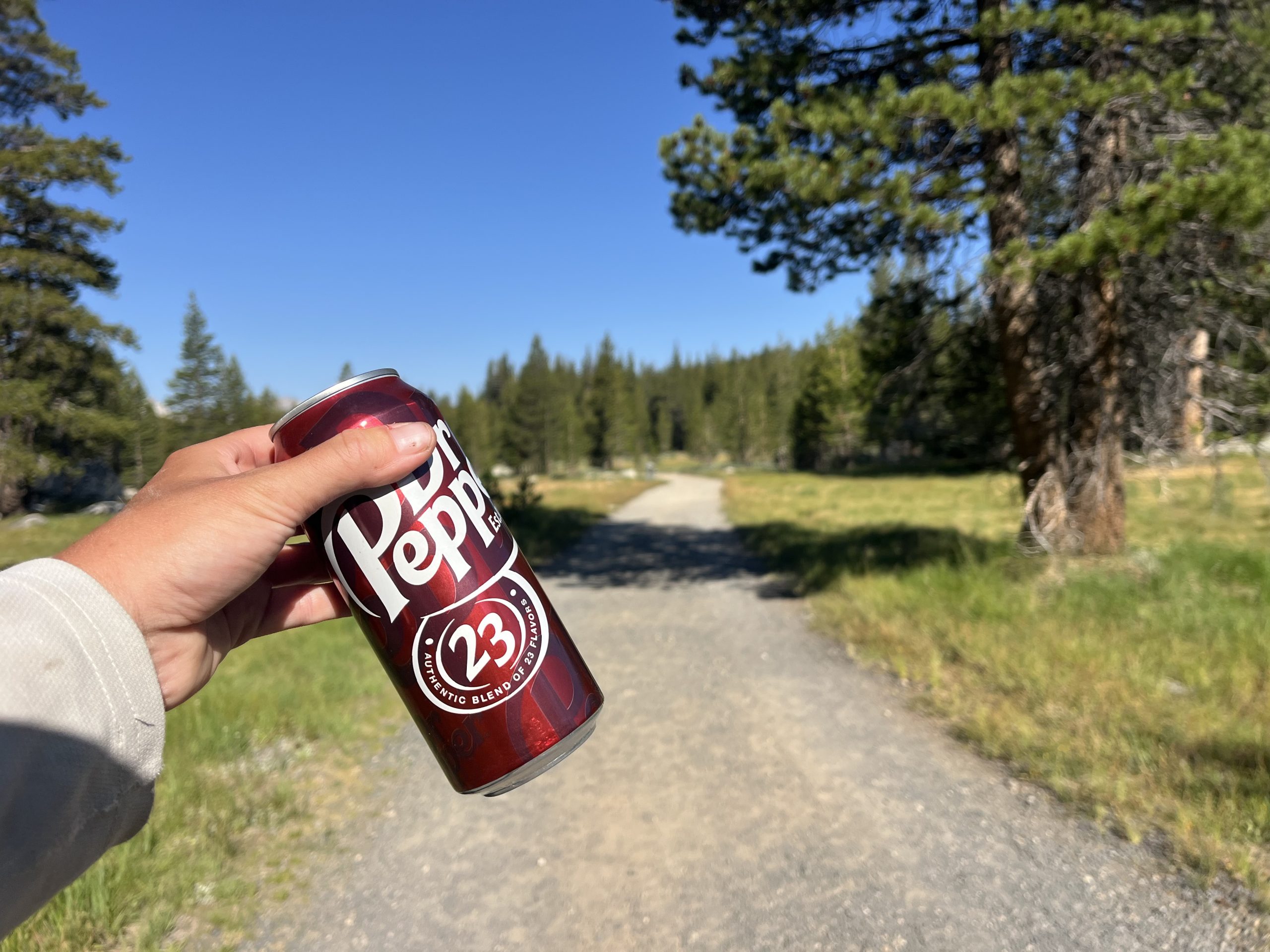
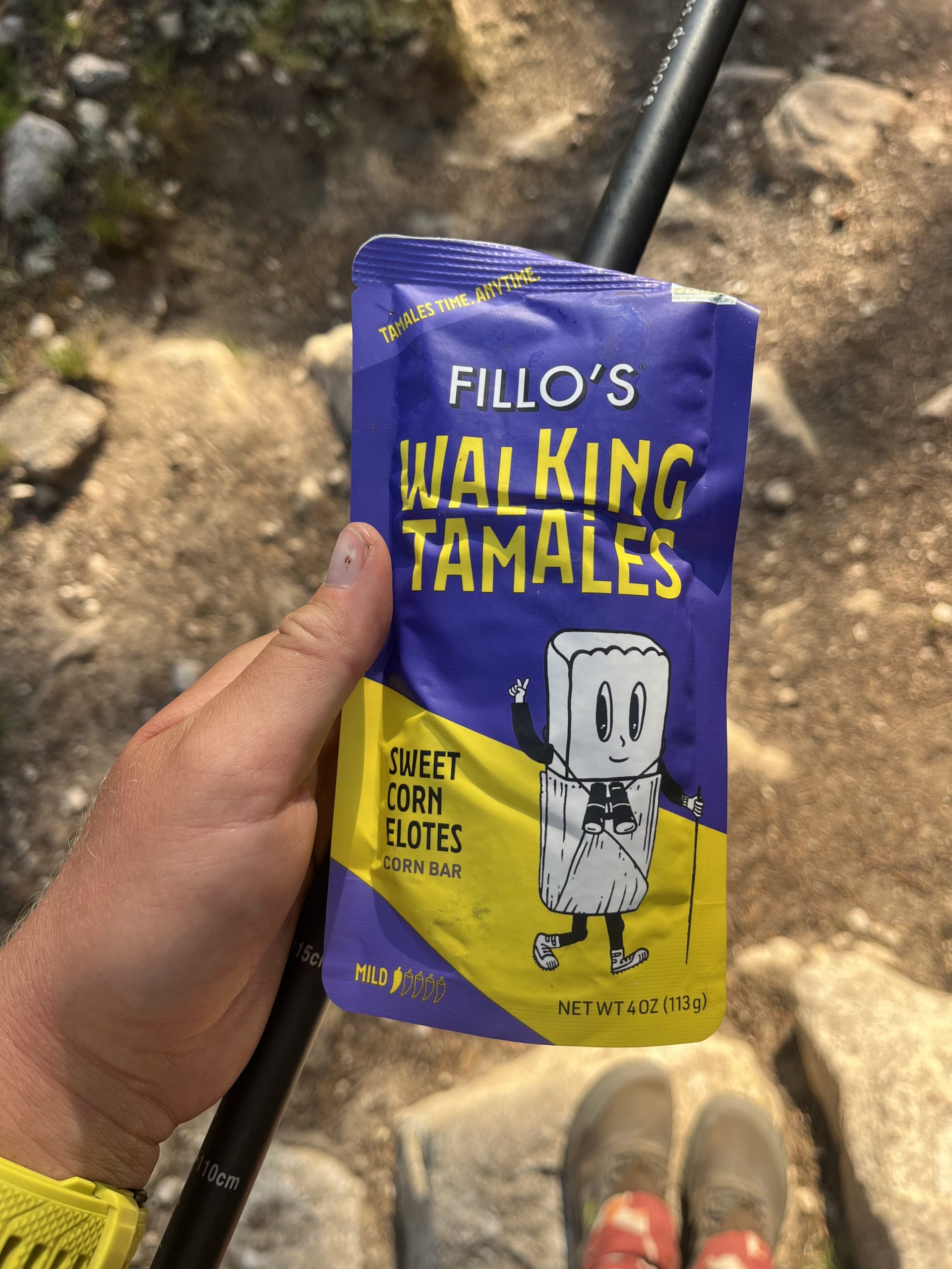
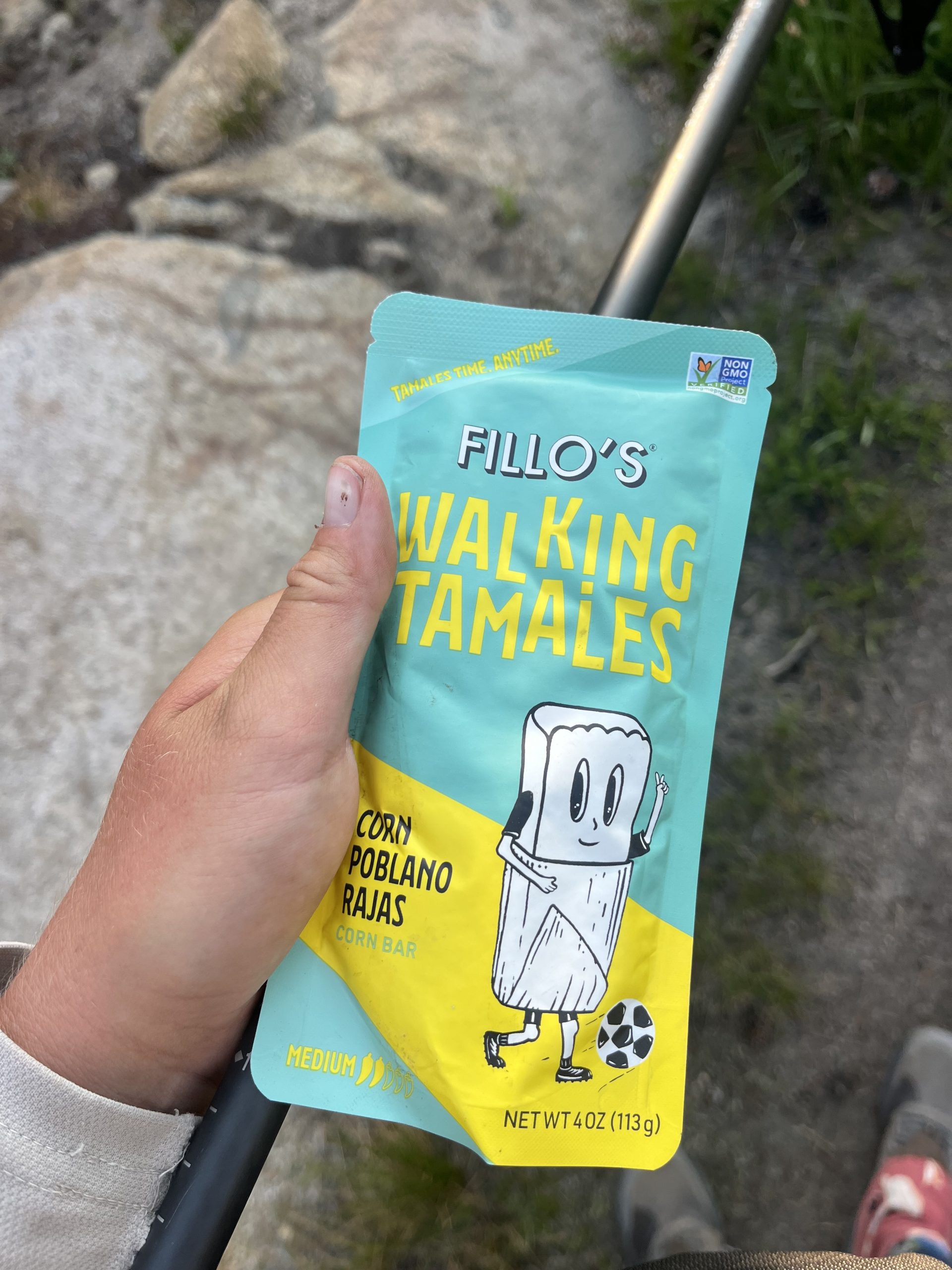
I wound up waiting a long time to get to the front of the line and order. But it was still really early, so that was ok. I got a hot chocolate, a breakfast burrito, and a side of home fries. While everything cooked, I headed to the general store next door to grab a couple things. I got two Gatorades to pack out in my water bottles. I also got a soda to carry out and drink later today. And the store had two types of walk-in tamales that I’ve never seen before. So I had to try those.
By the time I was done in there, my food was ready. I stuffed down the home fries and drank the hot chocolate. Then walked out with the burrito and ate it along the road. I knew the trail would follow along the road for a while. Then it would pick back up onto dirt track before getting onto some actual trail again. I ate while I walked and this next section wound up being one of the busiest sections of trail I’ve seen a long time.
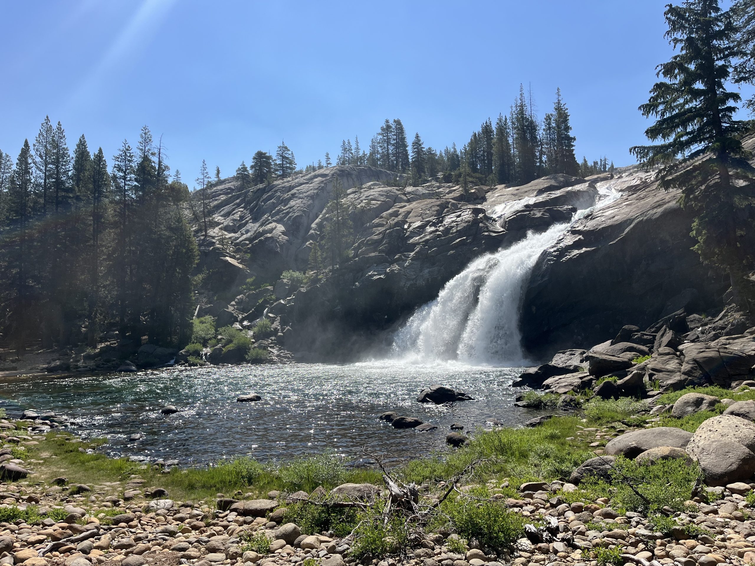
I wasn’t really prepared for it either. When I was here last time, Tuolumne Meadows wasn’t even open. I was so late in the season that everything was closed down so I didn’t see a soul. Apparently, though, the campsite about 5 miles north of Tuolumne Meadows is super popular. Because as I made my way there, I probably passed 50–60 people heading the opposite direction. They had all camped at the site last night. It’s right by a waterfall and apparently has running water and bathrooms.
I actually camped right by the waterfall and near the campground last time. I could see canvas tents, and other things set up. But things like that sort of give me the creeps when they’re closed. So I didn’t head over to investigate. This time around, it’s the middle of the season and there were tons of people utilizing the campground. It was a constant parade of large groups of hikers. Then I came to the junction for that campground and hardly saw a soul for the rest of the day.
It’s not surprising that the campsite right across from this waterfall is incredibly busy. I kept very close to this waterfall as well in 2022.
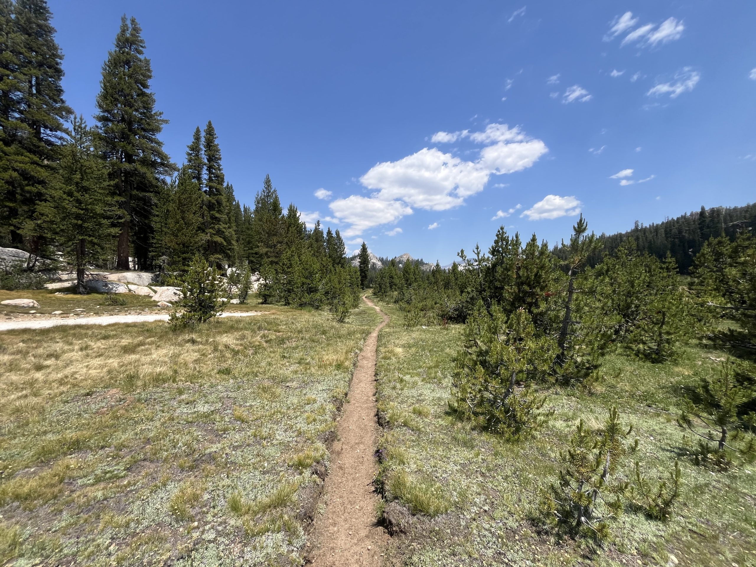
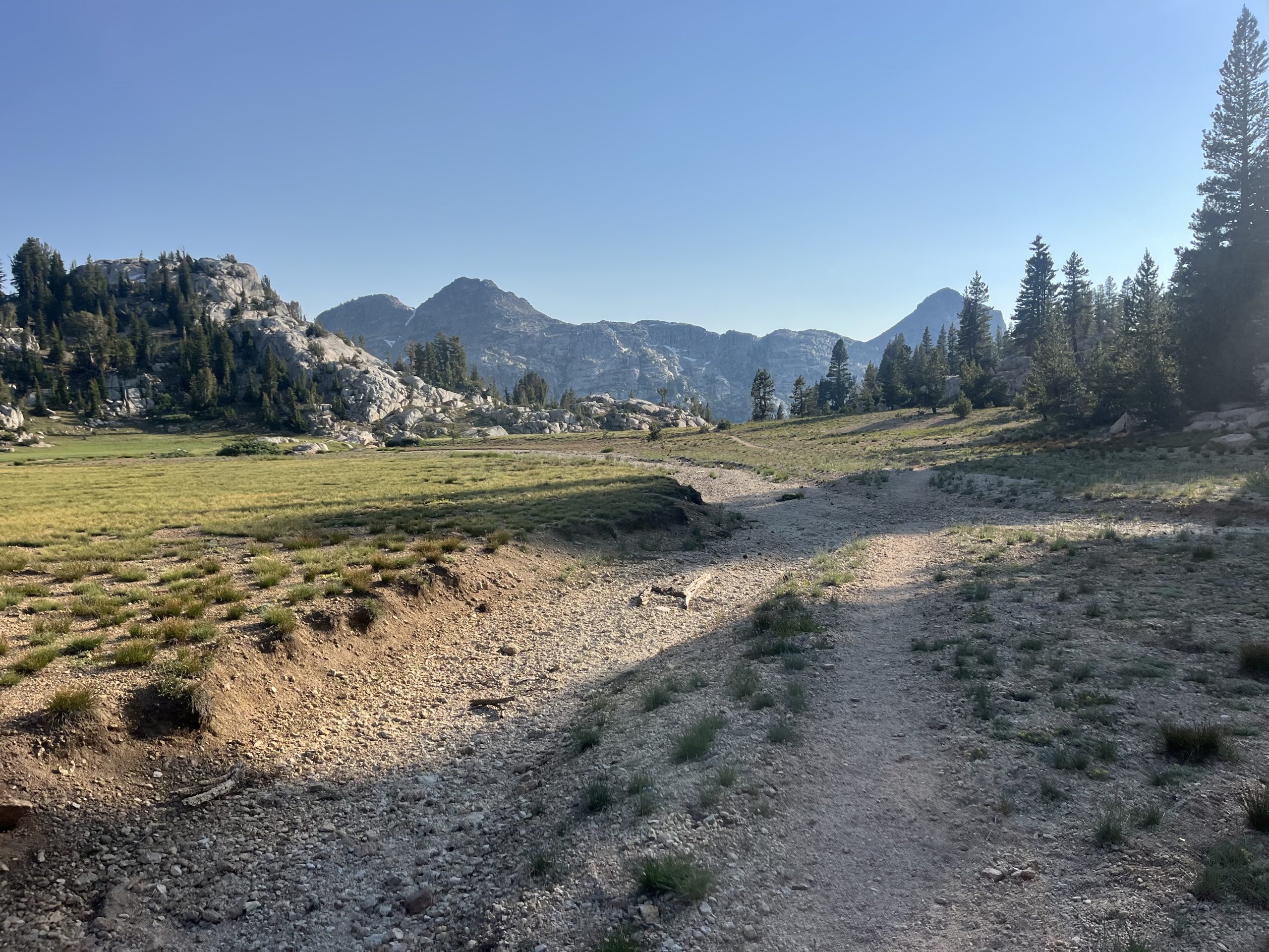
When I passed the junction for the campsite, I began a long but very gradual climb. It went on for the next seven or so miles. Then over the course of the day I would have a couple more gradual climbs. It’s getting to be the part of this trail, though, where things really calm down. The climbs are just going to continue to get more and more gradual and also shorter.
The terrain of this next climb was so nice and easy that I forgot I was going uphill most of the time.
Over the next couple hours, I made my way up to the top of that climb. It was scorching hot out already for the day so I stopped off a couple different times to grab water. At one point I was really thirsty and hadn’t seen a source in a while. Then I came upon a perfect clear puddle of snow melt. It was so clear and nice and cold. Not long after that I passed a couple hikers who didn’t seem to have the necessary maps or things. They had no idea where the next water source was and were asking me about it. Which is totally fine, and I always like helping people out. But it is a bit astonishing when you come out into the woods and aren’t even prepared enough to know where your water sources are. It always makes me nervous when people ask me questions like that. It’s very telling of how ill prepared someone is, typically.
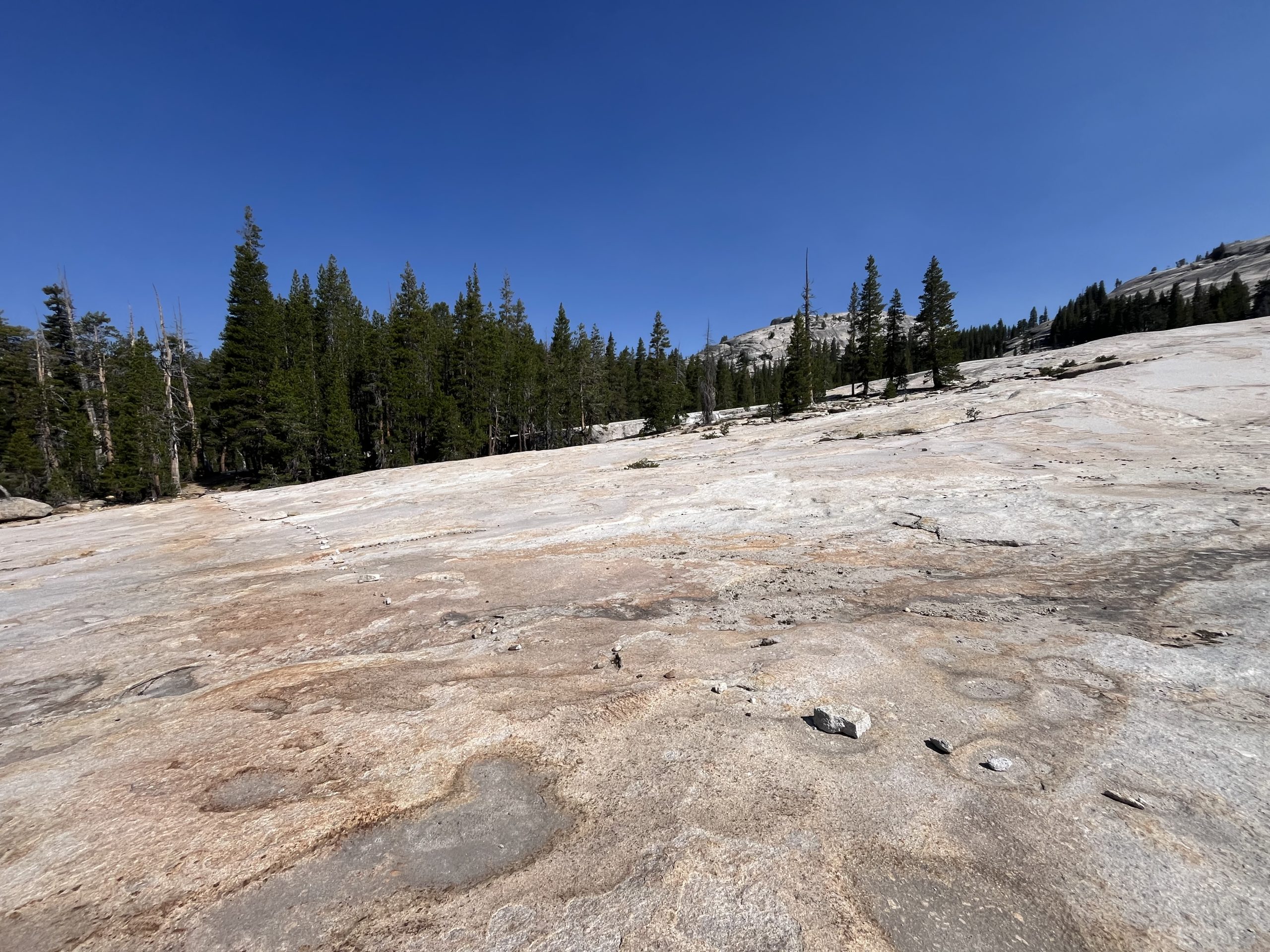
Eventually, I would have to do some elevation again. But prior to that, I enjoyed the beautiful trail.
Over the next couple hours, I had some more rolling climbs on and off. Then began making my way up the next pass. This would be my final big climb of the day. And one of the last passes in the Sierra. As they’ve gotten shorter though they’ve been a lot more gradual. And you barely get above tree line anymore. I listened to an audiobook as I walked and the time went by very quickly.
When I got up top, I ran into two other PCT hikers. But I was still hoping to go way further for the day, so I just kept on moving. By the time I was at the top I think I was over 32 miles in for the day. But was trying to go about 35 miles to set myself up for an early day into Kennedy Meadows north in a couple days. Originally I was planning on making it all the way off of that last pass and begin climbing up the next one.
But I wound up going by the next water source near a campsite and decided to stop off there. It was around 7:30 PM and I’d gone a little over 35 miles for the day. There were a few other people set up for the night at the tent site. But it seemed like everyone was already fast asleep. I grabbed water and then got my tent situated. Then boiled water and made dinner.
I picked up one of the stones from the nearby fire ring to hammer in my tent stake. The stone was still warm from the fire that the other 4 PCT hikers must have had before I arrived around 8PM. They were all lying in their tents, most of them sleeping. I could hear one or two of them roll over to peer out of their tents at the sound of my arrival. Last one in, last one out. That’s what I always recite to myself when I arrive late to a camp site with other hikers.
There are always exceptions to every rule. But generally this year I’m the last hiker to set up for the night if I camp with others. And usually I’m packed up and gone before the other hikers awake the next morning.
I quietly made dinner and thought about the day and the mileage. It’s so funny how much time I spent today thinking about mileage. I woke up this morning 81 miles out from Kennedy Meadows North. Yet was trying to work the miles regardless, and turn that 81 mile stretch into two days. But not just two days. Two days when, on the second day, I arrive at the highway early enough to hitch into Kennedy Meadows North. That was the center of the issue.
Doing two 40 mile days in a row wouldn’t have been that bad. But to ensure myself having enough time to hitch hike before dark, I’d have to do 45~ miles one day and closer to 35~ the next day. That’s the only way I could be certain to arrive at the road early enough to get a ride. And if I couldn’t get a ride then there was no point of any of it. That plan wasn’t working out. So instead I rolled back to my original plan, to arrive at KMN in the morning the day after tomorrow. It won’t be ideal to try to get in, eat, resupply, post a couple things, and get back on trail. But I don’t have to charge anything so as long as I get a fairly quick ride in, I think I should be able to get back out fast enough.
Every time I leave town with a loose plan of my intended future mileage. And it feels like every morning I wake up and slightly tweak that mileage to get to the next town quicker. Even when it appears that there is no way to tweak the mileage, you better believe I’ll try to find a way. Which usually involves some kind of crazy mileage. This time around though, logic won. Considering the fact that I really only have to average 26 miles a day for the rest of the year, I think doing 30–35 mile days is pretty great. Recently I’ve been doing a closer to 35 miles a day than the ladder. And yet even still, I can be hard on myself and try to push myself further. Every time I raise the bar, you would think I would be satisfied. Yet it just makes me want to raise the bar even higher. I suppose it’s a blessing and a curse.
If you enjoyed this blog and would like to support my hike by buying me a soda or a snack along the way, there is a “Tip the Author” button below! It links directly to my Venmo. Any and all support is incredibly appreciated!
This website contains affiliate links, which means The Trek may receive a percentage of any product or service you purchase using the links in the articles or advertisements. The buyer pays the same price as they would otherwise, and your purchase helps to support The Trek’s ongoing goal to serve you quality backpacking advice and information. Thanks for your support!
To learn more, please visit the About This Site page.
-

 Brand Stories6 days ago
Bloom Hotels: A Modern Vision of Hospitality Redefining Travel
-

 Brand Stories2 days ago
CheQin.ai sets a new standard for hotel booking with its AI capabilities: empowering travellers to bargain, choose the best, and book with clarity.
-

 Destinations & Things To Do1 week ago
Untouched Destinations: Stunning Hidden Gems You Must Visit
-

 AI in Travel1 week ago
AI Travel Revolution: Must-Have Guide to the Best Experience
-

 Brand Stories3 weeks ago
Voice AI Startup ElevenLabs Plans to Add Hubs Around the World
-

 Brand Stories2 weeks ago
How Elon Musk’s rogue Grok chatbot became a cautionary AI tale
-

 Destinations & Things To Do1 day ago
This Hidden Beach in India Glows at Night-But Only in One Secret Season
-

 Asia Travel Pulse3 weeks ago
Looking For Adventure In Asia? Here Are 7 Epic Destinations You Need To Experience At Least Once – Zee News
-

 AI in Travel3 weeks ago
‘Will AI take my job?’ A trip to a Beijing fortune-telling bar to see what lies ahead | China
-

 Brand Stories3 weeks ago
ChatGPT — the last of the great romantics