
Destinations & Things To Do
Little Rock Pond – The Trek
Day 92- 17 Miles today from Bromley Mountain Ski patrol hut to Little Rock pond shelter, 2,400 Feet Up, 3,500 Feet down, AT Mile Marker 1,678
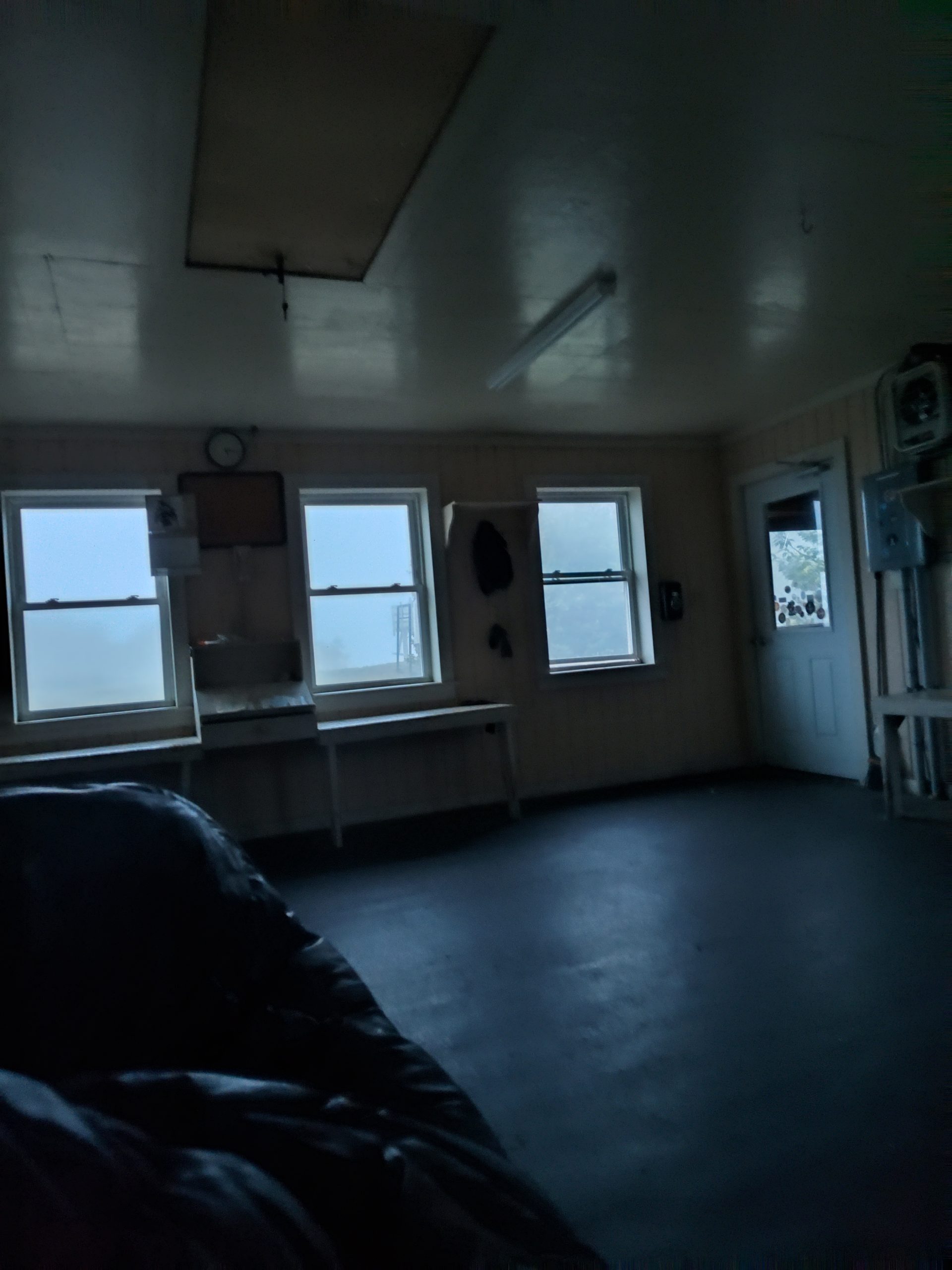
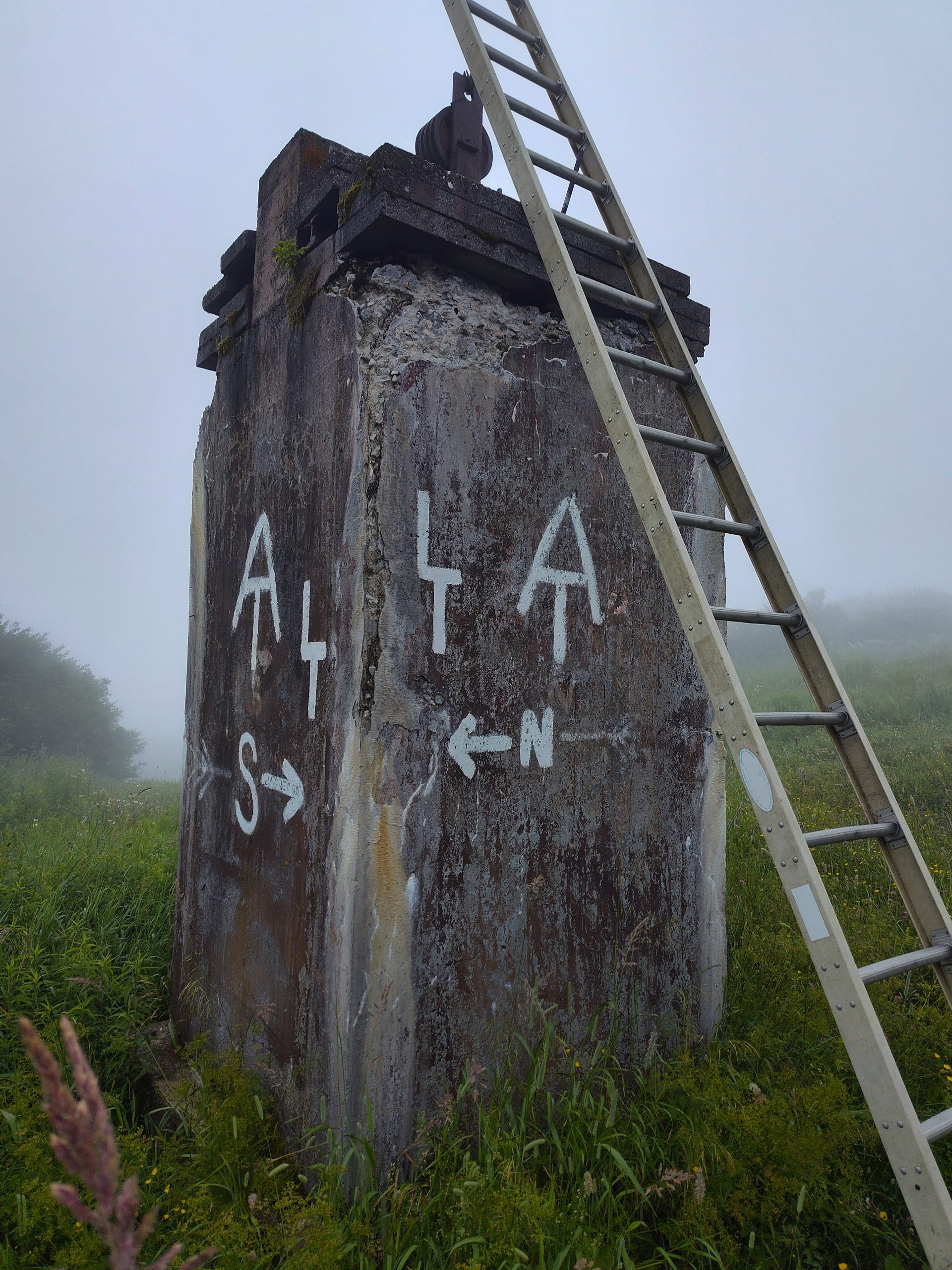
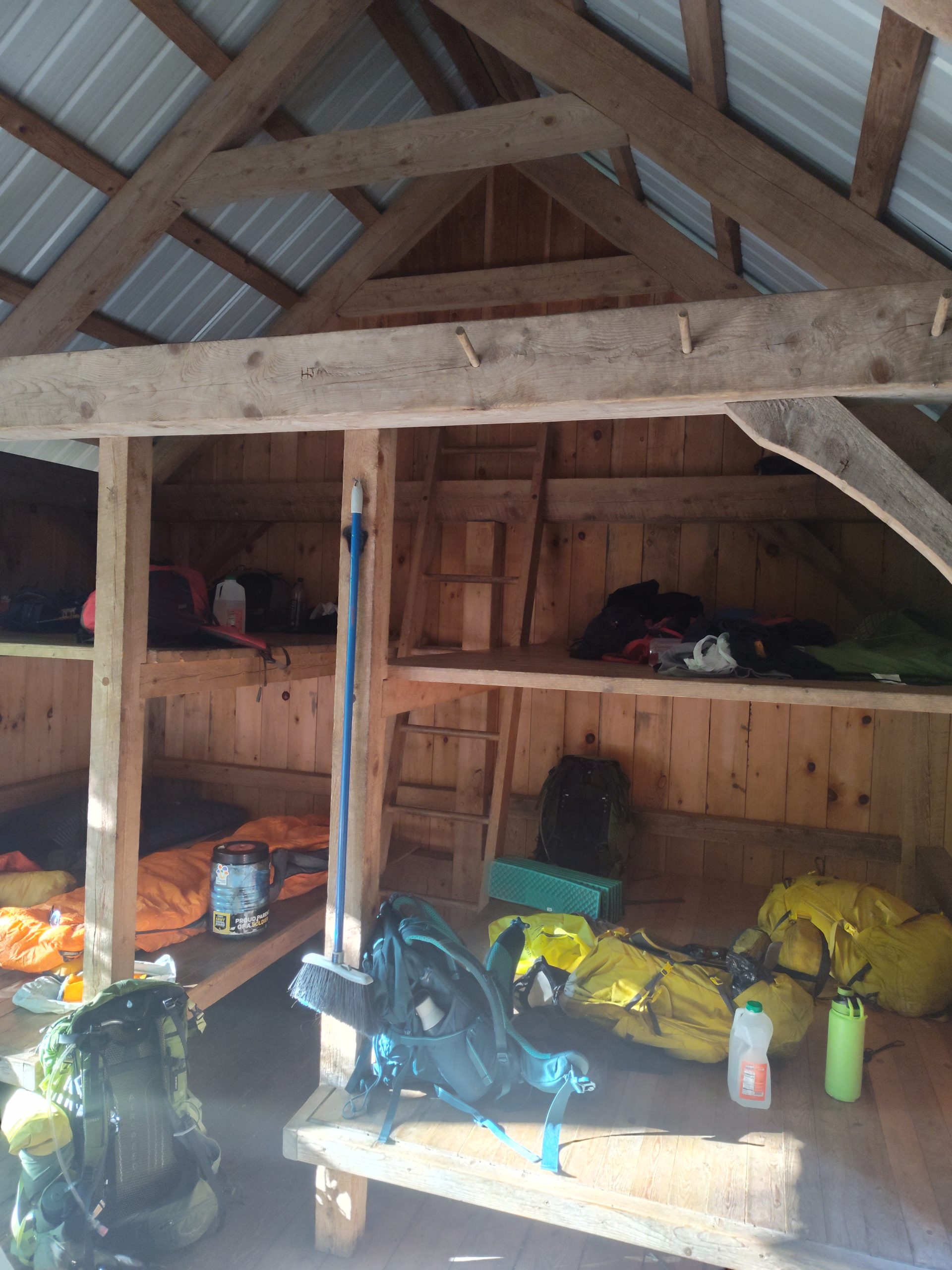
The Ski Hut
I arrived at the summit of Mount Bromley about 5:00 p.m. and I could see a storm off in the west heading in my direction. The views from the top of Mount Bromley were spectacular 360 degree views of large mountains all around.
The ski patrol hut was an enclosed building with windows, a small kitchen, picnic table, and several 2 foot wide platforms. I found a container of permethrin that had someone had left behind so I used the rest of the container up on my hiking clothes.
While being inside a building was nice it was a small building and I felt exposed. This was not like a shelter in the woods. This was an area that day hikers frequent. I have to admit it was a bit unsettling being alone inside this building.
I dozed off about dark and for the most part slept through the night. I woke a few times when I heard a noise.
Stroll On
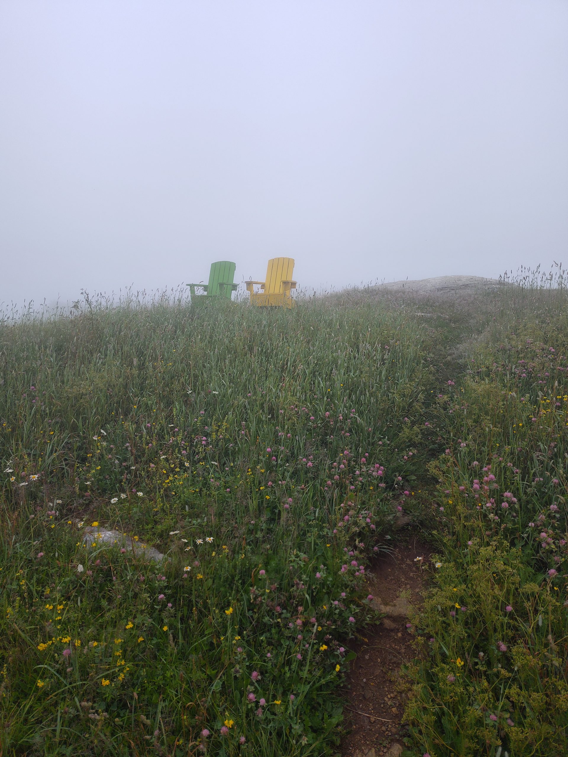
This morning the top of Mount Bromley was fogged in. I haven’t had too much luck with some of the most spectacular views.
It was mindless stroll down to Mad Tom Notch Road. I was moving along at a fairly fast pace of approximately 2 miles per hour and then began the climb up Styles peak.
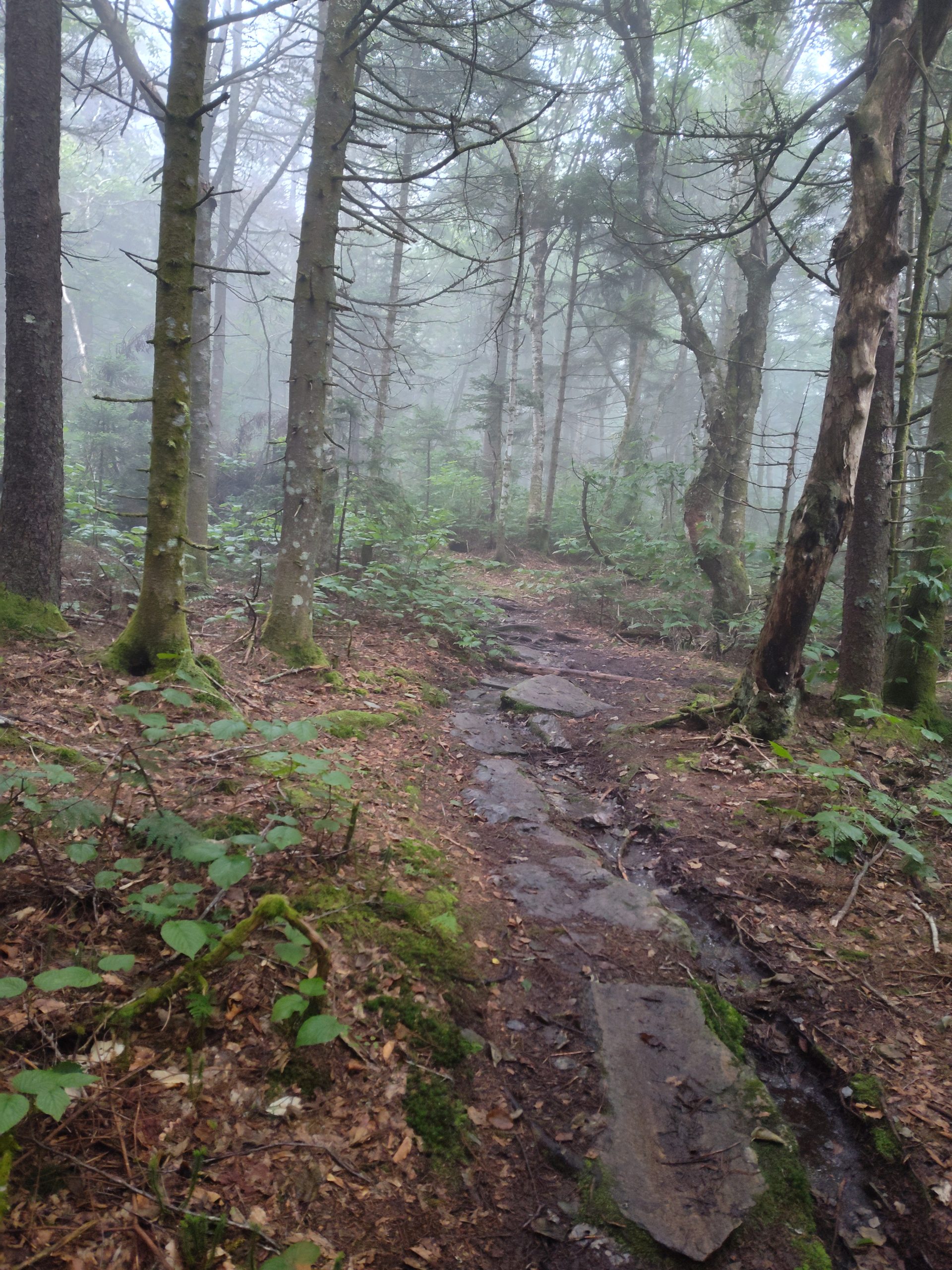
The trail meandered through a dense spruce and birch forest. After climbing it went along a ridge that looked like it had nice views on either side but the density of the forest kept the views hidden.
Water Source
I then descended steeply down to Upper Lake Brooke area. The Upper Lake Brooke was the first water source since yesterday. I had plenty of water because I took enough water up Mount Bromley yesterday in preparation for this long water carry. I was down to about a third of a liter.
I guessed that the waterfall ahead would be inundated with mosquitoes and flies so I stopped about 3/4 of a mile from the water source in a sunny area hoping that would reduce the amount of flies and mosquitoes that would attack me while I ate my cold soak ramen.
It was noon and I had only passed one hiker heading southbound all day. We both said hello but both of us seem to be on a mission to carry on in our respective directions so we didn’t even stop to talk.
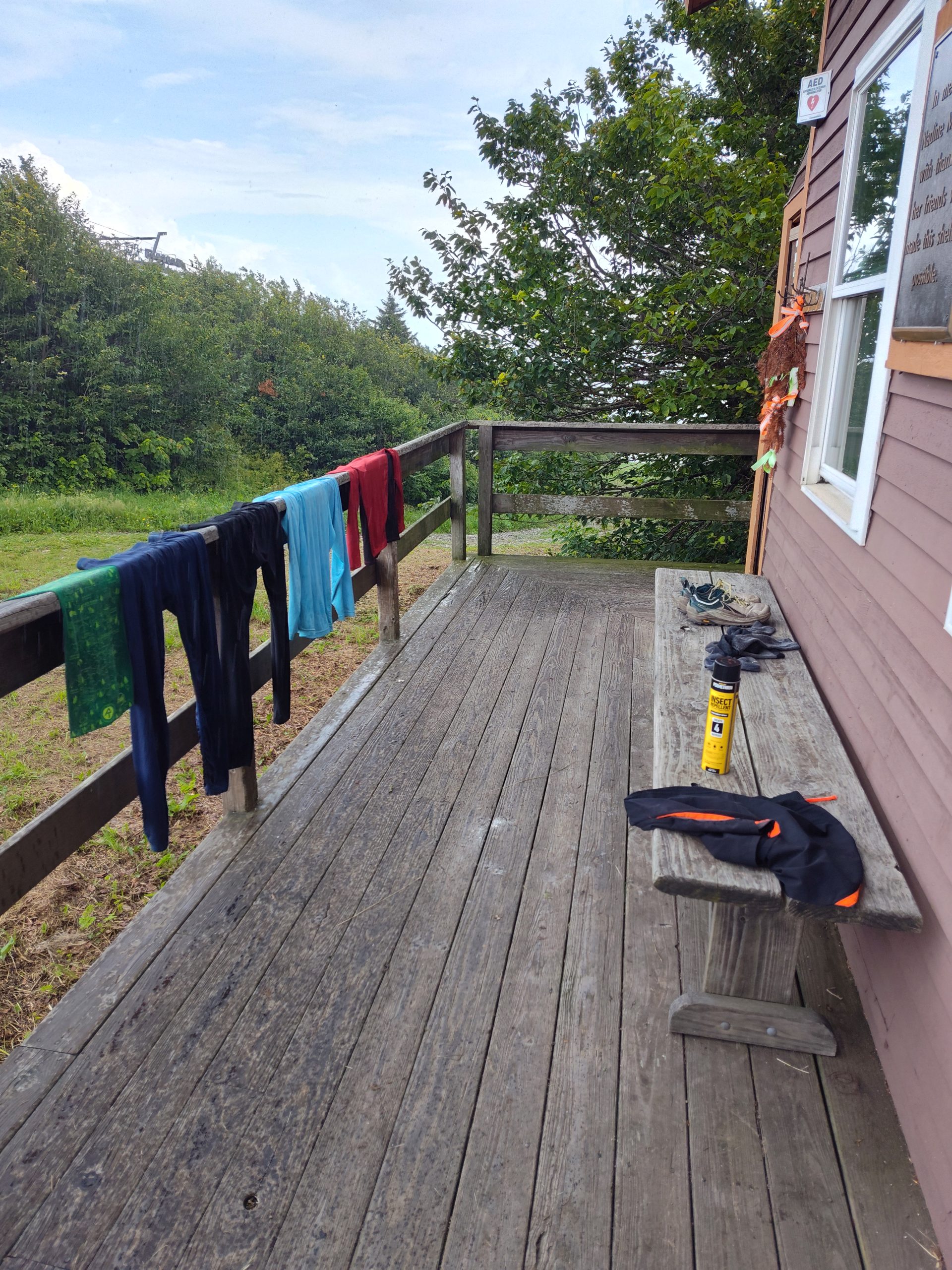
Shower Time
Just shortly after stopping to eat I came up on a small brook and decided I would get my water there. I was also able to use my smart water bottle cap that I drilled a bunch of holes in to make a little shower cap out of. Using my doctor Bronners soap I washed all the important parts of my body.
I was disappointed to look at the speed that I’ve been traveling at overall today. I’ve only been going about 1.5 mph. I had only gone 7 miles and still had 10 more miles to go.
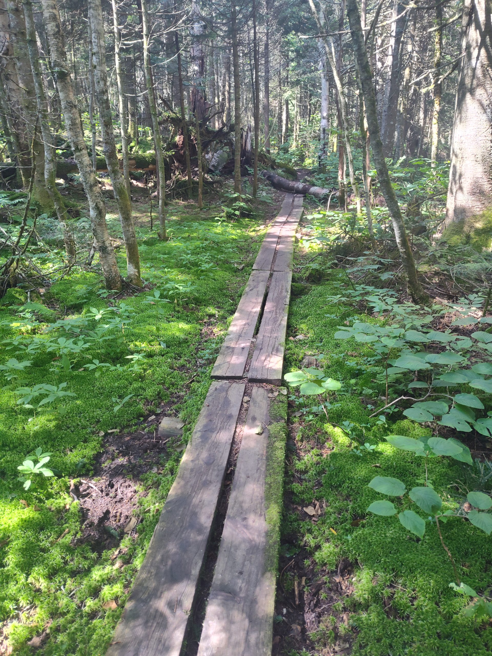
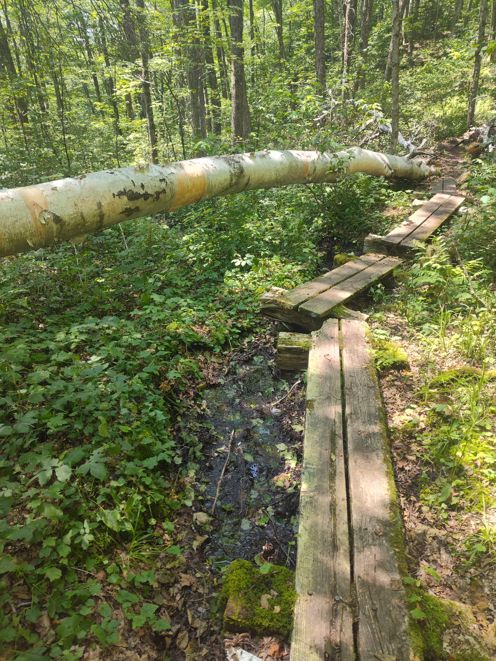
Around Peru Peak shelter there were endless boardwalks to walk down. It seemed to go on forever.
The trail continued on with some technical parts of rocks to navigate around.
Creek Symphony
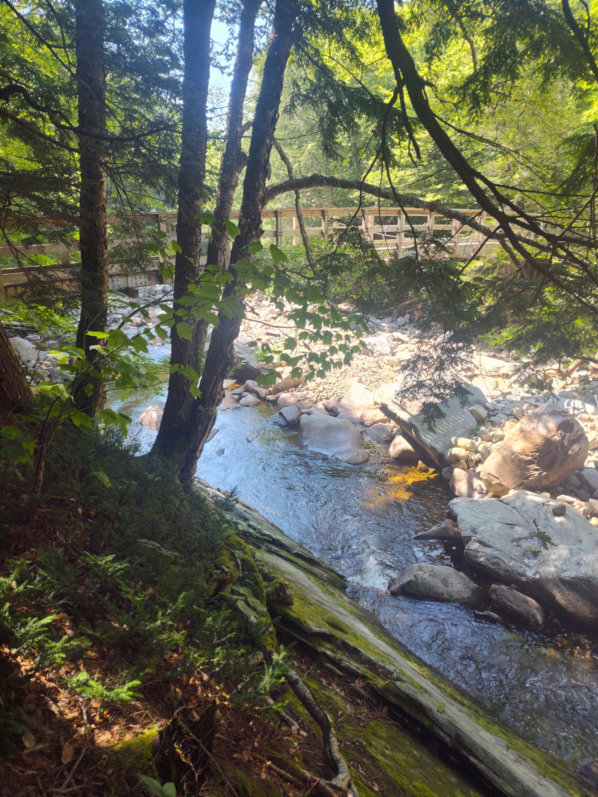
The path came out to a nice flat section where I could finally pick up some speed again. After passing Lost Pond the trail continued to parallel to a babbling creek. I couldn’t see it but I could hear it. I took my earbuds out so that I could listen to the rolling water in the woods next to the trail.
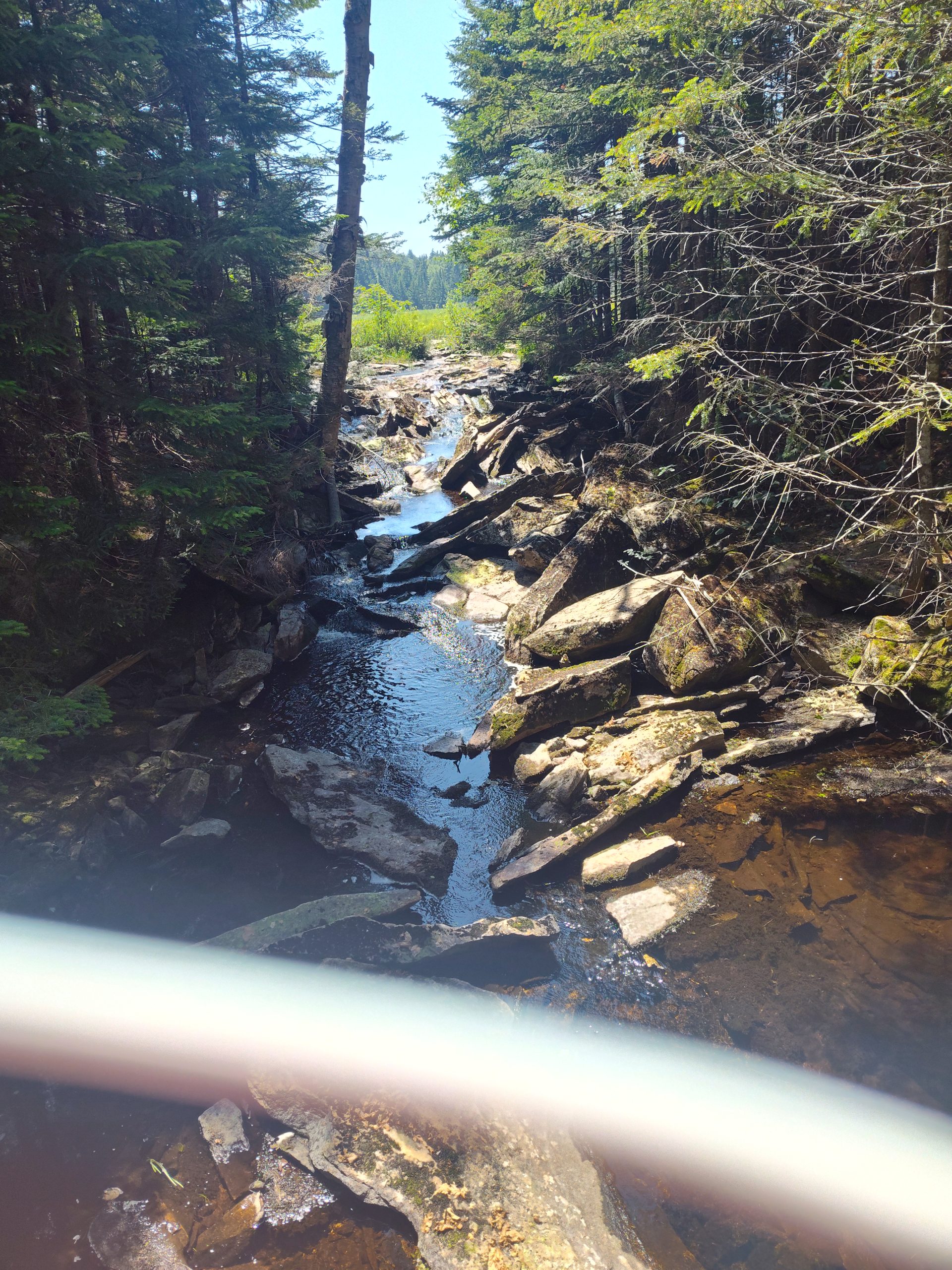
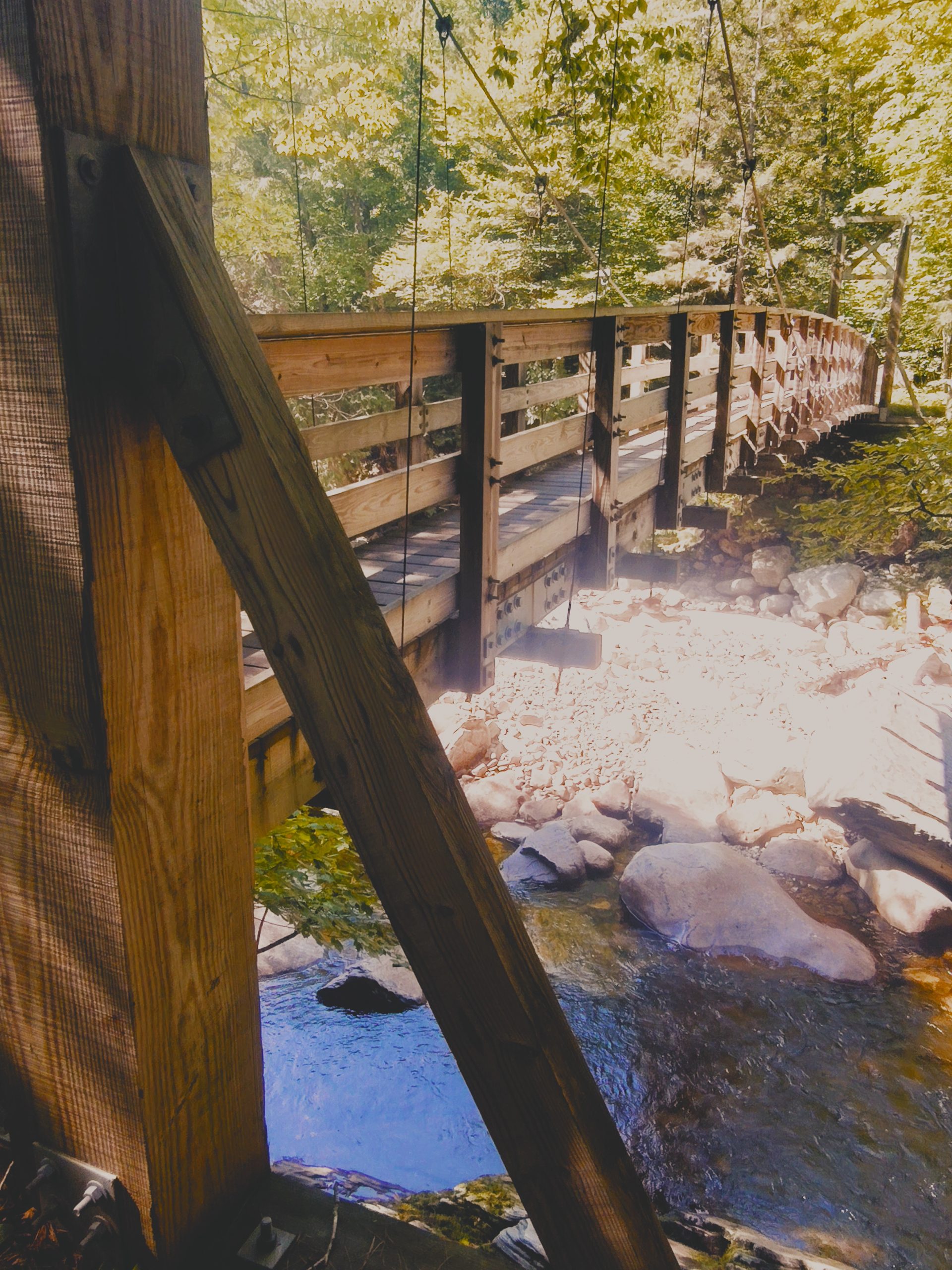
Eventually the trail led to Big Branch which was the size of a small river and had lots of little waterfalls on it. A huge 50-ft long suspension bridge spanned the little gorge where the Big Bend traveled through.
Crowds of People
I still had three and a half more miles left in my day.
The trail came out on FS10 and a parking area that was packed full of cars. I had heard that my destination Little Rock Pond was a big day use area.
The trail meandered along a nice small babbling creek all the way up to the shelter. After a day of seeing few people I now continued to pass multiple day hikers on my way to the shelter.
The shelter was packed with church group but I found the last spot in the shelter and set up for the night.
This website contains affiliate links, which means The Trek may receive a percentage of any product or service you purchase using the links in the articles or advertisements. The buyer pays the same price as they would otherwise, and your purchase helps to support The Trek’s ongoing goal to serve you quality backpacking advice and information. Thanks for your support!
To learn more, please visit the About This Site page.

In my previous post, I covered the journey of “Undecided” and I from Truckee to Chester, following this section’s closure in 2024 due to the Park Fire. Below is a reminder of our Fire Closure Areas to cover this season. This post covers the second part of the first closure.
Fire Closure One – Truckee to Mt. Shasta, CA – 340 miles
Fire Closure Two – The Three Sisters, OR – 118 miles
And finally:
Fire Closure Three – Glacier Peak Wilderness, WA – 108 miles
Follow The Blazes
Fire Closure One – Part Two
Start Point: Highway 36, Chester, CA
End Point: I5, and Soda Creek Road, CA
Start Date: Saturday June 28th
End Date: Monday July 7th
Chester to Mt. Shasta, 165 miles
Mileage Breakdown on trail (including side trails):
14.8 – 23.5 – 22.9 – 19.0 – 0.0 – 17.6 – 22.5 – 21.8 – 23.3 – 4.8
Highlights of Fire Closure One – Part Two:
Getting Back Onto Trail After Time Off
On the morning we left Chester, we had potatoes and toast at the local diner – a common staple for hiking vegans in smaller town restaurants. We grabbed coffee and ice tea from a local shop as I worked on a previous blog post. We rode the bus back to trail, grateful that we didn’t need to try and hitch again. That first day we walked only as far as the boundary of the National Park, to ensure we followed the rule that campers in the park need a Bear Cannister (of which ours are in Maine).
Don’t Tell Me To Enjoy My Hike
Sean was struggling with his appetite, and I continued to try and walk on a broken shoe, using a rolled up sock as a wedge. Most of this day was more burn zone, but we did get to see some new fauna. This came in the form of the Western Giant Ichneumon Wasp, with an extremely long ovipositor to help lay eggs in beetle grubs under tree bark (horror movie stuff).
Western Giant Ichneumon Wasp aka nightmare fuel
We made it to the end of the day, found a spot with less chance of widow makers ending our journey prematurely and went about cleaning up the sweat and dirt of the day. We didn’t know what to expect from Lassen, but knew there were several volcanic features in the upcoming area to enjoy.
Creek Water CNOC shower
Lassen Volcanic National Park
We entered the National Park, by which you could only know this from a small sign on the trail, and immediately hiked along a short side trail to see ‘Terminal Geyser’. Although not an erupting body of water, the cool stream which we stood by drains down to a geothermally active spot that heats the water. Large quantities of steam bubbled from the water and rocks nearby.
A Squinting Undecided with the Thermal Venting of Terminal Geyser
We then got to enjoy the sites of Boiling Springs Lake, before heading to a camping area. Any excuse to not dig a cathole is greatly welcomed, and we took advantage of the campground restrooms, as well as receiving trail magic in the form of some snacks and a yellow pepper from vacationers headed home.
Boiling Springs Lake – No Swimming
Though we couldn’t swim in the waters of Boiling Spring Lake, we did take a dip to cool down in the waters of Lower Twin Lake. This was my first full body swim since the Hot Springs in Southern California, and it felt great. Finally we worked through the heat of the remaining burn area in the park. Though it was hot, the trail was flat and easy to hike on. The views of Mt Lassen were also incredible!
Undecided in the Burn Area, Mt Lassen Looming in the Distance
Old Station and the Lava Tube
Some parts of trail are remote, whilst others just feel that way. After leaving Lassen, our next day took us through Old Station for breakfast. Of course we also hung out with hikers, and upped our snack levels. We then got to hit the third volcanic feature, a lava tube, north of Old Station. The Farout App describes this place as maintaining a 46F or 8C temperature year round. All I can say to that is that it was tough to leave here and continue on to one of the more challenging parts of this section: Hat Creek Rim (check the challenges section).
Showstopperi Squaterus in the Lava Tube
Burney Falls
The end of our resupply took us first to the Burney Mountain Guest Ranch where Sean treated us to a night in luxury. We then spent the next day in the town of Burney, eating our veggies, resupply shopping, and picking up a pair of replacement shoes I ordered a few days prior.
Packing the Beans and Veggies into Town Time
The next day we got a quick hitch from town to the trail, and made our way to Burney Falls. As we walked, I realised we had the chance to take a side trail to a viewpoint. I ran with a full pack, falling flat on my face, but managed to keep going before Sean missed the turnoff. We got to see the bridge from ‘Stand By Me’.
The Bridge from “Stand By Me”
As has become the pattern, we made it to Burnley Falls State Park, and went straight to the snack area for cold drinks, and to use the bathrooms. Hiker friends watched our packs so we could pop over to the falls. We were not disappointed with the beauty, though the day visitors did make for slow walking back up the pathway. The coolness of the air, sprinkled with waterfall mist was truly delightful and should be mandatory for all sections of trail on hot days!
Burney Falls and Me
The Falls are fed by Lake Britton, which also has an operating dam that we crossed on trail. There’s something about the sound of flowing water that brings me such peace and admiration.
Appreciation to the Dam Crossing at Lake Britton
Making it to Mt. Shasta
As we left the Dam area we took another three and a half days to reach Interstate 5, and this in itself was eventful. The trail wound along Hawkins Creek and then the McCloud River. As such, our days were filled with climbing up several thousand feet, then going right back down. Every time a creek or stream fed these larger bodies of water we had to hike along these areas to be able to cross the water at appropriate spots.
Taking a Break at a Small Water Source along a ridge
The elevation kept dropping us into sticky, warm areas, and then took us up to slightly cooler spots. The gradient of the trail was easy enough that we didn’t have to work too hard, but Deer definitely have the advantage.
A Deer before it climbed straight up the mountain when between Undecided and I
On the last full day of hiking, Sean was elated that we could finally take part in shenanigans that he had been planning since last year. At the final descent from the ridge towards the highway, you can follow the trail OR you can bushwhack a short distance to an old forest service road. This road rejoins the PCT, but cuts off three whole miles of trail. We didn’t even need to discuss if we were doing it. Our final night of this section was spent with the view of Mt Shasta looming over us.
The View of Mt Shasta from Inside our Tent
Challenges of Fire Closure One – Part Two:
Beating the Heat
With Summer in full swing, and the copious burn zones of NorCal, we were feeling the heat. It saps the energy from you; everything is damp with perspiration, and you have to pay attention to your hydration much more. Electrolyte packets like Liquid IV and Gatorade were essential to keep our salt levels up.
The Flowers Seem to Fair Better in the Heat
We planned to take as many breaks by bodies of water as we could, grateful that there weren’t too many mosquitoes (usually).
Undecided Cooling Off in a Large Creek, too Silty to Get Water From
We like to Dry Camp if there can be a stunning view, but sometimes we chose to stay by water just to keep hydrated, and with the chance to wash the salt from our bodies.
Camping at Low Elevation to Have Access to Water
My technique involves wetting my hair and hat whenever possible to cool me down. Sometimes I even dipped my sleeves in streams too! Of course my favourite way to keep cool was a dip in a pool.
Keeping Cool in Mt Shasta KOA Campground with a Dip in the Pool
Hat Creek Rim
Old Station was great. What isn’t so great is that the next on trail water was about 18 miles ahead. It’s a relatively gradual climb up to the ridgeline, and then you’re just walking under the heat of the sun.
The Lizards Seem to Enjoy The Heat (Mt Lassen in the background)
We packed out 4.5 liters (150oz) of water each ready to camel our way to the water cache provided by a trail angel named Jim. I also brought a Gatorade for bonus electrolytes. We received trail magic in the form of a hot, expired Diet Coke (I don’t recommend drinking these), and a small cache as we left a scenic viewpoint. Taking in the views kept our mind off water, but we did camp by a Communications Tower with dwindling water for the night. We were joined by our friends, and a pushy deer who was clearly after our salty deposits in our clothes, and on our packs.
Cowboy Camping at the Communications Tower
The next morning it was cool enough that our thirst didn’t challenge our last few miles to the water cache. However, the nearby cows did have Sean ready to hike on without water. We took a break, chatting with many hikers also filling up after a dry spell. The logistics surrounding the PCT continue to be one of the harder aspects of this hike, but we’re grateful to those who provide a helping hand.
The Kindness of Trail Angels and the Thirst for Water
Fire Closure One – Part Two Reflection
On our second to last night of the section, ‘Coin Flip’, ‘Rainbow’, ‘Ferdinand’, Undecided and I were warned by a hiker that there may be a fire ahead of us on trail by Cabin Creek. With no phone service we had no choice but to hike on and play it by ear, ready to turn around. We were fortunate that it wasn’t smoky and wasn’t affecting the trail. We did however head up the creek for water, a bathroom, and lunch, which resulted in a great discovery.
Trail Angel Mark Coming Through with the Pineapple Rings
We spent our last night on the edge of the trail, looking at the views of Shasta, grateful that we could finally check off this large section of trail. The next morning we hiked the last four and a half miles to the interstate. We knew the next days would be full of travel and logistics as we prepared to travel to central Oregon for our second fire closure section.
The Sleep Before Finishing our 340 Mile Section in Northern California
Sean found his trail legs and appetite, whilst I practiced resilience in dealing with gear failure. I even picked up a second pair of shoes in Mt Shasta that Topo Athletic sent out as part of the warranty claim for my damaged pair. We hung out in Mt Shasta and Dunsmuir and set our sights towards the Three Sisters, OR.
For now, goodbye California, it’s been real.
Catch Ya Later, California

Last fall, scientists from the Environmental Protection Agency (EPA) revealed that a popular lake in Wyoming’s Wind River Range is contaminated with human feces. And not just contaminated, but the most heavily contaminated lake out of nearly 1,000 lakes surveyed across the United States.
Look up a picture of Lonesome Lake, and you may be surprised. It doesn’t look like a biohazard. At first glance, it seems like paradise. The alpine lake sits at around 10,000 feet in elevation, and is ringed by the Cirque of the Towers—a picturesque semi-circle of 12,000-foot granite spires that has long enchanted rock climbers and trekkers alike. It’s also a stone’s throw from the Continental Divide Trail and a common stopping point for long-distance hikers. As a result, it is among the most heavily-trafficked backpacking destinations in the region. During peak season in August, as many as 400 hikers may visit the Cirque of the Towers each week.
In the spring of 2022, as part of the EPA’s National Lakes Assessment, the agency collected samples of water from 981 lakes around the country, including Lonesome. The results, published last fall, show that Lonesome Lake contains 490,895 calibrator cell equivalents of the bacteria genus Enterococci for every 100 milliliters of water, the highest of any lake tested. The EPA’s safe limit for swimming—not just drinking, mind you, but swimming—is 1,280 per 100 milliliters, meaning the contamination in Lonesome Lake is a jaw-dropping 384 times higher than the recommended limit.
As noted by local nonprofit news outlet WyoFile, “Arguably, Lonesome Lake was the most spectacular, remote waterbody in the broad study examining lake health all around the United States … and yet the data also suggested that Lonesome Lake’s water was the most polluted by poop. That’s especially remarkable given that the assessment also looked at lakes and ponds in urban areas and agricultural regions more typically associated with feces-related pollution.”
It’s worth noting that high concentrations of Enterococci do not necessarily equate one-to-one to high concentrations of feces. Researchers say more work still needs to be done. “A single datapoint doesn’t necessarily tell us much of anything,” the DEQ’s Ron Steg told WyoFile. “We need to get some real data to understand if there is a problem. If there is, we’ll react to the results of the data.”
Enterococci is intestinal bacteria, and thus its presence in a water supply is a strong indicator of fecal contamination. The sampling at Lonesome was conducted through the Wyoming Department of Environmental Quality (DEQ), and when the results came in last fall, researchers from the DEQ and U.S. Forest Service went out to take additional samples at the lake, this time searching for another indicator of fecal contamination, Escherichia coli, but came up with nothing. Over the next two months, scientists plan to take more samples at Lonesome Lake and nearby Big Sandy Lake, another popular trekking destination, to get a more definitive picture of the degree of contamination.
But to those in the know, the study results come as no surprise. “I tell people definitely do not swim in there, I tell people definitely do not drink the water,” Brian Cromack, a local outdoor gear shop employee, told WyoFile. “It’s been heavily contaminated for a long time, just via the negligence of outdoor recreation enthusiasts over the years.”
Although they may look pristine, alpine lakes surrounded by granite peaks like the Winds can face higher levels of contamination, because the non-porous granite and thin soil create a “bathtub effect,” offering no natural filtration for water. This, combined with the steep gradients, means that rain and snowmelt quickly wash fecal matter—not just from humans, but from dogs and natural wildlife—from the surrounding slopes down into the low-lying lakes. This problem peaks during spring thaw, when months of waste frozen in snowpack are often flushed into the water all at once, coinciding with peak visitation periods in the summer. At high elevations, cold water temperatures also allow dangerous pathogens like Giardia and E. coli to survive for longer periods.
It remains to be seen what the follow-up studies will reveal at Lonesome Lake, or what is to be done about it. Other high-traffic wilderness locales, like California’s Mount Whitney Zone, now require all visitors to pack their waste out in a “wag bag.” Currently there is no specific stipulation on how to dispose of bodily waste in the Cirque of the Towers, aside from following basic Leave No Trace principles—bury waste in a hole six inches deep, 200 feet from trails and water sources. But research is increasingly indicating that, taking into account the growing number of people recreating in the wilderness, these practices actually are no longer enough to prevent fecal contamination.

Birds of a feather flock together.
Since most people travel during the summer season, some of the world’s most beautiful destinations are also its most overcrowded.
A new ranking by Go2Africa has revealed the top 15 most overcrowded tourist destinations in the world — where the number of visitors dramatically outweighs the local population.
It highlights a growing global trend: picturesque destinations are feeling the strain of overtourism.
As travel rebounds worldwide, congestion of tourists raises questions about sustainability, local impact and the delicate balance between welcome and overwhelm.
To figure out which countries made this list, Go2Africa compared each country’s total number of visitors per year to its population data by analyzing tourism figures from national tourist boards and reports.
Their findings revealed that Vatican City — the world’s smallest country by both area and population — tops the list. Despite the population of this sovereign city-state within Rome, Italy being only 882 residents, the spiritual heart of Catholicism welcomes an astounding 6.8 million tourists annually.
That equates to a staggering 7,709.75 visitors for every local — a clear reflection of the city-state’s immense religious and historical draw.
Nestled in the Pyrenees between France and Spain, the mountainous principality of Andorra takes second place.
Best known for its ski resorts and tax-free shopping, this Southwestern European country sees around 9.6 million tourists each year. With a population of just under 82,000, that means there are 117.16 tourists for every resident.
Another European mountainous microstate, San Marino, ranks third. With only 33,581 residents, it attracts 2 million tourists annually.
Known for its medieval architecture and scenic hilltop views, San Marino hosts 59.56 tourists per local.
In fourth place is the Bahamas, a sun-soaked Caribbean paradise. Although home to just over 400,000 people, the island nation welcomes more than 11.2 million visitors each year — equivalent to 27.96 tourists per resident.
Its crystal-clear waters and sandy beaches remain a major pull for international travelers.
The tropical Caribbean country, Saint Kitts and Nevis, rounded out the top five. It has a population of 46,843 and draws in 875,085 visitors annually. The dual-island nation sees 18.68 tourists per resident. Its lush scenery and tranquil beaches have made it a celebrity favorite — most famously with Princess Diana.
These findings highlight the growing impact of tourism not just on infrastructure, but also on local communities.
While scenic and culturally rich destinations remain irresistible to global travelers, the figures reveal the need for sustainable tourism strategies to preserve these special places for generations to come.
The top 15 most overcrowded travel destinations:
1. Vatican City
Local population: 882
Tourists per year: 6,800,000
2. Andorra
Local population: 81,938
Tourists per year: 9,600,000
3. San Marino
Local population: 33,581
Tourists per year: 2,000,000
4. Bahamas
Local population: 401,283
Tourists per year: 11,220,000
5. Saint Kitts and Nevis
Local population: 46,843
Tourists per year: 875,085
6. Antigua and Barbuda
Local population: 93,772
Tourists per year: 1,154,236
7. Bahrain
Local population: 1,607,049
Tourists per year: 14,900,000
8. Monaco
Local population: 38,956
Tourists per year: 340,000
9. Malta
Local population: 563,443
Tourists per year: 3,563,618
10. Hong Kong
Local population: 7,414,909
Tourists per year: 44,500,000
11. Iceland
Local population: 393,396
Tourists per year: 2,287,341
12. Croatia
Local population: 3,875,325
Tourists per year: 21,300,000
13. Barbados
Local population: 282,467
Tourists per year: 1,520,740
14. Switzerland
Local population: 8,921,981
Tourists per year: 42,800,000
15. Grenada
Local population: 117,081
Tourists per year: 504,000
-

 Brand Stories3 days ago
Bloom Hotels: A Modern Vision of Hospitality Redefining Travel
-

 Brand Stories2 days ago
Olive Living: India’s Intelligent, Community-Centric Hospitality Powerhouse
-

 Destinations & Things To Do3 days ago
Untouched Destinations: Stunning Hidden Gems You Must Visit
-

 AI in Travel3 days ago
AI Travel Revolution: Must-Have Guide to the Best Experience
-

 Brand Stories3 weeks ago
Voice AI Startup ElevenLabs Plans to Add Hubs Around the World
-

 Brand Stories2 weeks ago
How Elon Musk’s rogue Grok chatbot became a cautionary AI tale
-

 Asia Travel Pulse3 weeks ago
Looking For Adventure In Asia? Here Are 7 Epic Destinations You Need To Experience At Least Once – Zee News
-

 AI in Travel3 weeks ago
‘Will AI take my job?’ A trip to a Beijing fortune-telling bar to see what lies ahead | China
-

 Brand Stories3 weeks ago
ChatGPT — the last of the great romantics
-

 The Travel Revolution of Our Era1 month ago
CheQin.ai Redefines Hotel Booking with Zero-Commission Model
You must be logged in to post a comment Login