
Destinations & Things To Do
Day 89: The Beginning of the End
- Bears Den Hostel (1005.9) to Snickers Gap (1006.5)
- 23 feet ascent, 333 feet descent
Concusiousness hit with a jolt of adrenaline this morning. This is it. I was linking 1975 with 2025. When I stepped out into Snickers Gap today, the impossible would be history. For fifty years, I had a gap in my life called Virginia. By lunch, the gsp would be filled. It is the beginning of the end.
Filling the gap was more eventful than I had expected it to be. I anticipated being wet but I did not anticipate weeks of flooding. I expected to be cold but did not expect temperatures in the 20s in May. I knew it would be to be hot but did not expect weeks of hiking in temperatures in the 90s and 100s. Linking my life a half-century showed me both I, and my world, have changed.
Breakfast of Champions
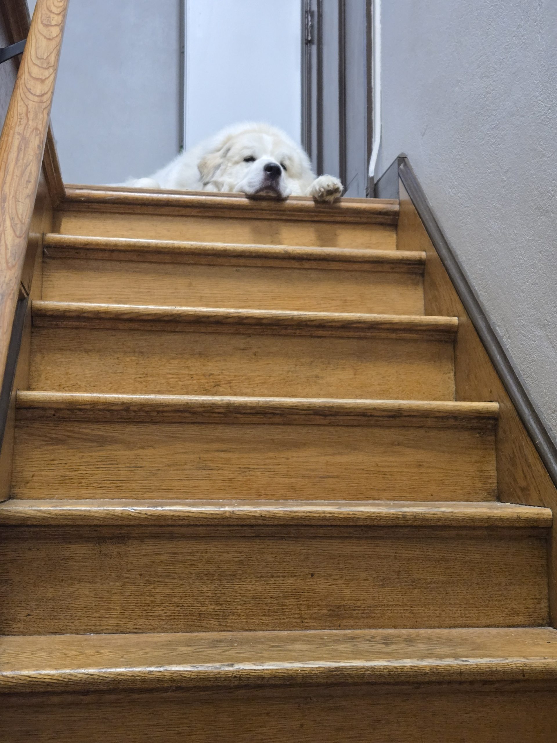
The upstairs of the Bears Den opens at 7 am. Hikers are invited to enjoy all you can eat, make your own pancakes.
As we made our way up the stairs to the kitchen, we were greeted by the expectant Great Pyrenees dog. We were assured he was never allowed to eat food from hikers but clearly he expected some day that rule would change. He was an affable mooch.
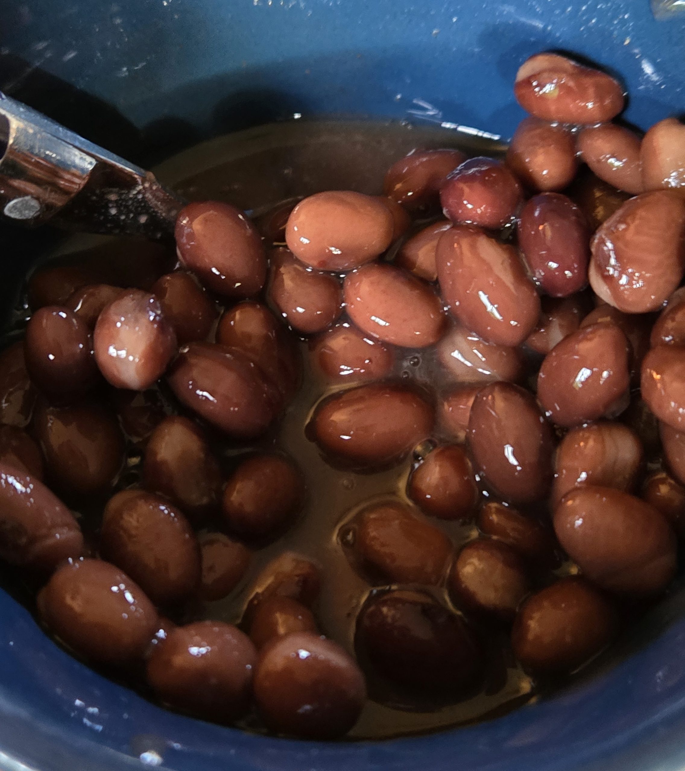
The Historian was eager for his fat, sugar, and refined carb fest but I really was slow to warm up to the idea. While I cooked pancakes for him, my eyes fell on a communal can of black beans. Bingo!
I placed a huge pile of pancakes in front of The Historian and a large coffee mug of black beans in front of me. Both of us were delighted with our breakfast.
On To Snikers Gap
We shouldered our packs and a fluttering heart, set out for our .6 mile hike to Snikers Gap. We made a lot of jokes about whether or not there would be a climb. The Historian decreed he would not go uphill. He was only willing to go downhill to the Gap. When we approached a slight rise, he cried out, “That’s it. I go no further!”
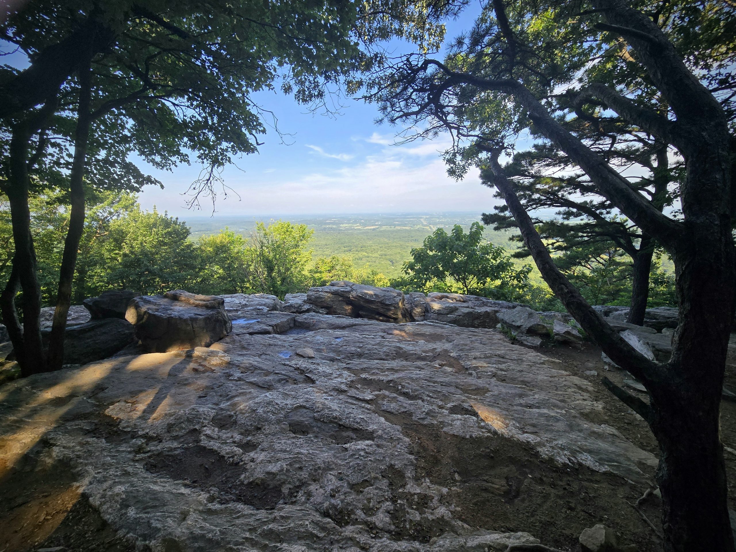
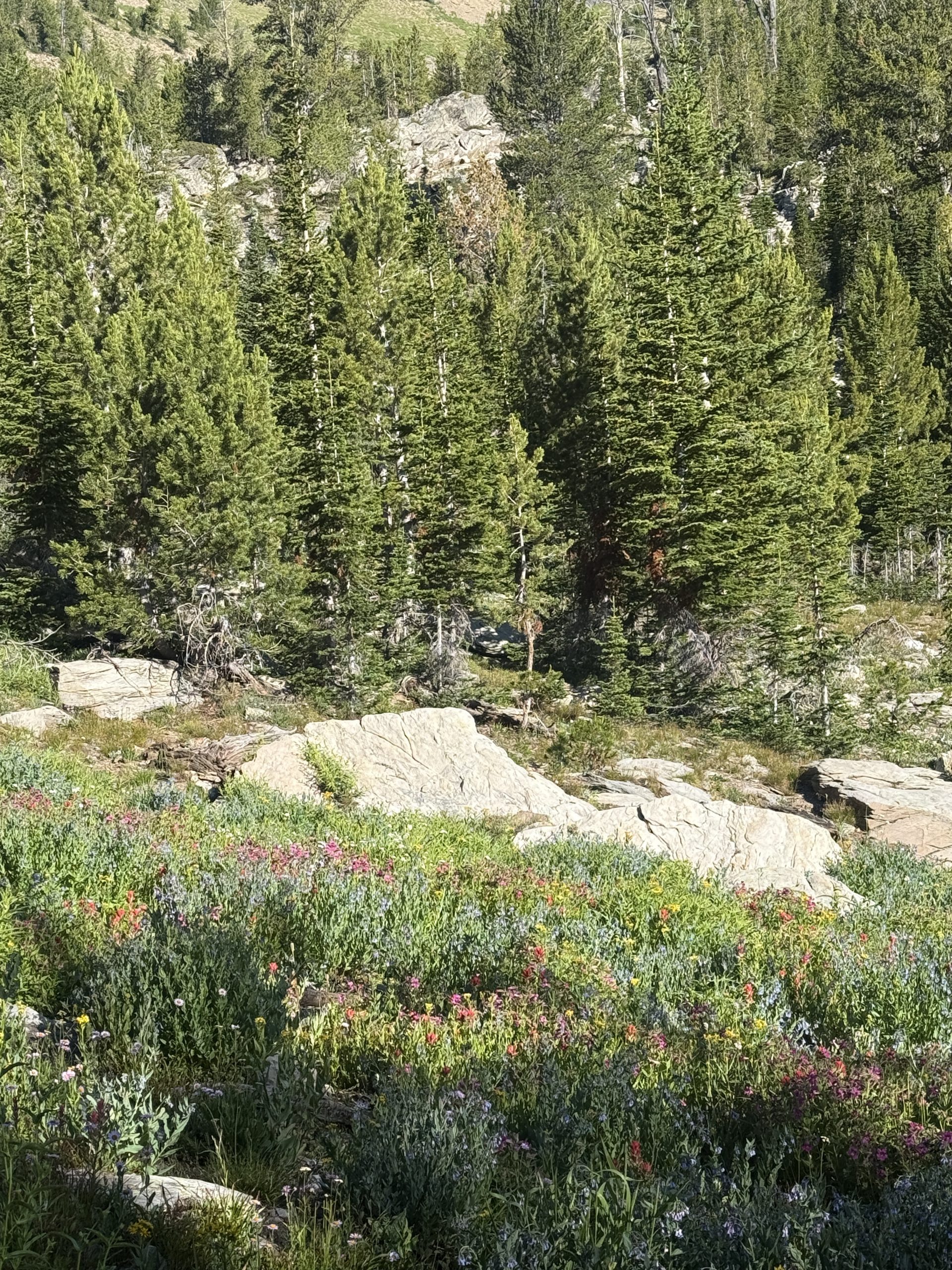
We both laughed and carried on. We stopped to enjoy the beautiful views of the Piedmont below the rocky hills of Bears Den. Seeing the land slope down toward tje Potomac River was a little heartrending. We were coming to the end of the mountains on this end of the Appalachian Trail as we were coming to the end of this massive effort to walk Virginia.
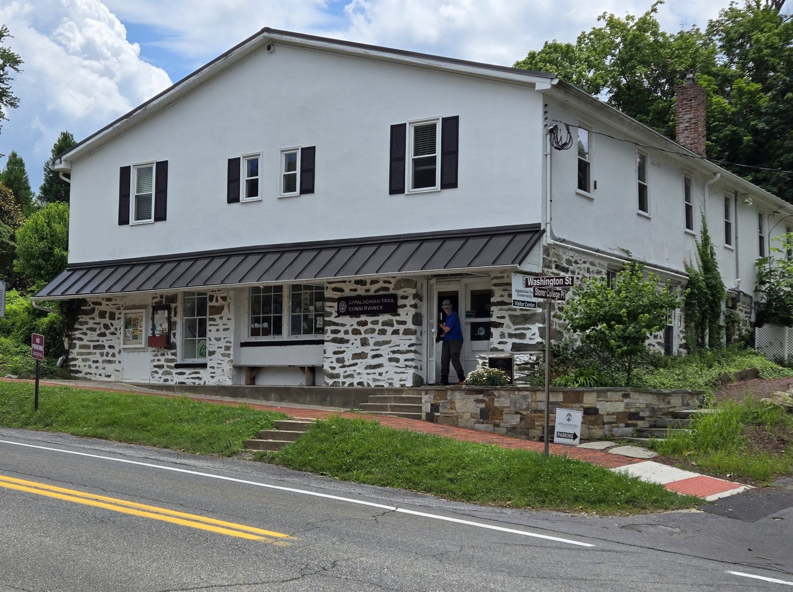
Snickers Gap
We came to the busy road at Snickers Gap. The Historian asked me if it looked like I remembered it and I could only say one of the small side roads off the gap looked vaguely familiar.
After we excitedly took photos at the Snickers Gap sign, we waited for our shuttle driver. He arrived as scheduled and we headed to Harpers Ferry. He had been shuttling hikers for many years and was able to fill in some of the gaps in my memory.
In 1975, the distance between Snickers Gap and Harpers ferry included a 13 mile road walk. I remembered doing that. I had even told The Historian, on a collect call or by letter about hiking to Maryland border in one day. Ed Garvey had dropped me off at Snickers Gap encouraged me to walk to Maryland that day. The connection was made.
Harpers Ferry
For the past theee years I have worked with a health coach. So far, our monthly meetings while on the Trail were by email. Soon after arriving at the Halfway Hideaway Hostel, I was able to videoconference with my health coach. It was delightful to get to see her. She was encouraging and proud of our effort. Her affirmation was more fuel for the fire burning within us.
After the video conference, we hiked to the Appalachian Trail Conservancy office. We had two goals. First, I wanted to get my picture for the ATC records. Second, we had decided to purchase AT tee shirts for travel to New England.
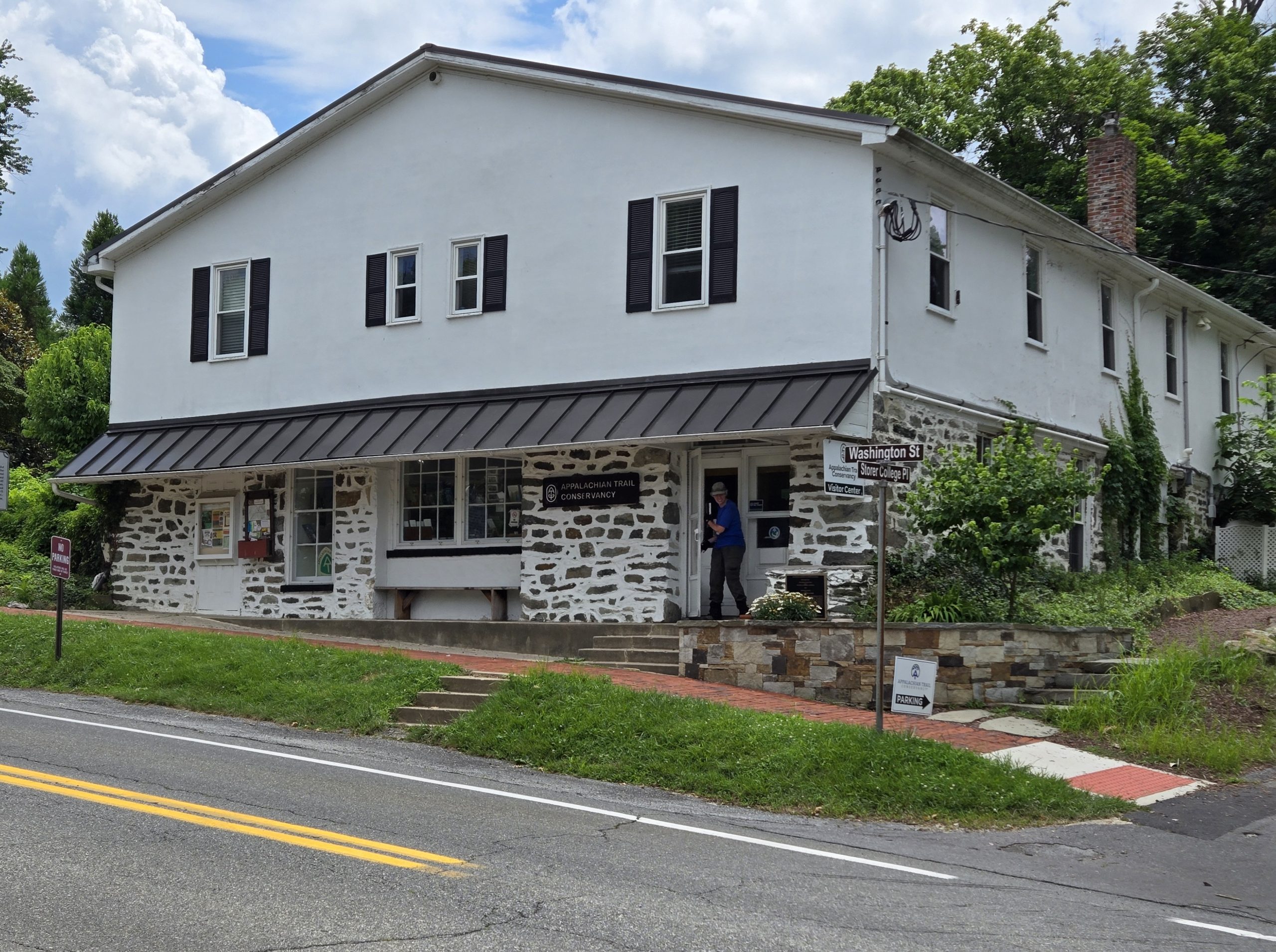
After our visit to the ATC, we stopped off at the Bolivar Bread Bakery and fell head first into the fragrant sour dough breads. We bought two loaves and two brownies along with butter and some cheese. This whole trip we have most craved fresh bread. This was the best of bread. Our next stop was at the Appalachian Snail grocery, which specializes in organic local foods. We bought arugula and fruit.
Next Steps
After finishing our AT mid-point chores and filling our bellies, we got down to business sorting out our journey to New England.
I have two short bits of trail left to finish the AT. First was a section of the AT between Hanover and Glencliff, NH. I had skipped it in 1975 in order to make sure The Historian, who was visiting me for a couple of weeks, could hike in the Whites. The second section was the within the bounds of Baxter State Park. Since I was there in November in 1975, I could not enter the park.
In total, I have less than 50 miles to thw end.
Staging the New England Segments
We lived in Hanover for a couple of years in the 1990s. We hiked some of the section between Hanover and Glencliff then. Also during that time, The Historian befriended and became business partners with an antiques dealer. Over the years their friendship deepened to brotherhood.
Our next step is to get to our friends house to relax, put weight on The Historian, and finish the section near their house in the Hanover area.
We originally planned to drive from Harpers Ferry to their house. After a thoughtful assessment of how tired we are, we decided not to drive.
There is a train from Harpers Ferry to Washongton, DC where we can connect to The Vermonter Amtrak train to a town close to our friends. Clicking train ticket “purchase” button was remarkably confusing.
Although it is possible to take the train in one day, the connection in DC was only 30 minutes at rush hour. We decided to spend the night in DC rather than risk missing The Vermonter.
Thankfully, we know DC well from years of working there. I was able to locate and book a hotel within a block of Union Station. We even got a very good rate since it was for a Friday night, a time when businesses hotels are often sparsely populated.
Dinner and Sleep
Decisions made, we were exhausted. Hiking this morning, an hour shuttle, our ATC visit, shopping, and then making train and hotel reservations, was stressful. So many decisons and transitions in one day! Our hardest choices are usually which of our dehydrated dinners we should eat (the heaviest, of course!).
We were startimg to think about dinner when a food delivery arrived. Someone ordered a few thousands of pounds of Kentucky fried chicken. Everyone at the Hostel was invited to partake. We enjoyed the fried chicken and aimed ourselves toward bed. Everyone in our room at the hostel was over 40 so we were all in bed by 8:30 pm.
We will need a good night’s sleep. Tomorrow is the beginning of the end.
This website contains affiliate links, which means The Trek may receive a percentage of any product or service you purchase using the links in the articles or advertisements. The buyer pays the same price as they would otherwise, and your purchase helps to support The Trek’s ongoing goal to serve you quality backpacking advice and information. Thanks for your support!
To learn more, please visit the About This Site page.

Day 26
Start: Tentsite, mile 413.6
End: Trout Lake, off mile 423.8
Miles hiked: 10.2 miles
The NOBOs cleared out early in the morning, waving their goodbyes as I ate my breakfast. Today was another special day: town day! The plan was to head into Trout Lake, eat a hearty meal, and pick up my resupply box. Sun didn’t have a box there, but he was happy to tag along.
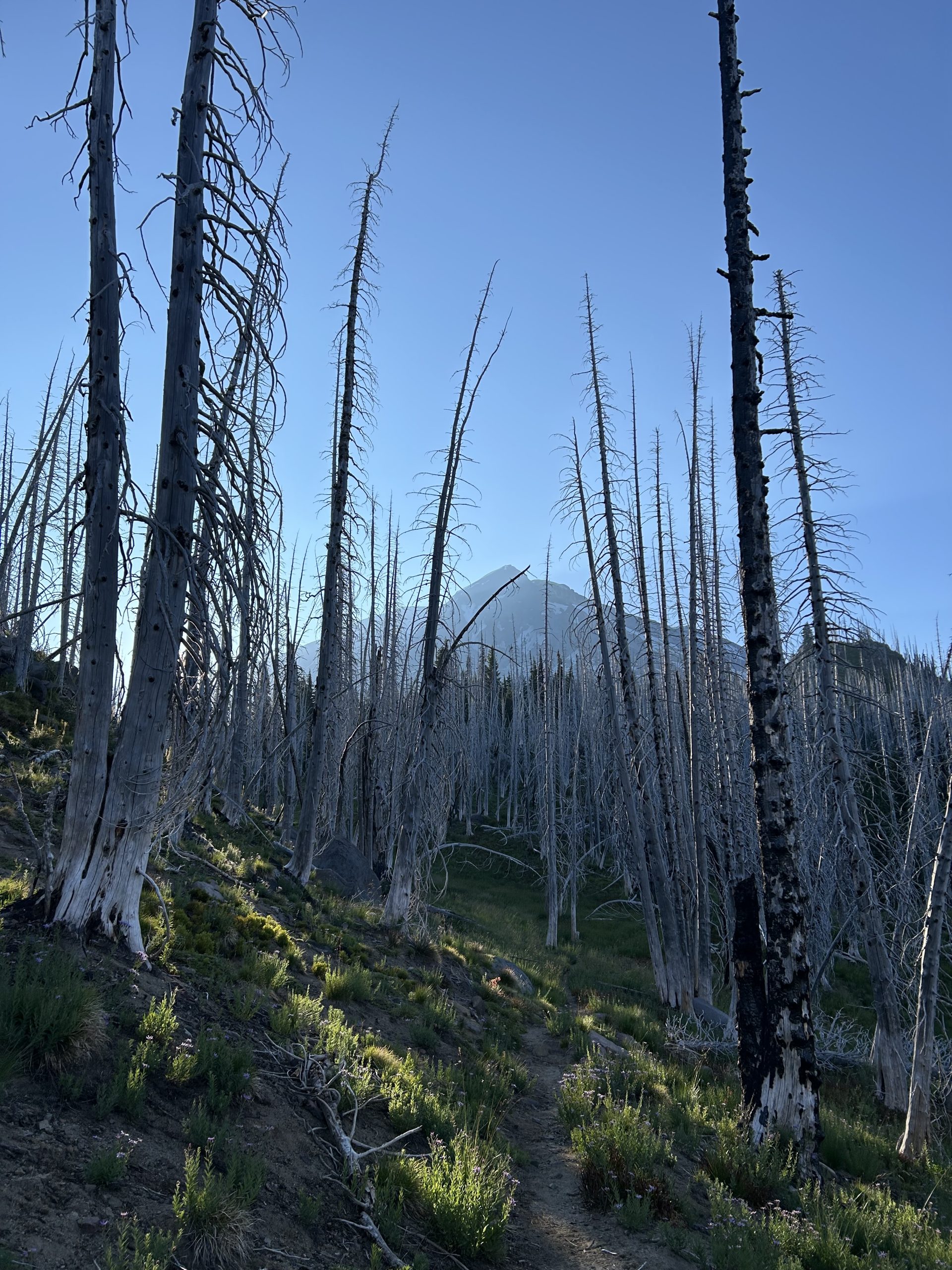
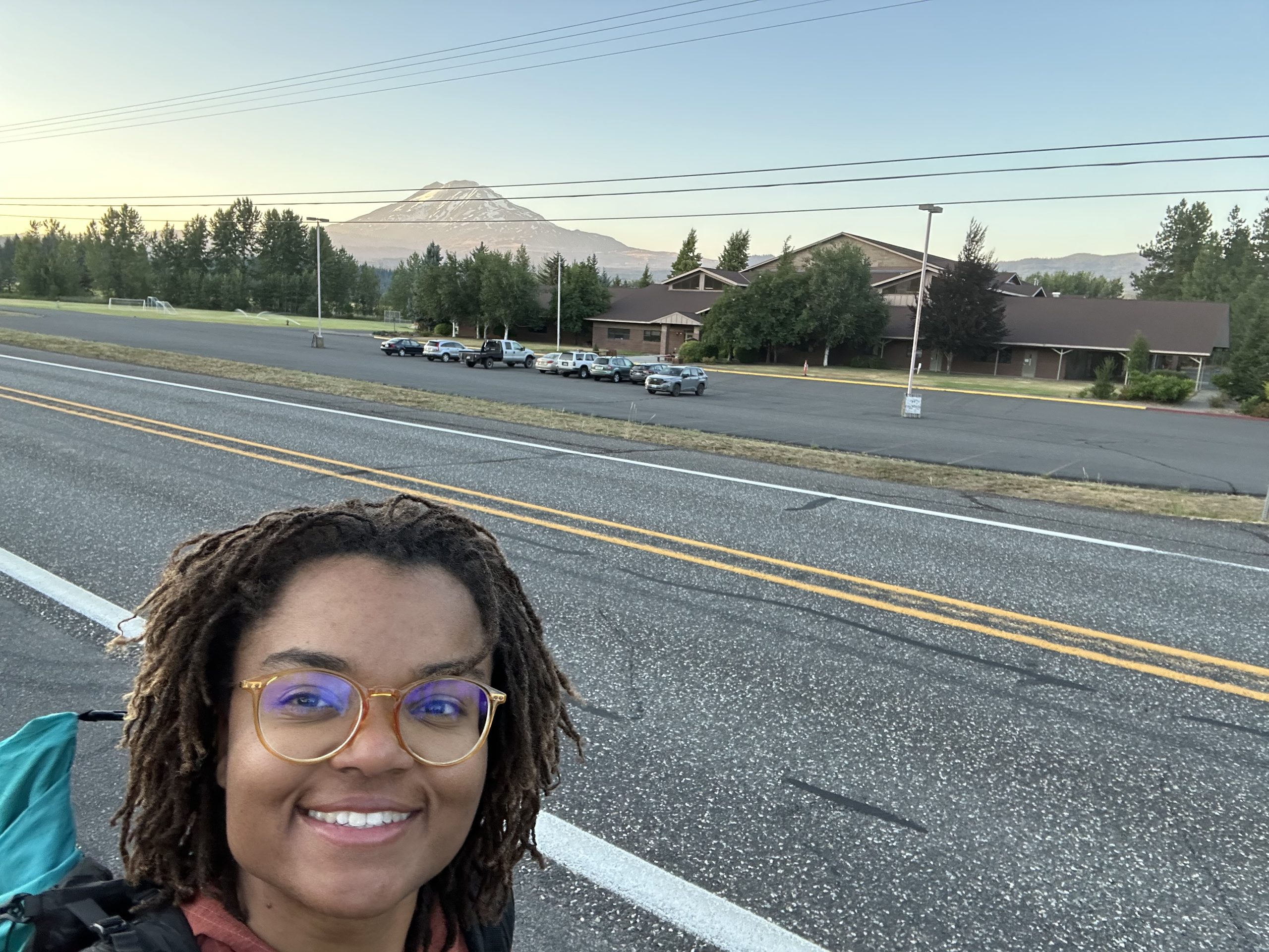
With only 10 miles in the day, the hiking was short and sweet. We ascended for a bit and were treated to another magnificent view of Mt. Adams. These mountains never get old. I enjoyed the view for a good portion of the day because I was passing through a burn zone. There were no trees to obstruct the sky. And since it wasn’t too hot and there wasn’t the immediate threat of a tree falling, I enjoyed the burn zone.
More and more NOBOs passed as the day progressed, and soon I found myself back under tree cover. At the bridge about 2 miles from the road to Trout Lake, I found the memorial to the hiker “Colors,” who tragically passed away in that spot during his thru-hike. Taking a moment to think about him, I took the chance to be grateful for the days that I have on the trail. Every day isn’t guaranteed, even when you’re living the dream.
With that somber note, Sun and I hiked the last two miles to the Trout Lake road and were lucky enough to get a hitch immediately. A NOBO PCT hiker who had to get off trail in March had dropped off another hiker as a favor and was headed back to Trout Lake just then. Awesome! Of course we talked trail in the van and shared our trail stories.
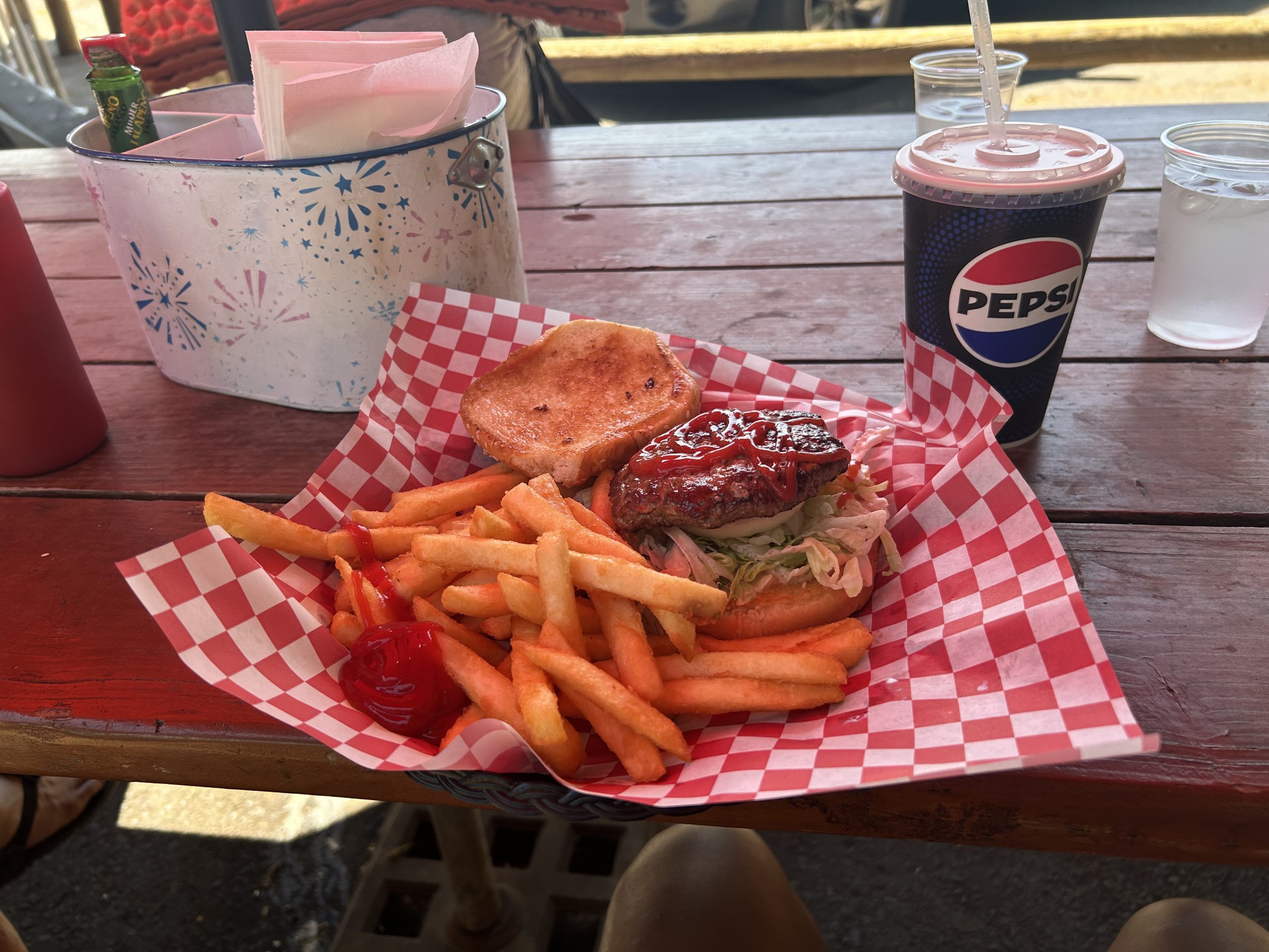
Once in Trout Lake, Sun and I immediately went to the cafe and got a burger, fries, and a soda. It hit the spot! Then, we crossed the street and walked about 300 feet to the General Store aka hiker central. We got set up with a campsite, laundry, shower, and got started on our chores.
To me, Trout Lake was a great trail town. Despite there not being too many places for hikers to stay, the people at the general store were super friendly, their selection of food and drinks was great for a small town, and the place was very relaxing. There weren’t a ton of of hikers around, so I figured that most people skipped this stop. But for me, even though I camped at the county park instead of getting a hotel room, I felt very relaxed and comfortable, which is exactly what I want from a zero day.
I spent a few hours in the afternoon chatting with Janitor since I missed him so much. There was no cell service for me in town but the store had WiFi available. When dinner time rolled around Sun, Nik (a young German hiker), and I headed down the road to the pizza place. It was about a mile walk, but the pizza was worth it! We split two pizzas and they were demolished when we left.
We all headed back to the campground after chatting with NOBO who was consistently hiking between 30 and 40 (sometimes more) miles per day. Although we weren’t going to hike that far tomorrow, we still needed our rest. The campground was quiet despite other non-thru-hiker campers being around, and I slept peacefully through the night.
And that’s a day in the life of a PCT SOBO hiker!
This website contains affiliate links, which means The Trek may receive a percentage of any product or service you purchase using the links in the articles or advertisements. The buyer pays the same price as they would otherwise, and your purchase helps to support The Trek’s ongoing goal to serve you quality backpacking advice and information. Thanks for your support!
To learn more, please visit the About This Site page.
Vietnam and Laos have been recognised by UK-based travel publication Time Out as top budget-friendly destinations in Southeast Asia, where travellers can enjoy great food, comfortable accommodation, and rich cultural experiences without breaking the bank.
According to Time Out’s latest ranking of affordable travel destinations on July 24, Vietnam secured second place, with average daily expenses estimated at just $20.80.
The magazine praised Vietnam for offering some of the cheapest beer in the world, with local bia hoi costing between $0.20 and $0.50 per glass, and filling street food meals, such as banh mi, priced at less than $1.00.
Accommodation was also highlighted for its affordability and quality, with highly rated hostels and guesthouses (scoring 8.0+ on Booking.com) available from just $3.20 per night.
Beyond basic costs, Time Out noted Vietnam’s cultural richness and accessibility, such as traditional water puppet shows for $4.00, along with free access to many temples and museums.
Local transport was described as both affordable and convenient, with public buses priced under $0.50, and app-based motorbike rides like Grab bike typically under $1.20. Longer-distance travel remains budget-friendly, with train tickets from Hanoi to Hue costing just over $28.
Laos topped the list as the most affordable country in the region, with average daily expenses at just $16.80. Budget accommodations in Luang Prabang and Vientiane are available from $4.40, and even lower in Vang Vieng, starting at just $2.00. Popular street foods such as sticky rice and grilled pork skewers can be enjoyed for $0.80 or less, while local beers are priced under $1.00.
Resupply 24 | Leadore, ID to Wisdom, MT
Author’s note: I am now in crunch time for getting to Canada and posts may be delayed as I try to push bigger days with less catch up time in town.
Day 93, 14.5 miles.
At breakfast this morning I flipped through the first annual CDT 2024 yearbook that my friend Lookout printed. I’m glad the inn had a copy. It can be a very lonely trail so it’s nice to see everyone together. In fact I’ll probably never see the SOBOs I met again until they show up in this yearbook, since they’re headed in the opposite direction. Class of 2025 hikers can go to advtgt.com/class-of-2025 to get notified when yearbook submissions open. Anyone can buy a copy.
Today I did a lot of stretching and logistics and finally organized a shuttle back to trail in the afternoon with a local named Carolyn. On the way up, I told her I had seen a golden eagle. “You know what I just learned about eagles?” she said. “Every forty years, they go hide somewhere and break their beaks and pluck all their feathers so they can regrow.” “Really! That’s insane,” I said. “To put yourself through so much suffering, in order to come out fresh.” Then I thought, well, it’s not unlike what I’m doing, is it? (Author’s note – this is MYTH – I only found out after I had internet later to fact check this).
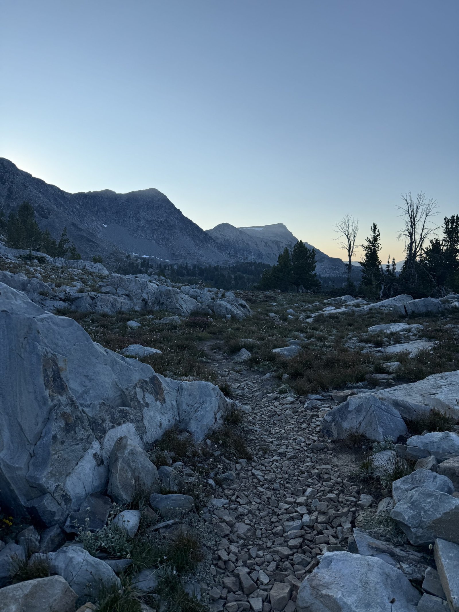
The hiking today was weirdly easy. It was well graded and well maintained. There wasn’t any crazy wind or biting flies or mosquitoes. I didn’t have to climb over deadfall or get my feet wet. It was cloudy and cool without any rain. The gates opened and closed easily. It was actually pleasant hiking. I thought, am I on the PCT? I kept waiting for the catch. I saw one road up ahead and thought, surely I’ll need to get up that. But the trail contoured around the bend. The cruisy trail gave me a lot of time to think.
On the ridgeline today, I walked past a lot of trees that grew leaned away from the wind. It wasn’t windy now but you could see the impression the wind had left on how the trees grew. Humans are the same. Whatever headwinds you grew up with may be gone, but you might still be compensating. You might still be leaned away instead of leaned into. One thing I love about mountains is that its contours mirror the way water carves into the sandbank on the side of the road. Like something so humble can be scaled up into something so grand. Everything in the physical universe is the same, just at a different scale. I am a human walking in an ecosystem. But I also contain ecosystems: in my gut, in each cell of my body. There is a logic to it all, and I fit into it. I am not separate from all of this. All of this is me, and I am all of this. That’s what’s in my brain when the world recedes and it’s just me and the woods. By the way, I hike totally sober. No drugs, no drinks.
Day 94, 33.3 miles.
The first existential crisis I ever had was when I was six or seven. I was walking to school with my mom, and in Seattle where I grew up, we get a lot of rain. And when there’s rain, there’s slugs. And one day I asked my mom: hey Mom, why do slugs exist? She looked at me and said, “why do you exist?” Oh, this broke my little brain. I mean, you tell me, you gave birth to me! And when I was 9, I read the whole of Gone With The Wind, which is not fourth grade reading material or content. It took me a month, but I wanted to see if I could finish the longest book I’d ever seen. So I guess I have not changed. I’m still out here thinking about existence and trying to finish the really long thing. I saw someone had written their name in sticks today on the trail. We humans love to write our names everywhere, like we’re so scared of dying and being gone that we’ve gotta make sure people knew we existed. Today I walked by Lemhi Pass, which is where Lewis and Clark, guided by the Shoshone woman Sacajawea, would have crossed the mountains looking for a northwest passage. I can’t imagine being in her position: hey we’re going to take over your neighborhood and everything around it but first can you show us around? There is a spring here called Distant Fountain Spring that is considered one of the headwaters of the Missouri-Mississippi river system. At this point I’ve walked past the headwaters of all the major rivers in the U.S.: the Rio Grande, the Colorado River, the Mississippi and Missouri Rivers, and the Columbia River (I’ll walk past this in Canada). All of it starts here on the continental divide.
Day 95, 30.8 miles.
I met a steady stream of SOBOs all day today. Often we would do a quick exchange of information. “How was the hitch into town?” I’d ask passing SOBOs. “Is the stretch to Lima as rough as everyone says?” they would ask me in return. I chatted with two SOBO women for a while comparing notes about who we knew up and down trail. They told me a lot of SOBOs had already quit in the first 300 miles. “Brutal start in Glacier,” she said. “It’s hard terrain with a lot of up and down.” “Well a lot of NOBOs quit in the first 100 miles before they even get to the first town,” I said. “There’s no water and if you can’t make the mileage to the next cache you’re screwed.” “Brutal start on both ends,” she agreed. “People forget this is the most formidable of the triple crown trails.” Shortly after I left them I heard a voice call out: “Stitches?” It was Casper, one of the few fellow women who also did the Sierra with me in 2023 which was CA’s highest snow year on record and she went in without snow experience. She went on to complete the AT last year and is hiking this trail SOBO to finish her Triple Crown. I knew she was nearing the end of Montana but didn’t know exactly where I’d see her and it was so nice to see a familiar face from my first long trail. I told her about Wyoming and she told me about Montana. Meeting people going in the opposite direction means you’ll likely never see them again on this trail. But wherever you met, the two of you together have hiked the whole trail, and slowly you’ll each fill in the knowledge of the other until you’ve both completed it end to end. Later on, at least four SOBOs told me that I was about to walk in some incredible scenery. In the comments it seemed the NOBOs were not as impressed. “It’s a lesser Winds,” one wrote. But beauty need not be zero sum. The Winds can be beautiful without taking away from the beauty of this valley in Idaho. This trail is sometimes described as a string of pearls: moments of delirious beauty interspersed with mundane nothingness. You’d be remiss to focus only on the brightest pearl rather than appreciating all of them as they come.
Day 96, 36.4 miles.
Lately I’ve been thinking about the culture of this trail. I feel like I have a distinct sense of the trail’s culture even though I’ve hiked it almost entirely alone, seeing very few others. I expect many others have a similar experience. So where does this feeling of a collective culture come from? Certainly there is the vibe of each trail town and the people who help out along the trail corridor. I think it might actually be captured in the comments we leave for each other on FarOut. Of course the majority of them are utilitarian: this stream is still running, there’s two good campsites here, don’t miss this turn. But then there are the other comments:
A discussion in the comments of the Sacajawea Memorial about honoring the historical significance of Sacajawea.
Or the detailed ratings for gates along the trail: this one swings at a B flat. This one has a creative locking mechanism.
Or a series of comments at the intersection of the Oregon Trail, all of them from hikers who were primary school students in the U.S. at a certain time when we sat in computer labs and played the computer game Oregon Trail.
Or sometimes a comment gets downvoted for not being part of the culture, maybe about cutting switchbacks or taking following the redline too seriously.
When I’m hiking alone, reading these comments brings a little levity to the day. You feel like you’re still part of a community that shares an understanding of what it means to be hiking the CDT.
We think of gossip as idle chatter, but it actually helps create culture by defining bad behavior and good behavior. What the norms of a society are. And that’s what we hikers are doing in the comments.
Day 97, 9 miles into Wisdom, 15 miles out. 24.2 miles total.
Last night when I was looking at where I might stop to camp, I realized the comments from hikers noted the road going into Wisdom was very quiet and some waited two hours for a ride. Most of the SOBOs I had spoken to had hitched from a busier road into Darby, MT. But I had a pair of new shoes waiting for me at the post office in Wisdom, which was only open for two hours in the morning. So I wanted to stage as close to the road as possible and prepare to sit at the road waiting for cars for up to two hours. Right as I got to the road a car passed and I stuck out my thumb. No luck. No luck with the next couple cars as well. I hope this isn’t all the traffic I’ll get today, I thought. Then another car approached and slowed, then pulled over. I ran up to the window. It was a mother and son. “Where you headed?” She asked. “Into Wisdom,” “Oh, that’s where we’re going. We’ll take you.” Eileen dropped me off at the post office, I got my shoes and did my resupply, and then she took me out to lunch and gave me a ride back and invited me to come back anytime. Sometimes you have to let the wrong cars pass by so that the right car can pick you up. Life is abundant if you allow it to be. The CDT today overlapped with the Nez Perce trail which was a route the Neemeepu people used to access summer hunting grounds and later used to flee war brought by white settlers. As I walked in their footsteps I looked at the forest and thought about how the plants and trees are just plants and trees to me but the indigenous people here would have known how to use all of it; how to follow the rhythms of this particular landscape. I had to get into Wisdom to survive, but they could survive off this land. That is what it means to be indigenous to a place. For some reason the pass here is named after the white man who launched a surprise attack on the fleeing natives. Why immortalize someone for trying to kill people who are already leaving the land you’re trying to take over? And why take it over in the first place? Is that what we value in America? Are we proud of that?
xx
stitches
This website contains affiliate links, which means The Trek may receive a percentage of any product or service you purchase using the links in the articles or advertisements. The buyer pays the same price as they would otherwise, and your purchase helps to support The Trek’s ongoing goal to serve you quality backpacking advice and information. Thanks for your support!
To learn more, please visit the About This Site page.
-

 Brand Stories2 weeks ago
Bloom Hotels: A Modern Vision of Hospitality Redefining Travel
-

 Brand Stories1 week ago
CheQin.ai sets a new standard for hotel booking with its AI capabilities: empowering travellers to bargain, choose the best, and book with clarity.
-

 Destinations & Things To Do2 weeks ago
Untouched Destinations: Stunning Hidden Gems You Must Visit
-

 Destinations & Things To Do1 week ago
This Hidden Beach in India Glows at Night-But Only in One Secret Season
-

 AI in Travel2 weeks ago
AI Travel Revolution: Must-Have Guide to the Best Experience
-

 Brand Stories1 month ago
Voice AI Startup ElevenLabs Plans to Add Hubs Around the World
-

 Brand Stories3 weeks ago
How Elon Musk’s rogue Grok chatbot became a cautionary AI tale
-

 Asia Travel Pulse1 month ago
Looking For Adventure In Asia? Here Are 7 Epic Destinations You Need To Experience At Least Once – Zee News
-

 AI in Travel1 month ago
‘Will AI take my job?’ A trip to a Beijing fortune-telling bar to see what lies ahead | China
-

 Brand Stories2 weeks ago
Contactless Hospitality: Why Remote Management Technology Is Key to Seamless Guest Experiences
You must be logged in to post a comment Login