
Destinations & Things To Do
Close to Home – Alpinist
[This Sharp End story originally appeared in Alpinist 90 (Summer 2025), which is now available on newsstands and in our online store. Only a small fraction of our many long-form stories from the print edition are ever uploaded to Alpinist.com. Be sure to pick up the hard copies of Alpinist for all the goodness!–Ed.]
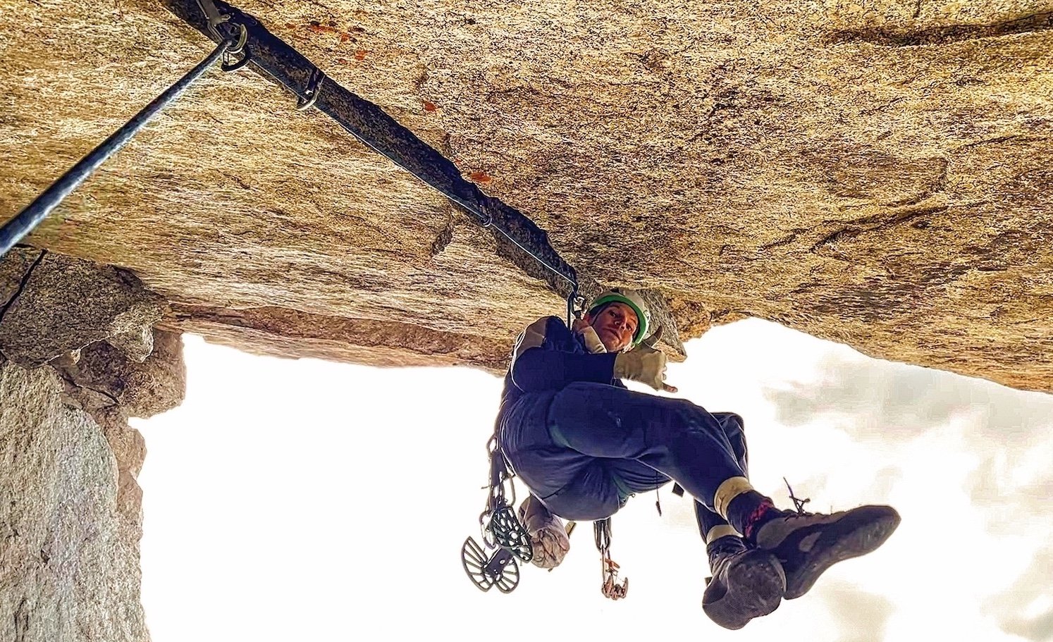
I’M INCREDIBLY LUCKY TO live in the heart of the Rocky Mountains, near Aspen, Colorado, an indisputable world-class destination. I have backcountry skiing, ice climbing, Class V+ whitewater, 5.15 sport climbs (yes, plural), sandstone splitters and untold nooks and crannies to explore at the drop of a laptop. Still, I know a part of me to complain: “BORING!”
I want to jet to Alaska and fling myself against the walls of the Ruth Gorge; dig through rime mushrooms to Patagonian summits; sink my fingers into the picturesque Digital Crack above Chamonix. My hometown sometimes feels so pedestrian. The itch to freeze my ass off and cheat death on the other side of the world is nearly constant.
At the end of the day, though, it’s only lack of imagination that dulls my vision. If experiences that test my limits and lead to fresh perspectives are the desire, I can easily find some action like that between now and tomorrow.
Fact: While jotting notes for this article on a trail fifteen minutes from my house, I spooked a juvenile moose from twenty yards away. The quiet evening forest erupted in a cacophony of splintering wood before I realized what was happening; I looked up in time to meet the animal’s dark, wide eyes as it tore through the brush.
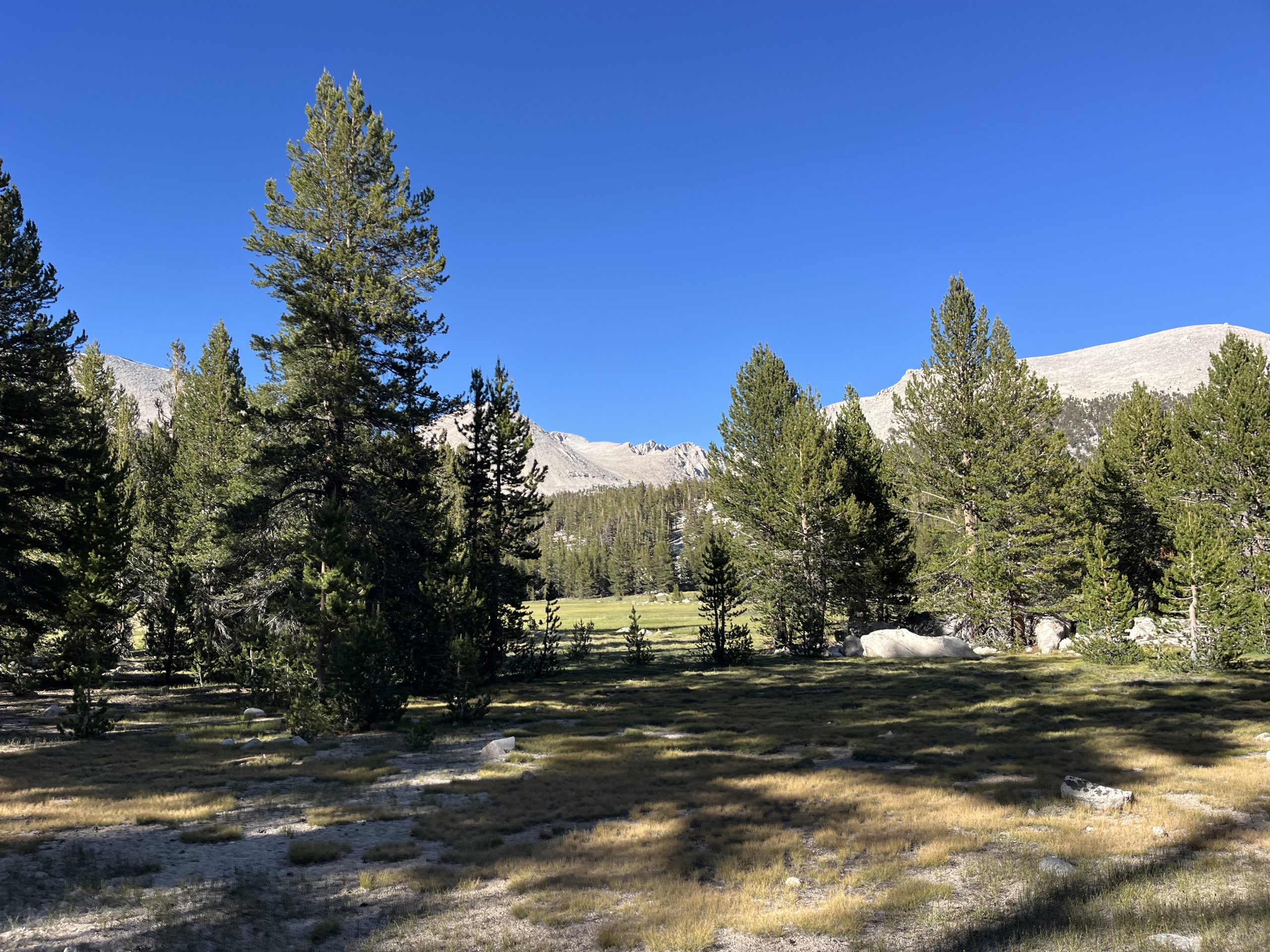
It is something of a miracle that my wife and I are able to make a living in this costly region. Mandi has spent her entire career in public schools, and I have spent mine as a journalist—both are notoriously underpaid professions. When it’s time to plan a getaway, we pull out our local trail maps. I’ve spent most of my life around these parts and there are still so many places I’ve yet to visit. It’s usually the four-wheel-drive roads that dead-end where the topo lines scrunch together that lead us to our favorite new spots, often no more than three hours from our front door. Sure, the surrounding hills are less dramatic and the rock quality is not nearly as good as it is at the iconic destinations. But having the fresh air and wildflowers all to ourselves easily rivals waiting in line to climb a crowded classic. On these trips to nowhere, we’ve plucked wild raspberries for breakfast and found unclimbed rocks an easy stroll from camp, including an offwidth roof crack that would be sought after if it were at a popular crag.
This past spring, Josh Wharton, one of the world’s top alpinists, told me about a satisfying first ascent that he completed with Jackson Marvell on Wheeler Peak in Nevada in 2021. The frigid 2,000-foot route took the ace climbers two attempts. “It was an equally cool, if not cooler, experience to many things I’ve done in the Greater Ranges,” Wharton said.
It’s not always necessary to get far from a major road to find unique challenges, either. In 2012 my friend Craig joined me to attempt the first winter ascent of a 700-foot limestone wall just off Interstate 70. It was plastered with snow and verglas from a recent blizzard and we came within 140 feet of the top before a stopper crux, darkness and a minor frost injury encouraged retreat.
In 2017 my friend Jack and I ascended a buttress on the teetering north face of a 13,200-foot peak east of Aspen. We hoped maybe there would be some worthwhile technical climbing. We ended up simul-soloing detached pillars up to 5.8 because the rock was so loose that placing protection and using a rope would have been more dangerous. Yet it remains a bright day in my memory for the laughter, discovery and freedom we enjoyed together.
I’m lucky to live where I do. Yet if I suffer the itch to circumnavigate the globe, I can only guess how climbers living in the flatlands must feel.
The good news is that we live in a nation with public lands and natural wonders in pretty much every direction. That is, assuming our public lands aren’t auctioned off by the Trump administration, which appears to be a real threat at the time of this writing, when thousands of employees critical for managing these lands are being laid off. [And by the time this article was posted online, legislation had been introduced in the US Senate that proposes selling millions of acres.] In this age of global warming and short-term exploitation of our environment, I say it’s high time for us to better advocate for what we have close to home.
[This Sharp End story originally appeared in Alpinist 90 (Summer 2025), which is now available on newsstands and in our online store. Only a small fraction of our many long-form stories from the print edition are ever uploaded to Alpinist.com. Be sure to pick up the hard copies of Alpinist for all the goodness!–Ed.]

This morning when I woke up at my tent site I was feeling so much better. I still had the slight tinge of a headache initially when I woke up. But I took some ibuprofen with my morning coffee and was feeling 100% by the time I packed up and left camp. I had about 10 miles to go before I would come to the junction for Cottonwood trailhead. That’s where OutsideJay left my bear can and all of my food.
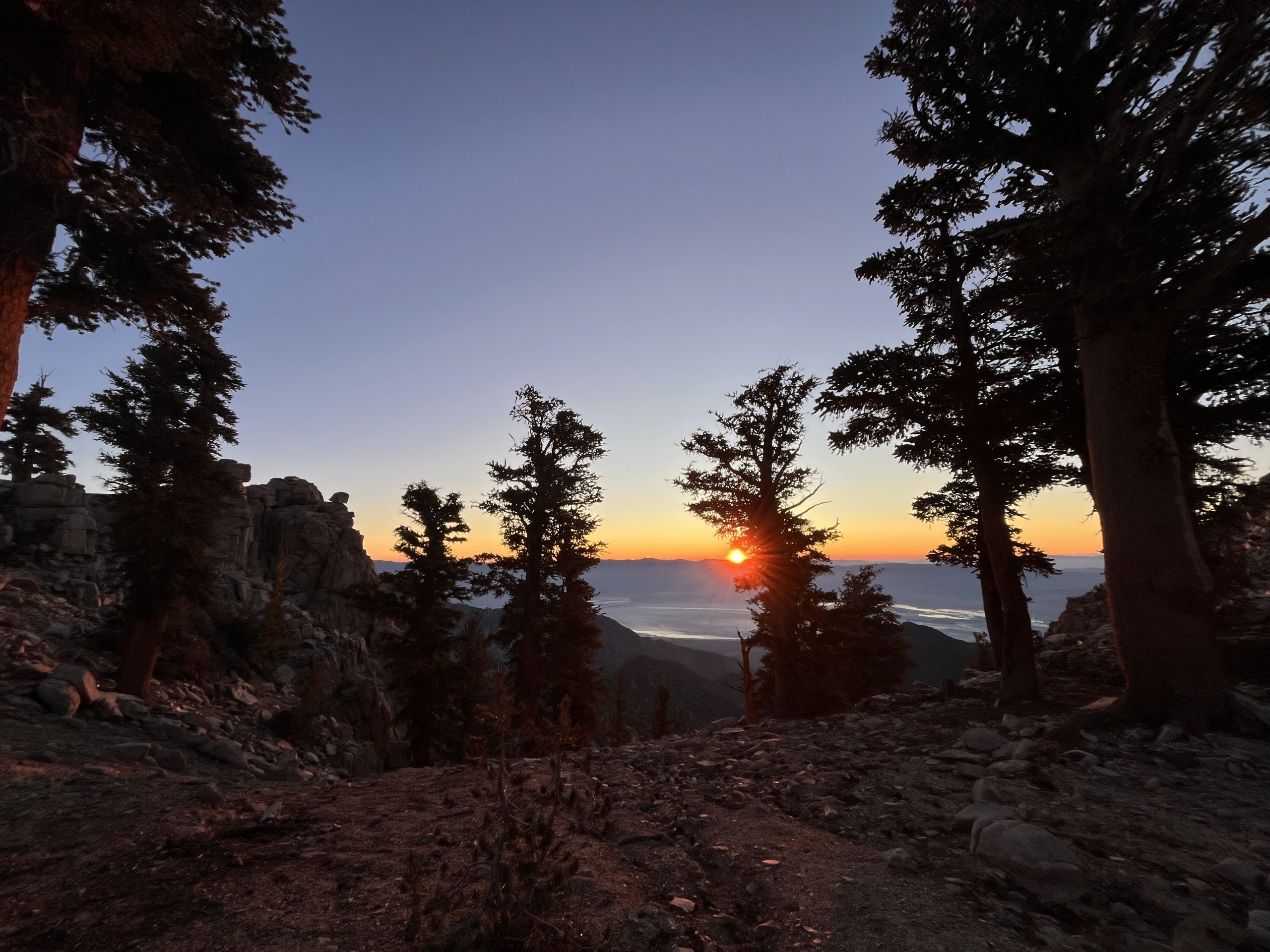
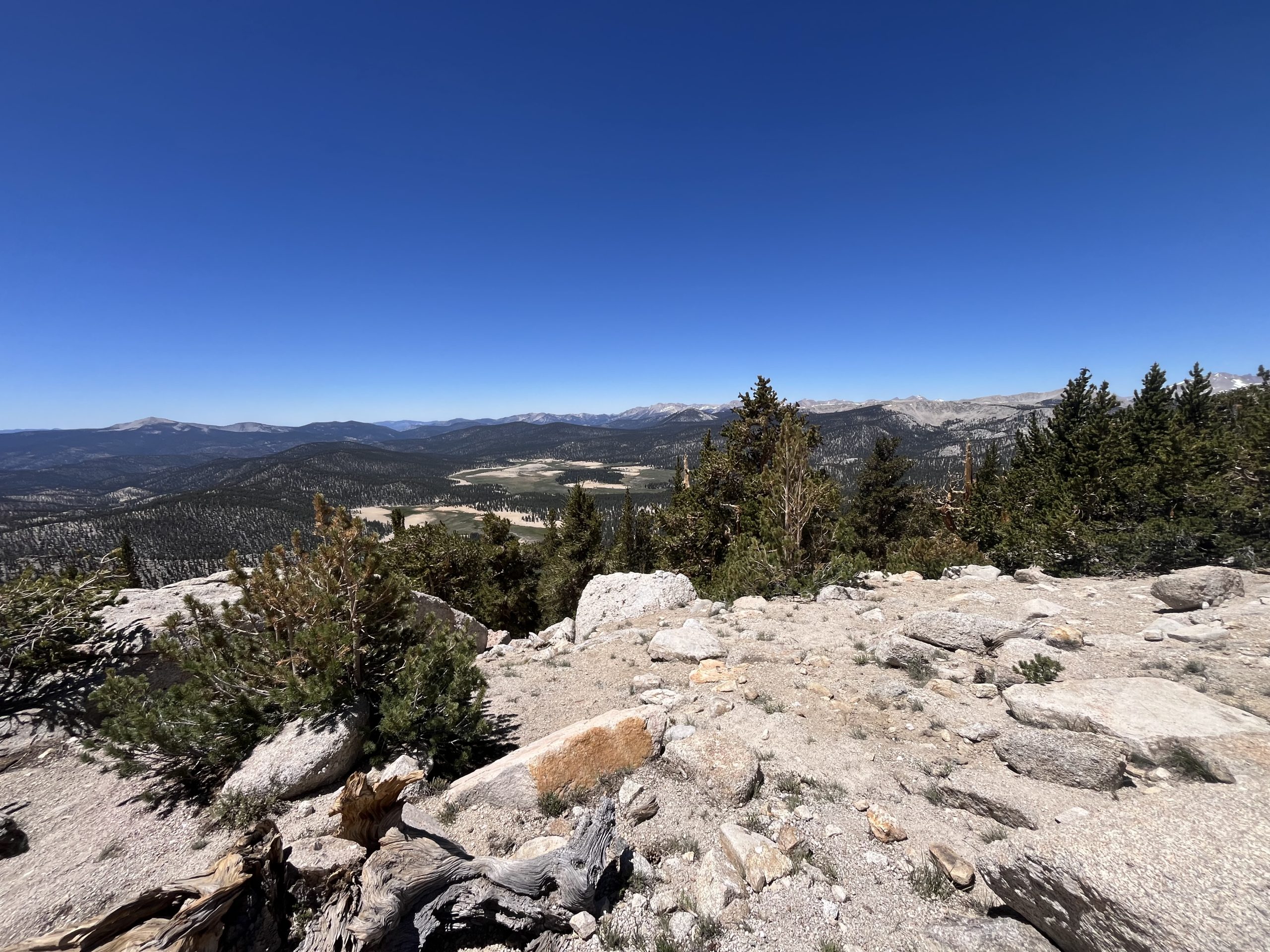
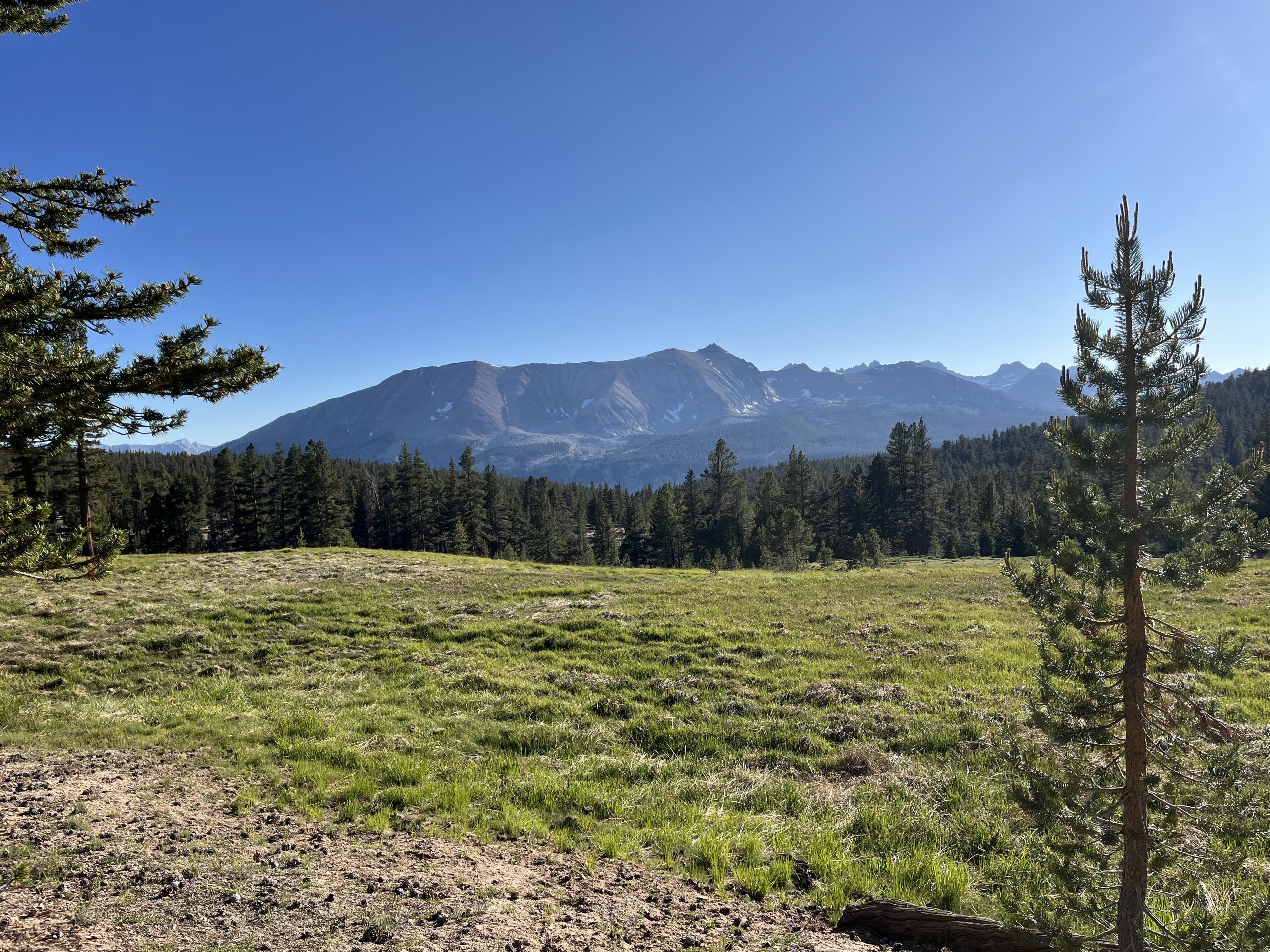
It was a beautiful thing starting the morning at high elevation. I didn’t have much more climbing to do over those next couple of hours. I mostly just went up and down mildly along ridge lines. I watched the most beautiful sunrise and remembered all of the amazing mornings that I spent here in the Sierra in 2022. It was a ghost town in October when I was here previously.
It’s usually recommended to get out of the Sierra and to Kennedy Meadow south by the first or second week of October. That’s just a safety recommendation to avoid getting caught in the high mountains when snow comes. But I remember getting to Kennedy Meadows south for their Halloween party. I got really lucky.
The trail was nice and easy this morning. I was making great time. I felt like my head was in a bit of a daze still, likely due to the change in altitude. Typically, I’ll feel a bit tired or out of it for the first 24 hours or so. Then the more time that I spend at higher elevation, I typically start to feel very strong. And lucky for me, that’s the way it went this time around as well. After a few hours of walking, I started feeling really good. I felt the fog lift, and I was definitely more clearheaded. For the rest of the day I felt basically completely normal.
It was so early when I came to the junction for Cottonwood. This time going through the Sierra, I’m avoiding any side trails if I can. That means carrying more food and resupplying less frequently. Most of the towns you can hitch into in the Sierra involve adding significant mileage and elevation gain and loss. Cottonwood is a nice middle ground. I was able to have a light pack yesterday and for most of this morning. And going down to the trailhead and back up to the trail only adds a mile and a half and maybe 500 feet of elevation gain. In the end, I think it’s definitely worth it so that I could acclimate yesterday. Though I’m sure coming up from the parking area in a bit is going to be rough.
Jay had told me that I would get service before dropping down to the trailhead. He sent me photos of specifically where he had put my food. The camping area has tons of bear boxes so it would’ve been helpful to know which one it was in. But I never did wind up getting service. Instead, I just made my way down to the parking area and hoped for the best. When I looked around and noticed the 50+ bear boxes in the surrounding area, though, I became a bit nervous. Jay had given me a rough idea of where the canister would be, so I just headed in that direction and started looking in every box. Right as I was starting to get a bit anxious, I opened one and found my bear canister and box of food.
The only bear canister that can fit in my small backpack is the bear vault 450. So in addition to fitting that into my backpack, I also had an additional 2–3 days of food that didn’t fit into the bear canister. Luckily in this area, you don’t need to store your food in the canister throughout the day. You just need to properly store your food at night. So today I’m going to hike as many miles as I need to in order to get to a campsite that has a bear box. That way I can properly store my food and don’t have to worry about it.
I wound up having to leave probably 1500 more calories behind in the box at the campground. I filled every single pocket of my backpack and shoved food into every last nook and cranny. Then eventually it was full to capacity and I couldn’t fit another bar. I’m just hoping that this will actually be enough food to get me where I need to go. As of now I’m planning to get more food at VVR, a resupply location just off the trail.
I was in and out of the parking area surprisingly quick. Then got back to the trail and began climbing up Cottonwood pass. If I had stayed on the red line, I would’ve had a 500 or so foot climb regardless. Now I had to climb a little over 1000 feet to make up for the descent down to the parking area. I figured it was going to be rough going with how heavy my backpack was. It was incredibly heavy. I honestly can’t remember a time that I’ve ever carried this much food or weight. Typically as a rule of thumb, I say that my backpack can only fit 5 1/2 days of food. This time around, I’m stretching that out a bit in hopes of avoiding getting off trail to resupply at inconvenient locations.
Between the six days of food, the bear canister, and the 2 L of water, I was really feeling the weight of my pack. But surprisingly as I began making my way up Cottonwood pass, I felt really strong. Any tiredness that I had felt yesterday from adjusting to the change in altitude had faded away. I wound up passing a bunch of people as I made my way up to the top of the pass. It felt really good to feel strong again.
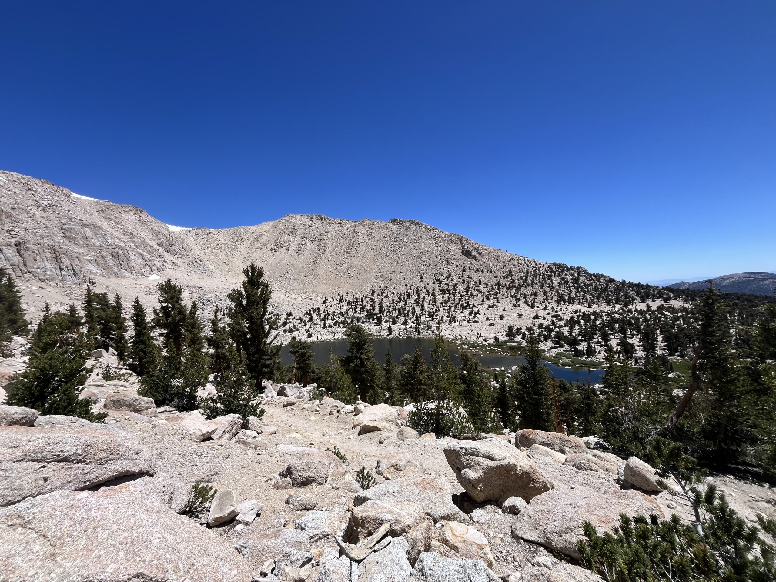
The climb went on for about 2–3 miles and it certainly wasn’t as bad as I expected. It was steep at times, but overall it was fairly gradual. Once I got up to the top, I reconnected to the PCT and then continued on to chicken spring lake. At the time, I didn’t realize that this was the last water source for the foreseeable future. Luckily, I still had a lot because I decided to bypass the lake on a whim. The trail would still get some views of the lake as I continued to climb a bit more. But it was early in the day and I had a ways to go. I just didn’t want to stop off and kill any more time. Even though the lake seemed like a beautiful break spot.
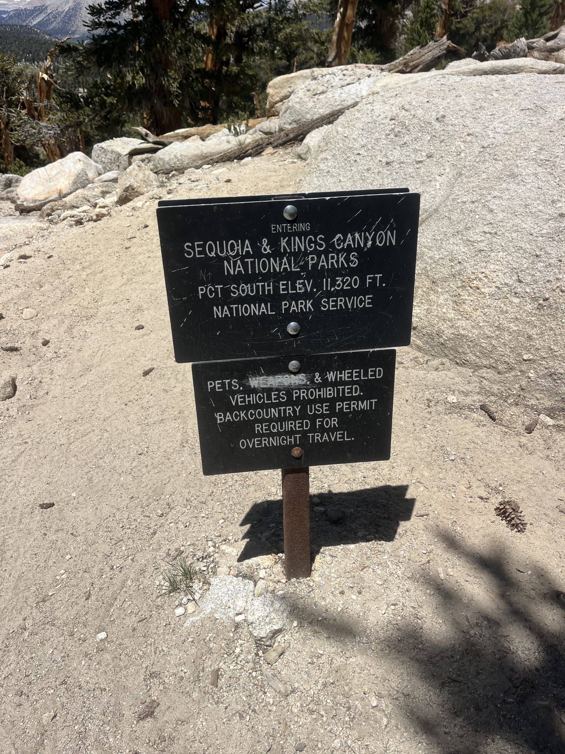
After climbing a bit further, I got up to the top and the next couple of hours would be nice and easy. There wasn’t much elevation gain remaining for the day until I would drop down to the bottom of the valley. Over the next hour or two I passed by a bunch of hikers who are doing the John Muir Trail. One of the ways around getting permits for Whitney portal when doing the John Muir Trail, is getting a permit for Cottonwood pass where I just was. It can be really difficult to get Whitney portal permits so it seems like the majority of people opted to enter Cottonwood and add a little bit of mileage.
It was pretty much every hikers first day, which was exciting to see. Most of the guys that I went past were able to guess that I was a thru hiker almost immediately. The Sierra is a hard stretch of trail. But PCT hikers have the luxury of a 700 mile warm up first. And the difference is noticeable.
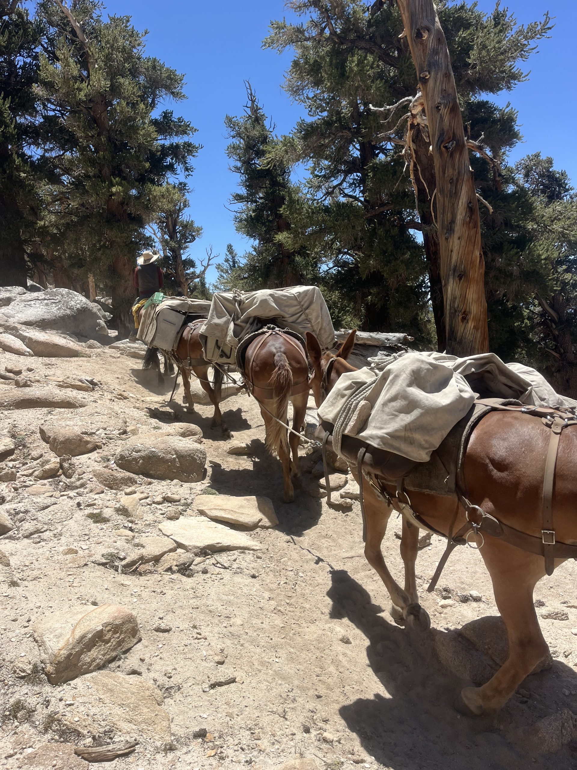
Time went by pretty quickly over those next few hours. I was passed by a group of men on horses with mules. They just finished out a week trip near the Whitney area. It seems like they had facilitated bringing in the gear for hikers. I didn’t get the impression that it was a vacation for them, more like their job.
I ate as much as I could as I continued along this downhill stretch. And just like yesterday, by the afternoon it was growing incredibly hot. The further I went downhill the more it warmed up as well. That’s been a tough trend the last two days.
As I was approaching the next water source and was still about 11 miles out from camp for the night I was feeling quite tired. It just felt like a very long way to go for the day and the heat had me very sleepy. I planned to fill up on water and then continue on for the rest of the day. If I reached my intended campsite, it would wind up being a 37 mile day though. Which is definitely going to help me in the long run and will set me up for getting to my next resupply location at a good time.
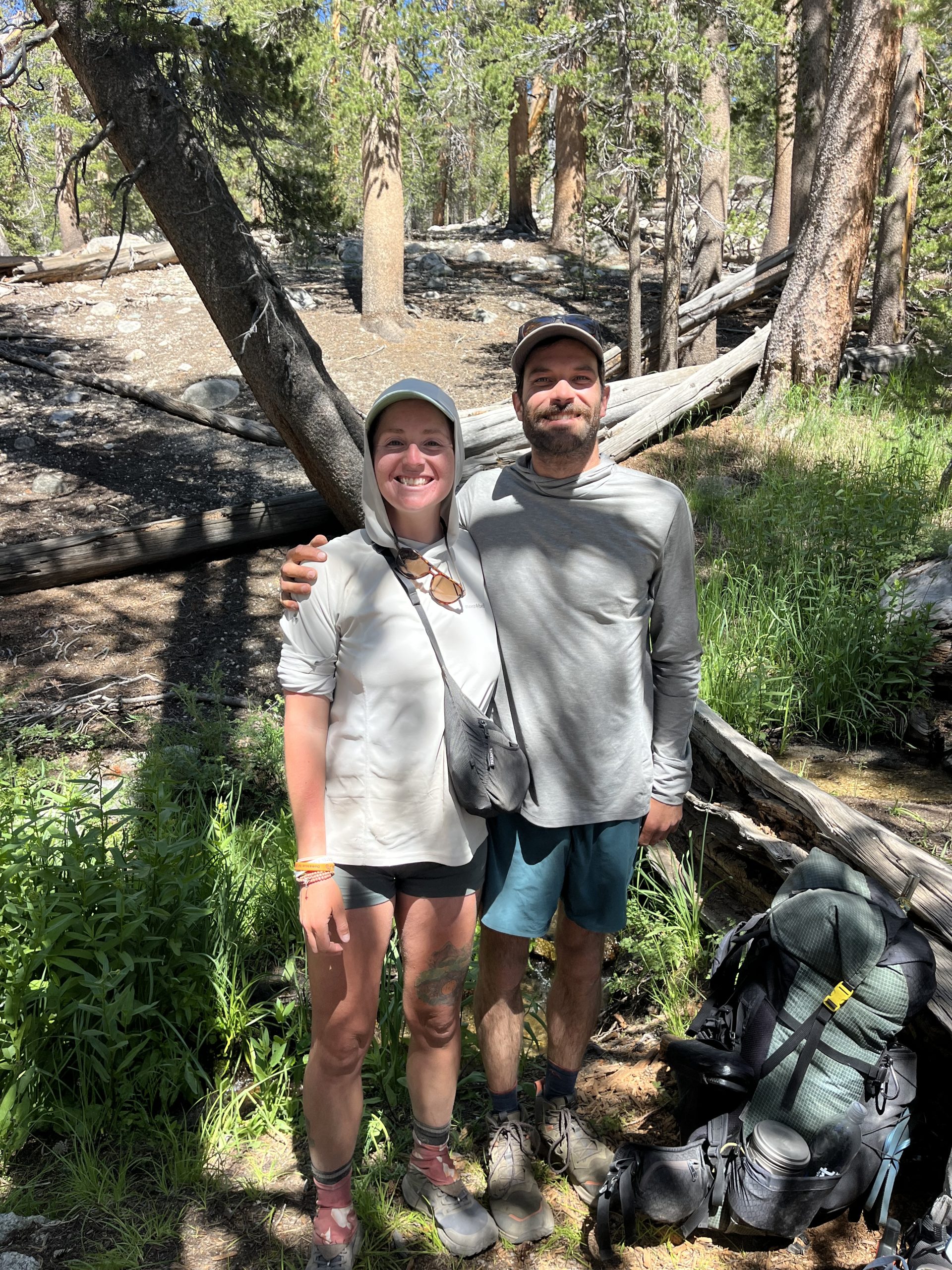
When I got to that next water source a couple hikers were heading out. I sat down and didn’t even notice that there were two hikers across from me. It was a guy and a girl and I heard the guy say something like “is that who I think it is” Which initially had me assuming that it was a complete stranger who recognized me off the Internet. I was wearing sunglasses and the section of trail we were on was pretty shaded. So I couldn’t see incredibly well. But when I took my sunglasses off, I realized it was Queen Liz! A hiker who I hiked about 800 miles with on the PCT in 2022.
Then, while he was hiking the Appalachian Trail last year, he stayed at my house in Philadelphia for a handful of day as he recovering from an ankle injury. He had been planning on doing the Appalachian trail and the continental divide trail in 2024. At the time we had thought we were going to run into each other on the CDT, but his ankle injury really never healed well.
Now here we are, in the middle of nowhere in the Sierra. And we’re both running into each other by pure luck? It’s always so wild how things play out on trail. He was out doing the section from Mount Whitney to Kearsarge pass with his girlfriend Chase. It was really nice to meet her and it was so cool to talk with him. It’s been way too long.
Before running into him, I was feeling tired and didn’t have a lot of energy left for the day. But chatting with the two of them and hanging out for a bit got me good to go. Unfortunately, he only planned to do another mile for the day. And I planned to do 11 more. At first, I thought he had said he was planning on camping at the same place that I was. But if I was only going to be out in the Sierra for a week, I would probably do shorter days and get to camp earlier as well.
We walked together for the next mile until we came to a beautiful river with tent spots and bear boxes. That’s where him and his girlfriend planned to camp for the night so he could fish for trout in the stream. I was feeling so much better at this point and was ready to roll out the next 11 miles. So I said goodbye to the two of them and continued on. The next few miles held a fairly steep climb, just short a 1500 feet. But after that, the remainder of the day would be relatively easy.
The climb wasn’t as bad as I imagined, and it actually leveled out about halfway in between the bottom and the top. Then I got to walk through a valley briefly before finishing out the last of the climb. I was feeling really good once I got up top and began descending. And the trail would be primarily downhill for the rest of the day. With the occasional short climb in between.
I wound up running into another hiker, who thought that I was someone else. I asked if they had seen any other PCT hikers and he informed me that he had been passed by Hillbilly about two hours ago. I met Hillbilly at Kennedy Meadow South. So it’s exciting to think that I’ll catch up to him either this evening or tomorrow. He left KMS the day before me, so I figured it would take another day or two at least to gain on him. It sounds like he’s trying to do 25–30 mile days.
By the time I was up at the top of that climb, I only had about 7 miles left for the day. And about an hour later, I passed the junction for Mount Whitney. There’s a campsite there that a lot of people use as a base camp. There were tons of tents set up when I went by. But this time around it’s just not in the cards for me to do Whitney. I’ve done it before and I would love to do it again. But I’m already carrying so much food and time is of the essence this year.
It wound up being a really nice end of the day. I’m always proud when I push on to my intended campsite, even when I’m tired.
The bugs were pretty bad when I passed that campsite and continued along the trail. But luckily, I only had a few miles left for the day. As I got closer and closer to my destination, I definitely started considering stopping off a little bit earlier. It still would’ve been a really long day either way. And I knew I had to do one last short climb before dropping down to the river where that would be tenting for the night.
I was just feeling lazy after a long day of walking. I passed by a couple water sources and looked around to see if there was tenting nearby. But there was nothing good so I forced myself to continue on. Sometimes I get the urge when I’m 30+ miles into a day to call it quits a bit early. But I’m always very glad when I don’t. This time was no different.
The remaining climb wasn’t too bad and I got up top pretty quickly. Then ran into a group of hikers as I began descending. One of them was named Bean Sprout and she recognized me from my videos. She was hiking with her boyfriend and two friends, and they were headed to the same camping area. At this point I was pretty excited to get to camp for the night so I kept moving at a good pace. Then dropped down to the river right around 7 PM. Maybe a little bit after.
I had read comments on far out, saying that this area had insanely bad mosquitoes. And those comments were incredibly true. I was swarmed immediately, but luckily took my pack off and put my wind gear on and my head net. At least once all of that is on the bugs can’t get to me, so I really don’t mind them. I just have to check to make sure I’m not getting bit on my hands. That’s the only portion of skin that’s still exposed when I’m wearing all my gear.
I got my tent set up and pulled out all my food. Then got everything organized and sorted and headed down to the river to grab some water. People often complain about mosquitoes when they’re at camp for the night. But I don’t really mind mosquitoes at the end of the day. I plan on spending the whole evening in my tent, relaxing, and eating anyway. So it doesn’t make a big difference to me if the bugs are out at the end of the day. I really only mind mosquitoes when they’re attacking me while I’m hiking. That can become pretty irritating.
I wound up having a mountain house meal for dinner. This one was the cheesy beef enchilada, another of their newer meals. More recently they came out with three new meals and I’ve now tried all of them. This one tasted really good and the smell was pretty nostalgic for me.
After eating dinner, I had some snacks and got everything put away. Then did a little bit of writing and video work before getting comfortable for the night. I figure that there will be a couple days on this section where I’m able to get some voice to texting. Just because there will be long segments of downhill coming off these mountain passes. A lot of the trail won’t be gradual enough to multitask. But I’m sure I’ll be able to find some moments. Today I wound up doing just shy of 37 miles with 5700 feet of elevation gain. And I set myself up very well to climb Forester pass tomorrow. I’m about 9 miles away, so not incredibly close. But I’ll at least be able to climb the mountain relatively early in the morning tomorrow.
If you enjoyed this blog and would like to support my hike by buying me a soda or a snack along the way, there is a “Tip the Author” button below! It links directly to my Venmo. Any and all support is incredibly appreciated!
It felt like the trail’s been taking, but it gave back tenfold today. My day was full and wide and left me inspired, though sore.
We woke up determined to make up the miles we’d missed the day prior due to thunder storms.
We decided to hike a minimum of 31 miles.
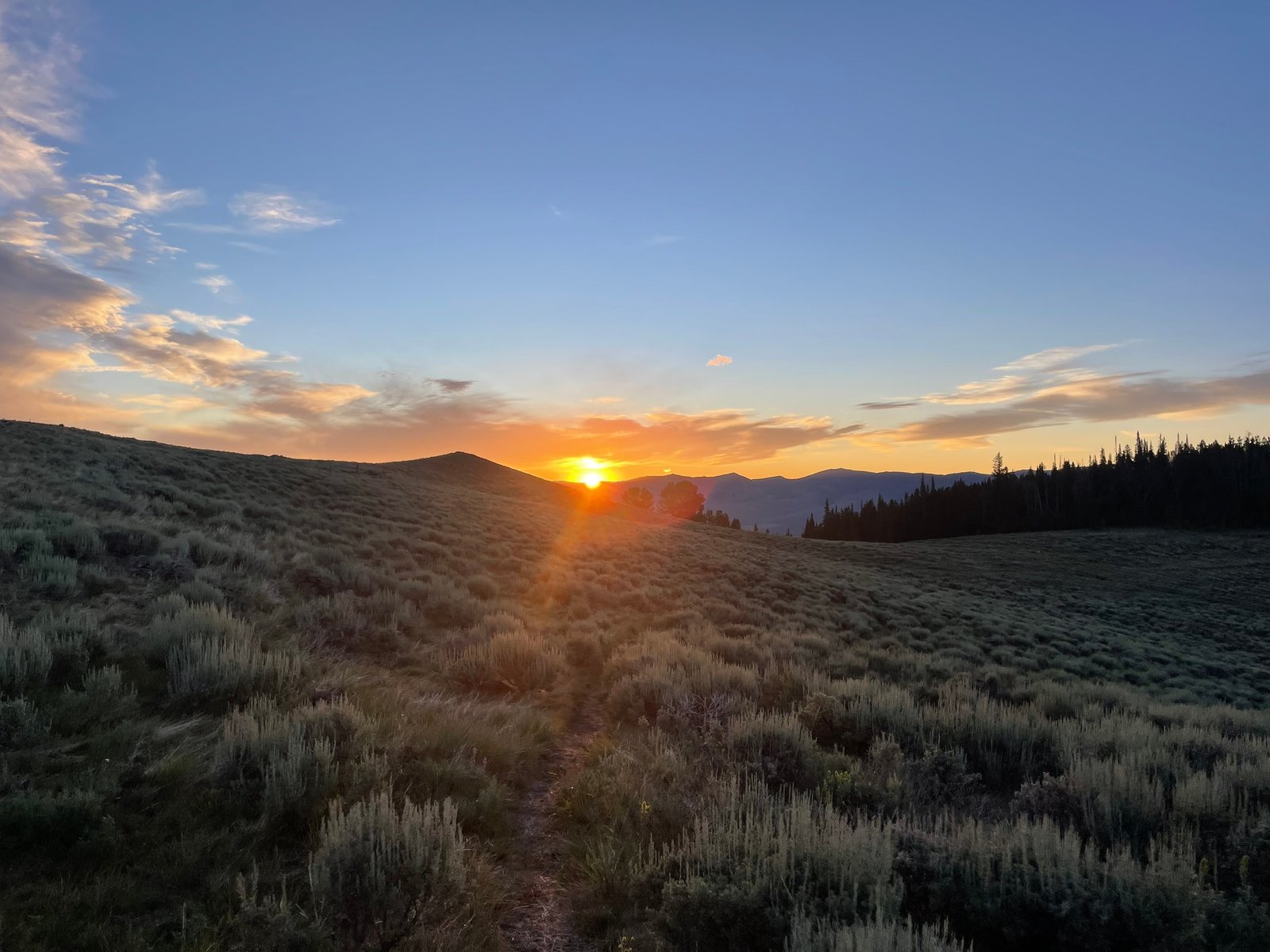
We woke up early enough to catch the sunrise. I’d been justifying my late starts for weeks now, but, staring down a glowy mountain pass I could no longer deny the truth I’d always known; alpine starts are the way.
We climbed up a scree-ey ridge in a pleasantly cool weather window. No sun beating down our backs, yet.
We eventually made our way to a dirt road that would lead us to an important spring, the first water in 10 miles. We found a cairn and wandered through a bog looking for the water source before realizing the bog was the source.
I filtered my water, chugging greedily without looking closely as we charged down trail. I stopped to examine my bottle and noticed something small and brown swimming around.
Reader, there was a live slug in my bottle. There were no nearby water sources, so Beaker helped me remove the slug and I, unfortunately, had to keep drinking from it.
As we walked the dirt road, a camper van pulled over offering us cold beers from the window. The older couple pulled over, offering us two cold glasses and waited for us to finish them to take the glass back.
“I used to be like you” the man said, gesturing to our packs. He told us he’d hiked a portion of the Appalachian Trail in the 90’s. He marveled at our light gear and trail shoes, remarking how far gear has advanced since he backpacked.
Because we were slightly calorie deprived, and very dehydrated, the single beers had us feeling tipsier than anticipated.
I felt grateful for the mixed terrain when we made it back to trail. Some road walking, combined with rolling green pastures and towering forested passes made for a beautiful, interesting day.
22 miles into the day we were staring down a dirt road that looked to be about ninety degrees.
“Do we go up that…?” I asked Beaker.
“Oh yeah.” he said.
The climbing lasted for what felt like forever, and I was rethinking our resolve to hike so many miles.
At the top of the climb we sat to eat cold ramen. I could feel my body/tendons stiffen the longer I sat, but the food revived me and I felt ready to follow true on our promise of big miles.
The push was worth it. We hiked green pastures beside curious cows, the sky turning bright orange and casting interesting hues against layers of mountains surrounded us on all sides.
The sun made its languid exit, and we had about 5 miles of night hiking ahead of us. We pulled out our headlamps and it occurred to me I hadn’t checked the battery on my lamp in months!
We entered a dark forest that felt still in the quiet of night.
“I forgot night hiking’s kind of scary” Beaker said. I laughed, as I’d been thinking the same thing.
We decided to make it to the next water source, which would cap our day at 35 miles. We exited the forest, finding ourselves beneath an open and starry sky. We saw the shadowy outline of looming mountains in the darkness around the sage field we stood in.
We set up our tent in the only flat spot we could find. My legs twitched as I lay on my sleeping pad, lids closing quickly. I listened to the crickets and felt proud. Like if I could trust myself to follow through on 35 miles, I could trust myself to do anything.
This website contains affiliate links, which means The Trek may receive a percentage of any product or service you purchase using the links in the articles or advertisements. The buyer pays the same price as they would otherwise, and your purchase helps to support The Trek’s ongoing goal to serve you quality backpacking advice and information. Thanks for your support!
To learn more, please visit the About This Site page.
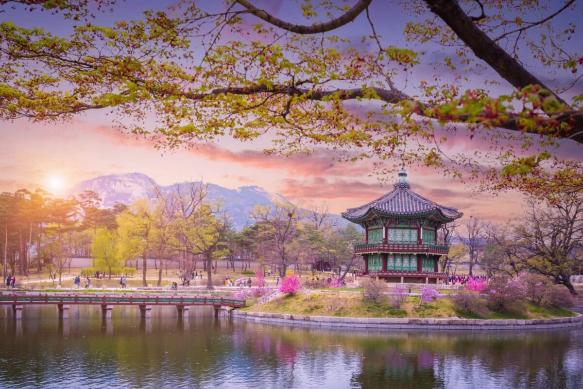
A vibrant destination known for rich culture, modern attractions, and natural landscapes, South Korea offers a diverse range of experiences with plenty of hidden gems to satisfy the wanderlust of even the most seasoned traveller.
While frequently visited for Seoul and Jeju Island, South Korea has a lot more to offer travellers. Here is a look at 10 lesser-known destinations in the one of the most-visited destinations in Asia and the Pacific.
Gyeongju
Travellers can take in the rich history of South Korea in Gyeongju. Also known as the ‘museum without walls’, the city is rich in temples, tombs, and historical attractions. It also served as the capital of the ancient Kingdom of Silla, making it a historically important city for South Korea.
One of its most popular attractions is Tumuli Gongwon, or the Daereungwon Tomb Park, which was used as the cemetery for royals during the Silla dynasty. The grassy hills provide a calm contrast to what they actually contain. Travellers can enjoy the natural scenery while also taking in part of South Korea’s history and seeing the extravagance of the buried royals.
Other must-see places in Gyeongju include the 1,000-year-old Buddha of Seokguram Grotto, a granite sculpture showcasing extraordinary craftsmanship. The Seokguram Grotto is part of the Bulguksa Temple, a UNESCO World Heritage site that features traditional Korean architecture.
The Cheomseongdae Observatory is another part of Korea’s history as it dates back to the 7th century and is one of the oldest surviving observatories in Asia. Finally, travellers in Gyeongju must also visit the Woljeonggyo Bridge, the largest wooden bridge in Korea offering a truly unique photo opportunity, for free!
Tongyeong
Another city rich in natural landscapes, cultural experiences, and exciting activities, Tongyeong is located four hours from Seoul by bus or train. Travellers can take in the scenery by riding the Tongyeong Cable Car, the longest in Korea at 18.8km. It takes travellers up Mireuksan Mountain and offers views of the city, harbour, and natural landscapes. Once at the top, they can explore the Mireuksan Mountain Observatory with its high-powered telescopes and 360-degree view of the area.
Nature lovers can head out to Jeodo Island, just off the coast of Tongyeong, known for its rugged coastline and natural beauty. Activities here include hiking the many trails to enjoy the breathtaking views and enjoying the many beaches by swimming, scuba diving, or even fishing.
On the culinary side, foodies can enjoy local delicacies all over Tongyeong. As a coastal city, there are plenty of restaurants that offer fresh and delicious dishes that can satisfy that palate of every traveller. A must-try dish is ‘sannakji’, or live octopus cut into pieces and served immediately.
Other attractions include the Tongyeong Art Center, a cultural melting pot for local artists; Daraengi Village, a small fishing village where travellers can enjoy seafood; Nammangsan Sculpture Park, an outdoor park offering views of the nearby mountains and ocean which is home to sculptures from Korean and International artists; and Dongpirang Wall Painting Village, home to local galleries and studios showcasing various artworks.
Suncheon
Suncheon, a Korean UNESCO World Network of Biosphere Reserve, is known for its ecological beauty, historical temples, and vibrant street markets. Travellers can take in its natural beauty at the Suncheon Bay Wetland Reserve, which features brackish water zones, salt marshes, reed beds, and home to hundreds of species of birds. Depending on the season, travellers can enjoy the reserve differently.
Naganeupseong Folk Village provides travellers a look into Korea’s history as it dates back to the Baekjae period. Houses in the village feature chogaijip – rice straw thatched roof, which are influenced by Joseon-era architecture.
Songgwangsa Temple, a key Buddhist temple in Korea, is a historic site with a wooder altar featuring a triad of Buddhas. A unique experience offered at the temple are templestay programs, where travellers can participate in morning and evening chanting services with the monastic community.
Another temple, Seonamsa Temple, offers travellers a look into Korea’s natural beauty and escape from city life. It is located just a short walk from a car park, where along the way travellers can see two bridges. The Seung-seon Bridge is the National Treasure No. 400 of South Korea and is a popular filming spot for Korean television shows and movies.
Travellers can also enjoy hiking in Bonghwasan Mountain, relaxing in Jorye Lake Park, and enjoying the sun in Hwapo Beach.
Damyang
Damyang is a tourism hub that international travellers probably have never heard of. It is known for lush natural beauty, making it an ideal destination for nature-lovers, hikers, and the like. The Damnyang Metasequoia-lined Road is a perfect example of this, with its Metasequoia tree-line roads ideal for leisurely strolls and instagram-worthy posts. The region is also home to the Korea Bamboo Museum with a nearby bamboo park and greenhouse to appreciate Korea’s great bamboo.
Travellers can also immerse themselves in local cultures by joining the Damyang Bamboo Festival during spring. This annual event celebrates the natural bamboo forests with various festivities, attractions, and local food and music that travellers can enjoy.
Other nature adventures include the Gwanbangjerim Forest, perfect for an eco-friendly stroll; Geumjeongsan Mountain, home to the Geumjeongsan Fortress built from natureal stones; and the Soswaewon Garden, a perfect destination to unplug and unwind from the hustle and bustle of city life.
Art lovers can visit the Moonlight Art Warehouse to view works made by local artists before enjoying a beverage at the underground cafe.
There are also several temples in Damyang which offer a templestay program where travellers (religious or not) can participate in traditional activities with the local monks. Temples to visit include the Geumseonsa Temple, Soswaewon Temple, Muwisa Temple, and Jungnogwon Shrine.
Jeonju
Jeonju is a city in the heart of South Korea that is best known for its well-preserved hanok (traditional Korean homes) village. The village is the best place to start exploring as travellers can walk the streets and see hundreds of traditional homes. For a complete experience, travellers can rent and wear a traditional hanbok (traditional Korean clothing) while strolling the streets before enjoying a night’s stay in a hanok for a completely immersive experience.
The city is also filled with street vendors to enjoy local cuisines. Jeonju is also where one of Korea’s most popular dishes, Bibimbap, originated from. Foodies looking to taste authentic cuisine can enjoy this mixed rice dish at many local restaurants and even street food stalls.
Travellers looking to learn more about Korean history and culture can head to the nearby Gyeonggijeon Shrine with its many historical artifacts. Guided tours are available and recommended to get the most out of the visit. The Royal Portrait Museum, located right beside Gyeonggijeon Shrine offers a look into the country’s past with portraits of previous Korean royals. Other attractions in Jeonju include the Traditional Wine Museum, Jeonju Crafts Exhibition Hall, and the Korea Traditional Culture Center.
Chuncheon
Chuncheon is frequently visited for Nami Island, a half-moon-shaped island the made popular by many Korean dramas to locals and tourists. However, there are many other sights and activities in Chuncheon to meet the needs of all travellers.
The Gangchon Rail Park (converted from the Gangchon Station in 2012) provides families a fun activity with rail bikes to ride along the rail lines. They can also rent regular bikes to ride along the bike paths or take a slow-paced stroll with the Bukhan River in view. Travellers can also enjoy canoeing Jungdo Mullegil Trail, another location made popular by Korean dramas. The Hajungdo Eco Park on Hajungdo Island is a good place to have a family picnic and enjoy slow-paced nature activities such as hiking around the island.
Winter activities are also available in Chuncheon with the Elysian Gangchon Ski Resort. The resort offers slopes and ski trails suitable for even beginners and children to let the entire family have fun in the snow.
Also, Chuncheon is home to Korea’s own Legoland, an excellent family vacation destination with a massive playground, rides, shows, and other attractions.
Namwon
Namwon, a small town just less than an hour from Jeonju, hosts many historical and cultural sites to visit. The city, known as Korea’s city of love, got its name from the story Chunhyang – one of Korea’s most famous love stories. The Chunhyang Theme Park commemorates this story with five distinct areas, each dedicated to a part of the story to make it the perfect date place for couples.
Nature lovers can head out to Jirisan National Park in Jirisan Mountain, which offers various trails to explore suitable for more seasoned hikers.
From the 15km Cheonwangbong Peak Trail with steep rocks and spectacular views to the Baemsagol Valley Trail that offers serene walks through forested paths. Cultural sites nearby Jirisan National Park include the Samseonggung Shrine, Jirisan History Museum, and a traditional Korean jjimjilbang (hot spring).
Namwon is also filled with various establishments to enjoy local cuisine from bibimbap, galbi tang, and bindaetteok. Must try restaurants include Bongga Myeonok with its cold noodles, Namwon Chunhyang-gol Saejip known for its loach, and Busanjib with its array of seafood items.
Gwangju
Gwangju is a city filled with art and culture. Travellers can visit the Gwangju National Museum with its collection of artifacts and items dating back to the Bronze Age. The museum also features separate spaces for Buddhist art, calligraphy, and ceramics as well as five prehistoric monuments out in the museum grounds.
Nearby, the Gwangju Museum of Art is home to a large collection of pieces of Korean and international paintings, calligraphy, illustrations, photography, and other artworks. The museum also has activities for families with a children’s museum with an experience space for hands-on fun. Travellers can also take in more Korean culture at the Asia Culture Center (ACC), Gwangju National Science Museum, and Mudeungsan Jeungsimsa Temple.
In the Deain Market travellers can purchase various fresh produce, crafts, homewares, and other local good. While at Chungjang-ro, the city’s main shopping and entertainment street, is home to a wide selection of clothing stores, restaurants, and karaoke rooms to enjoy modern Korean culture, cuisine, and activities.
Suwon
Suwon, located just a 40min drive or 50min train from Seoul, is known for being enclosed in by the walls of the Hwaseong Fortress. A UNESCO World Heritage Site, the fortress was built in the 18th century with around 5km of walls still standing today. Travellers can ride a trolly that takes them through the main gates, the royal palace, and the museum or ride a balloon 150m in the air at the Flying Suwon experience, located next to Hwaseong Fortress, to get a bird’s eye view of the area.
The Suwon Art Village is a perfect location for an afternoon walk to enjoy the local architecture, cafes, and see houses decorated with murals.
Those looking to learn more about Suwon’s history can head to the Suwon Hwaseong Museum. It houses many artifacts and records dating back to the 18th century to satisfy history aficionados.
Foodies can enjoy the popular samgyeopsal (known internationally as Korean barbecue) at Suwon is popular for gui, or traditional Korean food cooked on a grill in the middle of the table. The most popular dish being galbi, barbecued beef short rib marinated in soy sauce, sugar, garlic, and onions.
Other attractions in Suwon include the Toilet Museum, built to celebrate the foundation of the World Toilet Association; the Suwon World Cup Stadium, built for the 2002 FIFA World Cup; and Everland, the largest theme park in South Korea with numerous rides, attractions, and activities.
Changwon
The coastal city of Changwon was South Korea’s first planned city and modeled after the Australian capital, Canberra. It offers a more modern atmosphere with tall buildings and modernised areas while still giving a taste of local culture. During spring, travellers can enjoy walking along a cherry-blossom-filled path in the Jinhae district with the Yeojwacheon Starlight Festival taking place at night.
Changwon is also home to Yongji Lake, a famous man-made lake that offers water shows and live music. The Jinhae Inland Water Eco Park lets travellers escape the busy city to take in Korea’s natural beauty. There are various hiking paths, goldfish fishing, and nearby cafes to enjoy a relaxing afternoon. Travellers can also choose to enjoy a local hot spring to release stress and tension from a long day of walking and other activities.
What is a vacation without taking something home for family and friends? Changwon is home to the LOTTE Mart, the go-to shopping place for Korean treats. There are also other stores to purchase clothing, food, and other goods to help travellers bring a piece of Korea with them home.
-

 Mergers & Acquisitions2 weeks ago
Amazon weighs further investment in Anthropic to deepen AI alliance
-

 Mergers & Acquisitions1 week ago
How Elon Musk’s rogue Grok chatbot became a cautionary AI tale
-

 Asia Travel Pulse2 weeks ago
Looking For Adventure In Asia? Here Are 7 Epic Destinations You Need To Experience At Least Once – Zee News
-

 Mergers & Acquisitions2 weeks ago
UK crime agency arrests 4 people over cyber attacks on retailers
-

 Brand Stories2 weeks ago
Voice AI Startup ElevenLabs Plans to Add Hubs Around the World
-

 AI in Travel2 weeks ago
‘Will AI take my job?’ A trip to a Beijing fortune-telling bar to see what lies ahead | China
-

 Mergers & Acquisitions2 weeks ago
EU pushes ahead with AI code of practice
-

 Mergers & Acquisitions2 weeks ago
ChatGPT — the last of the great romantics
-

 The Travel Revolution of Our Era1 month ago
CheQin.ai Redefines Hotel Booking with Zero-Commission Model
-

 Mergers & Acquisitions2 weeks ago
Humans must remain at the heart of the AI story