
Destinations & Things To Do
Best Cyprus holiday destinations for 2025
An island rich in historic sites, unique cuisine and charming coastal resorts, Cyprus continues to uphold its reputation as an island that can cater to every type of traveller.
The sparkling crystal Mediterranean Sea wraps around this island like a silky scarf. Situated just under Turkey, the island has almost year-round warm weather to enjoy the Med’s waves across its popular seaside spots and beach resorts.
While it’s hard to draw yourself away from soaking up the sun, flopping on a lounger with a book in one hand and a cocktail in the other, the island combines this distinctly laid-back way of life with immeasurable amounts of Mediterranean history, as well as characterful hotspots for lively nightlife.
Capital Nicosia is the cultural epicentre of the country, while Paphos is its ancient historic centre, with ruins dating back centuries. You’ll find plenty of delightful beaches there too.
The Troodos Mountains offer an escape into the wilderness with picturesque villages, hiking trails and even ski slopes, while Limassol and Larnaca provide a relaxed beach resort alternative away from the party-centric town of Ayia Napa.
There are plenty of accommodation options available in all seven of our Cyprus hotspots, or you can always visit on a day trip, as the island is small enough to get across easily in just a few hours. Read on to find the best places to visit during your trip. Book flights to Cyprus via Skyscanner.
1. Paphos
Best for: Nightlife
Paphos remains one of the country’s most popular tourist destinations, with sparkling year-round weather allowing you to make the most of its Mediterranean promenade and beaches like Aphrodite’s Rock, Coral Bay or the Blue Lagoon.
The city itself comprises a charming old town (filled with colourful architecture, alfresco restaurants and great harbour views), a host of surrounding ancient ruins, a lively nightlife scene and great options for day trips such as vineyard tours or visits to other nearby towns.
Tourist highlights include the Kato Paphos Archaeological Park and its many ruins – which range from villas and mosaics to a 4th-century acropolis and the Odeon, an outdoor theatre – as well as the Chrysorrogiatissa Monastery and the Harbour Castle.
For a stay overlooking the sea, the Alexander the Great Hotel is an elegant beachfront property located minutes from Paphos harbour. It combines old-fashioned luxury with contemporary touches – from the opulent decor to the modern spa and five dining options – and features four swimming pools, a fitness centre and a terrace that is among the best sunset viewing spots in town.
Read more: The best beaches in Greece – and where to stay nearby
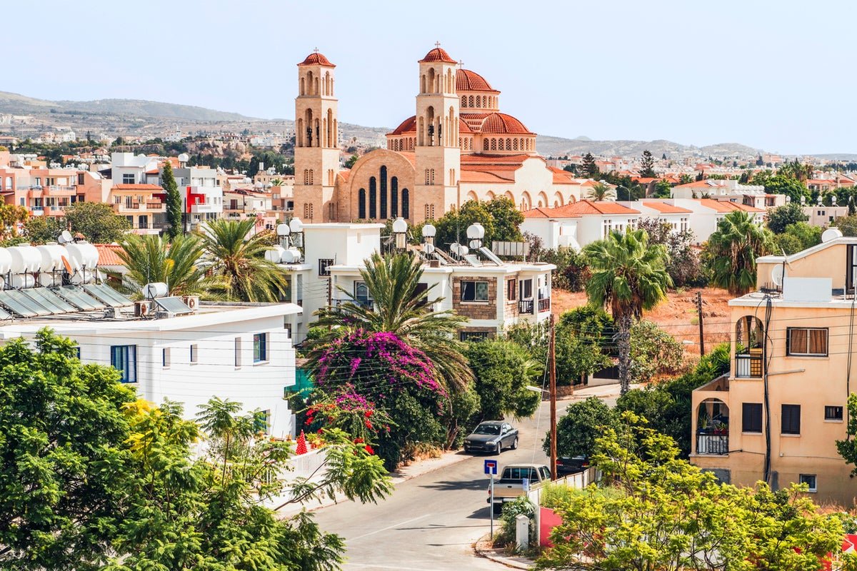
2. Nicosia
Best for: History
The capital is a magnificent showcase of Cypriot history, where Venetian, Ottoman and Byzantine architecture attests to the city’s complicated past. The skyline is dominated by russet-tiled roofs and walls of white and honey, with an old town surrounded by 16th-century Venetian city walls, delightful squares such as the recently redesigned Plateia Eleftherias and quaint neighbourhoods like the Chrysaliniotissa Quarter or Laïki Geitona.
Cyprus is divided into two parts by the UN-administered Green Line, which runs right through the country’s capital. The north and south of the city are separated into the Greek Cypriot and Turkish Cypriot communities, and the immediate area around the line is a good place to learn about recent Cypriot history.
Parts of Ottoman and Byzantine life remain today in the city’s many churches, mosques and the Hamam Omerye bathhouse. Archangelos Michail and Agios Ioannis are the main churches, while the Omeriye Mosque stands out as a working mosque that non-Muslims can visit. For the best views of both sides of the city, ascend the Shacolas Tower Observatory.
Choose the Djumba Hotel and Cafe for a boutique hotel stay in Europe’s last divided capital. It combines traditional Cypriot architecture and hospitality with a touch of the Mediterranean and offers cosy and modern rooms, a courtyard and terrace and lovely local food options.
Read more: The enchanting Spanish town that got tourism right
3. Limassol
Best for: Beaches
Limassol is a busier, more cosmopolitan alternative to Paphos or Larnaca. It is the second-largest city on the island, with a picturesque marina and beaches including Lady’s Mile, Dasoudi Beach and Governor’s Beach that offer safe swimming.
Stretching back from the waterfront, the city itself is a collection of white-washed buildings that line cobbled limestone streets, with a mix of high-rise buildings and preserved heritage sites. Older historic sites include Limassol Castle, Kolossi Castle and the 2,000-year-old ruins at Amathus, while you can also day-trip to the ancient ruins of Kourion, once one of the island’s most important city-kingdoms.
For a stay at a seaside location that is also within the city’s historic centre, The S Paul City Hotel means guests can pair beach visits with easy strolls through the old town. Interiors here fuse the modern with the traditional in a series of 22 minimalist rooms housed within a 19th-century stone building, and guests can enjoy easy access to the bar and its two restaurants.
Read more: Why you should swap Santorini and Mykonos for this peaceful Greek island instead
4. Larnaca
Best for: Scuba diving
Larnaca lies along the southern coast of Cyprus, just east of Paphos and Limassol, so it benefits from much of the same great weather and superb beaches. Standouts are Makenzy, Finikoudes, Kastella and Dhekelia.
Larnaca is probably less glamorous than its resort town neighbours but has a solid tourist infrastructure and enough sites to keep you occupied over a long weekend (if you decide you want to leave the beach). Lined with plenty of hotels and restaurants, Leoforos Athinon is the main thoroughfare, linking the marina with Larnaka Fort. Many of the city’s main sites are close by, including the Agios Lazaros (a 9th-century church), the museums of natural history and archaeology and the site of Ancient Kition, an ancient Greek city-kingdom.
Half a day can also be spent exploring areas like the Turkish Quarter or experiencing the phenomenal scuba diving on the Zenobia, one of the best wrecks in the world. The towns of Protaras and Ayia Napa are also both within easy reach.
The Lokàl provides a boutique hotel stay in the heart of Larnaca, just minutes away from the city’s main attractions. A family-run hotel with a distinctly homely feel, it lies just 300 metres from Foinikoudes Beach and offers its own rooftop terrace pool, along with a bar and modern Mediterranean bistro.
Read more: The best hotels in Santorini for luxury suites and sea views
5. Protaras
Best for: Families
Protaras offers more of a laid-back, family-friendly alternative to the well-known party atmosphere of Ayia Napa. It is smaller too, stretching from Fig Tree Bay in the south to Trinity Bay in the north (just over a 10-minute drive up the coast). There are plenty of other bits of attractive coastline too, including the Blue Flag beaches of Konnos Bay and Pernera.
Many of the activities in Protaras are aimed at families, with mini-golf courses, amusement arcades and the Ocean Aquarium all within easy reach. The Konnos Nature Trail offers hiking opportunities, while Cape Greco is the place to go for the best coastal views. The Church of Profitis Ilias, perched on a hill overlooking the coast, offers one of the most scenic views in town.
To stay at the beachfront in Protaras, Sunrise Jade is an adults-only oasis centred around its two large outdoor pools and an elegant terrace. Rooms are minimal with muted tones, and some come with direct access to their own small private pool.
Read more: Best hotels in Athens for luxury beachside resorts and inner city boutiques
6. Troodos Mountains
Best for: Hiking
This mountain range shows a different side to Cyprus, with quiet mountain villages surrounded by dense pine forests and medieval churches sitting alongside historic monasteries. Cooler temperatures allow for summer hiking and in the winter months, you can even go skiing on the slopes of Mount Olympus, Cyprus’s tallest peak.
The main settlement here, and the best base for tourists, is Troodos village, which sits just under Mount Olympus. Some of the most desirable villages to visit include Fikardou, Pedoulas and Agros, all of which are well-preserved and filled with churches and russet-roofed buildings that hug the verdant hills. Hiking trails in the area to check out include the Caledonia, Millomeris and Artemis.
The Troodos Mountains are full of traditional villages and accompanying hotels, but the Casale Panayiotis combines a picturesque mountain setting with modern amenities and traditional Cypriot touches. It is located in the town of Kalapanayiotis, and set in a series of traditional houses that contain contemporary rooms with period features. The Byzantino restaurant serves traditional cuisine, while guests can enjoy the use of a spa, swimming pool and large courtyard.
7. The Lemesos Region
Best for: Wine
While the city of Limassol largely dominates this area with its sparkling marina and popular beaches, the region of Lemesos in which it sits offers even more Cypriot experiences beyond the main port. The region is known for its wine, being home of the island’s wine-making industry. On the southern slopes of the Troodos Mountains, wine aficionados will find the ‘Krasochoria’ wine villages, which carry on the viticulture tradition with production of such tipples like the Commandaria sweet dessert wine. The vineyards make for a tranquil retreat away from the city centre, as well as a chance to indulge in a glass or two of the region’s finest bottles.
Lemesos also plays an important part in Cyprus’ history. It’s where the ancient city kingdoms of Amathus and Kourion once thrived, and nowadays, its archaeological remains can be visited and give a glimpse into the island’s chaotic political history. Once you have tired of the bustling city of Limassol, heading further inland to Lemesos’ wetland area offers opportunity for hikes, fishing or observing birds. Germasogeia Dam has a popular hiking trail around its reservoir, while Cyprus’ largest inland body of water, Akrotiri Salt Lake, attracts flocks of flamingos, cranes and other waders that migrate there in the winter months.
If you are looking to stay among the Krasochoria and its wineries, book a room at the Petit Palais Platres, a hillside accommodation not too far from the vineyards that showcases an expansive view over Troodos’ evergreen forests. When not exploring Platres village or hopping over to the wineries in Omodos, Petit Palais’ sauna and steam bath will help you unwind further at this hidden rural retreat.
FAQs
What currency do I need in Cyprus?
Cyprus uses the Euro (€ ).
How can I travel to Cyprus from the UK?
Several airlines offer direct flights from various UK airports to Larnaca (LCA) and Paphos (PFO). Flights with Wizz Air, Jet2, British Airways and easyJet take around 4 hours and 30 minutes.
What is the time difference between the UK and Cyprus?
Cyprus is two hours ahead of the United Kingdom.
When is the best time to travel?
Like much of southern Europe, Cyprus swelters in the peak of summer. According to the Met Office, the mercury rises to an average daily temperature of 31.4C in July and 31.6C in August. These figures may seem reasonable, but last year’s weather was anything but – a figure of 44C was recorded by the Cypriot Meteorological Department in June 2024.
Unless your single aim is to be horizontal on a sun bed, the shoulder season is a better bet for sightseeing and exploring this historic island without worrying about your health. May has an average temperature of 25.6C, while September and October enjoy a balmy average of 29.7C and 27.3C respectively. The lowest daily average temperature occurs in January at 16.9C.
Read more: The crowd-free island getaway that won’t break the bank this summer

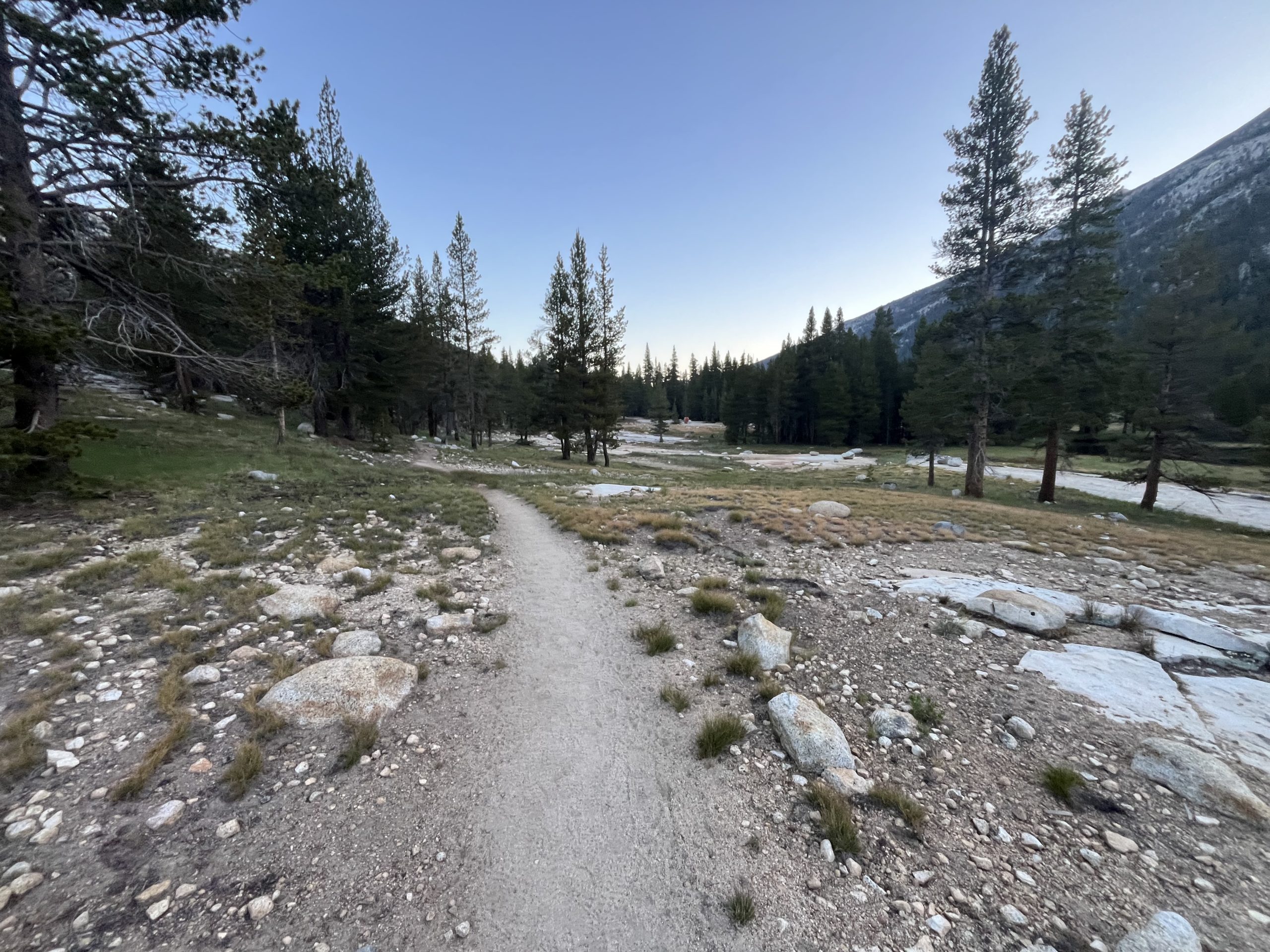
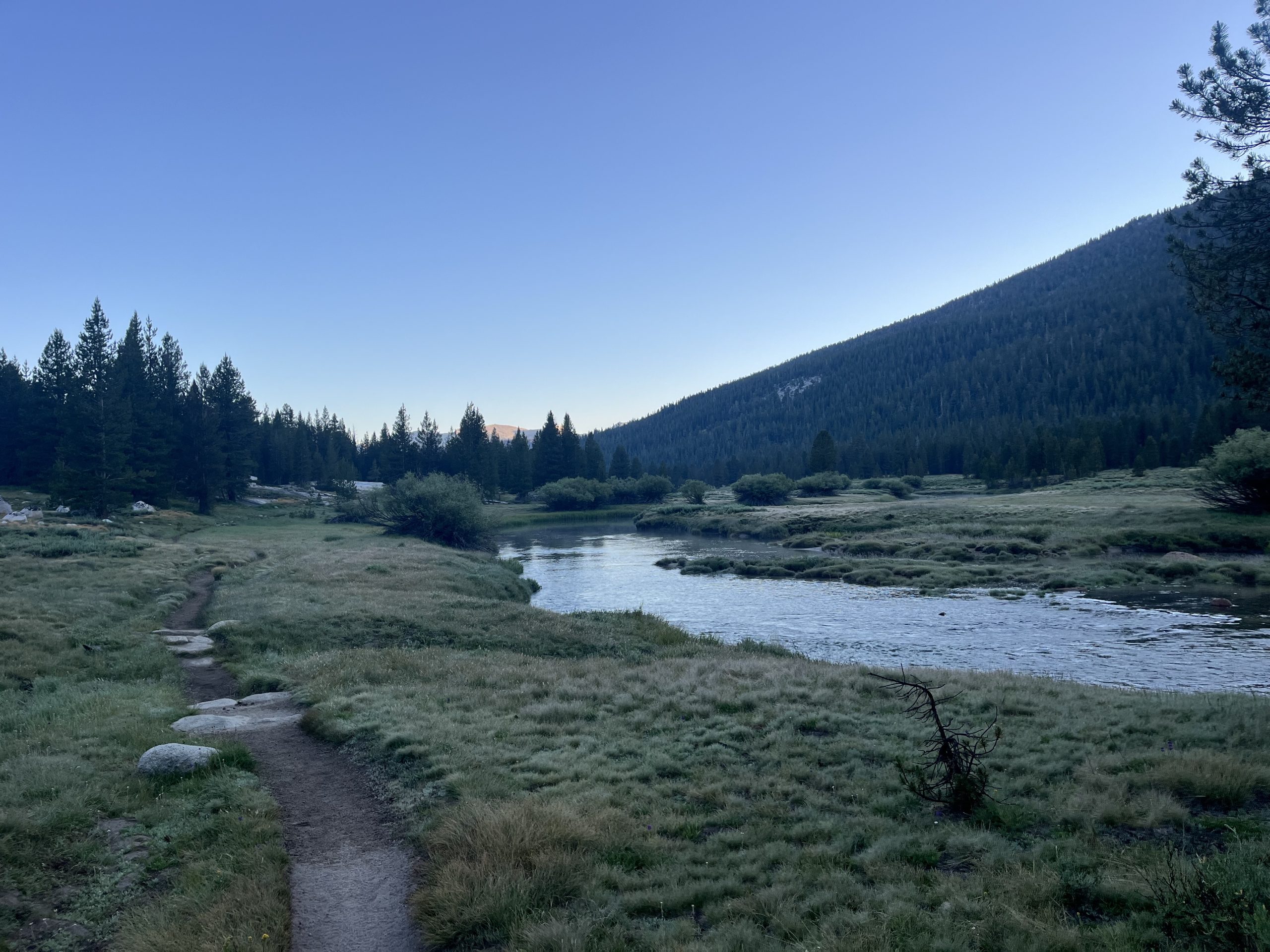
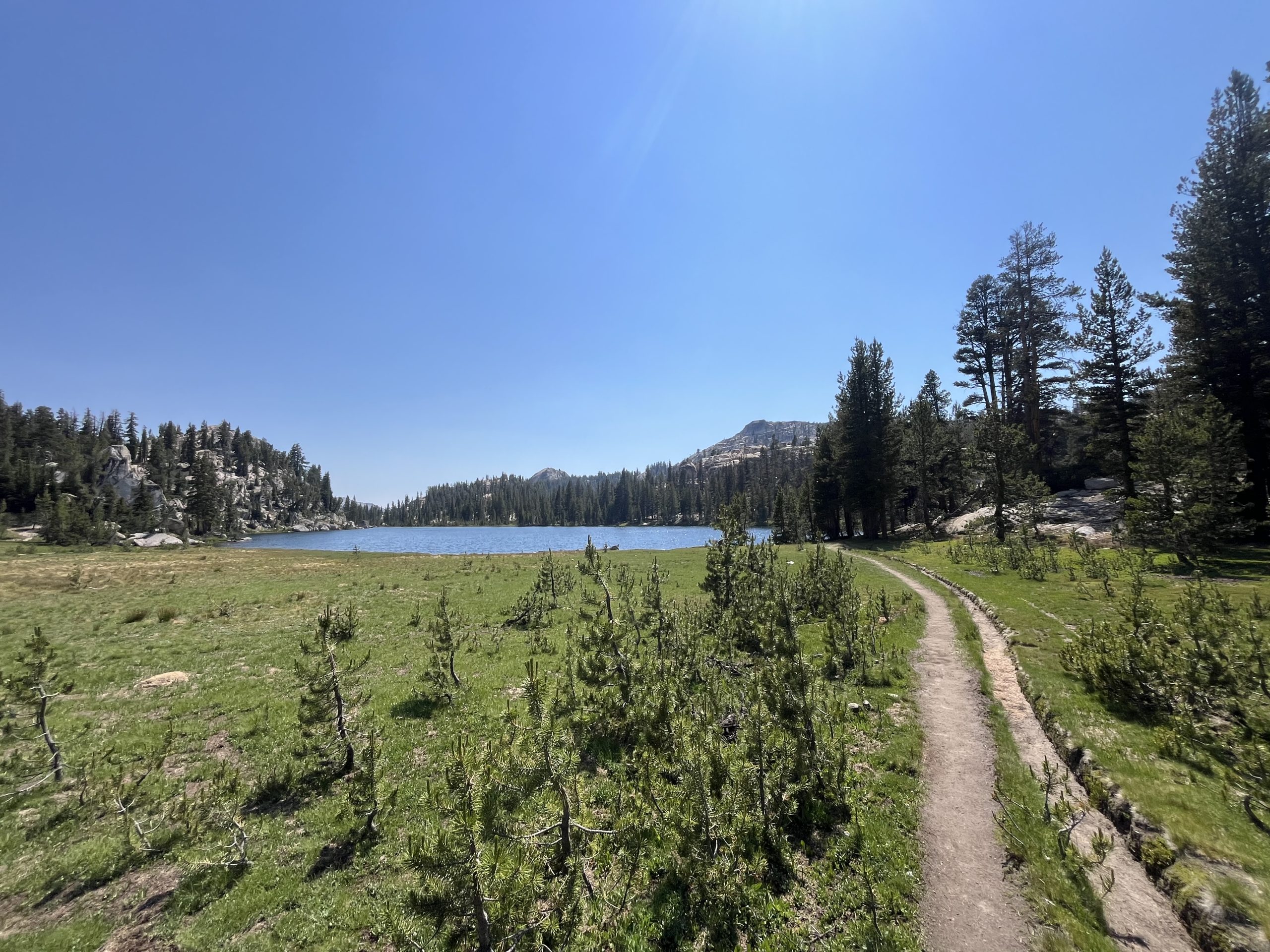
This morning I got up and made coffee. Then I was packed up and walking right around 5:45 AM. I said goodbye to Cara who I won’t be seeing again. The JMT and PCT split off very soon. She’ll be heading into Yosemite Valley to finish her hike. And I’ll be heading into Tuolumne Meadows and continuing on the PCT past there.
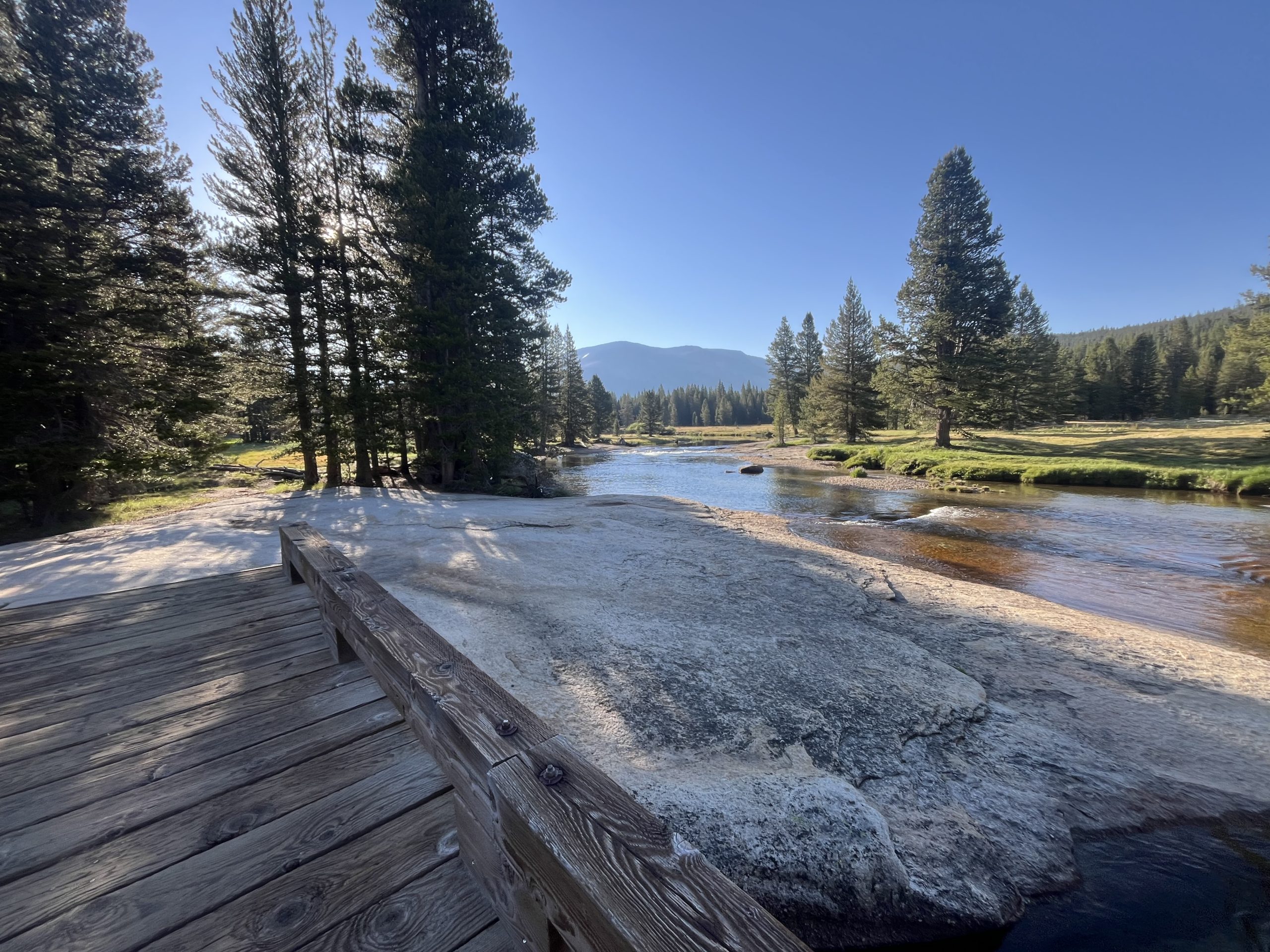
I only had a handful of miles to do this morning before I would get to Tuolomne Meadows. There is a small camp store there and a restaurant. I’m pretty excited to be able to grab a drink and something to eat. Especially considering it’s right off the trail. Plus the entire first 12 or so miles up today are completely flat. So the hiking from my camp spot to the store is about as easy as it gets.
As I got closer to Tuolumne I started passing a bunch of hikers. Some were out doing section hikes and others were doing day hikes from the parking area. I wound up getting into Tuolumne Meadows and down the road to the store right as it opened. I was standing outside by 8:02 AM. But unfortunately for me, so were about 10 other people who had driven there in their vehicles.
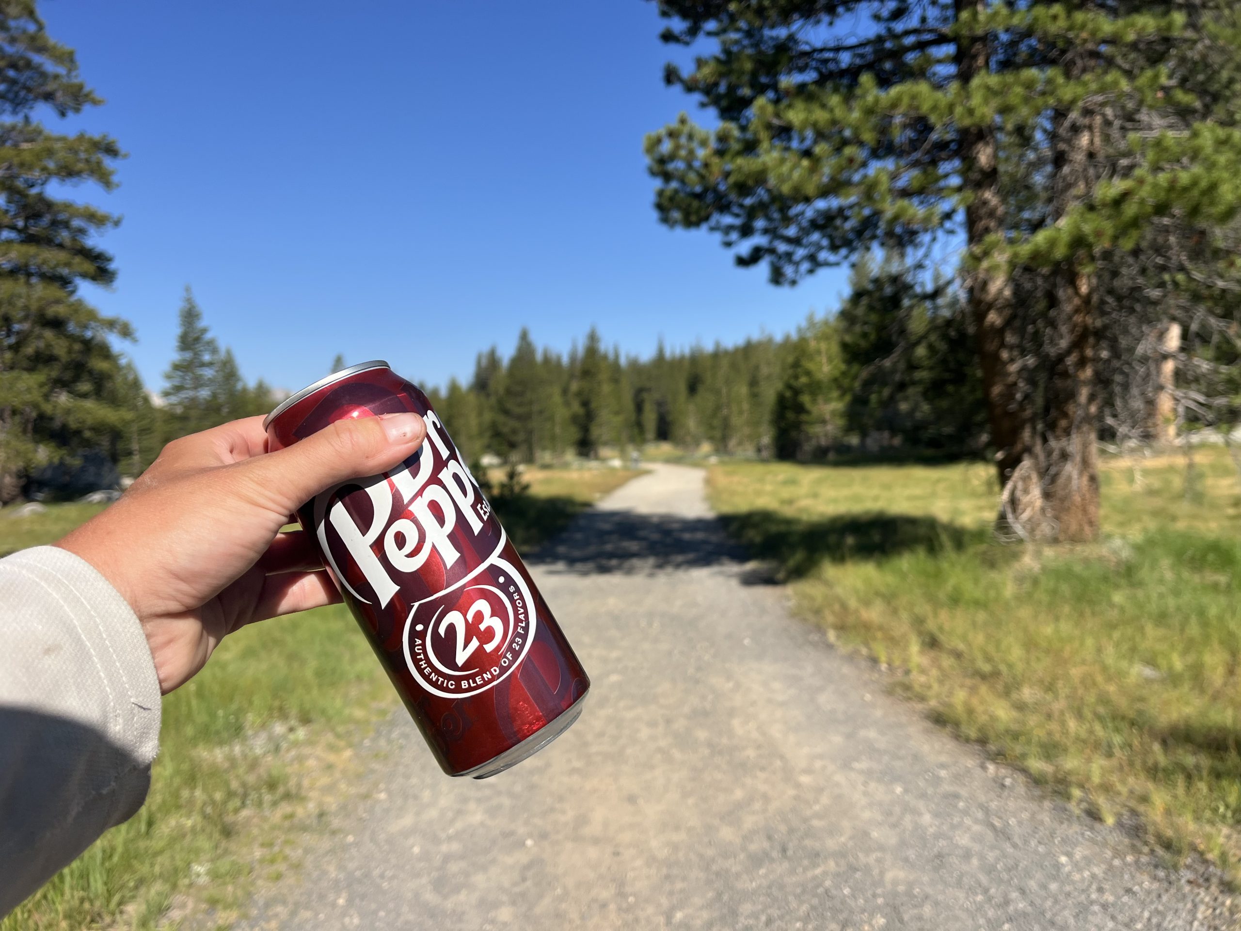
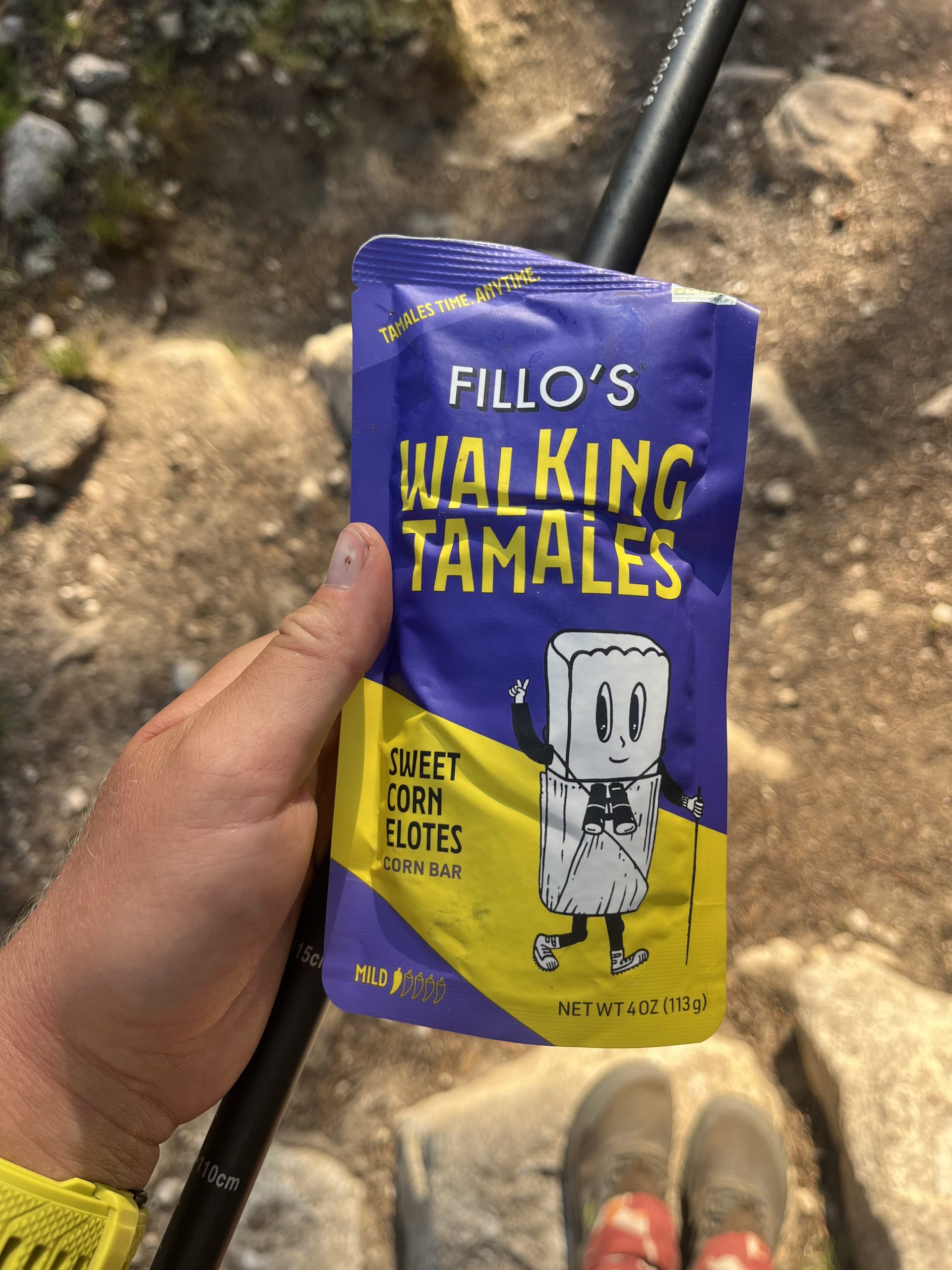
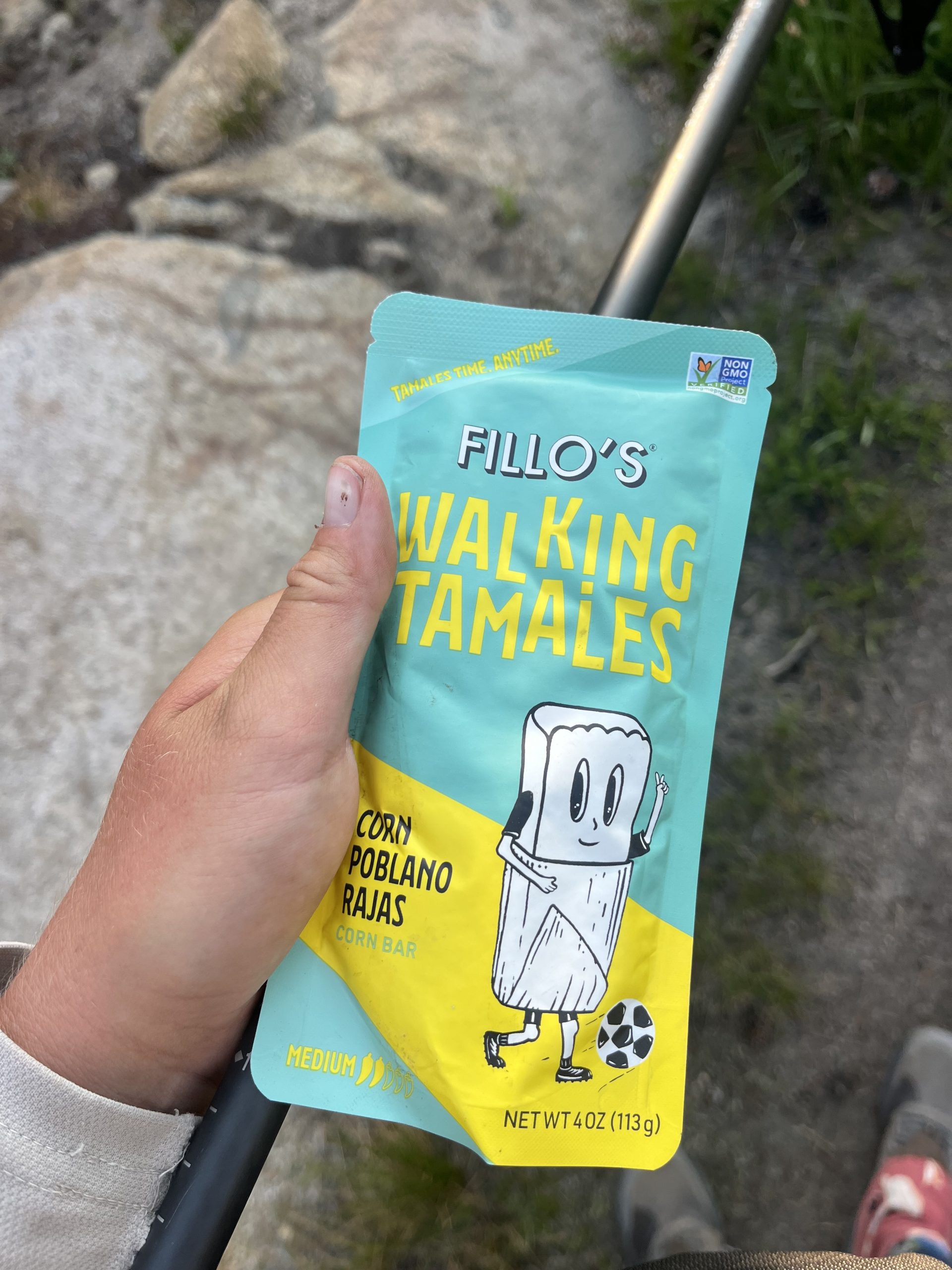
I wound up waiting a long time to get to the front of the line and order. But it was still really early, so that was ok. I got a hot chocolate, a breakfast burrito, and a side of home fries. While everything cooked, I headed to the general store next door to grab a couple things. I got two Gatorades to pack out in my water bottles. I also got a soda to carry out and drink later today. And the store had two types of walk-in tamales that I’ve never seen before. So I had to try those.
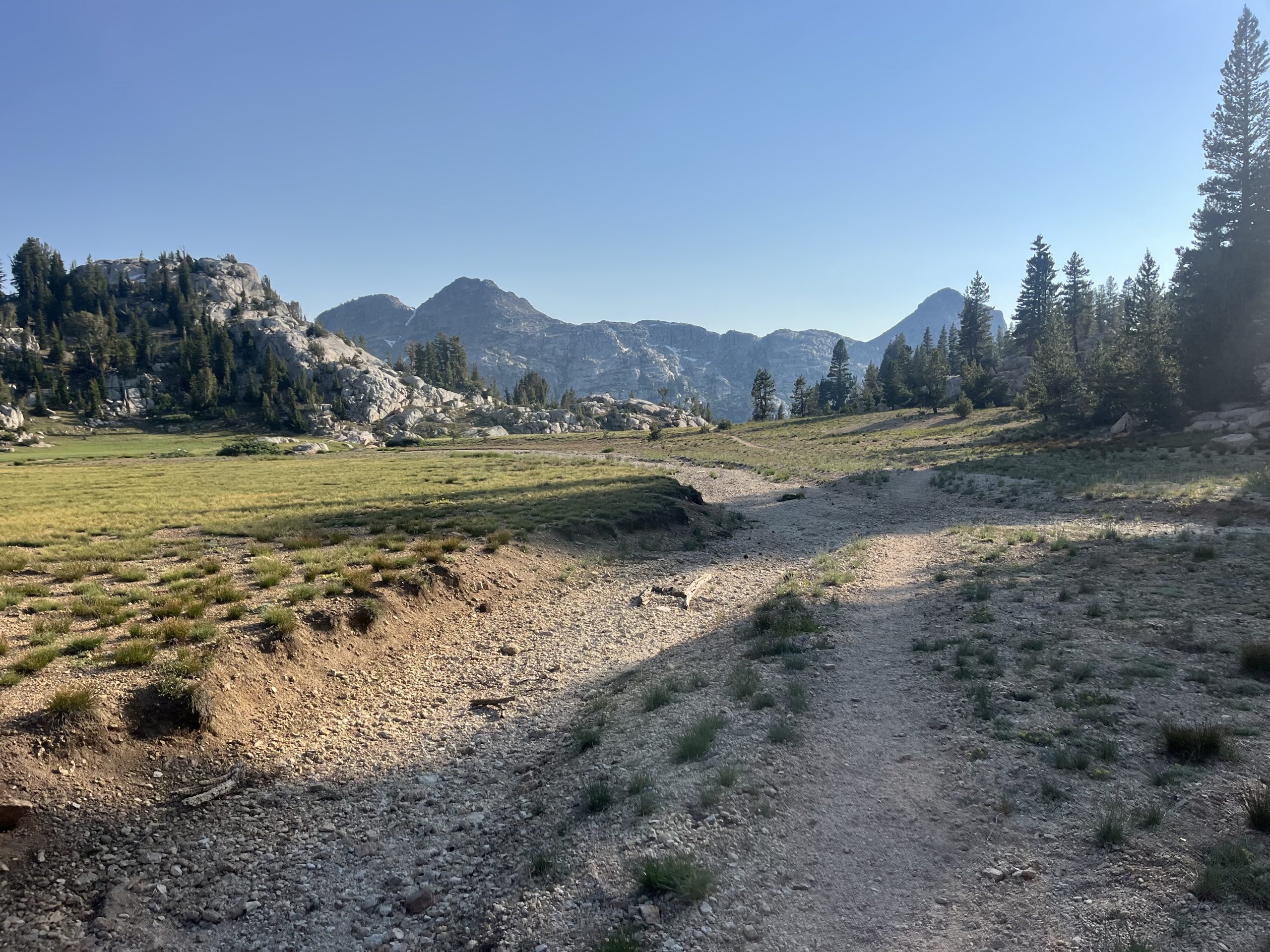
By the time I was done in there, my food was ready. I stuffed down the home fries and drank the hot chocolate. Then walked out with the burrito and ate it along the road. I knew the trail would follow along the road for a while. Then it would pick back up onto dirt track before getting onto some actual trail again. I ate while I walked and this next section wound up being one of the busiest sections of trail I’ve seen a long time.
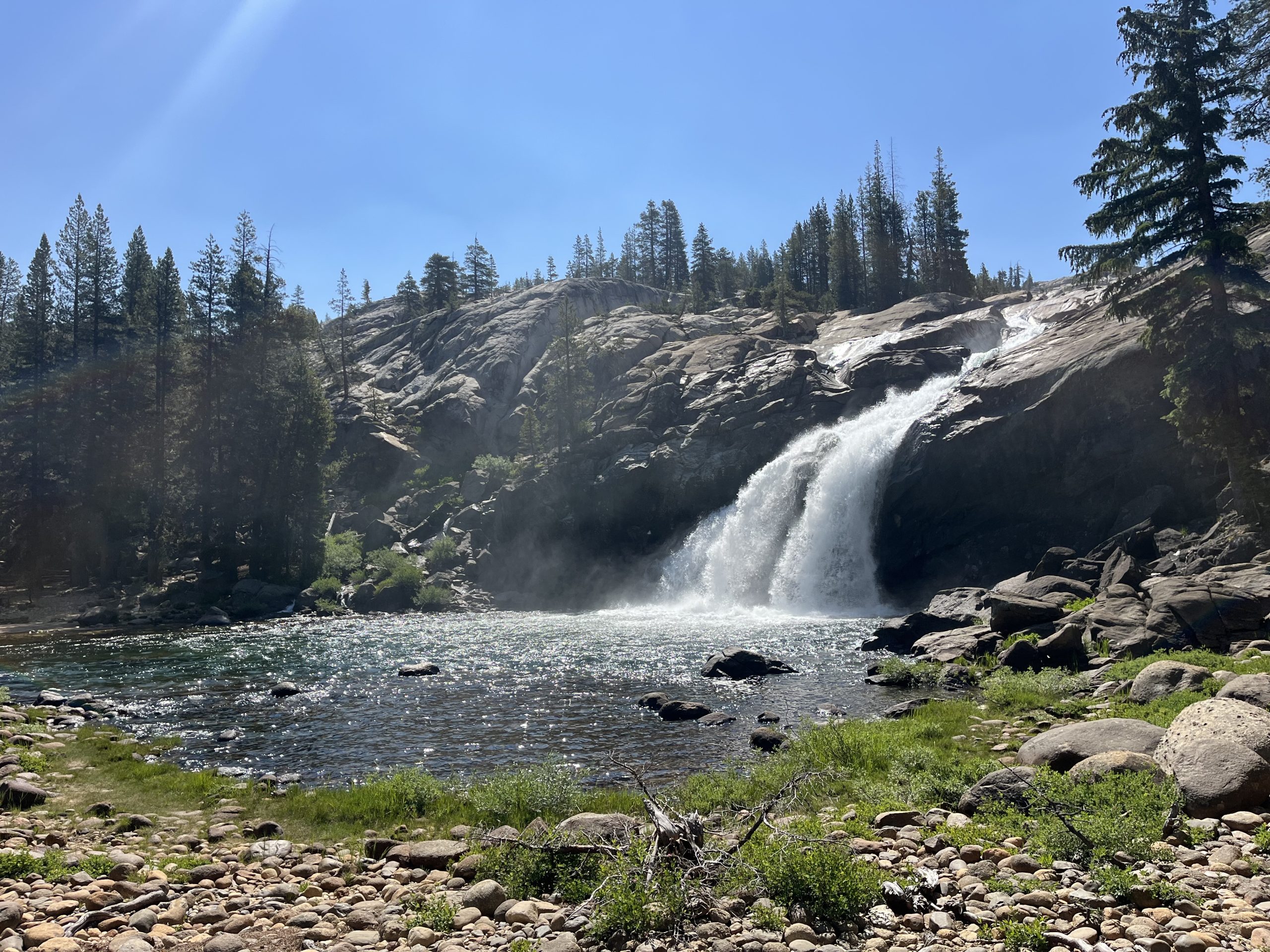
I wasn’t really prepared for it either. When I was here last time, Tuolumne Meadows wasn’t even open. I was so late in the season that everything was closed down so I didn’t see a soul. Apparently, though, the campsite about 5 miles north of Tuolumne Meadows is super popular. Because as I made my way there, I probably passed 50–60 people heading the opposite direction. They had all camped at the site last night. It’s right by a waterfall and apparently has running water and bathrooms.
I actually camped right by the waterfall and near the campground last time. I could see canvas tents, and other things set up. But things like that sort of give me the creeps when they’re closed. So I didn’t head over to investigate. This time around, it’s the middle of the season and there were tons of people utilizing the campground. It was a constant parade of large groups of hikers. Then I came to the junction for that campground and hardly saw a soul for the rest of the day.
It’s not surprising that the campsite right across from this waterfall is incredibly busy. I kept very close to this waterfall as well in 2022.
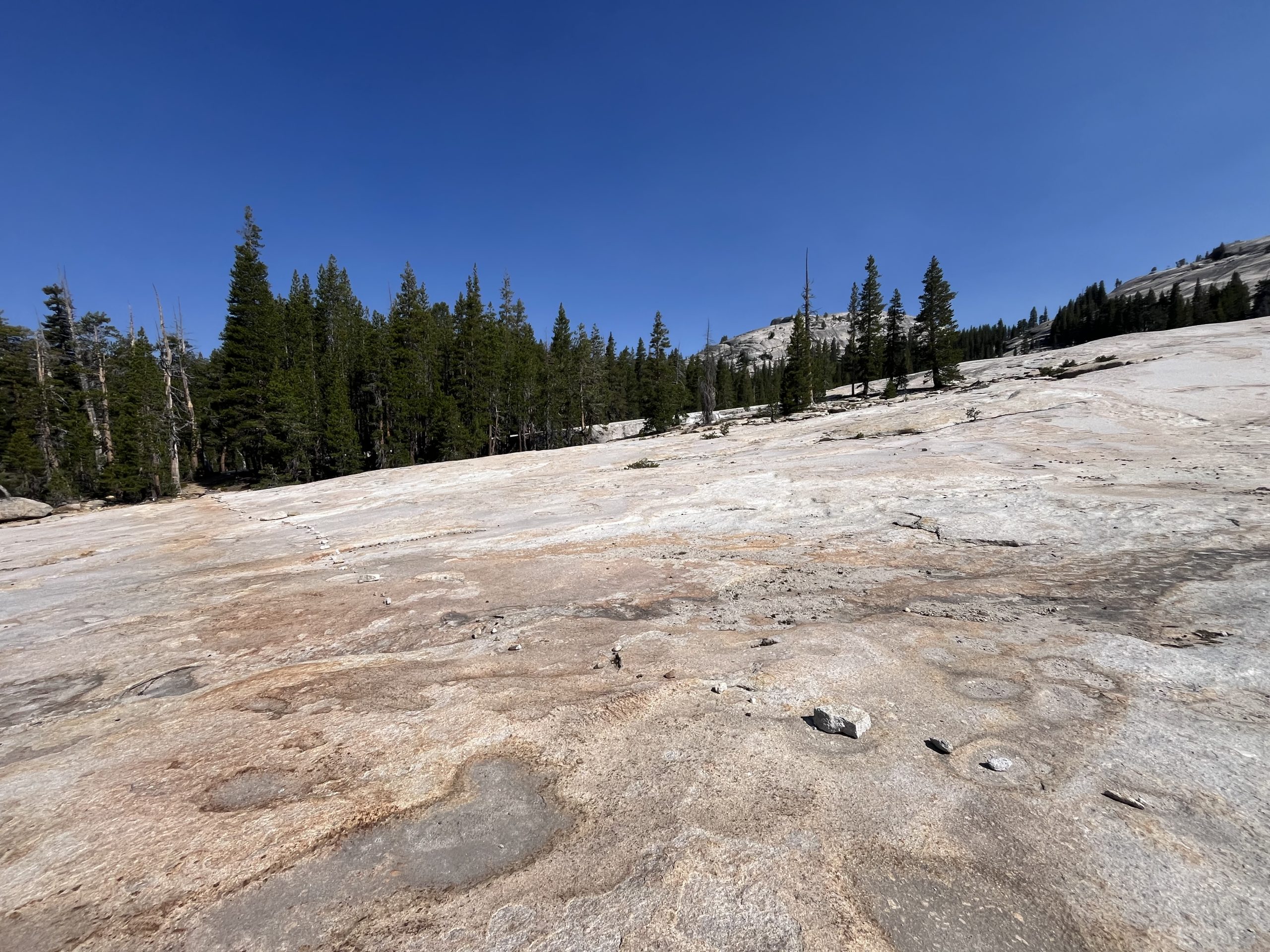
When I passed the junction for the campsite, I began a long but very gradual climb. It went on for the next seven or so miles. Then over the course of the day I would have a couple more gradual climbs. It’s getting to be the part of this trail, though, where things really calm down. The climbs are just going to continue to get more and more gradual and also shorter.
The terrain of this next climb was so nice and easy that I forgot I was going uphill most of the time.
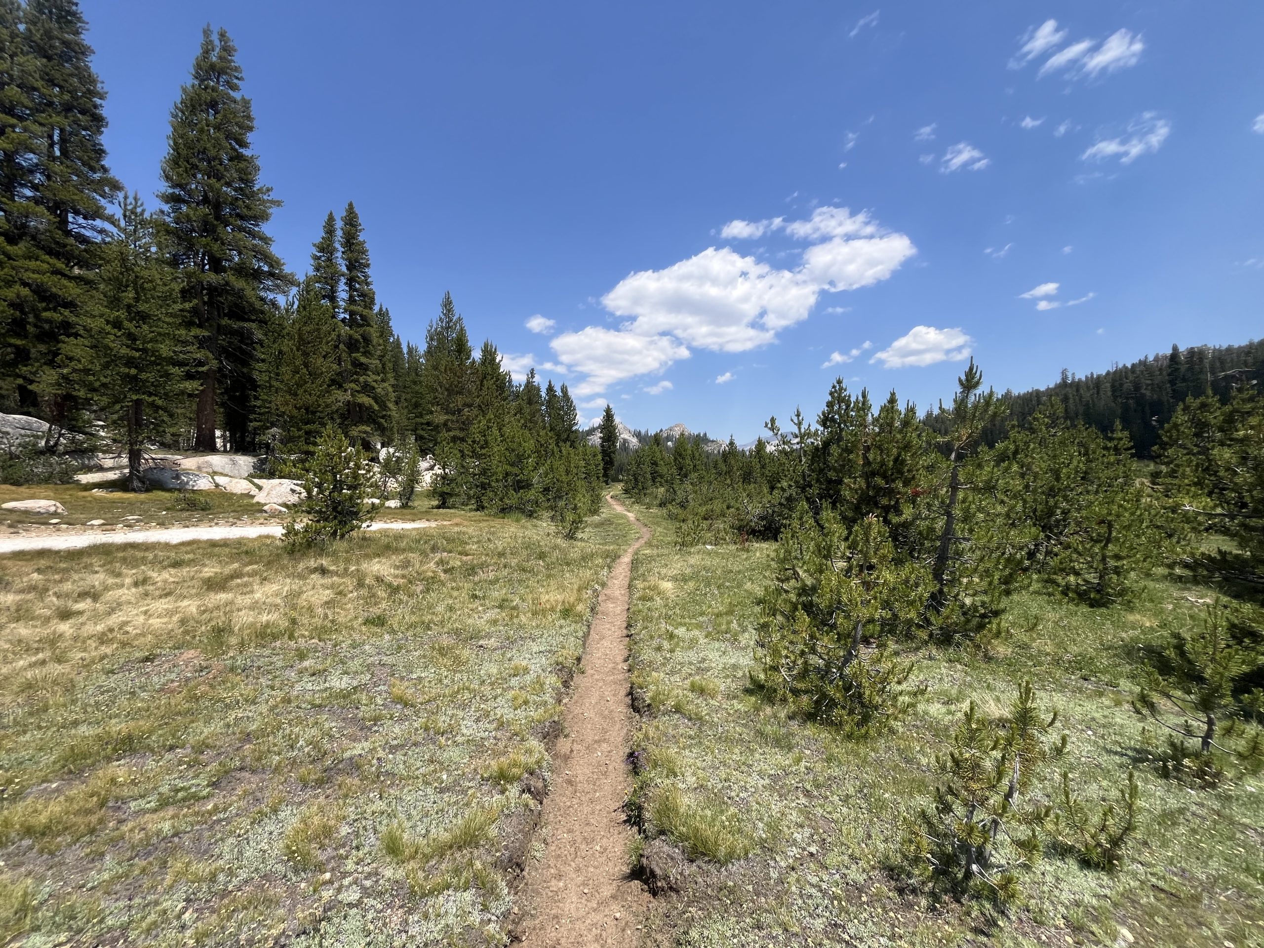
Over the next couple hours, I made my way up to the top of that climb. It was scorching hot out already for the day so I stopped off a couple different times to grab water. At one point I was really thirsty and hadn’t seen a source in a while. Then I came upon a perfect clear puddle of snow melt. It was so clear and nice and cold. Not long after that I passed a couple hikers who didn’t seem to have the necessary maps or things. They had no idea where the next water source was and were asking me about it. Which is totally fine, and I always like helping people out. But it is a bit astonishing when you come out into the woods and aren’t even prepared enough to know where your water sources are. It always makes me nervous when people ask me questions like that. It’s very telling of how ill prepared someone is, typically.
Eventually, I would have to do some elevation again. But prior to that, I enjoyed the beautiful trail.
Over the next couple hours, I had some more rolling climbs on and off. Then began making my way up the next pass. This would be my final big climb of the day. And one of the last passes in the Sierra. As they’ve gotten shorter though they’ve been a lot more gradual. And you barely get above tree line anymore. I listened to an audiobook as I walked and the time went by very quickly.
When I got up top, I ran into two other PCT hikers. But I was still hoping to go way further for the day, so I just kept on moving. By the time I was at the top I think I was over 32 miles in for the day. But was trying to go about 35 miles to set myself up for an early day into Kennedy Meadows north in a couple days. Originally I was planning on making it all the way off of that last pass and begin climbing up the next one.
But I wound up going by the next water source near a campsite and decided to stop off there. It was around 7:30 PM and I’d gone a little over 35 miles for the day. There were a few other people set up for the night at the tent site. But it seemed like everyone was already fast asleep. I grabbed water and then got my tent situated. Then boiled water and made dinner.
I picked up one of the stones from the nearby fire ring to hammer in my tent stake. The stone was still warm from the fire that the other 4 PCT hikers must have had before I arrived around 8PM. They were all lying in their tents, most of them sleeping. I could hear one or two of them roll over to peer out of their tents at the sound of my arrival. Last one in, last one out. That’s what I always recite to myself when I arrive late to a camp site with other hikers.
There are always exceptions to every rule. But generally this year I’m the last hiker to set up for the night if I camp with others. And usually I’m packed up and gone before the other hikers awake the next morning.
I quietly made dinner and thought about the day and the mileage. It’s so funny how much time I spent today thinking about mileage. I woke up this morning 81 miles out from Kennedy Meadows North. Yet was trying to work the miles regardless, and turn that 81 mile stretch into two days. But not just two days. Two days when, on the second day, I arrive at the highway early enough to hitch into Kennedy Meadows North. That was the center of the issue.
Doing two 40 mile days in a row wouldn’t have been that bad. But to ensure myself having enough time to hitch hike before dark, I’d have to do 45~ miles one day and closer to 35~ the next day. That’s the only way I could be certain to arrive at the road early enough to get a ride. And if I couldn’t get a ride then there was no point of any of it. That plan wasn’t working out. So instead I rolled back to my original plan, to arrive at KMN in the morning the day after tomorrow. It won’t be ideal to try to get in, eat, resupply, post a couple things, and get back on trail. But I don’t have to charge anything so as long as I get a fairly quick ride in, I think I should be able to get back out fast enough.
Every time I leave town with a loose plan of my intended future mileage. And it feels like every morning I wake up and slightly tweak that mileage to get to the next town quicker. Even when it appears that there is no way to tweak the mileage, you better believe I’ll try to find a way. Which usually involves some kind of crazy mileage. This time around though, logic won. Considering the fact that I really only have to average 26 miles a day for the rest of the year, I think doing 30–35 mile days is pretty great. Recently I’ve been doing a closer to 35 miles a day than the ladder. And yet even still, I can be hard on myself and try to push myself further. Every time I raise the bar, you would think I would be satisfied. Yet it just makes me want to raise the bar even higher. I suppose it’s a blessing and a curse.
If you enjoyed this blog and would like to support my hike by buying me a soda or a snack along the way, there is a “Tip the Author” button below! It links directly to my Venmo. Any and all support is incredibly appreciated!
This website contains affiliate links, which means The Trek may receive a percentage of any product or service you purchase using the links in the articles or advertisements. The buyer pays the same price as they would otherwise, and your purchase helps to support The Trek’s ongoing goal to serve you quality backpacking advice and information. Thanks for your support!
To learn more, please visit the About This Site page.
Bet you weren’t expecting that title, were you? To be honest, neither was I.
Easy and Hayduke are not words you usually see together in a sentence, unless it says something along the lines of: ‘Easy to get lost on the Hayduke,’ or perhaps: ‘Easy to run out of water on the Hayduke’.
But once I had passed the halfway point of the trail, things got considerably easier for quite a while. Yes, I mean easier in relation to the rest of the trail. By now, I had gotten used to slow miles, hard terrain. Gotten used to bushwhacking, scrambling, climbing, sliding, slipping, tripping and trembling. And let’s not forget: dehydrating.
When being tired and thirsty becomes a way of life, any change that lets you sleep, rest and drink water, is equal to living the high life. Last time we spoke, I had reached the halfway point somewhere along Hackberry Canyon in Utah.
400 miles done, 400 left to go.
I was all ready for some more hardship, but the terrain levelled out, and I got to make miles. That, in turn, brought with it another consequence:
I had permits arranged for the Grand Canyon section of the trail, and hiking buddies that would come and meet me there, so I had no wiggle room for arriving earlier. If I started moving too fast, I would arrive way too early!
Talk about a luxury problem…
All of a sudden, I found myself hiking on level, open terrain, and not being in any rush. Still, the amount of water and food I could (and did) carry, limited the amount of time I could waste. Eventually, I would run out of either or both.
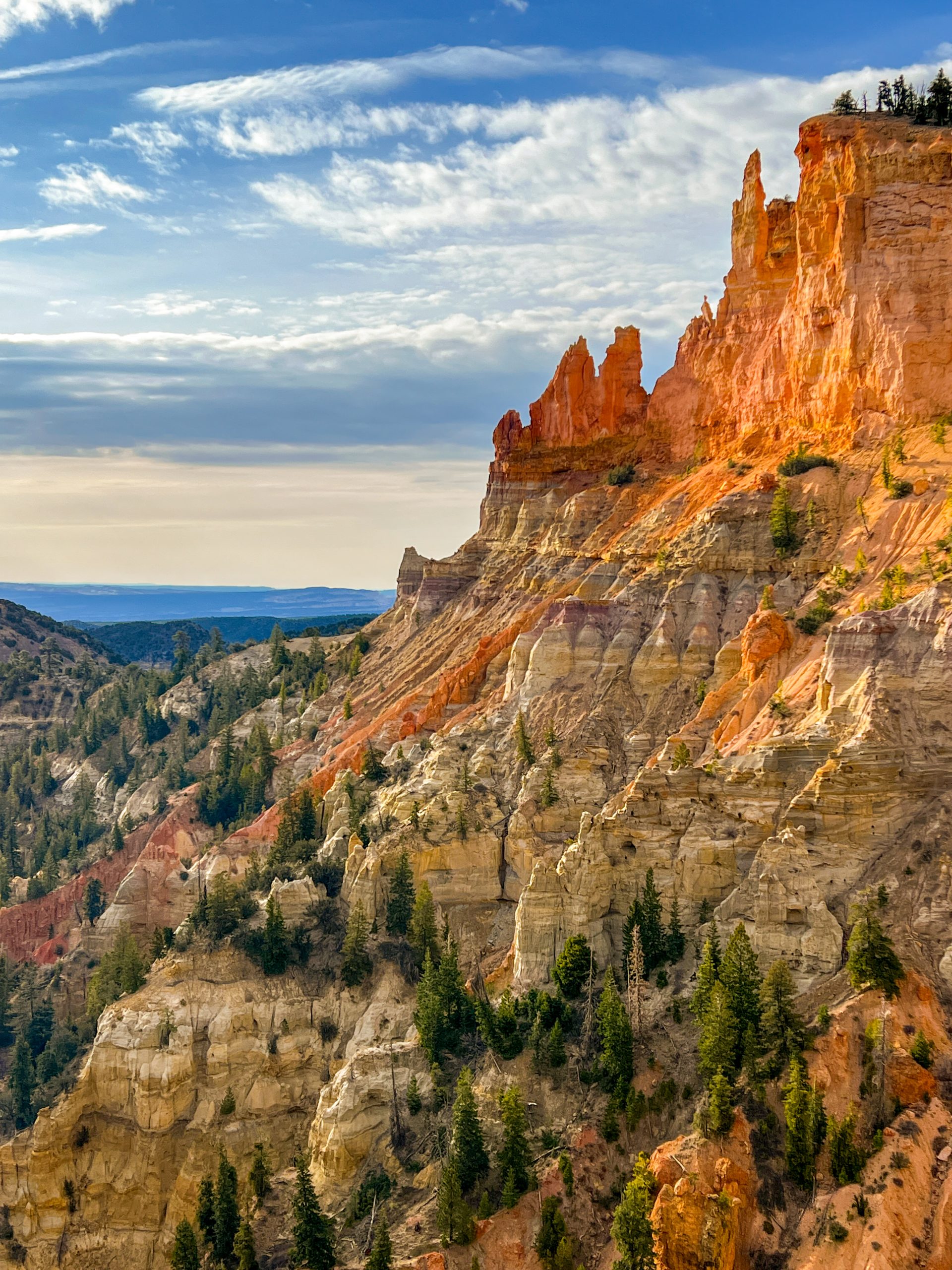
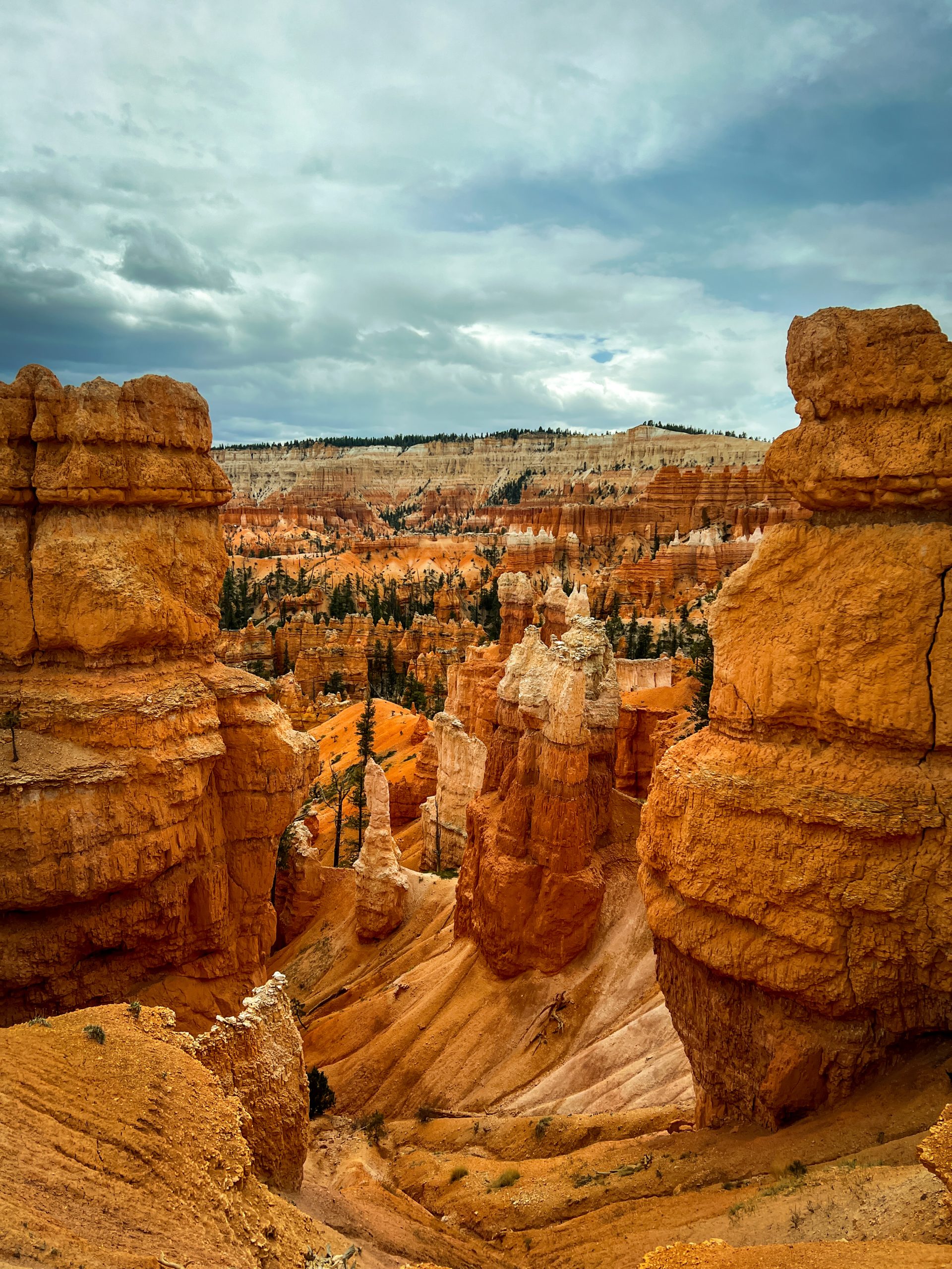
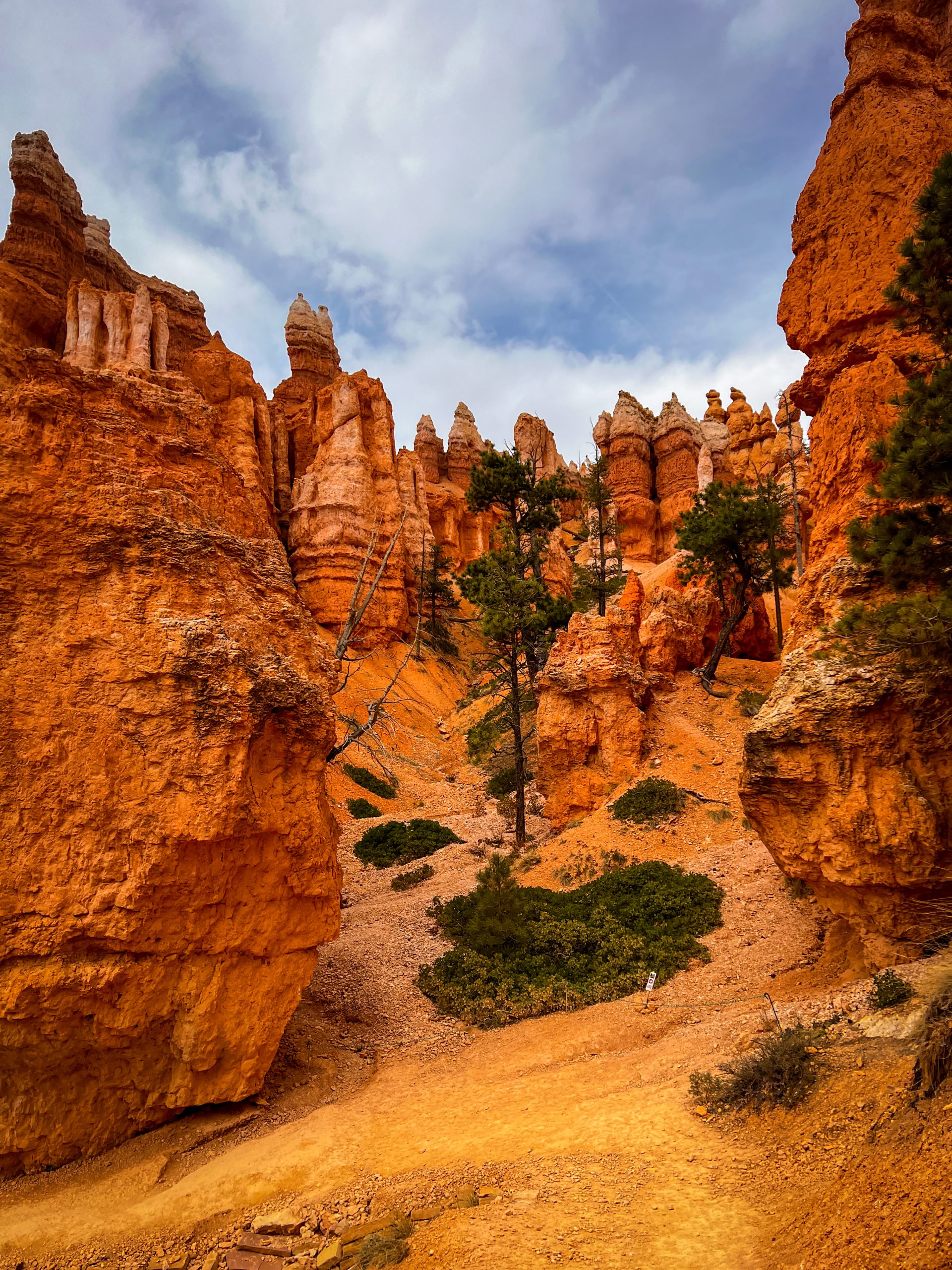
From Hackberry Canyon, the trail leads you along the Paria River, then eventually spits you out at Willis Creek. From there, it’s an easy detour to the town of Tropic, to resupply and visit Bryce Canyon National Park. Bryce is not officially on the Hayduke, but I had never been there, and had some time to kill, so of course I was going there!
Apart from the usual town amenities such as an unlimited supply of fresh food, showers, laundry, an actual bed (you know, with pillows and all), towels and internet reception, Tropic also gave me a chance to repair my malfunctioning gear.
Should you ever consider doing the Hayduke, make sure to bring gear that is either very sturdy, or old and ready for retirement. Because, let me tell you: the Hayduke is not kind on your expensive ultralight gear. By now, everything that had a zipper was protesting the abundant presence of fine sand. Two of my tent zippers had given up, my fanny pack kept splitting open, my fleece vest zipper was starting to malfunction. Also, my stove was refusing to screw onto gas canisters, one of my hiking poles had been bent during a minor mishap and my brand new backpack now sported several abrasions and holes in the side and mesh pockets from hauling it across the rocks with a rope.
With lots of elbow grease and some luck, I managed to temporarily fix most of the gear, but had to resort to sowing one of my tent zippers permanently shut. It’s also a good thing that cold soaking is easy in the desert, so who needs a stove anyway?
After a leisurely stay in Tropic, Bryce was breathtaking, but busy. I had not seen this many people all together in one place since I left Las Vegas back in March. It took me a while to get used to the throngs of tourists. Getting used to more people around always takes me longer than getting used to no people around. As I wandered around the park, marveling at the alien spires and bright colors all around, I heard the languages of the world spoken around me. I was not the only one under the spell of this mindblowing landscape. As I sat on a bench overlooking Bryce Point to eat my lunch, I stared at the rocks and tried to visualize how these wonders were created. Besides me, a couple was discussing if they wanted to hike down from the rim trail to the Queen’s Garden. I encouraged them to go. “It is a pretty special place, and you might only be here once, right?”
“Yeah, but we already walked five miles today,” the man said. “And what are you eating anyway? That looks awful.”
I looked down at my peanut butter tortilla wrap and had to agree. It did not look very appealing, but it would get me through my 20+ miles for the day. I decided against saying this out loud, though, and wished them a pleasant day.
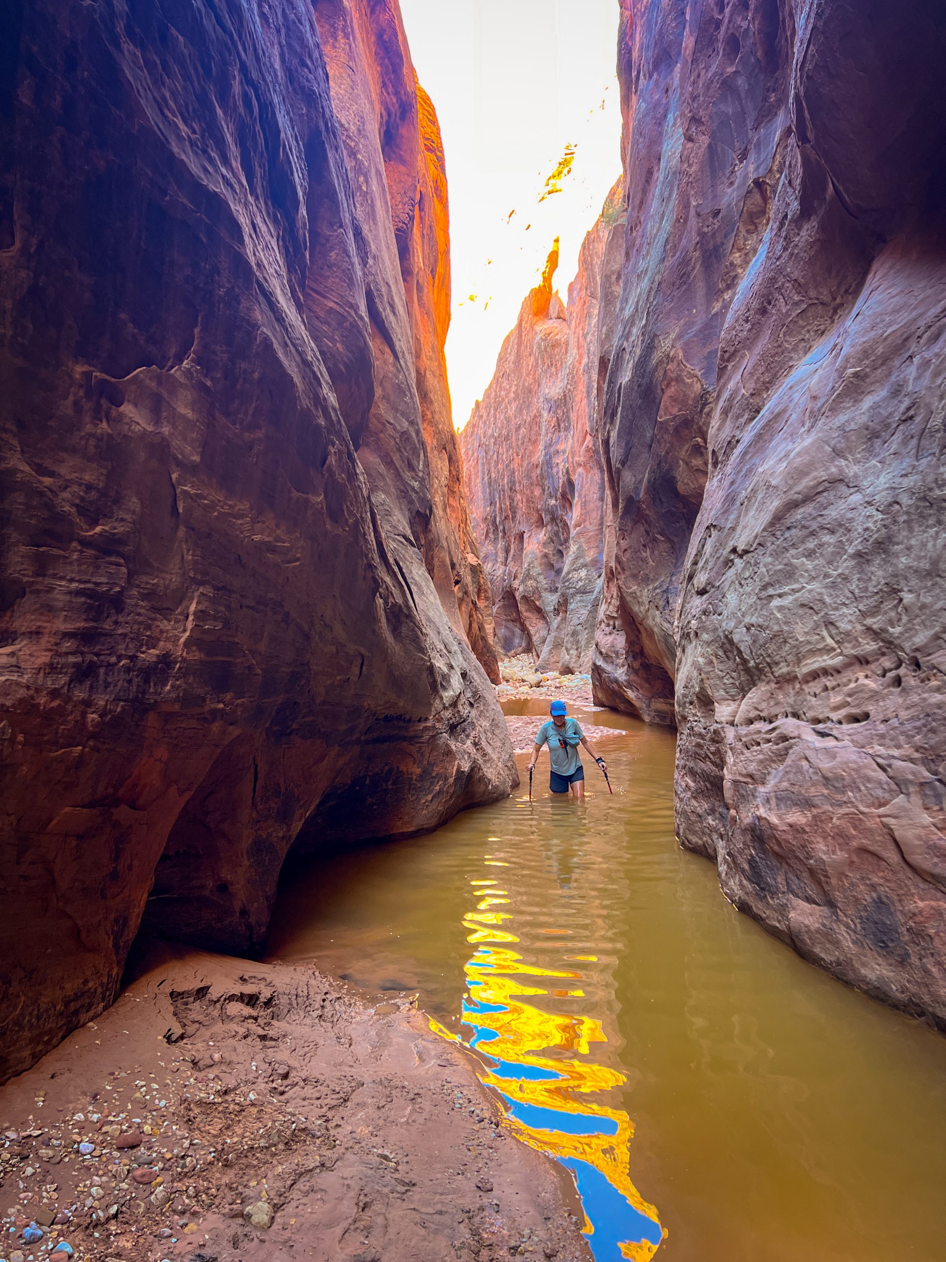
As popular as the park is, once you step away from the main pathways, the throng turns into a trickle, and soon, I was alone again. Though I remained suspicious, expecting that any turn up ahead would bring me more trials and tribulations, the going stayed surprisingly easy all the way to the Grand Canyon. Not until I dropped down the Nankoweap Trail and had to start boulder hopping along the Colorado River would I start cursing again. I will tell you more about that section next time though.
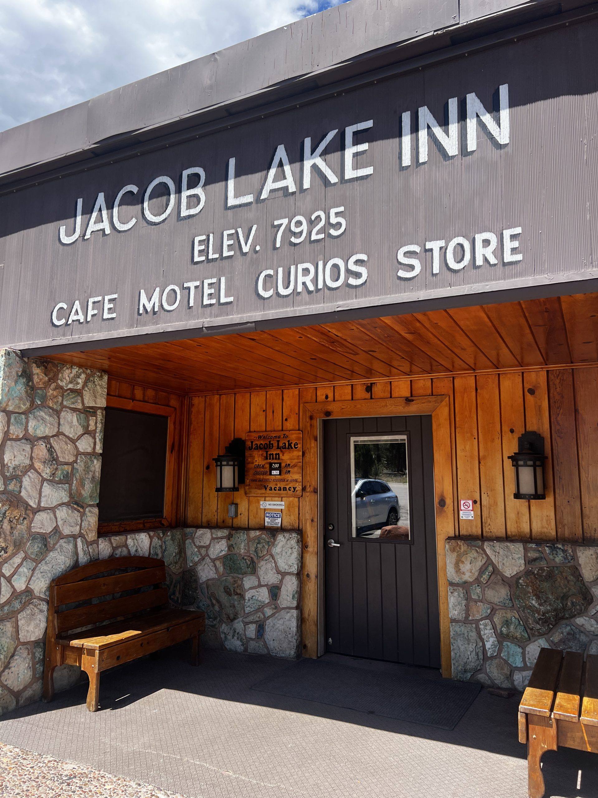
For now, the trail brought me to the small town of Kanab for another zero, and when I met up with my former PCT-tramily member Spreadsheet, we had a leisurely amount of time to get ourselves to the North Rim along 60 miles of the Arizona Trail (The Hayduke follows the AZT from the terminus at the Utah-Arizona border to the North Rim).
Now, don’t get me wrong, I am not claiming the AZT is a walk in the park, but compared to what I just came from, it was sheer lazy bliss. There was an actual, visible trail to follow. We had all the time in the world to take long lunch breaks in the shade of trees, eat cookies at Jacob Lake Inn, and walk as little as we felt like each day. Yes, I admit, when the weather got rather erratic and freezing cold up on the North Rim, we even camped near a (frozen) spring after a two-mile day once. Hardships, you know…
Every AZT hiker we encountered, had heard of the Hayduke Trail, also a new experience. As they were nearing the end of their 800-mile thruhike, almost all of them exclaimed how hardcore we were for doing the Hayduke. Meanwhile, we felt like the laziest hikers in the world. I had already forgotten all about the hardships of the previous weeks and now just felt slightly embarrassed and way too well-rested to be a thruhiker. Not to mention hydrated! For the first time since I had started this hike, I was not actually thirsty all day long. Compared to the Hayduke, the Arizona Trail offered a veritable cornucopia of water sources and caches.
It was a good thing, then, that I knew all of this luxury would soon cease…
Want to know more about my hike? Previous articles of my trip can be found here, or sign up to get notified when my next article hits The Trek website at the bottom of this page!
“Your love, lifting me higher
Than I’ve ever been lifted before
So keep it it up
Quench my desire
And I’ll be at your side
Forevermore
You know your love
Keep on lifting me
Higher
Higher and higher”
– “(Your Love Keeps Lifting Me) Higher & Higher – Jackie Wilson
- Hiked Today: 15.2 miles
- Appalachian Trail (1,859.3-1,861.4, 1,861.9-1,868.1, 1,868.7-1,870.2, & 1,870.7-1,874.1)
- Eisenhower Alt. (0.7 mile)
- Jefferson Alt. (0.6 mile)
- Adams Alt. (0.7 mile)
- Total Hiked: 3,807.3 miles
- Total Paddled: 99.5 miles
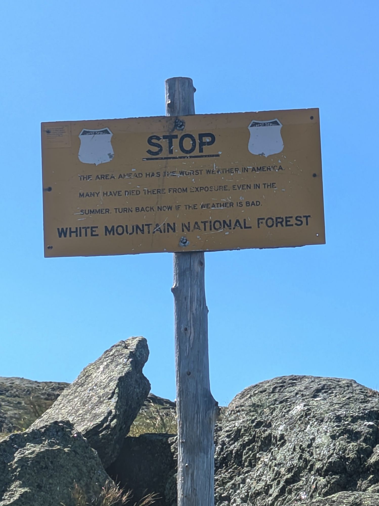
Weather: 48 – 68°F, mostly sunny, some puffy clouds, quite perfect again!
Elevation: 2,484 – 6,288 feet
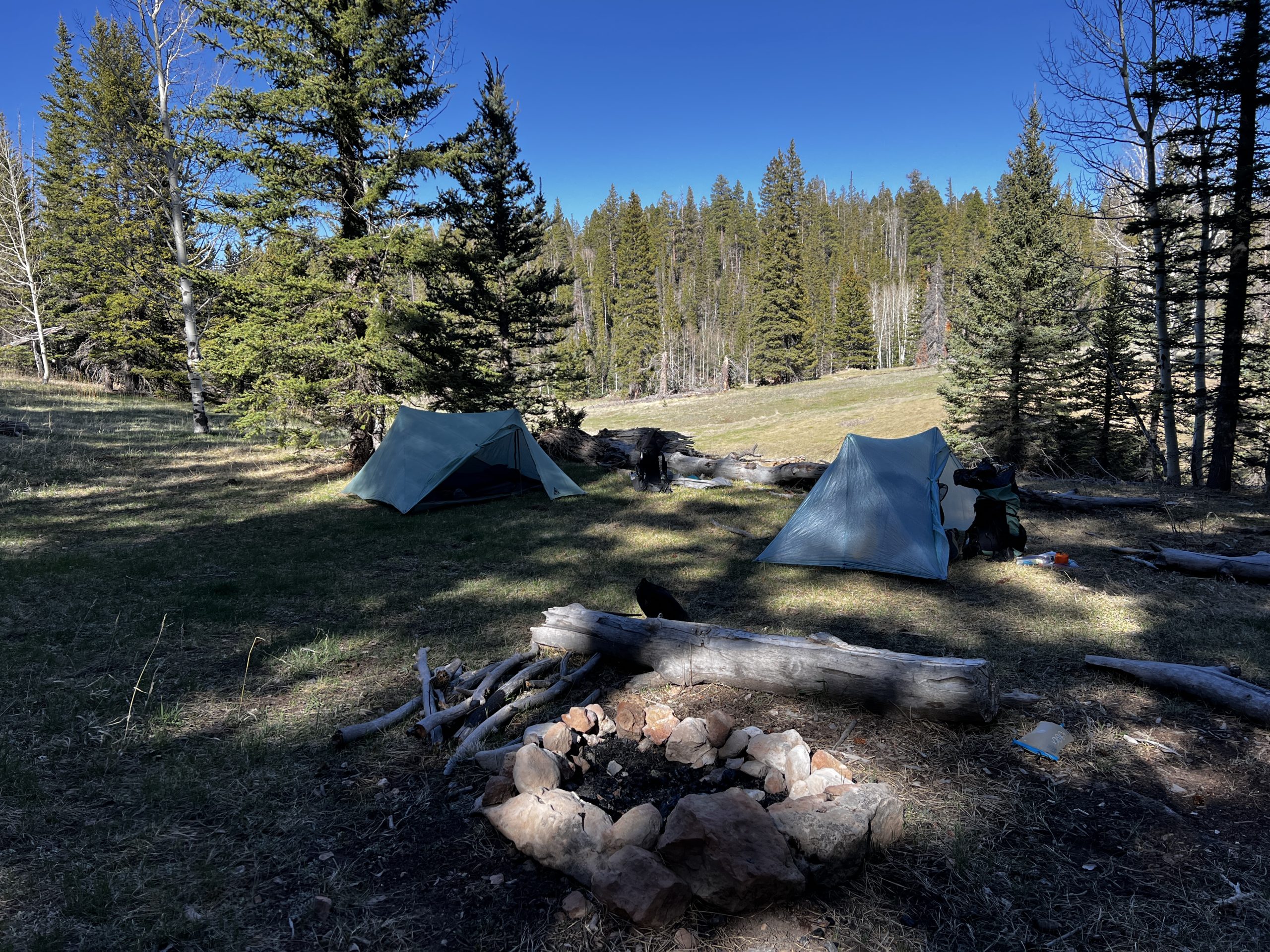
Nauman Tentsite to Osgood “Ballroom” Tentsite
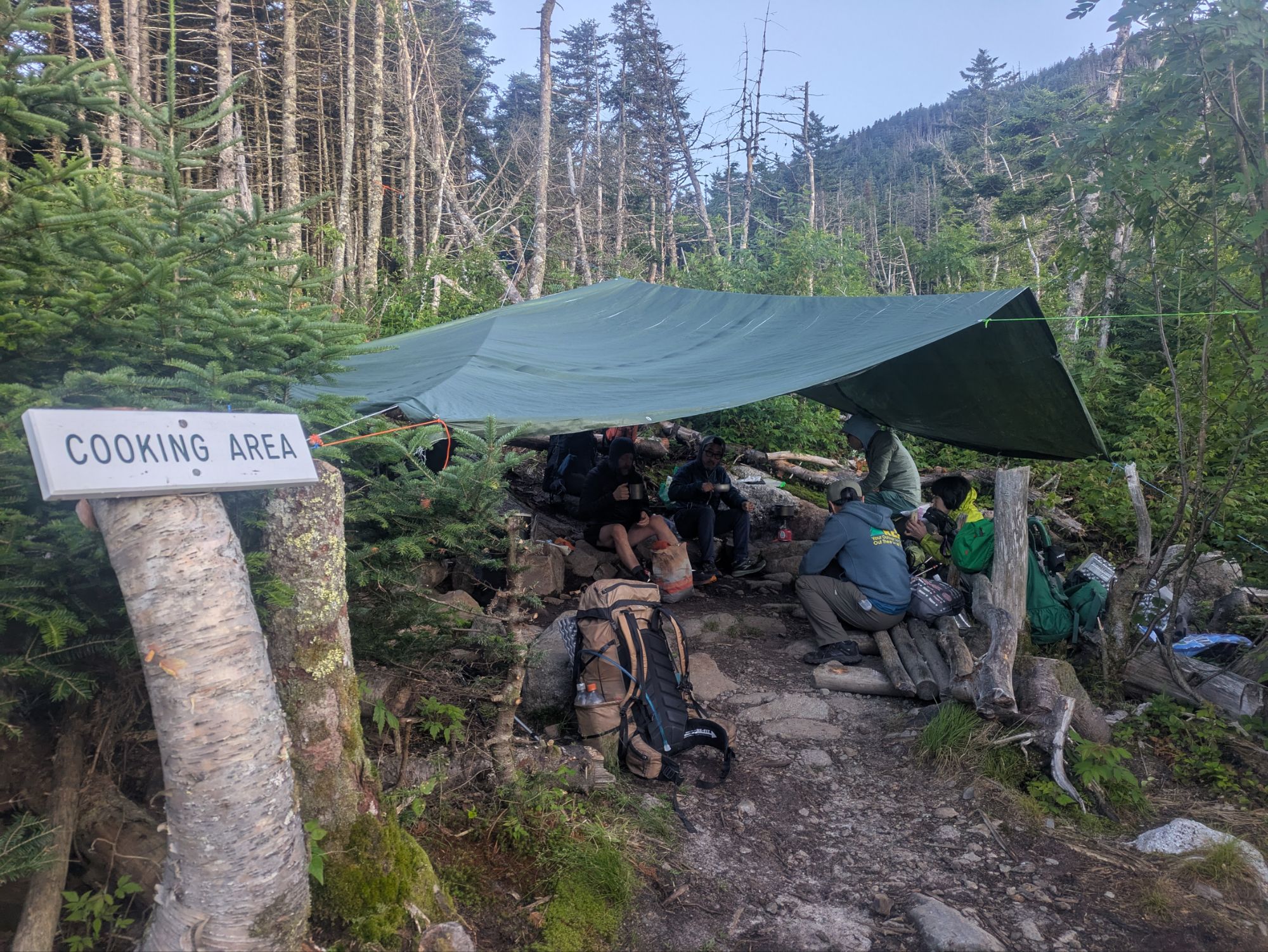
5:10 am – Alarm sounded. I did my routine a little differently since my food was down in the bear locker. Rather than go retrieve it and come back up (it was a short ways), I packed everything up by the tent and then moved down to do the final organizing. I had my fudge flavored PopTart while throwing things in my pack. Several others were up cooking what looked mostly like oatmeal and coffee.
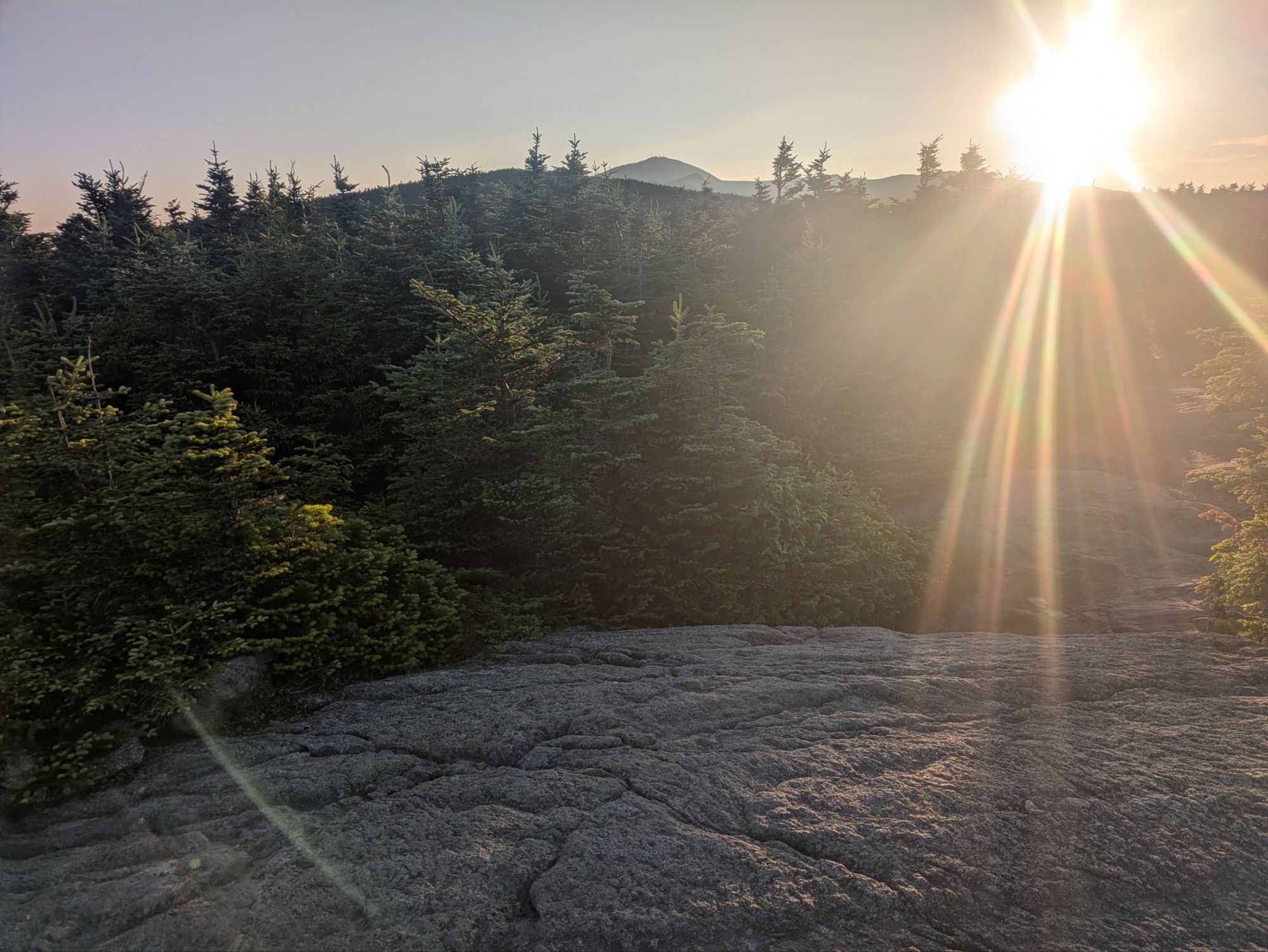
5:47 am – I finalized my stretching and said a quiet “happy trails.” Walking out of camp, I went by the Mizpah Hut and found where the trail continued. It was a steep bedrock slab and boulder scramble up. The weather was the best yet, calm, bright, and open sunshine. Birds were singing loud down at camp, but as I went higher up the sounds that stood out more were my pounding heart and sucking in and out of air, squeaks from my pack, clothing rubbing, and the gripping and slipping of my shoes below.
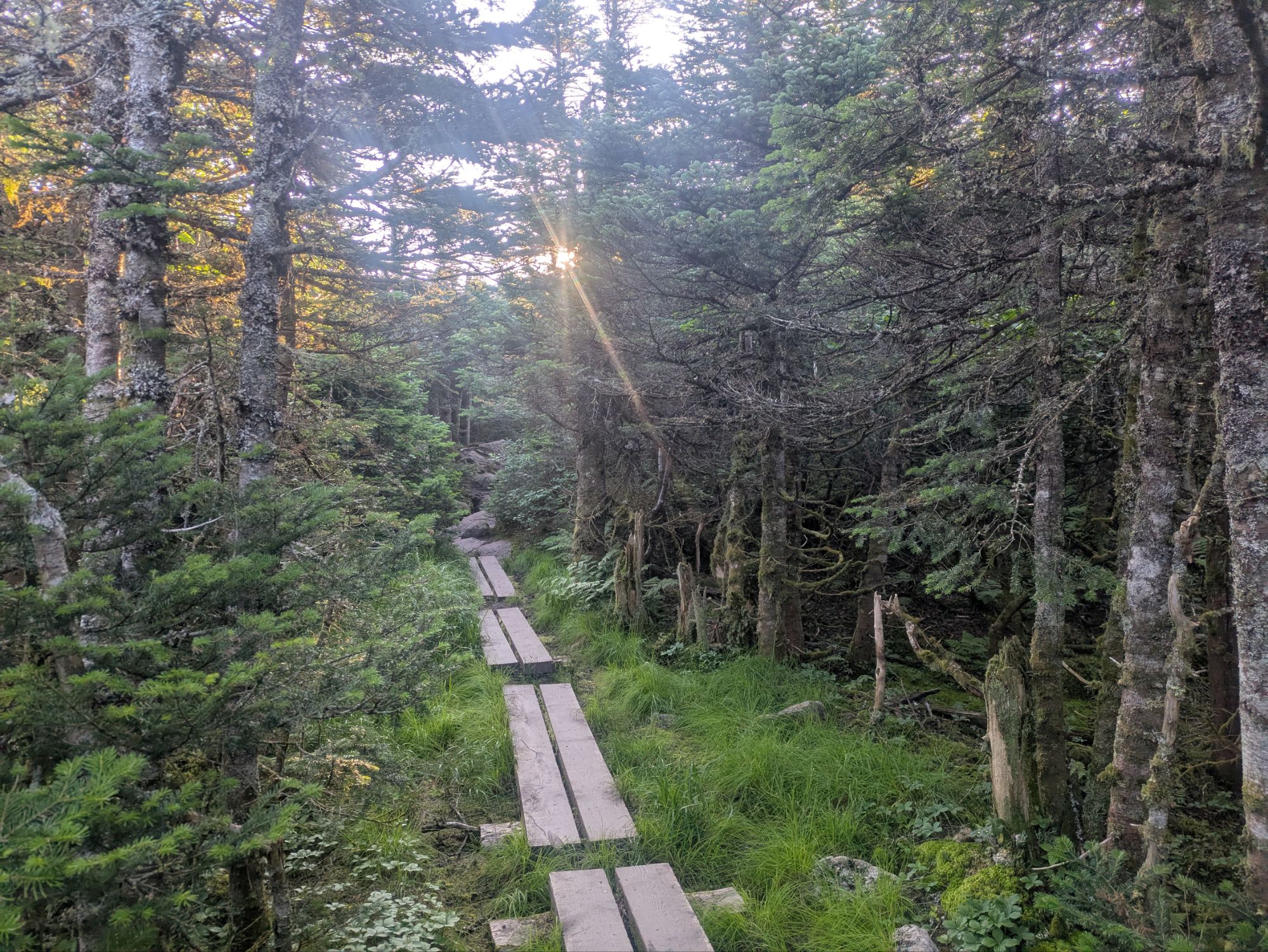
Things leveled out after less than a half mile and as has been the trend, the flatter terrain brought mud and rotting boardwalks.
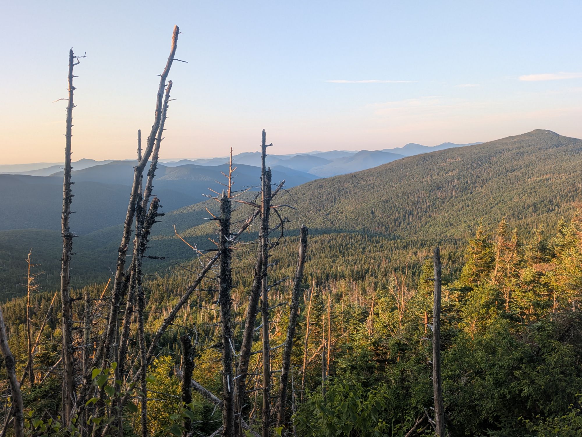
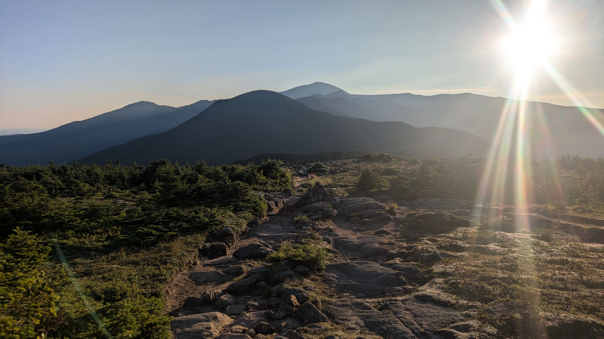
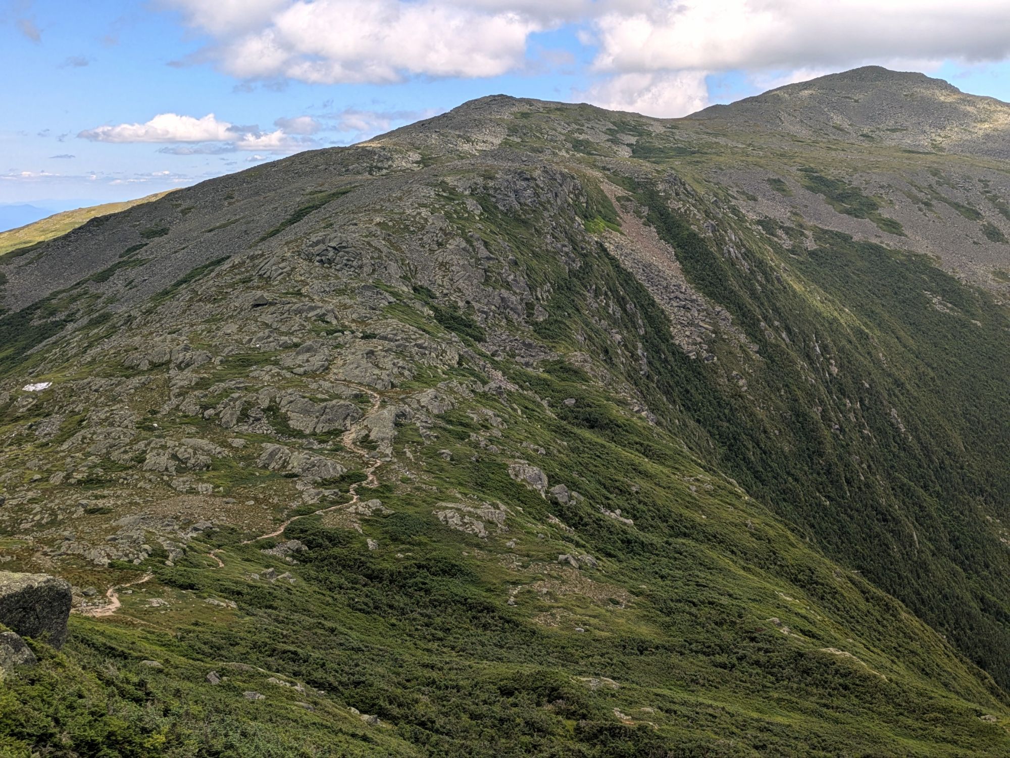
6:08 am – I had my first slip of the day, but caught myself from falling down. The trail started going up, but gradual. Then, ten minutes later I reached the mostly tree covered Mount Pierce at 4,310 feet elevation. Moving on, there was a wide open view of what lay ahead. The photo is blinded by the sun, but I could see it all clearly. It was pretty much alpine going forward so there were nonstop views.
I decided to do the side trip off the AT to the top of Mount Eisenhower. It was a steep, but nicely maintained trail going up.
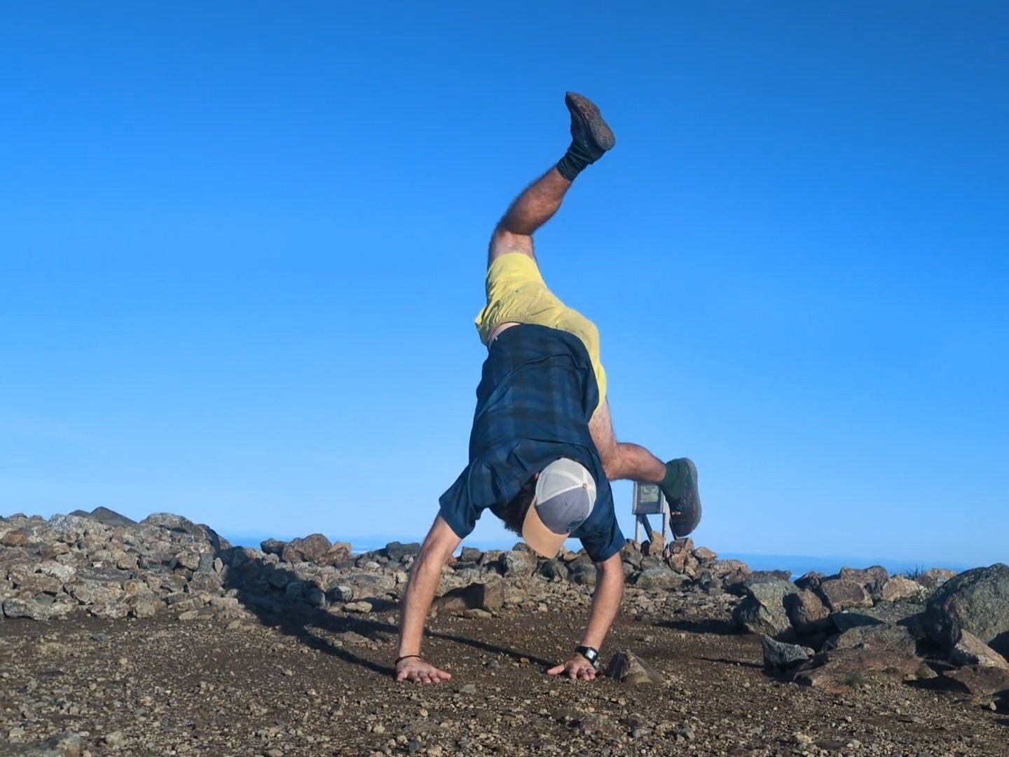
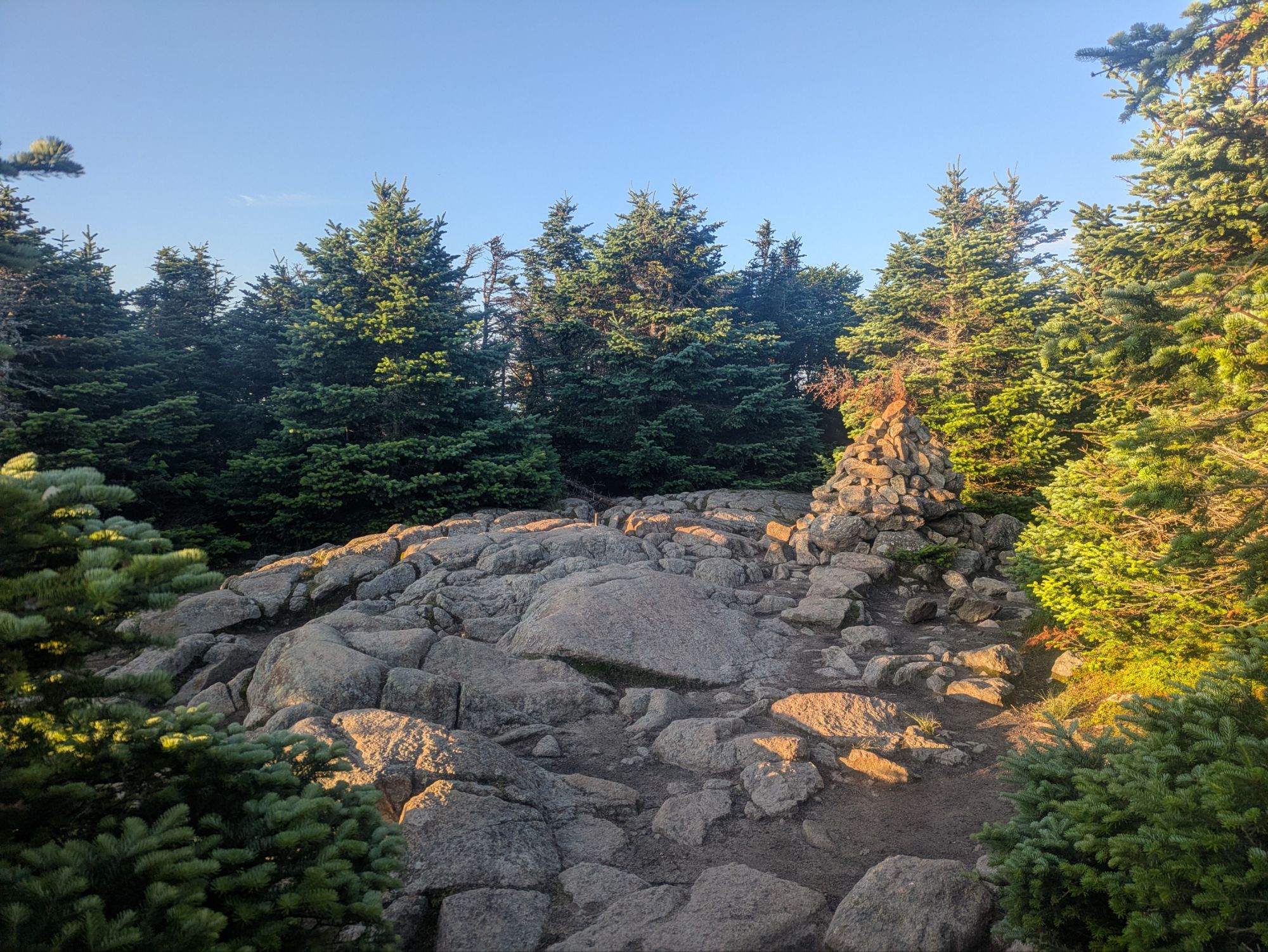
7:08 am – I got to the top of Eisenhower, which had a flat circular area with 360 degree views.
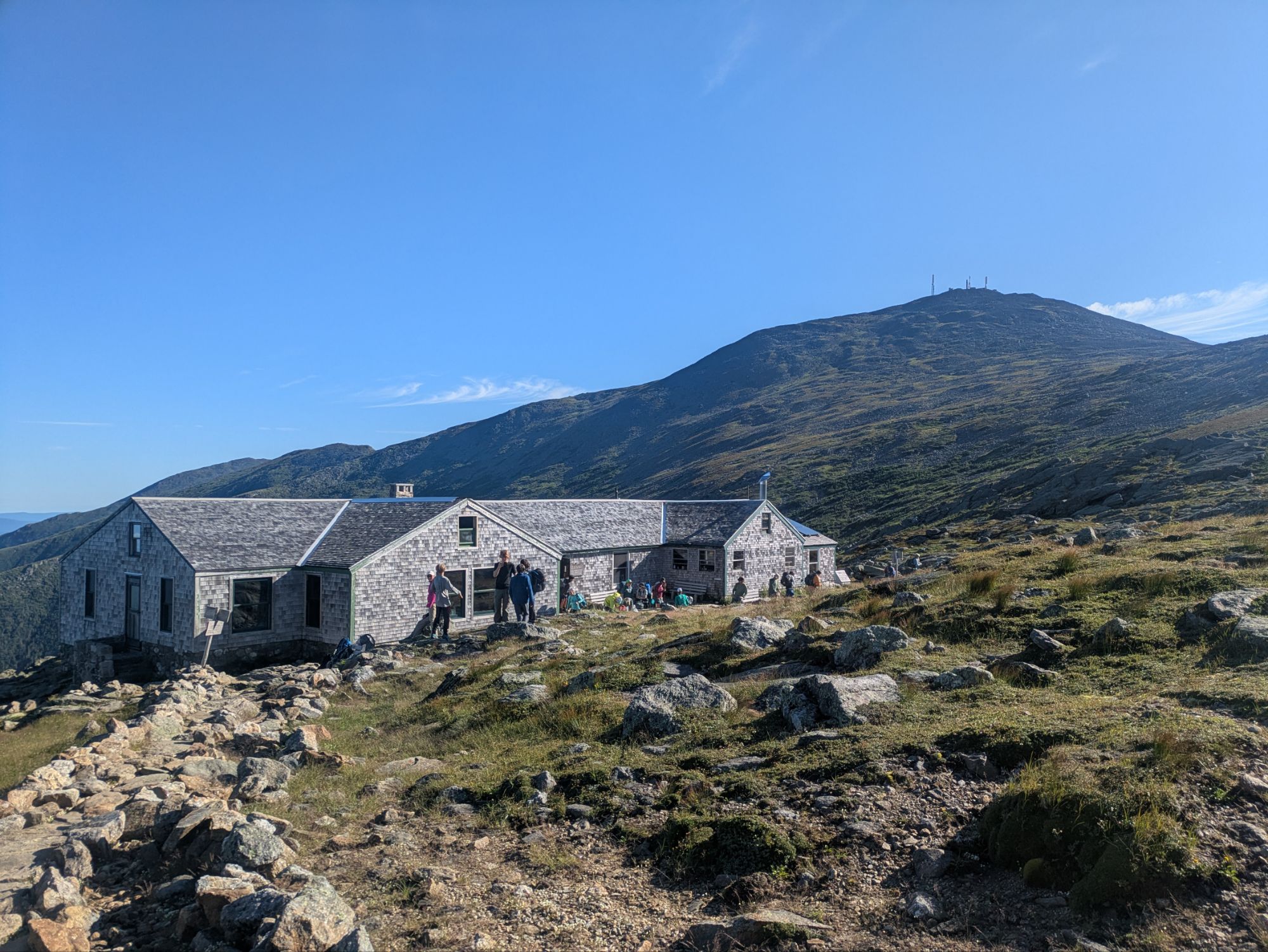
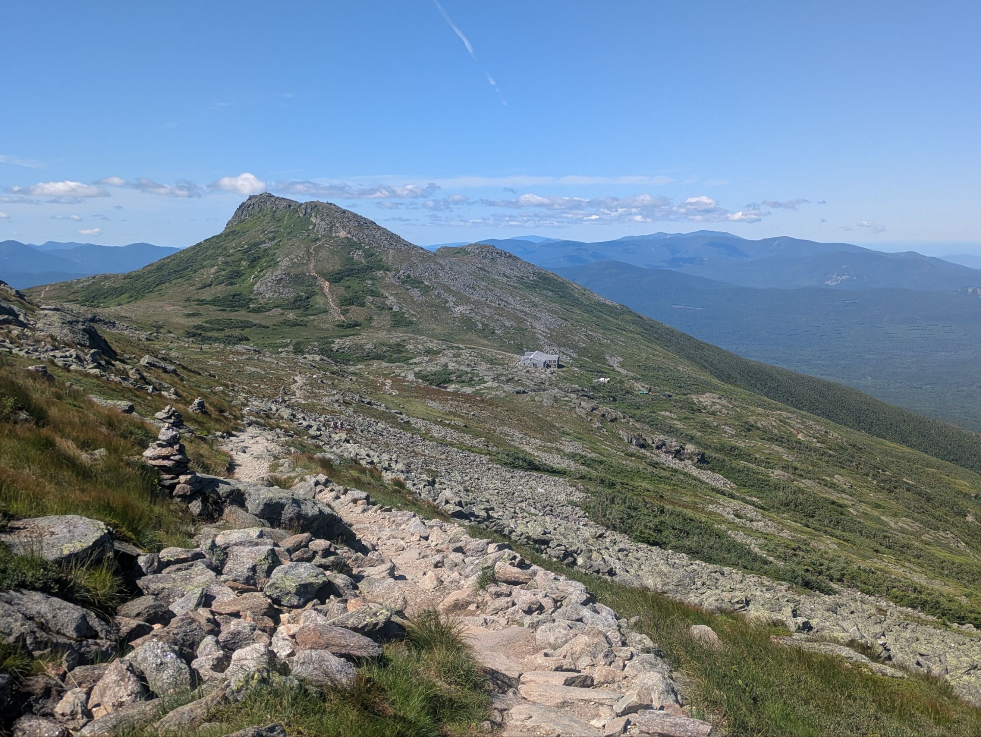
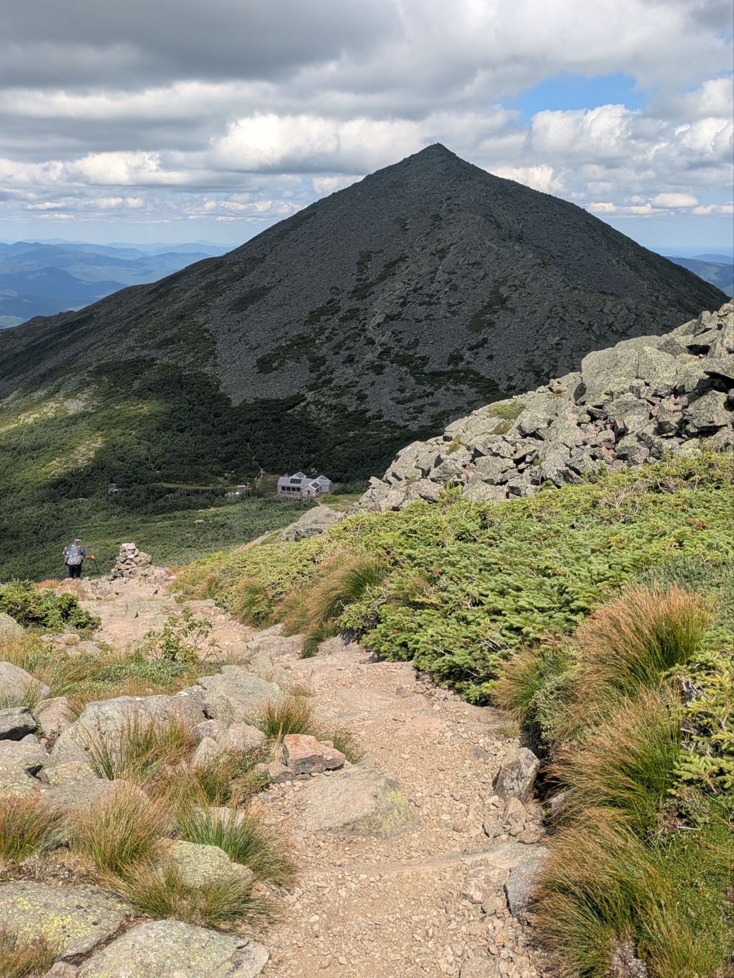
I decided to skip the Monroe alternate and stay on the AT. I’ll admit, I was a little worn out after the high elevation floor exercising. And I was happy with my choice because the trail was beautiful and flat and just straight pleasant. I wrapped around the peak instead of up and over and then got a view of the famous Appalachian Mountain Club Lakes of the Clouds Hut!
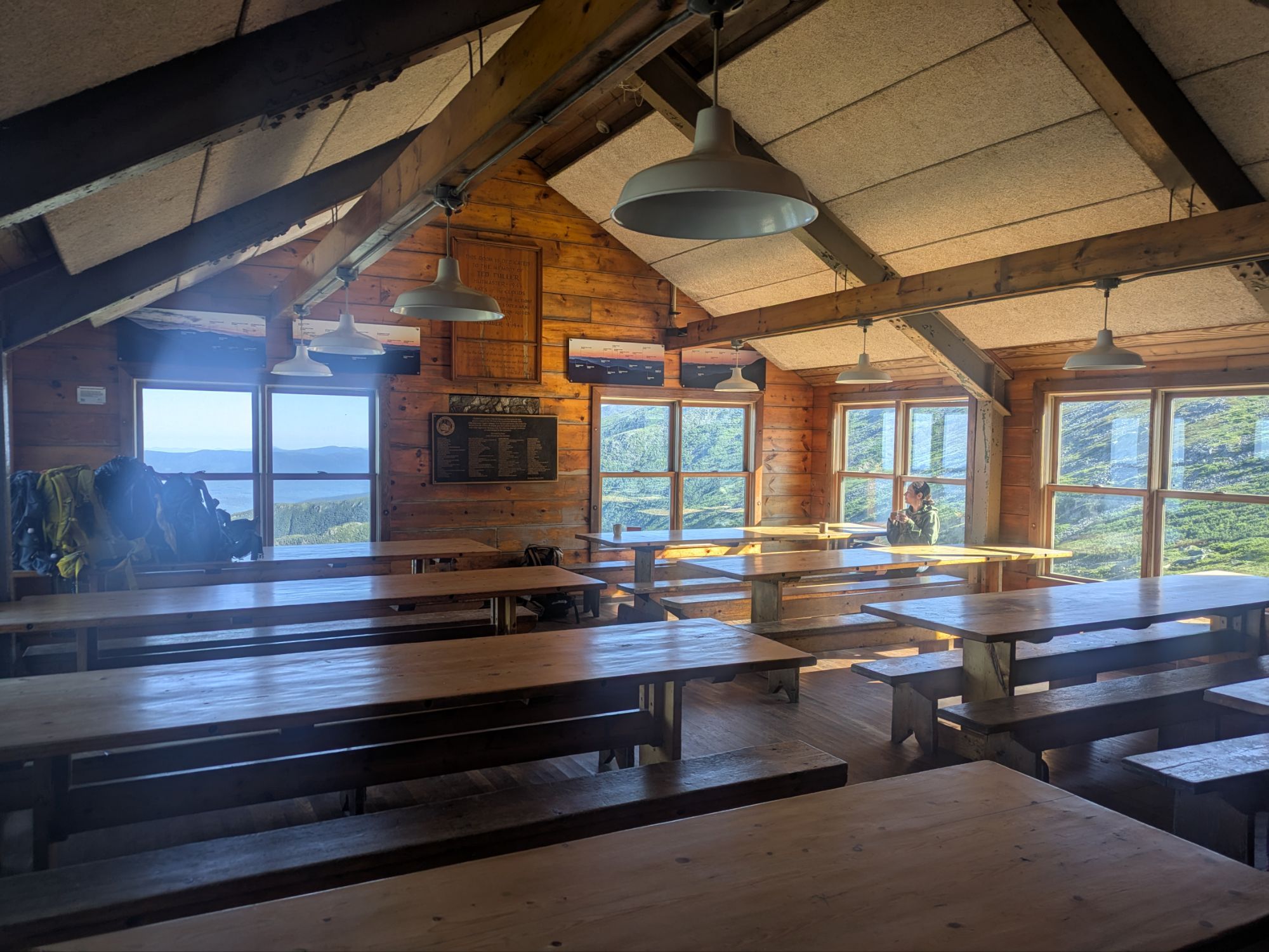
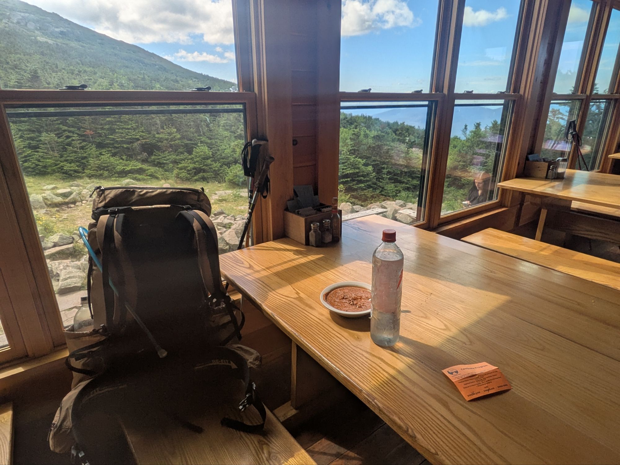
At the foot of Mt. Washington, it is easy to see why this is such a popular well-known place. When I entered, all the folks were leaving to start there hikes after finishing breakfast. I asked about getting my free baked good (this comes with the thru-hiker pass) and was told that if I don’t mind waiting about fifteen or twenty minutes they will set leftovers out. Hot dang, I thought, that sounded lovely.
I hung out for over an hour and eventually asked if they were going to set any food out. I guess they sort of forgot and really there wasn’t much, a bowl of scrambled eggs. To most, it might’ve looked like a sad bowl of cold scrambies, but I was still stoked about it. Plus in all that time waiting, I had coffee in an actual mug and got to talk with a nice couple who had a Mt. Kilimanjaro guiding company. Thru-hikers Pony Boy and Swamp Foot also showed up and it was fun to see them again. It was nice.
Still hungry though, I made oatmeal outside and then finally got going. I didn’t see myself staying two hours, but hey, it’s the Lakes of the Clouds Hut. Got to give it some time, right? And I had a big climb ahead, so wasn’t super keen on getting going with that. It wasn’t so bad though… these parts of the trail that are so well traveled are actually maintained haha.
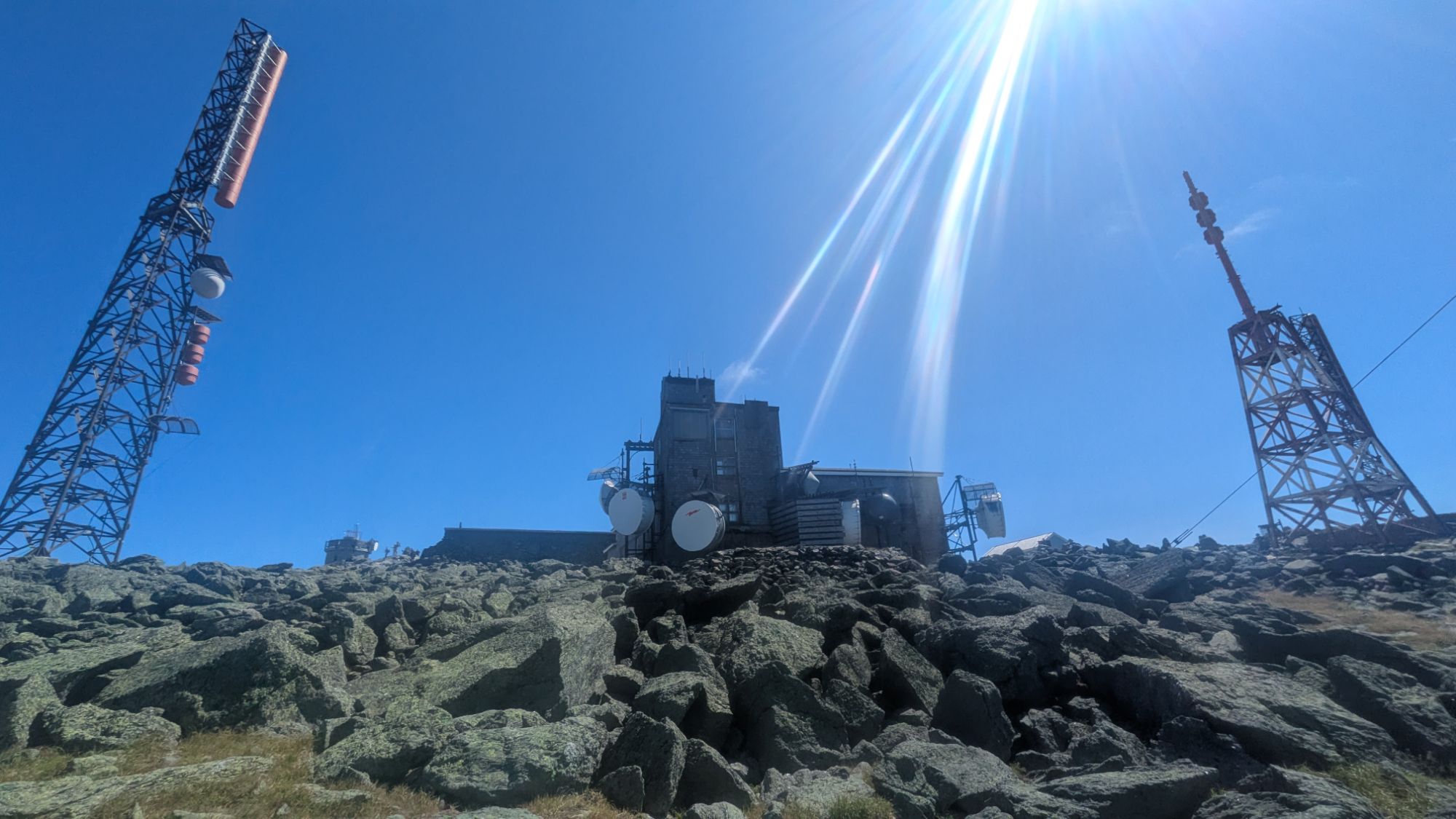
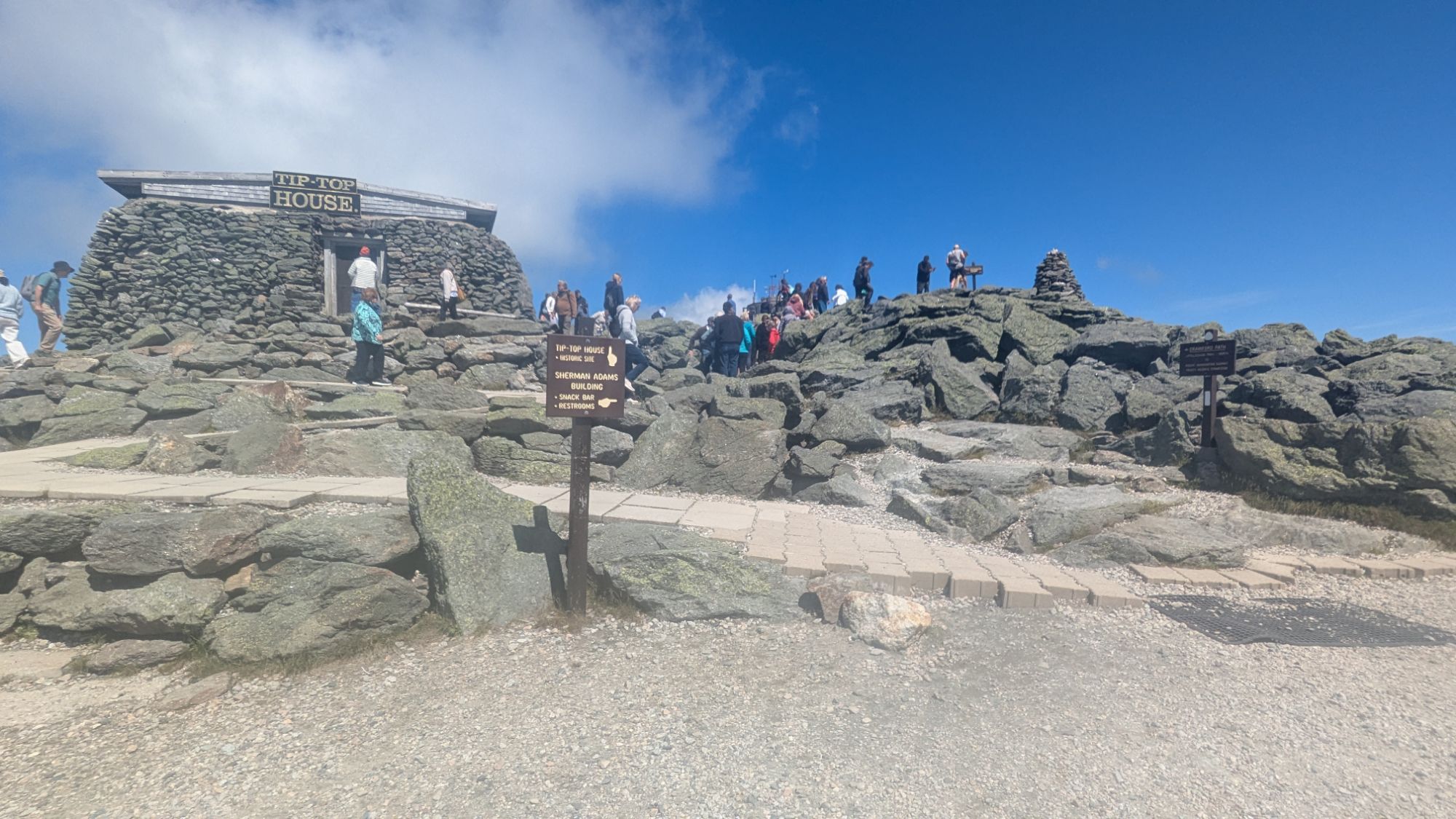
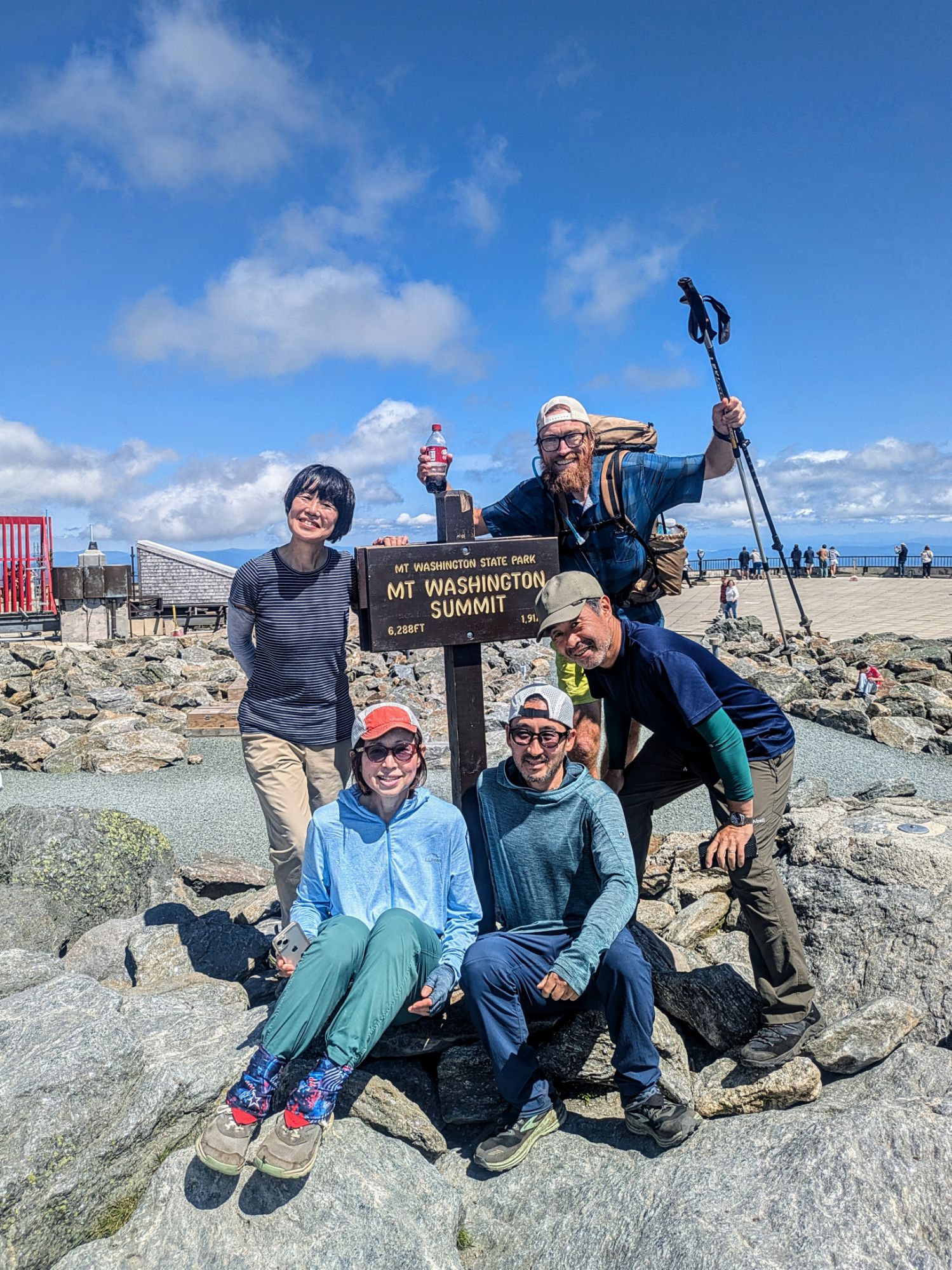
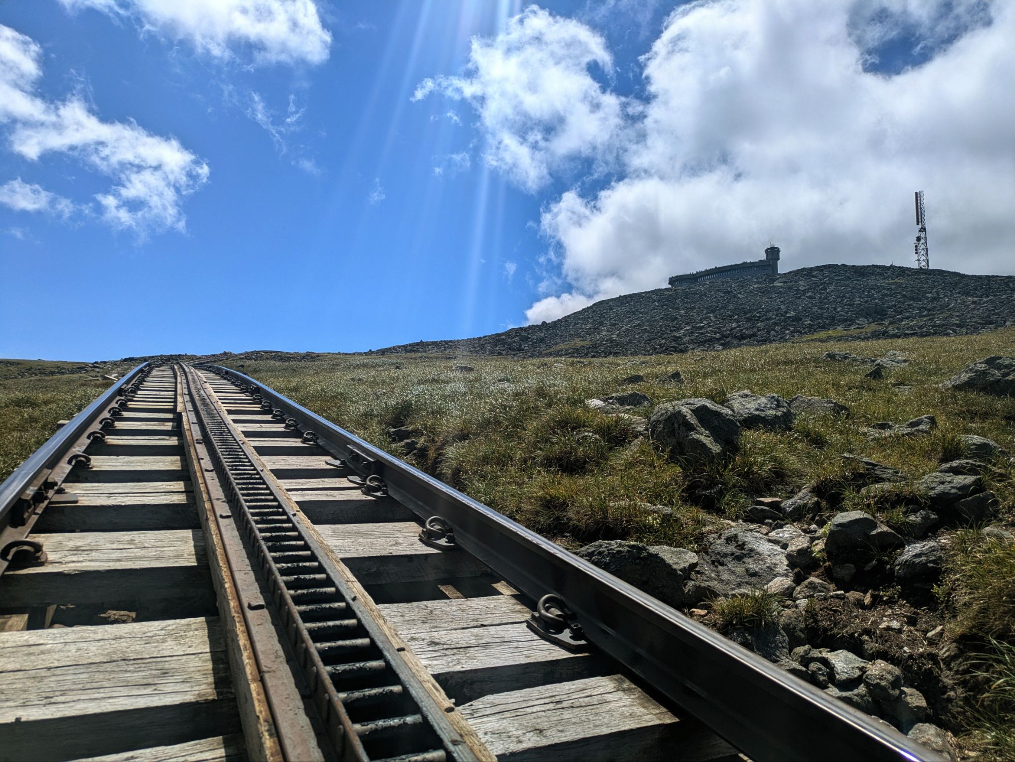
Mountain Washington is the tallest mountain in New Hampshire at 6,288 feet elevation. There is a train that brings visitors to the top and I believe an auto road, although I wasn’t sure where they parked because I didn’t see any cars. There was a cafeteria and a post office and a line of tourists for getting a photo with the summit sign. I happened to jump in line right behind Bamboo and Sakura and their friends, so when it came there turn, I just asked if they wanted to do a group shot.
I had only hiked about 6 miles in about 6 hours. Feeling the pull to get scooting, I hauled on my pack and started. Unfortunately, a ways ahead, I realized I did not check the water situation ahead. It was sparse and I should have filled up at the cafeteria area. I wasn’t backtracking for it though and told myself I’d ration. And so I did. And I switched it up to not have a sit down lunch today, but just snack and keep ‘er moving.
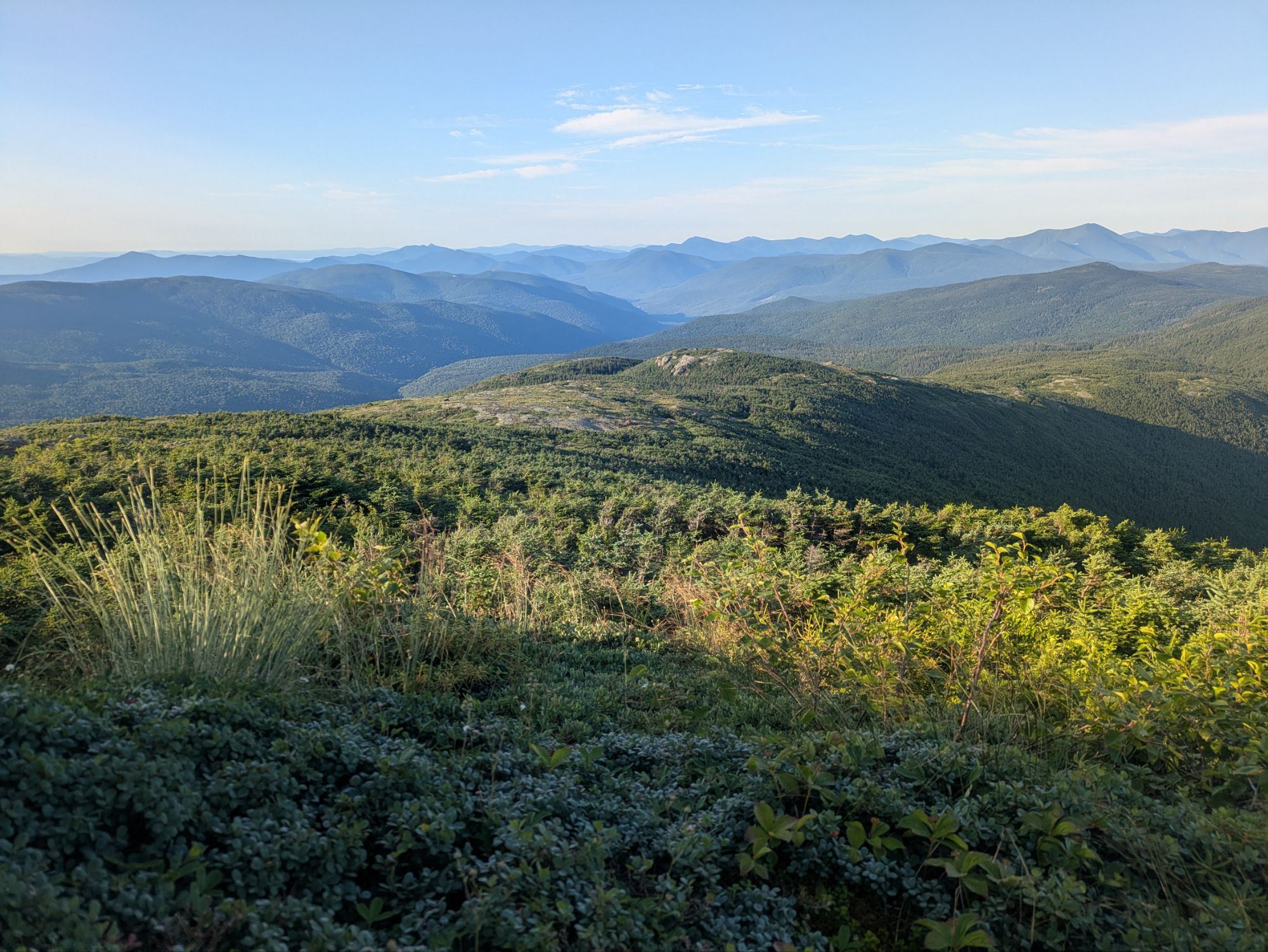
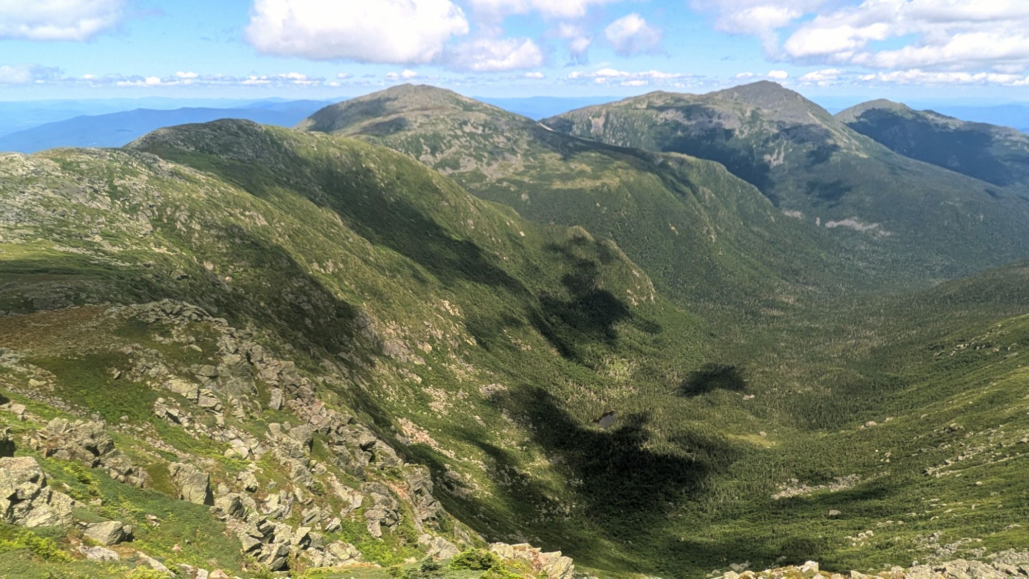
The path of peaks next up were laid out in glorious sunshine…
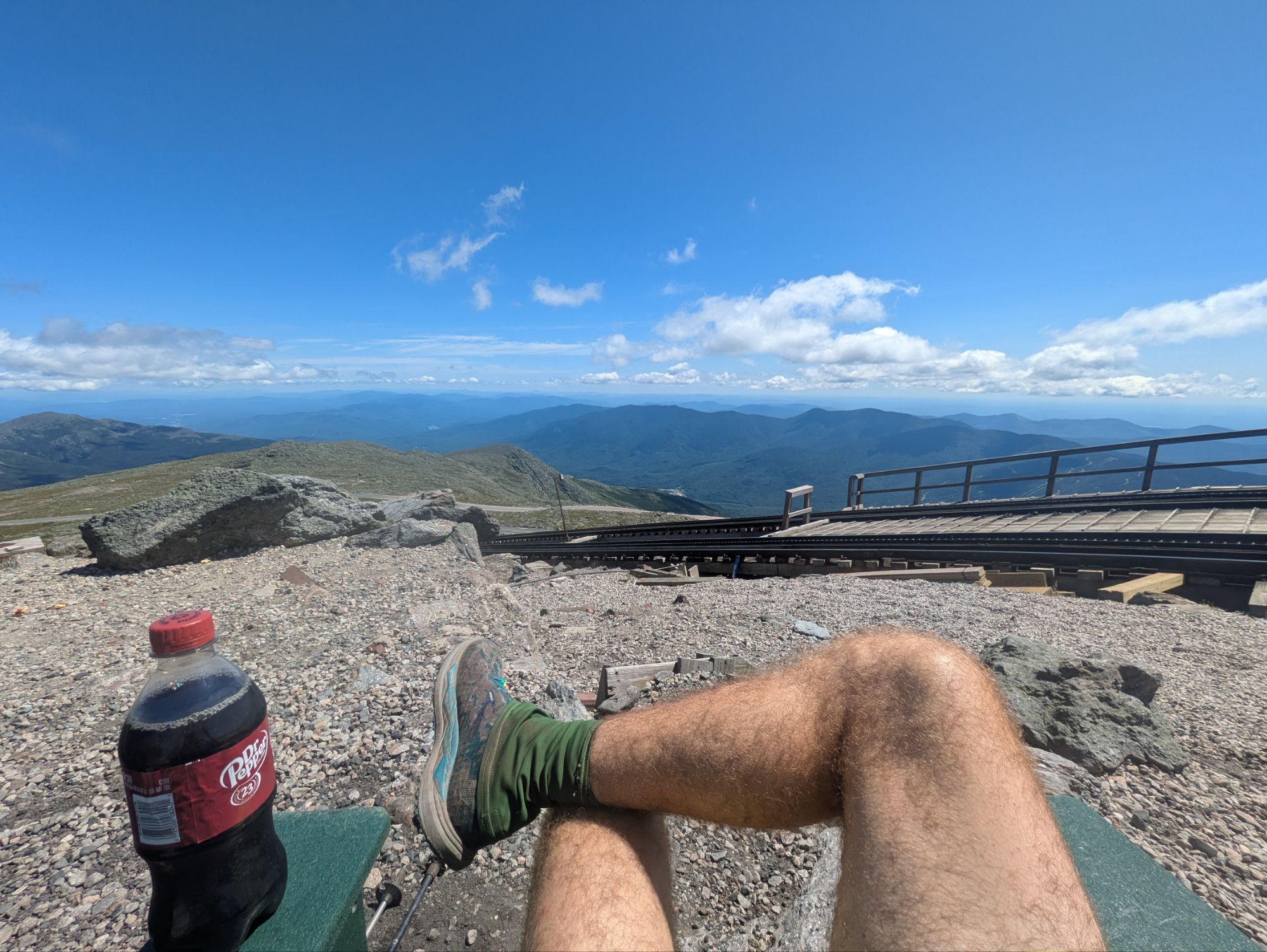
Still close to Washington, the trail crossed over the tracks for the cog railway and I got to witness the four brightly colored cars coming down. The folks inside were waving and seemed to be having a cheery ole time…
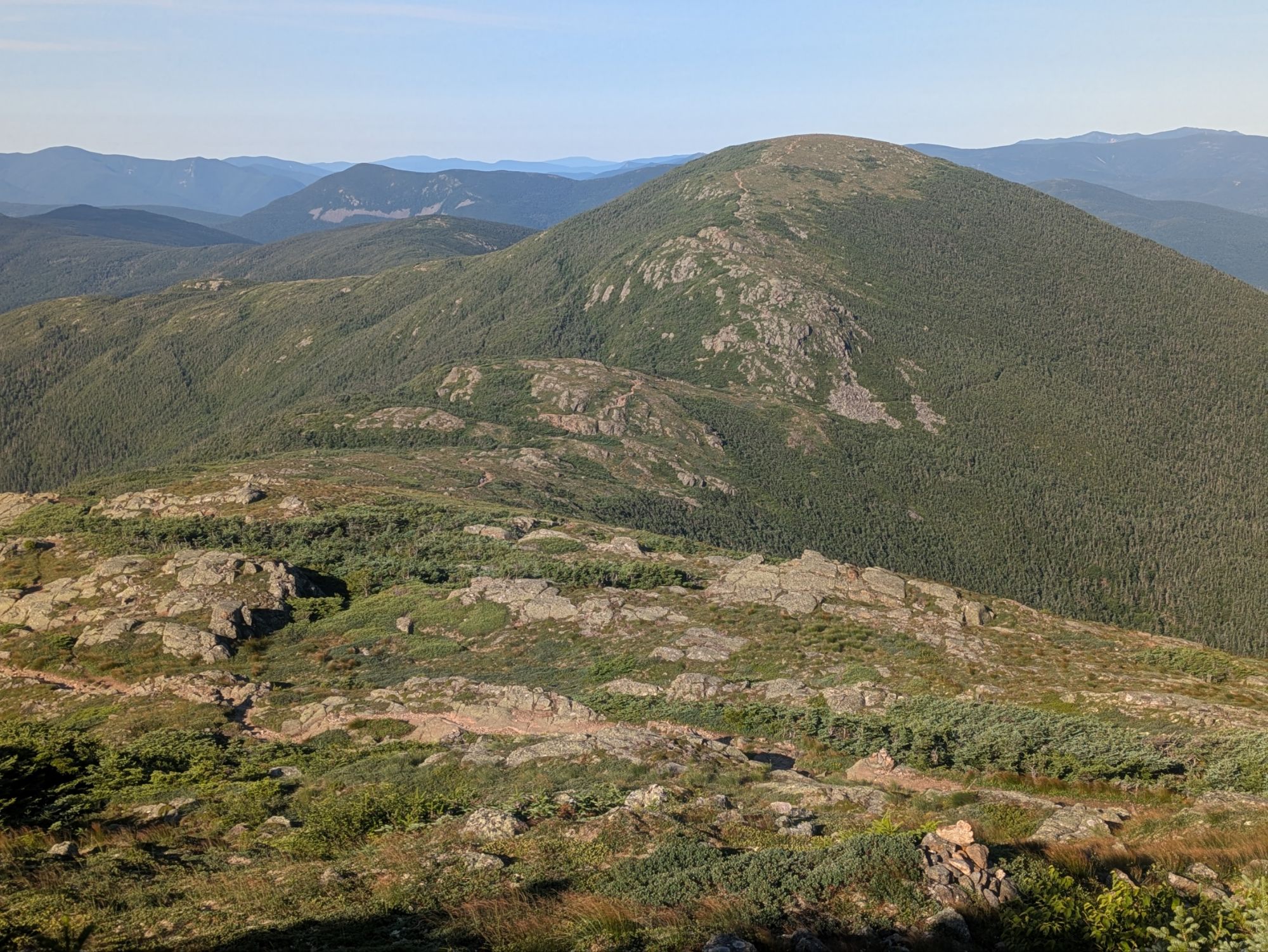
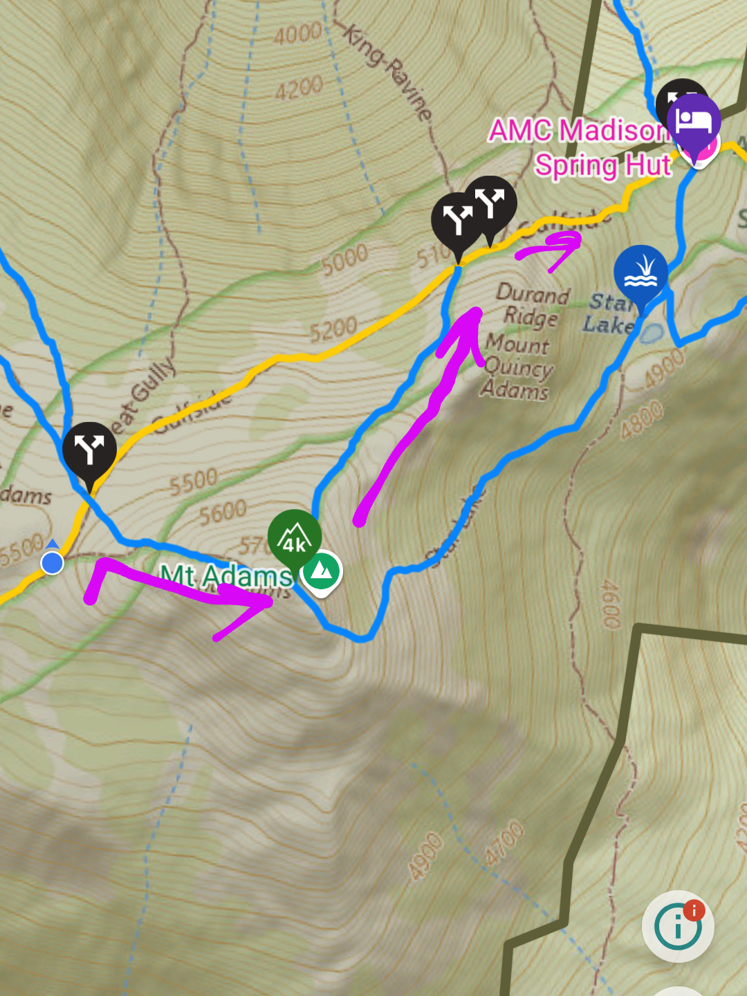
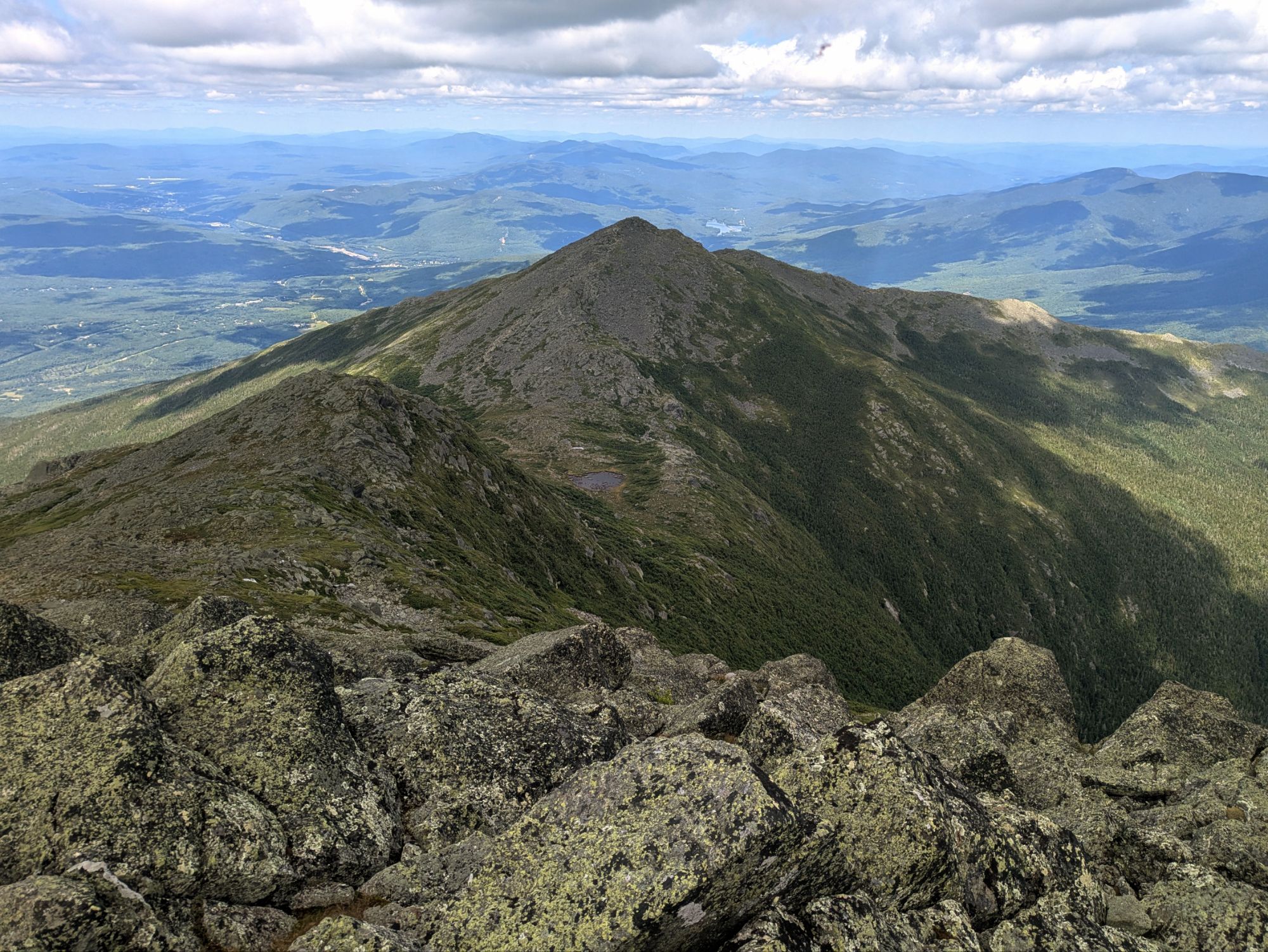
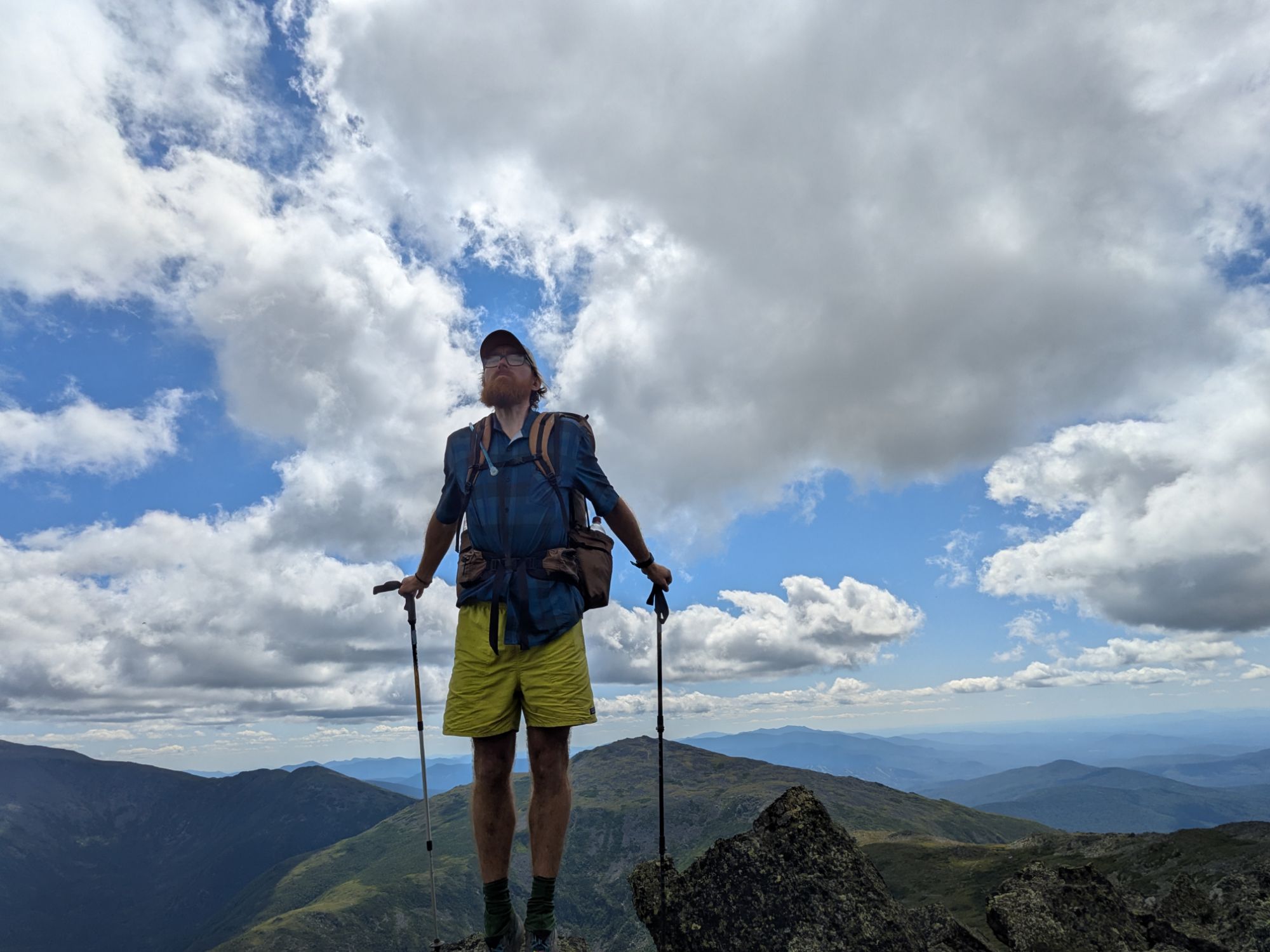
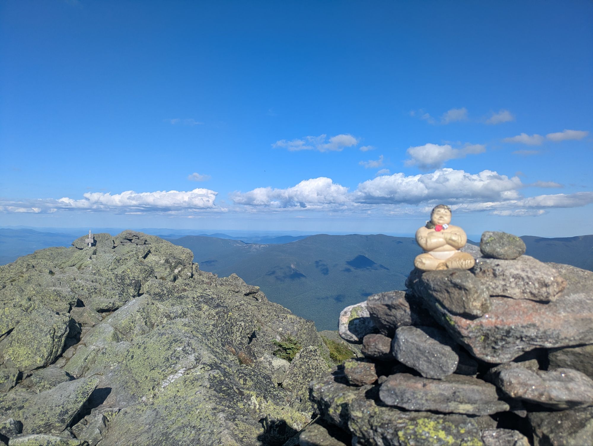
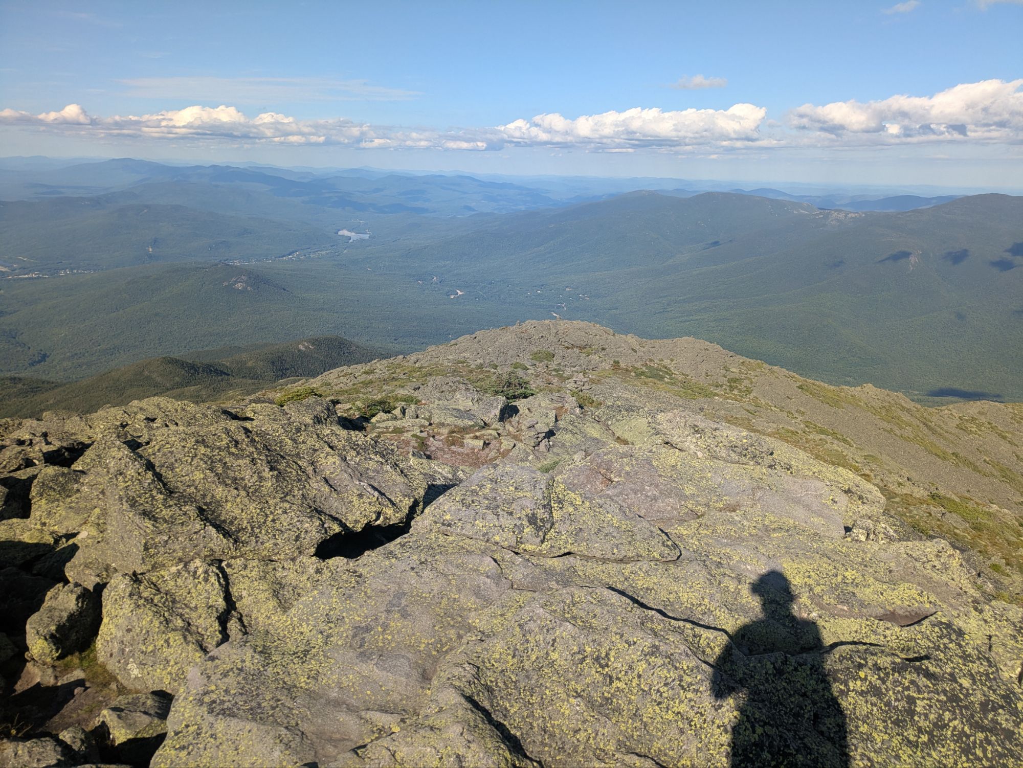
Already today I had the opportunity to split off the AT to climb up a nearby peak via a side trail. Going forward there were even more chances for this. I skipped the first, Mount Clay, opting to bypass it and stay on the AT. But the next one, Mt. Jefferson, I scrambled up to the top. According to FarOut, it’s the third highest in New Hampshire at 5,712 feet elevation…
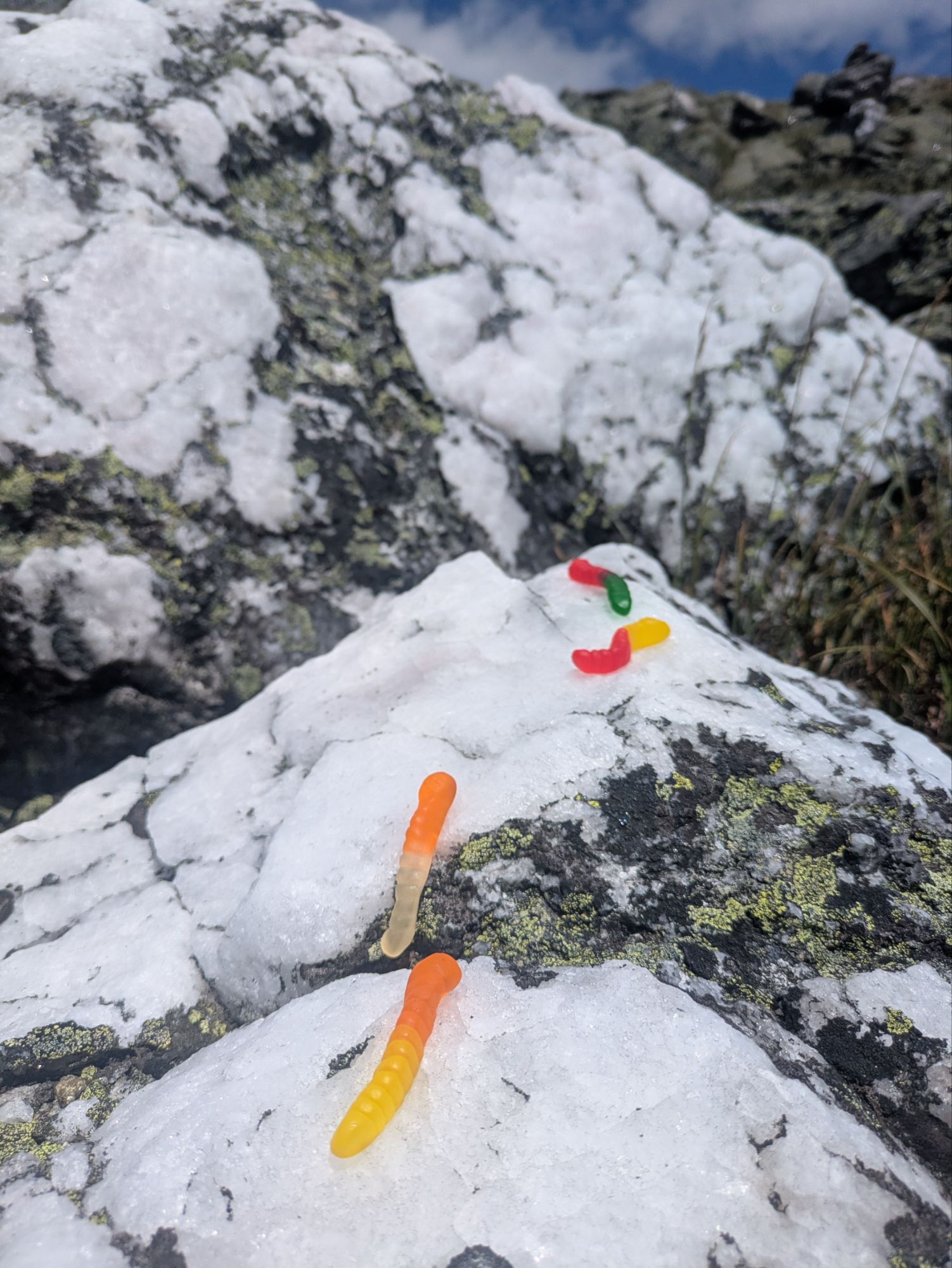
The elusive Martiodrilus Crassus, otherwise known as the Franconia Rainbow Worm… only known to be found between the elevations of 5,500-5,555 feet in the White Mountains of New Hampshire.
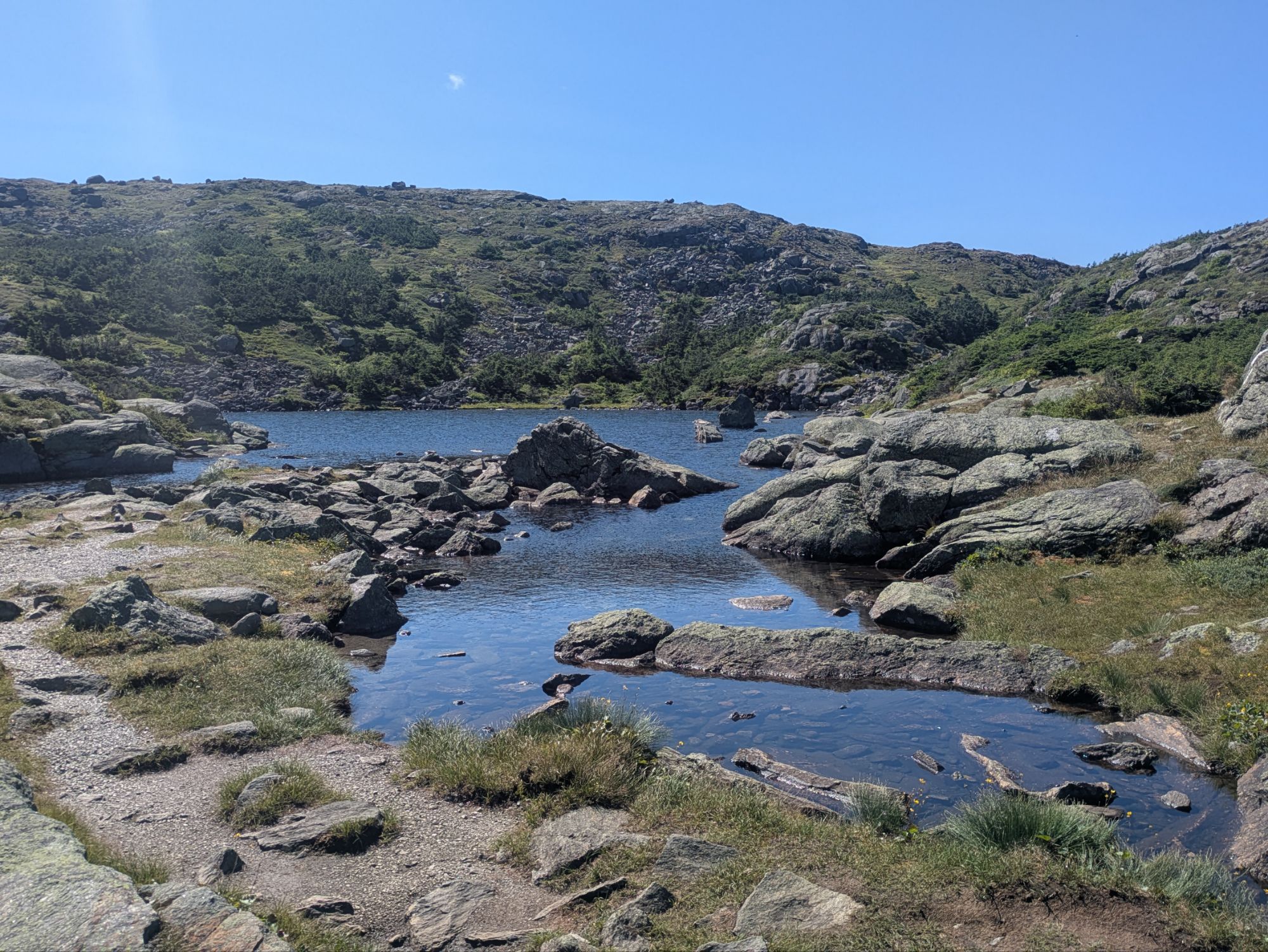
Next up was Mount Adams, New Hampshire’s second tallest at 5,774 feet. I figured I’d make it a thing and get the top three big boys. My water situation wasn’t looking good though and as I neared the cutoff for Adams, I made the decision to just head straight for the next hut. Just then, I found a little trickling stream though, so problem averted. Onwards to the top!
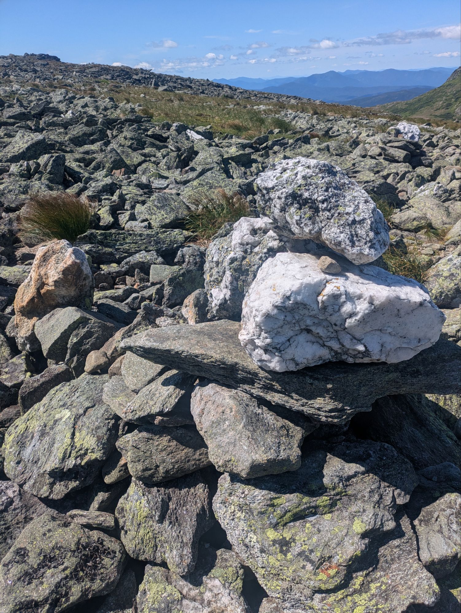
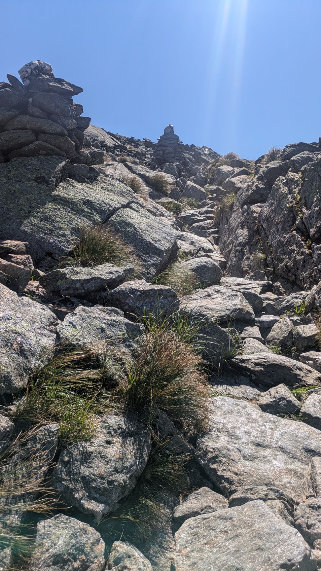
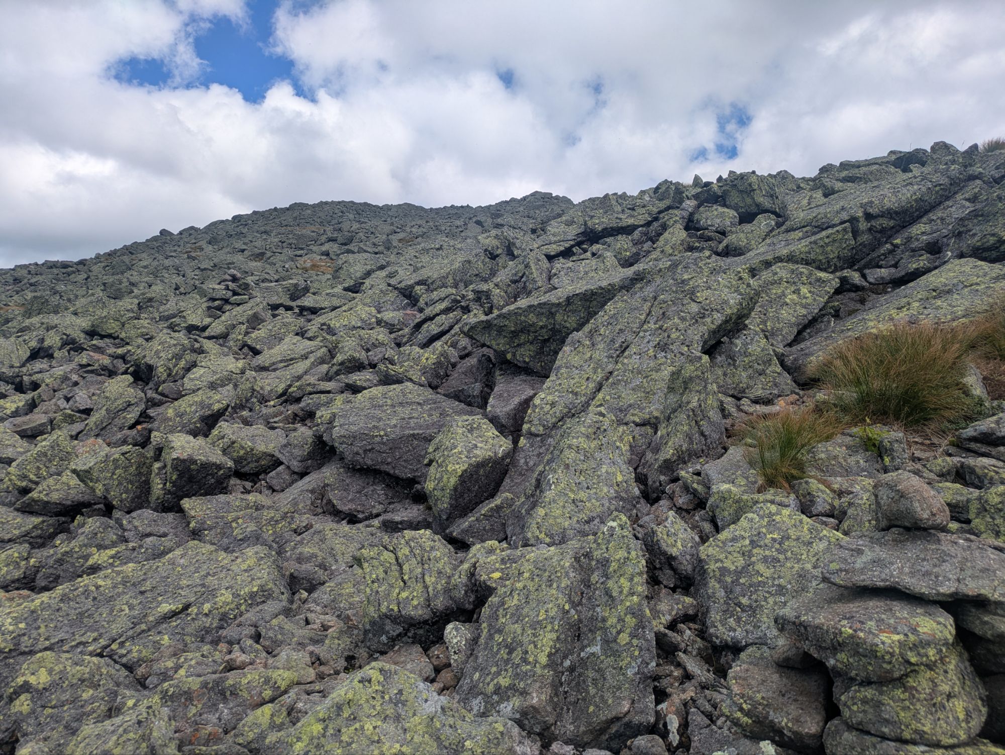
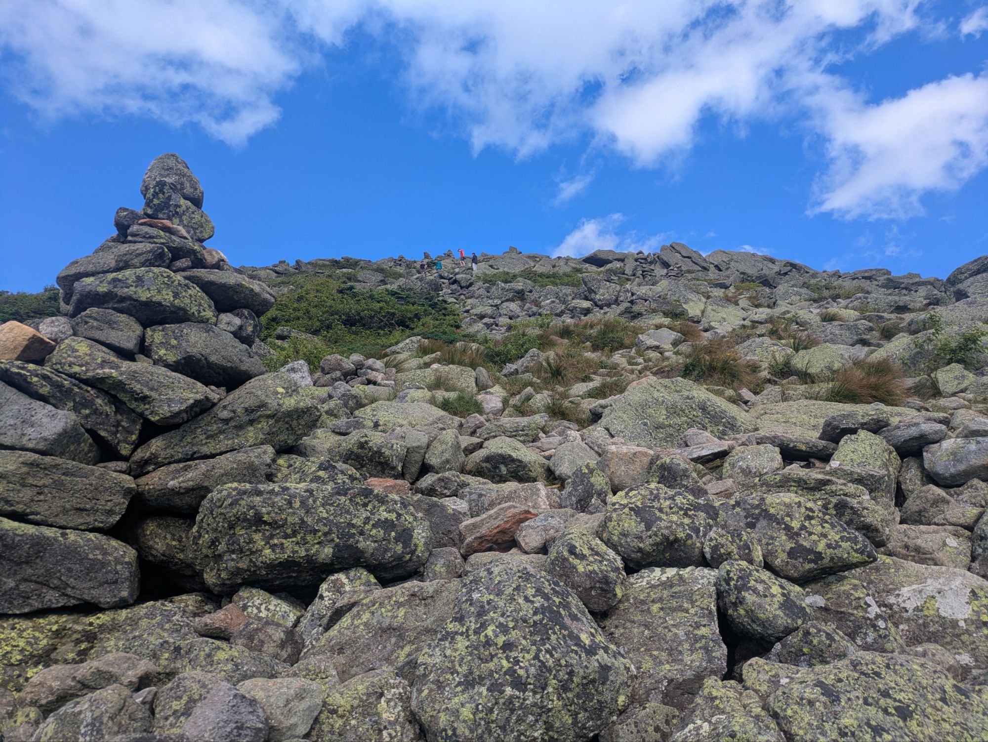
This was the “trail” to the top. In actuality, it’s just a series of cairns and choose your own adventure as to how you get up
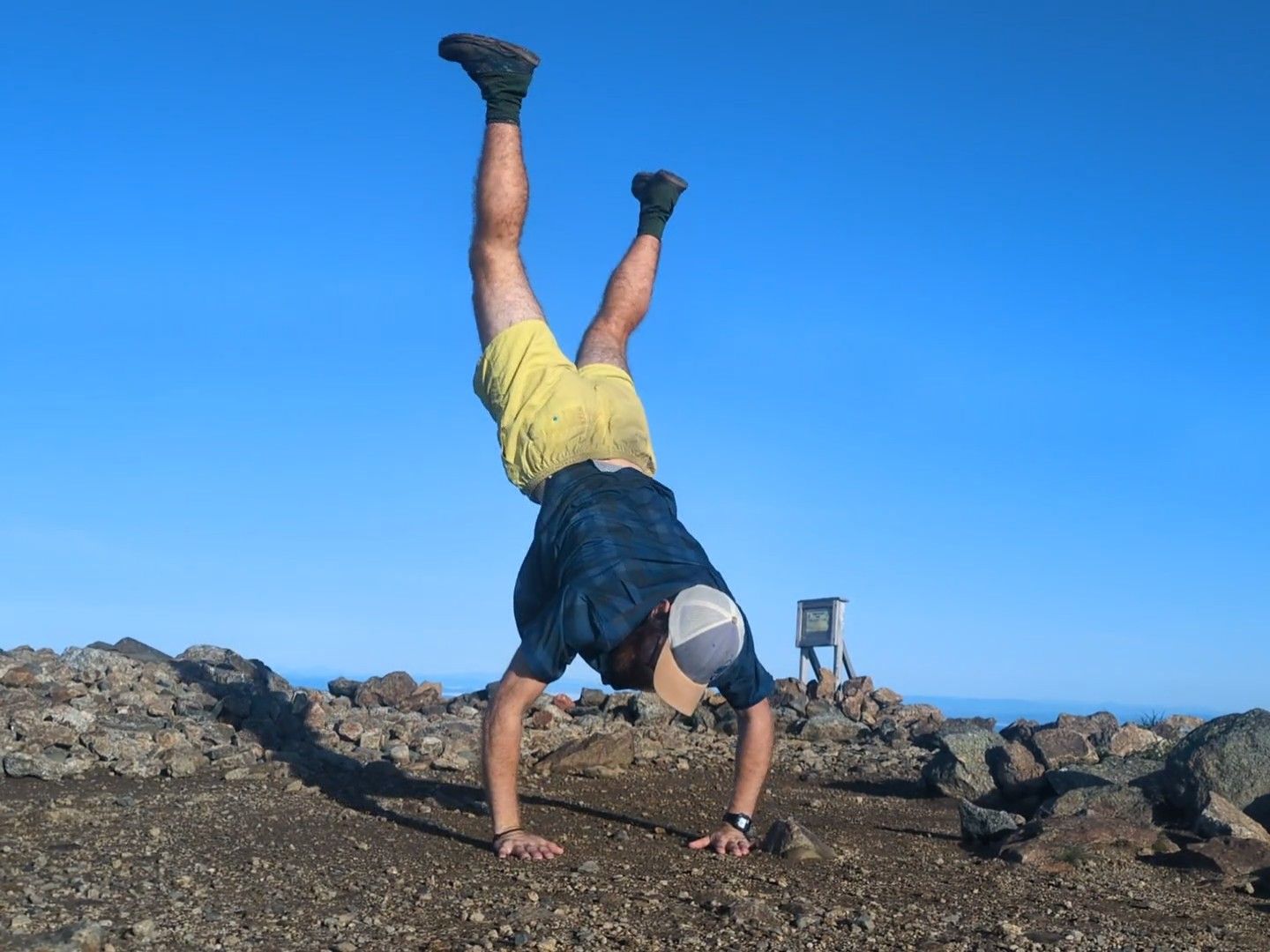
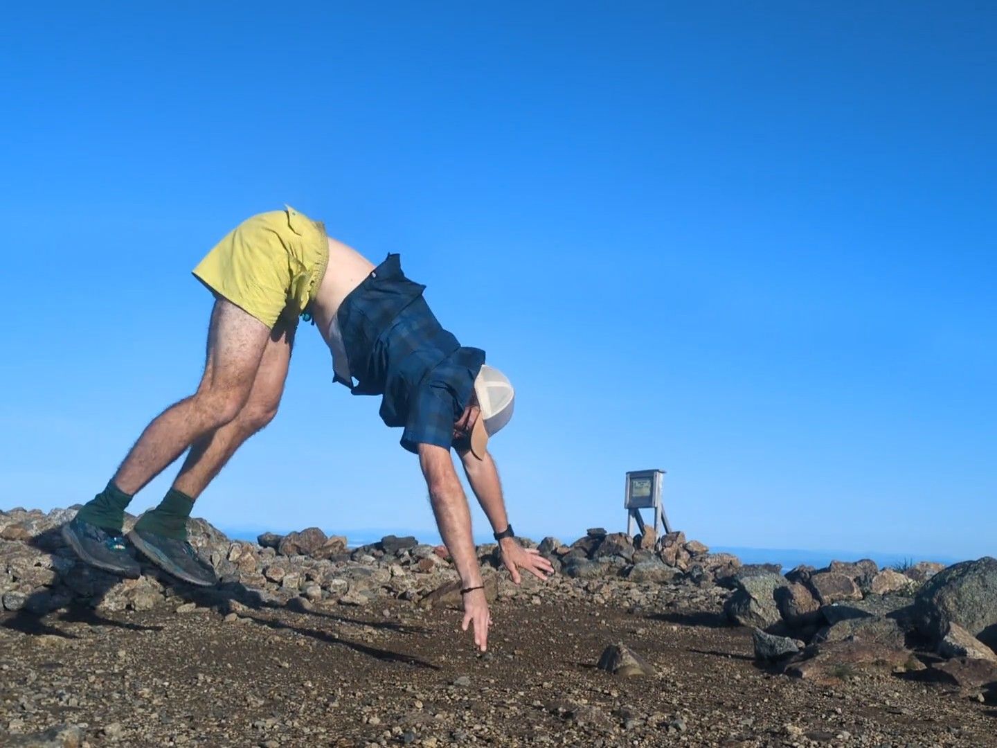
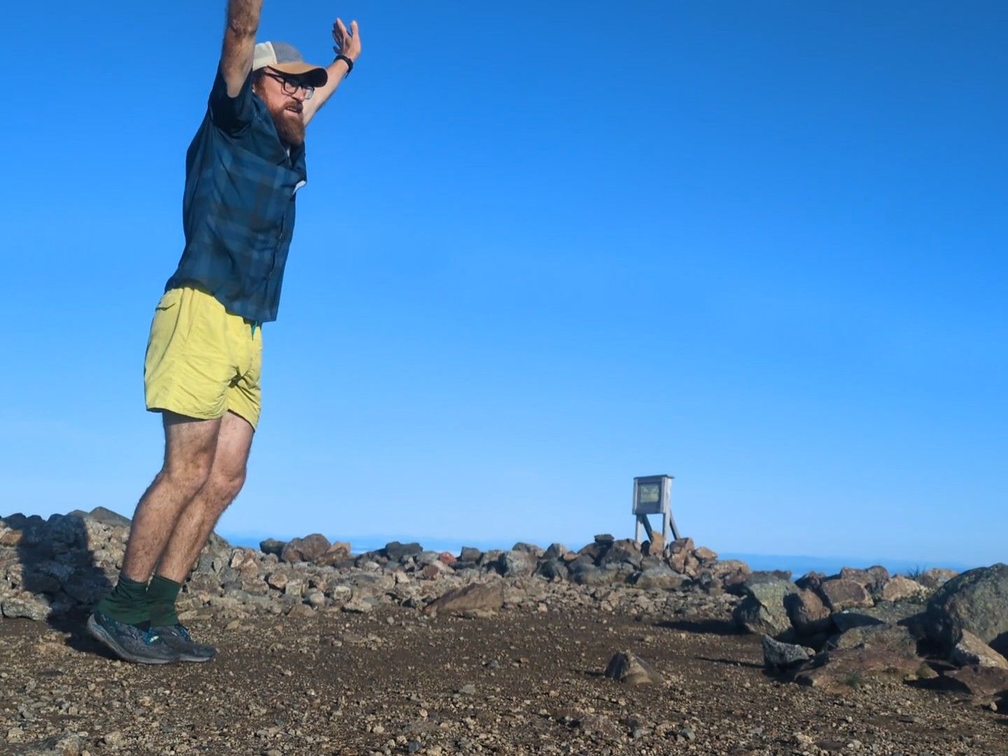
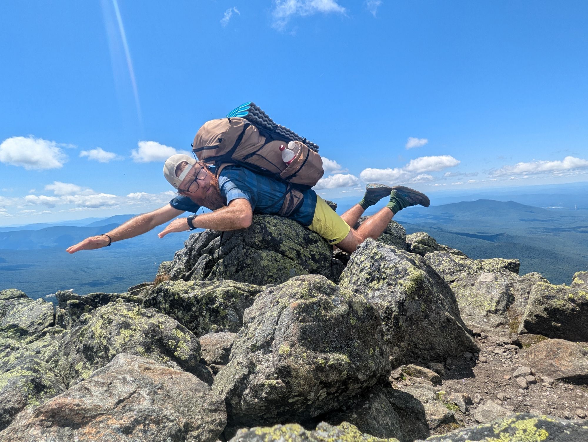
There were two or three other groups of hikers up at the top with me. And, back at Jeffy, there were some too. Folks probably were curious what I was up to with my timed photos. You all are probably curious too, why!? Yeah, I don’t know. When the inspiration hits, you don’t question it haha.
I stopped in and got my free soup! The creamy tomato was superb and I stayed longer than I’d planned again. I think it might’ve been an hour and a half or longer. The weather was so good today that I wasn’t worrying about getting up and over the last peak or anything. Instead, I tried to convince myself that if I got into camp late today it was fine. No worries. Go with the flow. Be the mountain you want to climb.
5:00 pm – I started hiking again with Mountain Madison looming above me. It was a steep scramble following cairns again, but I was feeling strong. Maybe there was some super food strength from the soup?
Up until this point I had a pretty wonderful day going. I think that probably came across in this novel of a post (my apologies for the extreme length of this one). Descending Madison was a struggle though and I got more than a little frustrated with the trail designers and maintainers. Well, I should make clear, not the actual folks out there doing trail work because they’re top notch people and I have huge respect for all they do! I get the feeling this is more a management decision not to put time and resources into trying to maintain such a rugged section.
Truthfully, there is no trail down from Madison. Like the way up, it is just a string of cairns that are hard to see at times and regardless, in between them is a jumbled up field of steep jagged boulders. It’s madness and it’s dangerous. I digress though.
I eventually made it down to the Osgood Campsite and found a wood platform to set up on. It might’ve been around 7:00 pm. There was no host at this one. I got the feeling that I had left the popular parts of the Whites behind and this corner gets neglected. I did meet section hiker Spider though and we chatted some before stuffing my face, hiding all the smelly items in the storage locker, and scrambling inside the tent. Another exhausting, but undeniably awesome day!
Albums of the Day:
“The Earth Is Not a Cold Dead Place” (2003) – Explosions In The Sky
“American Primeval” (2025) – Explosions In The Sky
Thanks for joining on the journey! It means a lot that you took the time to read up on these adventures. If you want to help kids get access to the outdoors, a cause that means a lot to me, please help me in supporting Outdoors Empowerment Network! The “Tip Author” button is a direct link to my fundraising page. Y’all are truly amazing. Thank you!
-

 Brand Stories6 days ago
Bloom Hotels: A Modern Vision of Hospitality Redefining Travel
-

 Brand Stories1 day ago
CheQin.ai sets a new standard for hotel booking with its AI capabilities: empowering travellers to bargain, choose the best, and book with clarity.
-

 Destinations & Things To Do1 week ago
Untouched Destinations: Stunning Hidden Gems You Must Visit
-

 AI in Travel1 week ago
AI Travel Revolution: Must-Have Guide to the Best Experience
-

 Brand Stories3 weeks ago
Voice AI Startup ElevenLabs Plans to Add Hubs Around the World
-

 Brand Stories2 weeks ago
How Elon Musk’s rogue Grok chatbot became a cautionary AI tale
-

 Destinations & Things To Do1 day ago
This Hidden Beach in India Glows at Night-But Only in One Secret Season
-

 Asia Travel Pulse3 weeks ago
Looking For Adventure In Asia? Here Are 7 Epic Destinations You Need To Experience At Least Once – Zee News
-

 AI in Travel3 weeks ago
‘Will AI take my job?’ A trip to a Beijing fortune-telling bar to see what lies ahead | China
-

 Brand Stories3 weeks ago
ChatGPT — the last of the great romantics