
Destinations & Things To Do
Andaman’s Hidden Gems: Four Natural Wonders Set To Shine As UNESCO Heritage Sites, Boosting Eco Tourism and Global Travel: Read More About It Now
Wednesday, July 30, 2025
The Andaman and Nicobar Islands, a pristine archipelago located in the Bay of Bengal, are making a concerted push to enhance their position on the global tourism map. The Union Territory administration has formally proposed four of its unique natural landmarks for inclusion in the Tentative List of UNESCO World Heritage Sites. This move is not only an effort to preserve and highlight the region’s geological and ecological richness but also a strategy to drive sustainable tourism and create economic opportunities for the local communities.
The proposal includes four stunning sites that reflect the Andaman Islands’ biodiversity, geological uniqueness, and cultural significance: Barren Island, Narcondam Island, Baratang’s Mud Volcanoes, and Shaheed Dweep’s Natural Bridge. Together, these landmarks have the potential to transform the region into a significant eco-tourism hub, attracting international travelers seeking immersive, responsible travel experiences.
1. Barren Island: India’s Only Active Volcano
Barren Island, located about 138 km northeast of Port Blair, is renowned as India’s only active volcano and one of the few active volcanic sites in South Asia. The island’s stark, barren landscape—dominated by volcanic cones, ash fields, and sparse vegetation—is surrounded by crystal-clear waters and coral reefs, making it a must-visit for those interested in geo-tourism and adventure tourism.
For years, Barren Island has remained a largely inaccessible destination for tourists due to its remote location and the volatility of the volcano. However, with increased tourism infrastructure and sustainability measures in place, it is now being considered for UNESCO World Heritage status, which would significantly elevate its profile as a geo-tourism destination. Its raw, rugged terrain and volcanic activity make it a fascinating site for scientific research and adventure tourism, providing visitors with a once-in-a-lifetime opportunity to explore a volcanic environment.
With sustainable eco-tourism development, Barren Island could become a popular attraction for eco-tourists, adventure seekers, and nature enthusiasts who are keen to witness the forces of nature at work in one of India’s most unique geological sites.
2. Narcondam Island: Home to the Rare Narcondam Hornbill
Another prime candidate for UNESCO World Heritage status is Narcondam Island, located about 240 km from Port Blair. Known for its biological significance, this volcanic island is home to the endangered Narcondam Hornbill, a species found nowhere else in the world. The island’s lush, dense forests and diverse wildlife make it a paradise for birdwatchers and ecologists, drawing increasing interest from wildlife tourism enthusiasts.
Narcondam Island is a sanctuary for the Narcondam Hornbill, which is currently protected under India’s Wildlife Protection Act and listed as an endangered species by the International Union for Conservation of Nature (IUCN). The island’s isolation has allowed its biodiversity to remain largely untouched by human activity, making it an important area for conservation and scientific study.
As global wildlife tourism continues to grow, the island offers a unique eco-tourism experience for travelers looking to explore untouched habitats and contribute to conservation efforts. Its UNESCO recognition would highlight the island’s ecological importance while bringing sustainable tourism practices to the forefront of the region’s development.
3. Baratang’s Mud Volcanoes: A Potential Wellness and Eco-Tourism Hub
Located in the Andaman Islands, Baratang is home to a remarkable geological feature—mud volcanoes. This area, characterized by dense mangroves, tranquil beaches, and unique natural phenomena, has the potential to become a wellness and eco-tourism destination, similar to South Korea’s Jeju Island. The mud volcanoes, which occasionally erupt mud and gases, offer visitors an extraordinary opportunity to witness tectonic activity and learn about the geological processes beneath the earth’s surface.
Baratang’s mud volcanoes provide an exciting educational experience for tourists, with the opportunity to witness the raw power of nature in a safe and controlled manner. The island’s unique ecosystem also attracts nature lovers and eco-tourists, while the potential to develop wellness retreats and eco-friendly accommodations could make Baratang a sought-after destination for those seeking nature-based wellness experiences.
The island’s geological significance combined with its untouched natural beauty provides an ideal setting for sustainable tourism development, offering both environmental conservation and economic benefits to local communities.
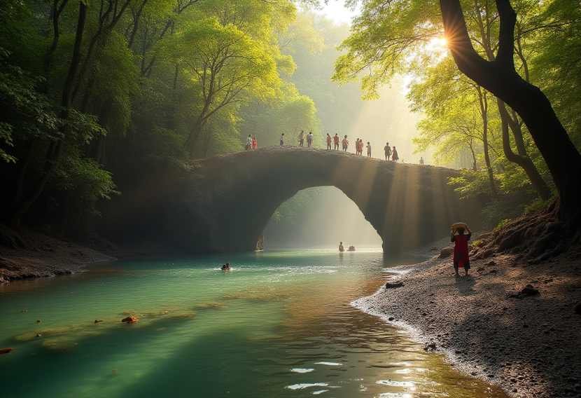
4. Shaheed Dweep’s Natural Bridge: A Scenic Trekker’s Delight
The Natural Bridge at Shaheed Dweep (formerly known as Neil Island) is a stunning natural arch formation that has become a popular trekking destination in the Andaman Islands. Accessible via a short forest trek, the Natural Bridge is a popular attraction for trekkers, nature lovers, and adventure tourists. The arch formation, known locally as Howrah Bridge, offers a unique scenic experience, attracting visitors who want to explore the island’s rich biodiversity and scenic landscapes.
With its pristine beaches and lush forests, Shaheed Dweep offers visitors a chance to immerse themselves in the untouched beauty of the Andaman Islands. The island’s eco-tourism potential is significant, especially with its blend of nature trails, birdwatching spots, and beach activities. The Natural Bridge itself is a perfect spot for photography and sightseeing, providing a perfect combination of adventure and nature-based tourism.
By securing UNESCO World Heritage status, the Natural Bridge could be elevated as a top eco-tourism destination, attracting global travelers while ensuring its preservation through sustainable tourism practices.
Economic Impact and Tourism Development in the Andaman & Nicobar Islands
The proposal to add these four remarkable sites to the UNESCO World Heritage Tentative List is not only a milestone in environmental conservation but also a vital step toward enhancing tourism infrastructure in the Andaman & Nicobar Islands. With the right focus on sustainable tourism practices, these natural wonders have the potential to drive increased international visitation, attracting travelers who are eager to explore off-the-beaten-path destinations and engage in eco-friendly travel.
As the Andaman Islands continue to develop their tourism industry, the local economy stands to benefit significantly, with opportunities for job creation, improved infrastructure, and a boost to the hospitality sector. At the same time, preserving these areas for future generations ensures that eco-tourism remains at the heart of the islands’ development.
Conclusion: A Vision for Sustainable Eco-Tourism
The Andaman & Nicobar Islands’ proposal for UNESCO recognition is an essential step in making the region a global destination for eco-tourism and geo-heritage tourism. These four sites—Barren Island, Narcondam Island, Baratang Mud Volcanoes, and the Natural Bridge at Shaheed Dweep—are not only geological wonders but also key to shaping a sustainable tourism model that blends natural preservation with local economic growth.
With UNESCO World Heritage recognition, these sites will gain international recognition, contributing to local conservation efforts and ensuring that future generations can enjoy these extraordinary places. The Andaman & Nicobar Islands stand on the brink of becoming a must-visit destination for eco-conscious travelers seeking adventure, sustainability, and natural beauty.


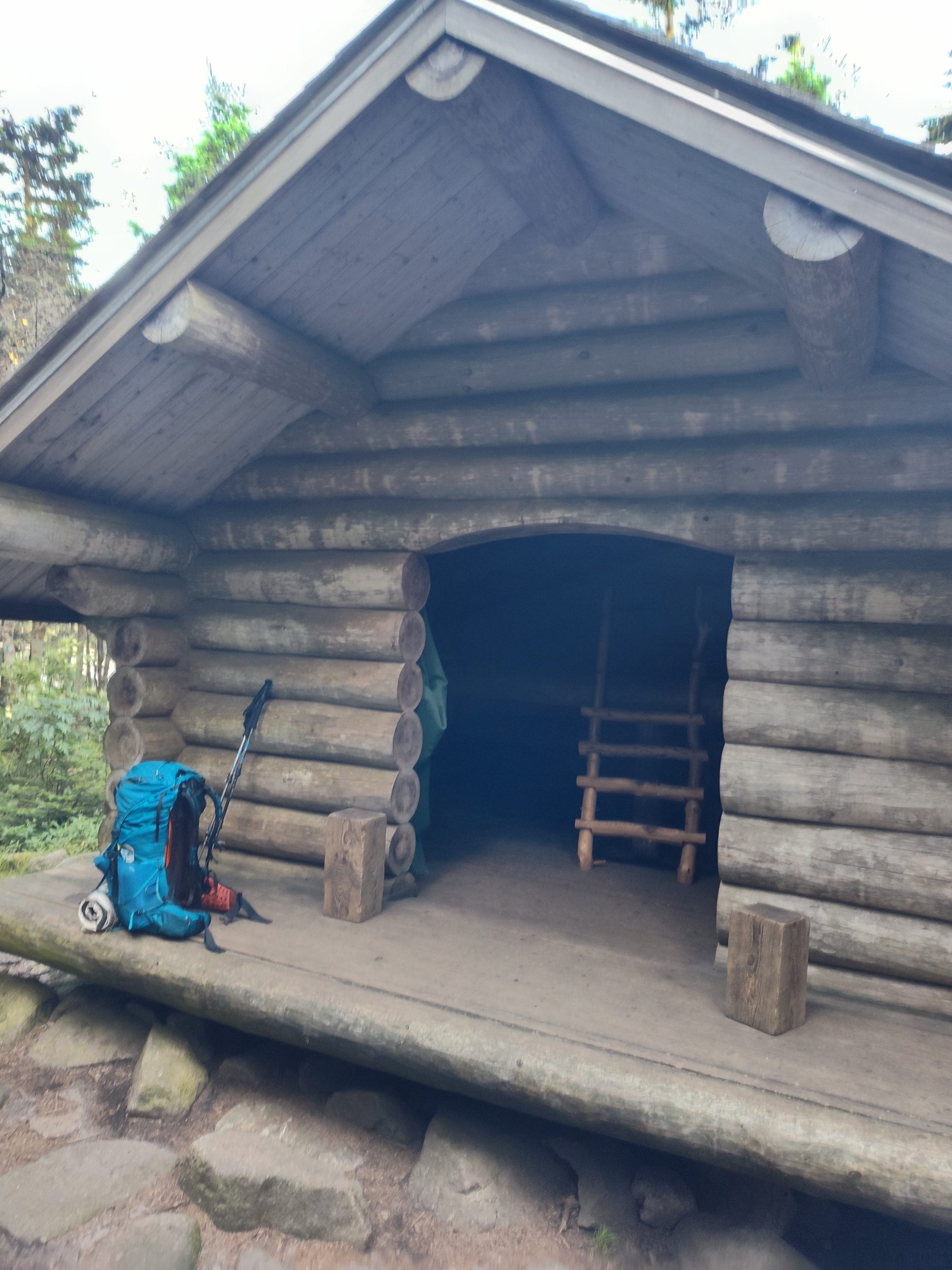
Day 13
I slept well in my tent at the Woods Lake campground. But from the moment my eyes opened, my stomach grumbled with hunger. We were all out of food – Zach, Burgs, the Brits, Droobie. We scraped the bottoms of our food bags for scraps. But Burgs came through for us. The night before, he’d chatted with an older gentleman who supposed he could take us in the morning if we still needed a ride. So we waited until an appropriate morning hour and went in search of our ride.
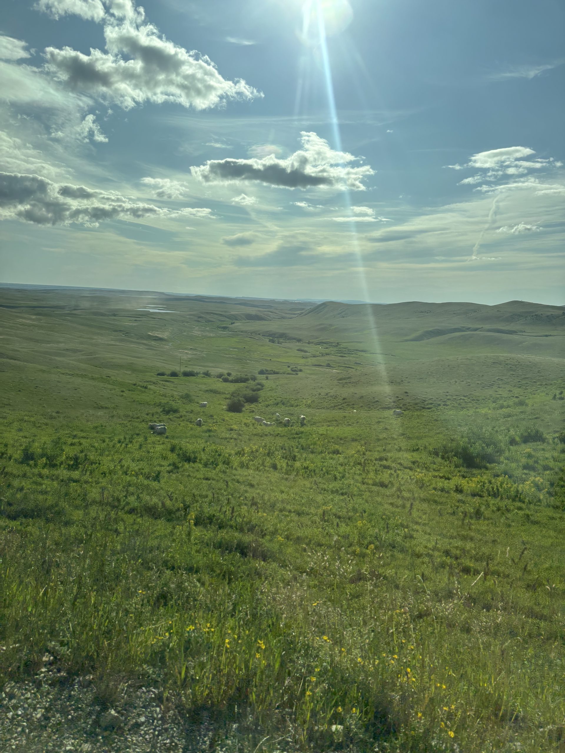
Mark was a kind man. Without hesitation, he opened his truck bed to the 6 of us, though Sally, John, and I got lucky enough to sit in the cab with him. We set out for the long, bumpy ride to Augusta. As the tall mountains turned into sweeping meadows and plains, Mark shared a lot of history and Montana knowledge with us. He described how bear research worked in the Bob since his brother had participated in the terrifying task in his youth. He described the land ownerships surrounding the Bob and the types of cattle raised in the plains. He even gave us a run down of the political state of Montanas people and provided hefty Bison lore as part of the political riff raff. Apparently there is argument over bison migration through ranch pastures and diseases that affect the cows and pastures. But they used to breed bison with cows and they were hard to tame so they stopped breeding them.
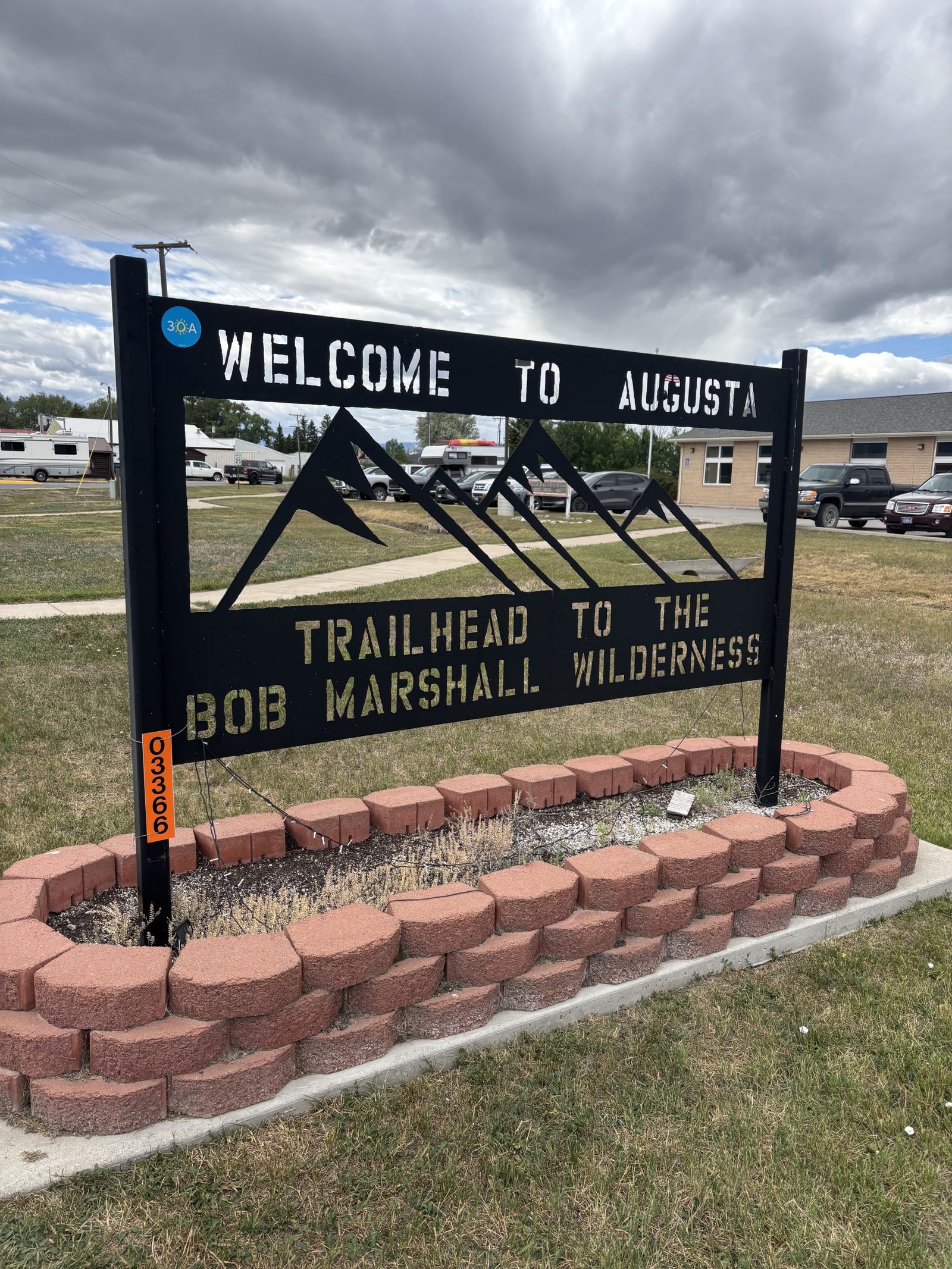
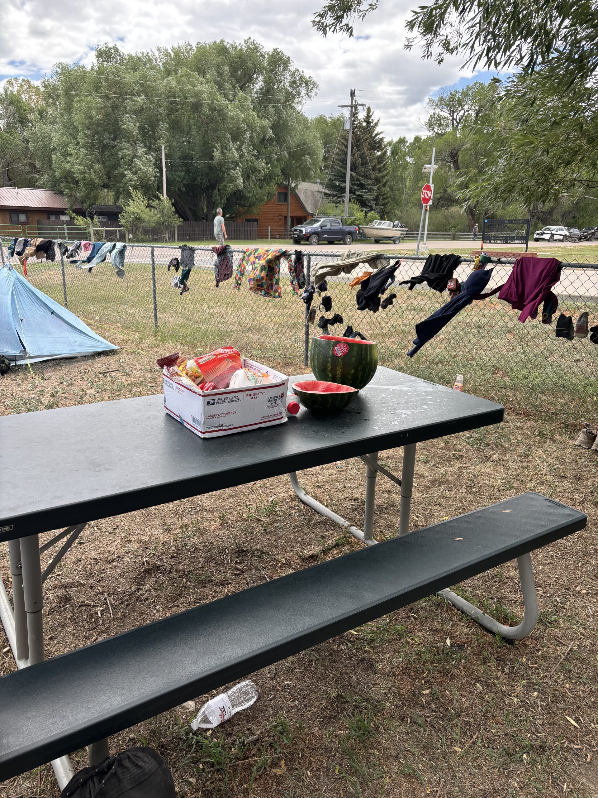
Once we reached Augusta, we set up camp in the grass around the RV park and began our camp chores. I took an ice cold shower with half a bar of soap and a dabble of conditioner in the men’s room. I waited for our clothes to get clean while sweating it out in my rain jacket and pants, though the washer stalled 5 minutes in and then the other machines were taken. When our clothes finally completed a thorough wash cycle, we hung them to air dry in the chain link fence around the park – both to save money and because being hiker trash is fun. Then I resupplied and gagged when I saw the price. Again, I was thinking about how much I dislike being in town and the itch to hit the trail returned despite being off of it for only a few hours.
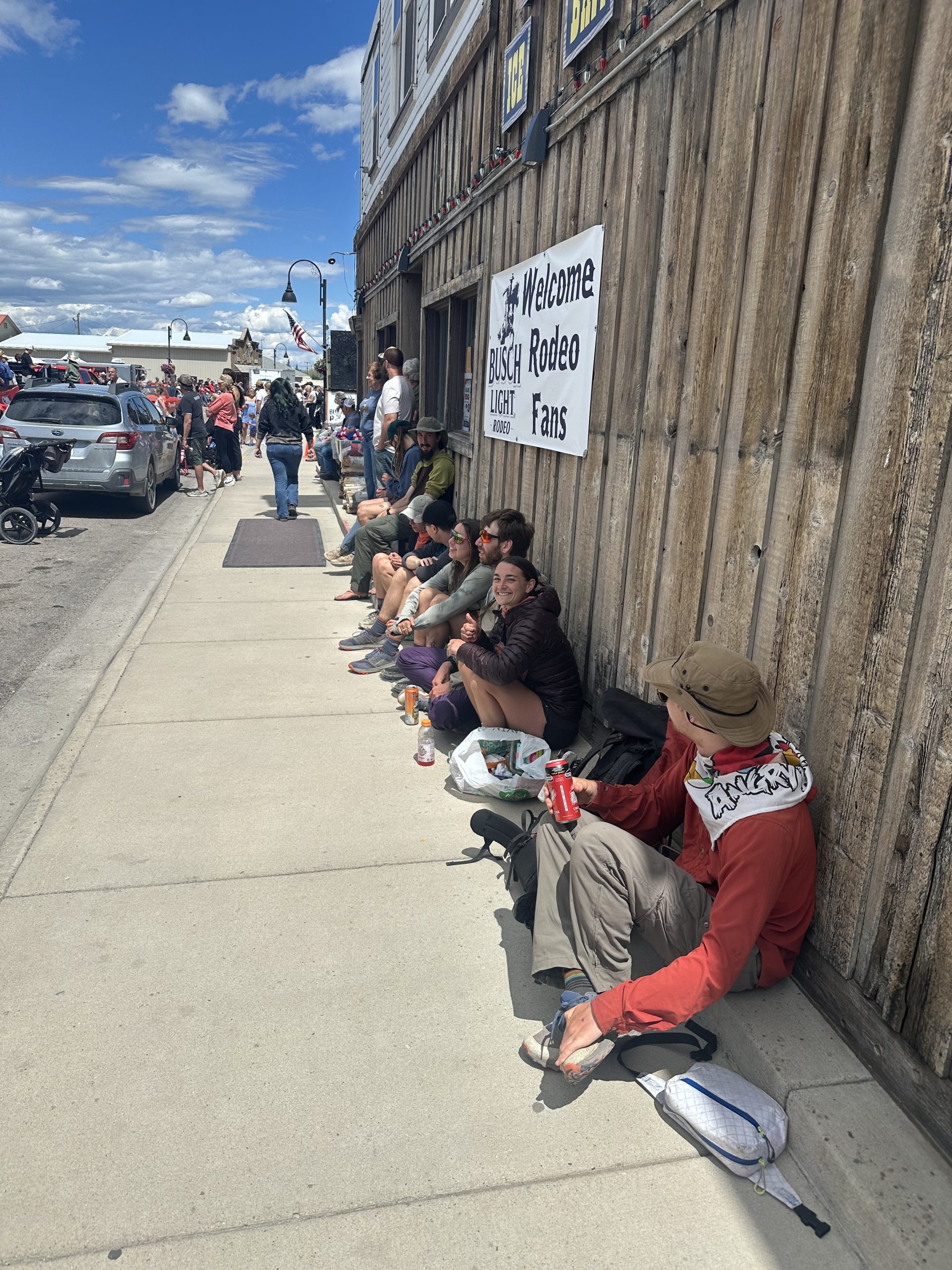
Finally, once laundry was done, the resupply price was paid, and the festivities we had come into town for were picking up, things began to turn around. The parade through town was full of local businesses and clubs with home-made floats from trailers and vans. Old cars rumbled down the street and each float or vehicle had a designated candy thrower. A bunch of hikers sat along the sidewalk outside of the grocery store and raised our hands up in the air each time a car drove by throwing candy. Some of us ran back and forth from our seat to the street to grab stray candy. Others of us waited patiently for those good candy throwers to shoot hard jolly ranchers and tootsie pops at our heads. I added a small supply of candy to my food bag following the parade.
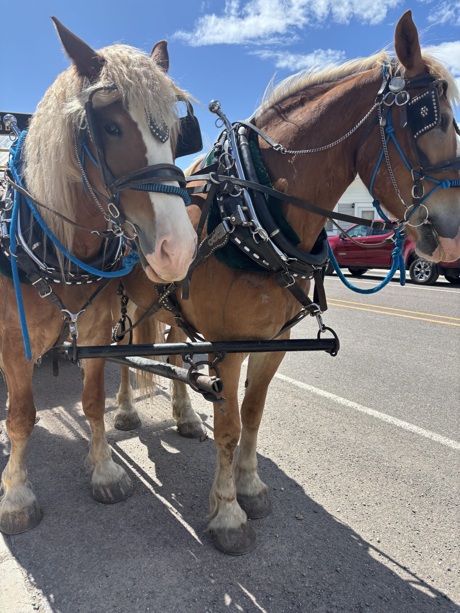
As things began to wind down and move into the second phase of pre-rodeo day, a horse drawn carriage strode down the street and to our surprise, John and Sally – the Brits – were waving at us from the rear bench of the wagon.
The evening picked back up once the sun began to set. Hikers and towns people bar hopped up and down the mile long town road. A group of us watched locals dance, and quite expertly at that. We played corn hole and people watched until hiker midnight had long come and gone. When I finally retired to my tent, it wasn’t until 1am when I was finally able to fall asleep as the drunken yelling had finally ended by that hour.
Day 14
I felt stuck in Augusta. The mental pull between staying to see the rodeo and wanting to get back on trail was physically painful. We bought tickets for the rodeo but could give them to hikers coming in this afternoon. But also trying to find a ride out of town was a fruitless challenge.
Rocket, Hamburglar, and I toddled away the morning hours packing up camp and enjoying the company of new incoming hikers. Then we went into town with our things to find lunch and try to find a hitch. If we could find a hitch, we’d leave before the rodeo. We ran into Lemon, Matcha, and Blueprint – a veteran hiker who is hiking the CDT for his third time (I think). I asked him for some wisdom moving forward since the current greatest debate amongst hikers is over which line to take after Helena. I was hoping to take the Big Sky alternate, but for the same reasons I’d initially wanted to stay for the rodeo – to hang out with hiker friends – I felt unsure that taking such a big cut off would be socially satisfying. He said that the Big Sky alt would help me to hike through the highlights of the trail without having to worry too much about my timeline. So really, the choice for me was between hiking with people or seeing as much of the trail as I could.
And even though I’d zeroed for the rodeo to hang out with people, I blurted out, “I really just want to see the highlights.” So there it was, I was going to do big sky. I’d come into the CDT knowing I was in it for the physical challenge and already I’d tried to steer my goals towards more social ventures. Sure it was fun but I wasn’t quite satisfied and in the spirit of trying to be true to my own goals, I needed to get back to the pursuit of the physical challenge.
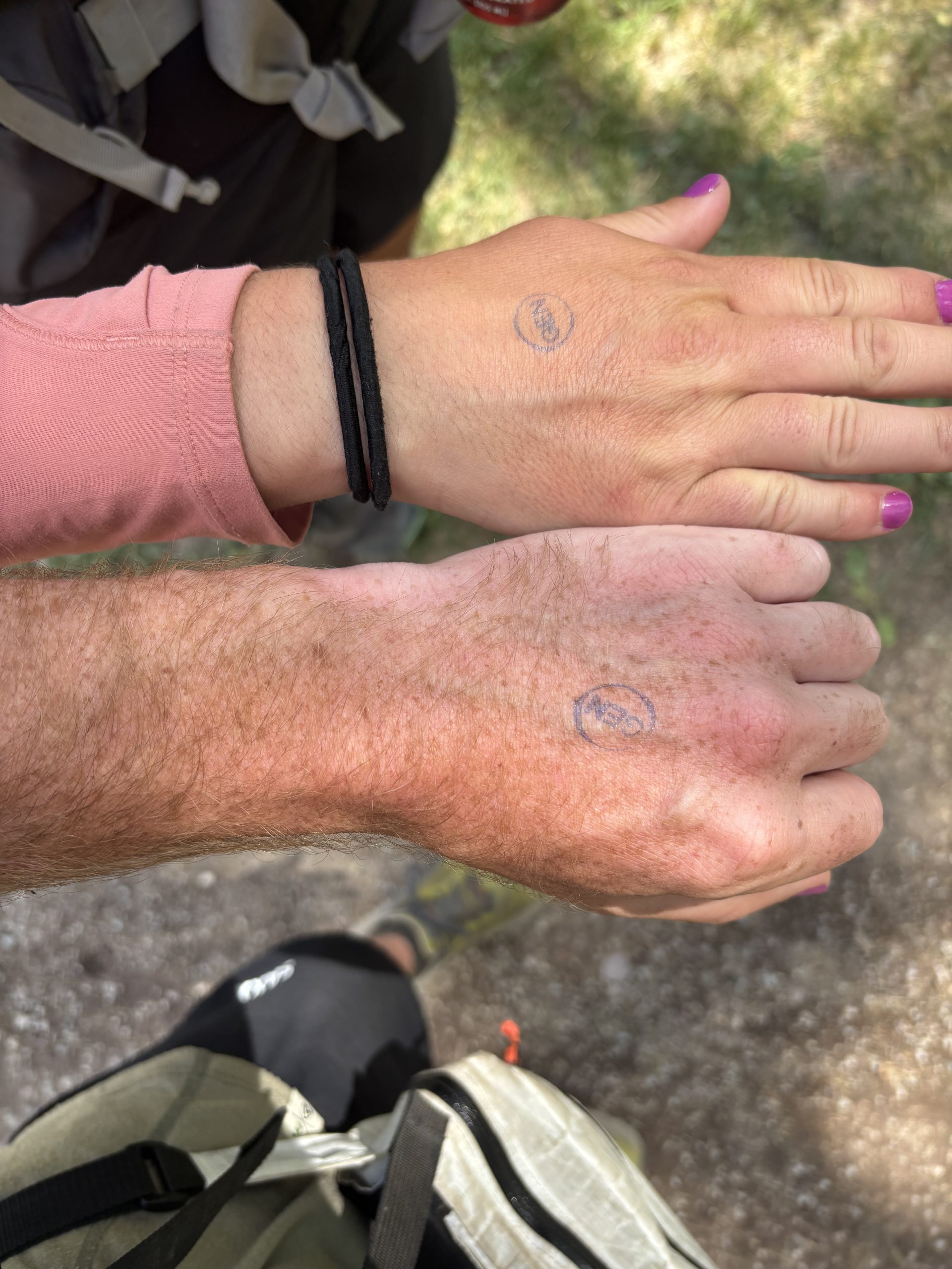
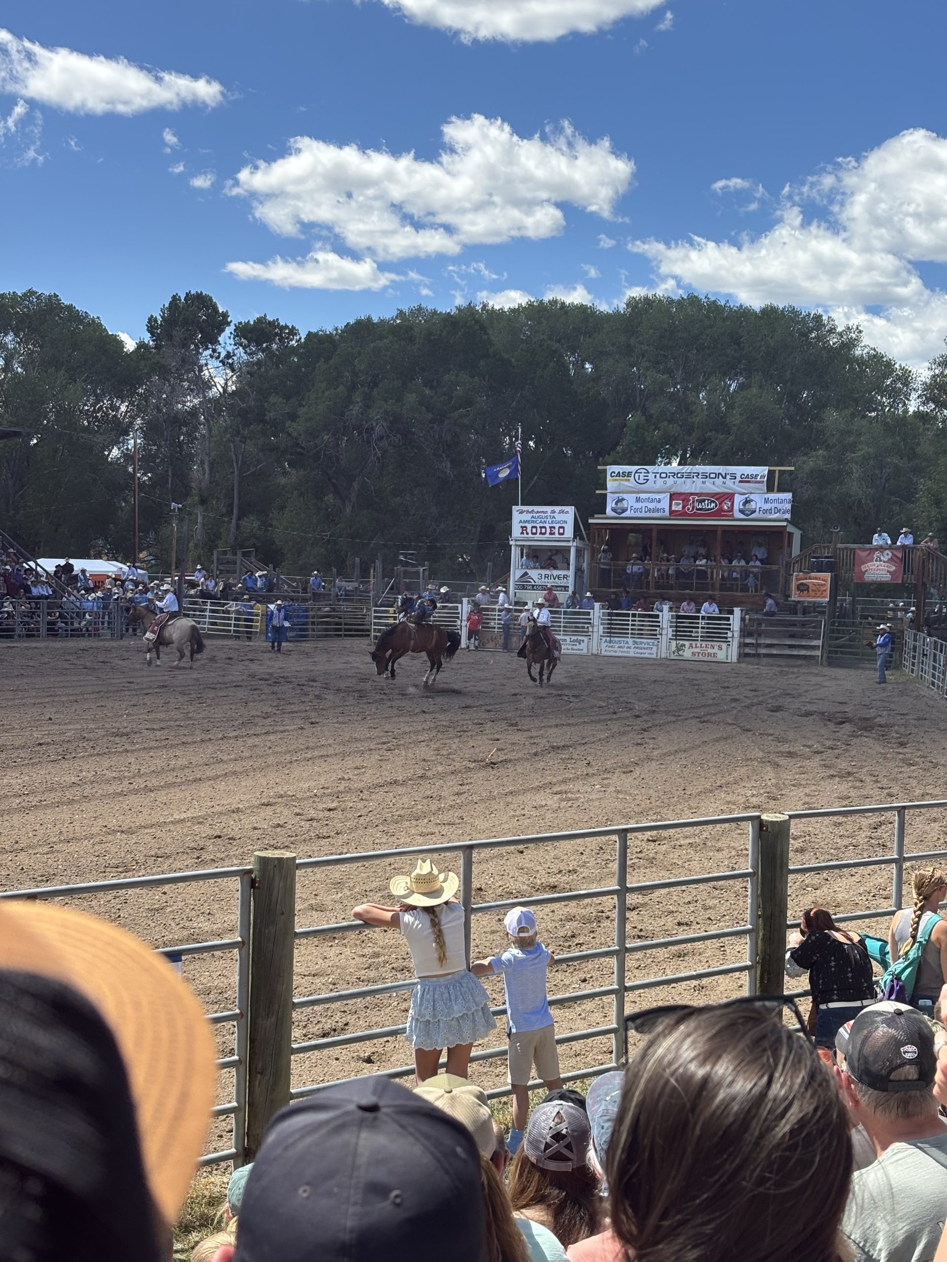
I enjoyed the company for a bit longer, painted my nails purple with rocket and Burgs to signify that despite my goals, I’d still met and would meet worthy people on this trail, and then we headed to the rodeo. Ultimately, I was glad to have stayed for the rodeo and even more glad that Rocket snagged us a hitch with plenty of time to see the rodeo and still hike 7 miles away from town. A group of South African boys, and particularly their drunken friend they pre-apologized for before we met, were funny and we shared nerds gummy clusters. The people around us who offered us umbrellas for shade from the sun were so kind and interested in our endeavors. And when the cowboys hopped on the bucking broncos and effortlessly lassoed the calves, my jaw dropped in horror and awe. The accuracy and the danger was so impressive and I’ve quite literally never known a horse to jump so high.
Alas, we didn’t see the bull riding since Rocket had nabbed us a hitch to trail. But I wasn’t too upset, I’d seen enough to have content to digest what I’d witnessed for several days. But what I’d come to digest more thoroughly was the guy who gave us a ride. He was from Belgium but recently became a US citizen. Quite literally as soon as we’d gotten out of range of cell service, he began speaking of his flag burning anarchy days and how he’d once flipped his car driving down a road like the one we were on. My finger was over the SOS button of my Garmin. But ultimately, he was kind and harmless. Perhaps a bit of a lost soul seeking direction. And when he offered to share his 1000 page manifesto discussing the corruption of the Colorado government, I politely declined and offered to buy him a beer instead if we got to Helena by the 4th of July (where he’d be in the coming days). And with that, we parted ways and hiked into the fading light trying to find a flat spot to camp along a narrow stretch of trail bordered in by a river and steep canyon walls.
Day 15
I woke up to frost on the inside of my tent. Reluctantly, I knew today would be another yard sale lunch kind of day. I set off up the trail got turned around when I missed a critical trail junction and crossed the creek. I was sure I wasn’t supposed to cross, but all was better when I ran into chew toy. When I saw someone ahead of me, I three times said, “hey,” “hey there,” “hi”. And on the fourth attempt, she turned around and saw me. We hiked together until lunch and it was pleasant to have someone to converse with and catch up with. About a mile from lunch, there were a few stream crossing that I was confident I could cross without getting my feet wet, however, against my own advice, I trusted a wet log and before I could even put any weight on it, my feet were in the air and I was lying on my backpack on my back in a foot of water. I scrambled to get up, hopeful that my trash bag liner didn’t have any holes in it and wasn’t leaking. Had I been alone in that moment I probably would’ve cursed but since chew toy was there I brushed it off nonchalantly, and it was easier to forget that I had potentially wet gear in my bag, distracted by good conversation.
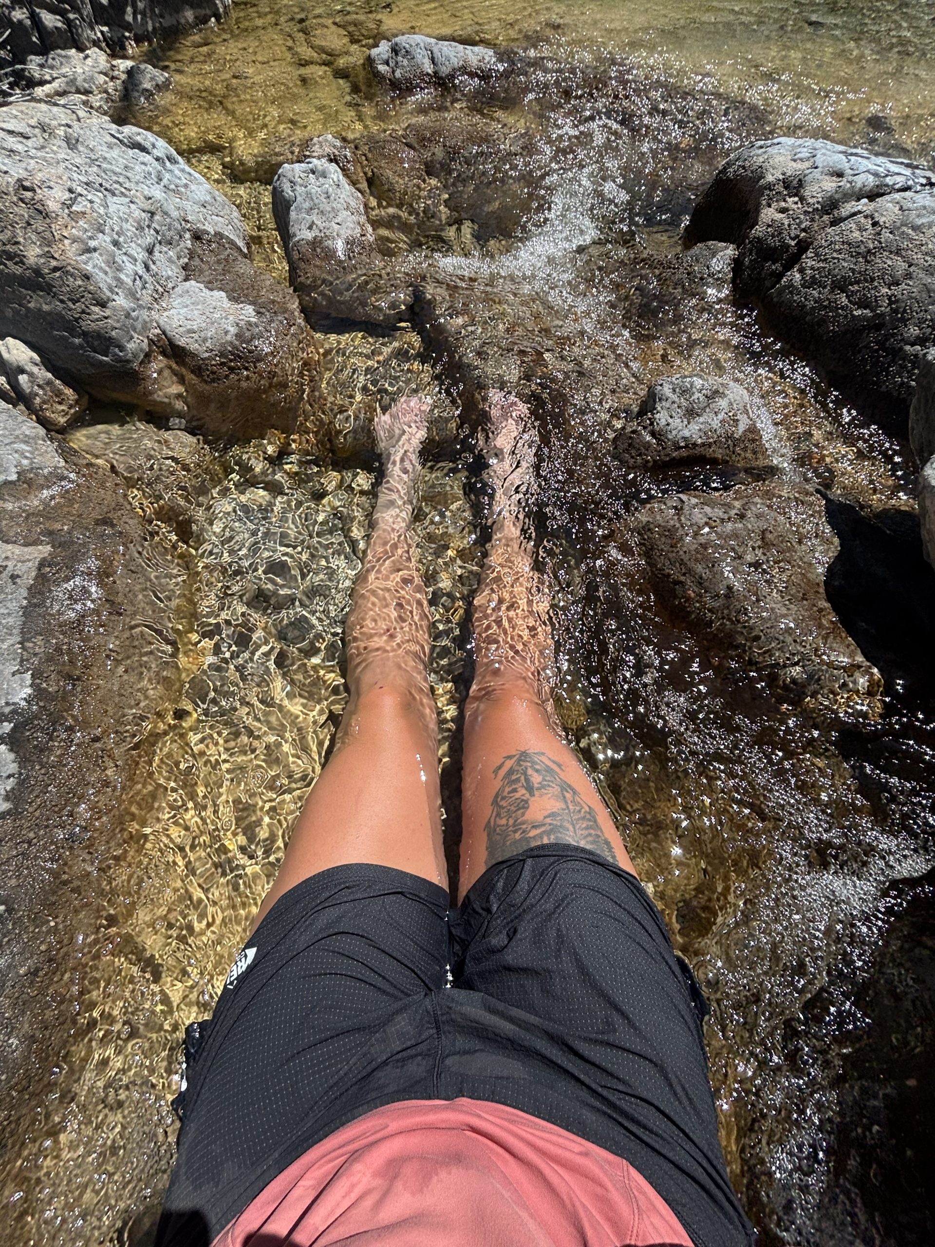
Somewhere along the way, Burgs caught up and then we caught up with Rocket who was sitting in the shade along a small stream. Before Rocket even pointed it out to us, I noticed the perfectly deep section of stream where one could pertly rest their body in the refreshing water. I immediately went for it ignoring the yellowish moss growing on the rocks within the water. I submerged myself up to my waist, sitting right in the water as it fell between the rocks and gave a small sigh of relief. The days were heating up and despite the frosty mornings, the few hours following lunch were hot enough to warrant a siesta. Though we discussed it a few times, at the end of the day, I could stand the idea of laying around in the middle of the day. Despite having many daylight hours to hike, I liked to keep moving. A siesta just wasn’t in the cards for me. But sitting in every river we crossed would be.
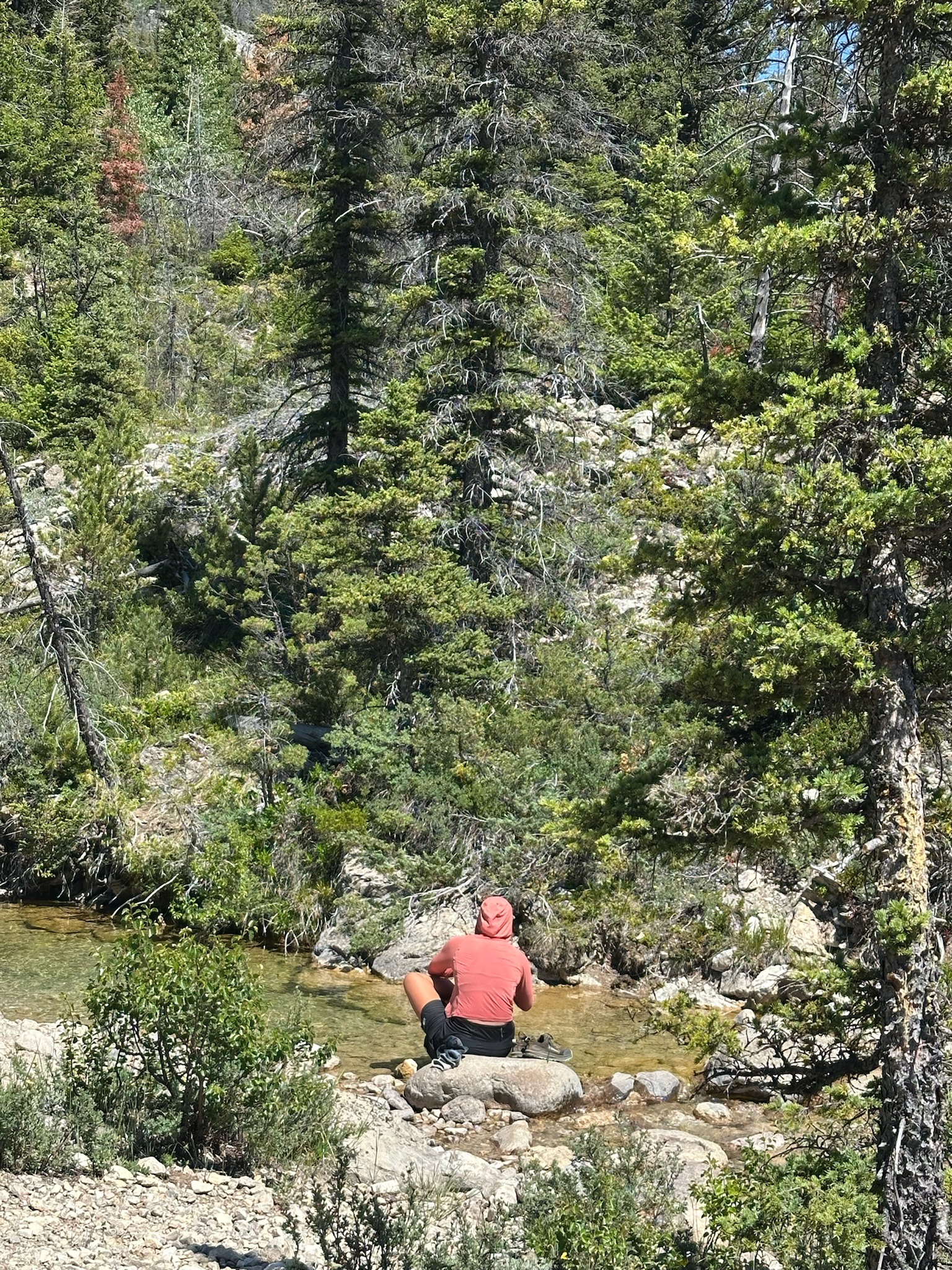
Just before I removed myself from the water, we heard footsteps. Samurai emerged from the tree line and in a moment of surprise, I shouted, “oh my gosh, Samurai!” He smiled and waved back just before he too took a dip in the river. Then Chew Toy walked up and did the same. It was a little river party.
Eventually, we had to pull away from the water and enter back into the hot sun. Thankfully, the trail meandered between trees offering intermittent reprieve from the heat. At the last stream crossing before the final climb of the day, Burgs and I ate dinner. It was becoming a thing to eat dinner before camp. If not to prevent bears from sniffing round our camp, it offered a chance to rest one last time before getting into bed and enough energy to get us the final few miles to camp and to set up camp at the end of each day.
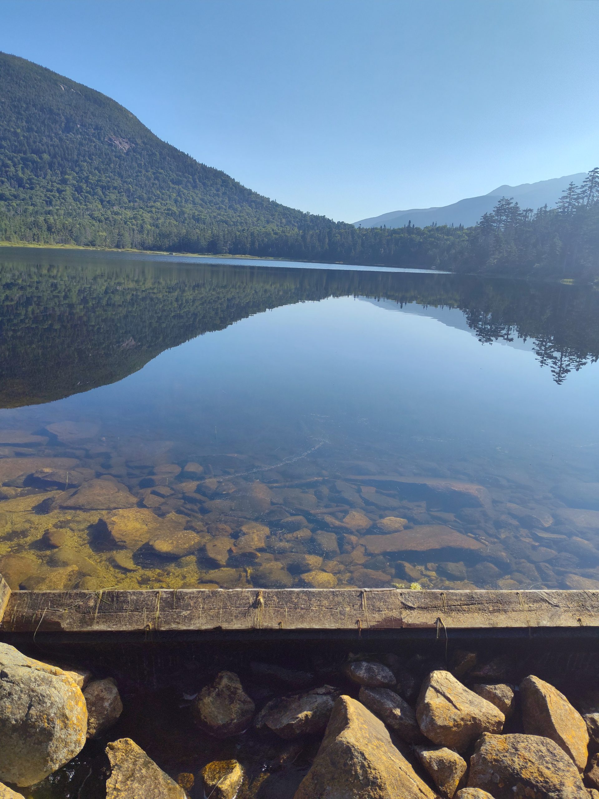
However, even with bellies full of calories, the climbs were never easier. It was slow going to get to the top. But cresting the summit where few trees obstructed the endless expanse of mountainous views was well earned. And cheers from Rocket and Super Noodz helped as well. I collected water from the shallowest of streams trickling through two jumps in the mountain and then headed just a bit further to camp. Fortunately there was plenty of space for everyone. Unfortunately, most of the ground was covered in horse poop. I swept away the large clumps of dung while giggling to myself after muttering, “shittiest campsite I’ve ever seen.” Burgs stoped and stared at me blankly for a few moments before shaking his head and returning to setting up his tent. Not everyone can handle my humor, I guess.
This website contains affiliate links, which means The Trek may receive a percentage of any product or service you purchase using the links in the articles or advertisements. The buyer pays the same price as they would otherwise, and your purchase helps to support The Trek’s ongoing goal to serve you quality backpacking advice and information. Thanks for your support!
To learn more, please visit the About This Site page.
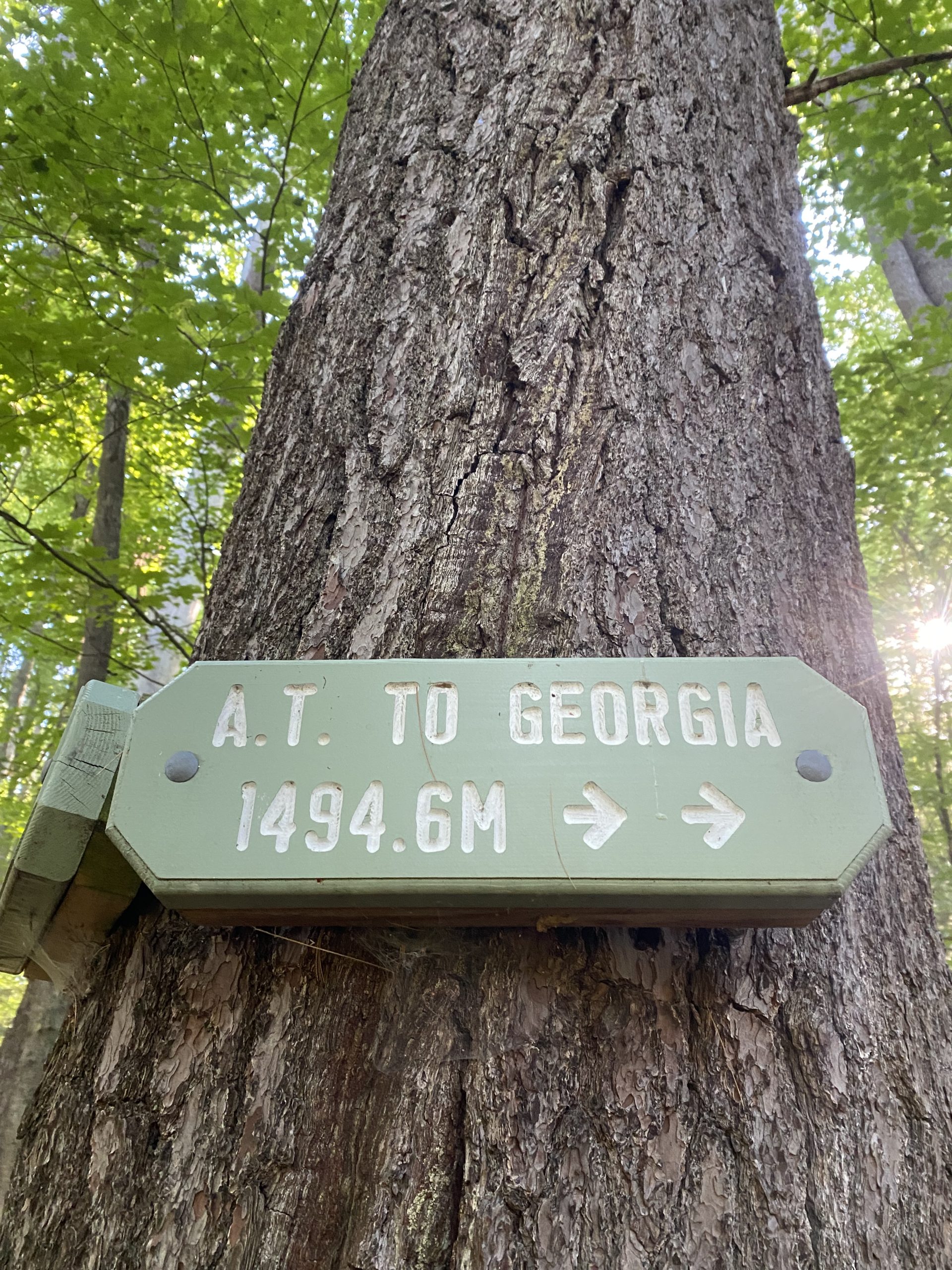
Day 101- 7 Miles today from Kinsman Pond shelter to Liberty Springs campsite, 2600Feet Up, 2400 Feet down, AT Mile Marker 1828
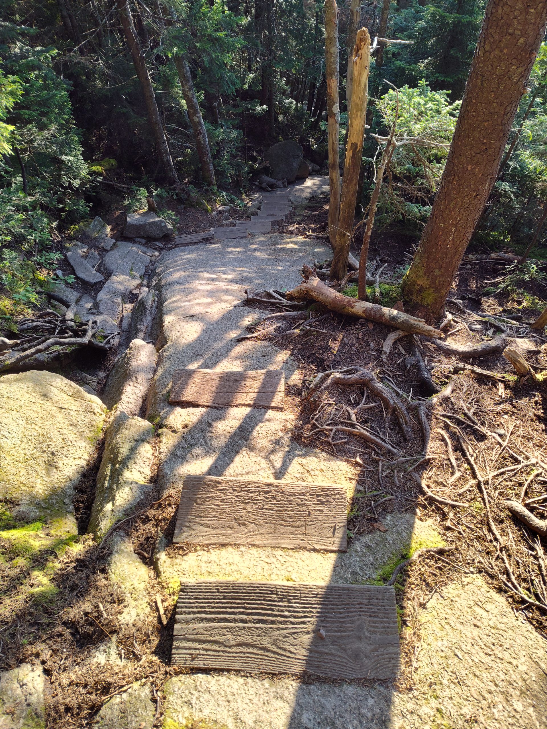
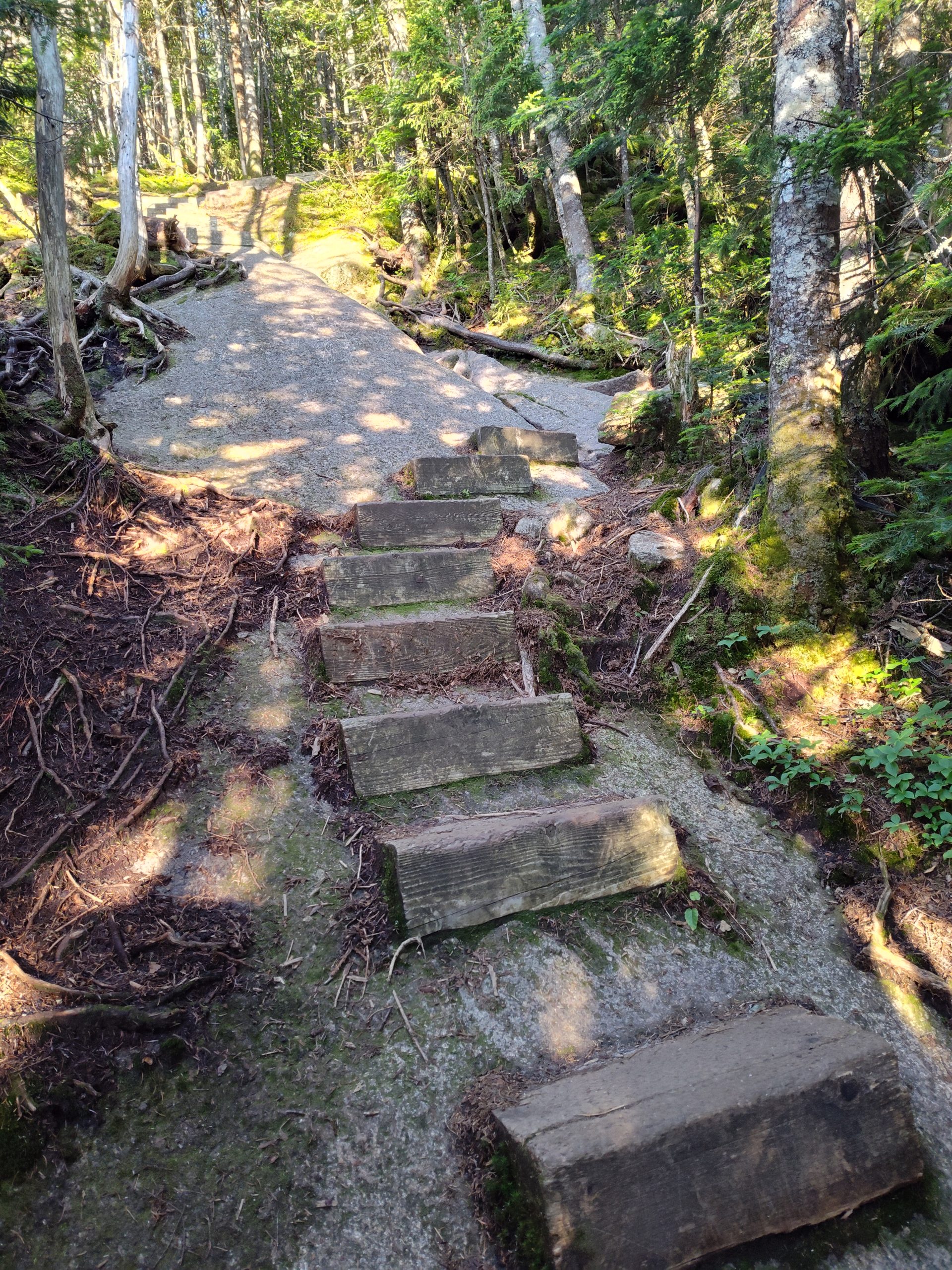
The Whites So Far
So far in the Whites the climb up Moosilaki mountain from Kinsman Notch to the Alpine zone maybe two three miles was a tough climb going south. Then after leaving the Alpine zone a couple of miles climbing down southbound off of the Mountain was tough. Coming up from Kinsman Notch was really tough after leaving Eliza Brook. There was some very difficult rock climbing for a a mile or so before reaching South Kinsman Mountain. That was very slow and I was very happy to see the shelter yesterday evening.
Zero?
I felt bad about taking a zero tomorrow especially since it’s only 5 miles down to a pickup point today. But there is rain in the forecast for tomorrow and I definitely don’t want to be climbing around on some of these rock faces like we were climbing on yesterday evening if it’s wet and raining and storming plus I don’t want to be up on Franconia Ridge during a storm.
So I’ll have the rest of the day and all of tomorrow to rest up. It’s probably a good thing because I have been pushing hard since Great Barrington especially since I left Knockerz at the Cookie Lady house. I pushed hard through Vermont.
My Food Bag
Got an early start this morning at 6:15. There was no need to rush today so I will just take it easy.
My pack is really light. It’s totally due to the food.
I purposely packed light with my food. Most of the Sobos I talked to carried anywhere from two to four days worth of food through the Whites. They all said you could get some food at the huts which really made it easier on the food carry.
I am really glad that I had a light pack because I needed the extra energy to get through some of those difficult climbs yesterday. However I really don’t want to eat the food that’s in my pack.
I was so hungry last night I ate two wraps that had cheese and meat sticks in them. And then I was still hungry I ate another wrap with peanut butter and honey. I also sprinkled in chilicheese Fritos in all my wraps. I didn’t eat much on the hike yesterday other than the snacks that I had put in my belt pockets to carry me through the hike. Last night with all that food I put in my belly, stomach acids were coming up in my throat.
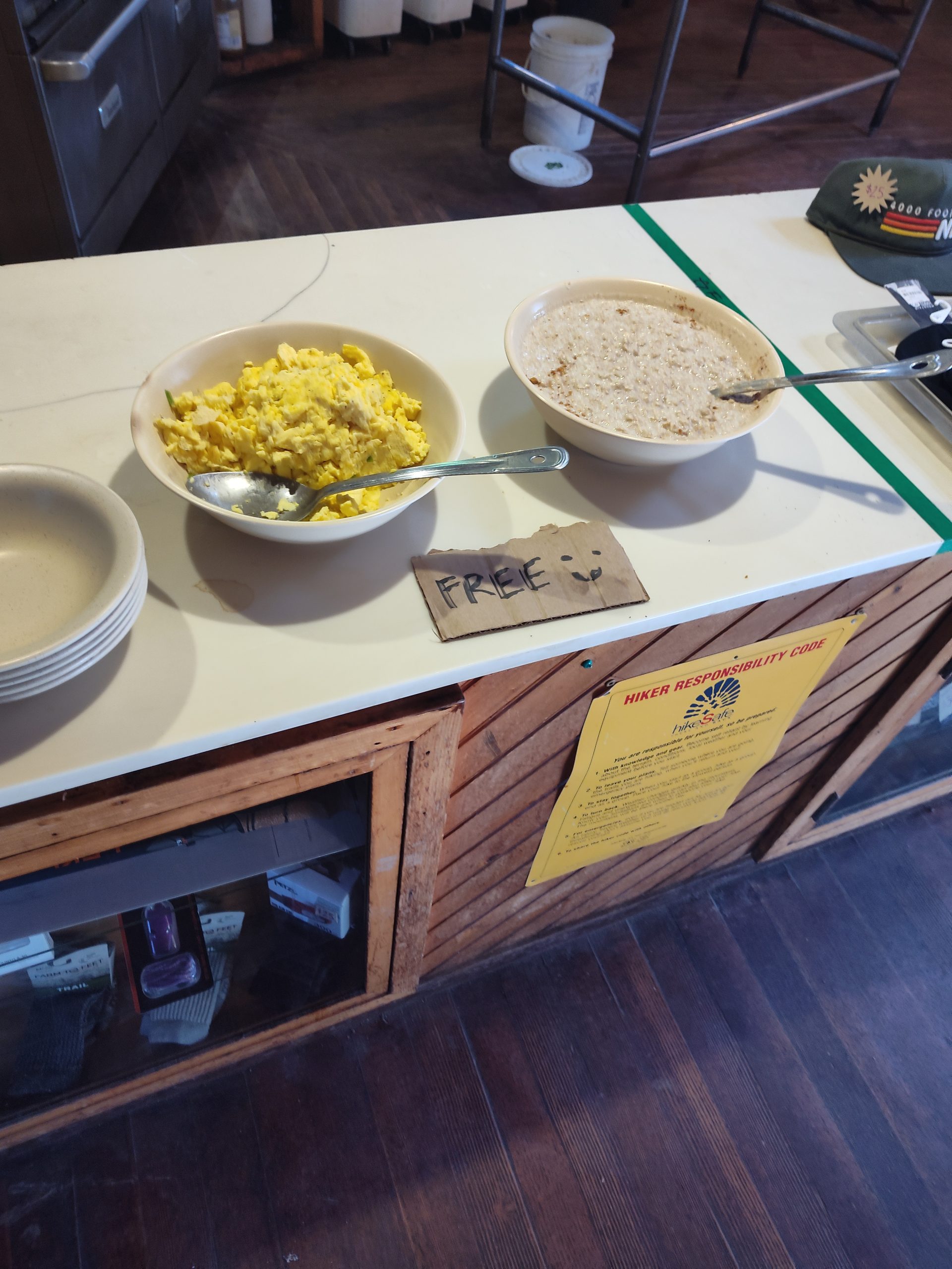
Free Breakfast
This morning there wasn’t anything in my pack I felt like eating so I made a Carnation instant breakfast and coffee shake and downed it real quick. I’m hoping I can grab something at the hut in just a little while.
The hike down to the Lonesome Lake hut was a little technical at first but not too bad. I stopped and at the hut a little after 8:00 which is the ideal time to grab leftover breakfast. I got some free eggs, oatmeal, and some coffee.
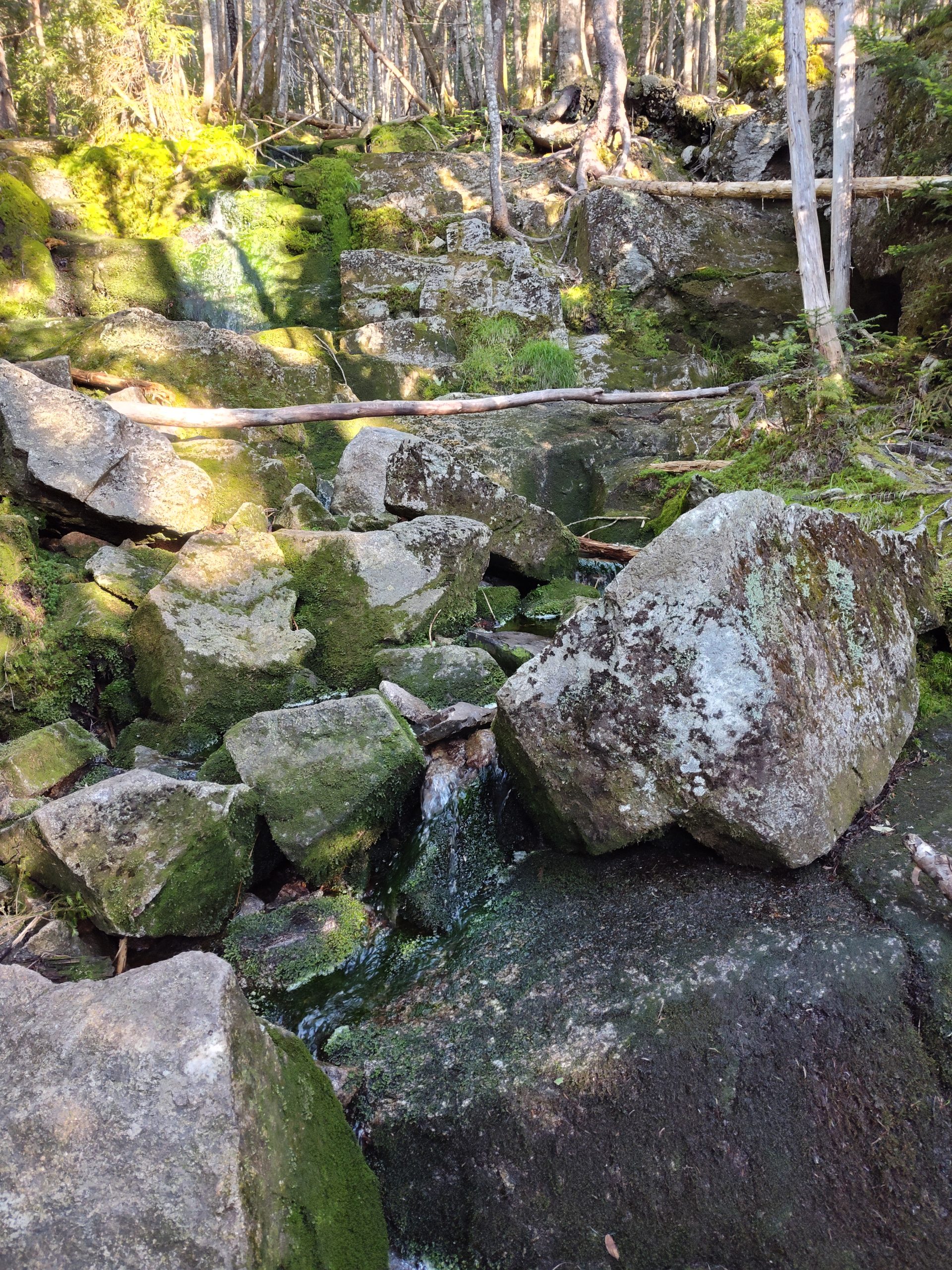
The trail then meandered around and crossed several creeks. The trail continued a nice easy descent down to the Interstate where my shuttle would have picked me up.
Nero, Zero or Hike On
It was only 10:30. I looked at what would be coming up next if I took a nero the rest of today and then a zero tomorrow. I would have to do 5,400 ft of climbing to get to the Garfields Ridge shelter.
I looked at the weather and it looked like there is still a chance of rain tomorrow.
I knew I would be stir crazy sitting around on this beautiful day today. And then sitting around tomorrow when I should be hiking. So I decided to move on to the Liberty Springs campsite only 3 more miles but 2400 feet of climbing. And that will knock off a lot of the climbing I’ll have to do to get to the Garfield shelter. That’ll set me up nicely for the following day to be able to have a nice day up on Franconia Ridge.
Storm Chasing?
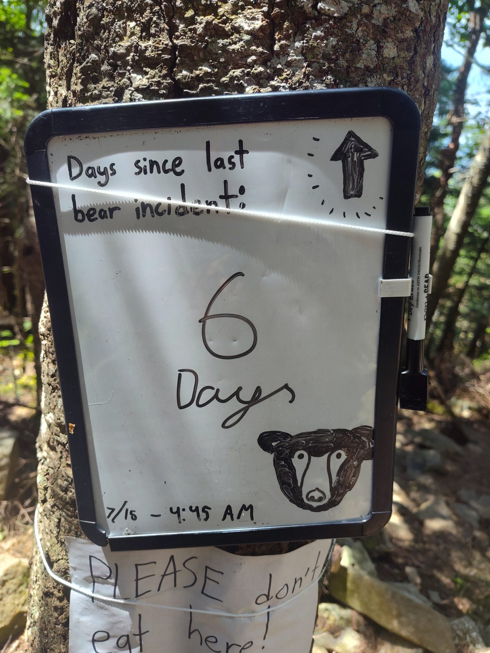
The climb up to the campsite was a continuous grade but nothing technical. The campsite has gotten infamous for a bear that wrecked somebody’s tent apart a few days ago. So we had to be careful about where we eat and store food. Tomorrow we need to get up early so hopefully we can avoid being on the ridge when the storm hits.
This website contains affiliate links, which means The Trek may receive a percentage of any product or service you purchase using the links in the articles or advertisements. The buyer pays the same price as they would otherwise, and your purchase helps to support The Trek’s ongoing goal to serve you quality backpacking advice and information. Thanks for your support!
To learn more, please visit the About This Site page.

I’ve been slacking on my evening writings, and I feel like it’s related to my enthusiasm for this stretch of trail. They say that NOBO hikers get the Virginia blues, and I feel like that has been building in me since we crossed into Connecticut.
We made it about 1/3 of the way on day 49. We got coffee at an overpriced and underwhelming coffee shop, but it was better than cold coffee and oats. We met another hiker named Frickles (short for fried pickles) and chatted with her over our sandwiches.
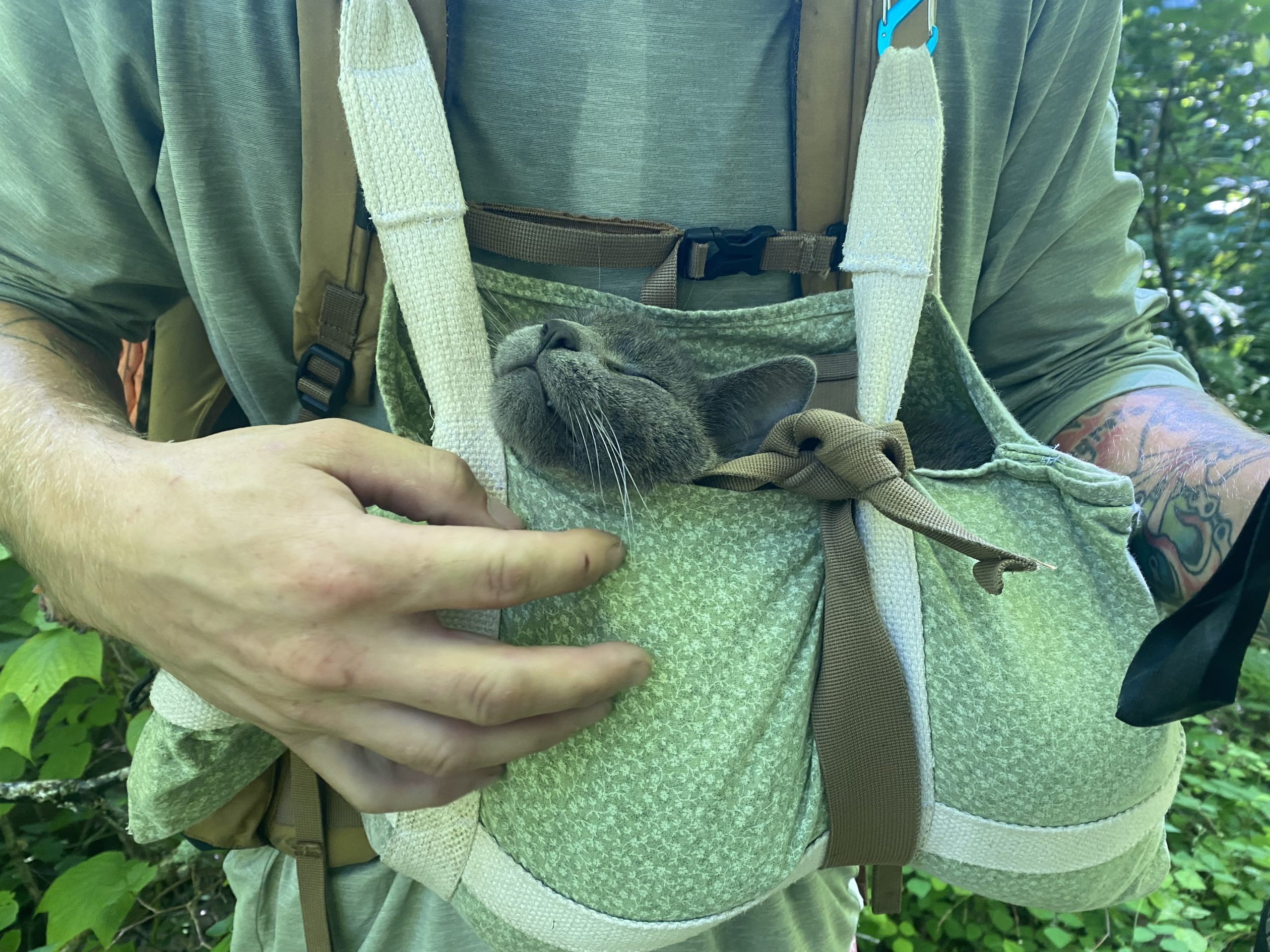
We have officially hit the bubble and crossed paths with so many hikers all day. The most notable being IKEA and his companion Smokie. Smokie is a cat that Ikea found in Tennessee that’s been bonded to him ever since.
The following day, we made it to Pawling, NY. We officially crossed out of Connecticut. There were too many puds to count, and in all honesty, we took a river road walk to avoid some of the worst of them. Hike your own hike, as they say. It made our time in this state all the more enjoyable, and we stayed cool on such a hot and humid day. I’d say that’s a win!
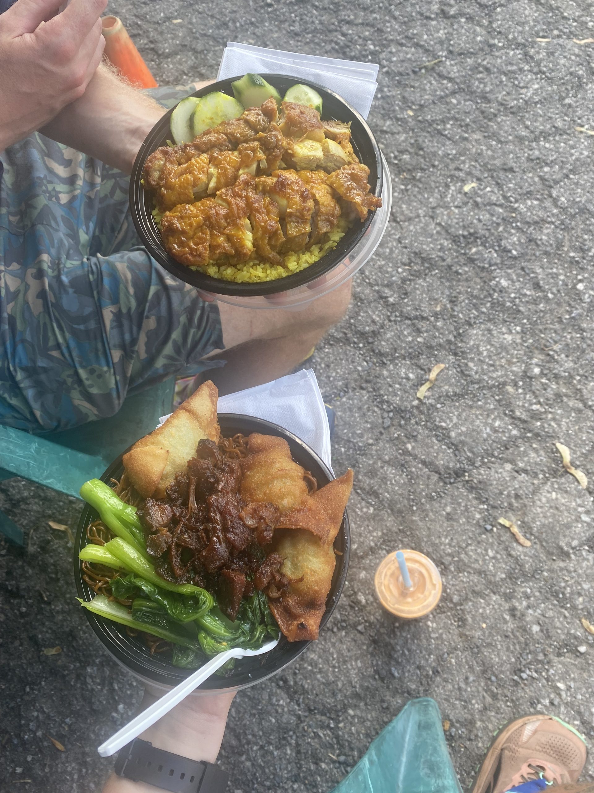
We had the absolute best trail meal yet. DC Malaysian Food was incredible. Nick got a crispy curry chicken, and I got Char Sui. It was a deliciously sweet honey pork over egg noodles, bok choy, and crispy filled wontons. It was another scorcher, so we started with Gatorade and had a Thai bubble tea for dessert.
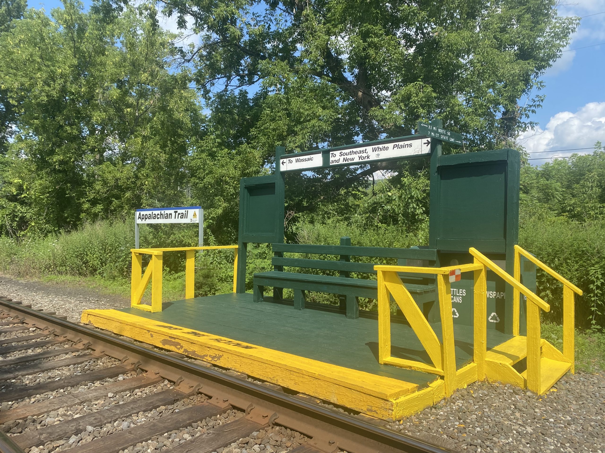
We passed over the train station on the trail. You can catch a commuter train to the city twice a day here!
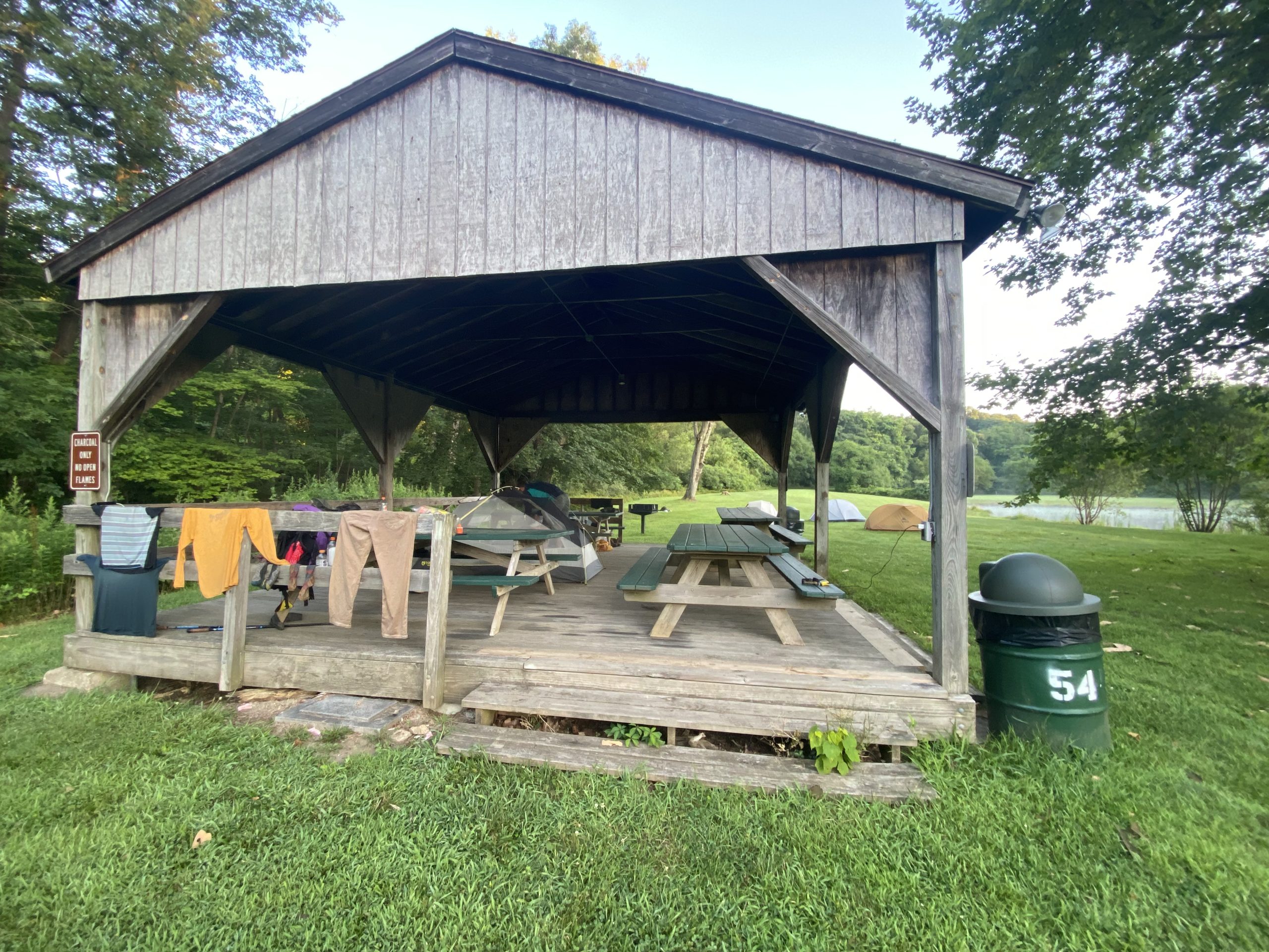
We hitched into the town of Pawling to stay at a Lion’s Club Park. There was a cold outdoor shower and a pavilion that we slept under. In keeping with the overpriced north section, we spent way too much at a CVS resupply. But we need the food, so it is what it is. We aren’t planning to stay in any other hotels or hostels until southern PA or further south, so we will eat the cost.
The next morning, we were picked up by the coolest little truck. We weren’t even hitching at this point; he just stopped and asked if we wanted to hop in the back. Duh!!
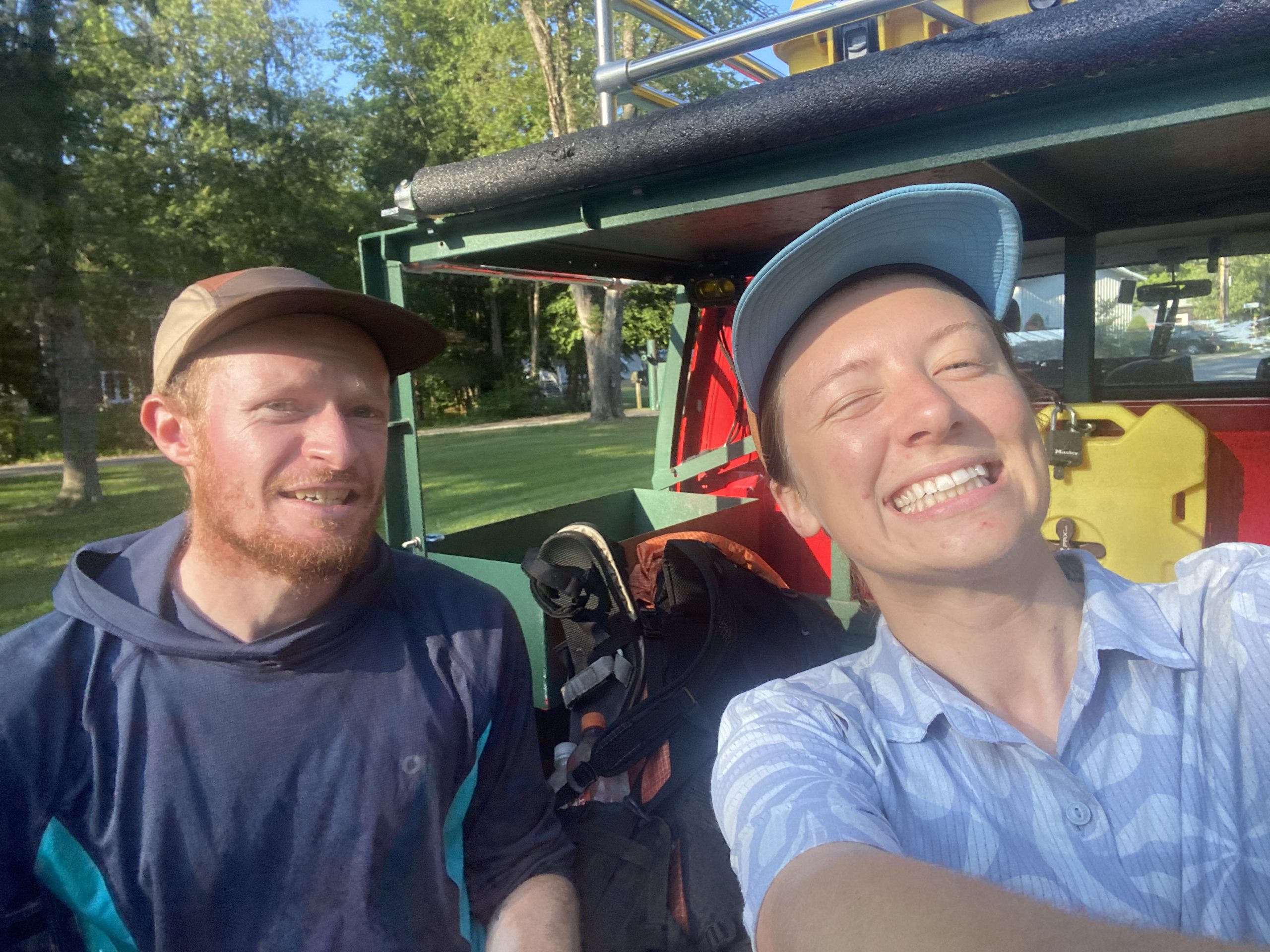
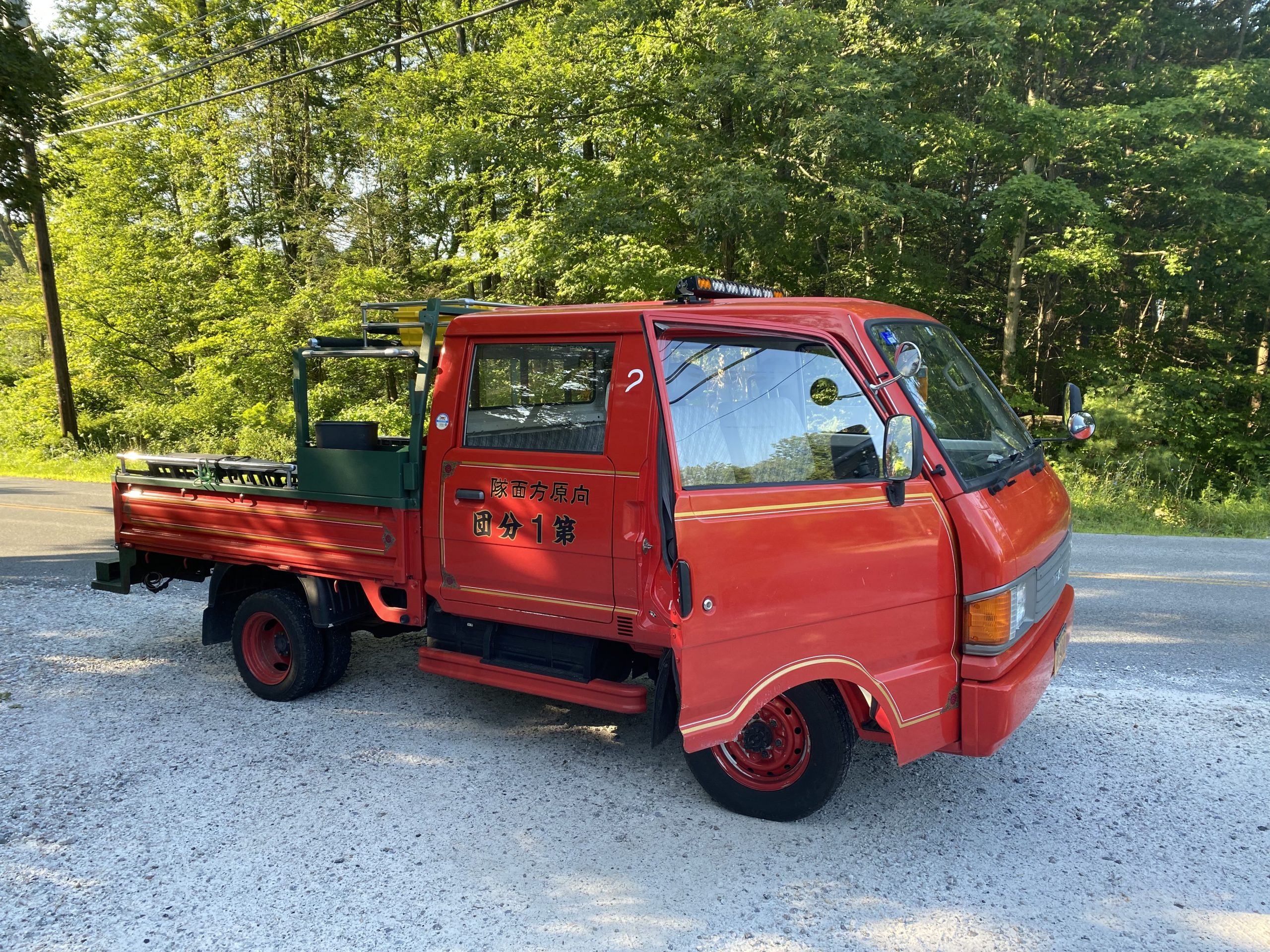
We had some lofty mileage goals to meet up with some of Nick’s friends before Bear Mountain. I was still feeling the residual Connecticut funk, so we scaled the miles back and pushed out our meetup a day.
We summited Shenandoah Mountain. There were power lines and cell towers everywhere. I was sitting facing away from the view, feeling a little sad, when a couple of folks walked up to us and asked if we were thru-hiking. This mom and daughter duo pulled ice pops out of their bag for us as mobile trail magic! Absolutely incredible, and this generosity picked me up in a moment of feeling pretty low.
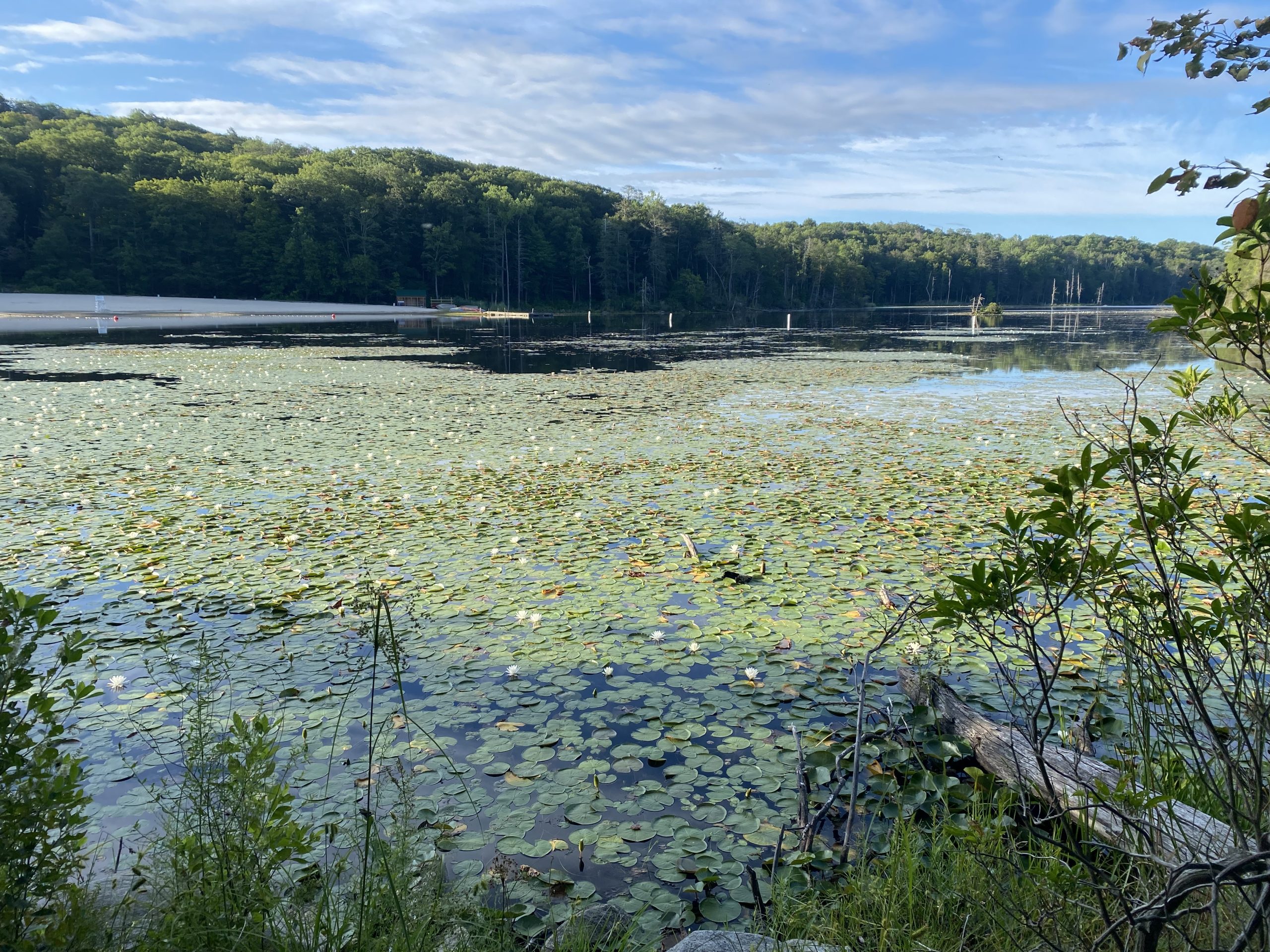
Our camp spot for the night was at Canopus Lake next to a state park. We got ice cream and warm showers and met some other awesome NOBOs.
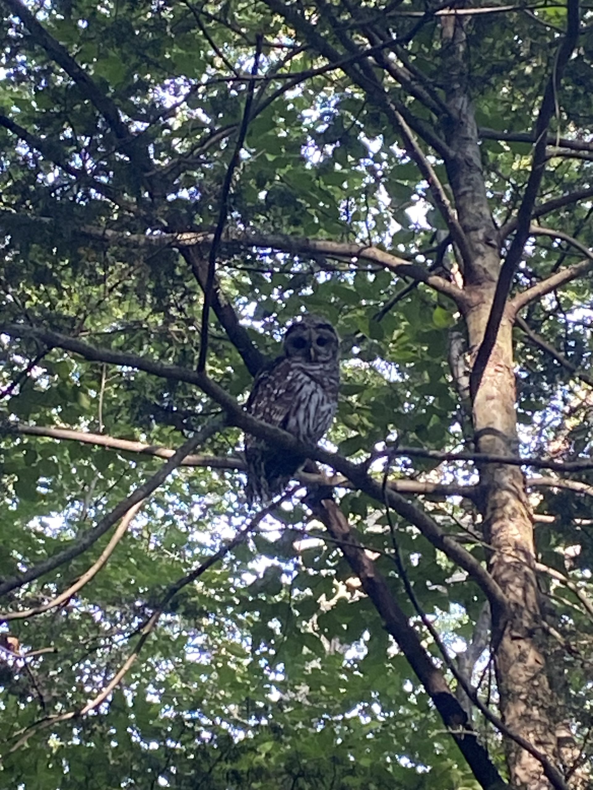
Our walk to meet up with Nick’s friends was all of 3 miles. We got very close to a barred owl, and he didn’t seem to care.
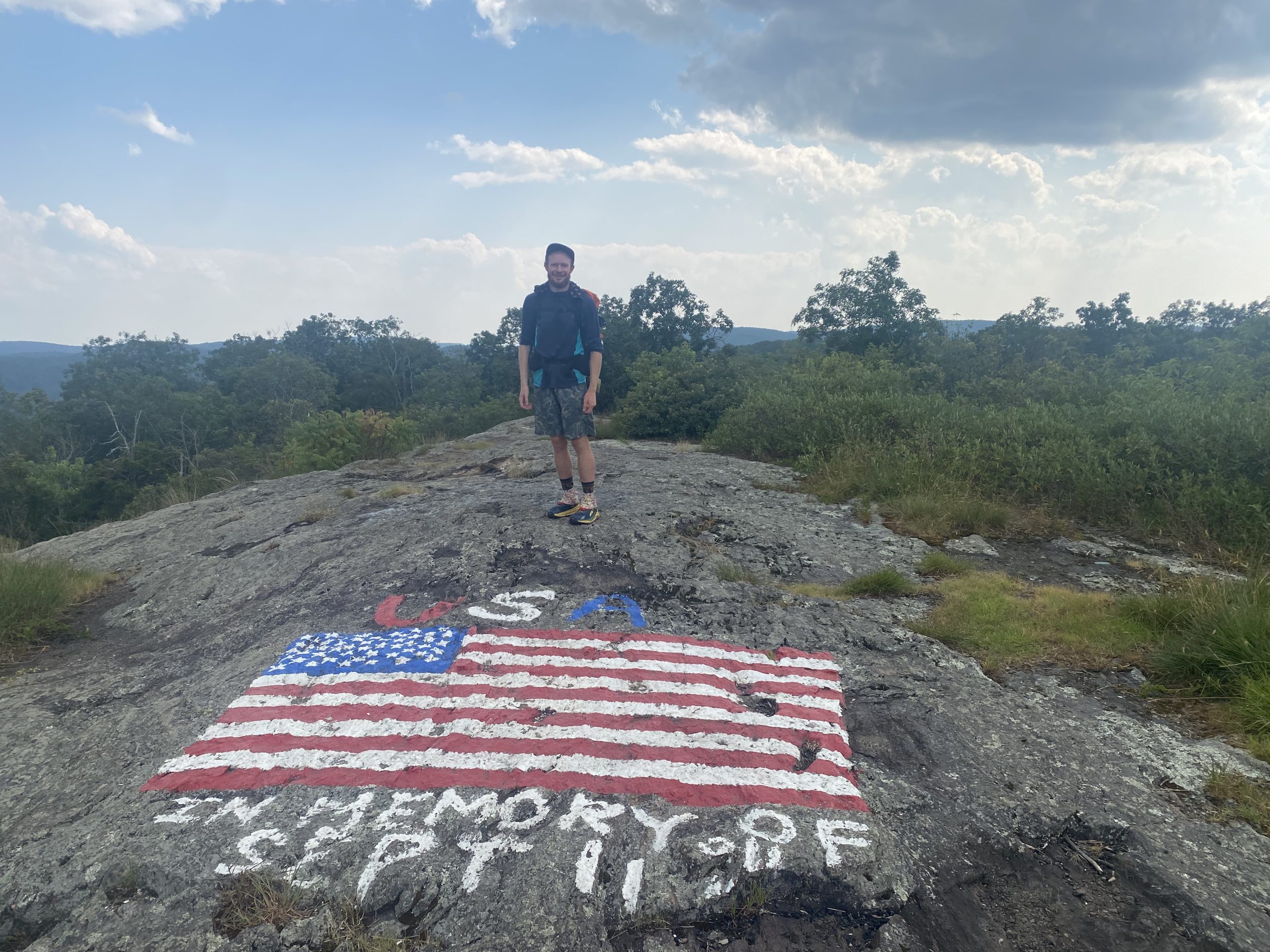
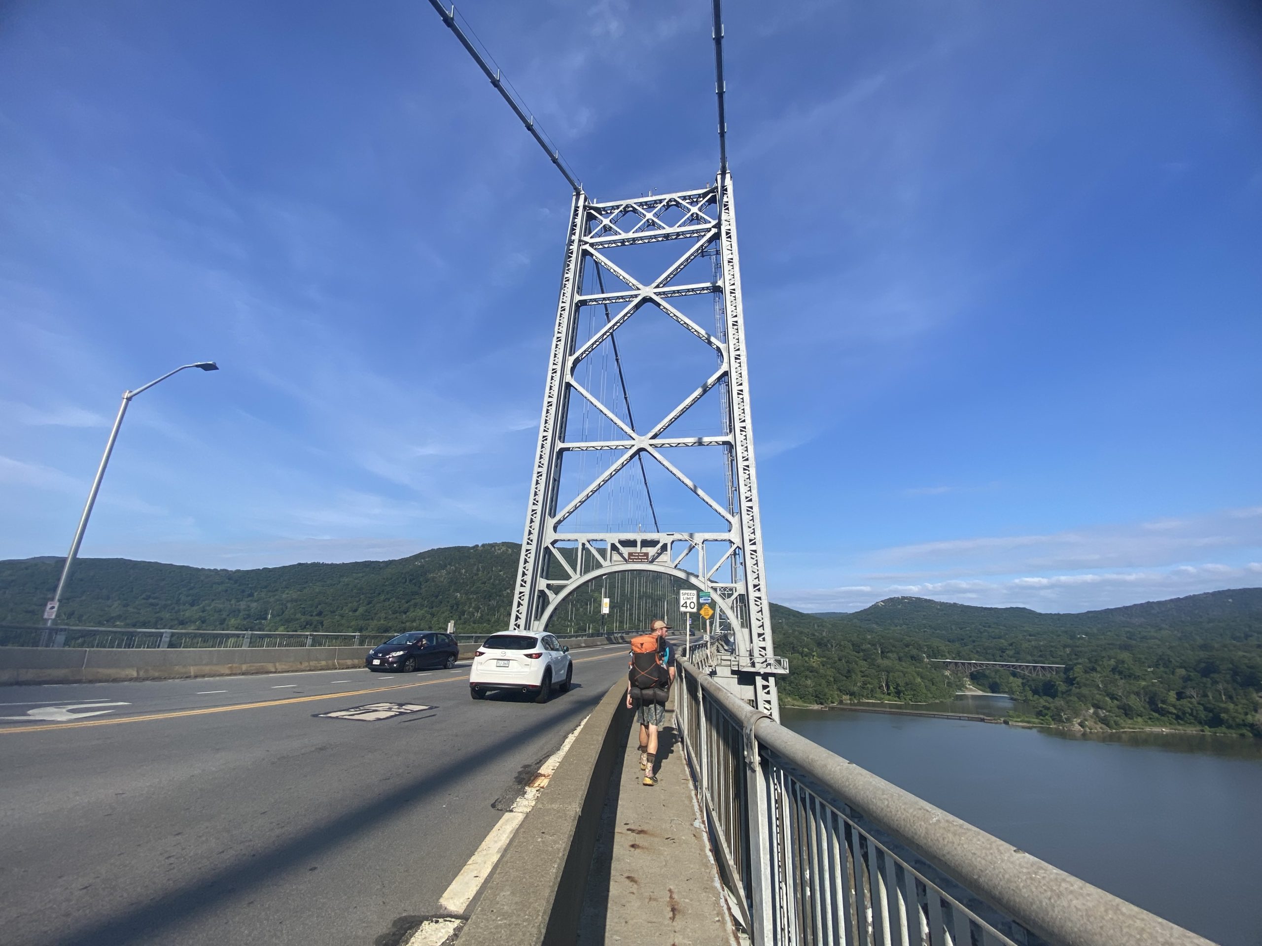
We crossed over Bear Mt Bridge and the Hudson River. Arguably the coolest part of New York yet. Unfortunately, the zoo that the trail goes right through wasn’t open yet, so we missed it. But we had showers and friends waiting for us very soon.
Our day proceeded with catching up with friends, resupplying at Walmart, and finally sending home some gear! I sent my puffy, a foam mat, my bowl and coffee cup, and some clothes. Nick did the same but also threw in the stove. We are officially entering our cold soaking era.
We enjoyed the company of Kayleigh, Dave, and their really sweet 1-year-old daughter, Juniper, for the first half of the day. Then we headed over to Sam, Matt, and their super cute 9-month-old daughter Juliana’s house for burgers, corn, and zucchini. We slept in a king-sized bed and hopefully got enough rest to keep it up!
I’ll try and get back on the wagon with daily postings. I just needed a little mental health break. It’s hot and I’ve been struggling with morale if I’m all the way honest. I know I’ll bounce back, I just need to rediscover my purpose out here. We are next to highways all the time. The scrubby vegetation is not the most beautiful and immersive woods I’ve ever been in. Thru-hiking just to be in nature all the time when “this” kind of nature isn’t what I want isn’t enough of a reason to keep me enthusiastic about the trail. I’ll get back to you when I bring myself back down to earth 😛
This website contains affiliate links, which means The Trek may receive a percentage of any product or service you purchase using the links in the articles or advertisements. The buyer pays the same price as they would otherwise, and your purchase helps to support The Trek’s ongoing goal to serve you quality backpacking advice and information. Thanks for your support!
To learn more, please visit the About This Site page.
-

 Brand Stories2 weeks ago
Bloom Hotels: A Modern Vision of Hospitality Redefining Travel
-

 Brand Stories1 week ago
CheQin.ai sets a new standard for hotel booking with its AI capabilities: empowering travellers to bargain, choose the best, and book with clarity.
-

 Destinations & Things To Do2 weeks ago
Untouched Destinations: Stunning Hidden Gems You Must Visit
-

 Destinations & Things To Do1 week ago
This Hidden Beach in India Glows at Night-But Only in One Secret Season
-

 AI in Travel2 weeks ago
AI Travel Revolution: Must-Have Guide to the Best Experience
-

 Brand Stories4 weeks ago
Voice AI Startup ElevenLabs Plans to Add Hubs Around the World
-

 Brand Stories3 weeks ago
How Elon Musk’s rogue Grok chatbot became a cautionary AI tale
-

 Asia Travel Pulse4 weeks ago
Looking For Adventure In Asia? Here Are 7 Epic Destinations You Need To Experience At Least Once – Zee News
-

 AI in Travel4 weeks ago
‘Will AI take my job?’ A trip to a Beijing fortune-telling bar to see what lies ahead | China
-

 Brand Stories4 weeks ago
ChatGPT — the last of the great romantics
You must be logged in to post a comment Login