
Destinations & Things To Do
Days 12-14 on the Superior Hiking Trail: The Final Countdown
The title could also include a reference to the day I spent goofing around in Grand Marais, I guess. But that’s not as cool and ominous.
I know this is really late, but everything else in my life has caught up to me. Also, so sorry to make the last day its own post, but I have a lot to say about finishing (and the trail in general) so I think that’ll be its own thing. I know everyone is on the edge of their seats wanting to know if I make it or not. Spoilers: if you’re reading this, it means I got back to civilization long enough to upload it. I’m probably ok. Unless I suffered a one in a million bear attack while in downtown Duluth. You never know.
It’s really starting to sink in that I don’t have too much time left on trail. Grand Marais was always a distant location that I’d get to eventually, a last checkpoint before the final stretch of trail. Now I’m in Grand Marais. I’m at the final stretch.
It really is crazy when I look on my map just how far I’ve travelled. I remember the reverse being true just two weeks ago. I was sitting in the rain, looking at the line of trail I still had to cross and thinking “I’ll never make it”.
Look at me now. I’m certainly a different person than I was back in Duluth, even if only by a little.
Day 12: Grand Marais (and a Fish Festival?)
I woke up, at the last of my food and drank the last of my water. I was running totally on empty, which meant that my food budgeting had been a bit tighter than expected.
The good news was that my 27 mile day paid off. When I woke up at South Bally Creek, I knew I only had around seven miles left into town. That’s light work. I expected to be there by noon.
The bad news was that hiking 27 miles in one day does, in fact, make your legs feel a bit off. Not horrible, but not great either. Needless to say it was a slow morning.
This was not helped by the rapidly deteriorating trail condition on the way in to GM. It was all the things I complained about in my first few posts: muddy, buggy, horribly overgrown. Fortunately, the knowledge that I wouldn’t be hiking through it for more than a couple hours helped me to push on.
There was one section that I’ll shout out for being particularly awful, where the ground looked solid but was actually peat (I think, or maybe just mud) over shin deep water. Both my poles hit solid ground, but my boot went straight. Soaked immediately.
Once again, though, the knowledge that I’d be done soon made the wet boot easy to just ignore.
Fortunately, the final section of the trail was an incredibly long and quite steep boardwalk down the mountain. No mud, and no slowly picking over rocks. After that, I road walked about a mile and a half into town. I tried hitching at first, but I kinda gave up after ten minutes of being passed. I guess I look too scruffy for the instant hitches I got at the start of the trail. The walk wasn’t bad, either.
The first thing I noticed as I walked into Grand Marais was that it was BUSY. There were lots of people in the streets, which made me think “huh, must just be peak season”. Then I saw the roped off street, the inflatables, the food trucks. There was some kind of festival going on, which was very exciting.
You see, I could care less about street walking (already do it) and inflatables (cool, but I haven’t shaved in too long and kind of look like a creep so I’m not taking my chances on a kids bounce house). Food trucks, however, were awesome news.
I found one that did smoothies, and ordered a smoothie called something weird like “Loon Passion”. It had mangoes and bananas and was ice cold. I’ve done nothing but crave cold drinks (I’ve ranted about this before) and this smoothie hit the spot so well that I drank it in one go. I don’t think my lips left the straw once.
After instantly deleting $8 (kinda pricy for a medium smoothie, but it was good so I’ll let it slide) I moved on to my next target: Hungry Hippie Tacos. I’d heard about it when I passed through Grand Marais on my way to Duluth, and being both hungry and a hippie it seemed like a good fit.
I ordered something with chipotle cream and pulled pork. The taco was larger than my whole hand (and I have big hands). Plus, it was fried. It was amazing. No complaints.
The real winner of the Hungry Hippie, however, was the medium (but infinite refill) fountain drink I got. They had coke products, I sat right next to the fountain. I would pound my drink before immediately refilling it. I kid you not, I must’ve drank at least two liters of red gatorade. It tasted like the nectar of the Gods.
I read in a textbook once about Alexander the Great and his army marching across the Sahara. They had little water or food, and when they finally got to the city they were headed to (Alexandria? It’s been a while) they ate and drank so much that they all became sick, vomiting up most of what they consumed in a vicious cycle.
Now, I got how you could get like that. I could conceptualize being so hungry and thirsty that you eat until you puke. However, I don’t think I truly understood that headspace until I got to Grand Marais, where I proceeded to do exactly the same thing. Between the smoothie I drank in two kinutes, the giant fried taco, and the absurd amount of red gatorade, I felt like I was going to puke. In a good way though, if that’s even possible.
Fortunately I was able to keep it all down, but it was a very slow walk to my campsite. I stayed at the same place I did on the way l ppl down. The campground in GM is almost always fully booked (as far as I could tell, it’s like that all summer) but it has first come first serve camp sites that are cheap enough for me to splurge on them. They are close to the road, but I’m so tired at the end of each day that noise hasn’t really been bothering me.
When I checked in to camp I asked what was going on down town. I didn’t get a. straight answer, but it was something about a fish festival? They did tell me that there would be fireworks later which was exciting.
I pitched my tent, which was actually surprisingly hard. The ground isn’t super deep at the campsite (rocky, too) so it’s hard to really get the stakes deep into it. This is bad, because due to the lack of frame my whole tent relies on the tension form the stakes to stay upright. It’s a trade off that I have to make for the ultralight benefits.
This means that I ended up doing some dumb stuff to make sure my stakes stayed in the ground. This included putting rocks on all the corners, and digging a hole and then rebutting two of the stakes. The end result was a pretty bad pitch, but there were no storms in the forecast so I wasn’t worried.
After sitting down at my site and letting my legs rest (for like three hours. This was no short break) I decided to get up and buy myself some groceries. Grand Marais was large enough to have a decent variety, including a propped outfitter store and a nice co-op grocery. I bought most of my stuff at the co-op, but because it was my last few days on trail I splurged on a couple of the fancy camping meals. I opted for thai curry, because thai curry is generally good.
Other notable puckups from the grocery store: I bought ~4000 calories worth of pop tarts (3 boxes). I picked three different flavors: blueberry, the ol’ reliable, sundae, which is quickly becoming my favorite, and cake batter, which was the one I’d always buy as a kid. When I packed them into my bear vault, I deliberately shuffled them so that I’d never know which one I was grabbing. This system worked out well, keeping things interesting for the rest of the hike.
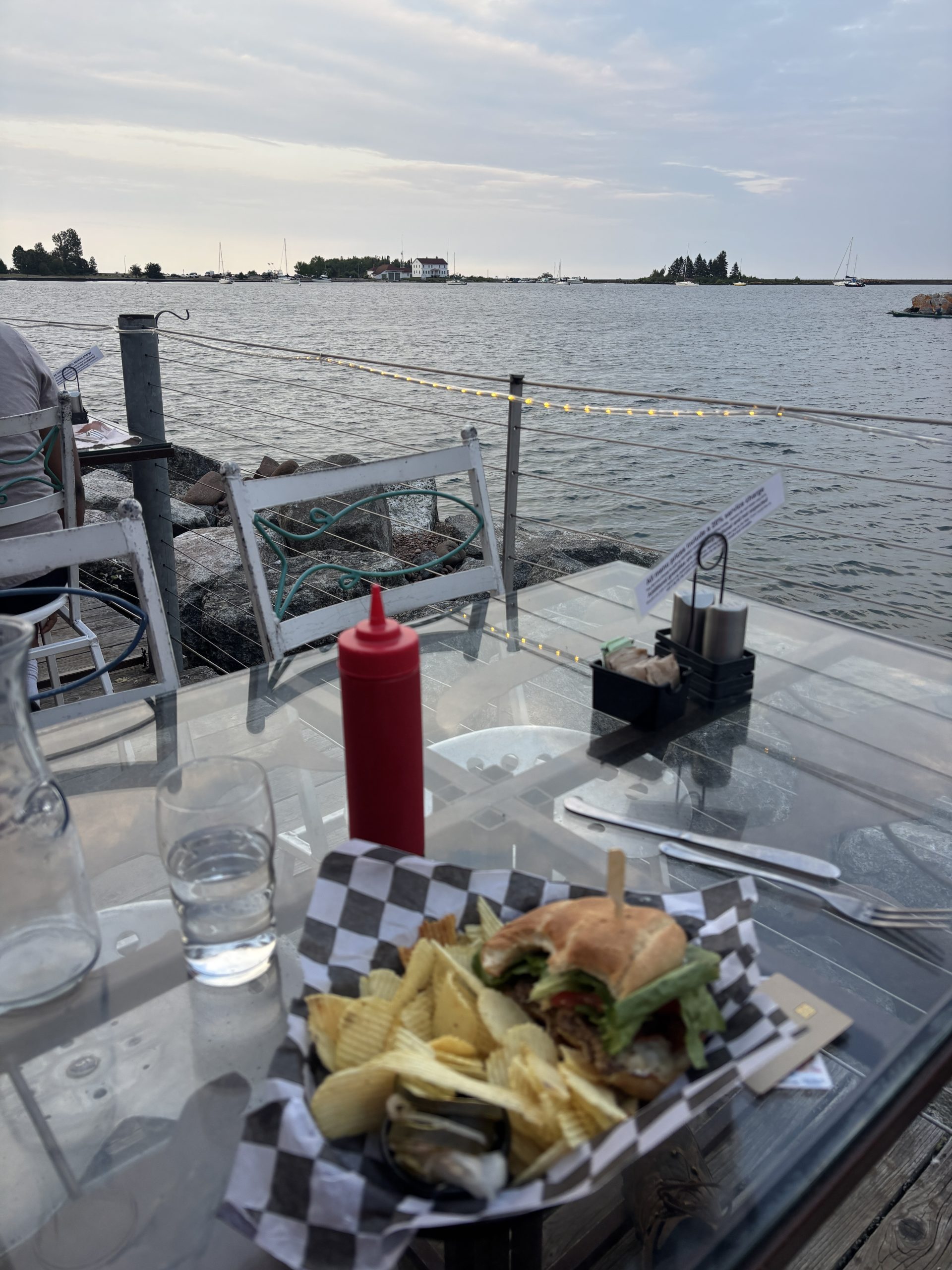
I then grabbed food at the Angry Trout, which is a Grand Marais restaurant that I cannot say enough good things about. They specialize in fish, grilled and fried (I got the fish sandwich). The food is all amazing, and it backs right up to the bay for some amazing views.
A super cool thing is that they make it really clear that you’re not supposed to tip, and that they’ve just raised prices so that they can compensate their waitstaff. It means things are a bit more costly, but knowing that I’m not determining how much my waiter gets paid was worth the extra $4 on the sandwich. There was a section saying that tipping is extra, purely for a good job. I wish I’d taken a photo of the menu where it said that.
After that, I went back to my campsite and lounged around some more (basically the theme of today). I worked on the blog a bit, then it got dark so I ushered down to go watch the fireworks. It was a really solid show, and I should’ve taken some photos of it but I honestly forgot my phone.
I still never figured out what the festival or fireworks was actually about.
As always, I slept like a rock.
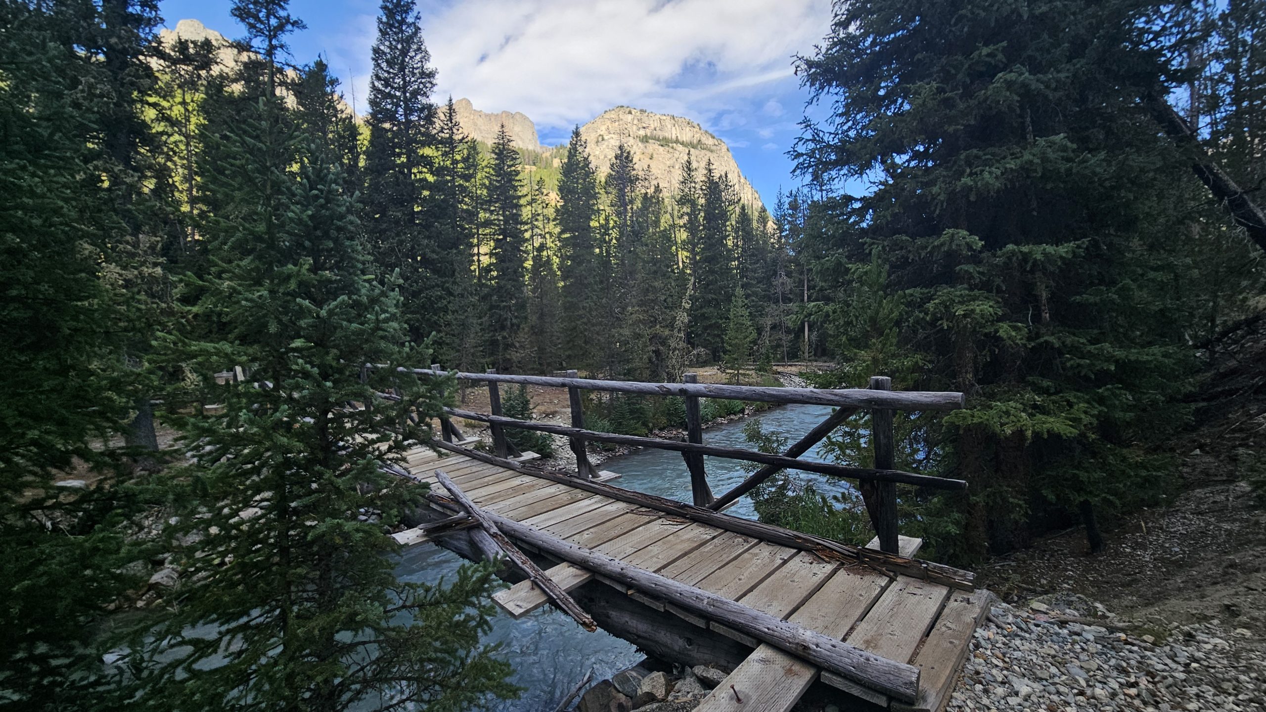
Day 13: My Life is Saved by the Right Bridge Being Down
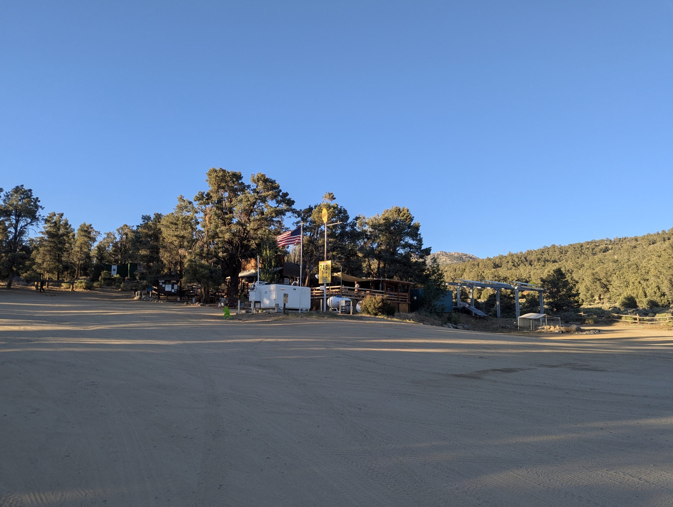
I woke up around 8:20 (like usual) and meandered over to the Java Moose for coffee and to work on my blog a bit. I didn’t love having to stay in town and write, but I was not going to do it while actually on trail so I figured I’d get ahead. Overall pleasant experience, good coffee, congee corner with four bars of cell service and a power outlet.
Leaving Grand Marais was slow, as it often is while I get out of town. My pack is full of food so it’s heavy, and road walks are just my that fun so I’m inclined to go slower.
I did eventually get rolling, though, and almost immediately came upon the Devils Track section of the trail. The bridge was put, but I’d heard from some of the southbound hikers that the river was fordable if needed. I hadn’t done a proper river crossing since Crow Creek (day 3? 4?) so I was excited to try my hand at it.
I got hiking. The “Devils Track” is a river running through a rocky valley (who would have guessed? That’s basically all named locations on the SHT). The water runs fast, to the point where I heard it well before I saw it. This did not fill me with confidence.
Laying eyes on the river made things way worse. It was deeper than just a creek and had several serious waterfall sections. Plus, the banks were steep on either side. If a bridge was out over the track, it meant I would be climbing as well as fording the river. It didn’t help my nerves that trail conditions were pretty poor (tree falls, not overgrown) which meant that very few people had recently come this way.
Still, I started psyching myself up for it. I was going to extend my poles all the way, lean into the flow of the water. I knew all the right steps. I was going to do it, and come out the other side alright. I was really about to do it.
The trail veered towards the river . It was still loud and raging water, so I braced myself for a really bad crossing. Sincerely, the thought went through my head “at least if I drown it’ll be in a pretty spot.”
And boom. There was a bridge.
I was really received, to be honest. Part of me was worried that the bridge was unstable (which is why it was “out”) so I rushed across, thanking the Lord that I didn’t have to try my luck fording.
If I had? 50/50 odds I wouldn’t be writing this blog post right now, if I went through with it. I like to think that I would’ve just gone back i’m and done the detour, but who knows. I was really in the “ford the river or perish trying” state of mind, and it was ~4 miles back to the trailhead. I guess we’ll never know, because I never had to cross.
Once the near death experience was over, I was suddenly more open to the views. Devils Track was incredibly pretty, with sharp rising walls made out of bright red stone and a rushing river beneath. Pines grew sporadically along the ridges. It reminded me a lot of something out of an old western movie, to be honest. I got some great photographs while climbing out of the gorge.
Eventually I get to the downed bridge, but after what I was prepared to do it ended up being nothing. To be honest, scrambling down the slope to the river bed was harder than actually crossing the rocks. No trouble at all.
After that I passed through a number of super cool open meadow areas as I climbed up into the hills again. I also met another thru hiker who said she was from Bristol, England. I was proud to be able to say “Hey! I’ve been there!”
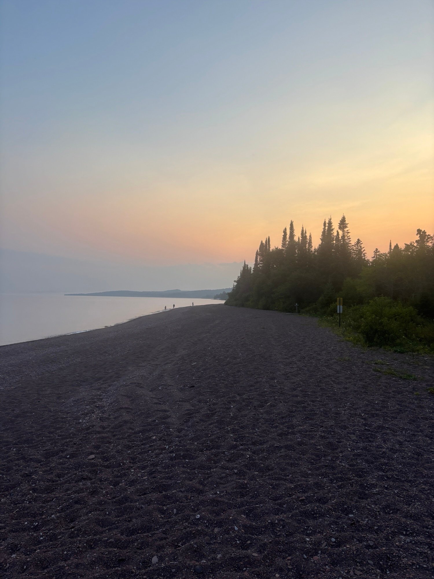
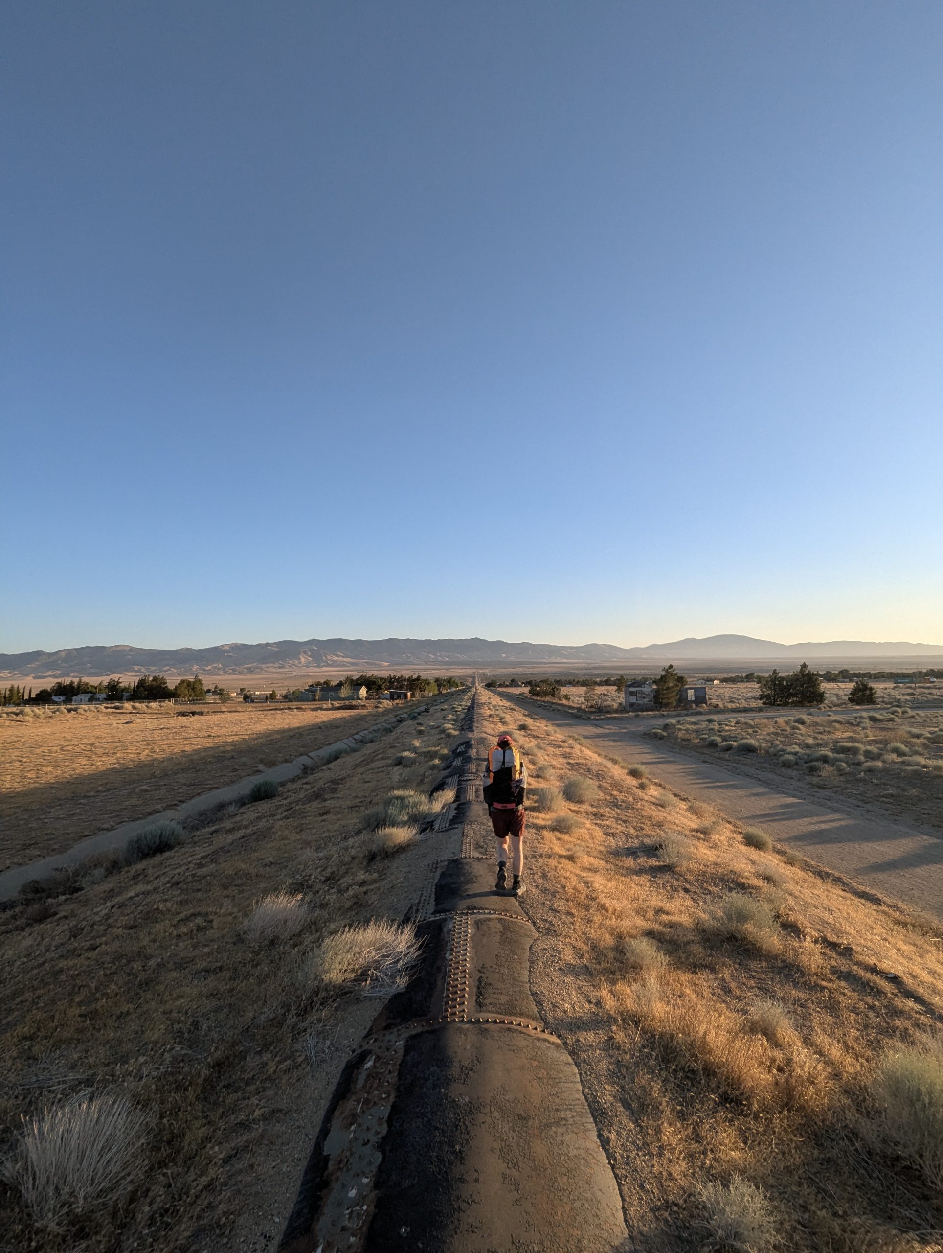
The sun was starting to set, but I knew the lake walk was just up ahead. Fun fact about the SHT: only around a mile and a half are actually on Lake Superior. This is the legendary “Lake Walk,” and I wanted to make sure I hit it at sunset rather than pushing through it in the dark (mostly for the views of the beach).
Before trying to push there, however, I stopped to have dinner. Despite being the most money I paid per calorie this whole trip, the coconut curry was worth it. After 20 minutes of rehydrating it tasted like takeout from a thai place. It was amazing. It paired well with the cake flavored pop tart I ate. Very solid.
After a couple hours of really determined hiking, I did make it to the lake walk just as the sun was setting. The whole thing was surreal; the water gently crashing against the rocks of the beach as mist rolled in off the lake.
It was probably the most solitude I’ve felt all hike, which was weird because I was less than 400m from the highway at all times. As the whole world turned pink it felt like a dream, especially the part right before you wake up where you’re half aware of the real world but not out of the magic quite yet. Truly surreal experience.
The trail eventually turned back inland right as it started to get dark, which was bad for a number of reasons. I still had a few (3ish) miles to go until my campsite, and the darkness meant the bugs were out in force. Also, even though my head lamp is good walking in the dark really ups my chances of falling and breaking something. Thankfully my poles kept me mostly upright, but there were a few close calls. Plus, walking along with just your headlamp lighting up the dark forest makes me feel like the protagonist of a found footage horror movie, which isn’t exactly a pleasant experience.
When I got to camp my problems got worse. 1) all the ground was rocky, which made it not only uncomfortable but also a pain to pitch my tent into (for reasons covered above). 2) the bugs. There were so many mosquitos that the second worst thing about them (after getting bitten) was having to put in mental effort to avoid breathing them in because the cloud was so thick. I would swat four or five at a time when I hit my legs. Awful, but a good motivator to get everything pitched and put away.
Fortunately I slept very well. Some might even describe it as rocklike.
Day 14: The Terrible, Horrible, No Good, Very Bad Second to Last Day on Trail
I started out this day somber and moody. I didn’t want the adventure to be over, and I knew this was my last full day on trail. I was worried that after I got done, everything would go back to normal and I’d lose the high on life feeling I’d been riding all week.
I never thought I’d say this, but thank goodness for the mosquitos. They made me more than ready to be done. But we’re getting ahead of ourselves.
Things didn’t exactly start off as the title of this section describes. It was a cold night, so the bugs chilled out a little bit in the morning. The trail conditions were good, so I made solid time and was at Judge C Magney state park before 11, where I found the new best official state sponsored sign I’ve ever seen.
Magney is smaller than the other state parks, being only one major trail called the Devil’s Kettle. This is a path that runs, you guessed it, along a river and past a really cool set of falls.
To their credit, said falls were probably the best ones on the whole hike. There was a lower one, which included a really cool rocky outcrop beneath where you could do a nice niagara falls spray knockoff. Then, the trail climbed to overlook the upper set of falls that were really spectacular. My phone doesn’t do justice to how massive or how cool they were.
Then, the trail climbed. I had a hiker warn me that coming out of Magney was the worst section on the entire trail because it just kept going up. I don’t think worst is an accurate descriptor (section B for misery, or that first day in the Swatooths if ranking purely on difficulty), but I can see where he got the idea from. It was certainly a long climb (~80% uphill for 5ish miles) if not the absolute steepest. I didn’t mind it tho; higher elevation generally means less bugs which is always good.
This section also featured a road walk, during which I saw a really cool abandoned heating and air truck overgrown by weeds. It was an old timey one, boxy like an ice cream truck. Very cool find.
After that, though… things got bad.
The road walk turned back into the woods and I was instantly reminded of section B. the upside of section B, however, was that it was flat. This was just overgrown.
What’s worse was the bugs. Swamp Gator and a generally relaxed attitude about getting a few bites had been holding off any bug related rage for the most part. That stopped today. There were so many mosquitos and biting flies that I literally couldn’t stop without ten or more landing on me. I couldn’t swat them effectively either, because that would mean slowing down/stopping and that just meant more would get on me. Honestly it was miserable, I shimmied down the trail slapping my legs like a circus monkey in a bad dancing act for almost ten miles.
There was one section where there were no mosquitos, which is a feeling that I’d describe as not quite as good as true love, but a close second. It was a rock that I’m calling the Spider Climb after the obstacle in American Ninja Warrior by the same name. Basically, it’s a big crack in a rock that you have to wedge yourself into and shimmy up. It’s about 6 feet tall and equally deep.
There is a path around it so you’re not technically required to shimmy, but I’m no coward. It was shimmy or nothing. The trick ended up just being throwing all my gear to the top of the rock and then climbing it with my hands free. Very fun, and also no bugs (heavenly). I decided to have dinner there, which was a little bit stressful because I constantly had to make sure things weren’t rolling over the cliff. Worth it, though, because no bugs.
After that it was more of the same. Thick brush, mosquitos, mud, hills. The only good thing was that I was making progress, but the trail was so miserable that it kind of erased that feeling. If every day had been like this I wouldn’t have been able to finish, that’s for sure.
Fortunately there was an unexpected light at the end of the tunnel. I stopped early at the Woodland Caribou Pond Camp (3 miles short of my planned stop) just to get out of the bugs.
Two great things happened. First, the bugs were just kind of… not as bad for some reason? They weren’t around in the same numbers as they had been.
Better still, there were people at the camp. I got to meet Seth and Harrison, two guys who had originally met in the Conservation Corps. They’d also done some volunteer work for the SHT association, so they were able to share some valuable insights into how the trail is maintained.
Apparently, the trail is cleared with chainsaws every spring. Then, crews go through with weed whackers from south to north, clearing the trail section by section. They speculated that the reason things were so tough in the last few miles was because the crews hadn’t gotten that far north yet. They also guessed that section B was bad because it had been whacked so long ago that the plants had time to regrow.
That wasn’t even the craziest part. Apparently, all of the bridges were built by crews of guys hiking in all the lumber on their backs. They said they’d carry some of the larger bits by just creating a rope harness between four guys and walking it in. Some of those bridges were massive, so I can only imagine the effort it must take to build and maintain them.
Knowing how much work went into to the trail made me feel kind of bad for complaining so much about trail conditions, to be honest. The SHT is all volunteers, too. I was just incredibly thankful that so many people had worked just to give me a trail to hike.
Seth and Harrison were just cool people in general, too. They’d done some wildfire fighting during their days with the conservation corps, so they had fascinating stories to share. They were also very generous with their cigarettes and whisky, although I had to tell them no on both counts. I don’t smoke, and while I do drink, with the calories and water levels I’m at, a shot of whisky would probably lay me out.
We stayed up late just talking before I finally headed in to bed. It was a great time, and definitely made a horrible day on trail better. That’s been one of the best parts; just meeting folk while hiking. Everyone is super nice, and everyone has this kind of good vibe to them that must come with doing outdoor hobbies. There have been so many great people that mot everyone has even made the blog. I’m really thankful for how good the community has been.
In Conclusion…
It’s going to be surreal not writing these any more, I have to say. This journey has been amazing. And I’ll definitely miss it when it’s done. I have so, so many thought about the SHT and will be doing one big final blog post detailing it all within the next few days.
Sorry for uploading this so late, the comforts of society have been a real distraction.
Happy Trails!

I woke up around 6, which is fairly normal. I felt fairly alert so it seemed like a good time to get started. I had about 13 miles to Knapsack Col. From what I hear from northbounders, it’s either amazing, beautiful, or very difficult and they would not do it again. It sounds like there’s lots of boulders or a boulder field where most likely trekking poles are of no use and you hop from rock to rock for potentially miles. I could see how this could be arduous or frustrating, but to me it sounds like an adventure. On the Appalachian trail during Mahoosuc Notch, some say the hardest mile of the A.T. I put my trekking poles away and hopped boulder to boulder as it started to rain. Ducking and crawling between giant rocks, scrambling. I make my way through in 45 minutes for a mile. This is considered a quick speed for Mahoosec Notch.
As I pack my things up I notice the mosquitoes from the night before are gone. I openen my bug netting to start packing my bag as I continue to lounge.
First things first, after getting out of my tent, I head off to dig a cat hole, do my business, and grab my food bag from the tree it was tied up to all night. No issues with animals, thank the Lord. One hiker I met, Matcha, told me that a bear was clawing at her bag one night and she decided to pack up and hike a few more miles by headlamp to get away from the Bear. I pray that never happens to me. After packing my things I make one last stop by the river since I’m almost out of water. I mix my coffee/breakfast essentials, take a swig, and I’m good to go. The trail is pretty smooth and follows along a river valley with little ups and downs, some rocks but overall fairly well beaten down.
Flat and smooth
This path is traveled often. Soon I come across a group of at least 10 that are headed out to summit square top mountain. I catch up to them quickly and finally someone says, “Hey, let’s pull over and let this guy pass.” It’s amazing how quick you are as a thru-hiker and don’t even realize it. The water in the river is an aqua color, must be from the minerals or glacier water. There are several crossings with logs and even a few bridges. What luxury! Trails are often kept up much better when they’re this close to a road. At the start of the river valley, there was a campground that can be reached by road. As I neared I saw many RVs and even heard vehicle traffic. This can be somewhat frustrating, but I also understand what a beautiful place this is and possibly it shouldn’t just be limited to those who can get here by foot. It definitely changes things though when you see a parking lot full of cars and you hear the noise of a motor instead of that of a stream or the wind blowing through the leaves of a tree.
Prayer Walk
As I walk, I pray for those that pop into my mind. Those who are praying for me, supporting me, those who have reached out to me with prayer requests, and whoever the spirit leads me to pray for. I pray for myself as well to be a witness and to be able to know and experience Jesus, as well as for strength for the day and a good mindset.
I drink my last bit of coffee breakfast and continue walking past the stream. The great thing about following water for many miles is that you don’t have to worry when you run out. I know that in a mile or 2, there’ll be more water and for now, I’ll enjoy the lighter pack. Water weighs about 2 pounds a liter! That’s a lot!
The miles come quick this morning. Mostly flat and in the forest with coolness still surrounding the valley floor. The trees also provide ample shade. I will most likely get to Knapsack Col Junction around noon and be doing the climb in some of the hotter parts of the day. I did not time this out correctly. Hopefully, we’ll get some clouds and possibly wind to help keep myself cool.
The Junction
I end up arriving to Knapsack Col Junction a little after 11. 13 miles in just over 4 hours! That’s pretty good. I will have plenty of time whether it’s hot or not to get up-and-over the col.
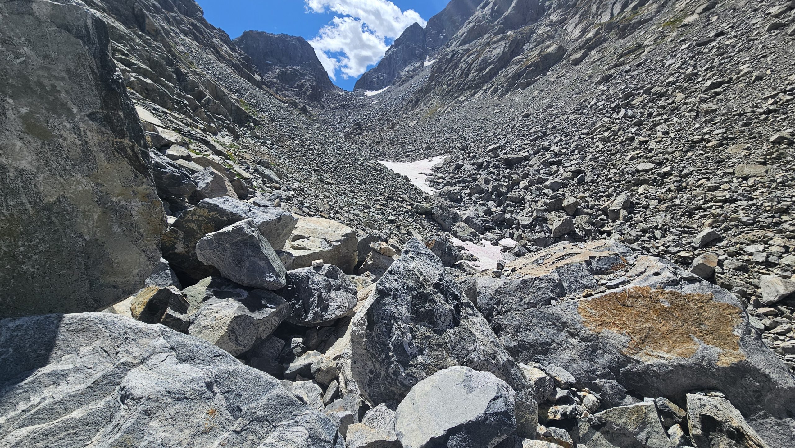
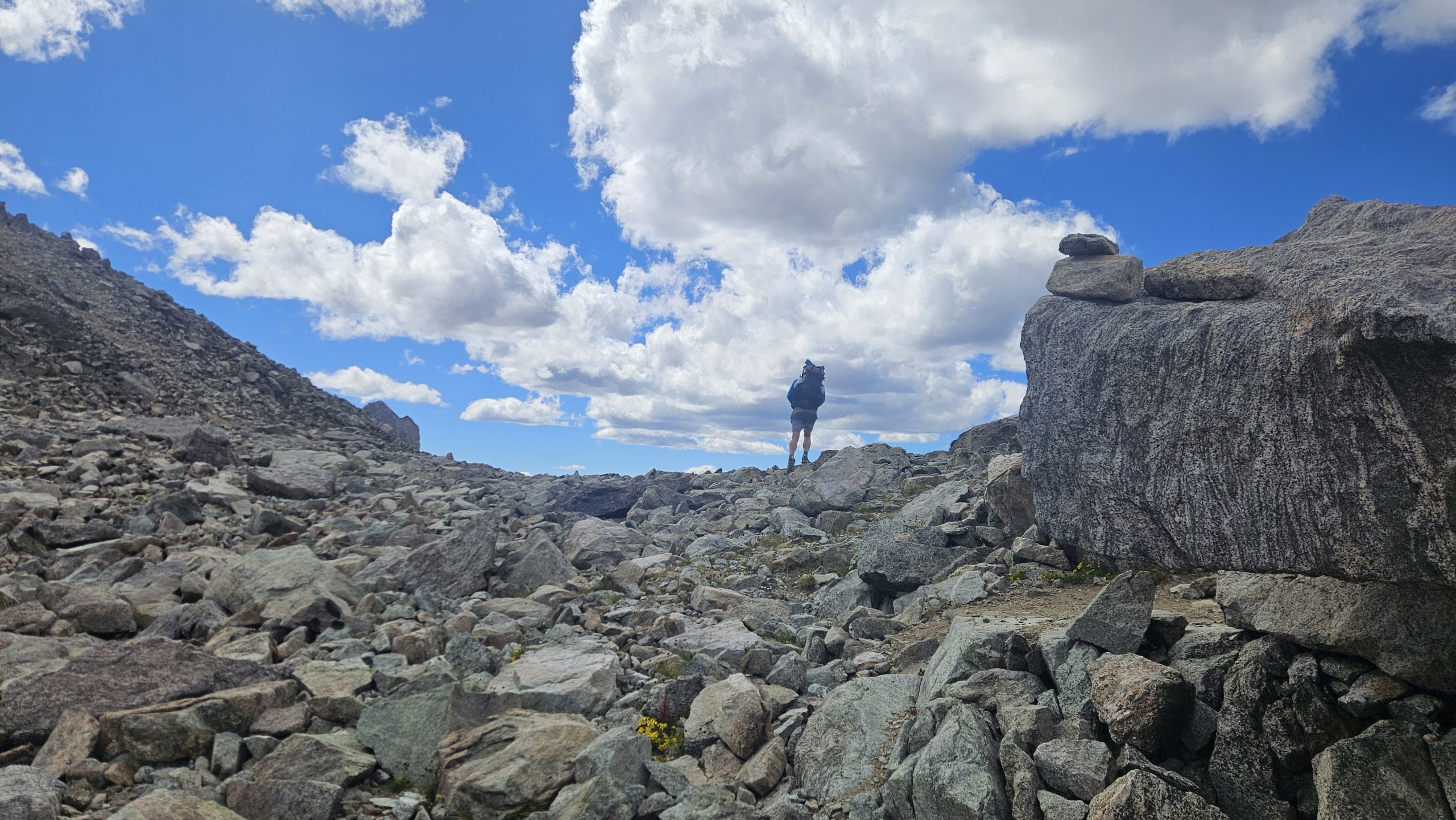
As I start off on the alternate, I’m low on water and luckily find a small stream 1.2 miles. After filtering water and digging through my pack to find the one granola bar that has caffeine in it I set off. I passed some hikers coming down from the col. A group of guys that went over, camped, and came back today. The trail quickly turns to rocks underneath and then to boulders, with cairns to follow the way. Deciding that my trekking poles are more hindrance than good, I stash them on the side of my bag and continue using hands and feet to scramble up, around, and over boulders. Hopping from rock to rock I ascend.
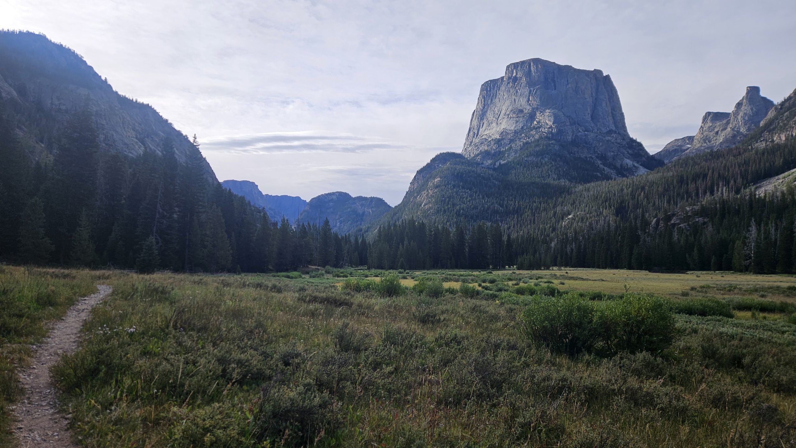
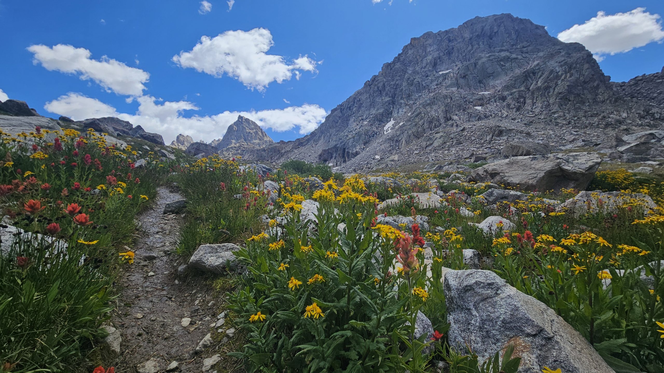
As I near the top of the first part of the climb a small stream trickles across the trail. The mountains open up to my left and I’m greeted with yellow, purple, blue and red wildflowers. Peeks above loom majestically.
Mountain Beauty
As I climb higher there’s a small mountain lake. I’m sure it is freezing and with the wind and clouds I’m not even tempted for a swim. I decided to touch the water and confirm its coldness.
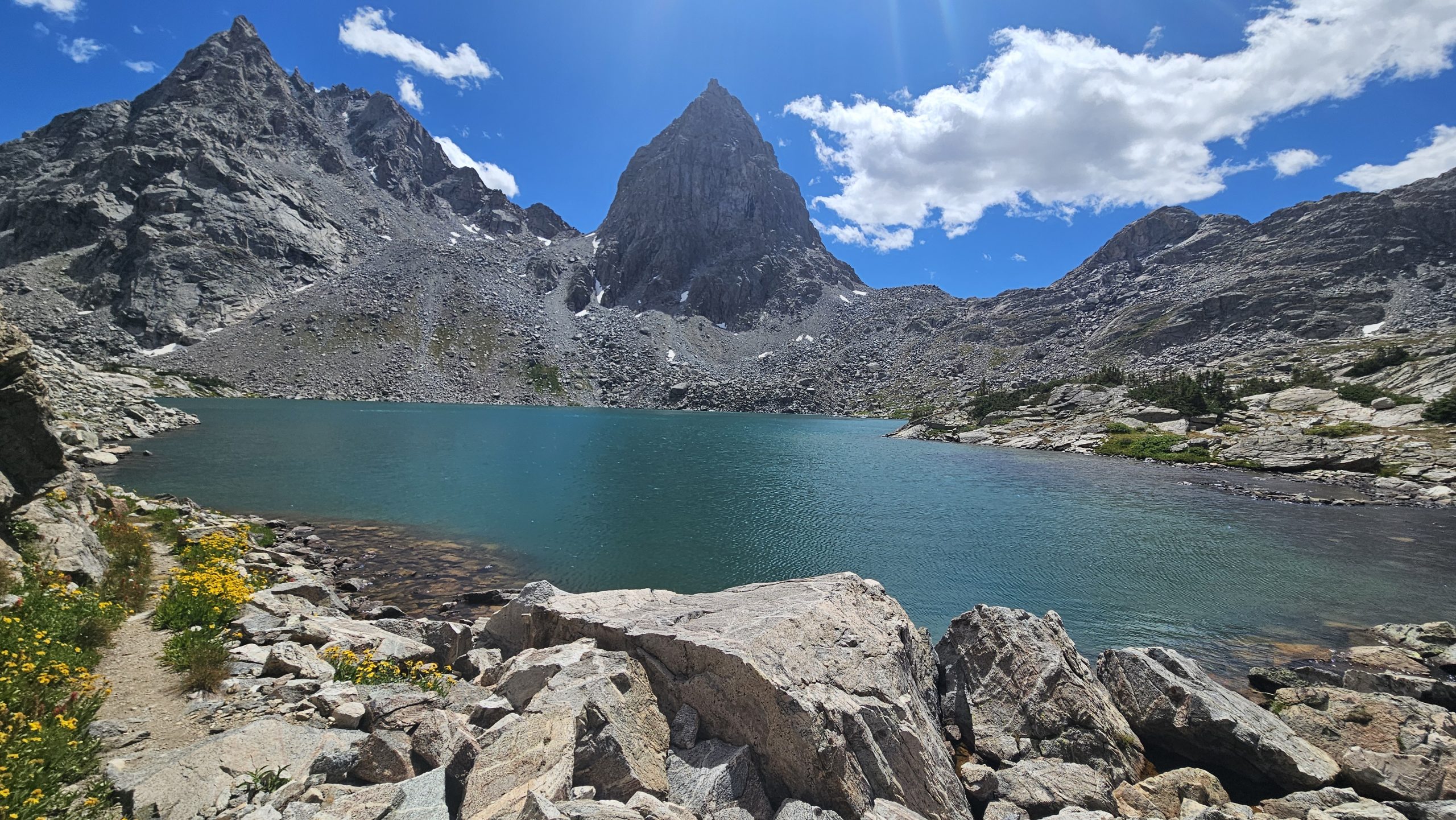
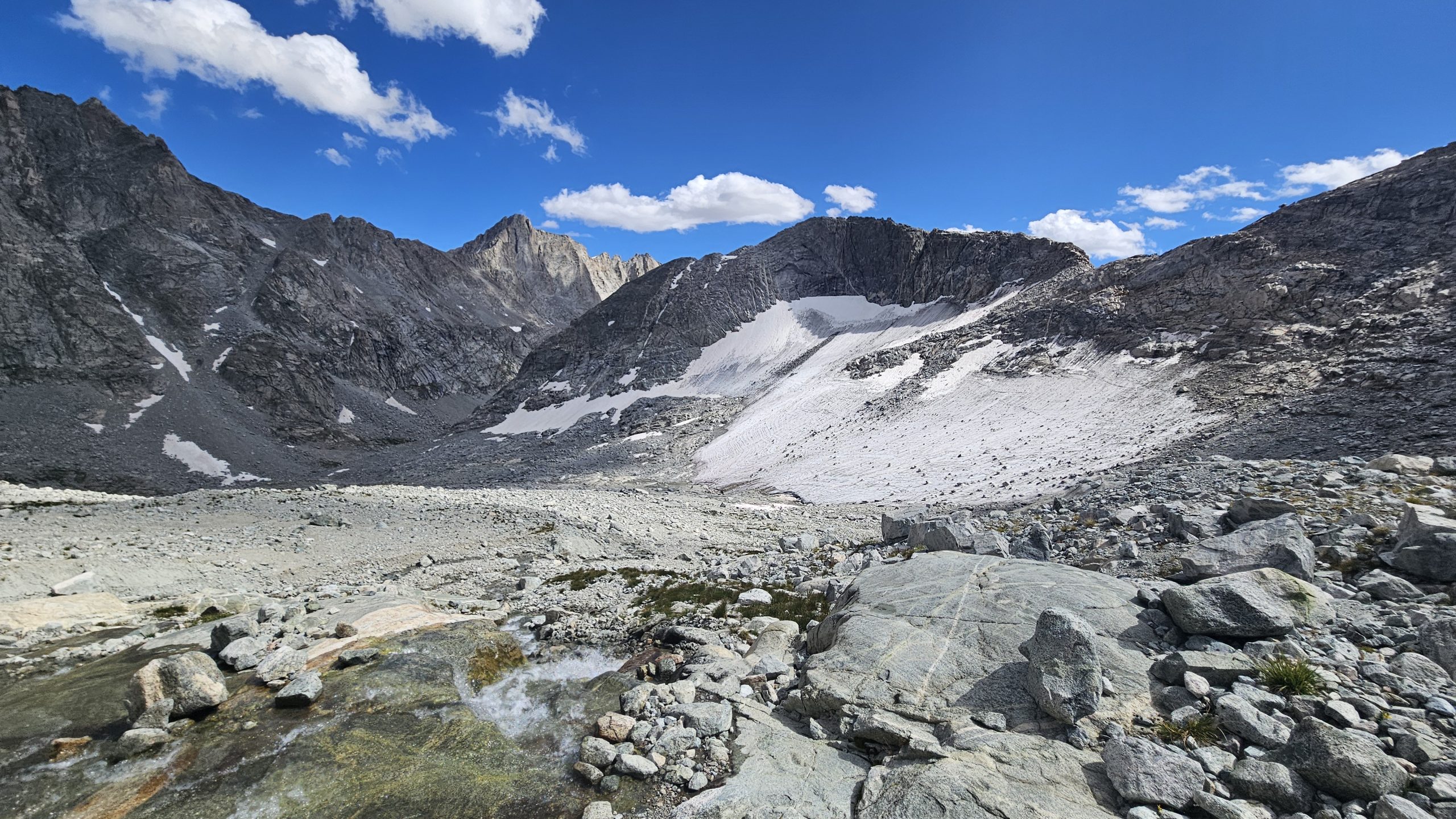
The trail flattens out momentarily before dropping down to another Alpine lake. The color is unreal. A Greenish blue. A stark contrast to its surroundings. Granite rock marked with blotches of green grass and patches of snow still lingering from the winter.
Soon enough, the trail begins upwards yet again.
As I crest a small knoll, suddenly I hear the sound of rushing water. I look up to the right to see a waterfall, beautiful.
What Trail?
After a time of climbing, the rocks and boulders begin again and I ascend rock hopping for a while. Eventually I check my map to see my progress and find that I am off of the trail. Luckily for me, I can loop around the rock structure ahead crossing some snow patches that have pink and red bacteria on them. I find my way back to the trail. It gets steep and real windy. Loose rock crumble beneath my feet as I make my way to the top. I take frequent 5 second breaks to catch my breath and also route check my next steps. As I reach the col I realized I’m off trail by a good 40 feet and I’ve climbed higher than I needed to. I also see a northbounder coming up the opposite side.
I stop, take off my pack, and start eating chips. Coco and I, the northbounder, start talking. He said he tried to follow the line on the map as best as possible and he should have just gone up the valley. He recommends that I just do that. After chatting for 10 or 15 minutes we decide it’s time to continue making miles. We head off in our separate directions, him north and me south. I can see where he came from and that route looks treacherous. I see another one that goes straight down the mountain and I choose that. The route is fine if not steep up until a certain moment where all rocks beneath my feet are loose gravel. My one foot slides as I lean into the mountain. My other foot somewhat sturdy. I ask the Lord for help. I slowly regain footing on semi secure rocks. Other than this brief moment the rest of the way down is good. I didn’t know this but the route I took is the twin glacier route.
I follow a mountain stream/glacier runoff. There’s a large snowfield that probably will never melt this summer.
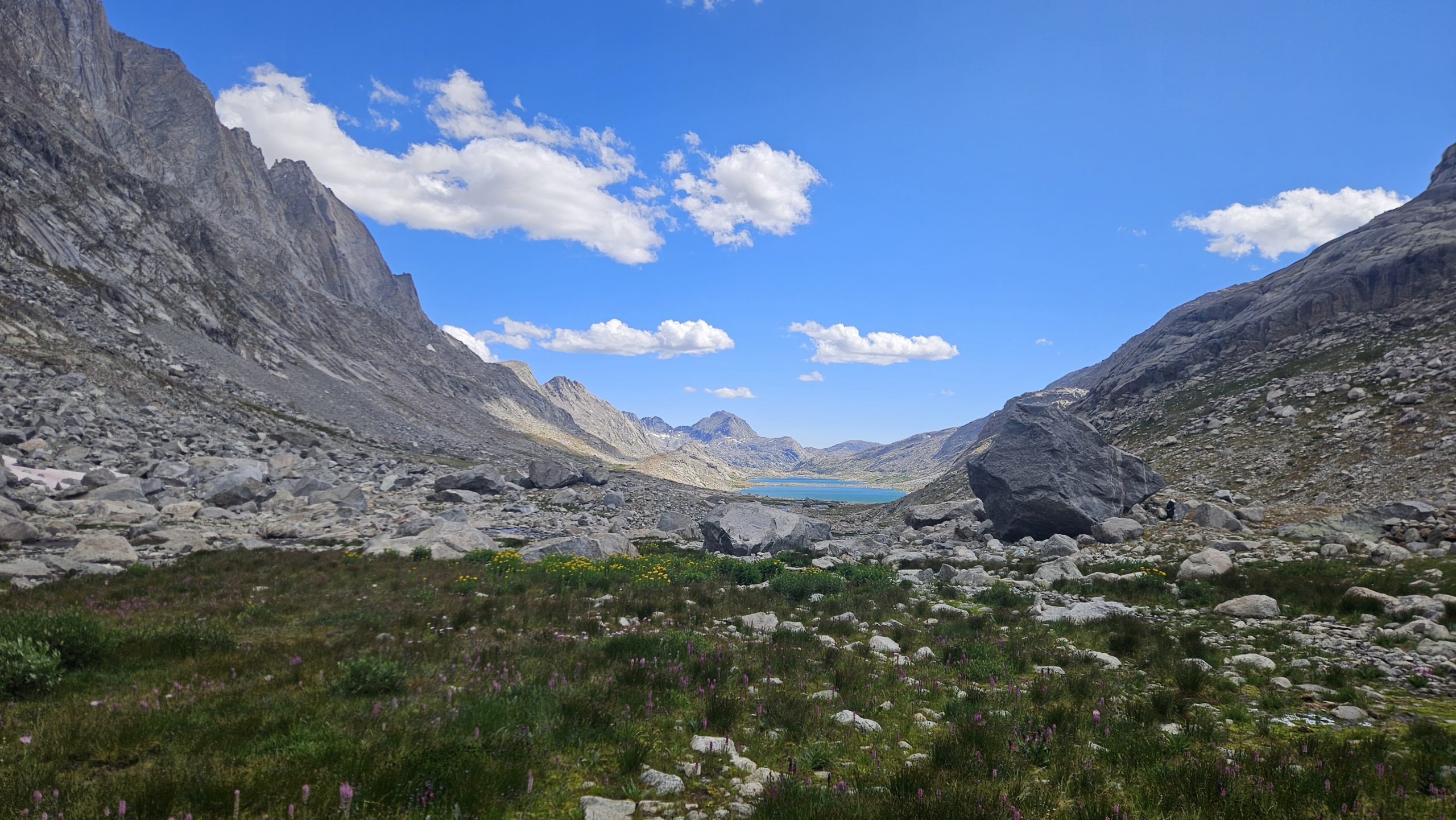
Low Lands
As the trail gradually descends, the wind picks up. I spy several lakes in the distance. The trail will continue to follow alongside these lakes all the way back to the red line of the CDT. There are about 6 or 7 I think. I pass several tents set up with no people in sight. It’s very windy and I don’t think I could pitch my tent here even if I wanted to.
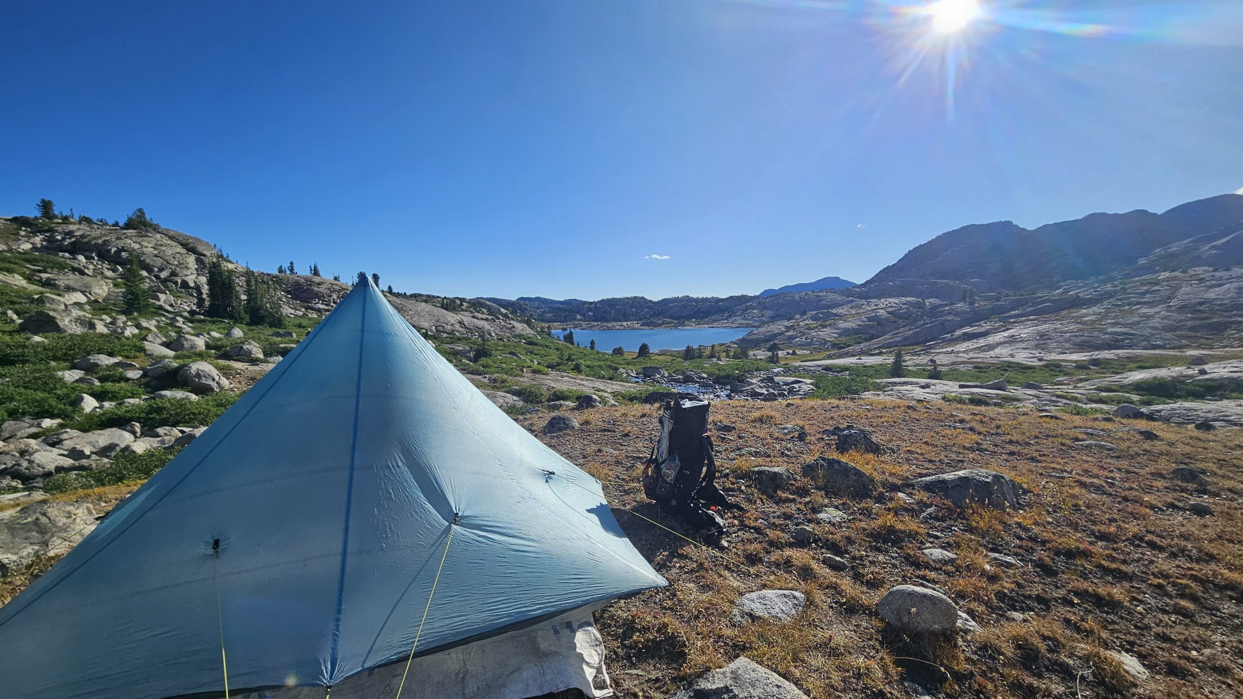
I continue on past the lakes and eventually come to a group of about 6 guys hiking up the mountain. Another hiker comes up with a pack on and ask me about Knapsack Col. He’s a friend of Coco and said he’s just slow. As I think more about how far away town is I debate on stopping early. The thought becomes more and more appealing. As I pass a stream I walk my way up it and talk to a day hiker about some lakes and the pass that he came from. I head off trail and soon find a flat spot with a gorgeous view of a lake bellow surrounded by mountains. It’s a bit windy but the ground seems stable and my stakes go in deep.
Camp
It’s only 6 o’clock, which is pretty early for me to stop, but I figure either hang out here for the evening or just get closer to town to get in early. I don’t feel I need to get into town early tomorrow. In fact I wouldn’t go in at all if I had enough food, but I need to resupply, so I must go into Pinedale.
Even stopping at 6 PM I only have about 12 miles to the trailhead to hitch into town. I should be there before noon, which is plenty of time to resupply and charge things up. There’s a hostel in town that I will most likely stay the night at and head out the next day after a big breakfast of course. Until next time, happy trails.
This website contains affiliate links, which means The Trek may receive a percentage of any product or service you purchase using the links in the articles or advertisements. The buyer pays the same price as they would otherwise, and your purchase helps to support The Trek’s ongoing goal to serve you quality backpacking advice and information. Thanks for your support!
To learn more, please visit the About This Site page.
Big progress was made this week. First, our trail family reassembled looking almost identical to the group we were back in Julian, almost 1250 miles ago! Second, someone que Bon Jovi, because, by some miracle, we are now over halfway through the PCT, closer to Canada than Mexico. Wildfires still hang in the forefront of our minds, but other than evidence of old burns, we continue to evade this threat.
Day 92
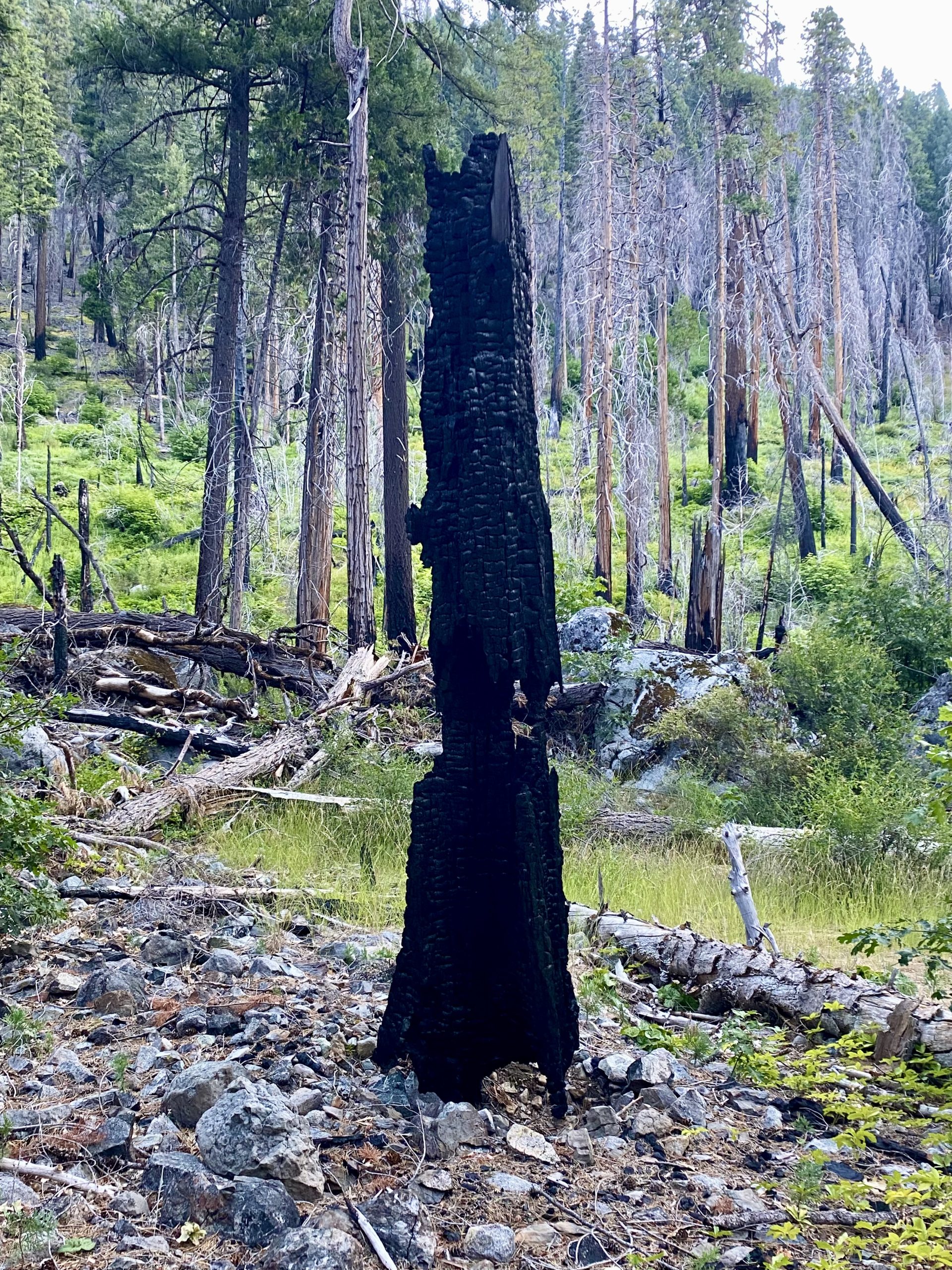
We woke and started the day with a climb, the hazy sky providing views of rolling blue hills. The early sun so low in the sky it reflected in the lakes appearing as silver mirrors. On trail, we moved through burn-scarred areas. Charcoaled trees nothing more than stick figures, but below an abundance of new, thriving life.
Once at the peak of our climb we proceeded downwards and would find ourselves descending 6000ft (1800m) to get to the town of Belden. Dan and I had a package at Caribou Crossing, so we left the others and flagged a ride down the road. The man who picked us up seemed normal enough until a cop car pulled up behind us. Our driver began swearing and calling out his licence would be revoked. At one point, he rolled up the windows and I wondered if he would do a runner if they tried to pull him over. Luckily they never did and we continued into Caribou but I still wonder what he had in the car to make him so jumpy.
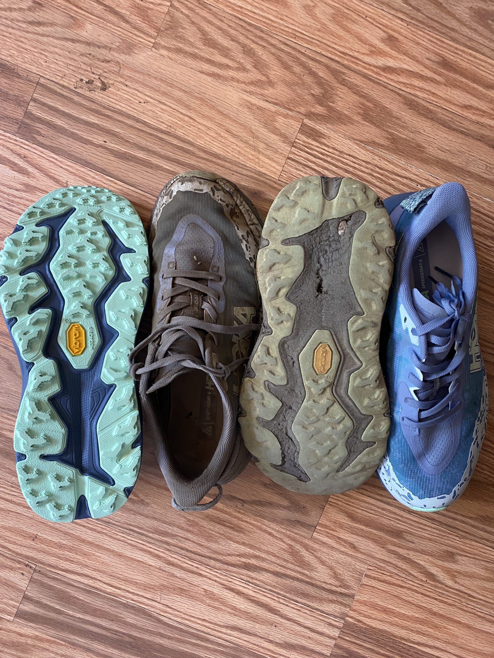
We picked up our resupply and much needed new pair of shoes. The Sierra had been brutal, wrecking our tread to nothing. It was painfully hot, slightly cooler outside in the shade with a breeze than within the sweaty store.
The laundry had taken longer than we anticipated, so by the time we headed back to trail we were an hour behind the others and had a 1.5 mile road walk before we even made it to trail. Daylight was dwindling quickly but despite this, the heat of the day remained. Hot wind licked our faces and the ground seemed to retain a days worth of sun.
The hike out of Belden was brutal, gaining almost 6000 feet (1800m) of elevation over 13.5 miles. We decided to camp 4 miles below the others, making a 2 mile dent in the climb. It was simply too hot, even in the fading light it continued to stifle us.
Day 93
By the time dawn reached us we had already been powering up the mammoth climb for an hour and a half. The path was thick with a mix of ash and mud, the trees leafless, the remaining stumps half blackened, half ghostly white. We would pass through sections dense with felled trees, having to navigate around or over them. It made for difficult walking, particularly as there was no shade and intense heat.
Ten miles in and we entered the Cascades, leaving behind the Sierra. The field we travelled through was rich with green grass and boggy in areas. The change from burnt area to this was sudden. I hadn’t realised the absence of birdsong within the burn until entering the meadow.
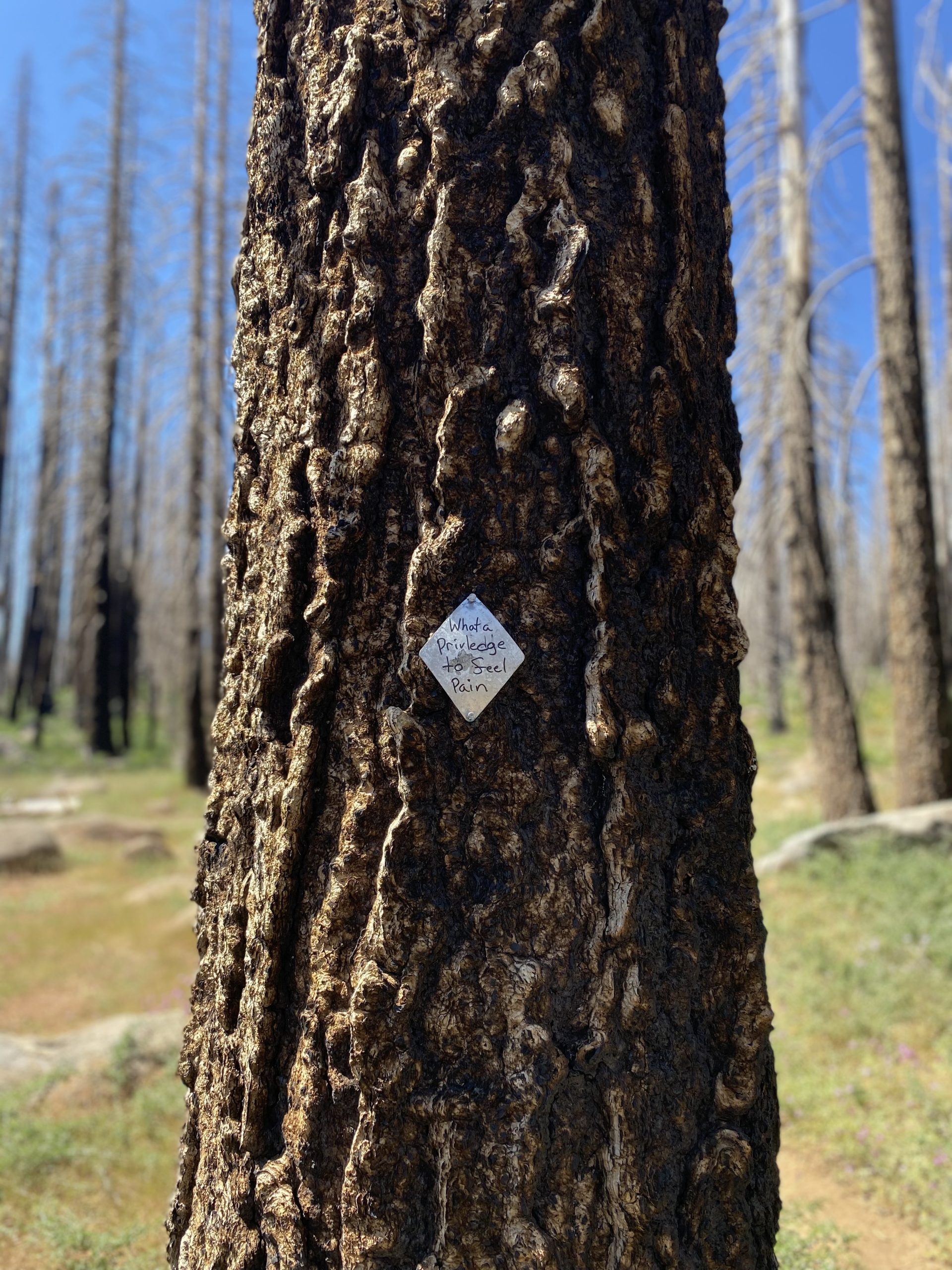
Soon we were back in burn zone, our legs now grey from the combination of dirt and ash. The view from the top of the climb was harrowing. The surrounding peaks appeared brown, their skeletal, bare trees suggesting more fire damage. Seeing how far the devastation spread made the threat feel colossal.
After 16 miles we broke for lunch at a spring and hid in the shade. By this time the trail family were all back together and we had entered living forest again. We spent a couple of hours here, resting and eating. The final 8 miles were fairly easy following undulating trail that trended downwards.
We made camp above Robbers Spring. Water had become sparse again and required a 0.6 mile round trip to replenish our bottles. A lone deer appeared to have a circuit running the perimeter of our camp, judging by the tread marks and the amount of times he encircled us. He would keep us company most of the night!
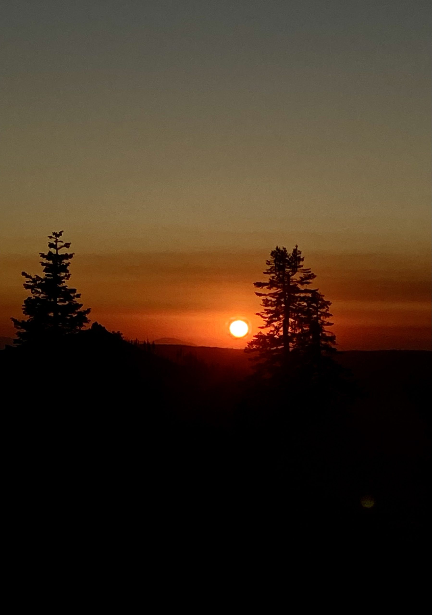
We sat eating on the ridge line of camp watching the sunset light up our surroundings a golden orange. The colour of the sky continued to burn even as we settled into our tents for some much needed sleep.
Day 94
We had planned to leave early, but as my 5am alarm sounded I silenced it, unable to hear anyone else rustling in their tents suggesting we all felt the need for a lie in. It turned out to work in our favour. As an hour later we were just finishing breakfast as Kaleidoscope wandered into camp. They had been a couple of days behind walking with a friend from home, but having smashed out 30 mile days had managed to catch up.
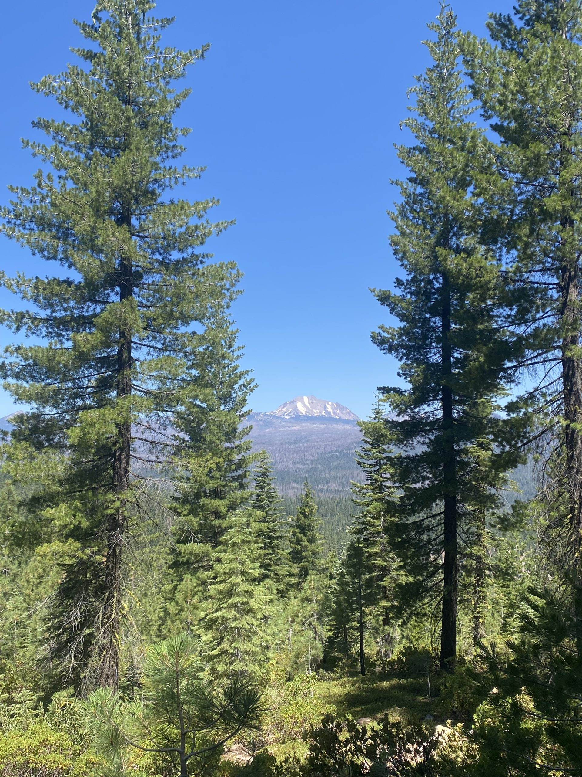
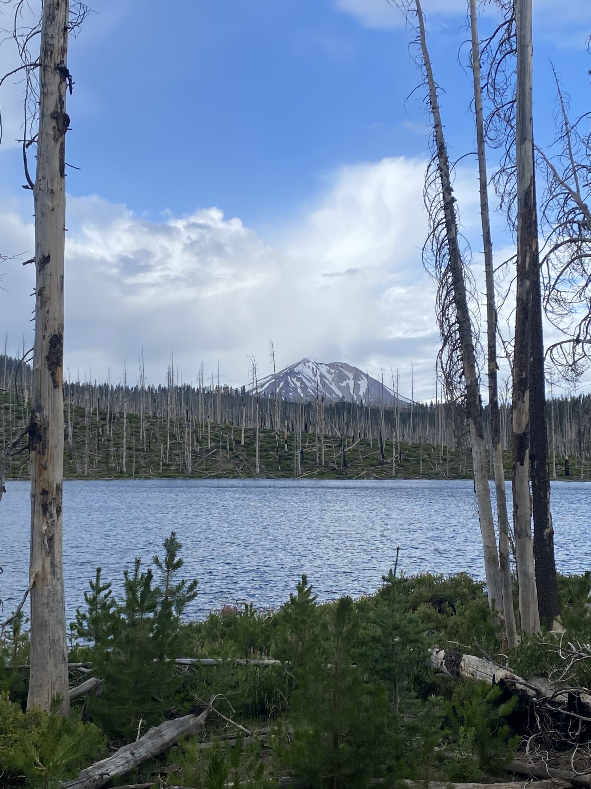
It was a wonderful surprise, especially considering we would be hitting the halfway mark of the PCT. The seven of us set off. The route to the mid-point taking us up an exposed ridge then down through lush forest which faded to low, overgrown bush. Views of Mount Lassen kept sneaking up on us, its snowy white peaks hazy in the smoky sky.
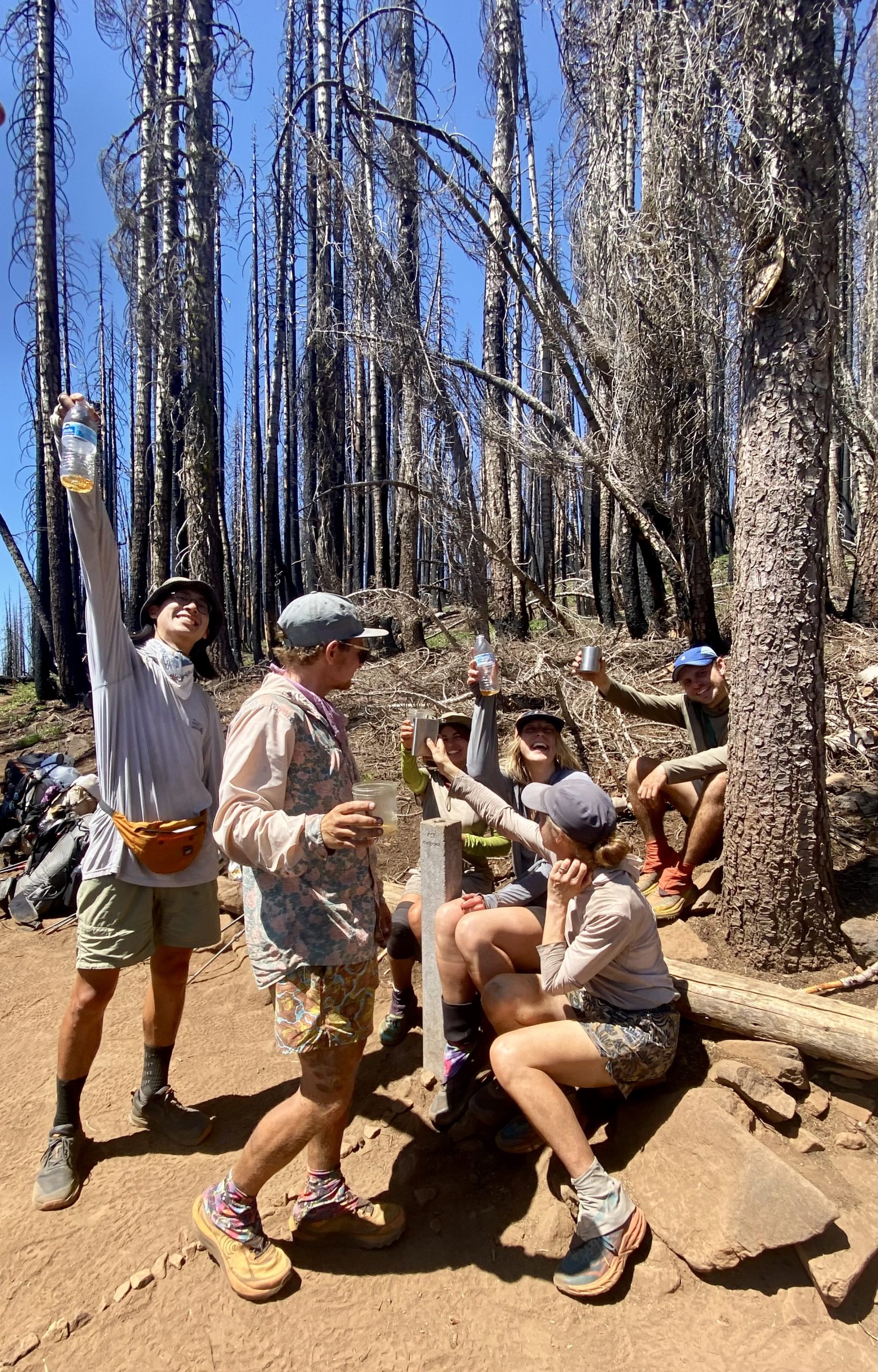
A mile from the marker we waited for one another so as to walk the final mile in unison. In keeping with our tramily name, The caterpillar, we marched in a single line and soon we were there, exactly 1325 miles to Canada and 1325 miles to Mexico: a single step to either side dictating which we were closer to. We cracked out the whisky, toasting to our achievement before chatting merrily and enjoying the photo opportunity.
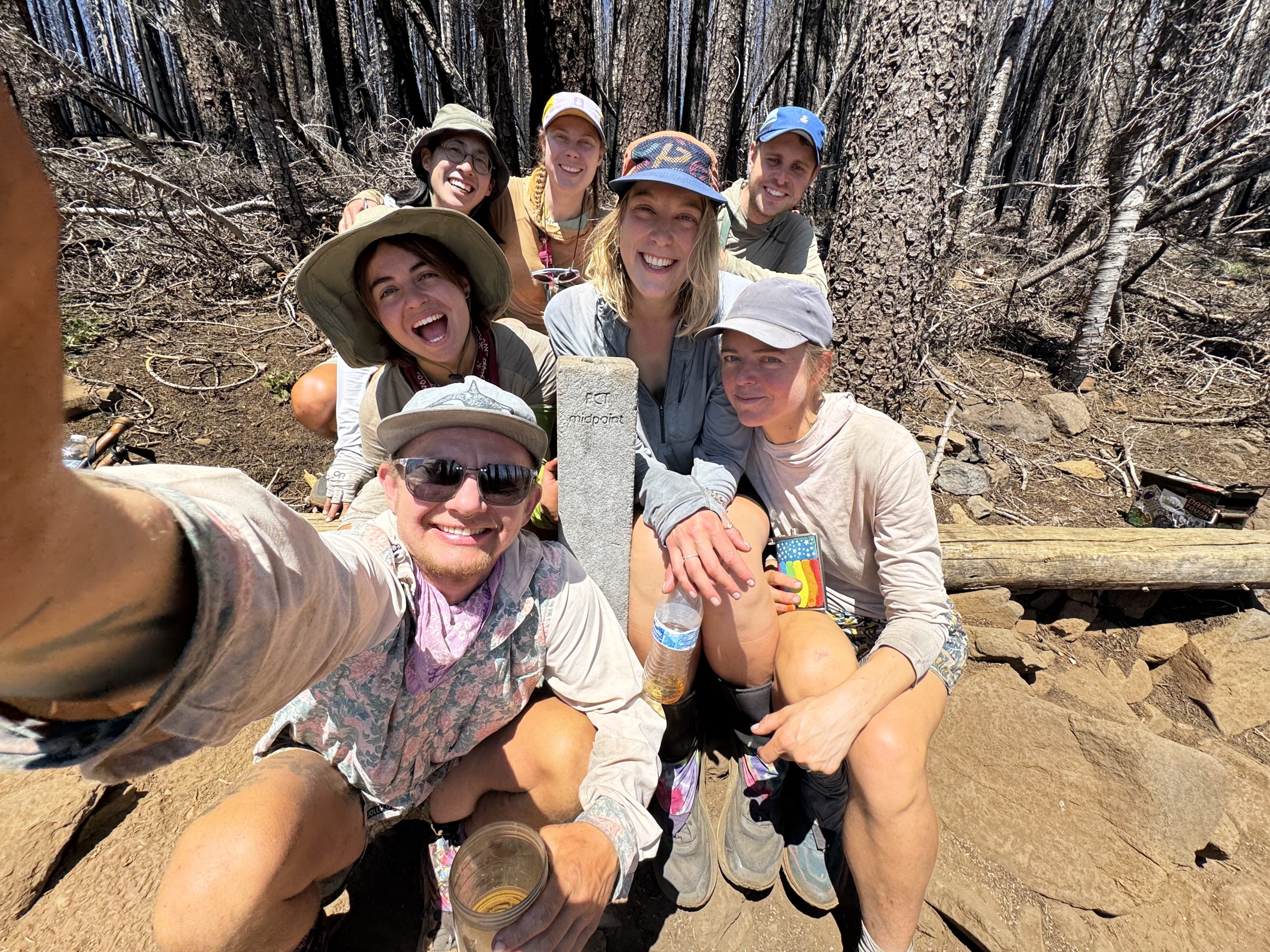
All seven of us had started on the same day. In fact, Dan and I had met them all at some point on that first day. We had also all split up from one another at some point on trail. Now, to find ourselves all together again 93 days later baffles me.
Don’t let the smiles fool you, we’re all internally having a moment of panic knowing we have to repeat this distance!
And so, we started the second half of our walk to Canada. As we descended through the burn zone I considered how I was feeling. A nagging, panicking part of my brain reminded me that it had taken us over 3 months to get halfway, and with a six month visa we needed to get a wiggle on. The more mellow part of my brain argued back that the distractions of the desert and the slow slog of the Sierra were behind us meaning we could make up miles going forward. I suspect the time it has taken us to get this far will be drastically cut in this second half.
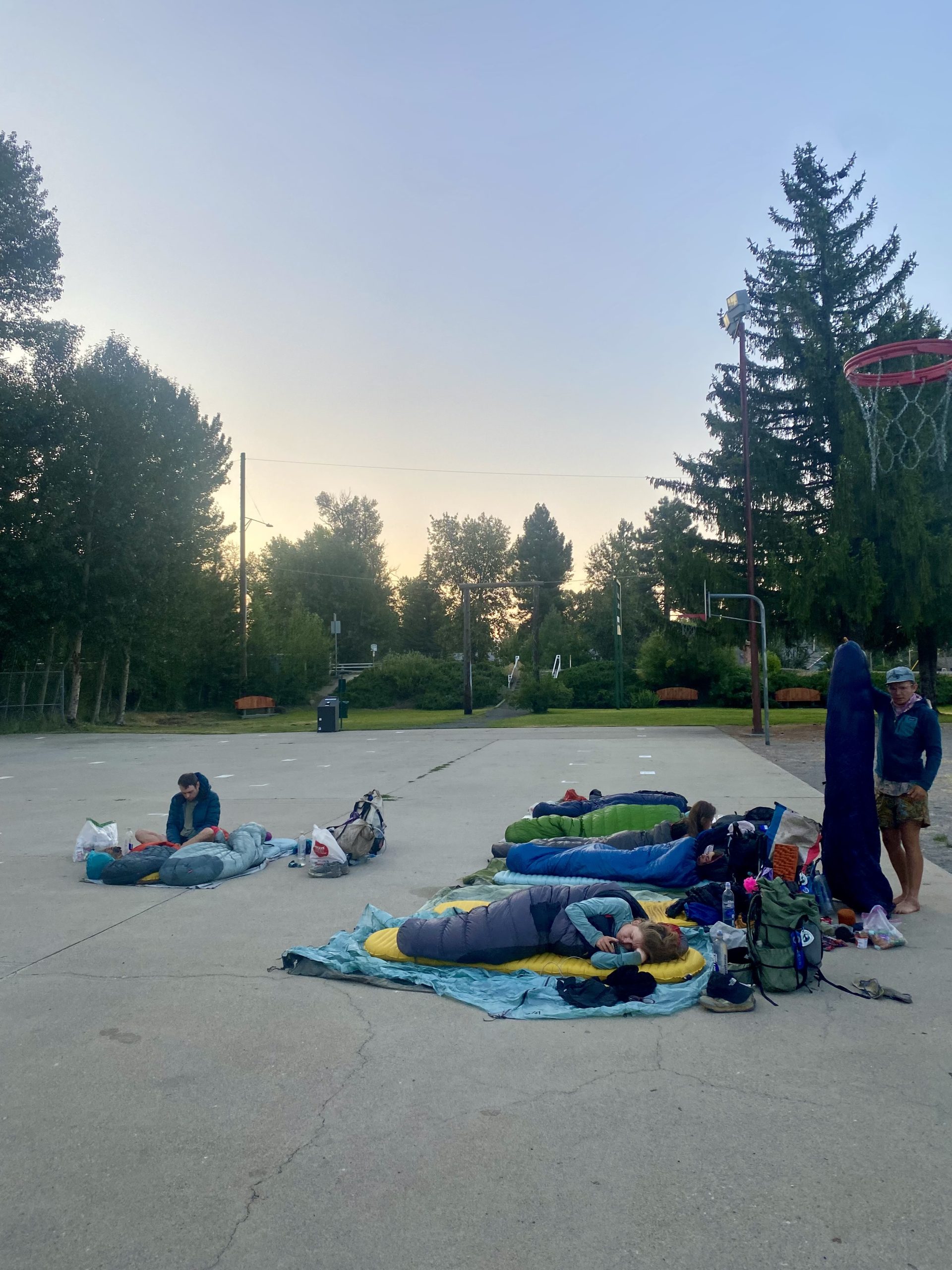
We arrived at the roadside, and while Dan and I had no plans to visit Chester, the others convinced us to join them. We hitched in, showered, did laundry and enjoyed milkshakes. Evening creeped in and we headed to the park to camp. Arena and Rebecca had now joined us meaning eight of us slept side by side under the stars while Sweet Rolls stayed at a nearby bed and breakfast. Luckily we had decided to cowboy camp on the basketball court instead of the grass surrounding it. As we were settling down, an awful clunking and rapid clicking sounded, which turned out to be the sprinklers.
Day 95
As expected, no one had slept particularly well on the basketball court. We made a swift exit, packing away and heading to the grocery store. A coffee and some rice pudding for breakfast and we were hitching back to trail.
The path was brutal. We were immediately thrown back into burn zone. Low level thorned shrub occupied the floor, cutting at our legs.
Just before entering its National Park, we got glimpses of Mount Lassen, and for the first time the view was unobstructed by smoke. The edges of the elongated volcano crisp and defined against the blue sky.
As we were walking through a section of the trail drenched in ash and lined with frail dead trees I heard Frodo shriek and run backwards. A dead tree had threatened to fall, swaying violently towards trail as the wind hit. We took it in turns, timing our passage to safety during breaks in the wind.
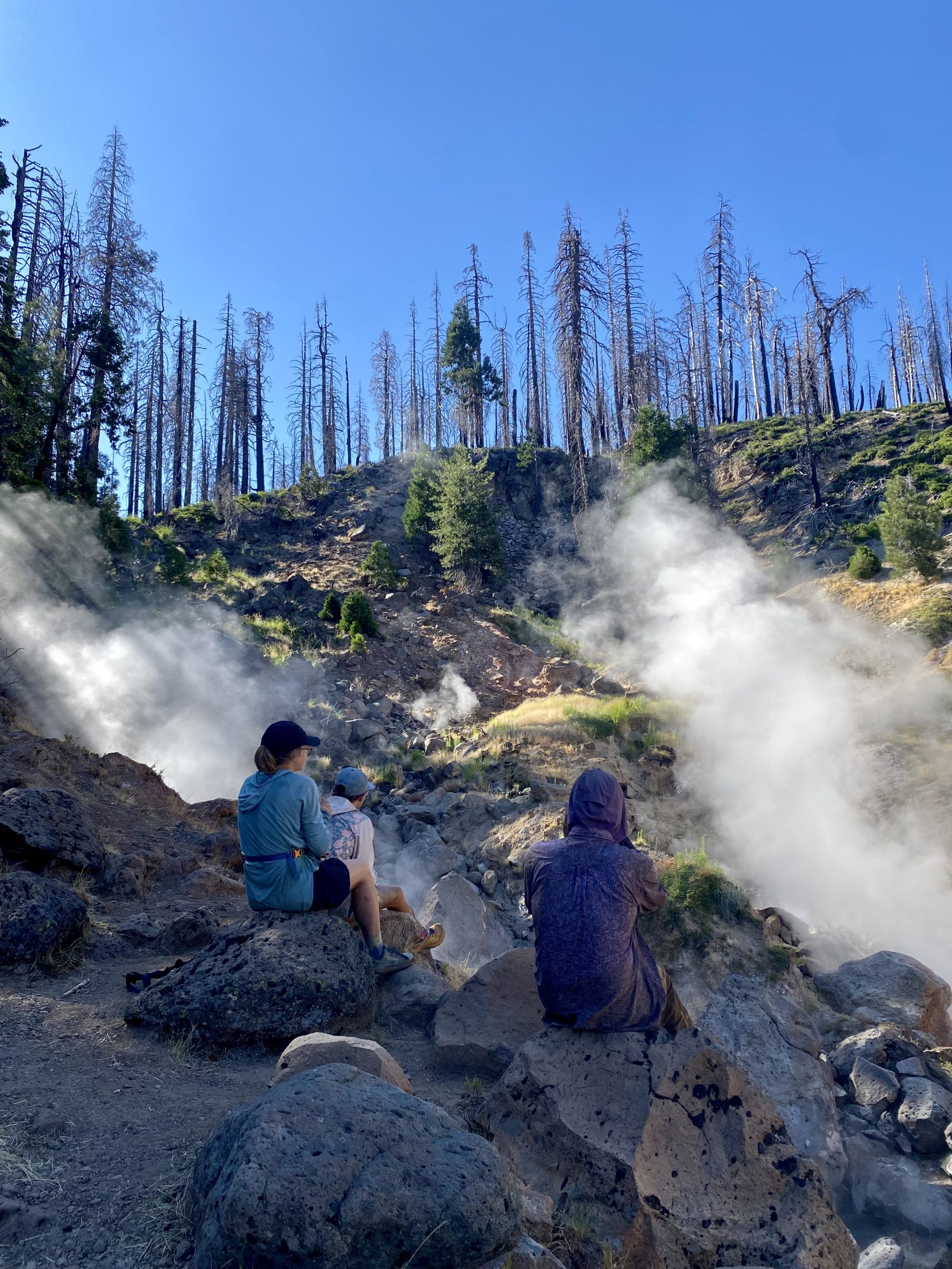
Towards the afternoon we took a small side quest off trail to visit Terminal Geyser. Here we sat watching the billowing clouds of supher loaded steam ascend from the spewing water and mud. It rose a few metres before dissipating into nothingness.
As we continued on we came across Boiling Springs Lake, a sulphur spring. It sat within a basin of red and yellow mud. The water itself looked the colour of an artists water jar after use, a mirky mix of grey and colour. It rippled with activity, steam dancing in the wind, and bubbles breaking the surface of the water.
We arrived at camp, now a large party of nine. Luckily there was room for us all at the campsite with bear boxes for use.
“It’s called the CREST trail. That’s why it’s so hard” – Kaleidoscope
Day 96
The mission that day was to get to the post office before 2pm to pick up resupply before it shut. The post office was 24 miles away. Kaleidoscope was in the same position as me so at 5am the two of us snuck out of camp to begin our quest of reaching the post office in time, leaving the rest of the camp sleeping. Dan was quite happy to enjoy an extra hour of sleep and not have to rush on his sore foot.
We started the climb up in the dark, sunrise breaking through the trees as we reached the summit. The dawning light revealed darkening wisps of cloud which promised rain. We raced on, trying to not only keep to our schedule but to also avoid the darkest of the clouds above us.
By 10am we had managed 13 miles and treated ourselves to a coffee break. We took a moment to discuss how we experienced trail, neither of us fully understanding what was driving us forward. Trail is not enjoyable in the typical sense. It is hard, painful and relentless. Yet there is a satisfaction of getting to the end of the day knowing that despite this, my body and mind can endure and even find joy and meaning in the day. We both reflected on how our tolerance for discomfort has increased and how much more adept we feel coping with the never ending challenges of trail. Whether this attitude will continue post-trail and back in the real world remains to be seen.
The night before, Twister had asked what everyone thought about while walking on trail. Interestingly, Sweet Rolls and Dan had expressed having blank minds while walking which shocked the rest of us who have to use audiobooks to mute the continuous ramblings of our brains. Kaleidoscope reflected that they thought they would have detailed discussions on people’s ‘why’s’ on the PCT and that would be the catalyst for deep reflective conversation with others. But in reality this question falls a little flat. My experience is that most hikers don’t fully know why they are compelled to hike the PCT. There is a calling and one must respond. I’ve also found that there’s a sense of understanding amongst hikers, whereby you don’t need to know their why, just an understanding that the same summoning has captured you.
Just as we packed away our cups the rain came and we swiftly departed, our ponchos fluttering in the wind.
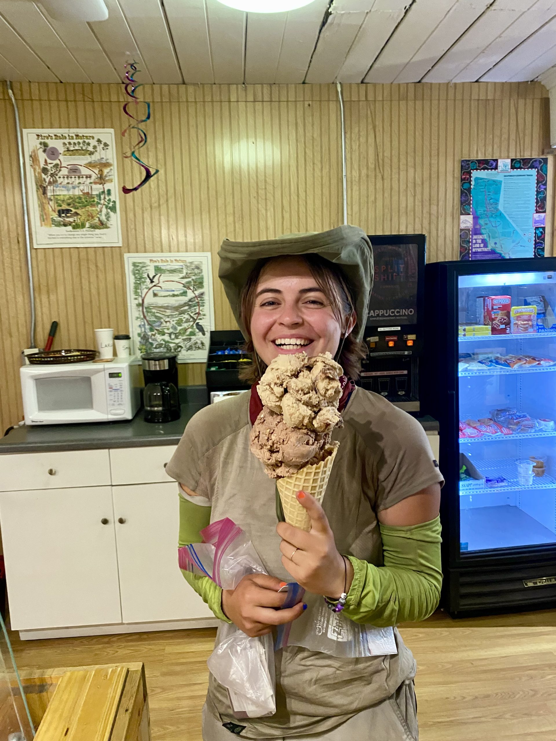
We made it to Old Station for 13:30 and after retrieving our packages settled at a shaded table outside of the general store. For the next couple of hours the rest of our family trailed in and we spent a considerable time eating ice cream and lounging about.
A ten year old and her two friends asked if we wanted hot dogs and sodas. The three of them tended to the grill and severed us some of the most unexpected trail magic on trail so far. Turns out the young girl in question is keen to hike the PCT with her mum one day and until then wants to help other hikers the way she anticipates to be treated.
The final 5 miles to camp were easy, especially after food and four hours of rest. We set up camp before squeezing into a cramped picnic bench for family dinner.
Day 97
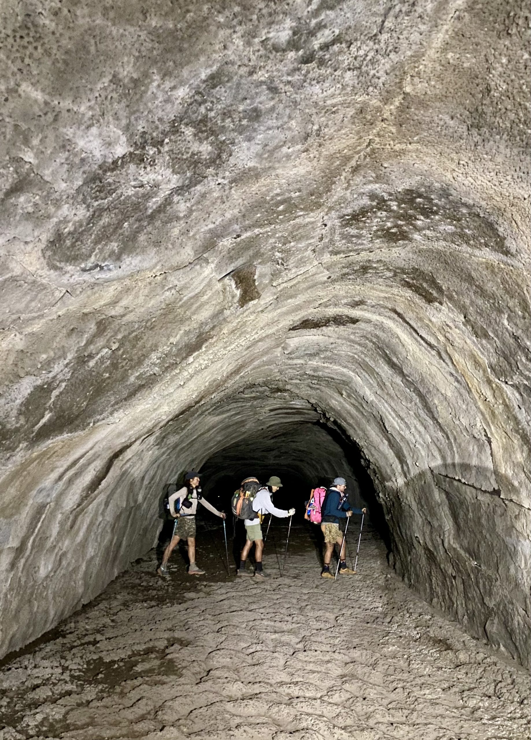
None of us set an alarm and I fully enjoyed the lie in, finally stirring at 6:30am. We packed away and got a coffee and bear claw from the gas station before walking half a mile down the trail. We arrived at the entrance to the lava tube. This is essentially a cave with a path running 1000 feet (300m) underground where lava use to flow about 20,000 years ago.
Still with coffees in hand we descended the steps and into the damp coolness of the tunnel. We donned head torches and as we walked we came across three figures up ahead, frozen while walking across the length of the passage. It was Sweet Rolls, Kaleidoscope and Sam, who admitted to waiting longer than anticipated in this position for our arrival.
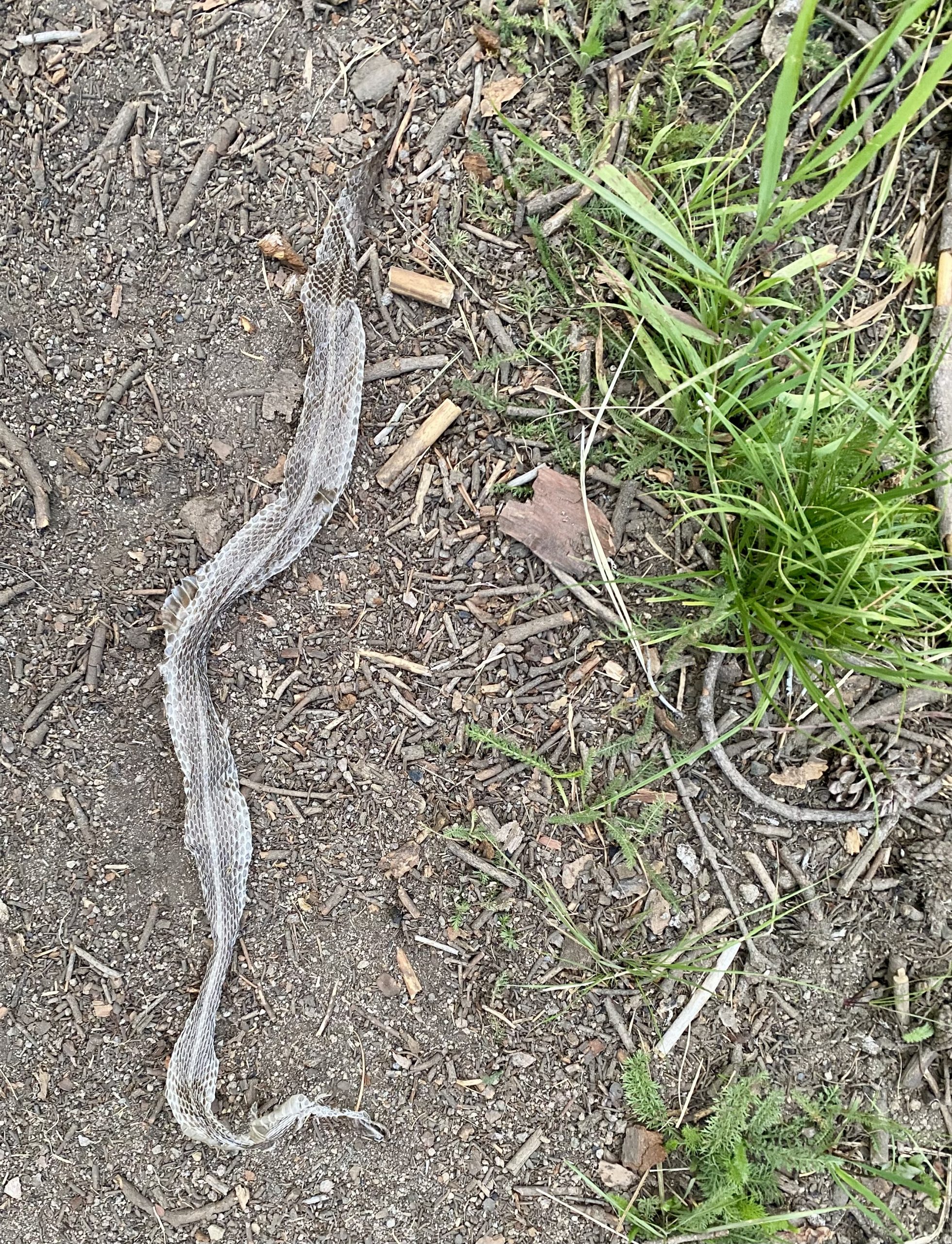
We headed on out up the exposed rocky path and suddenly we felt as though we were back in the desert. Manzanita shrubs lined the way and we were carrying 5L of water each to manage 30 miles without reliable water. To add to the desert feel, Dan and I heard a rattle and had to veer off the path due to a Mojave rattle snake territorially marking the area. We watched him for a while from a distance and he finally crossed the path revealing his sage coloured skin.
The heat was almost debilitating, hot and dry, but luckily with a flicker of cool air whenever the wind blew. One highlight of the day was seeing Mount Shasta for the first time, and in the other direction, from the same viewpoint, Mount Lassen.
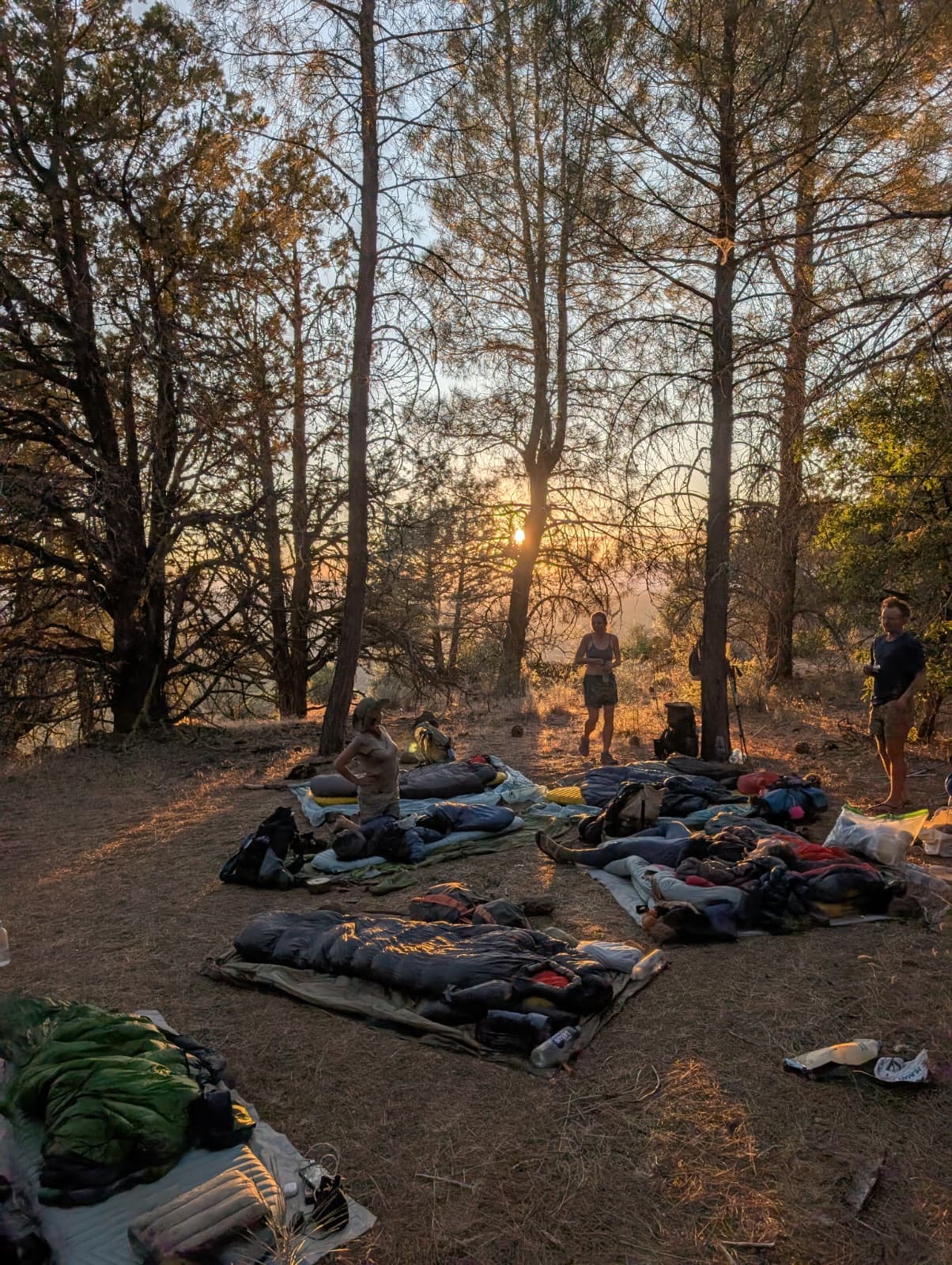
We made it to camp for 6pm, and collapsed onto the floor in a circle. The group were all tired and feeling burnt out. We all slowly came to the conclusion that we were too tired to set up tents, so simply cowboy camped where we dropped. The eight of us randomly dotted about on a slanted slope gave no heed to the poor night sleep we would likely have, just grateful to stop and admire the view of the sun setting from where we lay.
Day 98
For once we all woke up early. Not a surprise really: in such a close formation the first person rustling simply triggered the domino-alarm system. We began our day, and with 15 miles to town and a large resupply to do to cover us to the end of California, Dan and I decided to split, myself running on and Dan staying with the others. I shot off, grateful for the cooler climate so early in the morning, but cursed the sharp uneven ground that was trail.
Time moved quickly, myself hurtling towards the road. Squirrels and lizards darted from my path once the temperature picked up, but they were my only companions. By 10am I had made the road and hitched into the town of Burney. It was a logging town, but with decreases in the industry many establishments have gone out of business.
Our accommodation for the night would be the floor of the Word of Life Assembly Church. Here I was greeted with a free coffee, full use of showers and kitchen facilities, and allowed to camp on the gymnasium floor. I grabbed a latte and took it to the shower where I began the removal of the mud caking my legs. As I was scrubbing away the lights went off and I tried to tell myself it was the timer setting on the lights and not some haunted spirit.
By the time the others made their way down I had picked up our bounce box, showered and was on my way to the grocery store. After some food Dan joined me to help carry the bulging bags back to our accommodation. As we crossed a road a car pulled up and out jumped Paige. Utter joy passed us all at being reunited. While we haven’t been short of company I missed her terribly. Alistair and her drove us down the road saving our arms from the effort of carrying bags.
Come evening we congregated in Sweet Roll’s room where we ate Chinese food and drank beer. By 10pm we were back at the church, the gym littered with sleeping bags. For the second time this week we would be camping under a basketball hoop.
Physically we’re feeling well in ourselves. Both of us have had ongoing foot problems, but with new shoes this is improving. Mentally, we feel fantastic, surrounded by people we adore and enjoying the morale boost of passing halfway. It feels like we’ve finally found our trail legs, moving through high milage days and minimising town stays. As a group we are churning through the miles, something which continued into the next week.
Destinations & Things To Do
Why Should I Stay on the PCT? The Desert is Trying to Kill Me: PCT Days 27 to 41
Starting the Pacific Crest Trail is exciting.
Staying on it is a commitment.
Completing it is heroic.
After weeks in the desert, the excitement begins to fade, and the reality of the journey starts to settle in. You’ve only made it partway through, but the heat, miles, and days already feel heavy. This is a marathon, not a sprint, and you still need to get up and walk. Day after day after day.
Endless desert miles, shimmering in the midday heat
With your feet and legs beginning to adjust, your mind now has time to think. Okay, I can do this… but this is only the start. I need to keep going.
The Mental Challenge
This is where the PCT begins to test you mentally. You start to grasp the sheer scale ahead. The miles, the days, the steps. Around us, we saw friends from the early days disappearing from the trail. Some dropped out completely. Others skipped small sections, or whole stretches, to move ahead.
Trail families that felt permanent at Campo began to dissolve. Those early bonds vanish as people move faster, slower, or not at all.
And in those moments, the question creeps in: Why am I still here?
A hiker we met prior to coming on trail, gave us the simplest framework:
“You have to know why you’re here… and why you’d leave.”
For me, the answer was clear, I like the challenge. But your answer doesn’t need to be grand. Even I like hiking and this is a pretty hike is enough. What matters is knowing it, because you’ll need it to push through.
A quiet pause on a ridge, getting time to think and reset
The Physical Test
The desert is where many hikers break down. We kept our pace slow and steady, resisting the temptation to race ahead, because an injury here can end the hike before it really begins.
Famous sections like the LA Aqueduct lure you in with their flat miles but under the relentless sun and blasting wind, they become a test of endurance. This is where blisters swell, knees ache, and energy fades.
Hiking the LA Aqueduct being hot, flat, and never-ending.
Gear Failures
If it can go wrong on the PCT, it will go wrong in the desert. New gear fails. Old gear you’ve trusted for years suddenly gives up. Tent stakes snap in the baked ground. Sleeping mats deflate in the middle of the night.
Replacing gear means figuring out shipping, timing, and sometimes giving up your rest in town to sort it out. It’s part of trail life, but it adds to the mental load, especially early on, when anxiety is still high.
The Grind
The routine settles in. You wake before dawn, hike through the cool morning, and spend the heat of the day hiding under whatever scrap of shade you can find. You try to stay positive, but the desert has a way of wearing you down.
The sun beats down. The water carries are long. You’re hot, tired, and maybe a little irritable.
And then, just when the desert starts to feel endless…
The Bell at Kennedy Meadows
You hear it.
A bell, faint at first. Then louder.
You round the corner, and there it is. The Kennedy Meadows General Store.
The bell clangs, your name is called, and you realise: you’ve made it. The desert is behind you.
The mind clears. The excitement surges again.
The Sierra Nevada are at your feet.
Dusty, tired, and at Kennedy Meadows
This website contains affiliate links, which means The Trek may receive a percentage of any product or service you purchase using the links in the articles or advertisements. The buyer pays the same price as they would otherwise, and your purchase helps to support The Trek’s ongoing goal to serve you quality backpacking advice and information. Thanks for your support!
To learn more, please visit the About This Site page.
-

 Brand Stories3 weeks ago
Bloom Hotels: A Modern Vision of Hospitality Redefining Travel
-

 Brand Stories2 weeks ago
CheQin.ai sets a new standard for hotel booking with its AI capabilities: empowering travellers to bargain, choose the best, and book with clarity.
-

 Destinations & Things To Do3 weeks ago
Untouched Destinations: Stunning Hidden Gems You Must Visit
-

 Destinations & Things To Do2 weeks ago
This Hidden Beach in India Glows at Night-But Only in One Secret Season
-

 AI in Travel3 weeks ago
AI Travel Revolution: Must-Have Guide to the Best Experience
-

 Brand Stories1 month ago
Voice AI Startup ElevenLabs Plans to Add Hubs Around the World
-

 Brand Stories1 month ago
How Elon Musk’s rogue Grok chatbot became a cautionary AI tale
-

 Brand Stories3 weeks ago
Contactless Hospitality: Why Remote Management Technology Is Key to Seamless Guest Experiences
-

 Asia Travel Pulse1 month ago
Looking For Adventure In Asia? Here Are 7 Epic Destinations You Need To Experience At Least Once – Zee News
-

 Brand Stories1 month ago
ChatGPT — the last of the great romantics
You must be logged in to post a comment Login