
Destinations & Things To Do
JMT Day 6 – From Basalt to Burgers
JMT August 9th : Garnet Lake to Crater Creek
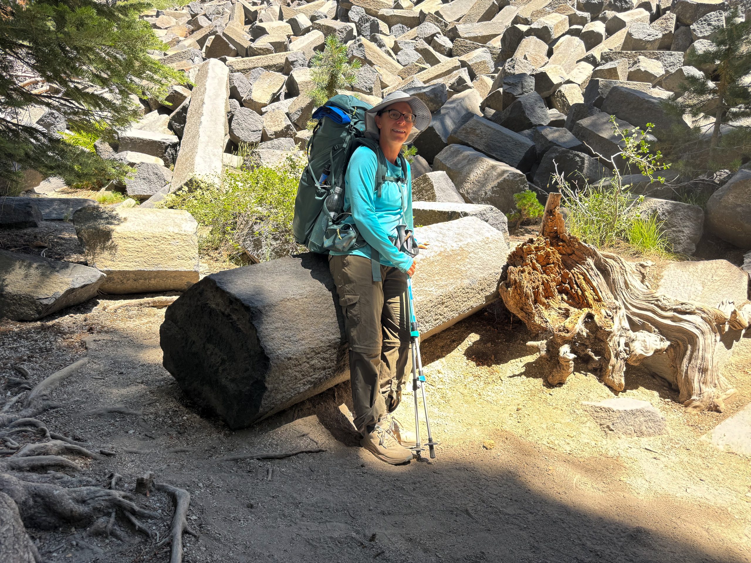
We set out early, moving quietly so as not to disturb the ladies camped on the ridge above us. The trail led us past the shimmering waters of Garnet Lake and alongside the peaceful shore of Rosalie Lake. Most of today’s hike was downhill—a welcome relief after the ascent over Donahue Pass just yesterday.
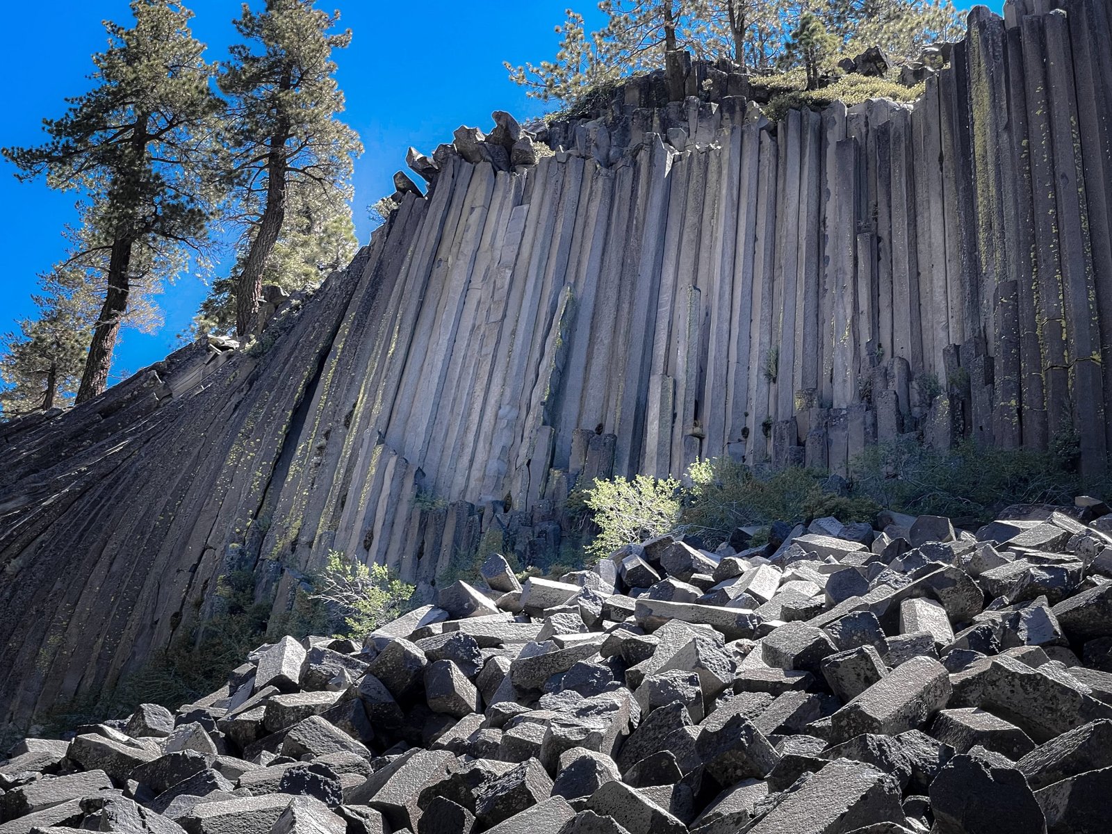
A Geology Lesson at Devils Postpile
We left Garnet Lake early to beat the searing afternoon heat. Our plan only partially worked. By the time we left the forest and entered the exposed, open terrain, the heat was already intense.
The trail led us to Devils Postpile, where we came across a film crew interviewing an older geologist about the area’s distinctive columnar basalt formations. One of the basalt columns had been set up as a seat just out of the camera frame. We were drawn into the conversation and paused to listen for a few minutes before continuing on toward our destination—Red’s Meadow Resort.
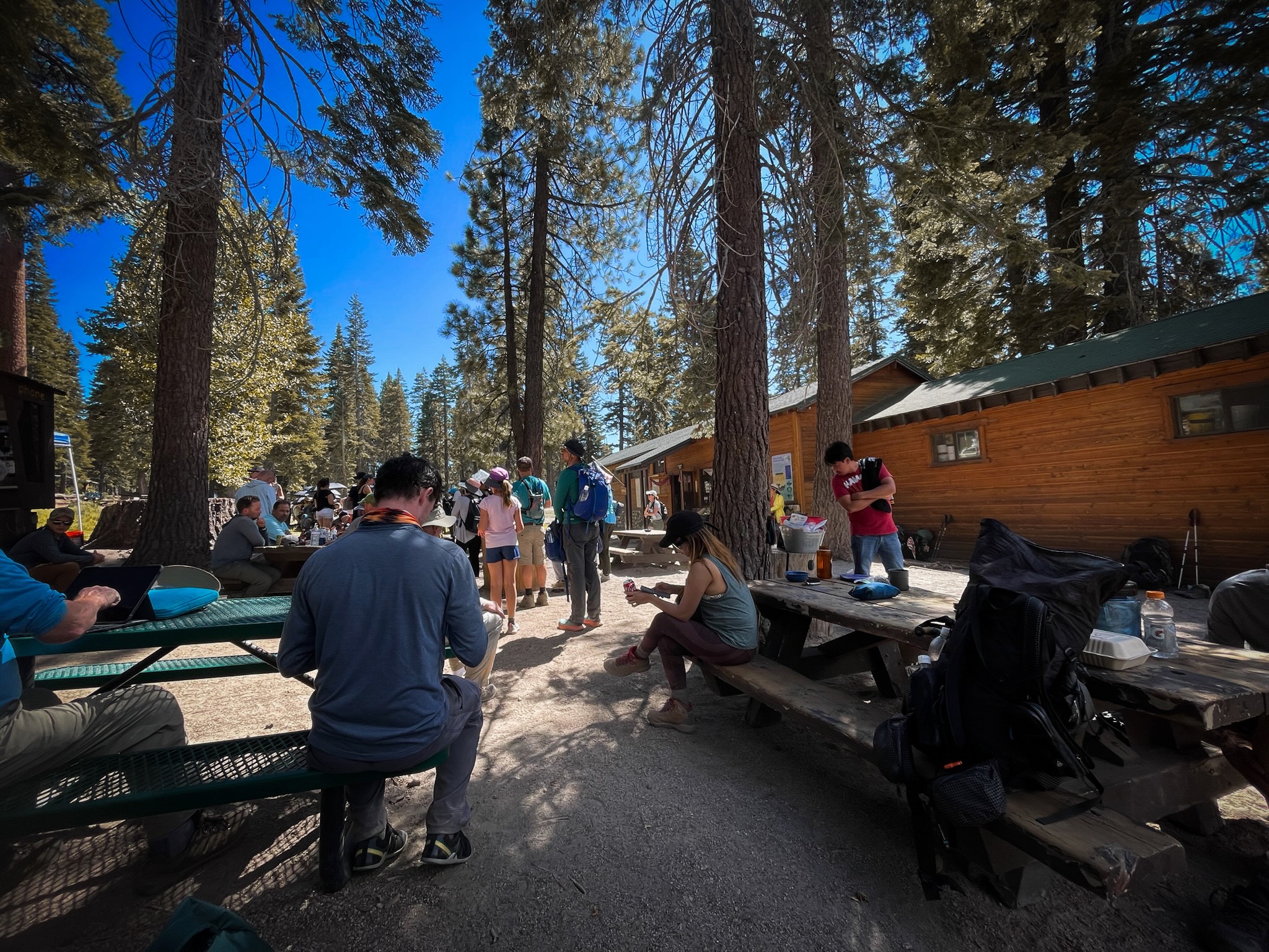
Our first stop at Red’s Meadow was the store, where I grabbed an ice-cold Gatorade and guzzled it down. Then we headed to the takeout window of the restaurant. We each ordered a burger with fries and fresh fruit—I couldn’t resist adding a tall, thirst-quenching lemonade. After the meal, we picked up our resupply and sorted through our treasure trove of new food. As we packed everything into our now overflowing bear canisters, we chatted with other JMT hikers, swapping stories and enjoying the brief break from the trail.
Through the Burn Zone to Red Cones
With full bellies, we pushed on for another three miles, hiking through a burn zone and climbing a gentle peak near Red Cones. We made camp at Crater Creek, a small and secluded site tucked beside a quiet stream. The creek had just enough flow to soak our tired feet and rinse out some of our stinky trail clothes—a perfect end to a full day.
This website contains affiliate links, which means The Trek may receive a percentage of any product or service you purchase using the links in the articles or advertisements. The buyer pays the same price as they would otherwise, and your purchase helps to support The Trek’s ongoing goal to serve you quality backpacking advice and information. Thanks for your support!
To learn more, please visit the About This Site page.

You’re reading Entrepreneur Middle East, an international franchise of Entrepreneur Media.
Dubai and Riyadh are emerging as must-visit destinations for both luxury seekers and business travelers in 2025, thanks to strategic investments in tourism infrastructure, hospitality, and cultural experiences.
Dubai, already a global travel powerhouse, continues to strengthen its position with an expanded portfolio of world-class hotels, sustainable tourism initiatives, and high-end entertainment options. Upcoming developments include ultra-luxury resorts along its coastline, new fine-dining experiences by Michelin-starred chefs, and immersive cultural attractions designed to appeal to a global audience.
Meanwhile, Riyadh is undergoing a rapid transformation under Saudi Arabia’s Vision 2030 strategy, which aims to diversify the economy and open the Kingdom to international tourism. Luxury hotel chains are expanding their footprint in the city, while flagship projects such as Diriyah Gate and the King Salman Park are set to provide unique leisure and cultural experiences.
Business travel is also seeing a significant boost in both cities. Dubai is enhancing its status as a leading hub for global events and conferences, while Riyadh is positioning itself as a rising center for business summits and international exhibitions. Improved connectivity through flagship airlines and new transport links between the Gulf capitals further strengthens their appeal.
Industry analysts note that the pairing of Dubai’s established tourism excellence with Riyadh’s bold new offerings creates a competitive yet complementary travel landscape in the Gulf. Together, the two cities are redefining the region as a premier destination for travelers seeking luxury, innovation, and opportunity.
Shelter cove to Big Lake Youth Camp
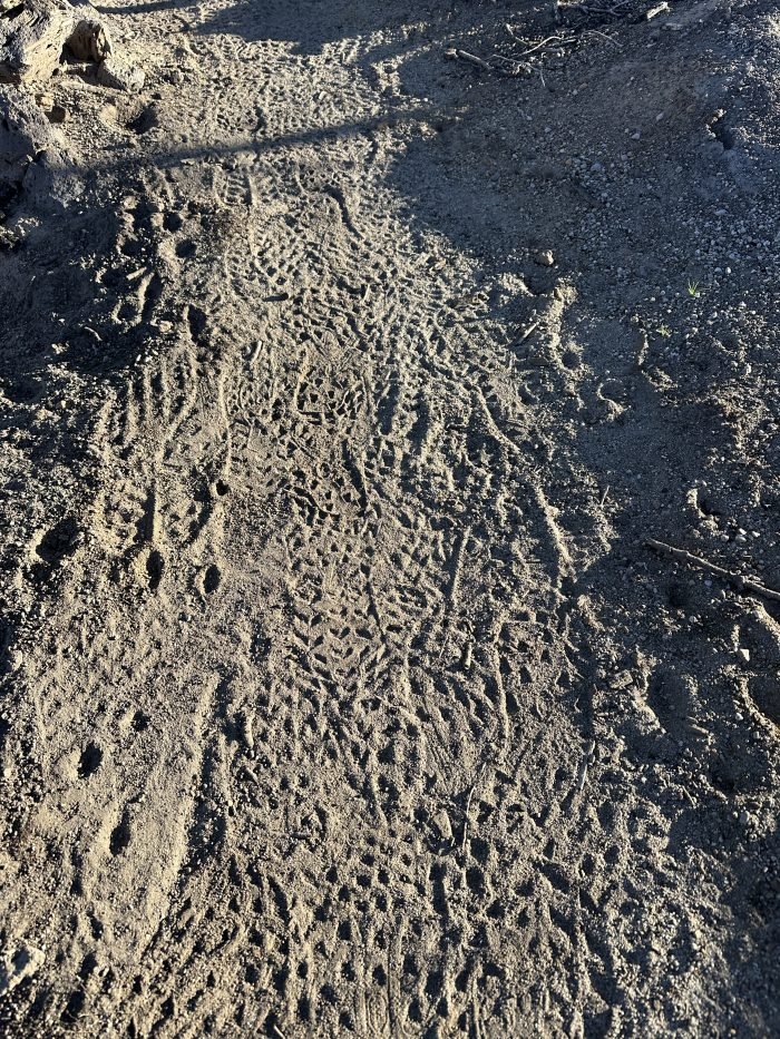
At one point after leaving Charlton Lake, I hiked through a desolate burned area. The area had been so completely torched that not even dead trees remained. The ash was fine on the trail and you could see the footprints of other hikers superimposed over each other with exquisite detail.
Throughout this hike, my feet follow the steps of others. Am I a leader, or a follower? We all hike the same path but what we take away from it may be completely different. So far, I can say that I have never met so many interesting people. Or maybe I have, but just never had the time or interest to get to know them before. This has been a surprising discovery on the PCT.
Updates
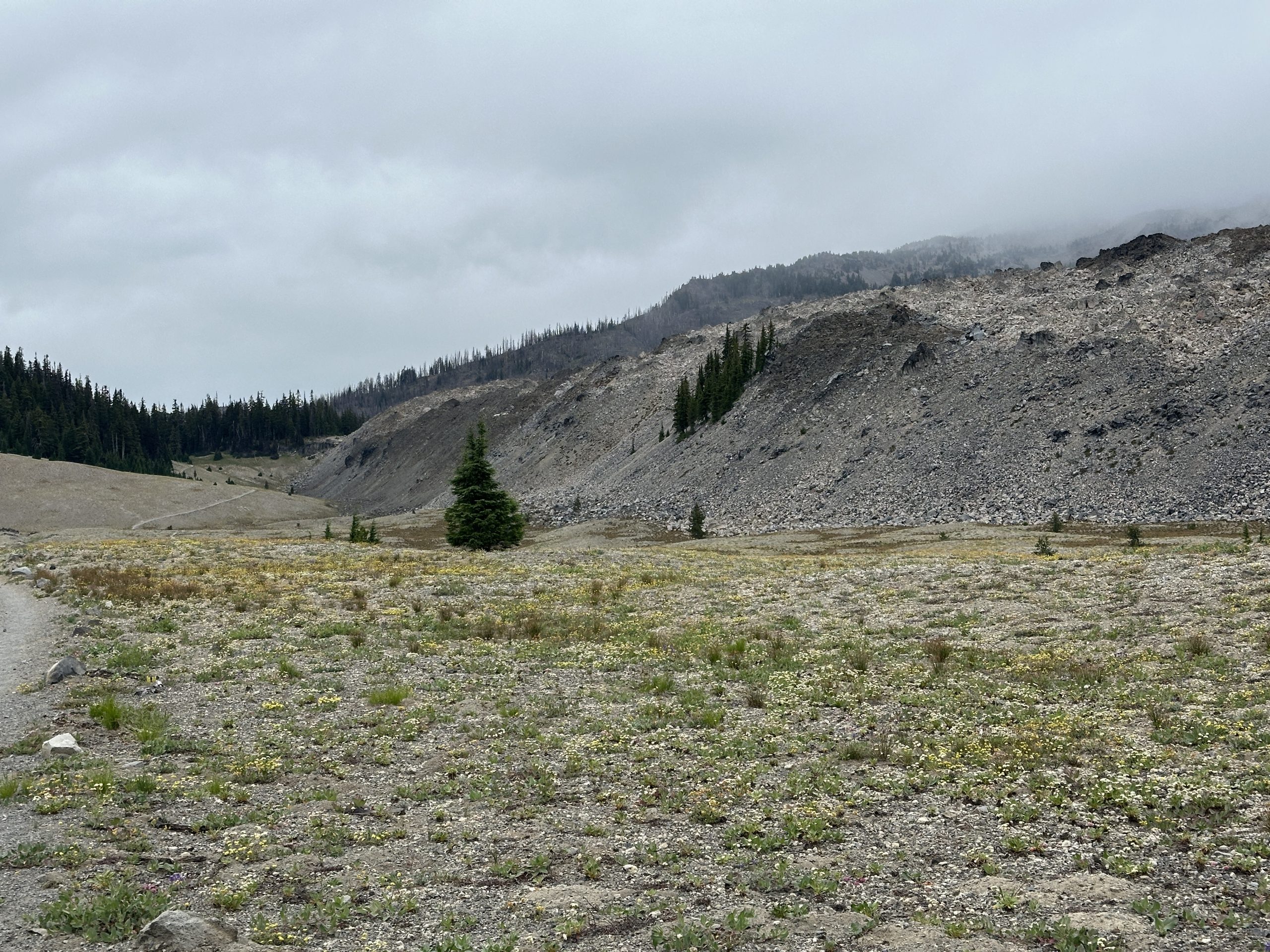
The most recent area I hiked through had a wide variety of different landscapes. The Three Sisters wilderness is extremely beautiful and fascinating with obvious signs of previous volcanic activity. To add to the mystique, the weather was cloudy and misty. In some ways, this was great because much of the trail was exposed, and would have been very hot. On the other hand, it obscured the tops of the peaks so vistas weren’t dramatic. Some sections went through flat plains full of small wildflowers while next to this plain, there was a mesa of volcanic rubble with nothing growing at all.
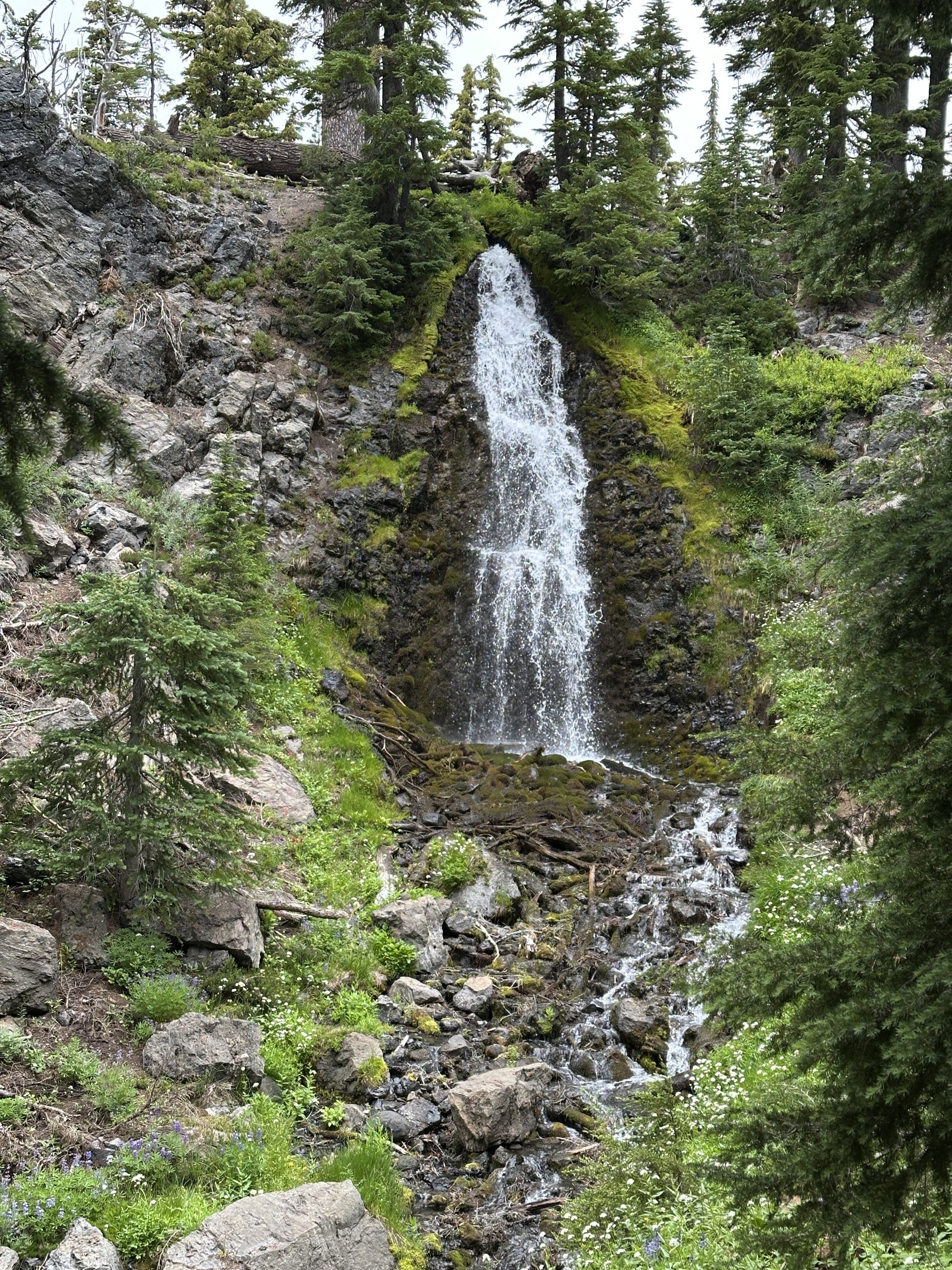
Obsidian Falls tumbles over boulders of obsidian.
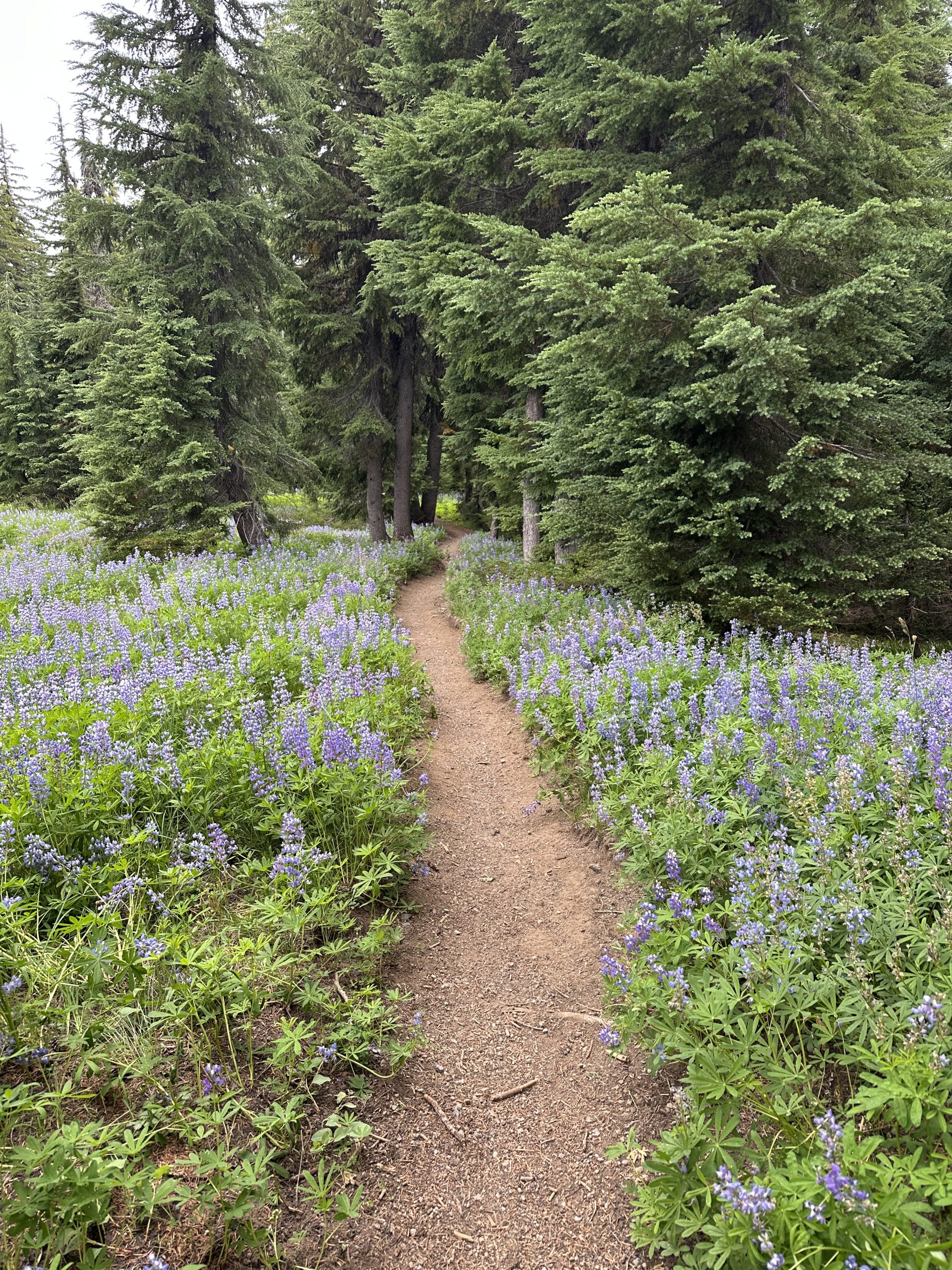
High glacial streams tumble down, their source the snow that is still present even in August. I walked through fields of fragrant lupine.
The misty weather turned to rain. I was extremely proud of my Durston x-dome in the wind and rain. The interior stayed completely dry.
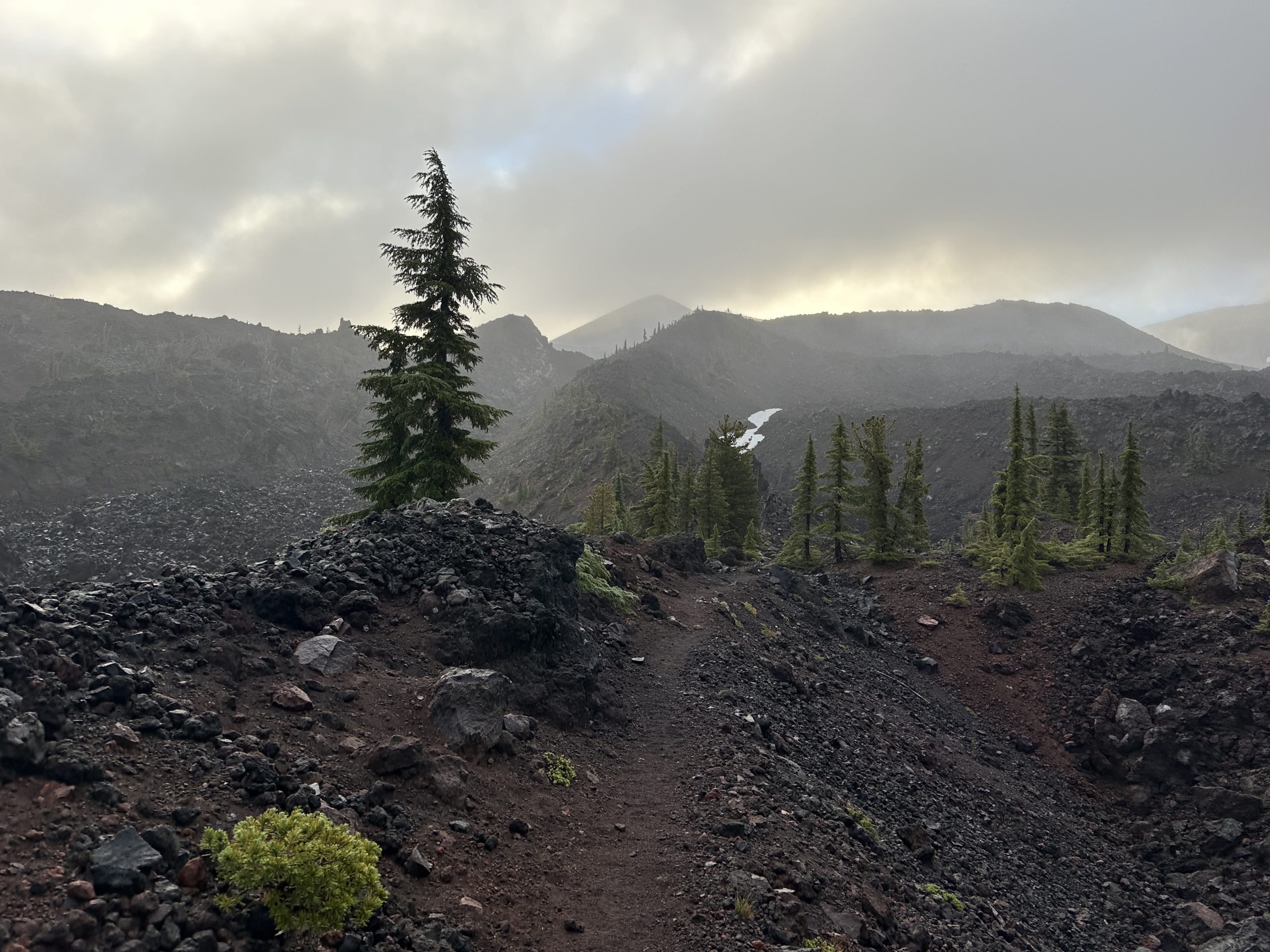
I had heard of the lava fields from a random stranger and an ice cream shop in Ashland. He had remarked on how challenging it was in the hot sun. I wondered when that would be and this was it. Again, cool and windy. Weather made it a little bit easier but walking over large gravel pieces for several miles made for slow going and was really tough on my feet. Another hiker described it as “hiking on the moon” (I wish we had had the moon’s gravity as well.)
Finally, I arrived at Big Lake Youth Camp. They are very welcoming and have a separate space for PCT hikers to socialize, do some laundry, take a shower, and deal with their resupply. They also offer meals to thru hikers. I am thankful they are so welcoming. I slept next to Big Lake last night. For the first time, my tent was frozen in the morning. Time to switch out to cool weather gear.
Seeing Family
After leaving Big Lake, I hiked to Santiam Pass, where my brother and his family picked me up. We visited Belcamp hot springs and stayed in the town of Sisters. It’s so nice to see family and to have the time to spend with them. I am so grateful that they came to support me.
This website contains affiliate links, which means The Trek may receive a percentage of any product or service you purchase using the links in the articles or advertisements. The buyer pays the same price as they would otherwise, and your purchase helps to support The Trek’s ongoing goal to serve you quality backpacking advice and information. Thanks for your support!
To learn more, please visit the About This Site page.

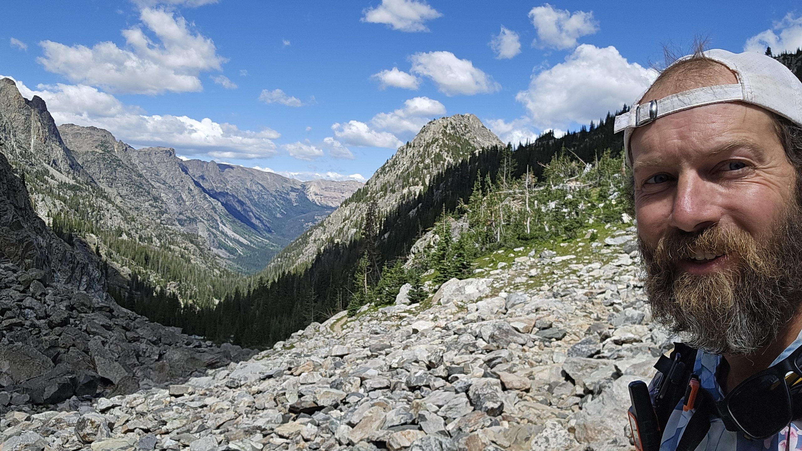
I woke up around 6, which is fairly normal. I felt fairly alert so it seemed like a good time to get started. I had about 13 miles to Knapsack Col. From what I hear from northbounders, it’s either amazing, beautiful, or very difficult and they would not do it again. It sounds like there’s lots of boulders or a boulder field where most likely trekking poles are of no use and you hop from rock to rock for potentially miles. I could see how this could be arduous or frustrating, but to me it sounds like an adventure. On the Appalachian trail during Mahoosuc Notch, some say the hardest mile of the A.T. I put my trekking poles away and hopped boulder to boulder as it started to rain. Ducking and crawling between giant rocks, scrambling. I make my way through in 45 minutes for a mile. This is considered a quick speed for Mahoosec Notch.
As I pack my things up I notice the mosquitoes from the night before are gone. I openen my bug netting to start packing my bag as I continue to lounge.
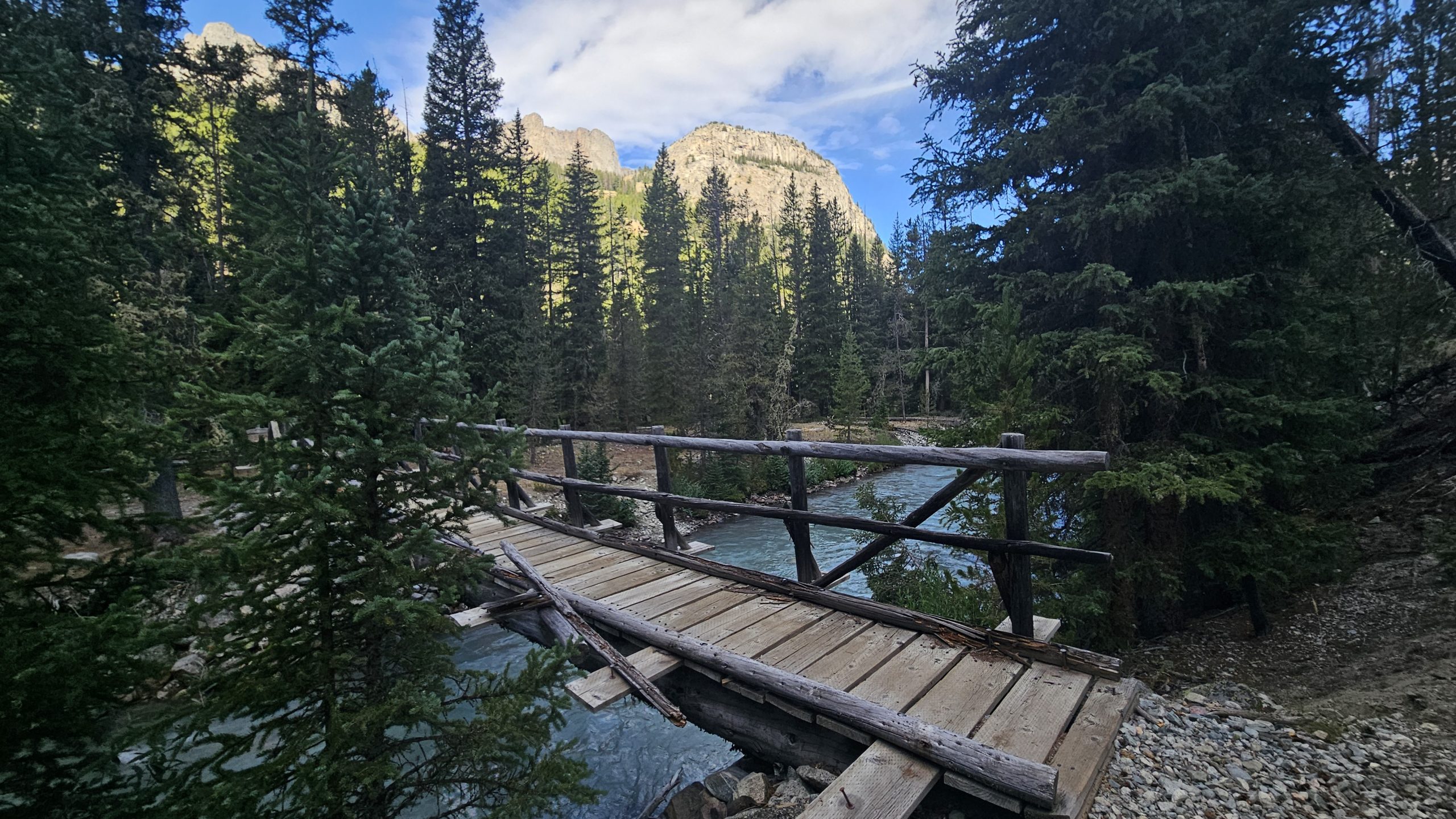
First things first, after getting out of my tent, I head off to dig a cat hole, do my business, and grab my food bag from the tree it was tied up to all night. No issues with animals, thank the Lord. One hiker I met, Matcha, told me that a bear was clawing at her bag one night and she decided to pack up and hike a few more miles by headlamp to get away from the Bear. I pray that never happens to me. After packing my things I make one last stop by the river since I’m almost out of water. I mix my coffee/breakfast essentials, take a swig, and I’m good to go. The trail is pretty smooth and follows along a river valley with little ups and downs, some rocks but overall fairly well beaten down.
Flat and smooth
This path is traveled often. Soon I come across a group of at least 10 that are headed out to summit square top mountain. I catch up to them quickly and finally someone says, “Hey, let’s pull over and let this guy pass.” It’s amazing how quick you are as a thru-hiker and don’t even realize it. The water in the river is an aqua color, must be from the minerals or glacier water. There are several crossings with logs and even a few bridges. What luxury! Trails are often kept up much better when they’re this close to a road. At the start of the river valley, there was a campground that can be reached by road. As I neared I saw many RVs and even heard vehicle traffic. This can be somewhat frustrating, but I also understand what a beautiful place this is and possibly it shouldn’t just be limited to those who can get here by foot. It definitely changes things though when you see a parking lot full of cars and you hear the noise of a motor instead of that of a stream or the wind blowing through the leaves of a tree.
Prayer Walk
As I walk, I pray for those that pop into my mind. Those who are praying for me, supporting me, those who have reached out to me with prayer requests, and whoever the spirit leads me to pray for. I pray for myself as well to be a witness and to be able to know and experience Jesus, as well as for strength for the day and a good mindset.
I drink my last bit of coffee breakfast and continue walking past the stream. The great thing about following water for many miles is that you don’t have to worry when you run out. I know that in a mile or 2, there’ll be more water and for now, I’ll enjoy the lighter pack. Water weighs about 2 pounds a liter! That’s a lot!
The miles come quick this morning. Mostly flat and in the forest with coolness still surrounding the valley floor. The trees also provide ample shade. I will most likely get to Knapsack Col Junction around noon and be doing the climb in some of the hotter parts of the day. I did not time this out correctly. Hopefully, we’ll get some clouds and possibly wind to help keep myself cool.
The Junction
I end up arriving to Knapsack Col Junction a little after 11. 13 miles in just over 4 hours! That’s pretty good. I will have plenty of time whether it’s hot or not to get up-and-over the col.
As I start off on the alternate, I’m low on water and luckily find a small stream 1.2 miles. After filtering water and digging through my pack to find the one granola bar that has caffeine in it I set off. I passed some hikers coming down from the col. A group of guys that went over, camped, and came back today. The trail quickly turns to rocks underneath and then to boulders, with cairns to follow the way. Deciding that my trekking poles are more hindrance than good, I stash them on the side of my bag and continue using hands and feet to scramble up, around, and over boulders. Hopping from rock to rock I ascend.
As I near the top of the first part of the climb a small stream trickles across the trail. The mountains open up to my left and I’m greeted with yellow, purple, blue and red wildflowers. Peeks above loom majestically.
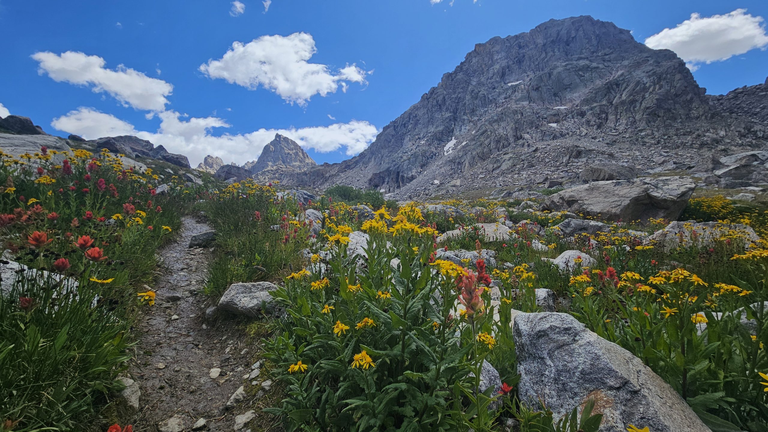
Mountain Beauty
As I climb higher there’s a small mountain lake. I’m sure it is freezing and with the wind and clouds I’m not even tempted for a swim. I decided to touch the water and confirm its coldness.
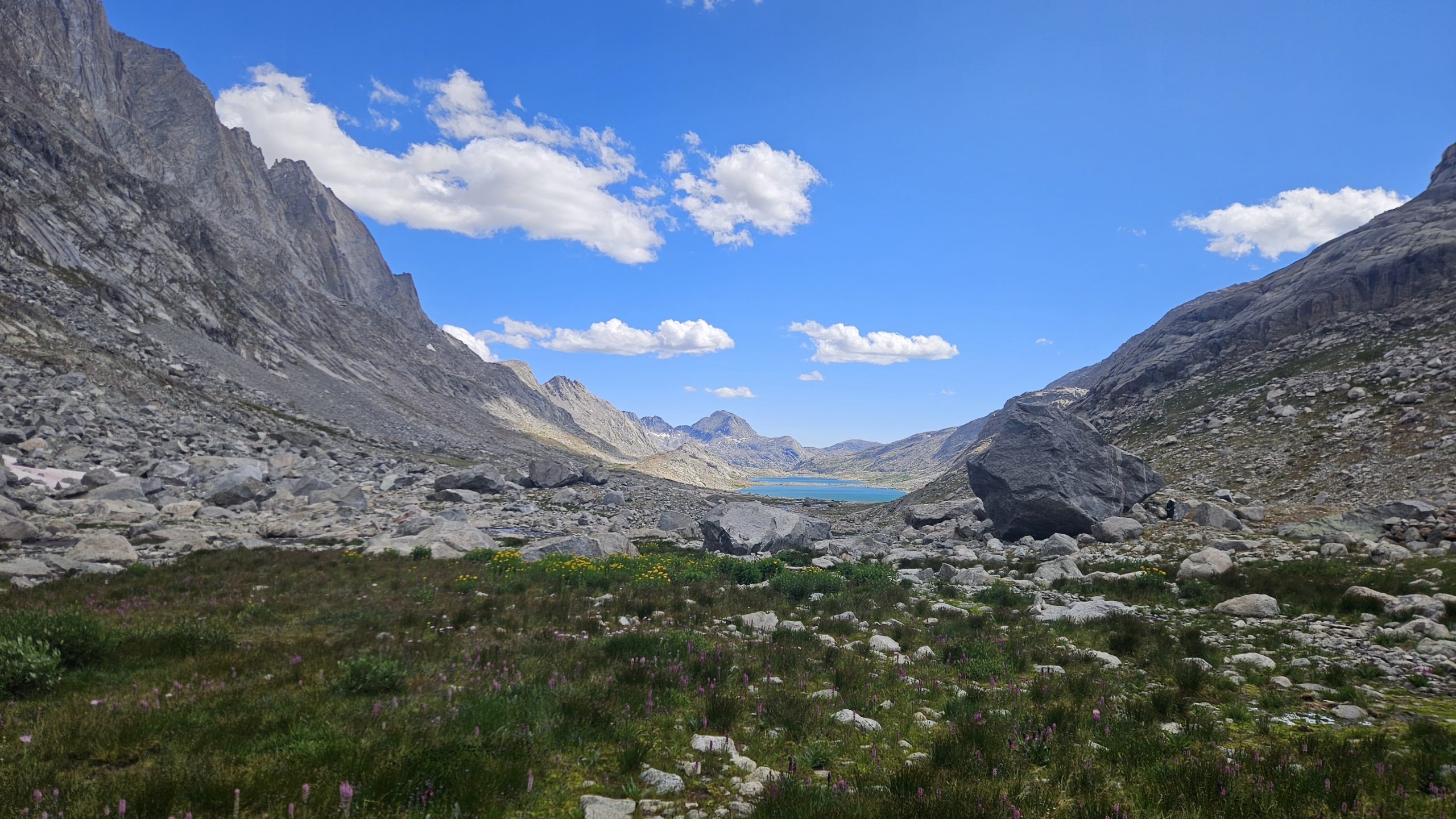
The trail flattens out momentarily before dropping down to another Alpine lake. The color is unreal. A Greenish blue. A stark contrast to its surroundings. Granite rock marked with blotches of green grass and patches of snow still lingering from the winter.
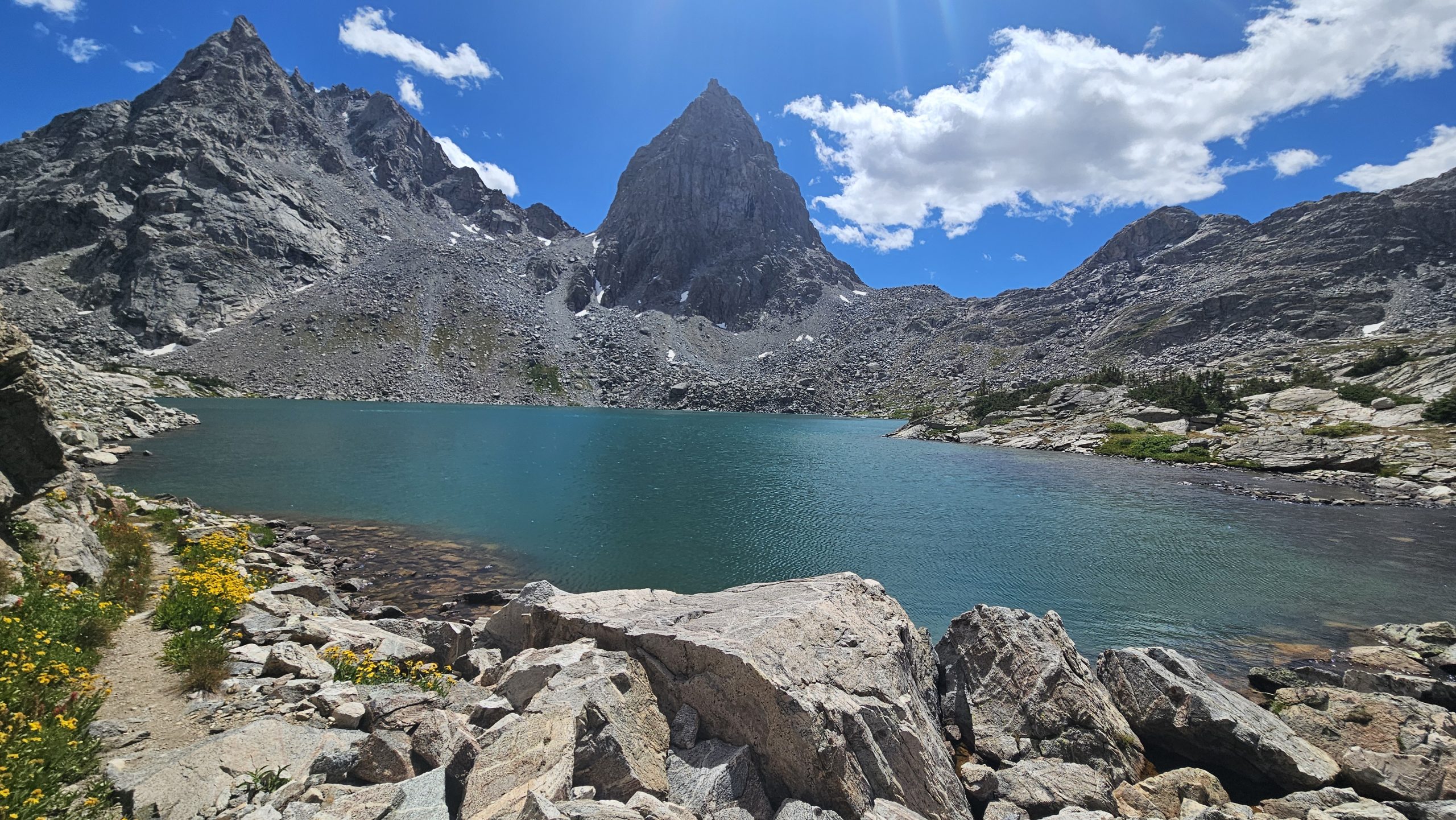
Soon enough, the trail begins upwards yet again.
As I crest a small knoll, suddenly I hear the sound of rushing water. I look up to the right to see a waterfall, beautiful.
What Trail?
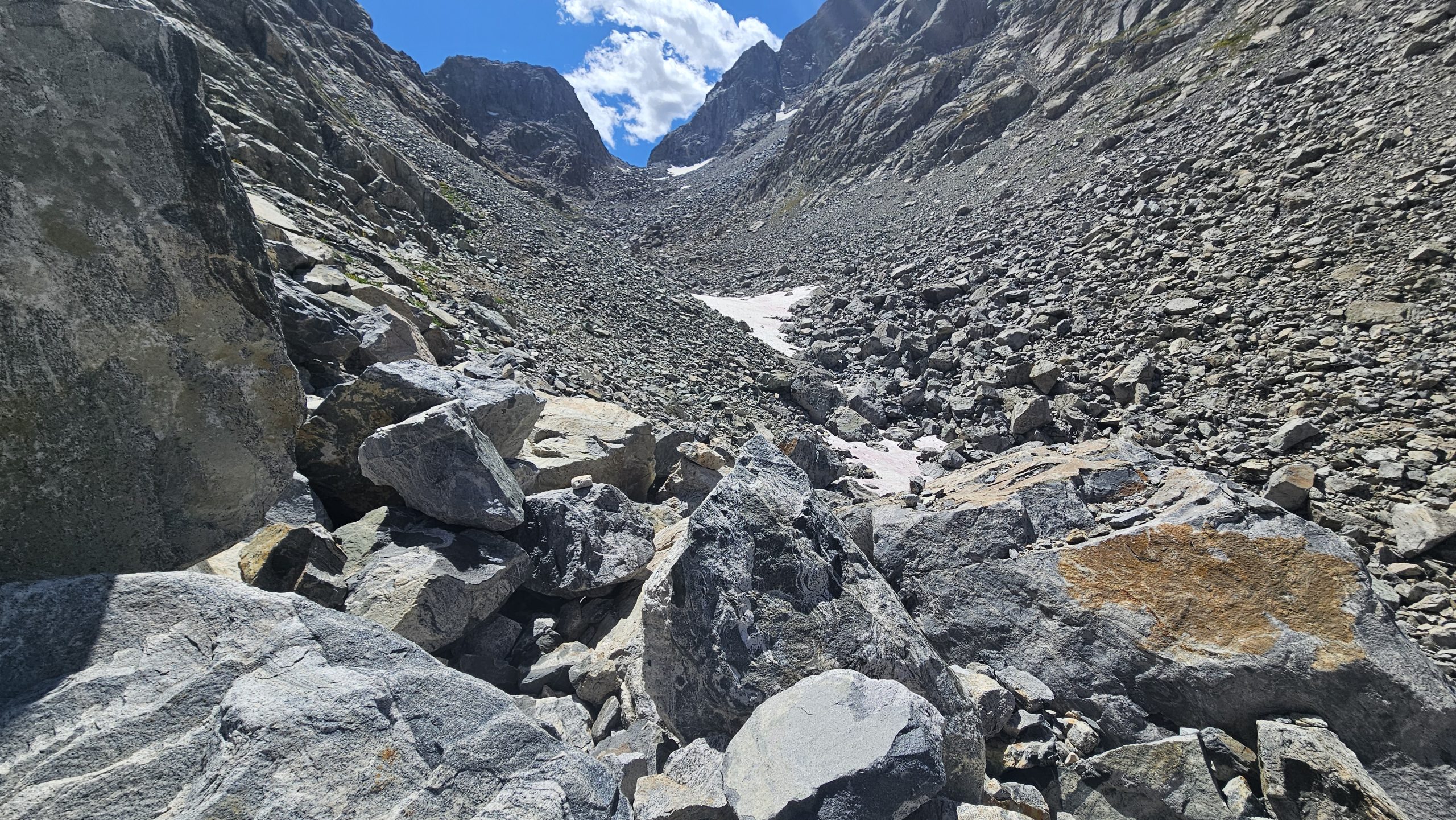
After a time of climbing, the rocks and boulders begin again and I ascend rock hopping for a while. Eventually I check my map to see my progress and find that I am off of the trail. Luckily for me, I can loop around the rock structure ahead crossing some snow patches that have pink and red bacteria on them. I find my way back to the trail. It gets steep and real windy. Loose rock crumble beneath my feet as I make my way to the top. I take frequent 5 second breaks to catch my breath and also route check my next steps. As I reach the col I realized I’m off trail by a good 40 feet and I’ve climbed higher than I needed to. I also see a northbounder coming up the opposite side.
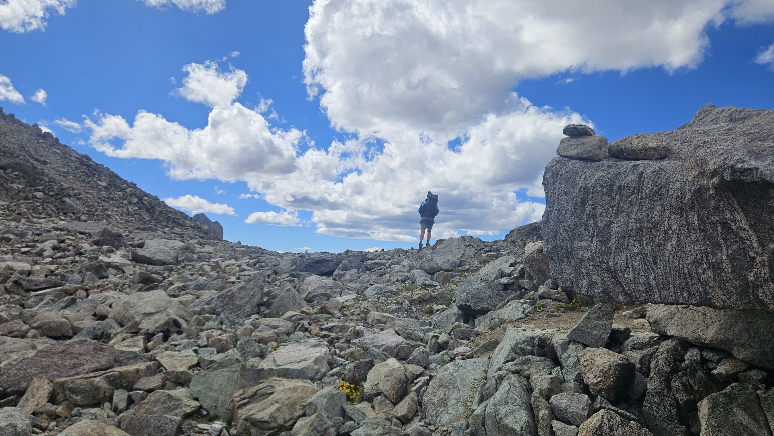
I stop, take off my pack, and start eating chips. Coco and I, the northbounder, start talking. He said he tried to follow the line on the map as best as possible and he should have just gone up the valley. He recommends that I just do that. After chatting for 10 or 15 minutes we decide it’s time to continue making miles. We head off in our separate directions, him north and me south. I can see where he came from and that route looks treacherous. I see another one that goes straight down the mountain and I choose that. The route is fine if not steep up until a certain moment where all rocks beneath my feet are loose gravel. My one foot slides as I lean into the mountain. My other foot somewhat sturdy. I ask the Lord for help. I slowly regain footing on semi secure rocks. Other than this brief moment the rest of the way down is good. I didn’t know this but the route I took is the twin glacier route.
I follow a mountain stream/glacier runoff. There’s a large snowfield that probably will never melt this summer.
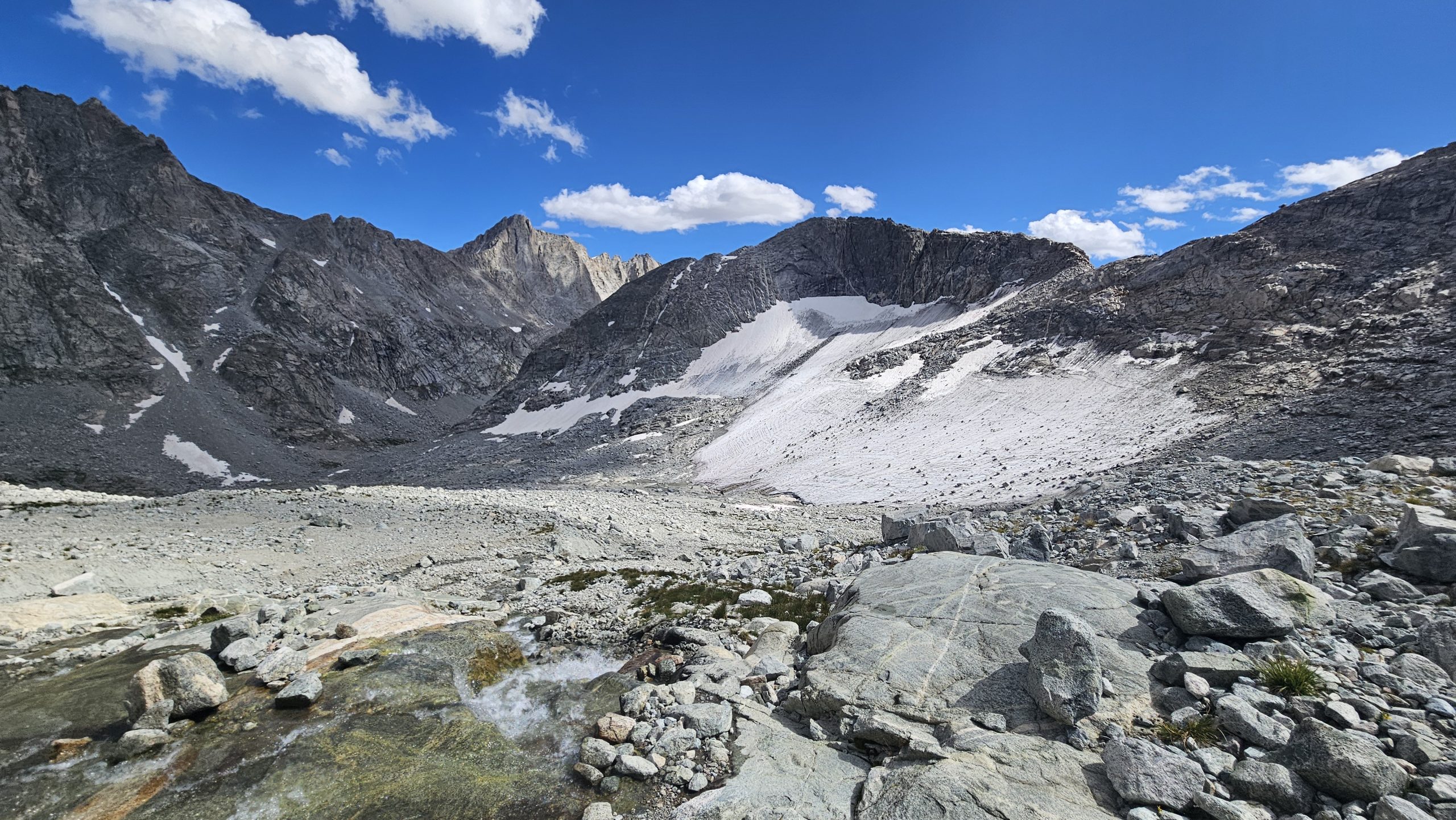
Low Lands
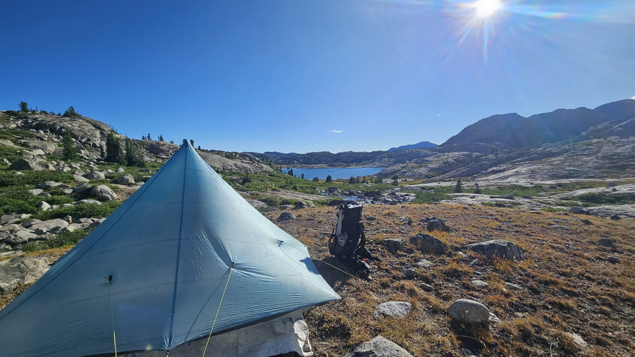
As the trail gradually descends, the wind picks up. I spy several lakes in the distance. The trail will continue to follow alongside these lakes all the way back to the red line of the CDT. There are about 6 or 7 I think. I pass several tents set up with no people in sight. It’s very windy and I don’t think I could pitch my tent here even if I wanted to.
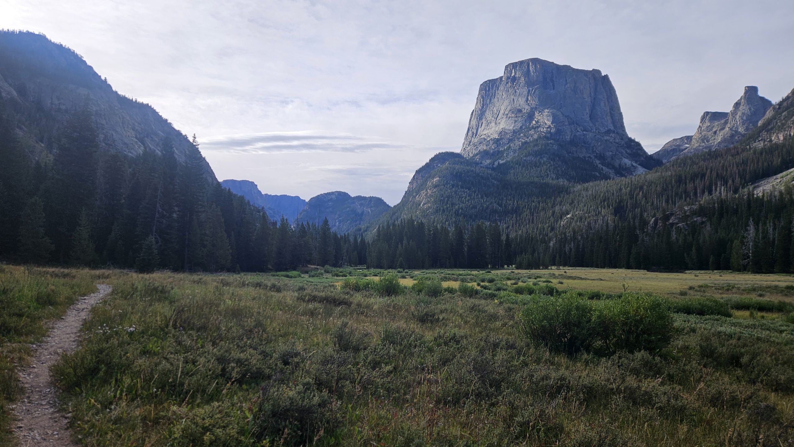
I continue on past the lakes and eventually come to a group of about 6 guys hiking up the mountain. Another hiker comes up with a pack on and ask me about Knapsack Col. He’s a friend of Coco and said he’s just slow. As I think more about how far away town is I debate on stopping early. The thought becomes more and more appealing. As I pass a stream I walk my way up it and talk to a day hiker about some lakes and the pass that he came from. I head off trail and soon find a flat spot with a gorgeous view of a lake bellow surrounded by mountains. It’s a bit windy but the ground seems stable and my stakes go in deep.
Camp
It’s only 6 o’clock, which is pretty early for me to stop, but I figure either hang out here for the evening or just get closer to town to get in early. I don’t feel I need to get into town early tomorrow. In fact I wouldn’t go in at all if I had enough food, but I need to resupply, so I must go into Pinedale.
Even stopping at 6 PM I only have about 12 miles to the trailhead to hitch into town. I should be there before noon, which is plenty of time to resupply and charge things up. There’s a hostel in town that I will most likely stay the night at and head out the next day after a big breakfast of course. Until next time, happy trails.
This website contains affiliate links, which means The Trek may receive a percentage of any product or service you purchase using the links in the articles or advertisements. The buyer pays the same price as they would otherwise, and your purchase helps to support The Trek’s ongoing goal to serve you quality backpacking advice and information. Thanks for your support!
To learn more, please visit the About This Site page.
-

 Brand Stories3 weeks ago
Bloom Hotels: A Modern Vision of Hospitality Redefining Travel
-

 Brand Stories2 weeks ago
CheQin.ai sets a new standard for hotel booking with its AI capabilities: empowering travellers to bargain, choose the best, and book with clarity.
-

 Destinations & Things To Do3 weeks ago
Untouched Destinations: Stunning Hidden Gems You Must Visit
-

 Destinations & Things To Do2 weeks ago
This Hidden Beach in India Glows at Night-But Only in One Secret Season
-

 AI in Travel3 weeks ago
AI Travel Revolution: Must-Have Guide to the Best Experience
-

 Brand Stories1 month ago
Voice AI Startup ElevenLabs Plans to Add Hubs Around the World
-

 Brand Stories1 month ago
How Elon Musk’s rogue Grok chatbot became a cautionary AI tale
-

 Brand Stories3 weeks ago
Contactless Hospitality: Why Remote Management Technology Is Key to Seamless Guest Experiences
-

 Asia Travel Pulse1 month ago
Looking For Adventure In Asia? Here Are 7 Epic Destinations You Need To Experience At Least Once – Zee News
-

 Brand Stories1 month ago
ChatGPT — the last of the great romantics
You must be logged in to post a comment Login