
Destinations & Things To Do
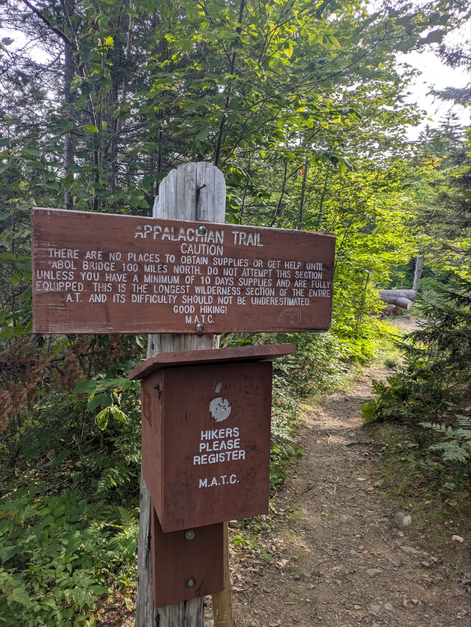
Setting Forth Into Maine’s 100-Mile Wilderness (ECT Day 205)
- Hiked Today: 20.5 miles
- Appalachian Trail (2,083.8 – 2,104.3)
- Total Hiked: 4,037.5 miles
- Total Paddled: 99.5 miles
Weather: 55-77°F, sunny, with just a few clouds. No wind. Nice.
Elevation: 575 – 2,670 feet
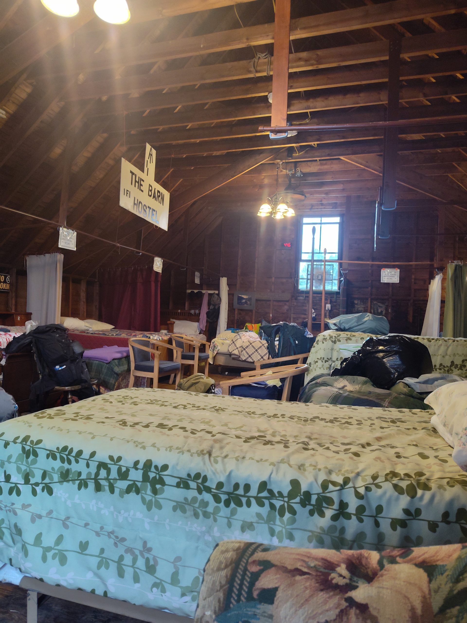
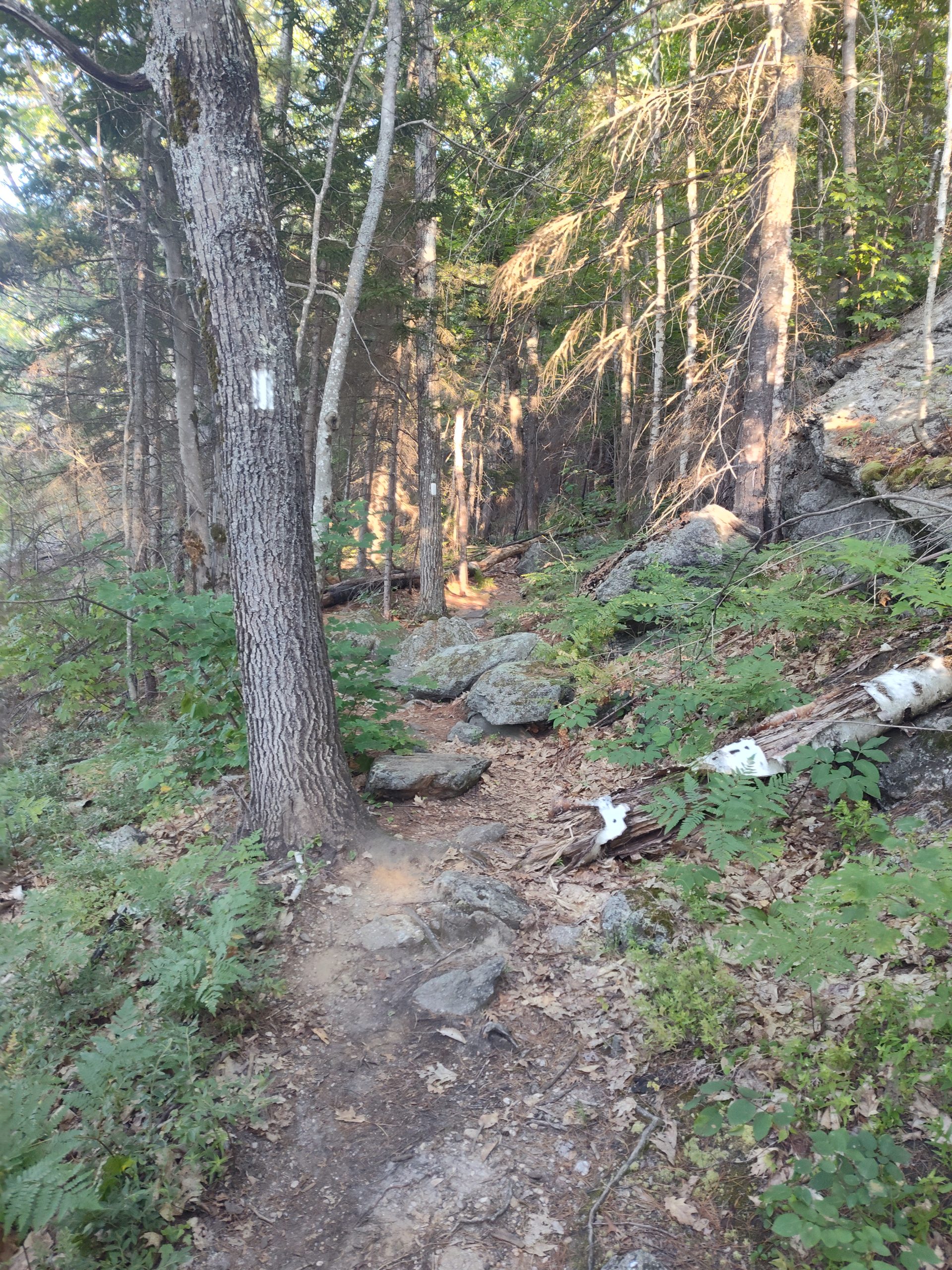
ME Route 15 & Shaw’s Hiker Hostel to Barren Mtn Spot
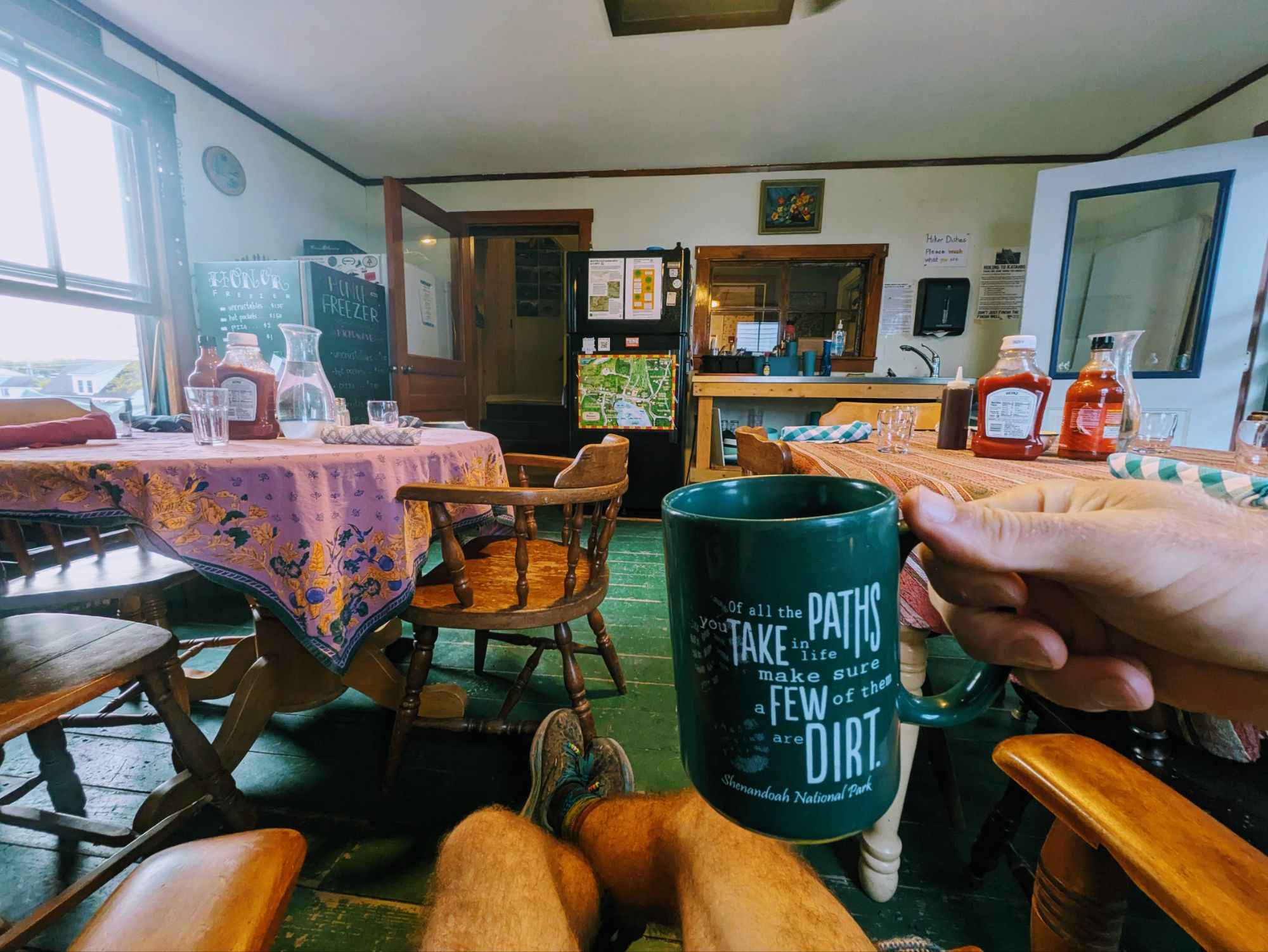
At 5:40 am I unzipped and crawled out of the tent and then headed into the hiker lounge. I wanted to have all my devices 100% charged and was close, but not quite there yet. Sitting in a cozy chair, a hiker soon walked by with a steaming ceramic mug in hand. That was my cue to go fetch my own cup of joe.
After a while I got myself motivated to start packing up. My tent was pretty soaked with condensation, so I was strategic about setting that out to dry and shoving everything else in first. Inside the house again, the tables had all been set and most hikers gathered a little before 7:00 am for Shaw’s famous hiker breakfast.
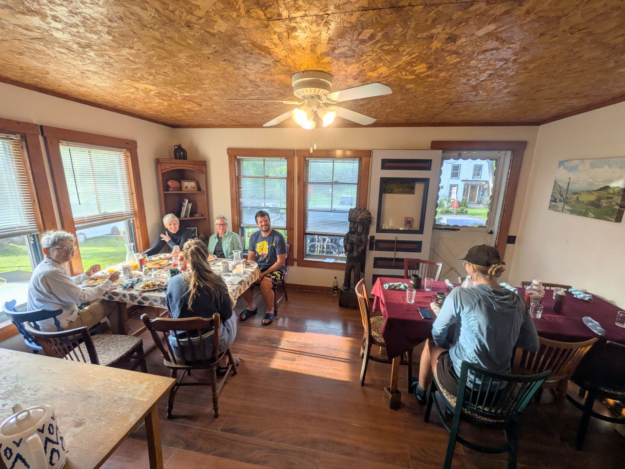
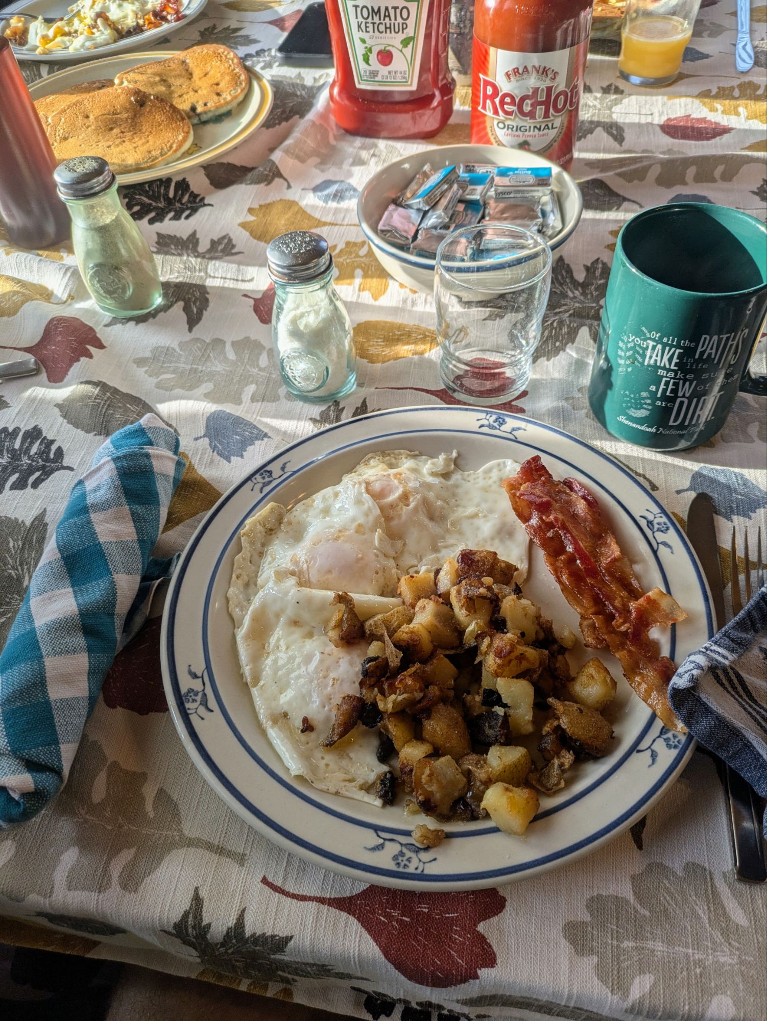
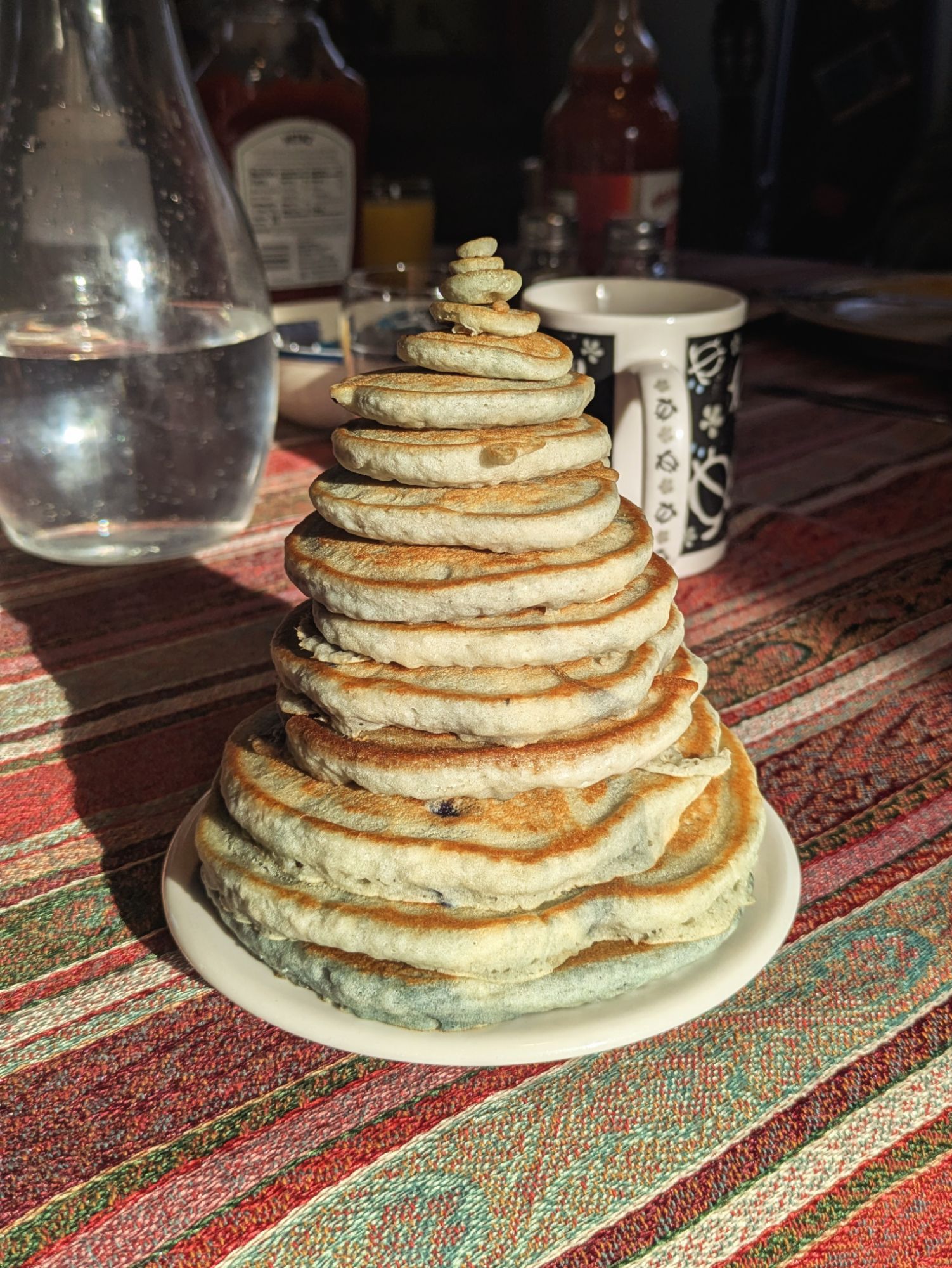
It was a wonderful experience. Great conversation, lots of laughs and stories about our silly life on trail, and some of the best victuals (this is a word my dad uses and he’s the only one I know that does) of the entire journey. I devoured it all… crispy bacon, fried potatoes with onions, 3 perfectly fried eggs, and best of all, blueberry pancakes
I sat with Potter, Oatmeal, Jodie (I think), Shorts from Canada and Pooh Bear from Belgium. With folks seated it was a little easier to guestimate how many of us there were and I’d say in the 25-30 range, maybe more. More than a few were hikers I met earlier on trail at various points.
Shaw’s is an incredible place and I had such a wonderful experience staying. On my 2019 hike of the PCT I was fortunate to get the chance to stay with some of the legendary trail angel hosts of that trail, Scout and Frodo’s near the southern terminus and also the Saufley’s “Hiker Heaven.” This felt like those stays… out of the ordinary warmth, kindness, hospitality, and a haven for weary hikers. It’s also been around since the 1970’s I believe, so there’s a ton of character and history that goes along with it. I was happy to have it be part of my ECT experience.
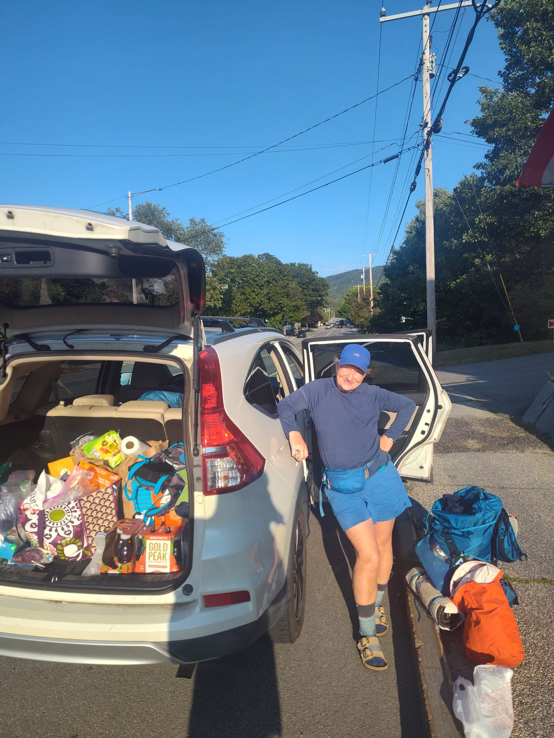
I wanted to get on the first shuttle back to trail if possible. Hoping for a full day of hiking, that early-ish start would be needed. And it worked out. I got myself all packed up, was one of the first to settle up my tab, and didn’t even have to throw any elbows to get a ride in that first vehicle leaving, which was driven by our host, Poet.
In my shuttle were Baby Talk and Rocket, Early Bird, Fire Tower, and Double Take (I think). We were all northbound for Katahdin except Double Take. At the trailhead, Poet gave us some last minute tips for side trail views and such and then left us with a haiku he came up with on his own AT journey. It was silly but thought provoking and heartfelt.
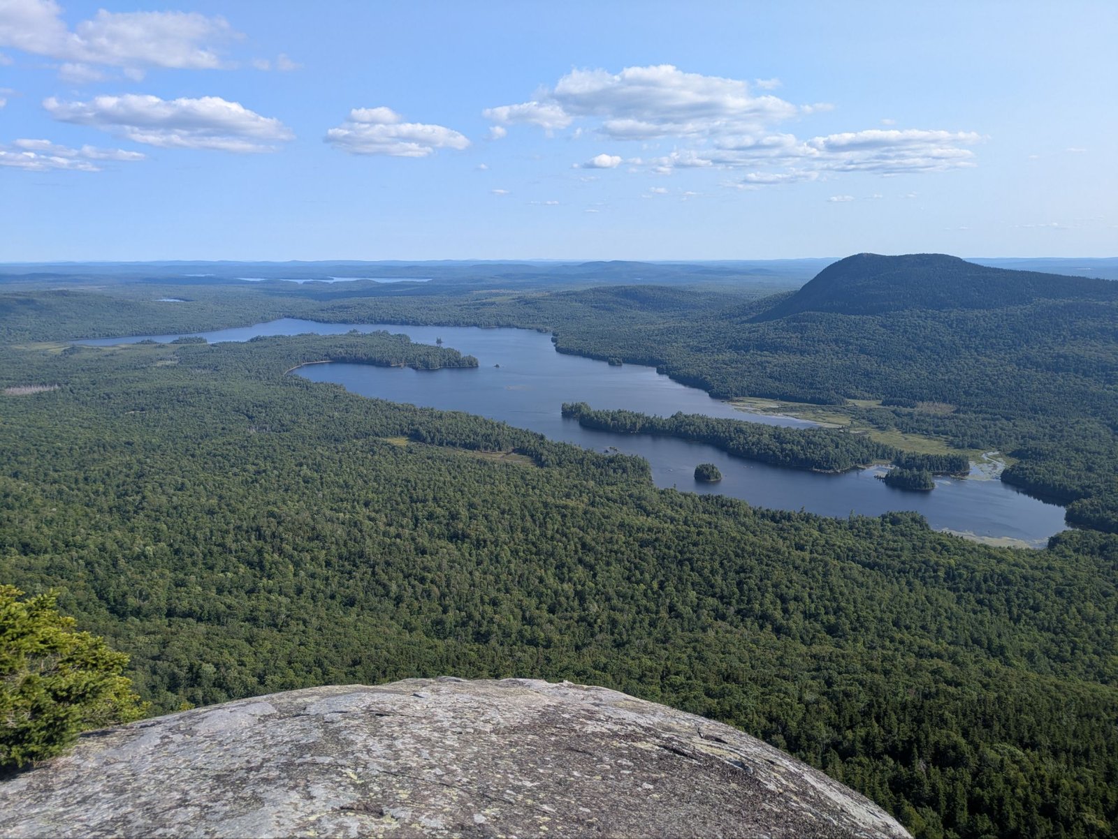
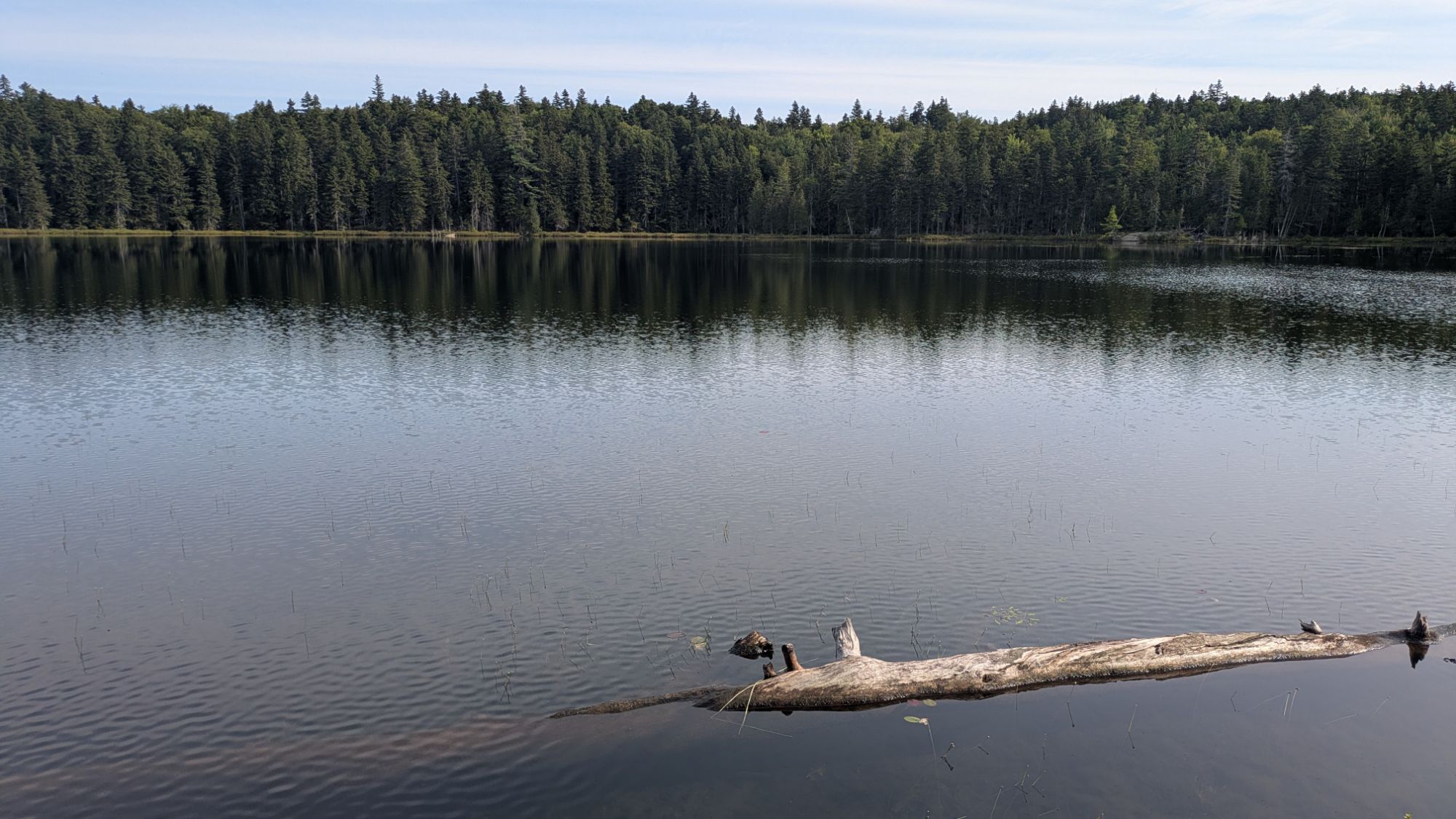
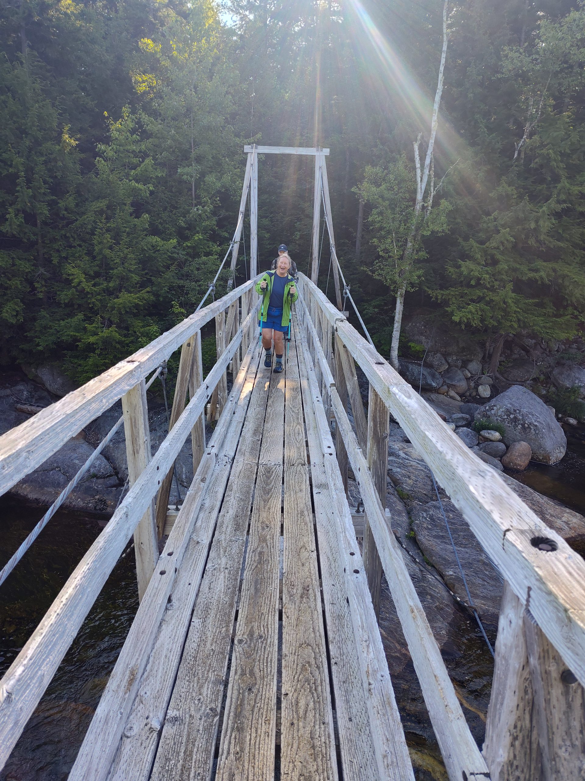
The others shot right on trail, but I stretched out and backtracked some to actually tie my walk together haha. I’m a semi-purist, I guess. Then, I hit it. The air was still and it became quiet quickly getting away from the road. As I passed Fire Tower, we both agreed it already felt like the trail, by offering up the peace and quiet, was suggesting we ruminate about the journey we’ve been on and it becoming nearer to its end. The ponds were near “glass” too furthering this idea of serenity and contemplation.
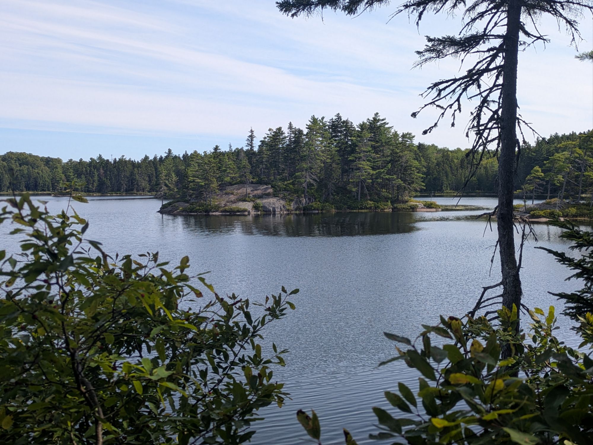
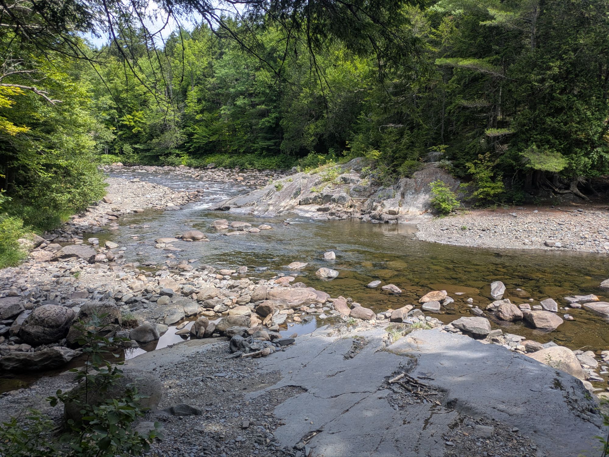
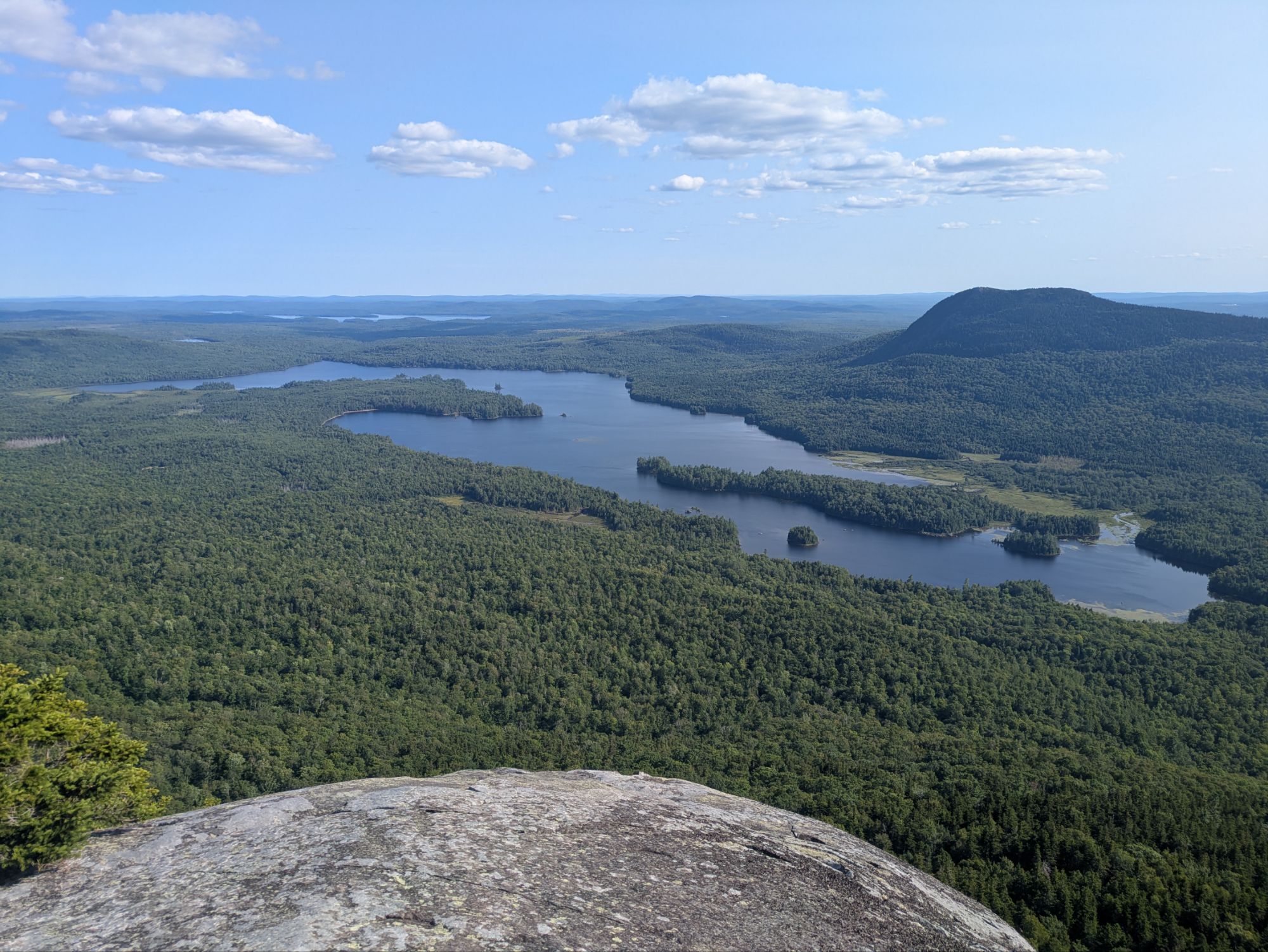
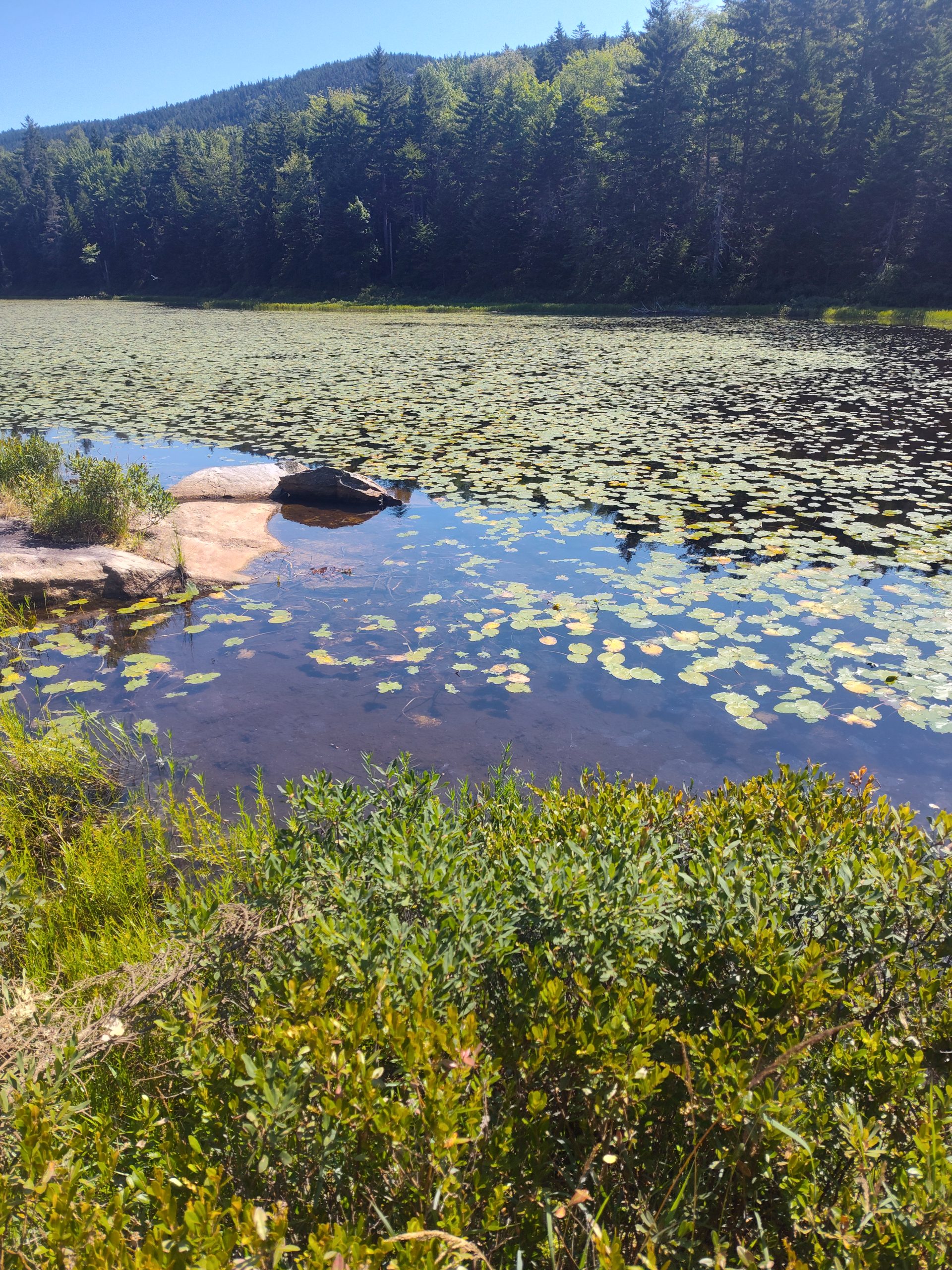
I took this photo seeing that island and the rock outcrop. I’m a big fan of jumping in off such places, but everything has been too shallow thus far.
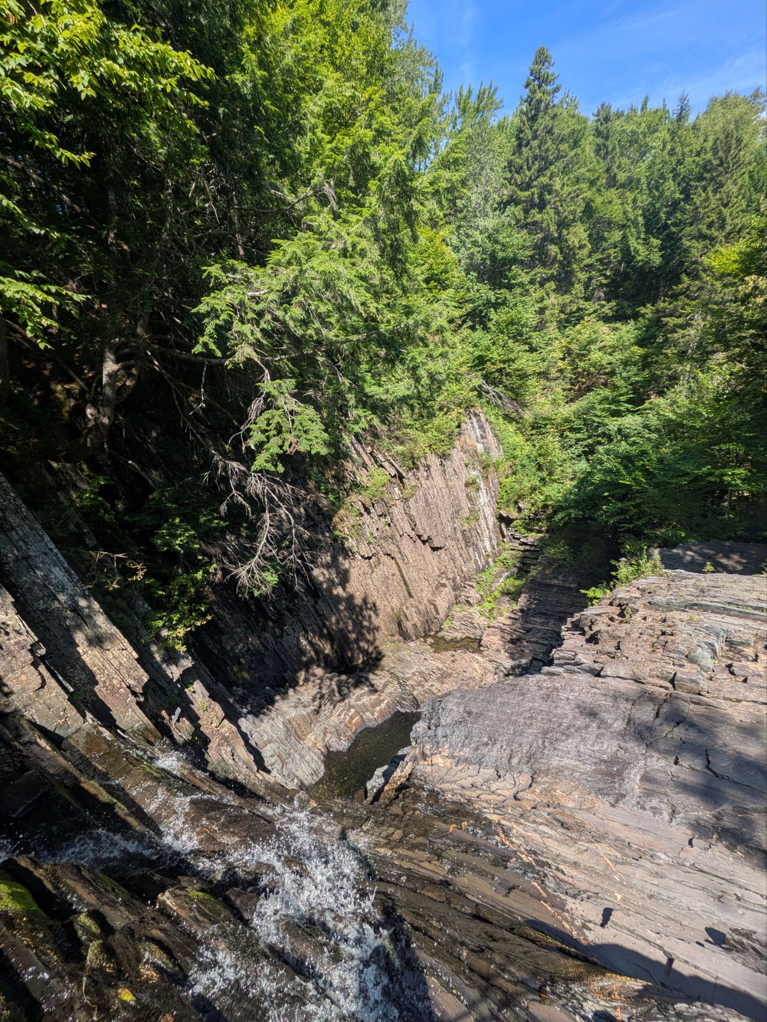
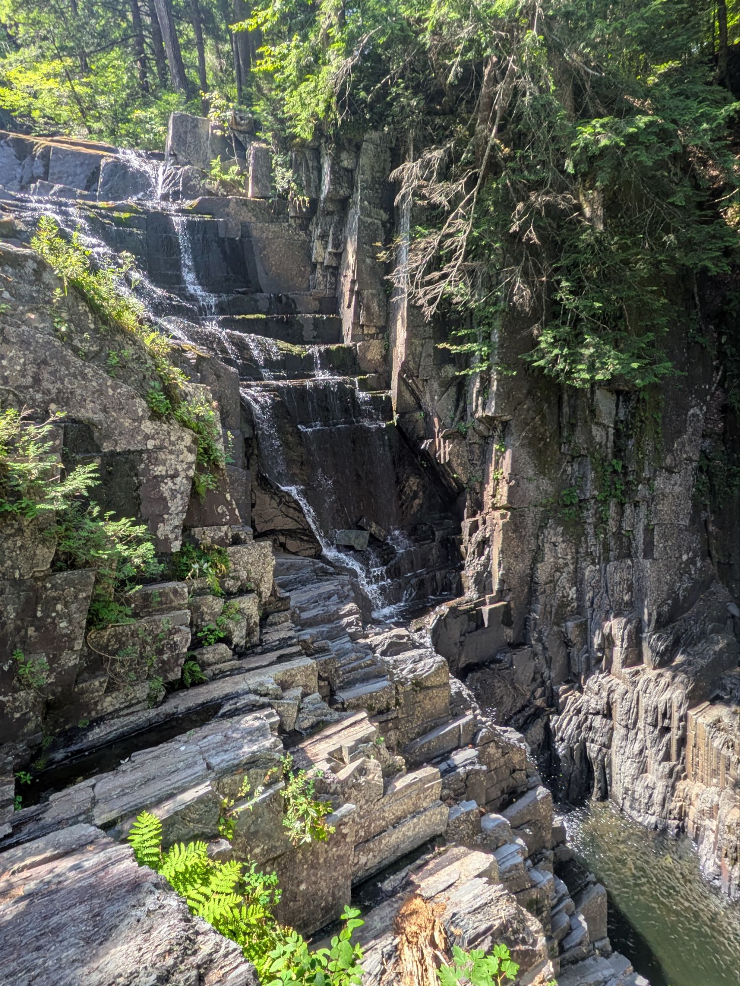
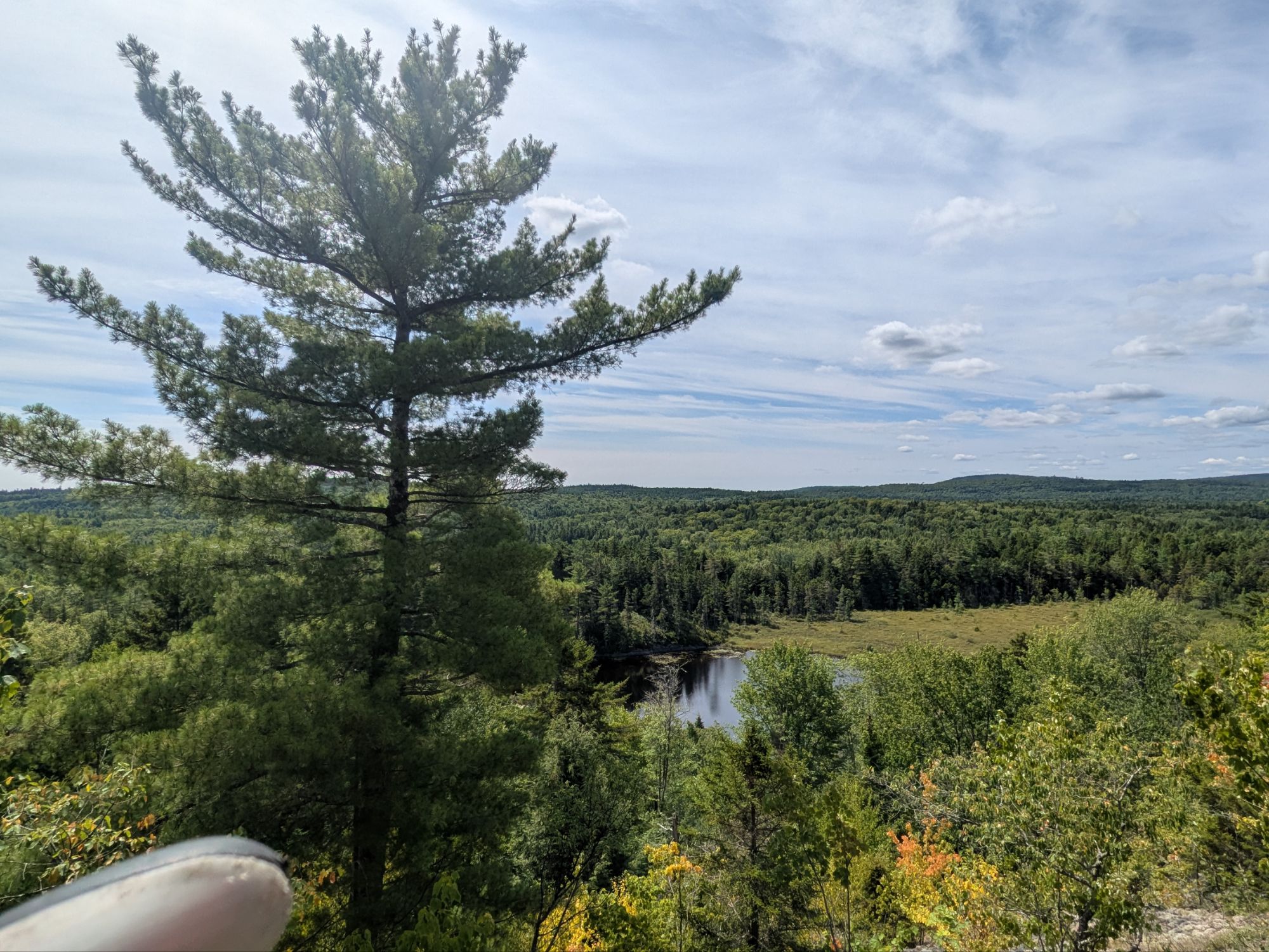
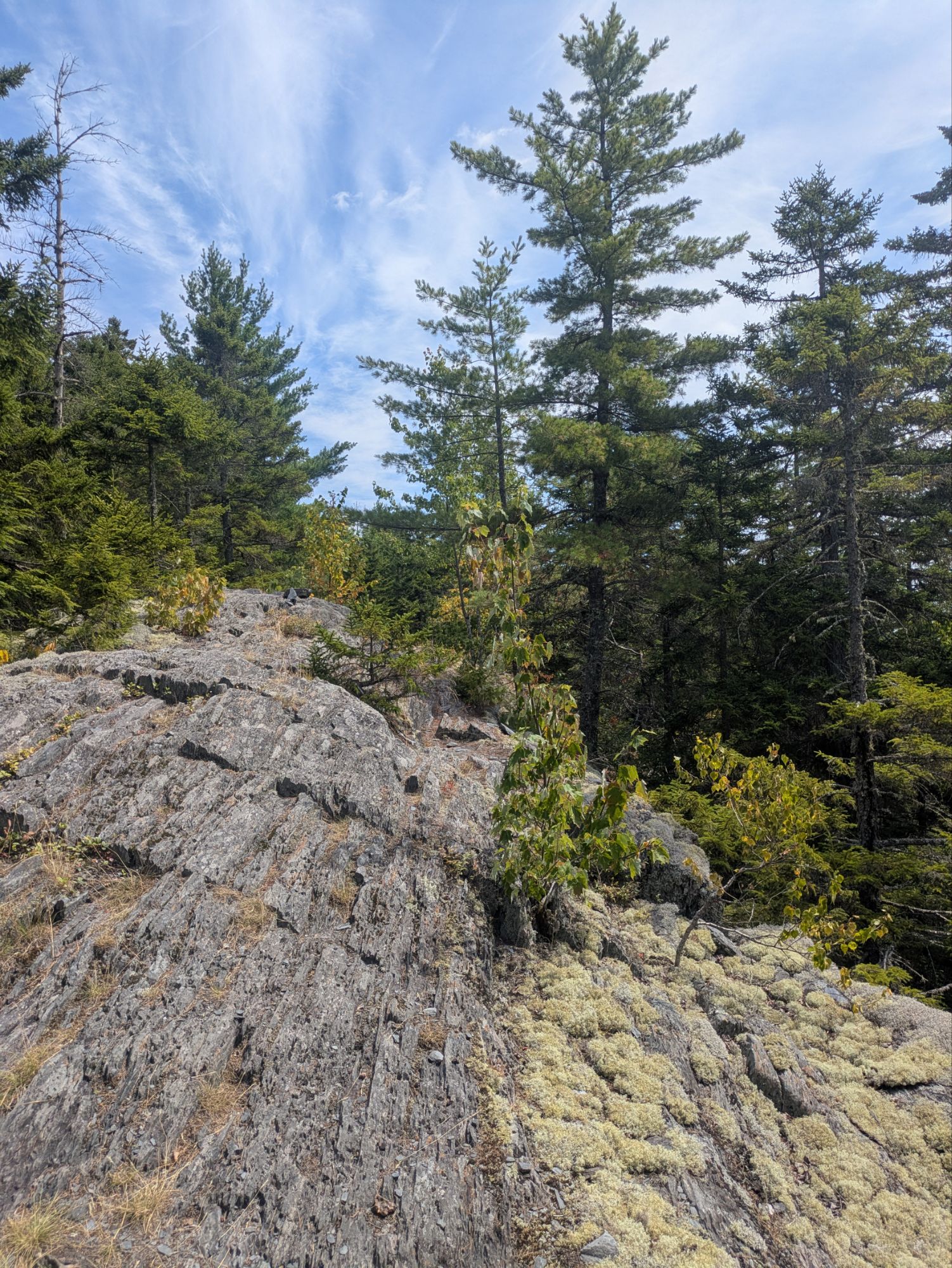
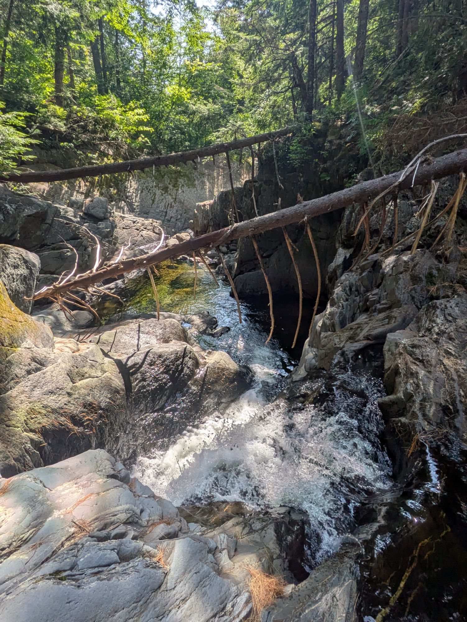
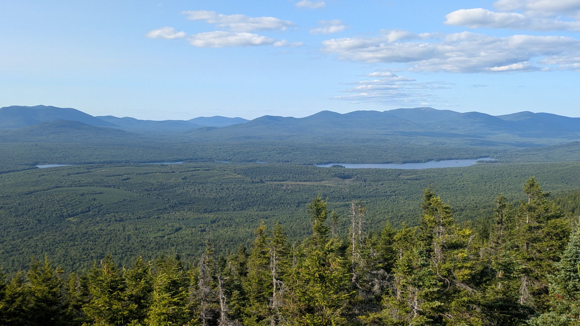
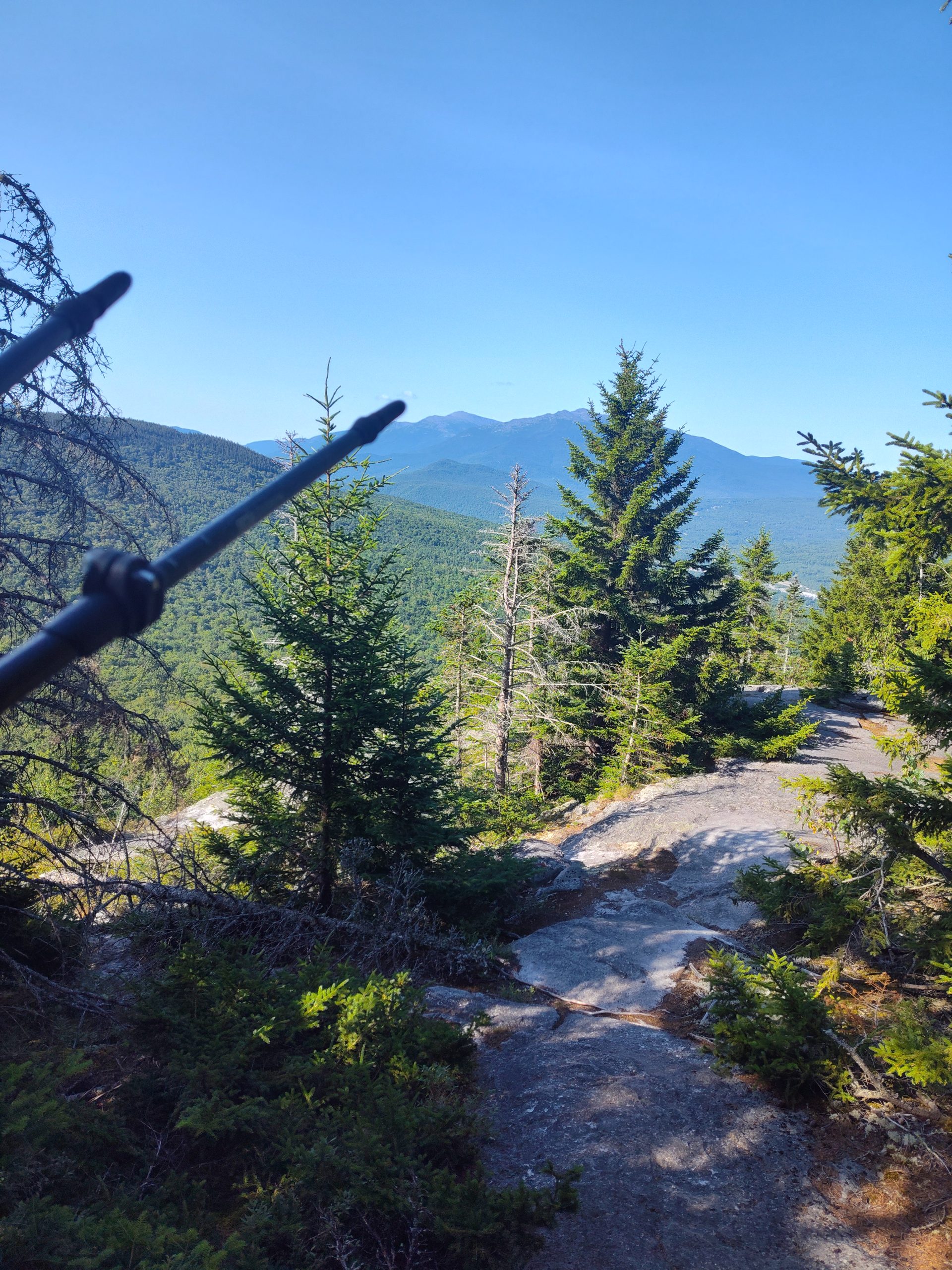
The first half of the day the hike was characterized by short bursts of up and down, but generally mellow. It was primarily a forest walk and I walked by several more ponds. There was a pretty stellar waterfall at Little Wilson Falls. And later on, the trail went up slightly higher in elevation to some ledges which offered some views.
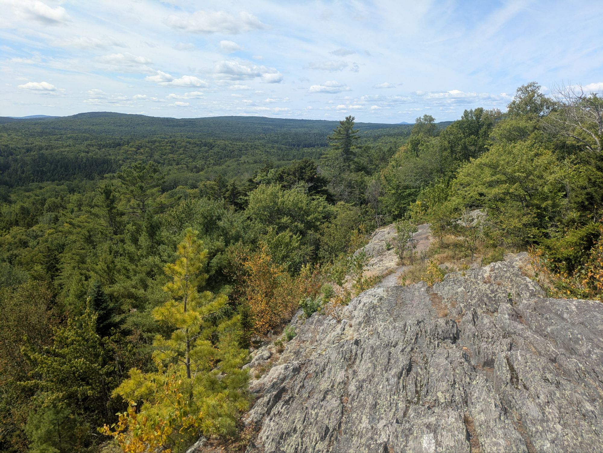
I found a nice lunch spot around 12:30 pm.
I went into swim mode first, but came up against two challenges when I tried to take my quick dip. First, the boulders were all super slippery being covered with algae. I overcame this obstacle by being slow and careful and doing a kind of crab walk out to the deeper waters where I could finally plop in. The next dilemma, however caused me to retreat… horse flies! Huge ones that were biting my bare back and legs. I was slapping and stunning several, but this was yet another ambush. I retreated to shore, but they were relentless. I was thinking of getting the shoes on and running for my life, but they started to thin. Some lay at my feet and maybe I scared the others off. Maybe their natural habitat is closer to the water and they had to return? Whatever the reason, the onslaught ended and I was safe to enjoy my lunch in peace.
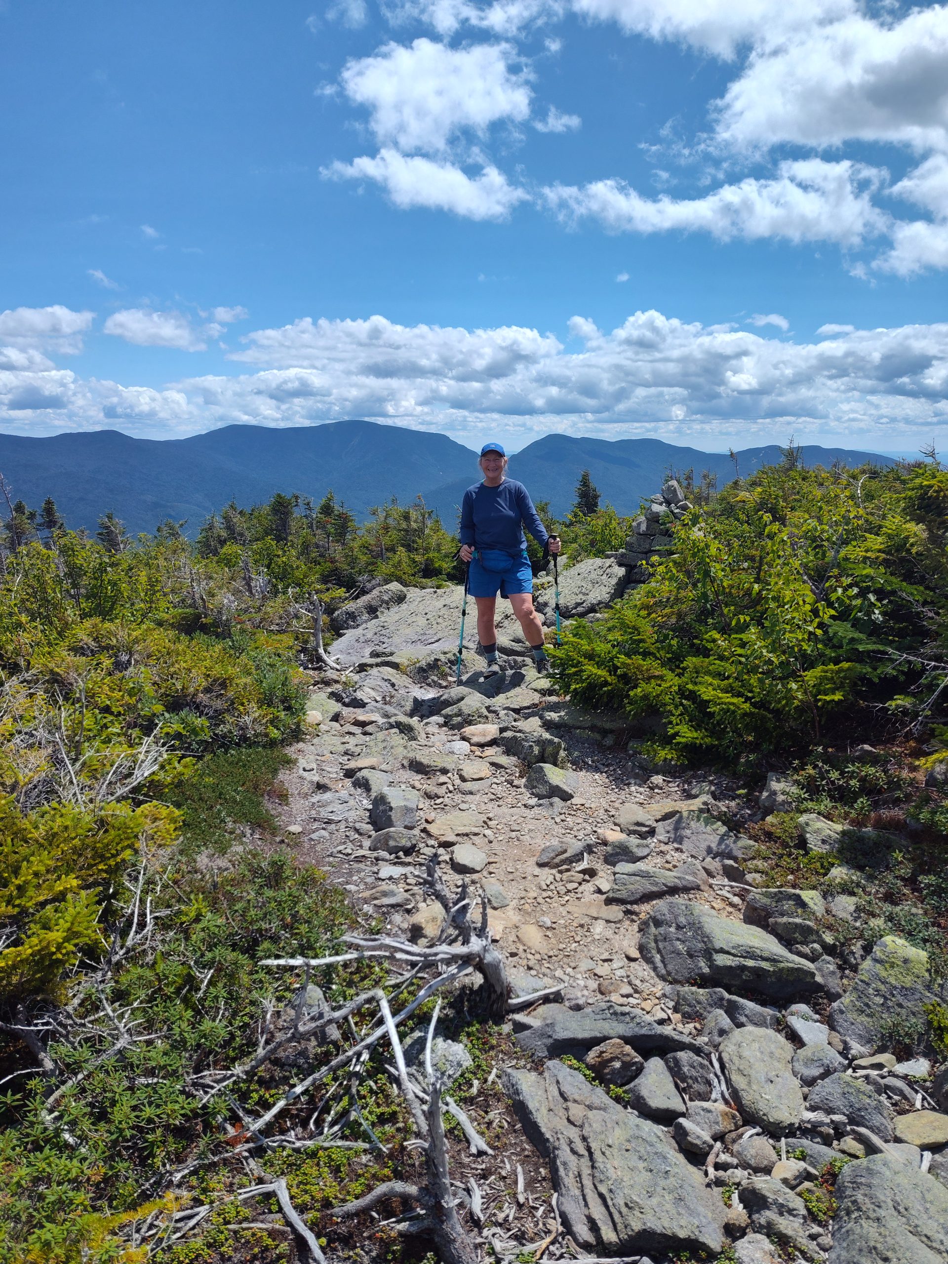
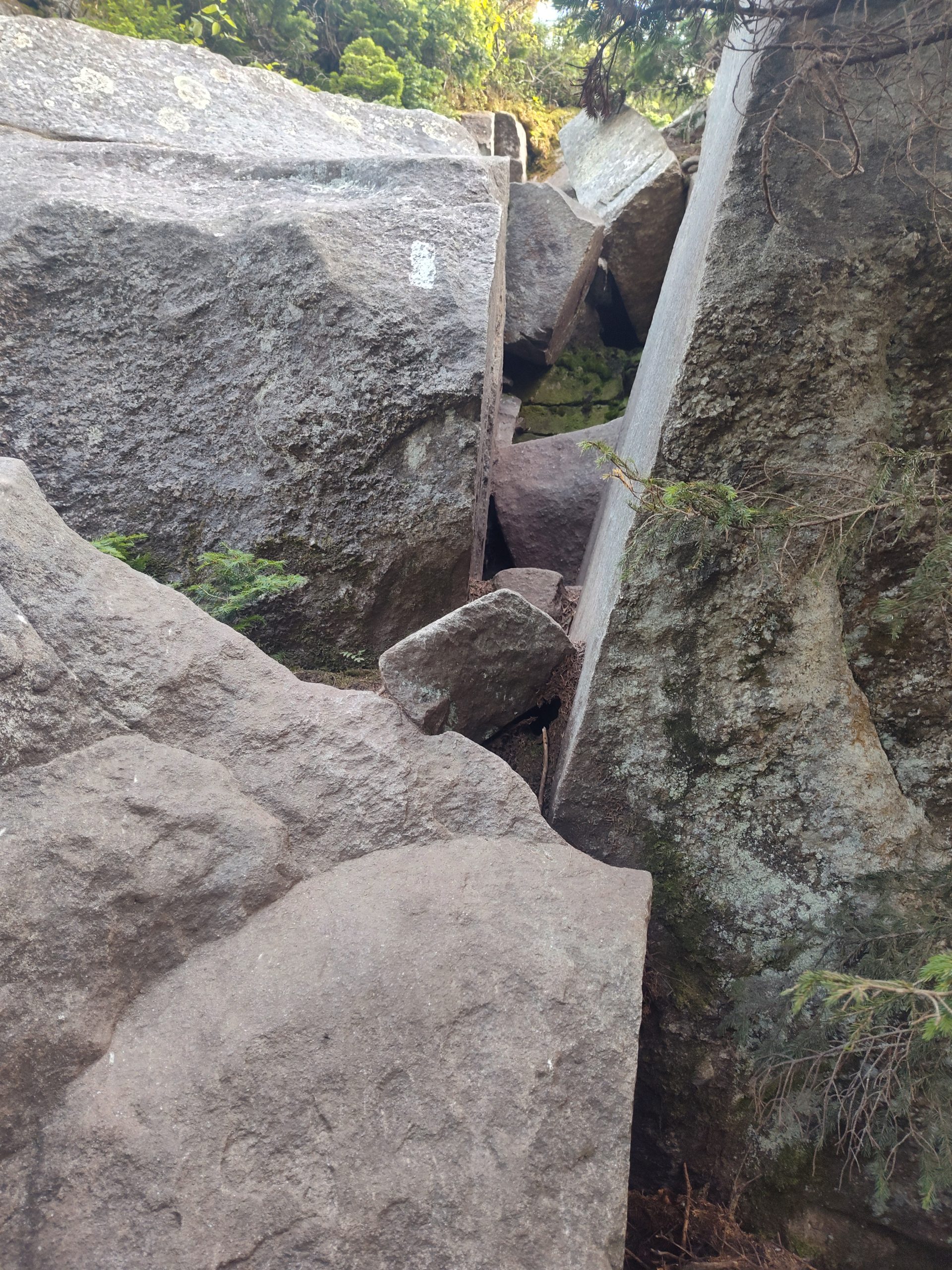
The first few hours of post-lunch were similar to pre-lunch, forestry stuff with some streamside walking. A little before 4:00 pm though, I started up the days bigger climb from around 600 feet elevation up to the 2,670 feet Barren Mountain. There was a first chunk and then it leveled out some before the second chunk sky rocketed up again.
I didn’t even realize the trees branches bending like that until looking at the picture. It was not windy today, but maybe over time the prevailing westerlies have transformed it permanently?
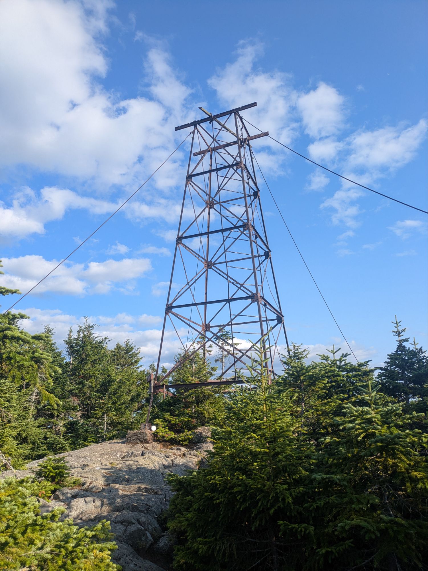
Found this guy at the top of Barren Mountain and although I didn’t go all the way up, I may have climbed just a short ways.
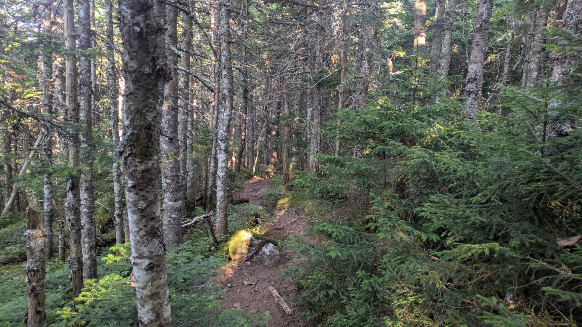
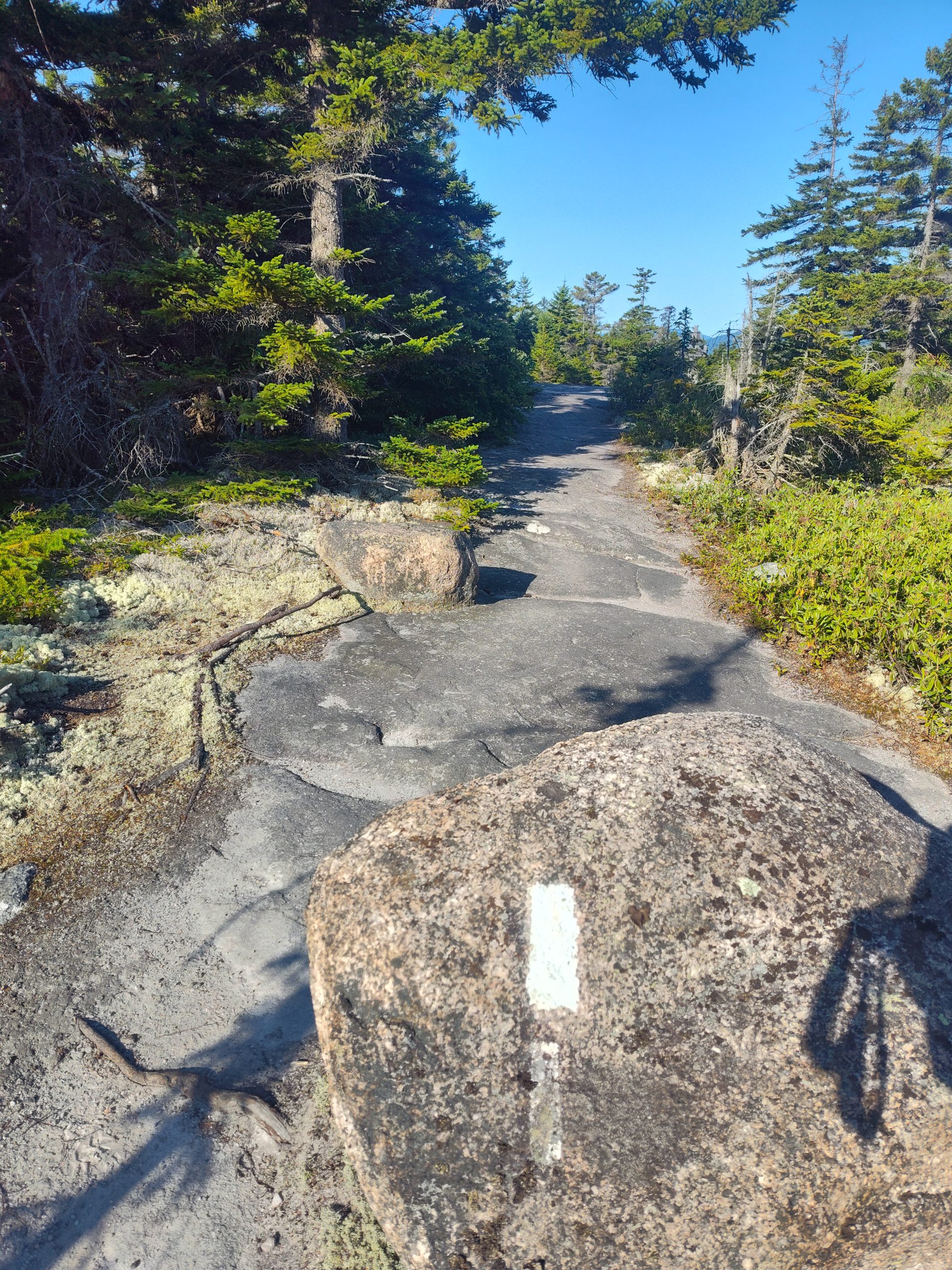
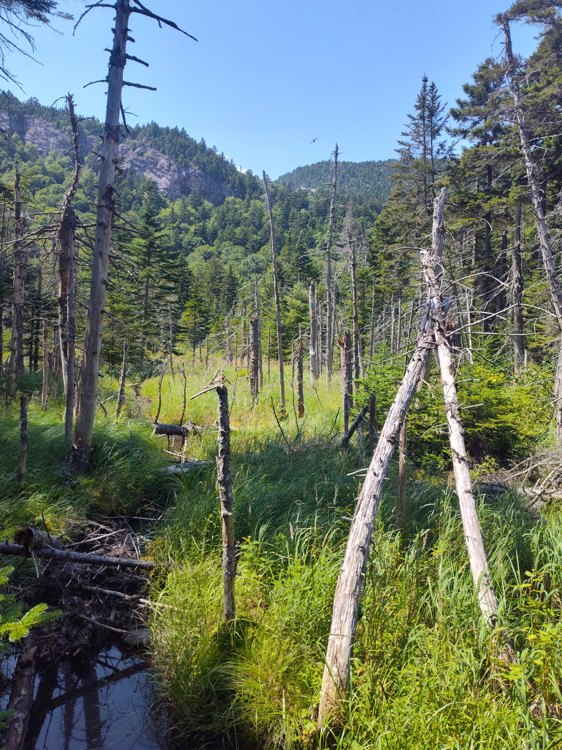
After Barren Mountain, I got some flat-ish woods. See here’s what the trail looked like.
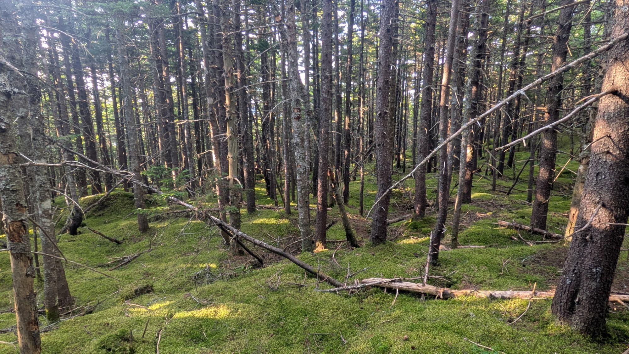
And this is what the woods would look like if I were to just be going cross country and no trail had been made.
I was very tired and considered stoping earlier than my picked out camp spot. The water ahead wasn’t reported to be great and maybe even non-existent at this point since the last report was “trickling” and about a week ago. But the closer camp spot was 0.3 miles off a side trail that was reportedly steep. There was a pond there. It shows how much I dislike going off trail that I kept going.
Once ahead at the water source, it wasn’t great. But, I’d gotten myself into a desperate situation and so made it work. The stream was not flowing anymore, but I found a pool, a.k.a., a puddle to fill up from. The water had a heavy brownish tan tint, but I cared not. Water is water, right? At least that’s what I was trying to convince myself. And so I continued 0.1 miles to a little tentsite and was happy it all worked out!
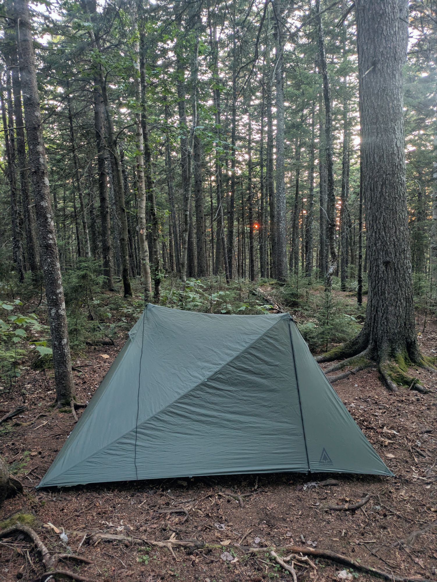
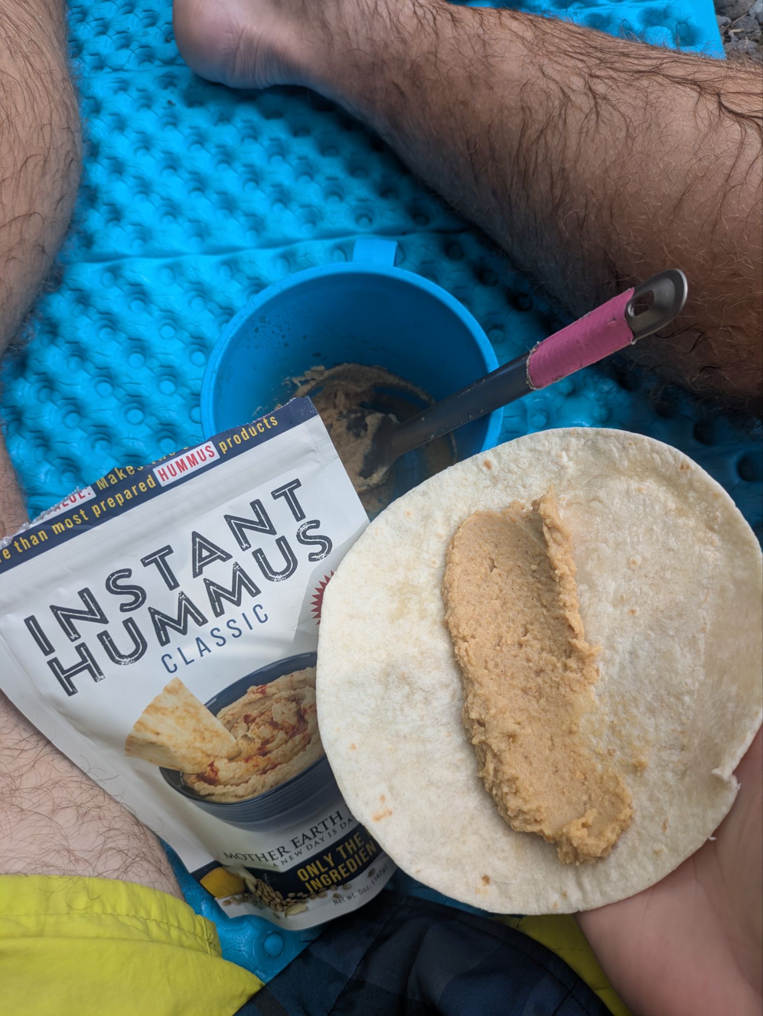
I got my first chance eating the super SPAM by dicing it up into my mac and cheese. I used one third of it, which was a lot! Pretty good combo though in my opinion. I did not get another loon lullaby this night, but instead was sung to sleep by the swarm of skeeters outside my tent!
It is such an incredible privilege to be on this journey backpacking across the eastern U.S. and I have so much gratitude for the opportunity. As I make the push to finish the Appalachian Trail, I’m also making a push to reach my goal in raising funds for Outdoors Empowered Network (OEN)! I’m trying to raise $2 for every mile I hike and am falling behind! Any amount helps… $2, $5, etc… it all adds up
The sad reality is that so many never come to know the benefits of connecting with nature. I want others to experience this relationship that has been so important in my life. Imagine a kid staring in wonder at a bright and colorful butterfly, laughing at a frog hopping away from them, being curious why the leaves are changing colors with the season. By donating, these are the things you’d be making happen!
So thank you for joining on the journey! It means a lot that you took the time to read up on these adventures. And if you want to help ALL kids get access to the outdoors, please help me in supporting OEN! The “Tip Author” button is a direct link to my fundraising page. Y’all are truly amazing. Thank you!
Podcast of the Day:
“Engines of Outrage: Parts 1-4” – Landslide
This website contains affiliate links, which means The Trek may receive a percentage of any product or service you purchase using the links in the articles or advertisements. The buyer pays the same price as they would otherwise, and your purchase helps to support The Trek’s ongoing goal to serve you quality backpacking advice and information. Thanks for your support!
To learn more, please visit the About This Site page.
Day 33
Start: Paradise Park Loop Alternate, mile ~550
End: Timothy Lake, mile 575.2
Miles hiked: ~25.2 miles
Last night was a little windy, which kept me from slipping into a deep sleep for a while. So, this morning, I slept in a bit later than usual, but eventually packed up and left my nearly perfect campsite.
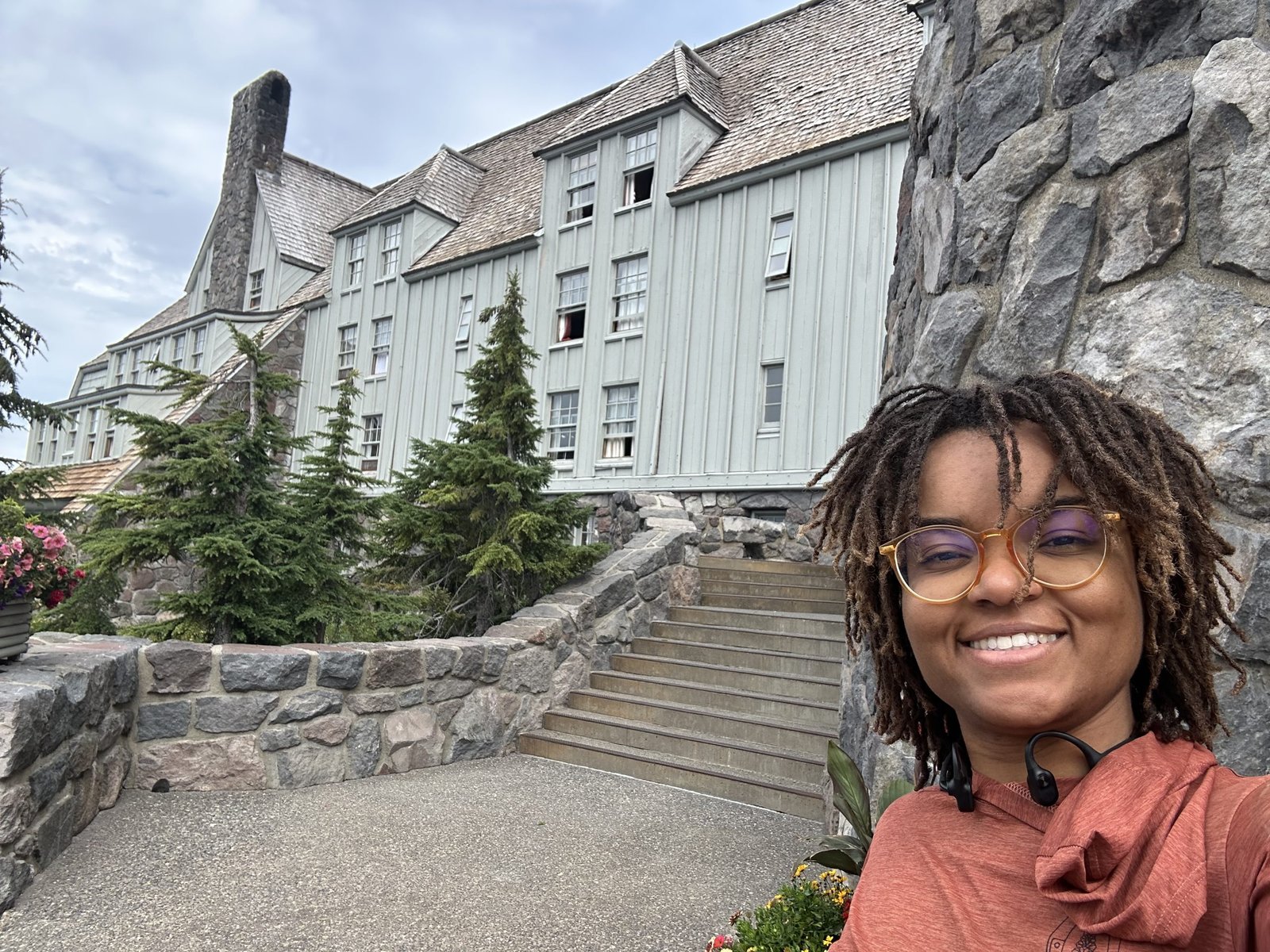
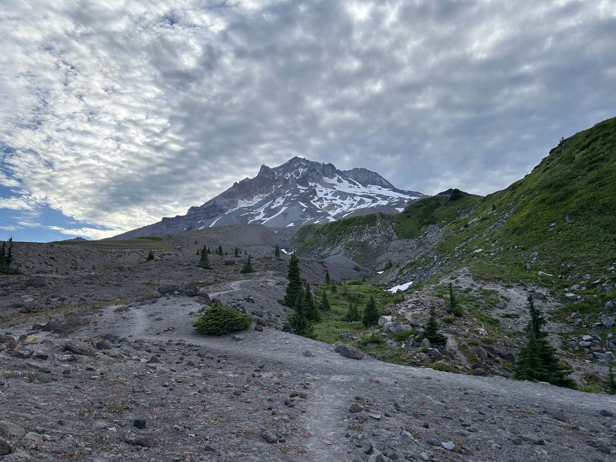
The goal for this morning was to reach Timberline Lodge to check it out. I didn’t have a box there nor did I plan on eating the breakfast buffet, but it still seemed like a cool stop. I had about 5 miles to hike to get there, but as I hiked, my legs felt heavy and sluggish.
A light layer of clouds covered part of the sky. As the morning wore on, the clouds expanded and got darker. It looked like rain was in the forecast for today! That didn’t stop the stream of day hikers that came from the direction of the Timberline Lodge. They were everywhere! I could tell I was getting close to the lodge when the day hikers were energetic and excited about their hike.
Soon, I passed a set of ski lifts and then I saw the famous grey building. I made it! And despite not planning on eating the breakfast buffet, my grumbling stomach steered me straight to the dining room. I saw a few other SOBO hikers in the small, dark room and said my greetings. To my surprise, I demolished two plates of food and felt like I could’ve stuffed another one down. I still think the buffet was overpriced, but it was worth it for the novelty of an on-trail buffet.
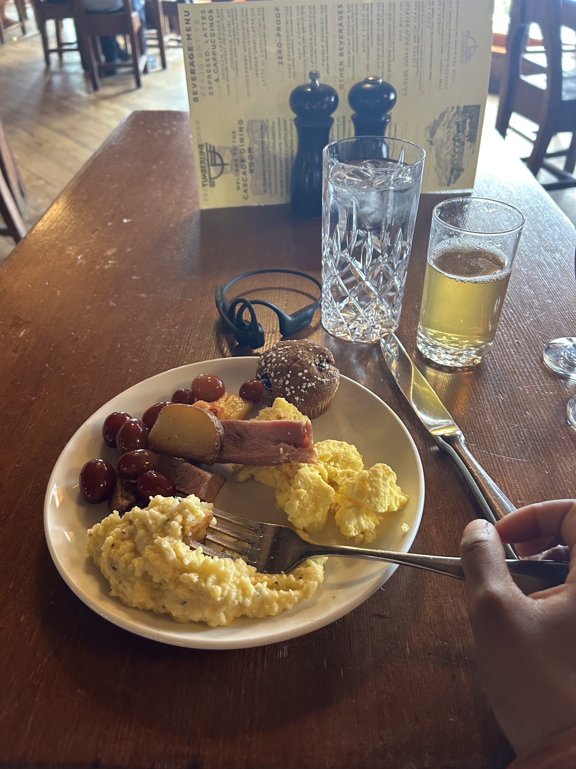
While having breakfast, I spotted a gentleman with a PCT shirt on and asked if he was a hiker. Turns out it was Papa Joe from Casa de Luna! If you don’t know, he and his wife were Trail Angels for 20 years, hosting hikers in Southern California before closing their doors a few years ago. Throughout my PCT research, Casa de Luna always showed up as a must-stop. To meet such a legend on trail really made my day!
After saying goodbye and paying my bill, I took a few minutes to explore the lodge. There was so much history contained here! From the little museum on the ground floor to the intricate carvings and symbols on the woodwork, there was a lot to see. I was surprised to find out that the lodge was constructed as part of FDR’s New Deal. I had no idea! I definitely want to come back and visit again.
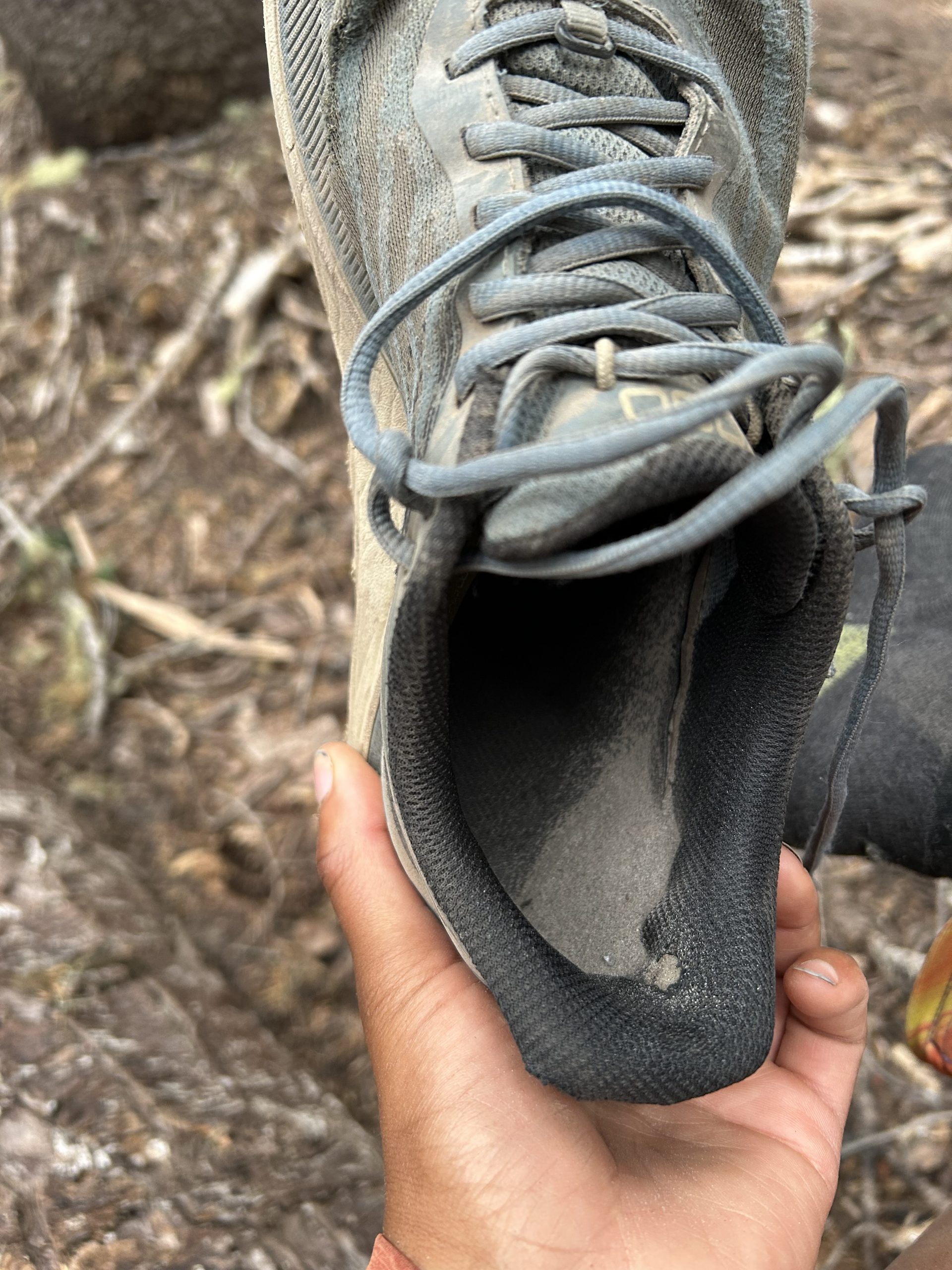
Back on trail, it was time to descend. The trail was beach-like; fine rock pulverized into sand got into my shoes as I made my way down. Once I got to the forested area, I had to dump my shoes and watch the sand fly out.
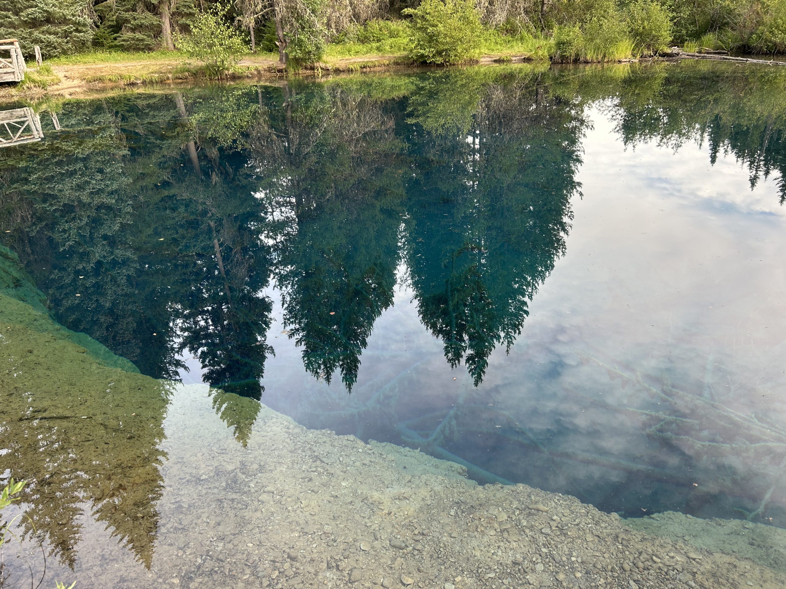
The rest of the day was easy walking through the forest along a relatively flat path. I ran into a couple of people who read my blogs (thanks for the support!) and took a short blue blaze to see Little Crater Lake, a magnificently blue pool of water.
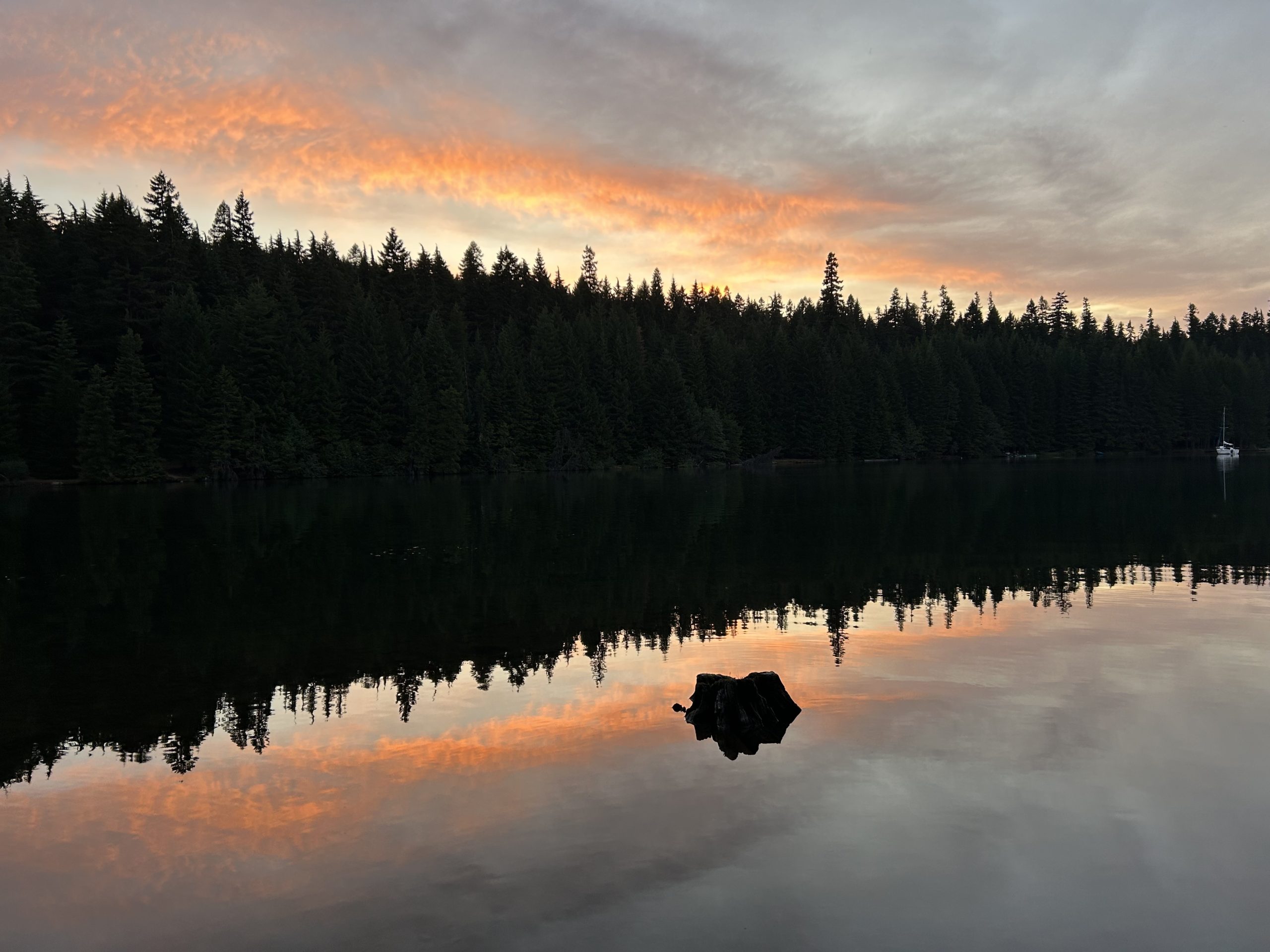
With sore feet and ready to be still for the evening, I walked the last 1.5 miles to my campsite on Timothy Lake. Another SOBO I had been leapfrogging was there as well as a section hiker. On the lake, baby ducks played and boaters floated on the water. I loved hearing the sounds of the family across the lake enjoying their summer outdoors. It was a peaceful evening.
And that’s a day in the life of a PCT SOBO hiker!
This website contains affiliate links, which means The Trek may receive a percentage of any product or service you purchase using the links in the articles or advertisements. The buyer pays the same price as they would otherwise, and your purchase helps to support The Trek’s ongoing goal to serve you quality backpacking advice and information. Thanks for your support!
To learn more, please visit the About This Site page.
For a time, Thomas Simpson was considered the man who would have discovered the Northwest Passage, if he had lived long enough. Today, he is relatively little known, but when he is remembered, it is for his death. Murder, suicide, madness, a notebook full of secrets — five men entered the wilderness, and only two returned. Who shot first? And why?
This lithograph depicts Thomas Simpson reaching Victoria Land in the Canadian Arctic. Photo: Willy Stower, around 1903
How Thomas Simpson turned explorer
Simpson, born in Dingwall, Scotland in 1808, was not a boy anyone expected to explore the Arctic. He was a delicate, sickly child, described by his brother Alexander as having “a quiet, tractable temper, and [paying] a steady attention to his studies.”
By the death of his schoolteacher father in 1821, Simpson was already destined for the church. At 17, he enrolled in King’s College, Aberdeen, and graduated with an M.A. with high marks. He kept at his studies, but Simpson had run into a common problem for M.A. graduates who wish to keep studying: He lacked the funds.
Simpson had hoped to go to medical school, but couldn’t afford it. Continuing in the church meant years of supporting himself as a tutor before he could get a parochial assignment. Besides, naturally resentful of authority, he was beginning to stifle under the strict, traditional Church of Scotland.
His elder half-brother, Aemilius, had joined the Hudson Bay Company in 1826, and his brother Alexander had signed up in 1828. They had a family connection; their cousin, Sir George Simpson, had recently become the Governor-in-Chief of Rupert’s Land (a British territory in the Hudson Bay drainage area of Canada). Sir George’s career is murky; he joined the Hudson Bay Company as a clerk in 1820. In 1826, following internal and external disputes that cleared out the executive suite, he became Governor.
Sir George offered his cousin the post of secretary to the company. Thomas, who had grown out of his sickly childhood constitution into heartiness and strength, agreed.
Sir George Simpson, a consummate businessman and opportunist, hired Thomas as his secretary. Photo: Wikimedia Commons
Early success and early trouble
Simpson took to the adventurous outdoor life. With his cousin, he toured the southeastern holdings of the Hudson Bay Company in a light canoe. He spent the next several years traveling around the Canadian Arctic in George’s employ.
Simpson distinguished himself early, guiding a party of nearly a hundred recruits through the wilderness with far fewer desertions than usual. A year later, he took a party of men and dogs over 1,100km from York Factory to Red River. He told his brother Alexander that he loved the 28-day snowshoe journey, enjoying the fresh air and exercise.
Already, however, interpersonal conflict plagued him. Sir George was not an easy man to work for. Thomas Simpson reportedly found him “wavering [and] capricious,” calling his cousin “a severe and most repulsive master.” He was unimpressed with most of his colleagues, but assured Alexander that they both would soon have the prominence and success that they deserved.
Sir George Simpson’s canoe, where he and his secretary traveled on business. Photo: Royal Ontario Museum
A notable incident
Most of the lower-level employees of the Hudson Bay trading posts were indigenous people from several groups and people of mixed white and indigenous descent. Simpson frequently expressed a low opinion of them. When Alexander came to visit Red River in December 1834, he found his brother at the center of a small-scale race war.
One of the mixed-race Canadian workers had entered Simpson’s office and requested an advance on his wages. We don’t have the worker’s side of the story, but Simpson claims the man was drunk and disorderly and refused to leave when his request was denied. According to Thomas, the man put up physical resistance when he tried to remove him, and they got into a fight. Simpson won, beating the man badly.
The local indigenous community reacted badly to the incident and began demanding that Sir George punish Thomas Simpson. Simpson, meanwhile, told his brother that he feared an attempt on his life and believed the indigenous people planned to use the incident as an excuse to launch a full-scale rebellion.
Sir George met with representatives of the community and negotiated a rapprochement. Sir George paid the aggrieved party a small sum, handed over a barrel of alcohol, and apologized. He promised to remove Thomas from the settlement, which both parties seemingly understood he was not actually going to do.
Relations returned to normal, but Thomas remained convinced the indigenous workers were out to get him. He slept alone with barricaded doors and a guard dog.
Part of the Red River Colony, mid-19th century. Photo: Archives of Manitoba
The Dease expedition
Thomas Simpson’s day in the sun came in 1837, when he became the second in command of an Arctic expedition. The Hudson Bay Company charter from 1670 included “finding the Northwest Passage” as a primary goal. So far, they had done little.
The expedition leader was 46-year-old Peter Warren Dease, the long-time chief trader and former John Franklin collaborator. What he lacked in qualifications, he made up for by being well-liked. Naturally, Thomas Simpson hated him. The leadership position, he was sure, was meant for him, and his cousin had spurned him at the last second.
In only 62 days, Simpson made an over 2,000km overland journey to meet Dease at Fort Chipewyan. With 12 men, they had set out on June 1, intending to fill in the gap between Franklin’s Return Reef and Point Barrow, Alaska. By July 23, the party had eclipsed Franklin’s furthest west, set in 1826. But by the end of the month, the ice grew too thick to proceed further.
The boats, trapped by ice, were still nearly 100km from Point Barrow. Undeterred, Simpson set off on foot with five of the men. The party ran into a group of Inuit and borrowed their umiak, a small open boat. In this vessel, they reached Point Barrow, completing the “west” part of the Northwest Passage.
In a letter to Alexander, Simpson wrote that “I, and I alone, have the well-earned honour of uniting the Arctic to the great Western Ocean.”
Point Barrow, Alaska, also known by the Inupiaq name Nuvuk, appears frequently in the annals of Arctic exploration. Photo: Wikimedia Commons
Few gaps remain
Dease and Simpson’s parties reunited and made their way back to Fort Norman by the start of September. There, they found instructions for the next stage of their explorations, up the Coppermine River.
Simpson spent the winter nursing a growing hatred of Dease and a conviction that their leader was contributing nothing. Dease was an “indolent, illiterate soul,” Simpson wrote.
In 1838, the expedition attempted to push east from Point Turnagain by boat. Again, the ice trapped their boats, and again, Simpson continued on foot, exploring a further 160km of coastline. The next year, conditions improved, and they traveled up the Coppermine River to the Boothia Peninsula. If they could find passage to the Gulf of Boothia and from there connect with the Atlantic, they would complete the Northwest Passage.
But it was too late in the season. Simpson had already harried them forward despite Dease’s wishes and the men’s exhaustion, forcing them up through the already freezing-over Mackenzie River. This was where Simpson claimed one of his most notable exploratory feats, that of naming Victoria Land (now Victoria Island).
By late September, the expedition was back at Fort Confidence. Simpson’s account of the expedition, published posthumously, provides much detail for readers willing to overlook all the self-congratulation.
A map of progress along the coast during the Dease expedition. Photo: Wikimedia Commons
One more expedition
Simpson no doubt felt that one more expedition would make him the first man to complete the famous, deadly passage. But they would not go back next season: Dease wanted to take his leave in Europe and have time off to marry and settle with his fiancée, a Métis woman named Elizabeth Chouinard.
Simpson did not have time for his loathed coworker’s domestic bliss. He petitioned Sir George for full command to continue the work. “Fame I will have, but it must be alone,” he wrote.
Sir George, possibly still concerned with his cousin’s personal issues, was reluctant. There was a tangled back and forth of letters, and for several weeks, Simpson refused to leave Fort Simpson for Red River as ordered.
Eventually, Simpson petitioned the board of directors in London. Worried that Dease would get there first and take all the credit, and wanting to make his petition in person, Simpson decided to go to the board himself. Simpson took his notebook, with many of the important observations and maps from the past three years.
In June 1840, he set out with four Métis men for the port of New York by way of St. Paul. He never returned.
A cairn left by Thomas Simpson and Peter Warren Dease at Cape Herschel was rediscovered in 1856 by Leopold McClintock, searching for the lost Franklin Expedition. Photo: Elisha Kane
The final journey
In another letter to Alexander, Simpson said that the journey would be good for him; his stomach had been bad, and his spirits had been low all spring. The five men soon fell in with a group of several dozen people moving from Canada to the United States. For several days, they traveled together, but then Simpson, citing the need to move as quickly as possible, pushed on ahead with the four men from Red River.
On June 15, two of the party — James Bruce and Antoine Legros Junior — ran back into the group of emigrants. They had a frightful story.
After eight days on the trail, Simpson had begun feeling sick and insisted they stop, wanting to return to Red River. John Bird and Antoine Legros Senior began setting up camp when Simpson fired his shotgun at them. Yelling that they planned to kill him, Simpson fired two shots, hitting first Bird and then Legros Sr. Bruce and Legros Junior, the son of the elder Legros, quickly leapt onto their horses and rode off for help.
The men urged the party of emigrants to follow them back to camp and capture Simpson. Six men agreed and cautiously followed the pair back to their camp. Robert Logan, one of this party, later gave an official deposition on the scene they found by the banks of the Turtle River.
The banks of the Turtle River, a tributary of the Red River. Photo: Wikimedia Commons
Simpson’s death
The eight men halted about 180m from the camp. They called Simpson’s name but received no answer. They could see the abandoned cart, the bodies of John Bird and Antoine Legros, and Bird’s dog lingering by his late master. The group moved a little to one side, hoping to get a different angle. Then a shot rang out, and a bullet “whistled over [their] heads,” from the direction of the camp.
All was quiet for some minutes, and the investigators decided to fire into the air in that direction, presumably to warn Simpson of their presence. Two men, Gaubin and Michel Rochette, fired, Rochette accidentally winging the dog, which ran off. Then all the party members fired twice and waited.
Finally, Rochette mounted his horse and did a quick ride-by of the camp, returning to report that he had seen Simpson lying on the ground, apparently dead. The men entered the camp.
Simpson’s body was “stretched out, with one leg across the other, and the butt end of his double-barreled gun between his legs, the right hand, with the glove off, directed to the trigger, the left hand, with the glove on, holding the gun, near the muzzle, on his breast.” He was missing the top of his head.
That was how Robert Logan reported it. But another of the party, who was deposed a few months later, described Simpson’s body as “lying with his face downwards, near, but not on, a blanket,” by the cart.
Legros’ body was under a blanket, with a pillow under his head. Bird’s body was a few steps away. They buried all three bodies.
Murder, madness, mystery
The question of Simpson’s final hours is twofold: Who fired the shot that killed him, and why did he shoot John Bird and Antoine Legros?
James Bruce repeated his story in an official deposition at St Peter’s, Iowa. The court never deposed Legros Jr, possibly in consideration of his age or family tie to one of the victims. The official verdict the court pronounced was “murder and suicide while of unsound mind.” Simpson had killed the two men in a fit of paranoid delusion, then shot himself.
Perhaps Simpson was an early and unrecognized case of so-called “polar madness.” Douglas MacKay, an early 20th-century historian of the Hudson Bay Company, argued that Simpson’s letters revealed “a rapidly mounting and almost uncontrolled egoism, the culmination of unbounded ambition and the lonely Arctic winter.”
We must acknowledge the role racial prejudice played in the incident at Turtle River, and the speculation that followed. Simpson distrusted his indigenous coworkers and had a history of conflict with them.
He was probably jealous of the fruits of his exploration and had admitted to suffering physical illness and a depressed spirit in the months before his death. That this paranoia and instability would become violence, directed at his Métis companions, is not necessarily out of character. It’s also not out of character for 19th-century fur traders to believe that indigenous people were thieves, murderers, and liars.
Adam Tollefsen went to Antarctica on the ‘Belgica’ and famously went mad. Photo: De Gerlache Family Collection
The official story contradicted
Alexander Simpson refused to believe it. In his biography of his brother, Alexander laid out a number of flaws in the official story.
Alexander asserted that his brother was an obsessive diarist and would certainly have had a notebook with him at the time of his death. But when his brother’s papers, recovered from the body, were delivered to Alexander, no diary was included. He also noted that his brother’s pocket map did not quite line up with the timeline given in the depositions. His foremost objection, however, was that his brother had never exhibited any signs of mental instability.
Remembering the events of December 1834, he believed the indigenous workers at the Hudson Bay Company in Red River had held a grudge against his brother. Both Simpsons were suspicious of “the evil passions of [their] race.” John Bird, in particular, was “dangerous,” according to Alexander, and believed that Simpson’s notes contained the secret of the Northwest Passage.
Alexander believed that his brother had gotten wise to the men’s plan to murder him for the documents and had feigned sickness to return to Red River. But over two days of travel, tensions mounted, and on June 14, Simpson killed Bird and Legros in self-defense, sustaining mortal wounds in return. The shot reported by Robert Logan and his party was, Alexander argued, imagined or invented.
The sudden end of his career today overshadows Simpson’s explorations. Photo: Library and Archives Canada
Continuing speculation
Arctic explorer Vilhjalmur Stefansson dedicated a lengthy section of his 1938 book, Unsolved Mysteries of the Arctic, to Simpson’s death. He proposed another alternative to the initial murder-suicide theory.
He posits that, rather than being independent agents after his notes, Bird and the Métis were assassins hired by Sir George. Sir George, Stefansson posits, may have been motivated to prevent the Northwest Passage discovery to protect the Hudson Bay Company’s monopoly on the fur trade. Sir George would also have had the opportunity to remove the diary from Simpson before sending anything to Alexander.
It is worth noting that Stefansson was, as Roald Amundsen so neatly put it, “the greatest humbug alive.” But the humbug does admittedly have a point that Sir George’s diary, on the date he received news of his cousin’s death at only 31 years old, devotes more time to the taste of whitefish (“somewhat the flavour of trout”) than to the death.
There is also a third possible answer to the question of who shot Simpson. If the investigating party had been firing low enough to clip Bird’s dog, could one of the many shots — they all shot twice — not have hit Simpson?
Whatever the truth, the events of June 15, 1840, ended Thomas Simpson’s exploratory career. Would he have gone on to discover the Northwest Passage? Did this bizarre murder-suicide indirectly doom John Franklin and his men? We will almost certainly never know the truth.

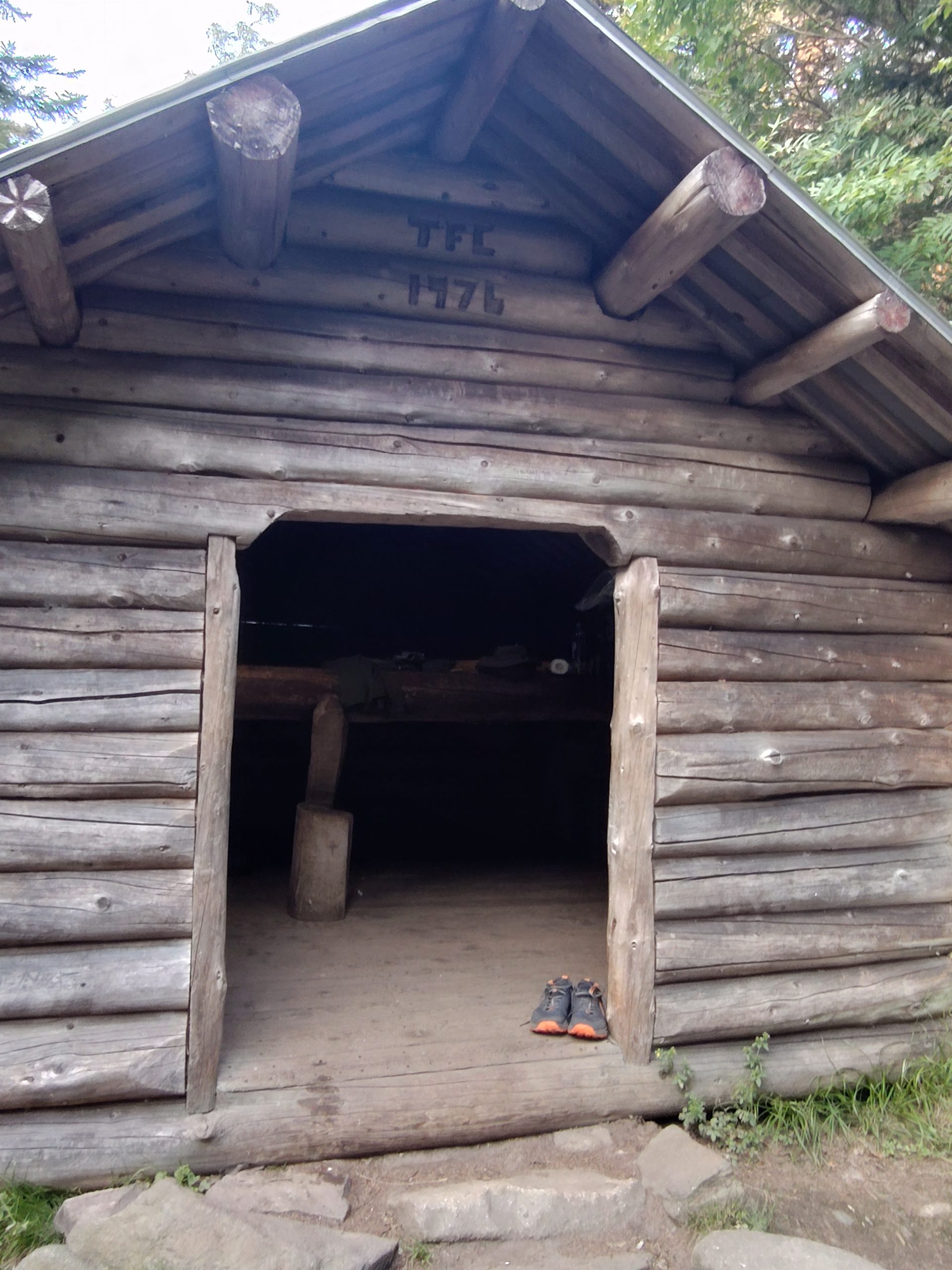
Day 108- 18 Miles today from Barn Hostel Gorham to Carlo Col Shelter, 6400 Feet Up, 4500 Feet down, 1917 AT Mile Marker
Knockerz Visits Boulder Hell
This is actually more than one day. The day after I finished Carter Moriah range I took Knockerz back to the Great Gulf Bypass up to the Osgood campsite and then to the Alpine zone heading towards Madison Hut.
I wanted her to experience the climb up to the Alpine zone. I also really wanted to show her the Alpine zone and the bouldering that was required to get through Madison Hut all the way to Mount Washington. The day I did that was my most difficult day yet.
It was my “zero” day but we still did the climb up to the Alpine zone and back down yesterday which was about 10 miles and 3300 feet elevation gain. I’m glad that I was able to let knockers see what it was like up there.
We then went to the brewery and strategized for the upcoming few days.
The Next Day
I started off this morning at 6:30 with a goal of getting to at least Gentian Pond shelter. I would really like to go farther than that but the elevation my be way too much at over 6,000 feet of climbing and over 4,000 feet of descent over 18 miles. But that would put me in a good spot to hit the Notch the following day.
It’s a cold morning with temperatures probably in the 40s. It wasn’t long before I got to the Mahoosic trail. It took me about an hour and a half to go 3 miles with 1800 ft of elevation. This is fast for me especially after the slowness of the Whites.
The trail is very well marked with lots of white blazes everywhere. I have to say it feels really good to look at this view and see Mount Washington off in the distance behind me and know I’m through the Whites.
“Normal” AT Trail
Today’s hike so far has been a “normal” hike. There were a few small climbs in addition to the overall climb but nothing technical yet. The technical stuff is what really slows you down. And that’s the thing about the Whites it is the technical climbs that drop your daily miles down.
I know it’s going to be technical going through Mahoosic Notch and I know Southern Maine has a lot of elevation. But you don’t hear people talk about Southern Maine in a fear mongering way.
It may be because we Nobos are just recently out of the Whites and this feels refreshing to have normal trail again.
Do I Push My Miles Today?
I think there is a technical climb if I make it to the shelter that is 16 miles in. The woods are really quiet I don’t hear any birds or squirrels or anything. I also have not run into a single individual yet.
I’m expecting to see some Sobos pass by me at some point today. I don’t think any Nobos will pass me because my pace is a pretty strong pace right now.
Reflection
With “normal” trail my mind can wander again because I’m not having to put all my mental energy into the obstacles of a technical trail so I just noticed something. I have always lived my life planning ahead.
It’s been my brain’s way of having some predictability on the future. I think uncertainty bothers me.
I know it was a trait my Mother had. She was always planning ahead and living for the future. The future has not yet come.
And in retirement one of the things I wanted to do was to help myself cure from always planning ahead. There is no need for me to plan career moves or things at work anymore. I can now just live life.
I really wanted to have this AT adventure to help me to process my mind’s desire to always plan ahead and be ready for the future.
And now I’ve noticed that I’m not planning ahead. I did take a peek the other day and I know it is a handful of miles, maybe two days, before I will be out of New Hampshire. But I haven’t planned too far ahead. It is nice to be able just to walk and have a destination but if I get to that destination great and if not there is always tomorrow.
It may be that there was a technical section or bouldering or something else that I didn’t anticipate that will hold me back from my chosen destination for that day but I will be able to attack it tomorrow.
This is similar to life. I hope this is a philosophy I can continue after this adventure. This is a 2200 mile hike but in reality it’s 2,200- 1 mile hikes. I can start my day off with a destination in mind and then take one step at a time towards that destination.
This was especially true during the very challenging times in the Whites like the boulder fields leaving Mount Madison. I just kept telling myself one step at a time. I had broken my hike up into 2 foot intervals at that point. This too is similar to life when you have extremely difficult times and you think you just can’t go on but you break it up into smaller manageable pieces and you move forward.
There is really no need to plan too many days in advance because the plans rarely work out as expected. This is one of the main lessons I really wanted to take away from this hike. Try to live my life more in the present.
Too Early to Stop Hiking Today
The climb up to the ledges was steep, short, but not too technical. I could see a great view of Mount Washington. Mount Washington is getting further and further behind me now and I was still making great time knocking out miles today.
By 11:00 I had done over 8 miles and over 3,000 feet of climbing.
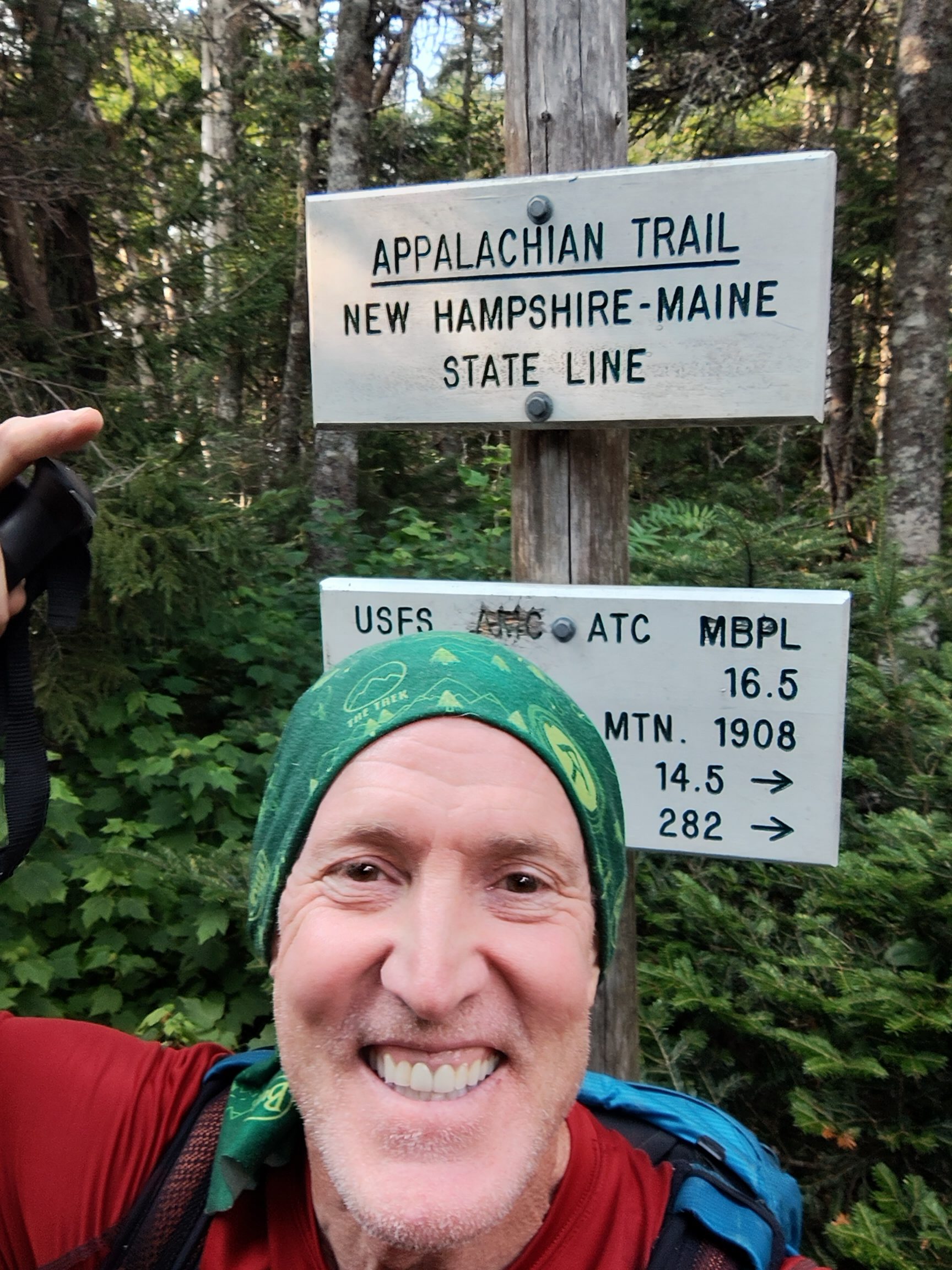
It was only about 3 more miles to the Gentian Pond shelter. So I knew I needed to continue on. My goal now is to get up over Mount Success and then into Maine. That will set me up with about 6 miles in the morning before the Notch. And then 15 miles overall to the road where I plan to meet Knockerz.
Reroute!
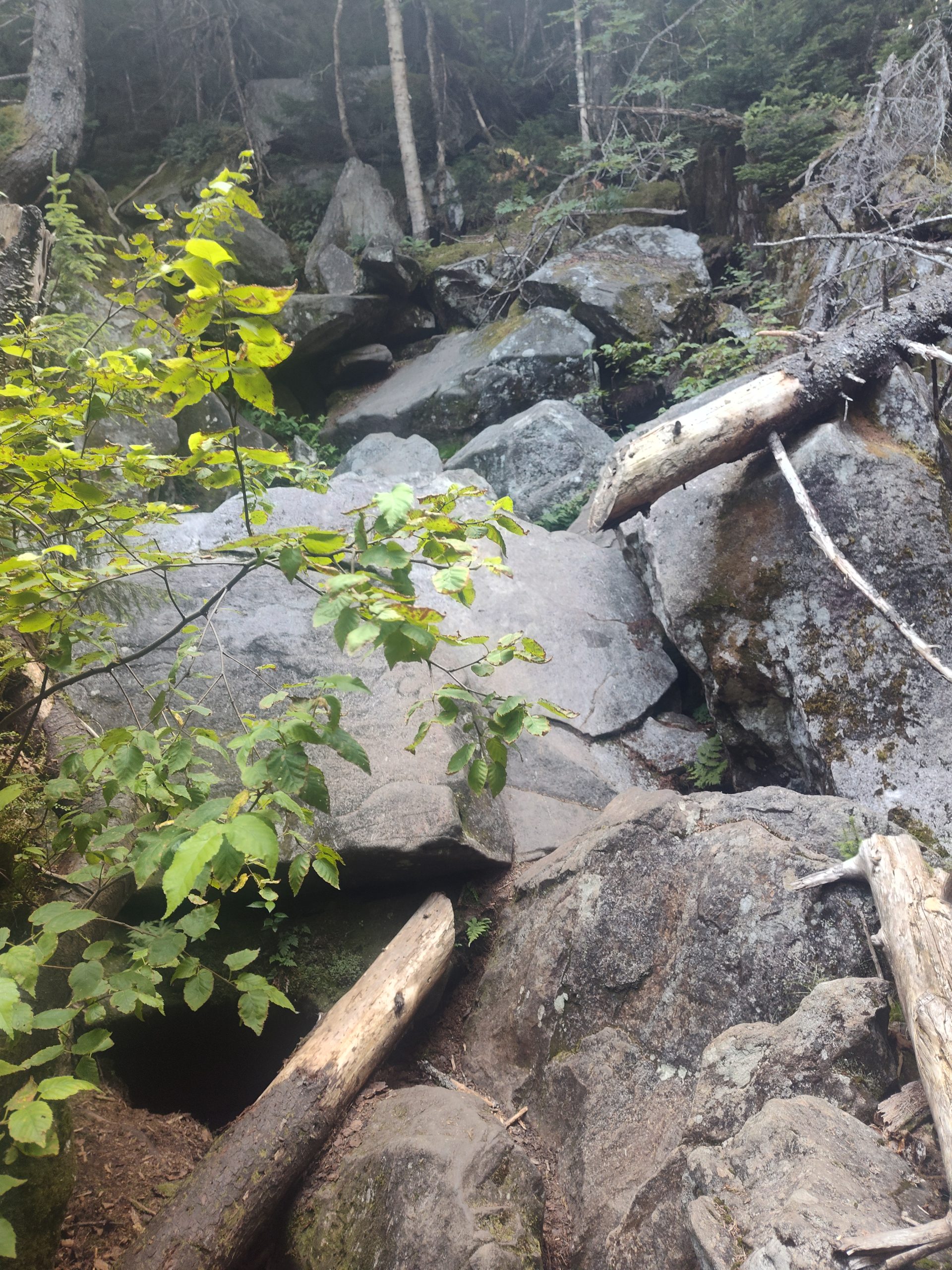
There was a beautiful brand new reroute around Dream pond. According to the comments the old AT was a bog that was very hard to get through.
The reroute was a nice unobstructed dirt path. I haven’t seen the trail like this in a long time. It was unmarked as far as white blazes but very it was very well traveled.
I continued to travel on past Gentian Pond shelter where there were a couple of pretty ponds. I was still traveling pretty fast with a little bit of technical trail to navigate but not too bad.
Maine Ahead!
Then I got to the bottom of Mount Success and I could see how much climbing I had ahead to the top. It was a bit overwhelming when I could just call it a day at Gentian Pond. I was starting to get tired.
I had to climb a thousand feet up Mount Success. There were some technical sections on the climb that slowed me down. After Mount Success I was in an Alpine zone heading towards the border with Maine.
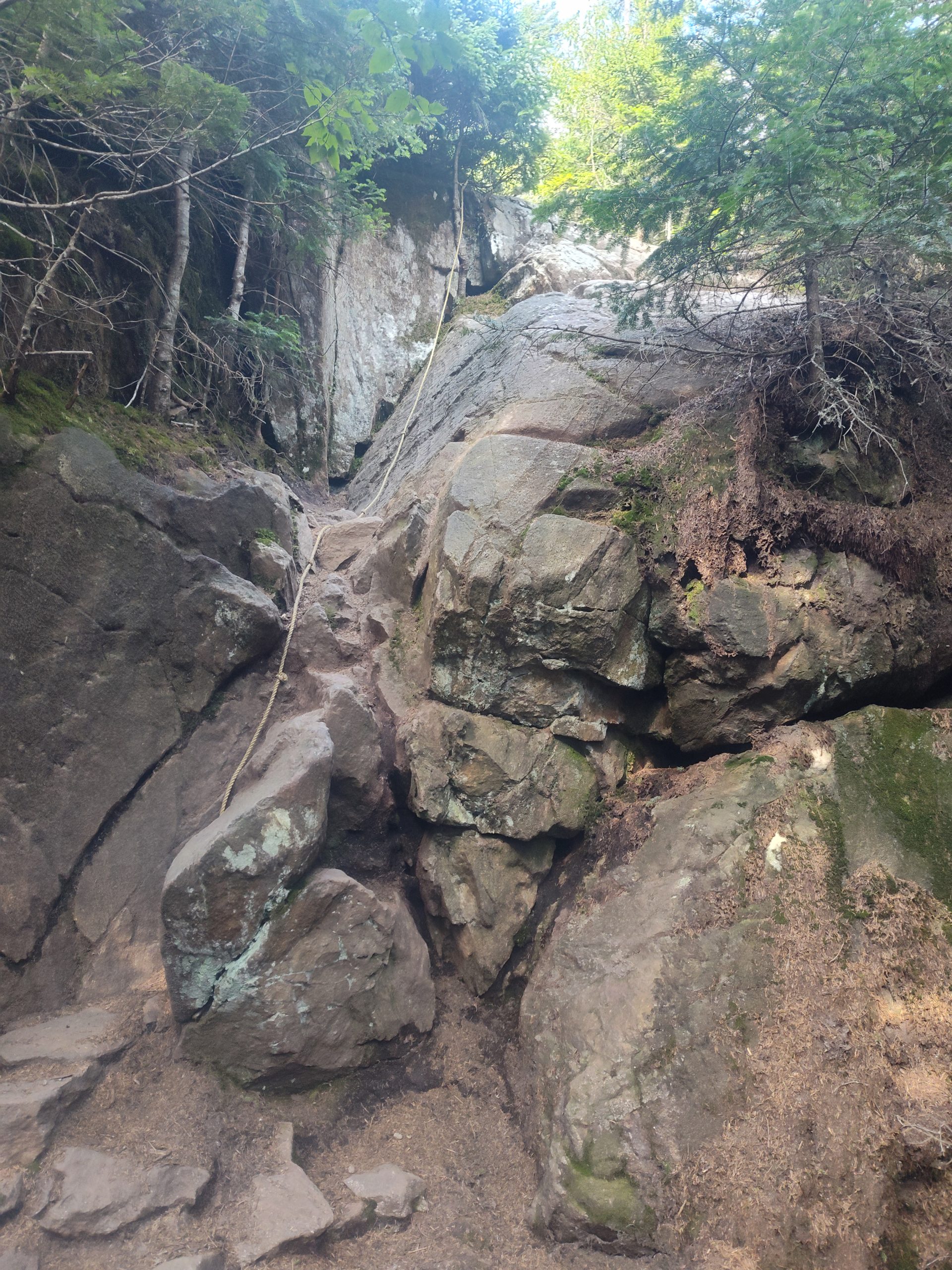
Up on Mount success in the Alpine zone the trees were just a couple feet tall and it was a boggy area with bog boards to walk on. The trail then became technical. There was a steep incline to climb that somebody had put a rope up to help you climb up that section.
Home Finally
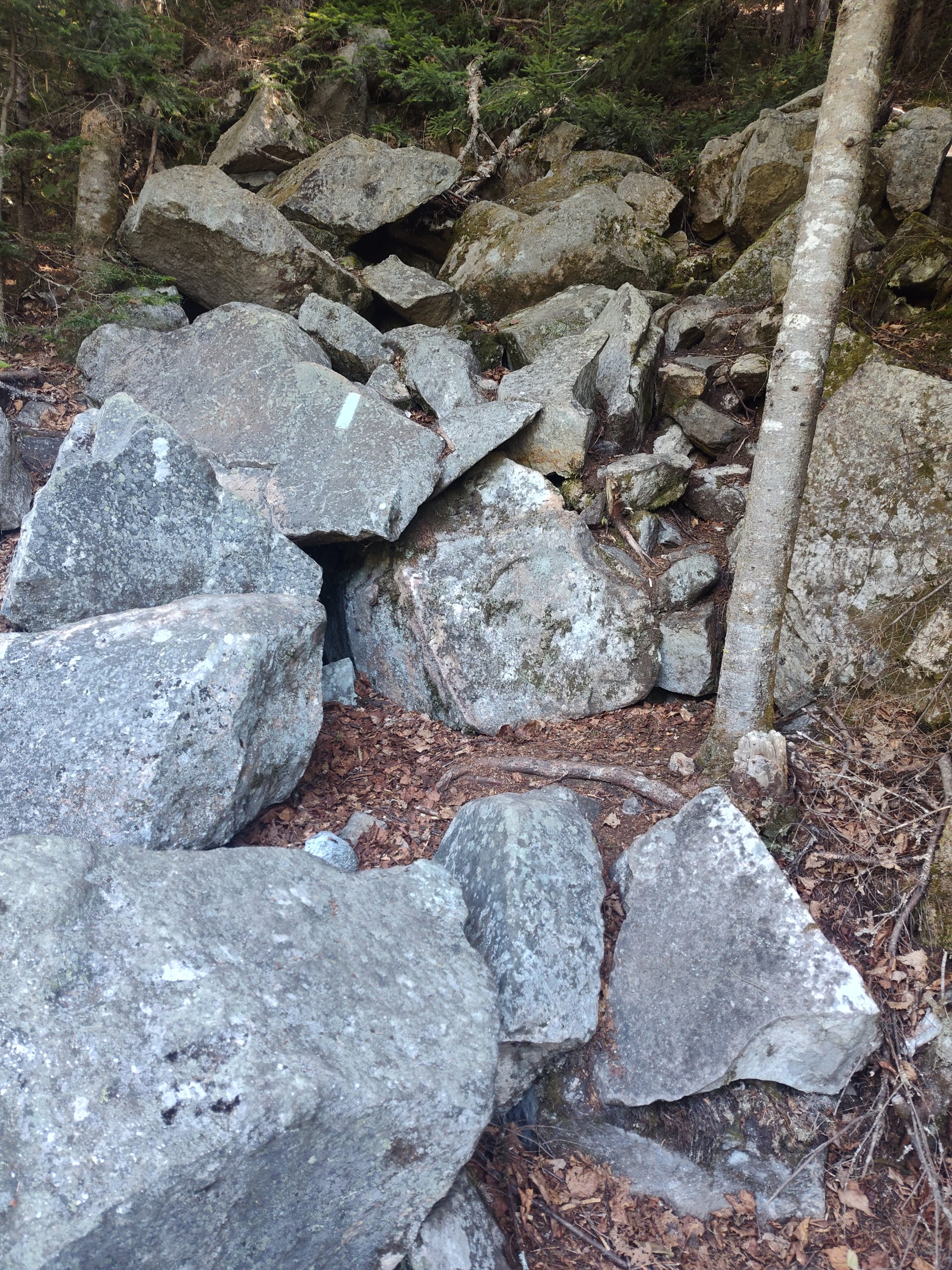
After crossing the border into Maine I got a taste of Mahoosic Notch. There were some very steep technical climbs and descents. Several of these left me sitting for a moment uncertain which direction to go. I was tired and the climbing was deadly. It was that bad. One wrong move and you would slip and probably die. These were stow your poles kinds of climbs with your face to the wall climbing down and up.
It was slow going but I finally made it to the Carlo Col shelter. I couldn’t believe I did such a big day today. This is the most I’ve ever done in elevation gain in one day.
This website contains affiliate links, which means The Trek may receive a percentage of any product or service you purchase using the links in the articles or advertisements. The buyer pays the same price as they would otherwise, and your purchase helps to support The Trek’s ongoing goal to serve you quality backpacking advice and information. Thanks for your support!
To learn more, please visit the About This Site page.
-

 Brand Stories3 weeks ago
Bloom Hotels: A Modern Vision of Hospitality Redefining Travel
-

 Brand Stories2 weeks ago
CheQin.ai sets a new standard for hotel booking with its AI capabilities: empowering travellers to bargain, choose the best, and book with clarity.
-

 Destinations & Things To Do3 weeks ago
Untouched Destinations: Stunning Hidden Gems You Must Visit
-

 Destinations & Things To Do2 weeks ago
This Hidden Beach in India Glows at Night-But Only in One Secret Season
-

 AI in Travel3 weeks ago
AI Travel Revolution: Must-Have Guide to the Best Experience
-

 Brand Stories1 month ago
Voice AI Startup ElevenLabs Plans to Add Hubs Around the World
-

 Brand Stories4 weeks ago
How Elon Musk’s rogue Grok chatbot became a cautionary AI tale
-

 Brand Stories2 weeks ago
Contactless Hospitality: Why Remote Management Technology Is Key to Seamless Guest Experiences
-

 Asia Travel Pulse1 month ago
Looking For Adventure In Asia? Here Are 7 Epic Destinations You Need To Experience At Least Once – Zee News
-

 AI in Travel1 month ago
‘Will AI take my job?’ A trip to a Beijing fortune-telling bar to see what lies ahead | China
You must be logged in to post a comment Login