
Destinations & Things To Do
The Continental Divide Trail: What’s the Bob Marshall like?
Part 2
The Bob Marshall
“A good traveler has no fixed plans and is not intent on arriving.” — Lao Tzu, Tao Te Ching
Dogleg, one of the folks Ice Cream and I met at the end of the AZT, was at Looking Glass Base Camp. He gets around, which is good, since he’s a source of good advice and trail magic both. He told me that he knew someone that quit the CDT because of COVID, as I sat outside in a plastic chair, trying to social distance, wrapped in my fleece liner, with COVID, probably. I never got tested, but the symptoms matched; I couldn’t smell a thing for one, and felt like death for another.
I was one of the early guinea pigs for the vaccine, and over the course of two or three years probably received five doses. I just got them when I got the flu vaccine. Easy peasy. But I wasn’t vaccinated now, and had picked the bug up somewhere. No one escapes forever, and COVID is part of life now, like the cold or the flu.
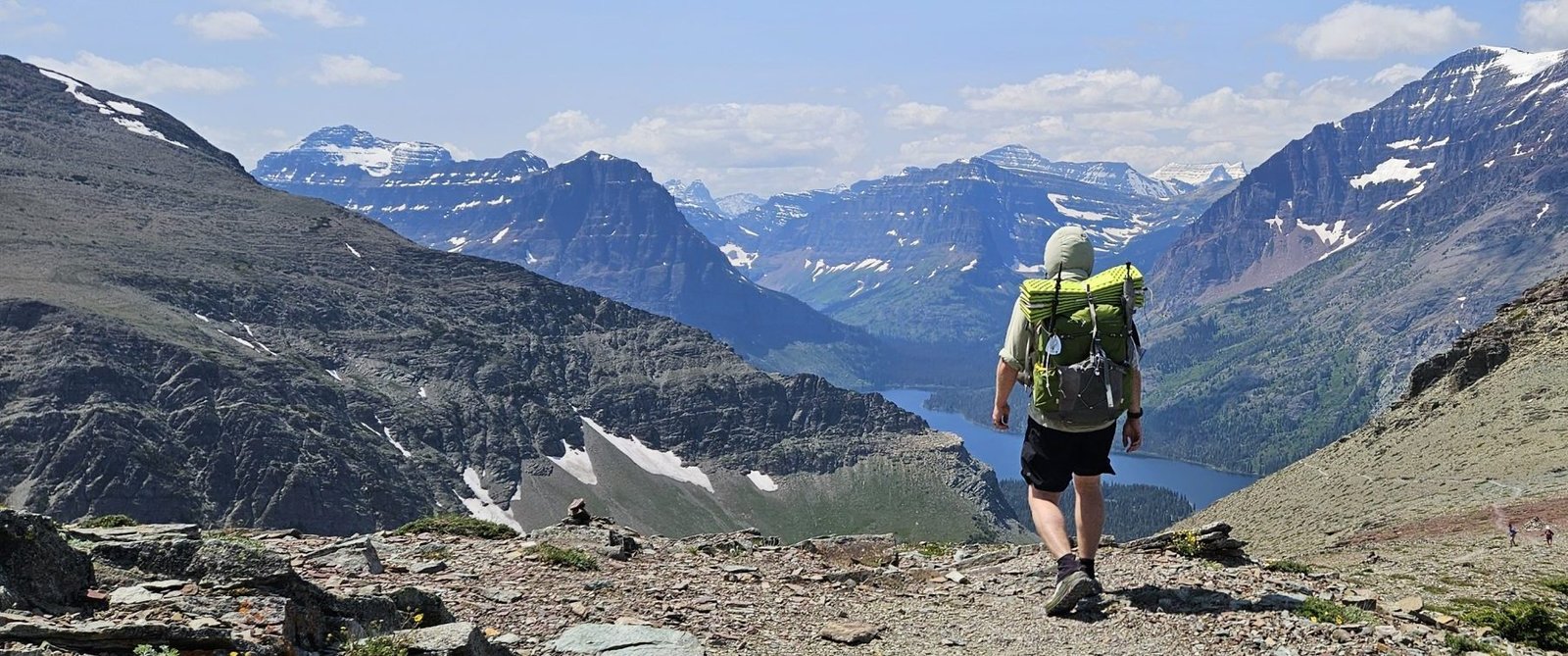
Stubbornly, I only allowed myself one zero before joining the rest of my tramily for the hike to Two Medicine. It was a short hike, only ten miles. How bad could it be?
On the climb up the slopes of Mt. Henry my mantra was, “I can breathe, I can breathe, breathe, breathe.” I barely could. My pack felt like it was loaded with rocks and misery, my body was lead, my lungs, death. Like Smaug from the Hobbit, I could produce a list of all of the parts of me that were no good.
The boys were long gone, far ahead, but Ice Cream watched from behind as I zombied up the mountain. I let my hands hang loose at my sides—less effort that way, somehow—and swayed back and forth. Between ragged breaths I would sometimes imagine laying down and dying. Melodramatic, yes, but also a tempting thought at the time.
In fact, that thought was so tempting that I did my best to do just that. Not even taking off my pack, I half sat, half lay down and did nothing else. Had I not felt so awful, it would have been the most relaxed I’d ever felt. I had no energy for any muscle tension whatsoever. Just breathing. Ice Cream, the angel, the perfect, sat down and shaded me with her umbrella and waved away the flies when they landed on my face. If ever there was a reason not to lay down and die, she would be it.
The death-rest worked well, and after a while I was able to get up and go again. It helped that most of the climb was over. Nearby was a blue blaze to the summit of Henry, but we passed it by. That stretch is already beautiful enough. Later came the baby bighorn sheep and their ragged-looking mothers, their winter coats still clinging stubbornly into June. The sheep on this trail are accustomed to people, and barely flinch when hikers pass by.
Down, down to the road and to Two Medicine shortly after. It looked different than it had the first time. The little ranger hut was there, and no doubt the beleaguered ranger Marcy was inside trying to sort out hiker’s dreams for too little pay. We didn’t go in. Toolman said we didn’t need permits for this campground, after all.
Instead we walked into the campground and tried to find the spots reserved for visitors without vehicles. There are a few. Certainly the boys would be there, already set up. They were not. After an hour of circling and not finding them, and getting no response from our Garmin messages, we decided to talk to Marcy after all.
She was there, about ready to close, hoping to eat her lunch, hours late. Despite that, she offered to help us out, since Two Medicine does, in fact, require permits, even for the walk-in sites. We told her to eat her lunch, and that we would hitch back to East Glacier. It was one half dozen or the other for us, and Marcy was too sweet to take advantage of.
Before hitching out we walked the short distance to the camp store. Toolman and Frito were there. They’d been there for a while, having never visited Two Medicine at all. It was obvious that Ice Cream and I were salty as the sea about this, but in the end, it wasn’t that big a deal. I just made a note not to count on them for team-related plans if they were in the front, which they undoubtedly would be.
Under a flag of unspoken truce, the four of us hitched back, once again, to Looking Glass. I was beginning to feel like a fly stuck to fly paper. Nearly one hundred miles hiked and we were still at the start.
I was still coughing up a lung, so we zeroed again. The boys may not be overly proactive, but they are good and loyal friends.
The next day we left for the Bob. Still sick but able to breathe better, I fell back to my old mantra, Stronger Every Day. It got me through IT band syndrome on the AT and it would get me through COVID now.
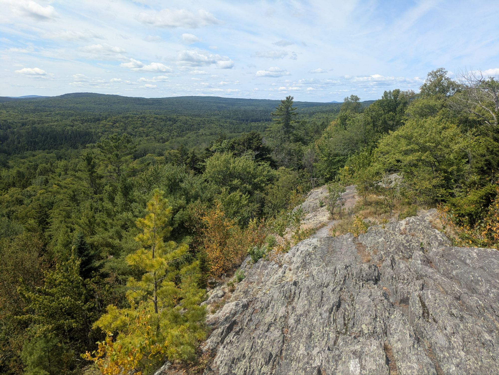
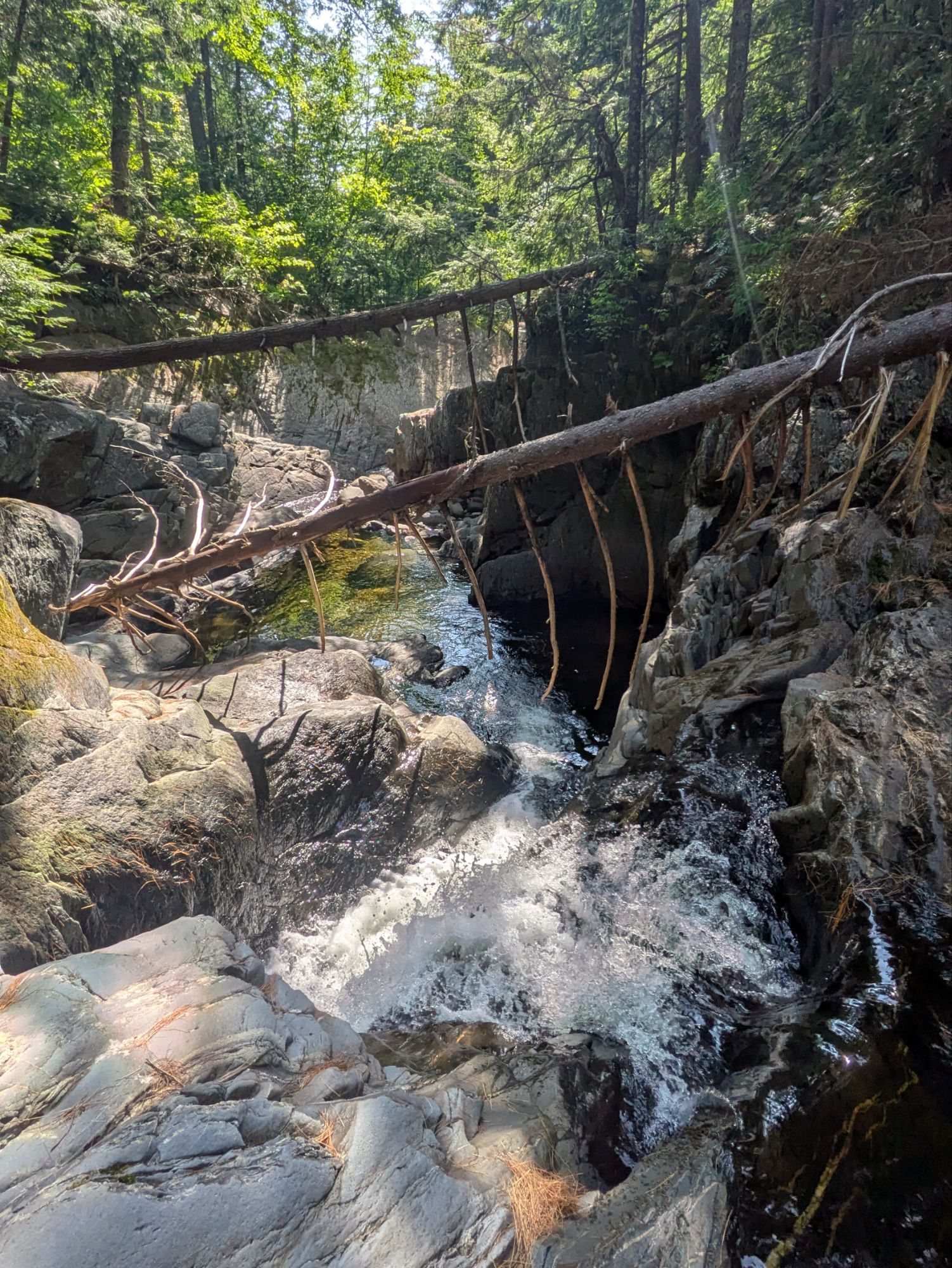
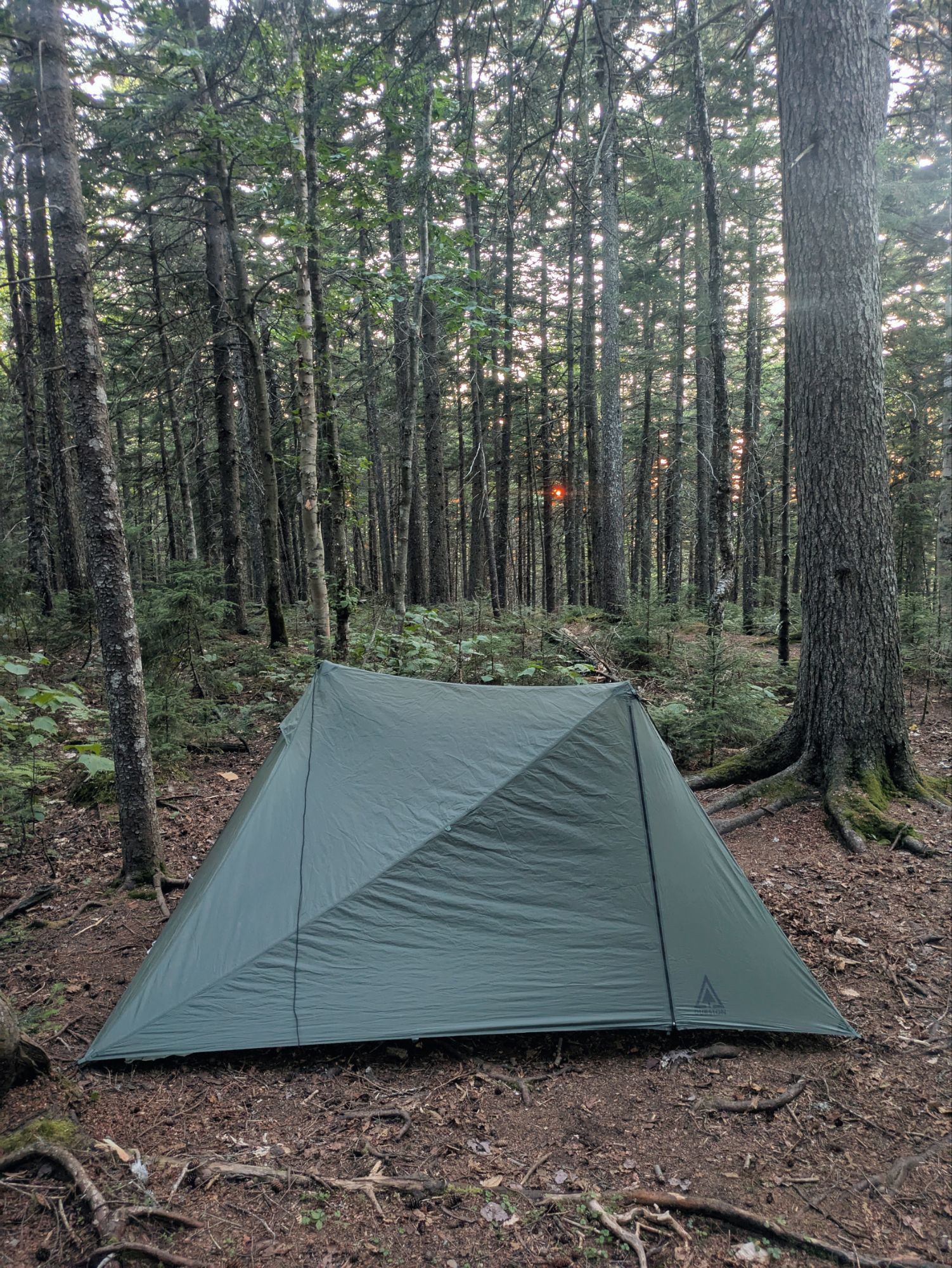
The Bob Marshall doesn’t begin right away. Two days of basic northern forests. The Bob Marshall Wilderness, named after pioneering conservationist Bob Marshall who advocated for preserving vast natural areas in the 1930s, encompasses over a million acres of pristine Montana backcountry. Established in 1964 under the Wilderness Act, it forms the heart of a larger 1.5-million-acre complex that includes the Great Bear and Scapegoat wilderness areas, all maintained as roadless zones where motorized vehicles are prohibited, allowing only foot, horse, or mule travel.
It’s something like two days from East Glacier to the wilderness boundary for average hikers (hi, it’s me, average hiker). The space in between isn’t memorable at all, except that Toolman took a tumble again, going, as he described, ass over tea kettle. On a steep and muddy slope he slipped. This time he was a few steps behind me. Once again I heard Frito say, “Toolman!” I whipped around to see that, somehow, he had slipped in the mud and then flipped down the hill. Again the plants were his friends, and some thick bushes caught him. He climbed out, brushed off, checked his gear and soldiered on without injury or complaint, as always.
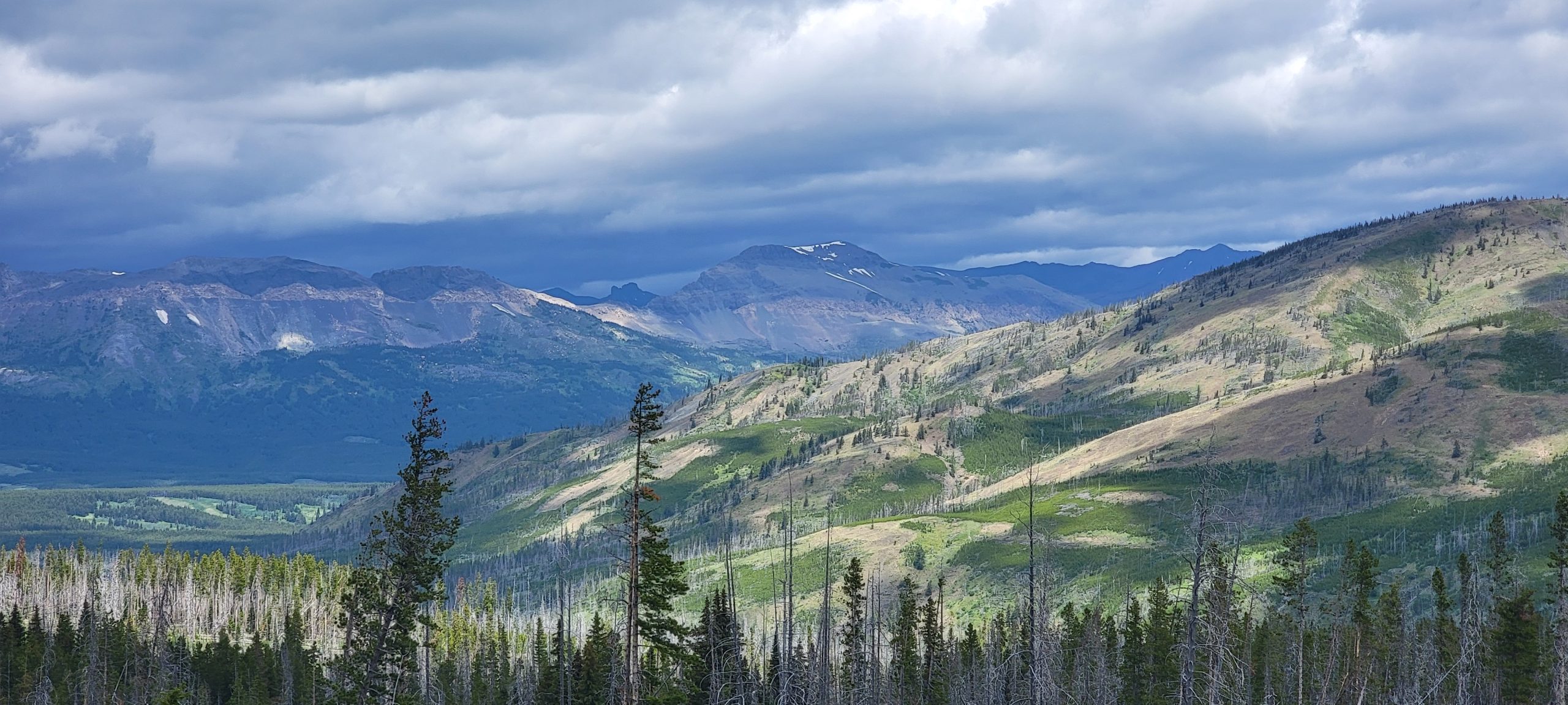
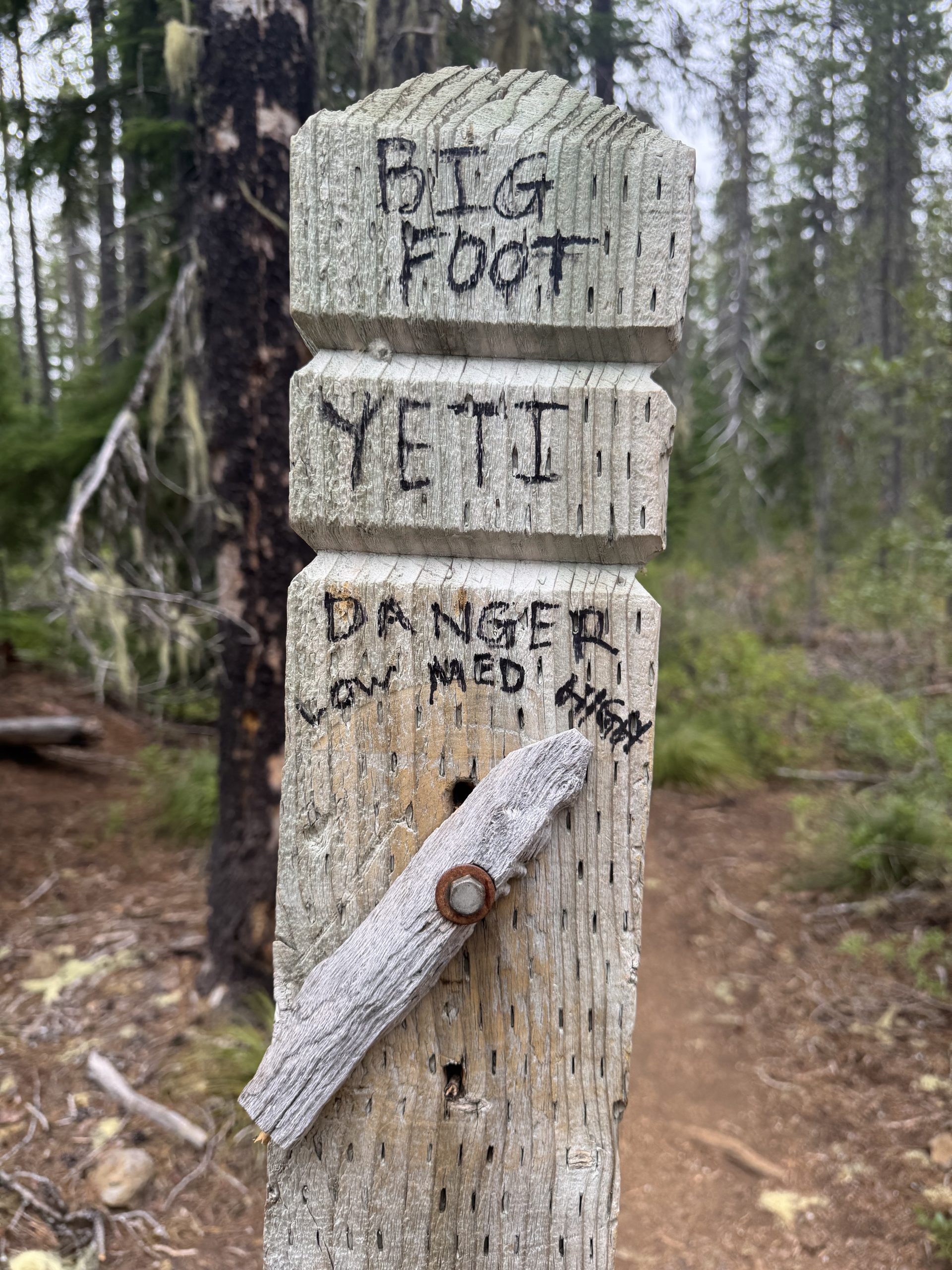
Most hikers know the Bob as the place with bad blowdowns. For us it wasn’t. Maybe word got around and the Chainsaw Bois showed up to trim it. Maybe it was aliens. Nothing is 100% certain. Therefore, less parsimonious explanations carry equal weight to more sensible ones, AMIRITE?
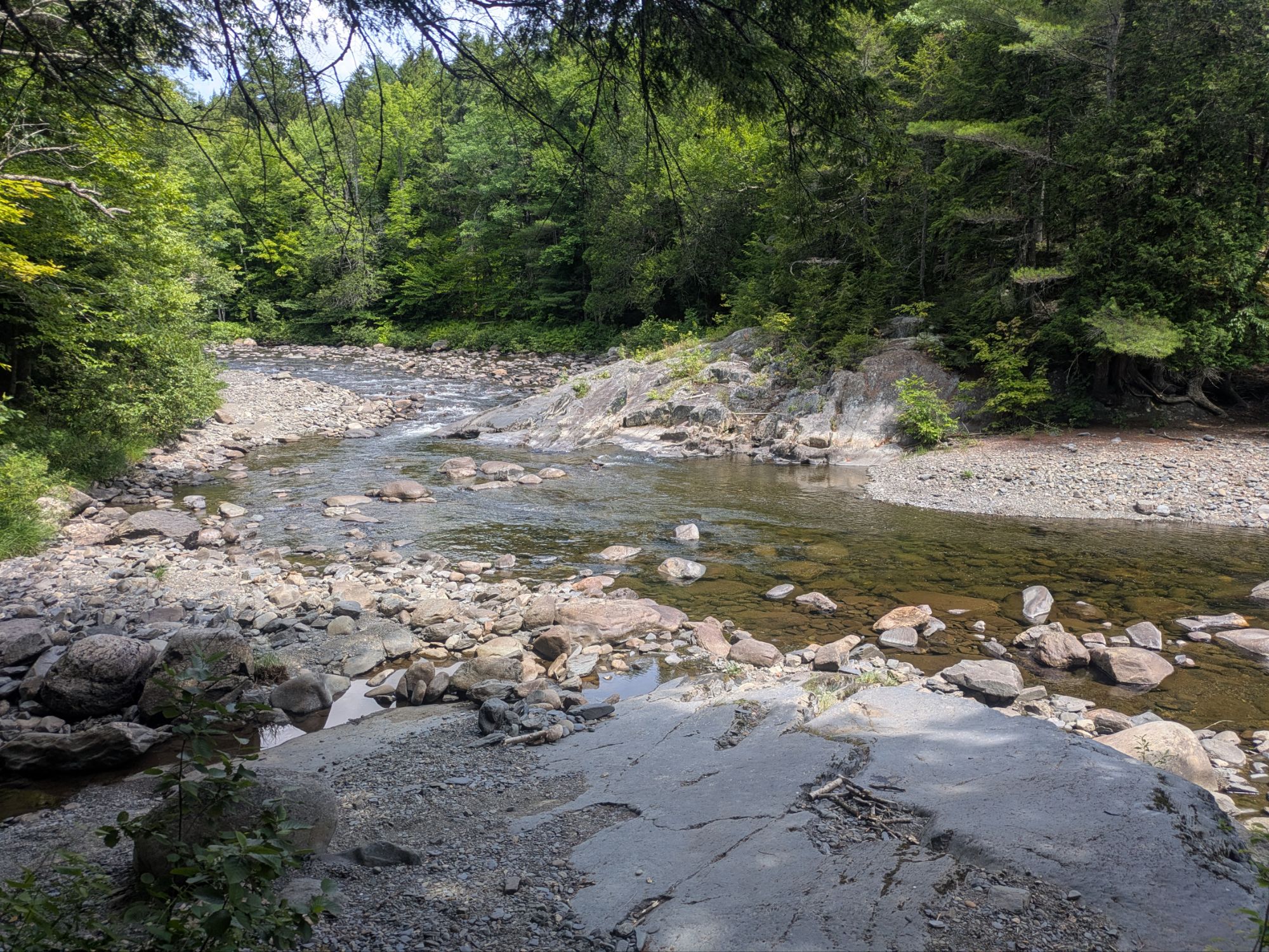
Anyway, whatever the blowdowns are like any given year, the Bob does have a load of stream crossings, and since Glacier had been constantly wet, we hiked the first 200 miles of trail with wet feet. Squish, squish.
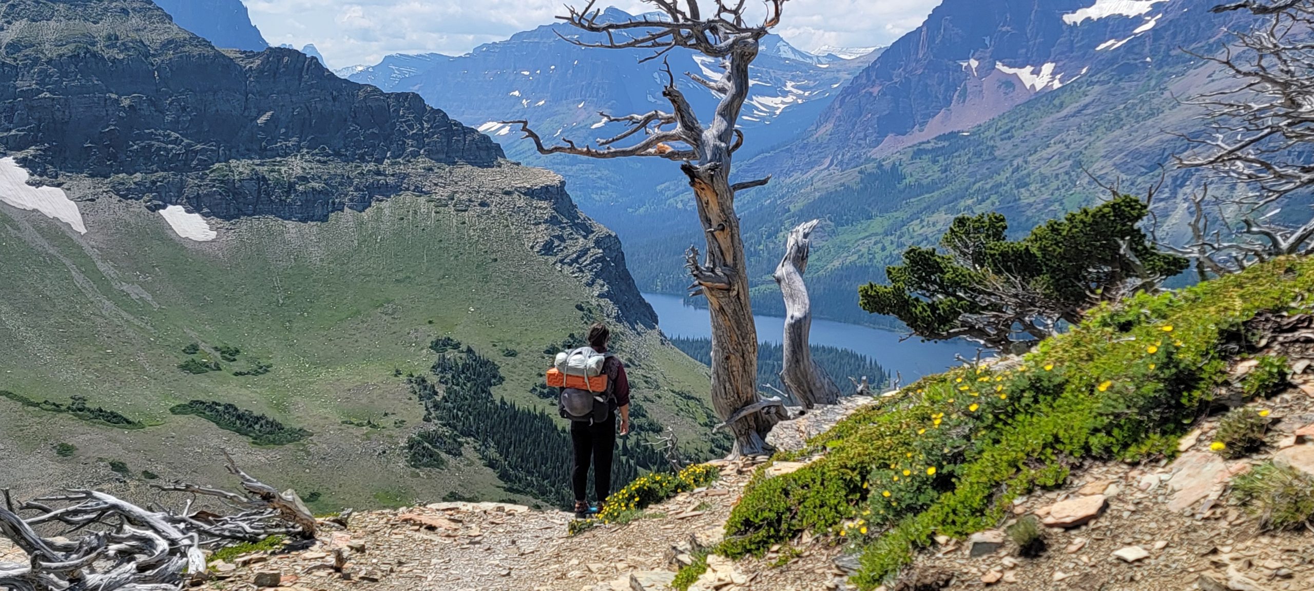
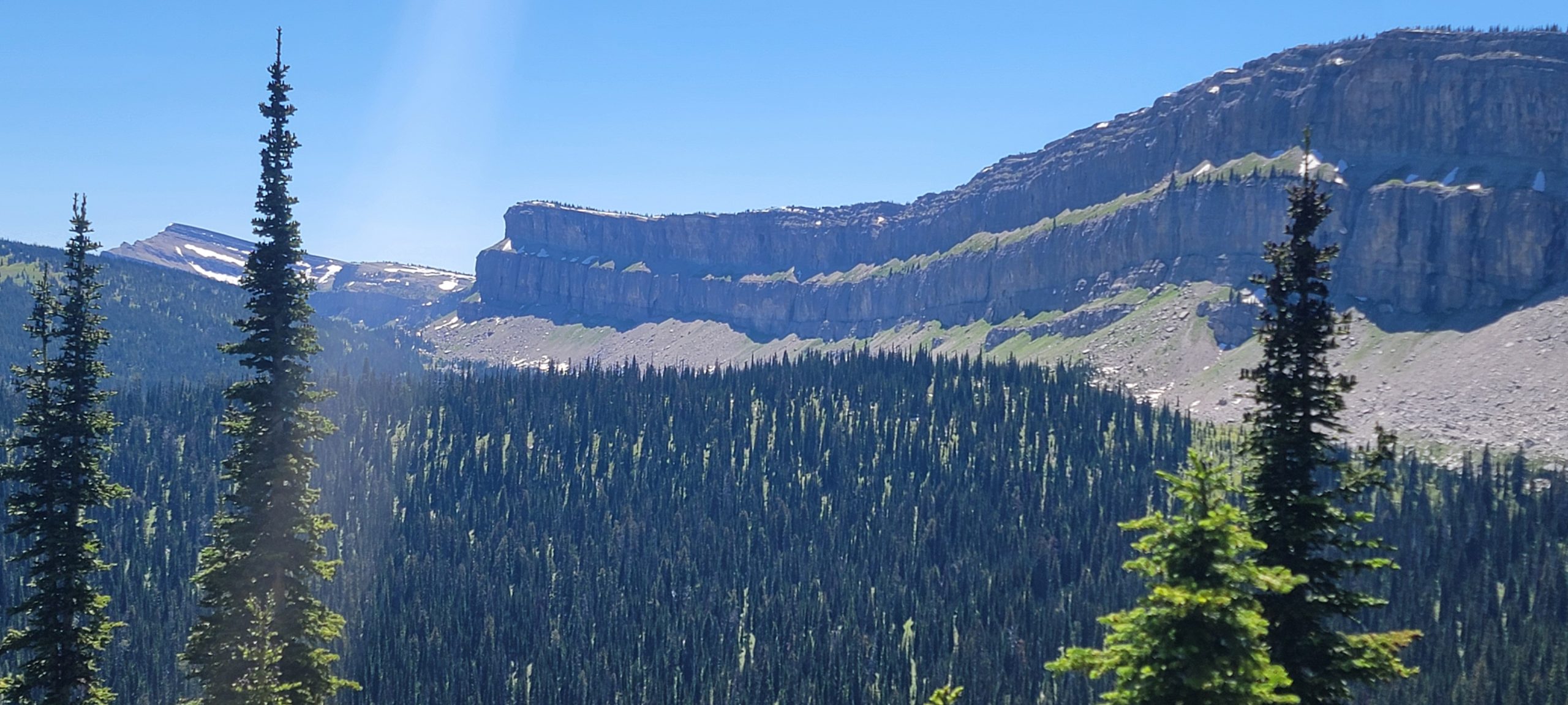
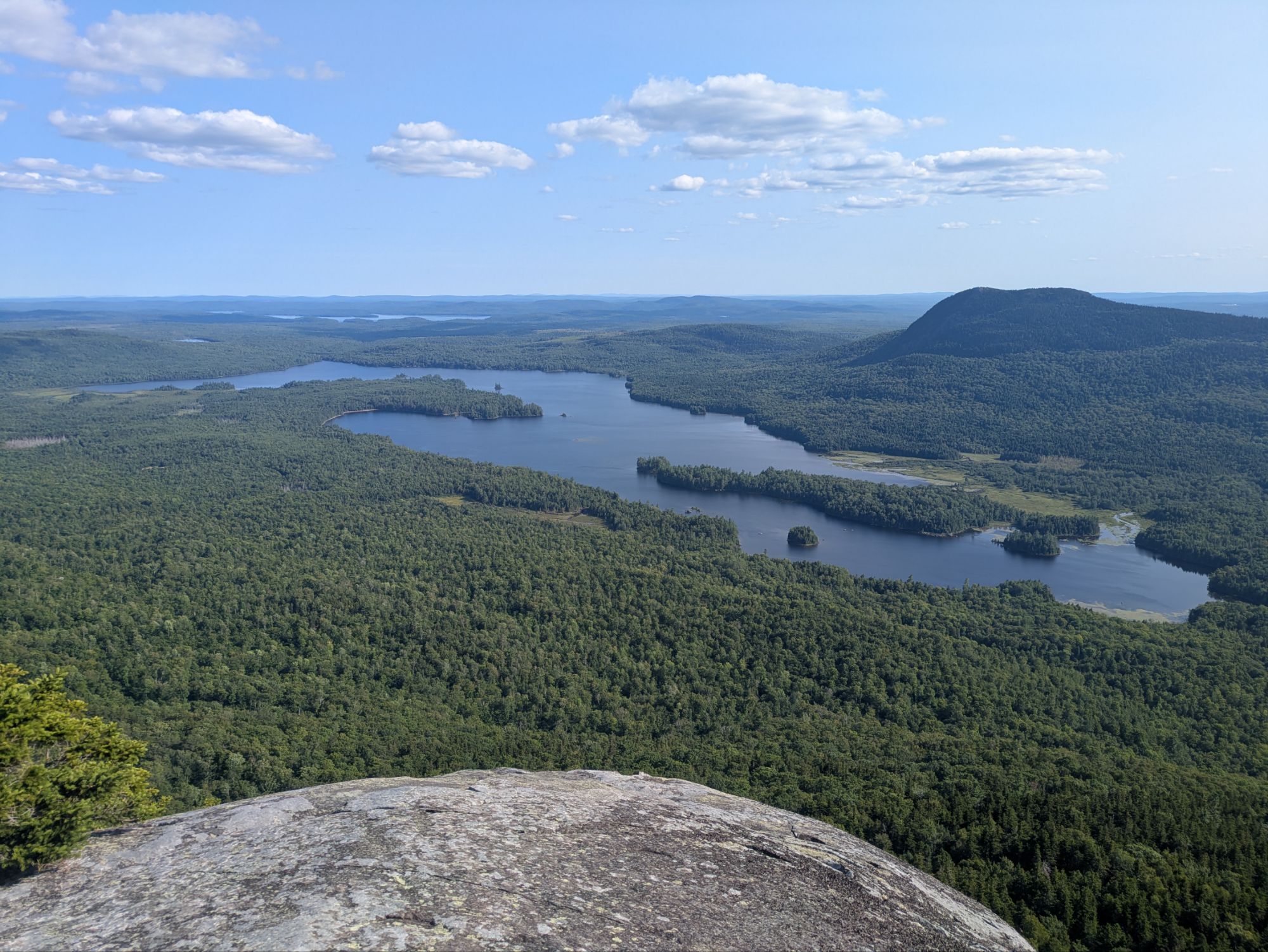
Other than the Chinese Wall, which is much cooler in person than in photos, I don’t remember the Bob that well. I was grumpy and sick. I fell into another death-rest once, and again Ice Cream patiently took the lead with camp setup, navigation and Man-Flu maintenance. There were some pretty views, I do remember that, and a chick named after Legumes, and another that judged Ice Cream for carrying a bear can rather than an Ursack. Legumes was sweet and memorable, Judge Dread was not.
There were also sporadic ranger cabins where cowboy camping on the porch is gray-area permissible, and where, wonderfully, privies can be found.
We strayed onto our first “alternate” beginning the lasting trend (for Ice Cream and I at least) of routing ourselves with Gaia rather than sucking the motherly teat of FarOut.
There were a lot of burned lands, and some rain, and some thunder and lightning (very, very frightening me. Galileo). Flies abounded, and would attack in legions whenever we stopped. I counted at least eight different species crawling on me at any given time, most didn’t bite. They just crawled around annoyingly and gave disgusting, tickly kisses with their proboscis.
A group of army veterans on horseback passed at a water source. All wore western gear, and most wore guns. They were Chads, their horses were Chads, their guns were Chads. One’s name was actually Chad, and he had hiked the AZT when Ice Cream and I had, though we never met him.
At times, Ice Cream and I caught the boys, even were able to hike with them for a while before Toolman’s machine-like stride took him away. Toolman is 99% sure a wolf passed his tent one night as he camped alone. There was a lot of sound, and a fresh dog print too big to be a dog.
Then, without much warning, there was a parking lot. A tiny cardboard sign said, “CDT trail magic.” The boys were already in Augusta, MT. Ice Cream and I planned to get there the following day, so we went to check out the trail magic.
There are times in life when I feel simultaneously surprised and not surprised all at once. This was one of those times. The trail magic was, of course, Dogleg and Trip from the AZT, and half a dozen other cool folk. Dogleg had a camper setup and was hosting a gaggle of tired hikers. He had drinks, made stir fry and hotdogs. Herman’s blessing upon him.
Other cool people were there, too, like Spruce Goose, attempting to be the first woman to walk in a continuous line from Tierra del Fuego on the southern tip of Argentina to the top of Alaska. Having made it to the CDT and following it “since it was convenient,” she was doing a great job of it. She had been working the project since something like 2017 and had dealt with the worldwide shutdown for COVID, Mexican cartels, perilous jungles and who knows what else. She also had a dog, Chicken Inspector, who she had picked up as a pup specifically for this trip. The dog knew nothing else. If I ever get the chance to reincarnate, I want to be a dog that belongs to someone like Spruce Goose.
Based on quality information from Dogleg, along with offers of pancakes for breakfast, Ice Cream and I decided to camp nearby and hitch in to Augusta in the morning. As my grand-pappy used to say, “Why do it now when you can do it later?” A wise man.
We hung out, we chatted, we laughed, we slept, and in the morning we rode into Augusta with a man wearing a thousand yard stare and a pistol, but that’s a story for part 3.
Unless given express permission for their use, all names and trail names in my articles have been changed. Any resemblance to real people is coincidental. If you enjoy my writing, please feel free to subscribe or buy me a coffee using the Tip the Author button.

Day 32
Start: Indian Springs Trail Junction, mile 525.1
End: Paradise Park Loop Alternate, mile ~550
Miles hiked: ~24.9 miles
After getting in late last night, I decided to sleep in for a while, waking up at 6:30am instead of 6:00am. I could hear the NOBOs getting up and heading out, so when it came time for breakfast, I enjoyed it at the picnic table alone. When I got back on trail, however, I noticed that there was one tent left: that of the other SOBO couple I had been leapfrogging since the beginning. I’d probably see them again sometime today.
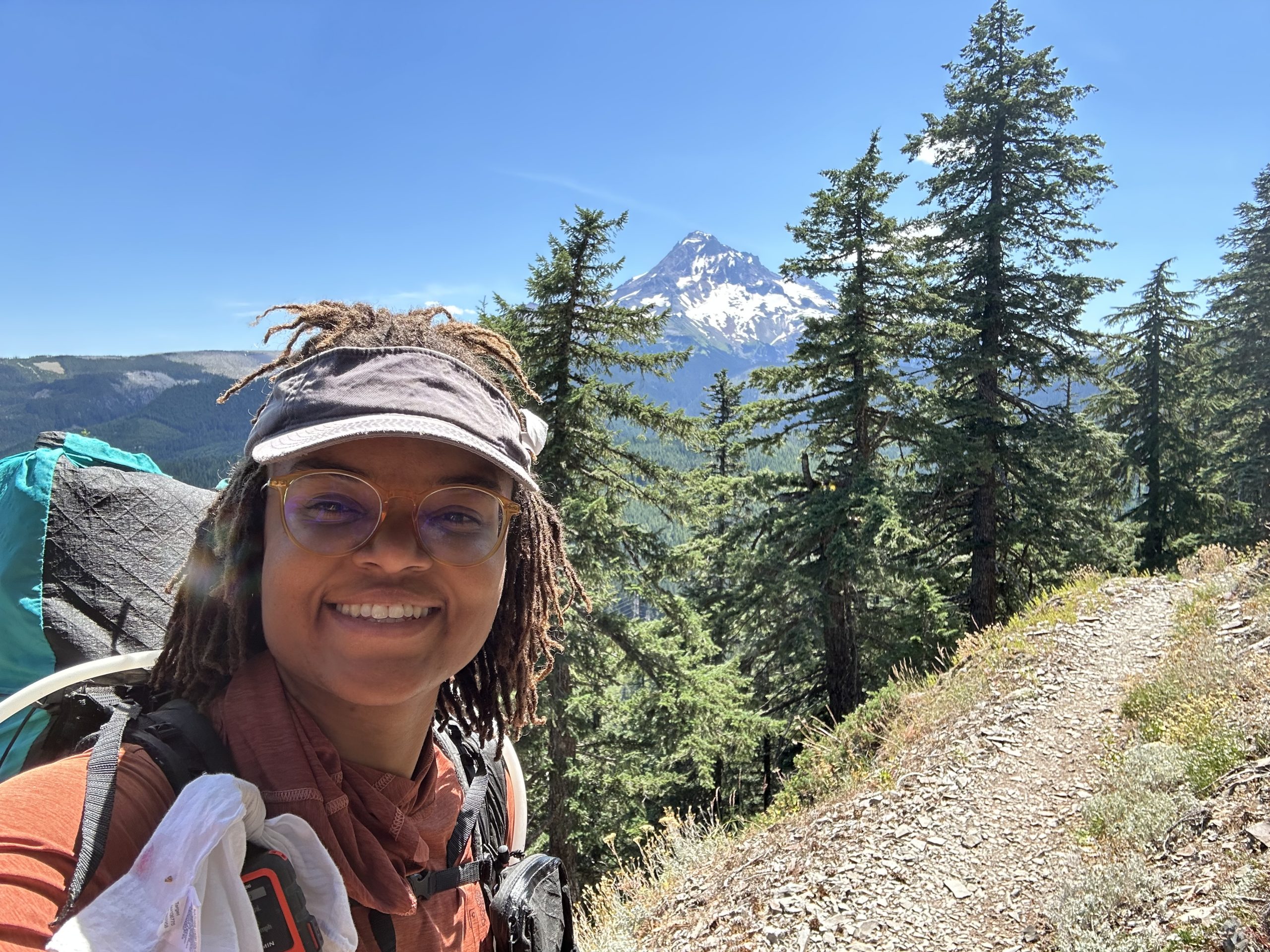
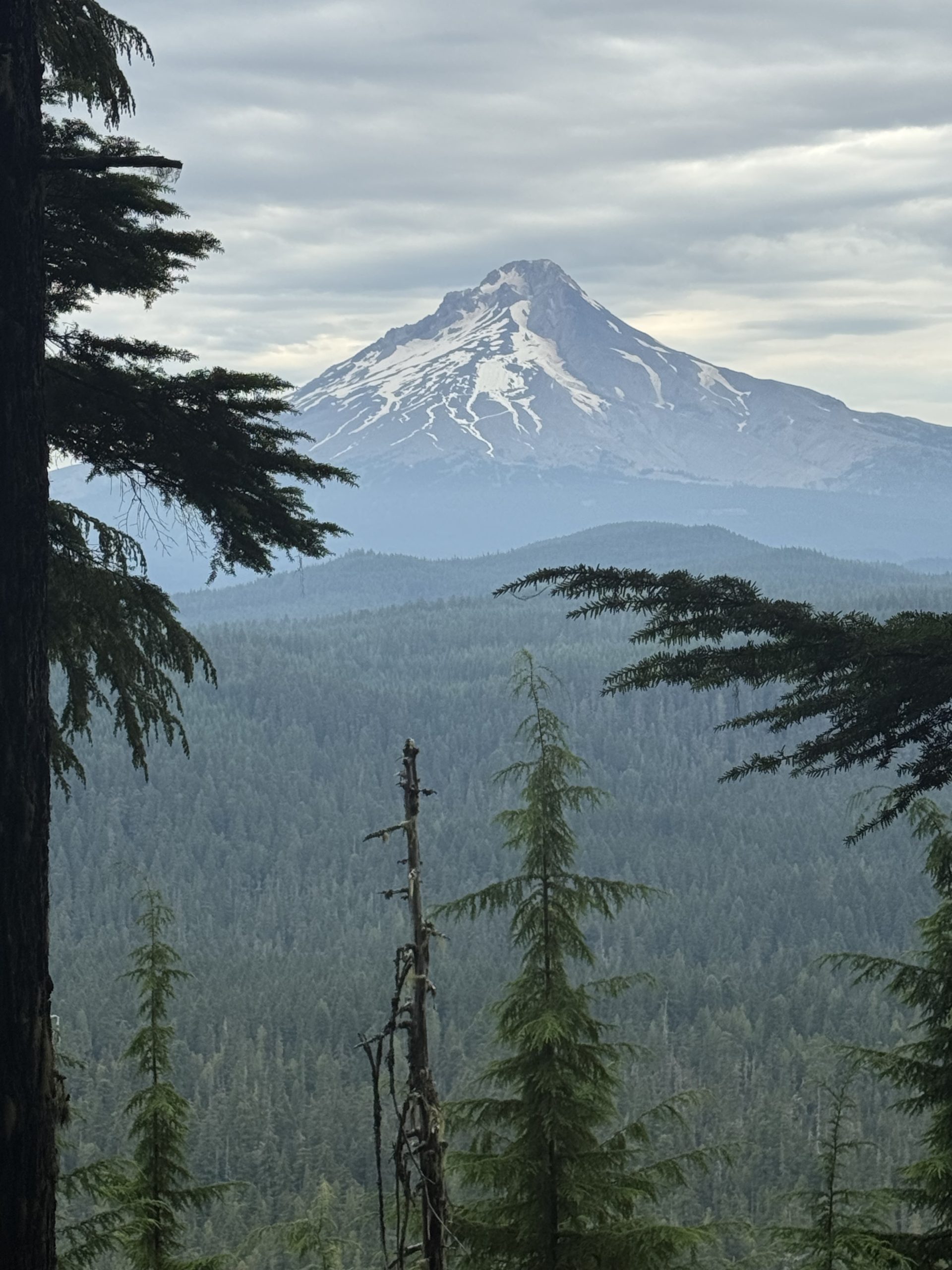
After a few minutes of climbing, I reached the wide open expanse of an exposed bald. Darn, this could’ve been my campsite last night. There were views of Mt. Hood, Mt. Rainier, and Mt. St. Helen’s with no clouds to cover them. If only I hadn’t been so wiped out after the climb. Oh well.
After that, it was a while until I saw the full sky again. The trail took me gently through the forest, past huckleberry and blueberry bushes that had already been well-picked. So many NOBOs and multi-day backpackers passed, it was unbelievable. But I did end up passing someone who I’d been looking for since the beginning. The crazy thing was, I didn’t even know what he looked like, just his name.
A friend from church had another friend hiking the trail this year and told me to look out for him. Well, a friendly guy and his wife passed and struck up a conversation, which doesn’t happen as often as you would think between NOBOs and SOBOs. It took us a few minutes to introduce ourselves, but when he did, a lightbulb went off; it was him! What a coincidence because now, with so many NOBOs passing, I just say hi and move on, but for some reason we struck up a real conversation. How lucky is that?
After a few miles, I sat down to have second breakfast. With 6 miles done so far, the morning was moving steadily along. Just as I was packing up to leave, the SOBO couple from this morning came to have their second breakfast as well. See? I knew it wouldn’t be long until I saw them again.
Since I had finished, I gave them the site and kept going. Then, through a break in the trees, I saw it: Mt. Hood! This was my destination for the day; I planned to camp along an alternate in the shadow of the beautiful mountain. Seeing it so close put a little pep in my step.
As the morning turned to afternoon, the temperature rose, increasing my gratitude for the constant tree cover. It was hot! I found a nice shady Tentsite right before my big climb of the day and leisurely ate my lunch. The menu for today included bread with cheese and meat sticks, jalapeño chips, a cookie, and a few Nerds gummies. Yum!
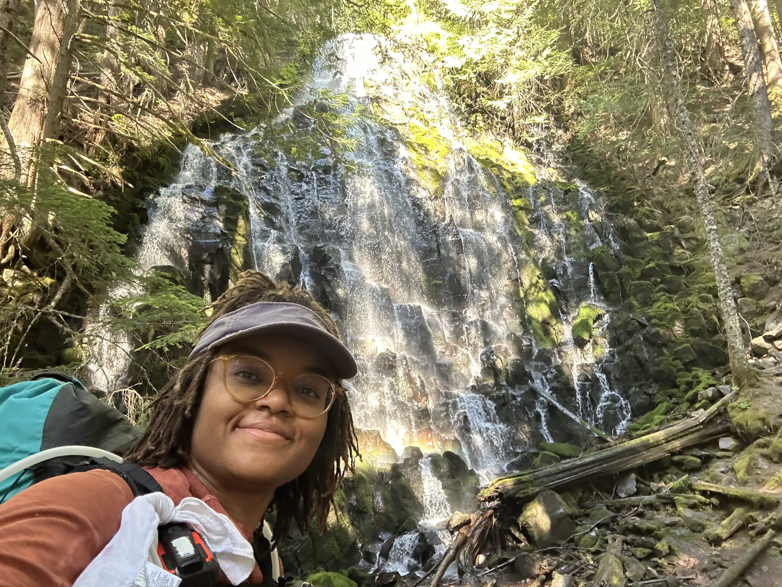
Fueled and ready to go, I tackled the first 1,000ft climb with ease. After a long descent, I took a quick break to dip my hands in the cool creak before heading to see Ramona Falls. This waterfall is not on the official PCT, but it’s a very popular alternate that is almost the same length as the PCT.
As I walked alongside the creek leading to the falls, I longed to jump in and take a dip. My shirt was soaked from my sweat and I could feel the heat of the day on my cheeks. Still, I knew I would find it annoying to take 2 breaks so close together and have to take off my socks and shoes, so I waited until the falls. Ramona Falls was big and beautiful, with water cascading down the cubed rocky face beneath it. Unfortunately there was no swimming hole, so I compensated by dipping my hands and enjoying the cool breeze that wafted from the falling water.
After a few snacks and getting my body temperature back to where I wanted it to be, I continued on, ready to tackle the last 4 miles and 2,500ft of elevation gain. The beginning of the climb wasn’t bad, but with about 1.5 miles left to go, I started getting tired. My shirt was soaked with sweat once again, and the sun stood high in the clear sky. The one thing that kept me going was the promise of an unforgettable campsite in Paradise Park.
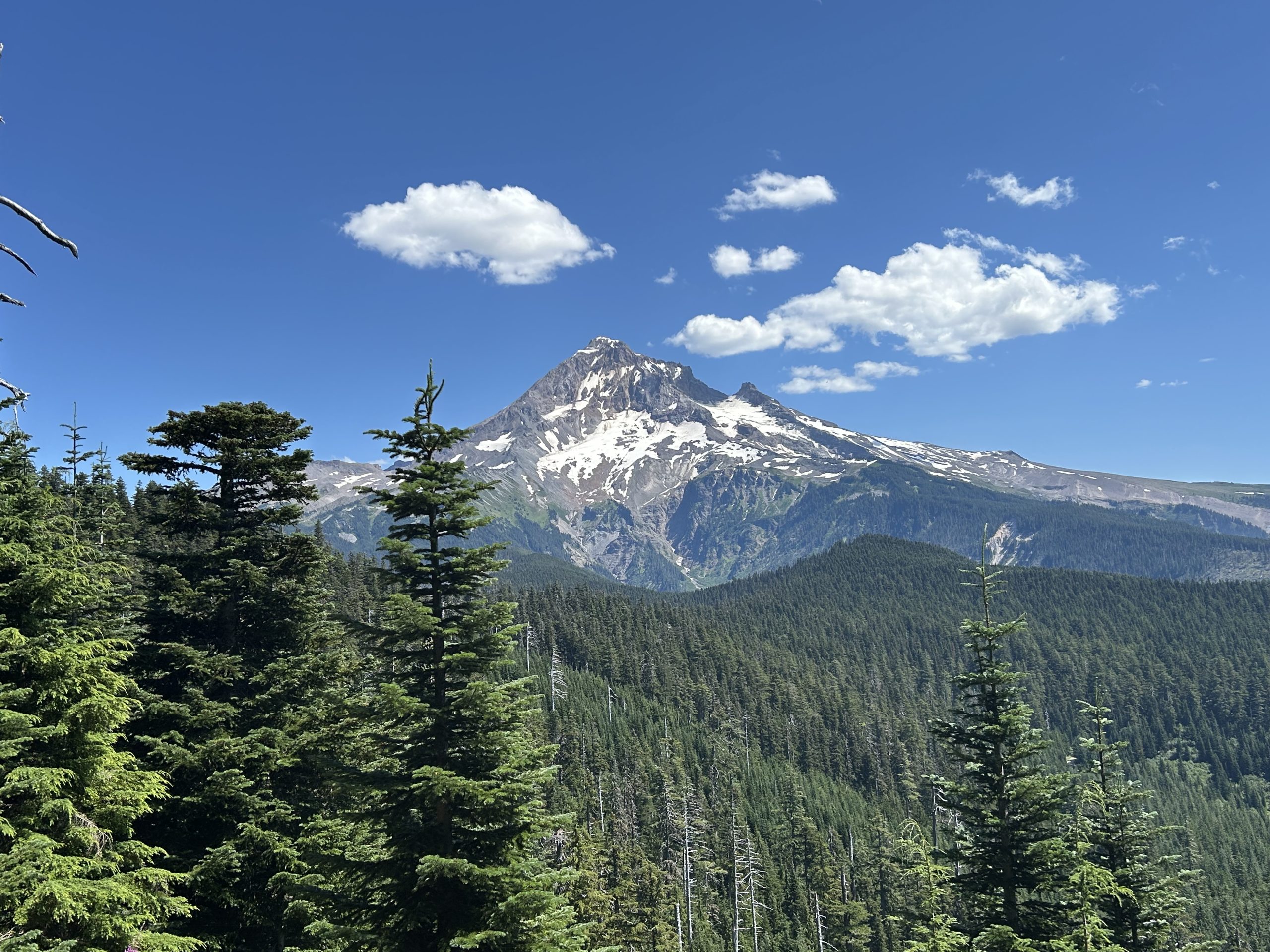
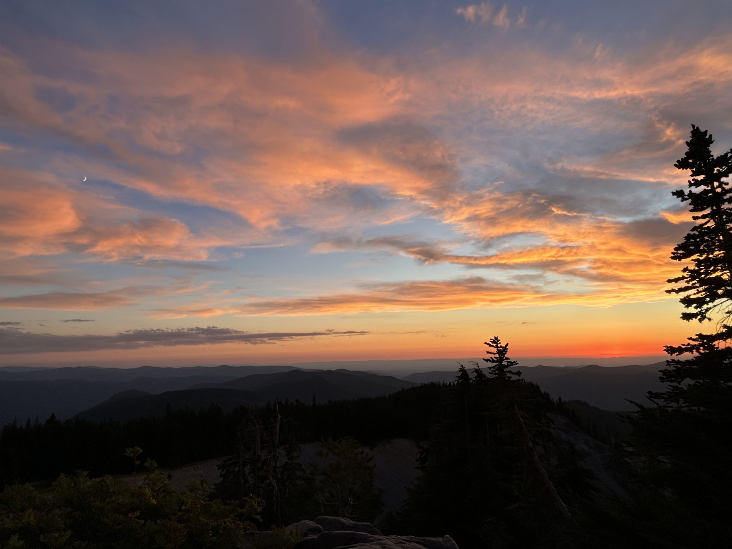
Once I reached the top, I knew that all the hard work was worth it. Mt. Hood stood clear and unobstructed in front of me while alpine meadows filled with wildflowers greeted me. It was peaceful and serene at the base of Mt. Hood.
And I wasn’t alone in wanting to camp in Paradise. There were a number of other campers scattered about, but it didn’t seem like many thru-hikers were up here. Eventually I found the perfect campsite and sat down to dinner and the greatest show on earth: the sunset. And this time, it didn’t disappoint. As the sun lowered towards the horizon, its rays softly warmed my face. I could see mountains upon mountains stretch out before me while Mt. Hood stood at my back. As I ate my dinner, the sky took on a rosy then fiery hue. Being so high in elevation, the sunset seemed to last forever. I have to say, I think it’s been the best one on trail yet.
Paradise Park truly is paradise. As the sun fades, I can see Portland, Vancouver, and other towns along the Columbia River twinkling in the distance. The crickets chirp softly while the muffled sound of a snowmelt stream burbles in the background. Tonight is an amazing night.
And that’s a day in the life of a PCT SOBO hiker!
This website contains affiliate links, which means The Trek may receive a percentage of any product or service you purchase using the links in the articles or advertisements. The buyer pays the same price as they would otherwise, and your purchase helps to support The Trek’s ongoing goal to serve you quality backpacking advice and information. Thanks for your support!
To learn more, please visit the About This Site page.
It Started with a Miss
When my resupply box did not show up at Shelter Cove as scheduled, I found myself feeling grateful which caught me somewhat by surprise. I was going to use the resupply to get me to Santiam Pass 4 days later so that I could meet up with my good friend Dan who was going to join me for the stretch to Cascade Locks.
Thanks to the UPS driver, I was now sipping my coffee and wondering what my options were for resupply and questioning if I could in fact hike the distance to Santiam Pass in time to meet my friend on Sunday afternoon.
As luck would have it, a fellow hiker was getting off trail for the day to visit with a friend he met while thru hiking the AT. His friend offered me a ride to town, but I had to decide in 5 min if I wanted to take it. I took the ride. I needed a resupply.
As I sat in the backseat looking for resupply options on FarOut for the town, an inner voice whispered to me – ‘take a break.’ With a deep breath and a long exhale, I realized what I really needed was a couple of days off the trail.
I would only realize later while at the trail angel’s house in Bend just how tired my body was. My feet ached. My legs were fatigued. I was hungry for non trail food. I wanted to sit on something comfortable. I wanted to just chill for a bit. I was tired. I need a break from the PCT. Physically and emotionally.
I had always heard of Bend Oregon and had wanted to visit, but I had never found myself in central Oregon. Sitting in that car, I realized I was just a short drive away. With the help of FarOut, I had a place to stay and a bus ride booked before I got out of the car.
When Emma picked me up at the bus station, she warned me that she had 3 dogs at her house. She knew immediately from my smile that I am a dog person so there was no reason to explain anything to me. I needed some doggie time anyway as I had not seen my lab since April.
I spent 2 days exploring Bend. I ate great food, drank delicious coffee, watched movies with Emma and other hikers at her house, played with the dogs, watched people float the river in town, and just relaxed. For once it was great to have a couple of zeros that were not focused on laundry and resupply. Bend was just what I had needed. Time there was like a resupply box for my soul.
After I got re-energized in Bend, I caught a ride just up the road to Sisters to meet my friend Dan who was coming in from Portland via bus. My day in Sisters was my trail resupply day, but I was ready to hang out when my friend Dan arrived that afternoon.
I have met some amazing people while on the PCT, but there is something special when you catch up with a true friend. We grabbed a bite to eat and then sat and talked while enjoying an Oregon Pinot Noir. When in Oregon…
Back on Trail
Dan and I got back on the trail at Santiam Pass. It took us 4 days to hike the 100 miles to Timberline Lodge on Mt Hood. Those 4 days turned out to be classic PCT days which I was glad that Dan got to experience.
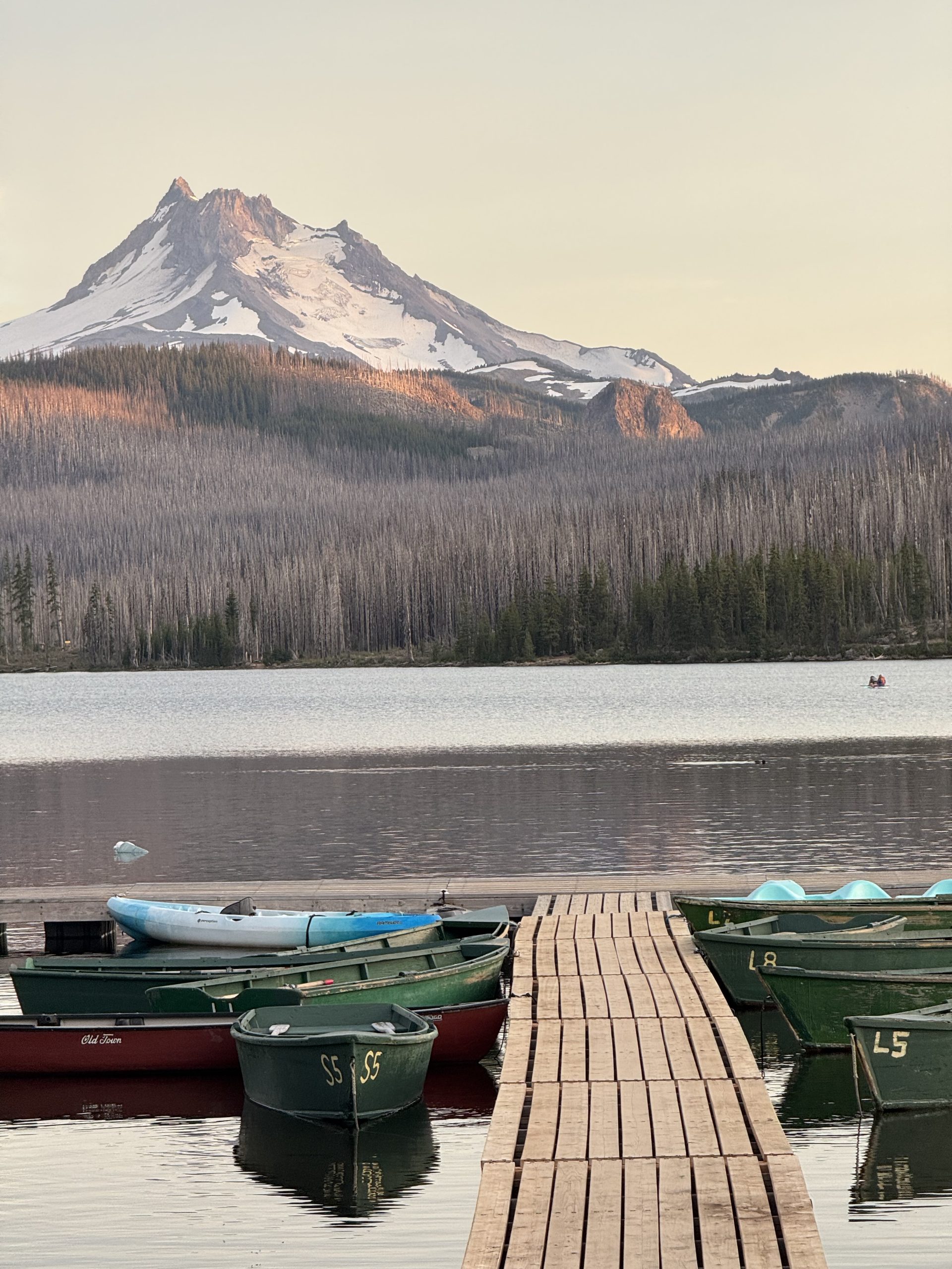
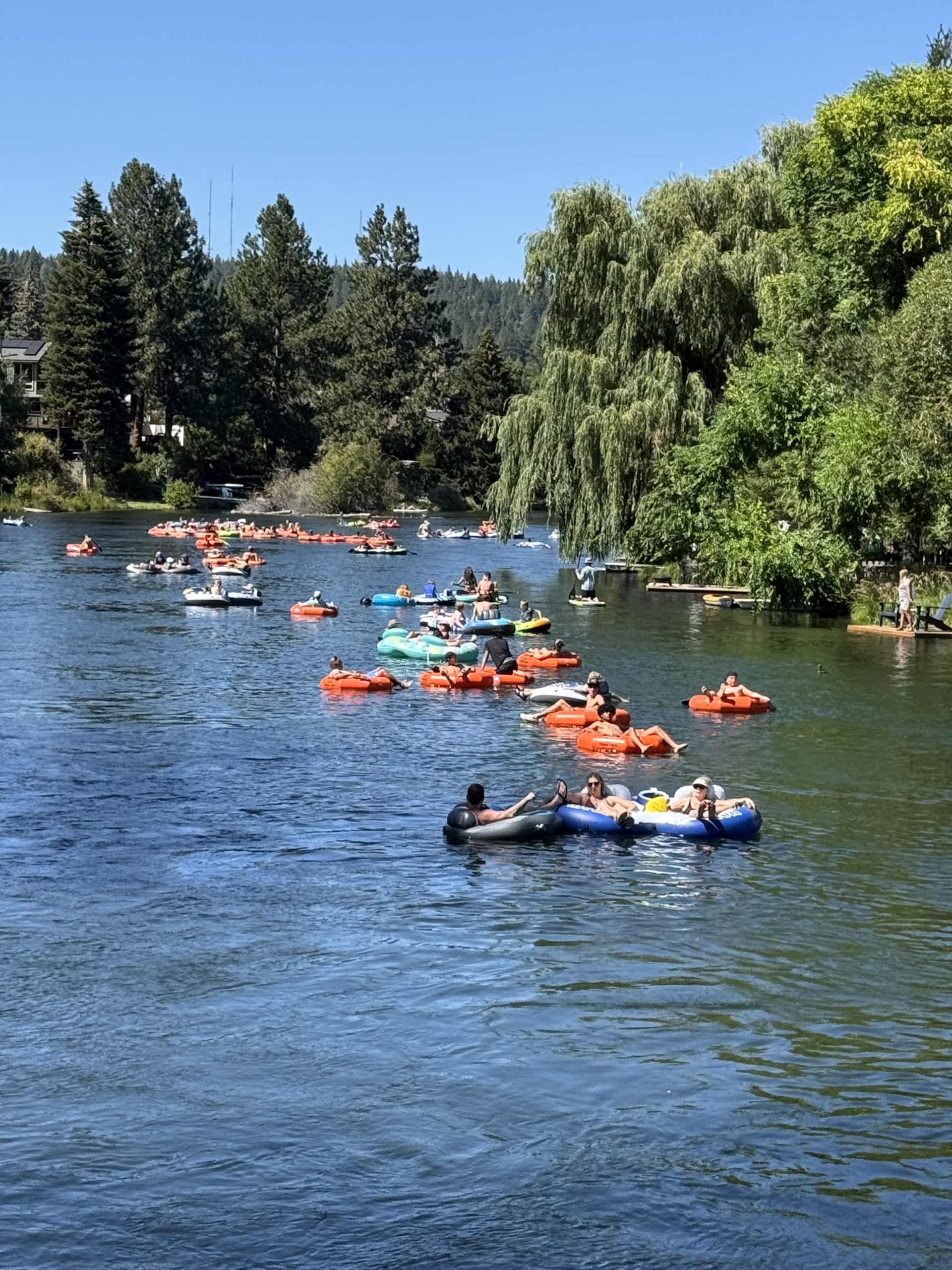
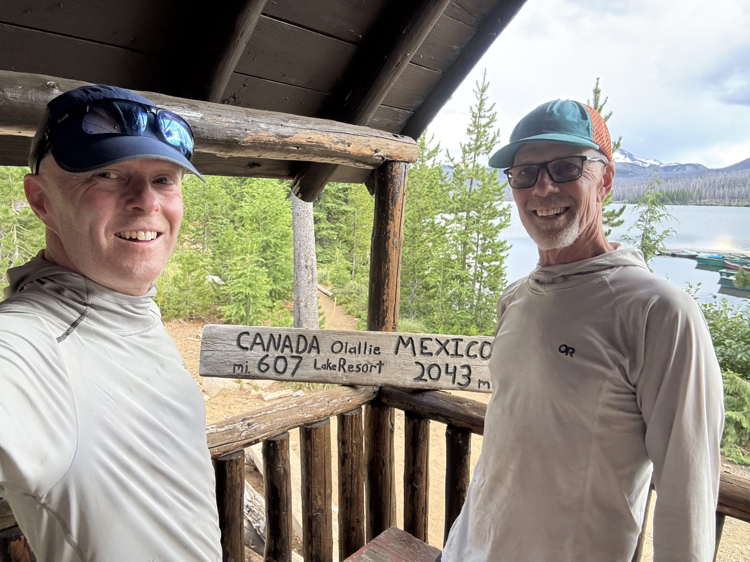
Day 1 was a hike through burn scars with a good climb. We camped on the south side of Jefferson and then spent Day 2 hiking around Jefferson and descending to Olallie Lake. Day 2 was dusty and very hot. Enjoying a cold lemonade from the store at Olallie Lake was a great way to end the day.
Day 3 saw us hiking through lush forest along beautiful trails. It was cooler and the shade from the trees was welcome after the 2 previous days in burn scars. Just before we got to camp, we saw an awning through the trees. Dan got to experience his first trail magic. Carbs was nice enough to make us grilled toast with egg in the middle. We both ate 4 pieces while sitting in the chairs that Carbs had provided.
When we got to the horse camp just a mile down the trail, we sat up camp next to a picnic table. I cannot stress enough how luxurious a picnic table, a pit toilet, and a water spigot are after 4 months on the PCT.
Day 4 was the beautiful hike and climb up to Timberline lodge.
At Timberline, we decided to get off trail to deal with an injury. While this meant that I would not be hiking to Cascade Locks, it was an easy decision for me as I wanted to maximize the time with my friend. Plus I know we will come back to finish this section at some point in the future. Besides it will give me an excuse to climb Mt Hood which has always been on my bucket list.
Time with Family
Since early July, I had Aug 5th on my calendar as that was the day my parents were flying into Portland to spend a few days with me. After hanging with Dan for a few days in town, I met my folks at the airport. Over the next few days, it was magical to hang out with them. I would like to say that we did a ton of tourist things in Portland, but that would not be true. We ate well, visited Powell’s bookstore and relaxed a lot at the Airbnb.
When I dropped my parents at the airport for their flight home, I found myself ready an excited to get back on the trail. I am on the home stretch now and have some beautiful sections of WA ahead of me. I also have more friends joining me on trail shortly.
Looking back at the time since I left Shelter Cove, I am happy that I got off trail for an extended period of time. I was way more tired that I realized – physically and emotionally. I also realize just how much I treasure my friends and my family. The 4 days on trail with Dan are 4 of my favorite days on the PCT. And spending time with my mom and dad was precious.
Now that I am back on trail, I am looking forward to everything that Washington will be serving up. I have climbed Mt Adams and Mt Rainier multiple times so hiking past them will give me a new perspective of places that I love. I am also certain I will find parts of Washington I want to explore again in the future.
Until next time. Happy Trails!
This website contains affiliate links, which means The Trek may receive a percentage of any product or service you purchase using the links in the articles or advertisements. The buyer pays the same price as they would otherwise, and your purchase helps to support The Trek’s ongoing goal to serve you quality backpacking advice and information. Thanks for your support!
To learn more, please visit the About This Site page.
- Hiked Today: 20.5 miles
- Appalachian Trail (2,083.8 – 2,104.3)
- Total Hiked: 4,037.5 miles
- Total Paddled: 99.5 miles
Weather: 55-77°F, sunny, with just a few clouds. No wind. Nice.
Elevation: 575 – 2,670 feet
ME Route 15 & Shaw’s Hiker Hostel to Barren Mtn Spot
At 5:40 am I unzipped and crawled out of the tent and then headed into the hiker lounge. I wanted to have all my devices 100% charged and was close, but not quite there yet. Sitting in a cozy chair, a hiker soon walked by with a steaming ceramic mug in hand. That was my cue to go fetch my own cup of joe.
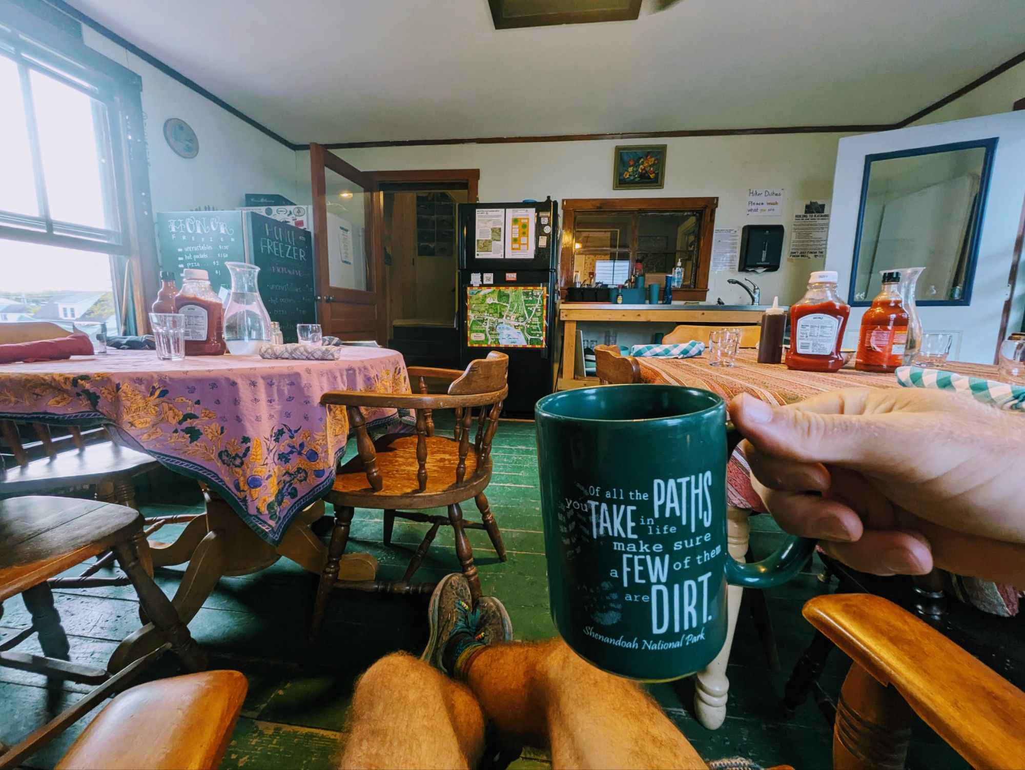
After a while I got myself motivated to start packing up. My tent was pretty soaked with condensation, so I was strategic about setting that out to dry and shoving everything else in first. Inside the house again, the tables had all been set and most hikers gathered a little before 7:00 am for Shaw’s famous hiker breakfast.
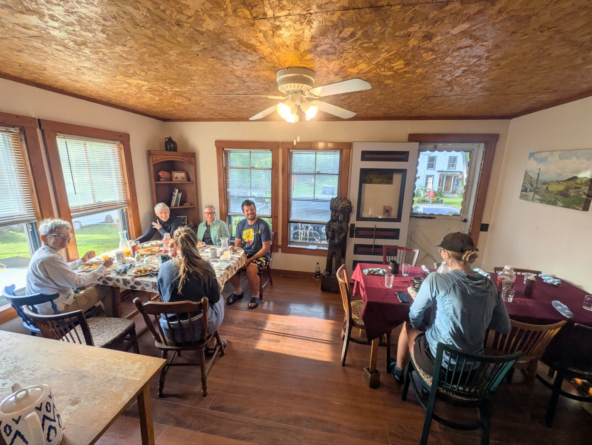
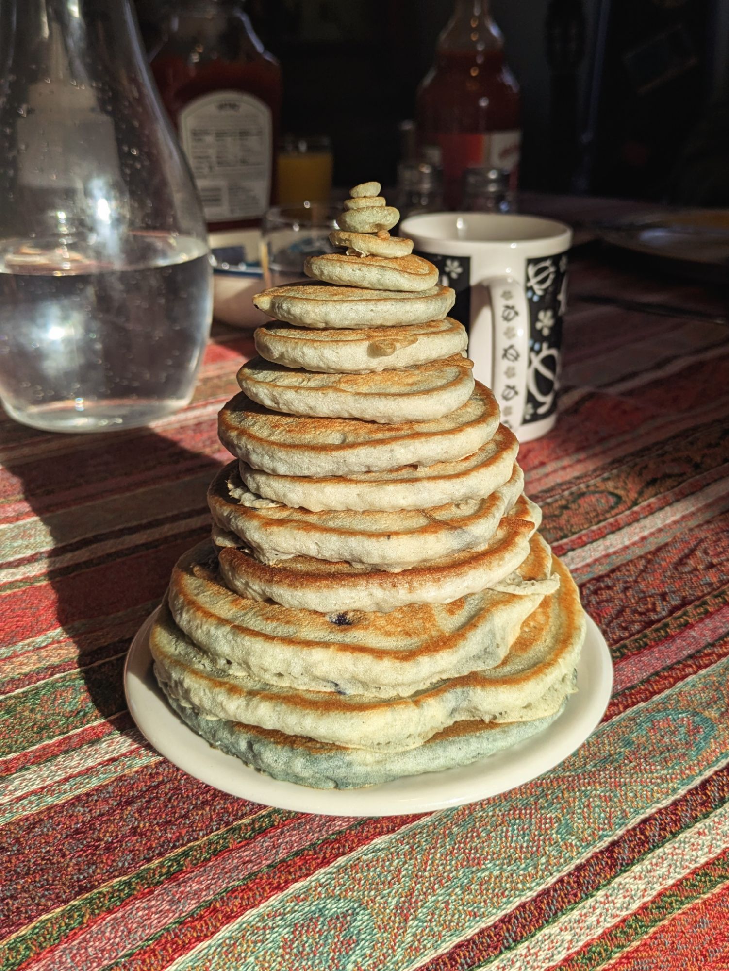
It was a wonderful experience. Great conversation, lots of laughs and stories about our silly life on trail, and some of the best victuals (this is a word my dad uses and he’s the only one I know that does) of the entire journey. I devoured it all… crispy bacon, fried potatoes with onions, 3 perfectly fried eggs, and best of all, blueberry pancakes
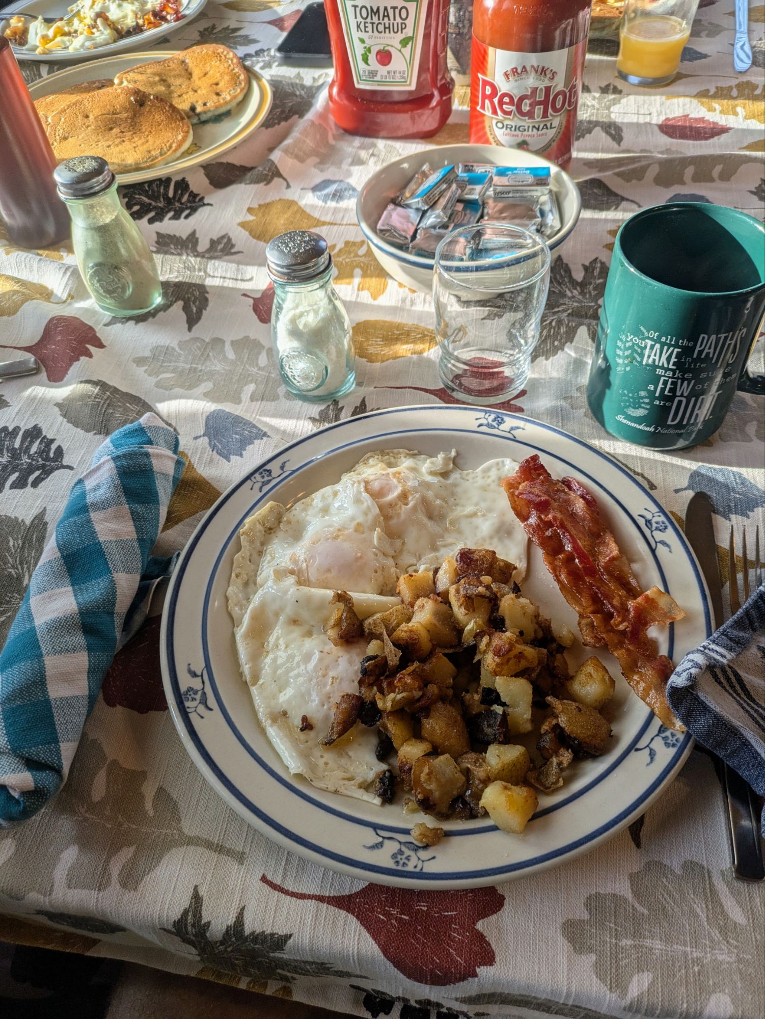
I sat with Potter, Oatmeal, Jodie (I think), Shorts from Canada and Pooh Bear from Belgium. With folks seated it was a little easier to guestimate how many of us there were and I’d say in the 25-30 range, maybe more. More than a few were hikers I met earlier on trail at various points.
Shaw’s is an incredible place and I had such a wonderful experience staying. On my 2019 hike of the PCT I was fortunate to get the chance to stay with some of the legendary trail angel hosts of that trail, Scout and Frodo’s near the southern terminus and also the Saufley’s “Hiker Heaven.” This felt like those stays… out of the ordinary warmth, kindness, hospitality, and a haven for weary hikers. It’s also been around since the 1970’s I believe, so there’s a ton of character and history that goes along with it. I was happy to have it be part of my ECT experience.
I wanted to get on the first shuttle back to trail if possible. Hoping for a full day of hiking, that early-ish start would be needed. And it worked out. I got myself all packed up, was one of the first to settle up my tab, and didn’t even have to throw any elbows to get a ride in that first vehicle leaving, which was driven by our host, Poet.
In my shuttle were Baby Talk and Rocket, Early Bird, Fire Tower, and Double Take (I think). We were all northbound for Katahdin except Double Take. At the trailhead, Poet gave us some last minute tips for side trail views and such and then left us with a haiku he came up with on his own AT journey. It was silly but thought provoking and heartfelt.
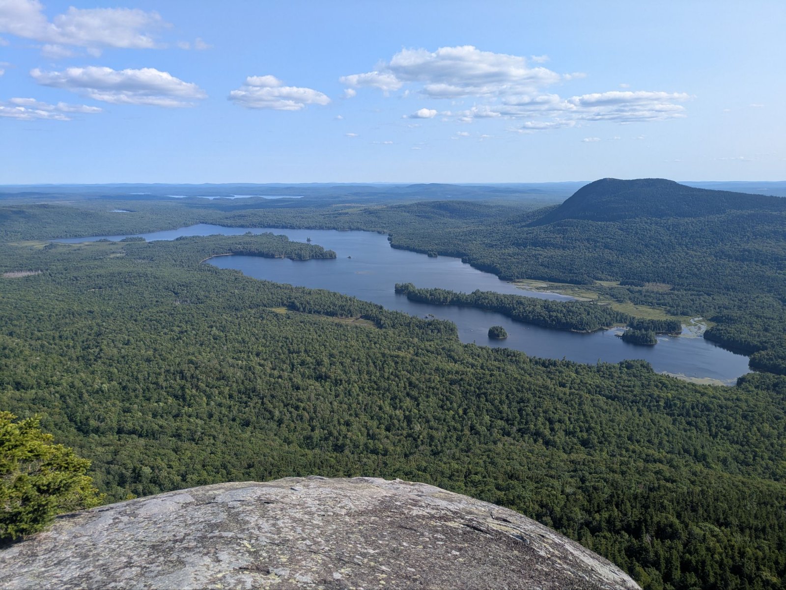
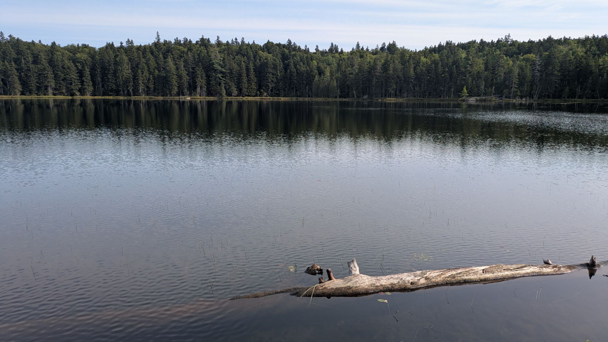
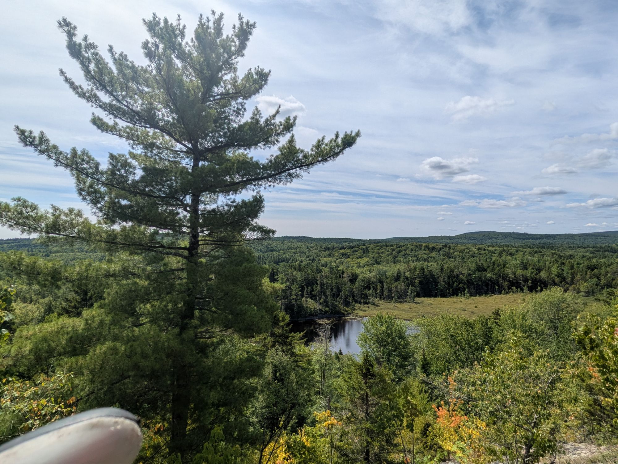
The others shot right on trail, but I stretched out and backtracked some to actually tie my walk together haha. I’m a semi-purist, I guess. Then, I hit it. The air was still and it became quiet quickly getting away from the road. As I passed Fire Tower, we both agreed it already felt like the trail, by offering up the peace and quiet, was suggesting we ruminate about the journey we’ve been on and it becoming nearer to its end. The ponds were near “glass” too furthering this idea of serenity and contemplation.
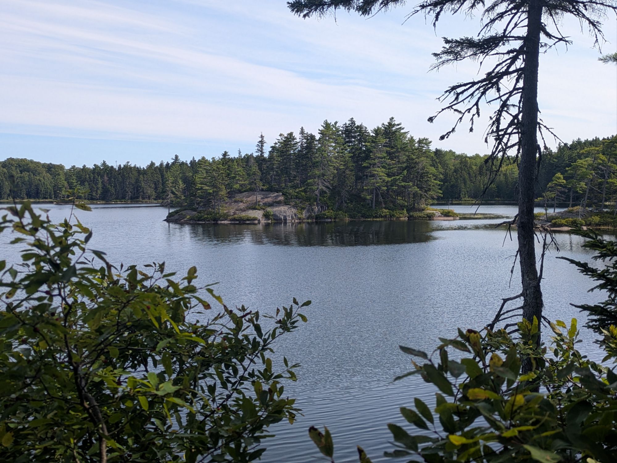
I took this photo seeing that island and the rock outcrop. I’m a big fan of jumping in off such places, but everything has been too shallow thus far.
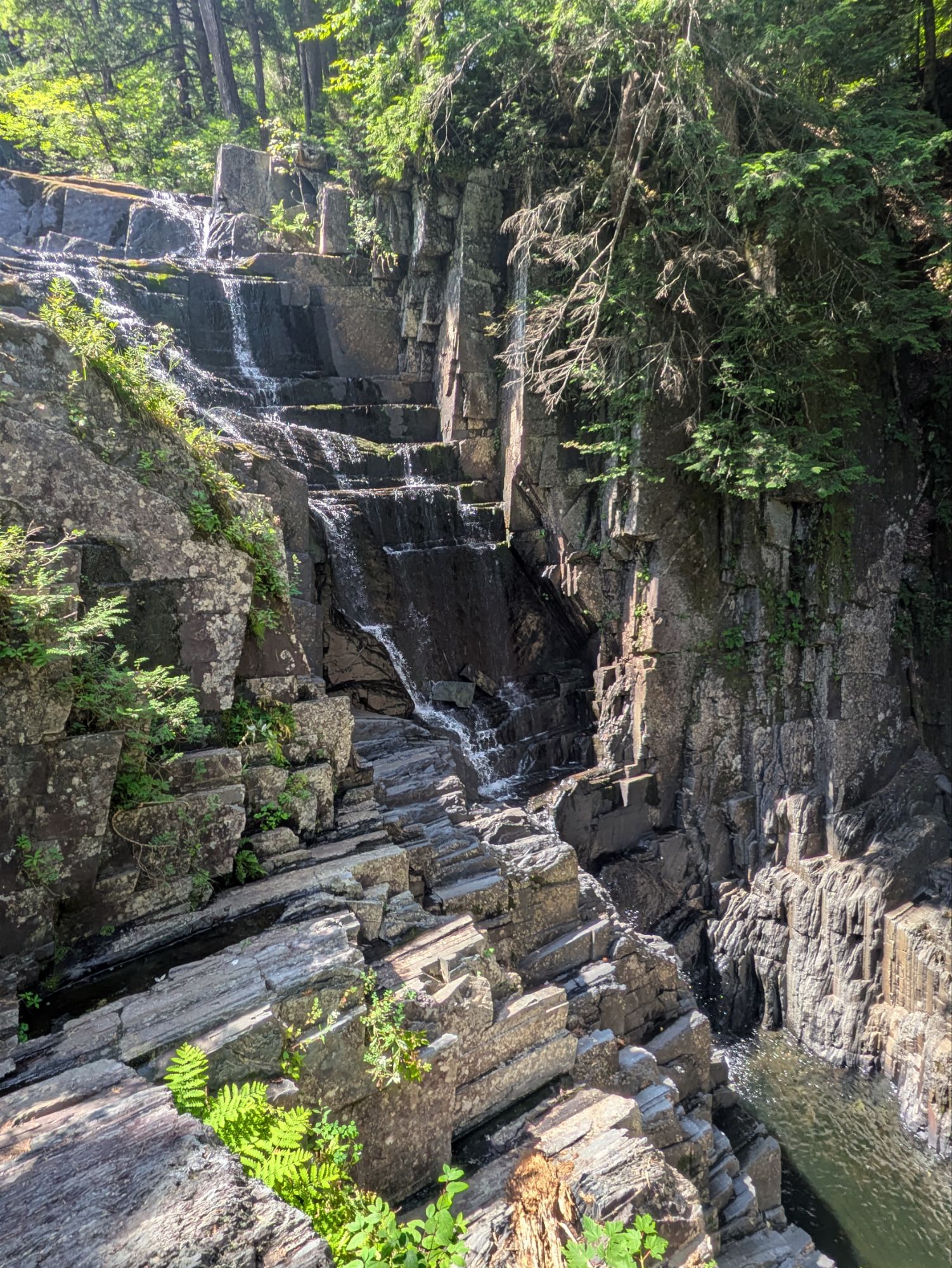
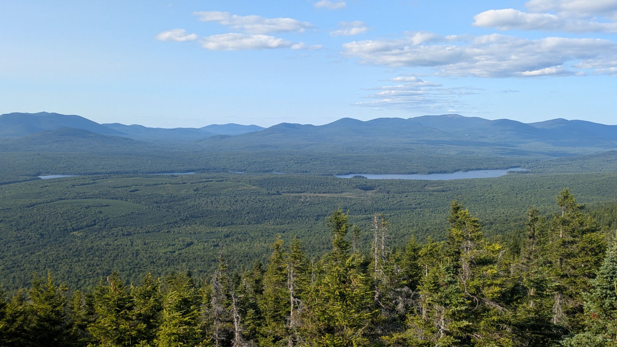
The first half of the day the hike was characterized by short bursts of up and down, but generally mellow. It was primarily a forest walk and I walked by several more ponds. There was a pretty stellar waterfall at Little Wilson Falls. And later on, the trail went up slightly higher in elevation to some ledges which offered some views.
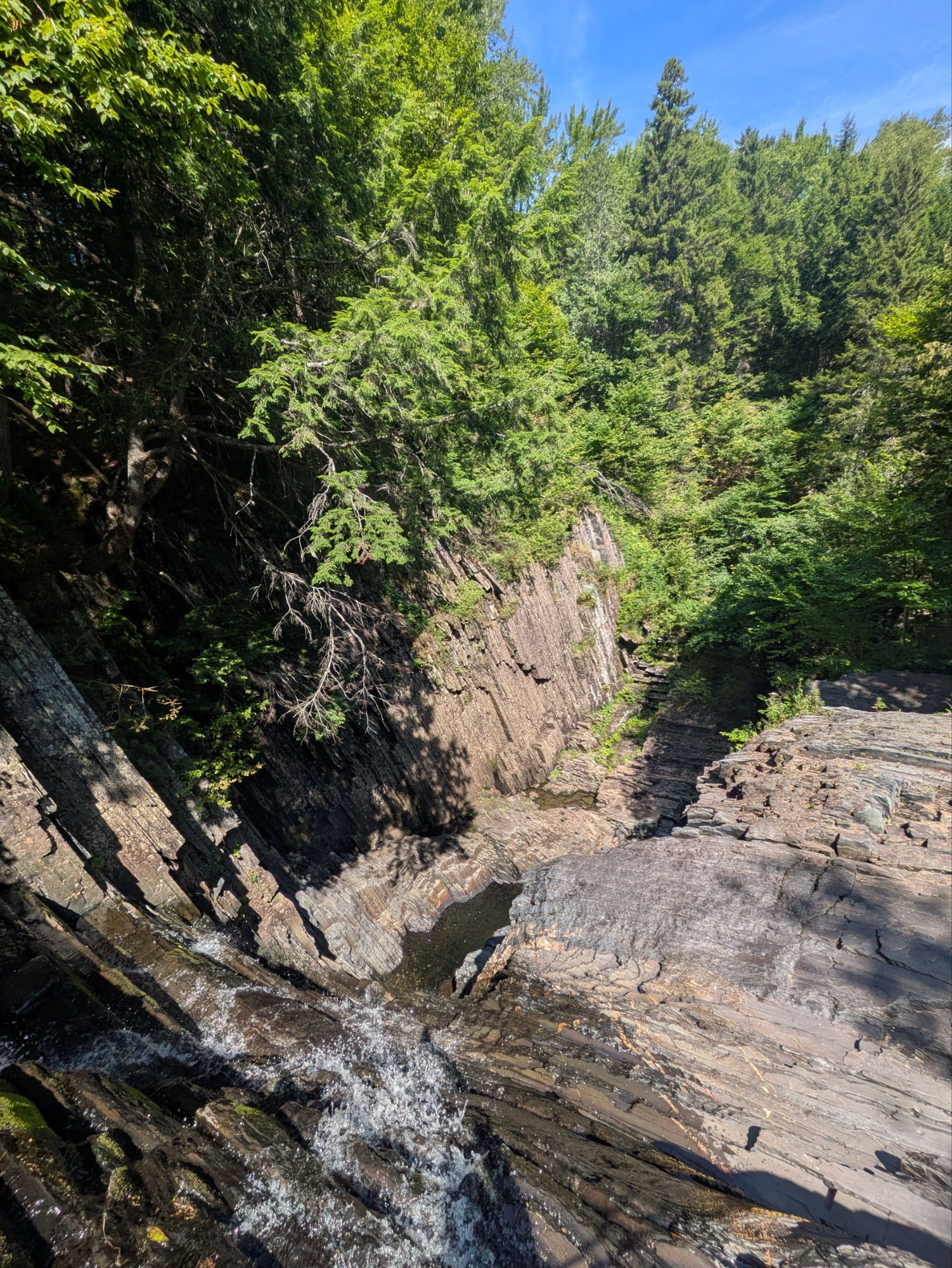
I found a nice lunch spot around 12:30 pm.
I went into swim mode first, but came up against two challenges when I tried to take my quick dip. First, the boulders were all super slippery being covered with algae. I overcame this obstacle by being slow and careful and doing a kind of crab walk out to the deeper waters where I could finally plop in. The next dilemma, however caused me to retreat… horse flies! Huge ones that were biting my bare back and legs. I was slapping and stunning several, but this was yet another ambush. I retreated to shore, but they were relentless. I was thinking of getting the shoes on and running for my life, but they started to thin. Some lay at my feet and maybe I scared the others off. Maybe their natural habitat is closer to the water and they had to return? Whatever the reason, the onslaught ended and I was safe to enjoy my lunch in peace.
The first few hours of post-lunch were similar to pre-lunch, forestry stuff with some streamside walking. A little before 4:00 pm though, I started up the days bigger climb from around 600 feet elevation up to the 2,670 feet Barren Mountain. There was a first chunk and then it leveled out some before the second chunk sky rocketed up again.
I didn’t even realize the trees branches bending like that until looking at the picture. It was not windy today, but maybe over time the prevailing westerlies have transformed it permanently?
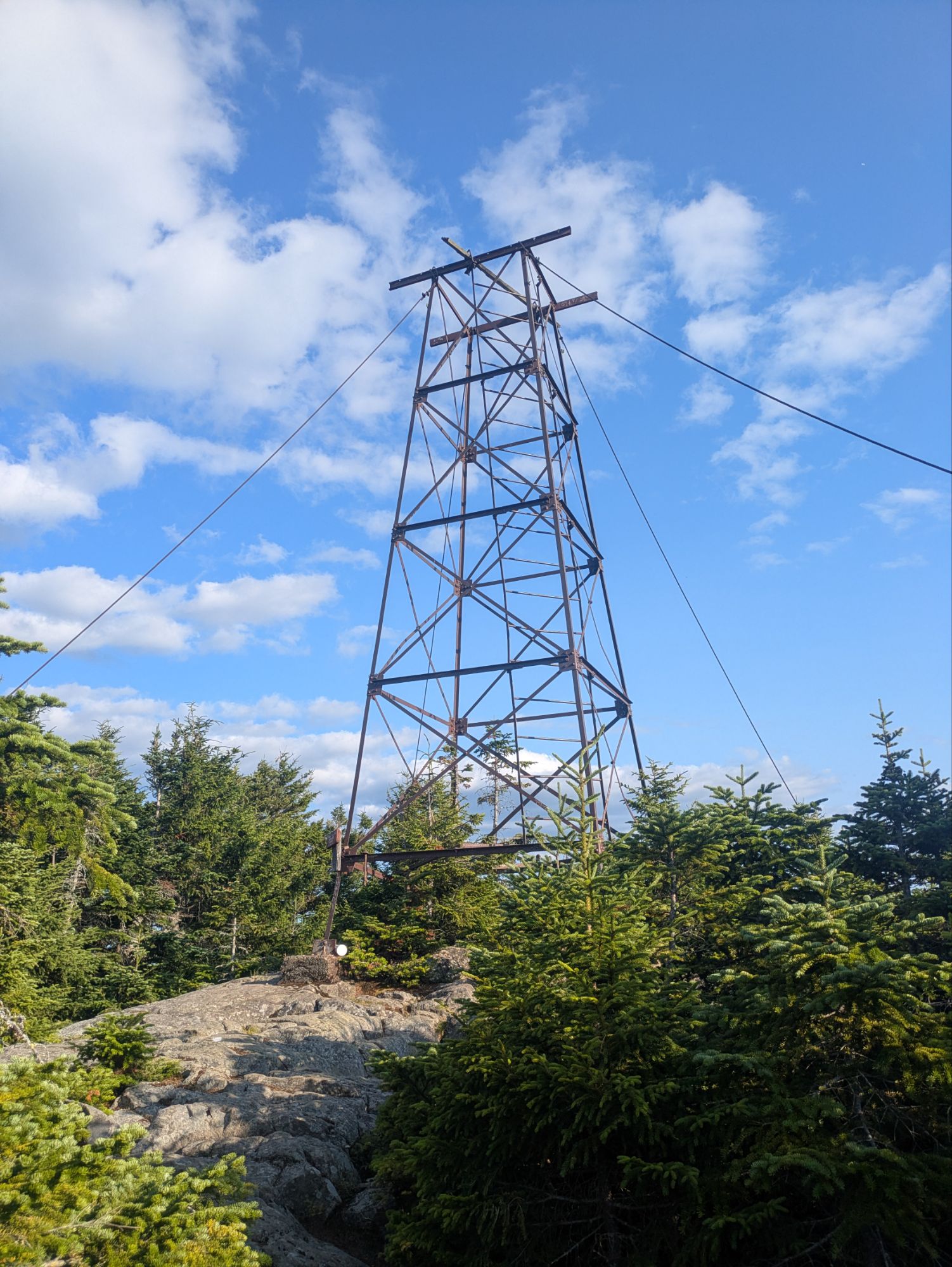
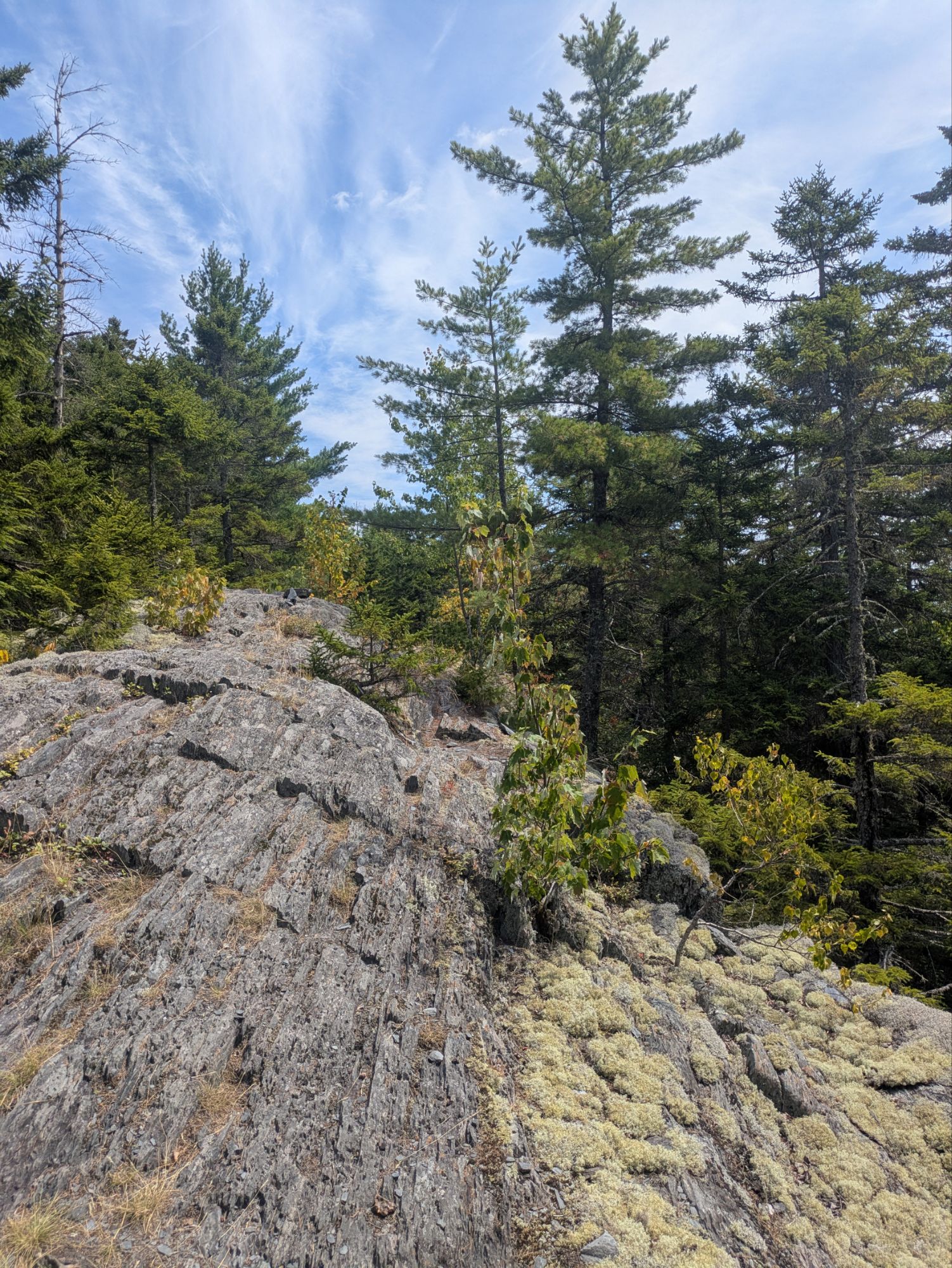
Found this guy at the top of Barren Mountain and although I didn’t go all the way up, I may have climbed just a short ways.
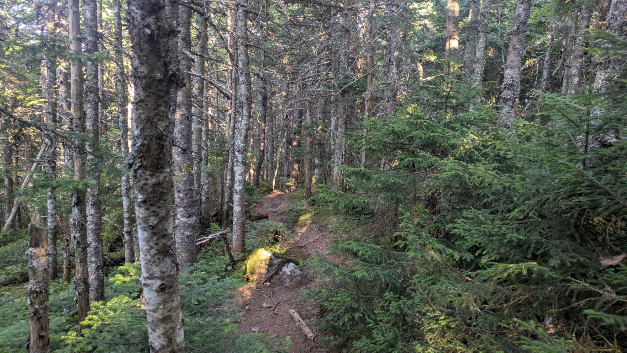
After Barren Mountain, I got some flat-ish woods. See here’s what the trail looked like.
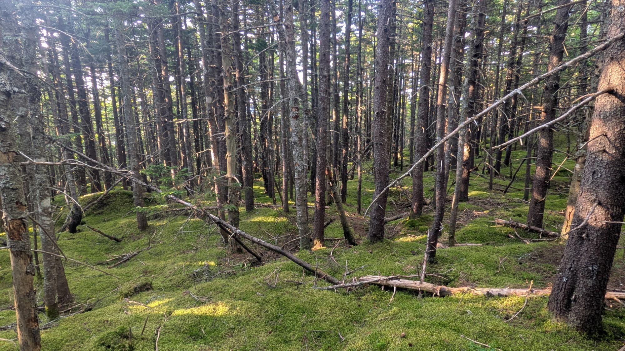
And this is what the woods would look like if I were to just be going cross country and no trail had been made.
I was very tired and considered stoping earlier than my picked out camp spot. The water ahead wasn’t reported to be great and maybe even non-existent at this point since the last report was “trickling” and about a week ago. But the closer camp spot was 0.3 miles off a side trail that was reportedly steep. There was a pond there. It shows how much I dislike going off trail that I kept going.
Once ahead at the water source, it wasn’t great. But, I’d gotten myself into a desperate situation and so made it work. The stream was not flowing anymore, but I found a pool, a.k.a., a puddle to fill up from. The water had a heavy brownish tan tint, but I cared not. Water is water, right? At least that’s what I was trying to convince myself. And so I continued 0.1 miles to a little tentsite and was happy it all worked out!
I got my first chance eating the super SPAM by dicing it up into my mac and cheese. I used one third of it, which was a lot! Pretty good combo though in my opinion. I did not get another loon lullaby this night, but instead was sung to sleep by the swarm of skeeters outside my tent!
It is such an incredible privilege to be on this journey backpacking across the eastern U.S. and I have so much gratitude for the opportunity. As I make the push to finish the Appalachian Trail, I’m also making a push to reach my goal in raising funds for Outdoors Empowered Network (OEN)! I’m trying to raise $2 for every mile I hike and am falling behind! Any amount helps… $2, $5, etc… it all adds up
The sad reality is that so many never come to know the benefits of connecting with nature. I want others to experience this relationship that has been so important in my life. Imagine a kid staring in wonder at a bright and colorful butterfly, laughing at a frog hopping away from them, being curious why the leaves are changing colors with the season. By donating, these are the things you’d be making happen!
So thank you for joining on the journey! It means a lot that you took the time to read up on these adventures. And if you want to help ALL kids get access to the outdoors, please help me in supporting OEN! The “Tip Author” button is a direct link to my fundraising page. Y’all are truly amazing. Thank you!
Podcast of the Day:
“Engines of Outrage: Parts 1-4” – Landslide
This website contains affiliate links, which means The Trek may receive a percentage of any product or service you purchase using the links in the articles or advertisements. The buyer pays the same price as they would otherwise, and your purchase helps to support The Trek’s ongoing goal to serve you quality backpacking advice and information. Thanks for your support!
To learn more, please visit the About This Site page.
-

 Brand Stories3 weeks ago
Bloom Hotels: A Modern Vision of Hospitality Redefining Travel
-

 Brand Stories2 weeks ago
CheQin.ai sets a new standard for hotel booking with its AI capabilities: empowering travellers to bargain, choose the best, and book with clarity.
-

 Destinations & Things To Do3 weeks ago
Untouched Destinations: Stunning Hidden Gems You Must Visit
-

 Destinations & Things To Do2 weeks ago
This Hidden Beach in India Glows at Night-But Only in One Secret Season
-

 AI in Travel3 weeks ago
AI Travel Revolution: Must-Have Guide to the Best Experience
-

 Brand Stories1 month ago
Voice AI Startup ElevenLabs Plans to Add Hubs Around the World
-

 Brand Stories4 weeks ago
How Elon Musk’s rogue Grok chatbot became a cautionary AI tale
-

 Brand Stories2 weeks ago
Contactless Hospitality: Why Remote Management Technology Is Key to Seamless Guest Experiences
-

 Asia Travel Pulse1 month ago
Looking For Adventure In Asia? Here Are 7 Epic Destinations You Need To Experience At Least Once – Zee News
-

 AI in Travel1 month ago
‘Will AI take my job?’ A trip to a Beijing fortune-telling bar to see what lies ahead | China
You must be logged in to post a comment Login