
Destinations & Things To Do
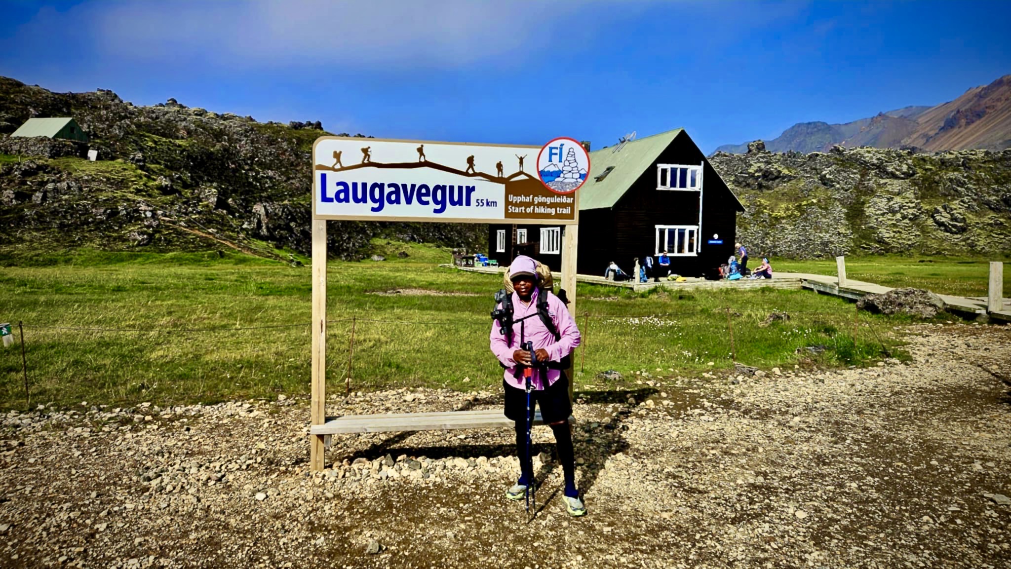
The Laugavegur Trail | Day 1 | It’s Go Time!
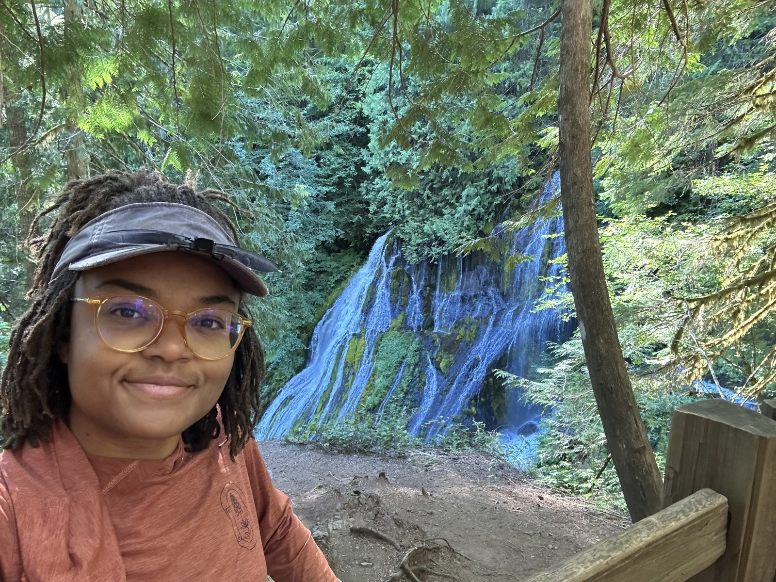
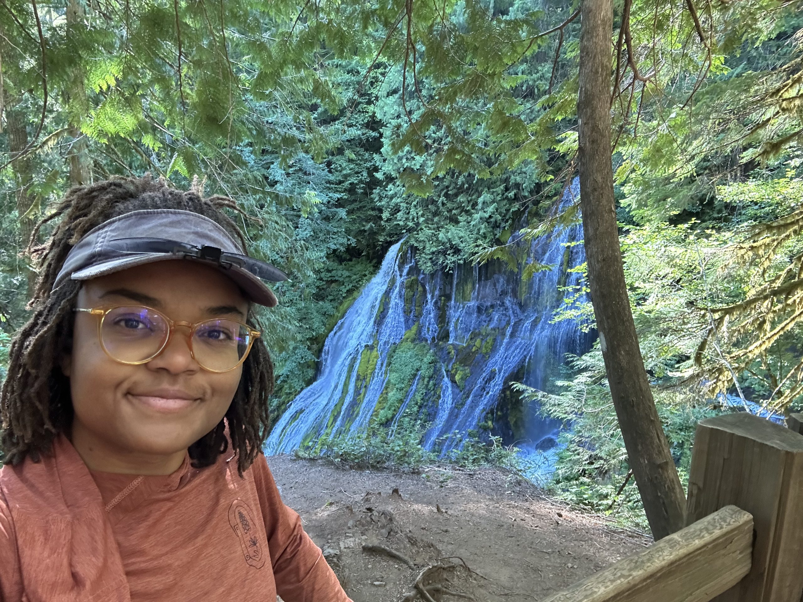
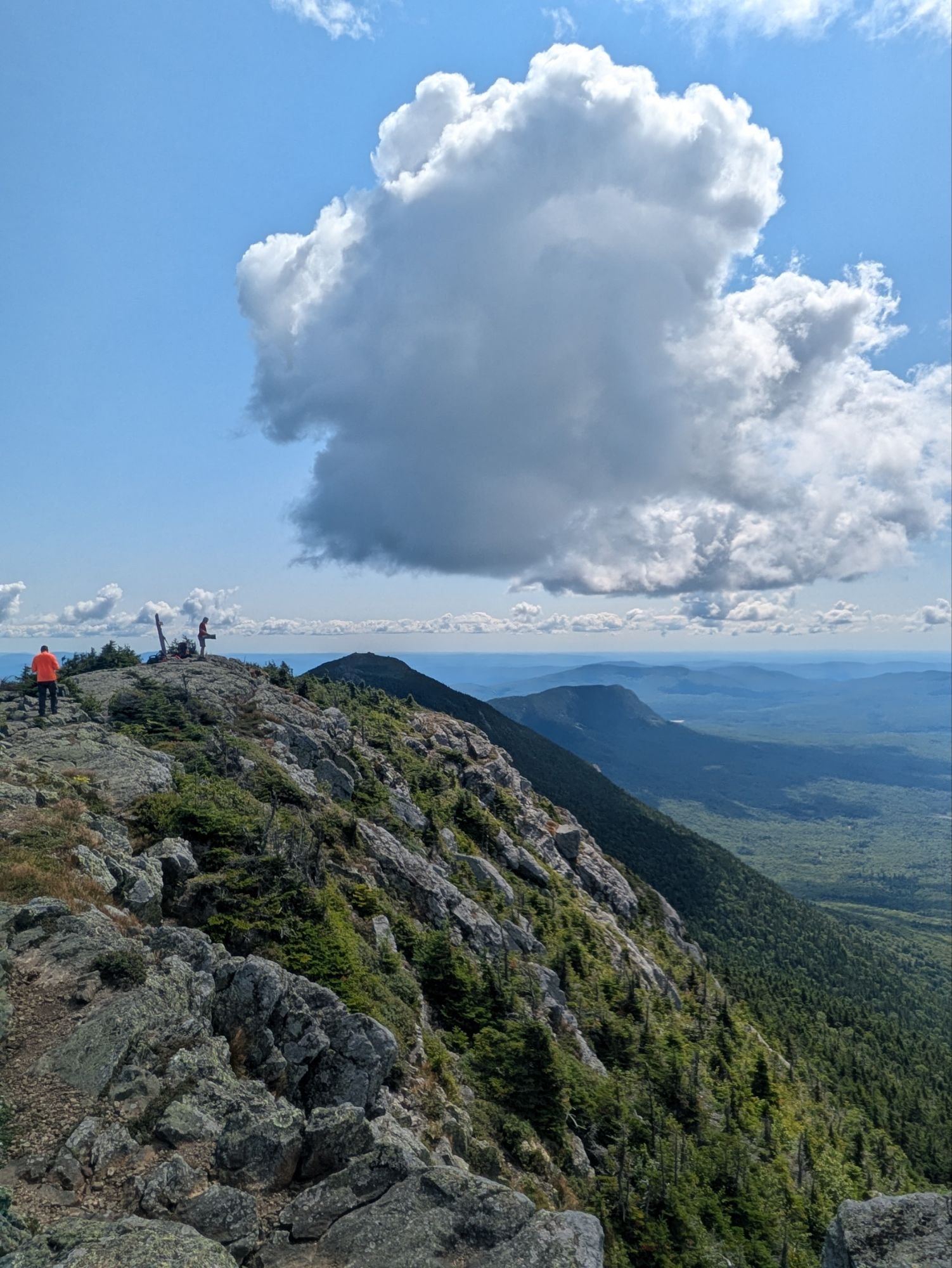
I woke up at 8:00 a.m. to a world wrapped in fog—52 degrees, low clouds, and rain expected by late afternoon. Seven miles stood between me and the next hut, and I had one goal: move with purpose and hope to beat the weather.
That’s the mindset you slip into when you’re hiking solo in a foreign landscape—accountable to nothing but your body, your instincts, and the ever-shifting sky.
I packed my tent with intention, separating the rain fly from the inner. If your setup allows it, do it. There’s nothing better than being able to pitch a dry space in the middle of a downpour.
I took some Vitamin I (ibuprofen) for my hips and lower back—unusual for me, but I’ve come too far to let an ache distract me from my commitment. After a quick breakfast, I hit the trail around 10:20 a.m.—and just as I did, the sun broke through the clouds. My thru-hike of the Laugavegur Trail had officially begun.
Keep Going!
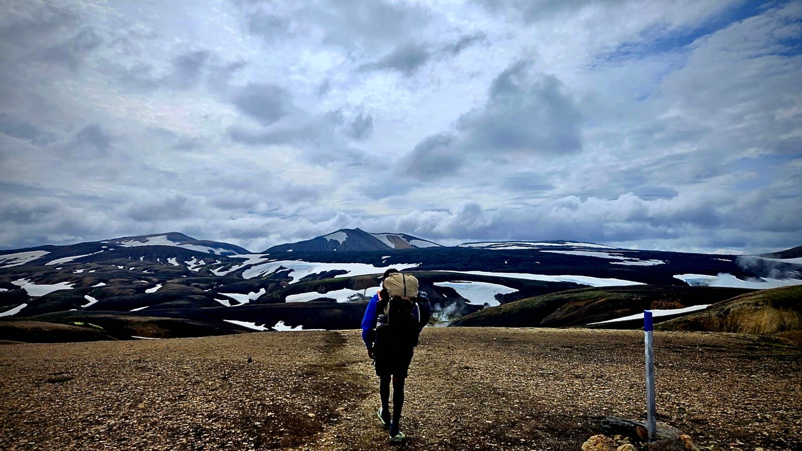
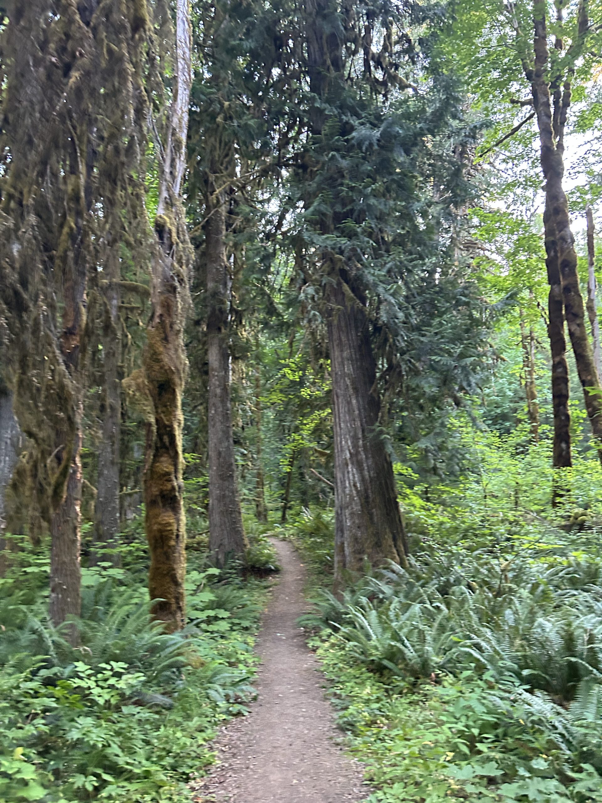
The hike kicks off with a climb—steep and steady—then teases you with a brief flat section before throwing you right back into the uphill grind. And then more climbing after that. I felt it immediately. Between yesterday’s warm-up hike and exploring every corner of Reykjavík the day before, I already had 24 miles on my legs. They were tired. My body was talking.
But the trail was louder. And what it said was: Look at this.
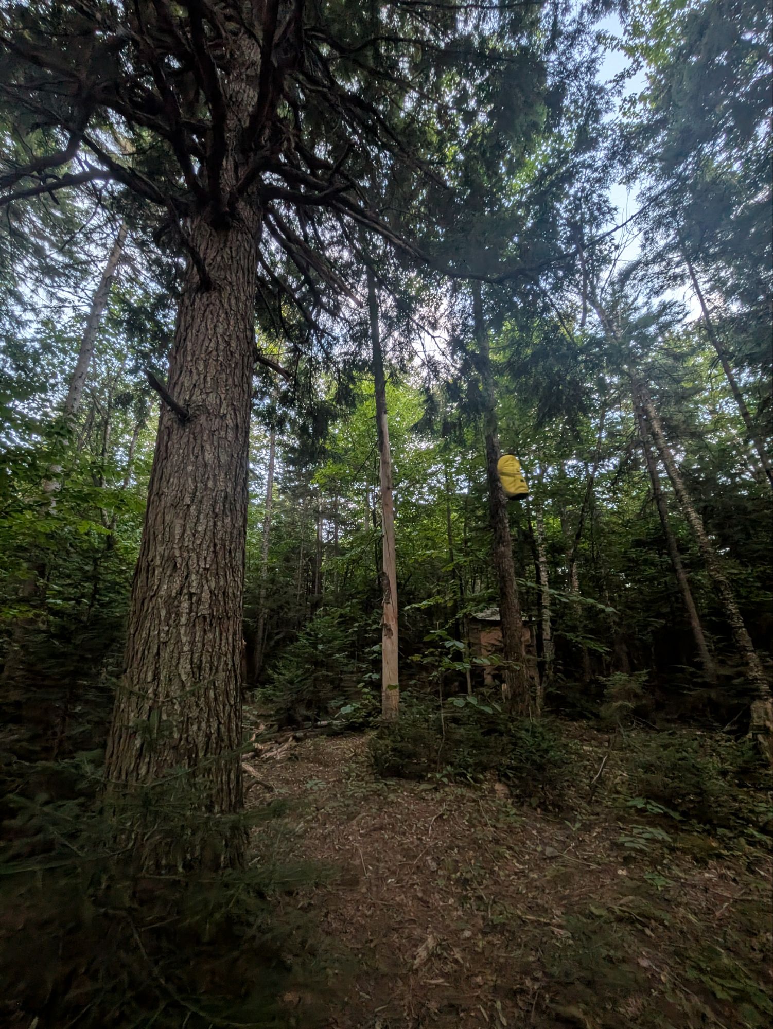
I was walking through a landscape sculpted by fire and ice—ancient lava fields hardened into black rock, ridges carved by glaciers long gone. The ground beneath me shifted between loose volcanic soil and solidified flows of obsidian and basalt. In the distance, multicolored rhyolite mountains glowed in muted pinks, oranges, and greens—minerals reacting to centuries of geothermal heat. Patches of snow still clung stubbornly to the hillsides, defying summer.
So I kept walking.
People and Lemon Drops
One of the best parts of hiking isn’t just the scenery—it’s the people you meet while chasing it.
First, there was Kiel, a 22-year-old from the Netherlands on his third Laugavegur trek. He had just wrapped up a multi-month hike in New Zealand and came straight to Iceland to hike this trail with his family. Next up? Moving to Banff to work at a resort. He’s got the kind of fearless spirit I admire—and, okay, envy just a little.
Then there was a man originally from Ohio who’s lived in Germany for over two decades. We touched on politics—just briefly—but isn’t it wild how even in the middle of Iceland, “Do you like Trump?” still becomes the universal conversation filter?
By that point, between the steep climbs and all the small talk, I was feeling a little socially overloaded.
Later, I crossed paths with Caitlin and Brad. She grew up in Rochester—where most of my family lives now—and when I mentioned Route 104, she knew exactly what I meant. Small world, big trail.
She offered me chocolate-covered Kix, and I traded her some lemon drops. Bartering candy on a glacier—just another day in the Icelandic Highlands.
One Goal. Nothing Else.
Somewhere in the middle of the trail, something unexpected happened—my brain shut up.
No spinning thoughts. No mental to-do lists. No wondering if I remembered to Venmo my ex-wife for the kids’ something-or-other. No checking in.
Just one clear mission: Get to the hut and set up camp.
That was it. No multitasking, no second screens, no tabs open in my mind. This was rare. It was kind of magical.
For once, I wasn’t everywhere—I was right here.
A Little Rain, A Lot of Gratitude
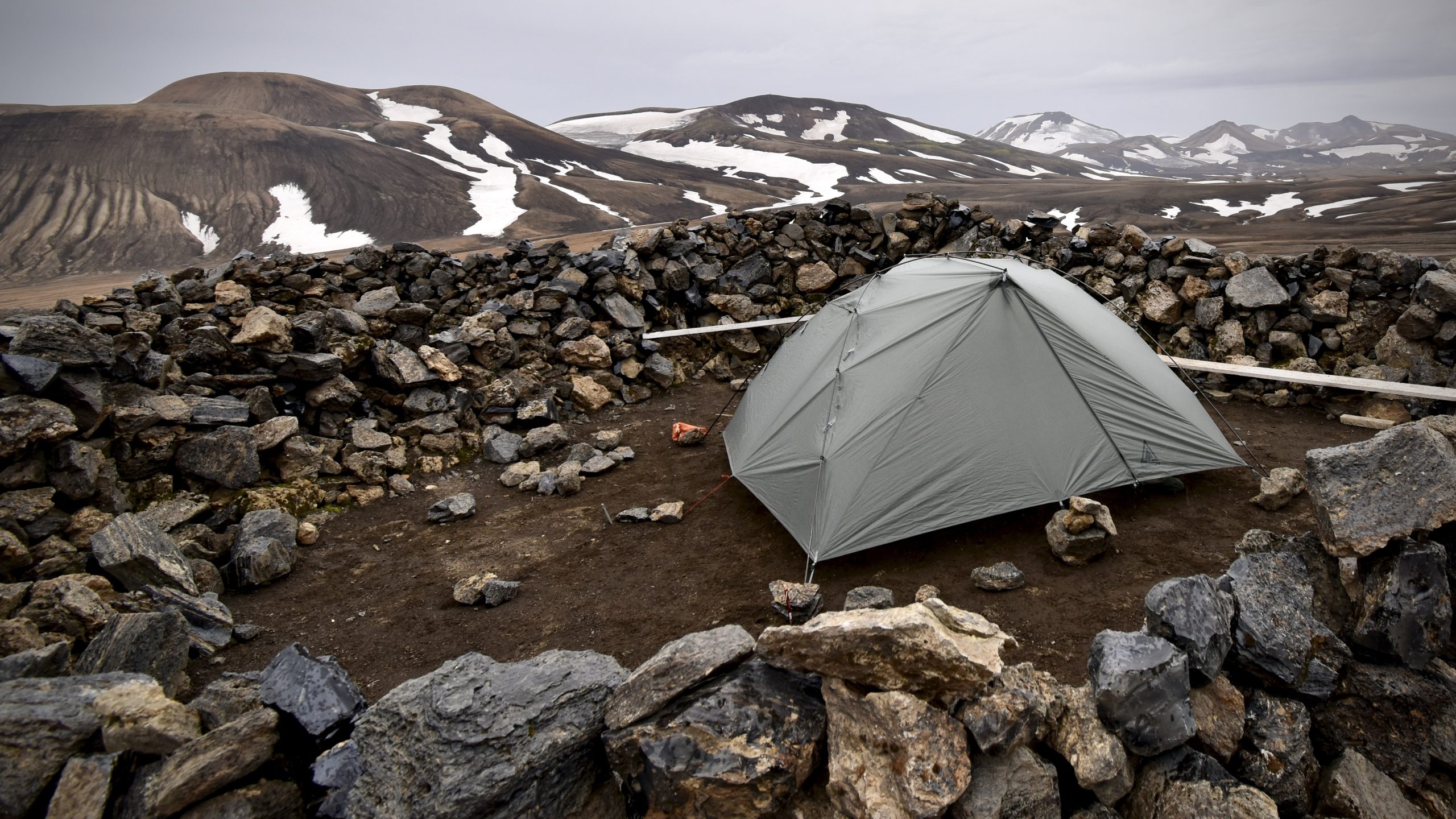
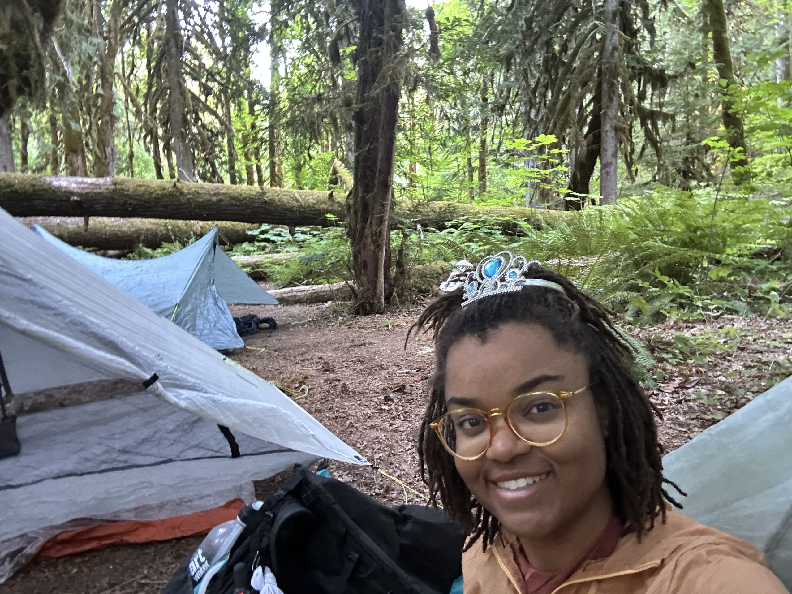
The last mile, the sky finally gave in. I felt the first drops, looked up, and saw the clouds stacking into rain formation. So I pushed hard.
When I got to the hut, I set up fast—rain fly first, then the rest. Just in time. The rain came in full.
But I was dry. I was safe. I was exactly where I needed to be.
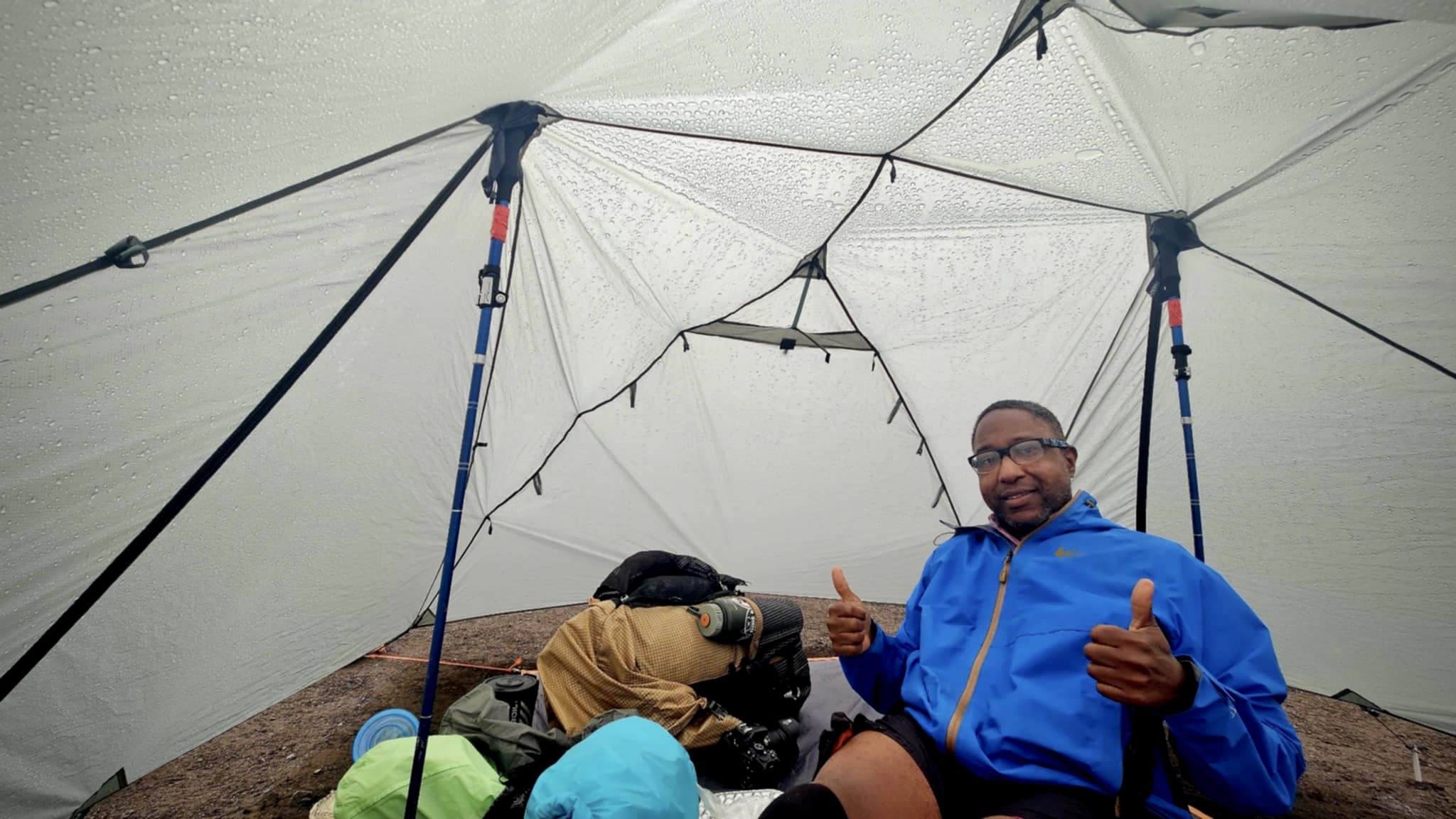
Inside my tent, I brewed tea, made pasta, and broke out some Icelandic chocolate I’d bought back in town. My camp chair was set, my groundsheet dry. I felt like a king in a nylon castle.
The Lesson in the Miles
Today reminded me of something I already knew, but had forgotten to trust: You only have to do one thing at a time.
I didn’t need to plan my whole life. I didn’t need to carry every worry I’ve ever known. I didn’t even need to hike all seven miles at once.
Just one step. Then another.
And when it got hard—and it did get hard—I kept moving anyway.
Even when I got stuck in the bathroom because the lock jammed (yep, that happened), I figured it out. Because what else can you do but solve the thing in front of you?
Rain Tomorrow? So Be It.
The forecast says tomorrow’s a wash. That’s okay. I’ll wake up when I wake up. Walk when I’m ready. Eat when I’m hungry. Hike seven more miles.
One thing at a time.
Maybe I’ll see Caitlin and Brad again. Maybe I’ll run into the Canadian couple I met earlier. Maybe I’ll hike in silence all day and love it.
For now, I’m lying in my tent, full and warm, listening to the sound of Iceland’s sky letting go.
And I am so proud of what I did today.
Not because it was easy.
But because it wasn’t.
Day 1 is done. My legs are sore. My heart is full. My brain is quiet. I’m not thinking about the end of the trail—just the next bend. And that is more than enough
This website contains affiliate links, which means The Trek may receive a percentage of any product or service you purchase using the links in the articles or advertisements. The buyer pays the same price as they would otherwise, and your purchase helps to support The Trek’s ongoing goal to serve you quality backpacking advice and information. Thanks for your support!
To learn more, please visit the About This Site page.
Day 28
Start: Stealth Site, mile 443.7
End: Tentsite, mile 470.5
Miles hiked: 21.6 miles, 26.8 trail miles
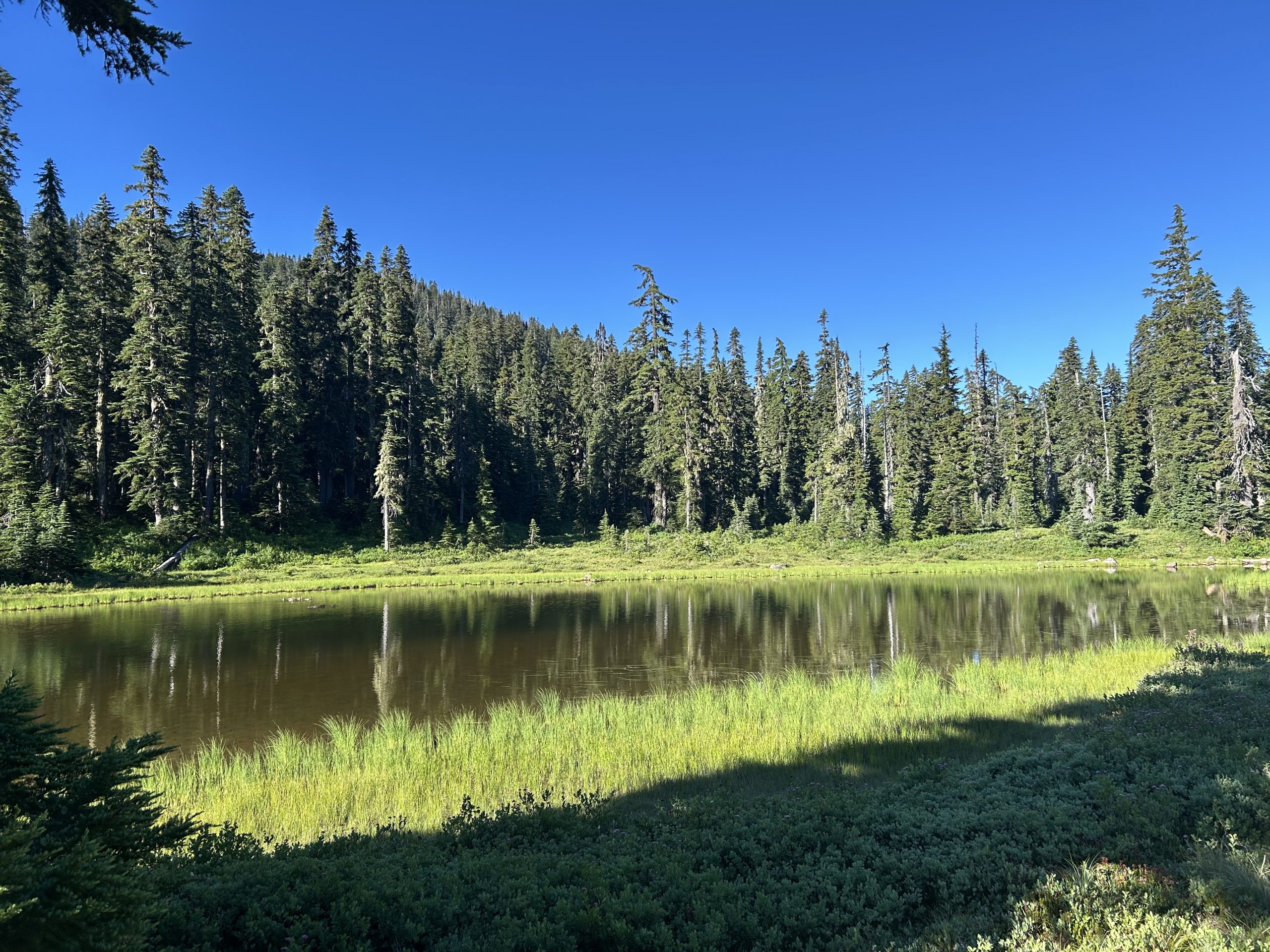
After our headache of a night last night, Sun and I slept in a bit and didn’t leave camp until around 7:30. The mosquitoes were a bit better this morning; they didn’t attack us with as much fervor as yesterday, even when we stopped for water at a lake.
The lake, Junction Lake, was such a serene place. Little baby ducks swam in groups across the water while the morning sun warmed the air. At one point, the mother duck came squawking in, flying this way and that way across the pond, throwing water in all directions. I’m not quite sure what the drama was about, something to do with the baby ducks, but eventually it was resolved since the squawking stopped.
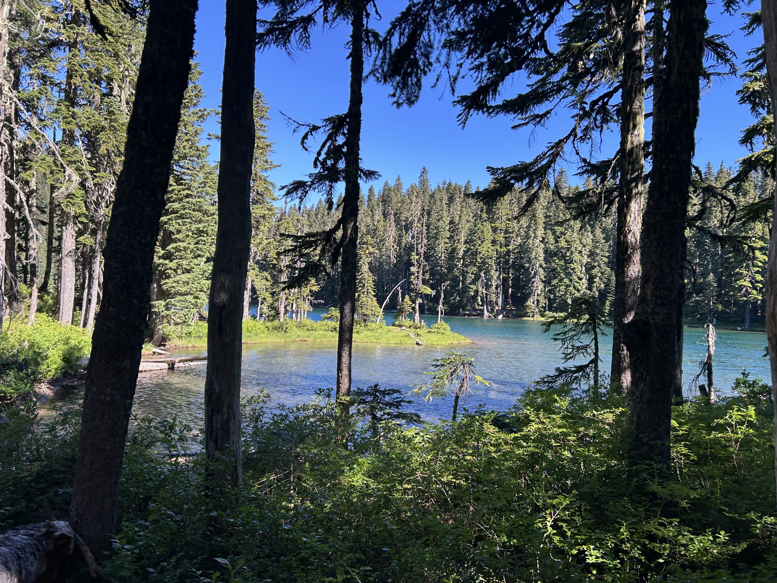
This morning, Sun and I were moving pretty slowly. We were both tired from the night before. My pack felt unusually heavy and I missed the spring I had in my step on that first day out of town. A couple of miles later we reached Blue Lake, but it was a bit too early, cool, and windy for a swim. It was a beautiful spot though. The NOBOs we passed said it was an excellent swimming spot.
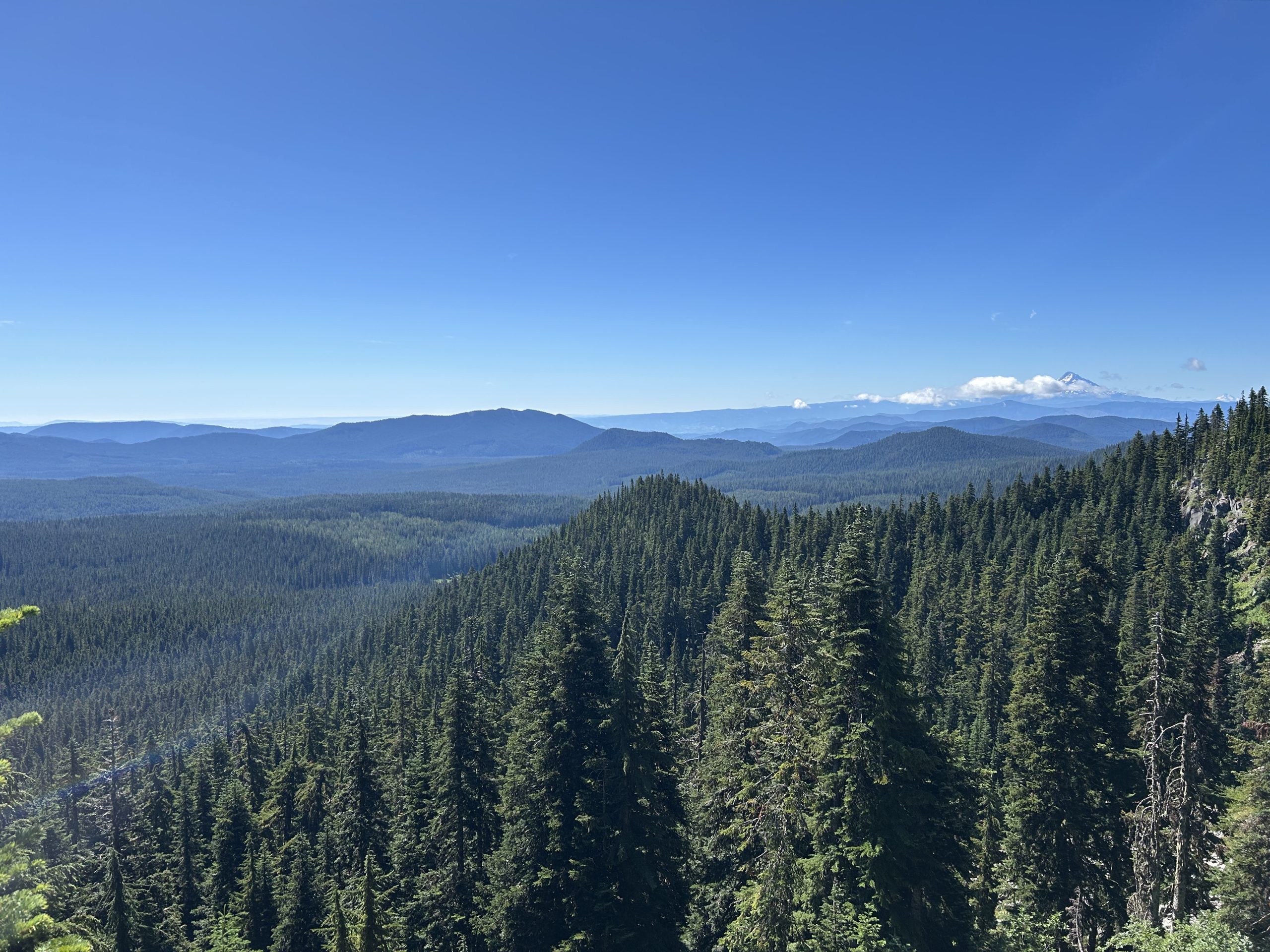
Sun and I climbed slowly up, taking a lot of breaks, almost one every 1.5-2 miles, which wasn’t really our style. I guess we had bitten off more than we could chew yesterday. We topped our climb of the morning and enjoyed the snippets of cell service and the warmth of the sun.
Then it was miles of downhill, passing a few NOBOs on the way. Our progress was further slowed by the huckleberries that lined the trail; I got a bit behind because they were so good!
We finally reached a parking lot with picnic tables and a pit toilet and decided it was the perfect place for lunch. Sun was hoping that we would find trail magic again, but no such luck despite all the cars that passed by on the gravel road. Lunch felt a bit more civilized this time since we had real tables to eat at instead of a bare patch of ground. Out big debate was whether to continue 12 miles on the trail to reach our goal campsite or take the 10.5 Panther Creek road walk alternate. If we walked the trail, we would have to climb with a long water carry and dry camp. But if we took the road, we could save a few miles and camp with water. We couldn’t decide what to do, so we decided to leave it for after our lunchtime rest.
Sun allocated 30 minutes for a nap while I relaxed in the shade. When nap time was up, our answer was clear: the road walk!
As we started down the road, we were immediately sidetracked by all of the big, juicy huckleberries that lined the road. We lost at least 30 minutes because there were so many to pick. We also found blackberries that tasted like candy. Yum!
As we walked, cars passed in either direction, but we still didn’t find the magic we had hoped for.
After a number of miles and a number of breaks, we reached Panther Creek Falls, one of the attractions of this alternate. A quick detour, they were worth the walk. Eventually, we were pooped and more than ready to be done with our long day. As we passed the Panther Creek Campsite, full of casual hikers and campers, the smell of hot hamburgers wafted over to us. If only we could have one!
After a few more minutes, we found our site and squeezed our tents in with a couple who were almost done with their section. After dinner, we had just enough time to get a few camp chores done before the daylight started to fade.
And that’s a day in the life of a PCT SOBO hiker!
This website contains affiliate links, which means The Trek may receive a percentage of any product or service you purchase using the links in the articles or advertisements. The buyer pays the same price as they would otherwise, and your purchase helps to support The Trek’s ongoing goal to serve you quality backpacking advice and information. Thanks for your support!
To learn more, please visit the About This Site page.
Destinations & Things To Do
Japanese travelers losing interest in Kyoto, top sightseeing spots slip behind Nara at peak season
Kyoto may be the historical heart of traditional Japanese culture, but current conditions are making it a less attractive placer for locals to visit.
Aside from maybe Tokyo, there’s no other city with more of a “must-visit” reputation than Kyoto for travelers to Japan, who flock to the country’s former capital to tour its historic temples, beautiful gardens, and otherwise get a glimpse of Japanese traditional culture. For a growing number of Japanese travelers vacationing in their home country, however, Kyoto is becoming a city they feel like they can leave off their itinerary.
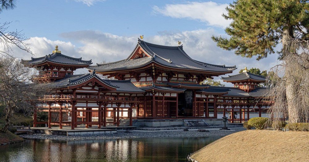
Tokyo-based data/research organization Blogwatcher recently released the results of its analysis of travel patterns during Japan’s 2025 Golden Week holiday season, which straddled the end of April and beginning of May. Examining mobile phone location data, Blogwatcher determined that there were significant drop-offs in the number of Japanese visitors to five of Kyoto’s most famous sightseeing spots compared to just two years prior. Japanese visitors to Fushimi Inari Shrine plummeted by 40.4 percent compared to 2023, and both Kiyomizudera Temple and Kinkakuij/the Golden Pavillion’s numbers of Japanese visitors fell by roughly 25 percent. Shimogamo Shrine and Byodoiin Temple both had slight upticks in Japanese visitors in 2024, but reversed course in 2025 and had approximately 10 percent fewer domestic visitors than they’d had at Golden Week in 2023.
▼ Byodoin’s Phoenix Hall is so famous that it’s even depicted on the 10-yen coin.
It’s not hard to imagine what’s discouraging Japanese travelers from visiting Kyoto. The weak yen continues to make Japan more affordable for foreign travelers to visit than it’s been in a generation, and with so many of them including Kyoto in their Japan travel plans, the city’s attractions are crowded and its hotels expensive. The Kyoto Tourism Association’s data shows that through the first five months of this year, the average price per night for a stay in a Kyoto hotel is around 50 percent more than it was just two years ago. Those cost increases are relatively easy for inbound foreign visitors to soak up as they leverage the favorable exchange rate, but for Japanese travelers, who are already getting hit in the wallet by rapidly increasing consumer prices without equivalent wage increases, the idea of paying inflated prices to go someplace clogged with tourists is no doubt feeling like a less enjoyable way to spend their diminished disposable income.
However, as Kyoto is looking like a less attractive destination for Japanese travelers, they’re becoming more drawn to Nara. Blogwatcher tracks domestic visitor numbers for 33 of Kyoto Prefecture’s top temples, shrines, and historical tourism sites, and 37 in Nara Prefecture. During Golden Week in 2023, Japanese travelers showed an overwhelming preference for Kyoto, with its top sights receiving nearly 70 percent more Japanese visitors than Nara’s. In 2025, though, more Japanese travelers visited Nara’s major sights than Kyoto’s.
Japanese visitors to major temples, shrine, and historic sites during Golden Week
● Kyoto 2023: 746,000
● Nara 2023: 446,00● Kyoto 2025: 559,000
● Nara 2025: 561,00
It could be argued that Japan is still in the middle of the initial wave of its inbound tourism boom. Residual pent-up international travel demand and the weak yen are doing a lot to make the country a trendy and affordable choice for visitors from abroad, but it’s still not entirely clear whether their intense interest is going to be permanent. As a result, it’s likewise too early to say whether huge crowds and high prices have turned Japanese people off to the idea of traveling to Kyoto entirely, or if they’re simply putting their Kyoto plans on the back burner for the time being. After all, if the shrines and temples you’re going to see are already centuries old, holding back for a year or two to see if the tourism congestion has settled down doesn’t seem like all that long of a wait. For the time being, though, it really does look like Japan’s travelers aren’t nearly as excited about the idea of visiting Kyoto as they were just a short while ago.
Source: TBS Cross Dig with Bloomberg via Golden Times
Top image: Pakutaso
Insert image: Pakutaso
● Want to hear about SoraNews24’s latest articles as soon as they’re published? Follow us on Facebook and Twitter!
- Hiked Today: 21.1 miles
- Appalachian Trail (2,012 – 2,033.1)
- Total Hiked: 3,966.3 miles
- Total Paddled: 99.5 miles
Weather: 52 – 75°F, mostly sunny, some clouds
Elevation: 1,150 – 4,145 feet
Cranberry Stream Campsite to West Carry Pond Shelter
For some reason the charge on my power bank seemed to diminish quicker than normal over the past couple days. I still have a few days to go before my next stop, so today I went into extreme battery saving mode. I even went as far as turning my phone off whenever possible, but afterwards I wasn’t sure if that was helping or causing it to drain just as quick/even more quick.
Thus, you’d expect not as many photos for today, but I struggled to stop myself. It was an all-time wonderful day and that causes me to want to have the phone out documenting all the fun stuff.
Bodacious: “very large or important, or something people enjoy or admire.”
– from the Cambridge Dictionary (https://dictionary.cambridge.org/us/dictionary/english/bodacious)
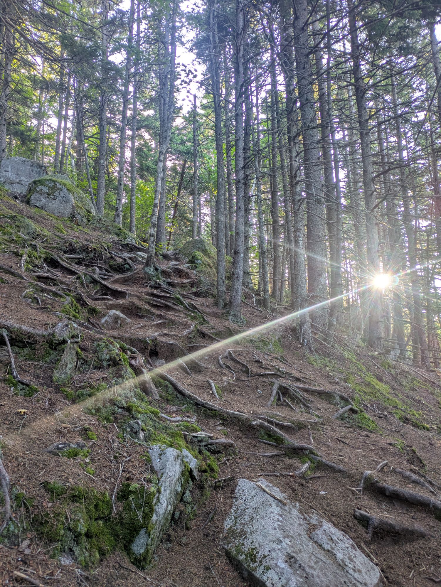
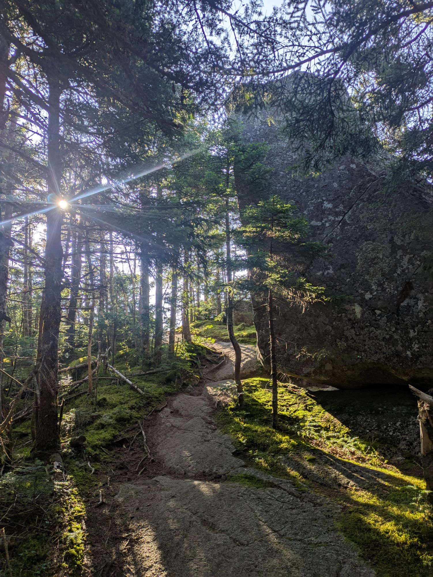
Leaving camp, straight away I was hiking up. The end of the day yesterday was more downhill and flat-ish and set me up at the foot of the Bigelow’s. The climb was ok, definitely lots of trippy roots but not as steep as some other spots…
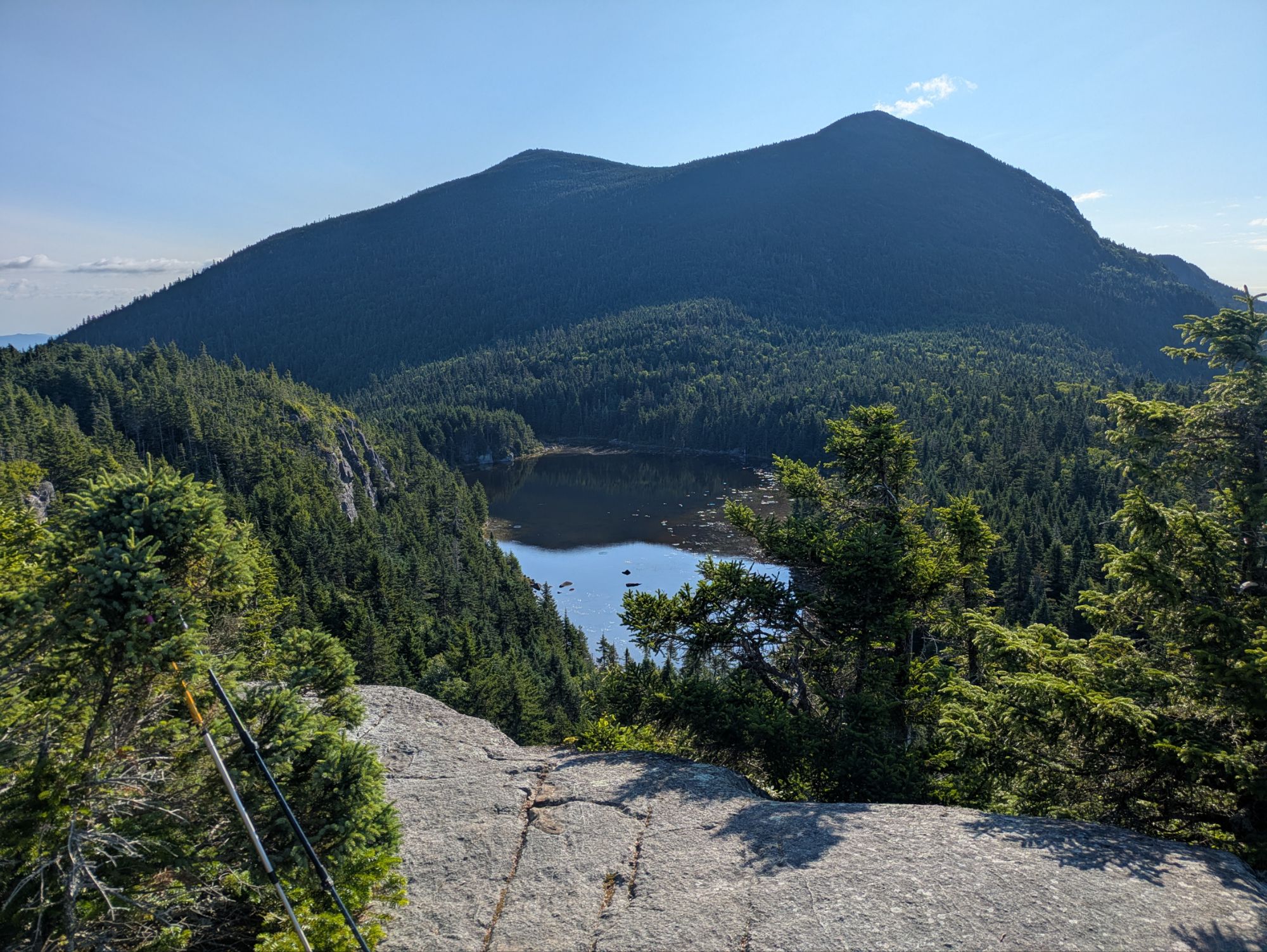
The photo above was taken right before popping out to a marvelous viewpoint. I got a kick out of the giant monolith type boulder and then was blown away when the view of Horn Pond and The Horns presented itself…
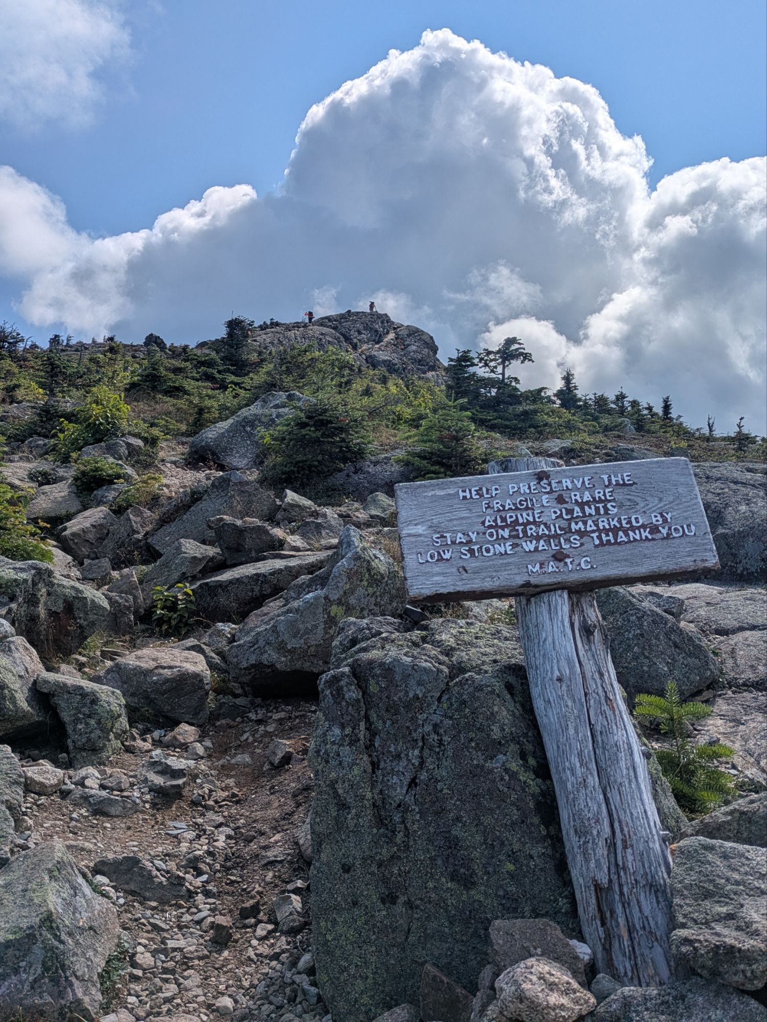
I thought the trail took me over both of the Horns, but just South. To get to North Horn it was a 0.2 mile side quest. I stuck to the white blazes and got some views looking back on the way up.
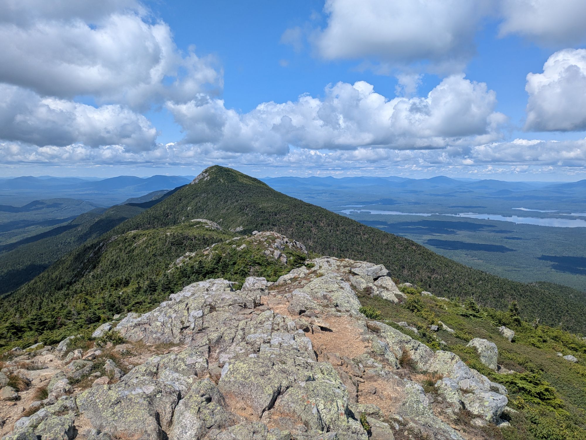
Atop South Horn there was another spectacular overlook and I sat down for second breakfast. Hikers Bookends and Ain’t Right joined too. The weather was once again premium and I soaked up the moment…
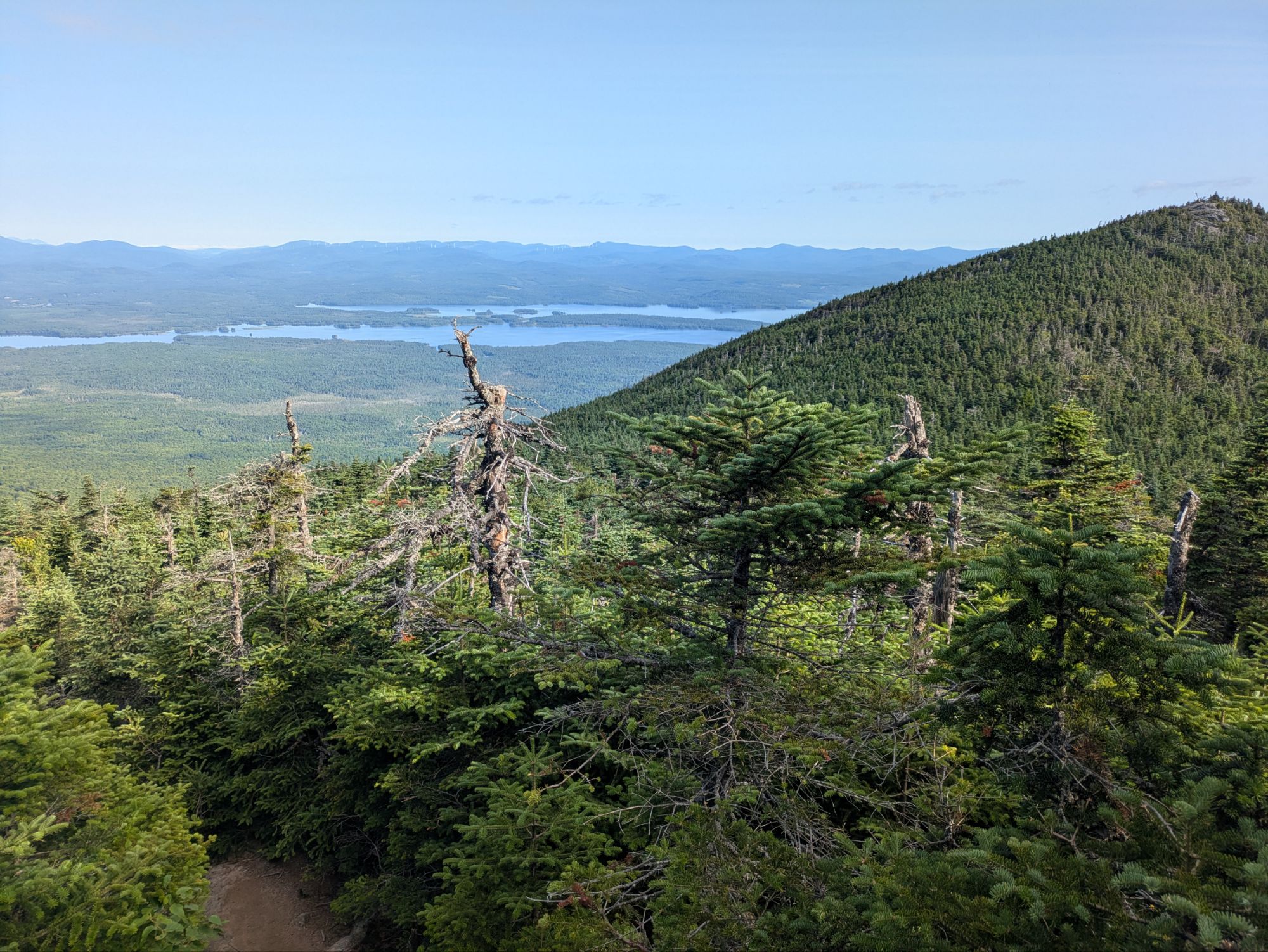
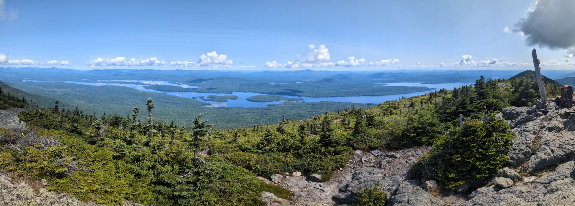
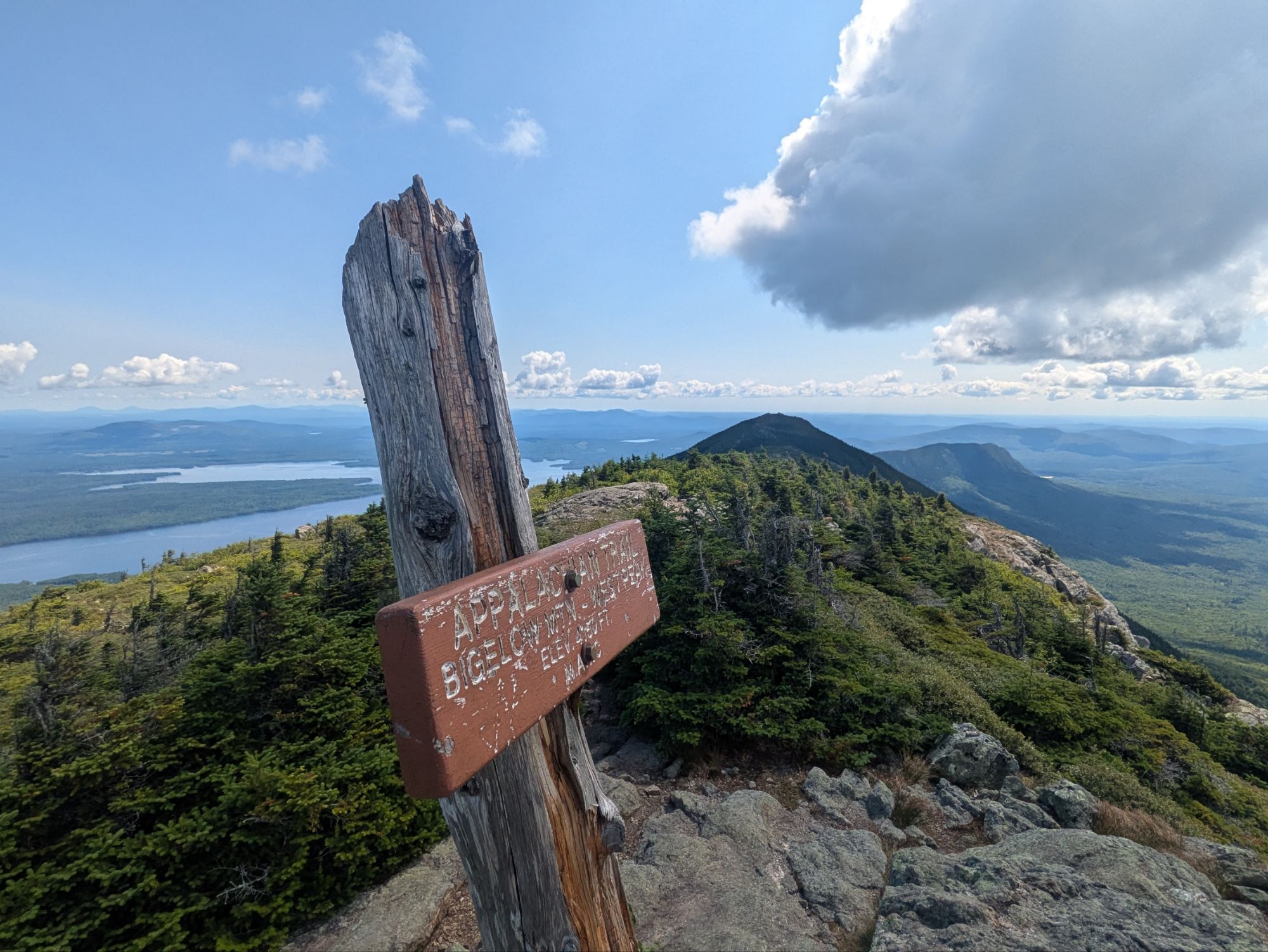
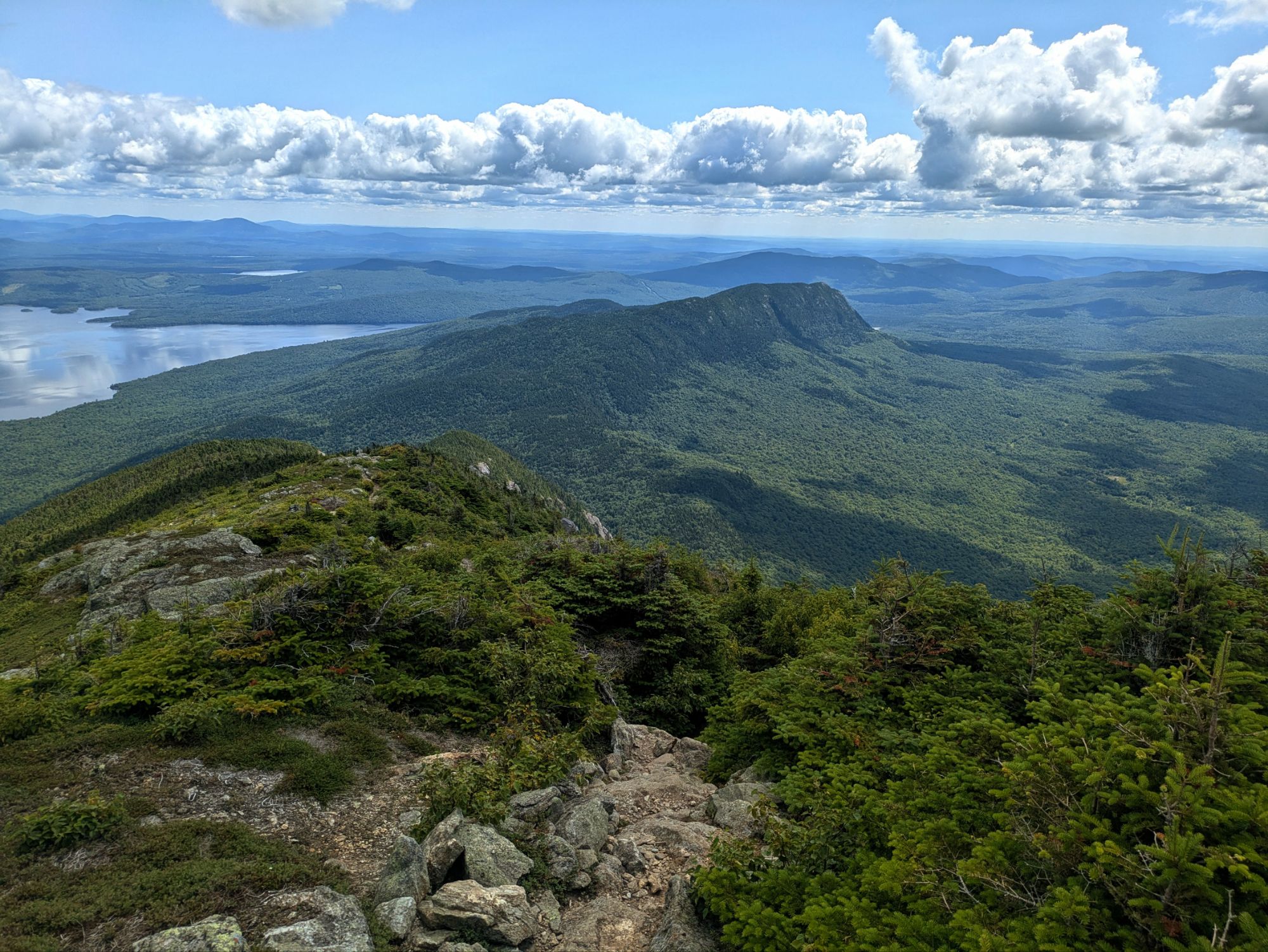
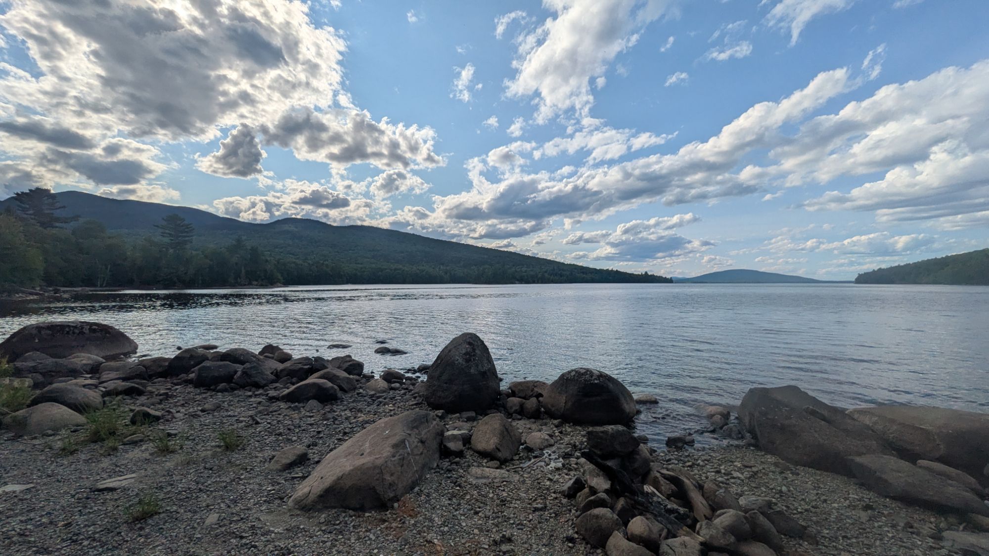
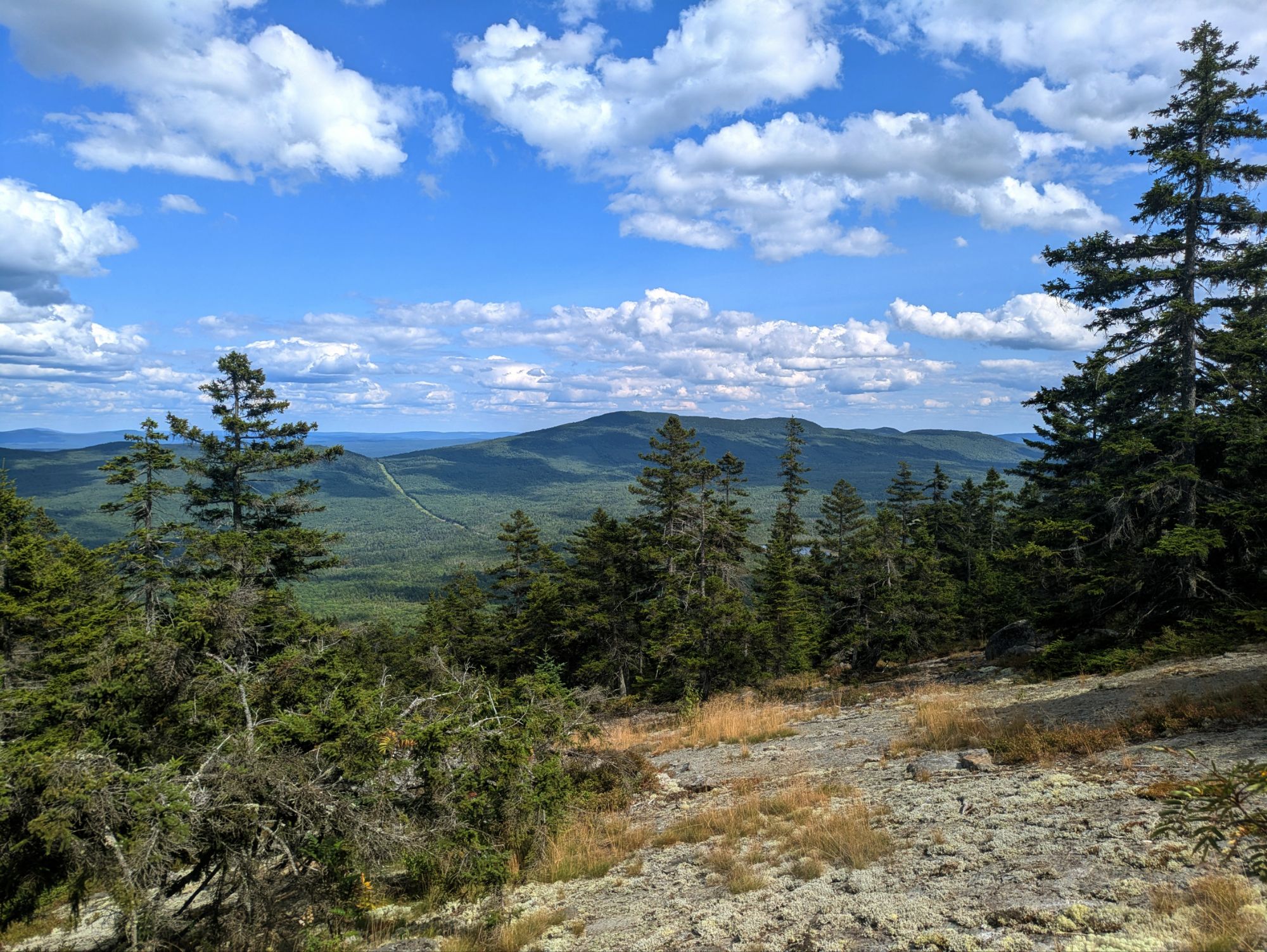
The next few miles were top-notch. Some of my favorite of the entire Appalachian Trail. It was down and then up to a ridge line topping the West Peak of Bigelow Mountain and then Bigelow Avery Peak. The massive Flagstaff Lake sat to the north and demanded my attention.
Sitting with the other hikers at this summit, I said something along the lines that this is more than a view, it’s a whole experience. What I was trying to get across was that it was 360 degrees, a whole scene, and as much as I try with photos and vids, being there in person is the only way to sense the grandeur. Sorry y’all. But alas, I did try to showcase the beauty nonetheless.
Before heading down into the trees again, I got a view of Little Bigelow Mountain where I’d be heading.
The rest of the day’s hike was less glamorous, but after Little Bigelow it was more cruisy. I came close to getting a good slow-motion vid of this giant Pileated Woodpecker, but pretty blurry…
Around 6:00 pm or so, I was internally thinking maybe I’d be able to push on further than my original goal. It never happens haha. Especially when I’m stopped for wonderful trail magic! Walking into a parking area, which later I’d find out was not even on the trail, I met Lebowski. He’s a 2021 (?) AT hiker that planned to set up the next day and chef tasty foods up for hikers. For me, he offered a beer, a chair, and some honey buns! It was nice resting and chatting with him.
Moving on from that, I was thinking I had about 6 miles of flat left to hike. The mileage estimate was accurate, but I underestimated the grade and there was not one, but two blips uphill I had to get over. Hence, I was exhausted and spent like normal by the time I reached camp at West Carry Pond Shelter.
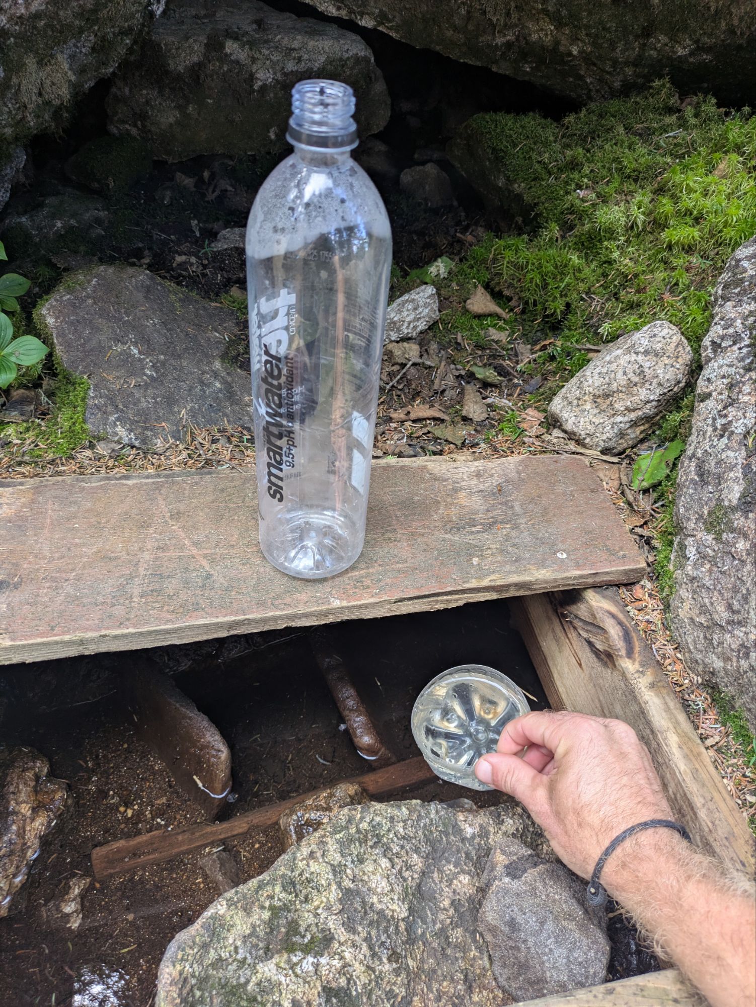
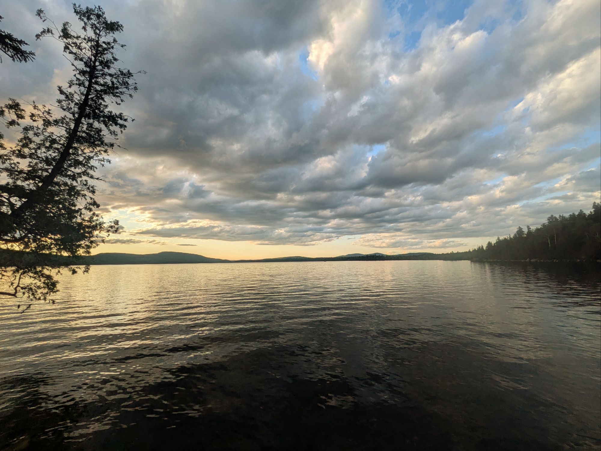
I filled up with water straight from the lake. It was post-7:00 pm arriving here at West Carry Pond. Again with the ponds though… looks like a lake to me folks. Will the madness never end?
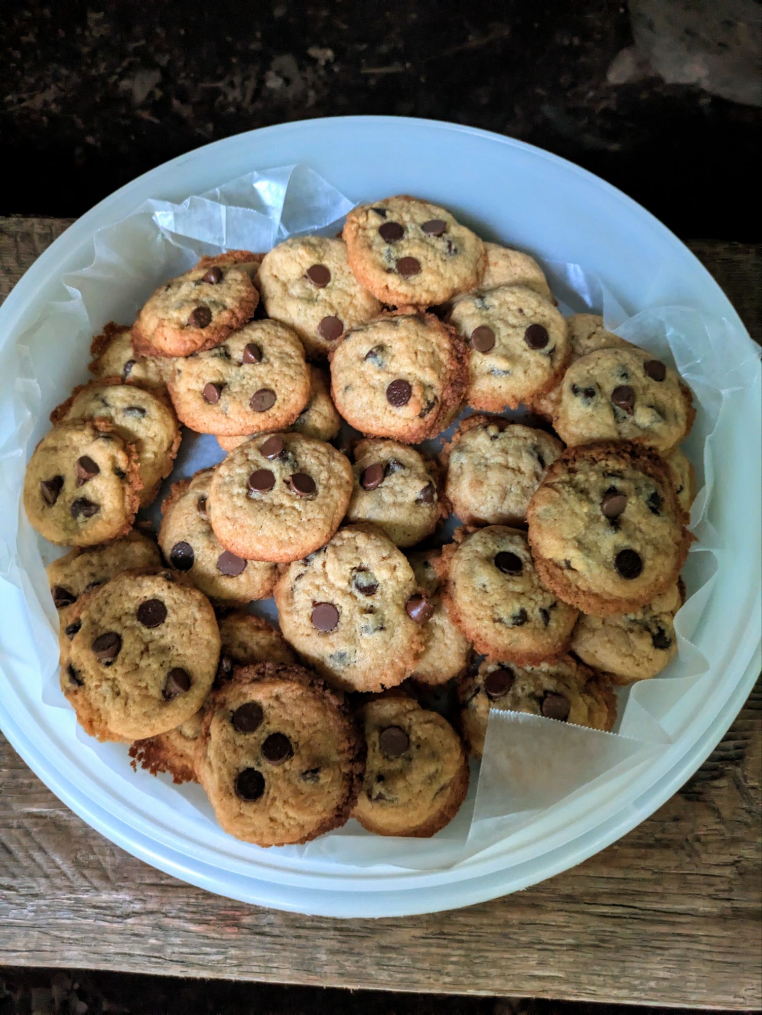
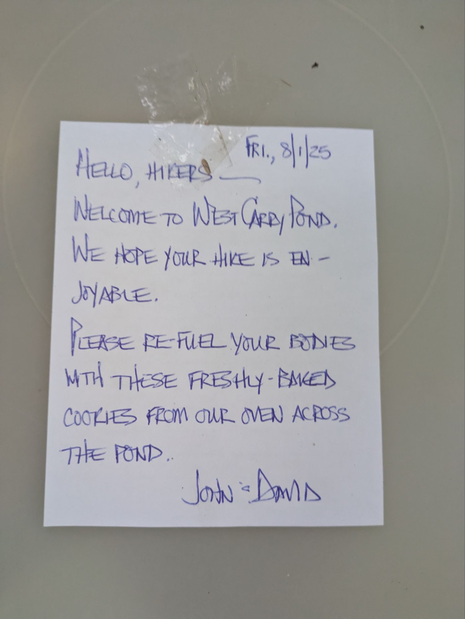
In my tired and hungry state, finding this glorious sight at the shelter was almost too much for me…
I mean, don’t they look like the most pristine and delicious chocolate chip cookies ever? I am a cookie monster and devoured several in quick succession.
I was the only one at the shelter and I still went for the tent. I set up and ate in record time. Going back to the cookies though… I didn’t feel right leaving them out for the bears to munch on. So, I ate them all! J.k., j.k. haha. I did eat a lot, but at least for the evening, I kept them safe by putting the whole Tupperware in my food hanging bag…
The loons sang me a lullaby as I drifted off to sleep. What a day! Another in the top 201 of the ECT I’d say 😎.
Thanks for joining on the journey! It means a lot that you took the time to read up on these adventures. If you want to help kids get access to the outdoors, a cause that means a lot to me, please help me in supporting Outdoors Empowerment Network! The “Tip Author” button is a direct link to my fundraising page. Y’all are truly amazing. Thank you!
This website contains affiliate links, which means The Trek may receive a percentage of any product or service you purchase using the links in the articles or advertisements. The buyer pays the same price as they would otherwise, and your purchase helps to support The Trek’s ongoing goal to serve you quality backpacking advice and information. Thanks for your support!
To learn more, please visit the About This Site page.
-

 Brand Stories2 weeks ago
Bloom Hotels: A Modern Vision of Hospitality Redefining Travel
-

 Brand Stories1 week ago
CheQin.ai sets a new standard for hotel booking with its AI capabilities: empowering travellers to bargain, choose the best, and book with clarity.
-

 Destinations & Things To Do2 weeks ago
Untouched Destinations: Stunning Hidden Gems You Must Visit
-

 Destinations & Things To Do1 week ago
This Hidden Beach in India Glows at Night-But Only in One Secret Season
-

 AI in Travel2 weeks ago
AI Travel Revolution: Must-Have Guide to the Best Experience
-

 Brand Stories1 month ago
Voice AI Startup ElevenLabs Plans to Add Hubs Around the World
-

 Brand Stories4 weeks ago
How Elon Musk’s rogue Grok chatbot became a cautionary AI tale
-

 Brand Stories2 weeks ago
Contactless Hospitality: Why Remote Management Technology Is Key to Seamless Guest Experiences
-

 Asia Travel Pulse1 month ago
Looking For Adventure In Asia? Here Are 7 Epic Destinations You Need To Experience At Least Once – Zee News
-

 AI in Travel1 month ago
‘Will AI take my job?’ A trip to a Beijing fortune-telling bar to see what lies ahead | China
You must be logged in to post a comment Login