
Destinations & Things To Do
The Top 10 Secrets of Forest Hills, Queens
Become a paid member to listen to this article
With over 88,000 residents, a unique historical legacy, classic old-time restaurants, and copious pop culture references, Forest Hills, Queens offers a lot to discover. As visitors walk down its vast avenues and quaint side streets, they are struck by the area’s breathtaking architecture. While beautiful on the outside, the neighborhood also has much hidden beneath its surface ready for discovery. Read to learn more about what makes Forest Hills such an integral and fascinating neighborhood in Queens.
1. Forest Hills Was Once Called Whitepot
Before the Forest Hills we know today—bounded by burgeoning hipster restaurants along Austin Street and brimming with architectural wonders in Forest Hills Garden—the area was once a simple farming community named Whitepot, which consisted mainly of wood-frame farmhouses and fields of crops. Around 1653, the Township of Newton was established by British and Dutch settlers, with Whitepot being one of its sections. It consisted of six farms named after Ascan Backus (who names Ascan Avenue), Casper-Joost Springsteen, Horatio N. Squire, Abram V.S. Lott, Sarah V. Bolmer, and James Van Siclen. Their farms greatly benefited the city’s supplies, providing hay, grains, vegetables, fruits, nuts, and many more items to New York’s markets.
The area remained relatively small over the years, being cited by the New York Times as having 30 residents in 1900 who were mostly German celery and potato planters. In 1906, the Cord Meyer Development Company purchased 600 acres of the Hopedale section of Whitepot—the area of land bounded by Queens Boulevard and Union Turnpike. The company used the land to form Forest Hills, renaming it for its high elevation and proximity to Forest Park. Today, the only known remnant of Whitepot is the Remsen Cemetery which contains tombstones from 1790 through 1819.
Interestingly, there was controversy surrounding the area’s original name in the early 20th century, with certain individuals debating that it was Whiteput instead. Some believed that the name Whitepot referred to the legend of the land having originally been purchased from the Native Americans with an exchange of three clay white pots. However, many have refuted this as being the original source name, claiming that the authentic spelling was Whiteput after the Dutch term “put,” which is a stream that becomes a hollow pit. Currently, it is believed that the area was called Whiteput by the original Dutch settlers, but the name was later anglicized by the English to Whitepot.
2. Many of Forest Hills’ Historic Street Names Have Been Lost
During the early years following the establishment of Forest Hills, many of its streets had a wide and eclectic range of alphabetical names that over time have been replaced by more common numerical names. One of the first street names that changed was Roman Avenue, located between Queens Boulevard and Austin Street. Today it is known as 72nd Avenue, with the only section of its name preserved in the Forest Hills Garden enclave. In fact, the enclave is the only section of the neighborhood that still fully recognizes all of its original street names.
Many of the neighborhood’s changed street names are located south of Austin Street leading to Metropolitan Avenue and include the streets of DeKoven, Pilgrim, and Zuni, now 72nd Road, 67th Drive, and 63rd Drive respectively. Others include streets that were originally named to reflect the area’s farming practices. These included the streets of Sample, Quality, and Harvest, which are now 66th Road, 67th Road, and 70th Road respectively. However, not all of the neighborhood’s original street names have been changed, with much of its thoroughfares retaining their authenticity. Some of the most important which still remain are Yellowstone Boulevard and Metropolitan Avenue.
Moreover, remnants of these forgotten street names exist in buildings across the neighborhood, which were named after their street’s original alphabetical name. These buildings and many others were named by the Cord Meyer Development Company, which has played a crucial role in Forest Hills’ development since its founding. Some examples include the apartment houses The Kelvin, now located on 69th Road, and The Livingston, now on 69th Avenue.
3. An English Tudor Style Enclave Can Be Found In Forest Hills Garden
Located within the neighborhood of Forest Hills, Forest Hills Garden is one of the most beautiful and oldest of America’s planned communities. Specifically, the enclave occupies a 175-acre wedge and is located south of the Forest Hills LIRR station. Around 4,500 residents call Forest Hills Garden home, comprising over 800 houses, 11 apartment buildings, and an assortment of churches, restaurants, parks, and storefronts. Currently, it is managed by the Forest Hills Garden Corporation, which is run by the area’s property owners.
Forest Hills Garden was first established in 1909 when Margaret Sage, founder of the Russell Sage Foundation, bought 142 acres of Forest Hills from the Cord Meyer Development Company. Architects Grosvenor Atterbury and Frederick Law Olmsted, Jr. were commissioned to plan and design the new town. They chose to model Forest Hills Gardens’ architecture directly after English garden cities of the early 20th century, giving the enclave a nostalgic and rustic charm. These garden cities—first popularized by theorist Sir Ebenezer Howard in 1891—were intended to be closed communities of working-class people surrounded by “green belts,” which would contain proportionate zones for agriculture, homes, and industry.
Throughout the neighborhood, visitors can find large Tudor homes fitted with the style’s typical boast towers, spires, Norman-inspired turrets, gabled roofs, and mullioned windows. Other additions to the enclave that help to give it a decidedly English appearance are its wrought-iron street lamps and sloping, curved streets containing nautical blue-hued street signs. Other nearby communities modeled after garden cities include Sunnyside and Jackson Heights, both in Queens.
Forest Hills Garden has maintained its distinctive style amid the bustling and modernizing city as a result of a covenant created in 1913. The covenant intended to ensure that the community remained an idyllic slice of country life in the heart of New York City’s growing industrial landscape. Specifically, the covenant puts limits on industry and prevents exterior alterations to the homes without approval, which has greatly aided in preserving the community’s historic style over the past 100 years. Moreover, the covenant has never imposed exclusionary economic, racial, or social restrictions on residents interested in moving, with the garden city concept designed to house individuals from different socio-economic strata.
4. Eddie’s Sweet Shop Is The Oldest Ice Cream Parlor In New York City
Established in 1925, Eddie’s Sweet Shop is a staple in the Forest Hills community, serving delicious ice cream for all to enjoy. Following the closure of the original Jahn franchise locations, Eddie’s Sweet Shop became the unofficial oldest ice cream parlor in the city. Walking inside the shop, customers are greeted by a blast from the past. The shop’s wooden and marble interior has not been changed since it first opened, giving it an old-fashioned vibe that serves as a nice break from the more modern dessert places across the city. Even its refrigerator is more than 80 years old.
Currently, Eddie’s Sweet Shop is owned by the Citrano family, who purchased the store in 1968. It has a small but still delicious menu, with 18 flavors of ice cream all made from scratch. Similarly, the shop’s topping selection is simple but flavorful, with its whipped cream also being homemade. Some of the shop’s ice cream flavors include classics such as rum raisin and butter pecan or more innovative combinations like pistachio pineapple. This ice cream is used in a number of old-time desserts, such as banana splits, floats, shakes, sundaes, egg creams, and sodas.
The shop is located at 105-29 Metropolitan Ave at 72nd Road. It is cash only and opens on weekdays besides Monday from 1:00 p.m. to 11:30 p.m. and weekends from 12:00 p.m. to 11:30 p.m.
5. Simon and Garfunkel Produced Music Together While Students At Forest Hills High School
The dynamic duo of the critically acclaimed folk-rock band Simon & Garfunkel both have a shared upbringing around the Forest Hills area. Paul Simon and Art Garfunkel grew up together during the 1940s and 50s in the predominantly Jewish neighborhood of Kew Gardens Hills, three blocks away from each other. Both attended Public School 164 and Parsons Junior High School and would first become friends in 1953 after appearing together in a sixth-grade adaptation of “Alice in Wonderland.” The two spent the following few years learning to harmonize and write songs together, even forming a streetcorner doo-wop group called the Peptones with three other friends.
After matriculating to Forest Hills High School in 1954, Simon and Garfunkel continued to make music. In 1956, while recording their song “Hey Schoolgirl,” the two were overheard by promoter Sid Prosen, who signed them to his independent label Big Records at just 15 years old. Under Big Records, the duo assumed the name Tom & Jerry and received much acclaim for their music, even appearing as the headliners for Dick Clark’s “American Bandstand” alongside Jerry Lee Lewis. Finally, the duo released two more singles, “Our Song” and “That’s My Story,” though to less acclaim. Impressively, the two accomplished all of this while still being full-time students at Forest Hills High School, from which they graduated in 1958.
However, Simon and Garfunkel’s connections to Forest Hills did not end after high school. Both returned numerous times to the neighborhood to perform at Forest Hills Stadium, gracing the stage in 1966, 1967, 1968, and for two nights in 1971 for their final official concert together as a band. More recently, Paul Simon has performed solo at the stadium in 2016 and gave the final concert of his Homeward Bound farewell tour right in the heart of his home community at Flushing Meadows Corona Park in 2018.
6. Forest Hills is the Home of Marvel Superhero Spider-Man
New York City is one of the key locations used for much of the action in Marvel Comics, serving as the traditional home of the Avengers, the Fantastic Four, Doctor Strange, Jessica Jones, and countless other characters. For Spider-Man—everybody’s friendly neighborhood superhero—his home can be found in the heart of Queens. Throughout the comics, Spider-man lives with his Aunt May and Uncle Ben at 20 Ingram Street, a two-story boarding house in Forest Hills Gardens. In real life, 20 Ingram Street is less modest and plain as it is portrayed in the comics, instead fashioned in the style of Edwardian and English garden houses.
Coincidentally, a real-life Parker family actually lived at 20 Ingram Street. In 1974, Andrew and Suzane Parker along with their two daughters moved into the residence. A few years later in 1989, the family reported that they began receiving junk mail addressed to Peter Parker, after their address was listed as the superhero’s home in the June and July 1989 issues of “The Amazing Spider-Man.” Originally, the character was created by Stan Lee in 1962 as a Forest Hills resident, but his official address was never pinpointed by the comic book legend, instead being added years later by writer David Michelinie.
However, it would not be until the family was told by a reporter from the “Queens Tribune” during the summer of 2001 that they realized how their lives shockingly mirrored that of one of Marvel’s most notable characters. Besides sharing a last name with Peter Parker, they also discovered another intriguing connection to the Spider-man comics. One of Andrew and Suzanne’s longtime neighbors of more than 20 years was Terri Osborne, whose last name was almost identical to that of Spider-Man’s biggest enemy, the Green Goblin, which is the alias of Norman Osborn.
7. There Was Once A Murder at Station Square
One winter night in January of 1977, a gruesome murder took place near Station Square, a beautiful brick-paved open space modeled on a medieval town center located down 71st Avenue in Forest Hills Garden. With its gorgeous archways and surrounding brick buildings, one would think the idyllic nature of Station Square could never be touched. However, as John Diel and Christine Freund sat together at the station while on a date, three .44 caliber shells smashed into the windshield of Diel’s car. Though Diel survived, Freund was hit twice and passed away shortly after. Berkowitz also murdered Forest Hills resident Virginia Voskerichian as she was heading to her Exeter Street home.
The murder was perpetrated by David Berkowitz, a serial killer known as Son of Sam and the “.44 Caliber King.” From mid-1976 to July 1977, Berkowitz killed six people and wounded seven others. During this time, Berkowitz was able to elude the police during one of the city’s largest manhunts. He even left letters mocking the police and promised further crimes. Eventually, he was captured on August 10, 1977, ending a killing spree that had greatly terrorized the city’s public. Berkowitz would go on to confess to all of his crimes, citing that he had acted at the behest of a demon manifested in the form of a neighbor’s dog named Sam—though he would state years later that the demon had been a lie.
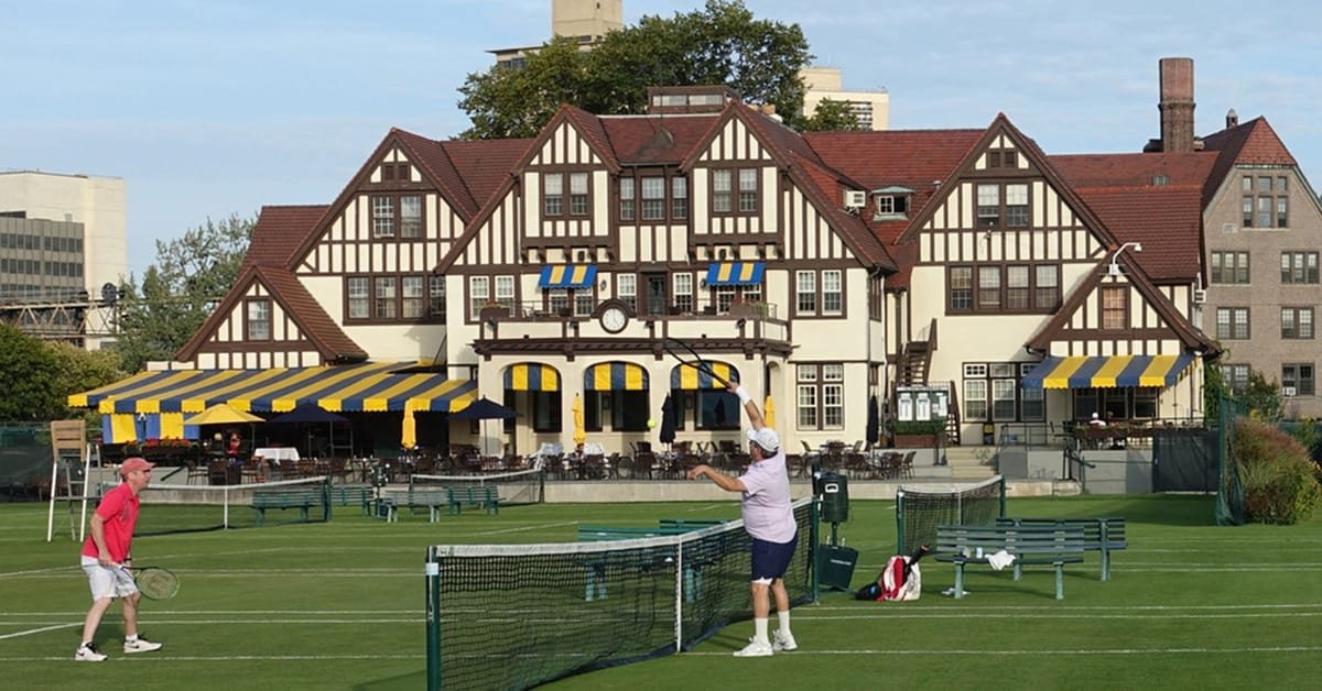
8. The Neighborhood’s Historic West Side Tennis Club Once Hosted the U.S. Tennis Open
Though the U.S. Tennis Open is currently held in Flushing Meadows Corona Park at the USTA Billie Jean King National Tennis Center, it once took place just a few miles away in Forest Hills at the West Side Tennis Club. Founded in 1892, the West Side Tennis Club’s original 13 members first rented land on Central Park West that contained three clay courts and a small clubhouse. However, this soon became too expensive and ten years later in 1902, the club moved uptown to land near Columbia University before making its way across the city to Forest Hills in 1912, after a committee voted to purchase a 10-acre plot in the area. The club’s Tudor-style clubhouse and fields were officially finished being constructed in 1914.
The U.S. National Championship (later renamed the U.S. Tennis Open in 1968) is the oldest tennis championship in the world, first beginning in Newport, Rhode Island in August 1881. A few years later in 1915, the National Championship would move to the West Side Tennis Club after a group of 100 tennis players signed a petition in favor. They argued that as most tennis clubs and fans were located in New York City, it was the most logical choice to officially move the championship there. However, the move was opposed by a group of eight former national champions and the issue was brought to a vote in February 1915 at the annual USNLTA meeting. The final verdict came to be 129 in favor versus 119 against the move.
From this point on, the West Side Tennis Club would serve as the official location for 60 U.S. Open Championships, first from 1915-1920, and then again from 1924-1977. The club would end its run as the purveyor of the country’s premier tennis competition in 1978 upon the opening of the USTA National Tennis Center. Housing the Forest Hills Stadium, the West Side Tennis Club is currently used today mainly as an outdoor concert venue. Some notable performers who have performed at the stadium include The Beatles, Bob Dylan, and The Rolling Stones.
9. Countless Famous Movies and T.V. Shows Have Been Shot Along The Neighborhood’s Streets
Some of the most iconic films and television shows have been shot throughout Forest Hills. One such example is Wes Anderson’s 2001 film “The Royal Tenenbaums” which was partially shot in Forest Hills. During one of the film’s most poignant scenes situated on the Center Court of the West Side Tennis Club, pro tennis player Richie Tenenbaum plays a disastrous final match which sends his career up in flames.
Another influential film produced in Forest Hills is Alfred Hitchcock’s 1951 film “Strangers On A Train,” with one of the film’s most famous scenes also taking place right at the West Side Tennis Club. Background footage of the 1950 Davis Cup finals held August 25-27 was also used in the film. In addition, recent television shows like “The Marvelous Mrs. Maisel” have used Forest Hills as a prime background for their actors. During the show’s third season, Rose, Abe, and Zelda move in together with the parents of Joel Maisel, with their new abode being located on a private street off Ascan Avenue.
10. The First Branch Of The Ridgewood Savings Bank Opened In Forest Hills
The Ridgewood Savings Bank is currently the largest mutual savings bank in all of New York State. Founded in 1921 in Ridgewood, Queens, the bank today is worth $4.6 billion and operates 35 branches across New York City, Long Island, and Westchester County. Located in Forest Hills at 107-55 Queens Boulevard, the bank’s first branch opened its doors in 1940. Stepping inside, visitors can see that much of its architecture has been carefully preserved, with its copper-colored teller booths and stained glass windows harkening to the past. Designated as a New York City landmark in 2000, the Forest Hills Ridgewood Savings Bank continues to remain one of the bank’s premier and culturally significant branches.
Next, check out Untapped’s Guide to Woodside, Queens: 16 Must-Visit Places!
The title could also include a reference to the day I spent goofing around in Grand Marais, I guess. But that’s not as cool and ominous.
I know this is really late, but everything else in my life has caught up to me. Also, so sorry to make the last day its own post, but I have a lot to say about finishing (and the trail in general) so I think that’ll be its own thing. I know everyone is on the edge of their seats wanting to know if I make it or not. Spoilers: if you’re reading this, it means I got back to civilization long enough to upload it. I’m probably ok. Unless I suffered a one in a million bear attack while in downtown Duluth. You never know.
It’s really starting to sink in that I don’t have too much time left on trail. Grand Marais was always a distant location that I’d get to eventually, a last checkpoint before the final stretch of trail. Now I’m in Grand Marais. I’m at the final stretch.
It really is crazy when I look on my map just how far I’ve travelled. I remember the reverse being true just two weeks ago. I was sitting in the rain, looking at the line of trail I still had to cross and thinking “I’ll never make it”.
Look at me now. I’m certainly a different person than I was back in Duluth, even if only by a little.
Day 12: Grand Marais (and a Fish Festival?)
I woke up, at the last of my food and drank the last of my water. I was running totally on empty, which meant that my food budgeting had been a bit tighter than expected.
The good news was that my 27 mile day paid off. When I woke up at South Bally Creek, I knew I only had around seven miles left into town. That’s light work. I expected to be there by noon.
The bad news was that hiking 27 miles in one day does, in fact, make your legs feel a bit off. Not horrible, but not great either. Needless to say it was a slow morning.
This was not helped by the rapidly deteriorating trail condition on the way in to GM. It was all the things I complained about in my first few posts: muddy, buggy, horribly overgrown. Fortunately, the knowledge that I wouldn’t be hiking through it for more than a couple hours helped me to push on.
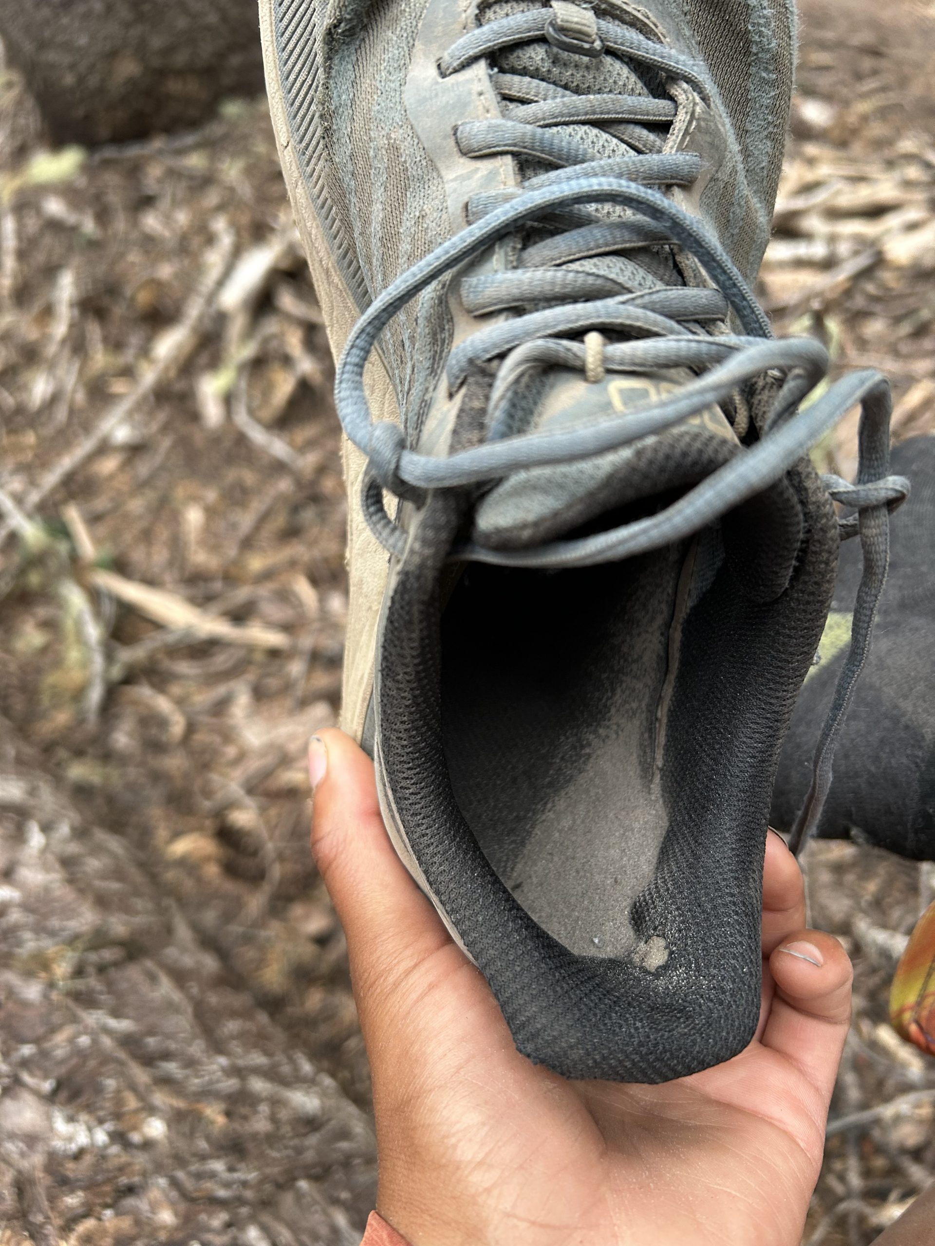
There was one section that I’ll shout out for being particularly awful, where the ground looked solid but was actually peat (I think, or maybe just mud) over shin deep water. Both my poles hit solid ground, but my boot went straight. Soaked immediately.
Once again, though, the knowledge that I’d be done soon made the wet boot easy to just ignore.
Fortunately, the final section of the trail was an incredibly long and quite steep boardwalk down the mountain. No mud, and no slowly picking over rocks. After that, I road walked about a mile and a half into town. I tried hitching at first, but I kinda gave up after ten minutes of being passed. I guess I look too scruffy for the instant hitches I got at the start of the trail. The walk wasn’t bad, either.
The first thing I noticed as I walked into Grand Marais was that it was BUSY. There were lots of people in the streets, which made me think “huh, must just be peak season”. Then I saw the roped off street, the inflatables, the food trucks. There was some kind of festival going on, which was very exciting.
You see, I could care less about street walking (already do it) and inflatables (cool, but I haven’t shaved in too long and kind of look like a creep so I’m not taking my chances on a kids bounce house). Food trucks, however, were awesome news.
I found one that did smoothies, and ordered a smoothie called something weird like “Loon Passion”. It had mangoes and bananas and was ice cold. I’ve done nothing but crave cold drinks (I’ve ranted about this before) and this smoothie hit the spot so well that I drank it in one go. I don’t think my lips left the straw once.
After instantly deleting $8 (kinda pricy for a medium smoothie, but it was good so I’ll let it slide) I moved on to my next target: Hungry Hippie Tacos. I’d heard about it when I passed through Grand Marais on my way to Duluth, and being both hungry and a hippie it seemed like a good fit.
I ordered something with chipotle cream and pulled pork. The taco was larger than my whole hand (and I have big hands). Plus, it was fried. It was amazing. No complaints.
The real winner of the Hungry Hippie, however, was the medium (but infinite refill) fountain drink I got. They had coke products, I sat right next to the fountain. I would pound my drink before immediately refilling it. I kid you not, I must’ve drank at least two liters of red gatorade. It tasted like the nectar of the Gods.
I read in a textbook once about Alexander the Great and his army marching across the Sahara. They had little water or food, and when they finally got to the city they were headed to (Alexandria? It’s been a while) they ate and drank so much that they all became sick, vomiting up most of what they consumed in a vicious cycle.
Now, I got how you could get like that. I could conceptualize being so hungry and thirsty that you eat until you puke. However, I don’t think I truly understood that headspace until I got to Grand Marais, where I proceeded to do exactly the same thing. Between the smoothie I drank in two kinutes, the giant fried taco, and the absurd amount of red gatorade, I felt like I was going to puke. In a good way though, if that’s even possible.
Fortunately I was able to keep it all down, but it was a very slow walk to my campsite. I stayed at the same place I did on the way l ppl down. The campground in GM is almost always fully booked (as far as I could tell, it’s like that all summer) but it has first come first serve camp sites that are cheap enough for me to splurge on them. They are close to the road, but I’m so tired at the end of each day that noise hasn’t really been bothering me.
When I checked in to camp I asked what was going on down town. I didn’t get a. straight answer, but it was something about a fish festival? They did tell me that there would be fireworks later which was exciting.
I pitched my tent, which was actually surprisingly hard. The ground isn’t super deep at the campsite (rocky, too) so it’s hard to really get the stakes deep into it. This is bad, because due to the lack of frame my whole tent relies on the tension form the stakes to stay upright. It’s a trade off that I have to make for the ultralight benefits.
This means that I ended up doing some dumb stuff to make sure my stakes stayed in the ground. This included putting rocks on all the corners, and digging a hole and then rebutting two of the stakes. The end result was a pretty bad pitch, but there were no storms in the forecast so I wasn’t worried.
After sitting down at my site and letting my legs rest (for like three hours. This was no short break) I decided to get up and buy myself some groceries. Grand Marais was large enough to have a decent variety, including a propped outfitter store and a nice co-op grocery. I bought most of my stuff at the co-op, but because it was my last few days on trail I splurged on a couple of the fancy camping meals. I opted for thai curry, because thai curry is generally good.
Other notable puckups from the grocery store: I bought ~4000 calories worth of pop tarts (3 boxes). I picked three different flavors: blueberry, the ol’ reliable, sundae, which is quickly becoming my favorite, and cake batter, which was the one I’d always buy as a kid. When I packed them into my bear vault, I deliberately shuffled them so that I’d never know which one I was grabbing. This system worked out well, keeping things interesting for the rest of the hike.
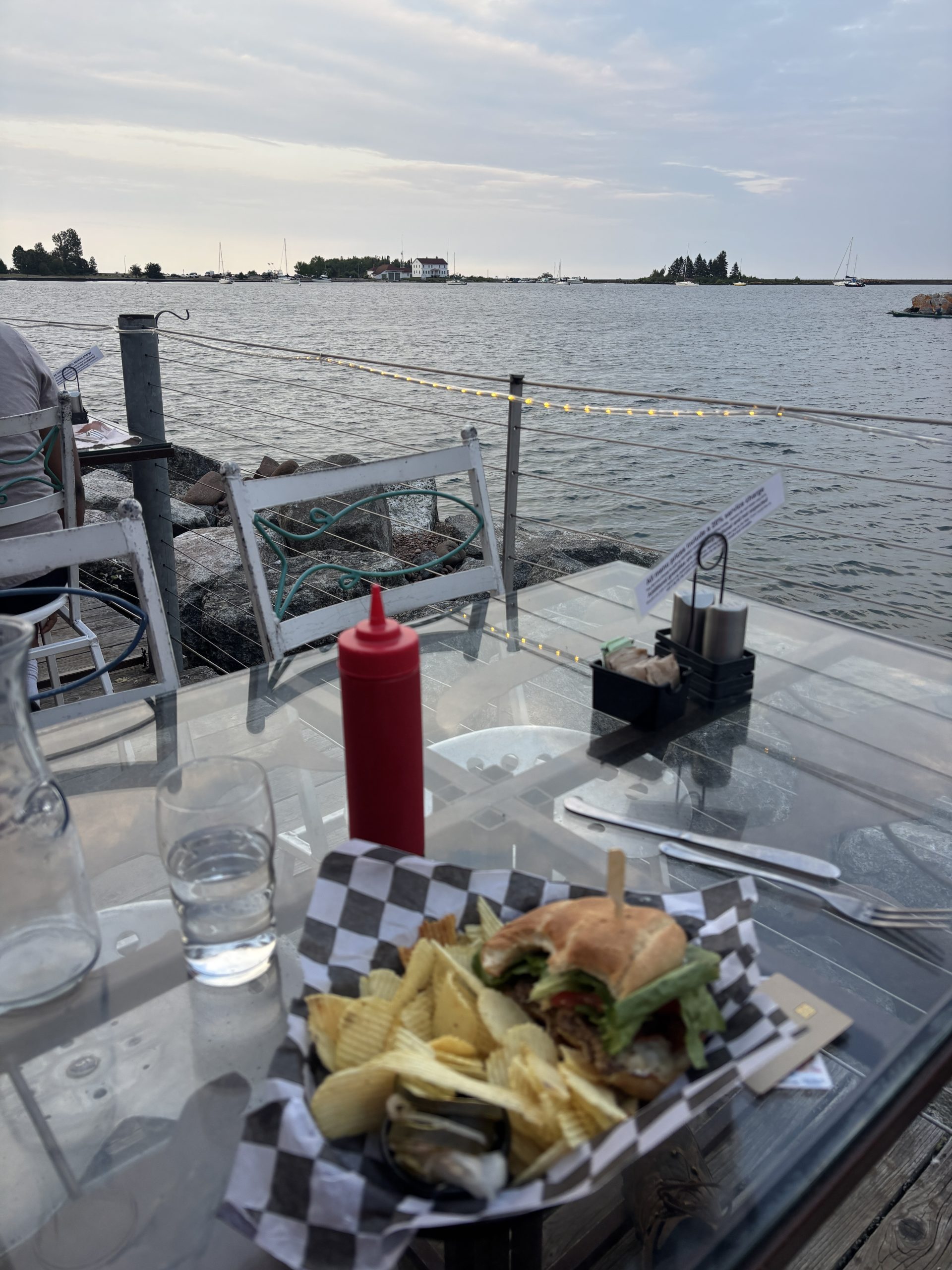
I then grabbed food at the Angry Trout, which is a Grand Marais restaurant that I cannot say enough good things about. They specialize in fish, grilled and fried (I got the fish sandwich). The food is all amazing, and it backs right up to the bay for some amazing views.
A super cool thing is that they make it really clear that you’re not supposed to tip, and that they’ve just raised prices so that they can compensate their waitstaff. It means things are a bit more costly, but knowing that I’m not determining how much my waiter gets paid was worth the extra $4 on the sandwich. There was a section saying that tipping is extra, purely for a good job. I wish I’d taken a photo of the menu where it said that.
After that, I went back to my campsite and lounged around some more (basically the theme of today). I worked on the blog a bit, then it got dark so I ushered down to go watch the fireworks. It was a really solid show, and I should’ve taken some photos of it but I honestly forgot my phone.
I still never figured out what the festival or fireworks was actually about.
As always, I slept like a rock.
Day 13: My Life is Saved by the Right Bridge Being Down
I woke up around 8:20 (like usual) and meandered over to the Java Moose for coffee and to work on my blog a bit. I didn’t love having to stay in town and write, but I was not going to do it while actually on trail so I figured I’d get ahead. Overall pleasant experience, good coffee, congee corner with four bars of cell service and a power outlet.
Leaving Grand Marais was slow, as it often is while I get out of town. My pack is full of food so it’s heavy, and road walks are just my that fun so I’m inclined to go slower.
I did eventually get rolling, though, and almost immediately came upon the Devils Track section of the trail. The bridge was put, but I’d heard from some of the southbound hikers that the river was fordable if needed. I hadn’t done a proper river crossing since Crow Creek (day 3? 4?) so I was excited to try my hand at it.
I got hiking. The “Devils Track” is a river running through a rocky valley (who would have guessed? That’s basically all named locations on the SHT). The water runs fast, to the point where I heard it well before I saw it. This did not fill me with confidence.
Laying eyes on the river made things way worse. It was deeper than just a creek and had several serious waterfall sections. Plus, the banks were steep on either side. If a bridge was out over the track, it meant I would be climbing as well as fording the river. It didn’t help my nerves that trail conditions were pretty poor (tree falls, not overgrown) which meant that very few people had recently come this way.
Still, I started psyching myself up for it. I was going to extend my poles all the way, lean into the flow of the water. I knew all the right steps. I was going to do it, and come out the other side alright. I was really about to do it.
The trail veered towards the river . It was still loud and raging water, so I braced myself for a really bad crossing. Sincerely, the thought went through my head “at least if I drown it’ll be in a pretty spot.”
And boom. There was a bridge.
I was really received, to be honest. Part of me was worried that the bridge was unstable (which is why it was “out”) so I rushed across, thanking the Lord that I didn’t have to try my luck fording.
If I had? 50/50 odds I wouldn’t be writing this blog post right now, if I went through with it. I like to think that I would’ve just gone back i’m and done the detour, but who knows. I was really in the “ford the river or perish trying” state of mind, and it was ~4 miles back to the trailhead. I guess we’ll never know, because I never had to cross.
Once the near death experience was over, I was suddenly more open to the views. Devils Track was incredibly pretty, with sharp rising walls made out of bright red stone and a rushing river beneath. Pines grew sporadically along the ridges. It reminded me a lot of something out of an old western movie, to be honest. I got some great photographs while climbing out of the gorge.
Eventually I get to the downed bridge, but after what I was prepared to do it ended up being nothing. To be honest, scrambling down the slope to the river bed was harder than actually crossing the rocks. No trouble at all.
After that I passed through a number of super cool open meadow areas as I climbed up into the hills again. I also met another thru hiker who said she was from Bristol, England. I was proud to be able to say “Hey! I’ve been there!”
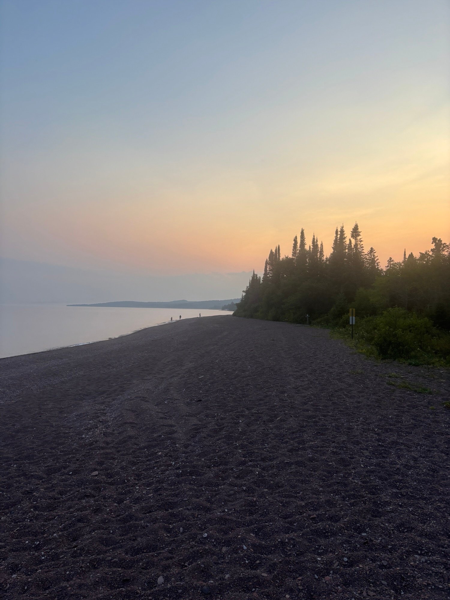
The sun was starting to set, but I knew the lake walk was just up ahead. Fun fact about the SHT: only around a mile and a half are actually on Lake Superior. This is the legendary “Lake Walk,” and I wanted to make sure I hit it at sunset rather than pushing through it in the dark (mostly for the views of the beach).
Before trying to push there, however, I stopped to have dinner. Despite being the most money I paid per calorie this whole trip, the coconut curry was worth it. After 20 minutes of rehydrating it tasted like takeout from a thai place. It was amazing. It paired well with the cake flavored pop tart I ate. Very solid.
After a couple hours of really determined hiking, I did make it to the lake walk just as the sun was setting. The whole thing was surreal; the water gently crashing against the rocks of the beach as mist rolled in off the lake.
It was probably the most solitude I’ve felt all hike, which was weird because I was less than 400m from the highway at all times. As the whole world turned pink it felt like a dream, especially the part right before you wake up where you’re half aware of the real world but not out of the magic quite yet. Truly surreal experience.
The trail eventually turned back inland right as it started to get dark, which was bad for a number of reasons. I still had a few (3ish) miles to go until my campsite, and the darkness meant the bugs were out in force. Also, even though my head lamp is good walking in the dark really ups my chances of falling and breaking something. Thankfully my poles kept me mostly upright, but there were a few close calls. Plus, walking along with just your headlamp lighting up the dark forest makes me feel like the protagonist of a found footage horror movie, which isn’t exactly a pleasant experience.
When I got to camp my problems got worse. 1) all the ground was rocky, which made it not only uncomfortable but also a pain to pitch my tent into (for reasons covered above). 2) the bugs. There were so many mosquitos that the second worst thing about them (after getting bitten) was having to put in mental effort to avoid breathing them in because the cloud was so thick. I would swat four or five at a time when I hit my legs. Awful, but a good motivator to get everything pitched and put away.
Fortunately I slept very well. Some might even describe it as rocklike.
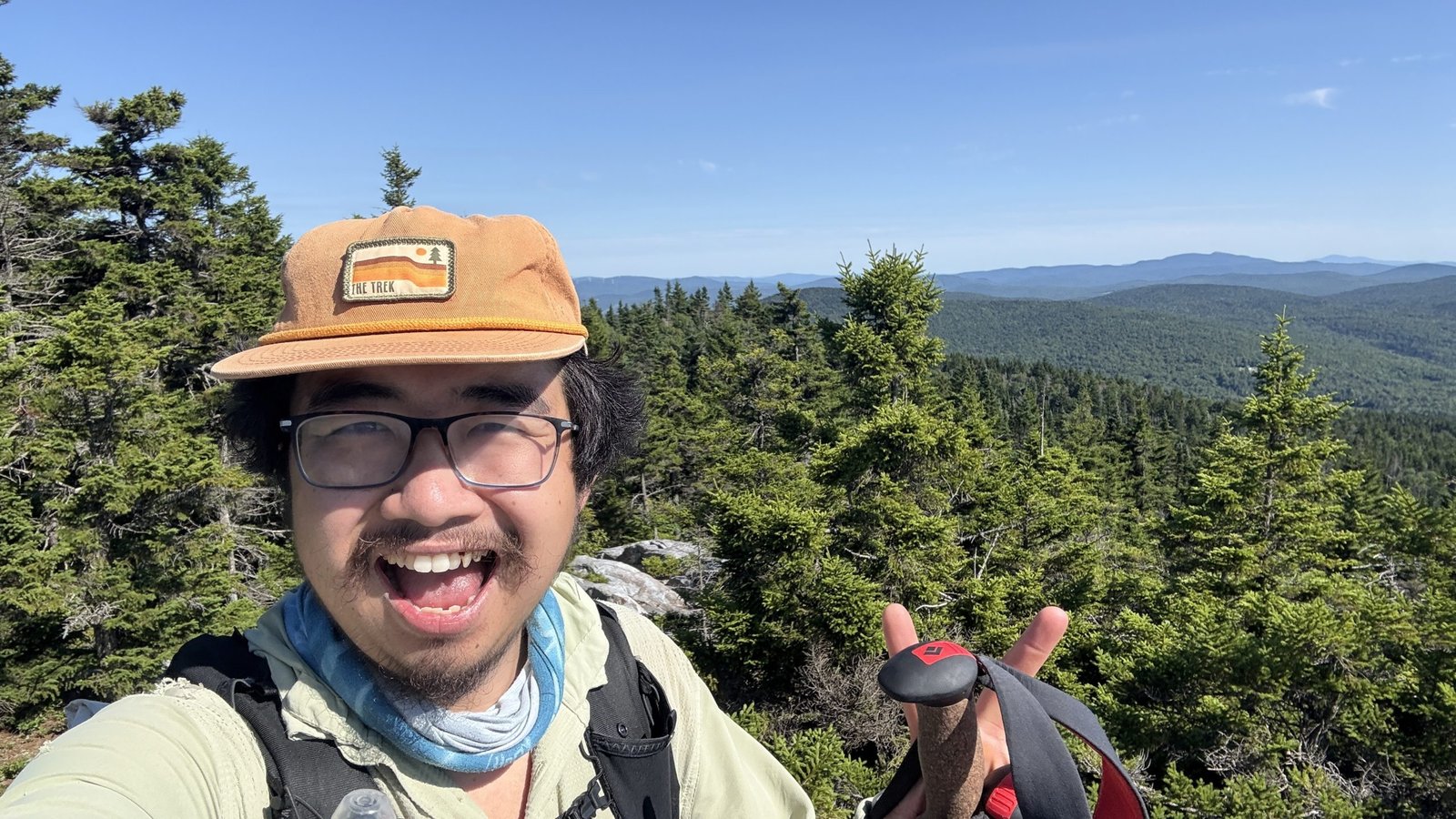
Day 14: The Terrible, Horrible, No Good, Very Bad Second to Last Day on Trail
I started out this day somber and moody. I didn’t want the adventure to be over, and I knew this was my last full day on trail. I was worried that after I got done, everything would go back to normal and I’d lose the high on life feeling I’d been riding all week.
I never thought I’d say this, but thank goodness for the mosquitos. They made me more than ready to be done. But we’re getting ahead of ourselves.
Things didn’t exactly start off as the title of this section describes. It was a cold night, so the bugs chilled out a little bit in the morning. The trail conditions were good, so I made solid time and was at Judge C Magney state park before 11, where I found the new best official state sponsored sign I’ve ever seen.
Magney is smaller than the other state parks, being only one major trail called the Devil’s Kettle. This is a path that runs, you guessed it, along a river and past a really cool set of falls.
To their credit, said falls were probably the best ones on the whole hike. There was a lower one, which included a really cool rocky outcrop beneath where you could do a nice niagara falls spray knockoff. Then, the trail climbed to overlook the upper set of falls that were really spectacular. My phone doesn’t do justice to how massive or how cool they were.
Then, the trail climbed. I had a hiker warn me that coming out of Magney was the worst section on the entire trail because it just kept going up. I don’t think worst is an accurate descriptor (section B for misery, or that first day in the Swatooths if ranking purely on difficulty), but I can see where he got the idea from. It was certainly a long climb (~80% uphill for 5ish miles) if not the absolute steepest. I didn’t mind it tho; higher elevation generally means less bugs which is always good.
This section also featured a road walk, during which I saw a really cool abandoned heating and air truck overgrown by weeds. It was an old timey one, boxy like an ice cream truck. Very cool find.
After that, though… things got bad.
The road walk turned back into the woods and I was instantly reminded of section B. the upside of section B, however, was that it was flat. This was just overgrown.
What’s worse was the bugs. Swamp Gator and a generally relaxed attitude about getting a few bites had been holding off any bug related rage for the most part. That stopped today. There were so many mosquitos and biting flies that I literally couldn’t stop without ten or more landing on me. I couldn’t swat them effectively either, because that would mean slowing down/stopping and that just meant more would get on me. Honestly it was miserable, I shimmied down the trail slapping my legs like a circus monkey in a bad dancing act for almost ten miles.
There was one section where there were no mosquitos, which is a feeling that I’d describe as not quite as good as true love, but a close second. It was a rock that I’m calling the Spider Climb after the obstacle in American Ninja Warrior by the same name. Basically, it’s a big crack in a rock that you have to wedge yourself into and shimmy up. It’s about 6 feet tall and equally deep.
There is a path around it so you’re not technically required to shimmy, but I’m no coward. It was shimmy or nothing. The trick ended up just being throwing all my gear to the top of the rock and then climbing it with my hands free. Very fun, and also no bugs (heavenly). I decided to have dinner there, which was a little bit stressful because I constantly had to make sure things weren’t rolling over the cliff. Worth it, though, because no bugs.
After that it was more of the same. Thick brush, mosquitos, mud, hills. The only good thing was that I was making progress, but the trail was so miserable that it kind of erased that feeling. If every day had been like this I wouldn’t have been able to finish, that’s for sure.
Fortunately there was an unexpected light at the end of the tunnel. I stopped early at the Woodland Caribou Pond Camp (3 miles short of my planned stop) just to get out of the bugs.
Two great things happened. First, the bugs were just kind of… not as bad for some reason? They weren’t around in the same numbers as they had been.
Better still, there were people at the camp. I got to meet Seth and Harrison, two guys who had originally met in the Conservation Corps. They’d also done some volunteer work for the SHT association, so they were able to share some valuable insights into how the trail is maintained.
Apparently, the trail is cleared with chainsaws every spring. Then, crews go through with weed whackers from south to north, clearing the trail section by section. They speculated that the reason things were so tough in the last few miles was because the crews hadn’t gotten that far north yet. They also guessed that section B was bad because it had been whacked so long ago that the plants had time to regrow.
That wasn’t even the craziest part. Apparently, all of the bridges were built by crews of guys hiking in all the lumber on their backs. They said they’d carry some of the larger bits by just creating a rope harness between four guys and walking it in. Some of those bridges were massive, so I can only imagine the effort it must take to build and maintain them.
Knowing how much work went into to the trail made me feel kind of bad for complaining so much about trail conditions, to be honest. The SHT is all volunteers, too. I was just incredibly thankful that so many people had worked just to give me a trail to hike.
Seth and Harrison were just cool people in general, too. They’d done some wildfire fighting during their days with the conservation corps, so they had fascinating stories to share. They were also very generous with their cigarettes and whisky, although I had to tell them no on both counts. I don’t smoke, and while I do drink, with the calories and water levels I’m at, a shot of whisky would probably lay me out.
We stayed up late just talking before I finally headed in to bed. It was a great time, and definitely made a horrible day on trail better. That’s been one of the best parts; just meeting folk while hiking. Everyone is super nice, and everyone has this kind of good vibe to them that must come with doing outdoor hobbies. There have been so many great people that mot everyone has even made the blog. I’m really thankful for how good the community has been.
In Conclusion…
It’s going to be surreal not writing these any more, I have to say. This journey has been amazing. And I’ll definitely miss it when it’s done. I have so, so many thought about the SHT and will be doing one big final blog post detailing it all within the next few days.
Sorry for uploading this so late, the comforts of society have been a real distraction.
Happy Trails!
I woke up a bit grumpy. Not necessarily because it was that bad a night of sleep, though it wasn’t great. No, it’s because I keep rolling the marbles in my head on how to approach the beginning of the Whites. Ya see, my plan was to saunter up to Hikers Welcome with a short day, cruise over Moosilauke on a short day, and take a nice rest in North Woodstock/Lincoln, some of my favourite towns. …
The post Who Has Lost All Powers… appeared first on The Trek.
Day 33
Start: Paradise Park Loop Alternate, mile ~550
End: Timothy Lake, mile 575.2
Miles hiked: ~25.2 miles
Last night was a little windy, which kept me from slipping into a deep sleep for a while. So, this morning, I slept in a bit later than usual, but eventually packed up and left my nearly perfect campsite.
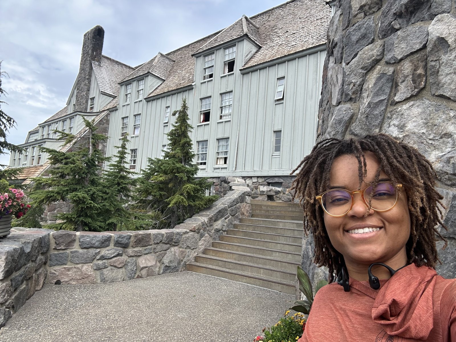
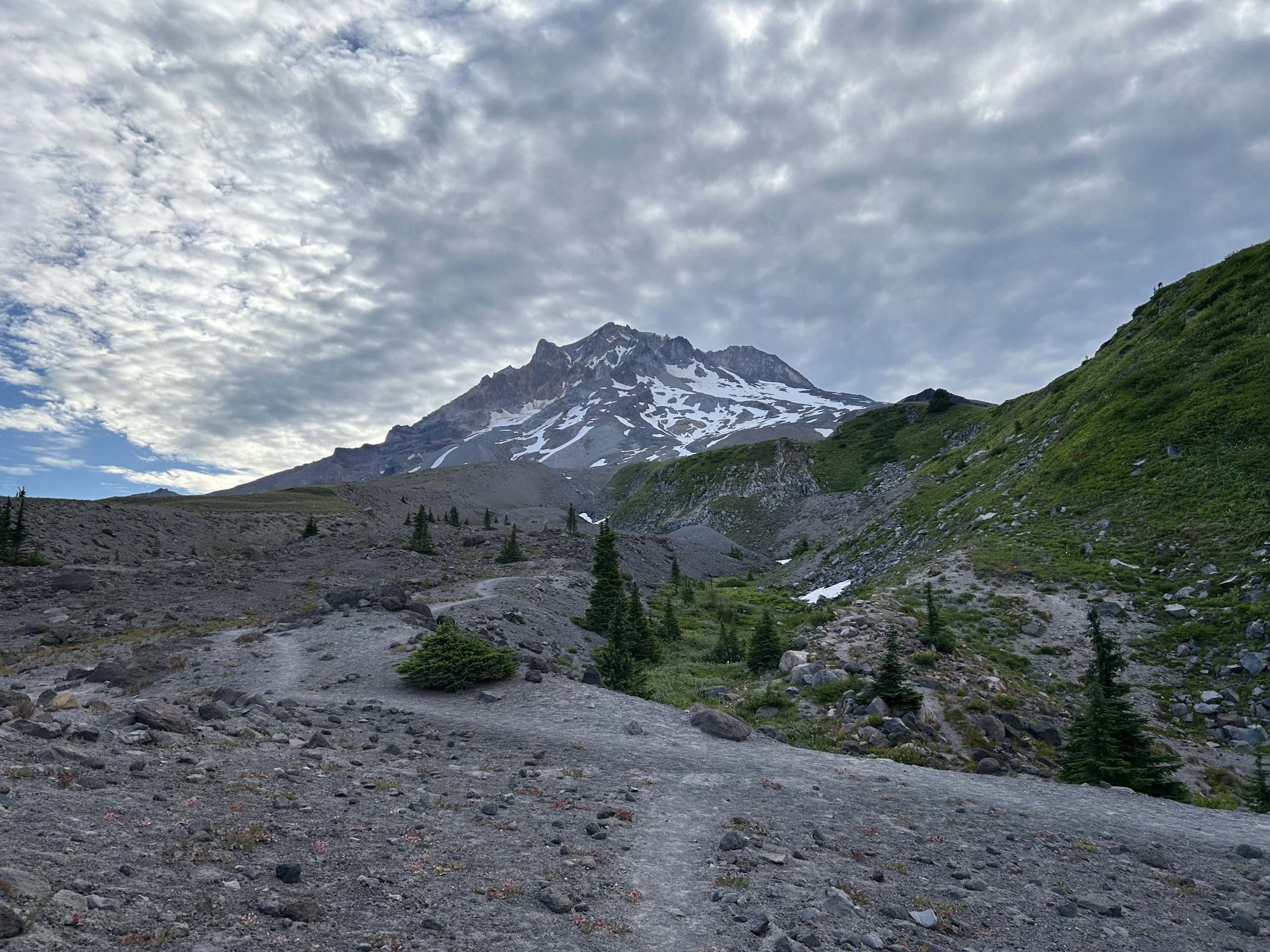
The goal for this morning was to reach Timberline Lodge to check it out. I didn’t have a box there nor did I plan on eating the breakfast buffet, but it still seemed like a cool stop. I had about 5 miles to hike to get there, but as I hiked, my legs felt heavy and sluggish.
A light layer of clouds covered part of the sky. As the morning wore on, the clouds expanded and got darker. It looked like rain was in the forecast for today! That didn’t stop the stream of day hikers that came from the direction of the Timberline Lodge. They were everywhere! I could tell I was getting close to the lodge when the day hikers were energetic and excited about their hike.
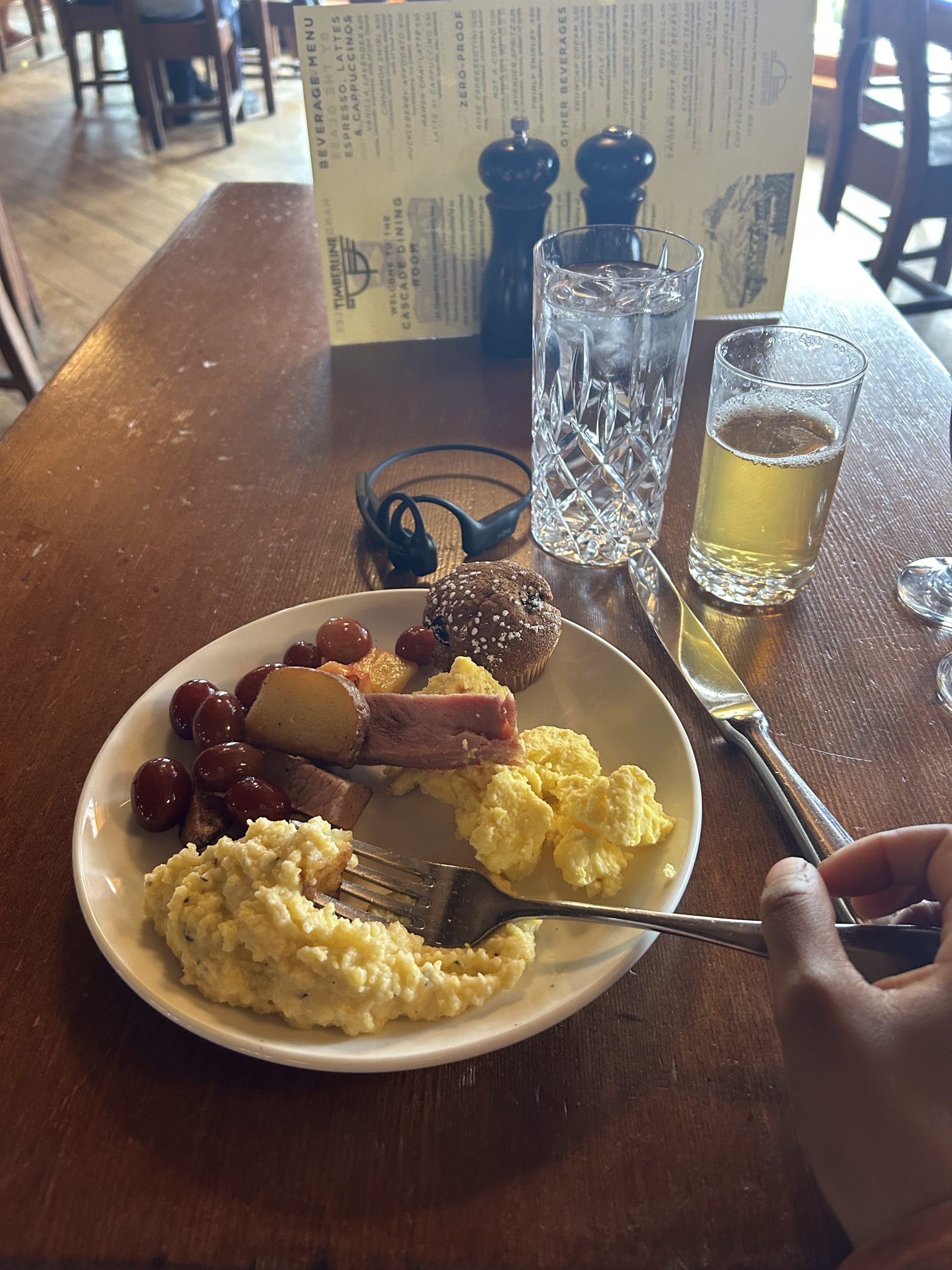
Soon, I passed a set of ski lifts and then I saw the famous grey building. I made it! And despite not planning on eating the breakfast buffet, my grumbling stomach steered me straight to the dining room. I saw a few other SOBO hikers in the small, dark room and said my greetings. To my surprise, I demolished two plates of food and felt like I could’ve stuffed another one down. I still think the buffet was overpriced, but it was worth it for the novelty of an on-trail buffet.
While having breakfast, I spotted a gentleman with a PCT shirt on and asked if he was a hiker. Turns out it was Papa Joe from Casa de Luna! If you don’t know, he and his wife were Trail Angels for 20 years, hosting hikers in Southern California before closing their doors a few years ago. Throughout my PCT research, Casa de Luna always showed up as a must-stop. To meet such a legend on trail really made my day!
After saying goodbye and paying my bill, I took a few minutes to explore the lodge. There was so much history contained here! From the little museum on the ground floor to the intricate carvings and symbols on the woodwork, there was a lot to see. I was surprised to find out that the lodge was constructed as part of FDR’s New Deal. I had no idea! I definitely want to come back and visit again.
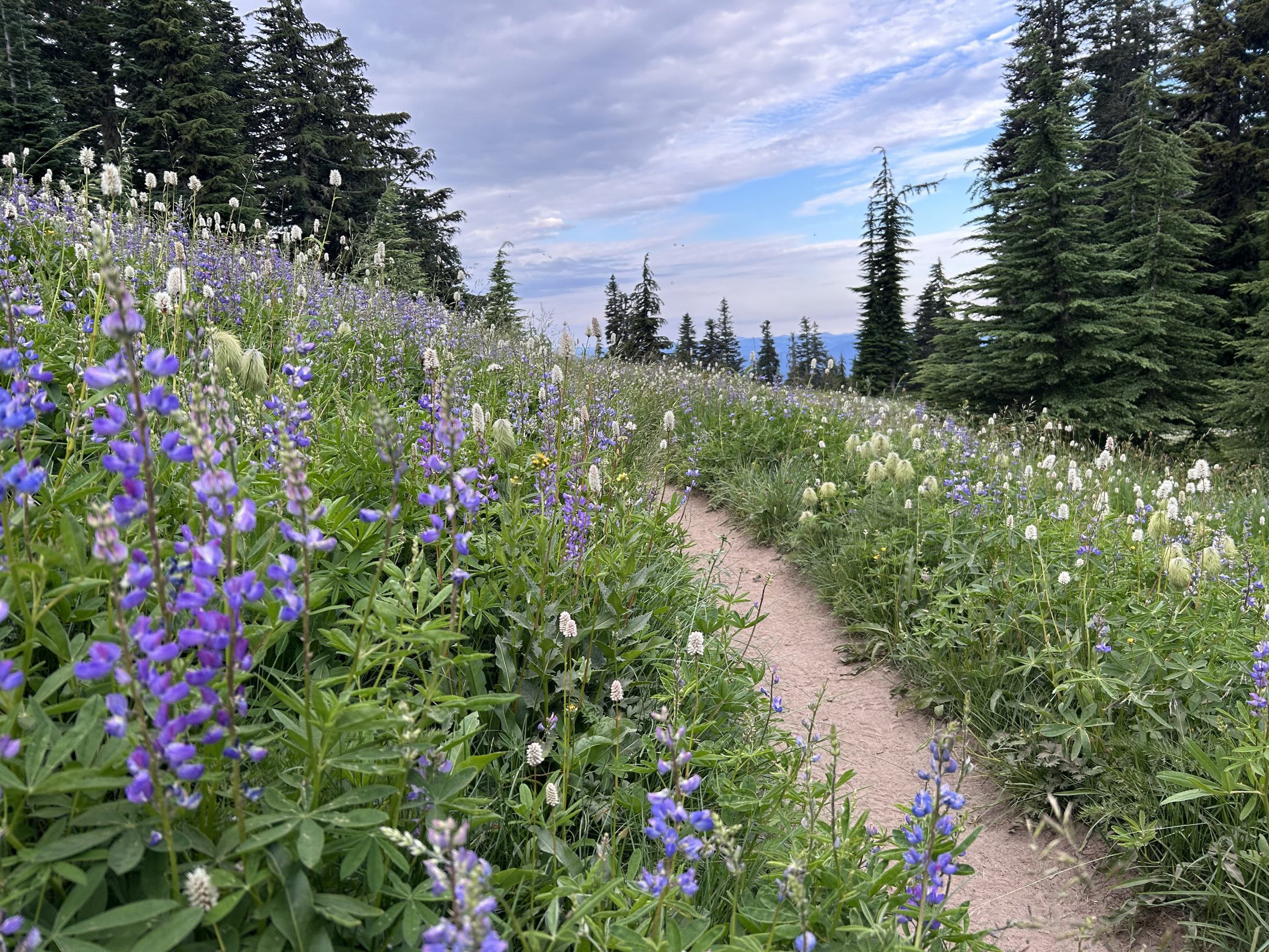
Back on trail, it was time to descend. The trail was beach-like; fine rock pulverized into sand got into my shoes as I made my way down. Once I got to the forested area, I had to dump my shoes and watch the sand fly out.
The rest of the day was easy walking through the forest along a relatively flat path. I ran into a couple of people who read my blogs (thanks for the support!) and took a short blue blaze to see Little Crater Lake, a magnificently blue pool of water.
With sore feet and ready to be still for the evening, I walked the last 1.5 miles to my campsite on Timothy Lake. Another SOBO I had been leapfrogging was there as well as a section hiker. On the lake, baby ducks played and boaters floated on the water. I loved hearing the sounds of the family across the lake enjoying their summer outdoors. It was a peaceful evening.
And that’s a day in the life of a PCT SOBO hiker!
This website contains affiliate links, which means The Trek may receive a percentage of any product or service you purchase using the links in the articles or advertisements. The buyer pays the same price as they would otherwise, and your purchase helps to support The Trek’s ongoing goal to serve you quality backpacking advice and information. Thanks for your support!
To learn more, please visit the About This Site page.
-

 Brand Stories3 weeks ago
Bloom Hotels: A Modern Vision of Hospitality Redefining Travel
-

 Brand Stories2 weeks ago
CheQin.ai sets a new standard for hotel booking with its AI capabilities: empowering travellers to bargain, choose the best, and book with clarity.
-

 Destinations & Things To Do3 weeks ago
Untouched Destinations: Stunning Hidden Gems You Must Visit
-

 Destinations & Things To Do2 weeks ago
This Hidden Beach in India Glows at Night-But Only in One Secret Season
-

 AI in Travel3 weeks ago
AI Travel Revolution: Must-Have Guide to the Best Experience
-

 Brand Stories1 month ago
Voice AI Startup ElevenLabs Plans to Add Hubs Around the World
-

 Brand Stories1 month ago
How Elon Musk’s rogue Grok chatbot became a cautionary AI tale
-

 Brand Stories3 weeks ago
Contactless Hospitality: Why Remote Management Technology Is Key to Seamless Guest Experiences
-

 Asia Travel Pulse1 month ago
Looking For Adventure In Asia? Here Are 7 Epic Destinations You Need To Experience At Least Once – Zee News
-

 Brand Stories1 month ago
ChatGPT — the last of the great romantics