
Destinations & Things To Do
Hidden Gems of Germany: The 8 Towns Locals Don’t Want You to Discover
While millions of tourists flood Munich’s Oktoberfest, elbow through Berlin’s crowds, and queue for hours at Neuschwanstein Castle, Germany’s locals have been quietly protecting some of the country’s most extraordinary destinations like state secrets. These are towns that look amazing to visit with charm, good food, fantastic people, and of course a nice half liter of beer.
We’re talking about medieval towns that make Rothenburg look touristy, coastal villages that rival anything the Mediterranean offers, and mountain retreats where the beer flows as freely as the pristine Alpine streams. These are places where centuries-old traditions continue undisturbed, where local restaurants serve recipes passed down through generations, and where visitors are still treated as honored guests rather than walking ATMs.
The locals have good reason for their secrecy. Once word gets out about these destinations, the charm that makes them special often disappears under waves of tour buses and souvenir shops. But some secrets are too beautiful to keep, and Germany’s hidden gems deserve recognition even if the locals might temporarily hate us for sharing them.
Monschau, North Rhine-Westphalia
This medieval town in the Eifel Mountains is so perfectly preserved it makes Disney look realistic
Monschau huddles in a valley along the Rur River like it’s hiding from the modern world, which, frankly, it is. This 700-year-old town features half-timbered houses that seem to lean into each other for warmth, cobblestone streets that follow medieval walking patterns, and a 13th-century castle that overlooks the red-tiled roofs like a protective guardian.
The town’s isolation in the Eifel National Park means it avoided both war damage and modern development pressure. Local families still run businesses from buildings their ancestors occupied for centuries, while traditional crafts from glassblowing to mustard making continue in workshops that double as living museums.
The Christmas market here is so authentically medieval that travel bloggers are starting to notice. The narrow streets can barely handle current visitor numbers, and locals worry that Instagram discovery could destroy the intimate atmosphere that makes Monschau feel like a personal secret.
Bacharach, Rhineland-Palatinate
Every view looks like a romantic painting, but without Rothenburg’s tour bus traffic
Bacharach perches on the Rhine River like a medieval jewel that somehow escaped the tourist marketing machine. This UNESCO World Heritage town features complete medieval walls, half-timbered houses that actually house local families, and vineyard-covered hills that produce wines you can only taste in local Weinstuben.
The town’s position in the Middle Rhine Valley creates dramatic river and castle views from every elevated street, while the surrounding vineyards produce Rieslings that rival anything from more famous wine regions. Local vintners still work terraced vineyards that have been continuously cultivated for over 1,000 years.
The town appears in Rhine River cruise itineraries, but most visitors only see it from the water. Locals fear that land-based tourism discovery could overwhelm the narrow streets designed for medieval foot traffic, not modern tour groups.
Skip the obvious photo spots and climb to the Postenturm (tower) for panoramic Rhine Valley views that locals consider the region’s best-kept secret. The local Weinstube zum Grünen Baum serves wines from family vineyards that have never exported beyond the immediate area.
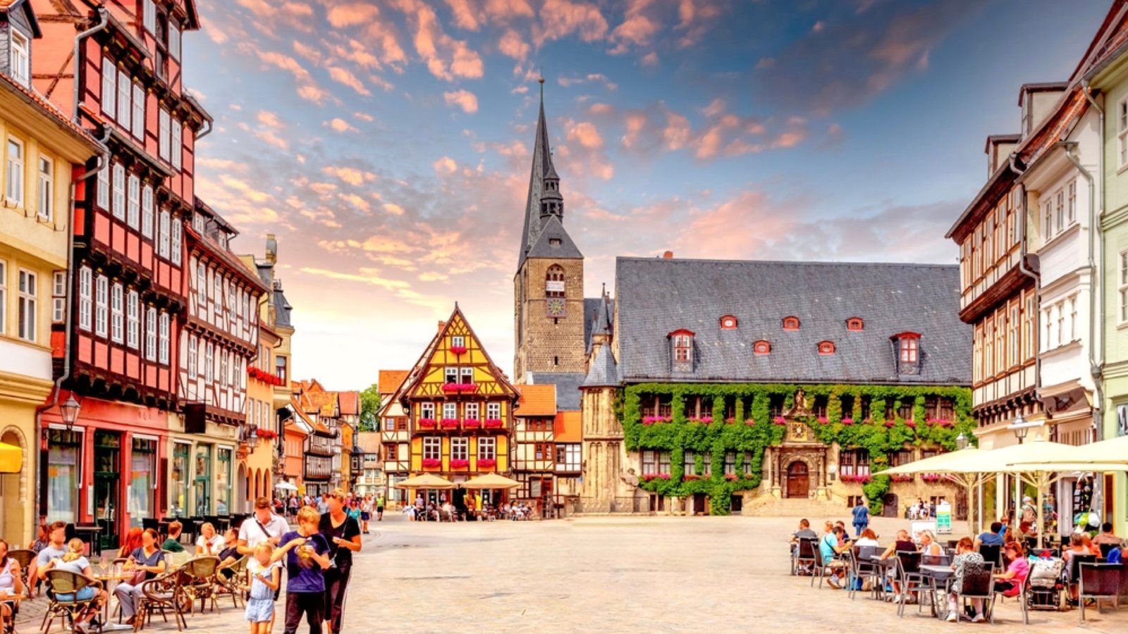
Quedlinburg, Saxony-Anhalt
Over 1,300 half-timbered houses from six centuries, but mysteriously absent from most Germany itineraries
Quedlinburg contains the largest collection of half-timbered buildings in Germany, spanning architectural styles from the 14th through 19th centuries in a town center that UNESCO recognized as “an extraordinary example of a European medieval town.” Yet somehow, it remains virtually unknown to international tourists.
The town’s royal history, it was the first capital of the Holy Roman Empire, created architectural wealth that survived both world wars and communist neglect. Recent restoration efforts revealed painted facades, intricate wood carvings, and architectural details that make every street corner a discovery.
The town’s location in former East Germany means infrastructure is still catching up to its tourism potential. Locals worry that sudden discovery could overwhelm their careful restoration efforts and the intimate atmosphere they’ve worked decades to rebuild.
The Schlossberg (Castle Hill) provides views over the medieval town center that rival any European UNESCO site, while the Klopstockhaus showcases how German Romantic poets lived. Local restaurants in 600-year-old buildings serve traditional Saxon cuisine that disappeared from most German menus decades ago.
Wismar, Mecklenburg-Vorpommern
Medieval maritime architecture meeting Baltic Sea beaches, but tourists flock to nearby Rostock instead
Wismar combines the best of medieval German architecture with Baltic Sea coastal charm, creating a destination that offers both cultural depth and beach relaxation. This former Hanseatic League city features brick Gothic architecture, medieval market squares, and a harbor where traditional sailing ships still dock regularly.
The town’s UNESCO World Heritage center showcases 800 years of maritime commerce history, while nearby beaches offer Baltic Sea swimming and coastal hiking that rivals more famous German coastal destinations. Local fishing boats still work traditional grounds, supplying restaurants with seafood so fresh it’s often caught the same morning.
The town sits just 30 minutes from the more famous Rostock, but visitors rarely make the connection. Locals appreciate the peace but worry about economic sustainability without more tourism revenue.
The Alter Hafen (Old Harbor) offers traditional boat tours through protected coastal wetlands where rare birds nest, while local restaurants serve Baltic herring preparations that represent centuries of regional culinary tradition.
Bamberg, Bavaria
UNESCO World Heritage city that’s more complete than Rothenburg but somehow escapes the tour bus circuit
Bamberg survived World War II completely intact, preserving a medieval city center so complete it feels like time travel. This former Holy Roman Empire capital features over 1,000 listed buildings, including a cathedral that houses the only papal tomb in Germany and the mysterious Bamberg Horseman sculpture.
The city’s unique position on seven hills creates varied neighborhoods connected by medieval bridges and staircases, while traditional breweries produce smoked beer (Rauchbier) using techniques unchanged since the Middle Ages. Local university students maintain vibrant cultural life without overwhelming the historical atmosphere.
The city appears on some beer tourism itineraries, and locals worry that discovery by brewery tour groups could overwhelm the traditional beer gardens where families have gathered for generations.
The Altes Rathaus (Old Town Hall) sits on an artificial island in the Regnitz River, but locals recommend the climb to Michaelsberg for panoramic city views. Traditional breweries like Schlenkerla serve smoked beer in medieval cellars that double as informal local community centers.
Cochem, Rhineland-Palatinate
Fairy-tale castle, endless vineyards, and half-timbered perfection, but Rothenburg gets all the attention
Cochem sits along the Mosel River like a medieval wine capital that never needed to advertise its perfection. The imposing Reichsburg castle overlooks steep vineyard slopes and a town center of half-timbered houses that house wine families whose viticultural traditions span centuries.
The surrounding Mosel Valley creates microclimates perfect for Riesling production, while traditional winemaking methods produce wines that reflect terroir impossible to replicate elsewhere. Local Weinfeste (wine festivals) remain authentic community celebrations rather than tourist performances.
Wine tourism is slowly discovering the Mosel Valley, and local families worry that commercialization could destroy the intimate wine-tasting traditions where visitors are welcomed into family cellars and treated to tastings that last hours.
The Pinnerkreuz viewpoint provides panoramic Mosel Valley views, while family wineries like Dr. Loosen offer tastings in medieval cellars where generations of the same families have perfected winemaking techniques dating to Roman times.
Görlitz, Saxony
Over 4,000 historical monuments from Gothic to Art Nouveau, but location near Polish border keeps it off tourist radars
Görlitz survived both world wars and communist rule with its historical center intact, creating what many architectural historians consider Europe’s best-preserved medieval city. The town features buildings from every European architectural period, creating walking tours through 900 years of Central European architectural evolution.
The city’s location on the Polish border means many visitors cross over for shopping, but few explore the German side’s architectural treasures. Recent restoration efforts revealed facades and details that showcase craftsmanship spanning centuries.
The location means lower costs than western German destinations, while Polish connections create cultural richness that purely German towns can’t match. However, locals worry that discovery could bring gentrification pressures that would force out families who’ve preserved these neighborhoods for generations.
The Obermarkt to Untermarkt walk passes through architectural periods from Gothic through Art Nouveau in just a few blocks, while the city’s use as a film location for period movies (The Grand Budapest Hotel) provides testament to its authentic historical atmosphere.
Lindau, Bavaria
Medieval island town with Alpine lake access and Austrian border proximity, but somehow Neuschwanstein gets all the Bavarian tourism
Lindau occupies an island in Lake Constance (Bodensee), connected to the mainland by bridges that maintain the town’s distinct island character. This former Free Imperial City features medieval architecture, Alpine lake views, and proximity to Austrian and Swiss borders that create unique cultural influences.
The lake provides swimming, sailing, and scenic boat trips with Alpine backdrops, while the medieval town center offers cultural attractions in a compact, walkable area. Local restaurants serve Lake Constance fish specialties that represent centuries of regional fishing traditions.
The town’s proximity to popular Alpine destinations means increasing visitor pressure, while locals worry that discovery by international tourists could overwhelm the island’s limited infrastructure and destroy the intimate lakeside atmosphere.
The lighthouse and Bavarian Lion harbor entrance provide iconic Lake Constance views, while traditional fish restaurants serve Bodensee specialties in buildings that housed fishing families for centuries.
The Secret’s Out: Germany’s Best-Kept Treasures
Sorry, locals, these destinations are too extraordinary to keep secret forever. Germany’s hidden towns offer experiences that famous destinations can’t match: authentic medieval atmosphere, traditional crafts and cuisine, genuine community culture, and the satisfaction of discovering places that most travelers never see.
These aren’t backup destinations when the famous places are too crowded, they’re often superior alternatives that provide deeper cultural experiences, better value, and the pleasure of feeling like you’ve discovered something special rather than just following guidebook recommendations.
The locals’ protective instincts are understandable, but Germany’s hidden gems deserve recognition for preserving authentic German culture, maintaining traditional crafts and cuisine, and creating communities where centuries of history remain alive rather than museumified.
Pack patience, curiosity, and respect for local traditions. These hidden German towns offer rewards that famous destinations can’t match, but only for travelers willing to engage with places as living communities rather than tourist attractions.

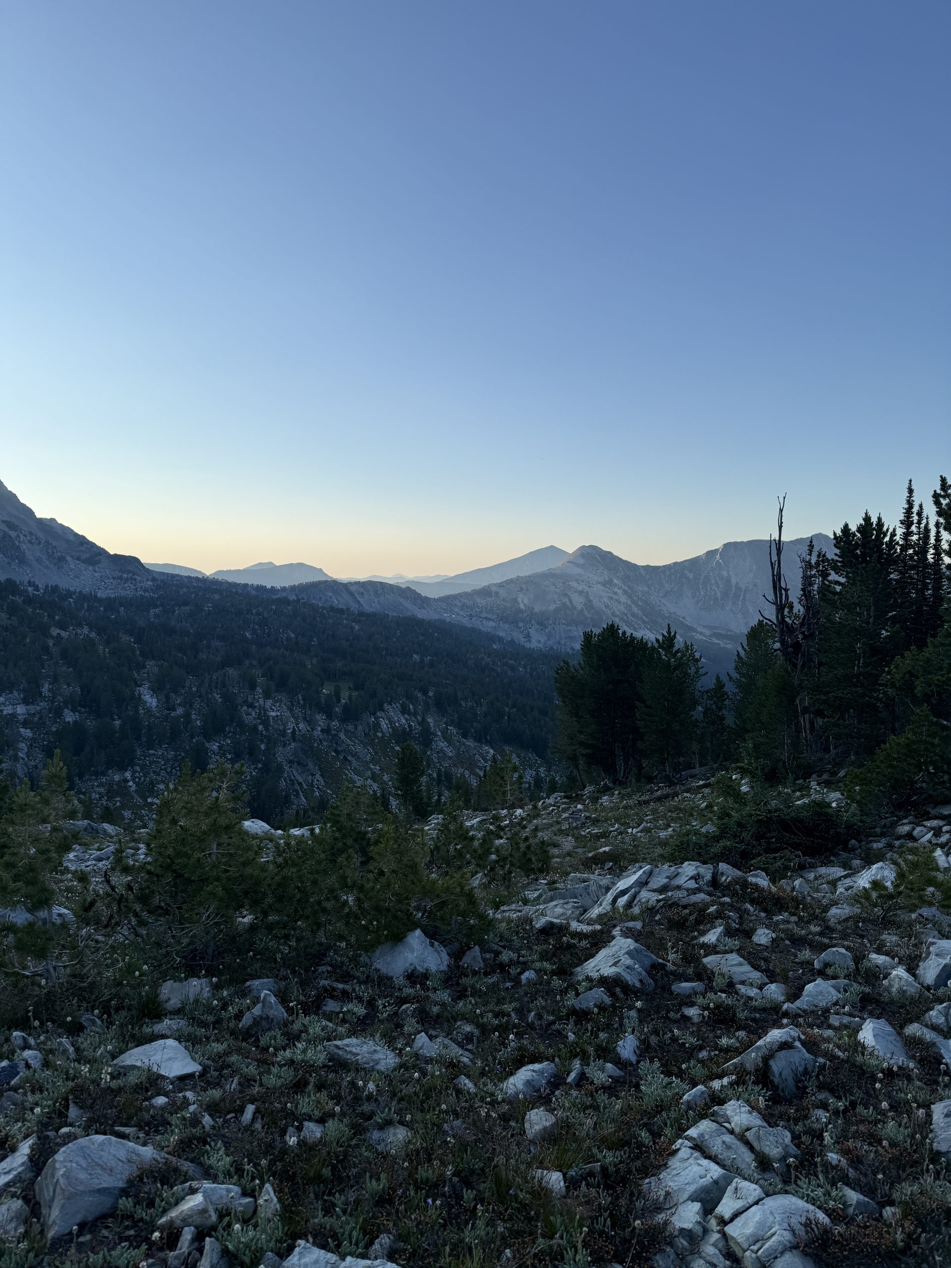
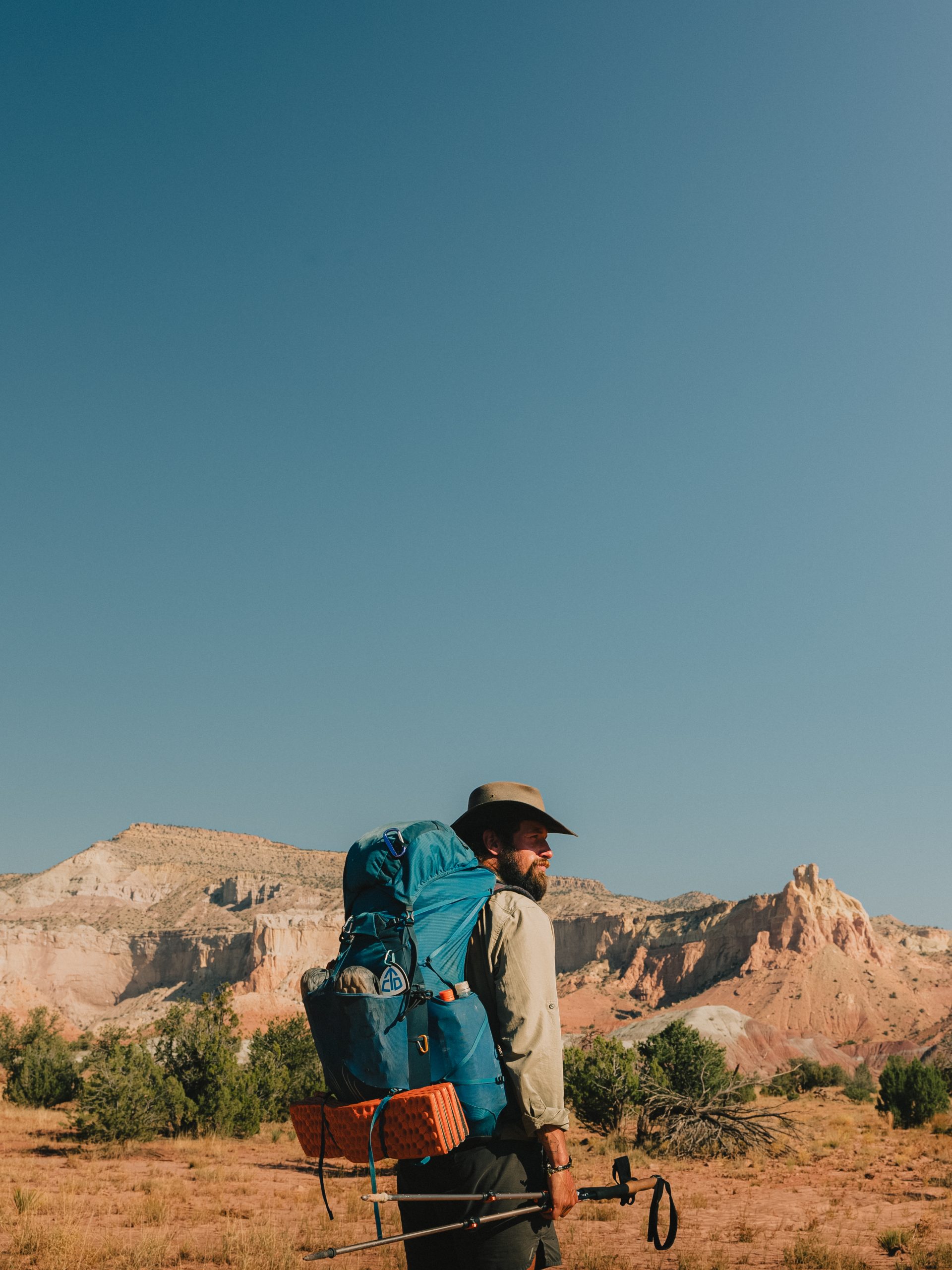
Day 26
Start: Tentsite, mile 413.6
End: Trout Lake, off mile 423.8
Miles hiked: 10.2 miles
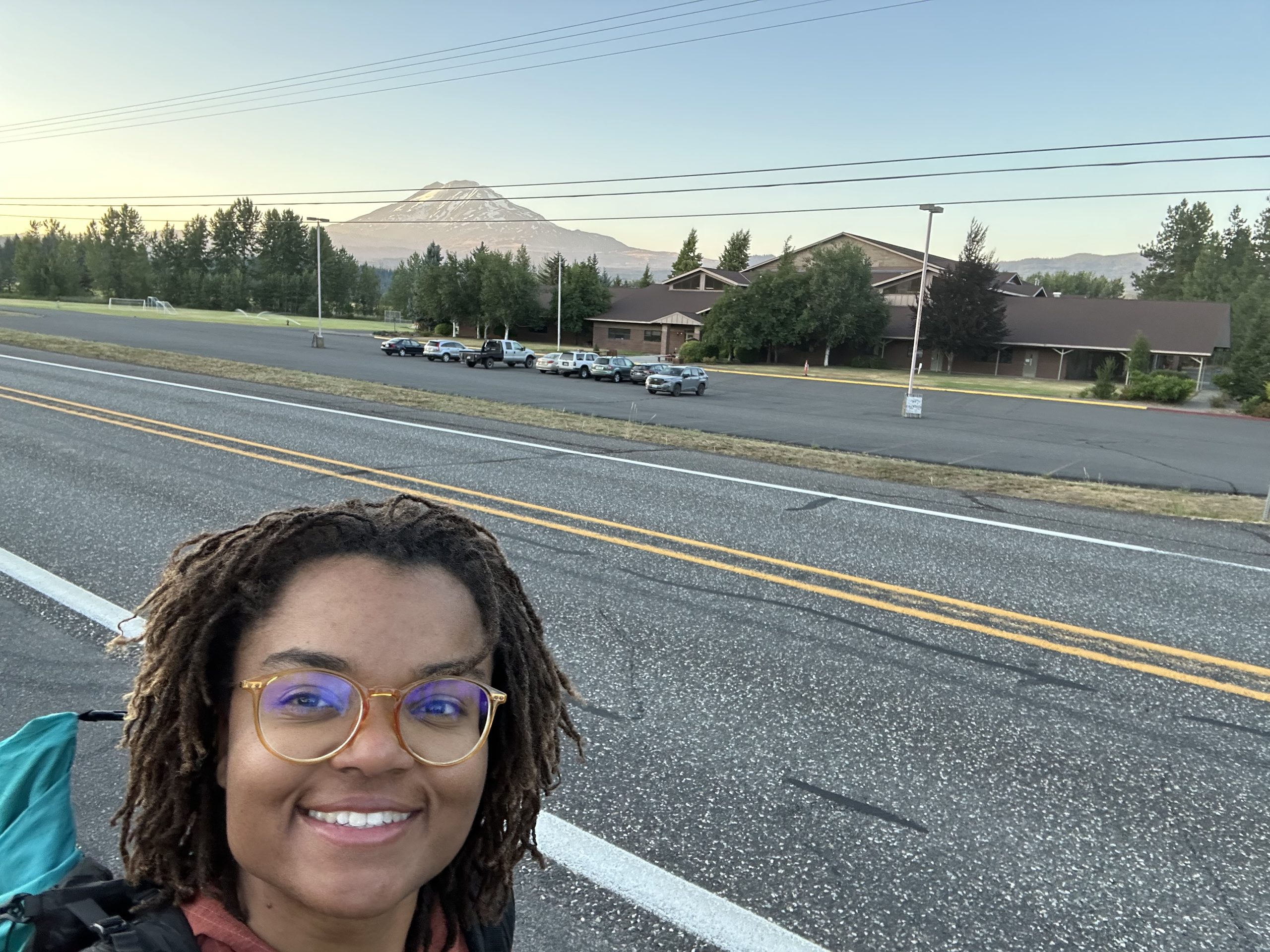
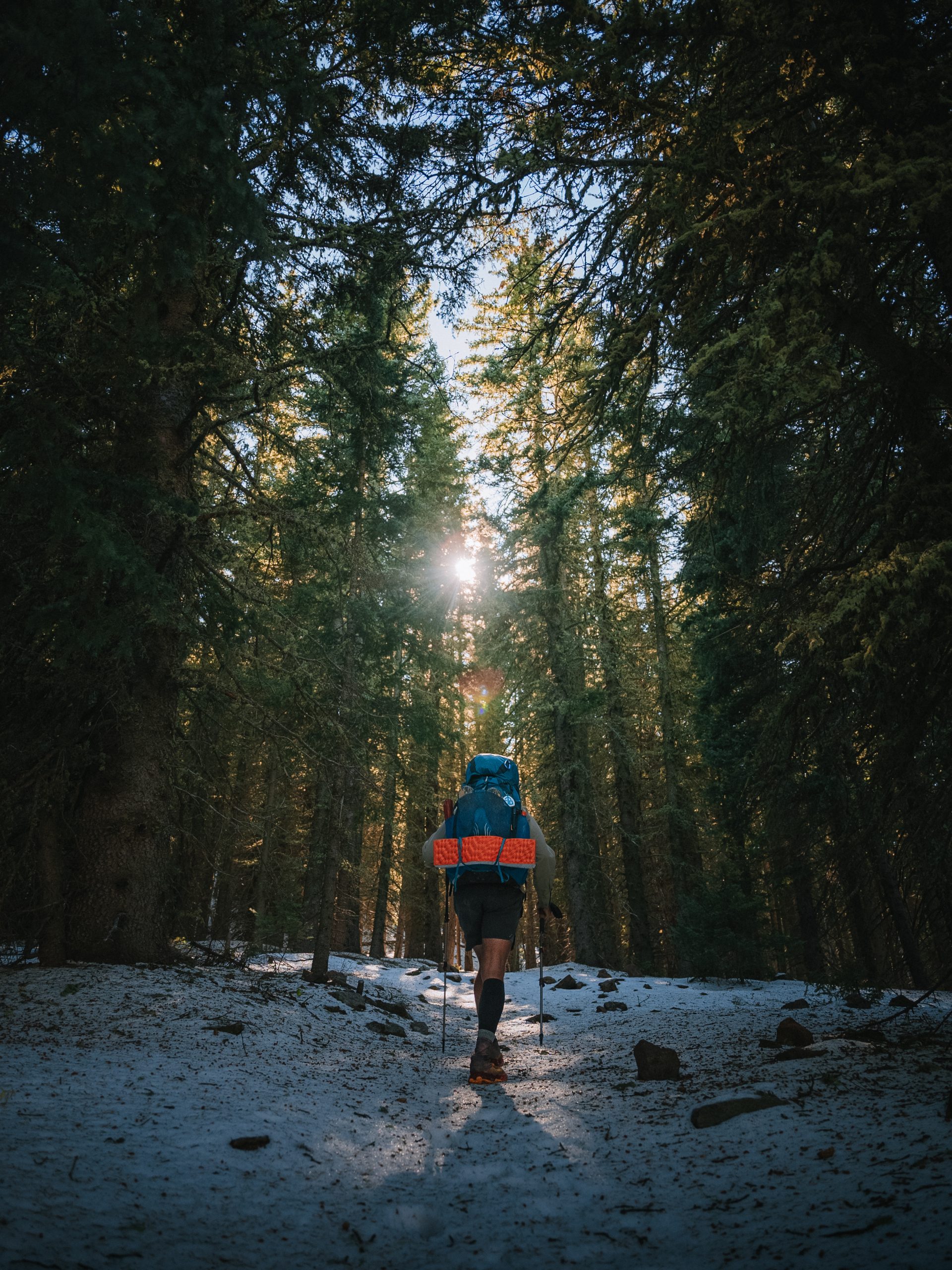
The NOBOs cleared out early in the morning, waving their goodbyes as I ate my breakfast. Today was another special day: town day! The plan was to head into Trout Lake, eat a hearty meal, and pick up my resupply box. Sun didn’t have a box there, but he was happy to tag along.
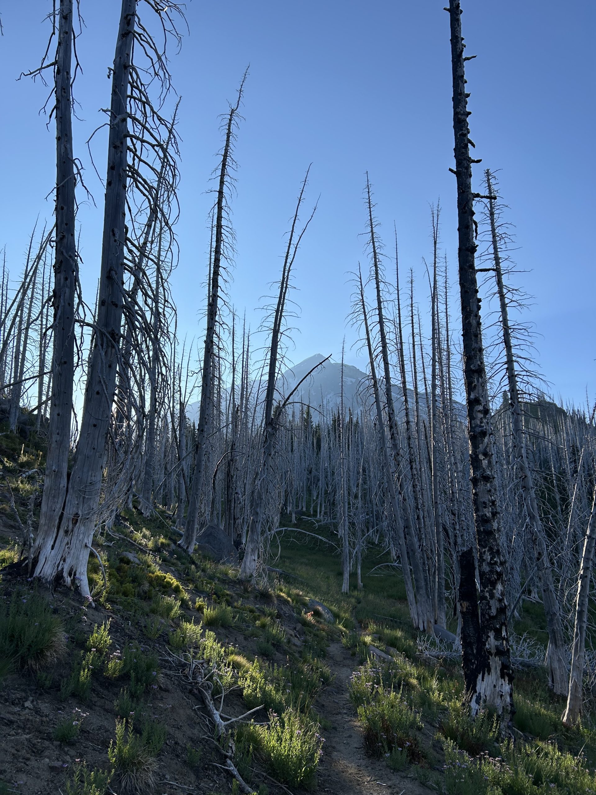
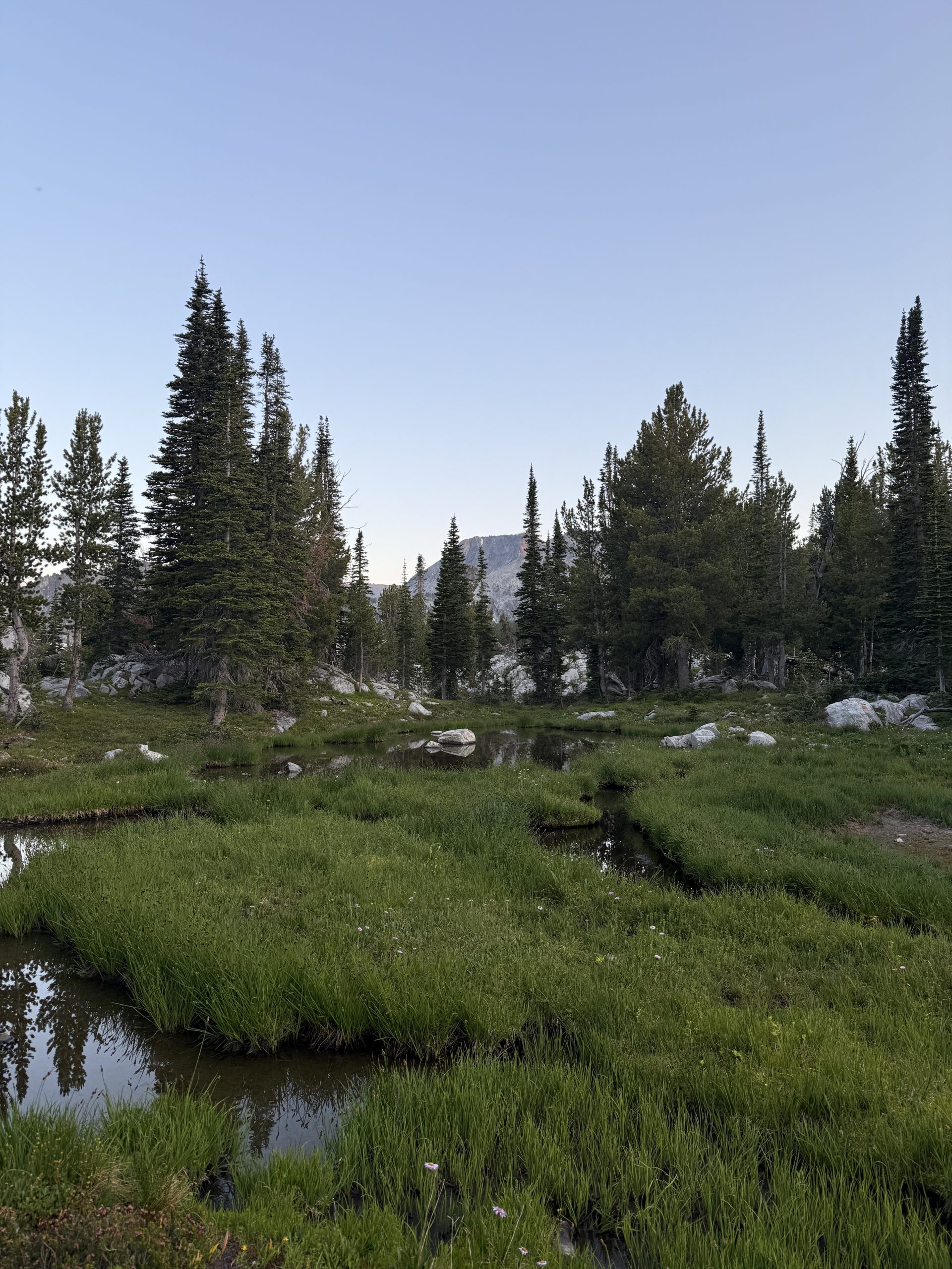
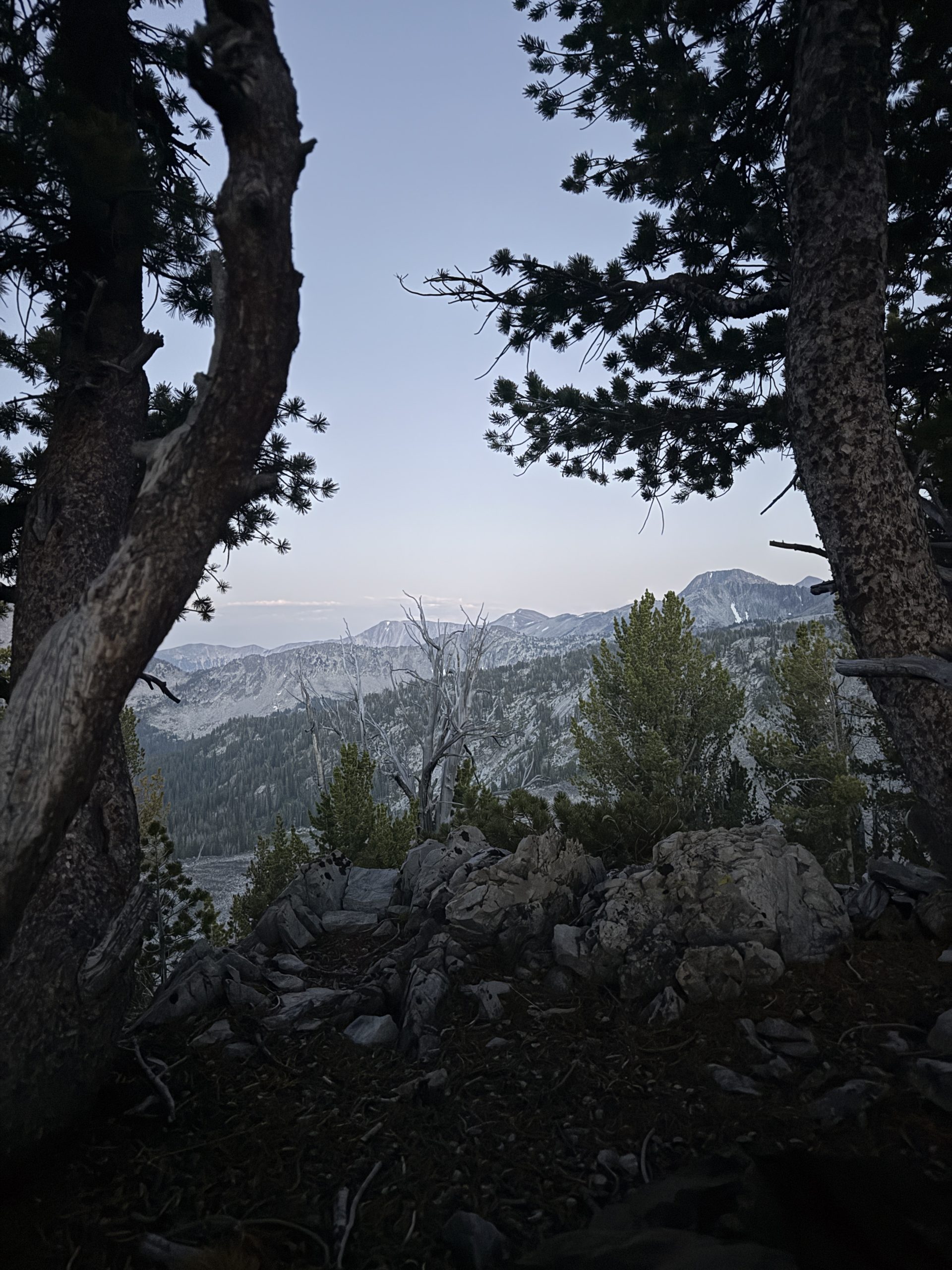
With only 10 miles in the day, the hiking was short and sweet. We ascended for a bit and were treated to another magnificent view of Mt. Adams. These mountains never get old. I enjoyed the view for a good portion of the day because I was passing through a burn zone. There were no trees to obstruct the sky. And since it wasn’t too hot and there wasn’t the immediate threat of a tree falling, I enjoyed the burn zone.
More and more NOBOs passed as the day progressed, and soon I found myself back under tree cover. At the bridge about 2 miles from the road to Trout Lake, I found the memorial to the hiker “Colors,” who tragically passed away in that spot during his thru-hike. Taking a moment to think about him, I took the chance to be grateful for the days that I have on the trail. Every day isn’t guaranteed, even when you’re living the dream.
With that somber note, Sun and I hiked the last two miles to the Trout Lake road and were lucky enough to get a hitch immediately. A NOBO PCT hiker who had to get off trail in March had dropped off another hiker as a favor and was headed back to Trout Lake just then. Awesome! Of course we talked trail in the van and shared our trail stories.
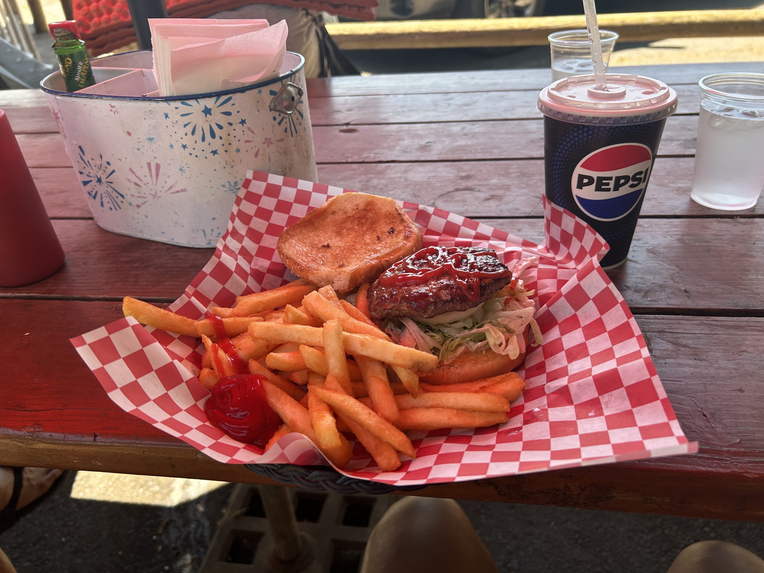
Once in Trout Lake, Sun and I immediately went to the cafe and got a burger, fries, and a soda. It hit the spot! Then, we crossed the street and walked about 300 feet to the General Store aka hiker central. We got set up with a campsite, laundry, shower, and got started on our chores.
To me, Trout Lake was a great trail town. Despite there not being too many places for hikers to stay, the people at the general store were super friendly, their selection of food and drinks was great for a small town, and the place was very relaxing. There weren’t a ton of of hikers around, so I figured that most people skipped this stop. But for me, even though I camped at the county park instead of getting a hotel room, I felt very relaxed and comfortable, which is exactly what I want from a zero day.
I spent a few hours in the afternoon chatting with Janitor since I missed him so much. There was no cell service for me in town but the store had WiFi available. When dinner time rolled around Sun, Nik (a young German hiker), and I headed down the road to the pizza place. It was about a mile walk, but the pizza was worth it! We split two pizzas and they were demolished when we left.
We all headed back to the campground after chatting with NOBO who was consistently hiking between 30 and 40 (sometimes more) miles per day. Although we weren’t going to hike that far tomorrow, we still needed our rest. The campground was quiet despite other non-thru-hiker campers being around, and I slept peacefully through the night.
And that’s a day in the life of a PCT SOBO hiker!
This website contains affiliate links, which means The Trek may receive a percentage of any product or service you purchase using the links in the articles or advertisements. The buyer pays the same price as they would otherwise, and your purchase helps to support The Trek’s ongoing goal to serve you quality backpacking advice and information. Thanks for your support!
To learn more, please visit the About This Site page.
Resupply 24 | Leadore, ID to Wisdom, MT
Author’s note: I am now in crunch time for getting to Canada and posts may be delayed as I try to push bigger days with less catch up time in town.
Day 93, 14.5 miles.
At breakfast this morning I flipped through the first annual CDT 2024 yearbook that my friend Lookout printed. I’m glad the inn had a copy. It can be a very lonely trail so it’s nice to see everyone together. In fact I’ll probably never see the SOBOs I met again until they show up in this yearbook, since they’re headed in the opposite direction. Class of 2025 hikers can go to advtgt.com/class-of-2025 to get notified when yearbook submissions open. Anyone can buy a copy.
Today I did a lot of stretching and logistics and finally organized a shuttle back to trail in the afternoon with a local named Carolyn. On the way up, I told her I had seen a golden eagle. “You know what I just learned about eagles?” she said. “Every forty years, they go hide somewhere and break their beaks and pluck all their feathers so they can regrow.” “Really! That’s insane,” I said. “To put yourself through so much suffering, in order to come out fresh.” Then I thought, well, it’s not unlike what I’m doing, is it? (Author’s note – this is MYTH – I only found out after I had internet later to fact check this).
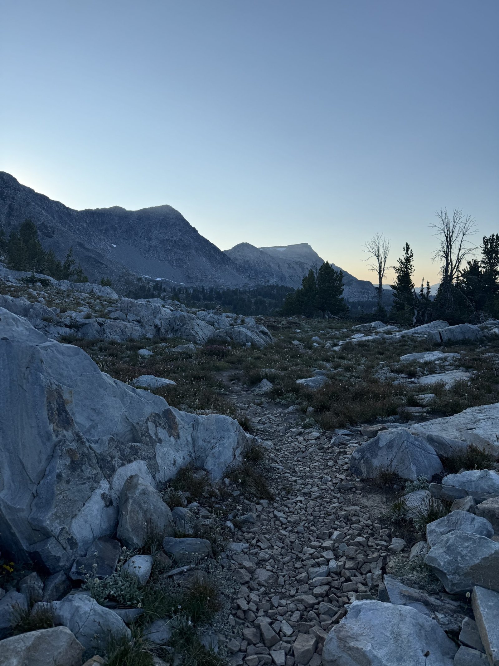
The hiking today was weirdly easy. It was well graded and well maintained. There wasn’t any crazy wind or biting flies or mosquitoes. I didn’t have to climb over deadfall or get my feet wet. It was cloudy and cool without any rain. The gates opened and closed easily. It was actually pleasant hiking. I thought, am I on the PCT? I kept waiting for the catch. I saw one road up ahead and thought, surely I’ll need to get up that. But the trail contoured around the bend. The cruisy trail gave me a lot of time to think.
On the ridgeline today, I walked past a lot of trees that grew leaned away from the wind. It wasn’t windy now but you could see the impression the wind had left on how the trees grew. Humans are the same. Whatever headwinds you grew up with may be gone, but you might still be compensating. You might still be leaned away instead of leaned into. One thing I love about mountains is that its contours mirror the way water carves into the sandbank on the side of the road. Like something so humble can be scaled up into something so grand. Everything in the physical universe is the same, just at a different scale. I am a human walking in an ecosystem. But I also contain ecosystems: in my gut, in each cell of my body. There is a logic to it all, and I fit into it. I am not separate from all of this. All of this is me, and I am all of this. That’s what’s in my brain when the world recedes and it’s just me and the woods. By the way, I hike totally sober. No drugs, no drinks.
Day 94, 33.3 miles.
The first existential crisis I ever had was when I was six or seven. I was walking to school with my mom, and in Seattle where I grew up, we get a lot of rain. And when there’s rain, there’s slugs. And one day I asked my mom: hey Mom, why do slugs exist? She looked at me and said, “why do you exist?” Oh, this broke my little brain. I mean, you tell me, you gave birth to me! And when I was 9, I read the whole of Gone With The Wind, which is not fourth grade reading material or content. It took me a month, but I wanted to see if I could finish the longest book I’d ever seen. So I guess I have not changed. I’m still out here thinking about existence and trying to finish the really long thing. I saw someone had written their name in sticks today on the trail. We humans love to write our names everywhere, like we’re so scared of dying and being gone that we’ve gotta make sure people knew we existed. Today I walked by Lemhi Pass, which is where Lewis and Clark, guided by the Shoshone woman Sacajawea, would have crossed the mountains looking for a northwest passage. I can’t imagine being in her position: hey we’re going to take over your neighborhood and everything around it but first can you show us around? There is a spring here called Distant Fountain Spring that is considered one of the headwaters of the Missouri-Mississippi river system. At this point I’ve walked past the headwaters of all the major rivers in the U.S.: the Rio Grande, the Colorado River, the Mississippi and Missouri Rivers, and the Columbia River (I’ll walk past this in Canada). All of it starts here on the continental divide.
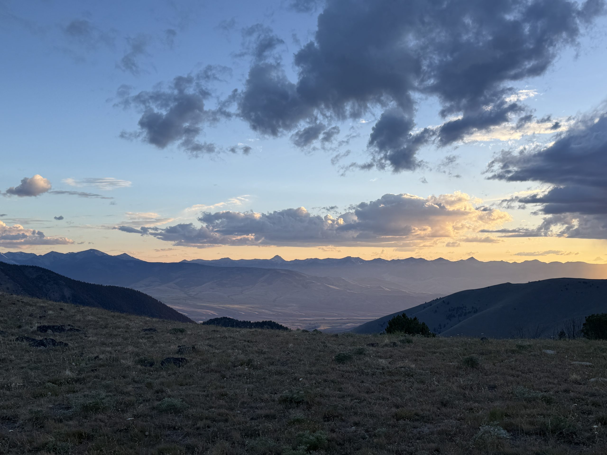
Day 95, 30.8 miles.
I met a steady stream of SOBOs all day today. Often we would do a quick exchange of information. “How was the hitch into town?” I’d ask passing SOBOs. “Is the stretch to Lima as rough as everyone says?” they would ask me in return. I chatted with two SOBO women for a while comparing notes about who we knew up and down trail. They told me a lot of SOBOs had already quit in the first 300 miles. “Brutal start in Glacier,” she said. “It’s hard terrain with a lot of up and down.” “Well a lot of NOBOs quit in the first 100 miles before they even get to the first town,” I said. “There’s no water and if you can’t make the mileage to the next cache you’re screwed.” “Brutal start on both ends,” she agreed. “People forget this is the most formidable of the triple crown trails.” Shortly after I left them I heard a voice call out: “Stitches?” It was Casper, one of the few fellow women who also did the Sierra with me in 2023 which was CA’s highest snow year on record and she went in without snow experience. She went on to complete the AT last year and is hiking this trail SOBO to finish her Triple Crown. I knew she was nearing the end of Montana but didn’t know exactly where I’d see her and it was so nice to see a familiar face from my first long trail. I told her about Wyoming and she told me about Montana. Meeting people going in the opposite direction means you’ll likely never see them again on this trail. But wherever you met, the two of you together have hiked the whole trail, and slowly you’ll each fill in the knowledge of the other until you’ve both completed it end to end. Later on, at least four SOBOs told me that I was about to walk in some incredible scenery. In the comments it seemed the NOBOs were not as impressed. “It’s a lesser Winds,” one wrote. But beauty need not be zero sum. The Winds can be beautiful without taking away from the beauty of this valley in Idaho. This trail is sometimes described as a string of pearls: moments of delirious beauty interspersed with mundane nothingness. You’d be remiss to focus only on the brightest pearl rather than appreciating all of them as they come.
Day 96, 36.4 miles.
Lately I’ve been thinking about the culture of this trail. I feel like I have a distinct sense of the trail’s culture even though I’ve hiked it almost entirely alone, seeing very few others. I expect many others have a similar experience. So where does this feeling of a collective culture come from? Certainly there is the vibe of each trail town and the people who help out along the trail corridor. I think it might actually be captured in the comments we leave for each other on FarOut. Of course the majority of them are utilitarian: this stream is still running, there’s two good campsites here, don’t miss this turn. But then there are the other comments:
A discussion in the comments of the Sacajawea Memorial about honoring the historical significance of Sacajawea.
Or the detailed ratings for gates along the trail: this one swings at a B flat. This one has a creative locking mechanism.
Or a series of comments at the intersection of the Oregon Trail, all of them from hikers who were primary school students in the U.S. at a certain time when we sat in computer labs and played the computer game Oregon Trail.
Or sometimes a comment gets downvoted for not being part of the culture, maybe about cutting switchbacks or taking following the redline too seriously.
When I’m hiking alone, reading these comments brings a little levity to the day. You feel like you’re still part of a community that shares an understanding of what it means to be hiking the CDT.
We think of gossip as idle chatter, but it actually helps create culture by defining bad behavior and good behavior. What the norms of a society are. And that’s what we hikers are doing in the comments.
Day 97, 9 miles into Wisdom, 15 miles out. 24.2 miles total.
Last night when I was looking at where I might stop to camp, I realized the comments from hikers noted the road going into Wisdom was very quiet and some waited two hours for a ride. Most of the SOBOs I had spoken to had hitched from a busier road into Darby, MT. But I had a pair of new shoes waiting for me at the post office in Wisdom, which was only open for two hours in the morning. So I wanted to stage as close to the road as possible and prepare to sit at the road waiting for cars for up to two hours. Right as I got to the road a car passed and I stuck out my thumb. No luck. No luck with the next couple cars as well. I hope this isn’t all the traffic I’ll get today, I thought. Then another car approached and slowed, then pulled over. I ran up to the window. It was a mother and son. “Where you headed?” She asked. “Into Wisdom,” “Oh, that’s where we’re going. We’ll take you.” Eileen dropped me off at the post office, I got my shoes and did my resupply, and then she took me out to lunch and gave me a ride back and invited me to come back anytime. Sometimes you have to let the wrong cars pass by so that the right car can pick you up. Life is abundant if you allow it to be. The CDT today overlapped with the Nez Perce trail which was a route the Neemeepu people used to access summer hunting grounds and later used to flee war brought by white settlers. As I walked in their footsteps I looked at the forest and thought about how the plants and trees are just plants and trees to me but the indigenous people here would have known how to use all of it; how to follow the rhythms of this particular landscape. I had to get into Wisdom to survive, but they could survive off this land. That is what it means to be indigenous to a place. For some reason the pass here is named after the white man who launched a surprise attack on the fleeing natives. Why immortalize someone for trying to kill people who are already leaving the land you’re trying to take over? And why take it over in the first place? Is that what we value in America? Are we proud of that?
xx
stitches
This website contains affiliate links, which means The Trek may receive a percentage of any product or service you purchase using the links in the articles or advertisements. The buyer pays the same price as they would otherwise, and your purchase helps to support The Trek’s ongoing goal to serve you quality backpacking advice and information. Thanks for your support!
To learn more, please visit the About This Site page.
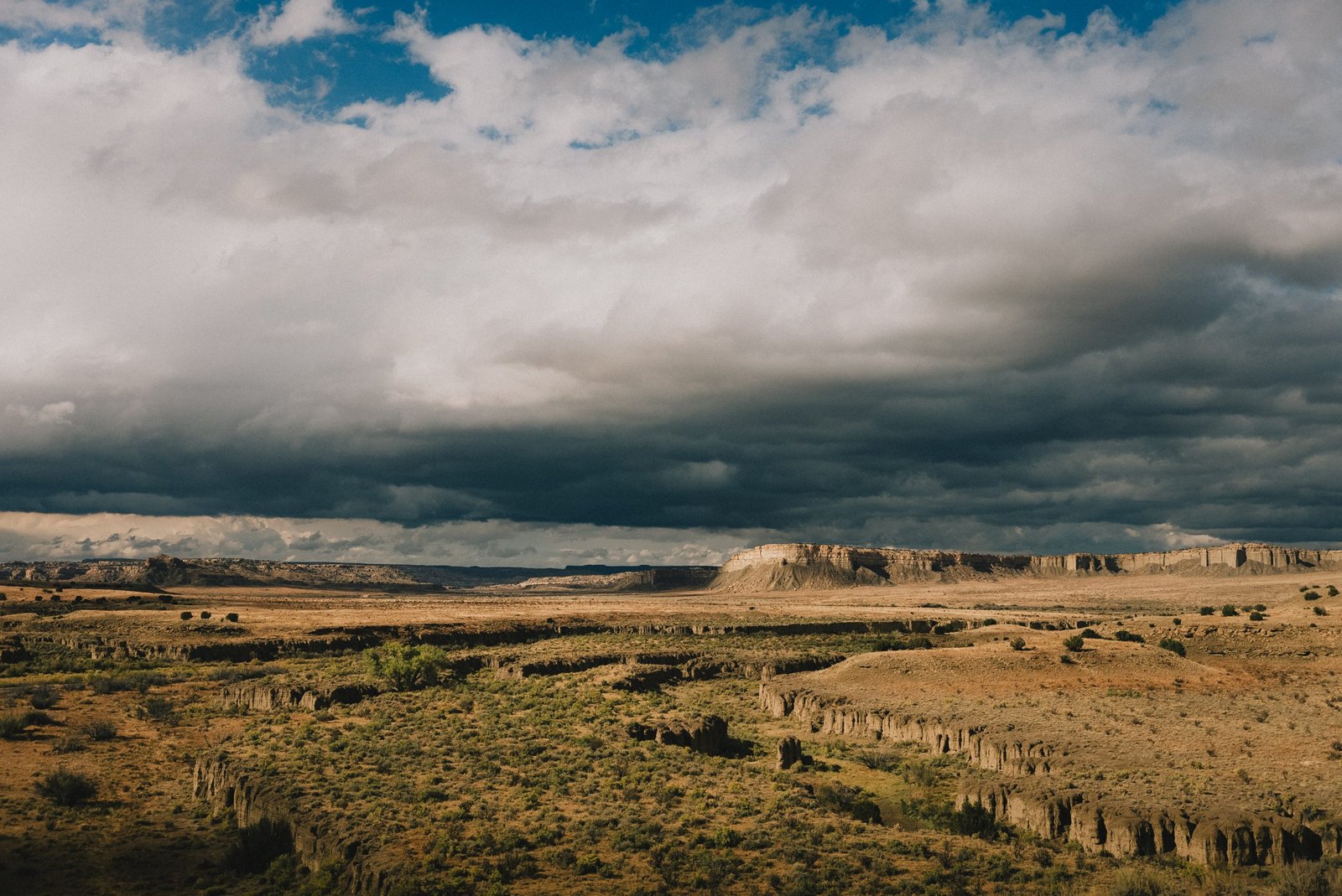
Monday, October 14th – Ghost Ranch, NM
I woke before the sun rose above the horizon. For the first time in a while, I slept deeply and warm – so warm that I even cracked my quilt open. It was a luxury I had forgotten about.
I took pictures of the sandstone cliffs as a wave of gold slowly gained over their native burnt orange color. Korn and I enjoyed the wonders of an all-you-can-eat buffet breakfast at the ranch, and soon after, I stepped back onto the trail.
The path led me along a gravel road nearing the Rio Chama, a major tributary river of the Rio Grande. A bridge carried me across the large body of water, and then the trail led me through the canyon as the light softened. By dusk, I was still walking, eager to make some miles and get closer to the next town – Cuba, NM. I ate dinner in the dark, near a rusty tire through that served as a water source. The moon rose full and clean above me, casting a pale wash of light over the dirt road and the surrounding woods. It was the kind of silence that made you sit up straighter. I felt it then – something. A presence. Like eyes behind the trees, watching from the shadowed timberline.
I kept walking, steady-footed and outwardly calm, but inside every alarm bell was clanging. Night hiking stirs a different kind of awareness – vision narrowed, sounds sharpened, the world shifting into shapes you can’t quite name.
Out here, darkness belongs to the predators.
After another hour of hiking, I camped just a few miles from the highway, on a patch of level ground. I felt proud – I’d pushed through and hiked more than I had planned to.
I. The Question
Wednesday, October 16th – Cuba, NM
I walked past scattered houses and barking dogs and reached the town of Cuba, NM. First stop: McDonald’s. Peg Leg and Syrup were there, as well as other familiar faces tucked in the corner of the place. I stuffed myself with food, then wandered to the dispensary. Word was, if you bought something, you could camp for free in their field out back. I picked up a pack of CBD gummies, hoping they might ease my foot ache a bit.
The field was tucked behind a marijuana grow, half-wild and fenced in. Not exactly your typical campsite. I looked around, laughed to myself. Sketchy, sure – but it had charm. One more odd place to call home, at least for the night.
After finishing my laundry, I found myself drifting back to McDonald’s like a sheep to its pen. McDonald’s was a haven out here – hot food, free Wi-Fi, long hours, and a warm place to sit that didn’t stink. It drew in all kinds – thru-hikers, yes, but bikepackers too. I ended up chatting with a British cyclist riding the Great Divide all the way from Banff. He looked worn in the same way I felt. I told him about the sketchy little field behind the dispensary. Told him he could crash there too. Two felt safer.
The next day, I woke to raindrops tapping my tent. When they let up, I packed and went for breakfast. The forecast wasn’t good – a storm was blowing in. And I thought the desert was sunny and dry! I gave it some thought, weighed my options, and stuck with my plan. I’d leave the next morning, no matter the weather. If my timing was right, I’d hit the summit of Mt. Taylor just after the storm cleared.
I spent the day ticking off the town chores – resupply, mailed out a box to Pie Town, then settled back into the strange comfort of McDonald’s.
At the grocery store, I was lining up my items – ramen, tortillas, Nutella – when the young cashier glanced at me and asked, flat as a board, “So, why are you walking anyway?”
I’d heard that question a hundred times before. Usually, I had an answer ready. But the way he said it – like it didn’t matter, like he didn’t expect anything true to come out of my mouth – hit different. For a moment, I just stood there. Then I gave him the safe, generic version. The one we all fall back on when we don’t want to explain too much: “I just wanted to travel and explore the country. You know, go on an adventure.”
Even as I said it, I knew it wasn’t right. It didn’t sound like me.
I walked out into the parking lot with a grocery bag in one hand and something heavier in the other. Four months. Over two thousand miles. And I still couldn’t say, with any certainty, why.
Friday, October 18th – 24 hours later
I climbed up one small mesa and watched the wind whip the sand into swirling dust devils. The wind had fought me the whole day. I wore sunglasses just to keep grit out of my eyes. The sky had darkened during the afternoon, and rain threatened. I found camp wedged between three low-standing trees – the only protected spot for a few miles around. My tent flapped in the wind, and rain started tapping the tent. I couldn’t settle. I thought about the border, wondered what weather I’d meet there. I prayed for sunshine and blue sky.
I told myself what I always do: Everything is temporary.
The next morning, rain woke me. I waited it out and then stepped out of my tent and into a world transformed. Fog tangled around the cliffs and mesas like smoke. The light was dim, almost dreamlike. A heavy layer of dark clouds laid above the horizon. I started walking with difficulty – the ground had turned to slippery paste. It wasn’t used to so much water. Each step was a gamble. Clay clung to my shoes like bricks, weighing them down. I moved slowly. The rain fell on and off – never enough to quit, but just enough to wear me thin.
The whole day, I didn’t see a single soul. I walked alone, with my thoughts, into this barren, muddy, relentless country.
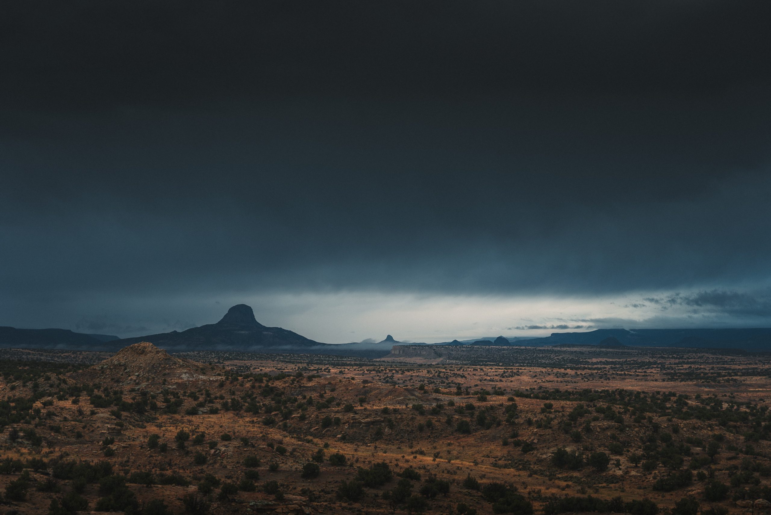
In the afternoon, a break in the clouds let the sun through. But not for long. After crossing a shallow river that had swollen with the latest rainfall, I saw the climb ahead – dark clouds massing over it like a warning. Lightning cracked the sky open across the ridge. I waited for half an hour behind a cluster of trees near an empty water cache, watching the thunderstorm closely. When it passed, I moved fast. Who knew when the next one would hit – there was never just one.
The trail climbed fast and steep. I was soaked in sweat and breathing hard when the sky lit up again, white and sudden. I didn’t wait for another warning. Quickly, I found a flat spot sheltered under a few trees and pitched my tent as fast as I could. Soon after I had entered my tent, hail pounded like marbles on the ground. Thunder followed, deep and brutal, like drums at a metal concert – raw, deafening, and close. I could feel it in my bones, in my chest. It was right above me.
Flashes of light burst through the fabric of my shelter, one after another. It felt like watching fireworks from inside my room on Bastille Day. I used to hate fireworks as a kid. But tonight, I wasn’t scared. I was in awe in front of this display of raw power. Lightning kept tearing through the sky, each bolt shredding the darkness like a blade through paper. I laid still.
Then, through the storm, I heard voices – the first I’d heard in over a day. Peg Leg and Syrup. They’d camped farther down the mountain, I heard them say as they passed. Sounded like they were moving on.
II. Tsoodzil, the Turquoise Mountain
In the morning, I finished the climb and stepped onto the flat top of the mesa. Visibility was low – a heavy mist clung to everything, swallowing the horizon. Charred trees leaned along the path, their limbs twisted and lifeless. Crows cut through the fog, cackling as they vanished between the few standing trunks. I felt as if I were walking into the set of a Tim Burton film.
Later, the wind blew the mist away, and for the first time in the past two days, I saw blue sky and felt the warmth of the sun. The trail was easy, but dull. The water carry was long, but the cool air helped. By the end of the day, I made camp beneath tall pines as the sun melted into the horizon. Finally, I was dry and warm. That night, I didn’t put my rain fly on and fell asleep while watching the stars appearing one by one in the darkening sky.
Monday, October 21st – Mt Taylor Alternate
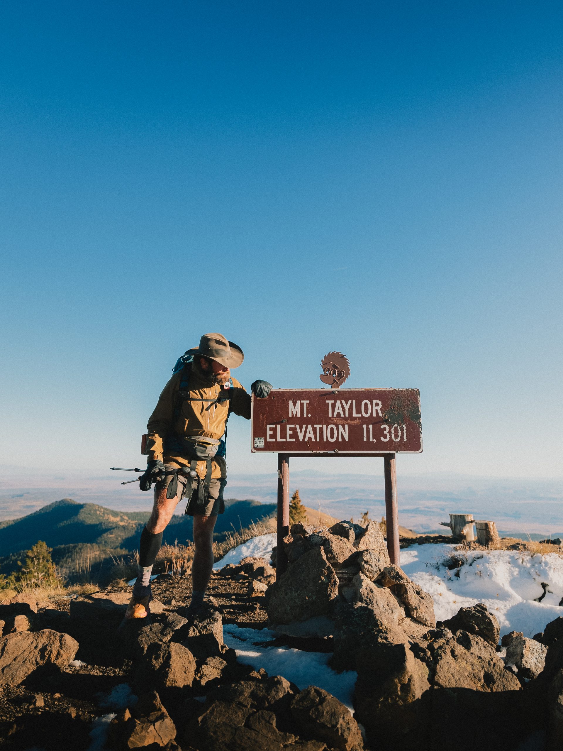
I woke up cold. A layer of frost clung to my gear. The storm had dragged in a cold front behind it – temperatures were dropping, and it was clear now: fall had settled in for good. I passed a hunter’s camp and took the Mt. Taylor alternate – a dirt road that went up most of the way. In Navajo, Mt Taylor was known as Tsoodzil (Turquoise Mountain) and was one of the four sacred mountains that marked the Navajo homeland.
The sky was clear, the air crisp. I was surprised to walk through patches of snow near the summit. Finally, by 3 pm, I reached the top. I waited for sunset, shivering in the wind. But the panorama was worth it.
I hiked down in the dark and set up on the side of another dirt road. Tired, but satisfied.
The next day, I walked into Grants and checked into Motel 8 just after noon for a long-needed shower and rest. Peg Leg stopped by my open door, and we caught up. I told her I’d heard her and Syrup walk past my tent during the stormy night. She shared her side.
That night, they’d camped at the bottom of the mesa, just a few hundred yards below me. Both in their tents, sheltering from the hail, when suddenly she heard a rushing roar. The ground shook, but it wasn’t thunder. Before she could react, a wall of water hit the tent – a flash flood. They scrambled out, grabbing what they could.
Soaked and with half their gear lost, they decided they couldn’t stay out there. They pushed on, heading straight to Grants – about 60 miles nonstop. It sounded like hell.
Hearing this, I empathized with them and felt grateful for myself. Lucky even. I realized I’d only avoided the same experience by pushing further uphill. That realization sat heavy. Close calls often did.
-

 Brand Stories2 weeks ago
Bloom Hotels: A Modern Vision of Hospitality Redefining Travel
-

 Brand Stories1 week ago
CheQin.ai sets a new standard for hotel booking with its AI capabilities: empowering travellers to bargain, choose the best, and book with clarity.
-

 Destinations & Things To Do2 weeks ago
Untouched Destinations: Stunning Hidden Gems You Must Visit
-

 Destinations & Things To Do1 week ago
This Hidden Beach in India Glows at Night-But Only in One Secret Season
-

 AI in Travel2 weeks ago
AI Travel Revolution: Must-Have Guide to the Best Experience
-

 Brand Stories1 month ago
Voice AI Startup ElevenLabs Plans to Add Hubs Around the World
-

 Brand Stories3 weeks ago
How Elon Musk’s rogue Grok chatbot became a cautionary AI tale
-

 Asia Travel Pulse1 month ago
Looking For Adventure In Asia? Here Are 7 Epic Destinations You Need To Experience At Least Once – Zee News
-

 AI in Travel1 month ago
‘Will AI take my job?’ A trip to a Beijing fortune-telling bar to see what lies ahead | China
-

 Brand Stories2 weeks ago
Contactless Hospitality: Why Remote Management Technology Is Key to Seamless Guest Experiences
You must be logged in to post a comment Login