
Destinations & Things To Do
11 of the best places to visit in July 2025
It’s all about the heat come July, with the northern hemisphere’s sizzling summer temperatures adding an extra shine to some of the world’s most popular travel destinations. Europe is bathed in sunshine, bringing the Mediterranean beach scene to the forefront, while in the tropics dry season signals prime wildlife spotting opportunities. Colder regions also benefit from the heat, with Arctic areas at their most accessible. Finally, there are the summer festivals and celebrations that bring fun and adventure to many destinations around the world.
Plan your July vacation with this pick of our favorite places to go.
1. Zanzibar, Tanzania
Best for relaxing by the Indian Ocean
Advertisement
The spice island Unguja – known to most as Zanzibar – is a scent sensation. Stroll the maze-like alleys of old Stone Town on a warm evening, and you’ll catch whiffs of nutmeg, clove and cinnamon in the Darajani Market, frying seafood at stalls in Forodhani Gardens, and the aroma of black coffee in Jaws Corner, where older locals gather to watch TV and gossip. Zanzibar’s historic heart, with its crumbling palaces and heartrending slavery-era relics, is just one gem of this treasure-trove island, at its best in July, in the middle of the dry season. Board a dhow to snorkel off the west coast, watching for dolphins; sniff the leaves and buds of a spice plantation; and find your own patch of coral-sand perfection on one of the wonderful beaches.
2. Westfjords, Iceland
Best for a road trip under the midnight sun
Iceland’s far northwest is crowned the Westfjords, spectacular fjords, glacial valleys and sheer scarps ice-scoured over millennia. The completion of the Dýrafjörður Tunnel in 2020 made possible a new road trip: the Vestfjarðaleiðin (Westfjords Way), a 950km (590 mile) circular drive with branches reaching the wildest highlights, offering a peaceful alternative to the popular Ring Road. Get behind the wheel in high summer, when roads are clear and night never comes, and when breeding puffins and other seabirds throng the soaring seacliffs of Látrabjarg. Of course, you’ll want to park up to explore on foot, too to spot an Arctic fox among the orchid-specked wilds of Hornstrandir Nature Reserve, to join seals on the pink-sand beach of Rauðasandur, to soak in Drangsnes geothermal pool, to gawp at Drangajökull glacier and the seven tiers of Dynjandi Falls, and to meet the smiling, independent people of this long-isolated region.
Planning tip: The Vestfjarðaleiðin peels off from Rte 1, the main ring road, 111km (69 miles) north of Reykjavík, a little further from Keflavík International Airport. Allow at least a week to circuit the Westfjords.
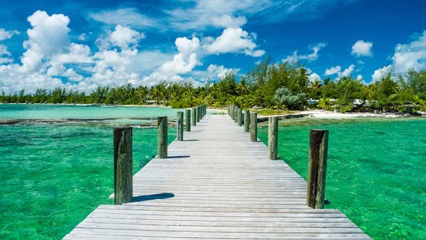
3. Andros and Bimini, the Bahamas
Best for wildlife and few crowds
The Bahamas are almost the Caribbean – yet, crucially, not quite. True, this speckle of islands and cays between Cuba and Florida boasts serene waters and beautiful beaches. But summer here, though “rainy,” is less afflicted by the storms that often hit other islands. July brings calm, clear, warm seas, ideal for enjoying superb diving and snorkeling off tourist-light Andros; its east coast is protected by the world’s third-longest barrier reef. Hop across to Bimini for manta ray encounters (peaking in July, when sharks are less prevalent) and the chance to come face to smiling beak with an Atlantic spotted dolphin. Add mangroves, excellent fishing, thriving birdlife and white-powder beaches, but subtract crowds – Andros is even quieter and better value in July.
4. Northwest Territories, Canada
Best for wild rivers and Indigenous culture
This vast region of tundra and taiga is as empty as it is wild, with a population smaller than the tiniest Caribbean nation scattered across a land nearly as large as Mongolia. To discover the natural and cultural wonders of the Northwest Territories, take a river journey into its untamed heart, possible for just a few weeks from late June when temperatures are (relatively) balmy and days stretch forever. Canoe a stretch of Canada’s longest river, the Deh Cho (Mackenzie); raft the South Nahanni from thundering, 96m-high (315ft) Virginia Falls in the sky-piercing Mackenzie Mountains; or enjoy a gentle kayak on Great Slave Lake, North America’s deepest. En route, learn about the traditional culture of the Dene peoples who have adapted to this challenging environment over tens of millennia, and watch for caribou, Dall sheep, black bear, moose and wood bison – the continent’s largest land mammal.
Advertisement
5. Coral Coast, Western Australia
Best for rays, whale sharks and humpbacks
Stretching over 1000km (621 miles) between Cervantes and Exmouth, the Coral Coast of Western Australia encapsulates much of the country’s appeal in miniature, making this relatively little-touristed stretch ideal for a winter road trip through empty expanses. Here, you’ll discover dramatic rock formations – the Pinnacles, limestone needles punching through the sand near Cervantes – and russet Tumblagooda Sandstone gorges in Kalbarri National Park. You’ll experience surfing and subaquatic adventures along the world’s largest fringing reef – 300km (186 miles) of coral that’s home to some 500 fish species. And you’ll meet miraculous marine wildlife, like when whale sharks gather in their hundreds on Ningaloo Reef (March to July), along with manta rays – more numerous off Exmouth May to September – and humpbacks too.
6. Aarhus and Jutland, Denmark
Best for sunny days in a cultural and culinary hot spot
Denmark’s second city is buzzier than a beehive. Founded by Vikings some 13 centuries ago, today Aarhus is eminently contemporary, with its groundbreaking ARoS art museum, rejuvenated waterfront cultural center, Dokk1, and innovative Iceberg apartment blocks. Even the Moesgaard Museum, home of the 2000-year-old, bog-preserved Graubelle Man, offers a cutting-edge tour through the past. Come evening, the city reveals its true colors, with cafes, cocktail bars and clubs showcasing that quintessentially Danish blend of smiles and smarts. High summer brings a host of festivals celebrating flowers, jazz, Viking heritage and more, plus warm sun (nudging 20ºC/68ºF) for basking on sandy Baltic beaches: try Den Permanente near the center, silky-soft Bellevue just to the north, and the blissfully empty strands of eco island Samsø, just a short ferry ride away.
7. Via Dinarica, Eastern Europe and Western Balkans
Best for a long-distance hike
Parts of the former Yugoslavia have developed rapidly since its breakup: Croatia’s much-vaunted coast, for example, is bustling in summer. Yet in hamlets speckling the remote higher reaches of the Dinaric Alps, time seems to have stood still. The best way to immerse yourself in traditional mountain culture is to trek the relatively new Via Dinarica. Its 1200km-long (746-mile) waymarked White Trail snakes southeast from Slovenia through Croatia, Bosnia and Hercegovina, Montenegro and into Albania’s Accursed Alps, conquering the highest peaks en route. Sunny summer days, when snow’s melted from the loftiest sections, beckon hikers through the uplands south of Sarajevo, past the glacial lakes and forested ridges of Sutjeska National Park (the country’s oldest and largest) across the border into Montenegro, skirting Tara Canyon (Europe’s deepest) and through UNESCO-listed Durmitor National Park, meeting shepherds and bedding down in isolated mountain huts en route.
Planning tip: Access the trail from Split (Croatia), Sarajevo or Podgorica. Experienced, fit hikers cover the 400km (248 miles) or so between shepherd-village Lukomir and the trail’s endpoint, Valbona (Albania), in about two weeks. Alternatively, plan a Bosnia loop from Sarajevo, visiting Lukomir, Sutjeska National Park and climbing Maglić (2386m/7828ft), the highest peak in Bosnia and Hercegovina.
8. Saskatoon, Saskatchewan, Canada
Best for fresh food and craft brews
Peak summer typically means peak crowds – but on Canada’s endless prairie, it’s not hard to lose the hordes. Landlocked Saskatchewan is a landscape of space and silence – indeed, an audio-ecologist deemed its Grasslands National Park one of the world’s quietest places. It’s also a great place to eat and drink. The province is the breadbasket of Canada, encompassing 50% of its arable farmland, not to mention a heap of extremely photogenic grain silos. Super-cool Saskatoon, which sits amid all this fertility, has become one of the country’s hottest foodie spots. A raft of distillers, craft brewers, artisan bakers and cocktail shakers have popped up in the small-but-mighty “Paris of the Prairies.” Take a foodie tour and cooking class, and visit nearby farms to meet producers. July also sees the sweet, nutty Saskatoon berries ripen – try them in everything from pies to wine.
9. Alta Badia, Italy
Best for high-altitude hikes
If the Dolomites are the Alps at their most magnificent, the Alta Badia valley in South Tyrol promises the Dolomites at their tastiest. This jagged array of deep valleys, high plateaus and piercing pinnacles in northern Italy echoes with poignant history: between 1915 and 1918, Italian and Austro-Hungarian forces fought amid these unforgiving peaks, and today you can hike routes such as the Kaiserjäger to discover their trenches and gun emplacements. Alta Badia is renowned for its skiing, but in summer, the cable cars and mountain huts reopen to serve hungry hikers, cyclists, paragliders and trail runners instead. The region is spangled with Michelin stars, but even simple refuges (mountain huts) dish up good-value but top-notch cuisine (think mountain cheeses, pasta and strudels).
10. Colombia
Best for diverse landscapes
With Caribbean beaches, mountains, plains, jungle and desert, Colombia encompasses an astonishingly diverse array of landscapes and correspondingly varied climates. July and August bring a period of drier weather perfect for touring fincas (coffee farms) amid the beautiful, rolling hills of the Zona Cafetera; admiring dazzling birdlife in Reserva Ecologica Rio Blanco; sleeping beneath the stars among the cacti and otherworldly rock formations of the Tatacoa Desert; hiking the lush highlands around Popoyán; and discovering the pre-Columbian tombs, petroglyphs and huge carved heads around San Agustín and Tierradentro. Also visiting this month are giants: between June and November, humpbacks calve off Colombia’s Pacific coast.
Planning tip: Join a whale-watching tour in Nuquí or from Buenaventura into Bahía Málaga to spot breaching behemoths. It’s also the driest month to spy sloths and pink river dolphins in Colombia’s slice of the Amazon.
11. Khardung La, India
Best for a motorcycle adventure through mountains
There are breathtaking road trips – and there are literally breathtaking road trips. The Khardung La is both. This 5600m (18,373ft) pass near Leh, amid the Indian Himalaya, was a key thoroughfare on the Silk Road and is now one of the world’s highest drivable highways. Crossing it by bus is an adventure; crossing it astride a classic Enfield Bullet motorbike even more so. Either way, both mountain views and soaring altitudes will leave you gasping. The roads here are only open for a few months a year, so make the most of the warm, snow-free conditions.
Planning tip: Bikers could zigzag up from Manali (Himachal Pradesh) to Leh (Ladakh) – one of the world’s best mountain rides. Or fly from Delhi to Leh to visit the town’s Tibetan-style palace and stupas before taking the Khardung La into the isolated Nubra Valley.
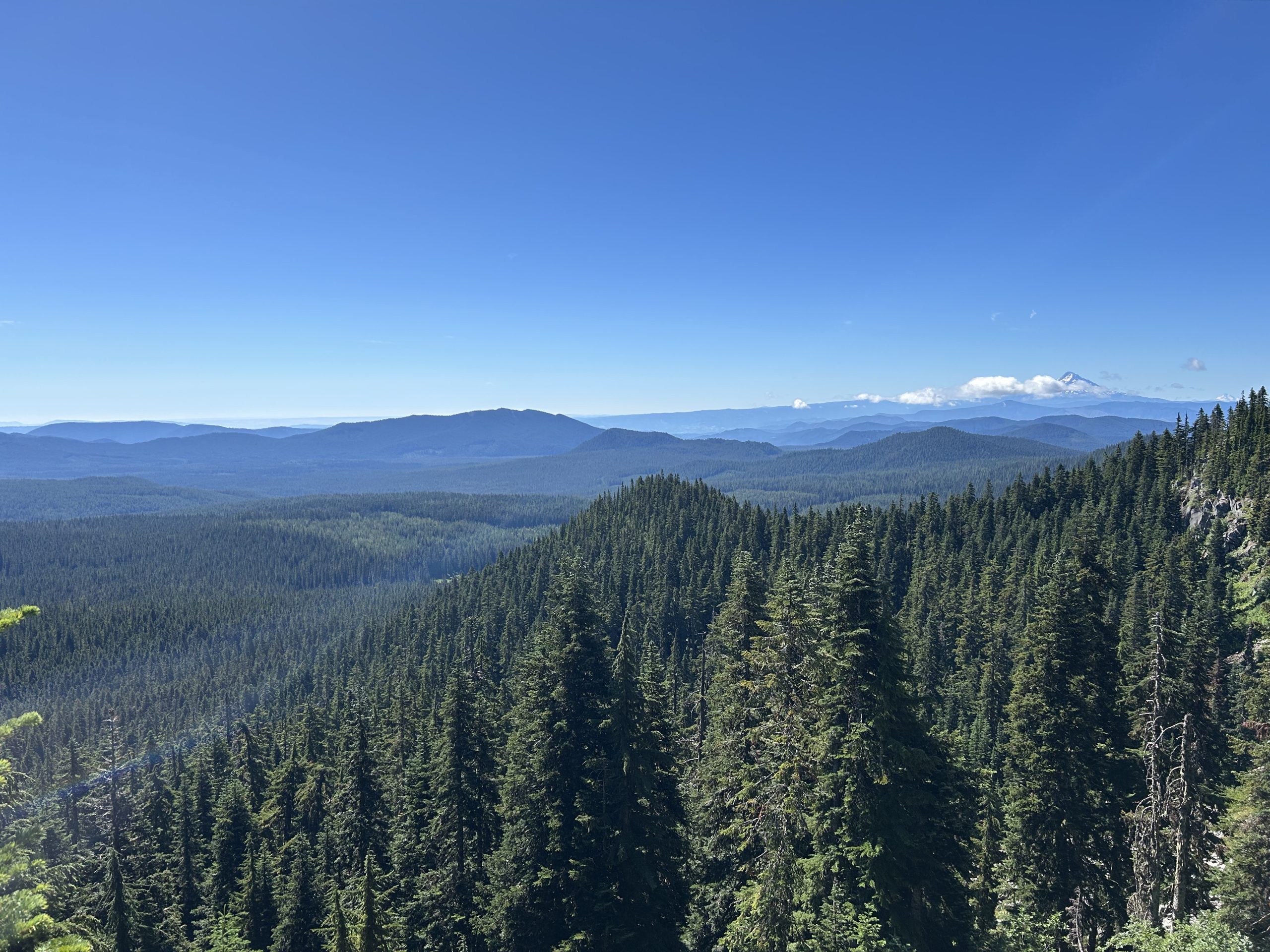
Day 28
Start: Stealth Site, mile 443.7
End: Tentsite, mile 470.5
Miles hiked: 21.6 miles, 26.8 trail miles
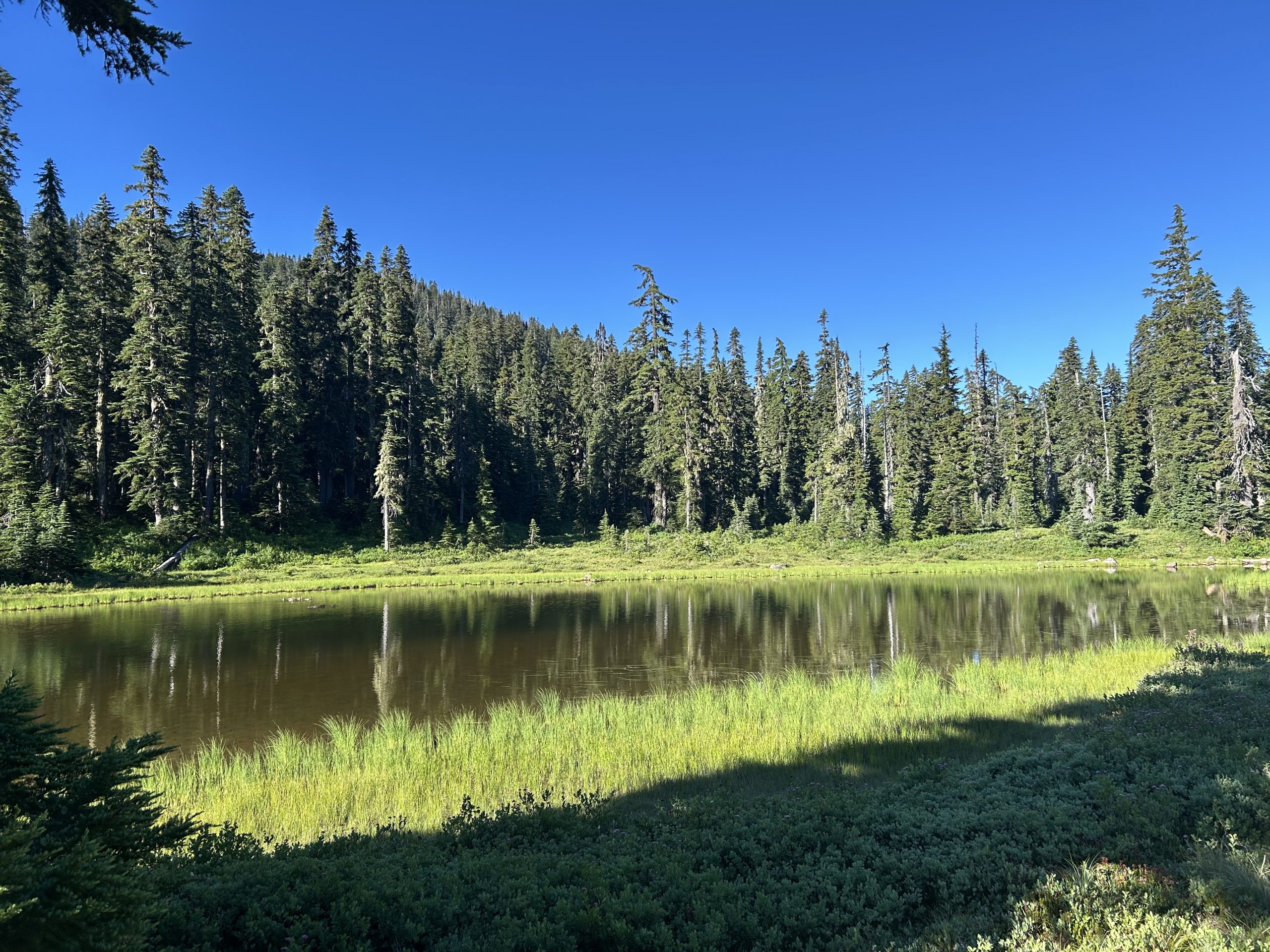
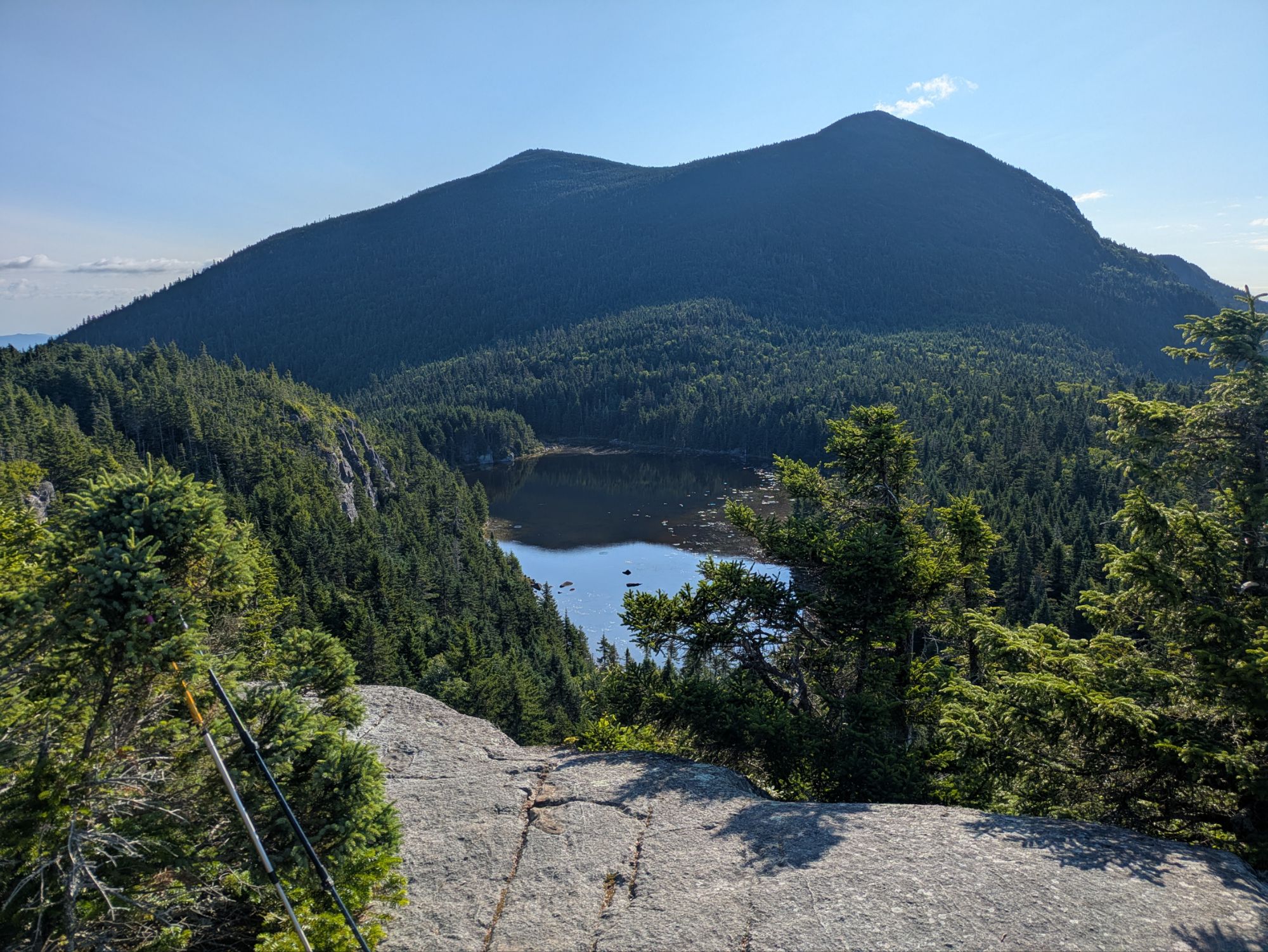
After our headache of a night last night, Sun and I slept in a bit and didn’t leave camp until around 7:30. The mosquitoes were a bit better this morning; they didn’t attack us with as much fervor as yesterday, even when we stopped for water at a lake.
The lake, Junction Lake, was such a serene place. Little baby ducks swam in groups across the water while the morning sun warmed the air. At one point, the mother duck came squawking in, flying this way and that way across the pond, throwing water in all directions. I’m not quite sure what the drama was about, something to do with the baby ducks, but eventually it was resolved since the squawking stopped.
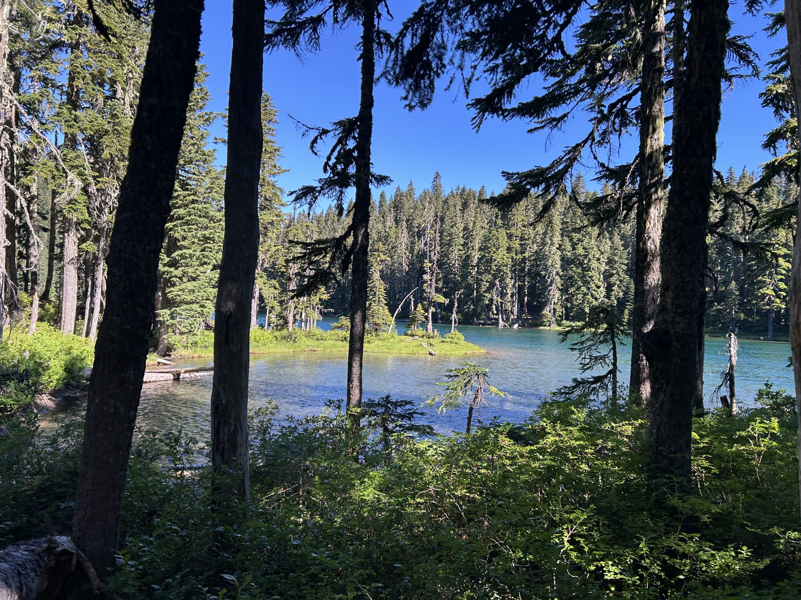
This morning, Sun and I were moving pretty slowly. We were both tired from the night before. My pack felt unusually heavy and I missed the spring I had in my step on that first day out of town. A couple of miles later we reached Blue Lake, but it was a bit too early, cool, and windy for a swim. It was a beautiful spot though. The NOBOs we passed said it was an excellent swimming spot.
Sun and I climbed slowly up, taking a lot of breaks, almost one every 1.5-2 miles, which wasn’t really our style. I guess we had bitten off more than we could chew yesterday. We topped our climb of the morning and enjoyed the snippets of cell service and the warmth of the sun.
Then it was miles of downhill, passing a few NOBOs on the way. Our progress was further slowed by the huckleberries that lined the trail; I got a bit behind because they were so good!
We finally reached a parking lot with picnic tables and a pit toilet and decided it was the perfect place for lunch. Sun was hoping that we would find trail magic again, but no such luck despite all the cars that passed by on the gravel road. Lunch felt a bit more civilized this time since we had real tables to eat at instead of a bare patch of ground. Out big debate was whether to continue 12 miles on the trail to reach our goal campsite or take the 10.5 Panther Creek road walk alternate. If we walked the trail, we would have to climb with a long water carry and dry camp. But if we took the road, we could save a few miles and camp with water. We couldn’t decide what to do, so we decided to leave it for after our lunchtime rest.
Sun allocated 30 minutes for a nap while I relaxed in the shade. When nap time was up, our answer was clear: the road walk!
As we started down the road, we were immediately sidetracked by all of the big, juicy huckleberries that lined the road. We lost at least 30 minutes because there were so many to pick. We also found blackberries that tasted like candy. Yum!
As we walked, cars passed in either direction, but we still didn’t find the magic we had hoped for.
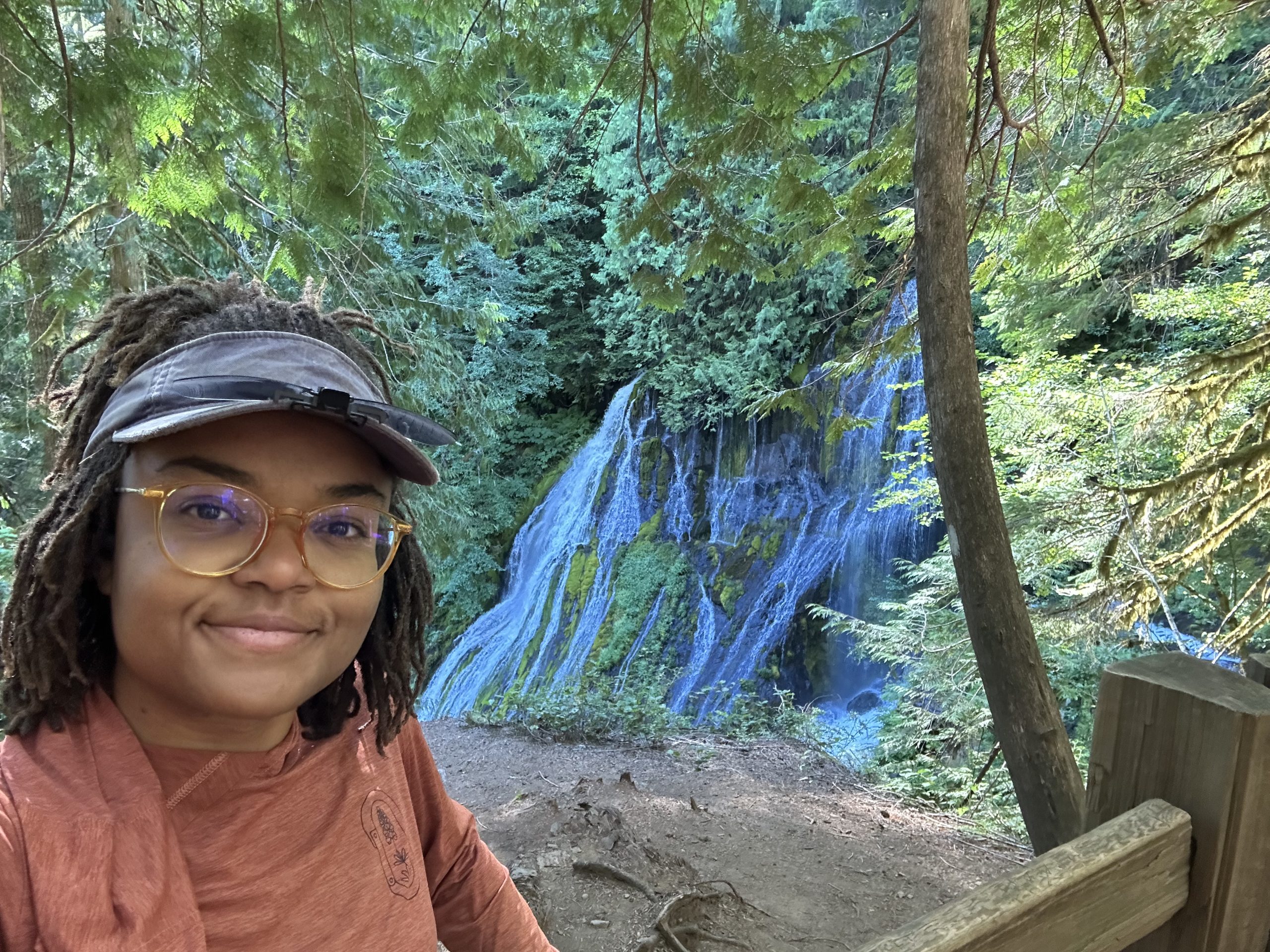
After a number of miles and a number of breaks, we reached Panther Creek Falls, one of the attractions of this alternate. A quick detour, they were worth the walk. Eventually, we were pooped and more than ready to be done with our long day. As we passed the Panther Creek Campsite, full of casual hikers and campers, the smell of hot hamburgers wafted over to us. If only we could have one!
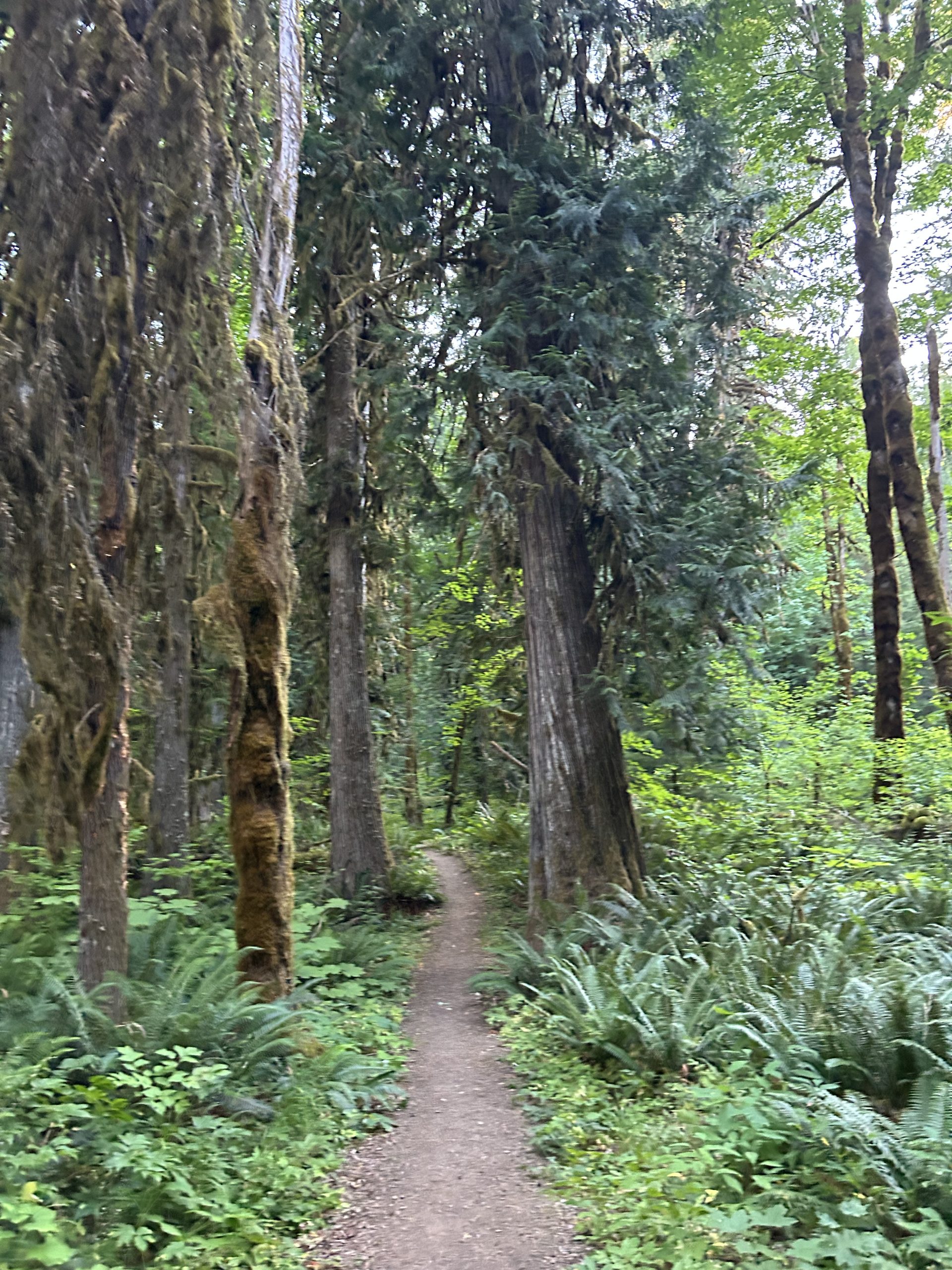
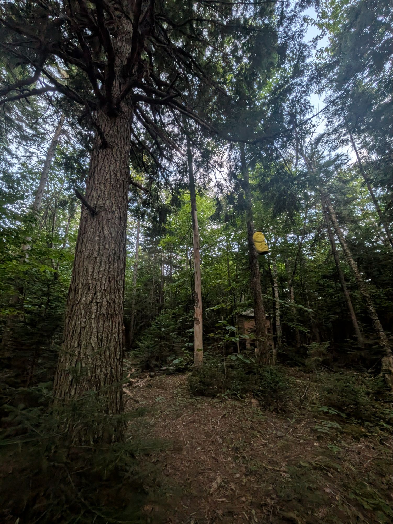
After a few more minutes, we found our site and squeezed our tents in with a couple who were almost done with their section. After dinner, we had just enough time to get a few camp chores done before the daylight started to fade.
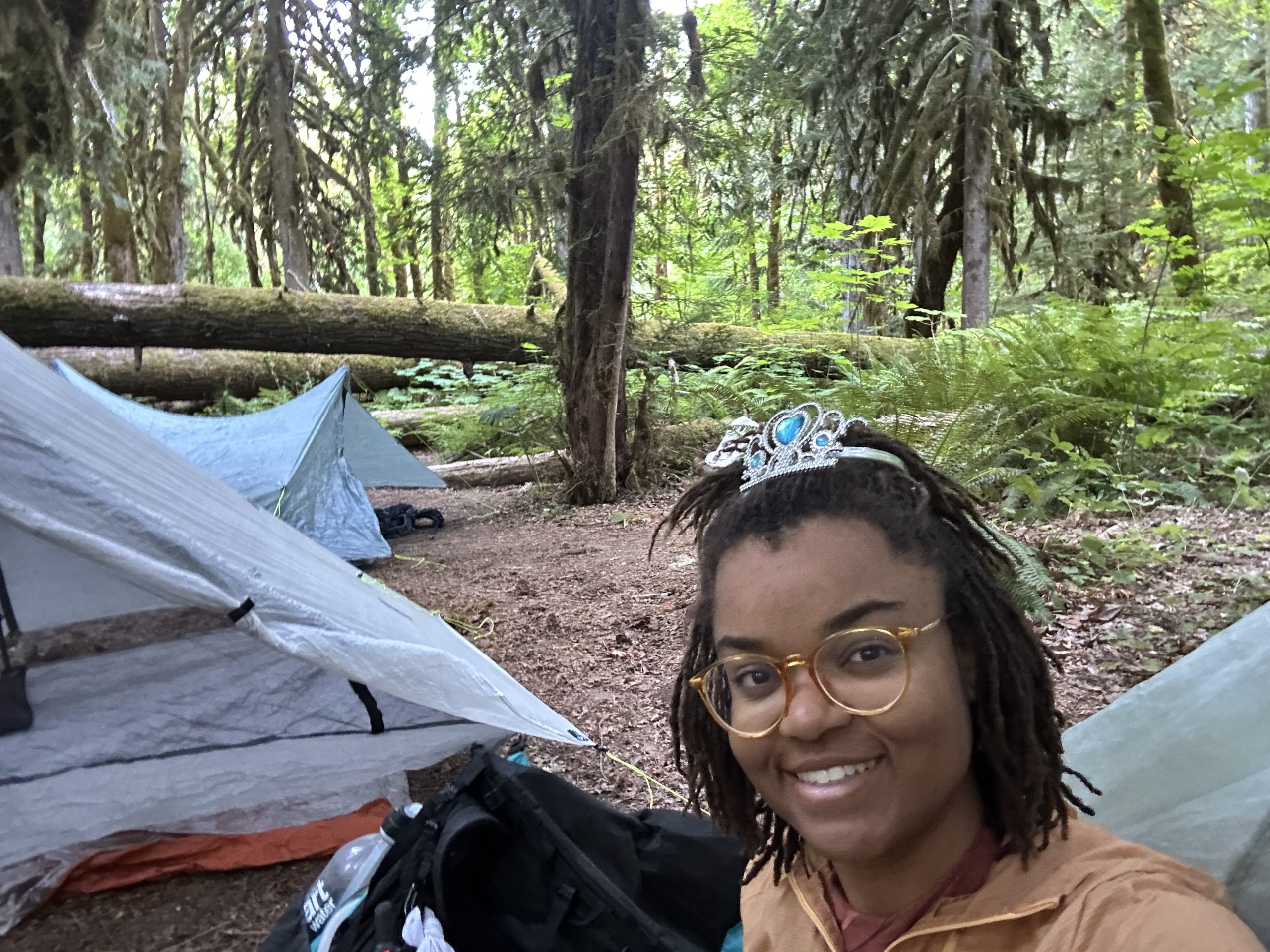
And that’s a day in the life of a PCT SOBO hiker!
This website contains affiliate links, which means The Trek may receive a percentage of any product or service you purchase using the links in the articles or advertisements. The buyer pays the same price as they would otherwise, and your purchase helps to support The Trek’s ongoing goal to serve you quality backpacking advice and information. Thanks for your support!
To learn more, please visit the About This Site page.
Destinations & Things To Do
Japanese travelers losing interest in Kyoto, top sightseeing spots slip behind Nara at peak season
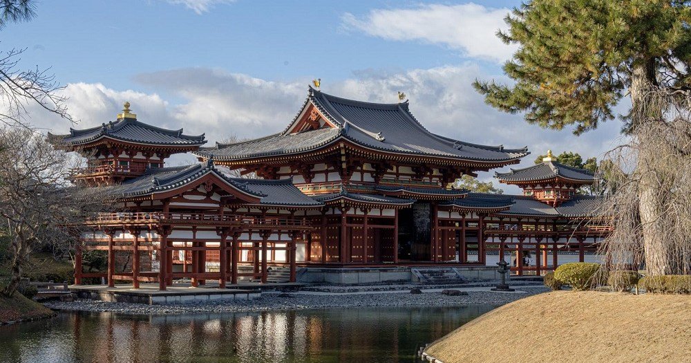
Kyoto may be the historical heart of traditional Japanese culture, but current conditions are making it a less attractive placer for locals to visit.
Aside from maybe Tokyo, there’s no other city with more of a “must-visit” reputation than Kyoto for travelers to Japan, who flock to the country’s former capital to tour its historic temples, beautiful gardens, and otherwise get a glimpse of Japanese traditional culture. For a growing number of Japanese travelers vacationing in their home country, however, Kyoto is becoming a city they feel like they can leave off their itinerary.
Tokyo-based data/research organization Blogwatcher recently released the results of its analysis of travel patterns during Japan’s 2025 Golden Week holiday season, which straddled the end of April and beginning of May. Examining mobile phone location data, Blogwatcher determined that there were significant drop-offs in the number of Japanese visitors to five of Kyoto’s most famous sightseeing spots compared to just two years prior. Japanese visitors to Fushimi Inari Shrine plummeted by 40.4 percent compared to 2023, and both Kiyomizudera Temple and Kinkakuij/the Golden Pavillion’s numbers of Japanese visitors fell by roughly 25 percent. Shimogamo Shrine and Byodoiin Temple both had slight upticks in Japanese visitors in 2024, but reversed course in 2025 and had approximately 10 percent fewer domestic visitors than they’d had at Golden Week in 2023.
▼ Byodoin’s Phoenix Hall is so famous that it’s even depicted on the 10-yen coin.
It’s not hard to imagine what’s discouraging Japanese travelers from visiting Kyoto. The weak yen continues to make Japan more affordable for foreign travelers to visit than it’s been in a generation, and with so many of them including Kyoto in their Japan travel plans, the city’s attractions are crowded and its hotels expensive. The Kyoto Tourism Association’s data shows that through the first five months of this year, the average price per night for a stay in a Kyoto hotel is around 50 percent more than it was just two years ago. Those cost increases are relatively easy for inbound foreign visitors to soak up as they leverage the favorable exchange rate, but for Japanese travelers, who are already getting hit in the wallet by rapidly increasing consumer prices without equivalent wage increases, the idea of paying inflated prices to go someplace clogged with tourists is no doubt feeling like a less enjoyable way to spend their diminished disposable income.
However, as Kyoto is looking like a less attractive destination for Japanese travelers, they’re becoming more drawn to Nara. Blogwatcher tracks domestic visitor numbers for 33 of Kyoto Prefecture’s top temples, shrines, and historical tourism sites, and 37 in Nara Prefecture. During Golden Week in 2023, Japanese travelers showed an overwhelming preference for Kyoto, with its top sights receiving nearly 70 percent more Japanese visitors than Nara’s. In 2025, though, more Japanese travelers visited Nara’s major sights than Kyoto’s.
Japanese visitors to major temples, shrine, and historic sites during Golden Week
● Kyoto 2023: 746,000
● Nara 2023: 446,00● Kyoto 2025: 559,000
● Nara 2025: 561,00
It could be argued that Japan is still in the middle of the initial wave of its inbound tourism boom. Residual pent-up international travel demand and the weak yen are doing a lot to make the country a trendy and affordable choice for visitors from abroad, but it’s still not entirely clear whether their intense interest is going to be permanent. As a result, it’s likewise too early to say whether huge crowds and high prices have turned Japanese people off to the idea of traveling to Kyoto entirely, or if they’re simply putting their Kyoto plans on the back burner for the time being. After all, if the shrines and temples you’re going to see are already centuries old, holding back for a year or two to see if the tourism congestion has settled down doesn’t seem like all that long of a wait. For the time being, though, it really does look like Japan’s travelers aren’t nearly as excited about the idea of visiting Kyoto as they were just a short while ago.
Source: TBS Cross Dig with Bloomberg via Golden Times
Top image: Pakutaso
Insert image: Pakutaso
● Want to hear about SoraNews24’s latest articles as soon as they’re published? Follow us on Facebook and Twitter!
- Hiked Today: 21.1 miles
- Appalachian Trail (2,012 – 2,033.1)
- Total Hiked: 3,966.3 miles
- Total Paddled: 99.5 miles
Weather: 52 – 75°F, mostly sunny, some clouds
Elevation: 1,150 – 4,145 feet
Cranberry Stream Campsite to West Carry Pond Shelter
For some reason the charge on my power bank seemed to diminish quicker than normal over the past couple days. I still have a few days to go before my next stop, so today I went into extreme battery saving mode. I even went as far as turning my phone off whenever possible, but afterwards I wasn’t sure if that was helping or causing it to drain just as quick/even more quick.
Thus, you’d expect not as many photos for today, but I struggled to stop myself. It was an all-time wonderful day and that causes me to want to have the phone out documenting all the fun stuff.
Bodacious: “very large or important, or something people enjoy or admire.”
– from the Cambridge Dictionary (https://dictionary.cambridge.org/us/dictionary/english/bodacious)
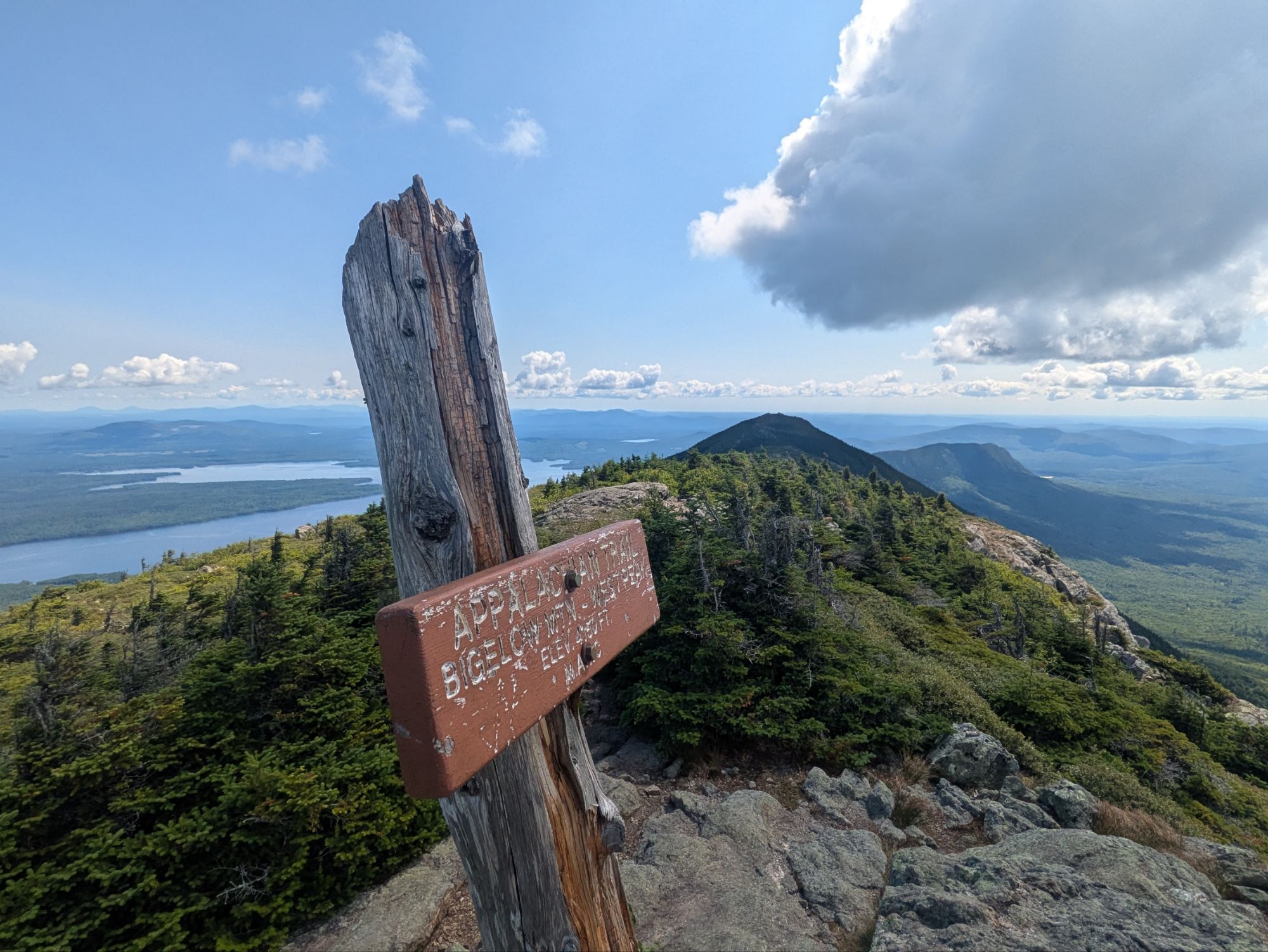
Leaving camp, straight away I was hiking up. The end of the day yesterday was more downhill and flat-ish and set me up at the foot of the Bigelow’s. The climb was ok, definitely lots of trippy roots but not as steep as some other spots…
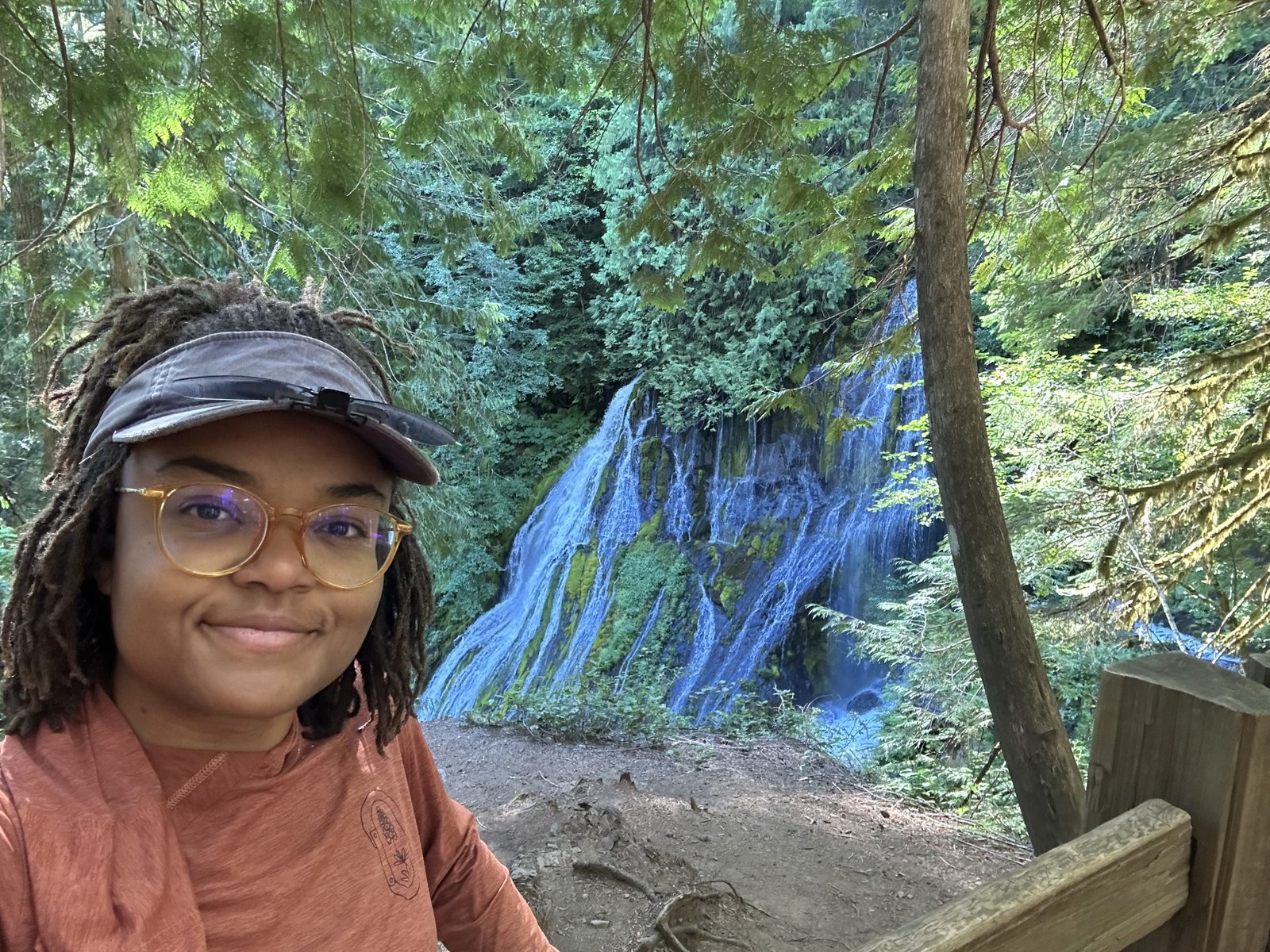
The photo above was taken right before popping out to a marvelous viewpoint. I got a kick out of the giant monolith type boulder and then was blown away when the view of Horn Pond and The Horns presented itself…
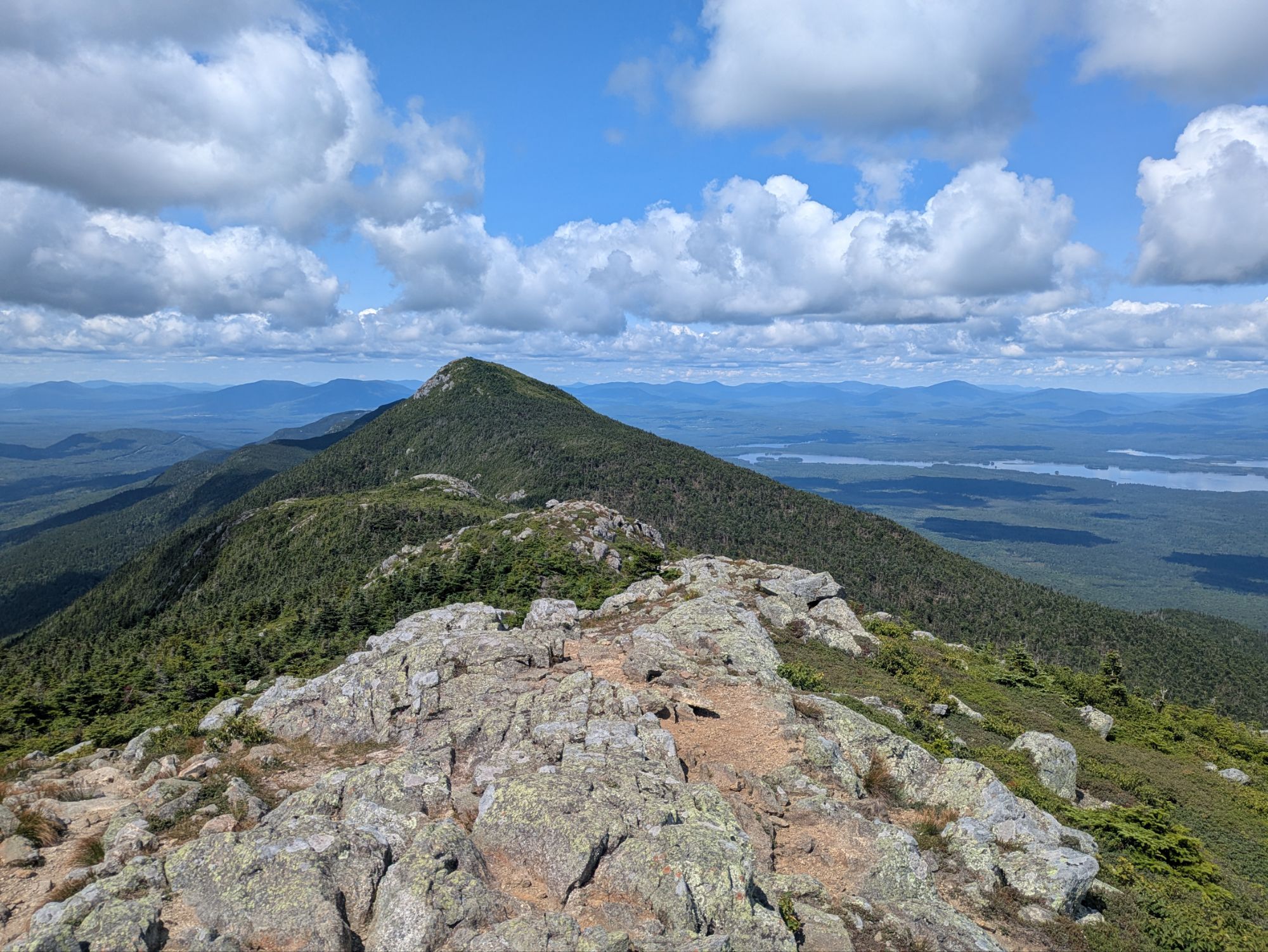
I thought the trail took me over both of the Horns, but just South. To get to North Horn it was a 0.2 mile side quest. I stuck to the white blazes and got some views looking back on the way up.
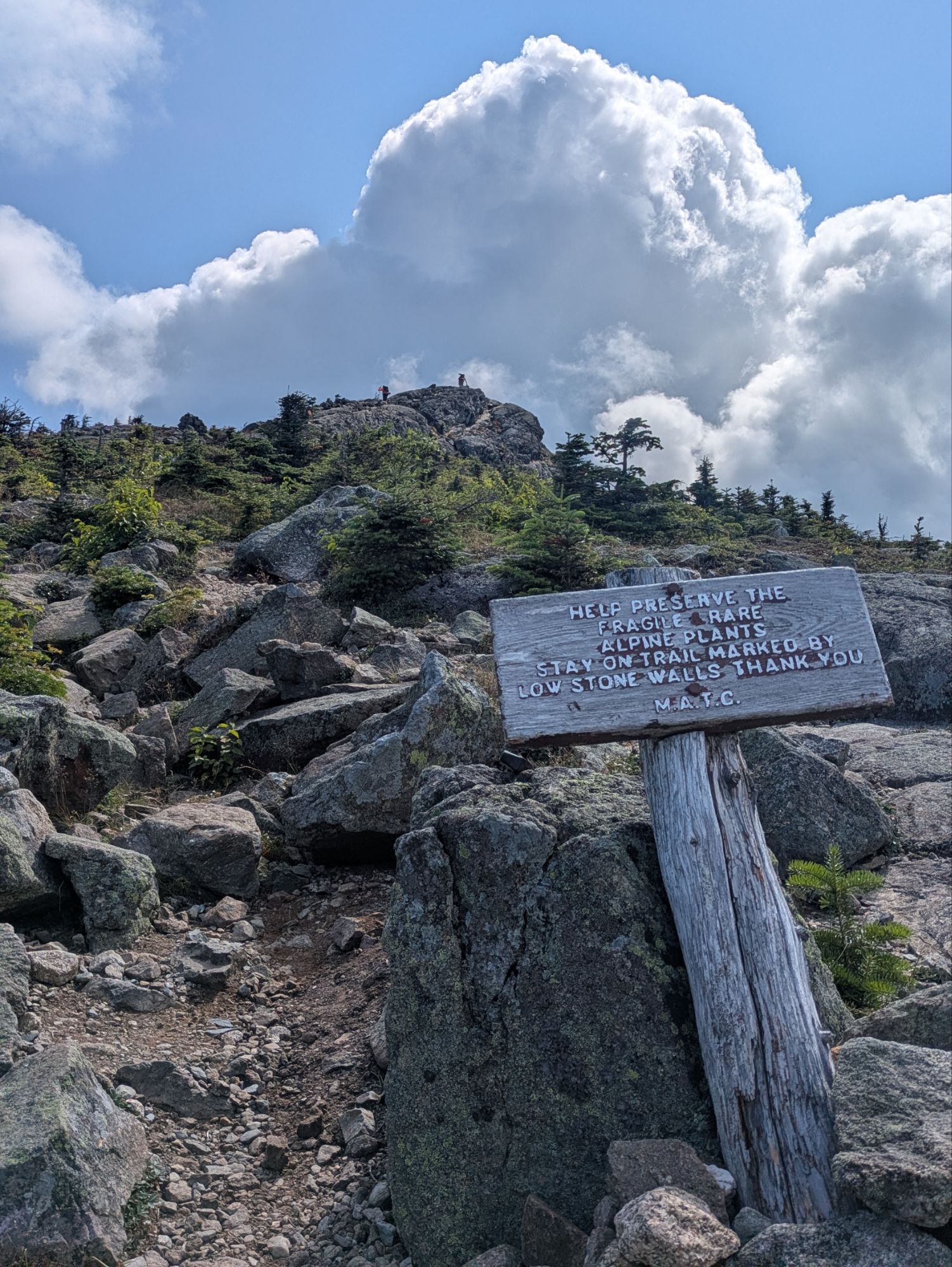
Atop South Horn there was another spectacular overlook and I sat down for second breakfast. Hikers Bookends and Ain’t Right joined too. The weather was once again premium and I soaked up the moment…
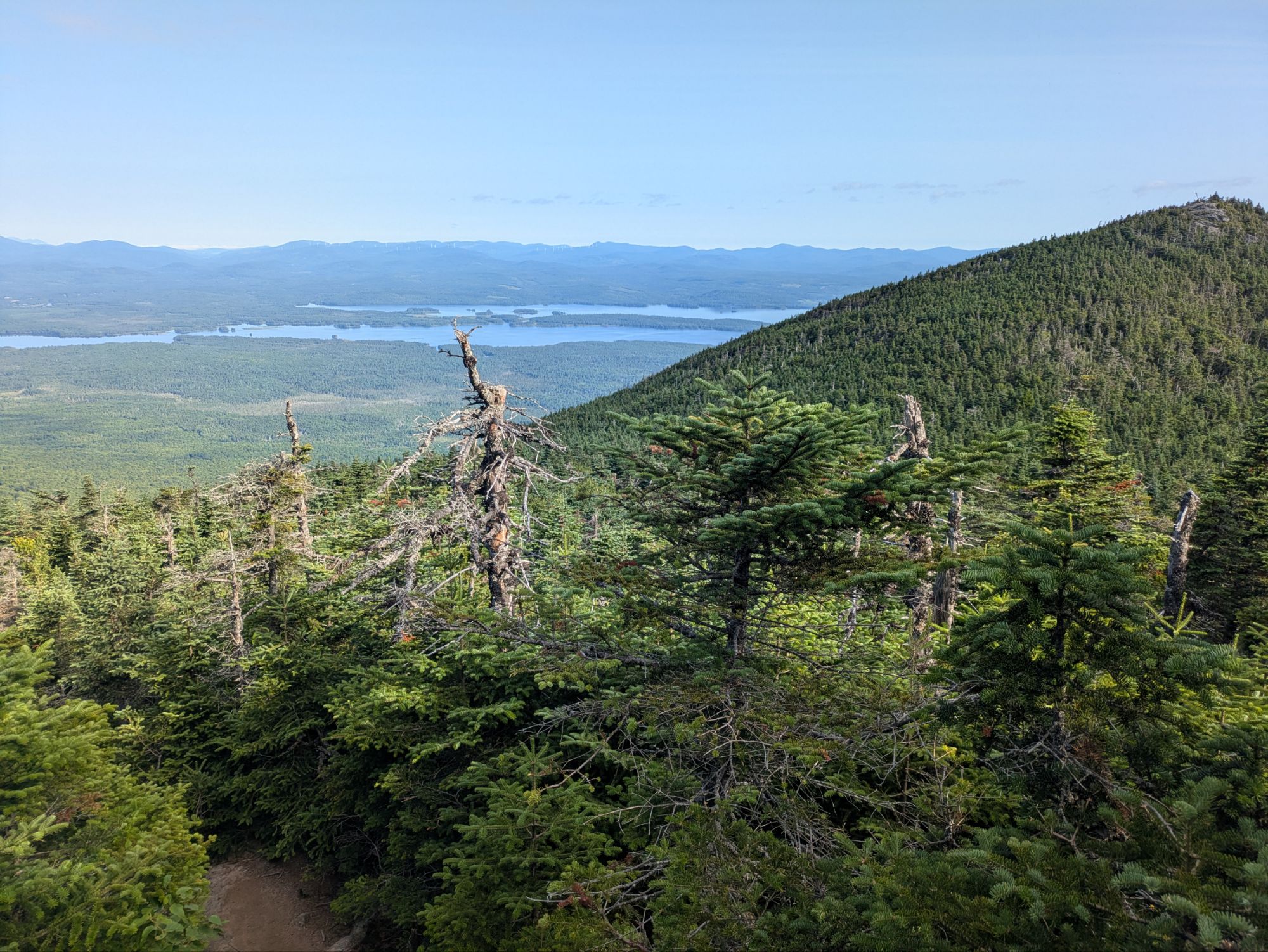
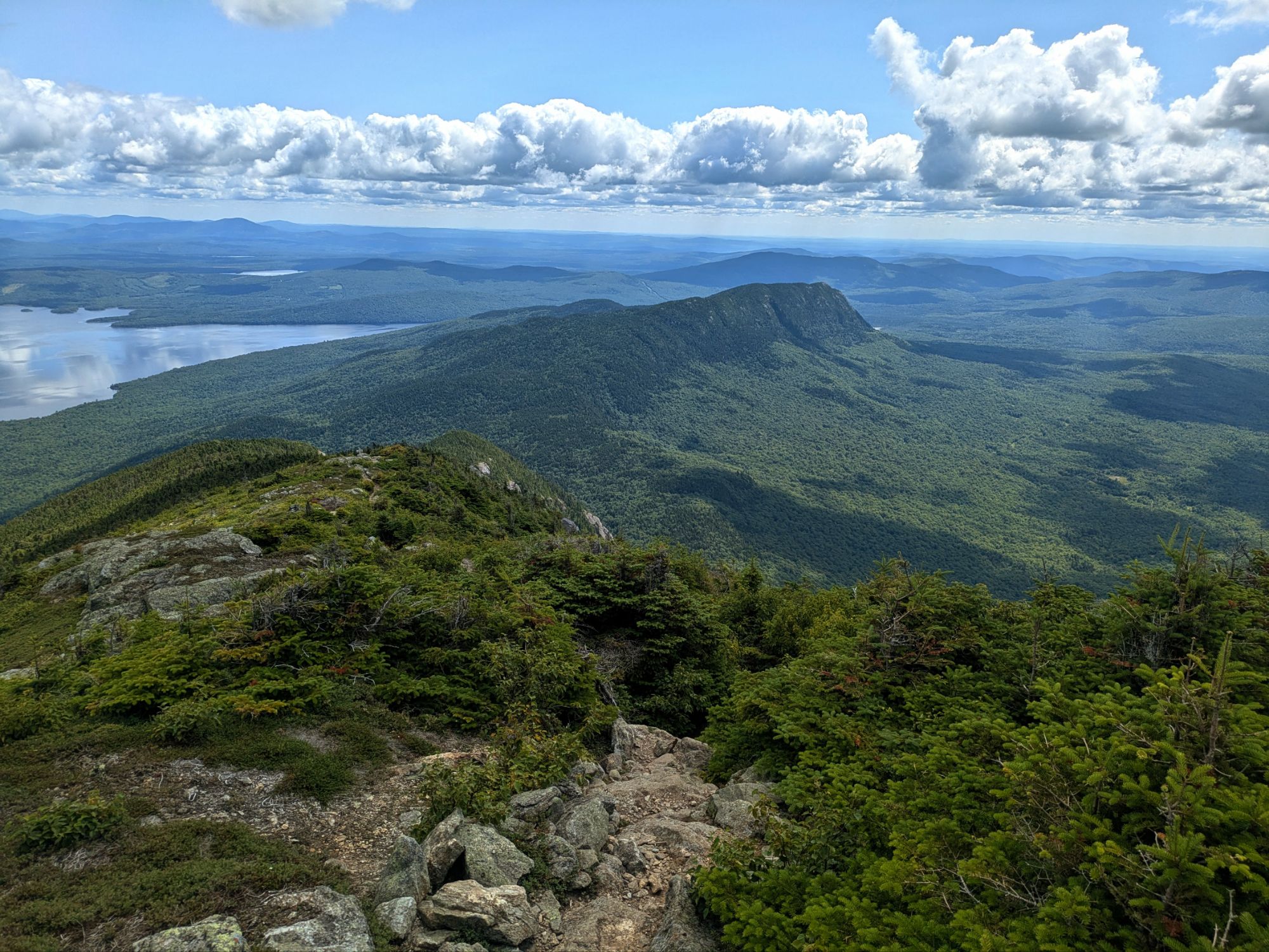
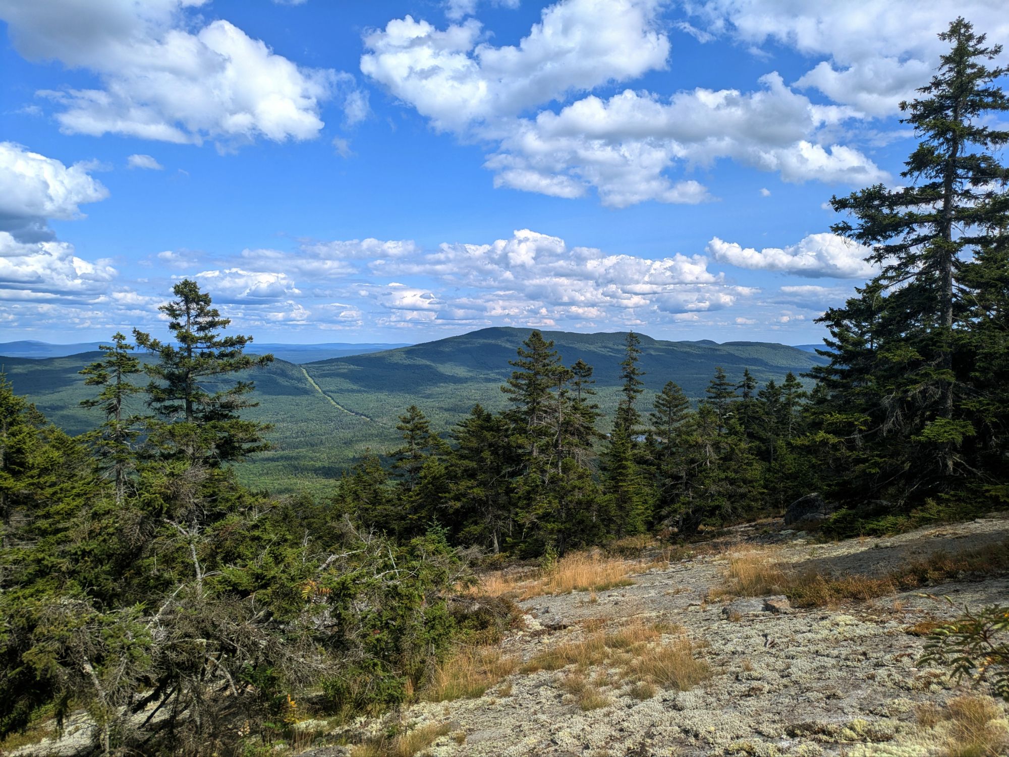
The next few miles were top-notch. Some of my favorite of the entire Appalachian Trail. It was down and then up to a ridge line topping the West Peak of Bigelow Mountain and then Bigelow Avery Peak. The massive Flagstaff Lake sat to the north and demanded my attention.
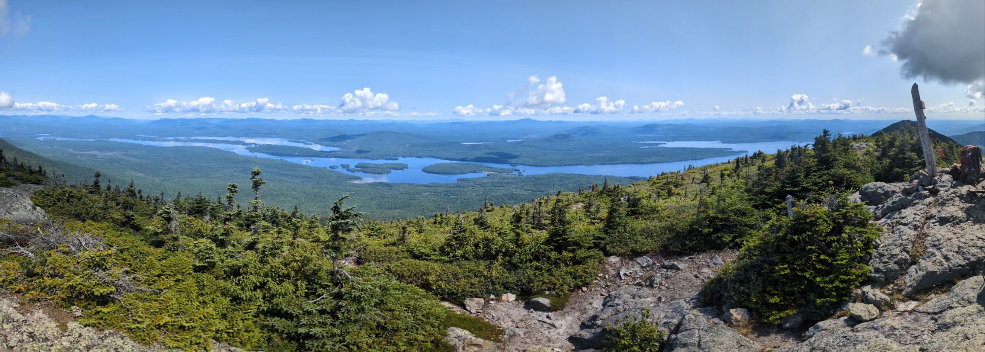
Sitting with the other hikers at this summit, I said something along the lines that this is more than a view, it’s a whole experience. What I was trying to get across was that it was 360 degrees, a whole scene, and as much as I try with photos and vids, being there in person is the only way to sense the grandeur. Sorry y’all. But alas, I did try to showcase the beauty nonetheless.
Before heading down into the trees again, I got a view of Little Bigelow Mountain where I’d be heading.
The rest of the day’s hike was less glamorous, but after Little Bigelow it was more cruisy. I came close to getting a good slow-motion vid of this giant Pileated Woodpecker, but pretty blurry…
Around 6:00 pm or so, I was internally thinking maybe I’d be able to push on further than my original goal. It never happens haha. Especially when I’m stopped for wonderful trail magic! Walking into a parking area, which later I’d find out was not even on the trail, I met Lebowski. He’s a 2021 (?) AT hiker that planned to set up the next day and chef tasty foods up for hikers. For me, he offered a beer, a chair, and some honey buns! It was nice resting and chatting with him.
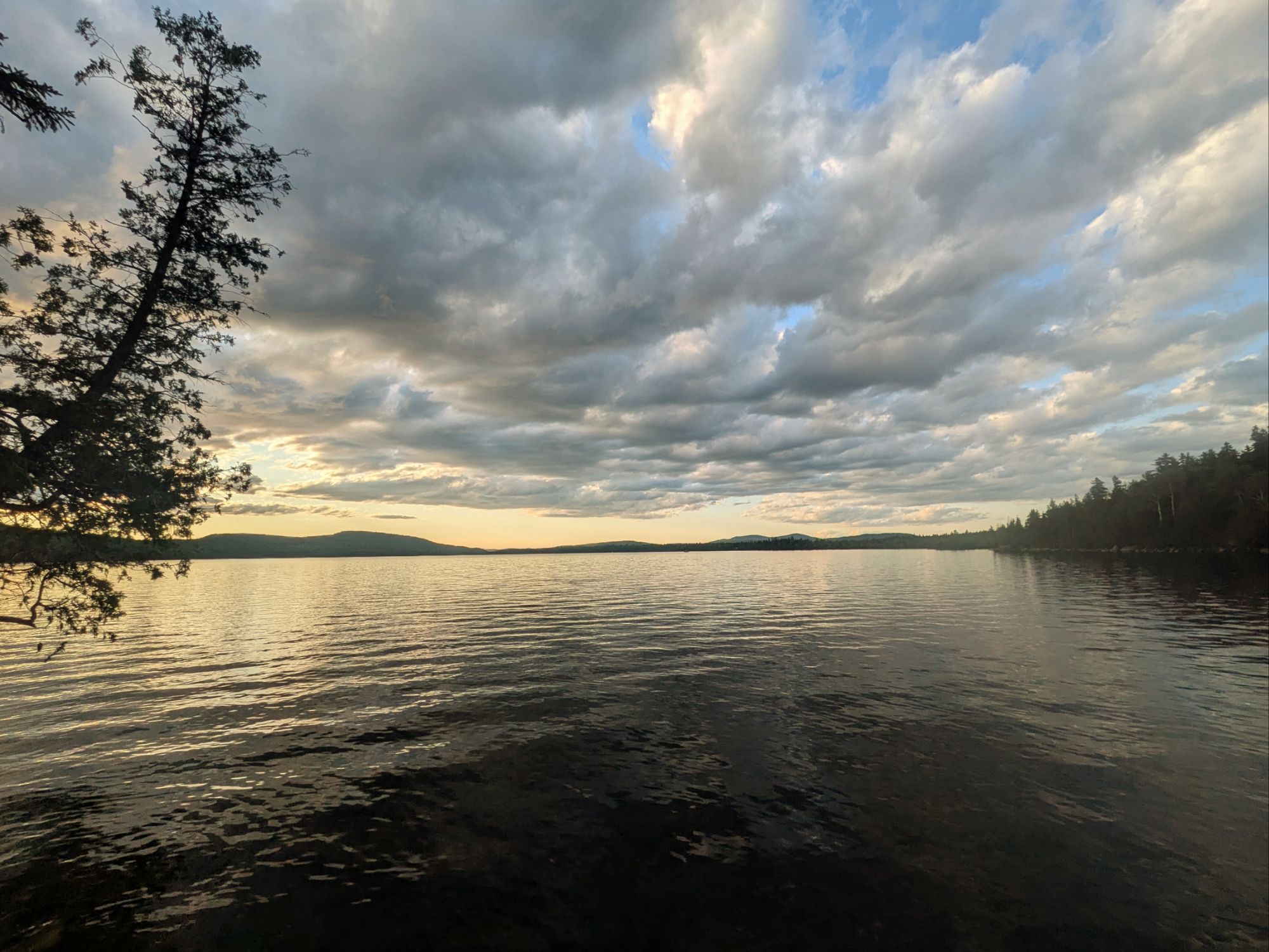
Moving on from that, I was thinking I had about 6 miles of flat left to hike. The mileage estimate was accurate, but I underestimated the grade and there was not one, but two blips uphill I had to get over. Hence, I was exhausted and spent like normal by the time I reached camp at West Carry Pond Shelter.
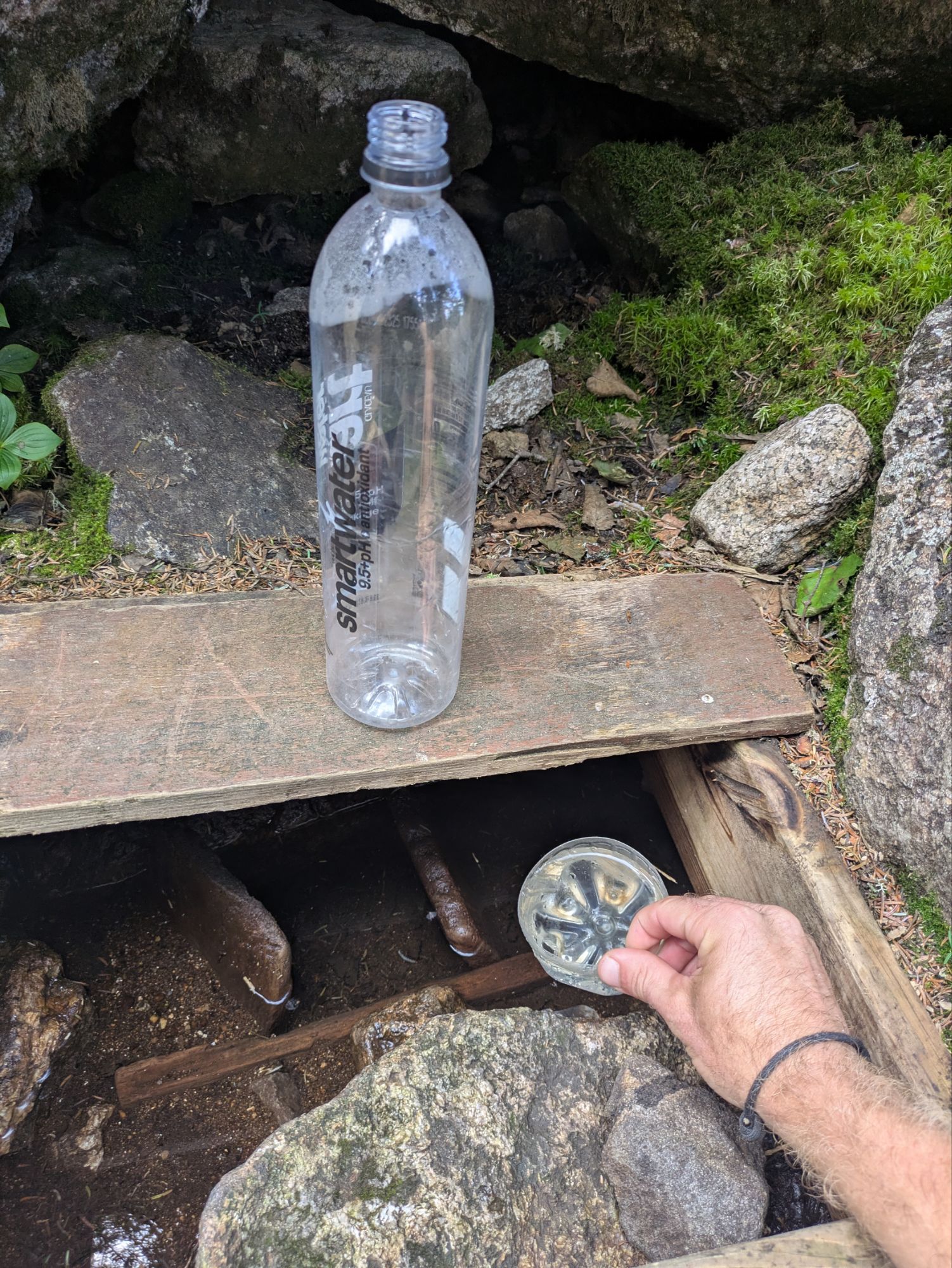
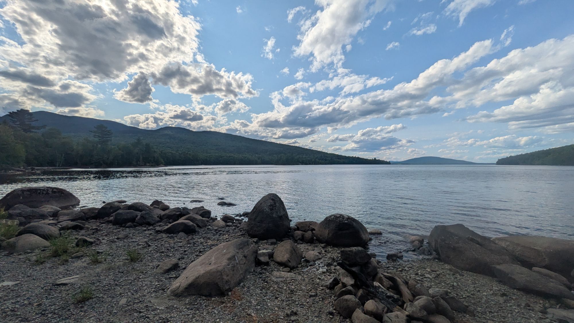
I filled up with water straight from the lake. It was post-7:00 pm arriving here at West Carry Pond. Again with the ponds though… looks like a lake to me folks. Will the madness never end?
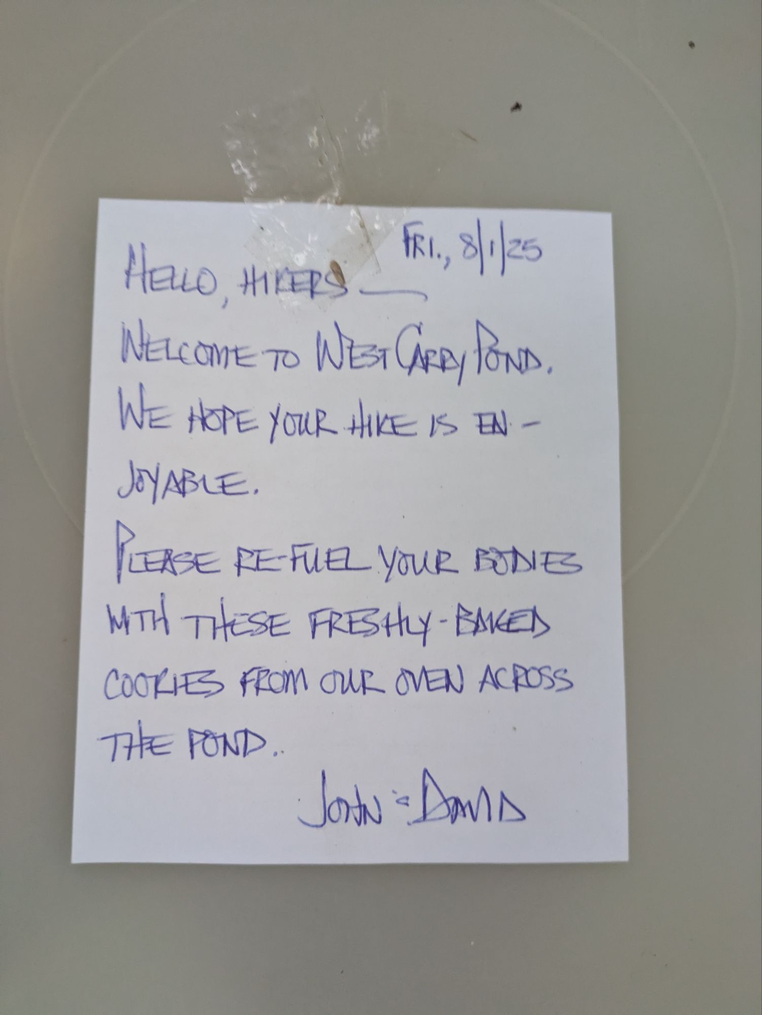
In my tired and hungry state, finding this glorious sight at the shelter was almost too much for me…
I mean, don’t they look like the most pristine and delicious chocolate chip cookies ever? I am a cookie monster and devoured several in quick succession.
I was the only one at the shelter and I still went for the tent. I set up and ate in record time. Going back to the cookies though… I didn’t feel right leaving them out for the bears to munch on. So, I ate them all! J.k., j.k. haha. I did eat a lot, but at least for the evening, I kept them safe by putting the whole Tupperware in my food hanging bag…
The loons sang me a lullaby as I drifted off to sleep. What a day! Another in the top 201 of the ECT I’d say 😎.
Thanks for joining on the journey! It means a lot that you took the time to read up on these adventures. If you want to help kids get access to the outdoors, a cause that means a lot to me, please help me in supporting Outdoors Empowerment Network! The “Tip Author” button is a direct link to my fundraising page. Y’all are truly amazing. Thank you!
This website contains affiliate links, which means The Trek may receive a percentage of any product or service you purchase using the links in the articles or advertisements. The buyer pays the same price as they would otherwise, and your purchase helps to support The Trek’s ongoing goal to serve you quality backpacking advice and information. Thanks for your support!
To learn more, please visit the About This Site page.
-

 Brand Stories2 weeks ago
Bloom Hotels: A Modern Vision of Hospitality Redefining Travel
-

 Brand Stories1 week ago
CheQin.ai sets a new standard for hotel booking with its AI capabilities: empowering travellers to bargain, choose the best, and book with clarity.
-

 Destinations & Things To Do2 weeks ago
Untouched Destinations: Stunning Hidden Gems You Must Visit
-

 Destinations & Things To Do1 week ago
This Hidden Beach in India Glows at Night-But Only in One Secret Season
-

 AI in Travel2 weeks ago
AI Travel Revolution: Must-Have Guide to the Best Experience
-

 Brand Stories1 month ago
Voice AI Startup ElevenLabs Plans to Add Hubs Around the World
-

 Brand Stories4 weeks ago
How Elon Musk’s rogue Grok chatbot became a cautionary AI tale
-

 Brand Stories2 weeks ago
Contactless Hospitality: Why Remote Management Technology Is Key to Seamless Guest Experiences
-

 Asia Travel Pulse1 month ago
Looking For Adventure In Asia? Here Are 7 Epic Destinations You Need To Experience At Least Once – Zee News
-

 AI in Travel1 month ago
‘Will AI take my job?’ A trip to a Beijing fortune-telling bar to see what lies ahead | China