
Destinations & Things To Do
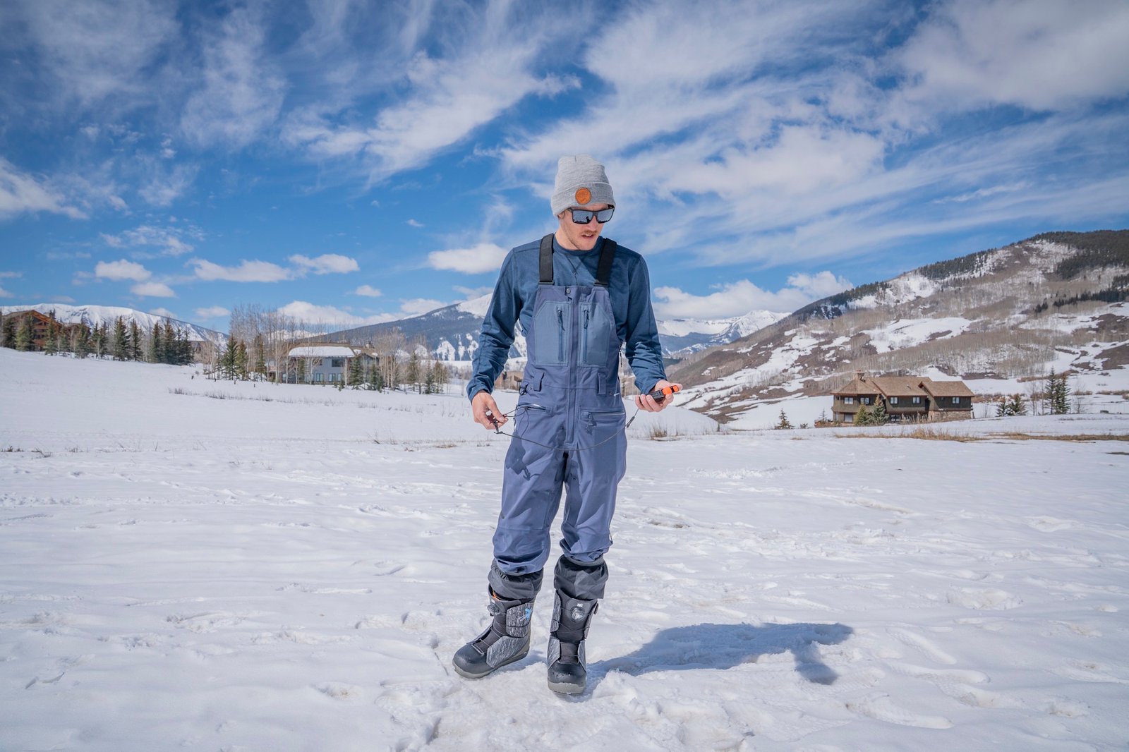
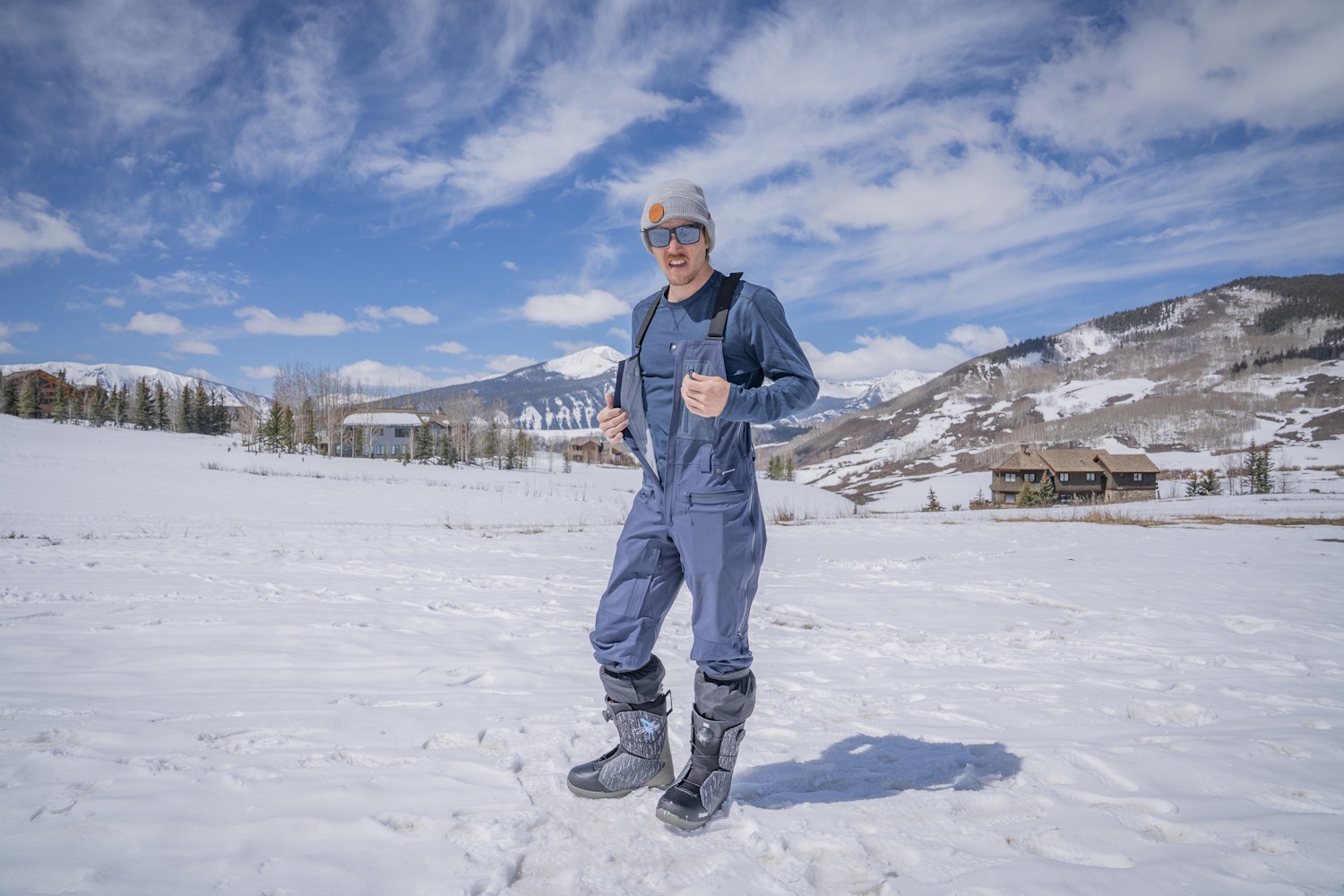
Flylow Stash Men’s Ski Bib Review
It was just after sunrise on a cold February morning in Colorado’s backcountry. Three others and I put on our skins and prepared to cross the wilderness boundary, starting our climb. I was testing the Flylow Men’s Stash ski bibs, and we were on a videography mission.
I had high hopes for conditions, though we had already encountered trouble with the approach. The videographer’s snowmobile died halfway in. We consolidated our camera gear and riders onto one sled — a hilarious yet inconvenient sight.
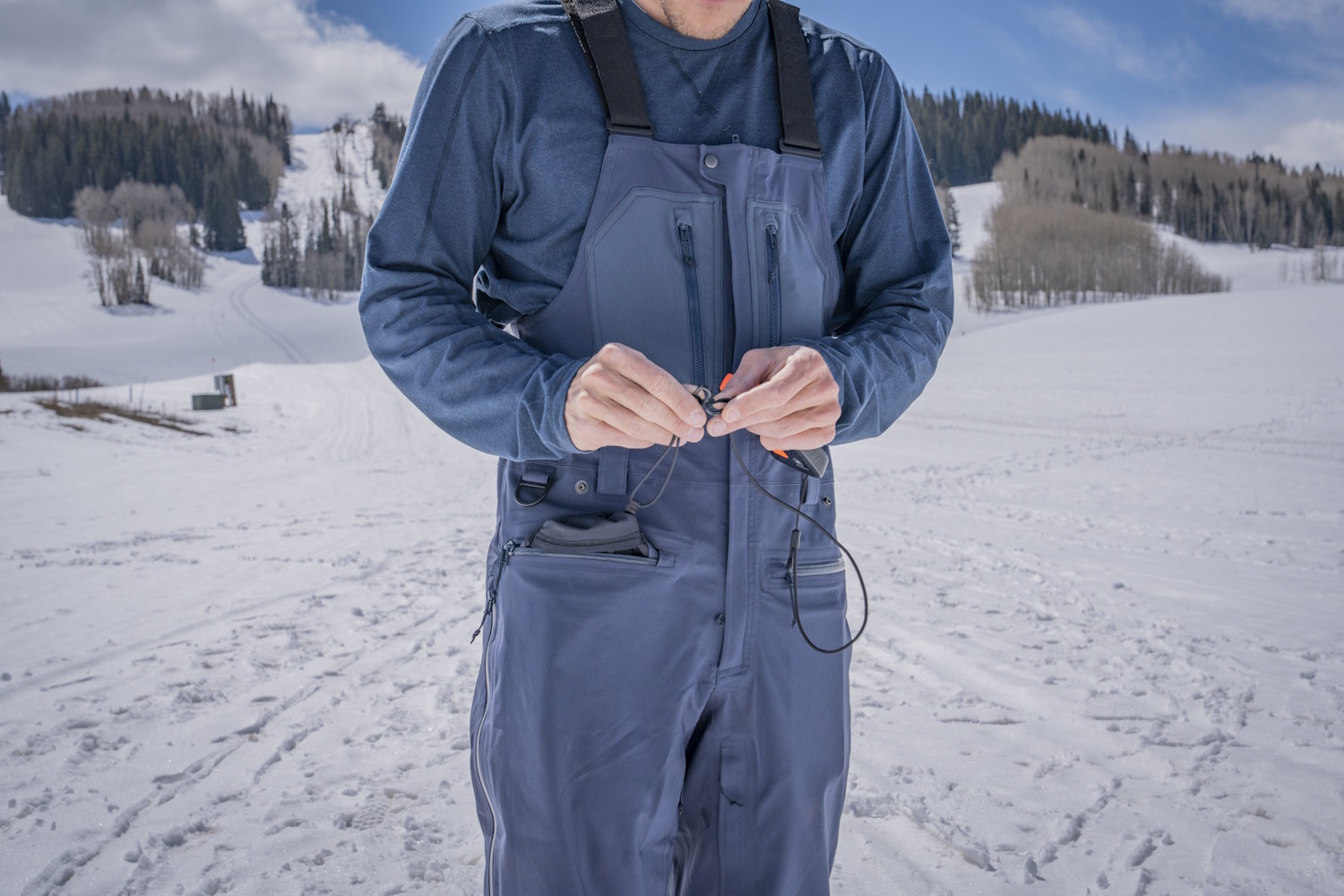
We stood on the opposing running boards, hands on one side of the handlebars. Thankfully, my snowmobile key was attached to the integrated D-ring on my ski bibs — in case we toppled over.
Despite the challenges, we had arrived and were ascending the skin track. The promise of good turns fueled our stoke.
We played leapfrog, shooting film of each other down the run. I unclipped and post-holed several times through chest-deep pow to get a good shot. From the face shots to hiking through deep snow, I was happy to be wearing the Stash bibs.
In short: The Flylow Stash Bibs ($420) are versatile and durable men’s ski bibs that are perfect for resort and backcountry conditions. This dense 3L layer is easy to enter with a center zipper and even easier to dump heat thanks to inner and outer thigh vents. Made with 100% recycled materials and extra reinforcement in high-friction areas, these bibs for men are well-constructed and worth the moderate price.
Scope out our other favorite men’s ski bibs in the Best Men’s Ski Bibs buyer’s guide.
Flylow Stash Men’s Ski Bibs Review: Material
The Stash ski bibs for men are thick, 100% recycled polyester 3L shell bibs with a blend of softshell and hardshell textiles. The softshell is made to be stretchy, allowing dynamic movements while also retaining its high 20K waterproof rating. This fabric feels soft and holds warmth. The surface makes water bead up.
Flylow takes sustainability seriously, including Bluesign and Oeko-Tex certifications, and meets high environmental and safety standards for its sourced products. 100% of the Stash men’s ski bib polyester comes from recycled materials. The Durable Water Repellent (DWR) applied to the bib is also made without toxic perfluorocarbons (PFCs).
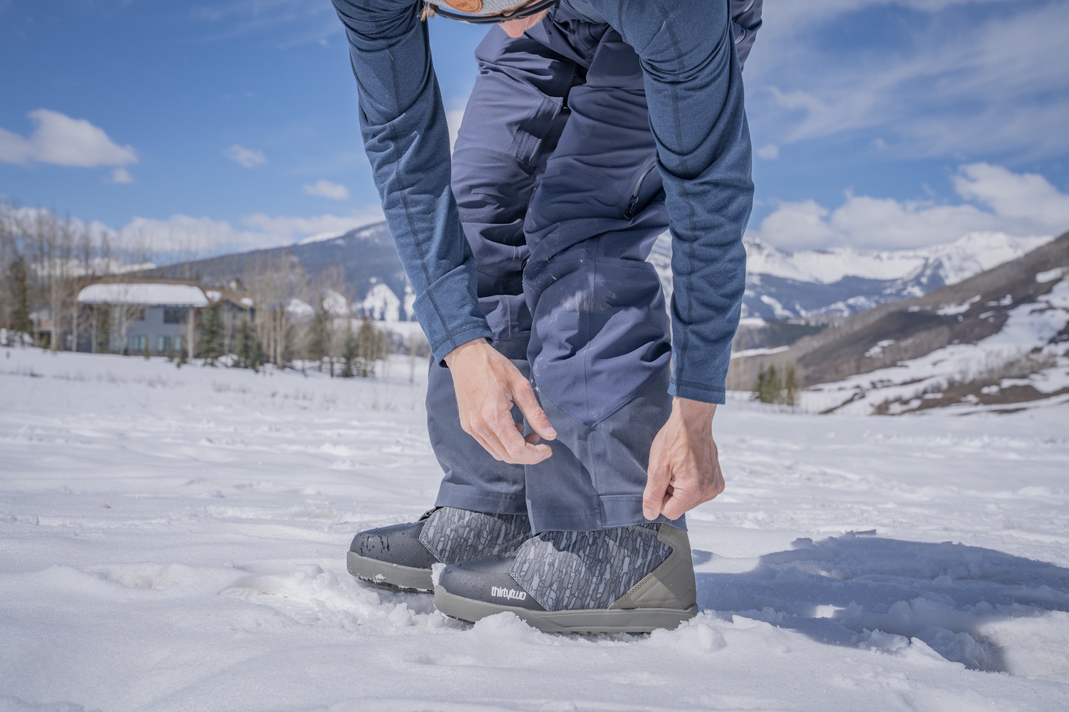
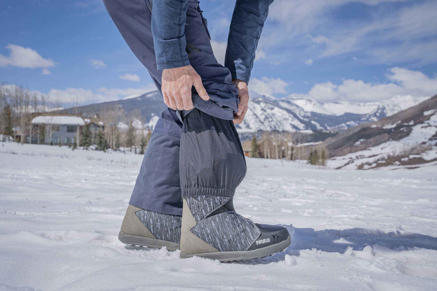
The zones around the knees and glutes — areas of high friction and use — are strategically reinforced with durable fabric. Additionally, the entire cuff, not just the inner ankle, is reinforced, with the inner ankle’s kick patch being considerably larger than on other ski bibs I’ve tested. As someone who snowmobiles, snowboards, splitboards, and generally destroys gear, I think these bits stand out in terms of durability.
Pockets
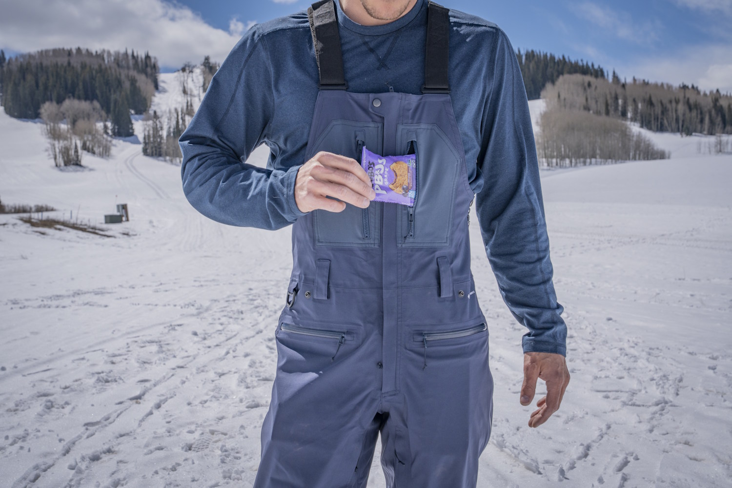
The men’s Stash Bibs have five pockets in total: two small zippered chest pockets and two larger zippered thigh pockets. The right one has an extendable tether for a device and an inner mesh pocket sleeve. There’s also a zippered back right-side pocket.
Overall, the Stash bibs have adequate storage for a full day outside. But the chest pocket design is my biggest gripe. It simply won’t fit my iPhone. The lack of space isn’t an issue at the resort, as I can use the thigh pockets. Still, in the backcountry, the thigh pocket is the only one with a tether for a beacon.
To maintain safe electronic interference separation, I can’t use the other thigh pocket for my phone. My beacon (I use the Mammut Barryvox S2) will fit in the chest pocket, although it’s tight and has no clip. Still, the pockets can hold enough snacks and equipment for a day at the resort or on the skin track for a long climb.
Who They’re For
As the name suggests, the Stash bibs are for powder skiers and snowboarders who want to find deep snow with enough durability for a long day on ski lifts and enough breathability for the skin track.
Flylow designed these men’s bibs for riders who appreciate features like an integrated D-ring on the waistband (for a snowmobile key), the option to snap in the powder skirt of a matching Flylow jacket, and both inner and outer leg vents for airflow.
At $420, the price packs a punch for a 3L shell that erases the line between feeling lightweight yet thick and durable. This front-zipper bib is an excellent fit for the rider wanting a one-quiver bib ready for various activities.
Conclusion
After that first solid 10-hour day of storm riding and photographing in February, I put serious miles on these bibs. The season continued with various days at the ski resort and in the backcountry. It’s hard to find flaws in these men’s ski bibs.
I have to get picky — like the lack of boot gaiter hooks, my preference for backcountry pockets, or the fact that the leg cuffs could be slightly narrower with less of a bell-bottom shape.
Overall, the Flylow Stash Bibs are pretty good for the price point, especially for a 20k/20k waterproof, three-layer, 100% recycled fabric ski bib. After a season with this pair and my previous on-snow experience with multiple pairs of Flylow bibs, I’m confident that these will hold up to several seasons of use. And if they finally start to wear out, you can send them back to Flylow for store credit off a new pair of bibs — a pretty sweet deal on top of versatile, durable, good-looking bibs for hybrid riders.
See what I did there?
Things have certainly been… going. The first day was a whirlwind of events. Constant trail changes, meeting new people, the bear. The next three days have been less of that, and much more mud and rain.
I’m starting to find my rhythm, for sure. I wake up when the sun comes up, then ignore it and roll back over for another hour. Get up around 8. Put ramen on the stove to boil for hot breakfast. The ramen doesn’t take long to cook, but it takes surprisingly long to cool off so I get it going while I do my other camp chores.
While my breakfast cools, I refill my water and take down my tent. I cover myself in bug lotion, to mixed results.
Once the camp is all put together, I shove it into my bag and then walk until I can’t feel my legs. Then, I pitch the tent, eat cold dinner (I’m usually too tired to mess with the burner by this point), and go to sleep. Repeat.
I’ve come to the realization that I will be able to physically complete this trail, barring any freak accidents. The mental battle will be the real deciding factor.
Day 2: The Downpour
Everything can essentially be boiled down to morale, like an old timey army. Any event can be sorted into one of two camps: an event that makes me happy to keep hiking, or an event that makes me want to quit.
Cool waterfall? Good for morale, I hike faster. Clothing still wet from the previous day? Bad for morale, I hike slower. Giant open sore on my leg from chafing? Bad for morale, but it does actually make me hike faster because I don’t have any bandages on me and I need to make it to Silver Bay to buy some. You get the point.
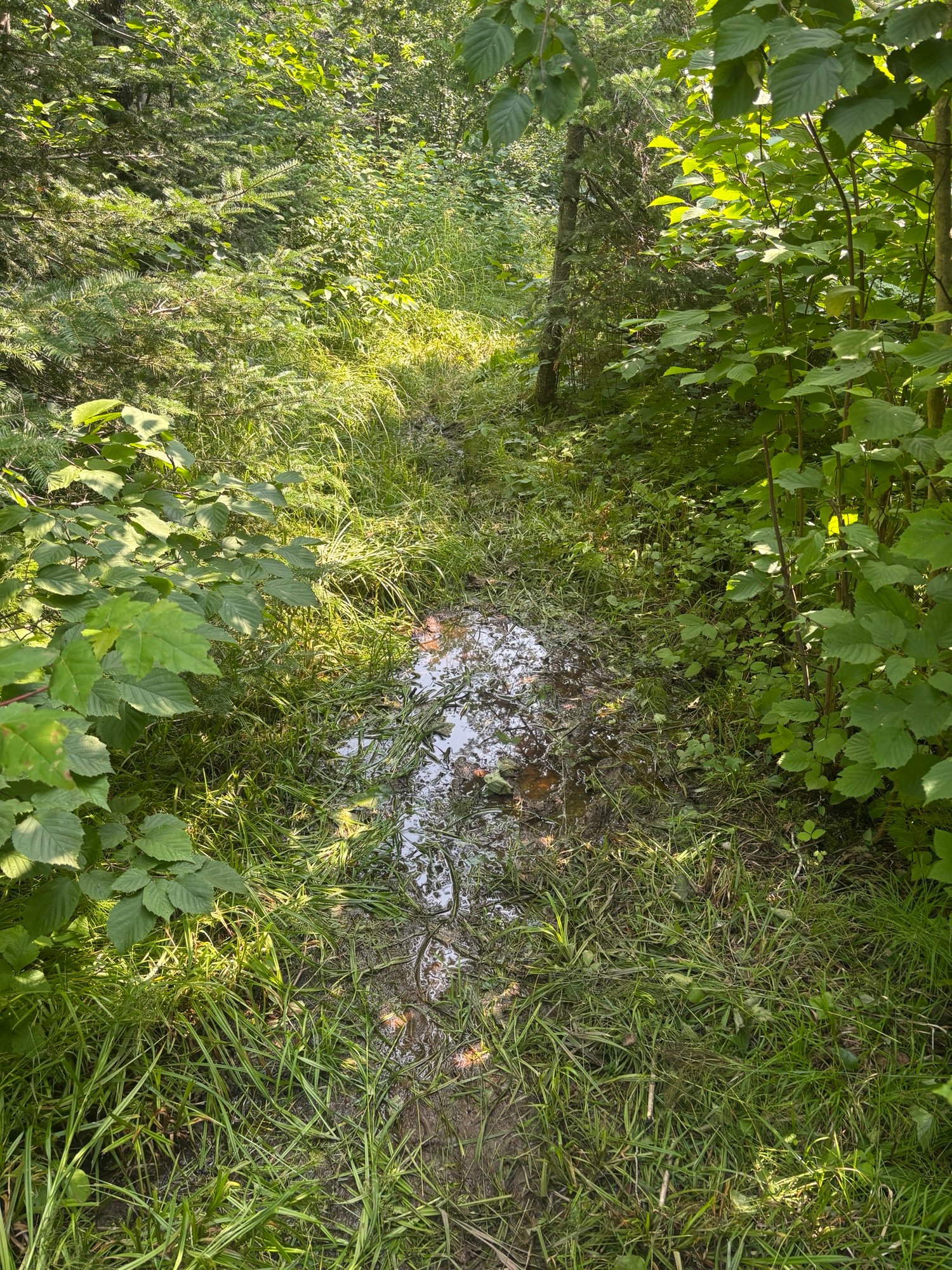
Day 2 was really pushing that limit of quitting, which is not a good spot to be in on the second day of the hike. It rained for the first half of day, from 10:30 in the morning to around 3 in the afternoon. As a reminder, I have no waterproofing in my kitchen at all. The only thing that saved me last time was that the rain eventually let up before it could soak everything in my backpack. This time, it did not. Bad for morale.
That’s not even the worst part. When it rains, my glasses fog up. This isn’t terrible on its own; my vision is okish so I just take them off and clip them to my jacket.
In the middle of a thunderstorm, getting pelted with rain, I realize they’ve fallen off their clip. At this point I’ve been hiking for two hours with them off, so they could be anywhere along trail. Terrible for morale. Horrendous, even.
As I walked back along the trail, thunder booming, rain pouring, I was already brainstorming how I would tell my parents. I think I prayed the Hail Mary fifteen times.
What’s more, the thought crossed my mind that I might not be cut out for this. I mean, losing literally the second most expensive item I own (after the phone, I guess) on the second day? That definitely raises some doubts about my ability.
Luckily, I found them not even twenty minutes later. They had bounced off some of the ferns lining the path and were sitting dead center of the trail.
I cannot stress enough how much of a miracle this is. The trail was overgrown and flooded. Had they bounced anywhere else they would be buried under feet of foliage or submerged. I think the exact quote I said when I found them was “Holy sh*t no way.”
Overall good for morale, but it was still raining and I had just wasted almost half an hour backtracking. I was pretty sick and a little rattled at this point, so I decided I’d pitch my tent at the next camp and wait out the storm.
I did just that, but like my other gear my tent was soaked through. The bottom liner is waterproof, which is great for keeping water out but unfortunately also works to keep it in. I tried to get as dry as possible, putting down my sleeping pad (also pretty wet) and stripping off all my damp clothing.
The end result was me eating tortillas and cheese sticks (my new favorite food combo) in. my underwear as the rain kept going. Everything was damp at the minimum, and most of my gear was outright wet. Sitting in my tiny tent in the rain, my morale was broken.
I got homesick like I never have before in my life, looking at old photos of me and my family, missing the good times with them. They’re all fine present tense btw, that sentence sounded really morbid like something happened, but they’re dry and I miss them so I wanted nothing more than to be with them.
I seriously considered if I’d be able to make it to the northern terminus, or if I should just call quits at Twin Harbor (the nearest town). Morale at an all time low.
Luckily, the rain broke around mid afternoon. That left me with enough time to saddle back up and keep moving.
This is where things start to tie back to the title. Trail conditions were TERRIBLE. Even when I wasn’t getting wet from above, the flooded trail meant I was getting wet from below. There were numerous sections where I had to walk through shin deep water. Calling it the Superior “Hiking Trail” is generous, I’d say it was closer to the Superior “Military Amphibious Assault Training Course”. Lots of mud.
Let’s do a speed run of all my terrible trail condition photos:
At a certain point, though, you can only get so wet. I knew my sleeping bag would be soaked when I slept, and had made peace with that (admittedly miserable) fact. Literally nothing on my was dry, so I figured I was at rock bottom and nothing could get worse.
Wrong. Section B, as previously mentioned, is all snowmobile trails through bogs. It is INCREDIBLY lowland, which means you get a lot of bugs. Rain makes the bugs 10 times worse.
In the hour it took me to set up camp that night, I got bit at least times by mosquitos. They harassed me all day, never letting me slow down. The only time I wasn’t getting bit or downpours on was when I was in my tent, at which point I immediately passed out from exhaustion.
So yeah, not a great day to be a hiker or even a human being in the woods in general. I’m starting to understand why American colonists cut down so many old growth forests. If I had to live outside all the time before the invention of bug spray or mosquito nets, I’d be inclined to slash and burn everything too.
It’s also worth noting that, by the point I went to sleep, I hand not interacted with another human since the previous afternoon. Not enough to make me go crazy (yet) but I was getting bored.
At least I found mushrooms.
Day 3: Walking WAY Too Far
Day 3 was a lot more of the same. I woke up, boiled myself some ramen, did a shot of my electrolyte caffeine mix, and packed up my tent.
On a side note, the electrolyte caffeine mix (Meijer branded, ofc) has become one of my favorite parts of the day. It’s a concentrate that your supposed to add into water, but since I have no bottles of clean water (I fill my bottles dirty and filter as I drink) I have nothing to mix it with. I’ve started just doing it like a shot every morning. It is INCREDIBLY sour (bc it’s concentrate) and makes my tongue tingle whenever I drink it. It’s a 10/10 experience and I’m half considering adding it to my non hike daily routine.
The trails were, for the most part, the same as before. There was a lot of standing water and mud, which slowed my progress. Fortunately there did seem to be at least a couple bits of really nice, well groomed dirt trail. Not enough to satisfy me really, but enough to give me hope that things would get better later.
My first stop was at McCarthy creek, where I got accused of being a communist and was able to take my boots off and soak my feet in the water. For whatever reason there were no mosquitos there, so I spent a LONG time just enjoying that. My feet didn’t need this, as my boots were still wet from the day before and so they’d kind of been soaking all day, but the cold water felt nice. I signed the SHT logbook there, ate lunch, and then pushed on.
I met a guy and didn’t catch his name, but he looked like a Bob, so we’ll call him Bob. He was the first person I’d seen in around 36 hours, but talking to him didn’t make me feel much better about the hike. He said that the trail was muddy and overgrown basically all the way to the northern terminus, which is where he’d started. He blamed it on all the rain, saying Minnesota had apparently been having a more rainy than average summer. From what I’d seen, I certainly believed him.
The trail eventually flattened out into a long gravel road walk section, which was cool because flatter, more consistent trail surface allowed me to really get my miles in. Also, three miles per hour seems to be the magic limit where most of the mosquitos can’t keep up. They’re motivating me to get my miles in more than I could ever motivate myself.
The road walk got further extended by a trail closure, causing me to push even further at this fast pace. I passed a camp site, but I figured I could get to the next one by the end of the day. By this point it was already 6, and the nearest camp site (big bend) was 6 miles away. The sun has been setting at 8:30, so it meant 6 miles in two and a bit hours. Doable.
The problem was, I hadn’t stopped to eat since McCarthy creek. I kind of forgot about this when I decided to push for big bend, but I sure felt it about two miles later. Also, the trail returned to its regular old self: mud and overgrown grass patches. This slowed my progress significantly.
I kept pushing. My legs started to tingle. The trail started following a river, and the river kept bending, but none of them were the big bend. The sun was starting to dip, and I still want at camp.
Part of the problem is that when I really hungry I get really dumb. This means worse decision making, but also just that I trip and stumble more. This slows me down, adding to the problems of pushing to camp while I’m on the clock. Should I have just stopped and eaten a cliff bar or something? Totally. That would have solved everything. But did I? No.
By the time I got into camp at 9 the light was already fading into dusk. I literally couldn’t feel my legs, and had to sit on the bench for a minute before I was ready to pitch camp. I I definitely, definitely overdid it, but oh well. My shoulder also felt like I’d pulled something, which was probably from catching myself with my poles while stumbling (literally stumbling) into camp.
I ended the day by eating 1000 calories of ramen and jerky and then crashed HARD.
Day 4: Oh Wait Hiking is Actually Fun
Luckily, this saga has a happy ending.
I woke up early like usual, then went back to sleep. I don’t think I got out of bed until 9, and slowly rolled into gear. I knew I’d pushed too hard the previous day, and was completely fine with chilling out a bit.
The good news was that my shoulder, which i’d been really worried about before going to bed, had turned out ok. Apparently 10 hours of sleeping on the ground is the best cure for aches and pains.
The bad news was my boots were still wet, and so my feet were starting to hurt a little bit. Not debilitatingly, but they were definitely tender. Also, the days of walking in the rain had made the chafing so bad on my legs that I made the executive decision to hike in my thermal layer instead. They’re tights, and although they’re a little hot for my liking they don’t rub nearly as badly as my actual hiking pants.
I braced for another day of mud and flooded our trails, but fortunately it only took around four miles before I passed the end of section B and into section C.
All of the other hikers I’d met weren’t lying. Within 300 meters of passing the section C trailhead I had to climb up almost 500 feet of switchbacks. It was like someone had heard me complaining about lowland mud hiking and curled the monkeys paw. It was tough trekking.
The top made it all worth it, though. I got my first of the promised “stunning views of Lake Superior and inland Minnesota” that I was beginning to think were a myth. The trail also cleaned up a lot, becoming much more of a mountaintop dirt path. This made it a lot easier to keep moving fast, which almost made up for the time I’d lost lugging my pack up the face of a cliff.
Almost immediately I bumped into another southbound thru hiker, a woman named Maddie. She was drying her gear in the sun while eating lunch. She supported the “trail gets better up north” narrative by saying that basically all the way to Grand Marais is similarly cool mountain trails, which was good to hear. She also told me that it flattened out for a bit after Crow Creek, which was nice because my legs were burning.
The trail quickly dipped back down, heading into one of the coolest rocky gorges I’ve ever hiked through. It reminded me a lot of out west. I ended up stopping there to eat take a breather before pushing on once more.
Maddie wasn’t lying, and the trail really did get flatter after that. I was able to go fast, as it was still relatively good quality with mud in a few spots. The weather was sunny and hot, but I didn’t mind it when the alternative seemed to be pouring rain.
As I neared my campsite, I kept seeing bear tracks in the mud. It was a good reminder that, even though I wasn’t seeing them like I did on day one, there were still bears in the area.
The best part of the day had to be the views, but the next best was the lack of bugs. I don’t know if it was the heat, the higher elevation, the dryer ground or some kind of divine intervention. There just weren’t as many bugs as there were one previous days.
I camped at a place called blueberry hills. It had no blueberries and only a passable amount of hill, but the ground was soft and I slept well.
Tomorrow I’ll be in stringing distance of Silver Bay for my first restock. I don’t technically need it; I’ve been hiking faster than I expected and started out carrying WAY too much food. Still, town will be good for drying out gear and buying some medical supplies to handle my blisters before they get too bad. Hopefully my chafing gets better too. It’s currently too graphic to even describe in a PG way, so the only way to go is up hopefully.
Also, I’ve decided that I’m going skinny dipping before the end of the trail. That’s always been a dream of mine, and I want to achieve it. It’ll have to be in an alpine lake to avoid leeches, on a weekday to avoid other hikers. In hoping for it to be cold and refreshing and life changing. And to not get a bacterial infection, I guess.
Stick around to see if I get there!
Happy hiking, y’all.

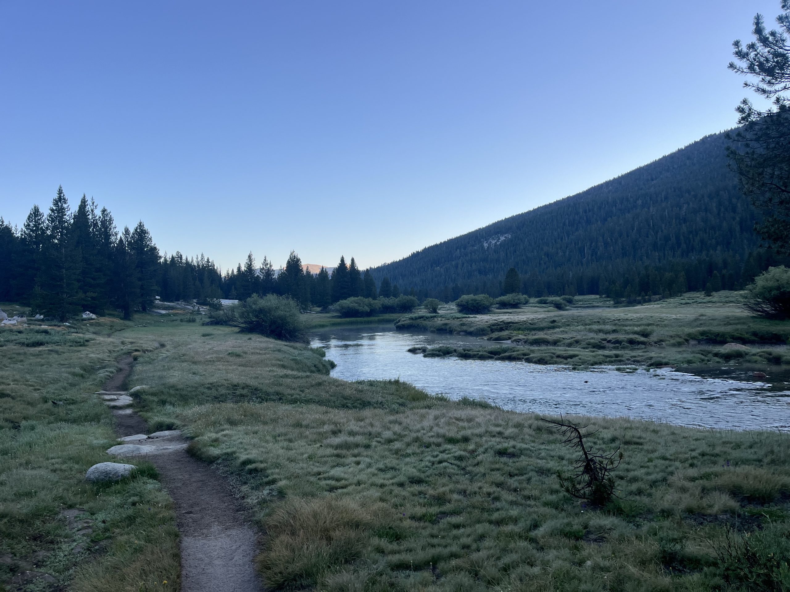
This morning I got up and made coffee. Then I was packed up and walking right around 5:45 AM. I said goodbye to Cara who I won’t be seeing again. The JMT and PCT split off very soon. She’ll be heading into Yosemite Valley to finish her hike. And I’ll be heading into Tuolumne Meadows and continuing on the PCT past there.
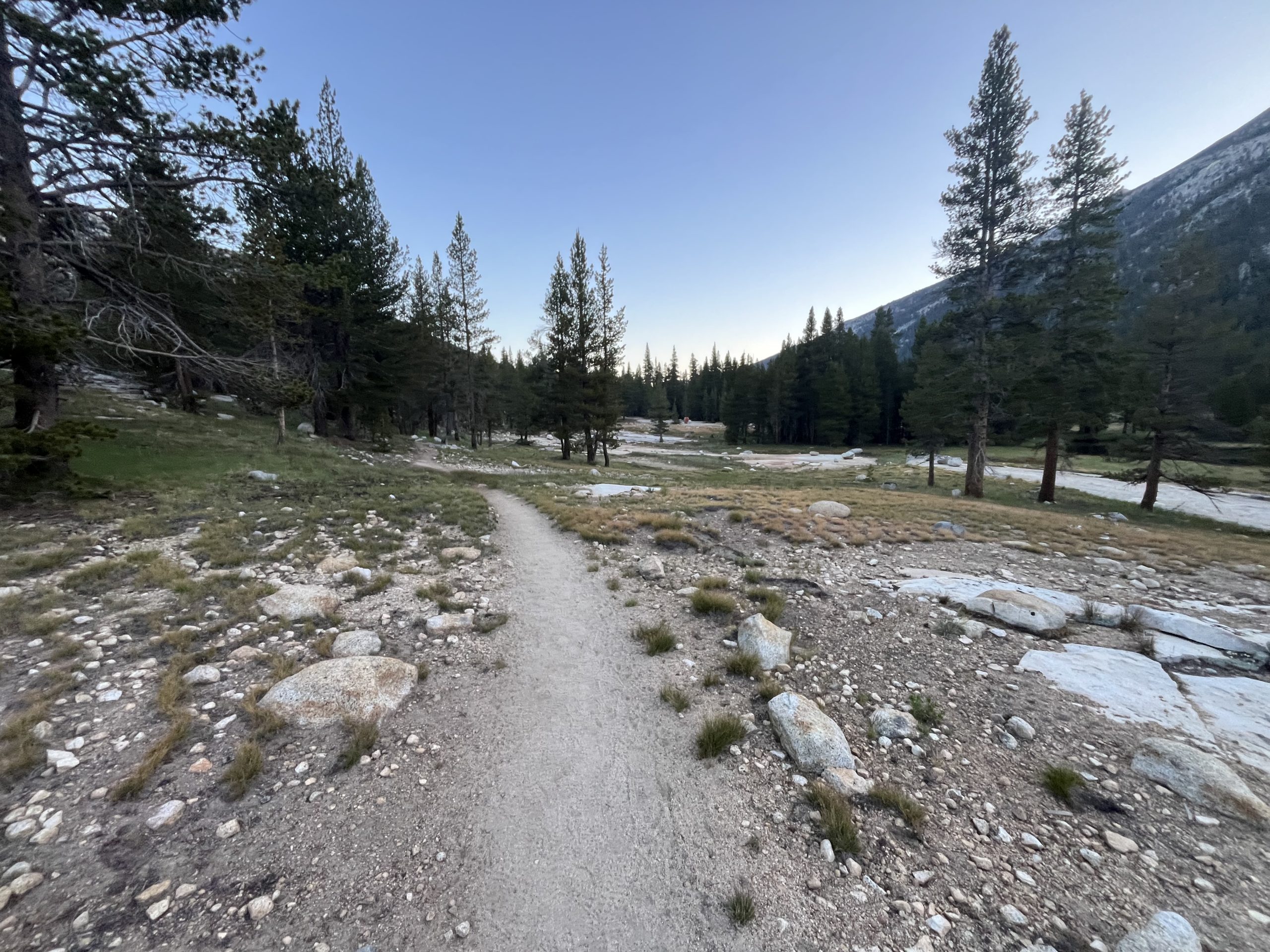
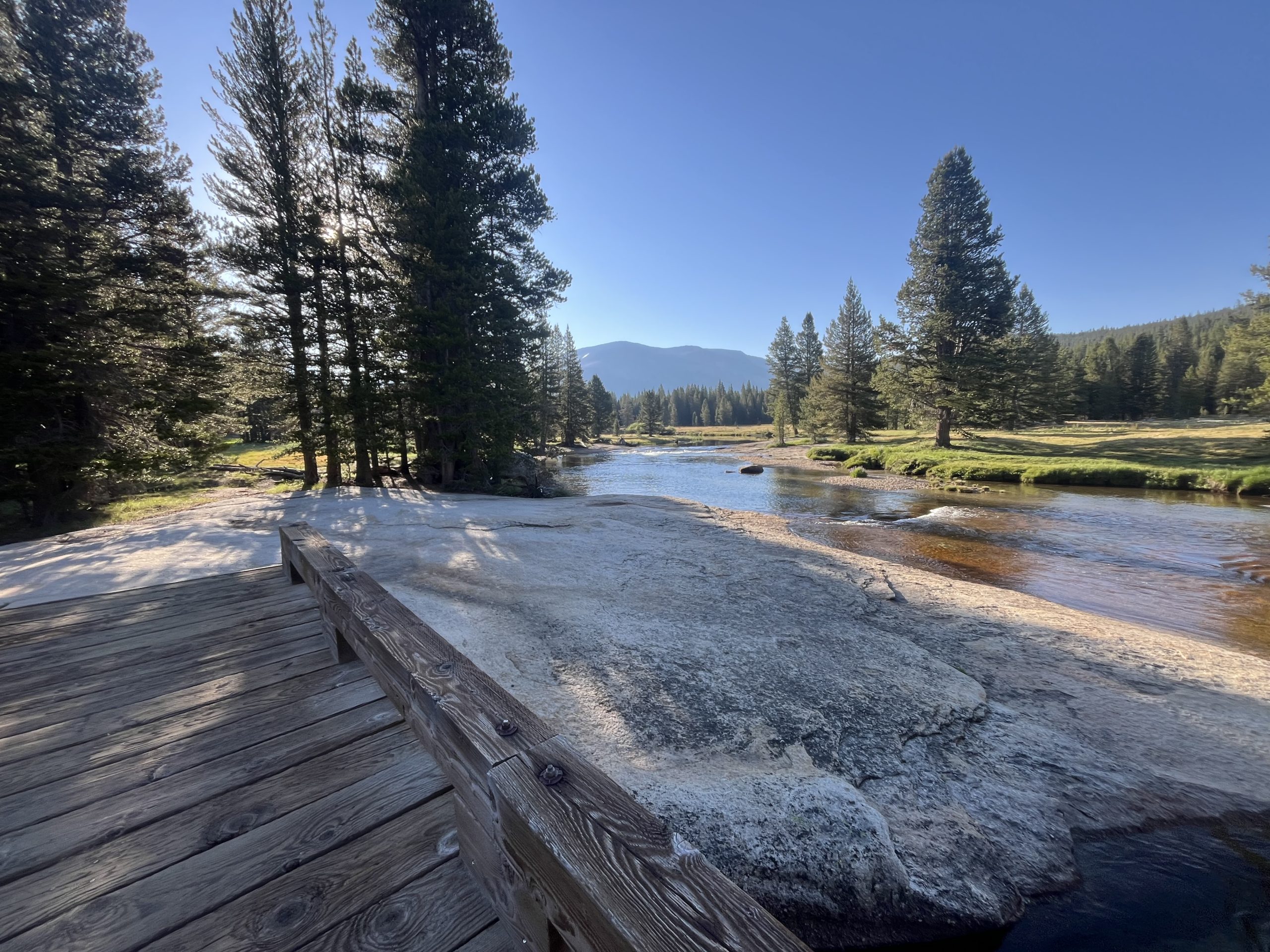
I only had a handful of miles to do this morning before I would get to Tuolomne Meadows. There is a small camp store there and a restaurant. I’m pretty excited to be able to grab a drink and something to eat. Especially considering it’s right off the trail. Plus the entire first 12 or so miles up today are completely flat. So the hiking from my camp spot to the store is about as easy as it gets.
As I got closer to Tuolumne I started passing a bunch of hikers. Some were out doing section hikes and others were doing day hikes from the parking area. I wound up getting into Tuolumne Meadows and down the road to the store right as it opened. I was standing outside by 8:02 AM. But unfortunately for me, so were about 10 other people who had driven there in their vehicles.
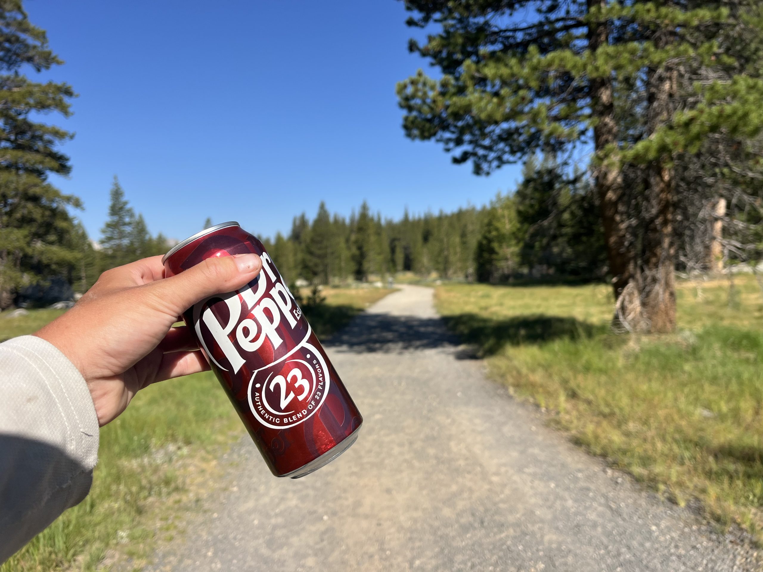
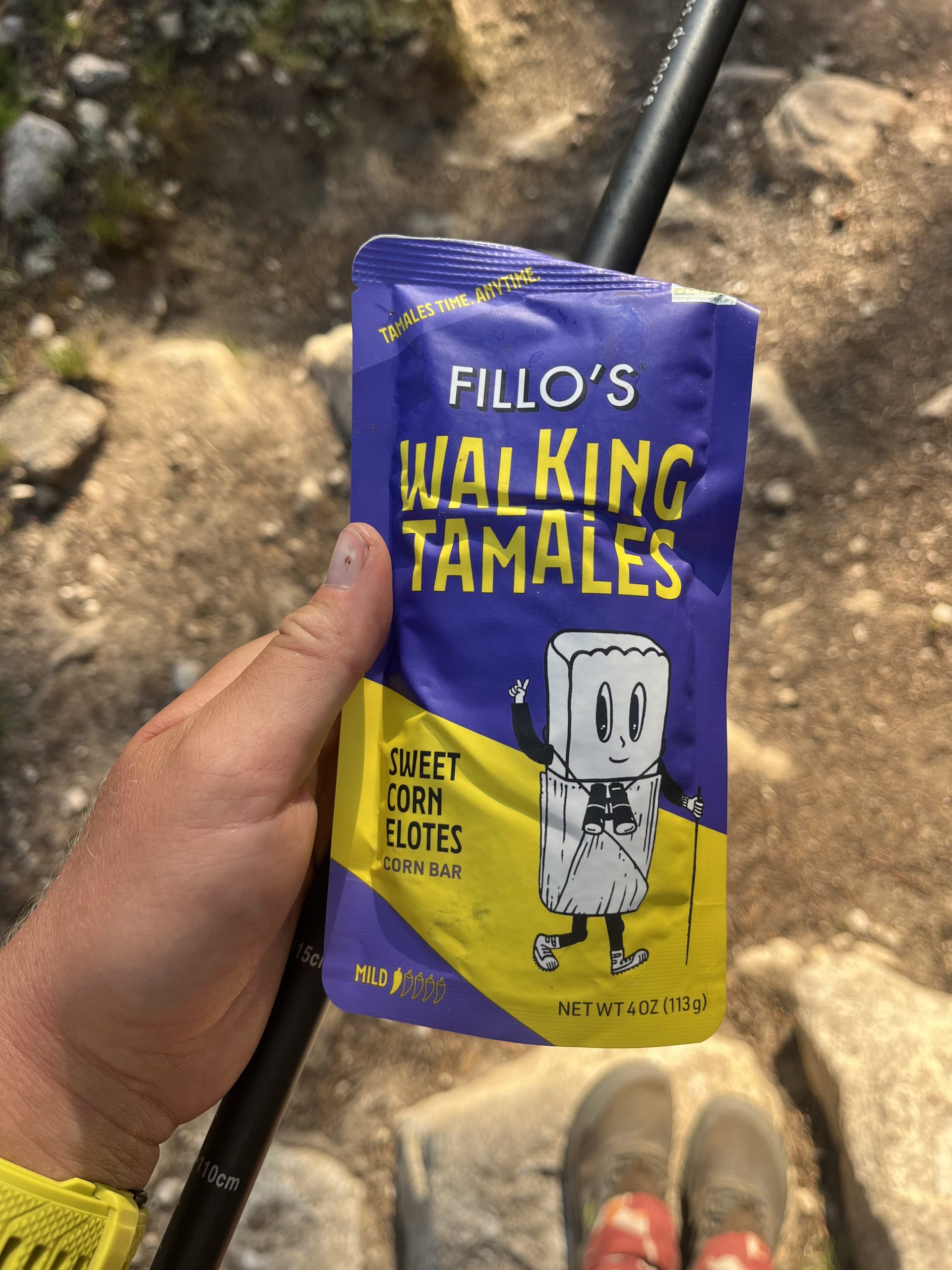
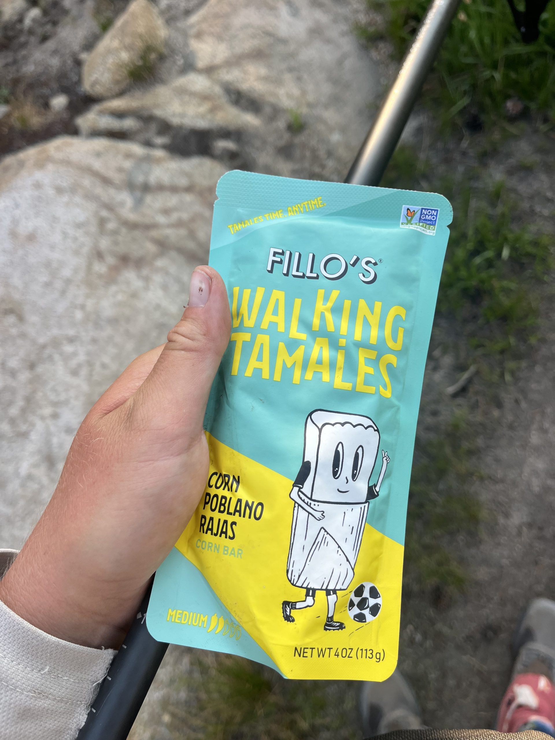
I wound up waiting a long time to get to the front of the line and order. But it was still really early, so that was ok. I got a hot chocolate, a breakfast burrito, and a side of home fries. While everything cooked, I headed to the general store next door to grab a couple things. I got two Gatorades to pack out in my water bottles. I also got a soda to carry out and drink later today. And the store had two types of walk-in tamales that I’ve never seen before. So I had to try those.
By the time I was done in there, my food was ready. I stuffed down the home fries and drank the hot chocolate. Then walked out with the burrito and ate it along the road. I knew the trail would follow along the road for a while. Then it would pick back up onto dirt track before getting onto some actual trail again. I ate while I walked and this next section wound up being one of the busiest sections of trail I’ve seen a long time.
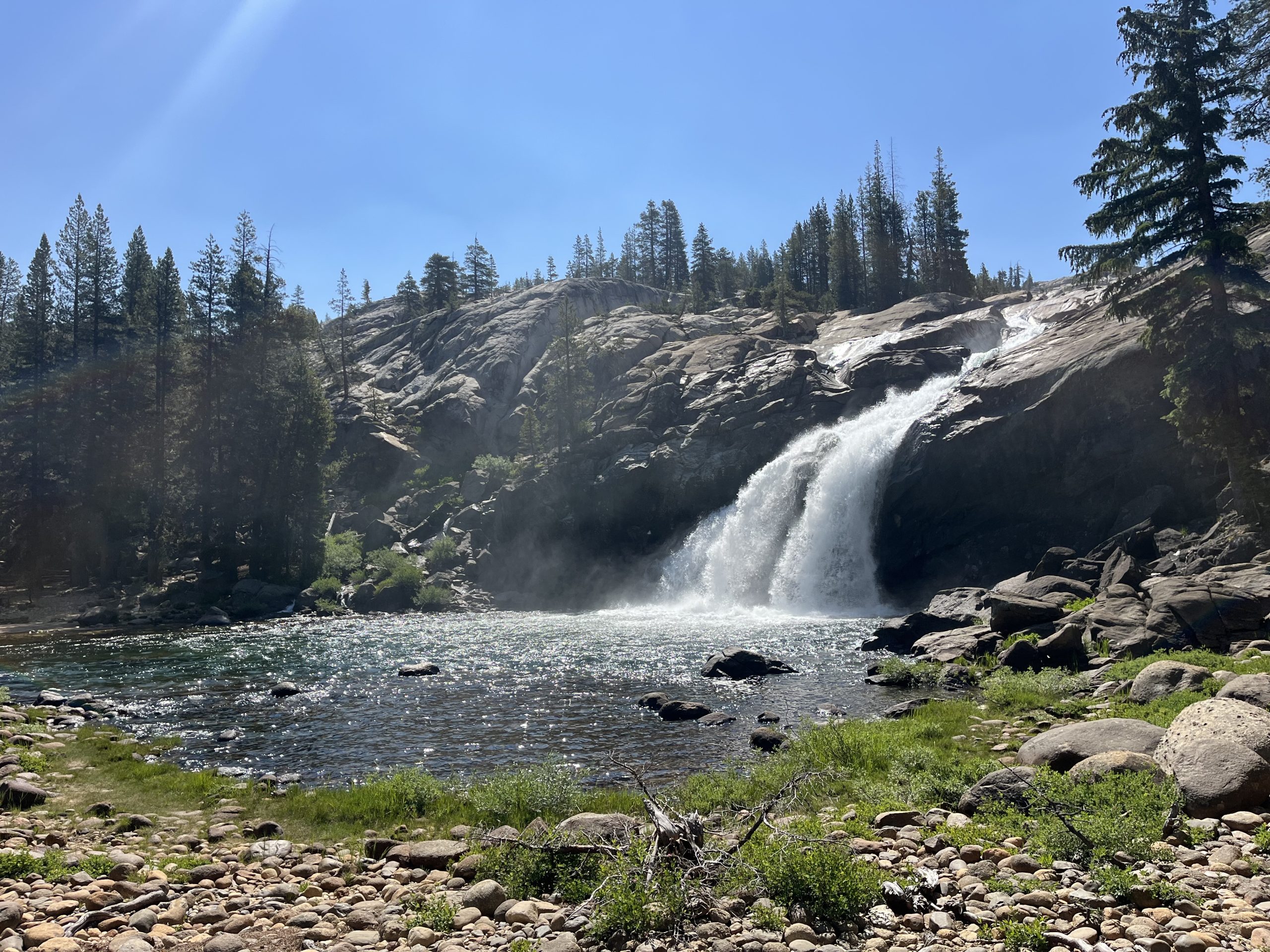
I wasn’t really prepared for it either. When I was here last time, Tuolumne Meadows wasn’t even open. I was so late in the season that everything was closed down so I didn’t see a soul. Apparently, though, the campsite about 5 miles north of Tuolumne Meadows is super popular. Because as I made my way there, I probably passed 50–60 people heading the opposite direction. They had all camped at the site last night. It’s right by a waterfall and apparently has running water and bathrooms.
I actually camped right by the waterfall and near the campground last time. I could see canvas tents, and other things set up. But things like that sort of give me the creeps when they’re closed. So I didn’t head over to investigate. This time around, it’s the middle of the season and there were tons of people utilizing the campground. It was a constant parade of large groups of hikers. Then I came to the junction for that campground and hardly saw a soul for the rest of the day.
It’s not surprising that the campsite right across from this waterfall is incredibly busy. I kept very close to this waterfall as well in 2022.
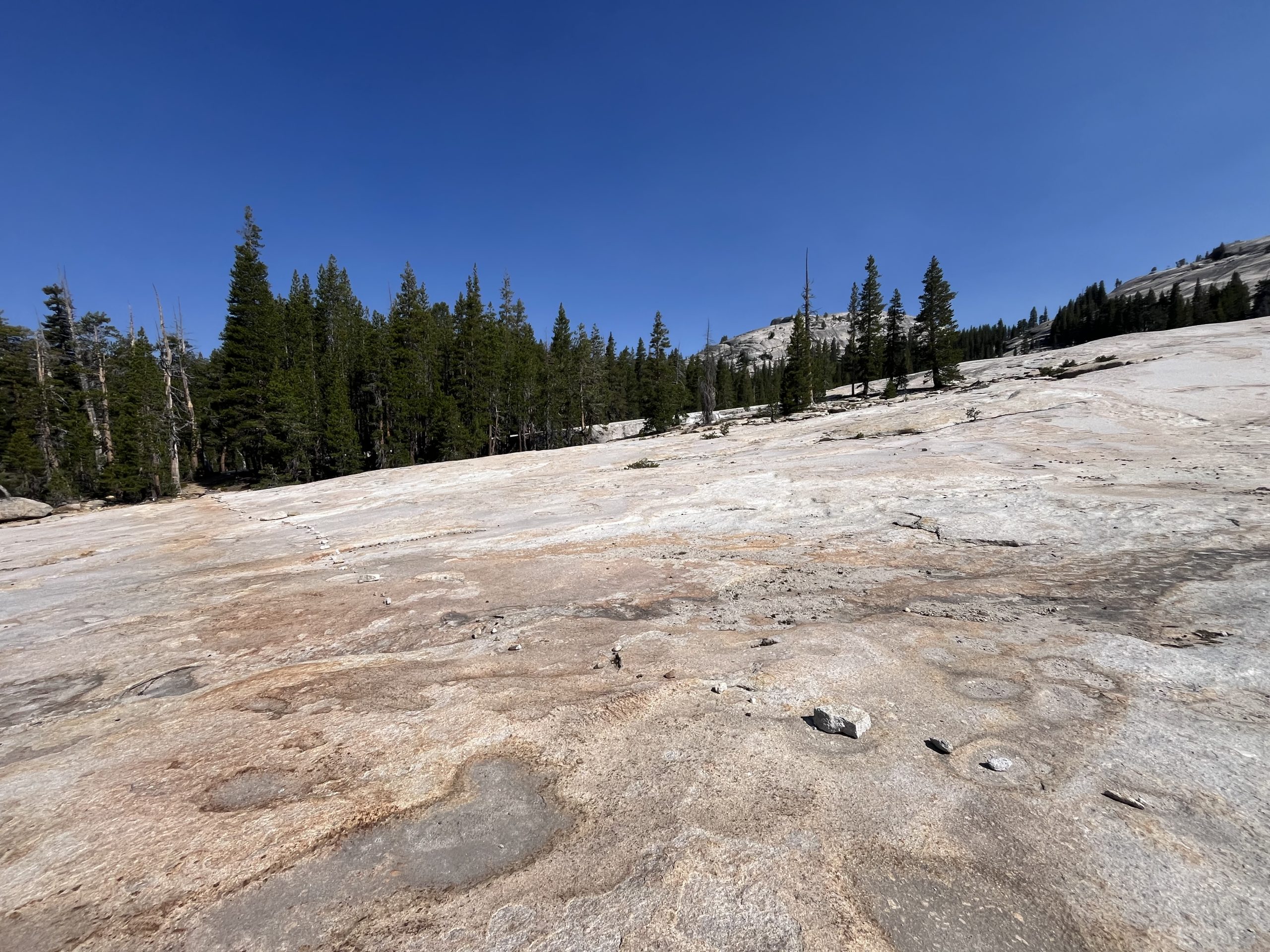
When I passed the junction for the campsite, I began a long but very gradual climb. It went on for the next seven or so miles. Then over the course of the day I would have a couple more gradual climbs. It’s getting to be the part of this trail, though, where things really calm down. The climbs are just going to continue to get more and more gradual and also shorter.
The terrain of this next climb was so nice and easy that I forgot I was going uphill most of the time.
Over the next couple hours, I made my way up to the top of that climb. It was scorching hot out already for the day so I stopped off a couple different times to grab water. At one point I was really thirsty and hadn’t seen a source in a while. Then I came upon a perfect clear puddle of snow melt. It was so clear and nice and cold. Not long after that I passed a couple hikers who didn’t seem to have the necessary maps or things. They had no idea where the next water source was and were asking me about it. Which is totally fine, and I always like helping people out. But it is a bit astonishing when you come out into the woods and aren’t even prepared enough to know where your water sources are. It always makes me nervous when people ask me questions like that. It’s very telling of how ill prepared someone is, typically.
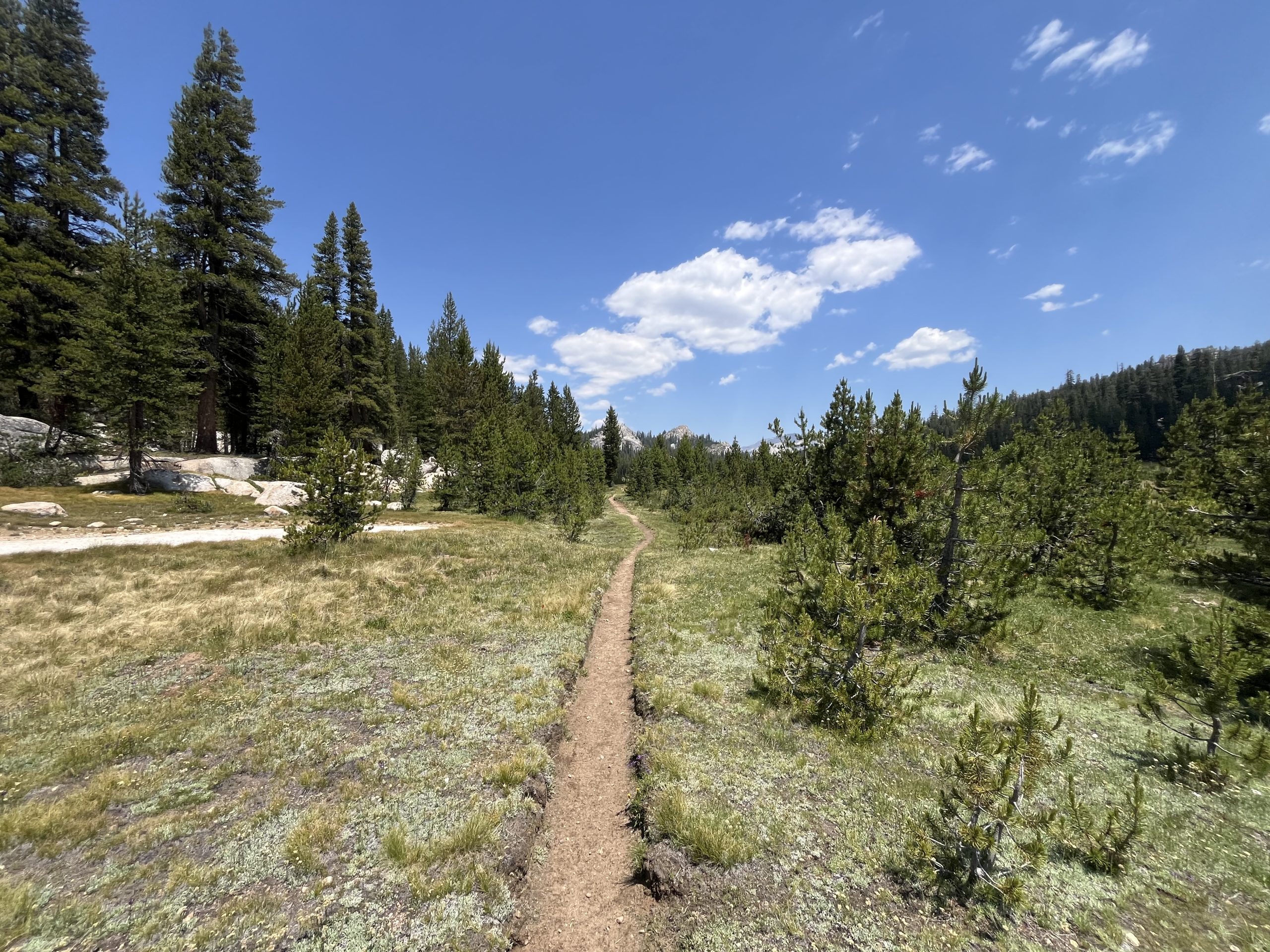
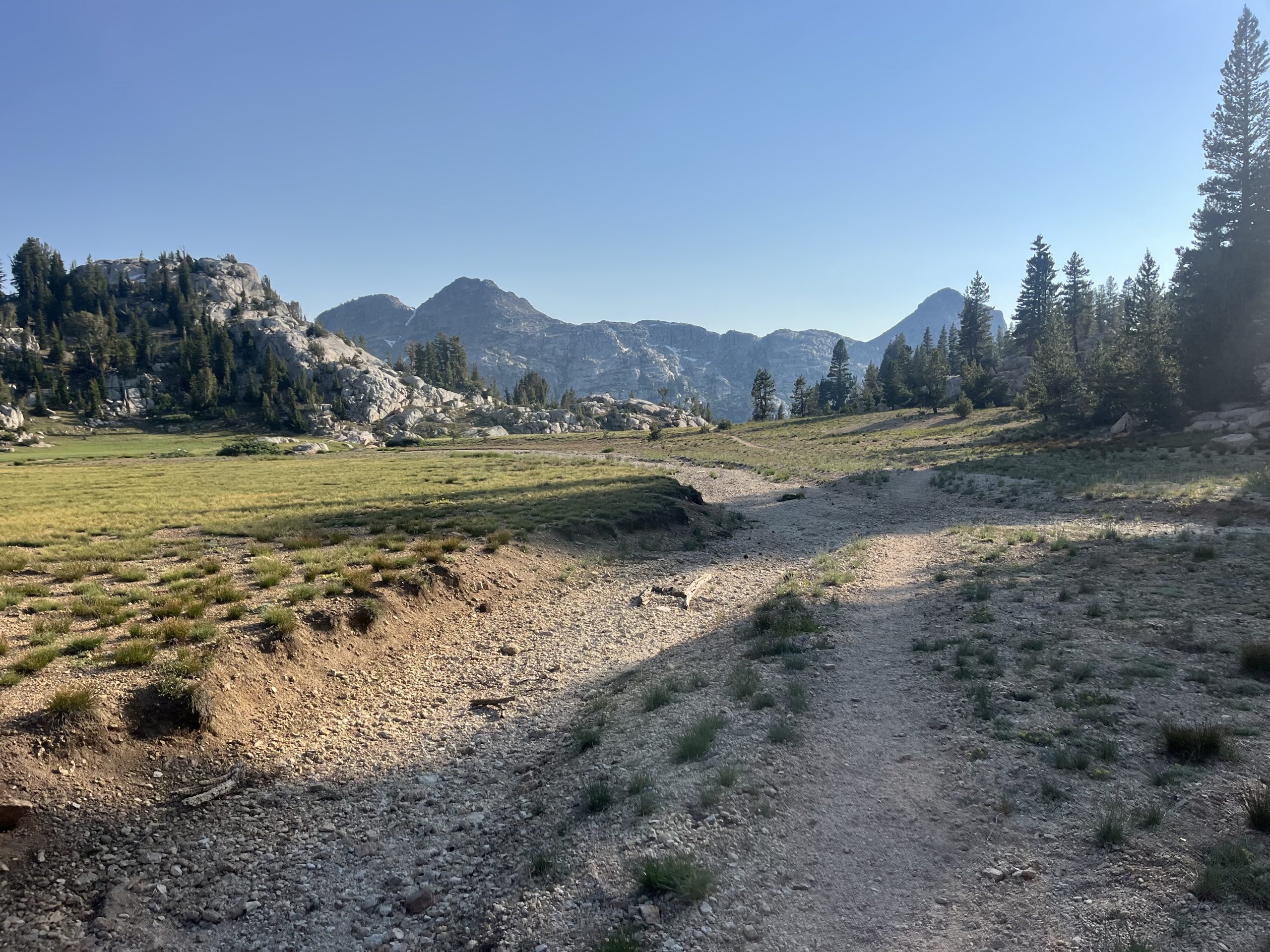
Eventually, I would have to do some elevation again. But prior to that, I enjoyed the beautiful trail.
Over the next couple hours, I had some more rolling climbs on and off. Then began making my way up the next pass. This would be my final big climb of the day. And one of the last passes in the Sierra. As they’ve gotten shorter though they’ve been a lot more gradual. And you barely get above tree line anymore. I listened to an audiobook as I walked and the time went by very quickly.
When I got up top, I ran into two other PCT hikers. But I was still hoping to go way further for the day, so I just kept on moving. By the time I was at the top I think I was over 32 miles in for the day. But was trying to go about 35 miles to set myself up for an early day into Kennedy Meadows north in a couple days. Originally I was planning on making it all the way off of that last pass and begin climbing up the next one.
But I wound up going by the next water source near a campsite and decided to stop off there. It was around 7:30 PM and I’d gone a little over 35 miles for the day. There were a few other people set up for the night at the tent site. But it seemed like everyone was already fast asleep. I grabbed water and then got my tent situated. Then boiled water and made dinner.
I picked up one of the stones from the nearby fire ring to hammer in my tent stake. The stone was still warm from the fire that the other 4 PCT hikers must have had before I arrived around 8PM. They were all lying in their tents, most of them sleeping. I could hear one or two of them roll over to peer out of their tents at the sound of my arrival. Last one in, last one out. That’s what I always recite to myself when I arrive late to a camp site with other hikers.
There are always exceptions to every rule. But generally this year I’m the last hiker to set up for the night if I camp with others. And usually I’m packed up and gone before the other hikers awake the next morning.
I quietly made dinner and thought about the day and the mileage. It’s so funny how much time I spent today thinking about mileage. I woke up this morning 81 miles out from Kennedy Meadows North. Yet was trying to work the miles regardless, and turn that 81 mile stretch into two days. But not just two days. Two days when, on the second day, I arrive at the highway early enough to hitch into Kennedy Meadows North. That was the center of the issue.
Doing two 40 mile days in a row wouldn’t have been that bad. But to ensure myself having enough time to hitch hike before dark, I’d have to do 45~ miles one day and closer to 35~ the next day. That’s the only way I could be certain to arrive at the road early enough to get a ride. And if I couldn’t get a ride then there was no point of any of it. That plan wasn’t working out. So instead I rolled back to my original plan, to arrive at KMN in the morning the day after tomorrow. It won’t be ideal to try to get in, eat, resupply, post a couple things, and get back on trail. But I don’t have to charge anything so as long as I get a fairly quick ride in, I think I should be able to get back out fast enough.
Every time I leave town with a loose plan of my intended future mileage. And it feels like every morning I wake up and slightly tweak that mileage to get to the next town quicker. Even when it appears that there is no way to tweak the mileage, you better believe I’ll try to find a way. Which usually involves some kind of crazy mileage. This time around though, logic won. Considering the fact that I really only have to average 26 miles a day for the rest of the year, I think doing 30–35 mile days is pretty great. Recently I’ve been doing a closer to 35 miles a day than the ladder. And yet even still, I can be hard on myself and try to push myself further. Every time I raise the bar, you would think I would be satisfied. Yet it just makes me want to raise the bar even higher. I suppose it’s a blessing and a curse.
If you enjoyed this blog and would like to support my hike by buying me a soda or a snack along the way, there is a “Tip the Author” button below! It links directly to my Venmo. Any and all support is incredibly appreciated!
This website contains affiliate links, which means The Trek may receive a percentage of any product or service you purchase using the links in the articles or advertisements. The buyer pays the same price as they would otherwise, and your purchase helps to support The Trek’s ongoing goal to serve you quality backpacking advice and information. Thanks for your support!
To learn more, please visit the About This Site page.
Bet you weren’t expecting that title, were you? To be honest, neither was I.
Easy and Hayduke are not words you usually see together in a sentence, unless it says something along the lines of: ‘Easy to get lost on the Hayduke,’ or perhaps: ‘Easy to run out of water on the Hayduke’.
But once I had passed the halfway point of the trail, things got considerably easier for quite a while. Yes, I mean easier in relation to the rest of the trail. By now, I had gotten used to slow miles, hard terrain. Gotten used to bushwhacking, scrambling, climbing, sliding, slipping, tripping and trembling. And let’s not forget: dehydrating.
When being tired and thirsty becomes a way of life, any change that lets you sleep, rest and drink water, is equal to living the high life. Last time we spoke, I had reached the halfway point somewhere along Hackberry Canyon in Utah.
400 miles done, 400 left to go.
I was all ready for some more hardship, but the terrain levelled out, and I got to make miles. That, in turn, brought with it another consequence:
I had permits arranged for the Grand Canyon section of the trail, and hiking buddies that would come and meet me there, so I had no wiggle room for arriving earlier. If I started moving too fast, I would arrive way too early!
Talk about a luxury problem…
All of a sudden, I found myself hiking on level, open terrain, and not being in any rush. Still, the amount of water and food I could (and did) carry, limited the amount of time I could waste. Eventually, I would run out of either or both.
From Hackberry Canyon, the trail leads you along the Paria River, then eventually spits you out at Willis Creek. From there, it’s an easy detour to the town of Tropic, to resupply and visit Bryce Canyon National Park. Bryce is not officially on the Hayduke, but I had never been there, and had some time to kill, so of course I was going there!
Apart from the usual town amenities such as an unlimited supply of fresh food, showers, laundry, an actual bed (you know, with pillows and all), towels and internet reception, Tropic also gave me a chance to repair my malfunctioning gear.
Should you ever consider doing the Hayduke, make sure to bring gear that is either very sturdy, or old and ready for retirement. Because, let me tell you: the Hayduke is not kind on your expensive ultralight gear. By now, everything that had a zipper was protesting the abundant presence of fine sand. Two of my tent zippers had given up, my fanny pack kept splitting open, my fleece vest zipper was starting to malfunction. Also, my stove was refusing to screw onto gas canisters, one of my hiking poles had been bent during a minor mishap and my brand new backpack now sported several abrasions and holes in the side and mesh pockets from hauling it across the rocks with a rope.
With lots of elbow grease and some luck, I managed to temporarily fix most of the gear, but had to resort to sowing one of my tent zippers permanently shut. It’s also a good thing that cold soaking is easy in the desert, so who needs a stove anyway?
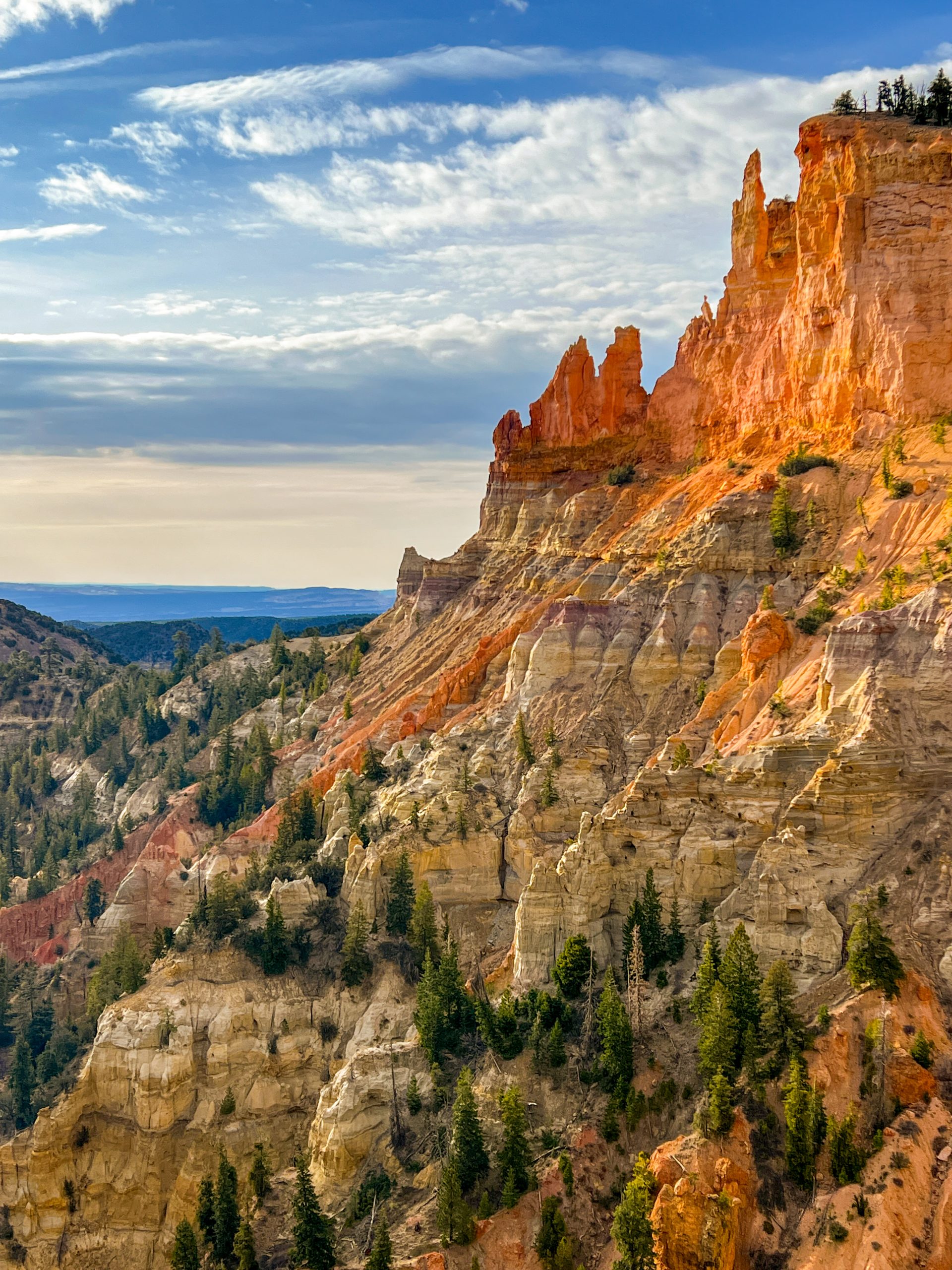
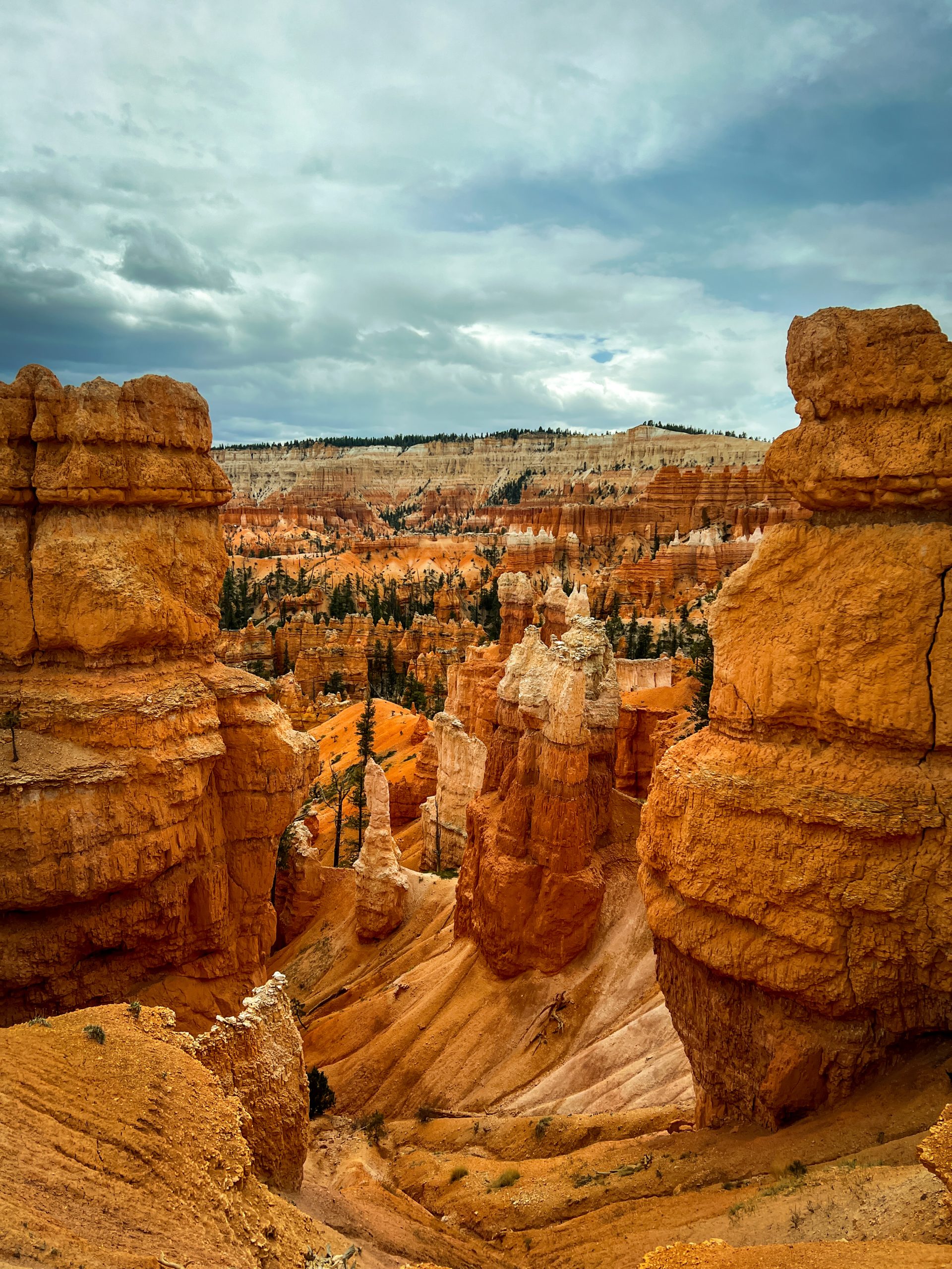
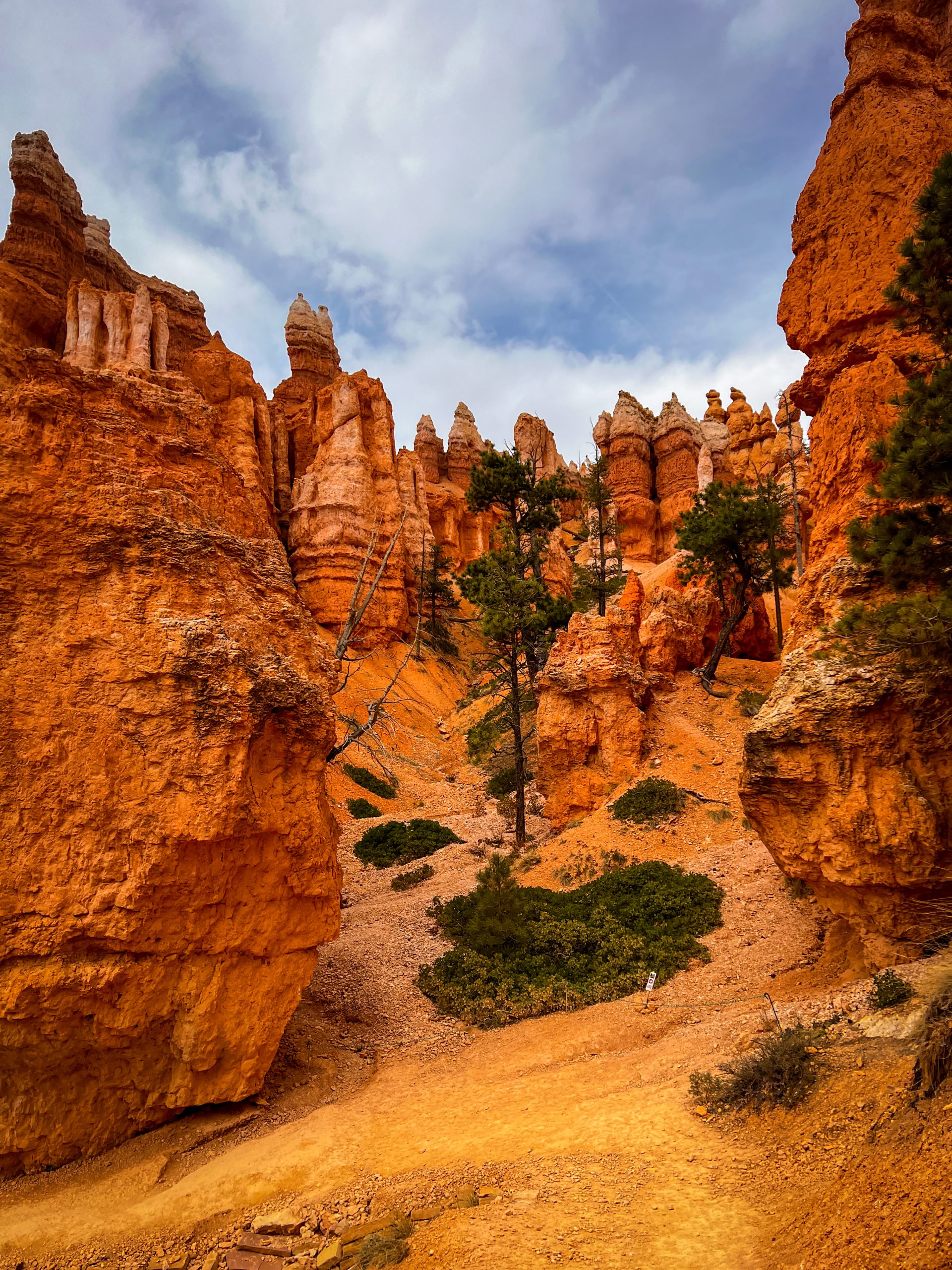
After a leisurely stay in Tropic, Bryce was breathtaking, but busy. I had not seen this many people all together in one place since I left Las Vegas back in March. It took me a while to get used to the throngs of tourists. Getting used to more people around always takes me longer than getting used to no people around. As I wandered around the park, marveling at the alien spires and bright colors all around, I heard the languages of the world spoken around me. I was not the only one under the spell of this mindblowing landscape. As I sat on a bench overlooking Bryce Point to eat my lunch, I stared at the rocks and tried to visualize how these wonders were created. Besides me, a couple was discussing if they wanted to hike down from the rim trail to the Queen’s Garden. I encouraged them to go. “It is a pretty special place, and you might only be here once, right?”
“Yeah, but we already walked five miles today,” the man said. “And what are you eating anyway? That looks awful.”
I looked down at my peanut butter tortilla wrap and had to agree. It did not look very appealing, but it would get me through my 20+ miles for the day. I decided against saying this out loud, though, and wished them a pleasant day.
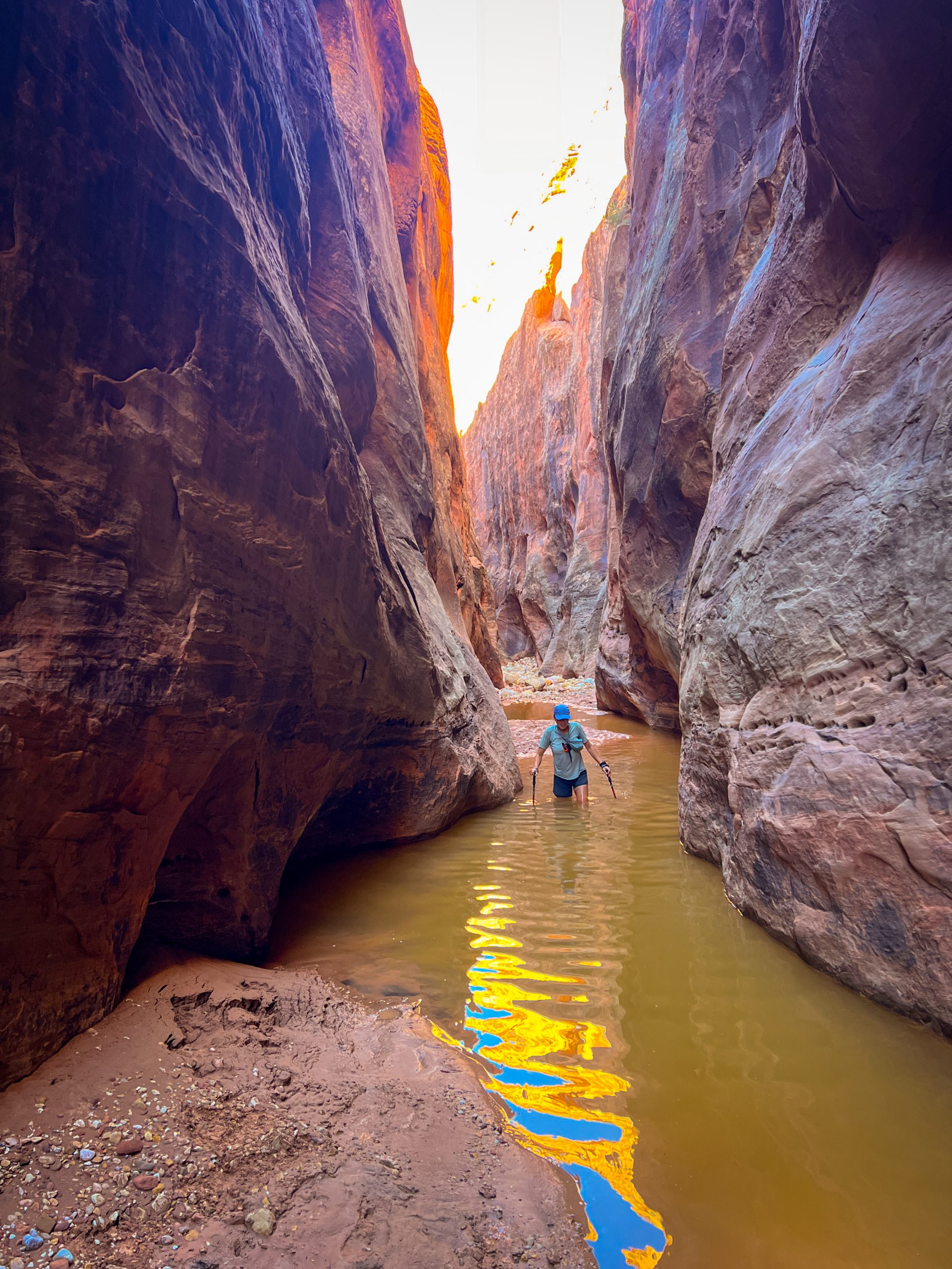
As popular as the park is, once you step away from the main pathways, the throng turns into a trickle, and soon, I was alone again. Though I remained suspicious, expecting that any turn up ahead would bring me more trials and tribulations, the going stayed surprisingly easy all the way to the Grand Canyon. Not until I dropped down the Nankoweap Trail and had to start boulder hopping along the Colorado River would I start cursing again. I will tell you more about that section next time though.
For now, the trail brought me to the small town of Kanab for another zero, and when I met up with my former PCT-tramily member Spreadsheet, we had a leisurely amount of time to get ourselves to the North Rim along 60 miles of the Arizona Trail (The Hayduke follows the AZT from the terminus at the Utah-Arizona border to the North Rim).
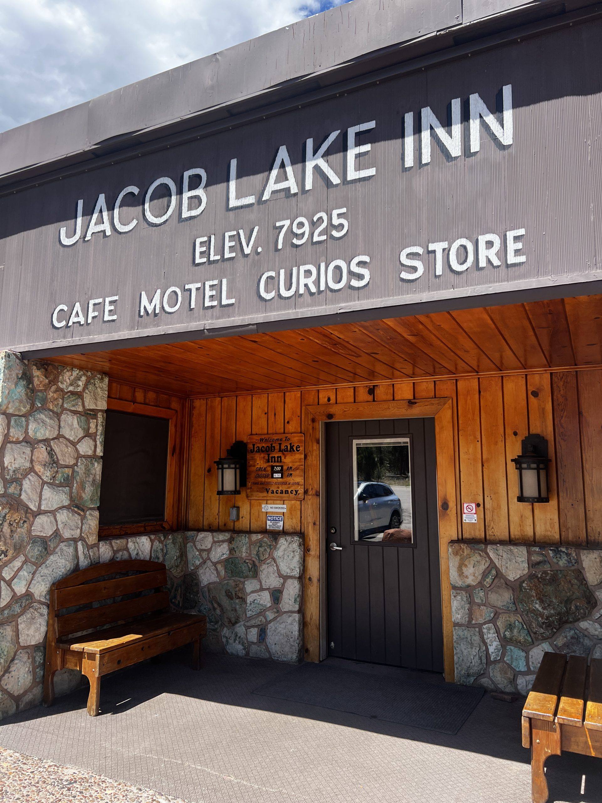
Now, don’t get me wrong, I am not claiming the AZT is a walk in the park, but compared to what I just came from, it was sheer lazy bliss. There was an actual, visible trail to follow. We had all the time in the world to take long lunch breaks in the shade of trees, eat cookies at Jacob Lake Inn, and walk as little as we felt like each day. Yes, I admit, when the weather got rather erratic and freezing cold up on the North Rim, we even camped near a (frozen) spring after a two-mile day once. Hardships, you know…
Every AZT hiker we encountered, had heard of the Hayduke Trail, also a new experience. As they were nearing the end of their 800-mile thruhike, almost all of them exclaimed how hardcore we were for doing the Hayduke. Meanwhile, we felt like the laziest hikers in the world. I had already forgotten all about the hardships of the previous weeks and now just felt slightly embarrassed and way too well-rested to be a thruhiker. Not to mention hydrated! For the first time since I had started this hike, I was not actually thirsty all day long. Compared to the Hayduke, the Arizona Trail offered a veritable cornucopia of water sources and caches.
It was a good thing, then, that I knew all of this luxury would soon cease…
Want to know more about my hike? Previous articles of my trip can be found here, or sign up to get notified when my next article hits The Trek website at the bottom of this page!
-

 Brand Stories6 days ago
Bloom Hotels: A Modern Vision of Hospitality Redefining Travel
-

 Brand Stories1 day ago
CheQin.ai sets a new standard for hotel booking with its AI capabilities: empowering travellers to bargain, choose the best, and book with clarity.
-

 Destinations & Things To Do1 week ago
Untouched Destinations: Stunning Hidden Gems You Must Visit
-

 AI in Travel1 week ago
AI Travel Revolution: Must-Have Guide to the Best Experience
-

 Brand Stories3 weeks ago
Voice AI Startup ElevenLabs Plans to Add Hubs Around the World
-

 Brand Stories2 weeks ago
How Elon Musk’s rogue Grok chatbot became a cautionary AI tale
-

 Destinations & Things To Do1 day ago
This Hidden Beach in India Glows at Night-But Only in One Secret Season
-

 Asia Travel Pulse3 weeks ago
Looking For Adventure In Asia? Here Are 7 Epic Destinations You Need To Experience At Least Once – Zee News
-

 AI in Travel3 weeks ago
‘Will AI take my job?’ A trip to a Beijing fortune-telling bar to see what lies ahead | China
-

 Brand Stories3 weeks ago
ChatGPT — the last of the great romantics
You must be logged in to post a comment Login