
Destinations & Things To Do
Elevation and Terrain – Not the Same
File this post in the enormous category of things I didn’t fully appreciate before setting foot on the AT 114 days ago. As regular readers will know, I’m a planner, don’t love surprises, and will evaluate every risk before making a choice. So I did a bunch of research – read the books, talked to former hikers, made lists and checked them more than twice, searched by soul – to be really ready for this indulgent six-month vacation. What New Hampshire (and Pennsylvania) taught me and Maine is reinforcing in a powerful way – terrain is absolutely not the same as elevation and it can knock you flat, even in good weather. This week included the strenuous 30 mile stretch including Mahoosuc Notch, which made all other terrain seem like a paved highway. All photo credits this week: Plus One.
AT Box Score
- Friendly People – 166/166
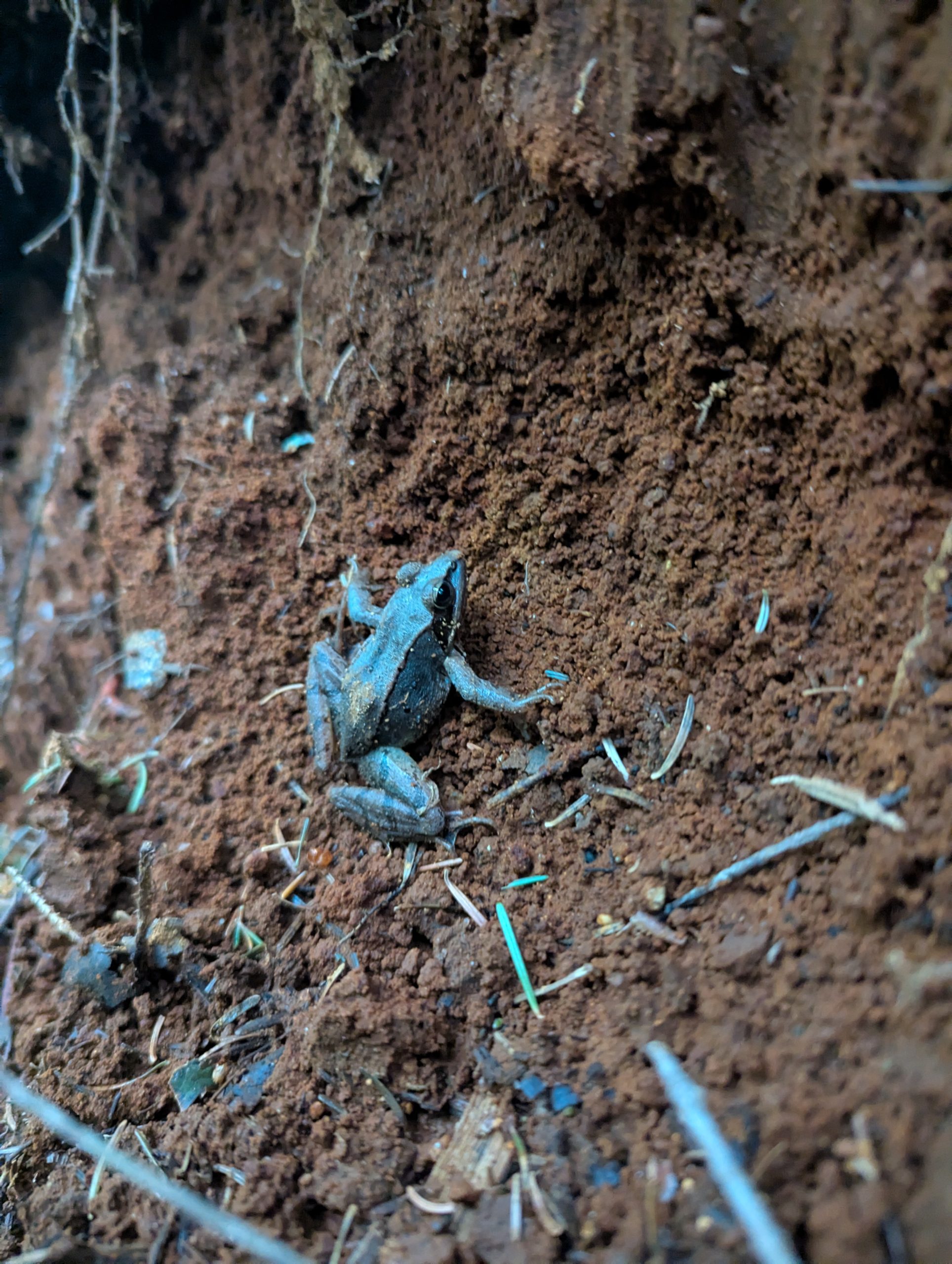
- Interesting Wild Critters – Frogs and toads!
- Errors – 0
- Injury Report – Thankfully, no news!
A funny thing happens at this point in an AT thru-hike – the northbound and southbound hikers start to collide (not literally, mostly) and the conversations change. NOBO hikers have a mix of sadness and excitement when they cross the Maine border because they’ve worked so hard to get here and the beauty of the remainder promises to be spectacular, but they aren’t necessarily ready for the vacation to be over. SOBO hikers have just completed the section of Trail that is the most remote and strenuous – they love talking about it and are so excited to hit the “cruisy” states. On both sides – renewed excitement for what’s to come.
The people I’ll remember most from this section are the day-hikers, though. It’s about 30 miles of extremely difficult terrain between US 2 in Gorham and ME 26 near Bethel. Most thru-hikers take 3 days to work their way through the jumble of boulders that litter the Trail. We met a handful of hikers/runners who were completing the distance in a day. Two had started at 4:30 AM and were expecting to finish with head lamps after the sun went down; two were confident they would be at the finish by dark despite one having fallen 30 feet in an ambitious scramble over some towering rocks. Two of them had bleeding wounds they hadn’t bothered to stop and dress. These folks are in a whole different tier of sufferfest.
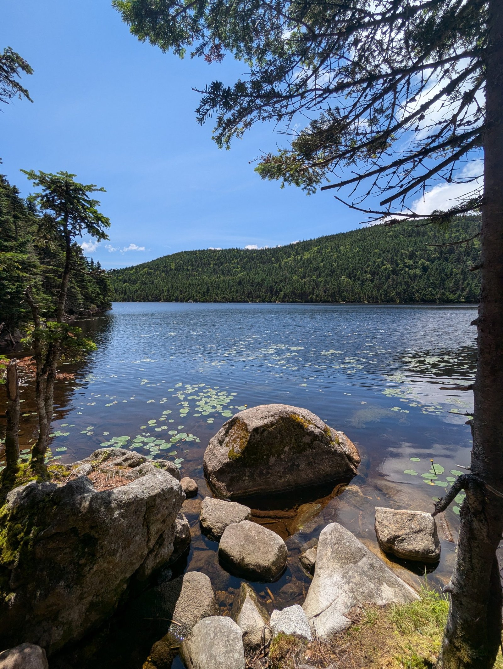
As you cross the border into Maine, the number of beautiful mountain ponds increases dramatically, so the call of bullfrogs becomes a daily experience. Coupled with that, we saw a huge increase in the number of toads on trail – lots of hopping critters!
We took special care to avoid errors and injuries this week, given the terrain, so glad to report success here.
It Wasn’t Just Mahoosuc
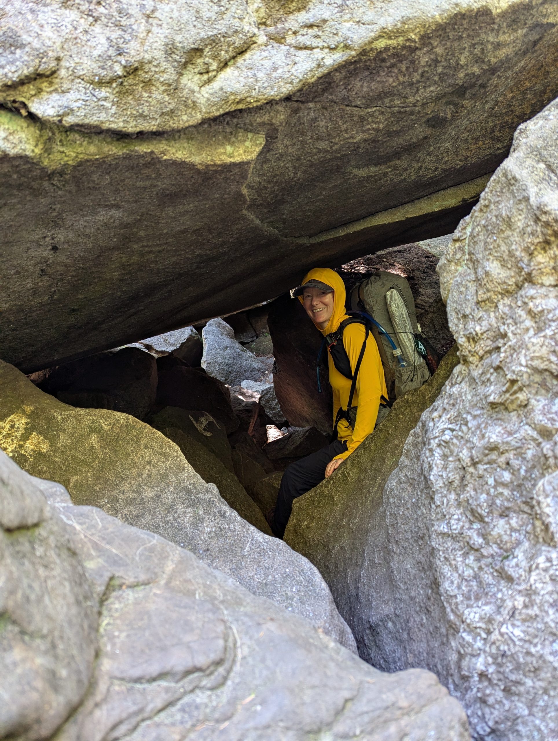
I guess that the Maine Appalachian Trail Club (MATC) doesn’t want northbound hikers to miss the challenges of New Hampshire as they cross the border or maybe it’s just a game of one-upmanship between these two states, but in either case they serve up some of the most difficult AT terrain in the first 30 miles. Mahoosuc Notch is the area that gets all the attention because it is a mile of car sized boulders randomly strewn about the landscape with no clear marking of the best way to navigate. Plus One and I took about two hours to travel through this section and by the end we were very ready to be done with it. I appreciated all the warnings of the terrain to come so that we could plan our day the right way. We went through it with beautiful sunny skies and couldn’t have asked for better conditions.
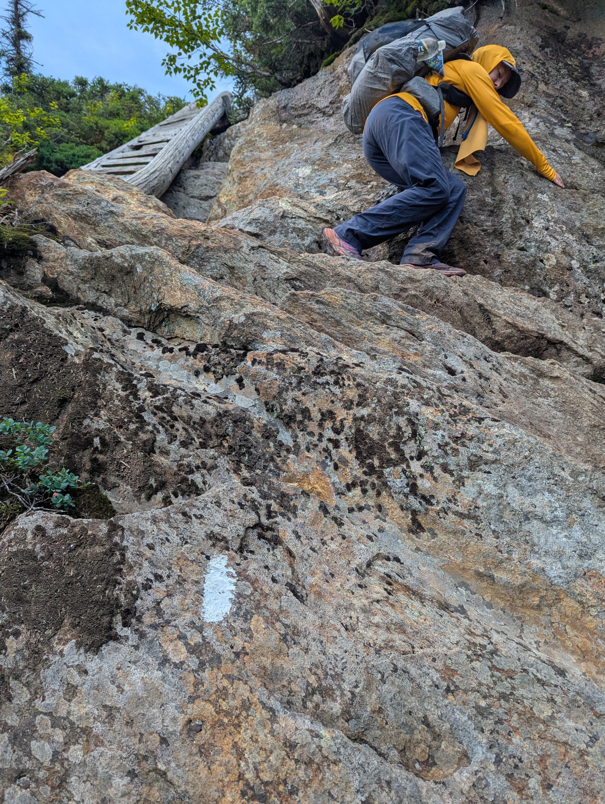
The thing that came as a surprise were the other sections of terrain that required us to stow our poles and climb hand-over-hand up (and down) enormous boulders and rock faces. The AT is extremely well documented – most hikers use FarOut or the Data Book to understand the knowable things about the Trail. In any given day, I can tell you with reasonable precision how many miles I’ll travel, how much elevation gain, and how much elevation loss. I love knowing these things – it helps me feel prepared. Terrain is different, though, because it can’t be measured. One person’s scary climb is another person’s casual stroll. The comments that describe the terrain are notoriously dire, so you learn to dismiss most of what is written as fear-mongering. I think hikers need a better way of understanding the difficulty of terrain because comments like “don’t do this in the rain” or “don’t go down that slope unless you have rescue insurance” aren’t helpful at all. I want to know things like whether it’s a hands and feet climb or whether the footing is grippy. Apps like FarOut can provide these descriptors through crowd-sourcing without the free-text comments that are so subjective. Nonetheless, I enjoyed most of the unexpected rock climbing that we tackled this week. The only bit that had me a little concerned was the climb up Baldpate East Peak, but the views were 100% worth my moments of panic.
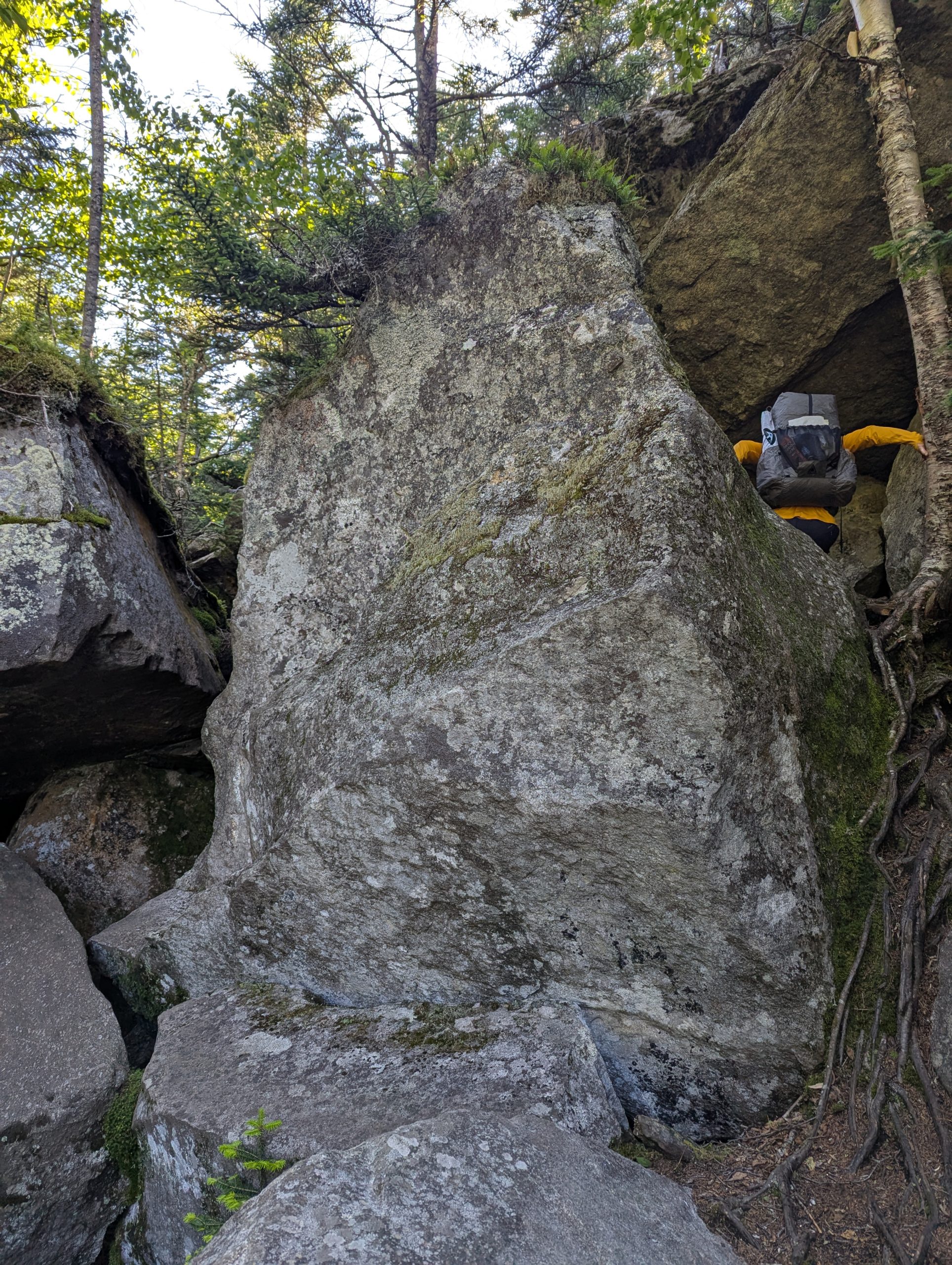
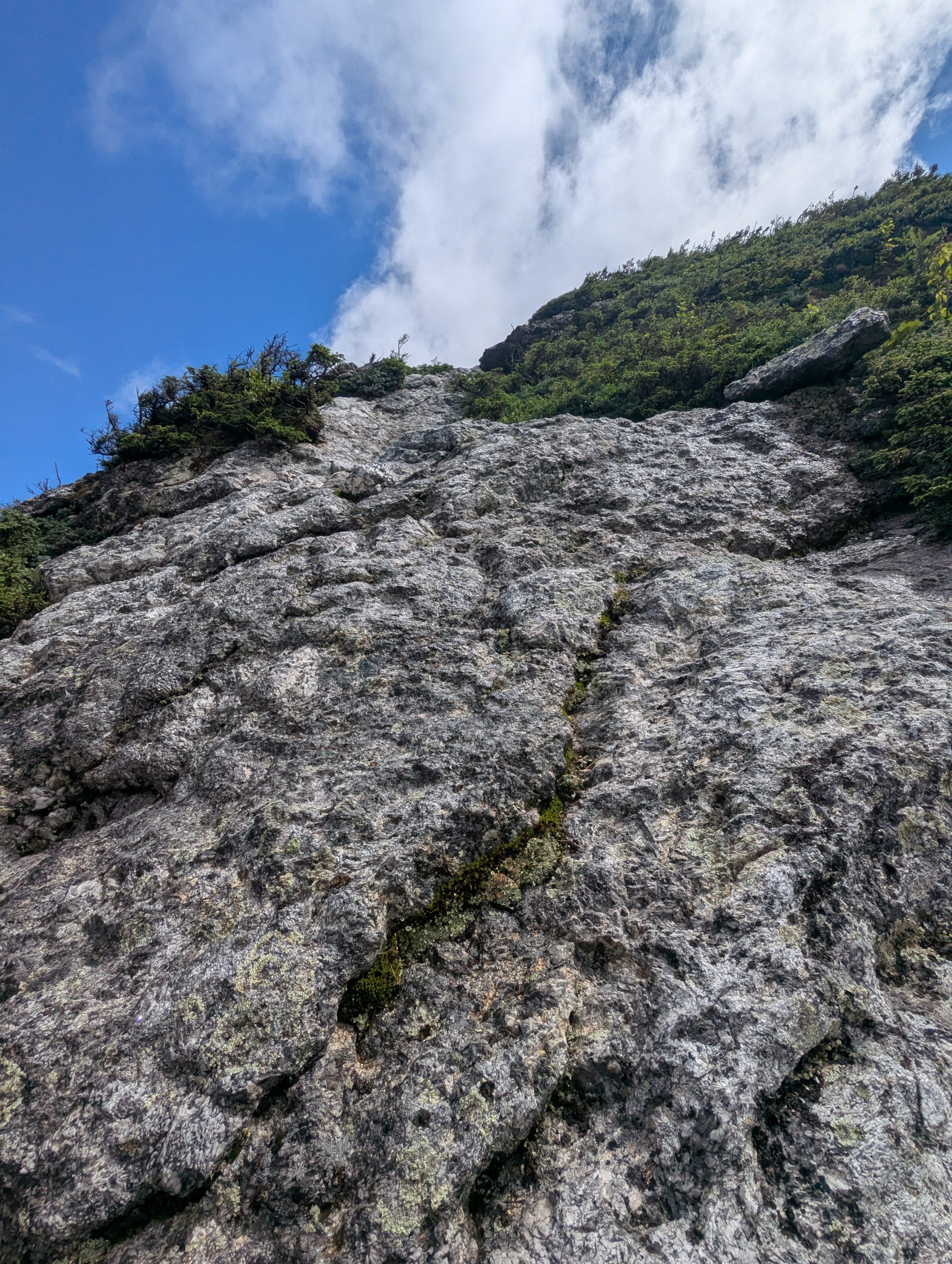
This descent down Old Speck really is as steep as it looks, and despite being extremely grippy terrain, it was still pretty hair-raising.
It’s hard to appreciate how steep this rock face is, but it’s very clearly covered in slippery lichen with no hand-holds.
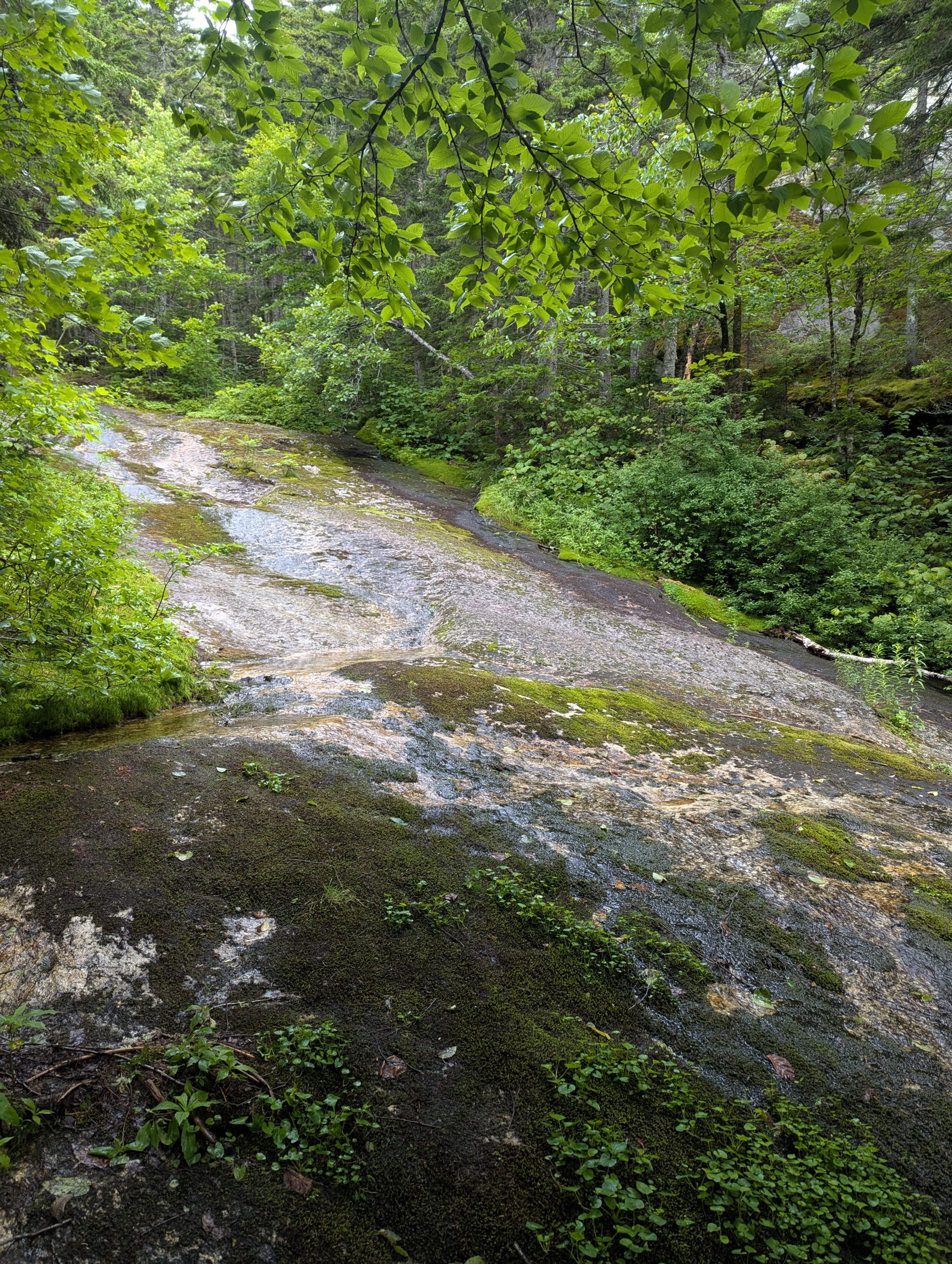
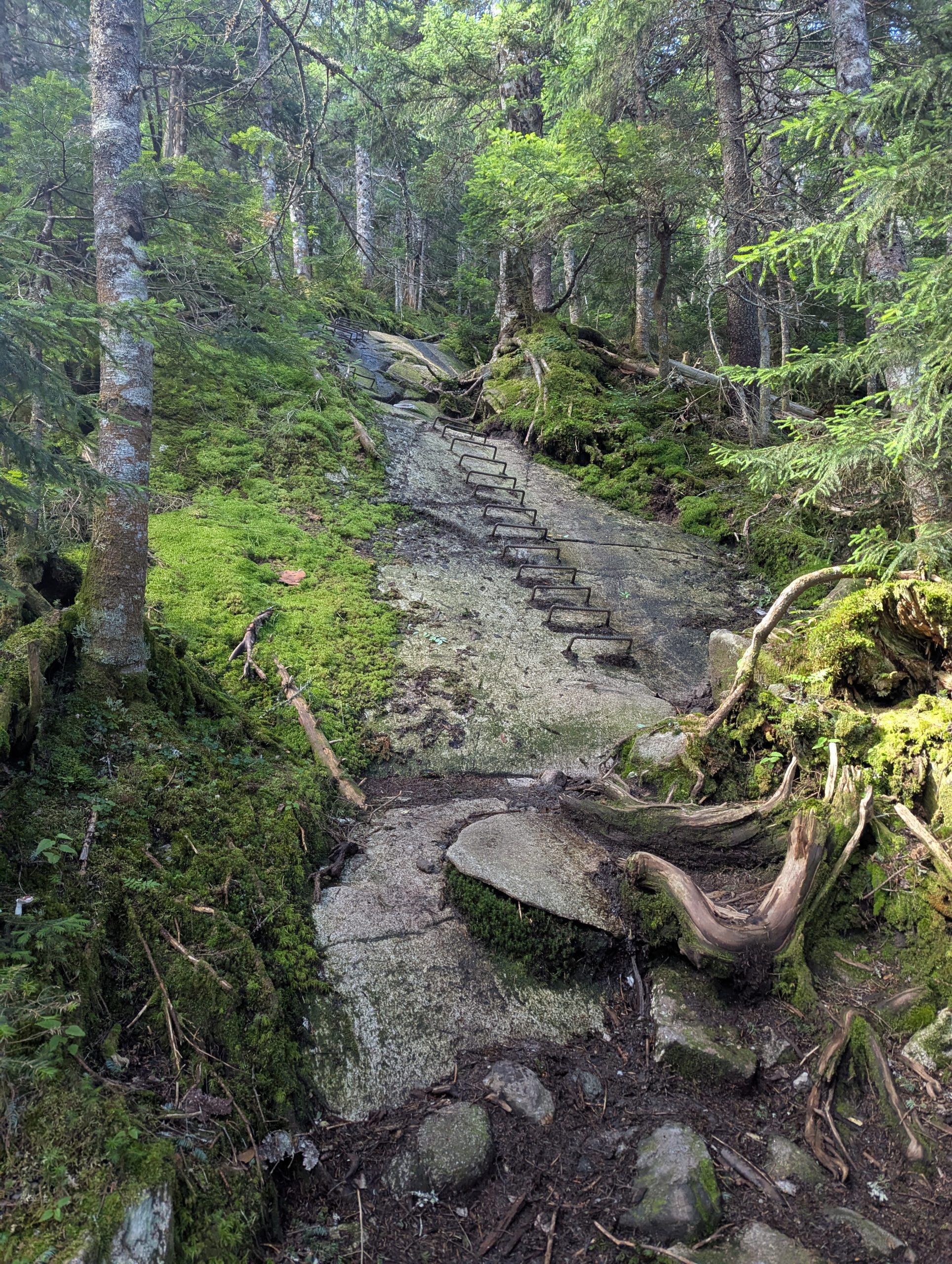
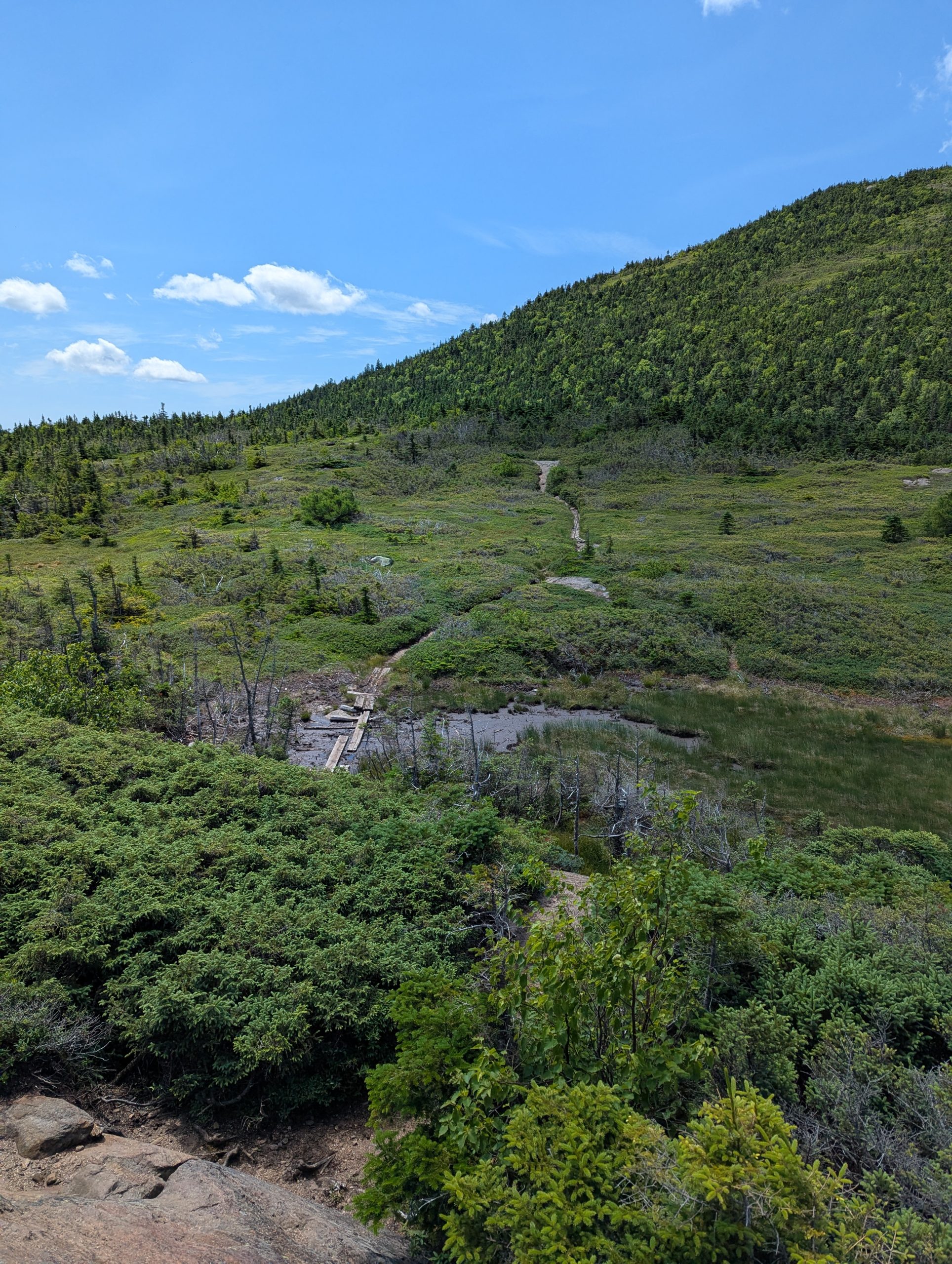
The alpine bog is a new kind of terrain delivered specially for hikers by the state of Maine. Some bogs have helpful boards across them; others not so much.
Fritos for Breakfast
I vowed in an early blog post that I wouldn’t write about food, poop, or rain and I’ve mostly stuck to that rule unless there was a story-telling opportunity that made it impossible to resist. I’ve been disinterested in tracking my body weight on the Trail because I’m doing everything I can to eat big quantities of nutritious, calorie-dense food. Blue Bear helps a lot with this and I’m really happy with how strong I feel as a result of paying close attention to what I eat. Which made a few of my food choices this week feel a little out of character – in addition to pouring avocado oil on my cold-soak dinners, it just seemed right to have Fritos as my post-breakfast treat. Really, is it ever too early in the day for Fritos?
Curiosities From the Trail
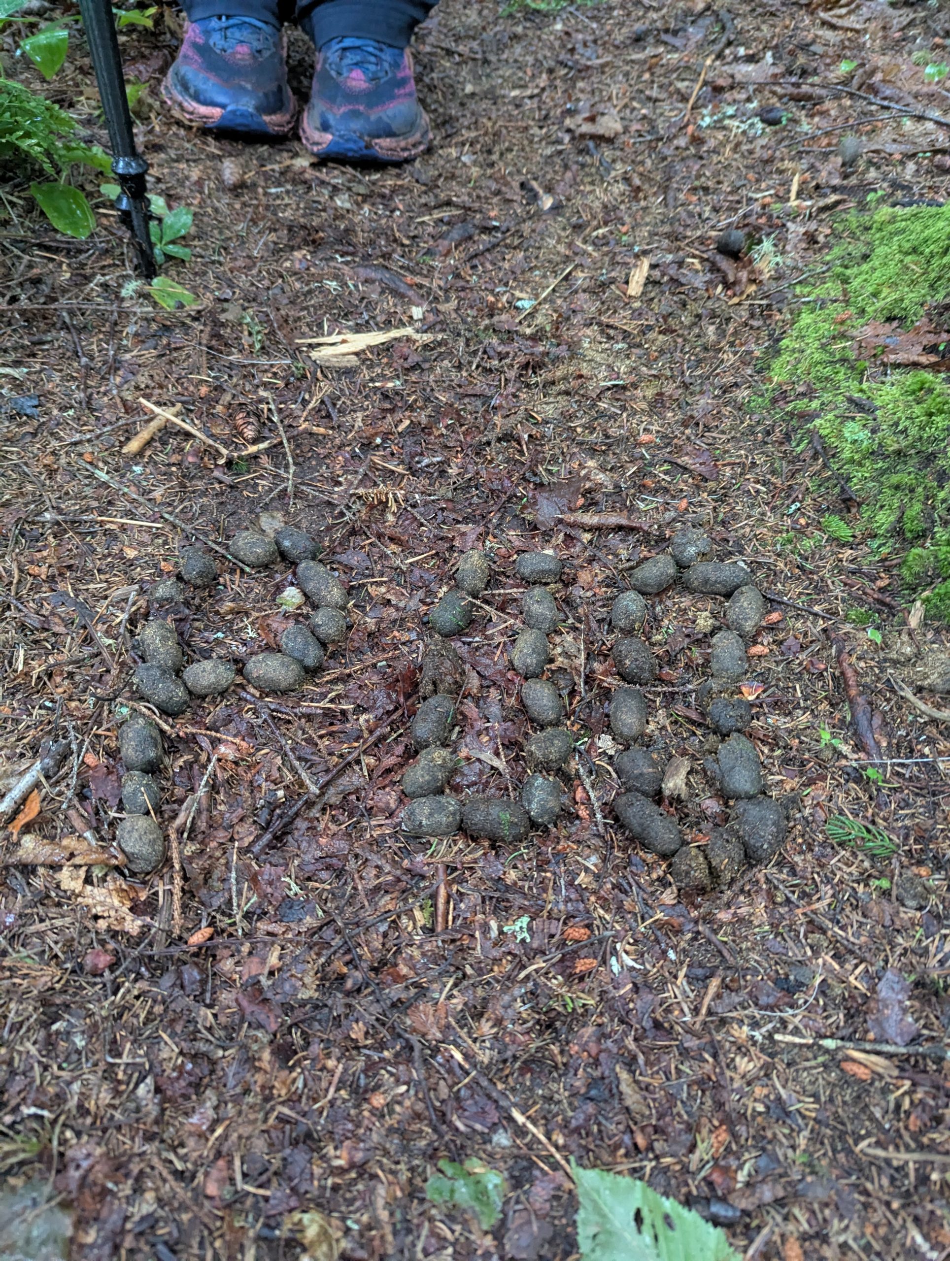
Oh, silly hikers! It is a well-known tradition that thru-hikers mark the major miles by arranging natural items in the shape of the relevant numbers. When Plus One and I happened upon this one, we just thought it was marking someone’s 600 mile accomplishment. But when you look closer, you see that it is “POO” spelled out in moose pellets, a Poo poo. And it left me wondering, did the hiker use their hands for that?! And who was the creative genius behind this?!
Remember to Look for Beauty
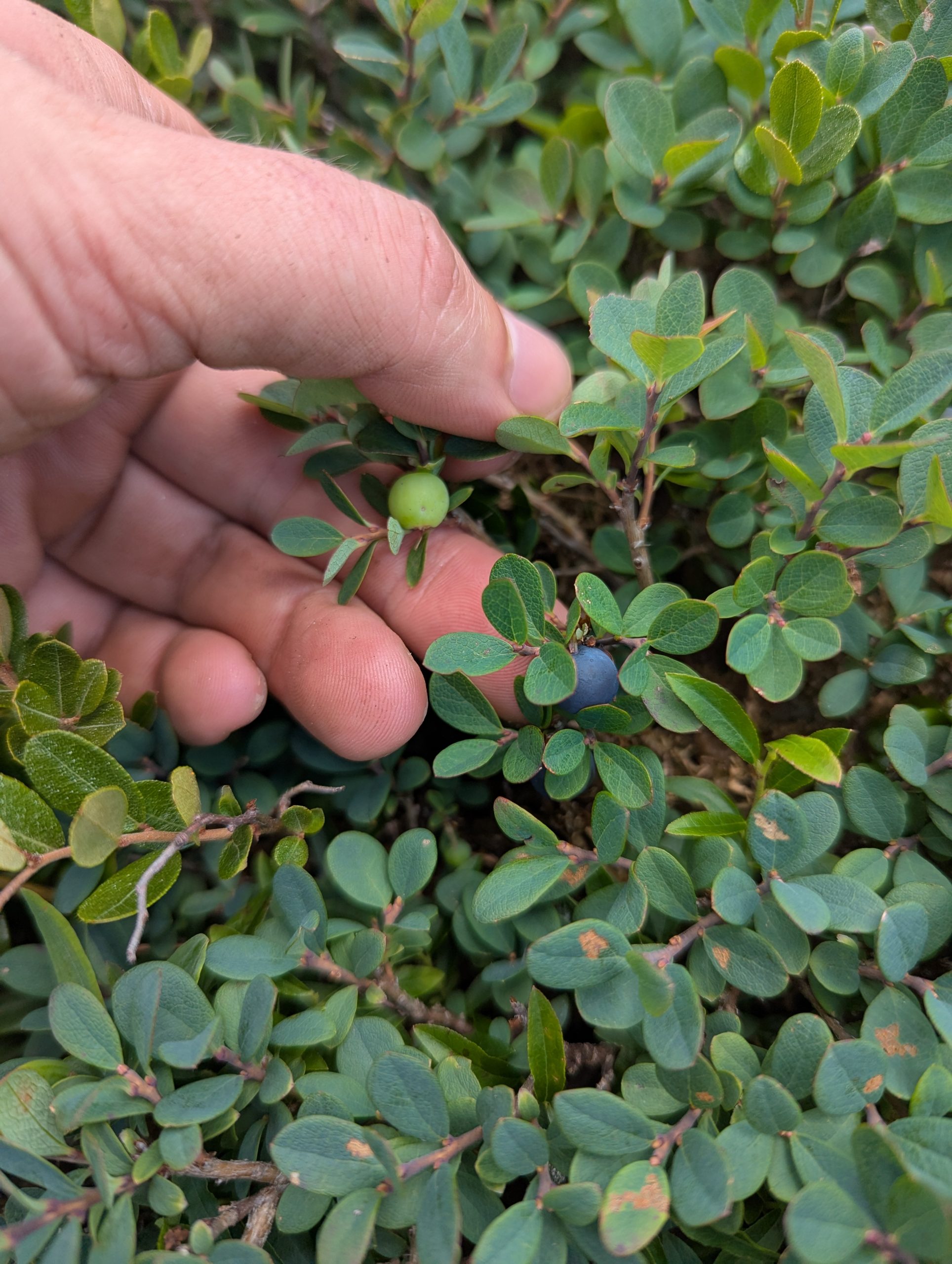
Maine is famous for its blueberries and they show up in huge quantities along the AT. They were perfect, without any intervention from people. The trick was getting to them before they were picked clean by other hikers and various critters that enjoy them!
~~~~~~~~~~~~~~~~~~~~~
Help me reach my goal of raising $25,000 for the ATC this year.
This website contains affiliate links, which means The Trek may receive a percentage of any product or service you purchase using the links in the articles or advertisements. The buyer pays the same price as they would otherwise, and your purchase helps to support The Trek’s ongoing goal to serve you quality backpacking advice and information. Thanks for your support!
To learn more, please visit the About This Site page.
You’re reading Entrepreneur Middle East, an international franchise of Entrepreneur Media.
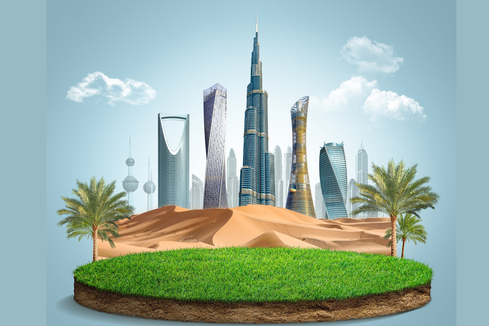
Dubai and Riyadh are emerging as must-visit destinations for both luxury seekers and business travelers in 2025, thanks to strategic investments in tourism infrastructure, hospitality, and cultural experiences.
Dubai, already a global travel powerhouse, continues to strengthen its position with an expanded portfolio of world-class hotels, sustainable tourism initiatives, and high-end entertainment options. Upcoming developments include ultra-luxury resorts along its coastline, new fine-dining experiences by Michelin-starred chefs, and immersive cultural attractions designed to appeal to a global audience.
Meanwhile, Riyadh is undergoing a rapid transformation under Saudi Arabia’s Vision 2030 strategy, which aims to diversify the economy and open the Kingdom to international tourism. Luxury hotel chains are expanding their footprint in the city, while flagship projects such as Diriyah Gate and the King Salman Park are set to provide unique leisure and cultural experiences.
Business travel is also seeing a significant boost in both cities. Dubai is enhancing its status as a leading hub for global events and conferences, while Riyadh is positioning itself as a rising center for business summits and international exhibitions. Improved connectivity through flagship airlines and new transport links between the Gulf capitals further strengthens their appeal.
Industry analysts note that the pairing of Dubai’s established tourism excellence with Riyadh’s bold new offerings creates a competitive yet complementary travel landscape in the Gulf. Together, the two cities are redefining the region as a premier destination for travelers seeking luxury, innovation, and opportunity.

The Historian tweaked his back in the Roller Coaster. He felt like poop. We had hoped a few zeros would reduce the trouble but it is not resolving. We have so few milea to go, and, honestly, every mile The Historian walks is a gift of love to me since he is not on this quest to finish the Appalachian Trail. His quest is to make sure I am OK to finish.
The post Day 96: A Poopy Day appeared first on The Trek.
Shelter cove to Big Lake Youth Camp
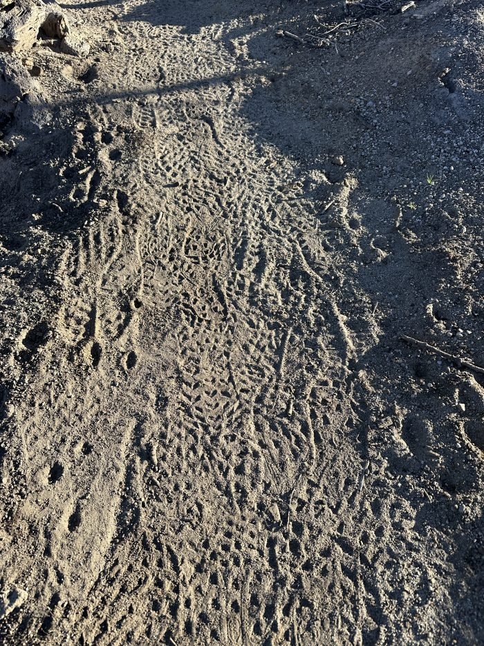
At one point after leaving Charlton Lake, I hiked through a desolate burned area. The area had been so completely torched that not even dead trees remained. The ash was fine on the trail and you could see the footprints of other hikers superimposed over each other with exquisite detail.
Throughout this hike, my feet follow the steps of others. Am I a leader, or a follower? We all hike the same path but what we take away from it may be completely different. So far, I can say that I have never met so many interesting people. Or maybe I have, but just never had the time or interest to get to know them before. This has been a surprising discovery on the PCT.
Updates
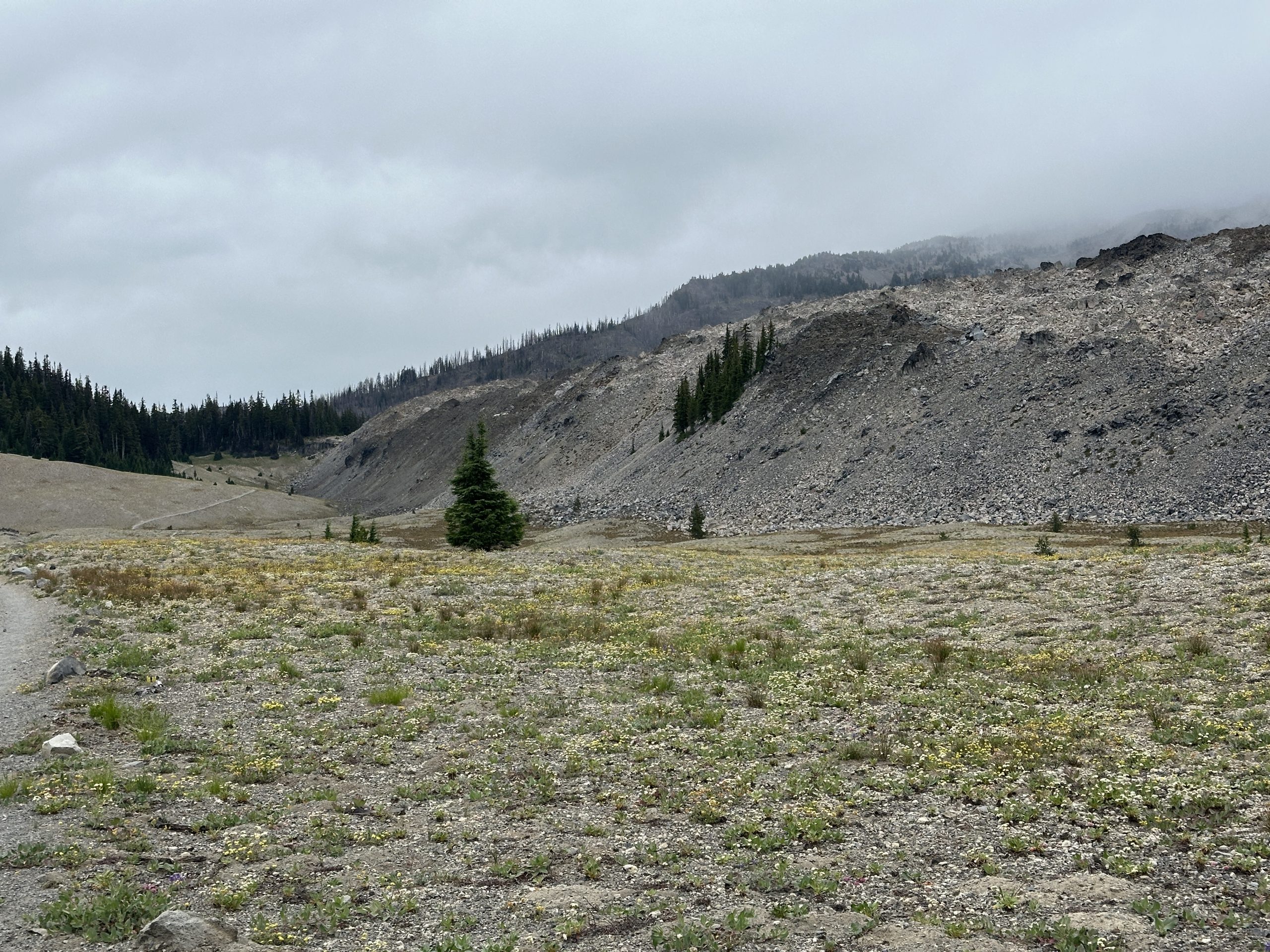
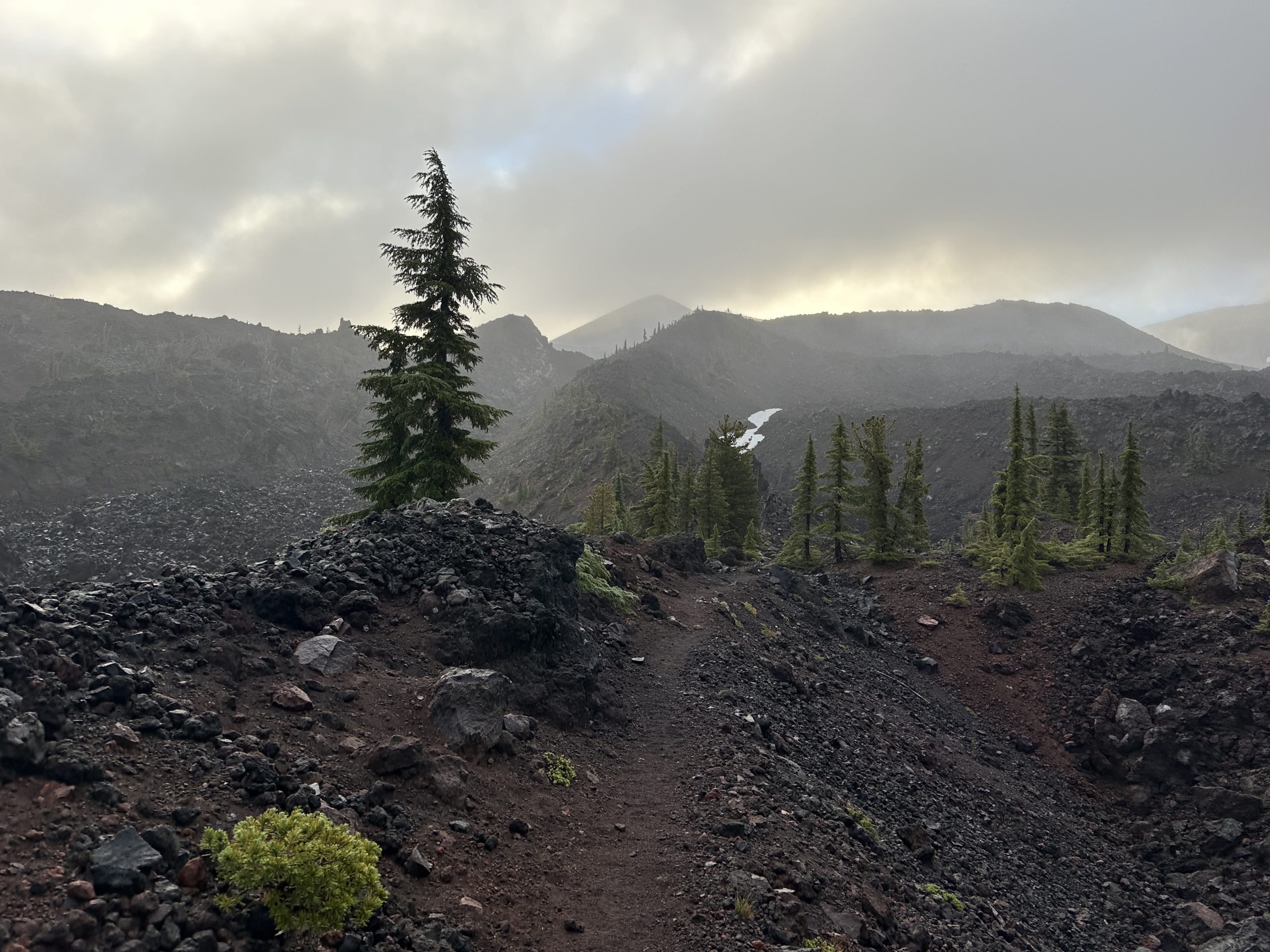
The most recent area I hiked through had a wide variety of different landscapes. The Three Sisters wilderness is extremely beautiful and fascinating with obvious signs of previous volcanic activity. To add to the mystique, the weather was cloudy and misty. In some ways, this was great because much of the trail was exposed, and would have been very hot. On the other hand, it obscured the tops of the peaks so vistas weren’t dramatic. Some sections went through flat plains full of small wildflowers while next to this plain, there was a mesa of volcanic rubble with nothing growing at all.
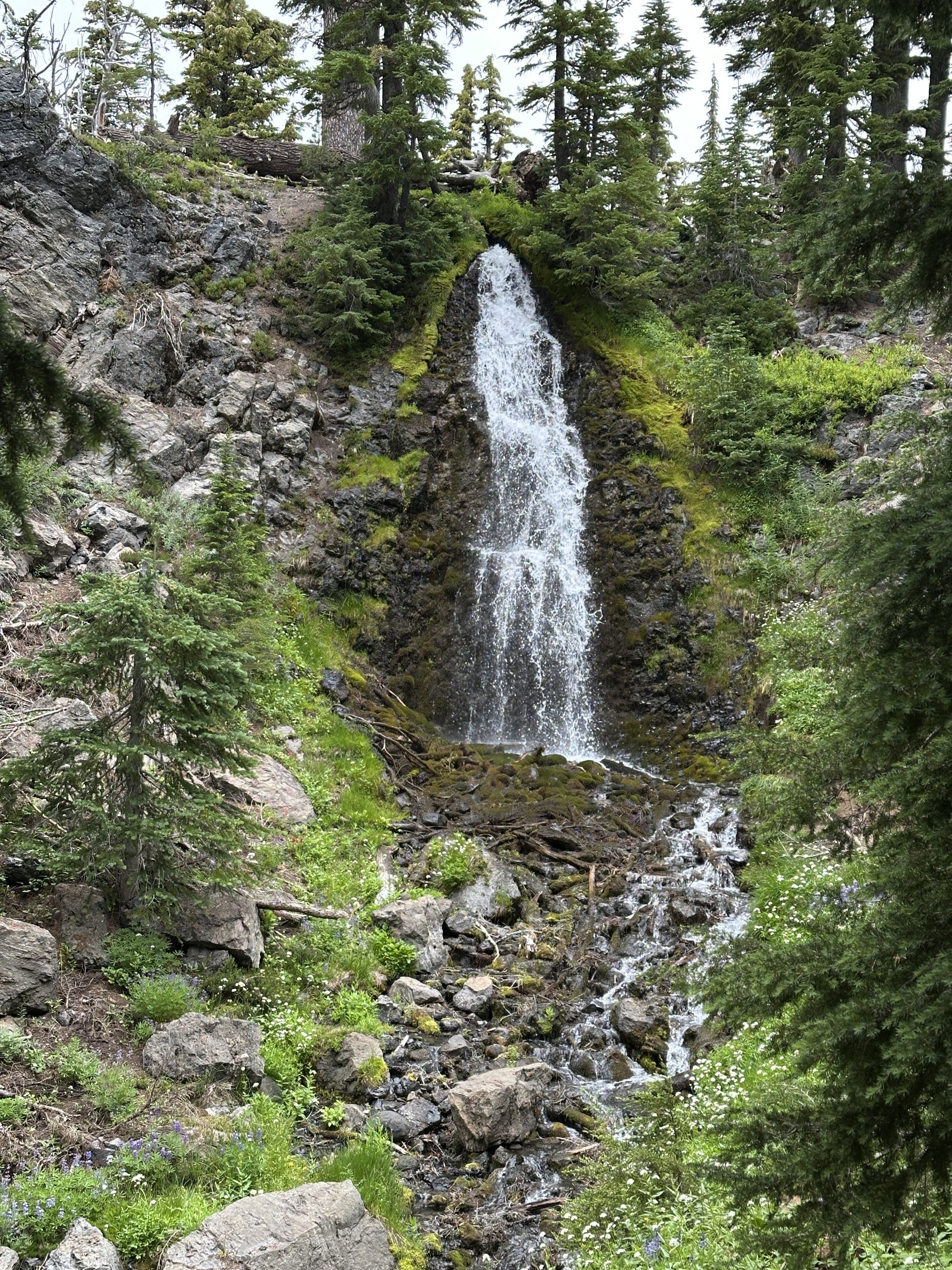
Obsidian Falls tumbles over boulders of obsidian.
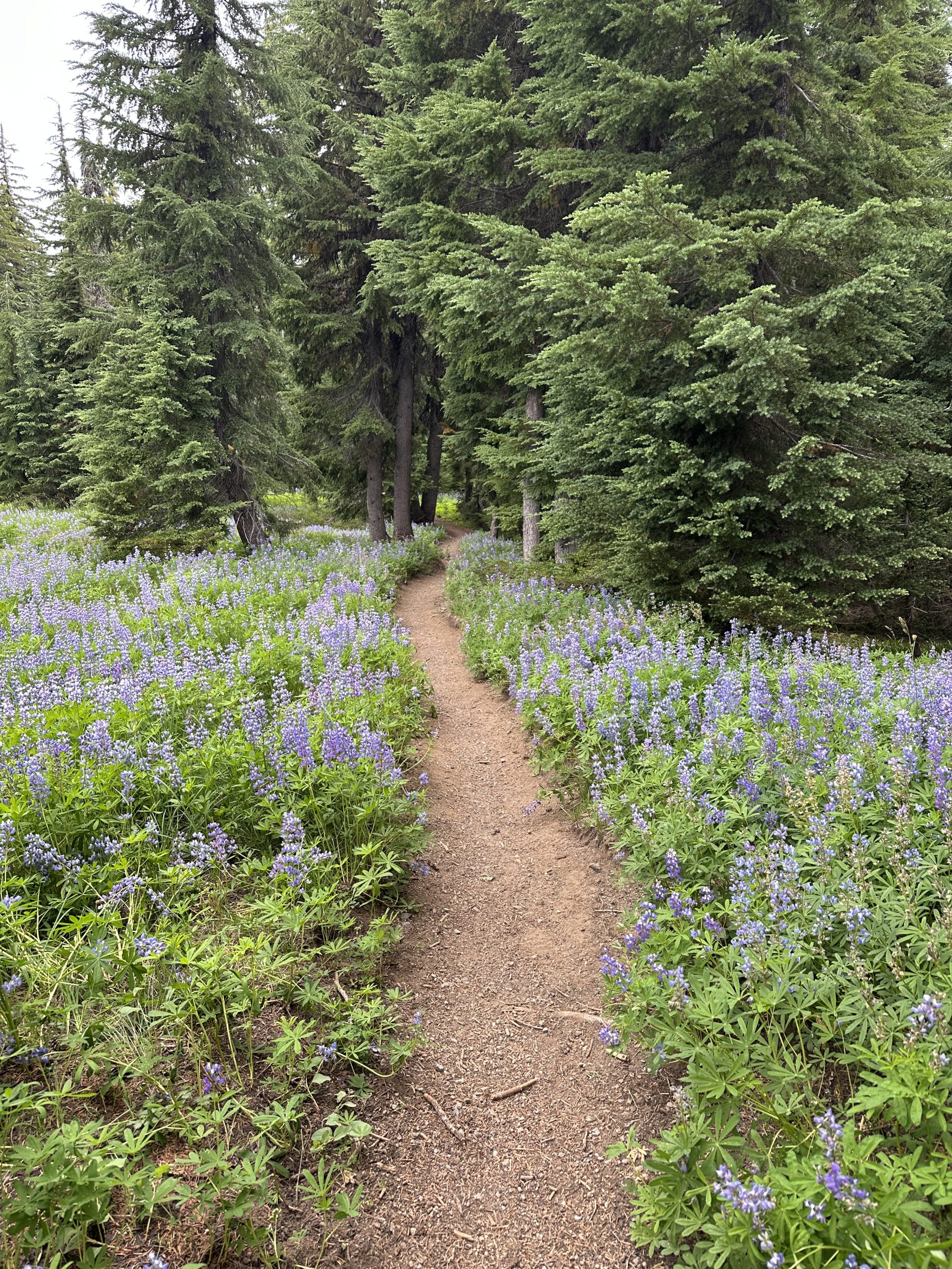
High glacial streams tumble down, their source the snow that is still present even in August. I walked through fields of fragrant lupine.
The misty weather turned to rain. I was extremely proud of my Durston x-dome in the wind and rain. The interior stayed completely dry.
I had heard of the lava fields from a random stranger and an ice cream shop in Ashland. He had remarked on how challenging it was in the hot sun. I wondered when that would be and this was it. Again, cool and windy. Weather made it a little bit easier but walking over large gravel pieces for several miles made for slow going and was really tough on my feet. Another hiker described it as “hiking on the moon” (I wish we had had the moon’s gravity as well.)
Finally, I arrived at Big Lake Youth Camp. They are very welcoming and have a separate space for PCT hikers to socialize, do some laundry, take a shower, and deal with their resupply. They also offer meals to thru hikers. I am thankful they are so welcoming. I slept next to Big Lake last night. For the first time, my tent was frozen in the morning. Time to switch out to cool weather gear.
Seeing Family
After leaving Big Lake, I hiked to Santiam Pass, where my brother and his family picked me up. We visited Belcamp hot springs and stayed in the town of Sisters. It’s so nice to see family and to have the time to spend with them. I am so grateful that they came to support me.
This website contains affiliate links, which means The Trek may receive a percentage of any product or service you purchase using the links in the articles or advertisements. The buyer pays the same price as they would otherwise, and your purchase helps to support The Trek’s ongoing goal to serve you quality backpacking advice and information. Thanks for your support!
To learn more, please visit the About This Site page.
-

 Brand Stories3 weeks ago
Bloom Hotels: A Modern Vision of Hospitality Redefining Travel
-

 Brand Stories2 weeks ago
CheQin.ai sets a new standard for hotel booking with its AI capabilities: empowering travellers to bargain, choose the best, and book with clarity.
-

 Destinations & Things To Do3 weeks ago
Untouched Destinations: Stunning Hidden Gems You Must Visit
-

 Destinations & Things To Do2 weeks ago
This Hidden Beach in India Glows at Night-But Only in One Secret Season
-

 AI in Travel3 weeks ago
AI Travel Revolution: Must-Have Guide to the Best Experience
-

 Brand Stories1 month ago
Voice AI Startup ElevenLabs Plans to Add Hubs Around the World
-

 Brand Stories1 month ago
How Elon Musk’s rogue Grok chatbot became a cautionary AI tale
-

 Brand Stories3 weeks ago
Contactless Hospitality: Why Remote Management Technology Is Key to Seamless Guest Experiences
-

 Asia Travel Pulse1 month ago
Looking For Adventure In Asia? Here Are 7 Epic Destinations You Need To Experience At Least Once – Zee News
-

 Brand Stories1 month ago
ChatGPT — the last of the great romantics