
Destinations & Things To Do
Looking for a Unique African Adventure? How About Trekking Across Zimbabwe and Mozambique on Intrepid Travel’s New Mystery Expedition?
Thursday, June 26, 2025
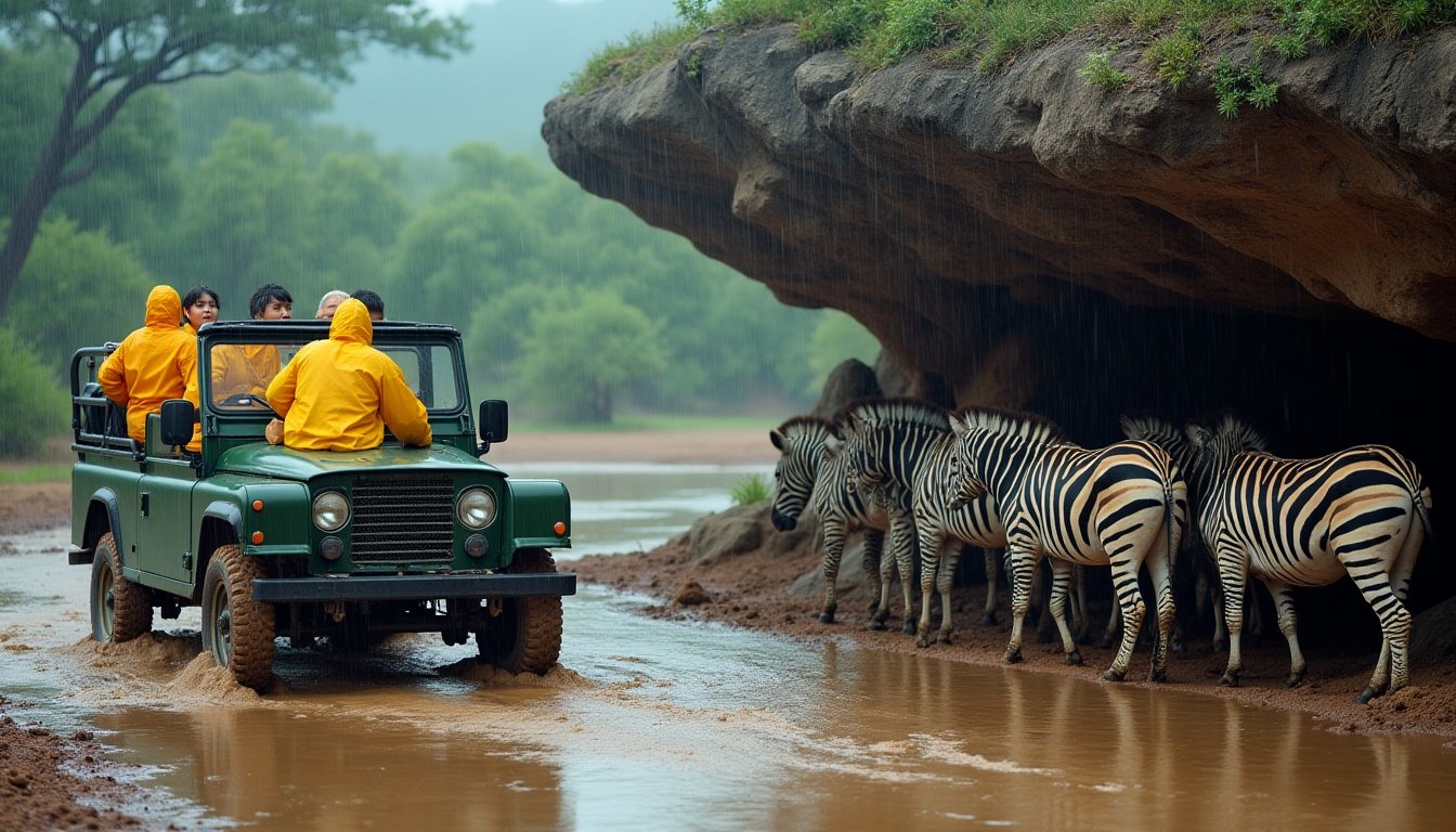
Intrepid Travel has once again embraced the spirit of adventure with its newly unveiled Mystery Expedition, an exclusive 14-day journey that promises to take guests on a once-in-a-lifetime experience across Southern Africa. Spanning over 1,500 miles (2,400 kilometers), the Mystery Expedition will take guests from Harare, Zimbabwe to the beautiful Ile de Mozambique, while ensuring that the itinerary remains a mystery until the journey begins. This immersive adventure is designed to give travelers a blend of thrilling activities, guided tours, adventure experiences, and a deeper connection to the local communities along the way.
The Mystery Expedition stands apart by its mystery element—participants will not know the exact itinerary before the trip. All that is known is that they will be venturing through Southern Africa, experiencing waterfalls, mountain hikes, and other local adventures, with expert guidance at each stop. The tour offers guests a moderate physical challenge due to trekking and the rugged terrain, but promises to push even the most seasoned adventurers out of their comfort zones.
This unique 14-day journey is set to depart in two different waves: the first departure on July 29, 2026, will be exclusively for past Intrepid travelers who enjoy early booking access, while the second departure on August 12, 2026, will be available to the general public. The Mystery Expedition will be limited to a small group of 21 travelers, ensuring an intimate and personalized experience. The cost for this exceptional journey will be $4,640 (or $6,410 CAD) per person.
“We run trips in over 120 countries and know our travelers always look to us to uncover new and exciting places to explore,” said Erica Kritikides, General Manager of Experiences at Intrepid Travel. “This itinerary is intrepid in every sense of the word, and I’m confident that this will be our best mystery trip yet.”
A Journey into the Unknown: What’s in Store for Adventurers?
The Mystery Expedition offers much more than a traditional tour—this adventure is a deep dive into the unknown. The participants will start their journey in Harare, Zimbabwe, and travel through an undisclosed route that will unveil hidden gems of Southern Africa, ending at the exotic Ile de Mozambique.
Throughout this exciting adventure, travelers will engage in several guided tours with local experts, allowing them to gain a deeper understanding of the region’s culture, history, and natural beauty. Some of the highlights of the journey are expected to include:
- Waterfall Adventures: A chance to swim beneath some of Africa’s most stunning waterfalls, offering guests an unforgettable natural experience.
- Mountain Hikes: Exploring the rugged terrain of Southern Africa on guided mountain hikes, taking in awe-inspiring views.
- Community-Based Experiences: Engaging with local communities through immersive experiences that connect travelers to the heart of the region’s culture.
- Adventure Activities: Additional activities that might include safaris, cultural tours, and time spent exploring various villages and towns that have shaped the region’s history.
This mystery journey promises an experience that is both active and educational, with opportunities for physical challenge, adventure, and personal growth. The best part is that every day will hold a new surprise for travelers, making it a truly once-in-a-lifetime opportunity.
Exclusive Departures and Limited Group Sizes
To maintain a personalized experience, Intrepid Travel is limiting the number of participants to just 21 travelers per departure. This ensures that each traveler has the opportunity to truly connect with their surroundings, their fellow adventurers, and the local communities they will visit along the way.
The Mystery Expedition will have two departures:
- July 29, 2026 – Exclusively for past Intrepid travelers, offering early booking access.
- August 12, 2026 – Available for the general public, allowing new adventurers to join the journey.
This departure limitation means that guests can enjoy a small group experience, ensuring that each moment is special, and travelers can enjoy greater access to the best that Southern Africa has to offer. With limited availability, interested parties are encouraged to sign up before June 29, 2025 to secure a spot. Following the application period, names will be selected via a random draw.
Intrepid’s Bold Approach: Inspired by Nostalgia
This new Mystery Expedition is part of Intrepid Travel’s Uncharted Series, which is designed for those who thrive on the unknown. Intrepid’s Uncharted Series brings the spirit of exploration and adventure into each trip, inspired by some of the first journeys the company organized for intrepid travelers years ago.
The previous edition of the Uncharted Series, which took 34 travelers through the Altai Mountains in Russia in 2018, proved to be an incredible success. The demand was so high that the first departure sold out within just 16 hours, with over 1,000 applications. This history speaks volumes about the appeal of mystery travel, where the thrill of the unknown is as important as the destination itself.
“This mystery trip taps into the nostalgia of our earliest Intrepid trips, where every journey held an element of surprise and the unknown,” said Kritikides. “It appeals to the most intrepid travelers—those with a sense of adventure who are prepared to take a leap of faith and go well beyond the beaten path.”
Who Should Join the Mystery Expedition?
The Mystery Expedition is perfect for those who enjoy a sense of adventure and have a passion for experiencing new cultures and environments. While the trip will involve trekking, it is rated as moderate, which means it is suitable for those in good physical condition, especially those who are comfortable with rugged terrain and a bit of physical exertion.
This trip will appeal to:
- Adventure seekers who thrive on the thrill of the unknown.
- Experienced travelers eager to step off the beaten path and visit places rarely seen by outsiders.
- Those who enjoy community-based travel and connecting with locals in an authentic, meaningful way.
- Intrepid Travel fans looking for a unique and challenging experience to add to their bucket list.
If you’re someone who loves the thrill of discovery and the excitement of living in the moment, then this Mystery Expedition is designed for you.
Booking Information and Application Process
Those eager to take part in this adventure are encouraged to submit their applications via the Uncharted registration form. The booking period closes on June 29, 2025, with names selected at random. As this journey is expected to generate a high volume of interest, early registration is recommended for those who want to be part of this exclusive adventure.
For more details and to apply, interested parties can visit the official Intrepid Travel website.
Conclusion: Embrace the Unknown
The Mystery Expedition is a bold step for Intrepid Travel, inviting adventurous travelers to embark on an epic journey that promises not only thrills but also a deeper understanding of the diverse cultures and landscapes of Southern Africa. It is the perfect opportunity for those who crave adventure, a challenge, and the excitement of not knowing what comes next. With limited availability, this once-in-a-lifetime trip is one that should not be missed by those who want to push their boundaries and embrace the unknown.


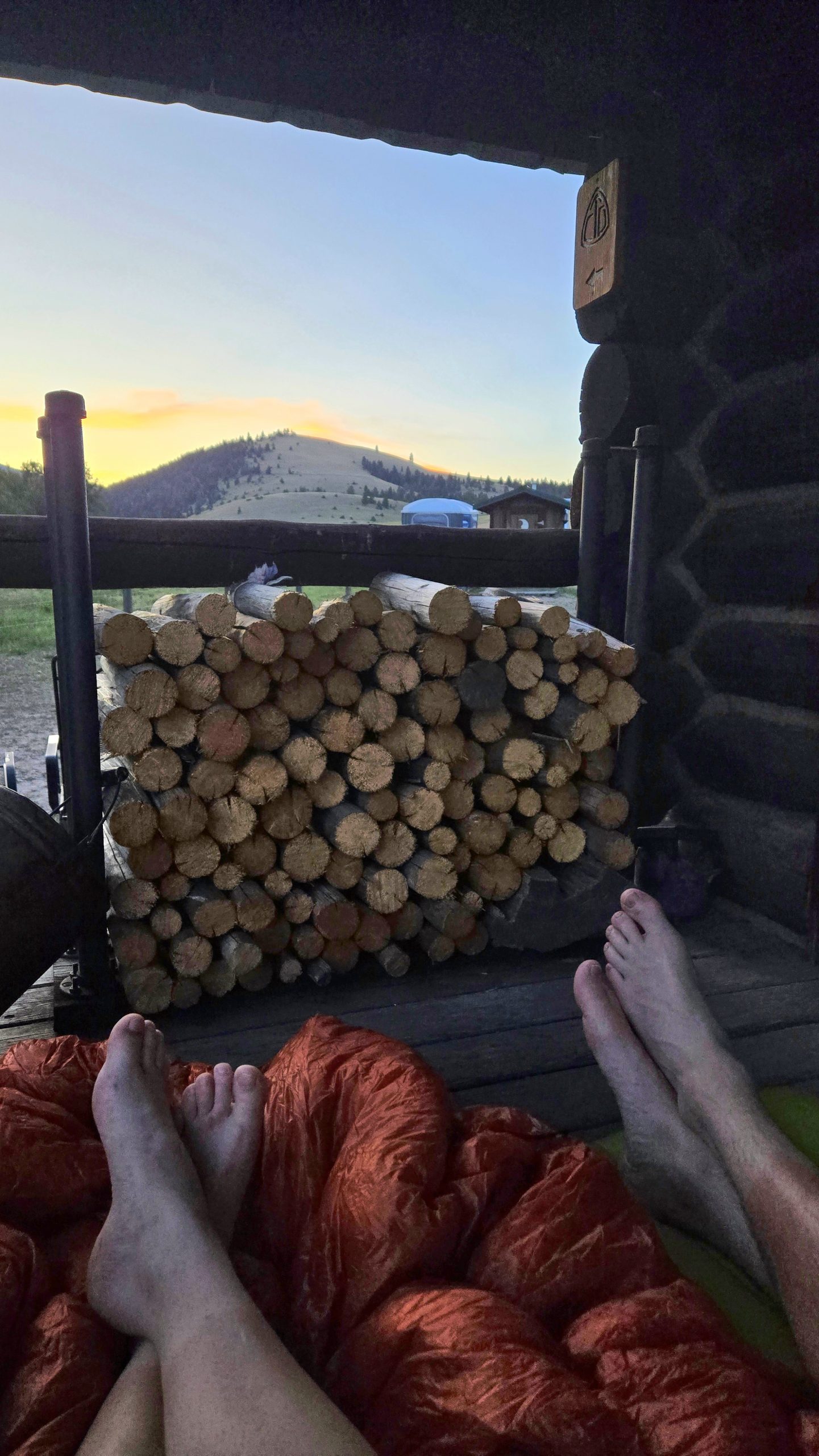
This morning I packed up around the usual time, but tried to be quiet. I joined the campsite last night that had four or five other people set up at it. Once I was pretty much ready to go those other hikers began moving around as well. Then I set out to start the day. The morning actually started with a bit of downhill. But I knew pretty soon after that I would be doing a good bit of climbing.
After I dropped down to the bottom of that descent, I began my next climb. I knew I had a few rolling climbs on and off for the next 10 or so miles. But I just threw in an audiobook and got into the zone right away. I was honestly feeling really good. Within the first hour or two I had the option of climbing across a sketchy log or getting my feet wet. At this point, I would just rather get my feet wet. I hate slowing down to try to carefully navigate across an obstacle. When I could just fling myself into the water and come out on the other side. Plus, it gets so dang hot out here. I knew my feet would be dry in no time.
Last night, I was at least considering doing some crazy mileage to rearrange my schedule. I’m really glad that I didn’t do that. It just would’ve put so much pressure on today. And while I was feeling great and still moving quickly, I wasn’t flying today. In the first few hours, I had multiple long climbs to do. And I made really good time doing them. But wasn’t hiking at 3+ miles an hour constantly. I just hiked at the fastest comfortable pace that I could. I would so much rather take my time today and go into town tomorrow morning though. Rather than stressing myself out all day today and running down the trail.
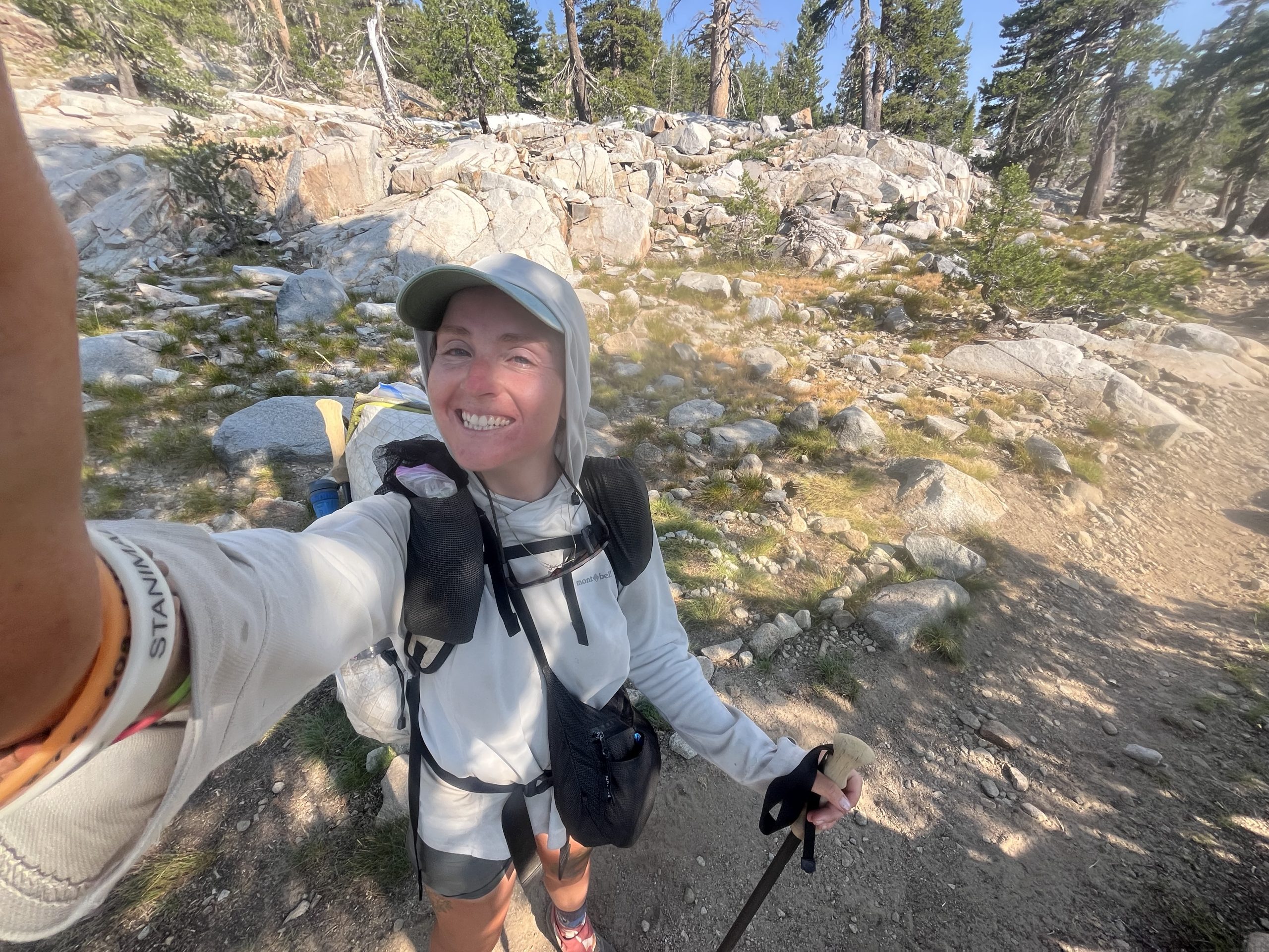
Over the course of the morning, I ran into a bunch of hikers. I passed by most of them and some were still set up at camp. One hiker who I met was named Mack. When I first saw her, she looked so incredibly familiar. It took a couple minutes to realize that I likely just recognized her off of social media. Because apparently we had never met before. But I guess she has a big following on Instagram. It was nice to talk to her for a few minutes before continuing on. Then when I was about 12 or so miles into the day, I stopped off briefly. Every now and then I’ll sit down for a few minutes to eat or do something. Most of the time I eat everything on the go. But there are just some food items that are easier to eat when you’re not moving.
As I sat, I got passed by one or two hikers who I had just gone past. But knew I would be catching up to them in a little bit. I definitely wouldn’t say that I’m the fastest hiker out here. Really the only thing I have going for me is the fact that I basically never stop going. Plenty of people have passed me over the course of this year. Usually they’re whipping by going 4 mph. But eventually, they’ll stop and sit and take a break like everybody else. While I may have gotten passed a few times this year, there isn’t a single hiker who’s passed me this year that I didn’t eventually overtake again.
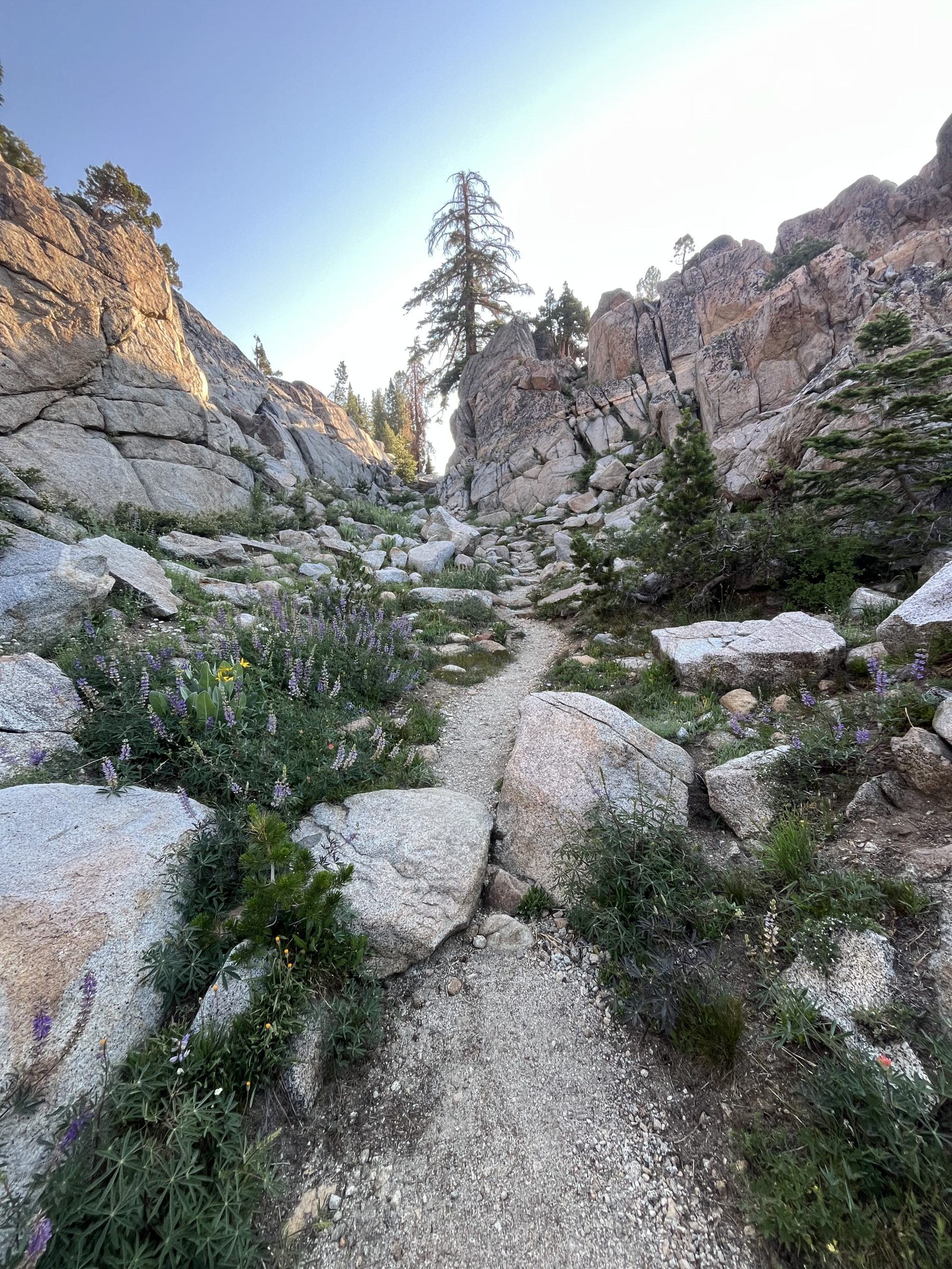
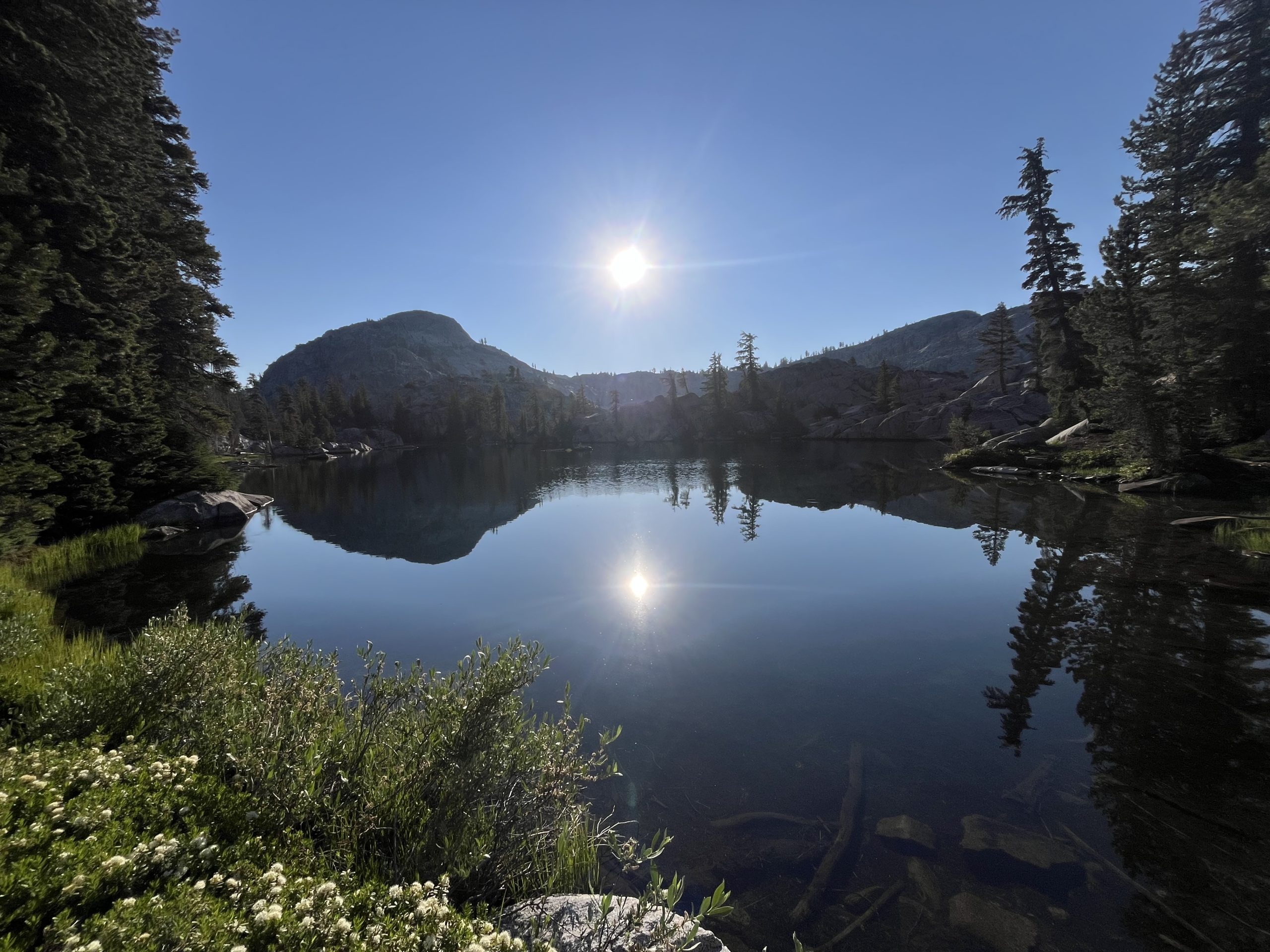
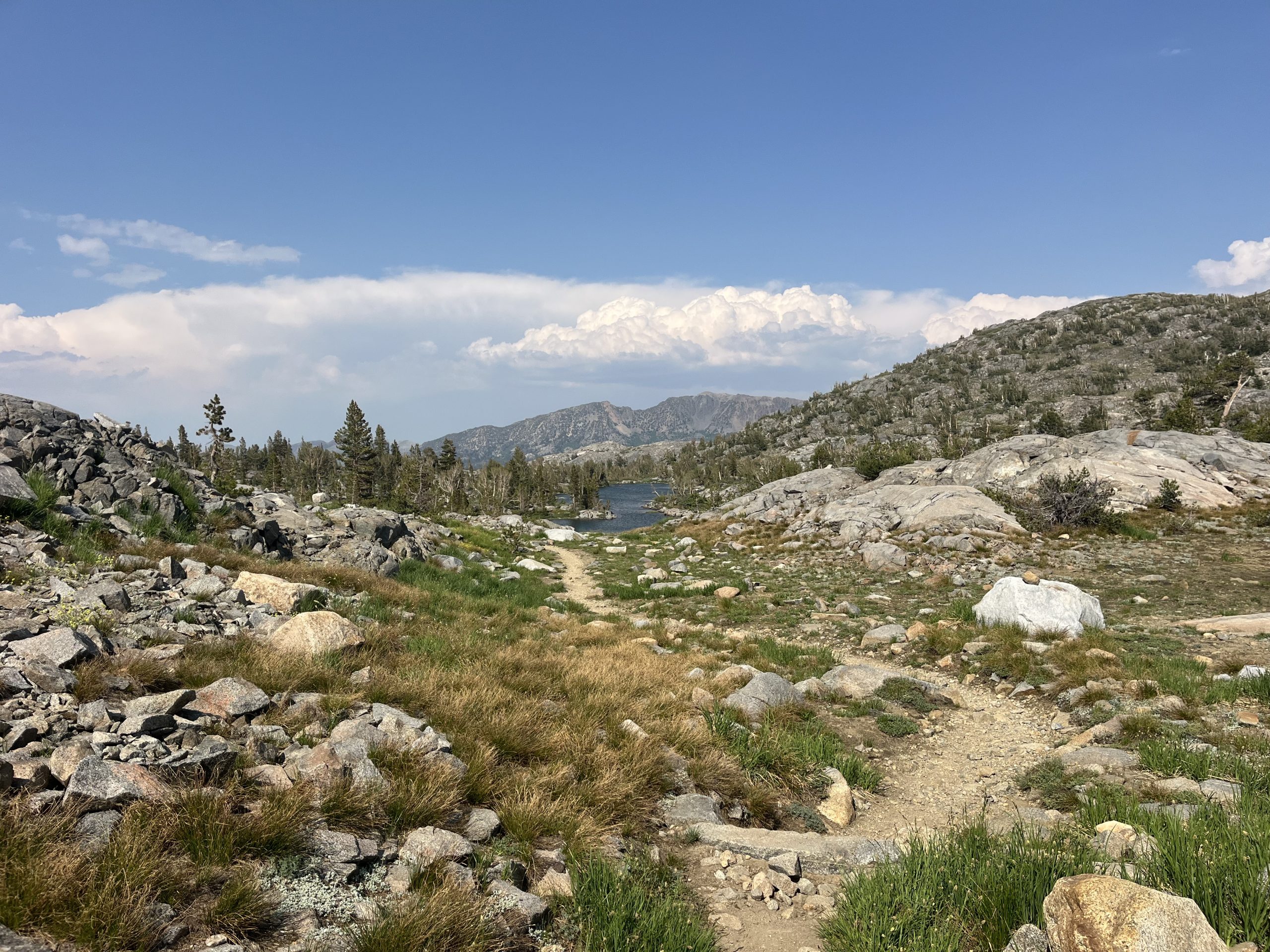
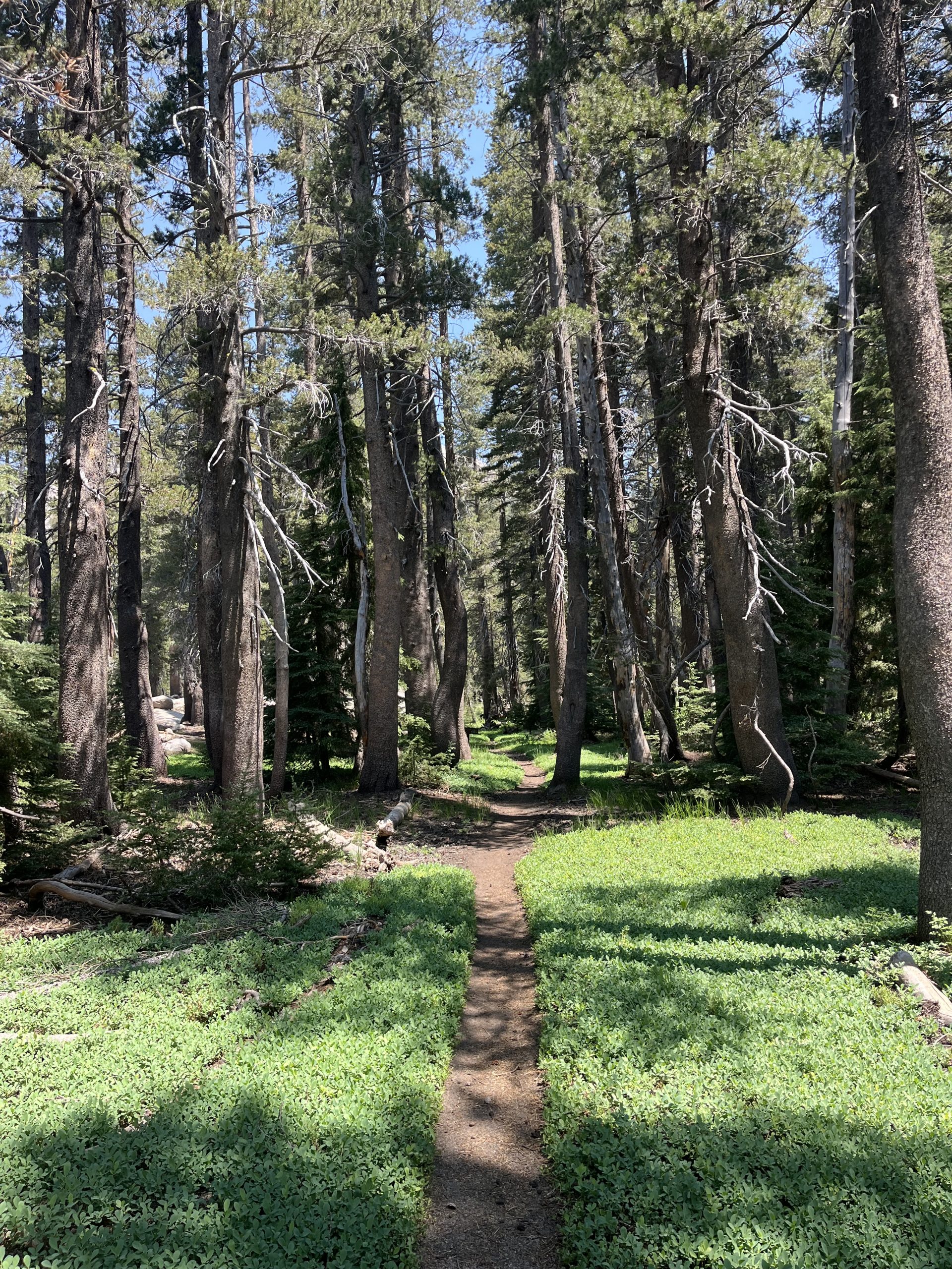
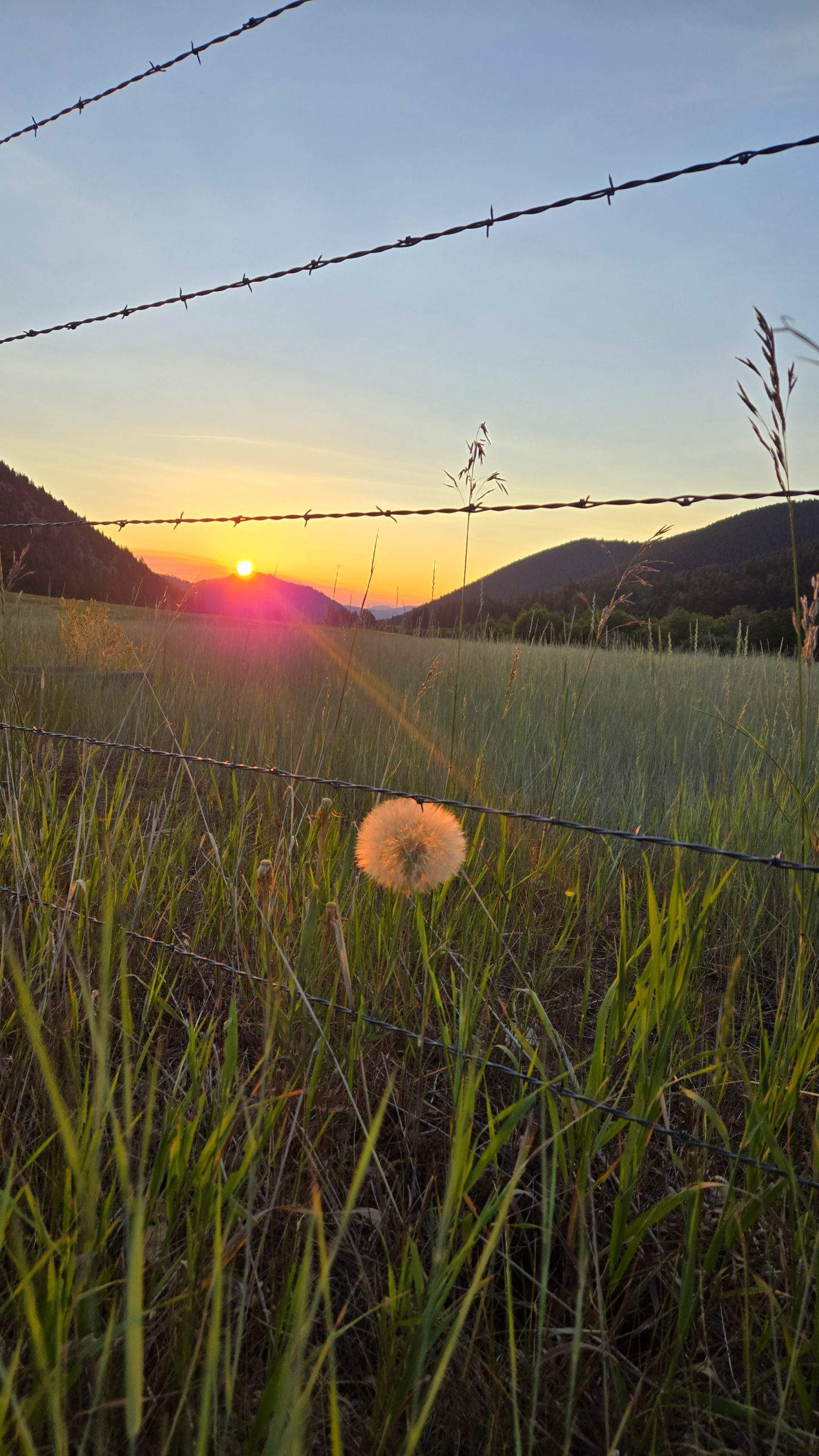
The trail today felt really variable and was quite exciting at times. One minute I would be walking through a lush green pine forest. The next minute I would be going by an Alpine Lake. Or maybe walking across along rock slab. Overall, it kept me quite entertained and was really beautiful. Today was one of those days for the time felt like it just slipped away. It doesn’t always work out like that. But when it does, it’s pure heaven. All the sudden I was looking down at my watch and it was nearing 20 miles for the day.
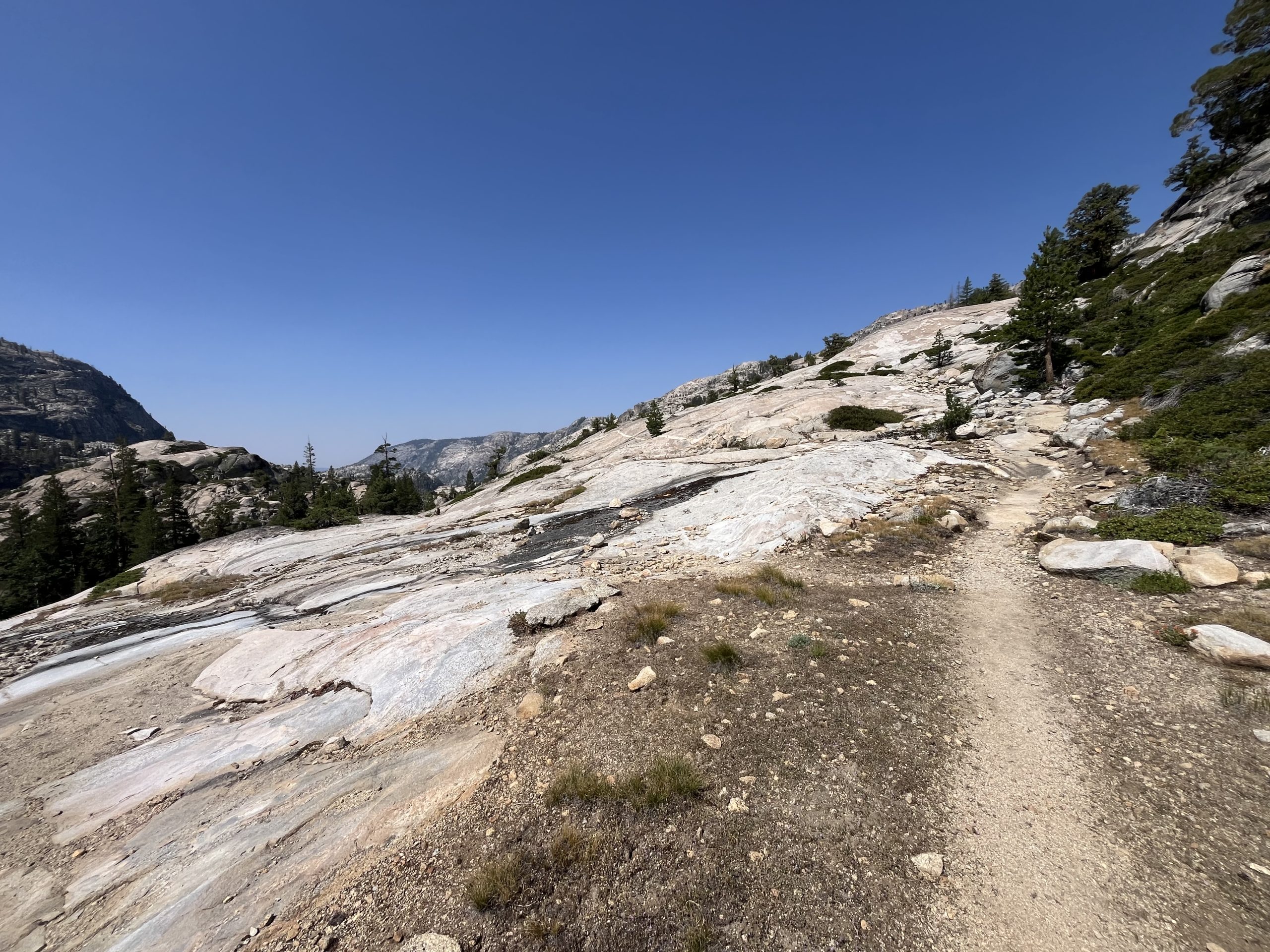
A really unique looking section of the trail. I really can’t think of anywhere else where the terrain looks like this.
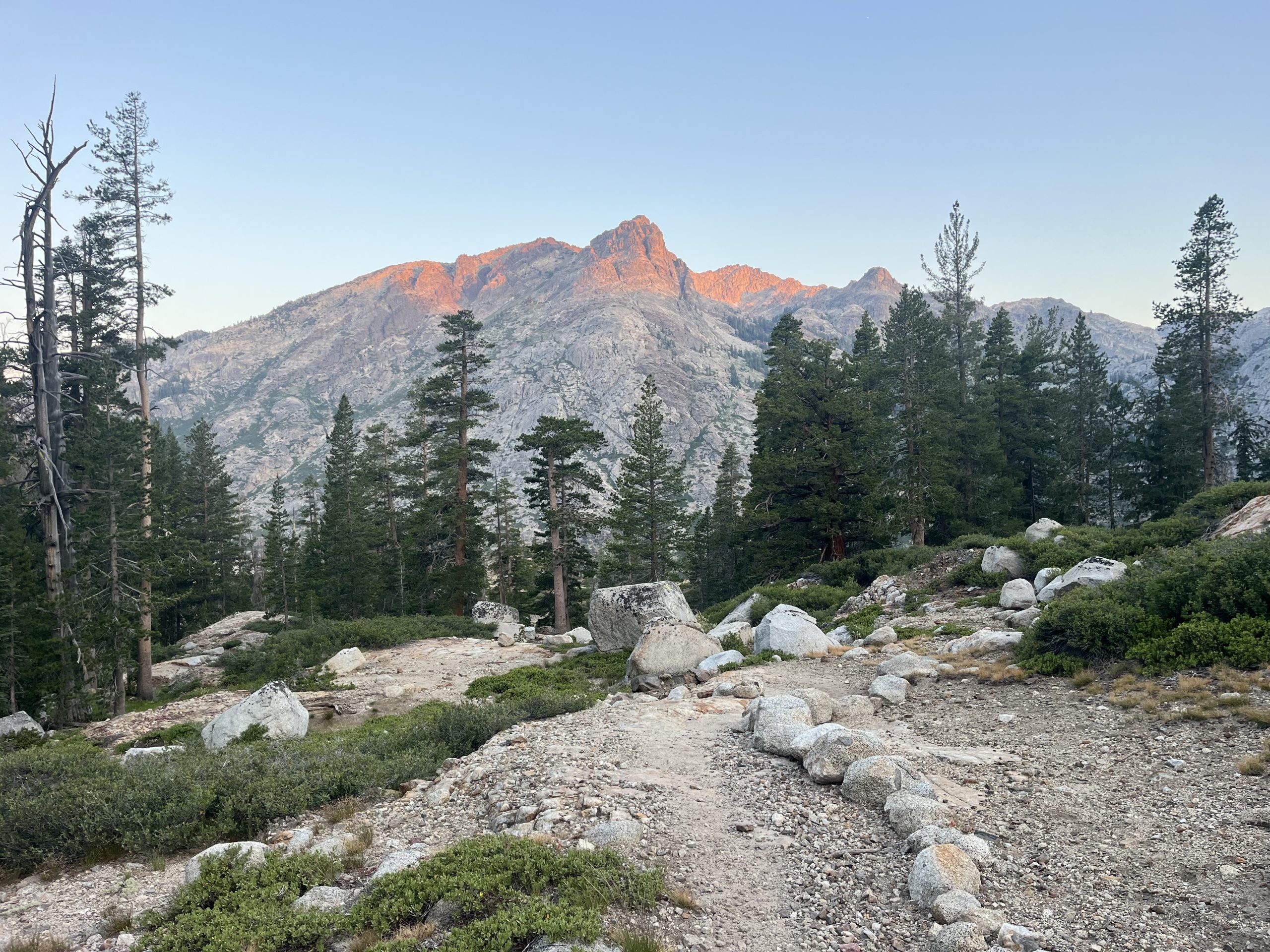
After going up and over rolling hills and brief climbs for most of the day, things calm down for a little bit. Then later on, I knew I would be beginning the final big climb of the day. It was a gradual but very long climb up Dorothy Lake pass. The views were beautiful in the section of trail, and most of the time you really couldn’t tell that you were going uphill.
When I got closer towards the top of the past, I went by a large camp set up. I think if I had had my head down, I would’ve walked right past it. It was a bunch of Trail maintenance guys out for a handful of days. They had a really big set up and we’re using some kind of a tube to pump in water from the lake. I chatted briefly with one guy who is standing near the trail. He asked me when I started and was baffled by my answer.
Today is actually day 31 for me on the PCT. And I’m going to be getting to Kennedy Meadows North tomorrow. Which means I’ve done about 900 miles in the last month. Obviously because of flipping between trails things aren’t as clear cut. But if I’m just counting the time spent on the PCT and the miles that I’ve hiked, then yes. The trail maintainer said that he has asked that question to a lot of hikers. And that most of the hikers are about two months into their hike if not more. Which is completely reasonable and definitely standard. It honestly blows my mind a little bit that I’ve made it so far on this trail in such a short period of time.
After passing by those guys, I didn’t have much further to get to the top. And when I crested it and began descending, I walked for another mile or so. Then decided to take one last break before marching my way to camp for the night. As someone who doesn’t really break a lot, I have been enjoying this break toward the end of the day. I’ve started a bit of a habit where I take a brief break Around the time that I have 8–12 miles left for the day. I think it’s more mental than physical. It just seems to really help and pass the time by quick quicker.
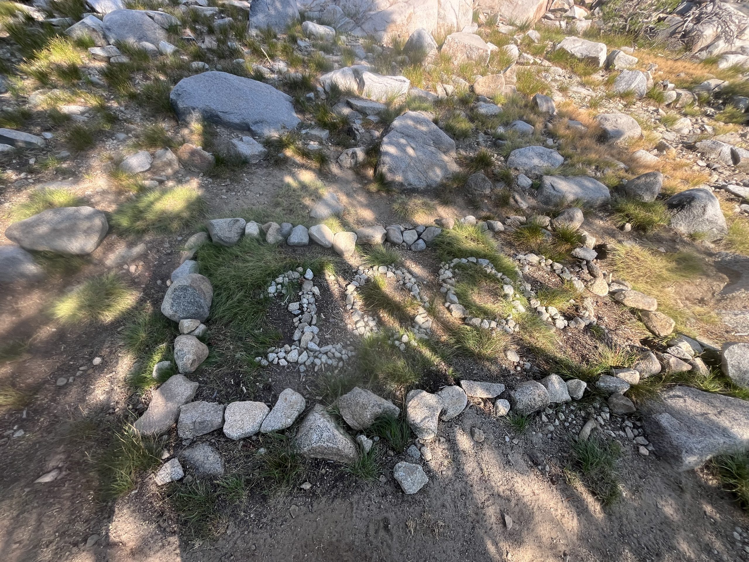
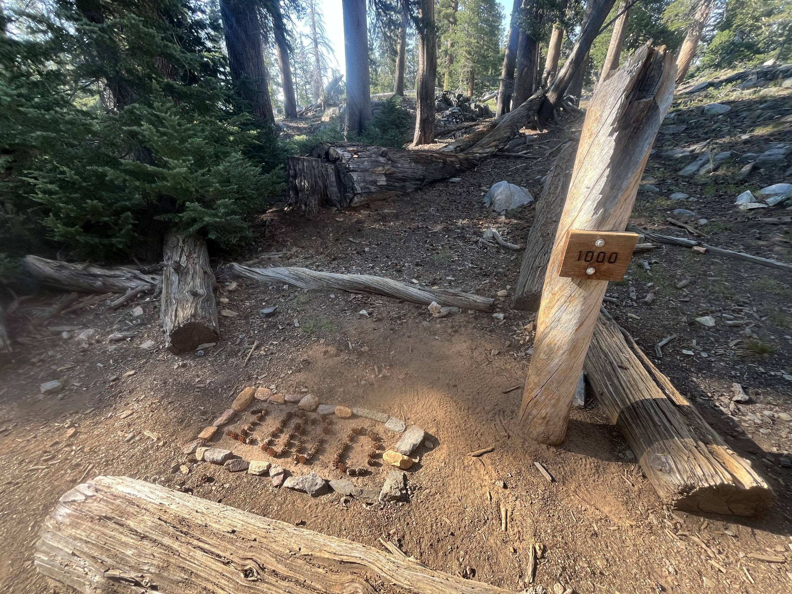
In between Dorothy Pass and my tent site for the night, I went by the PCT thousand mile marker! I can’t believe that I’m over 1000 miles into this trail. It really feels like it’s gone by in the blink of an eye. And I guess that means I’ve actually gone over 1000 miles in the last 31 days. I don’t know if that’s the furthest that I’ve gone in a one month period, but it’s probably fairly close.
It was really nice to end the day by going past such an exciting milestone. From there, I continued on for another hour or so. I wasn’t exactly sure where I was going to camp for the night. But lately the spots have just been speaking to me. I tried to set a mileage goal for the day. And once I reach that goal, everything else is fair game.
I started looking for tent sites and decided on one which was right by a river. There were a handful of tense set up between both sides of the river. I was able to find space though that wasn’t too close to everybody else. I feel bad showing up late and then keeping people up.
After I got my tent set up, I grabbed water and made dinner. When I was in Mammoth Lakes, I wasn’t able to get any normal dinners. The grocery store didn’t have Knorr side dish or anything like that. Instead, I got a few super random dinners. And tonight I was going to be trying to rehydrate or Rice-A-Roni for the first time ever. And spoiler alert, you can’t rehydrate Rice-A-Roni. Maybe if I had cooked it in my pot the entire time it might’ve worked. But instead, I put it in a Ziploc bag and added boiling water to it.
After about a half hour, it was very clear that the food would not be hydrating. I also knew I was going to have to carry the food out. So instead, I turned my camp stove on and decided to try and cook it in my pot. Even after cooking it first significant period of time, though, it was still crunchy. I ate as much as I could stomach and then just packed the rest out with my trash. That was a flop! Who knew that you couldn’t rehydrate Rice-A-Roni. Maybe plenty of people know that. But not me.
After dinner, I had to go clean up my cook pot. Then came back and returned to my tent to get comfortable for the night. I did my stretches and everything else. And while I didn’t get much work done, I did a little bit of writing and video stuff before heading off to bed.
If you enjoyed this blog and would like to support my hike by buying me a soda or a snack along the way, there is a “Tip the Author” button below! It links directly to my Venmo. Any and all support is incredibly appreciated!
This website contains affiliate links, which means The Trek may receive a percentage of any product or service you purchase using the links in the articles or advertisements. The buyer pays the same price as they would otherwise, and your purchase helps to support The Trek’s ongoing goal to serve you quality backpacking advice and information. Thanks for your support!
To learn more, please visit the About This Site page.
Destinations & Things To Do
West Highland Way Day 5 – and now…the end is near….it’s time to face….the final summit
Thursday 29th May
Ug…
I have barely slept a wink. Worrying about my ankle, worrying about my options and what time I might get to Fort William. One thing I had failed to consider when I originally booked this trip and then benched it. I didn’t have any accommodation in Fort William sorted, and all the major hotels and bunkhouses were now full. The hotel I stayed in back in Milngavie 74 days ago (it’s possible my sense of time has slightly warped….) has a room but that means getting to Fort William in time to catch a train back. I check the train times and the last train of the day goes at 5:38pm. OK, to quote Matt Damon as Mark Watney
I reckon I can probably walk at 2mph at the moment at a reasonable limp. It’s a 16 mile leg tomorrow so figure that is 8 hours of walking less any breaks. I want to get to Fort William with time to spare to get my train so my plan was to be walking by 6am! I decide this at approx 3am….yeah sleep didn’t really happen. I book the hotel room and pay extra to allow me to cancel it if I need too if this plan goes to pot.
Around 5:30am I start getting myself sorted doing my best to be as quiet as I can and not disturb those camping around me. Outside it is raining. Sorry my grammar was wrong there. Outside it is RAINING… that’s better. I can hear and feel the rain pounding the outside of my tent and as I am sleeping in a wooded glade the rain is collecting into heavy globules and and blatting down on my flysheet with what feels like considerable force! I scoff down some food, mainly my last granola and a salami stick. I can’t even be bothered to try and get the stove going outside the tent to get some coffee on which is in direct contradiction to my daily required caffeine function/addiction.
I dig out my first aid kit. Contained therein I know there is a support bandage that has sat there for probably a decade, taken on every trip I have been on and never used, it sits there it’s purpose in life unfulfilled. I pop open the plastic wrapping and if this bandage had a voice I imagine it would say “It’s my time to shine!” I strap up my ankle, pop some more drugs and proceed to get dressed. I wrangle on my waterproofs inside the tent not really caring how wet I am getting everything. This should be my last day so it doesn’t really matter how clean the inside of my tent is! Trail runners on I break out into the rain, and it is every bit as nasty as it sounded, pack my tent up and set out on my way.
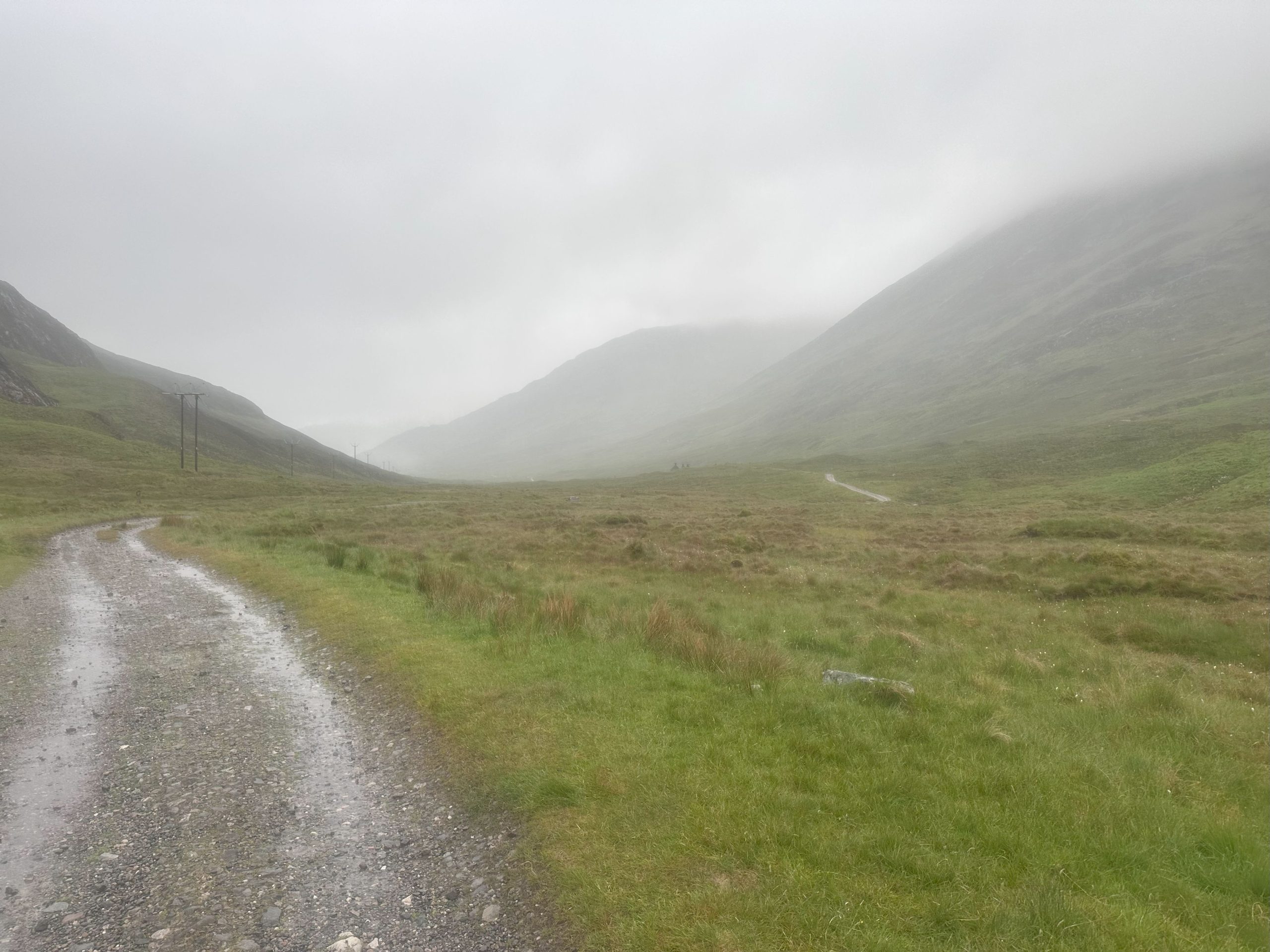
The climb out of Kinlochleven isn’t too bad. It’s a relatively steady climb up and ultimately connects onto the old military road to Fort William. My ankle is very stiff but seems to be ok on the uphill and I am encouraged by my progress. . . . and then my headphones break. They are absolutely sodden in the continuous downpour and have decided to just peace out. So today I have a further 15 miles to walk with just the thoughts in my head to keep me company….mother of god it’s worse than I thought!
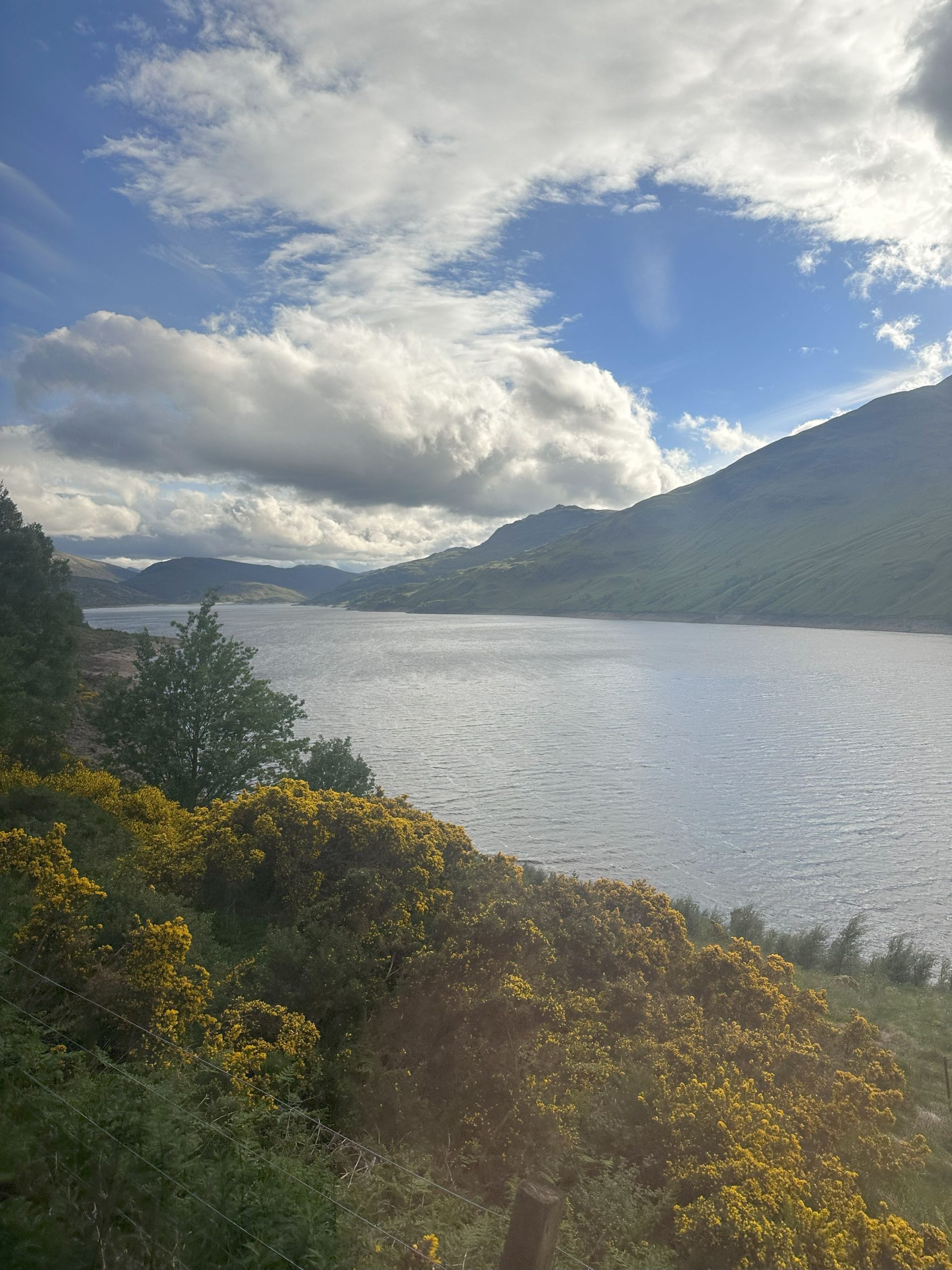
The path continues to trend upwards and the weather somehow continues to get worse. I pass a couple of wild campsites with tents set up and resolutely zipped up! Eventually after what feels like miles, I pass over a small summit and the path starts to fall away gently in front of me. I managed to capture a picture in between squalls as I make my way down.
Doing down is definitely worse that going up, I can feel the pressure on my shin and ankle each left step down. Thank god I have walking poles! I time my use to put weight on them with every left step to help take some of that strain off. Just down the hill (and just visible in the middle of the picture. I would have taken another photo up close but my phone isn’t rated to the kind of water pressures found in the Mariana Trench of rain) is Tigh-na-sleubhaich. I’ll be honest I have NO idea how to say that and my apologies to any Scottish readers but this old cottage is very atmospheric sitting in the misty Glen. I believe it was an old Drovers stop but don’t quote me on that.
After several more miles and a couple of forded brooks at a pace that would have the average garden snail muttering under its breath that was far too sedate I get to the bottom of this long downhill. I need a break so find a rock to perch on and finish off the last of the flapjacks in my back and a chocolate bar. I really am not taking care of my fueling today. I am very much in a “this sucks and I need to get on with it” mentality. The path starts to turn north and in the distance I can see acres of forestry land which consumes the path. I apologise for the lack of photos on this step, it’s so wet that my phones touch screen is failing to recognise fingers swipes and touches. I try and dry it with my microfleece but it makes no difference what so ever.
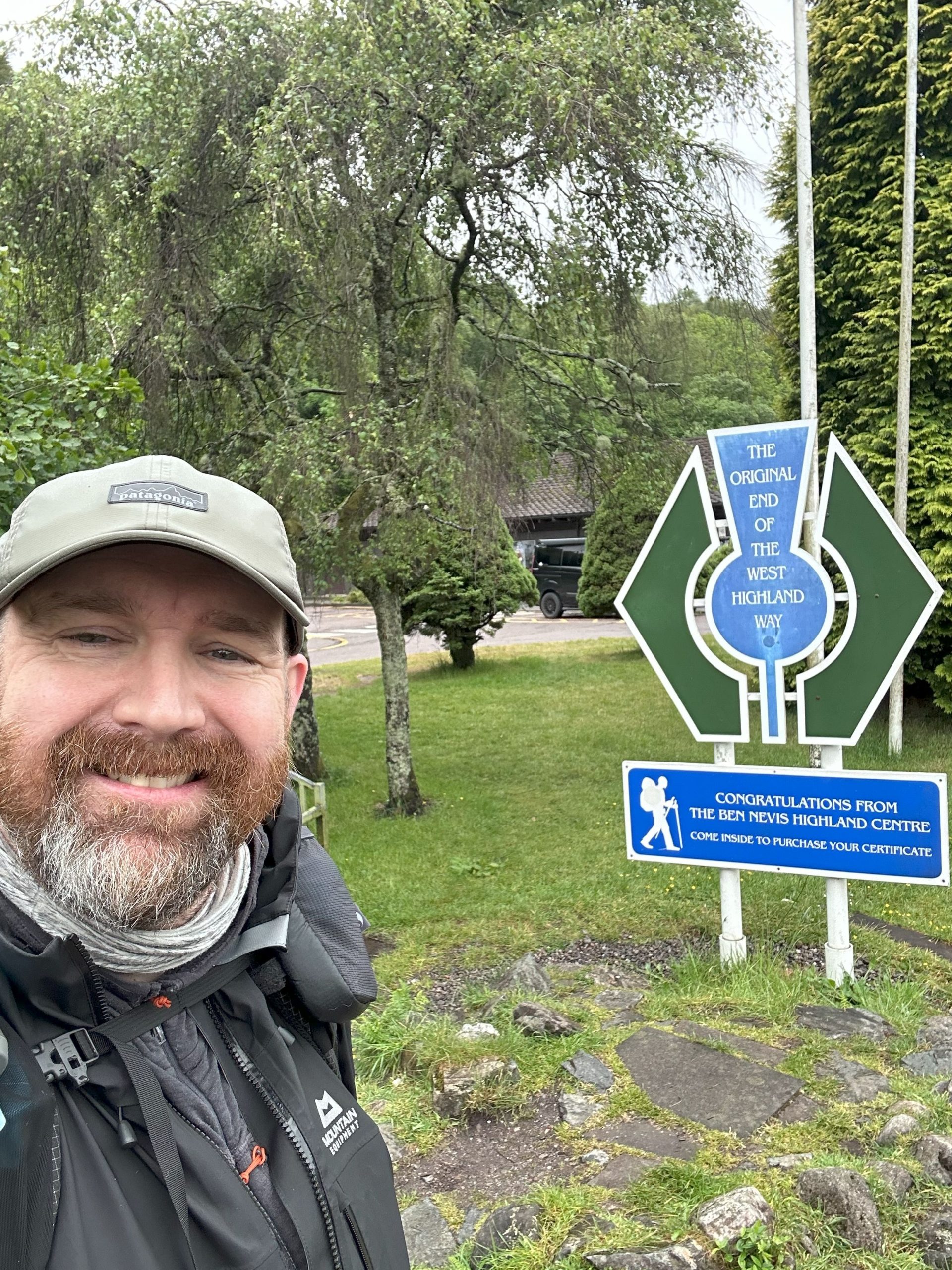
The trail seems to skirt most of the forested areas, snaking it’s way down through a clear section before starting up a long sustained climb. I actually don’t mind this as going up is easier than coming down at the moment. It eventually comes out on a forestry road at the top and I am excited to see down in the distance the edges of Fort William…all the way down this hill….down this long long hill….arse. At this point I am starting to be passed by those that must have got on their way after my early start. Everyone is very friendly, a few stop to ask if I am ok and I explain my ankle. Most depart with a “take it easy and good luck!”. At this point I realise I am going to make it to fort william with plenty of time to spare to get the last train and now I am eager to make sure I have a ticket booked on it. I find a sheltered spot at the side of the path and dig out my sleeping top, almost the last bit of dry clothing I have. I wipe my phone as dry as I can and also my hand and manage after a couple of attempts to get into my phone and use it enough to book a train ticket! Result, everything is coming up Milhouse! Several miles of gentle ambling later the trail comes out on the road from the foot of Ben Nevis to Fort William. Only a couple of miles to go! At the end of this lane is the original ending to the west highland way noted with a trail symbol shaped sign.
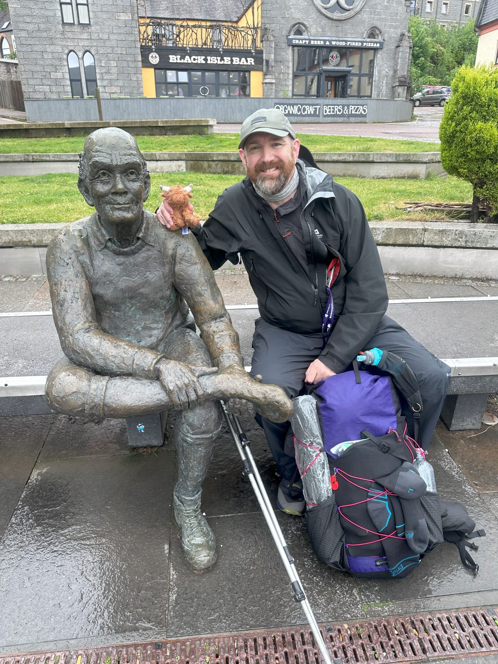
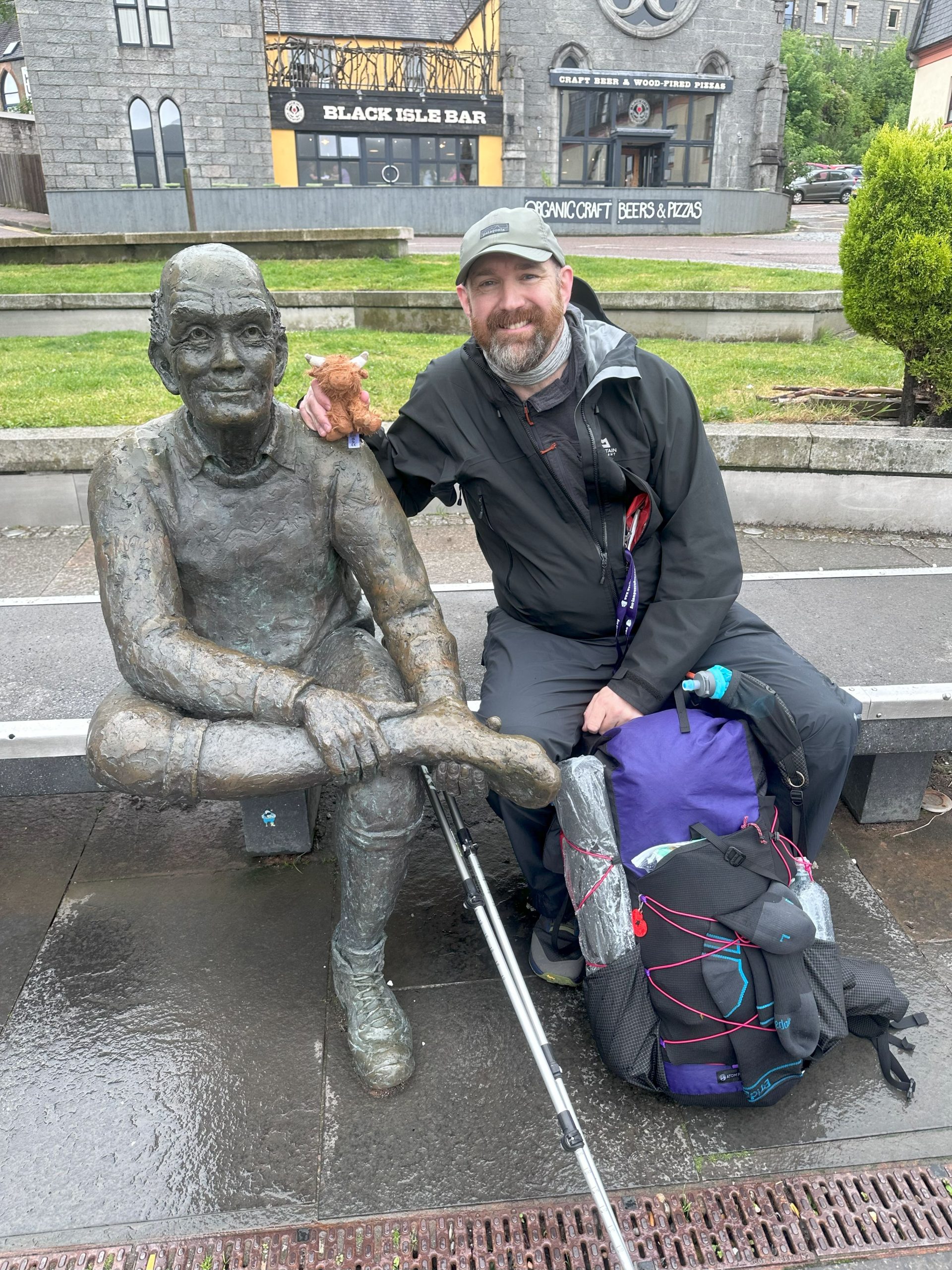
The rain has started to finally abate and I snap a quick selfie before that last push to the new finish. The last couple of hundred metres before reaching the pedestrianised area of Fort William are along the A82 and it is incredibly busy with traffic, a jarring welcome back to urban civilisation. Thankfully it is over quickly and I get to the the main high street in Fort William which is thankfully open to pedestrian traffic only. I pass gift shops, whisky shops (which I may or may not pause in front of), pubs and restaurants before finally reaching the end and the fabled “Sore feet” statue. I get a couple of “well dones” from some fellow walkers who passed me earlier and have finished and are walking back into town. I tag the finish marker and plonk myself down very unceremoniously by the statue. A very kind local offers to take my picture and I grab my lucky Highland Coo out to join me.
West Highland Way – completed it mate.
I could end the blog here and thank you for joining me along the way and hope you enjoyed the journey type thing but I actually arrived at the statue almost exactly at 2pm so I have 3 1/2 hours to fill before catching my train back to Milngavie.
So…for those of you still here I grabbed my stuff and walked down the high street to a pizzeria I had noted on my way though, walked in and found a table. I ordered the largest meatiest pizza they had on the menu and a large glass of fanta before stripping out of my sodden waterproofs and take my seat. I phone MrsDodge and DaughterDodge to share the news I have finished and to send them the photo at the statue, congratulations are shouted and exclamations of pride made. In the background I hear my dog bark, obviously excited that something good has happened but having no idea what it is!
The pizza arrives and is devoured in the kind of times usually used to measure particle decay in supercolliders. It is gone faster than the light carrying the information can carry it to nearby patrons. Somewhere at CERN a gravitational wave detector blinks a curious anomaly from the Scotland area, scientists scratch their head and assume it is duff data. I have no idea if it was hunger or genuine pizza quality but it tastes like one of the best pizzas I have ever had. Ooo they have a desert menu too! I wonder how quickly I can eat a tiramasu
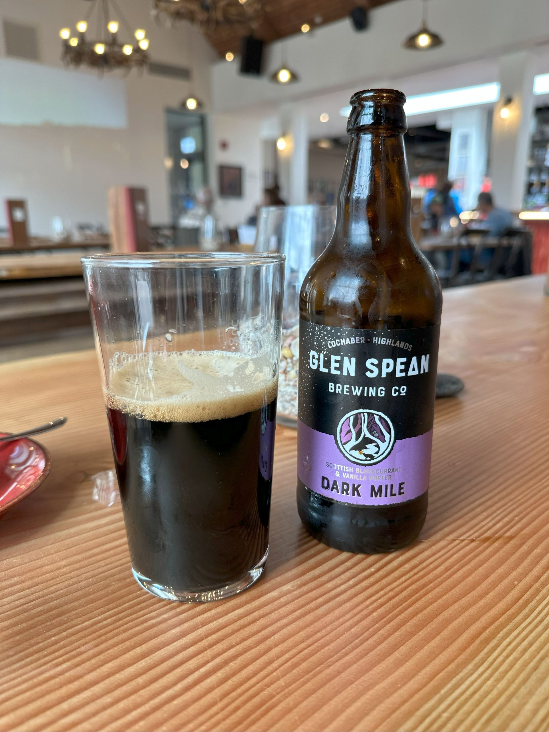
I still have a couple of hours to kill so wander off to a local supermarket to buy some food for the train later and a can of deodorant to make myself more tolerable to other train users! Then I head towards a charming little independent cinema I passed on the high street which looked like it had a cafe at the front. It is immediately obvious that several other hikers have had the same idea and I smile and nod a hello at some I recognise from the day. I order the largest coffee they are legally able to serve and sit myself down on a bench and charge my phone up. The coffee is delicious and I start to feel human again. After 6 days of nurturing battery life I feel the irresistible draw to connect to the online world and find out what I have missed the last few days….not on news sites…no I like my mental health thank you very much. But catching up with friends and sharing news of my finish. I guiltily remember that I was supposed to be blogging the trip and start to write a few notes down. The coffee is finished and I notice that they also serve drinks here. I try a couple of the local beers with the dark porter being my favourite!
Time passes by at a slow pace as I ease my way back into civilization but eventually it is time to walk down to the train station. I had carried in the very bottom of my pack a clean dry top and a change of underwear in a waterproof food bag to change into for the train trip. I use the bathroom to change and spritz myself in the deodorant before walking the short trip down to the station.
The platform feels like it is quite full however many board a train heading off to one of the coastal communities and by the time my train pulls in and everyone boards it is only maybe a third full. I stow my bag and settle down for the 4 hour trip to Milngavie station.
The train ride is….well…there is no other word for it…spectacular! If you walk the West Highland Way (and despite my injury towards the end I strongly encourage you to do so) I thoroughly recommend getting the train back to Glasgow or Milngavie whichever you are bound for. The train heads north of out Fort William before working its way through a river lined gorge and bursting out in harmonious isolation onto a remote track that takes you through the heart of the Highlands.
Passing Loch and Ben we work our way around and south, stopping at Corrour one of the most isolated stations in the country. There is a remote hotel there accessibly only on this train and some guests wave goodbye to the staff and board before we head on our way.
It is truly one of the best railway journies in the UK.
Eventually I make it back to Milngavie and have the 500m walk back to my hotel and car. I grab my overnight bag with clean clothes and wash kit, check in and collapse in my room! One invigorating shower later I decide to sort out my gear so I don’t have to do it in the morning. I open my pack and pull out a sodden tent and other walking paraphernalia before finding my food bag and opening it…..and finding six uneaten bags of porridge….
The next day was a 450 mile drive home, which I won’t go into detail of. It was fine, much coffee was drunk, podcasts listened to and I arrived home in the evening to hugs from Wife and Daughter and slobbered excitement from the dog and settled back into post trail home life.
I am going to finish this series with a final shill. The West Highland Way is a wonderful trail. And even with a lot of limping I had an amazing time. The views along the way are spectacular, the scenery ever changing and the weather unpredictable! Everyone I met was extraordinarily friendly, from fellow hikers to locals I bumped into and without exception every single establishment I went into the kindness and hospitality of the Scots was 1st class. As you are on a walking website I can assume that you have an interest in long distance trails and I would urge you to add the West Highland Way to your bucket list. I will do a follow up post at some point with the gear that I took with me if you are interested.
So that’s it folks. My West Highland Way. Thank you for getting this far! I haven’t written anything that wasn’t a JIRA ticket or SQL for the last 20 years so I hope you have enjoyed my meandering description of the journey!
Wherever you are in the world I wish you Happy trails!
Thanks,
Dodge
This website contains affiliate links, which means The Trek may receive a percentage of any product or service you purchase using the links in the articles or advertisements. The buyer pays the same price as they would otherwise, and your purchase helps to support The Trek’s ongoing goal to serve you quality backpacking advice and information. Thanks for your support!
To learn more, please visit the About This Site page.
Less Water, More PUDs
Halfway through the section of trail between the towns of Augusta and Elliston, the abundant water sources we’d been enjoying (read: taking for granted) throughout Glacier and The Bob mysteriously disappeared. Sources were suddenly scarce, becoming fewer and further between.
Water became a commodity we actually had to think about and plan our days around. I didn’t expect this until the “desert” sections of the trail. When you research the areas with the little water and thus long water carries on the CDT you’ll probably come across places in New Mexico and The Basin in Wyoming. I don’t remember reading anything about Montana.
Perhaps 2025 is just a particularly dry year in this state. Even bodies of water marked with the full water droplet waypoint symbol in FarOut (indicating a reliable source) have been dry this year. We have been told by locals that it’s currently in a drought status. This is likely due to, at least in part, the lower than average snowfall over this past winter.
Regardless of cause, the reality was that we were facing upwards of 15-20 miles between reliable water sources. And we were only hiking the same range of miles per day. That meant potentially carrying water from one night’s camp to the next. To make matters worse, the elevation profile through this section was far from easy, and full of PUDs (pointless ups and downs). More PUDs = more exertion = more hydration needed.
How did we combat these obstacles?
Flescher Pass Cache
First we got lucky with some impeccably timed trail magic. Two backpacker locals in the Lincoln area, Crusty Phil and Tinkerbell, maintain a cache of water and other goodies in the bear box at Flescher Pass. You never want to 100% rely on caches since you have no way of knowing for sure whether they are currently stocked. We had a backup plan to collect at an off-trail water source, but hoped we’d save our legs the extra half mile and be able to fill up at the cache.
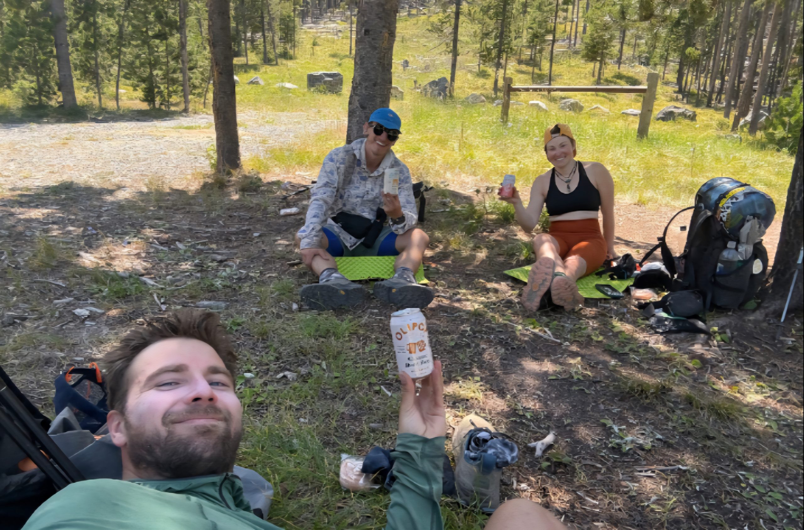
As luck would have it, just as we got down to the pass we ran into none other than Crusty Phil and Tinkerbell in the flesh. They told us they had not only restocked the water cache, but left exactly three soft drinks there as well. This was amazing news to three hot and sweaty hikers about to enter a dry spell.
When we arrived at the pass and opened the bear box we found two Olipops and a Spindrift, still cold, a bonus treat of Little Debbie Honey Buns, and a bounty of water. Plenty to get us to our dry camp, through dinner, breakfast, and on to the next day’s reliable source. We were very grateful that these trail angels go out of their way to maintain the cache that made our day much easier and more enjoyable.
The Llama Alt
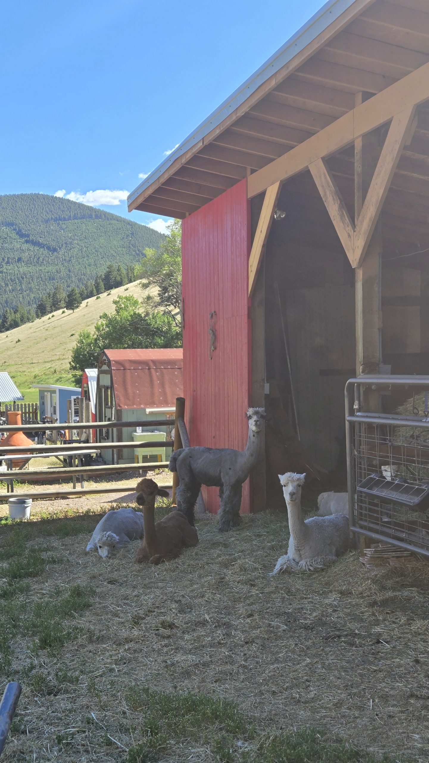
Another way we dealt with the lack of on-trail water was to not take the trail. The CDT is a journey of many alternate routes and it’s widely accepted and encouraged to take them as needed or wanted. It’s all about choosing your own adventure. The area we were in has an unofficial alternate commonly referred to by thru hikers as the “Llama Alt.” As its name implies, the route passes by a ranch that has llamas, among other farm animals.
The ranch is a property owned by a husband and wife and is primarily a hostel geared towards bike packers who are cycling the Great Divide Mountain Bike Route. The GDMBR is essentially the biking equivalent of the CDT. It traverses about 2700 miles from Banff, Canada to the New Mexico-Mexico border along the Continental Divide, and is allegedly the longest unpaved bike route in the world.
Our main intention taking the Llama Alt wasn’t to visit the ranch, but rather that the road paralleled and crossed more creeks than the red line (the official CDT route) and there was a much gentler grade and far fewer PUDs. We had heard rumors of trail magic of an unspecified variety at the llama ranch, which was only an added bonus for our purposes.
Unsure of whether or not camping was possible there, we figured we’d stop in, see what the place was about, then be on our way to stealth camp somewhere down the road. In a then-unknown manifestation, The Show said, “maybe we can ask and they’ll know of a place 5 miles or so down the road we can camp.”
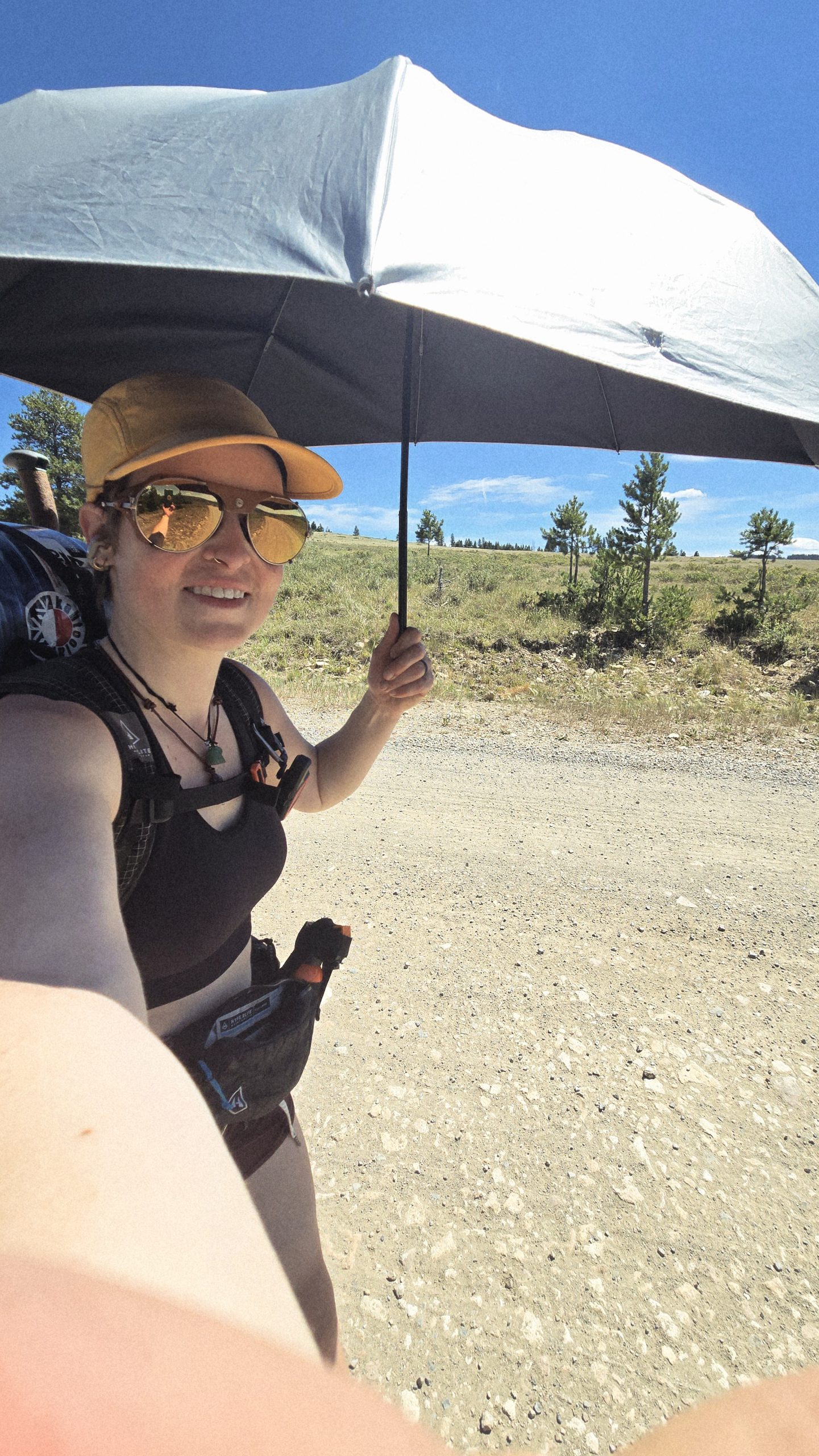
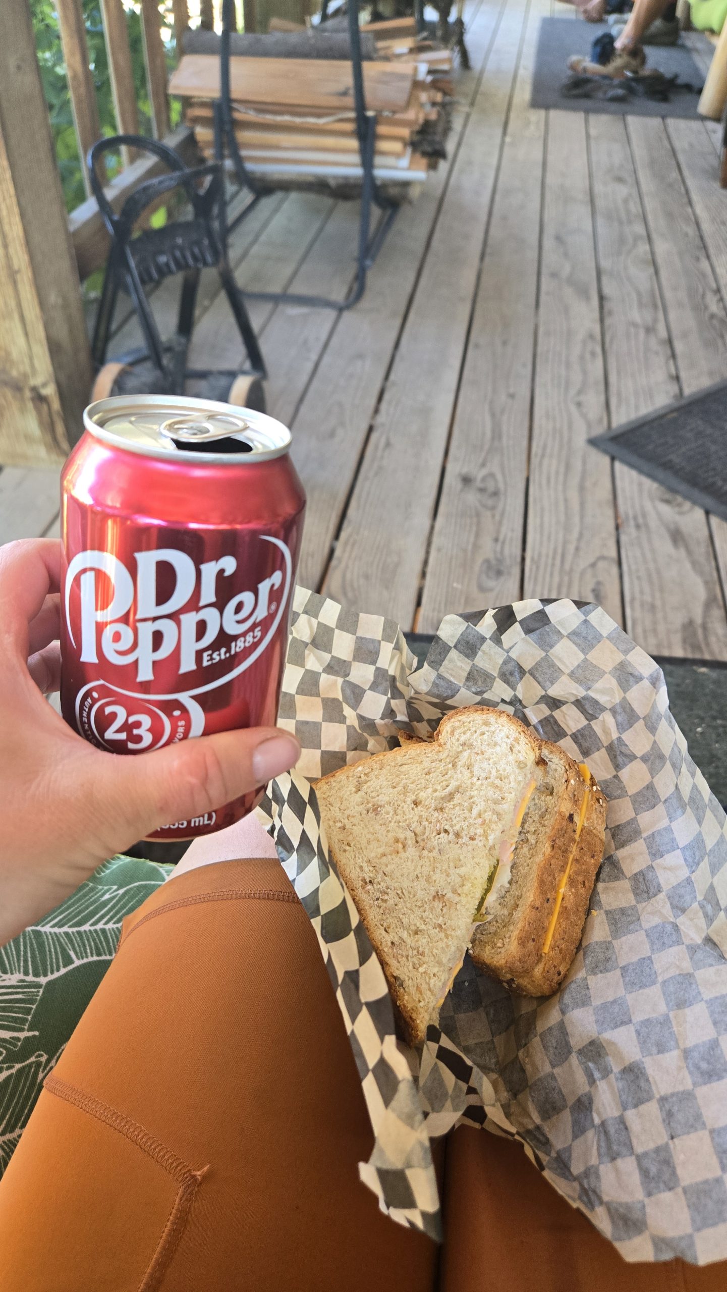
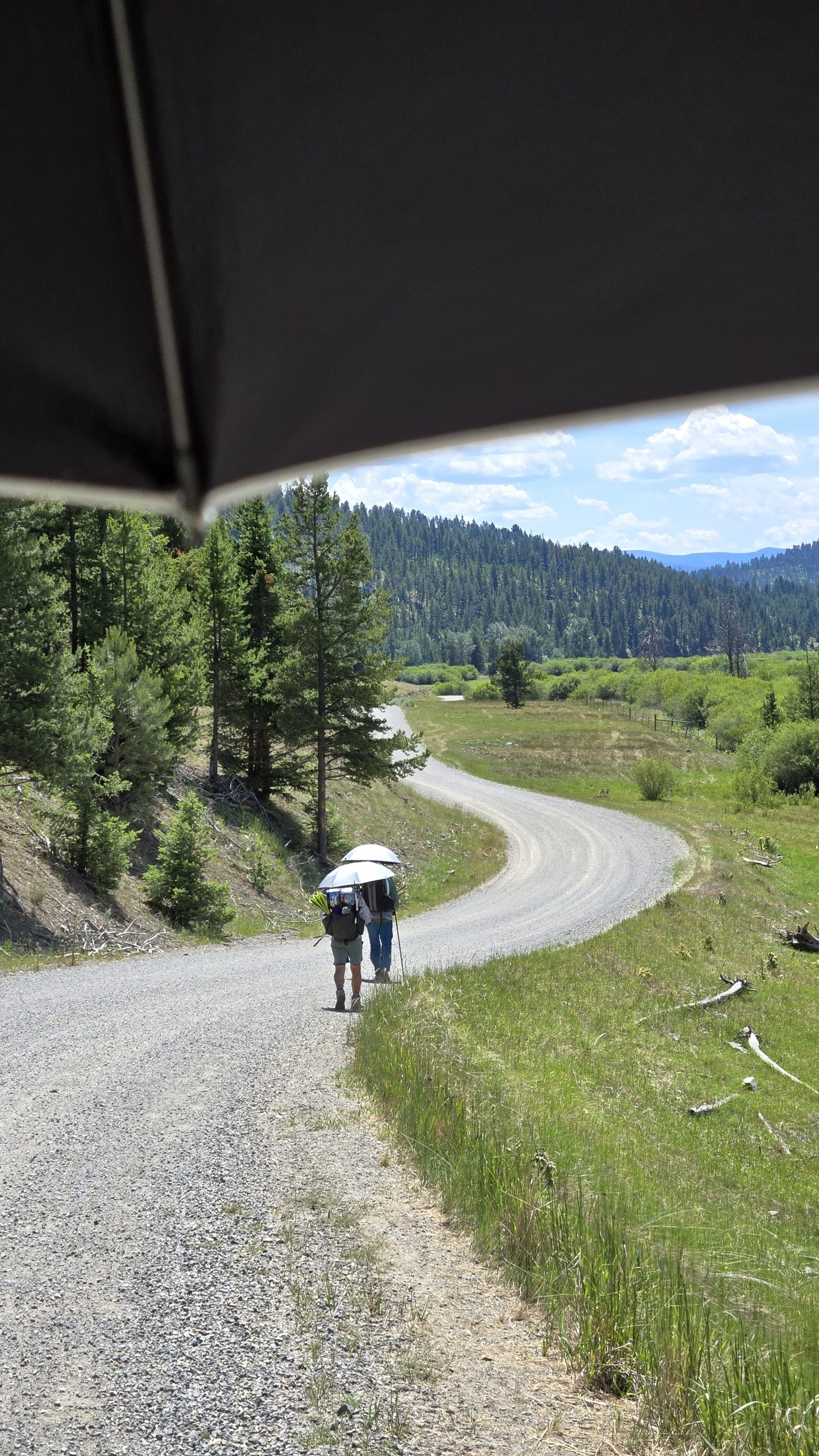
After a lengthy gravel and dirt roadwalk hiding under our umbrellas from the beating sun, we arrived at the llama ranch. The trail magic included a mini fridge on the porch stocked with sodas, beer, and cold cut sandwiches. I chose a turkey one that also had cheese, mustard, and sweet pickles on mutigrain bread. It hit the spot after 18 miles of hiking.
This umbrella has been one of my favorite pieces of gear during this hike. Makes sunny roadwalking much more bearable.
Pay it Forward
Shortly after arriving, we met one of the owners of the property, John. He gave us a brief spiel about the place, saying that they operate entirely free of charge and with a “pay it forward” philosophy. They do not even accept donations, believing they are better put to use out in the world. For example, paying for someone’s groceries in the line behind you would be a way to pay it forward. The ultimate goal, explained John, was to make the world a better place.
We asked about a place to camp a little ways away, and he mentioned he has a friend 5 miles down the road with a property he allows hikers to camp on. The Show, Free Samples, and I looked at each other in kismetic disbelief as we recalled what Show had said earlier. It was totally manifested.
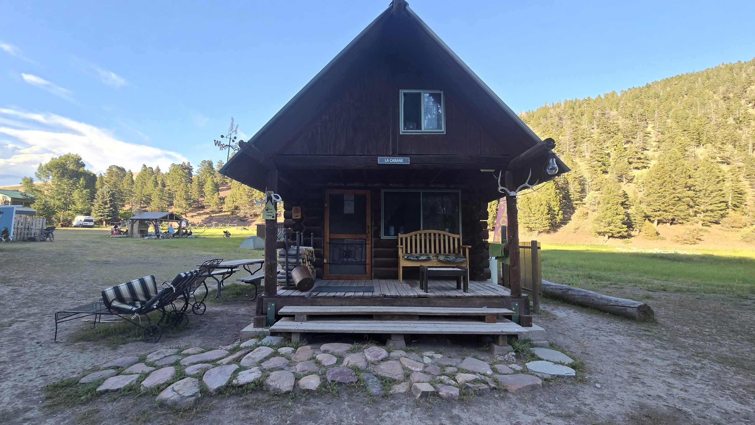
The Not-So-Romantic Cabin
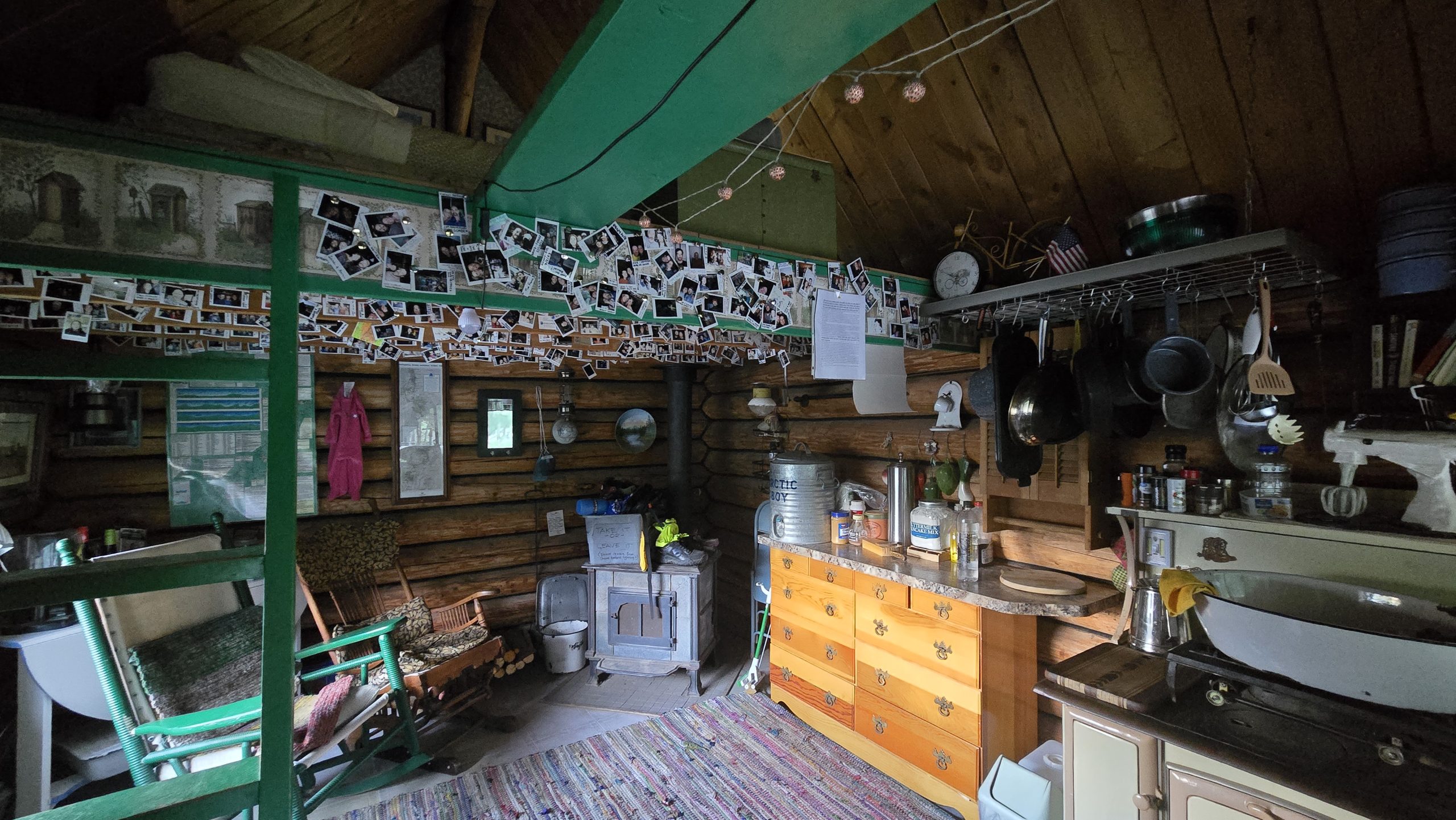
We did not, however, walk those extra five miles, but instead decided to stay at the ranch. Just past the llama hut were a bunch of tiny cabins and bunkhouses. Free Samples slept in a pink covered wagon. John offered The Show and I the cabin he said he reserved for romantic couples, a small cottage with lofted double bed and front porch. We gladly accepted but unfortunately it was more whimsical than practical.
Planning to get up by 4am to beat the heat on our next day’s road walk, we settled down in the loft bed to sleep by 9pm. It was still light out and the thermostat in the cabin read 86 degrees. After 20 minutes of trying, we concluded it was just too hot to fall asleep in there, and decided to cowboy camp on the porch instead. Heat problems solved, we settled in again, only to see a mouse run across the porch by our pillows.
That was the start to a restless night of paranoia that mice were crawling over us. Real or imagined, it prevented me from sleeping well. At around 3am I’m positive I felt a mouse scurrying at the foot of my quilt and jerked awake. Both awake, we decided soon after to pack up and leave. It was the worst night’s sleep on trail yet.
The Elliston Direttissima, or, The Dog Creek Alt
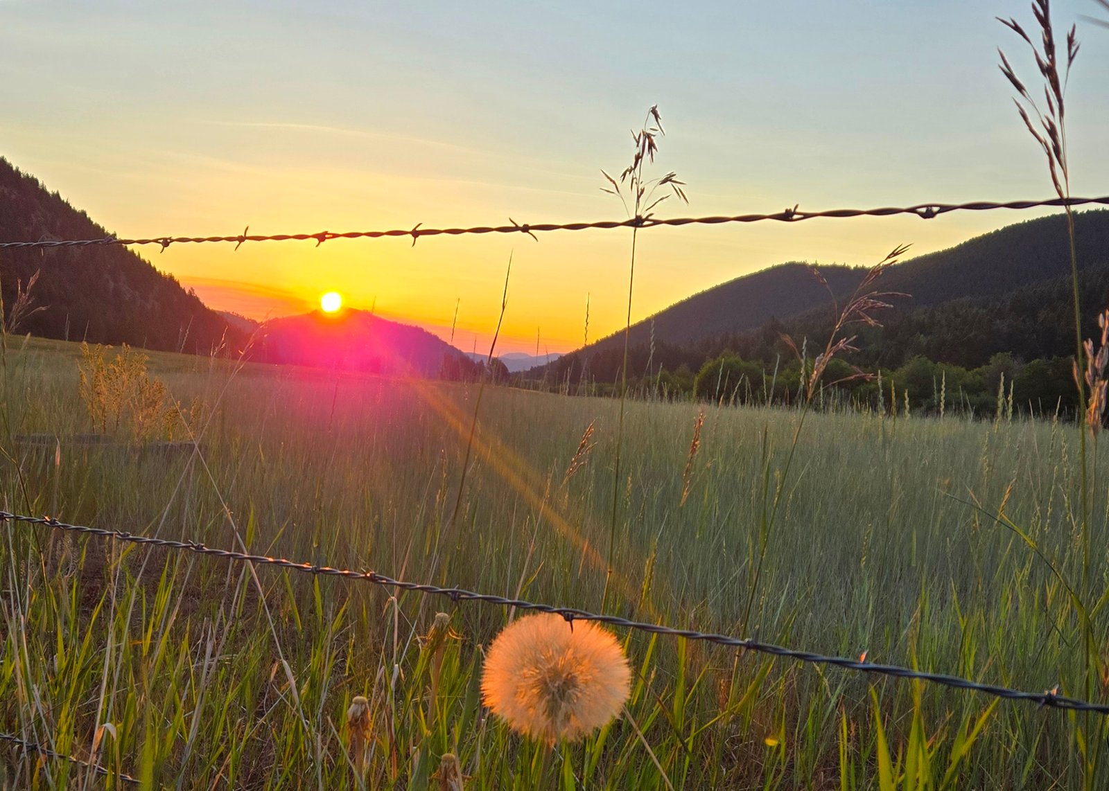
By 5am we were road walking again, this time an alternate of our own making. Realizing the town of Elliston was only 27 road miles away, we decided to stick to the roads instead of rejoining the trail and get there that much faster. We’d been out for seven days at this point and were more than ready for some town time ASAP. Plus, the red line was still looking dry and PUD-y in the area. We called the route the “Elliston Direttissima” as well as the “Dog Creek Alt” because it took the most direct path to town and followed a creek by that name for a portion of it.
Sunrise from our roadwalk out of the llama ranch. This dandelion was the size of my palm. They don’t make ’em that big back east.
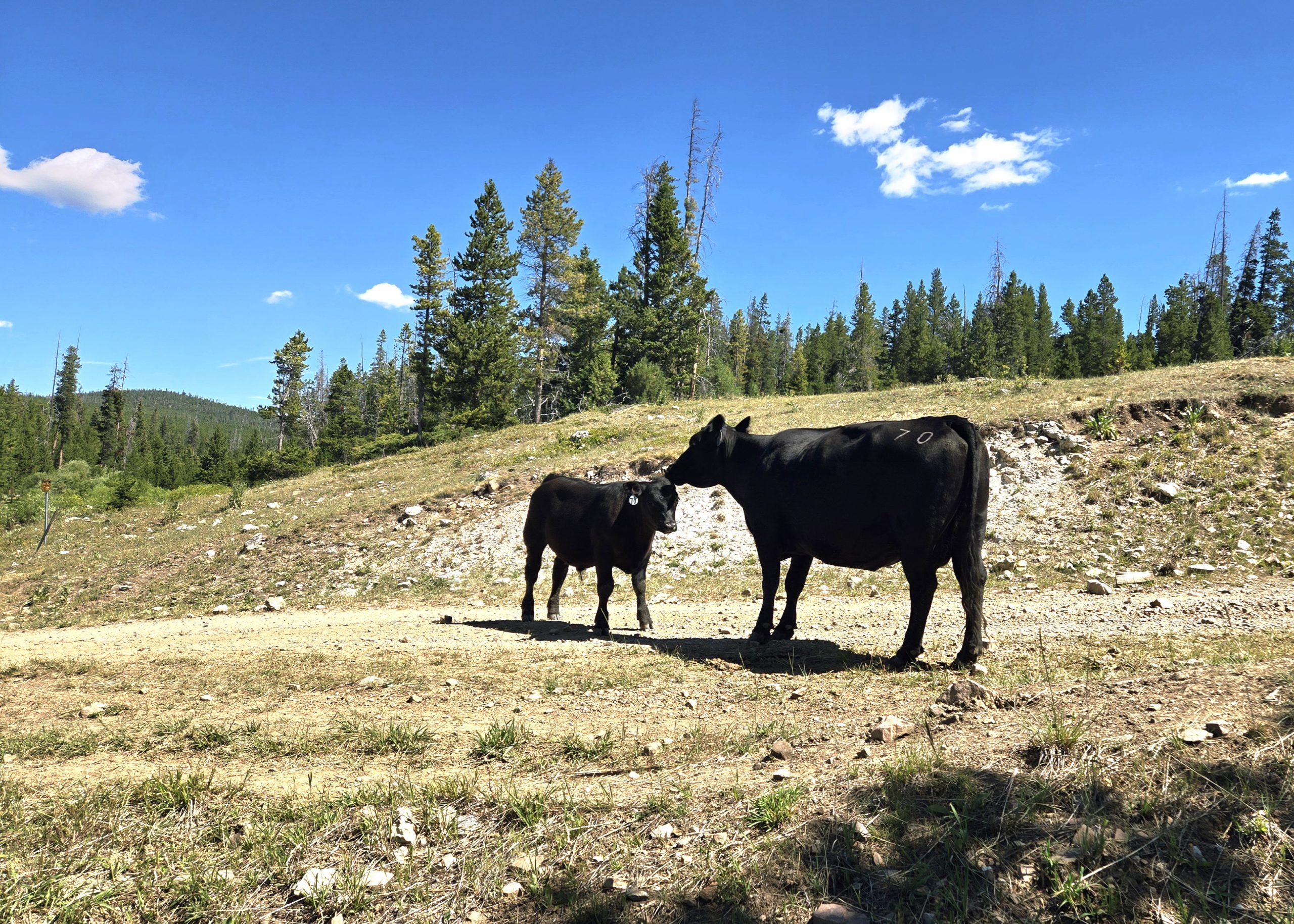
Along our alt we passed through a lot of cattle farmland and saw more black and brown cows than we could count. Some were timid and ran away from us into the trees. Others were disgruntled we were in their fields and mooed at us repeatedly.
Yucky Water
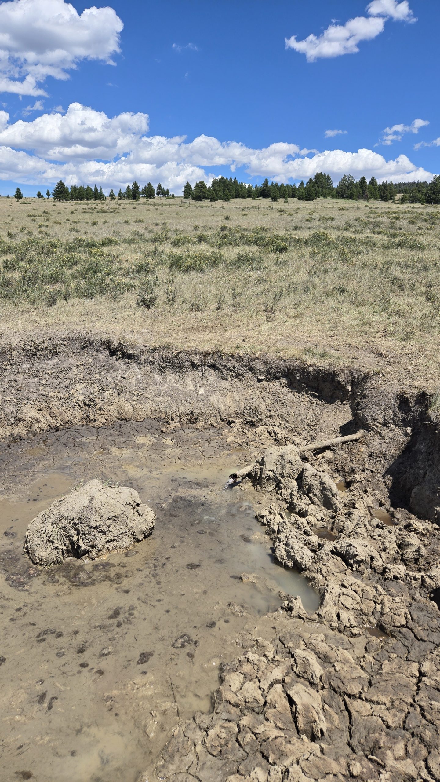
The roadside water situation turned out to be less abundant than we hoped. Creeks that are usually flowing were dry, or running directly through cow fields with cow pies on their banks. One spring we passed had a cow actively drinking from the trough so we didn’t bother to compete.
At one point our best option was what looked like some kind of irrigation line, a pipe emerging horizontally from the ground with a muddy crater surrounding it. It was certainly gross-looking, but was clear, cold, and tasted fine after we filtered it. I’m sure we’ll experience much worse down in New Mexico.
When we got to our planned stealth camp by the train tracks on Elliston Eve, we were elated to discover the nearby creek was flowing. We hadn’t been positive it would be. Not only was there running water, but enough to bathe in. We must have been a sight for the conductors of the multiple freight trains passing through to witness.
All and all, I’ll admit this leg was tough and not one of my favorites. But the selfless kindness of strangers and the freedom to create our own path helped make it a little easier.
-

 Brand Stories7 days ago
Bloom Hotels: A Modern Vision of Hospitality Redefining Travel
-

 Brand Stories2 days ago
CheQin.ai sets a new standard for hotel booking with its AI capabilities: empowering travellers to bargain, choose the best, and book with clarity.
-

 Destinations & Things To Do1 week ago
Untouched Destinations: Stunning Hidden Gems You Must Visit
-

 AI in Travel1 week ago
AI Travel Revolution: Must-Have Guide to the Best Experience
-

 Brand Stories3 weeks ago
Voice AI Startup ElevenLabs Plans to Add Hubs Around the World
-

 Brand Stories2 weeks ago
How Elon Musk’s rogue Grok chatbot became a cautionary AI tale
-

 Destinations & Things To Do2 days ago
This Hidden Beach in India Glows at Night-But Only in One Secret Season
-

 Asia Travel Pulse3 weeks ago
Looking For Adventure In Asia? Here Are 7 Epic Destinations You Need To Experience At Least Once – Zee News
-

 AI in Travel3 weeks ago
‘Will AI take my job?’ A trip to a Beijing fortune-telling bar to see what lies ahead | China
-

 Brand Stories3 weeks ago
ChatGPT — the last of the great romantics