
Destinations & Things To Do
Best Cyprus holiday destinations for 2025
An island rich in historic sites, unique cuisine and charming coastal resorts, Cyprus continues to uphold its reputation as an island that can cater to every type of traveller.
The sparkling crystal Mediterranean Sea wraps around this island like a silky scarf. Situated just under Turkey, the island has almost year-round warm weather to enjoy the Med’s waves across its popular seaside spots and beach resorts.
While it’s hard to draw yourself away from soaking up the sun, flopping on a lounger with a book in one hand and a cocktail in the other, the island combines this distinctly laid-back way of life with immeasurable amounts of Mediterranean history, as well as characterful hotspots for lively nightlife.
Capital Nicosia is the cultural epicentre of the country, while Paphos is its ancient historic centre, with ruins dating back centuries. You’ll find plenty of delightful beaches there too.
The Troodos Mountains offer an escape into the wilderness with picturesque villages, hiking trails and even ski slopes, while Limassol and Larnaca provide a relaxed beach resort alternative away from the party-centric town of Ayia Napa.
There are plenty of accommodation options available in all seven of our Cyprus hotspots, or you can always visit on a day trip, as the island is small enough to get across easily in just a few hours. Read on to find the best places to visit during your trip. Book flights to Cyprus via Skyscanner.
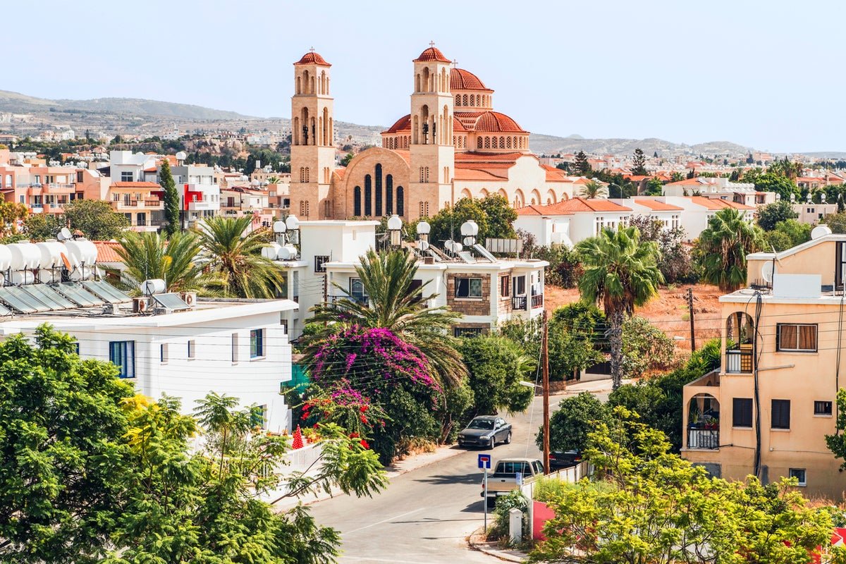
1. Paphos
Best for: Nightlife
Paphos remains one of the country’s most popular tourist destinations, with sparkling year-round weather allowing you to make the most of its Mediterranean promenade and beaches like Aphrodite’s Rock, Coral Bay or the Blue Lagoon.
The city itself comprises a charming old town (filled with colourful architecture, alfresco restaurants and great harbour views), a host of surrounding ancient ruins, a lively nightlife scene and great options for day trips such as vineyard tours or visits to other nearby towns.
Tourist highlights include the Kato Paphos Archaeological Park and its many ruins – which range from villas and mosaics to a 4th-century acropolis and the Odeon, an outdoor theatre – as well as the Chrysorrogiatissa Monastery and the Harbour Castle.
For a stay overlooking the sea, the Alexander the Great Hotel is an elegant beachfront property located minutes from Paphos harbour. It combines old-fashioned luxury with contemporary touches – from the opulent decor to the modern spa and five dining options – and features four swimming pools, a fitness centre and a terrace that is among the best sunset viewing spots in town.
Read more: The best beaches in Greece – and where to stay nearby
2. Nicosia
Best for: History
The capital is a magnificent showcase of Cypriot history, where Venetian, Ottoman and Byzantine architecture attests to the city’s complicated past. The skyline is dominated by russet-tiled roofs and walls of white and honey, with an old town surrounded by 16th-century Venetian city walls, delightful squares such as the recently redesigned Plateia Eleftherias and quaint neighbourhoods like the Chrysaliniotissa Quarter or Laïki Geitona.
Cyprus is divided into two parts by the UN-administered Green Line, which runs right through the country’s capital. The north and south of the city are separated into the Greek Cypriot and Turkish Cypriot communities, and the immediate area around the line is a good place to learn about recent Cypriot history.
Parts of Ottoman and Byzantine life remain today in the city’s many churches, mosques and the Hamam Omerye bathhouse. Archangelos Michail and Agios Ioannis are the main churches, while the Omeriye Mosque stands out as a working mosque that non-Muslims can visit. For the best views of both sides of the city, ascend the Shacolas Tower Observatory.
Choose the Djumba Hotel and Cafe for a boutique hotel stay in Europe’s last divided capital. It combines traditional Cypriot architecture and hospitality with a touch of the Mediterranean and offers cosy and modern rooms, a courtyard and terrace and lovely local food options.
Read more: The enchanting Spanish town that got tourism right
3. Limassol
Best for: Beaches
Limassol is a busier, more cosmopolitan alternative to Paphos or Larnaca. It is the second-largest city on the island, with a picturesque marina and beaches including Lady’s Mile, Dasoudi Beach and Governor’s Beach that offer safe swimming.
Stretching back from the waterfront, the city itself is a collection of white-washed buildings that line cobbled limestone streets, with a mix of high-rise buildings and preserved heritage sites. Older historic sites include Limassol Castle, Kolossi Castle and the 2,000-year-old ruins at Amathus, while you can also day-trip to the ancient ruins of Kourion, once one of the island’s most important city-kingdoms.
For a stay at a seaside location that is also within the city’s historic centre, The S Paul City Hotel means guests can pair beach visits with easy strolls through the old town. Interiors here fuse the modern with the traditional in a series of 22 minimalist rooms housed within a 19th-century stone building, and guests can enjoy easy access to the bar and its two restaurants.
Read more: Why you should swap Santorini and Mykonos for this peaceful Greek island instead
4. Larnaca
Best for: Scuba diving
Larnaca lies along the southern coast of Cyprus, just east of Paphos and Limassol, so it benefits from much of the same great weather and superb beaches. Standouts are Makenzy, Finikoudes, Kastella and Dhekelia.
Larnaca is probably less glamorous than its resort town neighbours but has a solid tourist infrastructure and enough sites to keep you occupied over a long weekend (if you decide you want to leave the beach). Lined with plenty of hotels and restaurants, Leoforos Athinon is the main thoroughfare, linking the marina with Larnaka Fort. Many of the city’s main sites are close by, including the Agios Lazaros (a 9th-century church), the museums of natural history and archaeology and the site of Ancient Kition, an ancient Greek city-kingdom.
Half a day can also be spent exploring areas like the Turkish Quarter or experiencing the phenomenal scuba diving on the Zenobia, one of the best wrecks in the world. The towns of Protaras and Ayia Napa are also both within easy reach.
The Lokàl provides a boutique hotel stay in the heart of Larnaca, just minutes away from the city’s main attractions. A family-run hotel with a distinctly homely feel, it lies just 300 metres from Foinikoudes Beach and offers its own rooftop terrace pool, along with a bar and modern Mediterranean bistro.
Read more: The best hotels in Santorini for luxury suites and sea views
5. Protaras
Best for: Families
Protaras offers more of a laid-back, family-friendly alternative to the well-known party atmosphere of Ayia Napa. It is smaller too, stretching from Fig Tree Bay in the south to Trinity Bay in the north (just over a 10-minute drive up the coast). There are plenty of other bits of attractive coastline too, including the Blue Flag beaches of Konnos Bay and Pernera.
Many of the activities in Protaras are aimed at families, with mini-golf courses, amusement arcades and the Ocean Aquarium all within easy reach. The Konnos Nature Trail offers hiking opportunities, while Cape Greco is the place to go for the best coastal views. The Church of Profitis Ilias, perched on a hill overlooking the coast, offers one of the most scenic views in town.
To stay at the beachfront in Protaras, Sunrise Jade is an adults-only oasis centred around its two large outdoor pools and an elegant terrace. Rooms are minimal with muted tones, and some come with direct access to their own small private pool.
Read more: Best hotels in Athens for luxury beachside resorts and inner city boutiques
6. Troodos Mountains
Best for: Hiking
This mountain range shows a different side to Cyprus, with quiet mountain villages surrounded by dense pine forests and medieval churches sitting alongside historic monasteries. Cooler temperatures allow for summer hiking and in the winter months, you can even go skiing on the slopes of Mount Olympus, Cyprus’s tallest peak.
The main settlement here, and the best base for tourists, is Troodos village, which sits just under Mount Olympus. Some of the most desirable villages to visit include Fikardou, Pedoulas and Agros, all of which are well-preserved and filled with churches and russet-roofed buildings that hug the verdant hills. Hiking trails in the area to check out include the Caledonia, Millomeris and Artemis.
The Troodos Mountains are full of traditional villages and accompanying hotels, but the Casale Panayiotis combines a picturesque mountain setting with modern amenities and traditional Cypriot touches. It is located in the town of Kalapanayiotis, and set in a series of traditional houses that contain contemporary rooms with period features. The Byzantino restaurant serves traditional cuisine, while guests can enjoy the use of a spa, swimming pool and large courtyard.
7. The Lemesos Region
Best for: Wine
While the city of Limassol largely dominates this area with its sparkling marina and popular beaches, the region of Lemesos in which it sits offers even more Cypriot experiences beyond the main port. The region is known for its wine, being home of the island’s wine-making industry. On the southern slopes of the Troodos Mountains, wine aficionados will find the ‘Krasochoria’ wine villages, which carry on the viticulture tradition with production of such tipples like the Commandaria sweet dessert wine. The vineyards make for a tranquil retreat away from the city centre, as well as a chance to indulge in a glass or two of the region’s finest bottles.
Lemesos also plays an important part in Cyprus’ history. It’s where the ancient city kingdoms of Amathus and Kourion once thrived, and nowadays, its archaeological remains can be visited and give a glimpse into the island’s chaotic political history. Once you have tired of the bustling city of Limassol, heading further inland to Lemesos’ wetland area offers opportunity for hikes, fishing or observing birds. Germasogeia Dam has a popular hiking trail around its reservoir, while Cyprus’ largest inland body of water, Akrotiri Salt Lake, attracts flocks of flamingos, cranes and other waders that migrate there in the winter months.
If you are looking to stay among the Krasochoria and its wineries, book a room at the Petit Palais Platres, a hillside accommodation not too far from the vineyards that showcases an expansive view over Troodos’ evergreen forests. When not exploring Platres village or hopping over to the wineries in Omodos, Petit Palais’ sauna and steam bath will help you unwind further at this hidden rural retreat.
FAQs
What currency do I need in Cyprus?
Cyprus uses the Euro (€ ).
How can I travel to Cyprus from the UK?
Several airlines offer direct flights from various UK airports to Larnaca (LCA) and Paphos (PFO). Flights with Wizz Air, Jet2, British Airways and easyJet take around 4 hours and 30 minutes.
What is the time difference between the UK and Cyprus?
Cyprus is two hours ahead of the United Kingdom.
When is the best time to travel?
Like much of southern Europe, Cyprus swelters in the peak of summer. According to the Met Office, the mercury rises to an average daily temperature of 31.4C in July and 31.6C in August. These figures may seem reasonable, but last year’s weather was anything but – a figure of 44C was recorded by the Cypriot Meteorological Department in June 2024.
Unless your single aim is to be horizontal on a sun bed, the shoulder season is a better bet for sightseeing and exploring this historic island without worrying about your health. May has an average temperature of 25.6C, while September and October enjoy a balmy average of 29.7C and 27.3C respectively. The lowest daily average temperature occurs in January at 16.9C.
Read more: The crowd-free island getaway that won’t break the bank this summer
Less Water, More PUDs
Halfway through the section of trail between the towns of Augusta and Elliston, the abundant water sources we’d been enjoying (read: taking for granted) throughout Glacier and The Bob mysteriously disappeared. Sources were suddenly scarce, becoming fewer and further between.
Water became a commodity we actually had to think about and plan our days around. I didn’t expect this until the “desert” sections of the trail. When you research the areas with the little water and thus long water carries on the CDT you’ll probably come across places in New Mexico and The Basin in Wyoming. I don’t remember reading anything about Montana.
Perhaps 2025 is just a particularly dry year in this state. Even bodies of water marked with the full water droplet waypoint symbol in FarOut (indicating a reliable source) have been dry this year. We have been told by locals that it’s currently in a drought status. This is likely due to, at least in part, the lower than average snowfall over this past winter.
Regardless of cause, the reality was that we were facing upwards of 15-20 miles between reliable water sources. And we were only hiking the same range of miles per day. That meant potentially carrying water from one night’s camp to the next. To make matters worse, the elevation profile through this section was far from easy, and full of PUDs (pointless ups and downs). More PUDs = more exertion = more hydration needed.
How did we combat these obstacles?
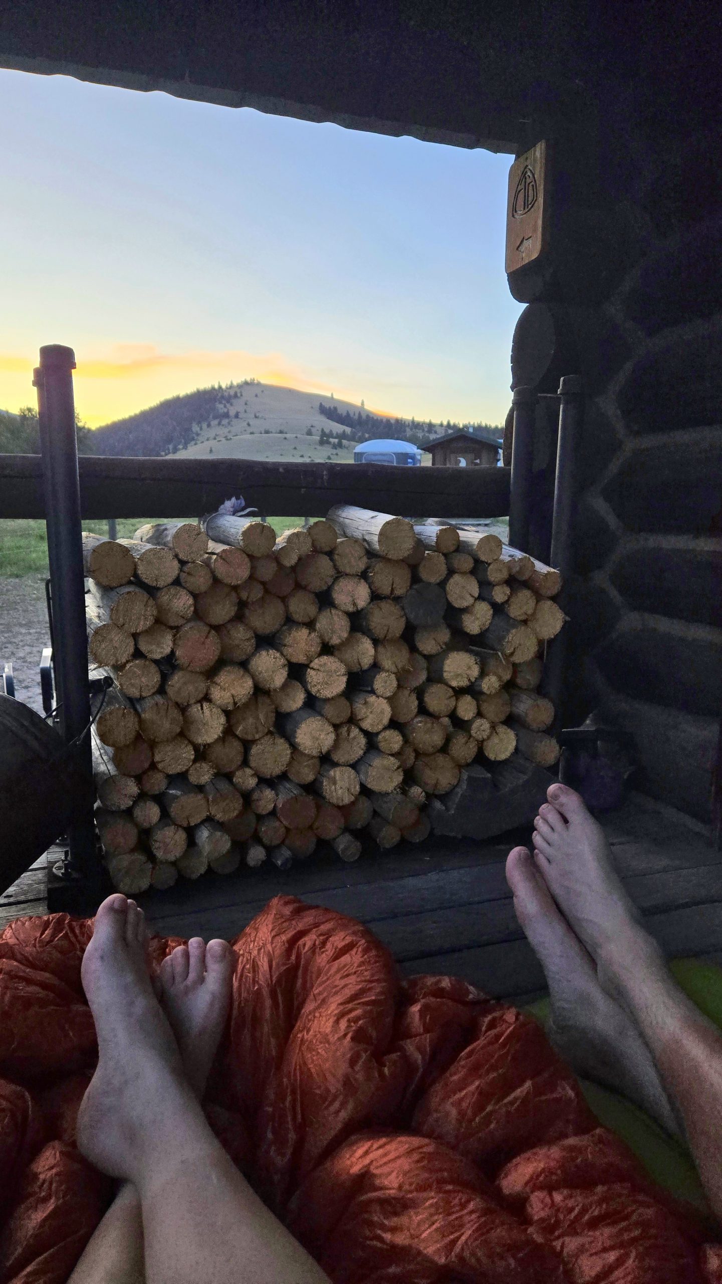
Flescher Pass Cache
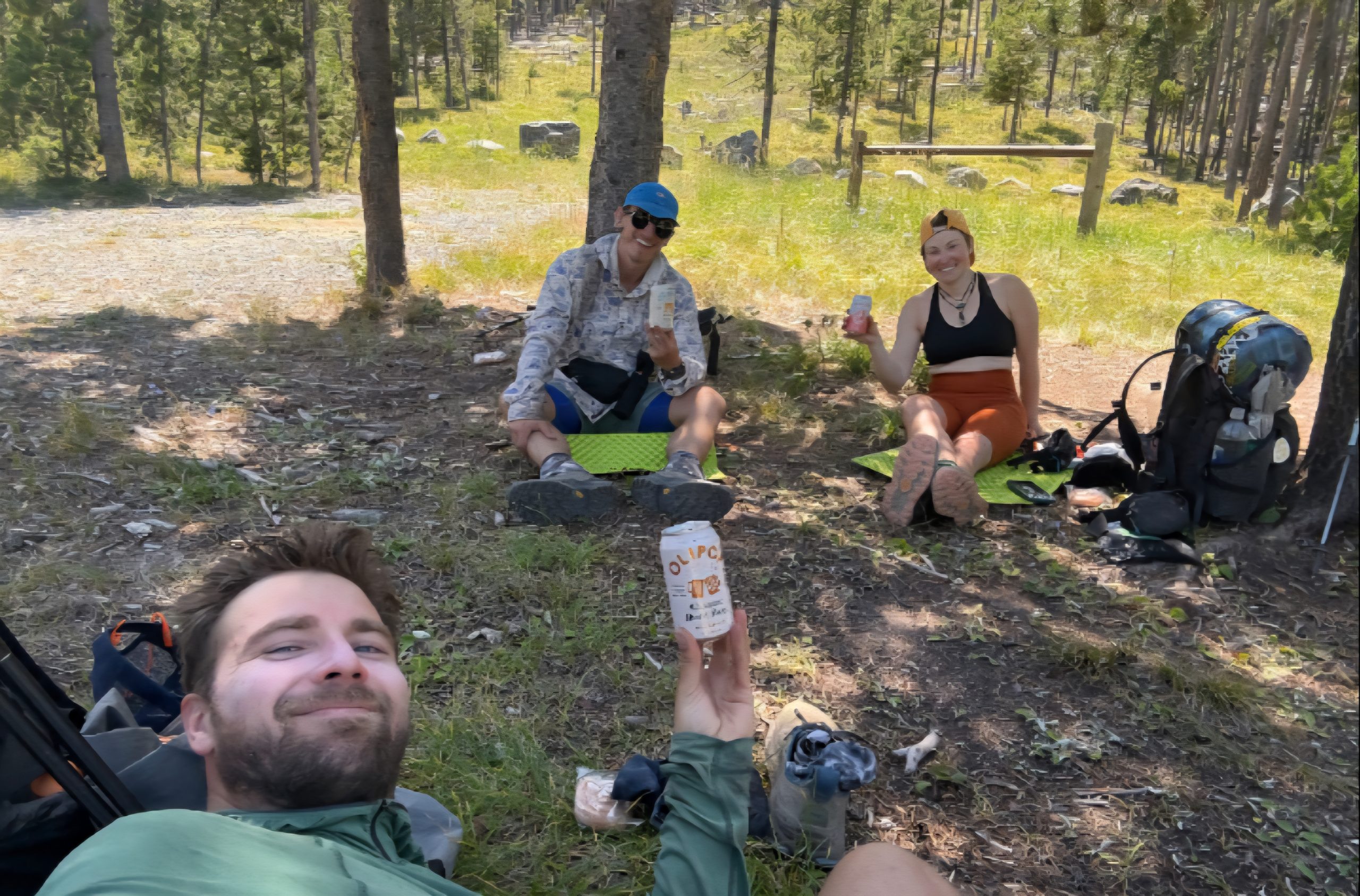
First we got lucky with some impeccably timed trail magic. Two backpacker locals in the Lincoln area, Crusty Phil and Tinkerbell, maintain a cache of water and other goodies in the bear box at Flescher Pass. You never want to 100% rely on caches since you have no way of knowing for sure whether they are currently stocked. We had a backup plan to collect at an off-trail water source, but hoped we’d save our legs the extra half mile and be able to fill up at the cache.
As luck would have it, just as we got down to the pass we ran into none other than Crusty Phil and Tinkerbell in the flesh. They told us they had not only restocked the water cache, but left exactly three soft drinks there as well. This was amazing news to three hot and sweaty hikers about to enter a dry spell.
When we arrived at the pass and opened the bear box we found two Olipops and a Spindrift, still cold, a bonus treat of Little Debbie Honey Buns, and a bounty of water. Plenty to get us to our dry camp, through dinner, breakfast, and on to the next day’s reliable source. We were very grateful that these trail angels go out of their way to maintain the cache that made our day much easier and more enjoyable.
The Llama Alt
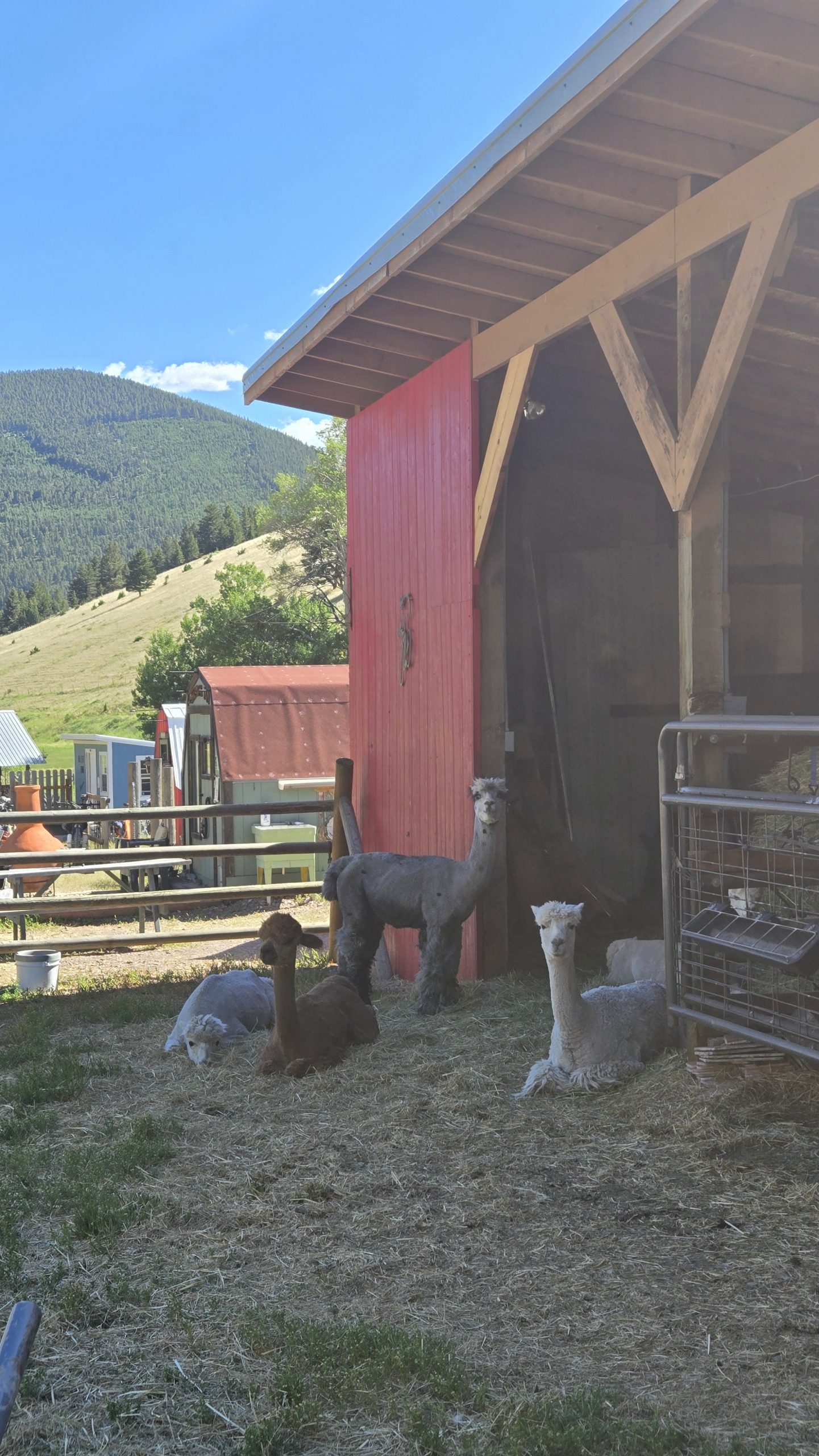
Another way we dealt with the lack of on-trail water was to not take the trail. The CDT is a journey of many alternate routes and it’s widely accepted and encouraged to take them as needed or wanted. It’s all about choosing your own adventure. The area we were in has an unofficial alternate commonly referred to by thru hikers as the “Llama Alt.” As its name implies, the route passes by a ranch that has llamas, among other farm animals.
The ranch is a property owned by a husband and wife and is primarily a hostel geared towards bike packers who are cycling the Great Divide Mountain Bike Route. The GDMBR is essentially the biking equivalent of the CDT. It traverses about 2700 miles from Banff, Canada to the New Mexico-Mexico border along the Continental Divide, and is allegedly the longest unpaved bike route in the world.
Our main intention taking the Llama Alt wasn’t to visit the ranch, but rather that the road paralleled and crossed more creeks than the red line (the official CDT route) and there was a much gentler grade and far fewer PUDs. We had heard rumors of trail magic of an unspecified variety at the llama ranch, which was only an added bonus for our purposes.
Unsure of whether or not camping was possible there, we figured we’d stop in, see what the place was about, then be on our way to stealth camp somewhere down the road. In a then-unknown manifestation, The Show said, “maybe we can ask and they’ll know of a place 5 miles or so down the road we can camp.”
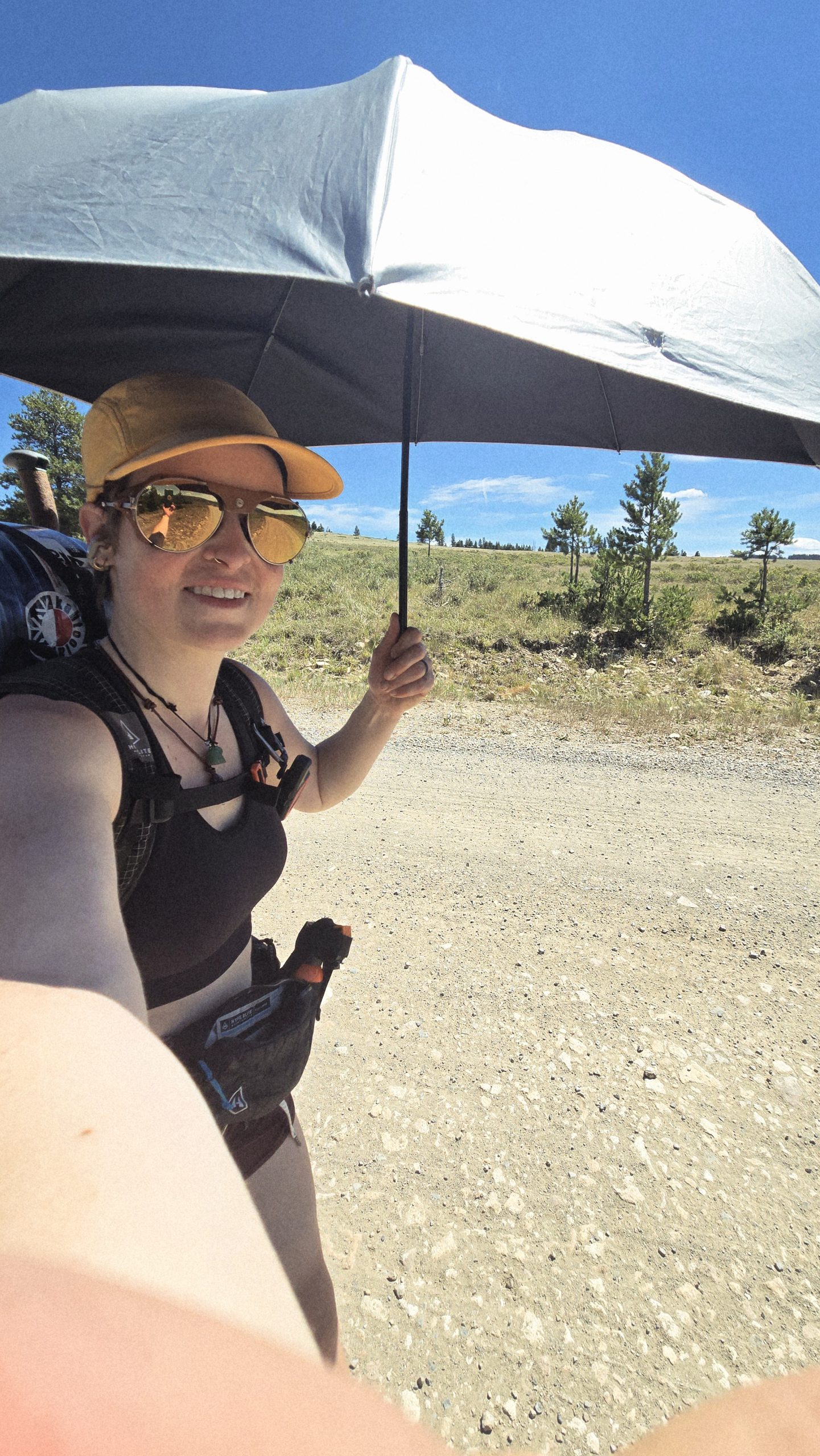
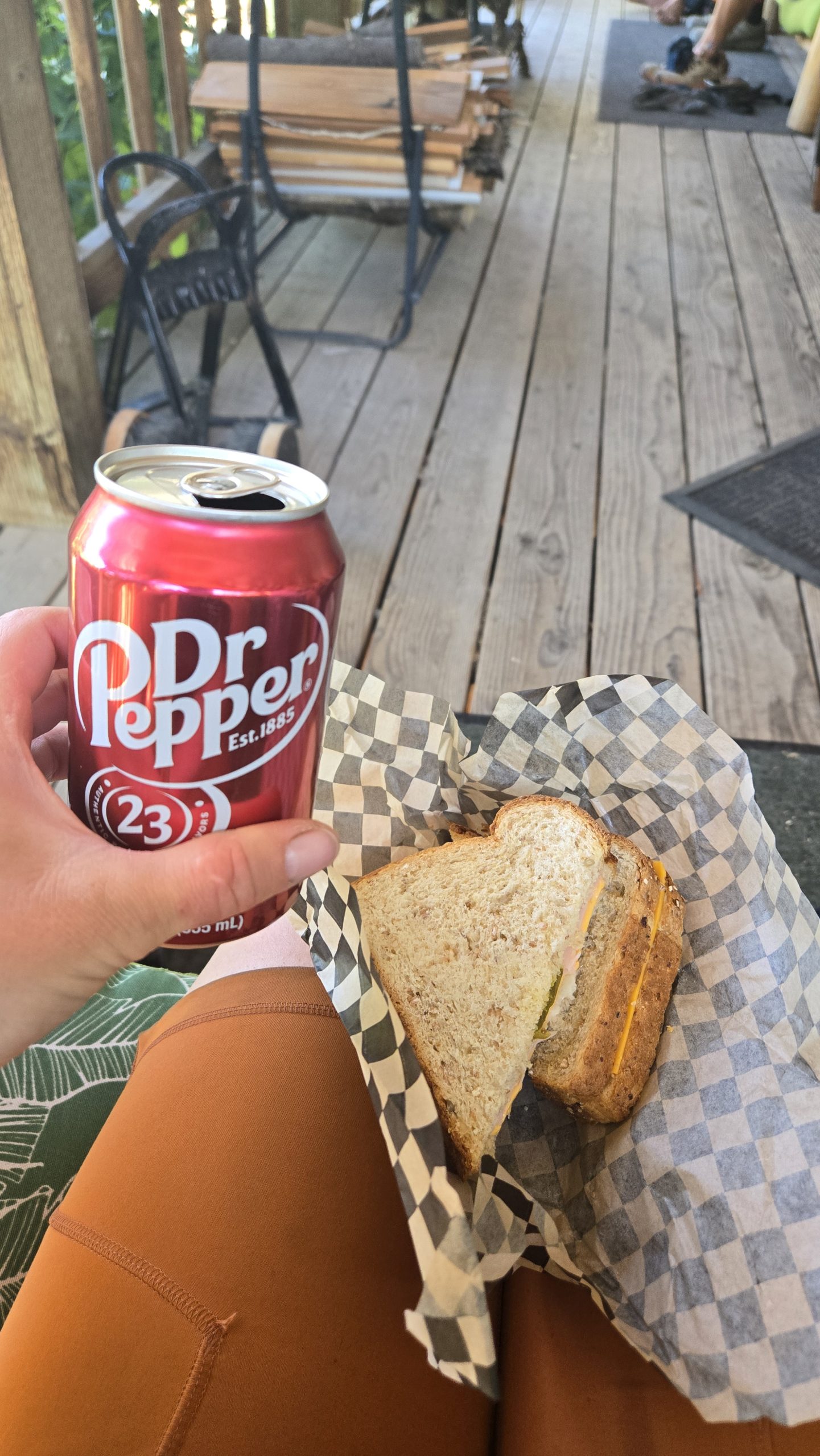
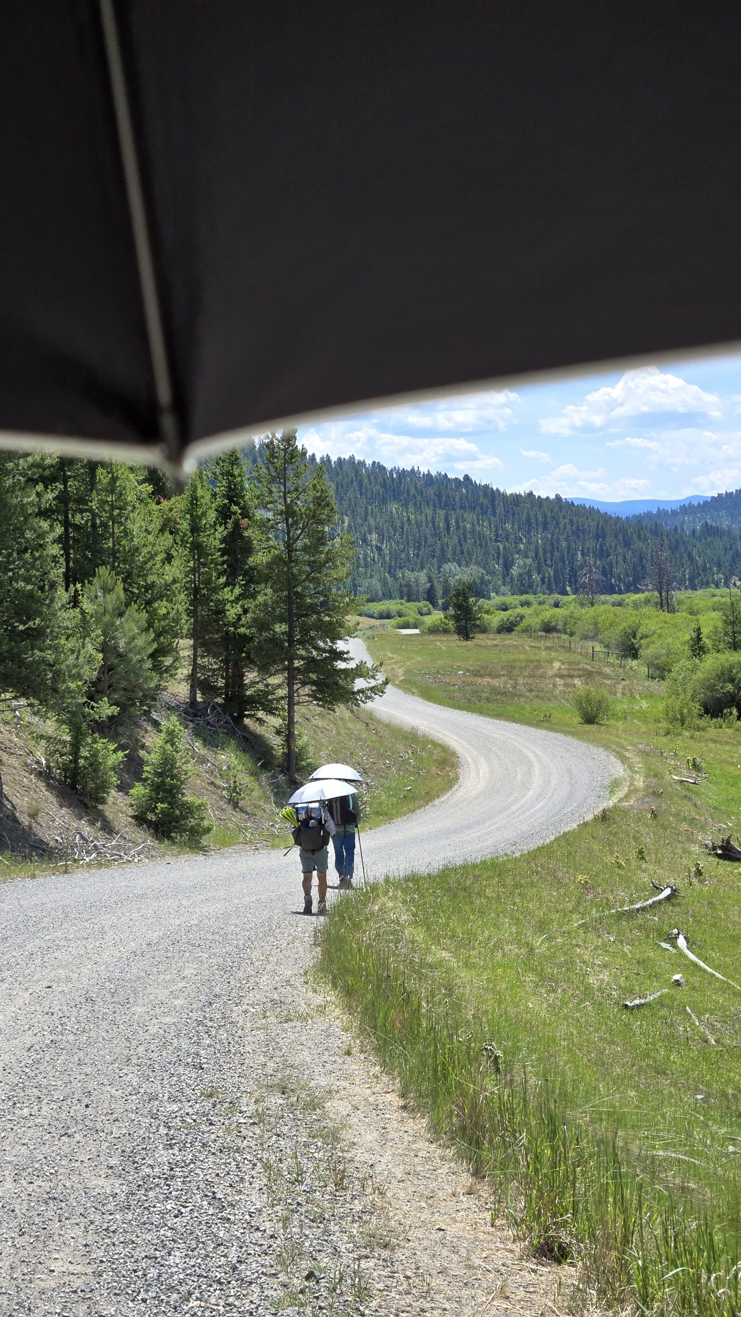
After a lengthy gravel and dirt roadwalk hiding under our umbrellas from the beating sun, we arrived at the llama ranch. The trail magic included a mini fridge on the porch stocked with sodas, beer, and cold cut sandwiches. I chose a turkey one that also had cheese, mustard, and sweet pickles on mutigrain bread. It hit the spot after 18 miles of hiking.
This umbrella has been one of my favorite pieces of gear during this hike. Makes sunny roadwalking much more bearable.
Pay it Forward
Shortly after arriving, we met one of the owners of the property, John. He gave us a brief spiel about the place, saying that they operate entirely free of charge and with a “pay it forward” philosophy. They do not even accept donations, believing they are better put to use out in the world. For example, paying for someone’s groceries in the line behind you would be a way to pay it forward. The ultimate goal, explained John, was to make the world a better place.
We asked about a place to camp a little ways away, and he mentioned he has a friend 5 miles down the road with a property he allows hikers to camp on. The Show, Free Samples, and I looked at each other in kismetic disbelief as we recalled what Show had said earlier. It was totally manifested.
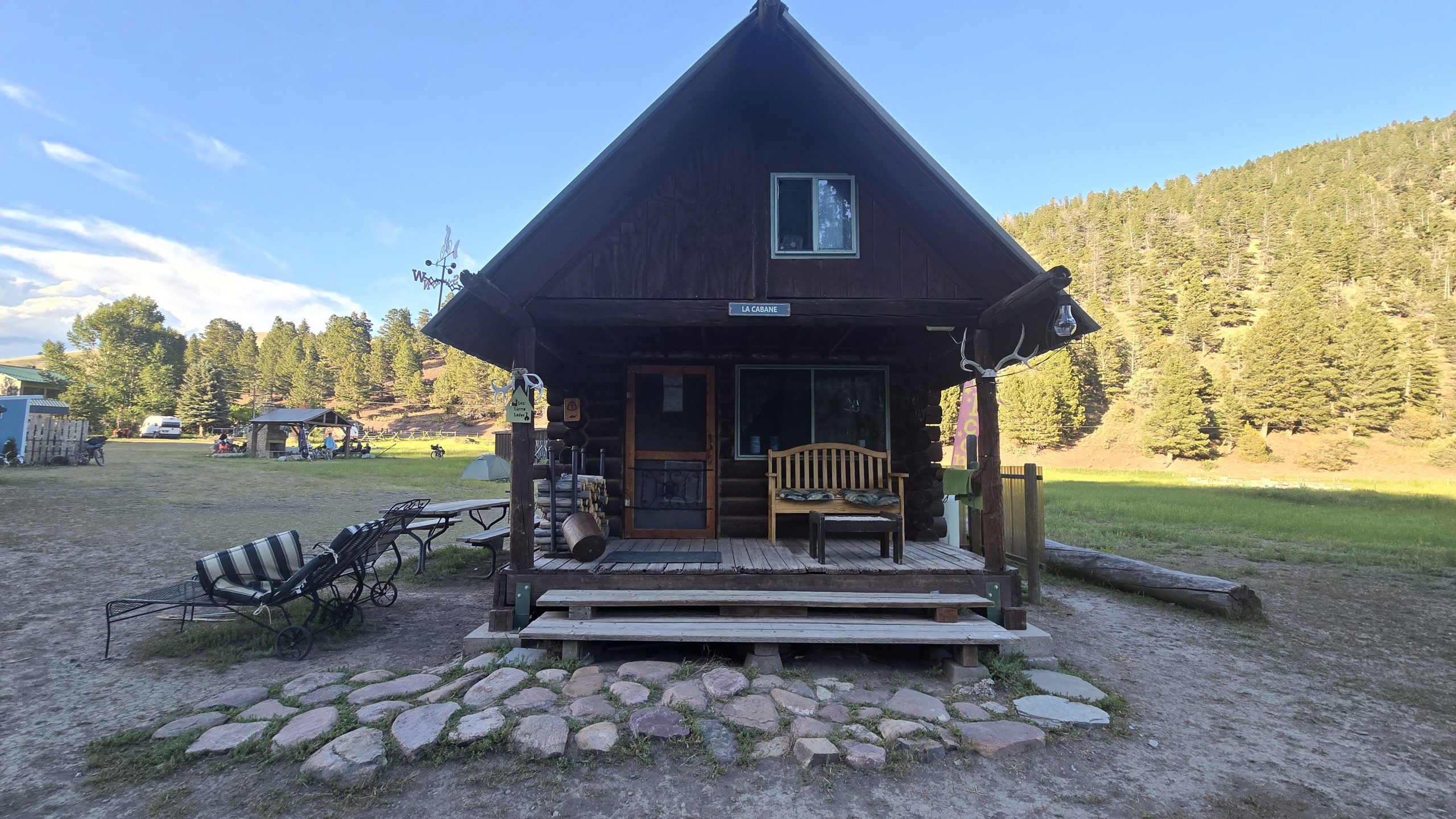
The Not-So-Romantic Cabin
We did not, however, walk those extra five miles, but instead decided to stay at the ranch. Just past the llama hut were a bunch of tiny cabins and bunkhouses. Free Samples slept in a pink covered wagon. John offered The Show and I the cabin he said he reserved for romantic couples, a small cottage with lofted double bed and front porch. We gladly accepted but unfortunately it was more whimsical than practical.
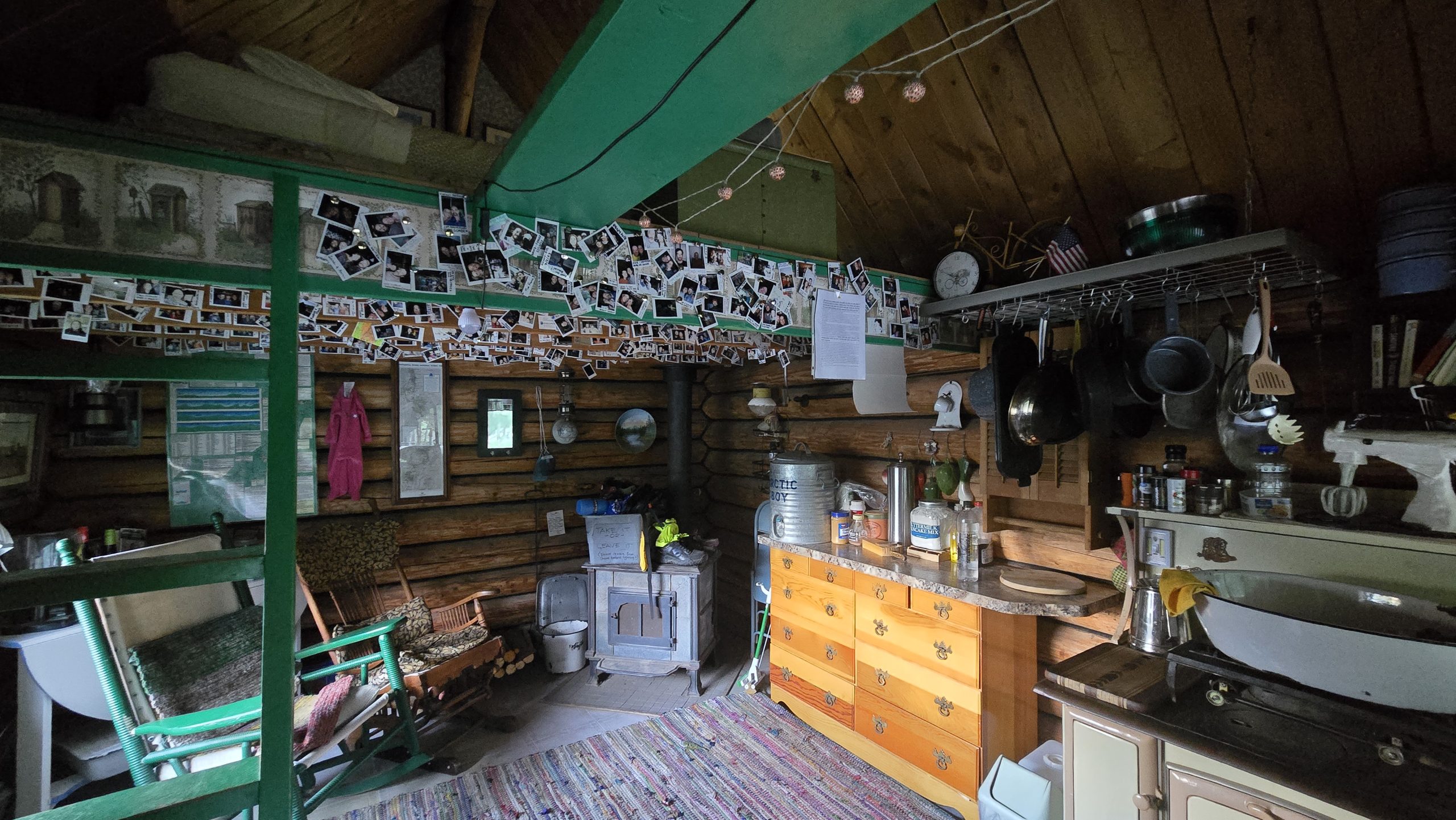
Planning to get up by 4am to beat the heat on our next day’s road walk, we settled down in the loft bed to sleep by 9pm. It was still light out and the thermostat in the cabin read 86 degrees. After 20 minutes of trying, we concluded it was just too hot to fall asleep in there, and decided to cowboy camp on the porch instead. Heat problems solved, we settled in again, only to see a mouse run across the porch by our pillows.
That was the start to a restless night of paranoia that mice were crawling over us. Real or imagined, it prevented me from sleeping well. At around 3am I’m positive I felt a mouse scurrying at the foot of my quilt and jerked awake. Both awake, we decided soon after to pack up and leave. It was the worst night’s sleep on trail yet.
The Elliston Direttissima, or, The Dog Creek Alt
By 5am we were road walking again, this time an alternate of our own making. Realizing the town of Elliston was only 27 road miles away, we decided to stick to the roads instead of rejoining the trail and get there that much faster. We’d been out for seven days at this point and were more than ready for some town time ASAP. Plus, the red line was still looking dry and PUD-y in the area. We called the route the “Elliston Direttissima” as well as the “Dog Creek Alt” because it took the most direct path to town and followed a creek by that name for a portion of it.
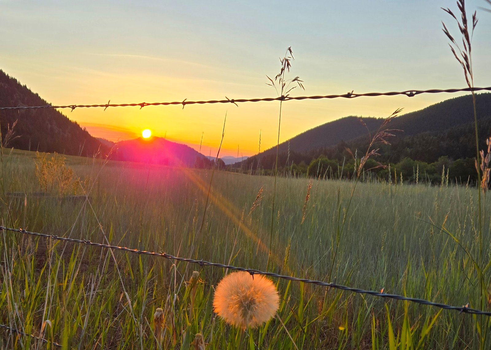
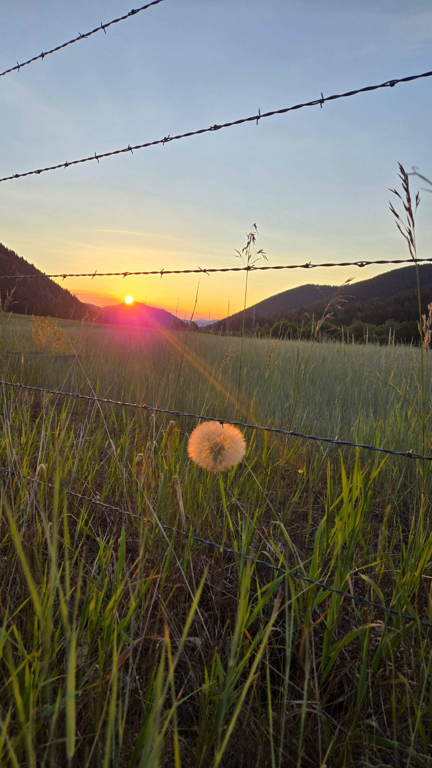
Sunrise from our roadwalk out of the llama ranch. This dandelion was the size of my palm. They don’t make ’em that big back east.
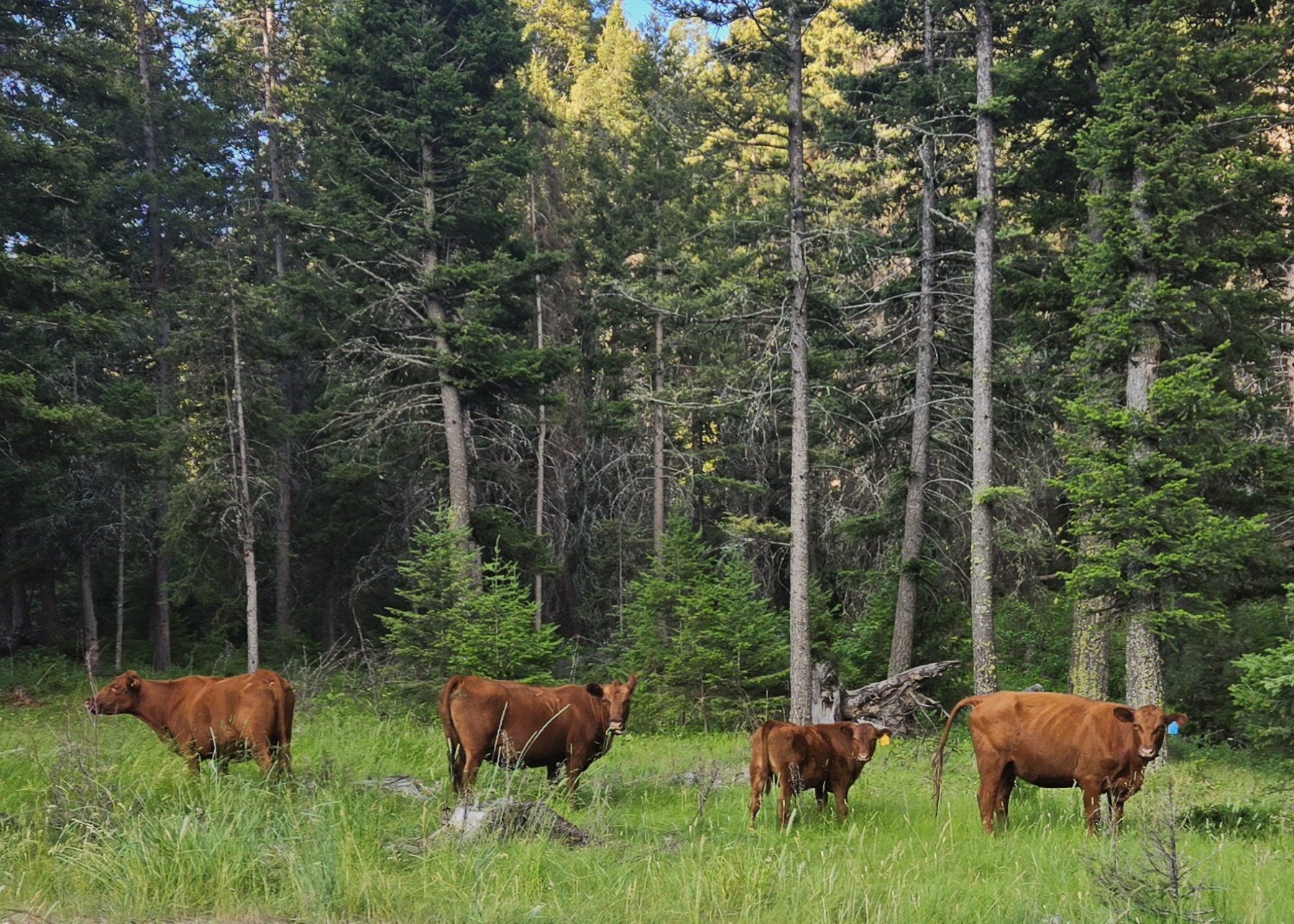
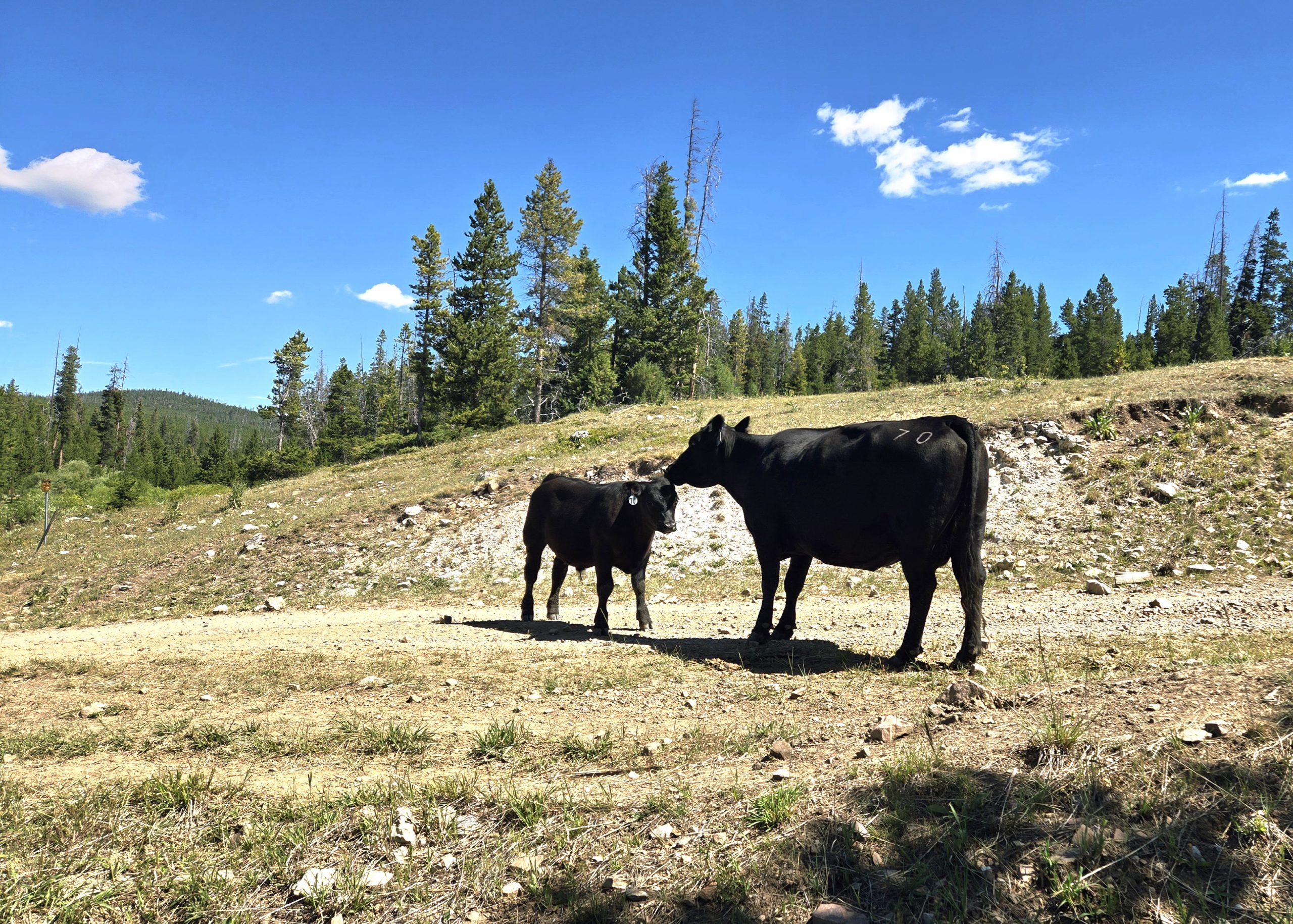
Along our alt we passed through a lot of cattle farmland and saw more black and brown cows than we could count. Some were timid and ran away from us into the trees. Others were disgruntled we were in their fields and mooed at us repeatedly.
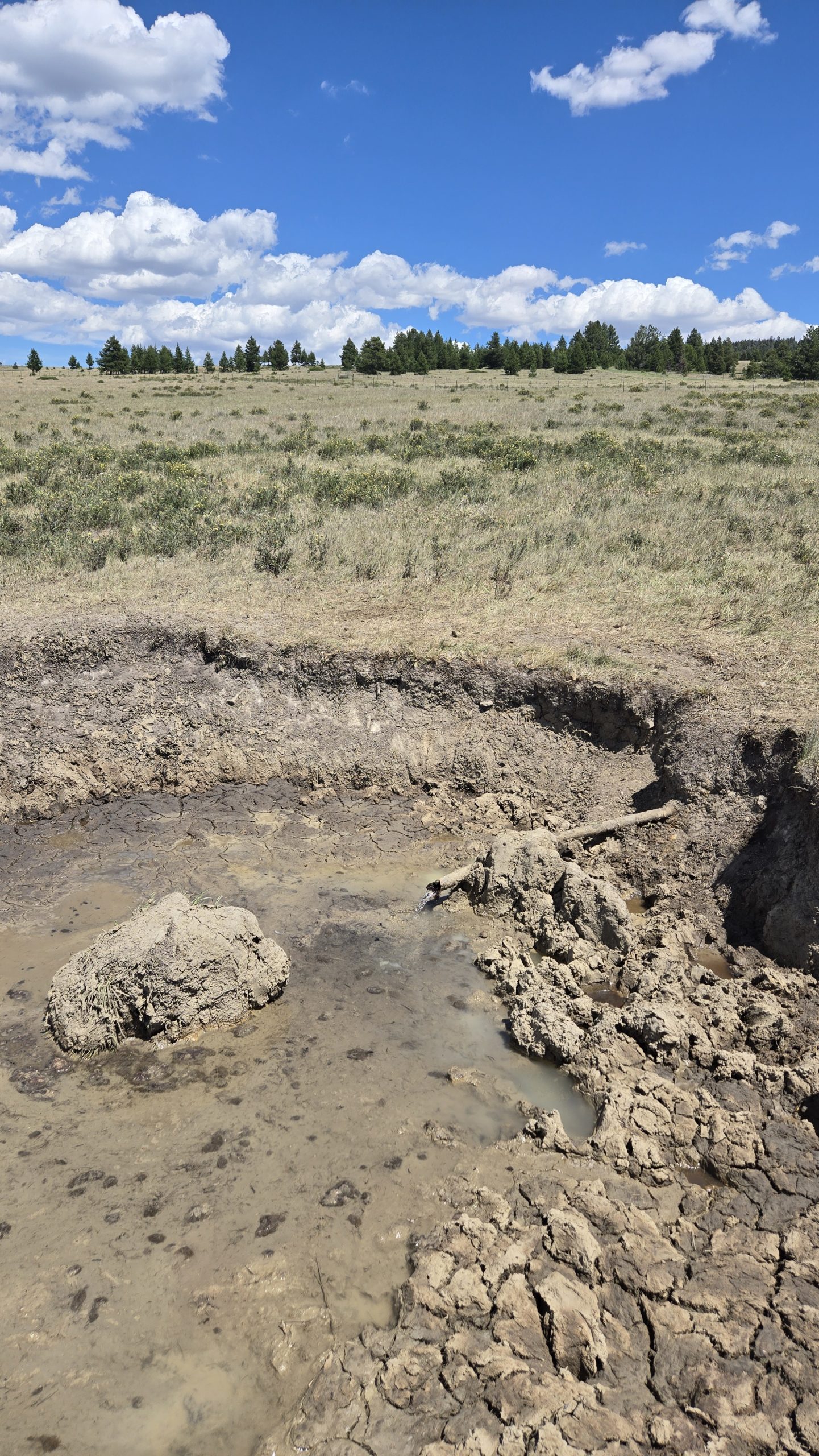
Yucky Water
The roadside water situation turned out to be less abundant than we hoped. Creeks that are usually flowing were dry, or running directly through cow fields with cow pies on their banks. One spring we passed had a cow actively drinking from the trough so we didn’t bother to compete.
At one point our best option was what looked like some kind of irrigation line, a pipe emerging horizontally from the ground with a muddy crater surrounding it. It was certainly gross-looking, but was clear, cold, and tasted fine after we filtered it. I’m sure we’ll experience much worse down in New Mexico.
When we got to our planned stealth camp by the train tracks on Elliston Eve, we were elated to discover the nearby creek was flowing. We hadn’t been positive it would be. Not only was there running water, but enough to bathe in. We must have been a sight for the conductors of the multiple freight trains passing through to witness.
All and all, I’ll admit this leg was tough and not one of my favorites. But the selfless kindness of strangers and the freedom to create our own path helped make it a little easier.
See what I did there?
Things have certainly been… going. The first day was a whirlwind of events. Constant trail changes, meeting new people, the bear. The next three days have been less of that, and much more mud and rain.
I’m starting to find my rhythm, for sure. I wake up when the sun comes up, then ignore it and roll back over for another hour. Get up around 8. Put ramen on the stove to boil for hot breakfast. The ramen doesn’t take long to cook, but it takes surprisingly long to cool off so I get it going while I do my other camp chores.
While my breakfast cools, I refill my water and take down my tent. I cover myself in bug lotion, to mixed results.
Once the camp is all put together, I shove it into my bag and then walk until I can’t feel my legs. Then, I pitch the tent, eat cold dinner (I’m usually too tired to mess with the burner by this point), and go to sleep. Repeat.
I’ve come to the realization that I will be able to physically complete this trail, barring any freak accidents. The mental battle will be the real deciding factor.
Day 2: The Downpour
Everything can essentially be boiled down to morale, like an old timey army. Any event can be sorted into one of two camps: an event that makes me happy to keep hiking, or an event that makes me want to quit.
Cool waterfall? Good for morale, I hike faster. Clothing still wet from the previous day? Bad for morale, I hike slower. Giant open sore on my leg from chafing? Bad for morale, but it does actually make me hike faster because I don’t have any bandages on me and I need to make it to Silver Bay to buy some. You get the point.
Day 2 was really pushing that limit of quitting, which is not a good spot to be in on the second day of the hike. It rained for the first half of day, from 10:30 in the morning to around 3 in the afternoon. As a reminder, I have no waterproofing in my kitchen at all. The only thing that saved me last time was that the rain eventually let up before it could soak everything in my backpack. This time, it did not. Bad for morale.
That’s not even the worst part. When it rains, my glasses fog up. This isn’t terrible on its own; my vision is okish so I just take them off and clip them to my jacket.
In the middle of a thunderstorm, getting pelted with rain, I realize they’ve fallen off their clip. At this point I’ve been hiking for two hours with them off, so they could be anywhere along trail. Terrible for morale. Horrendous, even.
As I walked back along the trail, thunder booming, rain pouring, I was already brainstorming how I would tell my parents. I think I prayed the Hail Mary fifteen times.
What’s more, the thought crossed my mind that I might not be cut out for this. I mean, losing literally the second most expensive item I own (after the phone, I guess) on the second day? That definitely raises some doubts about my ability.
Luckily, I found them not even twenty minutes later. They had bounced off some of the ferns lining the path and were sitting dead center of the trail.
I cannot stress enough how much of a miracle this is. The trail was overgrown and flooded. Had they bounced anywhere else they would be buried under feet of foliage or submerged. I think the exact quote I said when I found them was “Holy sh*t no way.”
Overall good for morale, but it was still raining and I had just wasted almost half an hour backtracking. I was pretty sick and a little rattled at this point, so I decided I’d pitch my tent at the next camp and wait out the storm.
I did just that, but like my other gear my tent was soaked through. The bottom liner is waterproof, which is great for keeping water out but unfortunately also works to keep it in. I tried to get as dry as possible, putting down my sleeping pad (also pretty wet) and stripping off all my damp clothing.
The end result was me eating tortillas and cheese sticks (my new favorite food combo) in. my underwear as the rain kept going. Everything was damp at the minimum, and most of my gear was outright wet. Sitting in my tiny tent in the rain, my morale was broken.
I got homesick like I never have before in my life, looking at old photos of me and my family, missing the good times with them. They’re all fine present tense btw, that sentence sounded really morbid like something happened, but they’re dry and I miss them so I wanted nothing more than to be with them.
I seriously considered if I’d be able to make it to the northern terminus, or if I should just call quits at Twin Harbor (the nearest town). Morale at an all time low.
Luckily, the rain broke around mid afternoon. That left me with enough time to saddle back up and keep moving.
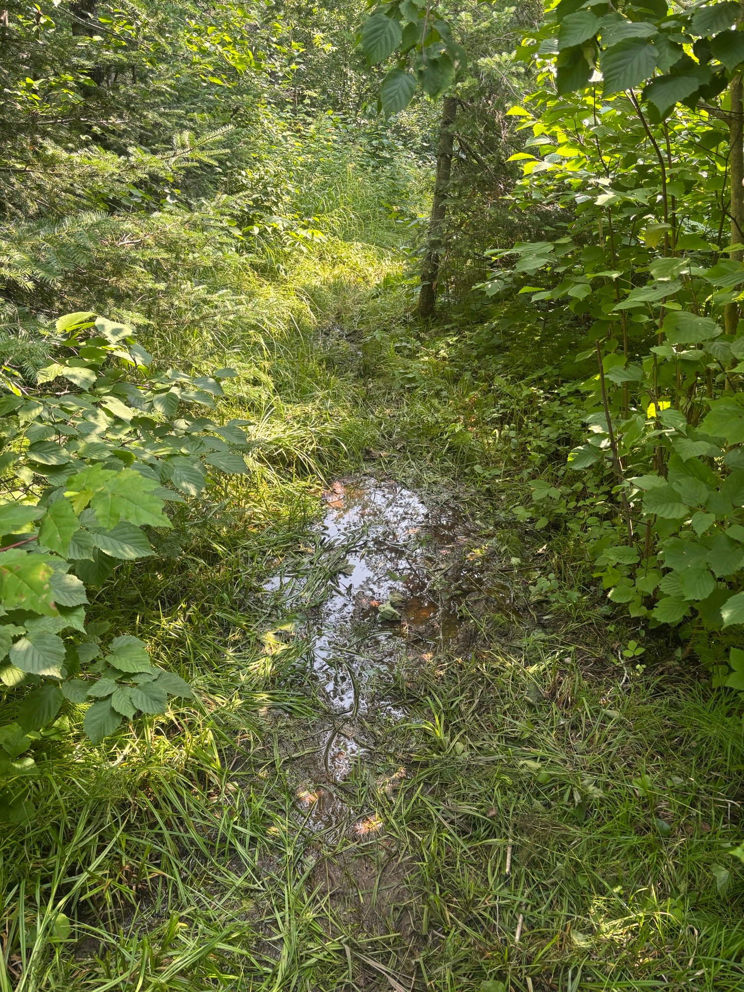
This is where things start to tie back to the title. Trail conditions were TERRIBLE. Even when I wasn’t getting wet from above, the flooded trail meant I was getting wet from below. There were numerous sections where I had to walk through shin deep water. Calling it the Superior “Hiking Trail” is generous, I’d say it was closer to the Superior “Military Amphibious Assault Training Course”. Lots of mud.
Let’s do a speed run of all my terrible trail condition photos:
At a certain point, though, you can only get so wet. I knew my sleeping bag would be soaked when I slept, and had made peace with that (admittedly miserable) fact. Literally nothing on my was dry, so I figured I was at rock bottom and nothing could get worse.
Wrong. Section B, as previously mentioned, is all snowmobile trails through bogs. It is INCREDIBLY lowland, which means you get a lot of bugs. Rain makes the bugs 10 times worse.
In the hour it took me to set up camp that night, I got bit at least times by mosquitos. They harassed me all day, never letting me slow down. The only time I wasn’t getting bit or downpours on was when I was in my tent, at which point I immediately passed out from exhaustion.
So yeah, not a great day to be a hiker or even a human being in the woods in general. I’m starting to understand why American colonists cut down so many old growth forests. If I had to live outside all the time before the invention of bug spray or mosquito nets, I’d be inclined to slash and burn everything too.
It’s also worth noting that, by the point I went to sleep, I hand not interacted with another human since the previous afternoon. Not enough to make me go crazy (yet) but I was getting bored.
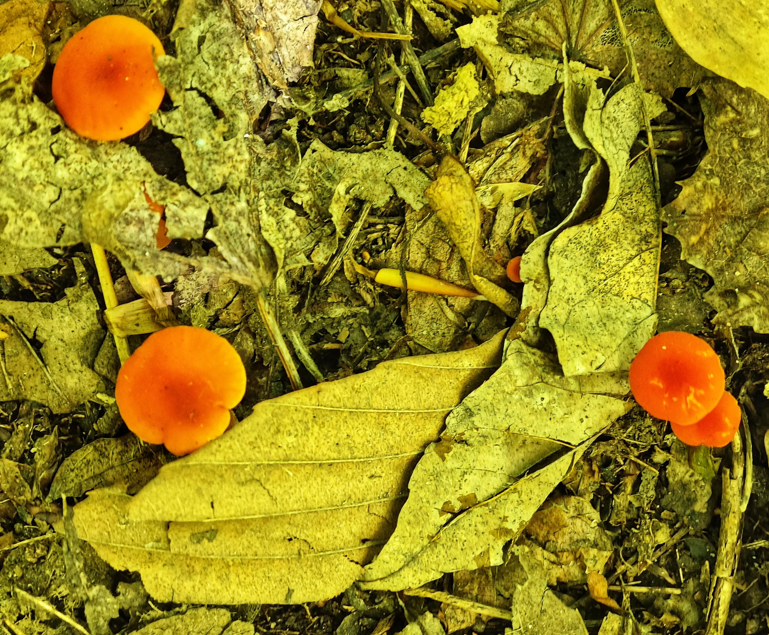
At least I found mushrooms.
Day 3: Walking WAY Too Far
Day 3 was a lot more of the same. I woke up, boiled myself some ramen, did a shot of my electrolyte caffeine mix, and packed up my tent.
On a side note, the electrolyte caffeine mix (Meijer branded, ofc) has become one of my favorite parts of the day. It’s a concentrate that your supposed to add into water, but since I have no bottles of clean water (I fill my bottles dirty and filter as I drink) I have nothing to mix it with. I’ve started just doing it like a shot every morning. It is INCREDIBLY sour (bc it’s concentrate) and makes my tongue tingle whenever I drink it. It’s a 10/10 experience and I’m half considering adding it to my non hike daily routine.
The trails were, for the most part, the same as before. There was a lot of standing water and mud, which slowed my progress. Fortunately there did seem to be at least a couple bits of really nice, well groomed dirt trail. Not enough to satisfy me really, but enough to give me hope that things would get better later.
My first stop was at McCarthy creek, where I got accused of being a communist and was able to take my boots off and soak my feet in the water. For whatever reason there were no mosquitos there, so I spent a LONG time just enjoying that. My feet didn’t need this, as my boots were still wet from the day before and so they’d kind of been soaking all day, but the cold water felt nice. I signed the SHT logbook there, ate lunch, and then pushed on.
I met a guy and didn’t catch his name, but he looked like a Bob, so we’ll call him Bob. He was the first person I’d seen in around 36 hours, but talking to him didn’t make me feel much better about the hike. He said that the trail was muddy and overgrown basically all the way to the northern terminus, which is where he’d started. He blamed it on all the rain, saying Minnesota had apparently been having a more rainy than average summer. From what I’d seen, I certainly believed him.
The trail eventually flattened out into a long gravel road walk section, which was cool because flatter, more consistent trail surface allowed me to really get my miles in. Also, three miles per hour seems to be the magic limit where most of the mosquitos can’t keep up. They’re motivating me to get my miles in more than I could ever motivate myself.
The road walk got further extended by a trail closure, causing me to push even further at this fast pace. I passed a camp site, but I figured I could get to the next one by the end of the day. By this point it was already 6, and the nearest camp site (big bend) was 6 miles away. The sun has been setting at 8:30, so it meant 6 miles in two and a bit hours. Doable.
The problem was, I hadn’t stopped to eat since McCarthy creek. I kind of forgot about this when I decided to push for big bend, but I sure felt it about two miles later. Also, the trail returned to its regular old self: mud and overgrown grass patches. This slowed my progress significantly.
I kept pushing. My legs started to tingle. The trail started following a river, and the river kept bending, but none of them were the big bend. The sun was starting to dip, and I still want at camp.
Part of the problem is that when I really hungry I get really dumb. This means worse decision making, but also just that I trip and stumble more. This slows me down, adding to the problems of pushing to camp while I’m on the clock. Should I have just stopped and eaten a cliff bar or something? Totally. That would have solved everything. But did I? No.
By the time I got into camp at 9 the light was already fading into dusk. I literally couldn’t feel my legs, and had to sit on the bench for a minute before I was ready to pitch camp. I I definitely, definitely overdid it, but oh well. My shoulder also felt like I’d pulled something, which was probably from catching myself with my poles while stumbling (literally stumbling) into camp.
I ended the day by eating 1000 calories of ramen and jerky and then crashed HARD.
Day 4: Oh Wait Hiking is Actually Fun
Luckily, this saga has a happy ending.
I woke up early like usual, then went back to sleep. I don’t think I got out of bed until 9, and slowly rolled into gear. I knew I’d pushed too hard the previous day, and was completely fine with chilling out a bit.
The good news was that my shoulder, which i’d been really worried about before going to bed, had turned out ok. Apparently 10 hours of sleeping on the ground is the best cure for aches and pains.
The bad news was my boots were still wet, and so my feet were starting to hurt a little bit. Not debilitatingly, but they were definitely tender. Also, the days of walking in the rain had made the chafing so bad on my legs that I made the executive decision to hike in my thermal layer instead. They’re tights, and although they’re a little hot for my liking they don’t rub nearly as badly as my actual hiking pants.
I braced for another day of mud and flooded our trails, but fortunately it only took around four miles before I passed the end of section B and into section C.
All of the other hikers I’d met weren’t lying. Within 300 meters of passing the section C trailhead I had to climb up almost 500 feet of switchbacks. It was like someone had heard me complaining about lowland mud hiking and curled the monkeys paw. It was tough trekking.
The top made it all worth it, though. I got my first of the promised “stunning views of Lake Superior and inland Minnesota” that I was beginning to think were a myth. The trail also cleaned up a lot, becoming much more of a mountaintop dirt path. This made it a lot easier to keep moving fast, which almost made up for the time I’d lost lugging my pack up the face of a cliff.
Almost immediately I bumped into another southbound thru hiker, a woman named Maddie. She was drying her gear in the sun while eating lunch. She supported the “trail gets better up north” narrative by saying that basically all the way to Grand Marais is similarly cool mountain trails, which was good to hear. She also told me that it flattened out for a bit after Crow Creek, which was nice because my legs were burning.
The trail quickly dipped back down, heading into one of the coolest rocky gorges I’ve ever hiked through. It reminded me a lot of out west. I ended up stopping there to eat take a breather before pushing on once more.
Maddie wasn’t lying, and the trail really did get flatter after that. I was able to go fast, as it was still relatively good quality with mud in a few spots. The weather was sunny and hot, but I didn’t mind it when the alternative seemed to be pouring rain.
As I neared my campsite, I kept seeing bear tracks in the mud. It was a good reminder that, even though I wasn’t seeing them like I did on day one, there were still bears in the area.
The best part of the day had to be the views, but the next best was the lack of bugs. I don’t know if it was the heat, the higher elevation, the dryer ground or some kind of divine intervention. There just weren’t as many bugs as there were one previous days.
I camped at a place called blueberry hills. It had no blueberries and only a passable amount of hill, but the ground was soft and I slept well.
Tomorrow I’ll be in stringing distance of Silver Bay for my first restock. I don’t technically need it; I’ve been hiking faster than I expected and started out carrying WAY too much food. Still, town will be good for drying out gear and buying some medical supplies to handle my blisters before they get too bad. Hopefully my chafing gets better too. It’s currently too graphic to even describe in a PG way, so the only way to go is up hopefully.
Also, I’ve decided that I’m going skinny dipping before the end of the trail. That’s always been a dream of mine, and I want to achieve it. It’ll have to be in an alpine lake to avoid leeches, on a weekday to avoid other hikers. In hoping for it to be cold and refreshing and life changing. And to not get a bacterial infection, I guess.
Stick around to see if I get there!
Happy hiking, y’all.

Budget Update
Whilst I want to rush headlong into telling you all about the views from the tower this morning, I previously promised to continue to update my budget every two weeks so that other frugal people like myself can see how realistic it is to tackle the trail on meager funds.
I’ve had a blowout. $147 spent in the last two weeks. An almost 50% increase on my first two weeks. And I know exactly what happened to cause this damage. Rotisserie chicken at Price Chopper.
Basically all that has happened is I’ve got much more hungry in the second half of my first month on trail. My caloric deficit has become too great as it does for all long distance hikers at some point, and when you walk into the grocery store your eyes become as big as saucers and you cannot imagine leaving the store without buying two of everything for instant consumption.
I’ve also had more opportunity by passing more towns in the last two weeks, and I’ve been very happy about that. The extra protein has been welcomed as my body slowly adjusts to the rigours of hiking every day. My spend on accommodation and transport collectively remains at a steady $0.00.
Total spend after four weeks on trail is $247.
Views
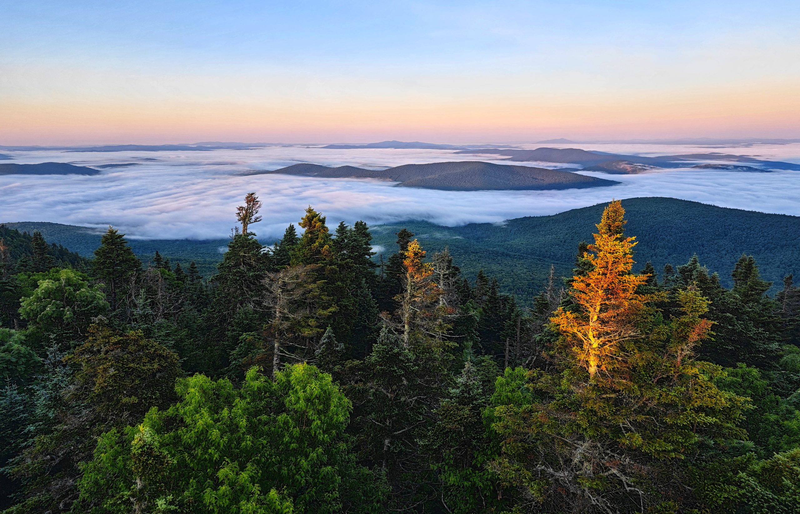
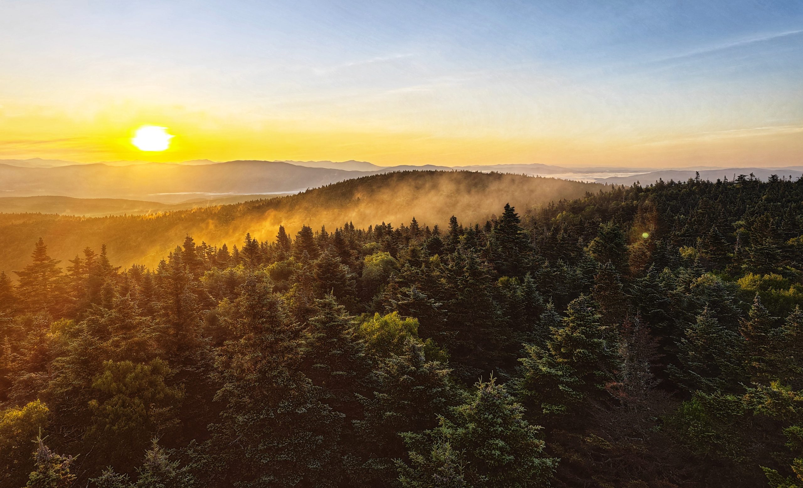
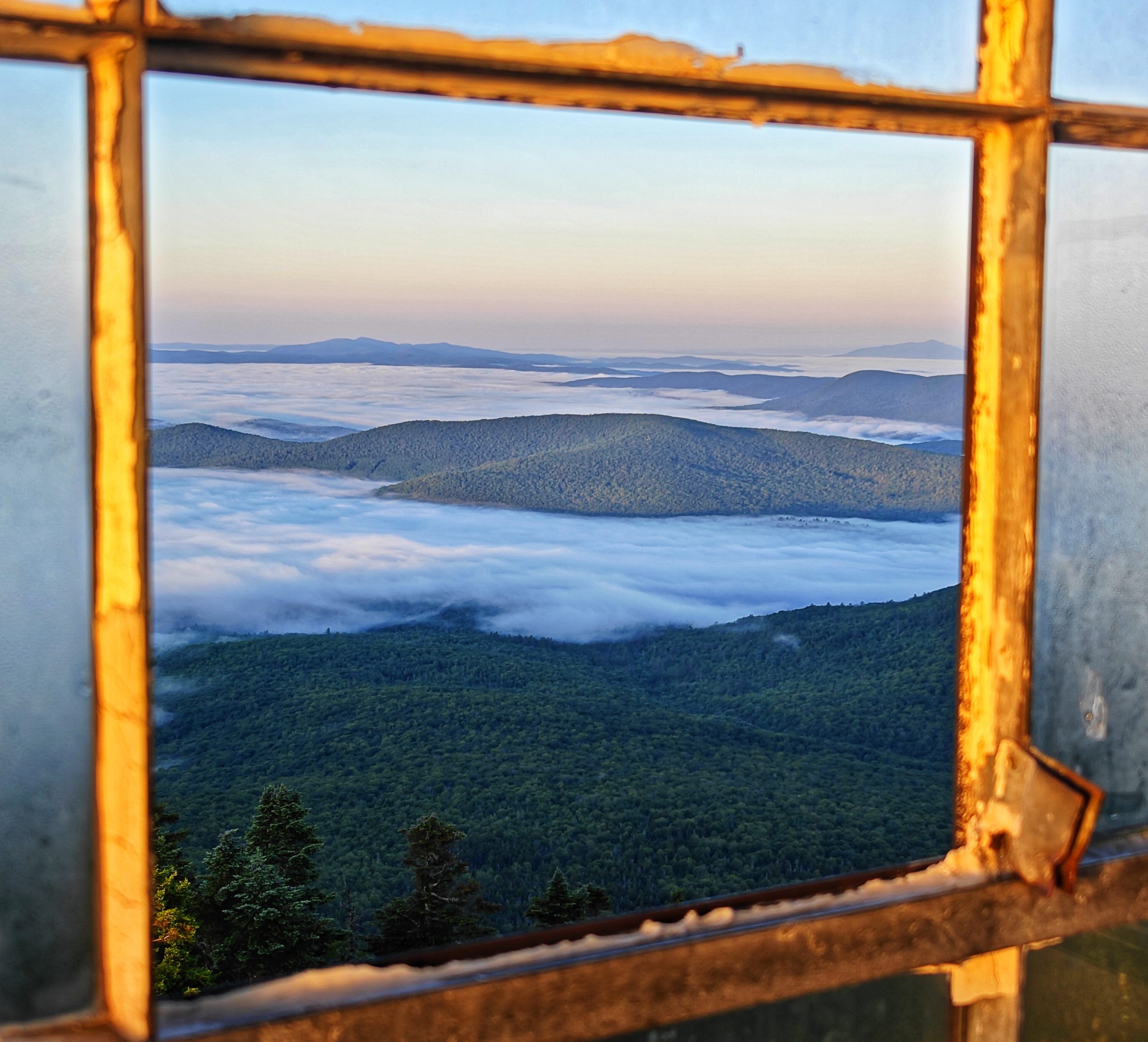
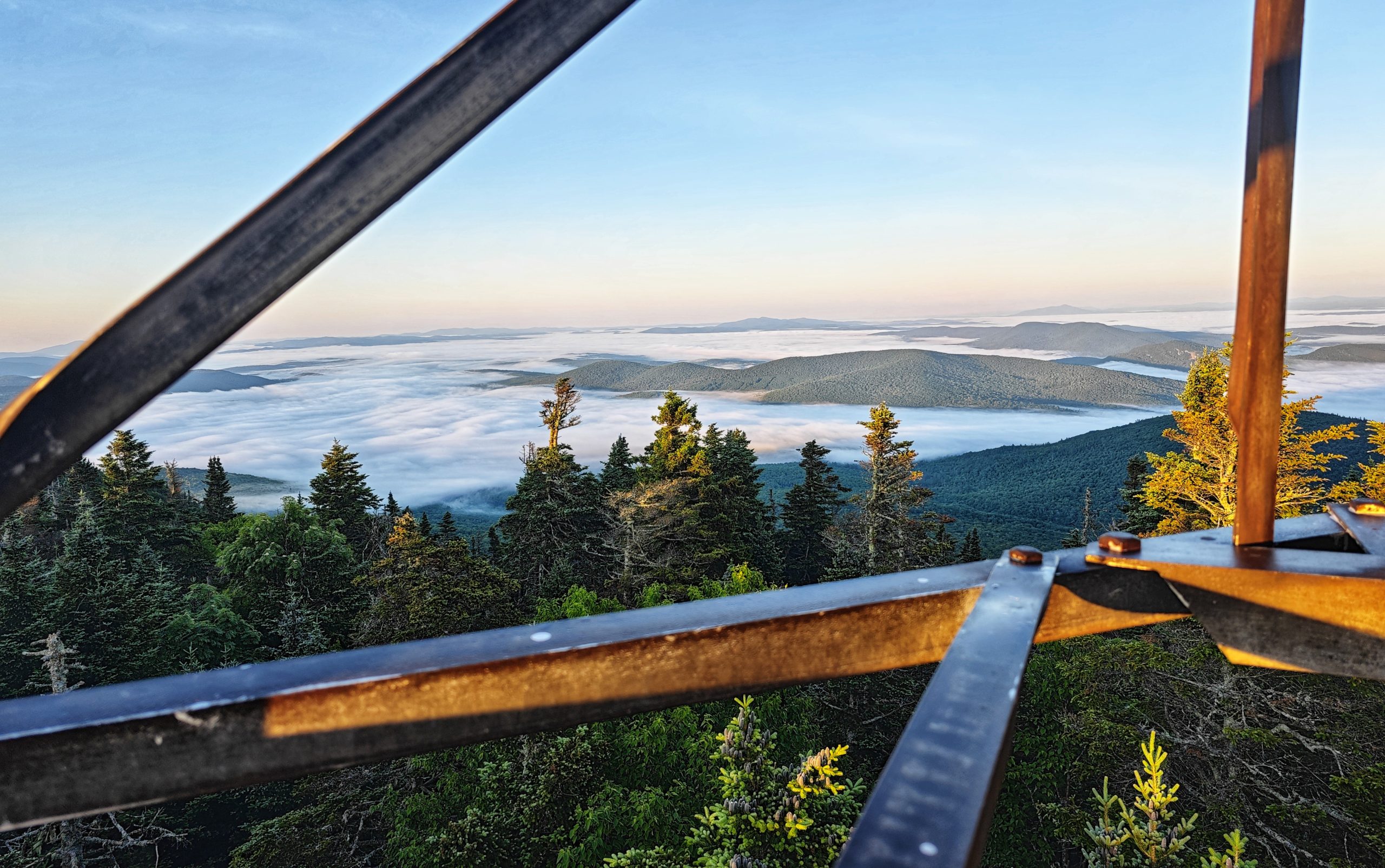
The day dawned clear and I scurried to get ready so I could head up to the fire tower and soak up the views. There were a few other hikers staying on the mountain last night so I expected we’d all be hanging from the tower trying to get the best angles for our pictures.
To my surprise I climbed the tower alone just after sunrise, and there was nobody above me.
Mother nature came to play this morning! The most perfect 360 degree view of cloud inversion and mountain peaks emerging from the mist. Days like these do not come along often on the trail, and I sent the next 30 minutes taking way too many photos of the glorious views.
It’s worth mentioning that it was absolutely freezing on top of the tower. The early hour combined with a healthy wind made for very cold hands that were unwilling to do simple things like press the shutter button on the phone and hang on to the tower so I didn’t fall.
I climbed off the tower to warm up, certain that I had taken enough shots. I ate a breakfast bar, drank some water, and then felt the inexorable pull to climb the tower just once more in case I’d missed an angle (I really hadn’t).
Eventually I managed to convince myself that no photo was going to do any justice to the spectacle I was enjoying, and after a quick selfie I headed back to terra firma to start my hike.
Hiking
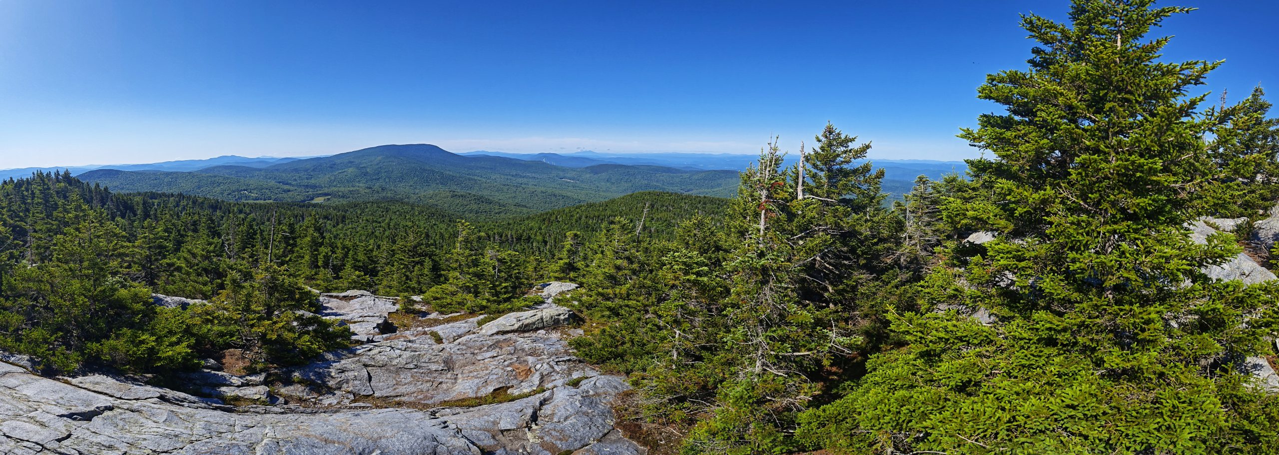
A long descent started the day as I wended my way off of Smarts. Fortunately it was not as steep a descent as the climb the day before. It was then time to climb Mt Cube, so named for its shape. A far more honest naming convention than bear or moose which of course only leads to despair and disappointment.
It was a decent climb up to the interestingly shaped peak, where more great views awaited.
Another descent followed (it’s almost like this trail follows along the spine of a mountain range) and then another climb toward a lunch time camp.
The comments on FarOut for Ore camp were less than glowing. Upon arriving I could see how one could come away with a less than stellar view of the campsite. The tent sites were sparse and uneven, and the water supply was…not good. Essentially the source of the water was some small stagnant pools located down a steep hill from the camp. Hikers are never delighted to have to do extra work to get to water at a camp, we are a fussy lot.
The good news about the stagnant pools is that they were a haven to mosquito larvae. Thousands of beautiful breeding insects hung around the pools, happy to relieve you of some of your weight in the form of blood donations while you scooped through the larvae to get to the drinkable water.
Task completed I hauled myself back up the hill and made the wise decision to put up the hammock for the afternoon as it had got very hot. The remaining kilometres to the final camp of the night would be completed after 4pm once the heat had leaked out of the day.
I made myself some tortillas for lunch and then rolled out the hammock and made myself cozy. The afternoon drifted by, it’s entirely possible I even napped for a while. All too soon it was nearing 4pm and time to get back on the trail.
Avoiding the heat had proved to be a great plan, and Chestnut and I were soon in stride heading toward camp.
Around 5.30pm we crossed a road and found some more trail magic. Some kind soul had left a carton of zero calorie seltzer water cans by the roadside. Certainly an unusual choice for thru hikers, I was not complaining as the bubbles hit just right at the end of a hot day.
We decided to cook dinner by a brook near the road, and after a hearty mac n cheese meal got back on the trail for the final push to camp.
And what a camp it proved to be.
On the shores of a pond, a few perfectly placed campsites were strewn about, allowing you to gaze at the water from your tent. I scoured the water for beavers and moose, and was rewarded with ducks and a turtle. I’m not duck or turtle averse so was very happy with my findings.
As sunset closed in it was time to turn in for the day, with a final spectacular light show playing out in the clouds.
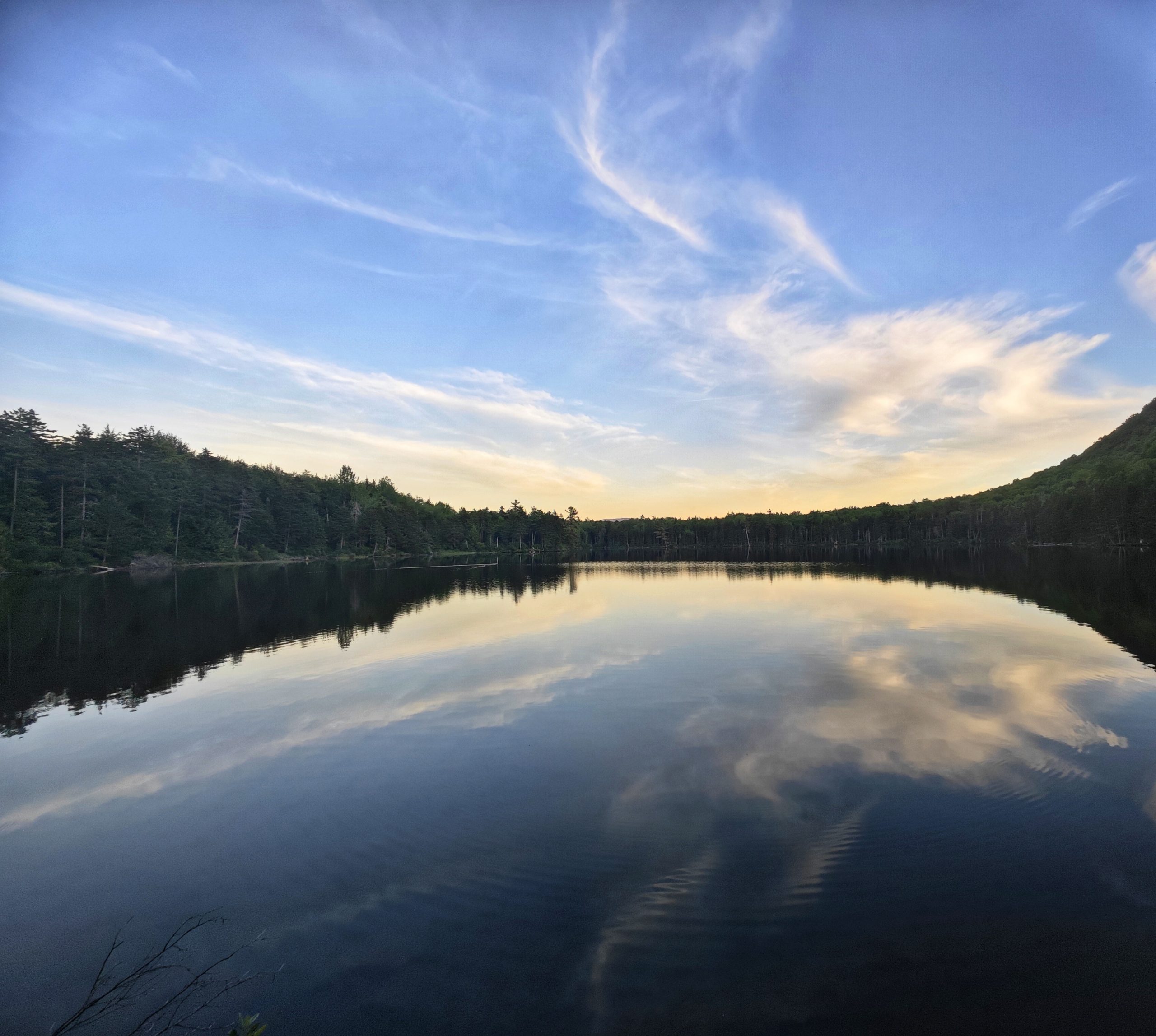
Hiker midnight had arrived and it was time to hit the hay.
This website contains affiliate links, which means The Trek may receive a percentage of any product or service you purchase using the links in the articles or advertisements. The buyer pays the same price as they would otherwise, and your purchase helps to support The Trek’s ongoing goal to serve you quality backpacking advice and information. Thanks for your support!
To learn more, please visit the About This Site page.
-

 Brand Stories6 days ago
Bloom Hotels: A Modern Vision of Hospitality Redefining Travel
-

 Brand Stories2 days ago
CheQin.ai sets a new standard for hotel booking with its AI capabilities: empowering travellers to bargain, choose the best, and book with clarity.
-

 Destinations & Things To Do1 week ago
Untouched Destinations: Stunning Hidden Gems You Must Visit
-

 AI in Travel1 week ago
AI Travel Revolution: Must-Have Guide to the Best Experience
-

 Brand Stories3 weeks ago
Voice AI Startup ElevenLabs Plans to Add Hubs Around the World
-

 Brand Stories2 weeks ago
How Elon Musk’s rogue Grok chatbot became a cautionary AI tale
-

 Destinations & Things To Do1 day ago
This Hidden Beach in India Glows at Night-But Only in One Secret Season
-

 Asia Travel Pulse3 weeks ago
Looking For Adventure In Asia? Here Are 7 Epic Destinations You Need To Experience At Least Once – Zee News
-

 AI in Travel3 weeks ago
‘Will AI take my job?’ A trip to a Beijing fortune-telling bar to see what lies ahead | China
-

 Brand Stories3 weeks ago
ChatGPT — the last of the great romantics