
Destinations & Things To Do
Madeira Is a Treasure Trove of Otherworldly Hiking Trails
“], “filter”: { “nextExceptions”: “img, blockquote, div”, “nextContainsExceptions”: “img, blockquote, a.btn, a.o-button”} }”>
Heading out the door? Read this article on the new Outside+ app available now on iOS devices for members!
>”,”name”:”in-content-cta”,”type”:”link”}}”>Download the app.
This past November, when I’d normally be shoveling my driveway or clicking into ski boots, I found myself pouring sweat as I hiked an incline so severe that I could reach out and touch the dirt in front of my face. I reached a switchback and sat down on a rock.
“Are any of the trails in Madeira a normal grade?” I wheezed, grasping for my water bottle.
My partner and I sat for a few minutes looking back along the switchbacks crossing the terraced hillside to the ocean 1,000 feet below. Every trail we’d hiked in Madeira at that point had been quite steep, but the sheer cliffs, densely forested interior, and brilliant blue water made for some of the most incredible landscapes I’d ever seen. The quad-burning climbs were worth the effort.
We did end up hiking more reasonably graded trails, and all of them varied wildly in scenery and terrain. We were on a 23-day, four-country trip to Europe, and as excited as I was for all our stops, I had most been looking forward to Madeira.
We had sought out temperate destinations for the late-fall trip, and made sure at least one location was hiking-focused. Madeira, a Portuguese island situated 320 miles west of Morocco, fit the bill perfectly.
The lodging and travel to and from Madeira was reasonably priced during the shoulder season, and the weather was between 60 to 75 degrees Fahrenheit every day. The trail network on the island was incredibly well-signed, developed, and robust. We didn’t plan much in advance, but still managed to hike to a massive waterfall, from the top of cliffs down to the ocean, along winding routes along the coast, and between the two highest peaks on the island. The day-hiking trails are all beautifully constructed and follow a numbered PR system, which translates to Pequena Rota, or Small Route. Here are the trails we explored, plus some advice for your own trip.
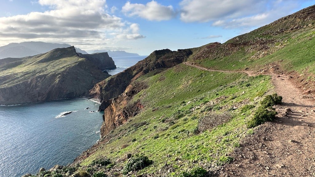
PR 8: Dragon’s Tail
Distance: 4.6 miles (out and back)
Elevation Gain: ~1,200 feet
I used to have an aversion to the most popular or Instagram-worthy destinations, but I’ve moved past that. By and large, these attractions land at the top of listicles for a reason, and Dragon’s Tail is no exception.
This route, officially called Vereda da Ponta de São Lourenço, follows winding coastal features with panoramic views the entire time. This trail felt crowded at first, but the hikers dispersed naturally along the route. The trail starts by descending a set of stairs with 360-degree views of contrasting red rock, green groundcover, and blue water, and you traverse the edge of these features for 2 miles before climbing steeply to a lookout at the very edge of the coast.
I underestimated the elevation gain of this hike, and the steep final climb took me by surprise. We huffed and puffed to the top and spent some time enjoying the view before hiking down to the cafe at the base of the climb for sodas and fresh-baked banana bread. I’ve hiked mostly in the U.S., so the prevalence of unexpected cafes along Madeira’s trails was a delightful surprise. I recommend getting to this trail early, as the parking area fills up and you’ll wind up walking extra along the road if you lose out on a spot. Did we follow this advice? Of course not, but I suggest you do.
PR 1: Pico a Pico
Distance: 7.6 miles (out and back)
Elevation gain: 2,700 feet
The route from Pico do Arieiro to Pico Ruivo is commonly known as Pico a Pico, or “peak to peak.” Along with Dragon’s Tail, this is one of the most famous trails in Madeira, taking hikers between the two tallest peaks on the island, Pico do Arieiro (sometimes spelled “Areeiro”) and Pico Ruivo on a narrow, steep trail with views of jagged peaks in every direction.
The trail is another marvel of engineering, with tunnels, handrails, and thousands of stone steps. Some steps are wide and easy to navigate, while some are so tight, steep, and winding that vertigo had me gripping the cable handrail for balance.
Most people begin at the large trailhead-shop-cafe complex near the summit of Pico do Arieiro at around 5,900 feet. The trail loses elevation to the saddle at 4,900 feet, though there are plenty of short, steep climbs in between. This means there is more elevation gain and loss than you’ll see on a generic elevation profile, and it was harder than I anticipated (par for the course with me).
The trail is easy to follow, tracing a natural ridge with dizzying drop-offs on both sides and some cliff-hugging sections. Sturdy cable rails surround the narrower sections, and while I never felt unsafe, hikers with fear of exposure might find it unnerving.
At the saddle, the trail begins climbing steeply toward the summit Pico Ruvio at around 6,200 feet, with more ups and downs along the way. You’ll reach a false summit and, like with all false summits, question why you were born. This was where my partner and I had to choose whether to continue toward Pico Ruvio or turn around. Most people book a transfer back to their car or shuttle spot from the summit of Pico Ruivo, eliminating the miles and climbing back to Pico do Arieiro. We did end up turning around, but I wish we’d planned enough to book the transfer. In the end, the views were astonishing and the trail was challenging enough to feel like an accomplished day anyway. Set aside a full day for this hike, and, again, try to get to the parking area early in the morning.
PR 9: Levada do Caldeirão Verde
Distance: 8.6 miles (out and back)
Elevation Gain: ~800 feet
Levada routes are some of the more moderate trails on the island, following irrigation infrastructure that brings water from rainier parts of the island to more arid areas. This route started in the Queimadas Forest Park and has the option of finishing at the Caldeirão do Inferno, which would have been just under 11 miles round trip. We stopped a bit earlier at Caldeirão Verde, a strikingly tall waterfall in the middle of dense, misty forest.
The route was largely flat, following stone walkways and hard-packed dirt next to dripping, moss-covered rock walls with the levada running parallel to the pathway. We went in and out of multiple tunnels where we would have benefitted from a headlamp. Most of the trail was on the edge of a massive drop-off that offered dramatic views of the primordial interior forest. The wide path eventually narrowed to a steep, narrow climb to the waterfall where we ate lunch and visited with the friendly and fearless birds hopping around hoping for a handout.
The hardest part of this route was the trip to the trailhead. Be ready to drive harrowing, windy roads to the Queimadas parking area, and bring your wallet because it costs a few euros to park. I’d also recommend leaving some time for the thatched-roof visitor center and trying pastel de nata—a classic flaky-crust-and-custard pastry—at the cafe.
Vereda da Ladeira
Distance: 3.5 miles (out and back)
Elevation Gain: ~1,500 feet
This steep trail was only 15 minutes from our hotel in Porto Moniz, and we found the trailhead near a signed miradouro—or viewpoint—with a tiny parking area. This route descends from the top of the cliffs down to the water’s edge on the northwest coast at the tiny town of Fajá da Quebrada Nova, formerly home to hundreds of people living and working on small farms.
We started on a series of switchbacks along farmed terraces, with some loose sections of rolling pebbles and rocks. At the bottom of the first climb, we reached a vegetated drainage that we had to cross via a rickety bridge that was missing a few key planks. It felt stable enough though, and we continued down the second part of the descent to incredible views of the ocean on steps cut into the rock above a stone retaining wall.
At the base of the climb, we hiked through tall grasses until reaching the tiny, near-empty town a quarter mile away. We followed the walkway west for another half mile and ate lunch at a lookout before heading back. This area actually has a cable car that travels up and down the next cliff from where we started, giving hikers a point-to-point option to skip the out-and-back, or to avoid the hike entirely.
Tips for a Madeira Hiking Trip
Understand the Trail System
Madeira’s network of day-hiking trails are on a numbered PR system. Visitor centers, ample signage, and information points all have maps highlighting key trails. Madeira is famous for its hiking, so you’ll find a good amount of blog posts, trail reviews, and online information with route details and directions. There are certainly less-developed trails than the ones we did, but all of the hikes we saw were well signed both along the route and at the trailhead, with developed parking areas and impressive trail infrastructure.
Rent a Car, But Be Ready For Some Overwhelming Driving
Madeira doesn’t have the most robust public transportation system, but there are plenty of reasonably priced car rental options with airport shuttles. We planned our arrival from Rome for mid-morning to ensure the rental place would be open, and scheduled a shuttle from the airport. We used Way2Madeira, a budget rental company just 20 minutes from the capital city of Funchal.
We rented a stunningly underpowered vehicle that struggled on the steep roads, some of which I swear were close to 20 percent grade. We were also surprised by everything from trucks stuck on hairpin turns to sheep and cows in the road, so stay alert behind the wheel. The trickiest driving were the smaller roads to the trails, and the highways were all quite nice. Finally, remember to load your road maps ahead of time on wifi or download the area on Google Maps if you don’t have a European SIM card.
Get to the Most Popular Trailheads Early
While Madeira isn’t the most well-known destination in Europe, it is renowned for its trail network and incredible coastal scenery. This meant that plenty of visitors, like us, were there for the hiking. I’d recommend getting to the most iconic hikes (Dragon’s Tail, Pico a Pico) by 7am, as even the largest parking areas fill up fast. The hikes never felt too crowded, but if you don’t get there early, plan for a longer walk from a distant parking spot.
If Possible, Stay in a Few Different Places
We started our trip in Porto Moniz on the northwest side, then moved to the capital city of Funchal on the southern coast for the second half of the trip. This allowed us to explore different parts of Madeira and made it easier to access various trails across the island. I absolutely loved the Aqua Natura Hotel in Porto Moniz. We had an ocean-view balcony, and the hotel has its own world-famous natural pools with ocean waves crashing into the manmade basins. Our hotel in Funchal was as far from boutique as you can get, but included a massive buffet breakfast, multiple pools, hot tubs, and gardens, and was walking distance to plenty of food and attractions.
Leave Yourself an Unplanned Exploration Day
We spent our Porto-Moniz-to-Funchal transfer day exploring, stopping for a few short hikes and viewpoints along the way. We hiked to ancient trees, hilltops, and miradouros with no other tourists nearby. The top of the island was totally different terrain than the mountainous interior or coastal cliffs. It had rolling plains covered in short grass with desert vegetation, all dotted with fuzzy-haired cows. It was a great way to spend an unplanned day, and I highly recommend it.
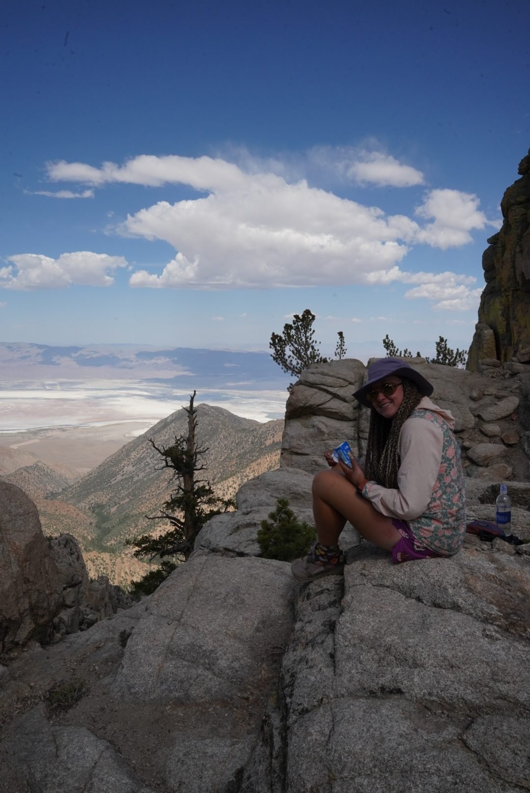
The Sierra is showing her true face – with marmots, thunderstorms, snowy climbs, and mosquito swarms. We’re officially in the high country now. Our group is back together, we’ve had our first real alpine lake swim, and we’re camping above 3,000 meters. With wet boots, sore legs, and full bear cans, we’re ready to tackle our biggest challenge yet: Mt. Whitney.
Day 55 – Marmots, Mosquitos & Mountain Views
Last night was warm enough to sleep with just the sleeping bag draped over us. Morning was a bit of a scramble to dig out our hand sanitizer and wet wipes from the bear can, but we made it work. Packing still takes a while – we’re getting used to fitting all our food into the can – but we eventually hit the trail. A long climb awaits, and we’re happy to have gotten a head start on the rest of the group.
The landscape is fully transformed. No more desert – we’re walking through cool, shady forest, sometimes even crunching over old snow patches. Instead of snakes, we spot a marmot. Yep, we’re in the mountains now. We stop for breakfast at a gorgeous overlook and still haven’t been caught by our crew. Weird.
Veary finally catches up during snack break. The trail drops down to lunch. Turns out Timo and Lea got delayed – they forgot to collect water and even had to set up their tent at breakfast to escape the mosquito apocalypse. Apparently, the season has begun. We got lucky with a breezy, bug-free breakfast spot, but the Swiss were swarmed. And to make matters worse, a mouse chewed a hole in Lea’s sock.
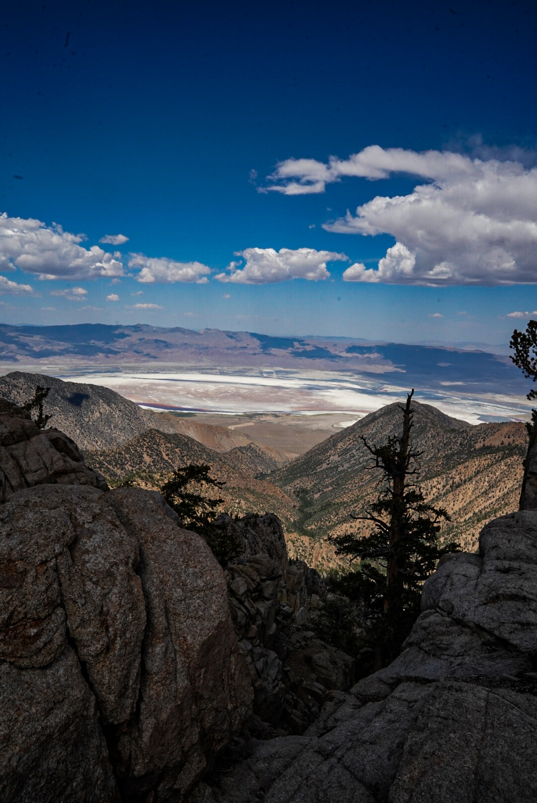
We eat lunch by a creek but don’t linger – dark clouds are forming. The forecast had warned of storms. We still have to climb a ridge, so we push on. Thankfully, the clouds move the other way. The views are spectacular – even the dried-up lakebeds look dramatic.
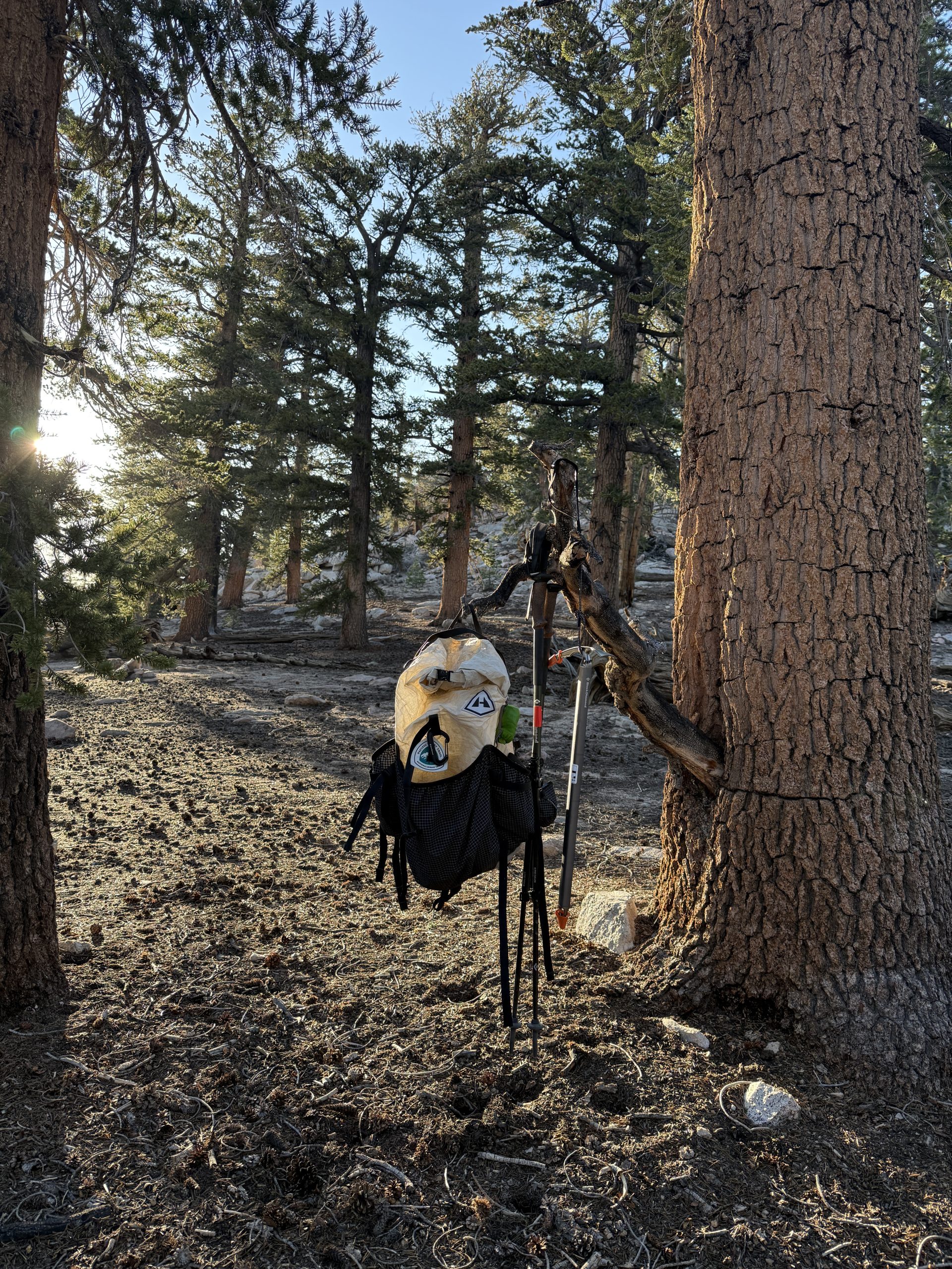
We hike further than planned. The original camp is too early and the weather holds, so we go for it. Our new camp is beautiful, but the water source is a bit of a hike downhill. By 5 p.m., we have tents up, stretched our legs, and counted the 70 steps to dinner rock. That’s where the bear cans and anything smelly go for the night.
We’re camping at 3,144 meters. We’ll see how sleep goes – apparently, the mosquitos have no issue with elevation.
Day 56 – Storms, Snowfields & a Glacial Lake Dip
Rain during the night! Not everyone was ready. Some scrambled to throw on their tent fly, Patrik climbed out to grab his backpack from a tree, and a few of us slept through the whole three-minute shower like champs.
Out of camp by 6 a.m. The trail is beautiful – forest, meadows, and increasingly frequent snow. Our shoes are starting to get damp. Clouds start gathering late morning, and by the time we reach our lunch spot at Chicken Lake, the thunder is rolling.
On the way, we lose the trail while navigating a snow patch and have to bushwhack a bit to find it again. Luckily, we spot Lea and follow her to the lake.
The sun is still out, so we seize the moment – glacial lake swim! Absolutely freezing, but refreshing and wonderful.
The Swiss are planning to wait out the storm here – they’ve already set up their tent. We eat quickly and hit the trail again in jackets. The climb is steep and the rain eventually starts, but we’re well prepared. No lightning near our ice axes, thankfully.
After filtering water for the night (no source at camp), we come across a massive snow wall – that’s the trail. We climb it, feeling tiny in the landscape. Just before camp, we stop for a snack – no eating at camp in bear country.
Camp comes early today, which is nice. We stretch, build the tent, and relax. The Swiss arrive much later – they got caught in the rain after packing up.
Dinner is 70 steps away again, and the evening is spent making a plan for tomorrow’s Mt. Whitney summit attempt. We’re sleeping at 3,362 meters. It’s getting cold – time to tuck in.
Day 57 – River Crossings & Ready for Whitney
No alarm this morning – we’re taking it easy. Today is just 11 miles to the base of Mt. Whitney. We plan to arrive early and rest up before tomorrow’s big climb.
I try packing the bear can inside my backpack for once. Not great. First, we have to cross a river to get to breakfast. It’s a proper river, but luckily there’s a fallen tree across it. We use that to get over.
Breakfast by the water. I’m still fiddling with my pack – the can is hard and presses uncomfortably into my back. Eventually, Lea arrives… but no Timo. After a while with no sign of him, we ping him on Garmin. Turns out there was a miscommunication, and she hikes back to find him. Eventually, we’re all together again and ready to move.
What a climb. Steep, relentless. We huff and puff our way up and are rewarded with an epic view – and storm clouds building once again.
The descent feels more like a retreat from the weather. We cross another river – this time no log, so in we go, boots and socks soaked.
Thankfully, camp is just around the corner. We pitch tents fast and stash the ice axes far away, just in case. We wait in the tent, hoping for a break in the rain so we can eat.
The sky clears just in time for a late lunch. We meet up with the group, then head back for a nap.
Later, the sun comes out – we hang up our soggy shoes and socks to dry before nightfall. Nap until six, then it’s dinner time.
We sit in a cozy hiker circle with our little trail family – and a surprise guest. A coyote trots casually past our camp!
Doug starts a new tradition: a dinner conversation topic. Today’s is books. Yes, please.We prep our snacks for tomorrow’s climb, stash everything in the bear can, and crawl into our bags. It’s time. Whitney tomorrow.
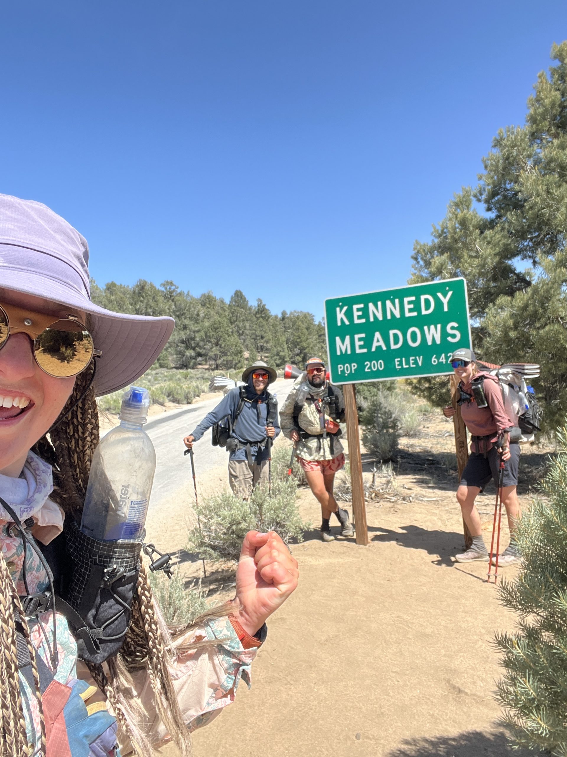
Three whole nights in one place – our first proper break! Kennedy Meadows marked the end of the desert and the start of something new. Between laundry, gear upgrades, bear can drama, and one homemade Czech trail magic, we wrapped up the desert chapter in style. On Day 54, we finally stepped into the Sierra – with snow gear strapped on, a bear can full of food, and a banana bread in our pack.
Day 52 – Pancakes, Packages & Planning
The downside of hiker hubs? Too many hikers. Some partied a little too hard last night, so the early morning hours were full of loud voices and wobbly footsteps. Still, we slept surprisingly well.
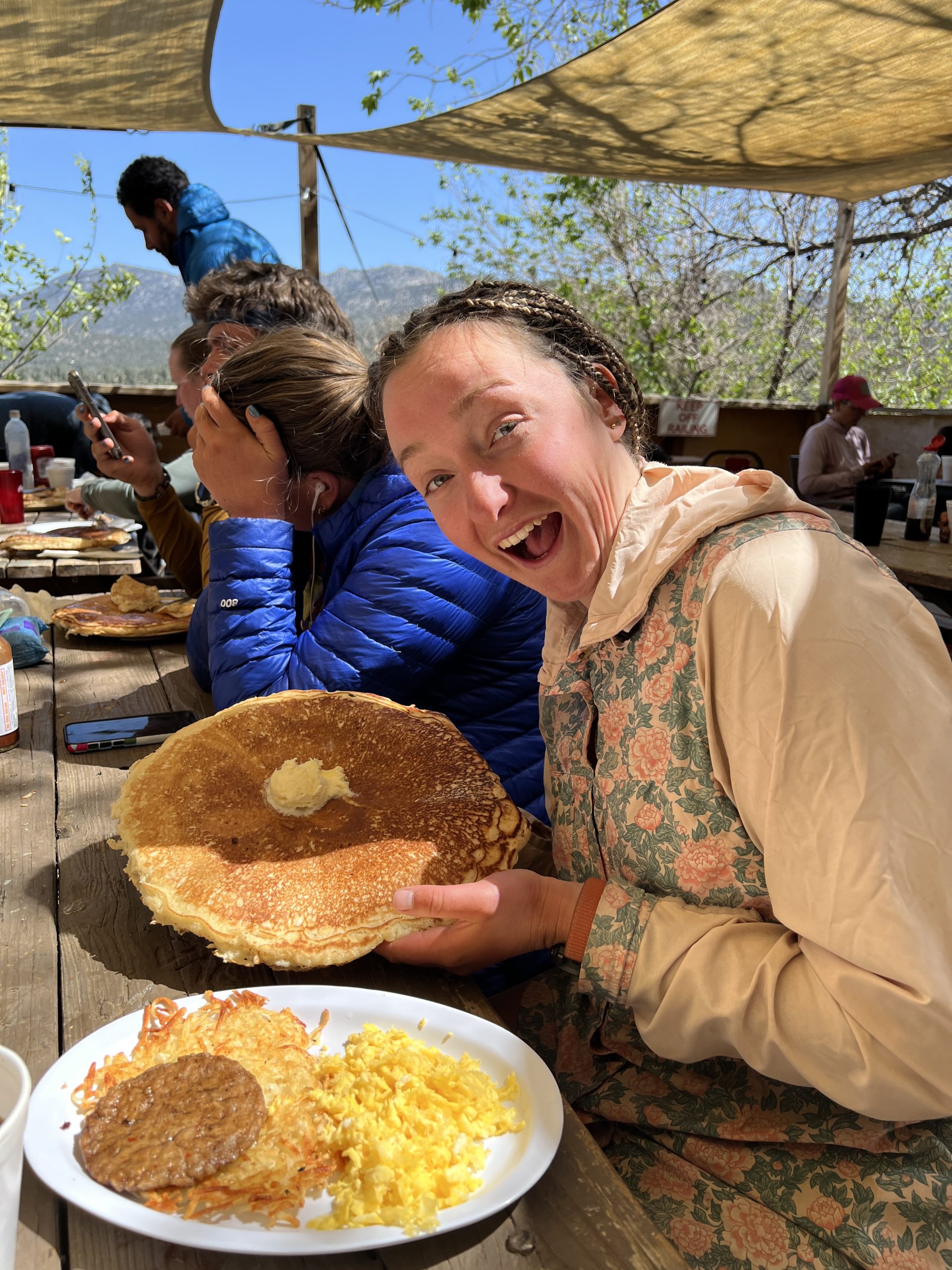
We stayed in our sleeping bags until almost 7:30, but when we finally rolled out, breakfast was calling! Turns out, so was everyone else. Long line, and a delayed opening. We didn’t get food until after 10.
Patrik got a burrito; I went for the “Hiker Breakfast” with Lea and Tim – eggs, hashbrowns, sausage, and a pancake so massive it didn’t fit on the plate… or in our stomachs. We packed the leftovers for lunch.
Next mission: resupply. We waited a bit, but at least there was Wi-Fi. New shoes (finally – over 700 miles!), food, and cute little birthday beanies. Patrik gifted me mine.
Then it was time for Triple Crown Outfitters – this little shack has everything: food for 7 days, bug nets, fresh socks, gaiters, and the big-ticket items – bear canister and ice axe. The bear can is that lovely blue barrel we now have to store all our food, trash, toothpaste, and smelly stuff in overnight. The folks there also gave us a quick rundown on ice axe basics.
Next up: the chaos of repacking. Somehow, we made it work. While Patrik finally got a hot shower (the water just started working again), I queued up for the laundry.
Reward? A milkshake and a well-deserved rinse.
By dinner, we met up with Doug and Veary – our new hiking crew for the Sierra. We went over route planning and snow strategies.
Laundry pickup had one final surprise: all of us were missing a sock. We searched everywhere. Then I remembered Marlen has the same ones as me… and sure enough – she had both of ours. Sock mystery solved. Good night.
Day 53 – Double Zero = Double Chill
First time taking a double zero – three nights, two full days. Yesterday was busy. Today? Nothing but chill.
We still woke up around six (ugh, body clocks), but at least there was no rush. Breakfast: leftover pancake.
We spent the morning catching up on calls – even got to chat with our friend Marťa. Then one last trip to TCO for a few forgotten odds and ends. Slowly, it was time for lunch: we shared a pizza (no hiker hunger today).
Then came a fun moment – decorating our ice axes with nail polish and snapping a group photo.
Finally, time for real relaxation. We laid in the tent and watched a few episodes of our show.
And then: the big moment! Patrik’s Czech trail magic. A few weeks ago, he came up with a small project – to share a little piece of home with the trail. So many hikers and strangers have helped us, and he wanted to give something back. He made a post on LinkedIn asking for support, and ended up partnering with To není možný, a Czech brand. They sent us a package of Liluka snacks, which we handed out to hikers around Kennedy. We were so happy to share a bit of Czech flavor with this awesome community.
Before dinner, one last hot shower. Then burgers for dinner and a quick round of card game instructions from Timo. I was a little disappointed – they ran out of ice cream. No milk either! And I’d been looking forward to it all day…
Anyway. We repacked our food one last time, brushed our teeth, and called it a night.
Day 54 – Banana Bread & Bear Cans
We woke up naturally – a mix of excitement and nerves. New terrain, new routines. Packing took a while as we figured out how to attach everything. Patrik and I decided to keep our food inside our packs and strap the bear can (empty or with clothes) on top. Others carried their cans vertically inside the pack.
Before we left, a fellow hiker gave us banana bread – his wife had baked it for him. Then we waited for the shuttle back to trail.
Miraculously, we squeezed six hikers and their packs into the car. Back on trail! Today was a training day – hiking together as a group, even though it wasn’t strictly necessary yet.
Barely two miles in, we hit trail magic: pancakes and oranges. Yes, please!
The trail is already changing. Still a bit sandy, but no longer desert-like. We crossed a proper river and had water almost the whole way. What a luxury!
Only desert memory left? A snake watching us from the bushes.
Snack break = banana bread. Then we filtered water and had lunch by a creek. We decided to go a bit farther than planned. Doug even showed us a tree that smells like caramel!
Later, from a bridge, we saw fish in the river. From cacti to trout – what a transition. We reached our camp by 4 – a quiet spot in the woods near a little stream. We rinsed off, stretched, and set up camp.
Dinner had to be 70 steps downwind from our tents. That’s also where we left our bear cans overnight – filled with food, toothpaste, sunscreen, even trash. Everything a bear might love. Not all of it fit tonight, but we’ll eat some tomorrow. Walking there and back in camp shoes? Something to get used to.
Goodnight from the edge of the Sierra.
This website contains affiliate links, which means The Trek may receive a percentage of any product or service you purchase using the links in the articles or advertisements. The buyer pays the same price as they would otherwise, and your purchase helps to support The Trek’s ongoing goal to serve you quality backpacking advice and information. Thanks for your support!
To learn more, please visit the About This Site page.
Destinations & Things To Do
Untouched Destinations: Stunning Hidden Gems You Must Visit
Discover the magic of untouched destinations—hidden gems where nature’s beauty and local culture remain pure, offering travelers a serene escape from the crowds and a chance to experience the world in its most authentic form.
The World’s Most Untouched Destinations: Where Mass Tourism Hasn’t Reached
In an age dominated by Instagram-worthy spots and heavily trafficked landmarks, many travelers yearn to explore truly off-the-grid places, where crowds are absent, and nature or local culture remains undisturbed. These untouched destinations offer a rare glimpse into serene beauty and authentic experiences, often preserved by geography, accessibility challenges, or conscious local stewardship. For those seeking adventures away from the conventional travel sphere, understanding where to go — and how to respectfully engage — is crucial. Here, we delve into some of the world’s most pristine locations, enriched by insights from locals and explorers who have ventured beyond the beaten path.
Explore Truly Off-the-Grid Places: The Appeal of Untouched Destinations
The appeal of untouched destinations is multifaceted. Beyond the aesthetic and environmental purity, these sites often carry a sense of solitude and intimacy that mass tourism struggles to deliver. They provide a chance to reconnect with nature and local cultures on a deeper level, away from commercialized settings.
Locals from these regions often have a distinct perspective shaped by years of living in harmony with their environment. For example, indigenous communities in the Amazon rainforest emphasize sustainable practices that preserve their land while welcoming curious travelers with respect and openness. Similarly, remote islanders in the Pacific encourage visitors to immerse themselves in their traditions rather than simply observe from a distance.
Explorers who specialize in off-the-grid travel often emphasize preparation and sensitivity. Understanding local customs, minimizing environmental impact, and supporting small-scale, locally owned businesses all contribute to sustaining the fragile ecosystems and cultural heritage of such places.
Hidden Gems of the World: Where Mass Tourism Has Yet to Bloom
1. The Faroe Islands, North Atlantic
Nestled between Iceland and Norway, the Faroe Islands have escaped heavy tourism despite breathtaking cliffs, dramatic fjords, and vibrant birdlife. With fewer than 100,000 inhabitants, the islands maintain a quiet, authentic charm that travelers find irresistible. Locals welcome visitors but advocate for cautious tourism development to keep the place unspoiled.
According to a community leader in Tórshavn, the islands prioritize small-scale eco-tourism initiatives that promote hiking and wildlife-watching without overburdening the local infrastructure. Exploring this archipelago means wandering serene coastal paths, dining on fresh, locally caught seafood, and engaging with a rich cultural tapestry of Viking history and Nordic influences.
2. The Kamchatka Peninsula, Russia
Far removed from European Russian cities, Kamchatka offers volcanic landscapes, steaming geysers, and extensive wilderness. Few tourists venture this far east due to the region’s remoteness and challenging logistics. However, those who do are rewarded with unrivaled natural beauty and encounters with bears, salmon runs, and traditional reindeer herders.
Native Koryak people and other indigenous groups emphasize living in balance with nature, inviting respectful visitors to learn about their customs and traditions. Explorers emphasize that traveling here requires preparation for rugged conditions and a spirit of adventure, but the payoff is a rarity in modern travel — pristine solitude.
3. Taveuni Island, Fiji
Often overshadowed by Fiji’s more popular islands like Viti Levu or Vanua Levu, Taveuni remains a hidden paradise with lush rainforests, cascading waterfalls, and rich coral reefs. The local communities are active in conservation efforts to protect Taveuni’s biodiversity, which includes rare bird species and vibrant marine life.
Visitors who come here to explore off-the-beaten-path trails and dive pristine reefs are urged to support community-run eco-lodges and cultural tours. Local guides share stories passed through generations, providing travelers with a deep connection to the land and sea far away from typical tourist crowds.
How to Travel Responsibly in Untouched Destinations
When exploring truly off-the-grid places, it’s important to embrace responsible travel practices. Many local residents have expressed concerns about preserving their environment and culture, as unchecked tourism can bring unintended harm.
Here are several guiding principles recommended by locals and experienced explorers:
- Respect Local Customs: Take time to learn about and respect the traditions and ways of life of indigenous communities. Friendly inquiry and cultural sensitivity go a long way.
- Minimize Environmental Impact: Stick to established trails, avoid disturbing wildlife, and use eco-friendly products to reduce your footprint.
- Support Local Economies: Choose locally owned accommodations, hire guides from the community, and purchase handmade crafts to contribute positively to the local economy.
- Travel Light and Slow: Reduce the frequency of travel and extend your stay when possible to lower carbon emissions and engage more deeply with your surroundings.
- Stay Informed: Keep updated on local conservation efforts and challenges. Being an informed traveler helps advocate for sustainable tourism.
The Future of Untouched Destinations in a Connected World
As global connectivity increases, few places will remain completely untouched forever. However, the growing awareness of sustainable travel’s importance may help safeguard many of these hidden gems. Technology can be a double-edged sword — while it spreads awareness and attracts visitors, it can also overwhelm fragile environments if not managed correctly.
Both local stakeholders and travelers hold responsibility for ensuring that these rare sanctuaries remain intact. Responsible travelers can act as ambassadors for preservation, sharing the beauty and cultural richness of these places while respecting their boundaries.
Ultimately, the allure of truly off-the-grid places lies not only in their pristine landscapes but in the unique human stories they preserve. To explore these corners of the world is to embark on a journey of humility and discovery — a profound reminder that some of the greatest travel experiences occur away from the trodden tourist trails.
For those inspired to step beyond familiar destinations, embracing patience, respect, and curiosity can unlock unforgettable adventures that few have had the privilege to experience. The world’s most untouched destinations are not simply places on a map; they are living testaments to nature’s and humanity’s enduring harmony.
-

 Mergers & Acquisitions1 week ago
Amazon weighs further investment in Anthropic to deepen AI alliance
-

 Mergers & Acquisitions1 week ago
How Elon Musk’s rogue Grok chatbot became a cautionary AI tale
-

 Asia Travel Pulse2 weeks ago
Looking For Adventure In Asia? Here Are 7 Epic Destinations You Need To Experience At Least Once – Zee News
-

 Mergers & Acquisitions1 week ago
UK crime agency arrests 4 people over cyber attacks on retailers
-

 Brand Stories2 weeks ago
Voice AI Startup ElevenLabs Plans to Add Hubs Around the World
-

 AI in Travel2 weeks ago
‘Will AI take my job?’ A trip to a Beijing fortune-telling bar to see what lies ahead | China
-

 Mergers & Acquisitions1 week ago
EU pushes ahead with AI code of practice
-

 Mergers & Acquisitions2 weeks ago
ChatGPT — the last of the great romantics
-

 The Travel Revolution of Our Era1 month ago
CheQin.ai Redefines Hotel Booking with Zero-Commission Model
-

 Mergers & Acquisitions1 week ago
Humans must remain at the heart of the AI story